Embed Size (px)
Citation preview

GIS in Real Estate
Phil Hurvitz
CAUP-Urban Form Lab
April 13, 2005

2
GIS in Real Estate
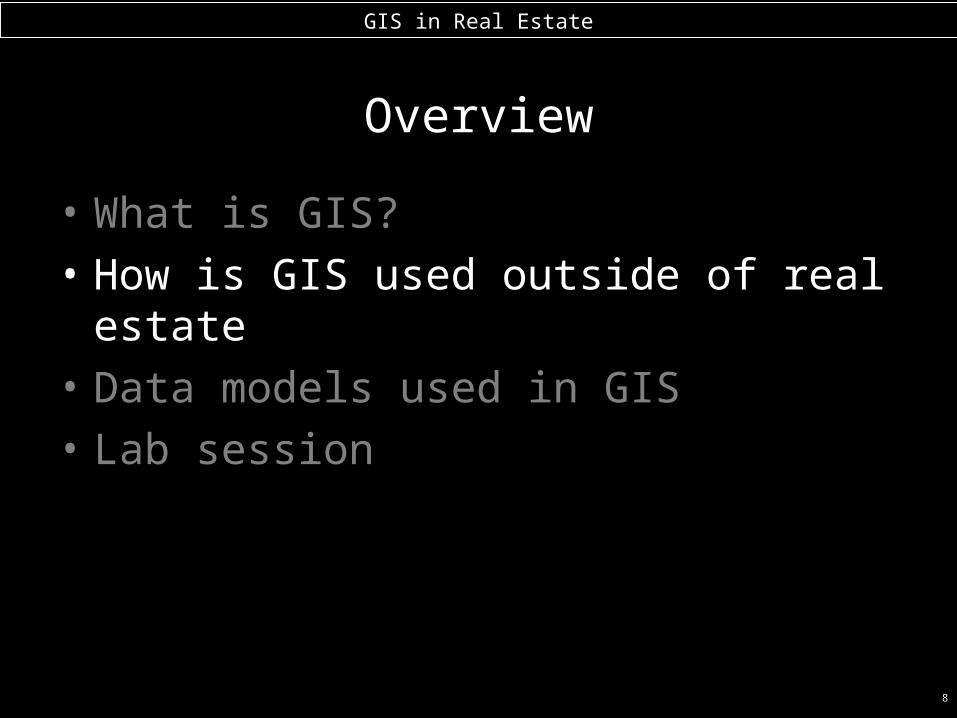
Overview
• What is GIS?
• How is GIS used outside of real estate
• Data models used in GIS
• Lab session_

3
GIS in Real Estate
Overview
• What is GIS?
• How is GIS used outside of real estate
• Data models used in GIS
• Lab session

4
GIS in Real Estate
What is GIS?
• GIS is a computer-based technology used for the – Capture– Storage– Manipulation– Analysis, and– Display
of spatially referenced data_
5
GIS in Real Estate
What the hell does that mean?
• Anything you have ever seen, or could imagine on a map can be stored and analyzed with specialized software on a desktop PC
• (Examples to follow)…_

6
GIS in Real Estate
Why use a GIS?
• An extension of the paper map, but much more than a map, as you will see
• GIS uses the analytical power of the computer to complete complex tasks
• Computer's storage power to manage large data sets. • Integration of many different types of data from many
different sources• GIS maps a variety of different data to the same
coordinate space (allows for combination of data)_

7
GIS in Real Estate
What are the necessary parts to a GIS?
1. Trained personnel (the most expensive part)
2. Software (at the high end, ArcGIS, ~$25,000 per seat)
3. Data (many for free, some cost $$)
4. Computers (even a moderate desktop PC these days can perform dazzling things)
5. Ideas!_
8
GIS in Real Estate
Overview
• What is GIS?
• How is GIS used outside of real estate
• Data models used in GIS
• Lab session

9
GIS in Real Estate
GIS use examples in various disciplines
• Natural resource management
• Telecommunications
• “Traveling salesman” problem
• Risk management & emergency response
• Space exploration
• Urban form & Public Health

10
GIS in Real Estate
Natural resource management
• Where are areas on a forest that meet a given complex set of criteria?
– “What parts of the forest are located:
– within 100 ft of a stream, – beyond 50 ft from a road,– on greater than 30% slope?”

11
GIS in Real Estate
• on > 30% slope?
• closer than 100 ft to a stream, and• farther than 50 ft from a road,

12
GIS in Real Estate
Telecommunications
• Cellular phone towers
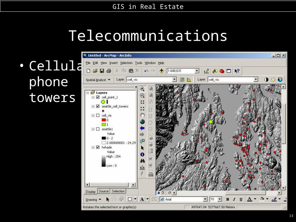
13
GIS in Real Estate
Telecommunications
• Cellular phone towers

14
GIS in Real Estate
Telecommunications
• Cellular phone towers

15
GIS in Real Estate
“Traveling salesman” problem

16
GIS in Real Estate
Space exploration

17
GIS in Real Estate
Urban form & Public Health
• Urban sprawl and automobile dependence– decreased activity levels– increased obesity rates
• Is urban spatial composition and configuration and indicator for obesity or other disease?
• Can communities be structured to promote an increase in activity levels?
• GIS is a central tool in quantifying the urban environment

18
GIS in Real Estate
Walkability & Bikeability Modeling
• WBC Project, funded by CDCs
• Urban Form Lab (Anne Moudon, Chanam Lee)
• A GIS extension for obtaining environmental data in a household’s neighborhood– Urban features within walking/cycling distance– 200+ variables per household– Stat

19
GIS in Real Estate
Walkability & Bikeability Modeling

20
GIS in Real Estate
What is in the neighborhood?
3 banks
1 km radius
1 bar

21
GIS in Real Estate
How do land uses cluster?

22
GIS in Real Estate
Overview
• What is GIS?
• How is GIS used outside of real estate
• Data models used in GIS
• Lab session

23
GIS in Real Estate
Spatial Data Model: Basic Data Types
• GIS are driven by spatial data
• 2 basic spatial (coordinate/geometric) data models exist
– vector: based on geometry of• points• lines • polygons
– raster: based on geometry of• grid cells (images, bitmaps, DEMs)_

24
GIS in Real Estate
Vector Data ModelPoints: represent discrete point features
each point locationhas a record in thetable
airports are point featureseach point is stored as a
coordinate pair
25
GIS in Real Estate
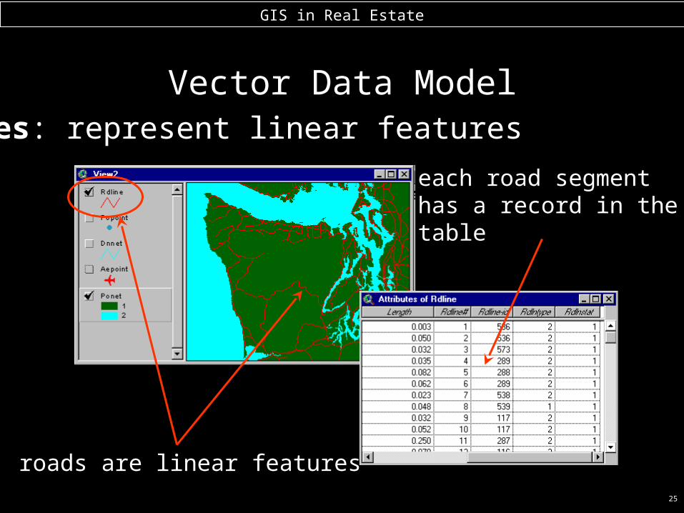
Vector Data ModelLines: represent linear features
roads are linear features
each road segmenthas a record in thetable

26
GIS in Real Estate
Vector Data ModelLines: fundamental spatial data model
• Lines start and end at nodes• line #1 goes from node #2 to node #1
• Vertices determine shape of line• Nodes and vertices are stored as coordinate pairs_
node
node
vertex
vertex
vertex
vertex
27
GIS in Real Estate
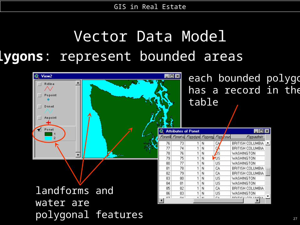
Vector Data ModelPolygons: represent bounded areas
each bounded polygonhas a record in thetable
landforms and water are polygonal features

28
GIS in Real Estate
Vector Data Model
• Polygon #2 is bounded by lines 1 & 2• Line 2 has polygon 1 on left and polygon 2 on right_
Polygons: fundamental spatial data model

29
GIS in Real Estate
Vector Data Model
• complex data model, especially for larger data sets• “arc-node topology,” only used for ArcInfo data sets_
Polygons: fundamental spatial data model

30
GIS in Real Estate
Raster Data Model
• digital orthophoto
• digital elevation model (DEM)_
A few different types of raster data

31
GIS in Real Estate
Raster spatial data model
• origin is set explicitly
• cell size is always known
• cell references (row/column locations)are known
• cell values are referencedto row/column location
• values represent numerical phenomena orindex codes for non-numerical phenomena_

32
GIS in Real Estate
Raster Data Model
• Characteristics of the raster data model:– Rectangular grid of square cells
• – Shape of discrete polygonal features generalized by cells
• + Continuous (surface) data represented easily
• + Simple data structure_
33
GIS in Real Estate
Raster Data Model
• Raster data are good at representing continuous phenomena, e.g.,
– Wind speed– Elevation, slope, aspect– Chemical concentration– Likelihood of existence of a certain condition– Electromagnetic reflectance (photographic or
satellite imagery)_

34
GIS in Real Estate
• The “where” of GIS is determined by coordinate (map) data structures, but …
• The “what” of GIS is determined by tabular (relational database) data structures
• Thus, tabular data are just as important as coordinate data_
Relational Database Model & Attribute Data Structures

35
GIS in Real Estate
Relational Database Model & Attribute Data Structures
•Attribute data are stored in database tables.
•Tables are composed of:
– fields
and
– records_

36
GIS in Real Estate
Relational Database Model & Attribute Data Structures
• You may already be familiar with some types of relational databases
– dBase– rBase– MS Access– MS Excel (database functionality)– Oracle, INFORMIX, INGRES, SQL Server– MySQL, PostgreSQL– INFO (in ArcInfo)_

37
GIS in Real Estate
Relational Database Model & Attribute Data Structures
•Each vector data source has an attribute table

38
GIS in Real Estate
Relational Database Model & Attribute Data Structures
•Tables can be linked and joined (“related”) by use of common values in fields

39
GIS in Real Estate
Relational Database Model & Attribute Data Structures
• Relationship between tabular and map data – one-to-one between features and records
• when a selection is made, both the record and feature are selected

40
GIS in Real Estate
Overview
• What is GIS?
• How is GIS used outside of real estate
• Data models used in GIS
• Lab session
41
GIS in Real Estate
Lab Session
• Open GIS software
• Download Seattle & King County data
• Perform query & display
• Create a map displaying a simple selection or analysis