Embed Size (px)
Citation preview

GIS for Environmental GIS for Environmental ScienceScience
ENSC 3603ENSC 3603
Class 23Class 234/7/094/7/09

A GIS Example:A GIS Example:Identification of Potential Landfill Identification of Potential Landfill
Locations Locations The following example uses information from the
Center of Advanced Spatial Technologies (CAST)
http://www.cast.uark.edu/local/gis/landfill.html

Landfill Location Landfill Location
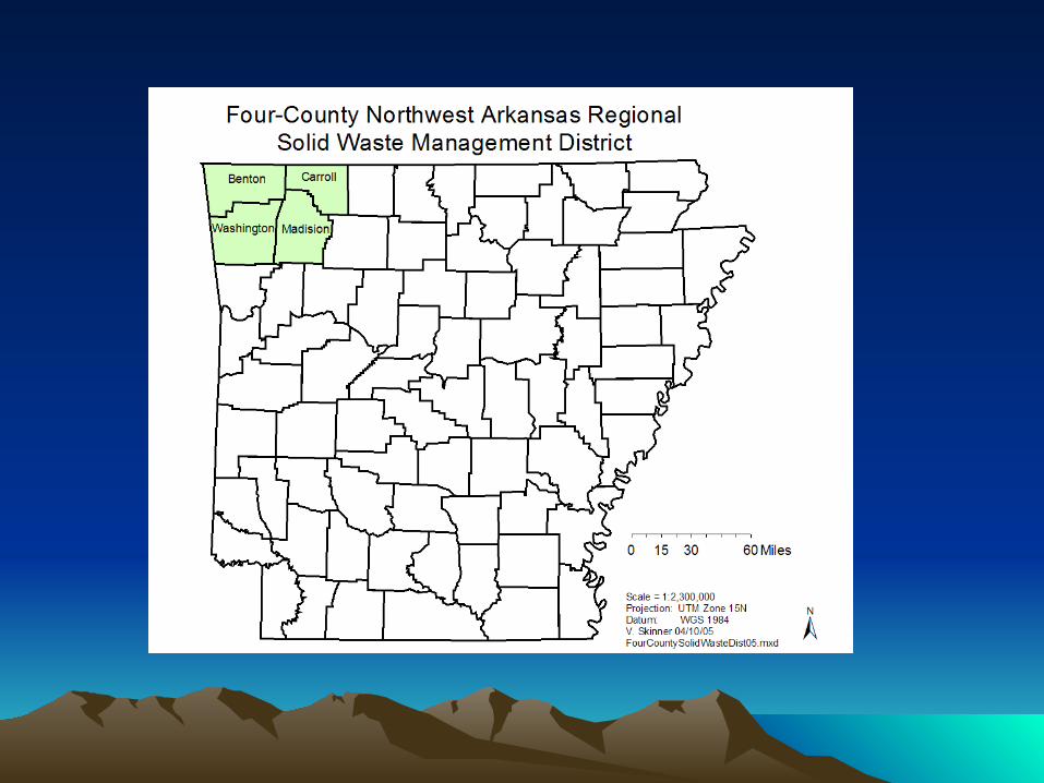
• Description:The Four-County Northwest Arkansas Regional Solid Waste Management District requested CAST to conduct a GIS study to see if there were suitable areas within Northwest Arkansas to locate a regional landfill.

EPA Landfill Location Restrictions EPA Landfill Location Restrictions Airport Safety - Bird hazardFloodplains - 100 year floodWetlands - ContaminationFault areas - Ground failure, landslides, structure
damageSeismic impact zones - Ground failure, landslides,
structure damageUnstable areas - Poor foundation, mass
movement, Karst terrains
EPA Solid Waste Disposal Facility Criteria Technical Manual
http://www.epa.gov/epaoswer/non-hw/muncpl/landfill/techman/intro.pdf

Landfill Location CriteriaLandfill Location Criteria
• Criteria provided by the Management District:No landfills within the following:
1) 500 feet of water intake sites2) 300 feet of incorporated areas3) 2 miles of designated streams
4) 10,000 feet an airport5) 12 miles of existing landfills
Landfill Location CriteriaLandfill Location Criteria
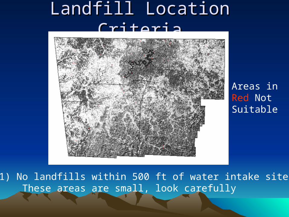
1) No landfills within 500 ft of water intake sites These areas are small, look carefully
Areas in Red NotSuitable
Landfill Location CriteriaLandfill Location Criteria
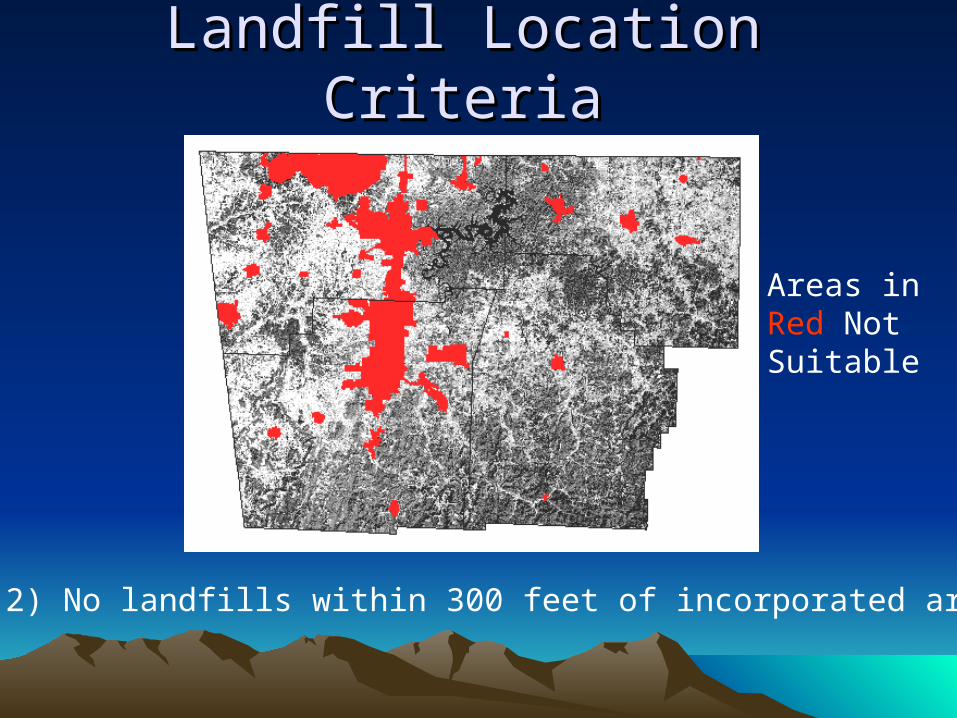
2) No landfills within 300 feet of incorporated areas
Areas in Red NotSuitable

Landfill Location CriteriaLandfill Location Criteria
3) No landfills within 2 miles of designated streams
Areas in Red NotSuitable

Landfill Location CriteriaLandfill Location Criteria
4) No landfills within 10,000 ft of an airport
Areas in Red NotSuitable
Landfill Location CriteriaLandfill Location Criteria
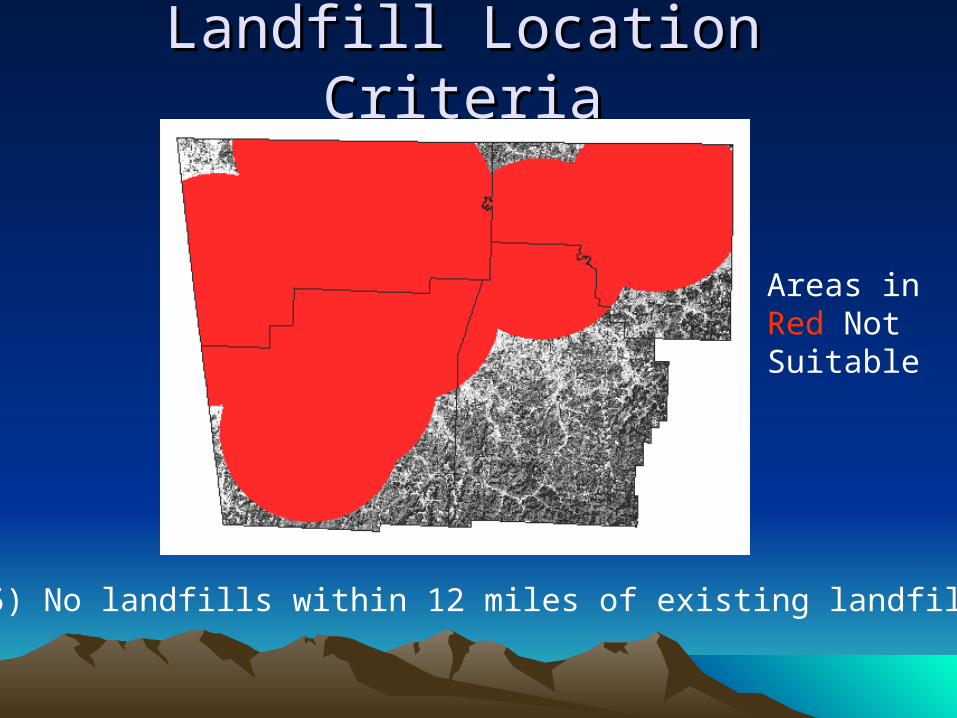
5) No landfills within 12 miles of existing landfills
Areas in Red NotSuitable
Landfill Location CriteriaLandfill Location Criteria
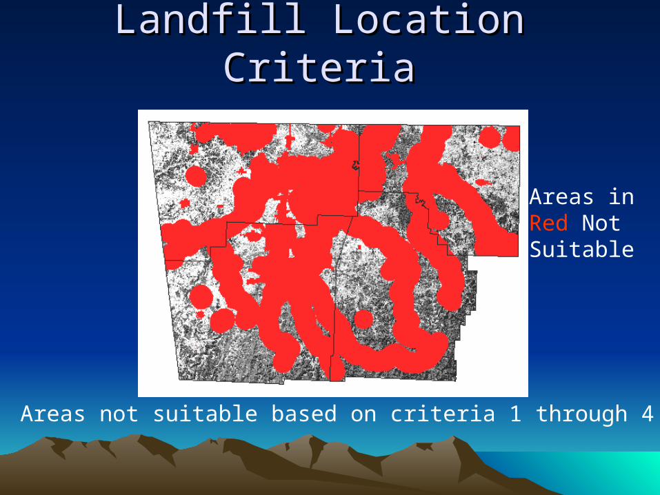
Areas not suitable based on criteria 1 through 4
Areas in Red NotSuitable
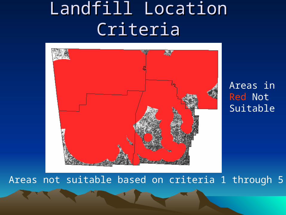
Landfill Location CriteriaLandfill Location Criteria
Areas not suitable based on criteria 1 through 5
Areas in Red NotSuitable
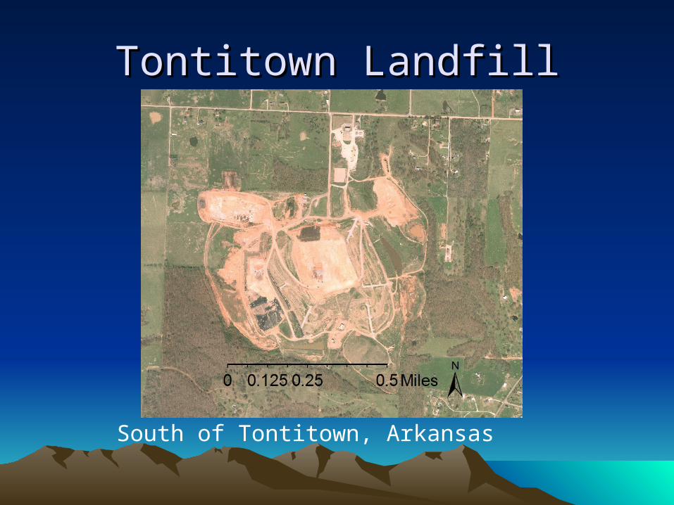
Tontitown LandfillTontitown Landfill
South of Tontitown, Arkansas

Tontitown LandfillTontitown Landfill
South of Tontitown, ArkansasLocal.live.com accessed 4/9/07
Another GIS Example:Another GIS Example:Identification of Potential Landfill Identification of Potential Landfill
Locations Locations California, Integrated Waste Management Board
Training. San Andreas, CA area.
Use Google Earth to find San Andreas, Ca.
Make sure 1st level admin. Borders and Populated Places are checked under layers.
Click on the following link for a Landfill slide set.
http://www.ciwmb.ca.gov/LEATraining/GIS/2005NovDec/LFSiting.ppt
Read and DoRead and Do
Review progress on your Project
• Quiz on April 16th

• It is amazing how fast people learn when they are not insulated from the consequences of their decisions.” Thomas Sowell
• "My grandfather once told me that there were two kinds of people: those who do the work and those who take the credit. He told me to try to be in the first group; there was much less competition." - Indira Gandhi