Embed Size (px)
Citation preview
GIS based Data Management in Pipeline Construction Projects
DMC1 GmbH
Werksgelaende DOW, Gebaeude B18
06258 Schkopau
Germany
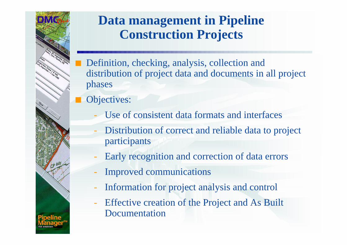
Data management in Pipeline Construction Projects
■ Definition, checking, analysis, collection and distribution of project data and documents in all project phases
■ Objectives:
- Use of consistent data formats and interfaces
- Distribution of correct and reliable data to project participants
- Early recognition and correction of data errors
- Improved communications
- Information for project analysis and control
- Effective creation of the Project and As Built Documentation

Implementation
Planner
ROW
Contractor
Client
Format StructureContentFlow
Definition
CheckData management
PMS
Build up
Implementation
Analysis/comparison (plan-actual)
Information provision
Project-planning
Project-control
Project-documentation
Misc…
Co-ordination
Access to PMS (read only)
Provision of analyses as needed
Client instructions to third parties
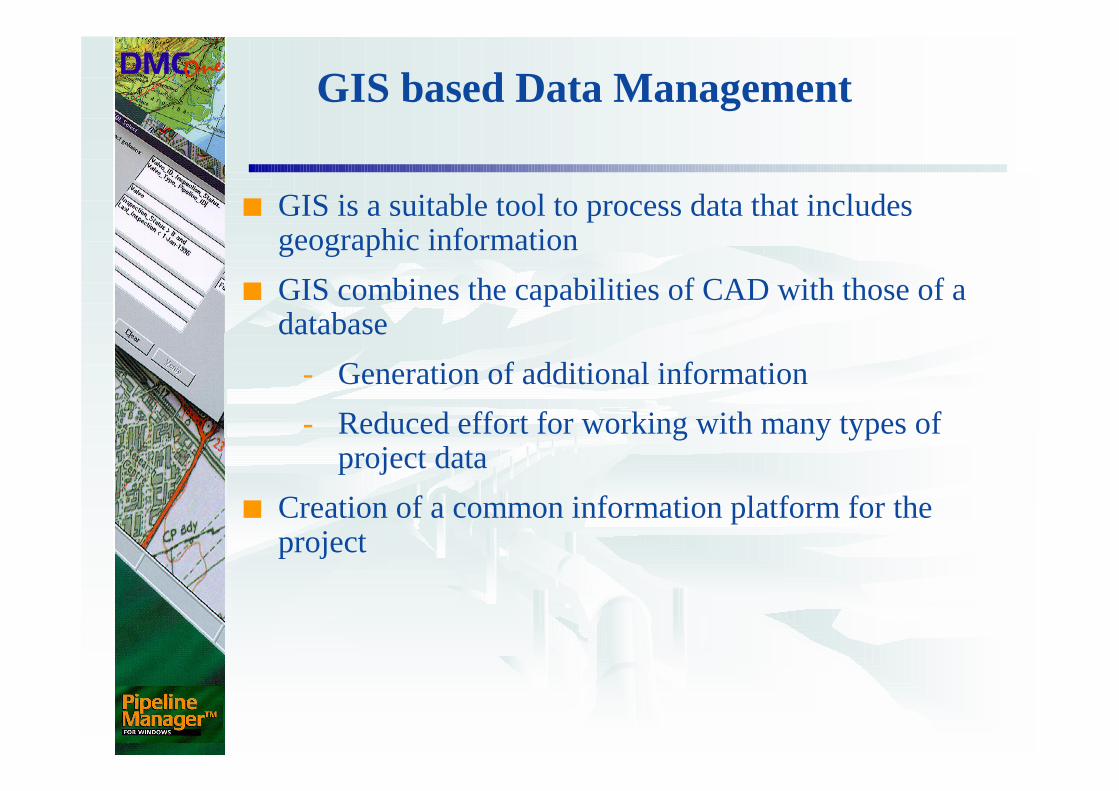
GIS based Data Management
■ GIS is a suitable tool to process data that includes geographic information
■ GIS combines the capabilities of CAD with those of a database
- Generation of additional information
- Reduced effort for working with many types of project data
■ Creation of a common information platform for the project
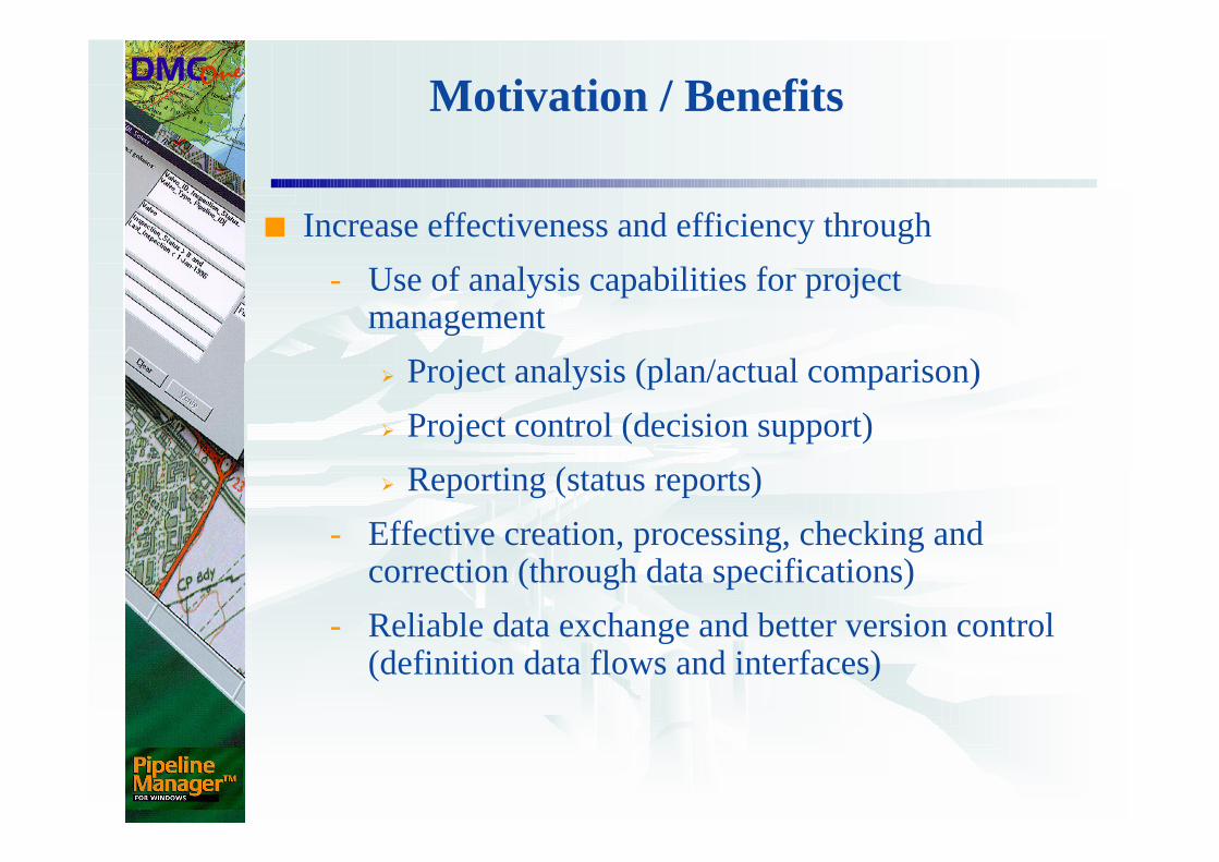
Motivation / Benefits
■ Increase effectiveness and efficiency through
- Use of analysis capabilities for project management
� Project analysis (plan/actual comparison)
� Project control (decision support)
� Reporting (status reports)
- Effective creation, processing, checking and correction (through data specifications)
- Reliable data exchange and better version control (definition data flows and interfaces)
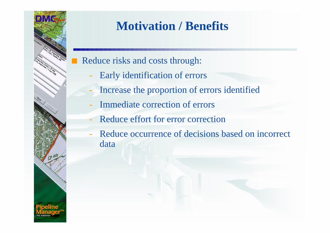
Motivation / Benefits
■ Reduce risks and costs through:
- Early identification of errors
- Increase the proportion of errors identified
- Immediate correction of errors
- Reduce effort for error correction
- Reduce occurrence of decisions based on incorrect data
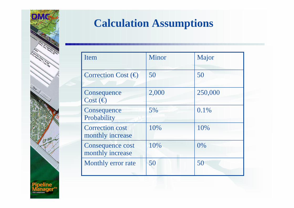
Calculation Assumptions
5050Monthly error rate
0%10%Consequence cost monthly increase
10%10%Correction cost monthly increase
0.1%5%Consequence Probability
250,0002,000Consequence Cost (€)
5050Correction Cost (€)
MajorMinorItem
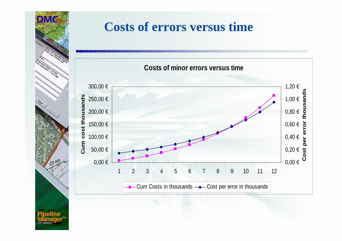
Costs of errors versus time
Costs of minor errors versus time
0,00 €
50,00 €
100,00 €
150,00 €
200,00 €
250,00 €
300,00 €
1 2 3 4 5 6 7 8 9 10 11 12
Cu
m c
ost
tho
usan
ds
0,00 €
0,20 €
0,40 €
0,60 €
0,80 €
1,00 €
1,20 €
Co
st
per
err
or
tho
usan
ds
Cum Costs in thousands Cost per error in thousands
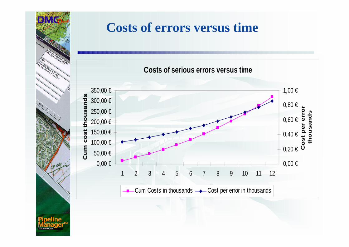
Costs of errors versus time
Costs of serious errors versus time
0,00 €
50,00 €
100,00 €
150,00 €
200,00 €
250,00 €
300,00 €
350,00 €
1 2 3 4 5 6 7 8 9 10 11 12
Cu
m c
ost
tho
usan
ds
0,00 €
0,20 €
0,40 €
0,60 €
0,80 €
1,00 €
Co
st
per
err
or
tho
usan
ds
Cum Costs in thousands Cost per error in thousands
Motivation / Benefits
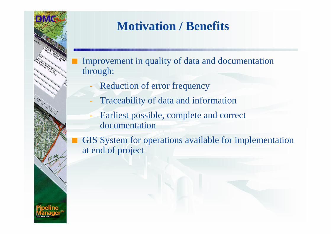
■ Improvement in quality of data and documentation through:
- Reduction of error frequency
- Traceability of data and information
- Earliest possible, complete and correct documentation
■ GIS System for operations available for implementation at end of project
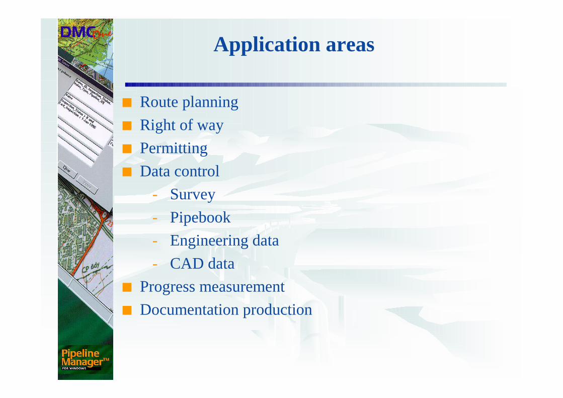
Application areas
■ Route planning
■ Right of way
■ Permitting
■ Data control
- Survey
- Pipebook
- Engineering data
- CAD data
■ Progress measurement
■ Documentation production
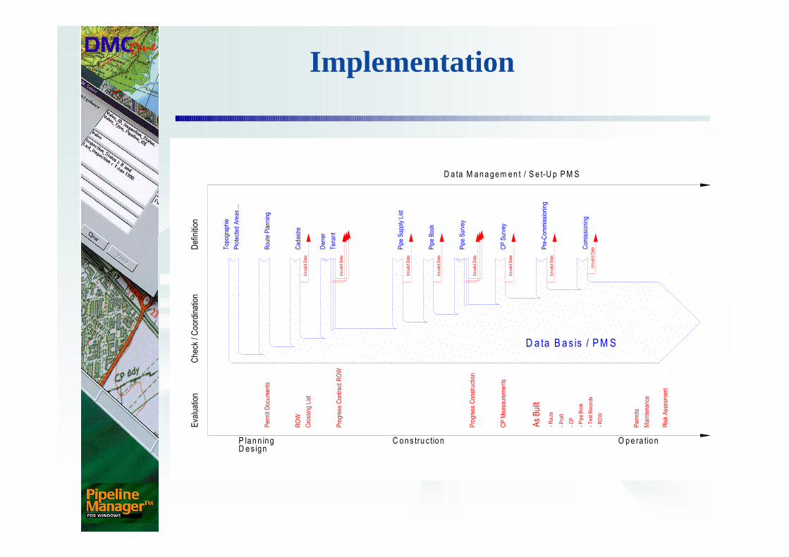
Implementation
Definition
Che
ck / Coo
rdination
Eva
luation
P la n n ingD es ign
C ons tru c tion O pe ra tion
Top
ograp
hie
Protected
Areas
...
Cad
astre
Rou
te Planning
Ten
ant
Owner
Pipe Supp
ly List
Pipe Survey
Pipe Boo
k
CP Survey
Pre-C
ommissioning
D a ta M anagem en t / S e t-U p PM S
Permit Docu
men
ts
ROW
Cross
ing List
Progres
s Contract R
OW
Progres
s Cons
truc
tion
CP M
eas
suremen
ts
Permits
Maintenan
ce
As Built
- Rou
te
- Profil
- CP
- Pipe Boo
k
- Tes
t Rec
ords
- ROW
D a ta B a s is / PM SUnv
alid Data
Unv
alid Data
Unv
alid Data
Unv
alid Data
Unv
alid Data
Unv
alid Data
Unv
alid Data
Com
ission
ing
Unva
lid Data
Risk Ass
esm
ent
Implementation / Specification
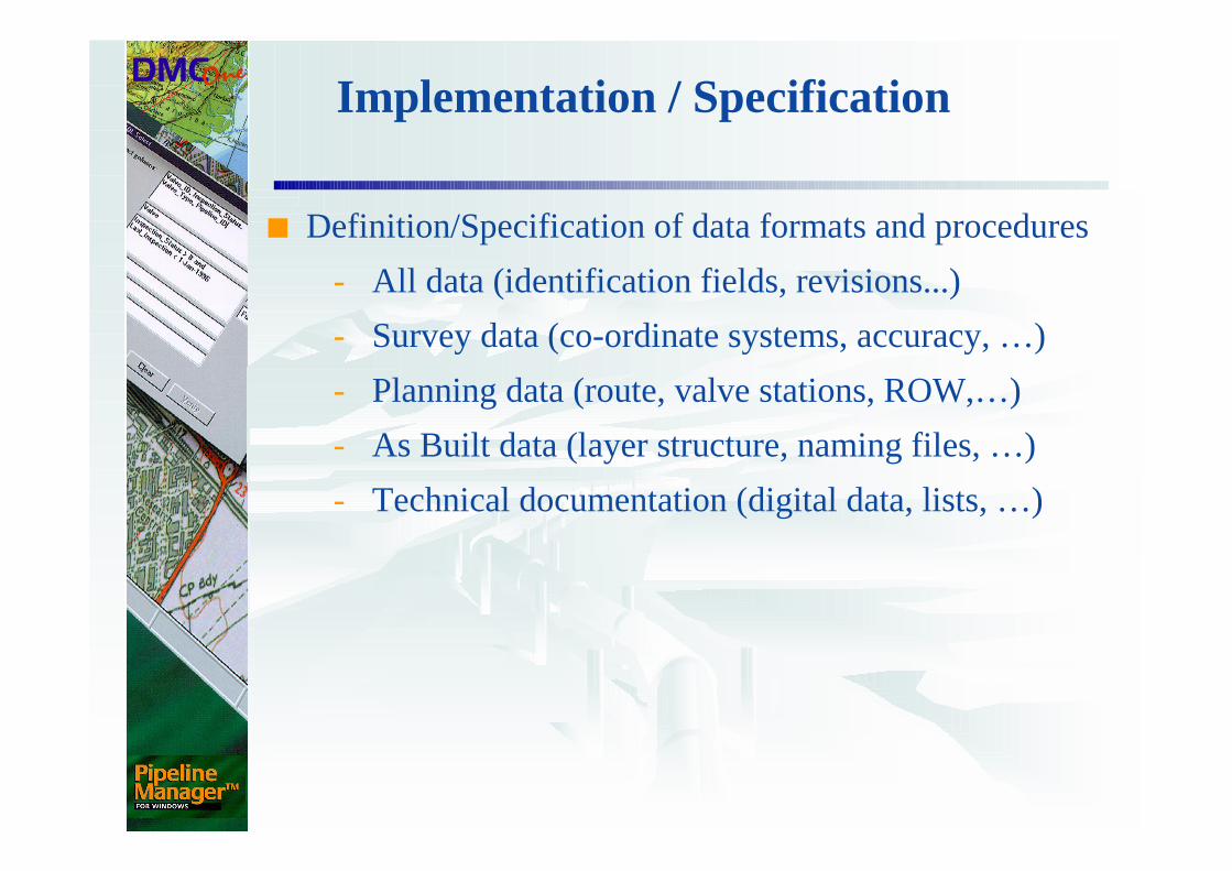
■ Definition/Specification of data formats and procedures
- All data (identification fields, revisions...)
- Survey data (co-ordinate systems, accuracy, …)
- Planning data (route, valve stations, ROW,…)
- As Built data (layer structure, naming files, …)
- Technical documentation (digital data, lists, …)
Implementation / Specification
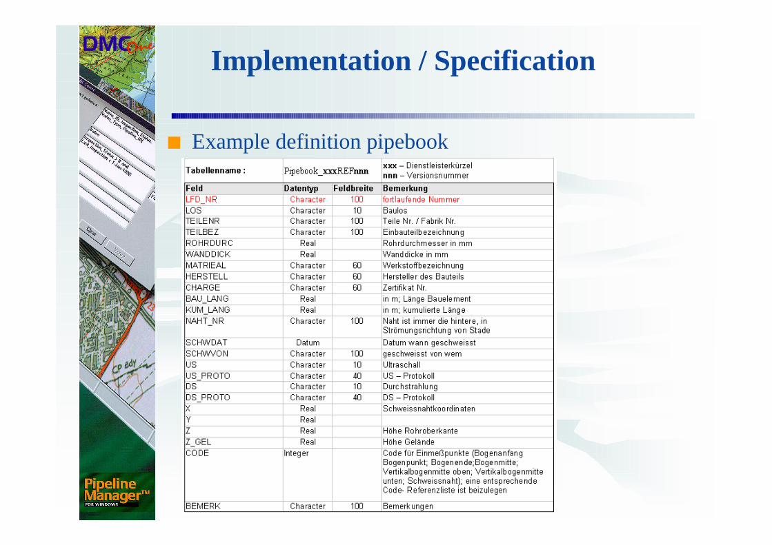
■ Example definition pipebook
Implementation / Coordination
■ Collection, control and distribution of data in accordance with specification:
- Instruction, training and support of third parties who produce or process data
- Quality control (plausibility/correctness)
- Data control and management of error correction
- Organisation of data flows between project participants
Implementation / Analyses
■ Production of information and documents:
- Provision of information to the project management team for
� Decision support
� Project progress measurement
� Analysis of problem locations along the route
� Analysis and evaluation of supplementary costs
- Support of As Built documentation
Examples and Experience
Construction of a 350 km ethylene pipeline
■ Re-routes
- 46 revisions with circa 105 planned and 92 confirmed re-routes
� Rejection of unnecessary re-routes
■ Crossings
- 21 revisions, circa 980 crossings
� Circa 20 missing / duplicate crossings
� Two crossings without permits at construction start
Examples and Experience
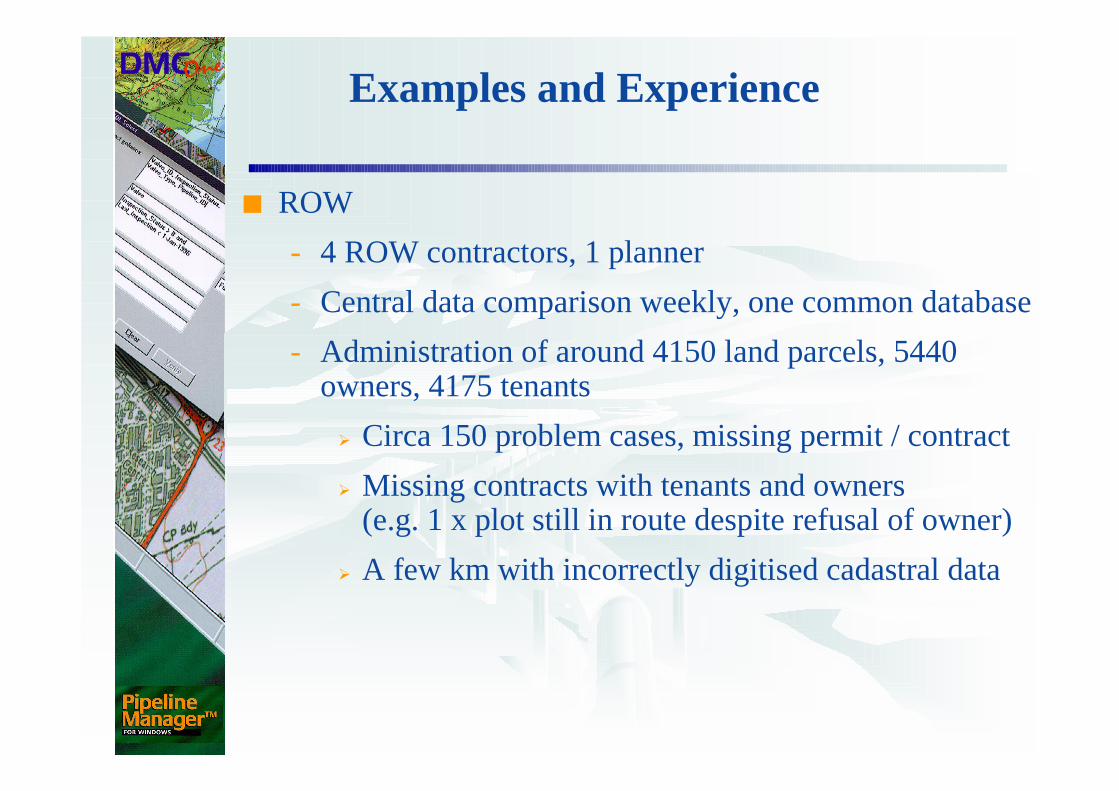
■ ROW
- 4 ROW contractors, 1 planner
- Central data comparison weekly, one common database
- Administration of around 4150 land parcels, 5440 owners, 4175 tenants
� Circa 150 problem cases, missing permit / contract
� Missing contracts with tenants and owners (e.g. 1 x plot still in route despite refusal of owner)
� A few km with incorrectly digitised cadastral data
Examples and Experience
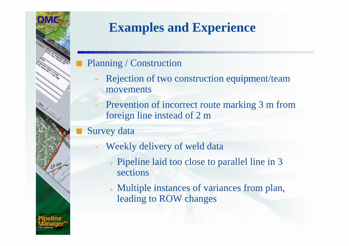
■ Planning / Construction
- Rejection of two construction equipment/team movements
- Prevention of incorrect route marking 3 m from foreign line instead of 2 m
■ Survey data
- Weekly delivery of weld data
� Pipeline laid too close to parallel line in 3 sections
� Multiple instances of variances from plan, leading to ROW changes
Examples and Experience
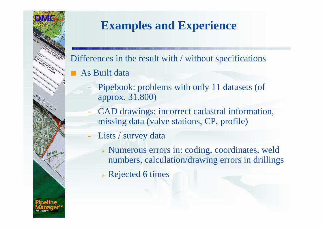
Differences in the result with / without specifications
■ As Built data
- Pipebook: problems with only 11 datasets (of approx. 31.800)
- CAD drawings: incorrect cadastral information, missing data (valve stations, CP, profile)
- Lists / survey data
� Numerous errors in: coding, coordinates, weld numbers, calculation/drawing errors in drillings
� Rejected 6 times
Examples and Experience
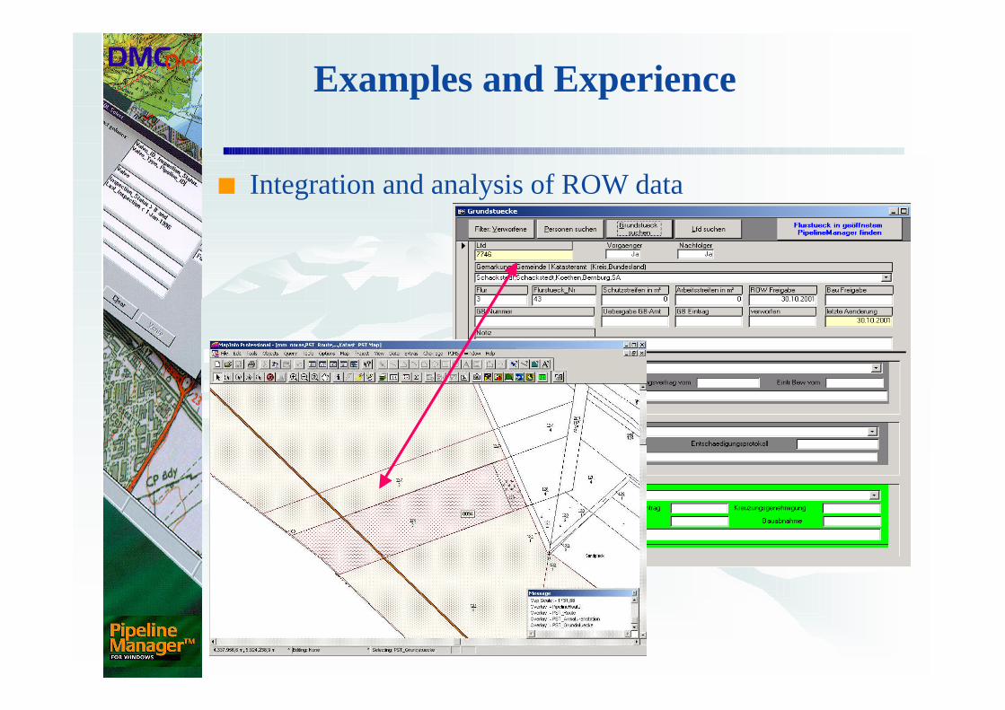
■ Integration and analysis of ROW data
Examples and Experience
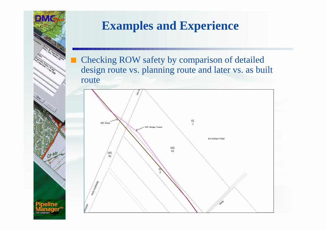
■ Checking ROW safety by comparison of detailed design route vs. planning route and later vs. as built route
43
Im hohen Feld
1
16243
3
von
Sal
zwed
el
43
16535
nach
Kuh
feld
e
Land
stra
sse W
eg
PST_Design_Trasse
PST_Route
Examples and Experience
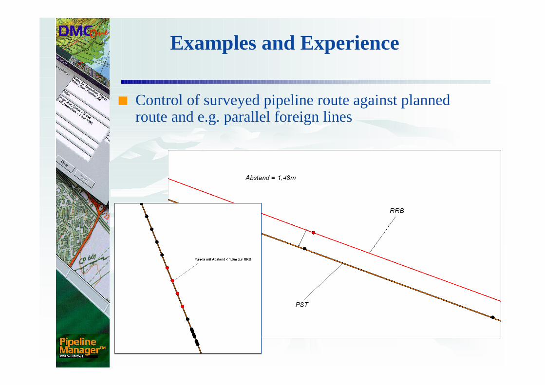
■ Control of surveyed pipeline route against planned route and e.g. parallel foreign lines
Examples and Experience
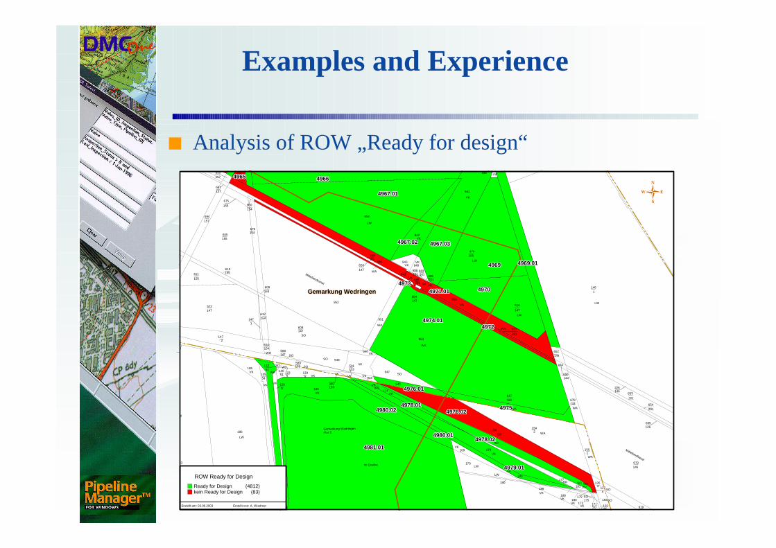
■ Analysis of ROW „Ready for design“
948589153
5123
5139
5120
1
590
183153
153591
147
147608
154
154
51
51122
140
147588
614
54105
185
53
52
186Gemarkung WedringenFlur 3
54
2147
Mittellandkanal
WA
WA
146679
201
653
146655
201654
1146
146619
VKSO
VK
SO
WA
SO
135
4
192
193
1274
171
656
144678
146226
180179
1155
144
177
181
188
172
187
175
LW
LW
147
516
201
657
VK
SO
144
LW
VK
LW
WA
953
951
685
147684
652
WA
SO
SO
VK
SO
155474
WA
WA
LWVK
VK
SO
SO
LW
VK
WA
190
189
154
169
170
176
194
182
153617
2
178
SO
156
VK
941
VK
LW
VKVK
VKVK
942
201201689
VK
VK
Im Drecke
VK 945191
174
155
675
954
201
683
950
201686
940
SO
VK
VK
WD
612
947
943201659
952
147
154609
660
WA
VK
VK
VK
SO
VK
SO
SO
155610
155605
154676
154
WD
SO
147572
LW
WA
946
VK
WA
VKVK
VK
VK
944SO
231156
658
949
157650
157661
694
155611
157
Mittellandkanal
LW
Gemarkung WedringenGemarkung WedringenGemarkung WedringenGemarkung WedringenGemarkung WedringenGemarkung WedringenGemarkung WedringenGemarkung WedringenGemarkung Wedringen
496649664966496649664966496649664966
4967.014967.014967.014967.014967.014967.014967.014967.014967.01
4979.014979.014979.014979.014979.014979.014979.014979.014979.01
4981.014981.014981.014981.014981.014981.014981.014981.014981.01
4980.024980.024980.024980.024980.024980.024980.024980.024980.02 4976.024976.024976.024976.024976.024976.024976.024976.024976.02
4974.014974.014974.014974.014974.014974.014974.014974.014974.01
4971.014971.014971.014971.014971.014971.014971.014971.014971.01 497049704970497049704970497049704970
496949694969496949694969496949694969
4967.034967.034967.034967.034967.034967.034967.034967.034967.034967.024967.024967.024967.024967.024967.024967.024967.024967.02
4980.014980.014980.014980.014980.014980.014980.014980.014980.01
497249724972497249724972497249724972
497349734973497349734973497349734973
496549654965496549654965496549654965
497549754975497549754975497549754975
4978.024978.024978.024978.024978.024978.024978.024978.024978.02
4978.014978.014978.014978.014978.014978.014978.014978.014978.01
4976.014976.014976.014976.014976.014976.014976.014976.014976.01
4969.014969.014969.014969.014969.014969.014969.014969.014969.01
ROW Ready for Design
Ready for Design (4812)kein Ready for Design (83)
Erstellt am: 03.06.2003 Erstellt von: A. Wiedmer
Examples and Experience
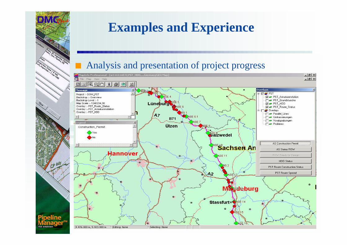
■ Analysis and presentation of project progress
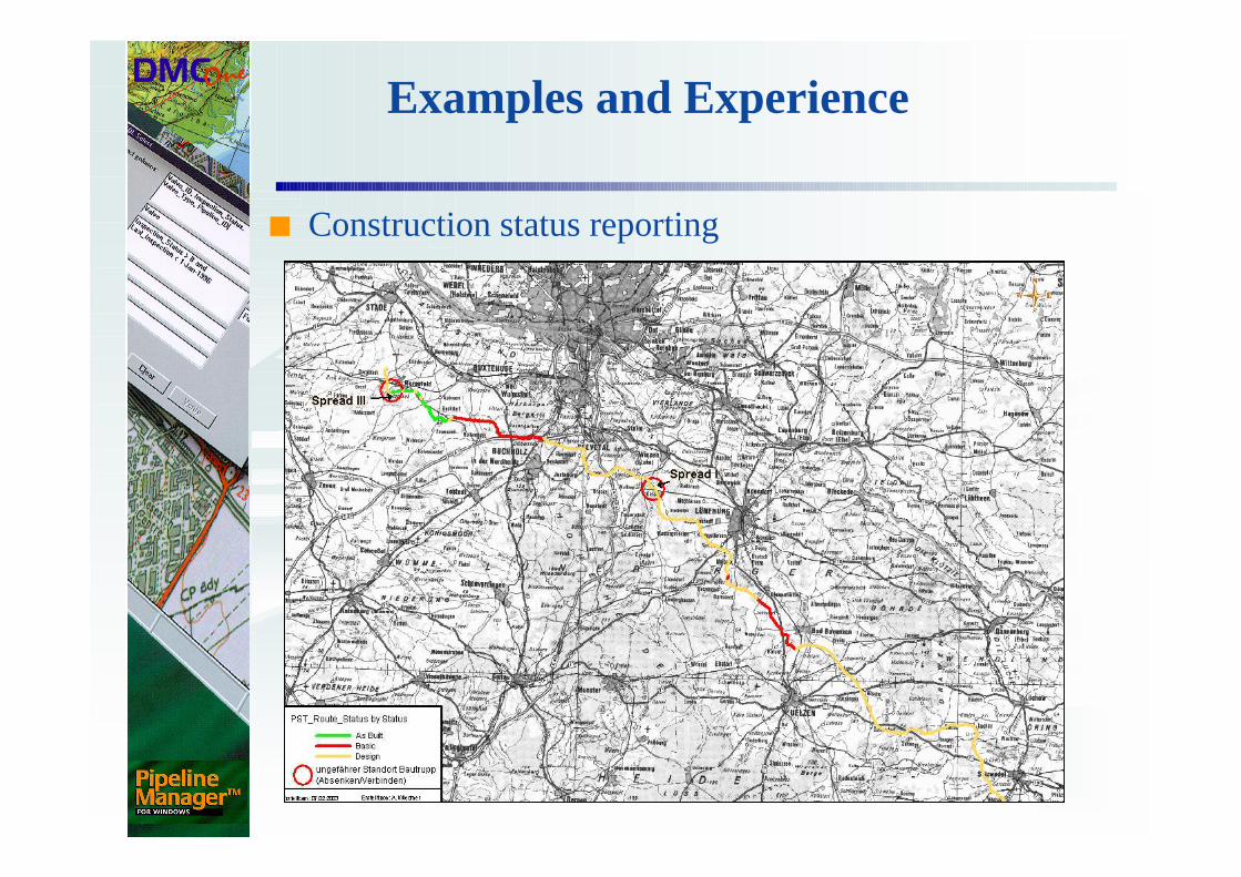
Examples and Experience
■ Construction status reporting
Summary
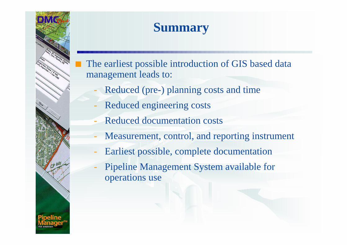
■ The earliest possible introduction of GIS based data management leads to:
- Reduced (pre-) planning costs and time
- Reduced engineering costs
- Reduced documentation costs
- Measurement, control, and reporting instrument
- Earliest possible, complete documentation
- Pipeline Management System available for operations use