Embed Size (px)
Citation preview

GetMetMake a difference to your flyingwith accurate weather briefing

1
Common sense and the law require you to obtain all the necessary weather information in order to plan and conduct your flight safely. Full information on meteorological services can be found in the UK AIP in the General Section at 3.5.
This booklet is intended to help you to obtain this information via internet, fax and telephone. If you have any suggestions for improving this booklet please contact:
Met Office
FitzRoy Road, Exeter, Devon EX1 3PB
Fax: 0870 900 5050
Email: [email protected]
www.metoffice.gov.uk/aviation
If you are unable to use any of the services, the TAFs and METARs, or require clarification for F214, F215, F414 and F415, special forecasts and route forecasts please call:
0370 900 0100
For aircraft departing from Isle of Man and Channel Islands please call:
Isle of Man 01624 821641 (ATC Hours)
Jersey 01534 492256 (ATC Hours)
Prices stated in GetMet are correct at the publication.
Introduction

2 3
Online briefing for pilots
The Met Office’s online web services provide a comprehensive range of weather briefing services direct to your computer.
The service is FREE and contains essential pre-flight information to help you get the most from your flying. Services include:
• F214 / F215
• UK TAFs and METARs
• UK AIRMETs
• Ballooning forecasts
• Satellite and rainfall imagery
For instant access, simply register at:
www.metoffice.gov.uk/aviation
4 5
Forecaster consultancy
If you need more than just clarification, or you cannot access charts or other information, you can speak directly to an aviation forecaster — available 24 hours a day. With our aviation forecaster consultancy, you can:
• speak to one of our aviation forecasters about the weather as it affects you, for example, planning return flights, weather windows;
• use it on its own, or as a natural accompaniment to our fax service;
• pay online by credit card – no forms to fill in.
Calls cost from £21 per call including VAT (prices correct at time of print).
To purchase credits for this service, please call 0370 900 0100 or +44 (0)1392 885680 and talk to one of our advisers. Call time limited to three minutes.
Fast-tracking for regular customers
You can fast-track through the menu systems to any service by:
• selecting the relevant option before the voice message has finished;
• then entering your credit card details.
Tel: +44 (0)8700 767 890
Payment and help
We accept Visa, MasterCard, Switch and Delta Visa Debit cards. For a consultation with one of our forecasters, you will be asked for your card details. Once verified, your card will be debited and you will be able to proceed to the service. You will only be charged once a successful connection has been made.
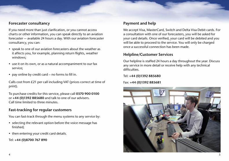
Helpline/Customer Services
Our helpline is staffed 24 hours a day throughout the year. Discuss any service in more detail or receive help with any technical difficulties.
Tel: +44 (0)1392 885680
Fax: +44 (0)1392 885681

6 7
Code element Example Decode Notes
1 Report type TAF ‘Terminal Aerodrome Forecast’ Name for an aerodrome forecast
2 Location EGSS ‘London Stansted’ Station four-letter ICAO indicator
3 Date/Time of origin Zulu is equivalent to UTC
130500Z ‘For the 13th at oh, five, hundred, Zulu’
4 Validity time 1306/1406 ‘Valid fromoh, six,hundred on the 13th to, oh, six, hundred on the 14th
UTC (Greenwich Mean Time)
5 Wind 31015G25KT ‘Three one zero degrees, fifteen knots, max twenty five knots’
VRB = Variable; 00000KT = calm. Wind direction is given in degrees true
6 Prevailing visibility or CAVOK*
8000 ‘Eight kilometres’ 9999 = 10 km or more; 0000 = less than 50 metres
7 Significant weather -SHRA ‘Light rain showers’ See present weather table on METAR (page 18) for details; NSW = No significant weather
8 Cloud FEW005 SCT010 SCT018CB BKN025
‘Few at five hundred feet, scattered at one thousand feet, scattered cumulonimbus at one thousand eight hundred feet. Broken at two thousand five hundred feet’
FEW = 1-2 oktas; SCT = 3-4 oktas; BKN = 5-7 oktas; OVC = 8 oktas; ‘VV///’ = state of sky obscured (cloud base not discernible); figures in lieu of ‘///’ give forecast vertical visibility in hundreds of feet. NSC = no significant cloud (none below 5,000 feet and no TCU or CB) TCU and CB will be the only cloud types specified. Cloud heights are given in feet above airfield height.
9 Significant changes Probability Time Change indicator Met. groups
PROB30 1314/1316 BECMG 1314/1316 FM131400 TSRA BKN010CB
‘30% probability’ ‘from fourteen hundred on the 13th to sixteen hundred on the 13th,’ or ‘becoming from fourteen hundred on the 13th to sixteen hundred on the 13th’ or ‘from fourteen hundred on the 13th’ followed by ‘Thunderstorm with rain, broken cumulonimbus at one thousand feet’
Only 30% or 40% probability will be used. Indicates beginning and end time of forecast period in UTC. Also TEMPO = temporarily may be used. Met. group follows indicating a change in some or all of the elements forecast in the first part of the TAF.
Met. decodesAerodrome forecast – TAF decode
Note: CNL may be used to indicate that a TAF is cancelled.* CAVOK will replace visibility and cloud groups

8 9
Example 1 24-hr TAF
FTUK32 EGGY 110500 EGPK 110500Z 1106/1206 13010KT 9000 BKN010 BECMG 1106/1108 BKN018 PROB30 TEMPO 1108/1116 17025G40KT 4000 TSRA BKN012CB BECMG 1118/1121 3000 BR NSC=
Decode
Twenty four-hour TAF issued at 0500 UTC on the 11th. Prestwick valid from oh six hundred on the 11th to oh six hundred on the 12th. Wind one three zero degrees ten knots. Nine kilometres visibility. Broken at one thousand feet. Becoming from oh six hundred on the 11th to oh eight hundred on the 11th, broken at one thousand eight hundred feet. 30% probability, temporarily between oh eight hundred on the 11th to sixteen hundred on the 11th, wind one seven zero degrees twenty five knots, gusting to forty knots. Four thousand metres visibility. Thunderstorm with moderate rain. Broken cumulonimbus at one thousand two hundred feet. Becoming from eighteen hundred on the 11th to twenty one hundred on the 11th, three thousand metres visibility, mist, no significant cloud.
Example 2 9-hr TAF
FCUK33 EGGY 300800 EGTE 300800Z 3009/3018 23010KT 9999 SCT010 BKN018 BECMG 3011/3014 6000 -RA BKN012 TEMPO 3014/3018 2000 DZ OVC004 =
Decode
Nine-hour TAF issued at 0800 Zulu on the 30th. Exeter valid from oh nine hundred on the 30th to eighteen hundred Zulu on the 30th. Wind two three zero degrees ten knots. Ten kilometres or more visibility. Scattered at one thousand feet. Broken at one thousand eight hundred feet. Becoming from eleven hundred on the 30th to fourteen hundred on the 30th, six kilometres, slight rain. Broken at one thousand two hundred feet. Temporarily between fourteen hundred on the 30th to eighteen hundred on the 30th. Two thousand metres visibility. Moderate drizzle. Overcast four hundred feet.

10 11
Flight planningIn addition to weather information:
• UK and Foreign NOTAM information is available from the UK Aeronautical Information Service at www.ais.org.uk where you can also access the UK AIP, its supplements, AICs and a flight plan form.
• For abbreviated and updated information on certain UK airspace restrictions, call the AIS information line on 0500 354802 or +44 (0)20 8750 3939.
Pilot’s pre-flight checkDesigned for General Aviation pilots, but information applies to everyone. SafetySense leaflets are in LASORS and the CAA website . . . . . . . . . . . . . . . . . . . . . . . . . . www.caa.co.uk/safetysense through “general aviation”.
Valid medical, type/class rating?
90-day rule for passengers?
Map/charts and information in date? www.ais.org.uk>VFR CHARTS
Frequencies changed? www.ais.org.uk>VFR CHARTS
Flight plan required? GetMet page 22 or AIS website
File CANP/PINS? Freephone 0800 515544 or fax 0500 300120
Mass/balance calculations? Flight manual, SafetySense leaflet 9
Weather forecast — route/area? F215/415, TAFs/METARs GET MET Pages 417
NOTAMs and aeronautical information checked? AIS website www.ais.org.uk
Route planned? Fuel? Diversion? Safety altitude? SafetySense leaflet 5
Take off/landing performance? Flight Manual, SafetySense leaflet 7
Temporary restricted airspace? AISwebsite or freephone 0500 354 802 or call +44 (0)20 8750 3939
Aircraft serviceable?
Pilot fit, both physically and mentally? SafetySense leaflet 23
Passengers briefed? SafetySense leaflet 2

12 13
Met. decodesAerodrome actual weather — METAR and SPECI decode
Code element Example Decode Notes1. Identification
METAR or SPECI Location indicator Date/time
METAR EGLL 291020Z AUTO
Meteorological Airfield Report London Heathrow ‘ten twenty Zulu on the 29th’ a fully automated report with no human intervention
METAR – aviation routine report, SPECI – selected special (not from UK civil aerodromes) Station four-letter indicator AUTO METARS may only be disseminated when an aerodrome is closed or at H24 aerodromes, where the accredited met. observer is on a CAA approved overnight duty break. Users are reminded that reports of visibility, present weather and cloud from automated systems should be treated with caution due to the limitations of the sensors themselves and the spatial area sampled by the sensors.
2. Wind Wind direction/speed Extreme direction
31015G27KT280V350
‘three one zero degrees, fifteen knots, gusting twenty seven knots’ ‘varying between two eight zero and three five zero degrees’
Max only given if 10 KT than mean. VRB = variable. 00000KT = calm. Variation given in clockwise direction, but only when mean speed is greater than 3 KT. Wind direction is given in degrees true.
3. Visibility prevailing visibility Minimum visibility (In addition to the prevailing visibility required)
3200 1200SW
‘three thousand two hundred metres’ ‘twelve hundred metres to the south-west’
0000 = ‘less than 50 metres’ 9999 = ‘ten kilometres or more’. No direction is required The minimum visibility is also included alongside the prevailing visibility when the visibility in one direction, which is not the prevailing visibility, is less than 1,500 metres or less than 50% of the prevailing visibility and less than 5000 metres. A direction is also added as one of the eight if points of the compass.
4. RVR R27R/1100 ‘RVR, runway two seven right, one thousand one hundred metres’
RVR tendency (U = increasing; D = decreasing; N = no change) may be added after figure (not currently used in the UK) e.g. R27R/1100D P1500 = more than 1,500 m; M0050 = less than 50 m. Significant variations – example: R24/0950V1100, i.e. varying between two values. (Not from UK civil aerodromes).
5. Present weather +SHRA ‘heavy rain showers’ + = Heavy (well developed in the case of +FC and +PO); -= Light; no qualifier = Moderate. BC = Patches BL = Blowing BR = Mist DR = DriftingDS = Duststorm DU = Dust DZ = Drizzle FC = Funnel cloudFG = Fog FU = Smoke FZ = Freezing GR = Hail (>5 mm)GS = Small hail or snow pellets HZ = Haze IC = Ice crystalsMI = Shallow PL = Ice pellets PO = Dust devils PR = BanksRA = Rain SA = Sand SH = Showers SG = Snow grainsSN = Snow SQ = Squalls SS = Sandstorm TS = ThunderstormVA = Volcanic ash VC = In vicinity UP = Unidentified precipitation (AUTO METARS only)Up to three groups may be present, constructed by selecting and combining from the above. Group omitted if no weather to report.

14 15
Code element Example Decode Notes
6. Cloud FEW005 SCT010CB BKN02
‘few at five hundred feet, scattered cumulonimbus at one thousand feet, broken at two thousand five hundred feet’
FEW = ‘few’ (1-2 oktas), SCT = ‘Scattered’ (3-4 oktas), BKN = ‘Broken’ (5-7 oktas), OVC = ‘Overcast’, NSC = no significant cloud (none below 5,000 ft and no TCU or CB) There are only two cloud types reported; TCU = towering cumulus and CB = cumulonimbus. VV/// = ‘state of sky obscured’ (cloud base not discernable). Figures in lieu of ‘///’ give vertical visibility in hundreds of feet. Up to three, but occasionally more, cloud groups may be reported. Cloud heights are given in feet above airfield height NCD = no cloud detected (AUTO METARS only).
7. CAVOK* CAVOK ‘cav-oh-kay’ Visibility greater or equal to 10 km, no cumulonimbus or towering cumulus, no cloud below 5,000 ft or highest minimum sector altitude (MSA) (whichever is the greater) and no weather significant to aviation.
8. Temp and dew point
10/03 ‘temperature ten degrees Celsius, dew point three degrees Celsius’
If dew point is missing, example would be reported as 10///. M indicates a negative value.
9. QNH Q0995 ‘nine nine five’ Q indicates millibars. If the letter A is used QNH is in inches and hundredths.
10. Recent weather RETS ‘recent thunderstorm’ RE = recent, weather codes given above. Up to three groups may be present.
11. Wind shear WS RWY24 ‘wind shear runway two four’ Will not be reported at present for UK aerodromes.
12. Colour state BLU Blue Military reports also display a colour state BLU, WHT, GRN, YLO1, YLO2, AMB or RED, coded according to cloud and visibility. BLACK indicates the runway is unusable.
13. Trend BECMG FM1100 23035G50KT 3000 SHRA
‘becoming from 1100, 230 degrees 35 KT, max 50 KT, temporarily, 3,000 metres, moderate rain showers
A forecast of significant changes in conditions during the two hours after observation time.BECMG = Becoming TEMPO = Temporarily NOSIG = No sig changeNSW = No sig weather AT = At FM = FromTL = Until NSC = No sig cloudAny of the wind, visibility, weather or cloud groups may be used, and CAVOK. Multiple groups may be present.
* CAVOK will replace visibility and cloud groups
Met. decodesAerodrome actual weather — METAR and SPECI decode

16 17
Example
SAUK02 EGGY 301220 METAR EGLY 301220Z 24015KT 200V280 8000 –RA FEW010 BKN025 18/15 Q0983 TEMPO 3000 RA BKN008=
An example of the above METAR for 1220 UTC on the 30th of the month, in plain language:
EGLY: Issued at 1220Z on 30th. Surface wind: mean 240 deg true, 15 KT; varying between 200 and 280 deg; prevailing visibility 8 km; weather: light rain; cloud: 1-2 oktas base 1,000 ft, 5-7 oktas 2,500 ft; temperature +18 °C, dew point: +15 °C; QNH 983 mb; Trend: temporarily 3,000 m in moderate rain with 5-7 oktas 800 ft.
Example
SAUK02 EGGY 301220 METAR EGPZ 301220Z 30025G37KT 270V360 6000 1200NE +SHSN SCT005 BKN010CB 03/M01 Q0999 RETS BECMG AT1300 9999 NSW SCT015=
An example of the above METAR for 1220 UTC on the 30th of the month, in plain language:
EGPZ: Issued at 1220Z on the 30th. Surface wind: mean 300 deg true, 25 KT; maximum 37 KT, varying between 270 and 360 deg; prevailing visibility 6 km, minimum visibility 1,200 m (to northeast); heavy shower of snow; Cloud. 3-4 oktas base 500 ft, 5-7 oktas CB base 1,000 ft; temperature +3 °C, dew point –1 °C; QNH 999 mb; Thunderstorm since the previous report; Trend: improving at 1300 Zulu to 10 km or more, nil significant weather, 3-4 oktas 1,500 ft.

18 19
Metform 215
Explanatory notes for the new Metform 215 (Chart of forecast weather below 10,000 feet).
The Metform 215 provides a forecast of in-flight weather conditions below 10,000 feet covering the British Isles and very near Continent for a 9-hour period centred on a specified fixed time. It is designed for use as either an area forecast or a route forecast. For simplicity the same codes have been used as are used in the METAR code.
Information provided
(a) Charts
The chart area shows the forecast position, direction and speed of surface fronts and pressure centres at the fixed time shown in the chart’s title box.
Zones of distinct weather are enclosed by continuous scalloped lines, each zone being identified by a letter within a box. Sub-zones may also be included and are indicated by a letter followed by a number e.g. A1. Where a zone is not linked to a front, the expected speed of movement of the boundary may be given.
(b) Tabular forecast
For each zone (identified by its number on the left hand chart), the text will detail the expected surface horizontal visibility, weather and cloud during the period of validity, including any sub zones referred to within the text and spatial or temporal variations within the zone. A general outlook is also included and describes the principal weather changes expected during the 7-hour period following the end of the chart validity.

20 21
Issue times
The date and time at which the forecast is issued by the Met Office is shown at the bottom left corner of the chart.
Amendments
Amendments will appear in black bold (italic and underlined) whenever an element changes through thresholds agreed between the Met Office and the CAA Met Authority. The word ‘amended’ at the top will appear in red.
Tolerances
There are also amendment criteria for the occurrence/non-occurrence of weather, icing severity, turbulence severity and boundaries.See UK AIP GEN 3.5 4.6d Amended Route/Area Forecast (Advisory Criteria).
Time when Metform becomes available
Fixed forecast time Period of validity Outlook to Prognosis chart to(Met Office website only)
0330 UTC 1200 UTC 0800 — 1700 UTC 2359 UTC 1800 UTC
0930 UTC 1800 UTC 1400 — 2300 UTC 0600 UTC 0000 UTC
1530 UTC 000 UTC 2000 — 0500 UTC 1200 UTC 0600 UTC
2130 UTC 0600 UTC 0200 — 1100 UTC 1800 UTC 1200 UTC
Original forecast Revised opinion
General cloud base, AMSL (amounts of SCT or more)
2500 FT or more1500 FT to 2500 FT700 FT to 1500 FT500 FT to 700 FT300 FT to 500 FT200 FT to 300 FTSFC. to 200 FT
< 2500 FT< 1500 FT or > 2500FT< 700 FT or > 1500 FT< 500 FT or > 700 FT< 300 FT or > 500 FT< 200 FT or > 300 FT> 200 FT
Visibility(general visibility)
8 KM or more5000 M to 8 KM3700 M to 5000 M2500 M to 3700 M1600 M to 2500 M800 M to 1600 M000 M to 800 M
< 8 KM< 5000 M or > 8 KM< 3700 M or > 5000 M< 2500 M or > 3700 M< 1600 M or > 2500 M< 800 M or > 1600 M> 800 M

22 23
Pressure centres and fronts
What is a front?
The surface positions of pressure centres are shown by an ‘X’ for low pressure and ‘O’ for high pressure accompanied by a letter ‘L’ (low) or‘H’ (high) as appropriate.
Example pressure centres
xL oH
Surface frontal positions
Warm front Cold front
Occulusion Trough
Speed of movement of fronts and centres will be indicated by arrows and adjacent figures in knots.
15 KT
Usually a speed of movement less than 5 knots is indicated as ‘SLOW’. Ridge axes are not normally shown.
Abbreviations commonly used in tabular section – a full list of abbreviations can be found in UK AIP, GEN 2.2.
Points of the compass (N, NE, E, ENE etc.) may be used to express direction, or to refer to part of a zone.
Surface horizontal visibility expressed in metres (M) or kilometres (KM) with change over at 5,000 metres.

24 25
Slight icing: not shown
Moderate/severe icing (MOD/SEV icing):
The following symbols will be used to show turbulence in cloud as well as mechanical turbulence over land:
Slight turbulence: not shown
Moderate/severe turbulence (MOD/SEV TURB):
A forecast of CB or TS implies severe turbulence and or icing
Met. decodesWeather
DZ drizzle GR hail RA rain SN snow FG fog HZ haze BR mist FZ freezing SH shower TS thunderstorm GR hail GS small hail/snow pellets
A – prefix (e.g. –DZ) indicates slight precipitation. No prefix indicates moderate precipitation (e.g. DZ). A + prefix indicates heavy precipitation (e.g. +RA). Weather phenomena may also be written as a combination of abbreviations, e.g. TSRASN (thunderstorm with moderate rain and snow).
Cloud Cloud amount (FEW, SCT, BKN, OVC) and type will be followed by an icing and turbulence symbol, if appropriate, and then the height of the cloud base and tops above mean sea level (AMSL).
The familiar abbreviations for cloud type will be used. Cloud tops extending above 10,000 FT will be shown by ‘XXX’ The following symbols will be used to show icing in cloud:

26 27
The height of the 0 °C isotherm (or ‘freezing level’) is provided in the column to the right of the cloud and this can be used for guidance as to the level above which icing is likely. The figure will indicate the average freezing level within the area.
Mountain wave activity is included in the visibility and weather section with a forecast vertical speed.
MAX maximum WKN weakening FPM feet per minute VSP vertical speed MTW mountain waves
Hill FG is used to indicate hill fog and implies a surface visibility of less than 200 metres.
A full decode of the F215 is available at: www.metoffice.gov.uk/aviation
Metform 214
Complements Metform 215 (above) by providing forecast spot upper winds and temperatures covering a similar area.
Metforms 415 and 414
Metforms 415 (significant weather) and 414 (upper winds/temps) are charts prepared in a similar format (but no outlook) for low-level flights into Europe. An Outlook Chart is only included with the Met Office web version of the F215 and shows only the expected positions of the principal synoptic features and mean sea level isobars at the end of the period. Weather zones are not given on the prognosis chart.

28 29
Call sign/ID Frequency MHz Operating hours Stations Contents Remarks
1 2 3 4 5 6LONDONVOLMET(MAIN)
135.375 H24(continuous)
AmsterdamBrusselsDublinGlasgowLondon GatwickLondon Heathrow London Stansted ManchesterParis/Charles de Gaulle
1. Half-hourly reports (METAR) 2. The elements of each report are
broadcast in the following order: (a) Surface wind (b) Visibility* (c) RVR if applicable (d) Weather (e) Cloud* (f) Temperature (g) Dew point (h) QNH (i) Recent weather if applicable (j) Wind shear if applicable (k) Runway contamination warning
if applicable (l) TREND if applicable
*or CAVOK 3. Non-essential words such as
‘surface wind’, ‘visibility’, etc. are not spoken
4. Except for ‘SNOCLO’ (see Column 6). The Runway State Group is not broadcast
5.All broadcasts are in English
The spoken word ‘SNOCLO’ will be added to the end of the aerodrome report when that aerodrome is unusable for take-offs and landings due to heavy snow on runways or runway snow clearance
LONDONVOLMET(SOUTH)
128.600 H24(continuous)
BirminghamBournemouth Bristol Cardiff JerseyLondon LutonNorwich SouthamptonSouthend Exeter
†LONDONVOLMET(NORTH)
126.600 H24(continuous)
E Midlands HumbersideIsle of ManLeeds BradfordLiverpoolLondon Gatwick ManchesterNewcastleDurham Tees Valley
SCOTTISHVOLMET
125.725 H24(continuous)
Aberdeen/DyceBelfast InternationalEdinburghGlasgowInvernessLondon HeathrowPrestwickStornowaySumburgh
En route information VHF Volmet
* Broadcast range extended to cover southeast England and English Channel

30 31
Amsterdam126.200 MHz
BRUSSELS127.800 MHz
DUBLIN127.000 MHz
PARIS126.000 MHz
Amsterdam Brussels Dublin Paris/CDG
Rotterdam Oostende Shannon Paris/Orly
Brussels London/Heathrow Cork Lyon/Satolas
Düsseldorf Luxembourg Belfast Geneva
Paris/CDG Amsterdam Glasgow Zurich
London/Heathrow Paris/Orly Prestwick London/Heathrow
London/Gatwick Frankfurt Manchester London/Gatwick
Copenhagen Cologne-Bonn London/Heathrow Brussels
Hamburg Düsseldorf London/Gatwick Amsterdam
It is not normally possible to receive VHF Volmet while abroad. However, certain short-wave portable radios with an SSB function may be able to receive the regular HF transmissions of METAR and airfield information from the RAF on 5,450 kHz and 11,253 kHz. These cover major military aerodromes in the UK and abroad. TAFs and METARs for major civilian aerodromes are broadcast from Shannon on 3,413 kHz (night only), 5,505 kHz and 8,957 kHz (24 hours), and 13,264 kHz (day only).
VHF European VOLMET
VHF VOLMET is primarily designed for international commercial IFR operations. Each broadcast should have a mean range of 200 NM at FL300. Coverage at low levels will be significantly less than this. In addition to London Main, North and South, as well as Scottish VOLMET, the following broadcasts may be received in some parts of the UK.

32 33
Aerodrome terminal information service (ATIS)
Certain aerodromes provide weather and/or aerodrome information by telephone, although not necessarily as a 24-hour service.
Other useful numbers
General Aviation Unit (GAU) Tel: 01293 3988 Email: [email protected] www.caa.co.uk/ga
Aircraft registration (CAA) Tel: 020 7453 6666 Fax: 020 7453 6670
Aviation Services (CAA) Tel: 01293 768374 Fax: 01293 573860 Email: [email protected]
Investigations and Enforcement Team (IET) Tel: 0207 453 6186 Fax: 0207 04536175 Email: [email protected]
Aviation Health Unit (CAA) Tel: 01293 573700 Fax: 01293 573995
NOTAMs and aeronautical information, AIS (NATS) AIS information line: 0500 354802 or +44 (0)20 87503939 Fax: 020 8750 3775
Licensing Department (CAA) Tel: 01293 573700 Fax: 01293 573996 Email: [email protected]
Publications Most are available on the CAA website www.caa.co.uk/publications Tel: 0870 600 5522 CAA publications listed on TSO website: www.tso.co.uk
Safety Promotion GASCo (General Aviation Safety Council) Tel: 01634 200203 www.gasco.org.uk
The CAA website www.caa.co.uk includes GA safety promotion information including /gasil or /safetysense leaflets.
Belfast City ATIS 02890 935124Benbecula ATIS 01870 604818Birmingham ATIS 0121 780 0910Blackpool ATIS 01253 343434 x8315Bournemouth ATIS 01202 364151Cardiff ATIS 01446 729319Carlisle ATIS 01228 574123Durham Tees Valley ATIS 09012 018111East Midlands ATIS 0906 851 7567Edinburgh ATIS 0131 333 6216Glasgow ATIS 0141 887 7449Guernsey ATIS 01481 238957Humberside ATIS 01652 682020Inverness ATIS 01667 464255Jersey ATIS 01534 498073Kirkwall ATIS 01856 878476Leeds Bradford ATIS 0113 2509696 x2489Liverpool ATIS 08717 505150London City ATIS 020 7646 0224London Stansted ATIS 01279 669325Lydd ATIS 01797 322 422Manchester ATIS 0161 499 2324Newcastle ATIS 0191 2143400Norwich ATIS 01603 420640Shoreham ATIS 01273 467372Southampton ATIS 02380 625877Stornoway ATIS 01851 707444Sumburgh ATIS 01950 461037Wick ATIS 01955 607596
Useful contacts

34 35
Important telephone numbers
Accident reporting, AAIBTel: 01252 512299 Fax: 01252 376999
Emergency Alerting (Distress & Diversion) Cell, LATCC (NATS)Tel: 01489 612406
Airprox reporting, UKAB
Occurrence reporting, Safety Data Dept (CAA)
Confidential Human Factors Incident Reporting (CHIRP)Tel: 0800 214645 (UK only)/01252 378947 Fax: 01252 378940www.chirp.co.uk/submit-a-report
General Aviation Unit (GAU)Tel: 01293 3988Email: [email protected] www.caa.co.uk/ga
Aircraft registration (CAA)Tel: 020 7453 6666 Fax: 020 7453 6670
Investigations and Enforcement Team (IET)Tel: 0207 453 6186 Fax: 0207 453 6175Email: [email protected]
NOTAMs and aeronautical informationAIS (NATS) Tel: 0500 354802 or +44 (0)20 87503939Fax: 020 8750 3775
Licensing DepartmentPersonnel licensing (CAA)Tel: 01293 573700 Fax: 01293 573996Email: [email protected]
CAA airworthiness evaluation and surveillanceFor all matters, including those relating to aircraft maintenance, please contact the General Aviation Unit.

36 37
Filing flight plansGuidance for completing flight plans is contained in AIP at ENR 1.10 – Flight Planning, and Safety Sense Leaflets 20 and 27. File when flying IFR in controlled airspace, when crossing an international boundary, or when flying over areas with sparse populations.
If your aerodrome of departure does not have an ATS unit, the primary means for filing flight plans should be through the Assisted Flight Planning Exchange (AFPEX) service. This allows pilots and small aerodromes access to file their own flight plans and other flight related messages.
The Civil Aviation Communications Centre (CACC) at Swanwick administers the AFPEX service and staffs the AFPEX Helpdesk to assist in filing flight plans and related messages. Permission to use AFPEX will only be granted to bona fide users based in the UK only and may be obtained from the CACC by email to [email protected]. Application forms are available on the website www.flightplanningonline.co.uk and approved users are issued with a LOGIN and unique password to access their personal mailbox.
An internet connection is essential but, once approved, an operator can file their flight plan from any computer.
Pilots wishing to file a flight plan who do not have access to AFPEX, or are unable to access the system for some reason, may use the AFTN Parent Unit listed in the AIP at ENR 1.10 – Flight Planning, and Safety Sense Leaflet 20.
The contact number for the AFPEX Helpdesk can also be used to close a flight plan or to cancel a state of emergency after landing if you have been unfortunate enough to need to declare one. The number can also be used by the nominated ‘responsible person’ to activate a flight plan, or in the event of an aircraft not arriving at its destination, to initiate overdue action.
CACC contact numbers (available 24 hours a day):
Helpdesk Telephone: 0845 601 0483
Registration and queries Telephone: 0845 601 0484

Met OfficeFitzRoy Road, ExeterDevon, EX1 3PBUnited Kingdom
Tel: 0370 900 0100Fax: 0370 900 [email protected]
Produced by the Met Office© Crown copyright 15/0368 Met Office and the Met Office logo are registered trademarks