Embed Size (px)
DESCRIPTION
Geoscience. Representing Earth's Surface. Prime Meridian is the "zero point" for land east and west on the world. a.Runs through Greenwich, England. Prime Meridian is the "zero point" for land east and west on the world. a.Runs through Greenwich, England b.Goes from pole to pole. - PowerPoint PPT Presentation
Citation preview

Geoscience
Representing Earth's Surface
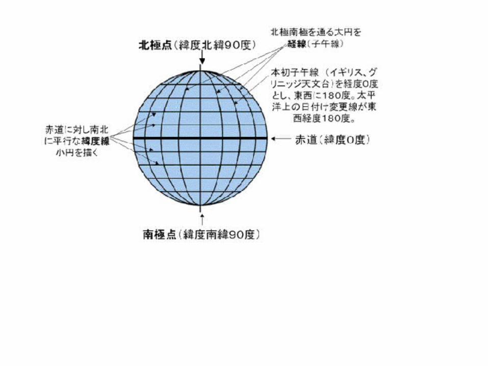


Prime Meridian is the "zero point" for land east and west on the world.
a. Runs through Greenwich, England

Prime Meridian is the "zero point" for land east and west on the world.
a. Runs through Greenwich, England
b. Goes from pole to pole

Prime Meridian is the "zero point" for land east and west on the world.
a. Runs through Greenwich, England
b. Goes from pole to pole
c. Runs on the outside of the Earth, not through the middle
World is spaced off 0º to the east or the west, up to 180º.
The Prime Meridian is a line of longitude. It goes up and down.

The Equator is the zero point on the Earth for points that are north and south.
The Equator is halfway between the north and south pole, and there are only 90º on either side of it, unlike the Prime Meridian.

Mercator Projection

Mercator Projection
A guy named Mercator came up with this in 1569.

Mercator Projection
A guy named Mercator came up with this in 1569.
Although the distances and sizes are distorted, because it is rectangular, the directions are accurate. This is a good thing when one is at sea.

Robinson Projection
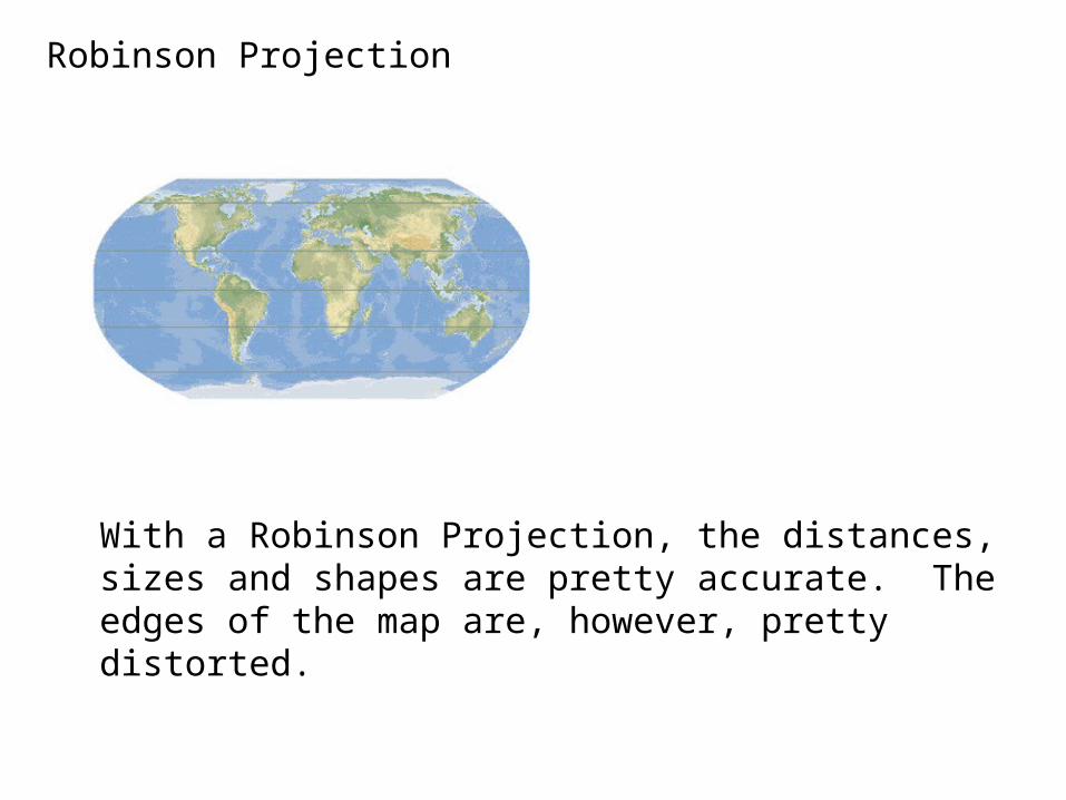
Robinson Projection
With a Robinson Projection, the distances, sizes and shapes are pretty accurate. The edges of the map are, however, pretty distorted.

Conic Projection

Conic Projection

Conic Projection
These maps show little distortion over small areas, so they are very useful for road or weather maps.

Gnomonic Projection

Gnomonic Projection
Gnomonic projection maps become more distorted as one moves away from the point of contact, but they are very good at showing the shortest distance between two points. Airlines would use these to find shortest distance between two cities.

Topographic Maps

Topographic Maps
Topographic maps show slopes of the land surface. Each line represents a different elevation above sea level, or elevation above some other arbitrary point.
Obviously, no two lines can ever touch.
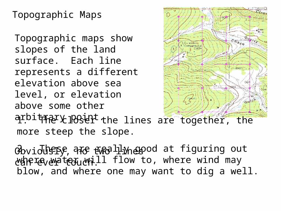
Topographic Maps
Topographic maps show slopes of the land surface. Each line represents a different elevation above sea level, or elevation above some other arbitrary point.
Obviously, no two lines can ever touch.
1. The closer the lines are together, the more steep the slope.
2. These are really good at figuring out where water will flow to, where wind may blow, and where one may want to dig a well.
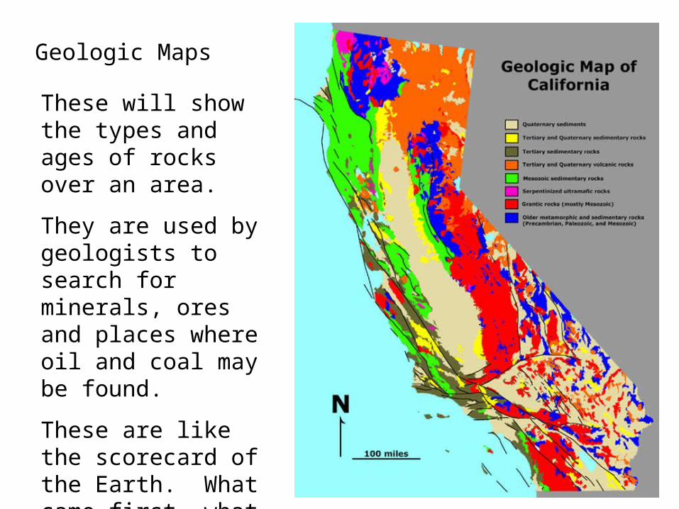
Geologic Maps
These will show the types and ages of rocks over an area.
They are used by geologists to search for minerals, ores and places where oil and coal may be found.
These are like the scorecard of the Earth. What came first, what is going where, and who is cracking under the pressure.

If someone said they were 500 miles from Boise, they could be anywhere on a sphere with a radius of 500 miles.
If you knew they were on Earth, they could be anywhere on a circle with a radius of 500 miles.

If a person said they were 500 miles from Boise, and 500 miles from Minneapolis, they could be on two parts of the surface of the Earth, or in many places, if they included airspace.

If they were 500 miles from Boise, 500 miles from Minneapolis and 500 miles from Tucson, they could ONLY be in one place.
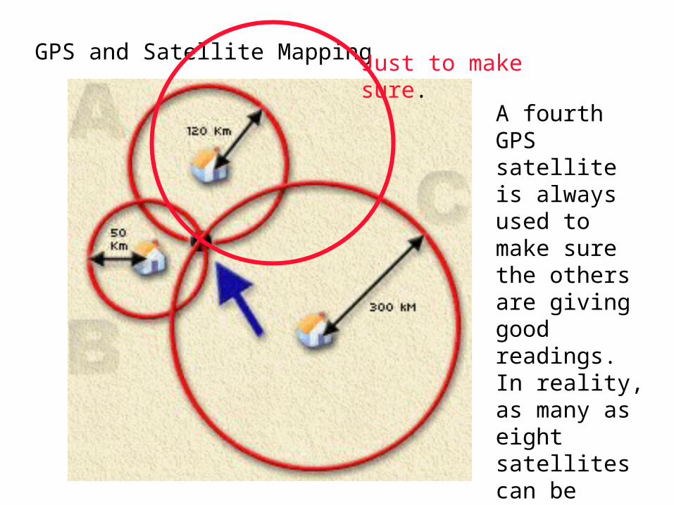
GPS and Satellite Mapping Just to make sure.
A fourth GPS satellite is always used to make sure the others are giving good readings. In reality, as many as eight satellites can be used. Four are needed.


Interesting fact, at least to me, is that
Einstein said that as thing go fast, time will remain constant for the moving object, but will slow down for those watching. This has proven to be true.
If the satellite is moving at about 18,000 miles per hour, and the relativistic time change is only very, very, small, then the GPS will be off by as much as 650 feet per day.
The satellites correct their position on an almost constant basis.