Embed Size (px)
Citation preview
Geophysical Abstracts 148-151 January-December 1952(Numbers 13284-14183)
'
GEOLOGICAL SURVEY BULLETIN 991
Abstracts of world literature . contained in periodicals,
i books, and patents
UNITED STATES GOVERNMENT PRINTING OFFICE, WASHINGTON : 1953
JNITED STATES DEPARTMENT OF THE INTERIOR
Douglas McKay, Secretary
4''*v . .
GEOLOGICAL SURVEY
W. E. Wrather, Director
CONTENTS
[The letters in parentheses are those used to designate the chapters for separatepublication].
Page(A) Geophysical Abstracts 148, January-March 1952 (nos. 13284-13547)_ 1(B) Geophysical Abstracts 149, April-June 1952 (nos. 13548-13802)___ 75 (Cf Geophysical Abstracts 150, July-September 1952 (nos. 13803-14003)- 145 (D) Geophysical Abstracts 151, October-December 1952 (nos. 14004-
14183)____________________________________ 195
Under departmental orders, Geophysical Abstracts have been published at dif ferent times by the Bureau of Mines or the Geological Survey as noted below:
1-86, May 1929-June 1936, Bureau of Mines Information Circulars. [Mimeo graphed]
87, July-December 1936, Geological Survey Bulletin 887.88-91, January-December 1937, Geological Survey Bulletin 895.92-95, January-December 1938, Geological Survey Bulletin 909.96-99, January-December 1939, Geological Survey Bulletin 915.100-103, January-December 1940, Geological Survey Bulletin 925.104-107, January-December 1941, Geological Survey Bulletin 932.108-111, January-December 1942, Geological Survey Bulletin 939.112-127, January 1943-December 1946, Bureau of Mines Information Circulars.
[Mimeographed]128-131, January-December 1947, Geological Survey Bulletin 957.132-135, January-December 1948, Geological Survey Bulletin 959.136-139, January-December 1949, Geological Survey Bulletin 966.140-143, January-December 1950, Geological Survey Bulletin 976.144-147, January-December 1951, Geological Survey Bulletin 981.
Geophysical Abstracts 148 January-March 1952(Numbers 13284-13547)
G]E OLOGICAL SURVEY BULLETIN 991-A
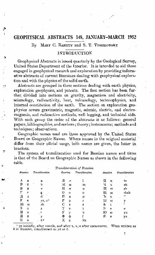
GEOPHYSICAL ABSTRACTS 148, JANUARY-MARCH 1952By MARY C. RABBITT and S. T. VESSELOWSKY
INTRODUCTION
Geophysical Abstracts is issued quarterly by the Geological Survey, United States Department of the Interior. It is intended to aid those engaged in geophysical research and exploration by providing inform ative abstracts of current literature dealing with geophysical explora tion and with the physics of the solid earth.
Abstracts are grouped in three sections dealing with earth physics, exploration geophysics, and patents. The first section has been fur ther divided into sections on gravity, magnetism and electricity, seismology, radioactivity, heat, volcanology, tectonophysics, and internal constitution of the earth. The section on exploration, geo physics covers gravimetric, magnetic, seismic, electric, and electro magnetic, and radioactive methods, well logging, and technical aids. With each group the order of the abstracts is as follows: general papers, bibliographies, and reviews; theory; instruments; methods and techniques; observations.
Geographic names used are those approved by the United States Board on Geographic Names. Where names in the original material differ from their official usage, both names are given, the latter in brackets.
The system of transliteration used for Russian names and titles is that of the Board on Geographic Names as shown in the following table.
Russian Transliteration
Transliteration of Russian Russian Transliteration Russian Transliteration
E e3K JK3 3H HK ftK K
a b vg d"
ye, e» zh z iy
1m n oP r3
t
U
f
kh
1 ye initially, after vowels, and after &, t; e after consonants. e in Russian, transliterate as ye or e.
n;Hmm^LIL9K>fl
nts.
n; ts^ chiii shm shch_. >)ti yT >
3 eK) yuH ya
When written as
1
2 GEOPHYSICAL ABSTRACTS 148, JANUARY-MARCH 1952
Geophysical Abstracts 1-86 and 112-127 were issued as Information Circulars by the Bureau of Mines, and 87-111 were issued as Bulletins of the Geological Survey. Geophysical Abstracts 128 and following numbers have been published as Bulletins of the Geological Survey.
' All Geophysical Abstracts published as Information Circulars are now out of print. Geophysical Abstracts issued as Bulletins of the Geological Survey (except no. 87, Bull. 887, and no. 88, Bull. 895-A, which are out of print) may be purchased as single copies or by sub scription, from the Superintendent of Documents, Government Print ing Office, Washington 25, D. C. For subscription, the Superintendent will accept a.deposit of $5 in payment of subsequent issues. When this is near depletion, the subscriber will be notified. The deposit may also be used to purchase any other publication from the Superintendent of Documents.
Acknowledgments. Special credit is due James R. Balsley, Jr., David F. Barnes, Lucy E. Birdsall, W. J. Dempsey, Roland G. Hender- son, H. R. Joesting, R. W. Johnson, Elizabeth King, Frank W. Stead and Isidore Zietz who have prepared the abstracts signed with their initials.
EARTH PHYSICS
GRAVITY
13284. Tanni, L. I., and Niskanen, Erkki. The geoidal undulations and disturbing . masses: Isostatic Inst. Internat. Assoc. Geodesy Pub. 25, 19 pp., 1951,
(Reprinted from the Acad. Sci. Fenn. Annales, Ser. A, v. 3. Geol.-Geog. 24, 1951.)
Previous investigations by Tanni (Geophys. Abstracts 11916, 11917)
indicate that the undulations of the geoid calculated from isostatically1 ; ' reduced gravity anomalies do not follow the topography. The purpose
of this paper is to explain the mean +30 rise of the geoid above thereference ellipsoid on the European continent.
From calculations based on Helmert's formula, it is concluded that an uncompensated rigid crustal mass need not be particularly large to produce the required undulations. If the disturbing mass is compensated in the crust (Pratt) or immediately under it in the root formation (Airy) impossible density disturbances in the crust would result. If
the compensation occurs at great depth, the density of the disturbance is within possible limits, however, the surface of equal pressure is deeper than has usually been supposed. Stress calculations show that the earth's crust under an uncompensated disturbing load should be con siderably thicker than is normally assumed. R. G. H.
13285. Nakamura, S. T., and Sima, Hiromu. A method of deduction of pressure distribution on an internal plane surface from the observed topographical change (Pt I) : Tohoku Univ. Sci. Repts., 5th ser., Geophysics, v. 3, no. 2, pp. 99-101, 1951.
The distribution of pressure, A, on an internal horizontal surface is expanded in double Fourier series. The theoretical displacements on
GRAVITY tf
the external surface are then expressed in series involving exponentials and the unknown coefficients of A. Next, the observed displacements on the earth's surface are expanded in double Fourier series and their co efficients evaluated. The comparison of corresponding terms of the expansions for theoretical and observed displacements provides a means of computing the unknown coefficients of the pressure distribution, A. It is also possible to estimate the depth at which the pressure is dis tributed. R. O. H.
13286. Schiitte, H. Die Bestimmung der Abplattung der Erde aus der Schwere- verteilung nach dem Schwereverzeichnis von N. F. Zhuravlev [The determination of earth's flattening from the catalog of gravity data compiled by N. F. Zhuravlev]: Gerlands Beitr. Geophysik, Band 62, Heft 1, pp. 9-26, 1952.
More than ten thousand gravitational data compiled by N. F. Zhuravlev from measurements extending all over the world were used for the determination of the flattening of the earth. Certain stations were from the outset excluded from the analysis, for instance, stations with very high altitudes above sea level, or stations with very high local anomalies. The results varied quite substantially according to different procedures used in calculations and in selecting the stations. The correct value of the flattening, computed on the basis of existing data, is said to be be tween 1/294.88 and 1/296.51. 8. T. V.
33287. Yun'kov [fun'kov], A. A. Opredeleniye mestopolozheniya i razmerov odnorodnogo ellipsoida vrashcheniya okolo vertikal'noy osi po nablyu- deniyam so staticheskim gravimetrom i gravitatsionnym variometrora [Determination of the position and dimensions of a homogeneous ellip soid of revolution with vertical axis from the observational data obtained with static gravimeter and the torsion balance]: Akad. Nauk SSSR Izv., Ser. geofiz. no. 6, pp. 56-59,1951.
Differentiating with respect to s, the vertical coordinate, the known expression of the potential produced by the ellipsoid of revolution at an external point, the expression for &ffx, that is the variation of g, can be found in the form of an integral, and the position of its maximum determined. This maximum is located above the center of the ellipsoid. Approximate integration can be performed by developing the inverse tangents of the formula into series. Using the formulas of Gel'fand for the value of the potential of the ellipsoid of revolution, it is possible to determine the coordinates of the center and the lengths of the axes of the ellipsoid. The excess or deficit of .density of the substance is supposed to be known. S. T.V.
13288. Pariyskiy, N. N. Vertikal'naya sostavlyayushchaya prityazheniya giper- bolicheskogo kupola [The vertical component of the attraction exercised by a hyperbolic dome]: Akad. Nauk SSSR Geofiz. Inst. Trudy, no. 12
.: (139), pp. 22-34, 1950.To facilitate the interpretation of the data of gravimetric surveys,
the disturbing effect of a body underground at a given depth and having the form of a hyperoboloid of revolution, is computed for points on the earth's surface. The depth of the top of the hyperboloid is assumed to be equal to the focal distance. The derived formula is then applied to several special cases. Five tables to aid in the calculations are given. S, T.V.
4 GEOPHYSICAL ABSTRACTS 148, JANUARY-MARCH 1952
13289. Jung, Karl. Die rechnerische Behandlurig der Airyschen Isostasie mit einer Entwicklung des Quadrats der Meereshohen nach Kugelfunktionen [Numerical treatment of isostasy according to. Airy developing the square of the altitudes into spherical functions] : Gerlands Beitr. Geophysik, Band 62, Heft 1, pp. 39-56, 1952.
In this study an attempt is made to represent the earth's relief mathe: matically in a series of spherical functions, assuming the Airy theory
. of isostasy as the physical basis of considerations. This makes it neces sary, in -order to achieve sufficient accuracy of the results, to develop not only the values of the altitudes, but also of their squares. The results seem to indicate the necessity to go still further in numerical refinements in order to achieve the goal. S. T. V.
13290. Malovichko, A. K. K voprosu ob osrednenii anomal'nykh poley [On the averaging of anomalous fields] : Akad. Nauk SSSR Izv., Ser. geofiz., no. 2, pp. 40-42, 1951.
Gravitational-field relief obtained as a result of a survey made over a certain area represents the superposition of several fields of different intensity, different geometric extension of disturbing masses, differently localized. Interpretation of the established field pattern is possible only after the total field is decomposed into separate fields. The total field is first constructed by smoothing the obtained data. Local anomalies are obtained by forming the difference between the total field and the regional fields.
To eliminate arbitrariness in this operation, several procedures are suggested. The method described in the present paper is similar to that of Tikhonov and Boulanger (Geophys. Abstract 8978). In the new pro cedure the original master charts are constructed not for a round dis turbing body, but for a square one, which makes it possible to use ordinary millimeter paper and simplifies calculations, assuring an accuracy of up to 2 per cent. For the average value of any readings, the author derives the formula
where L is length, and A0 are the observed values of respective anomalies. 8. T. V.
13291. Stoyko, Nicolas. Sur la variation saisonniere de la rotation de la Terre pendant les annees 1945-1946 [On the seasonal variation of the rotation of the earth during the years 1945-46] : Acad. royale Belgique Bull. Ol. sci., 5 ser., tome 87, no. 6, pp. 532-533, 1951.
analysis of precise time measurements of the observatories of Greenwich, Paris, Washington, and Berlin (Phys. Techn. Reichsanstalt ) during the years 1945-46, variations were found in the average duration of the day of about +0.0012 sec in January and 0.0018 sec in July. The lengthening of the day during the winter season of the northern hemisphere, and the Shortening during the summer, is probably caused by meteorological factors. 8. T. V.
13292. Ichinohe, TokiO. Highly sensitive double bifilar gravimeter [In Japanese with English summary] : Seismol. Soc. Japan Jour., V. 3, no. 2, pp. 9-16,
1951. .
Modification of the bifilar gravimeter to obtain a sensitivity of 10~*° g per mm, is reported. M. C. R.
GRAVITY '
13293. Cook, A. H. An investigation of the errors of some recent gravimeter observations: Royal Astron. Soc. Monthly Notices, Geophys. Supp., v. 6, no. 4, pp. 194-208, 1951.
A statistical analysis is made of the results of gravimeter surveys in three areas in England. Observations were made with a Graf-Askania instrument having a standard error of a single observation equal to 0.13 mgal under the most favorable conditions. A network of primary stations 15 miles apart was established with secondary stations at inter mediate points. Calculations of x2 from closure errors of primary figures show that the zero drift is linear and that the residuals have a normal distribution. The standard deviation computed from closure errors is 0.21 mgal. The observational procedure for secondary stations differed somewhat from that for primary stations. The distribution of residuals of secondary observations follows closely a Pearson-Type-VII law rather than a normal law. It is shown that this distribution can be generated random jumps of the zero of the gravimeter between succes sive observations. R. Q. H.
13294. Kolbenheyer, T. O pracach s Nb'rgaardovym gravimetrom TNK 379, v. r. 1948-49 [Report on gravity investigations with the N0rgaard gravim eter TNK 379 in 1948-49] [In Slovak with Russian and English sum maries] : Prace Statneho geologickeho ustavu, no. 28, 43 pp., 1951.
Regional gravimetric surveys were made of an area of about 3,000 sq km in southern Slovakia, with nearly 600 stations occupied. The method of whole-day loops was first used, with one suitably chosen reference station being the starting point in the morning and the closing point in the evening. The closing error was generally less than 0.2 mgal. In later surveys, shorter loops were selected, reducing this error to less than 0.1 mgal.
On the basis of these surveys the N0rgaard instrument is found to have the following properties: ease of manipulation, high degree of insensitivity to relatively severe shocks, lightness and transportability, satisfactory operation even in windy weather, and possibility of simple direct-loop method of surveying.
Increased precision could be attained by improvement in its thermal system and by perfecting the thermostat and thermal insulation.
The first survey was followed by a detailed local exploration of a small area in the thermal region around the villages Dudince, Priestauy [Piest'any], and Sturova, as well as in the southern Moravian Neogene. (Nearly 500 stations were occupied with distances between stations being about 30 m. From these determinations it can be concluded that at temperatures below 20 O errors of 0.10 mgal occurred only in exception ally unfavorable conditions. At higher temperatures the error may be 0.15 mgal or even more. S. T. V.
13295. Pariyskiy, N. N. Ovliyauii mifroseysm na o-predelenie sily tyazhesti metodom kachaniya mayatnikov [The effect of microseisms on the determination of gravity force by the pendulum method] : Akad. Nauk SSSR Geofiz. Inst. Trudy, no. 12 (139), pp! 3-21, 1950.
The effect of microseisnaic vibrations, both natural and those pro duced by industrial installations, on the period of oscillation of a simple pendulum used for measurement of gravity is discussed. From analysis of the differential equation of the oscillating pendulum into which
204759 52 2
6 GEOPHYSICAL ABSTRACTS 148, JANUARY-MARCH 1952
additive members for the effect of vertical and horizontal microseisms are introduced, it is concluded that neither. natural nor industrially caused microseisms produce an appreciable effect on the oscillations of the pendulum if these microseisms are vertical. As an example, micro- seisms of 8-sec period and 100 n amplitude cause an error of 0.5 XlO"5 mgal in the value) g. Natural horizontal microseisms of periods ranging from 2 to 10 sec also cannot affect adversely the de terminations of the value of gravity but horizontal microseisms caused by industrial installations in certain especially unfavorable cases can cause an error of about 0.3 mgal. By using two or four pendulums suspended on the same frame, as is ordinarily done, the effect of even the strongest industrial disturbance can be made negligible. 8. T. V.
13296. Garland, G. D. Comparison of gravitational and magnetic anomalies over certain structures in southeastern Ontario: Canadian Min. Met. Bull., v. 44, no. 472, pp. 546-551,1951.
The relationship between gravity anomalies and total-field magnetic anomalies is given by Poisson's equation which can be simplified to
V/ da;2)
where T is the total-field magnetic anomaly; /, the intensity of magneti zation of the mass relative to the country rock; E, the anomalous density of the mass; G, the constant of gravitation; V, the gravitational potential; and i, the direction of magnetization within the mass. Thus, knowing the constant factor I/E, it is possible to derive the gravity anomaly from a map of the total magnetic intensity or vice versa, or if both gravity and magnetic anomalies are known, it is possible to de termine the I/E of the anomalous mass, a better means of identifying its material.
Two examples are given. The circular basic intrusive near Crowe Lake in southeastern Ontario produces a simple gravity anomaly and a double magnetic anomaly, indicating that the magnetization of the mass
is not uniform. This ig borne out by measurements of a few sampleswhich show that a fine grained facies of the intrusive has a susceptibility at least 80 times greater than that of a coarse grained phase although their densities are approximately equal. At Marmora in southeast
Ontario the correlation between magnetic and gravity anomalies indi cates uniform magnetization of the anomalous mass and an I/E ratio of 90,000X10-* cgs suggesting some material more magnetic than basic rock. J. R. B.
13297. Einarsson, Trausti, Sigurgeirsson, Thorbjb'rn, and Bb'dvarsson, Gunnar. -A. report on the French-Icelandic gravity measurements in southern
Iceland in 19DO; Visindafeiag fslendinga, Greinar, y, 3, no, 1, pp, 30-52,1051.
Gravity surveys were made in the southern part of the island, with 134 gravity stations occupied. The Bouguer anomalies range from -J-65
mgal at the Reykjanes peninsula on the southwestern coast to -15mgal in the interior of the island. Previous measurements have shown
a similar decrease from the northeastern part of the island toward the
interior. A Bouguer anomaly map is included. D. F. B.
GRAVITY . :-.. 7
13298. Lee, C. S. Geophysical surveys on the Bahama Banks: Inst. Petroleum Jour., v. 37, no. 334, pp. 633-657,1951.
Geophysical surveys by the British Bahamian Oil Development, Ltd., in the Abaco, Eleuthera and Ragged Island areas are described, and similar surveys by others in the Bahamas are reviewed briefly.
Gravimeter surveys on land were made by standard methods; in shallow water they were made from tripods towed from station to station, and in deep water (to 96 ft) they were made from a diving bell. Closures of 0.2 rngal were considered adequate. The gravimeter sur veys were tied to pendulum stations. Horizontal control was by transit triangulation in areas of shallow water and by radar ranging in deeper water. These surveys were tied to astronomic fixes.
Gravity and other observations indicate that the Bahamas are under lain by a great thickness of light sediments, only slightly folded and faulted. Gravity highs under the outer arc of islands are believed to be caused by deeply buried volcanic remnants. Other gravity anomalies along the "Second Line" of islands leeward of the outer arc are governed by slight folding and warping, and by indurated reefs.
Widespread sedimentation is believed to have caused isostatic sinking, and the major troughs leeward of the outer arc are considered to be areas of rift faulting and relatively little sedimentation. The formation of subsidiary reefs and islands appears to be related to changes of sea level during periods of continental glaciation. H. R. J.
13299. Tainayo, J. L. Geografia general de Mexico. Geografia fisica. [General geography of Mexico. Physical geography.]: 2 vols., 628 and 583 pp. respectively and atlas, Mexico, D. F., Talleres Graficas de la Nacito, 1949.
The first volume of this work on the physical geography of Mexico contains a special chapter on geodetic and gravitational data. A map of gravity anomalies of Mexico and a table of 99 gravimetric stations with geographic coordinates, altitude, and gravimetric data are included. Other chapters are devoted to a description of Mexico as a volcanic country, to its seismologic characteristics and terrestrial magnetism in general with specific reference to Mexico, A table of the magnetic elements of 78 stations of the country and three maps of isomagnetic lines is given. S. T. V.
\
Oppenheim, Victor. The structure of Ecuador. See abstract 13423.
13300. Charlier, Charles, and Jones, L. L'apport de la Se"ismologie, de la Gravimetric et de la Geodesic dans la connaissance actuelle de 1'ecorce terrestre en Belgique. Concordance remarquable des r£sultats. [Con tributions of seismology, gravimetry, and geodesy to the present knowl edge of the earth's crust in Belgium. Remarkable agreement of results.]: Acad. royale Belgique Bull., Cl. Sci., 5th ser. tome 37, no. 8-9, pp. 780- 783, 1951.
Both gravitational and seismic evidence suggest that the earth's crust in Belgium consists of two blocks; the southern block 60 km thick, the northern, 20 km thick.
Results of precise surveys of 1892 and 1948 indicate that the northern part of Belgium is slowly sinking, and the southern part is rising. This suggests a narrow strip of reduced tectonic strength connecting these blocks. S. T.V. . '
8 GEOPHYSICAL ABSTRACTS 148, JANUARY-MARCH 1952
13301. Espinosa de los Monteros, J. M., and Lozano Calvo, Luis. Red de obser- vaciones con gravimetro en la provincia de Huelva [The network of gravimetric observations in the Provincia de Huelva] : Inst. Geog. y Catastral Mem., tomo 20, no. 7, pp. 1-31, 1950.
Between 1943 and 1945 relative measurements of gravity were made at 144 stations in the province of Huelva, Spain with Aracena and Corte- gana. as base stations. An Askania electro-mechanical gravirneter was used and the error of individual measurement is evaluated as less than 1 mgal.
The results of the surveys are presented in two tables giving for each station its geographic latitude, altitude, the theoretical value of gravity determined by the Cassinis formula, the observed value of gravity, Faye correction, Bouguer correction assuming a density of 2.65, and the gravity anomaly. A gravity map of the province on the scale of 1: 200,000 is included.
All anomalies are positive, ranging from 20 to 70 mgal. The smallest anomalies are found in the northwesterly-trending basin coinciding with a known fault at the intersection of the carboniferous^ deposits of Algarbes, the crystalline formations of Sierra de Aracena, and the granitic massive extending eastward from El Ronquillo. The absolute value increases from the basin along the three mentioned lines. 8. T. V.
13302. Lozano Calvo, Luis. Red de observaciones con gravimetro en la provincia de Avila [The network of gravimetric observations in the province of Avila] : Inst. Geog. y Catastral Mem., tomo 20, no. 10, pp. 1-21, 1950.
During the years 1947-1949 a detailed gravitational survey of Avila, Spain, was made, using an Askania gravimeter and covering 40 profiles with 120 stations occupied. Results of the survey are presented in a table containing for each station its description, altitude, observed gravity value, Faye gravity and anomaly, Bouguer gravity and anomaly, and the difference of these anomalies. Normal gravity was calculated from the Cassinis ellipsoid of 1930. Three gravity maps of the surveyed area show the anomalies. Though based admittedly on scanty data,comparison of the Faye and Bouguer anomalies indicates that the region is compensated isostatically as a block. In stations west of Puerto del Pico an excess of mass is indicated, and to the east, a deficiency. This
suggests a tendency towards subsidence of the western part of the Sierra de Gredos and rise of the eastern part. 8. T. V.
13303. Olczak, Tadeusz. Sila cle/ko^ci na Ziemiach Polskich [Gravity force inPoland]: Muzeum Ziemi, Wiadomos'ci, torn 5, no. 2, pp. 339-353, 1951.
Gravity investigations of Poland arc reviewed, and a map of Bougueranomalies of the area presented. Helmert's formula of 1901 was used
for the determination of normal gravity. The base stations were those Of KraliOW (lat 50°3.9' N.; long. 19°07.0' E., </=981.0540 gal) and War
saw Ont 52°14.6' N. : Ions. 21.°O.3' E., » = Q81.2412 gral). 8. T. V.
13304. Duclaux, Frangoise, and Martin, Jean. Contribution a 1'etablissementdes bases du r<5seau gravirnetrique africain [Contribution to the estab
lishment of the bases of an African gravimetric network] : Acad. sci.
Paris Cornptes rendus, tome 233, no. 16, pp. 847-840, 1951.
Principal stations were established at 35 airports and secondary stations at 85 other locations, using a North American gravimeter.
MAGNETISM AND ELECTRICITY 9
Values of gravity are tabulated for a principal axis Toulouse-Brazzaville- Livingstone-Tananarive-Reunion-Mauritius, a Brazzaville-Nairobi loop, and stations in East Africa and Madagascar. M. C. R.
13305. Sans Huelin, Guillermo. Enlace geodesico del continente Americano con Europa y Africa [Geodetic tying of the American continent with Europe and Africa] Rev. Geofis., v. 10, no. 37, pp. 57-60, 1951.
Knowledge of the precise relative geographic positions of the western and eastern hemispheres is of importance not only to geodesy but in many geophysical problems, including those of uniformity of the earth's rotation and continental drift among others. During 1951 the Inter national Association of Geodesy, with active participation of the U. S. Army Map Service and with the cooperation of scientific bodies of other countries, organized the first geodetic tying of the United States with Portugtl and Spain, using the Azores as intermediate station. The article describes the method employed, which is based on the observation of the occupations of various stars by the moon. The moment of occul- tatibn being the function of the geographic position of the observer, it is possible to find the latter by precise determination of this moment. The precision necessary in this case excludes visual observations which are replaced by photoelectric registration. S. T. V.
13306. Glennie, E. A. Density and geological corrections to gravity anomalies for the Deccan trap area in India: Royal Astron. Soc. Monthly Notices, Geophys. Supp., v. 6, no. 4, pp. 179-193, 1951.
The effect of density anomalies on gravity in the Deccan trap area is considered. The extent and thickness of the trap have been estimated from available evidence and an isogam chart prepared assuming a den sity anomaly of 0.24. The high value of gravity at Bombay, the gravity gradient of about 4 mgals to the east, and the seaward deflection of the plumb line cannot be explained by the assumed distribution of the trap. The effects of a hypothetical fissure extending for more than 100 km northward from about 25 mi south of Bombay have been computed as suming first an upwelling of basic lava from the intermediate layer at a depth of 10 km and an attendant rise of 30 km of the lower layer bringing ultrabasic material to the surface. Computations show that the width of a fissure 30-km deep depends on the height to which the lower layer rises in the fissures. It cannot be less than 5 km (if the lower layer rises nearly to the surface) and may be as much as 26 km or more. M. C. R.
MAGNETISM AND ELECTRICITY
13307. Haalck, Hans. Zur Frage der Erklarung des erdmagnetischeh Kern- feldes und des allgerneinen Magnetismus der Himmelskorper [Concern ing the explanation of the magnetic field of the earth's core and the universal magnetism of celestial bodies] : Gerlands Beitr. Geophysik, Band 62, Heft 1, pp. 1-8, 1952.
A new hypothesis of the physical causes of the magnetization of the earth and other celestial bodies, especially the sun, is suggested. As the starting point it is assumed that the core of every celestial body is formed of a mixture of gases, chiefly hydrogen, which are ionized owing to the very high temperature which makes the retention of molec-
10 GEOPHYSICAL ABSTRACTS 148, JANUARY-MARCH 1952
ular cohesion impossible, and therefore that the matter of the core consists of positively charged atoms and free electrons, all in violent thermokinetic oscillation around their central positions. The whole mass is electrically neutral having in every unit of volume an equal number of positive elemental quanta. But the rotary movement of the whole body produces a magnetic moment M which can be calculated as approximately equal to new/2 -4/3- Ro^daf, where dx is the amplitude of oscillation of individual free electrons, n their number, e the electrical charge of each quantum, w the angular velocity of rotation and Ro the radius of the core. The direction of this magnetic moment would coin cide with that established by astrophysical observations. Furthermore in the earth we can assume from seismological evidence -Ro=4.5X10* cm. It is also generally assumed that the magnetic moment of the earth M is equal to 8X1025 absolute units. Thus from the above equation we obtain dx=O.Q cm.
Applying the corresponding values for the sun, namely JRo=6.9X1010 cm, £0=2.27X10"° and M= 8.9X1033 , we find dx, the path of free electrons for the sun, equal to 23.6 cm.
The author points to the possibility of the generation of a magnetic effect by atomic transformation taking place in the interior of the sun, with formation of y quanta and subsequent accumulation of free electrons on the surface of the sun, increasing the magnetic moment around the sunspots. However the total electrical field generated by this atomic disintegration inside the sun cannot be fully explained in this way and is to be further investigated. S. T. "7.
13308. Hirayama, Misao. External field of geomagnetism: Kakioka Magnetic Observatory Mem., v. 6, no. 1, p. 67,1951.
To investigate the external field of the earth's magnetism, the mag netic potentials uniformly magnetized were expanded using the annual values (1922-36) at the magnetic observatories in the world. The coefficients of potential show excellent correspondence with the relative numbers of sunspots, but the amplitudes in a solar cycle are only 10 gamma or more. Electron densities are reported to change by an amount of about 50 percent in the F* layer because of low collisional frequency. This indicates the external field cannot be produced in the Fa layer or below in the ionosphere. M. C. R.
13309. Korneva, L. A. O vostochnoy sostavlyayushchey magnitnogo polya zemli [The east component of the geomagnetic field]: Akad. Nauk SSSRI>oklady, torn 80, no. 6, pp. 879-880, 1951.
The separation of the observed geomagnetic field into a fundamentalone and a superposed anomalous field would be a very important stepin the study of geomagnetism, but it has never been realized because of the absence of criteria for determining the anomalous component.-A. theory has recently been advanced by Shuleykin of a causal relation-
' Ship between the telluric currents in oceans ana electrical currents cir-
elating in the atmosphere. As a test of this hypothesis a map wasCOIlStruCteu representing the east component of the observed geomag netic field for the epoch 1945. Assuming that the direction of the mag-aetfc moment of tte fDfldamental field must coincide witu that of tuemoment of rotation, it can be concluded that the east component of* {fie anomalous field is exactly the east component of the geomagnetic field.
MAGNETISM AND ELECTRICITY 11-
In the light of Shuleykin's theory this map must also reflect certain characteristics of telluric currents, but their distribution over the earth's surface, especially over the0 surface of oceans, is as yet very little known. 8. T. V.
13310. Rikitake, Tsuneji. Electromagnetic shielding within the earth and geo magnetic secular variation: Tokyo Univ. Earthquake Research Inst. Bull., v. 29, pt 2, pp. 263-269, 1951.
According to theories advanced by Elsasser and Bullard secular vari ation is a perturbation of the main field caused by fluid motion near the core. The earth's mantle, however, has a finite conductivity and to some extent should have a shielding effect. This shielding effect of the mantle has been calculated on the basis of previously determined con ductivity distribution. The calculations show that secular variation having a period of less than one year would be almost entirely shielded; and that with a period longer than several hundred years a portion of the varying field appears at the earth's surface even in the case of a highly conducting core. The results are favorable to the hypothesis of Elsasser and Bullard. R. G. H.
13311. Singer, S. F., Maple, E., and Bowen, W. A., Jr. Evidence for ionosphere currents from rocket experiments near the geomagnetic equator: Jour. Geophys. Research, v. 56, no. 2, pp. 265-281,1951.
The results are essentially those reported in Geophys. Abstract 12919, with the addition of material on instrumentation and method of analyzing data. The total field magnetometer used in the rocket was calibrated in flight through the use of known fields applied-at regular intervals. The telemetered magnetometer and photo-orienter data com pletely defined the space orientation of the missile. The results obtained from the two rocket flights are believed to substantiate the predictions of the dynamo theory. R. O. H.
13312. Price, A. T., and Wilkins, G. A. The daily magnetic variations in equa torial regions: Jour. Geophys. Research, v. 56, no. 2, pp. 259-263,1951.
A new analysis of the S?-field for the Polar Year 1932-33 indicates that the maximum daily variation of H in equatorial regions is to be found between the magnetic and dipole equators in South America and Africa, but occurs to the south of both these equators in the Far East. It also appears that the line of maximum variation varies in position with the season, its movement being in the direction opposite to that of the sun. Author's abstract
13313. Ferraro, V. C. A., Parkinson, W. C., and Unthank, H. W. Sudden com mencements and sudden impulses in geomagnetism: their hourly fre quency at Cheltenham (Md.), Tucson, San Juan, Honolulu, Huancayo, and Watheroo: Jour. Geophys. Research, v. 56, no. 2, pp. 177-195, 1951.
Sudden commencement is restricted to a sudden movement followed by a magnetic storm, and sudden impulse applies to sudden movements simulating sudden commencements but not followed by magnetic storms. Diurnal variation in the frequencies of sudden commencements and sud den impulses at Cheltenham, Tucson, San Juan, Honolulu, Huancayo,
. and Watheroo, were analyzed separately for the period 1926-1946. Re sults show that any local time variation in the hourly frequency of
12 GEOPHYSICAL ABSTRACTS 148, JANUARY-MARCH 1952
sudden commencements seems likely to be small although it is suggested that sudden commencements may be more frequent in the afternoon hours, with a maximum around 13h local time. The hourly frequency of sudden impulses does not exhibit any marked local time effect when the stations are considered separately, but when combined data are con sidered the curve shows similarity to that obtained by Newton in analysis of Greenwich records. An essential difference between sudden com mencements and sudden impulses is suggested even though their appear ance on the magnetic traces is similar. L. E. B.
13314. Johnston, H. F. List of geomagnetic observatories and thesaurus of values: Jour. Geophys. Research, v. 56, no. 3, pp. 431-438, 1951.
Tables list 72 magnetic observatories throughout the world, their geographic positions, and the annual values, declination, horizontal in tensity, and vertical intensity. Among the newer observatories listed are Nurmijiirvi in Finland; Pruhonice in Czechoslovakia; Memam- betsu in Japan; El Abiod, Beni Abbes, and Mbour in French Colonial Africa; and Muntinlupa in the Philippine Islands. L. E. B.
13315. Lundbak, Asger. Calculation of magnetic declination and horizontal in tensity on the basis of the vertical intensity: Geofis. Pura e Appl., v. 20, pp. 31-45,1951.
If the vertical component of magnetic intensity is known over a hori zontal plane surface of sufficient extent, it is possible to compute both the horizontal intensity and declination of the magnetic field. For mulas and graphs are presented which are necessary for the numerical calculations. The method is applied to an area near Vendsyssel, Den mark, where both calculated and observed values are found to be in good agreement. Limitations of the method are discussed. I. Z.
Garland, G. D. Comparison of gravitational and magnetic anomalies over certain structures in southeastern Ontario. See abstract 13296.
13316. Matsumae, Shigeo. Magnetostriction in weak magnetic field: Tohoku Univ. Sci. Repts., 1st ser., v. 34, no. 3, pp. 129^139, 1950.
Measurements of the longitudinal magnetostriction of iron and nickel specimens in the initial-permeability range were made by a capacity- bridge method and by a mutual-dynamic-impedance method. In thefirst method the cylindrical-bar specimen was secured at one end and
the other end was attached to the midplates of a double capacitor theonrvnoi'ty of wnieK is varied as the bar vibrates longitudinally. In the
second method two coils are wound on the cylindrical-bar Specimen and
magnetically shielded from each other. The mechanical vibrations ofthe specimen due to the magnetostriction brought about by an alter nating current in one of the coils induces a field in the second coil whichis used as a measure of the magnetostriction.
Specimens of annealed electrolytic iron and nicKel were examined and.
the iron showed no magnetostriction in this range of fields while thenickel displayed magnetostriction proportioned to the magnetization. Further tests showed that the magnetostriction is affected by the method
MAGNETISM AND ELECTRICITY 13
of demagnetization, that is, by heating or by an alternating current field, and that it is also affected by internal stresses as brought about by hammering the specimen. W. J. D.
13317. Thellier, ^mile. Propriety magnetiques des terres cuites et des roches [Magnetic properties of terra cotta and of rocks]: Jour, physique et radium, tome 12, no. 3, pp. 203-218, 1951.
This is the text of a paper presented at an international colloquium on ferromagnetism and antiferromagnetism at Grenoble in July 1950. Induced magnetization, isothermal remanent magnetization, thermorem- anent magnetization, and observations of these phenomena in rocks are summarized. M. C. R.
13318. Neel, Louis. Theorie du trainage magnetique des ferromagnetiques en grains fin avec applications aux terres cuites [Theory of magnetic creep of fine-grained magnetic substances with applications to terra cotta]: Annales Geopfys., tome 5, fasc. 2, pp. 99-136, 1949.
Magnetic properties of bricks, pottery, and lavas in weak magnetic fields are attributed to the subdivision of the ferromagnetic constituents into independent grains sufficiently small for each to constitute a unique elementary domain. Magnetic properties of small isolated grains, ac cording to classic theory, are summarized and the consequences of the spontaneous passage of magnetic moment from one direction of easy magnetization to the other under the influence of thermal fluctuations and in magnetic fields much lower than critical are described. These passages are due to couples of magnetoelastic or purely magnetic origin produced by elastic deformation of the grains. The acquisition and dis appearance of isothermal and thermoremanent magnetization are de scribed, and evidence is offered for a magnetic creep proportional to the logarithm of time and of losses in alternating fields. M. C. R.
13319. Neel, Louis. L'inversion de 1'aimantation permanente des roches [The inversion of the permanent magnetization of rocks] : Annales G6ophys., tome 7, no. 2, pp. 90-102, 1951.
Several physical processes'can be conceived, according to which the permanent magnetization of an eruptive rock could be in a direction opposite to the magnetic field (taken as a feeble one) which produced it by thermal effect. Two of these processes call for the curious prop erties of ferromagnetic substances, particularly for this one: when the coefficients of the molecular field have appropriate values, the sign of the spontaneous magnetization changes with increasing temperature.
Inversion of permanent magnetization may still appear in a compact mixture of two small-grained ferromagnetic constituents having two different Curie points. The constituent which has the lower Curie point may be magnetized opposite to the externally applied field, by action of the demagnetizing field due to the other constituent. The con ditions for this effect are studied; it is shown that it can also take place in sedimentary rocks after certain chemical alterations.
It is by no means proved, however, that these processes, here theoreti cally justified, are actually involved in natural phenomena: experiments are needed. Author's abstract.
204759 52-
14 GEOPHYSICAL ABSTRACTS 148, JANUARY-MARCH 1952
13320. Roche, Alexandre. Sur les inversions de 1'aimantation remanente des roches volcaniques dans les Monts d'Auvergne [On inverse remanent magnetization in the volcanic rocks of the mountains of Auvergne]: Acid. sci. Paris Comptes rendus, tome 233, no. 19, pp. 1132-1134, 1951.
Studies of remanent magnetization of volcanic rocks of the Monts Dore['s], Monts [Plomb] du Cantal, and [Monts du] Velay have dis closed additional examples of inverse remanent magnetization. These seem to be most common in certain geologic ages, particularly in the late Miocene-early Pliocene and late Pliocene-early Pleistocene stages. M.C..R.
13321. Thellier, Emile and Thellier, Odette. Sur la direction du champ mag-n^tique terrestre, retrouve'e sur des parois de fours des e"poques punic etromaine, a Carthage [On the direction of the earth's magnetic field re*
- discovered on kiln walls of Punic and Roman times at Carthage] : Acad.sci. Paris Comptes rendus, tome 233, no. 23, pp. 1476-1478, 1951.
Three kilns, two dating from 146 B. C. and on" from about 300 A. D., were examined for remanent magnetism. Excellent agreement of the different measurements indicates that in Carthage in 146 B. C. the declination was 0° 30' W. and the inclination 58° N., and in 300 A. D. the declination was 1° 15' W. the inclination 51° N. M. C. R.
13322. Roze, T. N. Magnitnye svoystva nekotorykh gornykh porod pri raznykh temperaturakh [Magnetic properties of certain rocks at different tem peratures] : Uchenye Zapiski Leningrad. Univ., Ser. fiz. nauk, no. 120 pt. 7, pp. 174-201,1949.
The magnetic properties of about 40 specimens were measured using an astatic magnetometer at temperatures ranging from room temperature to the Curie point; the intensity of magnetic field varied up to 280 oersted. In accordance with their magnetic susceptibility, the materialswere divided into three groups: ferromagnetic rocks (magnetites); weakly magnetic substances (pyrrhotites and others) ; paramagnetic rocks (diabasic minerals, gabbro-diabase and others),
Analysis of the results shows, that the remanent magnetization ofsamples which had been exposed to a previous heat cycle with slow
cooling at the end is much higher than remanent magnetization obtained at a constant tamnavatui'a. This may explain the very high natural magnetization, higher than corresponds to the intensity of the geomag netic field, often found in minerals. A very great increase in the inagrnetic properties of pyrrhotites was noticed, when their temperature was"
raised to 180-280 C, which the author explains as resulting from an
irreversible change in the crystalline structure of this mineral causedby heating. S. T. V.
Macdonald, G. A. Beginning of geomagnetic observations at HawaiianVolcano Observatory. See abstract 13401.
Rikitake, Tsuneji. Diffx-action of electromagnetic waves around the craterof Volcano Mihara. See abstract 13411.
Rikitake, Tsuneji. Changes in magnetic dip that accompanied the activi ties of Volcano Mihara. See abstract 13412.
Rikitake, Tsuneji. The distribution of magnetic dip in Ooshima Island and its changes that accompanied the eruption of Volcano Mihara, 1950. See abstract 13413.
.^ . SEISMOLOGY - 15
13323. TRikitake, Tsuneji. Changes in earth current and their relation to the electrical state of the earth's crust: Tokyo Univ. Earthquake Research Inst Bull., v. 29, pt. 2, pp. 271-275, 1951.
1 Electromagnetic induction in a sphere with an inner core of conductiv- :< ity as covered by an outside layer of conductivity a2 is studied quantita
tively in terms of the EW-component, E, of the electric field and the 'v horizontal-component, E, of the magnetic field at the surface. The ampli-
/"' .< tude ratios and phase differences were calculated for certain combina- i " ;; tions of conductivities and their changes with increase in period were
'. " plotted for various thicknesses of the outer layer. The study shows that ;. " it is possible to determine the electrical state near the earth's surface by ; " analyzing changes in the earth current and changes in the geomagnetic
":J field." The phase difference between E and H is seriously affected by the conductivity of the crust. The influence of wave length is not large, because the problem involves quasistationary phenomena. R. 0-. S._
13324. Rikitake, Tsuneji. A method of studying the distribution of electric cur- rents in a spherical shell having non-uniform conductivity: Tokyo Univ. Earthquake Research Inst. Bull., v. 26, pts. 1-4, pp. 11-16, 1948.
An approximate method of studying the distribution of electric cur rents in a thin spherical shell having nonuniform conductivity is de scribed. Although the results obtained by this method contain errors, especially in the coefficients of higher harmonics, the method may be useful in some problems of geomagnetism. M. C. R.
13325. Ivanov, A. G. Impul'snye vozmushcheniya zemnykh tokov, [Impulsive perturbations of telluric currents] : Akad. Nauk SSSR Doklady, tom 81, no. 5, pp. 807-810, 1951.
Observations of telluric currents at the Garm geophysical station in the northern Pamirs revealed continuous, very slow, and, as a rule,
1 insignificant variations of the intensity of telluric currents. In addi tion, impulses of very short duration and of much greater intensity, up to 50 mv per km were observed. These perturbations appear very irregularly, on some days being completely absent. Similar perturba tions were registered simultaneously on stations more than 700 km apart. These cannot be attributed to industrial disturbances, and are evidently related to electromagnetic factors of regional extent. 8. T. T£.
SEISMOLOGY
13326. Milne, W. G. Bibliography of seismology: Dominion Observatory Ottawa Pubs., v. 14, no. 7, pp. 147-164,1950.
Items 7222-7417, January to June 1950, are listed. L. E. B.
13327. Milne, W. G. Bibliography of seismology: Dominion Observatory Ottawa Pubs., v. 14, no.>8, pp. 167-185,1950.
Items 7418-7570, July to December 1950, with the subject index for the year 1950 appended, are listed. L. B. B.
13328. Milne, W. G. Bibliography of seismology: Dominion Observatory Ottawa Pubs., v. 14, no. 9, pp. 187-194,1951.
Items 7571-7652, January to June 1951, are listed. L. E. B.
16 GEOPHYSICAL ABSTRACTS 148, JANUARY-MARCH 1952
13329. Keylis-Borok, V. I. 0 poverkhnostvykh volnakh v sloye, lezhashchem na uprugom poluprostranstve [Surface waves generated in a layer spread over an elastic semispace] : Akad. Nauk SSSB Izv., Ser. geofiz., «** no. 2, pp. 17-39, 1951.
A critical review is presented of the work on the nature of surface waves; specifically the problem is analyzed of the steady surface waves
: produced in a plane-parallel layer over elastic semispace. Both the upper layer and the supporting semispace are assumed to be homoge neous, isotropic, and perfectly elastic. The upper layer is rigidly con nected along the boundary plane with the semispace. The waves are produced by a concentrated pulsating force acting at a point of the upper boundary plane in the direction perpendicular to it.
An extended mathematical analysis of the problem is presented, first for the special two-dimensional case, later extending it to threedimensions.
In the mathematical treatment of the wave phenomena, functions of complex variable are used, acting forces and component displacements >r being represented as exponential functions with complex exponents.
<?' Surface waves are finally described by their horizontal and vertical displacements in the two-dimensional case and by their horizontal (radial) and vertical components in the three-dimensional problem. Points of the boundary surface are considered sufficiently remote from the disturbing force.
Amplitudes, frequencies, and velocities of surface waves are deter- < mined and the dispersion especially analysed. Finally the results ob tained in this theoretical study, as well as by other scientists, are com pared with the evidence of seismic experiments and of observations on remote earthquakes. 8. T. V.
13330. Keylis-Borok, V. I. Graficheskiye metody rascheta dinamicheskikh parametrov ochaga zernletryaseniya [Graphic methods of determination Of the dynamic parameters of the focus of an earthquake] : Akad. Nauk SSSB Izv., Ser. geofiz., no. 6, pp. 11-27,1951. «
Graphic methods for determining the dynamic properties of the ini tial shock at the focus of an earthquake applicable to computations of a great number of observations are presented, and the procedure ofgraphical solution explained by several examples, assuming the initial shock of the earthquake to be produced by a simple force, by two forces either exerting or not exerting a moment around the Z-axis, and bya aipoie co^w^ with a moment. Extensive numerical taMes to beused in the construction of graphs are included. /S. T. V.
13331. Officer, C. B., Jr. On the existence Of Ullei'S WaVCS '. SeisniOl. SOC.America Bull., v. 41, no. 4, pp. 307-311,1951.
Reexamination of the general theory of wave propagation prOPOS6(l hy TJHer indicates his general wave function is not the solution of a
wave equation and the theory cannot be considered valid in me inter pretation Of seismic data. M. c. &. ^
13332. SuZUki, ZirO. On 8' Waves [In Japanese with English summary]:
Seismol. Soc. Japan Jour., v. 4, no. 2, pp. 7-10, 1951.
From computations using a simplified earth model it is concluded < that waves reported as S' so far on the basis of travel time and ampli-
' ' SEISMOLOGY 17
tude, cannot be interpreted as S'; the rigidity of the earth's core cannot be greater than 109 cgs. M. C. R.
13333. Ewing, Maurice, Press, Frank, and Worzel, J. L. Further study of the T phase: Seismol. Soc America Bull., v. 42, no. 1, pp. 37-51, 1952.
Records of T phases from many circum-Pacific shocks at Honolulu and at the Kaneohe and Point Sur sofar stations permit direct deter mination of velocity. Velocities are in excellent agreement with those of sofar propagation and indicate that the T phase is propagated as compressional waves in water. M. C. R.
13334. Benioff, Hugo, Ewing, Maurice, and Press, Frank. Sound waves in the atmosphere generated by a small earthquake: Nat. Acad. Sci. Proc., v. 37, no. 9, pp. 600-603, 1951.
A train of waves recorded on a microbarograph at Pasadena following the Imperial Valley earthquake of January 24, 1951, represents the air- coupled waves. Observed travel times agree reasonably well with those calculated from phase and group-velocity curves in view of the uncer tainty of the elastic constants used in theoretical curves and the assumed simplification in aerial path. M. C. R.
13335. Nuttli, 0. W. The western Washington earthquake of April 13, 1949: Seismol. Soc. America Bull., v. 42, no. 1, pp. 21-28, 1952.
The paper presents the results of a study of seisinograins from 102 stations at epicentral distances of 1.4° to 150°. The epicenter was located from near-station data at 47° 10.0' N. lat, 122° 37.0' W. long, in Puget Sound east of Ketron Island. The time of origin was 19h 55m 42.9s G. m. t. and the depth of focus, 70 km. The travel time curve shows unexplained early arrivals between 28° and 36°. Study of the distribution of first motion indicates a fault striking either N. 21.5° W. or N. 60° E. M. C. R.
13336.-Coulomb, Jean. Love waves of the Queen Charlotte Islands earthquake of August 22, 1949: Seismol. Soc. America Bull., v. 52, no. 1, pp. 29-36, 1952.
The dispersion of Love waves along continental paths and Love and Rayleigh waves along Pacific paths are reasonably consistent with results of earlier studies except that in the Pacific area there are apparently two different dispersion curves for Love waves. One cor responds to the G wave; the other is possibly a Love wave with one nodal plane. M. C. R.
13337. Yoshiyama, Ryoichi. On the travel of seismic waves from the Fukui earthquake of 1948 and the crustal structure in Japan. [In Japanese with English summary] : Seismol. Soc. Japan Jour., v. 4, no. 1, pp. 9-16,
1 1951.
Travel-time curves of P, P*, and P« were determined from the seis- mological data for the Fukui earthquake, June 28, 1948. The veloci-
' ties are_5, 6.2, and 7.5-7.6 knips respectively/ The layers correspond ing to P and P* were found to be 35 and 14 km thick. M. 0. R.
18 GEOPHYSICAL ABSTRACTS 148, JANUARY-MARCH 1952
13338. Gaskell, T. F. and Swallow, J. C. Seismic refraction experiments in the North Atlantic: Nature, v. 167, no. 4253, pp. 723-724, 1951.
Results of seismic refraction surveys in the North Atlantic during the summer of 1950 are reported. Measurements were made at 47°40' N. lat, 13°40' W. long, where a single layer with compressional velocity of 19,100 fps was observed; 41°46' N., 35°30' W., again a single layer with 22,000 fps velocity; 36°08' N., 62°16' W., two layers with veloci ties of 14,300 and 23,400 fps, the upper layer about 12,000 ft deep; 32°04' N., 69°39' W., three layers in which the velocities are 6,050, 15,200 and 20,800 fps, uppermost layer about 1,500, the second 5,500 ft thick; 27°48' N., 68°28' W., three layers with velocities of 6,800, 18,400, and 23,600 fps, depths of 2,400 and 5,400 ft respectively for upper and middle layers. A short line in shallow water near Bermuda showed a uniform velocity of 13,500 fps to a depth of at least 2,000 ft. This was probably limestone and may perhaps be correlated with the 14,300 and 15,200 fps layers. M. C. R. . .^^
13339. Baule, Heinrich. Seismische Geochwindigkeitmessung im Karbongestein unter Tage [Seismic velocity measurements in carbonaceous rocks under ground] ; Jour. Geophys. Research, v. 56, no. 2, pp. 157-161,1951.
Travel times of longitudinal waves in sandstone were precisely meas ured at distances of 5 to 100 m in a mine. Velocities determined were 4,240 and 4,100 m per sec; frequencies were between 100 and 500 cycles per sec. The frequency of the first arrival decreased from 300 cycles per sec at 5 m to 180 at 95 m. Laboratory determinations gave velocities of 4,400 m per sec for rock salt, 2,800 m per sec for sandstone, 670 m per sec and 450 m per sec for coal. M. 0. R.
13340. Willmore, P. L., Hales, A. L., and Gane, P. G. A seismic investigation of crustal structure in the western Transvaal: Seismol. Soc. America Bull., v. 42, no. 1, pp. 53-80, 1952.
From readings from 200 seismograms of Witwatersrand tremors, velocities of 6.09 kmps and 8.27 kmps for Pi and Pn and 3.68 kmps and
'i 4.83 kmps for corresponding 8 phases have been obtained. Promi nent phases with velocities of 6.83 and 3.89 kmps are also observed. If the latter are not considered as indicative of a layer, the depth to the
* MohoroviSic' discontinuity is 36 km, including 5 km of sediments. In clusion of an intermediate layer increases this depth to 39 km. The data may also be interpreted as evidence of a regular increase of velocity with depth. If. 0. R.
13341. Reich, Hermann, Fortsch, Otto, and Schulze, G. A. Results of seismic observations in Germany on the Heligoland explosion of April 18, i947: Jour. Geophys. Research, v. 56, no. 2, pp. 147-156,1951.
Depths to and velocities in crustal layers as determined from records: of the Helgoland explosion by Schulze and Fortsch, Willmore, and Min- ; trop are discussed and compared. Velocities inferred from the sum
marized observations are 5.4 kmps in the upper (granitic) layer, 6.18; ana e.o umps m me middle (gabbroic) layer, and 8.32 and 8.19 kmps in i the lower (periodotitic layer). Observational data indicate the granitic 'i and gabbroic layers are not horizontal. If the nonuniform elastic prop
erties of the sedimentary layer and inclination along profiles are consid ered, a more uniform depth for crystalline rocks is fojand. M. C. R.
SEISMOLOGY 19
13342. Bflth, Markus. Earthquake magnitude determination from the vertical component of surface waves: Am. Geophys. Union Trans., v. 33, no. 1, pp. 81-90, 1952.
A formula for the determination of earthquake magnitude from the ' vertical component of surface waves of 20-sec period has been developed,
based on measurements of 305 earthquakes recorded on the Benioff reluctance transducer seismometers at Pasadena. The magnitude is given as the sum of five terms that are related to ground amplitude, epicentral distance, depth of focus, regional correction, and the variation with magnitude of the ratio of vertical to horizontal amplitudes of surface waves. M. C. R.
13343. Charlier, Charles. L'effet d'ecran du houiller dans la propagation des ondes s&smiques et ses consequences sur la forme des isos&stes [Screen ing effect of a coal layer on the propagation of seismic waves and .on the form of isoseismal lines] : Acad. royale Belgique Bull., Cl. Sci., 5 ser., tome 37, no. 7, pp. 640-649,1951.
Seismic activity in Belgium since 1900 can be related to four seismic lines, one corresponding to the axis of the Hainaut coal basin, one extend ing from Nieuport [Nieuwpoort] south-southeast to Court-Saint-lStienne, one in the Province de Li£ge, a_nd one in Limbourg. The shocks in Hainaut are all superficial (depth of focus 3 km or less) other shocks are all deeper. To explain the shape of the isoseismal lines, it is suggested that the coal layers are poor conductors of elastic energy and conse quently have a screening effect. A similar phenomenon has been observed in northern France. M. C. R.
13344. Tsuboi, Chuji. Determination of the Richter-Gutenberg's instrumental magnitudes of earthquakes occurring in and near Japan: Tokyo Univ. Geophys. Inst, Geophys. Notes, v. 4, no. 5, 10 pp., 1951.
Comparison of the maximum amplitude A recorded at the principal Japanese stations with the magnitude M as reported by Gutenberg and Richter yields the following relations: for A<500 km, M=0.20 A +9.67 log A+3.SO; for A>500 km, M=0.03 A +0.61 log A+5.00. In each, A is in terms of 100 km, A in 10"8 mm. M. C. R.
13345. Homma, S. and Seki, A. A relation between the area of aftershock region and the radius of sensibility circle (continued) [In Japanese with Bng- lish summary] : Seismol. Soc. Japan Jour., v. 3, no. 2, pp. 4-8, 1951.
It has previously been reported that the area of an aftershock region (A km2 ) and the radius of sensibility circle (R km) of several earth quakes in Japan were closely related with each other. With additional data the following relations have been obtained for 12 land shocks and 9 oceanic shocks: Iog10 4=1.50+3.16 -BX10'3 (land); log*, A=2.13+ 2.86 RX10'3 (ocean). If the radius R of the earthquake of September 1, 1923, is assumed to be 700 km instead of 900 km, the former formula becomes log*. A=0.87+4.67 RXW* M. C. R.
13346. Akademiya Nauk SSSR Vestnik. O npvom seysmo-tektonicheskom metode seysmicheskogo rayonirovaniya [The new seismo-tectonic method of seismic zoning]: No. 7, pp. 103-104, 1951.
In connection with extensive constructional activity in the U. S. S. R., the question of earthquake danger to buildings has been raised. Par-
20 GEOPHYSICAL ABSTRACTS 148 ; JANUARY-MARCH 1952
allel seismologic and tectonic studies have often established a close rela tionship between the seismicity of a region and the geologic structure. This made possible evaluating the seismic danger in many localities where, because of lack of population, no records of past earthquakes ex isted. In many instances, judgments on the seismic activity of an area, made exclusively on the basis of tectonic investigations, have been fully confirmed by later seismic observations. .
The Geophysical Institute of the Academy of Science has worked out a program of tectonic studies to be applied to seismologic investigations. For this purpose localities of interest are explored by different geophysi cal methods such as seismic, electric, and others to establish details of geologic structure and, on the basis of this evidence, to evaluate the seismic danger. 8. T. V.
13347. Wood, H. O., and Heck, N. H. Earthquake history of the United States, Pt. 2 Stronger earthquakes of California and western Nevada: U. S.Coast and Geodetic Survey, Serial No. 609,85 pp., 1951.
This is a revision of 1939 and 1941 editions and includes earthquake shocks through 1950 arranged according to date and classified as to intensity and location with a brief description of duration and the area experiencing shock and damages. Modifications in the descriptions of many of the earlier earthquakes, occasioned by a review of old and authentic records, have been made. L. E. B.
13348. Heiskanen, W. On Seattle earthquakes and gravity anomalies: Seismol. Soc. America Bull., v. 41, no. 4, pp. 303-305, 1951.
Attention is called to the pronounced gravimetric "hollow" centered near Seattle (isostatic anomaly 93 mgal according to the Bowie for mula) and its possible relation to the frequent earthquakes in the region. M. C. R.
13349. Hiller, Wilhelm. TJber Ergebnisse der geophysikalischen Forschung in Siidwestdentsehland unter besonderer Beriicksichtigung der Erdbeben
[The results of geophysical investigations in southwestern Germany withspecial consideration of earthquakes] : Ver. vaterl. Naturkunde wurt-temberg Jahresh., DOS. 102-105, pp. 46-50, 1950. .
The gravitational field of southwestern Germany is characterized by anomalies of +10 to +20 mgal in the northern portion and from 20 mgal in the region near Stuttgart to 100 mgal along the snores of Boden See, in the southern part. The geomagnetic field has similaranomalies in northern and southern portions, with a particularly im portant positive anomaly in the vicinity of .Steinheim. The results of tectonic investigations of recent decades gives a full explanation of ob served seismic phenomena. A difference in mechanical phenomena at thefoci Of earthquakes has been observed. Near Boden See the initial motion
at the focus is mainly horizontal, suggesting an approximately horizontalpressure directed from the A.lps tpwartls tlie northeast, while in the
Black Forest and in the valley of the Rhine this motion is vertical.These features identify the tectonic causes of recent earthquakes with, the forces which produced the Alps during the Tertiary. S. T. V.
SEISMOLOGY 21
13350. Fourmarier, Paul and Charlier, Charles. Les seisines dans la Province clu Hainaut de 1900 a 1949 [Earthquakes in Hainaut from 1900 to 1949] : Acad. royale Belgique Bull., 01. Sci., 5th ser., tome 36, no. 3, pp. 207-219, 1950.
Data on earthquakes in Hainaut and especially near Haine since 1900 indicate there have been 19 periods of seismic activity, 5 with epicenters in Bassih du Cduchant de Mons, 19 in Bassin du Centre, and 6 in Bassin de Charleroi. The epicenters are alined fairly well along known faults. The depth of focus is slight as evidenced by the remarkable regularity of the isoseismal lines. The epicenters are associated with a zone of strong negative gravity gradient. The occurrence of earthquakes is the result of subsidence of the Haine depression. M. C. R.
13351. Marliere, Ren6. Les tremblements de terre d'avril-mai 1949 dans la region de Mons [The earthquakes of April-May 1949 in the vicinity of Mons] : Soc. beige geologic Bull., tome 60, fasc. 1, pp. 17-27, 1951.
Macroseismic data have been compiled for the earthquake of April 3, 1949, and its aftershocks, and an isoseismal map compiled for the main shock. The origin of the shocks is discussed and it is concluded, with Fourmarier, that the Haine depression is a weak zone in the crust favor able to the development of seismic phenomena. M. C. R.
Charlier, Charles and Jones, L. Contributions of seismology, gravimetry, and geodesy to the present knowledge of the earth's crust in Belgium. See abstract 13300.
13352. Rey Pastor, Alfonso. La comarca sismica de Caravaca [The seismic province of Caravaca] : Inst. Geog. y Catastral Mem., tomo 20, no. 5, pp. 1-18,1950.
A delineation is proposed of the Proyincia de Murcia into different seismic zones, which can be considered seismotectonically independent of each other, and a detailed description is given of the Caravaca region. A characteristic of this region is that the earthquakes do not occur as frequently as in other parts of Murcia, but their intensity is usually much higher, and sometimes reaches destructive level. In 1931 and 1941 earthquakes observed were of intensity 7, and those of 1948 of in tensity S. The article contains four geologic cross sections and a repro duction of the seisrnogram of the last earthquake. 8, T. V.
13353. Fontser6, Eduardo. Los tremblores de tierra Catalanes de los anos 1948 y 1949. [Earthquakes of Catalonia, 1948-1949] : R. Acad. Cien. y Artes Barcelona, Sec. Meterologica Sismic del Observatorio Fabra, Bol. 38, pp. 255-258, 1951.
This is a list of 10 earthquakes occurring in Catalonia, from January 1948 to September 1949. Included are brief descriptions of observations, intensities as recorded at the various observatories, and an isoseismal map of the earthquake of February 13,1949. L. E. B.
13354. Rey Pastor, Alfonso. Los fenomenos sismicos de Elche de agosto a noviembre de 1947 [Seismic phenomena in Elche from August to Novem ber 1947] : Inst. Geog. y Catastral Mem., tomo 20, no. 1, pp. 1-37, 1950.
A detailed description and seismological analysis is given of twelve earthquakes observed between August and November 1947 near Elche,
204759 52 4
22 GEOPHYSICAL ABSTRACTS 148, JANUARY-MARCH 1952
Provincia de Alicante, Spain, and recorded on the Mainka seismograph . at the Alicante seismological observatory. The shocks were of only
intensity 4, but remarkably clear records were obtained at the Alicante observatory. The epicentral distance from Alicante was 21 km, and the depth of focus, 8 km. The focus is at the base of the sedimentary formations, probably near the upper boundary of the granitic layer. The epicenter is on the seismotectonic line of VinalopO, which has been the locus of numerous previous earthquakes in this area. The depth of Mohorovidic" discontinuity was found from the time of arrival of reflected waves to be 51 km. 8. T. V.
13355. Hey Pastor, Alfonso. Nota acerca del sismo submarine de Alicante del 9 de junio de 1947 [Note on the Alicante submarine earthquake of June 9,1947]: Inst. Geog. y Catastral Mem., tomo 20, no. 3, pp. 1-15,1950.
The area affected by this earthquake comprises the southern portion of Provincia de Alicante and the adjoining offshore region. The epicenter lies on the previously determined rectilinear fracture line (Geophys. Abstract 12564), between PeS6n de Ifach and the Cabo de Santa Pola, at lat 38°30' N., long. 0°25' W.; the depth of the focus about 10 km. An isoseismal map is included. S. T. V.
13356. Rey Pastor, Alfonso. El sismo de 23 de junio de 1948 [The earthquake of June 23,1948] : Inst. Geog. y Catastral Mem., tomo 20, no. 5, pp. 19-35, 1950.
This continuation of the seismotectonic study of the Caravaca region of the Provincia de Murcia, Spain, contains a detailed description of the earthquake of June 23,1948, which shook an area of about 17,000 sq km. The intensity of the most violent shocks was 8; the principal focus was determined by the method of Kovesligethy, modified by Inglada, as well as by instrumental data, at a depth of about 11 km near Cehegln, about 10 km northeast of Caravaca. The epicentral zone of this earthquake coincides with the fault line known to exist along the depression of the Rio Argos. The tectonic cause of the earth-quake is said to be a new fracture along the old fault line of Sierrade la Puerta between the Triassic and Cretaceous strata. S. T. V.
13357. Rey Pastor, Alfonso. El sismo de Confrides (Alicante) del 9 de febrerode 1949 [The earthquake of Confrides (Alicante) of February 9, 1949] :Inst. Geog. y Catastral Mem., tomo 20, no. 8, pp. 1-17,1950.
The earthquake of February 9, 1949 was purely local; the intensitywas 5 at the epicenter but decreased rapidly with distance so that Itwas recorded only by the seismographs at the Alicante observatory. The epicenter was found from noninstrumental data by the Kovesligethy method to be in the outskirts of Confrides. The depth of the focus wasdetermined as about 6 km. The principal shock occurred, at Oh Ol~ ana
was followed by five weaker aftershocks on the same day.The principal interest in this shocls lies in its tectonic interpretation
which makes it possible to complete the delineation of the region, con sisting of the provinces of Murcia, Alicante and a portion of Valencia, into eleven seismic zones. A seismotectonic map is included. 8. T. V.
SEISMOLOGY 23
13358. Galanopulos, A. G. Die beiden scliadenbringenden Beben von Larissa aus den Jahren 1892 and 1941 [The two destructive earthquakes of Larissa in the years 1892 and 1941J: Gerlands Beitr. Geophysik, Band; 62, Heft 1, pp. 27-38, 1952.
The effects of the March 1941 earthquake in the region around the city of Larissa [Larisa], Greece, are described and compared with the evidence which was gathered about a similar earthquake in this same- region in January 1892. Determinations of epicenters and of causes of both earthquakes have to be made on the basis of noninstrumental data, and opinions of seismologists sharply disagree.
: Two factors influence the evaluation of destructive effects of the last earthquake, the heavy bombardment suffered by L&risa shortly before the earthquake, and local geologic conditions tend to increase the destructive effects. Shortly before the earthquake the plain of Ldrisa experienced an abrupt subsidence. Moreover, the city is built on a very dangerous foundation consisting of relatively recent conglomerates and detritus. If the resulting exaggeration of destructive effects are taken into account, the epicenter will be near the village of Makrychori [Makrikh6ri], and the earthquake may be attributed to the subsidence of the plain of Larisa, producing destructive effects of local character. 8. T. V.
13359. Mihailovif, Jelenko. Zemjotresni oblasti vo Makedonija [Seismic regions of Macedonia] (In Serbian) : Trudovi na G'eol. zavod na Nar. Republika Makedonija, sv. 2, pp. 3-15, 1951.
The region of the present republic of Makedonija is characterized by high seismicity. In recent years, the earthquakes of 1904, 1921 and 1931 were catastrophic, and many more destructive earthquakes are
: ' known from historical evidence. Lack of observatories makes seismo- logic study difficult, but noninstrumental observations furnish evidence of about 1,000 strong earthquakes since 1906. The epicentral zones are
- not yet definitely established, but the most active are the valleys of the Vardar, Drina, Skopje, and the basin of Lake Ohrid. The sources of
i seismic energy are in the ancient crystalline mass of the Rhodope Moun tains, consisting of separate unstable blocks which cause pressure in different directions toward the east, as during the earthquake of 1912;. toward the north, as in the earthquake of the Maritsa valley in 1928;. and toward northeast, as in the 1931 castastrophe at Valandovo and several others. S. T. V.
13360. Mihaliovic, D. J. SeizmiCka karakteristika podruja Litije [Seismic characteristics of the Litija region] (In Serbian with summary in French) : Univ. Beograd geol, anali Balkanskoga Poluostrova, tome 19,. pp. 235-253, 1951.
The seismic region of Litija occupies the valley of the upper Sava. ; between latitudes 45°45' and 46°10' N. and longitudes 14°40' and 15°20' E. Between 1669 and 1949, 299 earthquakes occurred here, five of them
being extremely destructive. The earthquakes are autochthonous, and their epicenters can be grouped into four seismic zones. The first zone, the most seismically active, lies in the area of Triassic and Carboniferous formations of the north bank of the Sava. The second lies along the
24 GEOPHYSICAL ABSTRACTS 148, JANUARY-MARCH ' 1 952
southern bank of the river. The third zone runs parallel to and south of the'second. The fourth zone crosses the1 three'preceding from south- southwest to north-northeast. The seismicity of the Litija region seems to be influenced by the seismic activity in- the adjoining Ljubljana re gion. This was especially noticeable during the violent earthquake of April 14, 1895. Certain autochthonous earthquakes of the Litija region . are probably caused by rock bursts in ancient mining galleries, worked out 1,000 years ago. 8. T. V.
13361. MihailoviC, Jelenko. Seizmicnost podrucja Skadarskog jezera. [Seismic ity of the region of Lake Scutari] [In Serbian with French summary] : Univ. Beograd geol. anali Balkanskoga Poluostrova, tome 19, pp. 203- 213, 1951.
The region around Lake Scutari is an ancient graben. Since 1837 . numerous earthquakes have occurred, about fifteen being of great in
tensity, and mostly during the summer months. The earthquake ept- . centers may be grouped around four centers, Zadrima [Zadrime], Brdica
[Berdice], Lake Scutari, and Anamalit.Possible sources of seismic energy are the north Albanian overthrust
directed toward the south and the eruptive massif of Miriditi directed toward the north, but a more important source of seismic activity is probably the tectonic instability of Dinaric Alps and of the bottom of the Adriatic Sea. 8. T. V.
33362. TJzelac, M. D. Seizmicka karakteristika Backe i Baranje [Seismic char acteristics of the Backa and Baranja regions] [In Serbian with French summary] : Univ. Beograd geol. anali Balkanskoga Poluostrova, toine 19, pp. 215-224, 1951.
A short review of the seismic history of these two regions is presented with only the area now within the Republic of Yugoslavia considered. Between 1697 and 1900 ten earthquakes, some of great violence, occurred and since 1901, when the seismological service was organized, more than thirty earthquakes have been observed. The latest earthquakes of noticeable intensity were registered on January 15, 1921, in Backar and
; on November 24, 1922, in Baranja.Chronologic data and geographical-distribution of the earthquakes are
given as well as all determined epicenters. These can be grouped into five distinct zones : a very active zone along the lower Drava; another along a known fault crossing the first; the third along the middle course Of tlie Tisza [Tisa] river from Senta to Novi Becej [Volosinovo] ; one
. in the direction from Apatin toward Vukovar, related to seismic zone OfSrem; and one from Novi Sad to Backa Palanka. Small displacements along the existing faults produce frequent autochtonous shocks of mod erate intensity, but occasionally new dislocations appear, accompanied
by deeper-foci earthquakes of greater violence. The former are usuallypreceaea toy subterraneun noise. -S. T. V.
13363. N'edeljkovic1 , R. L. Seizmicika karakteristika Kninskog Polja. [Seismic Characteristics Of the region Of Knin] [In Serbian with French sum mary] : Univ. Beograd geol. anali Balkanskoga Poluostrove, tome 19, pp. 225-234,1951.
In the Knin region of Yugoslavia seismic shocks are quite frequent.Between 1841 and 1949 more than one hundred earthquakes have oc-
: curred, mostly of low intensity, with the exception of shocks in 1898,
.,,- 'SEISMOLOGY . 25
, ' 1901, and 1925. /Strong underground noise always preceded the earth- . ' quakes, and brontides of long duration and great intensity were often,
observed.Three zones are indicated as the sources of earthquakes. The most
;. active, producing two thirds of the earthquakes, is the zone of Knin. The second, less active zone, is that of Drnis, along the border between the Tertiary and Cretaceous formations. A third seismic zone .between Siveric and Tepljuh connects the first two zones. The Tertiary forma tions form a connection between the seismic movements of all three zones and the coastal region of Sibenik and Zadar. All the earthquakes 'Observed in the Knin region are either of tectonic origin with shallow foci or are due to karst topography of the Dinaric Alps. S. T. V.
13364. Kingdon-Ward, F. Caught in the Assam-Tibet earthquake: Nat. Geog. v Mag., v. 103, no. 3, pp. 403-416,1952.
This is an account of the experiences of the author and his wife, camped in Assam- at the time of the earthquake of August 15, 1950, near" its epicenter. The article is illustrated with pictures of extensive; damage including avalanches, flooded streams, trees broken by falling rock projectiles, and rock slides. L. E. B.
13365. Takagi, S. Distribution of initial motions of the Great Kwanto Earth quake. [In Japanese with English summary] : Seismol. Soc. Japan. Jour., v. 4, no. 2, pp. 27-31,1951.
The distribution of initial motion is thought to have been of the conical rather than the quadrant type. The vertical angle of the cone was 120° and its axis inclined 8° to the east from the vertical. The epicenter of the earthquake was found to be near Mt. Tanzawa [Tan- zawa-yama] and the depth 45 km. M. G. R.
13366. Danilov, V. V. Gorizontal'nye deformatsii zemnoy kory v rezul'tate zemletryaseniya v Yaponii 1.IX.1923 v distrikte Kvanto [Horizontal deformations of the earth's crust caused by the earthquake of September 1, 1923, in the Kanto district, Japan] : Akad. Nauk SSSR Geoflz. Inst. Trudy, no. 12 (139), pp. 69-71, 1950.
" In continuation of the study of horizontal deformations of the crust, produced by the earthquake of September 1, 1923, in the Kanto district, Japan, displacements of second-order bench marks, as determined by Japanese scientists, are given. The greatest displacement was found to be 4.6 m. Still greater displacements should be attributed to points that are covered by water. S. T. V.
13367. Gutenberg, Beno. Observations and theory of microseisms, pp. .1303-1311 in Compendium of Meteorology, Boston, American Meteorological So ciety, 1951.
Eleven types of micfoseisms, exclusive of those due to traffic and industry, are described and illustrated. Transmission of energy from, meteorological disturbances into the ground and the propagation of elastic waves in the ground are briefly reviewed, and desirable empirical, and theoretical studies are outlined. M. C. R.
26 GEOPHYSICAL ABSTRACTS 148, JANUARY-MARCH 1952
13368. Macelwane, J. B. Practical application of microseisms to forecasting, pp. 1312-1315, in Compendium of Meteorology, Boston, American Mete orological Society, 1951.
The tripartite method of studying microseisms and its use in predict ing weather disturbances is described. M. C.R.
13369. Bath, Markus. The microseismic importance of cold fronts in Scandi navia : Arkiv for Geofysik., Band 1, Hafte 2-4, no'. 12, pp. 267-358,1951.
Microseismic effects of cold fronts in Scandinavia are studied, using the records of the Wiechert 1,000-kg horizontal seismograph, at Uppsala University. The periods of the microseisms studied lie between 4 and 8 sec, and no microseisms of local origin are recorded.
Previous literature on microseismic effects of cold fronts is reviewed. This is followed by theoretical study of the rate of change of the effective
; coast length for a cyclone with circular isobars and for fronts crossing a coast. Several special cases are studied both for cyclones and for
v cold fronts. It is shown that in certain circumstances the rate of change\ of the effective coast length may be far greater for fronts than for
cyclones. A theoretical derivation of d(a/T)/dt, where a is the microseismic
i amplitude, T, period, and *, time, was made for a cold front passage of a coast. It is emphasized and later confirmed in individual cases studied that the primary importance of cold fronts in Scandinavia lies in the change of effective coast length and wind velocity, which is brought
, about, when the fronts cross a coast. The theoretical argument indi cates that the change of effective coast length and of wind velocity are in general of comparable magnitude.
Eighteen individual storms for the years 1945-46 are studied by means of weather maps, records of observatories, and data of the tides, and comparisons are made with simultaneous microseisms. These compara-
' tive studies confirm the theoretical expectations concerning cold front action. The most favorable situation for a large and rapid increase of the amplitudes, especially the N-S component occurs when an intense cyclone moving northeastward is situated just outside the Norwegian coast and cold fronts come from the northwest. S. T. V.
13370. Bath, Markus. The distribution of microseismic energy with special
reference to Scandinavia: Arkiv for Geofysik, Band 1, Hafte 2-4, no.13, pp. 359-393, 1951.
The distribution of microseismic energy has been investigated with particular reference to Scandinavia, using the records of Bergen and Umjsaia observatories for 18 different meteorological situations. Theresults confirm earlier findings that the microseisms for the most partVary in unison; considerable deviations in the behavior sometimes occurand are not yet fully explained. A statistical survey of periods andamplitudes of microseisms shows that at' both stations the periods aresignificantly greater on the N S component than on the E W component; flnfl tllCrC iS nO Significant amplitude difference between the two com
ponents at Uppsala. There are two main types of development. In One, a front passes the coast in the north at a point equidistant from Bergen
and Uppsala, so that the amplitudes are about equal (or slightly smaller at Bergen), and the variations are simultaneous. In the second, the
RADIOACTIVITY 27
front passes the coast at Bergen, producing much greater amplitudes there and causing the variations to occur 1-2 hr. earlier at Bergen than at Uppsala.. All intermediate types also exist. Comparisons of ob served amplitudes, weather maps, and the energy diagrams indicate that in many microseism storms the amplitude ratios can only be explained by the energy diagram and not by a cyclonic source. 8. T. V.
RADIOACTIVITY
13371. Fleming, E. H., Jr., Ghiorso, A., and Cunningham, B. B. The specific alpha-activity of U235 : Phys. Rev., v. 82, ser. 2, no. 6, p. 967,1951..
The half life of U238 has been determined as (7.07 ± 0.11) X 10" years. Use of this value in computation of the age of the earth as carried out by Holmes reduces his figure of 3!,350 million years by about 3 percent. M. C. R.
13372. Pringle, R. W., Standil, S., Taylor, H. W., and Fryer, G. A further study of the natural activity of lanthanum: Phys. Rev., v. 84, ser. 2, ho. 5, pp.1066-1067, 1951.
» Further study of the activity of La138 by scintillation spectrometer has
established a suggested disintegration scheme with three gamma rays of energy 535 ± 15 kev, 807 ± 15 kev, and 1390 ± kev; the approximate half life is 2.0 X 10U yr F. W. S.
13373. Katcoff, S., Schaeffer, O. A., and Hastings, J. M. Half-life of I12fl and the age of the elements: Phys. Rev., v. 82, ser. 2, no. 5, pp. 688-690, 1951.
Assuming that most of the Xe129 on the earth at present originated from decay of I129 after the formation of the earth, that the original cosmic abundance of I129 was about equal to that of the stable Im, and using the newly determined half life of I"9 of (1.72 ±0.09) XlO7 years, the time interval between the formation of the earth and the formation of the elements has been calculated as 2.7 XlO8 years. M. C. R.
13374. Suess, H. E. and Brown, Harrison. I128 and the age of the elements: Phys. Rev., v. 83, ser. 2, no. 6, pp. 1254-1255, 1951.
In view of the present state of knowledge of abundance regularities, radiogenic origin of atmospheric Xe129 can by no means be proved. The value of 2.7XlO8 years given by Katcoff, Schaeffer, and Hastings should be interpreted only as an approximate lower limit for the time interval between the formation of the elements and the formation of the earth's atmosphere. M. 0. R.
13375. Alpher, R. A., and Herman, R. C. The primeval lead istopic abundances and the age of the earth's crust: Phys. Rev., v. 84, ser. 2, no. 6, pp. 1111-1114, 1951.
The important calculation in the age of the elements is that of the age of the crust. Many determinations of the latter have been based on Nier's determinations of lead isotopic abundances in lead ores. In using these data, it is assumed that there .have been no changes in the ratios of U and Th- to Pb other than those due to decay. In order to determine a rough maximum age of the crust, the uranium-lead data were examined and the time at which one of the primeval lead abun-
28 GEOPHYSICAL ABSTRACTS 148, . JANUARY-MARCH 1952
dances (Pb200 ) was zero was found by least squares. The result gives a .maximum of about 5.3 XlO9 yr. If Behr's values for the age of the uni verse and the tiine between element formation and formation of the at mosphere are reliable, Holmes' result of 3.3X10" yr is reasonable though the data and method of analysis on which it is based cast doubt on its precision. M. C. R.
13376. Burling, R. L. The age of the elements: Phys. Rev., v. 84, ser. 2, no. 4, pp. 839-840, 1951.
Several recent computations of an "age of the elements" have been based on observed abundance of elements in the part of the earth's crust accessible for sampling. These should, be regarded as giving rather an upper limit to the age of the crust. M. C. .R.
13377. Brajriikov, Boris. Sur une source d'erreur possible dans la determination de 1'age geologique par les mineraux uraniferes [; On a possible source of error in the determination of geologic age from uranium minerals]:
Acad. sci. Paris Comptes rendus, tome 233, no. 1, pp. 74-75,1951,As the half lives of U235 and U238 are different, the ratio of the two
isotopes should vary in time. A formula has been established for this relationship. From the ratio in any given mineral, geologic age can be calculated from tm =2.81 X10" X log (141+u235/U2:is ).
Comparison of ages determined by lead-isotope methods and the U^/TJ238 relationship show fair agreement. Spontaneous fission of U is thought to be too slow to account for observed deviations, but they maybe clue to fissions produced by neutrons of cosmic or telluric origin. M. C. R.
13378. Johnson, Frederick, editor. Radiocarbon dating: American Antiquity, v. 17, no. 1, pt. 2, pp. 1-65, 1951; also published as Memoir 8, Soc. forAm. Archaeology.
The memoir consists of a table of radiocarbon dates prepared at the Institute Of Nuclear Studies, Chicago, and released June 21, 1951, and
twelve papers commenting on these dates and their implications onarchaeological and geologic dating in specific areas. M. C. R.
13379. Arnold, J. R. and Libby, W. F. Radiocarbon dates: Science, v. 113, no. 2927, pp. 111-120, 1951.
Radiocarbon ClateS for 159 samples from Mesopotamia and westernAsia, Western Europe, United States, Mexico, and South America are listed. They are arranged, in groups according to geographic locutionwith a separate listing for two tree-ring samples. The dates are based
' on a value 556S±30 years as.the half life of radiocarbon, !/. E. B.
13380. Bartlett, H. H. Radiocarbon datability of peat, marl, caliche, and ar chaeological materials: Science, v. 114, no. 2951, pp. 55-56, 1951.
Radiocarbon dating of postglacial and prehistoric events is subject
to errors that are independent of laboratory procedures in the measure ment. Later additions of carbonates, "dead" carbon (C12 ) derived from
geologically ancient calcium carbonate may dilute the equilibrated niiX- ture of C12 and C14 derived from atmospheric carbon dioxide. Later
RADIOACTIVITY 29
/ r. ! . addition of carbonate might conceivably increase or decrease the OM 1 content of marl, caliche, or subaqueously formed peat. These should
be treated with acid and washed to reduce contamination and gross errors before testing for radiocarbon datings. L. E. B.
13381. de Terra, Helmut. Radiocarbon age measurements and fossil man in Mexico : Science, v. 113, no. 2927, pp. 124-125,1951.
Radiocarbon dating of two samples of wood and peat from the Becerra formation, upper Pleistocene of Mexico, indicated an age of 10,603 to 20,000 yr, thus supporting the original estimate of 11,000 to 12,000 yr for "Tepexpah Man." Age measurements of fossil roots of 4,118±300 yr indicate a date for an overlying marl rather than the bone-bearing layer. Age measurements of 6,390±300 yr for charcoal establishes an age of early human occupation antedating organized farming societies of Archaic civilization by about 3,000 yr. L. E. B.
13382. De Geer, Ebba Hult. De Geer's chronology confirmed by radioactive car bon, C14. Geol. foren Stockholm Forh. Band. 73, Heft 4, pp. 517-518, 1951; Stockholms Hogskolas Geokronol. Inst. Data 83, 2 pp., 1951.
Radiocarbon dating seems to prove that the varves of G. De Geer are annual deposits, and gives the date of the zero varve as 6,740 B. C. L. E. B.
13383. De Geer, Ebba Hult. Conclusion from C" and De Geer's Chronology. Dani-Gotiglacial, with datings: Geol. Foren Stockholm Fb'rhandl. Band 73, Heft 4, pp. 557-570, 1951; Stockholms Hogskolas Geokronol. Inst., Data 84, 13 pp., 1951.
The remarkable correlation of the last Pleistocene deglaciations by the radiocarbon dating method and G. De Geer's chronology, both in the western and eastern hemispheres, is discussed. A table of correla tions is included. L. E. B. v
13384. Smith, P. V., Jr., and Hudson, B. E., Jr. Abundance of N15 in the nitrogen present in crude oil and coal: Science, v. 113, p. 577, 1951.
Mass spectrographic analyses of the nitrogen obtained from the or ganic matter in samples of oil and coal of different ages show that the percentage abundance of N1B is essentially the same as found in the atmosphere today. This is in contrast to White and Yagoda's results with pitchblende. M. C. R.
13385. Kohl, E. Zur Frage der Radioaktivitat mariner Horizonte im Karbon [On the radioactivity of marine horizons in carbon] : Gliickauf, Jahrg. 87, Heft 51-52, pp. 1195-1196/1951.
The author quotes two studies of the radioactivity of marine rocks in the coal basin of northern France, one by Georgette Muchembltj, another by Jacques Chalard, and points to abnormally high radium con tent of these deposits, ranging from 2.22 XlO"12 to 10.5 X10"" g Ra per gram of rock. The highest content of radium was found in samples of ampelite schists rich in organic silts taken from Poissouni6re horizon. In Chalard's study the importance of the use of Geiger-Miiller counter in investigations of radioactivity of marine deposits is emphasized. (For the papers by Muchembl§'and Chalard, see Geophys. Abstracts 8124 and 9052.) 8, T.V.
204759 52 5
30 GEOPHYSICAL ABSTRACTS 148, JANUARY-MARCH 1952/
13386. Love, S. K. Natural radioactivity of water: Ind. Eng. Chemistry, v. 43, no. 7, pp. 1541-1544, 1951.
In the disposal of radioactive wastes surface and ground water sup plies nearby, or even at considerable distance from the point of dis charge of such wastes, may be contaminated. From the few data avail? able the radioactivity of normal surface and ground water ranges from about 0.1 X10"12 to 10X10"12 gm of radium per liter; the radioactivity of most thermal or mineralized springs is less than 10,000 X10"12 gm of radium per liter although values in excess of 500,000 X10'12 gm per liter have been published. Background information on the natural radio activity of surface and ground waters is essential in order to identify and evaluate possible pollution from waste materials and bomb bursts. F. w. S. ' ' .
13387. Hess, V. F., and O'Donnell, G. A. On the rate of ion formation at ground . level and .at one meter above ground: Jour. Geophys. Research, v. 56,
no. 4, pp. 557-562, 1951.
Observations were made on the lawn at Fordham University with twoidentical flat ionization chambers to find the rate of ion formation by
, . beta, gamma, and cosmic rays at ground level and at one meter aboveground. The total ionizations at the ground and one-meter levels werefound to be 11.48 I and 7.40 /.
Hess had previously found the value for cosmic rays to be 1.96 I in the same location. Beta and gamma rays were separated by taking readings alternately with and without a 0.31 cm thick aluminum plate in each chamber. Ionization due to beta rays was 2.18 at 0.47 7 at
. ground and one meter above ground; that due to gamma rays was 3.76 and 3.21 J at the same levels. An estimate of 3.58 I for ion formation by alpha particles at ground level was determined from the previously observed rate at one meter due to radon and thoron and their products. L. E. B.
13388. Garrigue, Hubert. Recherches de radioactivity au sommet du Puy deDome [Research on radioactivity at the summit of Puy de Dome] : Acad. sci. Paris Comptes rendus, tome 233, no. 23, pp. 1447-1448, 1951.
Snow which fell during the night of November 19-20, 1951, was radio active ; the half life of the radioactive substance was about 10 days. M.C.R.
HEAT;.
13389. Thompson,.W. B. Thermal convection in a magnetic field: Philos. Mag. v. 42, no. 335, pp. 1417-1432,1951.
The Rayleigh-.Tpffreys analysis of slow thermal convection in a con-ducting fluid is modified by introducing the effect of a homogeneous mag
netic field. Maxwell's equations for the electromagnetic fields are added to the fundamental hydrodynamic ana heat flow equations. For a non- viscous fluid, a critical temperature gradient, /3o must be exceeded in Order for convection to occur. It is found, that the viscosity in the
Rayleigh-.Teffreys formula for critical temperature gradient must be replaced by a "magnetic viscosity" which depends upon the magnetic field strength, H, and upon the conductivity and depth of the fluid. For a viscous fluid, a multiple of the normal viscosity depending upon H must be added to the "magnetic viscosity". From examination of the
' HEAT ' 31
time-dependent problem, it is found that for. most materials the flow is steady; however, oscillations are theoretically possible. -R. G-. H.
13390. Nawijn, A. De wanntebalans van de aardkorst [The heat balance of the earth's crust] : Chronica Naturae, Deel 106, no. 8-9, pp. 409-414,1950.
Conclusions about the age of the earth based on the heat balance in the crust are reviewed. The error caused by disregarding the heat produced by radioactive disintegration is pointed out, and detailed computations are given of the amounts of heat generated by uranium, thorium, and potassium according to recent experimental data. S. T. V.
13391. Zvyagiutsev, O. Ye. Radioaktivnost' i teplovoy rezhiui zemli [Radio activity and the thermal balance of the earth] : Priroda, no. 12, pp. 43-44, 1951.
The main sources of heat are the sun and radioactive disintegration of various substances in the crust. At the present time the energy coming from sun is about 1.9X10¹⁸ cal per hr, and the heat generated by radioactivity 0.47 X10¹⁸ cal per hr; The amount of heat from radio active disintegration was much greater in past geologic eras, being 1.15 xlO18 cal per hr 3 billion years ago and 1.88 X 1C18 cal per hr 4 billion years ago. Most of this heat was produced by disintegration of potassium. S. T. V.
13392. Bullard, E. C. and Niblett, E. R. Terrestrial heat flow in England: Royal Astron. Soc. Monthly Notices, Geophys. Supp., v. 6, no. 4, pp. 222-238, 1951.
Temperature measurements havejDeen made in six boreholes in Not tinghamshire and in two in Yorkshire, using mercury maximum ther mometers. Maximum depths of observation ranged from 1,966 to 3,066 ft Thermal conductivities were measured .usin-gNfihe divided bar method. Temperature gradients and heat flow of 2.73, 2.75 and 2.87XlO-6 cal per cm2 per sec at three Nottinghamshire bores (Eakring 5, 6, and 141) are the highest found at any place in the world where there are measure- jinents of both gradient and conductivity. Calculations indicate that the source of this local anomaly cannot be either an excess of radio activity or igneous activity. A reasonable explanation may lie in the flow of water in the Carboniferous limestone from the Pennines in the west eastward beneath the Coal Measures of Nottinghamshire, where it sinks to depths of about 5,000 ft., and then rising over the Eakring anticline. Mean heat flow of 2.24X10-" cal per cm2 per sec in Notting hamshire and 1.16 XlO~6 cal per cm2 per sec in Yorkshire do not confirm the theoretical expectation that low-lying places will have a small heat flow. M. C.R.
13393. Penta, F. and Conforto, B. Risultati di sondaggi e di ricerche geomine- rarie nei Campi Flegrei per vapore, acque terniali e "forze endogene" in generale [The results of exploratory drilling in Campi Flegrei region and of prospecting for vapor, thermal water, and endogenous forces]: Annali Geofis, v. 4, no. 3, pp. 369-385,1951.
Between 1939 and 1943 about 20 holes were drilled in Campi Flegrei near Naples, in exploration for accumulations of steam or hot water suitable as a source for the production of electrical energy. The highest measured temperature of water was 225 C at depths of 585 and 677 m. 8.T.V.
32 GEOPHYSICAL ABSTRACTS 148, JANUARY-MARCH 1952
13394. Belyakov, M. F. Geotermicheskiye anomalii Dneprovsko-Donetskoy vpadiny [Geothermal anomalies in the Dnieper-Donets depression] : Priroda, no. 11, pp. 52-53, 1951. ,
Geothermal measurements in the depression between the Dnieper and Donets rivers prove that the heat flow across the upper layer of the crust is influenced by the geologic structure of the region. In the south east part at the depth of 1 km the temperature was found to be 40 C; in the central part, 33 C; and at the western extremity, only 24 C. The differences are related to variations in the heat conductivity of different formations.
The geothermal gradient varies also in the vertical direction. In the interval 100-200 m the temperature increases 1 C per 60 m; be tween 220-600 m, the temperature increases 1 C per 38 m; between 600- 1,240 m 1 C per 53 m, and between 1,240-1,444 m 1 C per 35 m. *
Therefore the often quoted value of 33 m per 1 C has no physical significance even as an average figure. The geothermal step may be as low as 10 m in some localities and in others as high as nearly 200 m. 8. T.V.
VOLCANOLOGY
13395. Matschinski, Mathias. Donne"es num£riques sur la distribution des vol- cans des bords de l'Oc6an Pacifique [Numerical data on the distribution of volcanoes bordering the Pacific Ocean] : Rev. gSomorphologie dyna- mique, 2 ann<§e, no. 6, pp. 276-280, 1952.
As a characteristic of a series of volcanoes, the term "cartographic radius" is introduced, defined as the radius of curvature with respect to a certain point at the surface, which is chosen so that great circle arcs proceeding from it to different points of the volcanic arc are all equal. Fourteen volcanic arcs about the Pacific Ocean are discussed in terms of the length of arc, deviation in miles from a straight line at the center of the arc, the "cartographic radius", and the number of active volcanoes in each arc. M. G. R. ,i
13396. Matschinski, Mathias. Densite lineaire des volcans sur Fare volcanique et courbure de cet arc [Linear density of volcanoes in the volcanic arc and the curvature of that arc]: Acad. sci. Paris Comptes rendus, tome233, no. 23, pp. 1474-1476, 1951.
A statistical correlation between the curvature of a volcanic arcand its Linear density has been demonstrated. The expression l/ps=CR/(F-\-R), in which ps is the linear density, R the radius of
curvature, and 0 and F are constants (in round numbers 350 and 4,500respectively), is deduced to express the relationship. M. C. R.
13397. Tomkeieff, S. I. The volcanoes of Kamchatka : Bull, volcanologique, set. 2, tome 8, pp. 87-112, 1849.
The article lists 62 volcanoes on Kamchatka Peninsula, with a brief description of their sediments and activities, and with frequent refer
ences to previous studies in the area, including those of volcanic gases,volcanic activities, and rock types. Maps, diagrams, tables of chemical
analyses, and a biblography are appended. L. E. B.
VOLCANOLOGY . ' "' 33
13398. Dozy, J. J. Some notes on the volcanoes of Guatemala: Bull, volcano- logique. ser. 2, tome 8, pp. 47-67, 1940.
The paper is based on a group of eleven aerial photographs of some Guatemalan volcanoes, taken by Fairchild Aerial Surveys, Inc., in 1938.
, " - y'ol'canic sediments are discussed, the various volcanoes and lakes in the region described, with diagrams of the area included. L. E. B.
13399. Zavala, Joaquln. Vulcan's land: AmSricas, v. 4, no. 3, pp. 20-33, 45-46, 1952. ;
-\ This is a popular account of the Nicaraguan volcanoes and includes references to folk-lore, literature, and social and economic aspects as well as scientific observations. L. E. B.
13400. Fries, Carl, Jr. and Gutie"rrez, Celedonio. Activity of Paricutin Volcano from January 1 to June 30,1951: Am. Geophys. Union Trans., v. 33, no. 1, pp. 91-100, 1952.
No marked change was noted in the maximum intensity of eruptions, although the duration of strong eruptions seems to have been less than in the second half of 1950 and periods of weak eruptions longer and more frequent. A gradual increase in the frequency of the periodic explosive type of eruption has been observed. Ash fall continued to decline in volume. Radical changes in the form of the cone occurred with the formation of new eruptive vents on the northeast flank. Total volume of lava extruded in the 6-month period is estimated as 18 million
. . cu m. M. C.R.
13401. Macdonald, G. A. Beginning of geomagnetic observations at HawaiianVolcano Observatory: Volcano Letter, no. 511, pp. 1-3, 1951.
\. .' ; Measurements of the vertical magnetic field at a series of permanent
stations on Kilauea and the lower slopes of Mauna Loa were begun in February 1950, using two Wolf son magnetometers. Magnetically uni form areas of about 100 sq ft were selected for each of the 28 stations established. Readings at all the stations are made during a 1- or 2-day period at intervals of a month or more and compared with a base sta tion where frequent readings are made during this period to eliminate diurnal variations. Care is taken to duplicate exactly the position of the instrument both horizontally and vertically. The instrument is read once and reversed, to average out errors in orientation and level ing. The difference of each station reading from the base station value
* has been tabulated for a year's period. There was a decrease in mag netism of the group of stations nearest Mauna Loa prior to the eruption in June 1950, but any correlation is doubtful, as the stations are 13 and 20 miles respectively from the eruptive axis and the site of the eruption. After the eruption a group' of three stations was established close to the rift to determine magnetic effects of the cooling magma. The ir regular variations at the stations on Kilauea are associated with what
f . is probably that volcano's quietest period in historic time. E. K.
13402. Finch, R. H. The December 1950 subsidence at Kilauea: Volcano Letter, no. 510, pp. 1-2,1950.
Increased earthquake activity in the area of Kilauea on December 8, 1950, was accompanied by a rapid subsidence of the entire top of Kilauea,
34 GEOPHYSICAL ABSTRACTS 148, JANUARY-MARCH 1952
as* shown by tilt records. The tilting started on December 8, and con tinued for 4 days with a southwesterly cumulative total of 14.5 sec of arc at Whitney Camp station, while at the Uwekahuna station, the cumulative total was 22.1 sec of arc to the east-southeast. Tilting, earthquakes, and cracks at the surface indicate that a considerable area,
. probably several miles in diameter around Kilauea Crater, subsided. Several short spells of harmonic tremor recorded on December 10 and 11, indicate that there was some movement of magma at a depth of 4 or more miles, the depth of focus of many of the 656 earthquakes felt during this period of subsidence. L. E. B.
13403. Thorarinsson, Sigurdur. The eruption of Mt. Hekla: Bull, volcanologique, ser. 2, tome 10, pp. 157-168, 1950.
The article is a description of the eruption on March 29, 1947, of Hekla, which had been dormant, for 102 yr. Lava flows were noticed before the volcanic tremors or explosions of pumice and ash occurred. A fissure, 5 km in length, was formed, and lava was discharged along its entire length. An unsolved problem of the eruption is whether the melting glaciers and perennial snowfields could account for the whole mass of the warm-water floods in the river Ytri-Ranga. Photographs of the eruption and chemical analyses of the lavas, pumice, and ash are included. L. E. B.
13404. Bonelli Rubio, J. M. Contribucion al estudio de la erupcion .del volcan del Nambroque o San Juan (isla de la Palma) 24 de junio 4 de agosta <le 1949 [Contribution to the study of the eruption of the Nambroque or San Juan volcano (Palma Island) of June 24-August 4, 1949] : Inst Geog. y Catastral Mem., tomo 20, no. 9, 22 pp., 1950.
The island of Palma, one of the Canary Islands, is traversed from north to so-nth by a chain of mountains of volcanic origin, rising to a height of almost 8,000 ft above sea level, and covered by a number of craters through which large masses of lava have been ejected during several eruptions since 1585. On June 24,1949, a new volcanic cone was formed on one of the mountainous plateaus. Associated activity in cluded numerous earthquakes, with maximum intensity of 8, lava flows, and the ejection of rocks and considerable smoke from the crater. To the new volcanic cone the author gives the name of Nambroque or SanJuan, June 24, being the day of this saint.
The depth of focus of the principal shock was computed using the Inglacla modification of the Kovesligethy method as 1.55 km. -A magni
tude of m, was found from the Gutenberg and Richter formula, and theenergy computed to be 1O " ergs.
The article contains detailed descriptions of the volcanic phenomena observed, twenty photographs, a map of the island, and several geologic
cross sections. 8. T. V.
13405. CuCUZZa Silvestri, Salvatore. Sui vari tipi di esplosioni vulcaniche osser-vati suit' Etna nell' anno 1947 [On the various types of volcanic explo- Sions observed on Etna during the year 1947] : Accad. gioenia sci. nat.
Boll., Ser. 4, fasc. 2, pp. 126-134,1949.The explosive activity of Mount Etna during the 1947 eruption is de
scribed in detail, and phenomena preceding or accompanying the eruption are analyzed.
EARTH PHYSICS 6$
Volcanic eruptions are sard to be caused by the development in the magma of hydrogen-containing gas mixtures. If the concentration of hydrogen is high, a detonation takes place with destructive results. If the concentration of hydrogen components is low, their ignition produces no immediate mechanical destruction but often quite extended burning effect. Explosions are also produced by high hydrostatic pressure deep in the crater as well as those caused by rapid -vaporization of water at the contact of glowing lava with humid soil or water retained in puddles on the surface of the volcano. S. T. V..
13406. ImbO, G. Importanza delle determinazioni delle temperature d'irrigidi- mento delle lave [Importance of the determinations of the temperatures of solidification of lava]: Bull, volcanologique, ser. 2, tome 8, pp. 115-116,
. 1949.
During the years 1935^47 among other volcanologic investigations variation of temperature of lava with time was studied. A pronounced knee of this curve, characteristic for each volcano, was discovered. Thus Vesuvian lava shows a pronounced bend in the temperature curve at 760-800 C, whereas the curve for Etna lava has this bend at 660-680 C. These temperatures, determined by the heat of fusion of respective lavas, are important characteristics of magmatic masses forming the corre sponding lava, and with corresponding laboratory tests may give an indi cation of the approximate chemical composition of the lava. S. T. V.
13407. Imbo, G. Le recenti manifestazioni eruttive vesuviaue . [Recent mani festations of eruptive,activity of Vesuvius]: Bull, volcanologique, ser. 2, tome 8, pp. 119-122, 1949.
Ajnong the complicated phenomena forming a volcanic eruption, four phases are emphasized as most important. The first phase is a period of abundant, relatively calm effusion of lava, which in Vesuvius can continue for several days and during which the volume of effused lava can reach some 20 million cu m. This amount of effusion was observed during eruptions of the years 1872, 1906, and 1944. The following phase is characterized by separate eruptions of lava combined with violent
. ' explosions during which incandescent masses are thrown up to a height of several kilometers and ,can be carried laterally by the wind as far away as 16 km. The total duration of this phase can be some 15-20 hr. It is followed by a period of violent explosions with projection, to a height of over 5 km, of incandescent masses containing an ever increas ing amount of cinders, which can be carried a distance of some 500 km. During the last phase, seismic shocks interspersed with eruptive explo sions of slowly diminishing intensity are observed. Quite often the seismic shocks continue for a long period of time, sometimes until the next eruption. To predict approaching eruptions, the extension of in strumental observations covering every possible line of study will be of importance. S. T.V..
13408. Imbo, G. Carattere fondamentale nell' andamento delle variazioni annue nelP inclinazione del suolo all' Osservatorio vesuviano [Fundamental feature of the annual variations of the inclination of the ground around the Vesuvian observatory] : Bull, volcanologique, ser. 2, tome 8, pp. 117- 118,1949.
Since 1935 daily measurements have been made of the inclination of one of the slopes of Mt. Somma, and interesting differences discovered
36 GEOPHYSICAL ABSTRACTS 148, JANUARY-MARCH 1952
in the changes of the apparent vertical to the ground in relation to eruptive activity. Obvious differences between the intervals preceding eruptions and those followed by a quiescent state suggest the possibility of using these measurements for the prediction of approaching out breaks of volcanic activity. S. T. V.
13409. Imb.6, G. Considerazioni sulla presente attivita del Vesuvio [Considera tions on the present activity of Vesuvius]: Bull, volcanologique, ser. 2, tome 8, pp. 123-132,1949. '
An account is presented of an expedition into the crater of Vesuvius on June 13, 1949. The exterior walls of the crater rise to an average altitude of 1,165 m.; the bottom of the crater is a nearly elliptic hori zontal platform covered with detrital rock about 216 m. below the upper ring wall of the crater. The altitude of the bottom platform is some 60 m. higher than 5 yr. earlier, evidently the result of crumbling of the crater walls.
There are numerous fumaroles inside the crater, especially along the contact between side walls and the bottom. The temperature of the gases ranged from 100 C to about 300 C; the first temperature evidently corresponds to places where hot gases from the interior of- the volcano
, come in contact with important water accumulations, producing great amount of saturated steam. The investigated gas jets contained HC1, H2 S, and H2O.
The importance of making periodic measurements of altitudes of different points on the bottom and on the sides of the crater is indicated. Variations observed may make it possible to establish a causal relation between external changes in the body of the crater and its volcanic activity, thus serving as .predictions of future eruptions. Ten photo-
. graphs of different parts of- the crater are included. S. T. V,
13410. Van Bemrnelen, R. W. Report on the volcanic activity and volcanological research in Indonesia during the period 1936-1948 : Bull, volcanologique, ser. 2, tome 9, pp. 3-29, 1949.
The article includes a bibliography of publications by the Netherlands Indies Volcanological Survey, a list of volcanic activity in Indonesia, tables showing the volcanic centers in the East Indian Archipelago, and a Jist of active volcanoes during the period 1936 to 1948. Maps, sketches and pictures of volcanoes, and locations are appended. L. E. B.
13411. Rikitake, Tsuneji. Diffraction of electromagnetic waves around the crater of Volcano Mihara: Tokyo Univ. Earthquake Research Inst. Bull., v.
29, pt. 1, pp. 153-159,1951.Immediately after tfce eruption of Mihara-yama on September 23, 195O,
measurements at 15 stations were made using a loop antenna as receiverin order to determine the azimuth of polarization of broadcasting radio
waves of 590 kc. frequency. An anomalous distribution of polarization was found that may theoretically be accounted for by assuming aninfinitely conducting cylinder of diameter 800 m. The dimensiona of the
cylinder were chosen to be comparable to that of the lava mass in the crater, which in turn are comparable to the wave length of the trans mitted'radio waves. The latter condition makes the diffraction of radio waves possible. The author develops formulas for the numerical calcu lation of the azlmuthal direction of maximum signal and obtains fair agreement between computed and observed values. /. Z. ,
TECTONOPHYSICS 37
13412. Rikitake, Tsuneji. Changes in magnetic dip that accompanied the activi ties of Volcano Mihara (second report) : Tokyo Univ. Earthquake Research Inst. Bull., v. 29, pt. 3, pp. 499-502, 1951.
Magnetic dip surveys over Ooshima Island [6-shima] were made before and after the eruption of Mihara-yaina on September 1950. In February 1951, a new eruption took place; magnetic observations were again made from March 28 to April 1, with the same instrument used in the previous survey. A slight decrease in dip of 2 to 3 min of arc was observed over the central part of the island between September 1950 and April 1951. The previous survey, however, had shown a much larger decrease in dip with a maximum decrease of 30 min of arc from July to September 1950. It is concluded that the same changes occurring in the volcano at the early period of activity have been maintained up to April 1951, and even slightly increased. This implies that a high temperature is still main tained in the interior of the volcano. /. Z.
13413. Rikitake, Tsuneji. The distribution of magnetic dip in Ooshima (Oo-Sima) Island and its change that accompanied the eruption of Volcano Mihara, 1950: Tokyo Univ. Earthquake Research Inst., v. 29, pt. 1, pp. 162-181,
; 1951.
An earth-inductor survey of 6-shima was made during the early period and at the final stages of the eruption of the volcano Mihara-yama in July 1950. If the approximate shape of the island is a cone, the mean intensity of magnetization is computed to be 0.03 emu. Comparison of the results of the two surveys shows a general decrease in the dip angle
. over the island at the final stages of the eruption. This may be attributed to the demagnetization of an approximate sphere with center at a depth of 5 kin and mean radius of about 2'km. The direction of magnetization is approximately opposite to the earth's normal field with an intensity of magnetization of 0.03 emu. It is concluded that this demagnetization is due to the increased temperature associated with. the eruption. /. Z.
13414. Battey, M. H. Recent eruption of Ngauruhoe: Auckland Inst. and Mus. Rec., v. 3, no. 6, pp. 287-29(5, 1949.
This paper describes the early part of the eruption in February 1949, of Ngauruhoe in New Zealand. Levees or "moraines" were formed along the length of the margins of the blocky'lava flow, and in addition, there was a conspicuous median dark zone that appeared to.stand as a ridge above the general surface of the flow, which may be caused by the lava breaking through the crater rim in two places and two parallel flows being joined. A petrographic description of the 1949 lava is included. L. E. B.
TECTONOPHYSICS
13415. Douglas, G. V. Recent ideas on mountain-building: Royal Soc. Canada Trans., 3d ser., v. 45, sec. 4, pp. 41-45,1951.
Recent experiments on mountain-building at Dalhousie University, led to these conclusions: In earth movements, if one side is active (moving) ' and one side passive (resisting), the folding will be asymmetrical; but if both sides are active, symmetrical folding will be found in the cen tral part. Soft materials were found to be incapable of transmitting stress for any distance. This fact applied to the earth's crust would
38 GEOPHYSICAL ABSTRACTS 148, JANUAtRY-MARCH 1952
indicate that the veneer of sediments is incapable of transmitting stress,, and a shrinkage of the basement must be involved. L. E. B.
13416. Uinbgrove, J. H. F. Rhythm and synchronism of tectonic movements:. Am. Jour. Sci., v. 248,"no. 8, pp. 521-526, 1950.
As set forth in The Pulse of the Earth, a correlation in time for orogenic revolutions in widely separated regions of the earth is a phenom enon that cannot be denied; simultaneous occurrence of orogenic move ment in widely separated regions as well as contemporaneous movements in nonorogenic areas points to a common deep-seated cause, the character of which is still highly problematic; orogenic periods plotted against geologic time show a rhythmic character. Gilluly's.criticism of Stille's work on the time relations of tectonic movements is thought to be too' extreme and the golden mean to lie somewhere between Stille's and Gilluly's conclusions. M. C. R.
13417. Akademiya Nauk SSSIt Izvestiya. O geologicheskikh faktakh imeyush- chikh kosmogomcheskoye zna.cheniye [Geological facts of cosmogonic significance] : Ser. geofiz. no. 3, pp. 94-96, 1951.
A symposium took place in February 1951, in the Geophysical Institute of the U. S. S. R. Academy of Sciences in Moscow, participated in by geologists, geophysicists, astronomers, and other scientists to discuss different geologic facts firmly established in science that have relation to the genesis and development of the-earth. Thirteen resolutions were adopted as answers to questions posed. -Among them the following are most interesting.
What is the basic form of tectonic movements? Vertical oscillatory movements of the earth's crust <are the basic and the most universal tectonic movements. Faults and fractures are more limited in time andexpanse.
What are the amplitudes and velocities of these tectonic movements
that are positively established in the past history of the earth? Vertical amplitudes up to ±10 km., velocities from almost zero to several centi meters per year.
Were there horizontal displacements of continents? The conference rejected any important horizontal displacements of continents as postu lated by Wegener. Concerning substantial displacements of the poles the decision was that geology alone has not enough data to give a positive
answer.What are the sources of tectonic energy? The-fundamental sources
are the energy Of gravitation and heat of radioactivity, it is conceiv
able that some not yet known forms of energy shaped the tectonic historyOf the eaitn. ' Chemical energy was probably negligible except dxiring:
Archean period, when the extended exothermic prOC6SS of granitlZatiOB took place.
Are there positively established facts pointing to changes in thevolume Of tlie eartla? None.
What is the age of Oldest minerals, as determined by radioactivemethods? About 2 billion years. £?. T. V.
13418. Nye, J. F. The flow of glaciers and ice-sheets as a problem in plasticity: Royal Soc. London Proc., ser. A., v. 207, DO. 1091, pp< 554-572, 1951.
A calculation is made of the distribution of stress and velocity in an ideal glacier and in an ideal ice sheet. The ice is assumed to have a
TECTONOPHYSICS 39
constant yield stress and to obey, like other polycrystalline plastic aggregates, the L6vy-Mises equations of flow and either the Mises or the Tresca criterion of yielding. The solution obtained for an ideal glacier represents the two-dimensional flow of a long slab of ice down a gently
. undulating rough slope. The addition of ice to the upper surface by snowfall and the removal of ice by ablation are allowed for, but the f rictional resistance of the sides of the glacier valley is neglected. Two states of flow are possible, "active" and "passive", corresponding to the active and passive Rankine states in soil mechanics. Which of these states occurs at a given place depends upon the relative magnitudes of the curvature of the bed and the rate of snowfall or ablation; a simple algebraic expression of this dependence is obtained. In both states of flow the velocity is greatest at the surface and decreases with depth according to an elliptical law. It is shown that, in accordance with observation, crevasses of limited depth can open in active flow but not in passive flow. The slip-line field for the problem has a close connec tion with the directions and positions of shear faults (although the laminated structure of-a glacier is doubtless also an important factor here). In passive flow the faults to be expected are similar to the "thrust planes" often seen on glaciers. The theory suggests that in active flow a complementary sort of shear fault with the opposite direction of movement may occur, and there is some observational evi dence for this. The tendency of glaciers to accentuate hollows in their beds is connected with the suggestion that erosion should proceed faster under passive flow than active flow.
The second solution obtained is formally similar but represents the two-dimensional flow of a large ice sheet, such as the Greenland icecap. If a horizontal bed is assumed the profile is calculated to be formed from parts of two parabolas, the maximum height being given by the yield stress of ice. In the accumulation area flow is active. The maximum velocity is everywhere at the surface while,the maximum shear rate is on the bed. The solution thus gives no support to the belief that the weight of ice above squeezes out the underlying ice at a faster rate. Author's abstract.
13419. Matschinski, Mathias. Altitude moyenne des continents et forces g^odynamiques [Average elevation of continents and geodynamic forces] : Rev. ge'omorphologie dynamique, 2nd ann6e, no. 4, pp. 157-165, 1951.
Continents of greater area have also a greater average alitude. This "law" follows from the author's general theory on the cooling of the earth's crust and orogenesis which postulates rupture of a crust cooling under tension, formation of the fragments so separated into parts of spheres of smaller radius, and finally deformation under the influence of gravity. M. C. R.
13420. Szebehely, V. G. and Pletta, D. H. The analogy between elastic solids and viscous liquids: Virginia Polytech. Inst. Bull., Eng. Exper. Sta. Ser. 80, v. 45, no. 1, 24 pp. 1951.
By assuming first, that displacements are small and therefore a linear relation between displacement and strain tensors exists; second, that Hooke's law holds and therefore a linear relation between strain and stress tensors exists; and third, that a linear relation between velocity
40 GEOPHYSICAL ABSTRACTS 148, JANUARY-MARCH 1952
derivative and stress tensors exists, it is shown that the mathematical expressions related to elastic solids are directly analogous to those re lated to viscous liquids. This analogy does not exist for nonlinear relations in elasticity, as in thin plates and in materials like rubber, or for nonlinear relations in flow such as in superaerodynamics. This purely formal analogy has no physical counterpart since stresses are connected with deformation in solids and with velocities in viscous flow. J. R. B. ' '
13421. Gassmann, Fritz. TJber Dampfung durch Abstrahlung elastischer Wellen und fiber gedampfte Schwingungsen ,von Staben [Attenuation of elastic waves by reflected radiation and damped oscillations of bars]: Zeitschr. angew Math. Physik, v. 2, fasc. 5, pp. 336-357, 1951. Reprinted at Inst. Geophysik Zurich Mitt., no. 20, 21 pp., 1951.
Every vibrating substance loses energy by inner losses transforming a certain amount of mechanical energy into heat, resistance of the ex ternal medium, such as air or water, surrounding the vibrator, by the spreading of vibrations from the vibrating body, into supporting members of the structure from measuring instrument, or into the ground from vibrations of buildings caused by seismic waves. The last form of energy loss, quite often overlooked in studies of oscillating phenomena, is analyzed. Several problems of longitudinal and torsional vibrations of a semi-infinite bar with different boundary conditions are treated, and the damping produced in an isotropic, perfectly elastic medium into which the waves penetrate, is discussed. In the treatment' of these problems the amplitudes of the waves sire represented in exponential form with imaginary exponents and methods of rectorial calculus are used. 8. T. V.
13422. Hughes, D. S., and Stanbrough, J. H. Transmission of elastic-pulses in rods: Texas Jour. Sci., v. 3, no. 4, pp. 568-576, 1951.
Specimens of brass and pyrex have been studied using the method of impressing a series of pulses on the specimen. Measurements were made at three temperatures and two to five pressures in the range 25-205 C and 0-50,000 Ib per sq in. The results are listed in tableswhich show that the velocity of dilational waves in pyrex decreases with increasing pressure and decreasing temperature; in brass it increases with increasing pressure and decreasing temperature. (See also Geophys. Abstracts 12231, 12232, and 12826.) J. R. B.
13423. Oppenheim, Victor. The structure of Ecuador: Am. Jour. Sci., v. 248, no.8, pp. 527-539, 1950.
Ecuador can be divided into three tectonic provinces: coastal, betweenthe Cordillera Occidental and the Pacific; eastern or oriente, extending east of the Cordillera Real toward the Brazilian shield; and the central Andean, consisting of the high ranges of the Cordillera Real, CordilleraOccidental, and the inter-Andean basin. This division indicates large-
scale block faulting. The coastal sedimentary belt is bounded by twomajor faults or zones of faulting and is itself intensely fractured andfaulted. Raised'beaches in southern Ecuador indicate recent tectonicactivity. An extensive major fault, normal with local thrusting to theeast, extends along the eastern foot of the Cordillera Real from the
. southern to northern boundary of Ecuador. Several other large longi-
INTERNAL CONSTITUTION 41
tudinal faults are known higher in the flank of the Cordillera, along one of which the active volcanoes Volcaii Sangay and Volcan Reventador lie. Raised river valleys indicate that tectonic activity along the eastern flanks and the eastern foot of the Cordillera Real is still in progress. In the central Andean province the contact between the two cordillera is obscured but extensive faulting along the inner bases facing the basin is inferred from the distinct differences in rock composition. The inner basin is divided on physiographic evidence into several separate blocks, individually outlined by transverse ranges or groups of volcanic cones.
Results of gravity observations by' oil companies have not been made public, but such data indicate a gravity minimum in the eastern Andes ( 201 mgal Bouguer at Latacunga) and a general rise to the east (to +14 mgal Bouguer at Tarqui on the border with Peru). .Volcanic activity in the western Cordillera has almost ceased but is still in an active stage in the eastern Cordilleras. Large destructive earthquakes have occurred repeatedly. M. C. R.
INTERNAL CONSTITUTION
13424. Colton, F. B. Our home-town planet, Earth. (Examining the iron- hearted globe, science gains new knowledge of earthquakes, volcanoes and Earth's birth and future.) : Nat. Geog. Mag., v. 101, no. 1, pp. 117- 139, 1052.
This is a nontechnical review of Earth's origin and composition. L. E. B.
13425. Belousov, V. V. Problemy vnutrennego stroyeniya zemli i yeye razvitiya [The problem of the interior structure of the earth and its evolution]: Akad. Nauk SSSR Izv., Ser. geofiz., no. 2, pp. 4-16,1951.
The dominating phenomenon influencing the whole development of the earth is considered to be the physicochemical process of differentiation. This process is going on simultaneously on many levels, sometimes influ encing one another and sometimes independently, thus resulting in structural discontinuities. The speed of differentiation is greater in surface layers than in the deeper formations. It would be wrong to assume that tectonic activity is now over; such a conclusion would be correct only about the top layers of the earth's crust.
As a result of physicochemical differentiation radioactive substances migrate toward the earth's surface and are concentrated in the granitic layer. The migration of radioactive elements and their disintegration progresses in discontinuous stages and produces local heating and cooling, causing the rising or sinking of layers, as well as intrusions of one into the adjoining.
The importance of seismic investigations in determining the boundary surfaces of different layers is stressed, and the necessity is emphasized of experimental investigations of physical and chemical changes in different substances at temperatures and pressures approaching those to be expected in deep layers of the earth. S. T. V.
13426. Shimaxu, Yasuo. Density distribution and concentration of heavy ma terials within the earth [In .Japanese with English summary] : Seismol. Soc. Japan Jour., v. 4, no. .1, pp. 1-8, 1951.
In his theory of density distribution in the mantle of the earth, K. E. r.ullen assumed the existence of a density discontinuity at 400 km depth.
42 GEOPHYSICAL ABSTRACTS 148, JANUARY-MARCH 1952
He also assumed chemical homogeneities on both sides of this depth, for the continuous and homogeneous mantle leads us to an unreasonable result as to the state of the core.
Recently, H. Brown who studied the chemical compositions of the earth's interior inferred from those of meteorites, concluded that the concentration of the metal phase would increase linearly with depth. The concentration of metallic materials will also have influence upon the density distribution.
A possible density distribution of the model having such a concentra tion is discussed in this paper.
The main results are as follows: the density at the bottom of the mantle may be 6.289; the metal phase contents at the bottom of the mantle may be 20.4 percent by weight; the total content of metal phase in the mantle may be 11.4 percent by weight; the atomic ratio of iron to silicate in the whole earth will be 1.559, the number not affected by iron content of the mantle. Author's summary.
13427. Nishitake, Teruo. On the discontinuities of the earth mantle [In Japa nese with English summary] : Seismol. Soc. Japan Jour., v. 3, no. 2, pp. 17-21, 1951. ,
According to the quantum theory of solids, the ratio of the bulk modulus of a crystal to its rigidity is approximately proportional to density/ By computing the ratio from the observed velocity values in the earth's mantle, several discontinuities can be found. If the density does not decrease in the mantle according to depth, the decrease of the ratio cannot be explained without assuming some change in composition or successive occurrences of polymorphic transitions. On this basis, the following five layers are postulated: 33 km-500 km, 500 kin-SOO km, 800 kni-1,000 km, 1,000 km-1,800 km,. 1,800 km-2,800 km. M. C. R.
Yoshiyama, Byoichi. On the travel of seismic waves from the Fukui earthquake of 194S'and the crustal structure in Japan. See abstract 13337.
Gaskell, T. F. and Swallow, J. C. Seismic refraction experiments in the North Atlantic. See abstract 13338.
Wilimore, P. L., Hales, A. L., and Gane, P. G. A seismic investigation of Crustal structure in the western Transvaal. See abstract 13340.
Retell, Hermann, iTOrtscli, Otto, and' Scliui^e, G. A. Results of seismic
investigations in Germany on the Heligoland explosion of April 18, 1947.See abstract 13341. ' .
EXPLORATION GEOPHYSICS
GENERAL
13428. MaC'Milltlll, J. K. Geophysical operations in tlie Canadian busb.: World
Oil, v. 133, no. 7, pp. 81-84, 1951.
Bush country of northern Alberta presents many problems to tne exploration-geophysics crews. Many of these problems are seasonal, as subzero weather in winter and soft spongy muskeg that immobilizes the equipment in summer. Isolation, high costs of equipping and housing the personnel are also important, but the most acute problem is the shortage of trained personnel. L. E. B.
GRAVITY METHODS 43
13429. Cantos Figuerola, Jose. Una excursion a los campos petroliferos de schoonebeek en Hollanda [An- excursion to the oil fields of Schoonebeek in Netherlands] : Inst. geol. uiin., Espana Notas y Cornunicaciones, no. 24, pp. 81-91, 1951.
This is a description of the present state and a short history of the greatest oil field in the Netherlands with a yearly production of more than
; 750,000 tons of petroleum. This oil field, located in flat land covered with many feet of Quaternary deposits and without any outward evi dence of oil, was discovered by the work of geophysicists. Since geophysical exploration of the region began in 1935 gravitational, magnetic, and seismic work have been continuously carried on with more than 19,000 gravimeter, 9,200 torsion balance, 370 pendulum sta tions occupied, 300 magnetic stations established, and about 6,500 km of seismic profiles explored. 8. T. V.
13430. Garcla Siueriz, Jose. Memoria General 1950: Inst. geol. y min. Espafia, 97 pp., 1951.
Section 3 lists a brief description of geophysical and hydrologic investi gations in'different sections of -Spain, during 1950. These reports are accompanied by profiles and geologic maps of the investigated areas. L. E. B.
GRAVITY METHODS
13431. Haalck, Hans. tJber die zweckmassigste Form der Anwendung der Eotvosschen Drehwaage und er Bearbeitung ihrer Messergebnisse [On the most advantageous use of the Eotvos torsion balance and of the analysis of its measurements] : Gerlands Beitr. Geophysik, Band 62, Heft 1, pp. 57-73, 1952.
The Eotvos torsion balance is nowadays used exclusively in detailed exploration of relatively restricted areas. This necessitates a high degree of precision in making measurements and in the treatment of the data. The most efficient procedure, worked out on the basis of several recent investigations and convenient to practical application, is suggested. It is important to increase the number of stations and to decrease the time spent for each measurement. On the other hand, evaluation of curvature coefficients can be omitted. It is recommended that the curves of isanomalies Wxz and Wys, be traced simultaneously with the measurements, as this is helpful in smoothing the measured values, and that the isanomalies Wzzz and Wz be computed at once. Finally the depth of the disturbing, masses must be immediately computed (at least approximately) .from the Wzzz isanomalies.
The recently designed double balance with two mutually perpendicular beams is strongly recommended, as its use effectively reduces the duration of measurement at each station.
The most lucid picture .of the distribution of disturbing bodies is obtained from the pattern of isanomalies "^222 and Wz. As the effect of the disturbing mass on Wz decreases linearly, but on Wzzz decreases with the fourth power of the depth, the value of WZ22 serves for indication of shallow disturbing bodies, whereas Wz is important in localization of deeper masses.
A simple procedure for the determination of these derivatives reduc ing the amount of calculations to a minimum is described. It assures sufficient accuracy of the results. This procedure is illustrated by a practical example. S. T. F,
44 GEOPHYSICAL ABSTRACTS 148, JANUARY-MARCH 1952
13432. Elkins, T. A. The effect of random errors in gravity data on second derivative values: Geophysics, v. 17, no. 1, pp. 70-88, 1951.
Since the second derivative method of interpretation is one of high resolving power, a study of the effects due to random errors was at tempted. The values at the intersections of two arbitrarily selected rectangular grids were made by considering a set of 111 balls marked according to a Gaussian distribution with a probable error of 10, the numbers ranging from 0 to 40. The balls were placed in a container and selected one by one, the value at each intersection corresponding to the number drawn. Second derivative maps were constructed using different spacings. A noticeable trend of highs appeared in the direction of the grid lines. As a consequence, before interpreting second deriva tive maps the probable error of the .data should be ascertained and proper analysis made in order to rule out any false trends which may appear in the second derivative map but might only be a reflection of random errors.
As a statistical check the theoretical probable error of the second derivative value was compared with the observed probable error. To compute the latter however, an assumption of low correlation between second derivative values had to be made. It is shown mathematically that this is the case mainly because of the large number (169) of values involved. I. Z.
13433. McCollum, E. V. Quality of geophysical measurements: Geophysics, v. 17, no. 1, pp. 56-69, 1952. :
A method is presented for determining the quality of geophysical measurements. Random errors are substantially separated from re duced geophysical quantities with the aid of difference tables and a few well-known error formulas. In an analysis of a composite theoretical gravity anomaly on which random errors were superimposed, the computed probable error agreed well with the value assumed. It is shown that the probable error of computed functions such as second derivatives can also be estimated. The method is illustrated by its application to several different kinds of observed geophysical data. R. G. H.
13434. Nettleton, L. L. Gravity operations in water covered areas: Oil and
Gas Jour., v. 150, no. 7, pp. 235-239, pp. 284-286,1951.The first measurements were made with the torsion balance, and later
the gravity meter, mounted on a tripod but there was too much motion for accurate readings. Following World War II the diving bell con taining instrument and operator was widely used but was cumbersomeand somewhat risky. This has been replaced by various types of re- motely controlled meters in sealed containers with a multiconductor
cable for transmitting the readings. To obtain a required accuracy of0.1 mgal, errors due to motion of the water can be reduced by picking
calm days or operating in more' than 25 ft of water. Other GrTorscaused by Slight vertical movements of an elastic sea bottom under
changes of loading may be eliminated by picking1 quiet intervals on a continuous record, by averaging several readings, by using an "inte grator" to obtain the mean position of the instrument, or by reducing motion of the instrument within the moving container by means of a
MAGNETIC METHODS ' 45
"counter-accelerator." These and other improvements have made gravity surveying possible in all weather which permits seismic operations.
Survey craft range in size from small shallow-draft boats for inland waters to converted military craft more than 100 ft long for offshore areas. Positions must be accurate to within 200 ft and are obtained by triangulation from visual targets or by one of several electronic methods such, as radar. Depth measurements are made by a line, pressure gage, or electronic fathometer, and must be corrected for tidal variations.
. The instrument may-be lowered by the conductor cable or by a separate line. Four or five readings at mile intervals can be made in an hour by maintaining position without anchoring. Operation is routine in 200 ft of water and possible at 500 ft.
Surveyed areas are mainly off Texas and Louisiana; others are off Florida and California in the United States, and various areas off Holland, the Middle East, both the East and West Indies, and Australia. A total of 59,500 gravity stations have been made by remote control, 30,500 by diving bell, and 17,000 by tripod. E. K.
13435. Morelli, Carlo. Rilievo sperimentale gravimetrico-magnetico nelf avampaese dei Colli Eiiganei [Experimental gravimetric and magnetic exploration of the foreland of Colli Euganei] : Annale Geofis., v. 4, no. 3, pp. 355-367, 1951.
Magnetic measurements are reported in this concluding section of a report on geophysical exploration of the Colli Euganei. During the magnetic survey 51 stations were occupied. Instruments used were two Ruska magnetic balances, one Ruska rnagnetograph, and one Askania magnetic balance. The magnetograph and the Askania balance were installed near the base station and used for registration of diurnal variations.
All instruments were carefully, tested, their temperature coefficients and corrections for inaccurate levelling determined. Errors of individ ual measurements were estimated to be ±3 gammas for vertical- intensity values and ±4 gammas for horizontal intensity. Two- posi tive and one negative magnetic anomalies were found; their position and the shape correspond closely to the gravitational anomalies pre viously found, thus indicating a common cause. S. T. V.
MAGNETIC METHODS
13436. Tsubokawa, letsune. General description of a new type magnetometer: Geog. Survey Inst. Japan Bull., Geophys. Supp., no. 1, 6 pp., 1949.
This is a description of a magnetometer using a Helmboltz coil to null a component of the earth's field and a rotating pickup coil to indicate null conditions, the arrangement mounted on a theodolite frame so that vertical and horizontal angles can be determined. More .details are given in Geophys. Abstracts 12359 and 12628. W. J. D.
13437. Rikitake, Tsuneji. A miniature earth-inductor: Tokyo Univ. Earth quake Research Inst. Bull., v. 29, pt 1, pp. 147-152, 1951.
The instrument is similar in principle to the usual earth inductor but differs in that the induced emf is amplified by a special d-c amplifier and detected by a crystal receiver of rochelle salt. The observer hears
i
46 GEOPHYSICAL ABSTRACTS 148, JANUARY-MARCH 1952
a 1,000-cycle-per-second sound modulated with the frequency of the rotation of the coil. When the axis of the coil coincides with the direc tion of the magnetic field, no audible signal is heard. Advantages of the instrument are that only one person is needed for transportation and observation, and the probable error of a single observation is only one minute. /. Z.
13488. Buck, W. K. Geological mapping, structural problems and the magne tometer : Canadian Min. Met. Bull., v. 44, no. 473, pp. 592-596, 1951.
A Schmidt-type magnetometer was used to aid detailed geologic mapping in the southwest quarter of Dasserat township, Te"miscamingue County, Quebec. Readings at 764 stations were made at 50-ft centers. A fault displacement and arcuate bending of a diabase dike traversing the area was determined. The location of the intersection between the Howe Creek fault and the diabase dike was inferred. The general geology of the area is described together with the theory and operation of the magnetometer. W. J. D.
13439. Low, J. H. Magnetic prospecting methods in asbestos exploration:, Canadian Min. Met. Bull., v. 44, no. 473, pp. 610-617, 1951.
Determination of relative magnetic susceptibility of drill cores of typical rocks and ores of the Thetford [Thetford Mines] area, Quebec, indicates that magnetic anomalies will be associated with asbestos ore zones. Magnetometer surveys of the "H" ore body of Black Lake and Vimy Ridge show that the general outline of the ore zones corresponds to magnetic highs. Extended surveys of the Black-Lake property and the Pennington dike outlined known ore zones and at the former prop erty were instrumental in locating two small ore bodies by encouraging additional drilling after original drilling results, had been considered unfavorable. In the Pennington dike, where width as well as grade arenecessary ore requirements, the magnetometer gives indications of both.
Sheared and brecciated zones as well as a serpentine zone and a pyroxene-rich peridotite zone give anomalies not indicative of asbestos ore. The brecciated shear zone may be a "marker" for ore zones as they are usually located close to the ore producing areas. Other pre- Cambrian serpentine areas being prospected for asbestos dO uOt SllOW SS gOOd Correlation between magnetic anomalies and asbestos as dis played in the Thetford Mines region. Nonetheless, the magnetometer is considered to be a worthy tool in these areas for the determinationof faulting "or other geologic conditions favorable to the formation of: asbestos. W. J. D,
13440. Meen, V. Ben. Solving the riddle of Chubb Crater; Nat. GCOg. Mag., V.
101, no, 1, pp, 1-32,1952.An expedition sponsored by tne National Geographic Society, Wash
ington, and the ROyal Ontario Museum Of Toronto, in the summer of1950, explored the Chubb Crater [Ungava Crater] in the Ungava rCgiOU Of Quebec Province. A ground magnetic survey showed a positive: anomaly, taken to be evidence of meteorite fragments buried in the granite on the east rim of the crater. L. E. B.
MAGNETIC METHODS 47
13441. Hayakawa, Masami. Magnetic survey in Tenmabayastii District, Aomori Prefecture [In Japanese with English summary]: Geol. Survey Japan Bull., v. 2, no. 2, pp. 56-58,1951.
As the result of magnetic survey at the Tenmabayashi mine, Aomori- ^ ken in 1944, a remarkable "iron sand" body was discovered. Magnetic
anomalies are shown schematically. M, C. R.
13442. Modriniak, N. Magnetic studies of the proposed dam site at A'tiamuri: New Zealand Jour. Sci. Technology, v. 32, no. 4, pp. 15-27,1951.
A vertical magnetic intensity survey in the vicinity of the Atiamuri dam site indicated a dome-shaped body of rhyolite at depth. This mass was proved by drilling, and its magnetic effect, computed and subtracted from the observed values. The resultant residual magnetic map in dicates former stream channels as magnetic lows and masses of pumice breccias as highs. A table of susceptibilities of 68 samples of rhyolite, pumice sand, and soil is included. J. R. B.
Morelli, Carlo. Experimental gravimetric and magnetic exploration of the foreland of Colli Euganei. See abstract 13435
13443. Cheney, Richard. The flying prospectors: Steelways, v. 8, no. 2, pp. 24-27, 1952.
This is a nontechnical article reviewing the procedures in the use of the airborne magnetometer as used by the Aero Service Corporation in Philadelphia. L. E. B.
33444. Sans Huelin, Guillermo. ProspecciCn magnetica desde el aire [Airborne magnetic prospecting]: Rev. Geofis., v. 10, no. 38, pp. 139-142,1951.
A brief review is given of the new "efficient and thrifty" method of exploration airborne magnetic prospecting. Equipment, observational procedures, and some results are described. 8. T. V.
13445. Hoylman, H. W. Evaluation of magnetics in the Delaware Basin: World Oil, v. 133, no. 3, pp. 91-98,1951.
Most of the magnetic surveys of the past 20-25 years are termed worth less owing to poor quality. Carefully conducted and interpreted mag netic surveys are of value as is shown by favorable results in the Delaware basin of west Texas and southwest New Mexico.
An airborne-magnetometer survey was necessary in the basin because near-surface magnetic float made doubtful the reliability of ground surveys. Results of the .aeromagnetic survey are judged accurate to ±2.0 gamma after drift was corrected by means of a base-loop system. A wide variation in basement depth is evident from the types of anomalies found. Special derivative maps are shown to sharpen the anomalies and increase their attractiveness for further geophysical investigation.
Four specific anomalous areas located around the periphery of the basin have been interpreted as indicating structure. The structure in the Ellenburger formation was later confirmed by a seismic survey. It is concluded that excellent correlation of magnetic data with struc ture is possible in th'e shallower part of the basin with less success probable in the deeper portion. J. R. H,
48 GEOPHYSICAL ABSTRACTS 1-48, JANUARY-MARCH 1952 '
33446. Jenny, W. P. Aerial magnetic oil discoveries: World Oil, v. 133, no. 6r pp. 85-93, 1951.
A series of aerial magnetic surveys were flown over a portion of the serpentine district in south central Texas, and several local anomalies were selected for further study. The 16- x 40-mile area had previously been studied on the ground, and numerous serpentine fields discovered, by these ground surveys showed distinctly in the aerial survey. A detailed study in the air and on the ground of the serpentine trend- through, the Thrall field led to the discovery of three producing areas, none of commercial significance, but' indicative of the possibilities of the "micromagnetic" surveys in areas containing sedimentary structures. Flying 'at different levels is advocated as a means of clearly defining the shape and depth of the source of the aerial magnetic anomalies. The future value of "micromagnetic" prospecting methods in West Texas is indicated by the discovery record for the Thrall field survey: three highs, three fields. R. W. J.
13447. Hawes, Julian. A magnetic study of the Spavinaw granite area, Okla homa : Geophysics, v. 17, no. 1, pp. 27-55, 1952.
Vertical-intensity magnetic surveys over outcrops of Spavinaw granite reveal several strong positive and negative anomalies approximately equal in number, areal extent, relief, and gradient. Measurement of the magnetic properties of samples shows the average remanent mag netization to be about 25 times greater than the average induced mag netization. The direction of the remanent magnetization generally is in the proper direction to produce the strong magnetic anomalies meas ured. The vertical gradient of the vertical intensity measured over 1.67 ft indicates an average depth to the source of several of the strong- anomalies to be about 25 ft. It is assumed, therefore, that anomalies are produced by the reruaneut magnetization, but calculations, assuming cells with 25-ft radius,of alternating direction of magnetization, show that these anomalies will be reduced to zero at a distance of 500 ft above the outcrop. This is demonstrated by a total-intensity airborne magnetic survey made at 675 ft above the surface. The broad anomalySllOWn O11 the airborne survey is attributed, to sxisoeptibility contrast
between the granite and surrounding basement rock rather than to itstopographic .relief. Measui-eni«nts of volume percentages of magnetite
and, of magnetic susceptibility of 9 crushed specimens gave an average figure of o.oooTC foi- A- in the expression k=8/P where 8 is the suscepti bility per Ullit VOHime in cgs units and P is the volume percentage of magnetite. J. R. B.
13448. U. S. Geological Survey. Total-intensity aeromagnetic maps of Indiana.Geophysical Investigations Maps GP 103-144, 1951.
This is a continuation of the series listed in Geophys, Abstracts 11816,12253, 12034, 12S2O, and 12O9S. Maps of Clay, Fountain. Franklin.
Green, Johnson, Knox and part of Lawrence county, mmois; Marion,Randolph, Sullivan aud part of Crawford County, Illinois J Ullioil, VlgO,and Wayne Counties in Indiana have been issued. The total magneticintensity at about 1,000 ft. above the surface of the ground is shown by contour lines, on a scale of 1 in.=l mile, and 8. COHltOVl' JfltDlTOl 9* 10 gammas. L. E. B.
MAGNETIC METHODS 49
13449. U. S. Geological Survey. Total-intensity aeromagnetic and geologic maps of Minnesota.: Geophysical. Investigations-Maps GP 91-96, 1951.
These 6 maps are a continuation of the series listed in Geophys. Abstracts 11817 and 12819. The maps are of St. Louis County: GP 91, the southeast section, GP 92, the east-central section, GP 93, part of northeast section, GP 94, part of the south-west section, GP 95, the west- central section, and GP 96, part of the northwest section. The total magnetic intensity at about 1,000 ft. above the surface of the ground is shown by contour lines, on a scale of 1 in.=1 mile, and a contour interval
, of 50 gammas. Geologic data have been superimposed over the magnetic anomalies. L. E. B.
13450. Canada Geological Survey. Aeromagnetic maps of the Province of Alberta : Dept. of Mines and .Tech. Surveys, Geophysics Paper 26; 1951.
This is a continuation of the series listed in Geophys. Abstract 13002. Geophysics Paper 26, Bruederheim quadrangle has been published as a blue line aeromagnetic map showing by contour lines the total magnetic intensity at about 1,000 ft above ground level, on a scale of 1 in.=l mile, and contour intervals of 5 to 100 gammas depending on the intensity of the anomaly. L. E. B.
13451. Canada Geological Survey. Aeromagnetic maps of the Province of New Brunswick: Dept. of Mines and Tech. Surveys, Geophysics Papers 58, 64, and 65; 1951.
This is a continuation of the series listed in Geophys. Abstracts 13005 and 13211. The following quadrangles in the Province of New Brunswick have been published as blue line aeromagnetic maps,.which show by con tour lines the total magnetic intensity at about 1,000 ft above ground level: G. P. 58, Nepisiguit Falls, and G. P. 65, Sevogle, both in Gloucester and Northumberland Counties ; and G. P. 64, Nepisiguit Lake, Resigouche, Northumberland and Victoria Counties. The maps were prepared on a scale of 1 in.=l mile, and the contour interval of 10 to 500 gammas, depending on the intensity of the anomaly. L. E. B.
13452. Canada Geological Survey. Aeromagnetic maps.of Northwest Territories: Dept. of Mines and Tech. Surveys, Geophysics Papers 50, 51, 55, 56, 60, 61, and 62; 1951.
This is a continuation of the series listed in Geophys. Abstracts 13001 and 13212. The following quadrangles in the District of Mackenzie have been published as blue line aeromagnetic maps which show by contour lines the total magnetic intensity at about 1,000 ft above ground
. level: G. P. 50, Petitot Islands; G. P. 51, Wilson Island; G. P. 55, Slave Delta; G. P. 56, Jean River; G. P. 60, Rat River; G. P. 61, Taltson Bay; and G. P. 62, Thubun Lakes. The maps were prepared on, a scale of 1 in.=l mile, and the contour interval of 10 to 500 gammas, depending ou the intensity of the anomaly. L. E. B.
13453. Canada Geological Survey. Aeromagnetic maps of the Province of Ontario: Dept. of Mines and Tech. Surveys, Geophysics Papers 45, 46, 48, 67, 68, and 69; 1951.
This is a continuation of the series listed in Geophys. Abstracts 13000 and 13007. The following quadrangles in the Province of Ontario have
50 GEOPHYSICAL ABSTRACTS 148, JANUARY-MARCH 1952
been published as blue line aeromagnetic maps which show by contour lines the,total magnetic intensity at about 1,000 ft above ground level: G. P. 45, Lightning River and G. P. 48, Aylen River, both in the District of Cochrarie; G. P. 46, Magusi River, District of Timiskaming and Cochrane; G. P. 67, Renfrew, Renfrew and Lanark Counties; G. P. 68, Clyde in Renfrew, Frontenac and Lanark Counties; and G. P. 69, Sharbofc Lake, Frontenac and Lanark Counties. The maps were prepared on a scale of 1 in.=l mile, and the contour interval of 10 to 500 gammas depending on the intensity of the anomaly. L. E. B.
13454. Canada Geological Survey. Aeromagnetic maps of the Province of Quebec: Dept. of Mines and Tech. Surveys, Geophysics Papers 43, 71, 72, and 73; 1951.
This is a continuation of the series listed in Geophys. Abstracts 13004 and 13006. The following quadrangles in Abitibi County have been published as blue line aeromagnetic maps which show by contour lines the total magnetic intensity at about 1,000 ft above ground level: .G. P. 43, Desmeloizes; G. P. 71, Lamorandiere; G. P. 72, Barraute; and G. P. 73, Val d'Or. The maps were prepared on a scale of 1 in.=l mile, and the contour interval of 10 to 500 gammas, depending on the intensity of the anomaly. L. E. B.
SEISMIC METHODS
13455. Harris, Sidon. Current trends in seismic exploration: Oil Forum, v. 5r no. 11, pp. : 419-420, 1951..
This is a summary of geophysical exploration, especially seismic, for oil in North America. The locations, promoters, and type of surveys since the beginning of the Korean war in June 1950 are reviewed. L. E. B.
13456. Weatherby, B. B. Some uses and abuses of the seismic method: Geo physics, v. 17, no. 1, pp. 129-136, 1952.
Deficiencies in instrument operation, field procedures, and handling of data are pointed out. Most of these are due to inadequate train ing of personnel resulting from the rapid expansion of exploration. .The quality of seismic work will improve when not only the operation of instruments but the way to use them to greatest advantage is under stood, and when data are interpreted accurately and thoroughly In the light of an understanding of the geology of the area under considera
tion. M, C,R,
13457. ciayton, Neal,. Western Anadarko basin geophysical emblems ; WoriaOil, v. 133, no. 7, pp. 86-90, 1951.
Recent world events and the increased demand for petroleum plus therecent discovery of oil in the Atoka series or basal Pennsylvanian In
Ochiltree County, Tex., have been factors in the increased explorationin the western Anadarko basin of the Oklahoma and Texas Panhandle.Thick deposits of reworked Teritary material or beds of gypsum, WjliCtl seem to prevent the recording of usable reflection seismic records, have complicated interpretation of geophysical data.
Within the past three years, use of the Poulter seismic method, in volving an air-shooting technique, has resulted in some improvement of
'' data in many areas. L. E. B.
EXPLORATION GEOPHYSICS 51
13458. Handley, E. J. Geophysical exploration in Williston basin: Oil and Gas Jour., v. 50, no. 26, pp. 64-66, 76, 1951.
The Williston basin can be considered as a southeast extension of the Alberta basin, and is probably entirely underlain by rocks of Devonian age. Factors encouraging the recent geophysical? activity in the basin are the low cost of acreage, discovery of Devonian rocks and productivity of oil in North Dakota and eastern Montana, and the existence of large, short-term-option blocks. By September 1951, about 67 seismograph crews were exploring the basin, sometimes being transferred from less costly areas. Seismic crews find problems in water shortages, poor seis mic reflections, and difficult drilling conditions. L. E. B.
13459. Berson, I. S. O vyyavlenii dinamicheskikh osobennostey seysmicheskikh zapisey pre razlichnykh sootnosheniyakh chuvstvitel'nosti kanalov [The revealing of dynamic properties of seismic records as influenced by dif ferences in the sensitivity of individual receiving channels]: Akad. Nauk SSSR Izv., Ser. geofiz., no. 6, pp. 5-10, 1951.
When prospecting by seismic correlation method it is usual in Russian field practice to adjust the amplification of individual geophone chan nels so that the amplitudes of all recorded waves are about the same, because only the travel time curves of different waves are used in inter pretation. But this method of amplification makes difficult the tracing of individual waves refracted or reflected on the boundaries of dif ferent formations and causes error in correlating the waves. More over, the dynamic characteristics of individual waves for instance, their attenuation in different formations cannot be used, although these characteristics can be important in both the reflection and refraction methods.
An analysis is given of the method of recording with all channels, except those very near to or very distant from the shot point, adjusted to equal sensitivity. The adjustment to equal sensitivity makes clearly visible the variation of the intensity of the wave motion of individual waves and differences in damping in various layers, which are important characteristics of geological structures. Several seismograms obtained by this method of recording are discussed and their geological meaning interpreted. S. T. V.
13460. Riznichenko, Yu. V. Opredeleniye elementov zaleganiya prelomlyayush- chey granitsy v predpolozhenii, chto ona ploskaya lish' v oblasti priyema seysmicheskikh voln [The determination of the position of the refract ing boundary under the assumption that it is plane in the region of the arrival of seismic waves] : Akad. Nauk SSSR Izv., Ser. geofiz., no. 3, pp. 9-15, 1951.
Possibilities of subsurface exploration when the shot point is sepa rated from the observer by a region of unknown geology, are discussed. Nevertheless the angle of dip and the direction of the refracting-plane boundary supposed to exist in the immediate vicinity of the points of observation can be determined.
The medium is assumed to be isotropic, the section of the refracting boundary is assumed to be plane, and the velocities above and below this boundary are constant. By establishing geometrical relations be-
, tweeh the vectors of the seismic rays arriving at the point of observa tion and the geometric characteristics of the boundary, the parameters of
52 GEOPHYSICAL ABSTRACTS 148 ; JANUARY-MARCH 1952
this boundary can be determined without knowing the coordinates of the shot point. The solution is of importance when studying near earth quakes or when exploring deep-lying formations separated one from another in the vicinity of the point of observation. S. T. V.
13461. Gamburtsev, G. A. Oblasti kinematicheskoy vozmozhnosti sushchest-' vovaniya prelomlennykh voln pri inversii plastovykh skorostey [Zones
where the arrival of refracted waves is kinematically possible in the caseof the inversion of velocities in strata] : Akad. Nauk SSSR Izv., Ser.geofiz. no. 6, pp. 1^, 1951.
The interpretation of seismic data obtained by the correlation-refrac tion method is much facilitated if, from the start, zones are determined in which the arrival of refracted waves at the surface of the earth is in general possible. This can be done by analyzing the kinematic con ditions of the wave paths independently of the dynamic considerations of the wave propagation. Kinematic relations for the arrival of re fracted waves spreading in two layer media have long been known. Propagation of waves through a three-layer medium in which Vu >Vi>Vi or Vi~>Vu>Vi is now analyzed, Vu , V.i, and Vi being the veloci ties in the upper, the intermediate, and the lower layers respectively.
If.all boundary surfaces separating the layers are plane and hori zontal, then from geometrical optics it can be concluded that the re fracted waves in the first case are completely screened out but not in the second.
If boundary surface between intermediate and lower layers is con cave upwards, then for certain angles of incidence of the wave into the lower layer reappearance of the refracted wave on the surface is possible. A set of curves for the limiting angle of incidence is given, for varying ratios of Vu/Vi. Similarly it can be proven that in the case of a convex upper boundary of the lower layer the arrival of refracted waves is impossible. S. T. V.
13462. Evison, F. F. An electromechanical source of elastic waves in the ground: Physical Soc. London Proc., Sec. B, v. 64, pt. 4, no. 376, pp.. 311-322, 1951.
To obtain a source of energy that -would give impulses of controllable amplitude and frequency, a 600-lb Admiralty Fessenden oscillator was modified for seismic work. The unit was mounted on bolts cemented
in a rock floor and was driven at frequencies of 300, 600 or 1,000 cycles
per sec. With a 2 kw., 600 cycle input the unit will radiate 0.07 watts, of which % is in the compressional mode and % is in shear. A Rochelle salt microphone and amplification system can record the vibrations at distances as great as 500 ft. The operation of the unit is analyzed by the method of electromechanical analogy. JD. F. B.
13463. Evison, F. F. A new approach to the study of elastic propagation inrocks : Royal Astron. Soc. Monthly Notices, Oeophys. Supp., v. 6. no. 4,
pp. 209-221, 1951.A special electromechanical vibrator (Geophys. Abstract 13462) has
been used in mines to study the propagation of elastic energy in the ground, particularly phenomena involving amplitude and frequency. Energy was radiated from the vibrator at frequencies from 300 to 1,000 cycles per sec, continuously or in pulse form, and recorded at distances
SEISMIC METHODS 53
up to 550 ft. Studies in a fissured sandstone showed a decrease in the amplitude of vibration across a fissure. In chalk, frictional attenua tion at a 600-cycle-per-second frequency was found to be 1.5 Ib per hun dred ft for compressional waves (velocity 7,660 fps) and 1.8 Ib for shear waves (velocity 4,080 fps). The relationship between the ampli tudes of energy reflected and refracted from a rock interface can be determined and seem to agree roughly with published theoretical values. M. C. R.
13464. Watanabe, Takeshi. Dynamical studies of the surface structure of the ground [In Japanese with English summary] : Seismol. Soc. Japan Jour., v. 3, no. 2, pp. 31-36,1951.
The fundamental principle of the dynamical method consists in the application of vibrations generated by an oscillator set up on the ground surface. The oscillator, designed by the writer, consists of three steel- plate wheels, each 20 cm in diameter, to which are bolted lead plates in order to produce an unbalanced force. The sinusoidal elastic waves are generated in the ground. The amplitudes and phase differences at various points in the field under investigation are measured with sensitive electromagnetic seismographs. Investigating the dynamical amplitude-distance and time-distance curves, the writer determined dynamical qualities that is, phase velocity, natural frequency and bedding value of the soil. Method of measurements and analysis of the field data are explained in detail with respect to the actual examples carried out near the Tokyo station in August 1950. Author's summary-
13465. Habberjam, G. M., and Whetton, J. T. On the relationship between seismic amplitude and charge of explosive fired in routine blasting operations: Geophysics, v. 17, no. 1, pp. 116-128, 1952.
Experimental investigations of the relationship between seismic ampli tude and. size of charge were made in a quarry near Leeds. With the seismograph set in one position, a series of blasts at distances of 300 to 400 ft were recorded and the variation of amplitude of an individual peak observed. A relationship between first peak amplitude and charge is given by (7=QA1-242 where Q varied between 1.26 and 3.16 and appar ently depends on blasting conditions. M. C. R.
13466. Clayton, Neal. Weathering and other surface shooting problems: World Oil, v. 132, no. 4, pp. 57-58,1951.
Objections to the Poulter method include fear that damages will be excessive, and the weathering problem might be too hazardous or difficult of solution. The first objection may be overcome by a good public-rela tions program. .Factors involved in securing good weathering infor mation are a set of low-pass filters to be used in interpreting refraction breaks, a suitable method of computation, and the optimum geophone spacing. The latter can readily be determined tif-ter a few miles of line have been completed; L. E. B.
13467. Poulter, T. C., and Lombard!, L. V. Multiple reflections on the Edwards Plateau: Geophysics, v. 17, no. 1, pp. 107-115, 1952.
Seismic records of hole shots in the Edwards Plateau are complicated by numerous phases, many of which seem to be multiple reflections within the Edwards limestone. These multiple reflections are greatly

54 GEOPHYSICAL ABSTRACTS 148, JANUARY-MARCH 1952
reduced by use of air-charge patterns. This may be because essentially all the energy entering the ground is of low frequency, thus nullifying the high-frequency selectivity effect in the Edwards limestone. M. C. R.
13468. Riihinkorf, H. A. Bin Beitrag zur Fortpflanzungsgeschwindigkeit in ter- tiaren Sediruenten des Oberrheintalgrabens [Contribution to the question concerning the velocity' of propagation in Tertiary sediments of the upper Rhine grabeu] : Erdol u. Kohle, Jahrg. 4, Band 4, Heft 8, pp. 469-470, 1951.
The velocity of propagation of seismic waves has been determined to the depths of more than 3,000 rn in the upper Rhine graben. In the northern part of Baden and on' the western bank of the Rhine much higher velocities than those in northern Germany, as much as 4,000 m per sec in the Oligocene and Eocene formations, were observed. The values determined in different places by refraction and reflection shoot ing, as well as by measurements in drill holes, are presented in the formof graphs. For use in seismic exploration, the value of 3,500 m per sec isrecommended. 8. T. V.
13469. Brinckmeier, G., and Helms, Hans von. Zur refractionsseisnrischen Bestimmung des Rancles und der Flanke von Salzstb'cken [Determination
.of the rim and flanks of salt. domes by seismic refraction methods]: Erdol u. Kohle, Jahrg. 4, Heft 6, pp. 3.21-326, 1951.
Travel time curves of refracted waves from shot points in the area surrounding salt domes were determined for eleven different configura tions of domes. Curves were constructed for both a homogeneous sur rounding medium and for one containing one or two interbedded higher- velocity or "carrier" layers up to the flanks of the domes. In north western Germany these carrier layers were limestone intercalations. Velocities were assumed to be 2,000 m per sec in Tertiary formations, 3,000 to 4,500 in per sec in the carrier layers, and 4,500 to 5,000 m per sec in the salt deposits. Drilling indicated good correspondence between outlines of several domes and those inferred from computed travel-time curves. 8. T. V.
13470. Helms, Hans von. Neuere refractionsseisrnische Untersuchungen an flachen und steilen Salzstb'cken in Nordwestcleutschland [Recent seismicrefraction investigations of flat and steep salt domes in northwestern Germany] : Erdol u. Kohle, Jahrg. 4, Heft 10, pp. 615-620, .1951.
This is a continuation of tbe study by Brinckrueier and Helms. (SGGpreceding abstract.) Several hundred, profiles were investigated on domes of various outlines and the corresponding travel-time curvesdetermined, using the refraction method. Analysis of the obtained.
travel-time curves makes possible the determination of the location Oftne upper boundary of tne dome, its depth, and slope. Eleven graphs of
the determined curves and of the seismograms obtained illustrate theprocedure. S. T. V.
13471. lida, Kumizi ; Fuchida, Takato ; Hayakawa, Masami ; Hattori, Yasumasa ; TetSUichi ; and Omote, Syun'itiro. Compilation of coal seismic
exploration data in Japan. [In Japanese with English summary]; Geophys.'Bxploration, v. 4, no. 2, pp. 47-58, 1951.
Results of seismic surveys of about 30 areas of the Japanese coal fields are summarized and compared with drilling and geologic data.
ELECTRICAL AND ELECTROMAGNETIC METHODS . 55
Velocities were usually found to be less than 2 kmps; in Tertiary rocks from 1.7 kmps to 3.7 krnps, in basement rocks usually 4 kmps or more. M. C. R.
13472. Morris, George. Vibrations due to blasting and their effects on building structures: The Engineer, v. 190, no. 4944, pp. 394-395, and no. 4945,
, pp. 414-418, 1950.
The variation of the amplitude of ground motion with the following factors has been experimentally determined: direction of motion, quan tity of explosive, type of explosive, degree of confinement, balance of shot, firing method, distance and nature of ground, frequency, and dura tion of vibration. The type of explosive, degree of confinement, fre quency, and duration of vibration had no apparent effect on the ampli tude. Proper balance and short-period-delay firing both reduced the vibrations. Longitudinal and transverse motion was of the same order of magnitude. The amplitude was proportional to the square root of the energy, and therefore of the square root of the explosive, and in-, versely proportional to the surface distance between shot point and instrument. In the second part the effect of ground vibrations on buildings is discussed, and the following general rules for determining permissible weight of explosives are proposed: for a rock site, 8.2= (110 V~i)/d; for wet clay 8.2= (300 4~E)/d, E being the weight of explosive in pounds, and d the distance in feet. M. G. R.
ELECTRICAL AND ELECTROMAGNETIC METHODS
13473. Tikhonov, A. N., and Skugarevskaya, O. A. O stanovlenii elektricheskogo toka v neodnorodnoy sloistoya srede [The transient of electric current in a heterogeneous stratified medium]: Akad. Nauk SSSR Izv., Ser. geog. i geofiz., torn 14, no. 4, pp. 281-293,1950.
In a previous paper (Geophys. Abstract 12271) a solution was pre sented in the form of integrals convenient for approximate investigation of the electrical field in the beginning of the process. Another solution is given in a form convenient for approximate determination of the field
. pattern in asymptotic form, that is, for great values of time. The electrical field studied is exerted by an single elementary dipole of a given moment Idx, placed in the zero point of the coordinates in the direction of the a? axis. The medium in which the electrical field is produced is composed of a homogeneous layer of given thickness and given electrical conductivity over nonconductive semispace.
The mathematical treatment of the problem is identical with that followed previously. Results are also presented in the form of graphs. 8. T. V.
13474. Skugarevskaya, O. A. O nachal'noy stadii procesa stanovleniya elek tricheskogo toka v sloye, lezhashchem na ideal'no provodyashchem osnovanii. [The initial stage of the transient of electrical current in a layer spread over a perfectly conductive foundation]: Akad. Nauk SSSR Izv., Ser. geofiz. no. 6, pp. 28-36,1951.
A short cable, grounded at both ends, is laid on the surface of the earth and at moment, t=Q, electric current is switched into this cable. At a certain distance from the first cable, a measuring cable is laid.
56 GEOPHYSICAL ABSTRACTS 148, JANUARY-MARCH.. 1952
The earth's crust is assumed to be composed of a top layer of a finite electrical conductivity and a given thickness, supported by a semispace of ideal conductivity. The variation with time of the electromagnetic field in different points on the surface of the earth is to be determined.
The solution was found by the method suggested by Tikhonov. (See Geophys. Abstracts 9325 and 12271.) It is reduced to the determination of the electrical and magnetic vectors, satisfying Maxwell equations under the conditions of the problem, that the tangential components of these vectors on the boundary separating the media are equal, and that the circulation around the current line over an infinitesimal con tour is determined by the expression 47rJ/c, where I is the current at the point considered and c is the factor reducing the formula to electrostatic units. In the final form, expressions are found for the intensity of electrical field on the surface of the earth, corresponding to parallel and to perpendicular positions of two cables, assumed in the problem as dipoles. In the necessary computations *, denoting time, is assumed to be small, corresponding to the initial stage of the transient process. 8. T. V.
13475. Skugarevskaya, O. A. O konechnoy stadii procesa stanovleniya toka v sloye, lezashchem na ideal'no provodyashchem osnovanii [The final stage of the transient of the curent in a layer spread over a perfectly con ductive foundation] : Akad. Nauk SSSR Izv., Ser. geofiz., no. 6, pp. 37-49, .1951.
Asymptotic expressions of the electrical field, those corresponding to- very large values of time, are considered. The general arrangement of dipoles producing and measuring the electrical field on the surface of the earth are the same as in previous studies. Two positions of electrodes
are analyzed, one in which the feeding and measuring electrodes are on a straight line, the second in which they are parallel, and the values of electrical field varying with time are computed for different points onthe surface of earth. Graphs of the derived formulas are also computed for different values of the thickness of the upper layer, and thus can give an indication of this thickness. These graphs can be obtained from thecorresponding curve. S. T. V.
13476. Tikhonov, A. N. and Skugarevskaya, 0. A. 0 stanovienii eiektricheskogo- toka v neodnorodnoy sloistoya srede [The transient of electrical currentin u heterogeneous stratified formation 1 : Akad. Na.uk SSSR IZV., Ser.
geofiz., no. 6, pp. 50-55,1951.i.
Solutions Of the problem 01 electrical transients in Homogeneous antl
inhomogeneous media have been given by Tikhonov. (See Geophys.Abstracts 9235, 12047, 12271.) Skugarevskaya has obtained a solution for a medium consisting of two layers.
Different formulas were used in each problem, one adapted for smallvalues Of time corresponding to the Initial period of the process, the
-other for asymptotic values representing the end of the process. Perti-nent graphs were constructed for both. By bringing together the 6X-
tremities of obtained graphs for the intermediate values of time, it ispossible to complete the range of the calculated curves. The ordinateof the current at the beginning of the process is independent or thedepth of the upper layer and is the same for all curves, whereas in the branches of the curves over large values of time the ordinates are
57
different for various values of this depth. This gives a useful indication as to the thickness of the covering layer. In the graphs this thickness is expressed in units of electrode spacing. 8. T. V.
13477. Skugarevskaya, 0. A. Rasprostraneniye e'lektricheskogo toka po bes- konechnomu krugovoinu tsilindru [Spreading of electrical current along an infinite circular cylinder]: Akad. Nauk SSSR Geofiz. Inst. Trudy no. 12 (139), pp. 66-68,1950.
In interpreting electrical well logs, it is important to know the pat tern of the electrical field in the formation around the hole. Using the formulas of V. A. Fok for the potential in a point of space with cylindrical symmetry, expressions are derived1 for the electrical current flowing through this point under the action of a point source. Expressing cylin drical coordinates of the point under consideration in terms of the radius of the drill hole, and electrical resistivity of the surrounding formation in terms of the resistivity inside the hole, formulas are derived for the intensity of the current in any given point. Graphs are given of this intensity also. From these it can be seen that more and more current flows along the axis of the borehole if the resistivity of the surrounding formation increases. In the opposite case, for very well conducting for mation, electrical current flows, almost perpendicularly to the axis of the borehole. 8. T.V. .
13478. Lamoglie, Carlo. Sulla eliminazione dei campi elettromagnetici primari nelle misure induttive [On the compensation of primary electromagnetic fields in induction measurements] : Serviaio geol. Italia Boll., v. 71, pp. 201-206, 1951.
In applications of the electromagnetic method of prospecting it is extremely desirable to compensate the primary electromagnetic field because of the relative smallness of secondary vectors and because of the proximity of transmitting and receiving apparatus. This compensa tion can be achieved by placing between the transmitting and the receiv ing coils an additional screening coil. Under its action in certain points of the space, coplanar with the introduced coil, a field will be produced opposite to the primary one so that here the exploring coil will be acted upon only be the secondary field.
A method of determining analytically the cordiuates of such points is presented. It is based on the equation of Poluani representing the in tensity of the magnetic field as the function of the exciting current and the parameters of the coil. This formula contains two elliptic integrals of the first and second kind whose values are given in the annexed table. Thus the finding of the point of neutralization does not present any diffi culty. 8. T.V.
13479. Tost, W. JT. The interpretation of electromagnetic reflection data in geo physical exploration Part I, General theory: Geophysics, v. 17, no. 1, pp. 89-106, 1952.
The electromagnetic fields within and on the surface of a semi-infinite homogeneous conductor are examined in the case where the transmitter is located at the surface. The complete theory is outlined for a low- frequency oscillating dipole, a pulsed dipole, and for a transmitter which may be regarded as the sum of either such, dipole elements. The study indicates that the measured field intensities are not in phase with the
58 GEOPHYSICAL ABSTRACTS .148, JANUARY-MARCH 1952
exciting current, and that the insulating region influences the electro- . magnetic fields within the conductor. In image approximations, there fore, the images cannot be assumed to behave as they would in an infinite conductor. Plots of amplitude against distance and phase shift against: distance for several angles of propagation into the conductor are given, which permit interpolations for geophysical applications. The theory
. and computations are verified by the use of laboratory scaled models. R.O.H.
13480. Kiyono, Takeshi. The apparent resistivity in a drift [In Japanese with English summary]: Geophys. Exploration, v. 4, no. 2, pp. 71-74, 1951^
The formulas for calculation of apparent resistivity from the data obtained in a long straight drift were reduced. The relation between apparent resistivity and electrode spacing was shown in a graph. Author's suwmat-y.
13481. Castany, Gilbert, and Breusse, J. J. Le seuil de Gafsa [The sill of Gafsa] : Tunis Direction des Trauvaux Publics Annales des Mines et Geologier no. 6, 59 pp., 1950.
This is the first in a series of combined geologic, geophysical, and hydrologic studies of the "hydraulic sills", water sources associated with, fault zones, in Tunis. Electrical-resistivity surveys in the Gafsa area have demonstrated the existence of two electrically different areas and have enabled tracing the fault between them as well as. structural details If. C. R.
13482. Yamaguchi, Hisanosuke; Yamaguchi, TCyuichi, and Yanase, Akira. On prospecting for leakage water at the Hamura-Weir. [In Japanese with English summary]: Geophys. Exploration, v. 4, no. 2, pp. 75-77, 1951.
Resistivity surveys near the Hamura weir on the Tama-ga\va aqueduct, where considerable leakage is known, indicate that there are two ancient valleys under the ends of the weir. Leakage apparently takes place along these ancient valleys. M, 0. R.
13483. Stein, Paul. Nuclear counters: Mining Mag., v. 85, no. 2, pp. 75-80, 1951.
This article is intended to briefly describe the function of radiation-rneasuring devices, known as nuclear counters, and some of their appli cations of interest to the mining engineer and metallurgist. Field appli
cations of nuclear counters include use for the exploration of radioactiveore bodies and outcrops, tracing such rocks under a limited overburden without excavations, and radioactivity logging. L. 13. B.
13484, FranKlin, E. and Loosemore, W. R. A survey equipment using low- voltage halogen-Quenched Geiger-Muller counters : Inst. Electrical Eng.Proc., v. 98, pt. 2, no. 62, pp. 237-244,1951.
A. small portable instrument for xise l>y the prospector ill the location
and approximate assay of radioactive ores emphasizes cheapness in cost and maintenance, simplicity of operation, long battery-life (2,000 hr) r robustness, lightness of weight' (6 Ib), and smallness of size
RADIOACTIVE METHODS 59
. : (8% x 8 x 3]/2 in). . A pair of headphones and a meter are supplied as indicators. One quarter of full-scale deflection of the meter denotes the presence of bed rock containing 0.03 percent uranium oxide, ILOg (0.03 per hr for gamma rays from radium), and full-scale deflection denotes 1 percent uranium oxide, U308 (0.018 per hr).
Cold cathode valves are used in the instrument, one acting as a constant-amplitude oscillator feeding a miniature Cockroft-Walton voltage-quadrupler producing a stabilized voltage output. . The moulded plastic container is completely weatherproof.
The Geiger-Iyiullei: counter tubes use bromine as the quenching agent, have thresholds of about 300-330 volts, and have very long lives. The range of temperature over which they will operate is from 50 0 to +40 C, the temperature coefficient of threshold voltage being less than 0.2 v per degree C. Plateaus are 100 volts in length, with slopes from 0.03 to 0.1 percent per volt. The counters may be operated at ±800 volts without damage. Their efficiency is not appreciably different from that of standard tubes. F. W. 8.
13485. Purbrick, R. L., Cherry, L. T., and Carpenter, ,T. F. The design of thin- windowed Geiger-Miiller counters: Rev. Sci. Instruments* v. 22, no. 7, pp. 482-^84, 1951.
Laboratory tests indicate that the optimum length of an end-window counter for the measurement of weak C14 activities is about 1 cm. L. E. B.
13486. Kulp, J. L., Holland, H. D., Volchok, H. L. Scintillation alpha, counting of rocks and minerals: Am. Geophys. Union Trans., v. 33, no. 1, pp. 101-113, 1952. .
Scintillation counters have been developed which have advantages over parallel-plate ionization chambers for the low-level alpha counting of rocks and minerals. The design, construction, and calibration of the counters is described. Two types of counters have been studied. In one type a lucite cone is used to gather light flashes from a much larger surface area of sample than is possible with a photomultiplier tube alone. However, the gain in count rate is overbalanced by de creased pulse height, loss of plateau, and additional correction factors. In the second type of counter no cone is used, but the sample area is essentially infinite with respect to the sensitive area of the photo- multiplier tube. In this situation a count rate is obtained which is 119 pet of that of .the theoretical count of a thin source. Under these con ditions the background can be reduced to 0.35 counts per cm2 per hour. Experiments to define the source of the background of the counters are described. Author's Abstract.
13487. Ochiai, Toshiro. Radioactive exploration on the faults. [In Japanese with English summary] : Geophys. Exploration, v. 4, no. 2, pp. 78-83, 1951.
In an experiment in the fault zone at Manazuru, Kanagawa-ken in 1951, radioactive intensity was measured by boring a hole in the ground and putting into it a Geiger-Miiller counter. Results of the experiment clearly indicate that the place where the maximum radioactivity was shown, agreed well with the place where a fault crosses, and that an area about 200 m wide has a greater radioactive intensity. If. C. R:
60 , GEOPHYSICAL ABSTRACTS 148, JANUARY-MARCH 1952
13488. Sadahiro, Taro. Measurements of^underground radioactivity (first re port) [In Japanese with English summary] : Seismol. Soc. Japan Jour., ^ 3, no. 2, pp. 22-25, 1951.
Radioactivities were measured by a Geiger-Muller counter at various depths in the Ikuno copper mine. Local anomalies and prevalences of penetrating gamma rays were studied. Aiithor's sumimary.
13489. Peirson, D. H. and Franklin, E. Aerial prospecting for radioactive minerals: British Jour. Applied Physics, v. 2, pp. 281-291, 1951.
The gamma-ray flux over a radioactive mineral deposit has been calculated and expressions derived for the variation with operational flying conditions. An airborne equipment comprising 49 Geiger-Muller tubes was designed to investigate the over-all sensitivity and the practical problems arising from the use of such a method of prospecting. Thus a surface mineral deposit of concentration factor (percent UaOg by weight) x area (sq yd) of about 100 is just detectable above "back ground" fluctuations at an altitude of 500 ft overhead and speed of 120 m p h. The effect of deposit and background activity upon the com parative performance of Geiger and scintillation counters is such that a practical improvement of three times may be expected from the scintillation counter. Author's abstract.
WELL LOGGING
13490. Eroding, R. A., Zimmerman, C. W., Somers, E. V., Wilhelm, E. S., Stripling, A. A. Magnetic well logging: Geophysics, v. 17, no. 1, pp. 1-26, 1952.
An inductive bridge having a solenoid as the unknown Z is lowered in a well hole and the unbalance quadrature voltages used to determine magnetic susceptibility and conductivity of a cylinder of rock concentric to the drill hole.
A self-orienting total-field flux-gate magnetometer is simultaneously lowered in the drill hole. The susceptibility log shows excellent repro- ductibility and indicates that permeable zones may be detected directly
or by including iron filings as tracers in the drilling muds; it further indicates that the susceptibility of sediments is too low to cause magnetic anomalies at the surface. The conductivity logs are adversely affected by the low conductivity of the drilling muds.
The total-magnetic-field log has limited use but does snow that the
magnetic field within a high susceDtibility mass, igneous rock havingK=about 3,OOOX'1O~8 cgs units, is less than immediately outside the mass.
This may be indicative of the remanent magnetism. W. J. D.
13491. Keller, G. V. Modified mono-electrodes for improved resistivity logging:
Producers Monthly, v. 14, no. 9, pp. 13-16,1950.The shielded monoelectrode consists of a cylindrical single-point elec-
trode between two longer cylindrical electrodes, all three of which aremaintained at a constant potential with respect to a fourth electrode at
the surface. A modification of this consists of adding another pair ofelectrodes a short distance above and below.the main shielding; electrodes.
These are carried at a higher voltage and effectively focus the currentflow from the center section. The shielded, monoelectrode has been laboratory and field tested and preliminary results indicate it may pro vide a more accurate representation of resistivity hi sections containing a large proportion of thin beds. M. C. R.
WELL LOGGING 61
13492. Guyod, Hubert. The shielded-electrode method : World Oil, v. 133, no. 7, pp. 134,136, 138, 140, 142,144, 1951.
The shielded electrode is useful for delineating individual beds even though relatively thin. In noninvaded formations true resistivities may be obtained when the hole size is known and fairly good resistivity data when the formation resistivity is greater than one-half the mud resistivity even if the hole size is unknown. In mud-invaded formations, resistivity data are usually poor. M. C. R.
13493. Guyod, Hubert. Principles of Micro Log interpretation: Oil and Gas Jour., v. 50, no. 31, pp. 102-105, 112, 114, 1951.
Micrologs are resistivity measurements made with electrodes of a fraction of an inch in diameter mounted in rubber pads held against bore walls by means of springs. These logs have great vertical detail; the measurements involve primarily the mudcake and a thin shell of the formation immediately behind the bore wall; the effect of the mud is minimized so that good data are obtained in very salty mud where conventional logs are of little value. Principles of interpretation are discussed in detail. In general, it may be said that permeable beds are characterized by resistivities between 3 and 20 Rm (Rm-mud resistivity) and by positive and large separation; shale and % clay have resistivities of less than 3 Rm and negative separation, dense formations have resistivities greater than 20 Rm and show positive separation, and if the apparent resistivity given by the Microlog is greater than the formation resistivity the formation is permeable. There are exceptions to the first three conclusions particularly when the mud is salty. M. C. R.
13494. Keller, G. V., and Licastro, P. H. A progress report on the interpretation of differential resistivity logs: Pennsylvania State Coll. Min. Industries Exper. Sta. Bull., no. 59, pp. 77-85, 1951.
Interpretation of differential resistivity logs is not yet routine, but preliminary experiments indicate it is possible to determine porosity, water saturation, effective permeability, and oil saturation from electric log data M. C. R. .
13495. Howell, B. F., Jr., Licastro, P. H. and Schwendinger, W. W. An empirical correlation between rock resistivity and porosity for the Bradford sand: Producers Monthly, v. 15, no. 11, pp. 9-14, 1951.
A correlation between resistivity and porosity has been empirically determined for the Bradford third sand after fresh-water flooding. Based on this correlation a method is developed for determining porosity from data of three logs, a self-potential obtained before flooding and both resistivity and self-potential logs following flooding. In six wells, a reasonable correlation between porosity determined from log data and core analysis has been found. M. C. R.
13496. Berg, J. W., Jr. Conductivity study of aqueous kaolin-NaCl mixtures: Pennsylvania State Coll. Min. Industries Exper. Sta. Bull., no. 59, pp. 1-8, 1951.
Experimental determinations of the true resistivities of aqueous kaolin-NaCl mixtures demonstrated that the effective clay conductivity of a given mixture is not independent of the concentration of the electro lyte. M. C. R.
62 GEOPHYSICAL ABSTRACTS 148, JANUARY-MARCH 1952
13497. Griffiths, J. C. Directional permeability and dimensional orientation in Bradford sand: Producers Monthly, v. 14, no. 8, pp. 26-32,1950.
Measurements of the orientation of the long axis of quartz grains in fourteen thin sections from three cores of Bradford sand suggest that a grain orientation exists, the most pronounced being at an angle of about 30° to the bedding. Maximum permeability is apparently parallel to this thirty-degree imbrication. M. G. R.
13498. Howell, B. F., Jr., and Aiken, R. W. Determination of radial permeability variations by electrical measurements: Pennsylvania State Coll. Min. Industries Exper. Sta. Bull., no. 59, pp. 74-76,1951.
Studies of the Bradford sand have shown that permeability may vary as much as 30 percent with direction. Variation of resistivity of this sand during flooding has been investigated, using a special type of cell developed for measuring the resistivity at successive radial distances from the axis of the core as a water front was driven through it. By a slight redesign of the cell, this technique may be adapted to the study of radial variations of permeability. M. C. R.
13499. Tixier, M. P. and Forsythe, R. L. Application of electrical logging in Canada: Canadian Min. Met. Bull., v. 44, no. 473, pp. 580-591, 1951; Canadian Inst. Min. Metallurgy Trans., v. 54, pp. 358-369, 1951.
Applications of electrical logging during the past four years in Canada are reviewed. Examples of correlation by means of electric logs are given, and the determination of porous and permeable zones described with emphasis on the use of micrologs. Other techniques discussed are the quantitative determination of fluid saturation and porosity, use of the resistivity gradient as an indicator of the presence of oil, and the Laterolog as a means of obtaining a reliable resistivity log when logging in salty muds. M. -G. R.
13500. Wyllie, M. R. J. and Morgan, Frank. Comparison of electric log and core analysis data for Gulf's Frank No. 1, Velma pool, Stephens County, Okla.: Pennsylvania State Coll. Min. Industries Exper. Sta. Bull., no. 59, pp. 111-127, 1951.
Detailed comparison of the distribution of resistivity of a formation measured in place by electric logging and that derived from measure ments on cores desaturated by the capillary-pressure ("restored-state") technique indicate that in the Velma pool rocks at least, the restored-state method does not adequately reproduce reservoir conditions.
M. C. R.
13501. Hamilton, K. G. Log analyzer simplifies electric log quantitative calcu lations : World Oil, v. 133. no. 3, pp. 143-146, 1951.
A new pocket-size slide-rule calculator has been devised for quantita tive analysis of electric logs, eliminating the necessity of cumbersomecharts and complicated mathematical formulas. Use of the slide rulepermits determination o£ porosity, permeability and water- saturation
uy me Tixier metnoci, ana porosity ana water saturation by tne Arcniemethod. L. E. B.
- WELL LOGGING 63
13502. Scotty, C. B. Quantitative log interpretation of the San Andres dolomite: World Oil, v. 133, no. 1, pp. 166-168,172-176,1951.
To establish empirical relationships between electric and radioactive logs and laboratory-core analyses, a special study was made of data from two wells in west Texas which penetrate the San Andres dolomite. It is concluded that true, or corrected resistivity is in better agreement with core analysis than the apparent resistivity; that the self-potential curve is a better indication of shaly zones than the gamma-ray curves; and that a good quantitative estimate of the fluid content of a reservoir may be obtained from a combination of radioactivity and electric logs, the porosity being derived from the neutron log, and the interstitial water' content from electric logs. L. E. B.
13503. Simpson, D. J., and Bonwer, E. F. Radioactivity logging: Geol. Soc. South Africa Trans. (1950), v. 53, pp. 1-12,1951.
The original object of the radiometric survey of boreholes was to locate horizons containing U308 in quantities that might be in economic interest. Uranium, a very sensitive marker of mineralization, is a more common constituent than gold in the Witwatersrand system. The paper deals with capabilities and possibilities of radiometric logging in boreholes penetrating the Witwatersrand system.
Because of the small diameters of boreholes sunk by prospecting com panies it was necessary to adapt or design special tubes, probes, light supporting wires and winch. The size and shape of the anomaly recorded were found to be influenced by the speed of the probe as well as the constancy of the speed, the thickness of the radioactive band causing the anomaly, and the U30^ content of the band itself. Two types of Geiger tubes were used, the more sensitive had a counting rate approxi mately five times that of the insensitive tube. The procedure used was a survey of the hole at average and .constant speed, with the small tube, and in returning up the hole, with the same speed but,with greater sensitivity. Should any features of particular interest be observed, the probe was relowered and detailed measurements were made at those points. Duplication of results is advised, for the recording of extraneous effects can be cancelled out by duplications.
Relatively large amounts of potassium are present in the Ventersdorp lavas and are thought to be the source of the high anomalies in the lavas. L. E. B.
13504. Campbell, J. L. P. Radioactivity well logging anomalies: Petroleum En gineer, v. 23, no. 6, pp. B7-B12, 1951.
Radioactivity anomalies in old producing wells, due to deposition of radioactive salts on screens, liners, and perforated casings, may reflect the most permeable portions of the sands. Gamma-ray and neutron curves also indicate lignites, bentonitic streaks, casing breaks, fluid level, and radioactive cement distribution. F. W. S.
12505. Lytle, N. J., and Rieke, R. R. Well logging in the Spraberry: Oil and Gas Jour., v. 50, no. 32, pp. 92-94, 96, 105,1951.
The preferred logging method is a combination gamma ray and induc tion log which works equally well in empty and oil-filled holes. Expert-
64 GEOPHYSICAL ABSTRACTS 148, JANUARY-MARCH 1952
ence to date indicates the combined log is useful in formation correlations,, lithologic identification, and in estimating porosity and water satura tion. M. G. R.
13506. Mardock, E. S., and Myers, J. P. Radioactivity logs define lithology in. the Spraberry formation. (P. 2 of That Spectacular Spraberry. A- symposium on world's largest oil field.) : Oil and Gas Jour., v. 50, no.. 30, pp. 96-102, 1951; Tomorrow's Tools Today, v. 17, no. 4, pp. 4-8, 1951.
. Radioactivity logs, both gamma-ray and neutron curves, obtained with detectors of 9-in. effective length instead of with standard 30-in. cham bers, can differentiate thin layers of one or more feet in thickness. Curves obtained with these smaller detectors are called extra-detail curves. Correlation of the gamma-ray and neutron curves with core data for two wells in the Spraberry formation shows that quantitative interpre tation of neutron curves in terms of porosity is possible. F. W. 8.
13507. Mercier, V. .T. Simultaneous radiation logging in Kansas: World Oil, v.. 133, no. 6, pp. 146-153, 1951.
By incorporating the Geiger counter, the slow-neutron counter, the neutron source,- and the casing-collar locator within a single probe,, simultaneous recording of the gamma-ray curve, the neutron curve, and' the casing-collar log is possible, thus allowing a substantial saving in: rig time plus optimum accuracy in log interpretation and correlation. F.W.8.-
TECHNICAL AIDS
13508. Tajime, Kyoji. Improvements of the equipment for acquiring the uni form rotation by self-maintained vibration. [In Japanese with English'summary] : Seismol. Soc. Japan Jour., v. 4, no. 1, pp. 23-35, 1951.
The apparatus which was used in this experiment was that previously described by C. Tsuboi. It consists of a bifilar pendulum and a synchro nous motor driven electrically by the pendulum. It was attempted to- improve the accuracy obtainable by this apparatus. The present study consists of two parts, the one concerning the bifilar-pendulum, and the other concerning the synchronous motor. The fluctuation in the periodof the pendulum in relation to the phase of the exciting electric currentwas investigated. It was found that the fluctuation was 10-" sec when the motor iS excited at the most preferable phase. As the period of the
pendulum was 101 sec, the relative accuracy was 10-°. Author'ssummary.
335O9. Tfijiine, Koyji. A simple method for tnea.sxii-ii.ig the voltage-sensitivity ofan-electromagnetic transducer [In Japanese with Engiisii summary]:
Seismol. Soc. Japan Jour., v. 3, no. 2, pp. 26-30,1951,The natural period and voltage sensitivity of a portable electro-
,,^K,,.:>t5., t-rn.T.«ci,»'t.oi- ^;il olnmitro fi-oin time to time. In order to bfi' aDle tO (liSCUSS amplitudes On the record, it is desirable to cliec-K tnese
constants immediately on the spot after the transducer is used in the field. For this purpose, .we have devised a simple method and madeSeveral experiments. The results Show that the voltage sensitivity can
be determined with an error of a few percent. Author's abstract.
PATENTS 65
13510. Tajime, Kyoji. On the illuminating lamp of an oscillograph used for the seismic prospecting [In Japanese with English summary] : Geophys. Exploration, v. 4, no. 2, pp. 67-70, 1.951..;
This is a report on investigations to determine the most suitable lamp for the Y. E. W. oscillograph used in Japan. M. C. R.
13511. Lee, Frank W. and Tinder, B. M. Helicopters a versatile oil-field tool: Oil and Gas Jour., v. 50, no. 7, pp. 225-228, 1951.
Seismic and gravity surveys are speedily carried out by helicopters to marshlands or areas otherwise difficult to traverse. As many as 10 miles a day have been laid out by a seismic crew in marshlands, using the helicopter and lightweight seismic equipment, while in gravity surveying, one helicopter and gravity crew obtained 77 gravimetric readings in a single day. Helicopters are useful in other types of work, ranging from rescue to shuttle service between office and field. L. E. B.
13512. Oil Progress. "Full Fathom Five.", v. 1, no. 2, pp. 6-8, 1951.
This is a brief nontechnical article on the adaptation of the Decca navigator system adapted to marine seismic surveying. L. E. B.
PATENTS
GRAVITY EXPLORATION
13513. Walsh, P. J. Gravity meter, U. S. patent 2,590,740 granted March 25, 1952. S claims.
An electrical device.
MAGNETIC EXPLORATION
13514. Frowe, Eugene W. Magnetometer, U. S. patent 2,584,571 granted Feb. 5, 1952. 11 claims. Assigned to Robert H. Ray Co., Houston, Texas.
An earth-inductor type instrument.
13515. Schonstedt, E. O. Anchoring and connecting means for strain-cord electrical cables, 'U. S. patent 2.590,131 granted March 25,1952. 7 claims.
Cable for airborne magnetometer.
SEISMIC EXPLORATION
13516. Wolf, Alexander. Reflection seismic exploration, U. S. patent 2,580,636 granted Jan. 1, 1952. 4 claims. Assigned to The Texas Co.
The recording galvanometer is actuated by the sum of adjacent pairs of groups of detectors, each group covering an area the least dimension of which is not less than about one wave length of any interfering vibrations.
13517. Alexander, W. A. Geophone, U. S. patent 2,581,063 granted Jan. 1, 1952. 3 claims. Assigned to Standard Oil Development Co.
A vertical instrument consisting of an electrically conductive body with one convex and one concave surface supported above a permanently electrified body with a curved surface.
66 GEOPHYSICAL ABSTRACTS 148, JANUARY-MARCH 1952
13518. Foster, P. H. Continuous line seismometer, U. S. patent 2,581,091 granted Jan. 1, 1952. 5-claims.' Assigned to Standard Oil Development Co.
13519. Winterhalter, A. C. Cable provided with polarized outlets for seismic prospecting, U. S. patent 2,581,994, granted Jan. 8, 1952. 2 claims. Assigned to Sun Oil Co.
13520. Congdon, R. L. Seismometer, U. S. patent 2,582,769 granted Jan. 15,1952. 2 claims. Assigned to General Instruments, Inc.
Electromagnetic instrument.
13521. Perry, E. G., Jr. Method and apparatus for recording vibrational data, U. S. patent 2,582,793 granted Jan. 15, 1952. 12 claims. Assigned to General Instruments, Inc.
A projection method for recording on a photosensitive surface several sets of data for comparative study.
13522. Kendall, J. M. Underwater microphone, U. S. patent 2,582,994, granted Jan. 22,1952. 6 claims. Assigned to Geophysical Research Corp.
An electromagnetic device for measuring particle motion at the inter face between a body of liquid and its bed.
13523. Seavey, G. C., and Horsley, C. B. Means for application of alternating shear at sonic frequencies to the treatment of material, U. S. patent 2,584,053, granted Jan. 29, 1952. 16 claims. Assigned to Sonic Re search Corp., Boston, Mass.
13524. Crede, C. E. Seismic frame structure, U. S. patent 2,586,307, granted Feb. 19,1952. 2 claims. Assigned to Barry Corp., Cambridge, Mass.
13525. Parr, J. O., Jr. Seismic surveying, U. S. patent 2,586,706, granted Feb. 19, 1952. 9 claims. Assigned to Olive S. Petty, San Antonio, Texas.
In marine exploration, a bell shaped casing with open bottom, for reflecting energy downward and baffle to impede downward dissipation of unreflected energy.
13526. Simon, R. F., and Heaps, S. N. Surface generation of seismic waves, U. S. patent 2,586,731, granted Feb. 19, 1952. 2 claims. Assigned to
Socony-Vacuum Oil Co., Inc."Wave-generating means including an elongated explosive charge in
contact with the earth and characterized by a ratio of length to velocityof detonation greater than the minimum time interval which can be read on the record, detonators spaced along the charge at intervalsnot greater than twice the product of the velocity and minimum time interval, and means for simultaneously energizing detonators com-
pletely to expend the charge within thig minimum time MeMl.
13527. Ricker, N. H. Distortionless seismic wave filter, U. S. patent 2,588,291,granted Mar. 4, 1952. 2 claims.
13528. Groenendyke, G. M. Seismic prospecting system, U. S. patent 2,590,530,granted Mar. 25, 1952. 6 claims. Assigned to SocoDy-yacuum Oil Co., Inc.
Seismic-surveying apparatus consisting of a geophone housing, a gimbal ring supported by the housing and supporting a second gimbal
PATENTS ; 67
ring in which a seismic detector is maintained in a vertical position re gardless of the position of the. housing.
13529. McLoad, K. W. Selector arrangement for seismic prospecting system, U. S. patent 2,590,531, granted Mar. 25, 1952. 9 claims. Assigned to Socony-Vacuum Oil Co., Inc.
13530. Menton, J. P. Filter for seismic prospecting, U. S. patent 2,590,822, granted Mar. 25,1952. 5 claims. Assigned to Socony-Vacuum Oil Co., Inc.
ELECTROMAGNETIC EXPLORATION
13531. Barret, W. M. Method of electrical prospecting, U. S. patent 2,581,349, granted Jan. 8, 1952. 26 claims. Assigned to Engineering Research Corp., Shreveport, La.
Location-of underground mass with anomalous index of refraction from the tilt of the wave front of electromagnetic waves propagated along the earth's surface.
13532. Barret, W. M. Transmitting and receiving apparatus for electromag netic prospecting, U. S. patent 2,585,907, granted Feb. 19,1952. 2 claims. Assigned to Engineering Research Corp.
Apparatus consists of an energizer consisting of elongated conductor, adjustable condenser, and inductor connected in series with each other and with conductor, a resonance indicator coupled to the energizer, and a source of radio-frequency waves. The length of the conductor in an odd multiple of one-fourth wave length, and the condenser and inductor
... are adapted to vary the electrical length of the conductor.
13533. Herzog, Gerhard. Geophysical exploration, U. S. patent 2,581,412, granted ; Jan. 8,1952. 16 claims. Assigned to The Texas Co;
An improvement which consists -of determining the spectrum of natural neutrons emitted from an earth mass.
13534. Lichtman, S. W. Radioactivity detector and discriminator, U. S. patent 2,584,138, granted Feb. 5, 1952. 8 claims.
An electrical system for discriminating between synchronous and non- synchronous signals from several sources.
13535. Constable, J. M. Geiger tube radiation meter, U. S. patent 2,584,844, granted Feb. 5, 1952. 5 claims.
WELL LOGGING
13536. Herzog, Gerhard. Locating casing collars in a well, U. S. patent 2,580,544, granted Jan. 1,1952. 3 claims. Assigned to The Texas Co.
: The position of casing couplings is indicated by points of least scattered neutron intensity on neutron logs.
13537. Doll, H. G. Electromagnetic well logging system, U. S. patent 2,582,314, granted Jan. 15, 1952. 41 claims. Assigned to Schlumberger Well Surveying Corp.
'68 GEOPHYSICAL ABSTRACTS 148, JANUARY-MARCH 1952
13538. Doll, H. G. Differential coil system for induction logging, TJ. S. patent 2,582,315, granted Jan. 15, 1952. 6 claims. Assigned to Schlumberger Well Surveying Corp.
13539. Arps, J. J. Well or borehole logging, U. S. patent 2,583,288, granted Jan. 22, 1952. 7 claims.
Neutron method.
13540. Thayer, J. M. and Pearon, R. B. Method for neutron well logging, U. S. patent 2,583,9,04, . granted Jan. 29, 1952. 1 claim. Assigned to Well Surveys, Inc.
A method of determining the proper strength of a neutron source.
13541. Thayer, J. M. and Fearon, R. E. Method for neutron well logging, U. S. patent 2,583,976, granted Jan. 29, 1952. 1 claim. Assigned to Well Surveys, Inc.
A method of determining the space between a given source of neutrons and a given detector that will minimize neutron-heavy particle processes in the detector resulting from impinging of neutrons on metallic detector elements.
13542. Tullos, F. R. Acoustic well logging, U. S. patent 2,586,745, granted Feb. 19, 1952. 7 claims.
13543. Pearson, J. M. Electrical logging method and apparatus, TJ. S. patent 2,587,518, granted Feb. 26, 1952. 4 claims. Assigned to Sun Oil Co.
Apparatus for determining location and character of strata penetrated by a borehole containing a conductive casing.
13544. Niles, J. A. ; Simpson, N. B. ; Sturgis, H. F. ; Vincent, R. P., andC. W. Apparatus for measuring well characteristics, U. S. patent 2,588,748, granted Mar. 11, 1952. 2 claims. Assigned to Stanolind Oil
and Gas Co.A self-contained instrument for determining electrical properties.
MISCELLANEOUS
13545. Patnode, H. W. Method of determining formation factor of irregular rock samples, U. S. patent 2,583,276, granted Jan. 22, 1952. 6 Claims. Assigned to Gulf Research and Development Co.
Method COnSiStS Of determining resistances of electrolytic cell filled
With eiectrioaiiy-conducting fluid, and with dispersion of same composition in Its continuous phase, with and without sample saturated with
fluid.
13546. Wyllie, M. R. J. and HOgg, G. A. Method for determining a parameterearth formations penetrated by a borehole, U. S. patent 2,583,284,
Join, 22, 1952. 11 Claims. Assigned to Gulf Hosea^^ and E»e-
velopment Co.
Fragmentary samples are saturated with electrically-conducting liquid, and the electrical resistance of a quantity of fragments and of the displaced liquid measured.
PATENTS 69
13547. Brownlow, C. L. Line fault detector, U. S. patent 2,586,781, granted Feb. 26, 1952. 1 claim. Assigned to Phillips Petroleum Co.
Locating open circuit fault in one conductor of multiconductor cable by applying an audible frequency alternating current to one end of conductor and to ground, grounding a capacitive plate by a circut con taining an indicating device responsive to this frequency, grounding separately all other conductors in the cable, and moving the capacitive plate along the cable.

INDEX, Abstract
.Aiken, R. W_______________ 13498Akademiya Nauk SSSR Izvestiya 13417 .Akademiya Nauk SSSR Vestnik 13346 Alexander, W. A___________ 13517Alpher, R. A________________ 13375Arnold, J. R_:_______ ____ _ 13379 Arps, J. J_______________ 13539
Barret, W. M__________ 13531,13532 Bartlett, H. H______________ 13380 Bath, Markus______ 13342,13369,13370Battey, M. H_____________ 13414 Baule, Heinrich__________ 13339Beliakov: see Belyakov. Belousov, V. V__________ __ 13425
Belyakov, M. F _____ 13394 Benioff.Hugo ____:________ 13334 Berg, J. W., Jr_______________ 13496Berson, I. S____________ 13459 Bodvarsson, Gunnar 13297 Bonelli Rubio, J. M___________ 13404 Bouwer, R. F_ __ _ 13503 Bowen, W. A., Jr______ _ __ 13311Brajnikov, Boris________ __ 13377 Breusse, J. J_ ___ ___ 13481 Brinckmeier, G __ __ 13469 Eroding, R. A______________/13490Brown, Harrison _ 13374 Brownlow, C. L______ '.______ 13547 Buck, W. K________________ 13438Bullard, E. C_______________ 13392 Burling, R. L______-__ ____ 13376
Campbell, J. L. P___________ 13504 Canada Geological Survey 13450-13454 Cantos Figuerola, Jose":____ ____ 13429Carpenter, J. F_ _ ____________ 13485Castany, Gilbert_______ _ 13481 Charlier, Charles____ 13300, 13343,13350 Cheney, Richard- _ _ 13443 Cherry, L. T_____ _____ _ _ 13485Clayton, Neal _:_______ 13457,13466 Colton, F. B_____________ _ 13424
Conforto, B_____________ _ 13393 Congdon, R. L_______________ 13520Constable, J. M______ 13535 Cook, A. H____-________ 13293Coulomb, Jean____ ________ 13336Crede, C. E_________________ 13524Cucuzzi Silvestri, Salvatore 13405 Cunningham, B. B_______________ 13371
Danilov, V. V______________ 13366 De Geer, E. H__________ 13382,13383 de Terra, Helmut __ 13381 Doll, H. G____________ 13537,13538
Abstract Douglas, G. V ______________ 13415Dozy, J. j____________ _____ 13398Duclaux, Franc.oise__________ 13304
Einarsson, Trausti________.___ 13297 Elkins, T; A:_________________ 13432Espinosa de los Monteros, J. M___ 13301 Evison, F. F _________ 13462,13463Ewing, Maurice_____'____ 13333,13334
Fearon, R. E___________ 13540,13541 Ferraro, V. C. A ______ 13313Finch, R. HI-_______________ 13402Fleming, E. H., Jr______________ 13371FoutsereY Eduardo -_______ 13353 Forsythe, R. L___!__._________ 13499Fortsch, Otto_____ ___.__ 13341 Foster, P'. H______.______ _ 13518 Fourmarier, Paul ____ 13350 Franklin, E__ _____^___ 13484, 13489 Fries, Carl, Jr___!________ __ 13400Frowe, E. W _____________ 13514 Fryer, G___________________ 13372Fuchida, Takato _______ 13471
Galanopulos, A. G 13358 Gamburtsev, G. A_:__________ 13461Gane, P. G_____ - __ 13340Garcfa Sineriz, Jose" ___ _ 13430 Garland, G. D________________ 13296Garrigtie, Hubert ____ 13388 Gaskell, T. F_________ _____ 13338Gassmann," Fritz_______ 13421Ghiorso, A____________ __ 13371 Glennie, E. A________:__ ___ 13306 Griffiths, J. C __ - 13497 Groenendyke, G. M_______,___ 13528 Gutenberg, Beno_ _ 13367 GutiSrrez, Celedonio 13400. Guyod, Hubert_______ 13492,13493
Haalck, Hans____ _____ 13307,13431 Habberjam, G. M____ 13465 Hales, A. L_________________ 13340 Hamilton, R. G_______________ 13501Handley, E. J_________ 13458 Harris, Sidon_ __ 13455 Hastings, J. M __ 13373 Hattori, Yasumasa J. 13471 Hawes, .Julian____ ____ 13447 Hayakawa, Masami_______ 13441, 13471 Heaps, S. N________________ 13526-Heck, N. H_______ ___ 13347 Heiskanen, W_______ ______ 13348 Helms, Hans von_ _ 13469, 13470 Herman, R. C ___ - 13375
71
72 INDEX
AbstractHerzog, Gerharcl_________ 13533, 13536 Hess, V. F__________________ 13387 Hiller, Wilhelm______________ 13349 Hirayama, Misao__ ______ _ 13308 Hogg, G. A ____________ __ 13546Holland, H. D________________ 13486Homma, S__________________ 13345 Horsley, C. B_______________ 13523 Howell, B. F., Jr__________ 13495,13498Hoylman, H. W_ __________ 13445Hudson, B. E., Jr________ 13384Hughes, D. S_____ _______ 13422
Ichinohe, Tokio_____________ 13292 lida, Kumizi_______________ 13471 Imbo, G ______-_____ 13406-13409 lun'kov: see Yun'kov. Ivanov, A. G__^___________ 13325
Jenny, W. P _ __ __ 13446 Johnson, Frederick- ________ 13378 Johnston, H. F______________ 13314 Jones, L________ _________ 13300 Jung, Karl__________________ 13289
Kaneko, Tetsuichi____________ 13471 Katcoff, S __ ____________ 13373 Keilis-Borok. See Keylis-Borok. Keller, G. V____________ 13491, 13494 Kendall, J. M_______________ 13522 Keylis-Borok, V. I________ 13329, 13330 Kingdon-Ward, F____________ 13364 Kiyono, Takeshi__________ __ 13480 Kohl, E___________________ 13385 Kolbenheyer, T____________'__ 13294 Korneva, L. A_:_____________ 13309 Kulp, J: L_________________ 13486
Lamoglie, Carlo___ _ ___ _ 13478 Lee, C. S___________________ 13298Lee, Frank W__ issii Libby, W. F__:__________ 13379 Licastro, P. H______ ___ 13494, 13495Liclitman, S. W- 13534 Lombard!, L. V___________ 134671.^000^0^0. w R ____________ 13484 Love, S. K_________________ 13386 Low, J. H_________________ 13439 !.«._-. o,,u-o. __«..,_____ 13301.12302 Lundbak, Asger 13X15Lytle, W. J_____ _ '__ 13505
McCollum, E. V __.
Macdonald, G. A_.Macelwane. J. B__ McLoacl, K. W ___.MacMillan, jr. K__.Malovichko, A. K_Mttple, E _________
Mardock, E. S
1343313401133681352913428
1329013311
1350613351
Abstract Menton, J. P__ -________________ 13530Mercier, V. J________________ 13507 MihailoviC, D. J______________ 13360 Mihailovic", Jelenko_______ 13359, 13361 Milne, W. G_________-__ 13326-13328 Modriniak, N________________ 13442 Morelli, Carlo_______________ 13435 Morgan, Frank._______________ 13500Morris, George _ ___________ 13472 Myers, J. P_______________'__ 13506
Nakamura, S. T_____________ 13285 Nawijn, A_________________ 13390 NedeljkoviC, R. L_____________ 13363 Nfiel, Louis____________ 13318,13319 Nettleton, L. L______________ 13434. Niblett, E. R_______________ 13392 Niles, J. A________________ 13544 Nishitake, Teruo____-________ 13427 Niskanen, Erkki_____________ 13284 Nuttli, O. W________________ 13335 Nye, J. F_______________ __ 13418
Ochiai, Toshiro______________ 13487 O'Donnell, G. A_____________ 13387 Officer, C. B., Jr____________ 13331 Oil Progress_________________ 13512 Olczak, Tadeusz______________ 13303 Omote, Syun'itiro_____________ 13471 Oppenheim, Victor_____________ 13423
Pariyskiy, N. N_________ 13288,13295 Parkinson, W. C _____________ 13313Parr, J. 0., Jr_^____________ 13525 Patnode, H. W______________ 13545 Pearson, J. M__________ __ 13543 Peirson, D. H____ _ 1348»Penta, F__________________ _ 13393 Perry, E. G., Jr________________ 13521 Pletta, D. H_________________ 13420' Poulter, T. C_____^_ 13467 Press, Frank__________ 13333,13334 Price, A. T_____________ 13312Pringle, R. W________________ 13372Purbrick, K. L____ - 13485.Reich, Hermann___ _ ____ 100*1 Key Pastor, Alfonso__ 13352,13354-13357Ricker. N. H____ ~ -3&2TKi«Ke, tt. it___...... , io.-.o=Rikitake, Tsuneji_____ ; 13310,
13323, 13324,13411-13413, 13437Riznichenko, Yu. V________ 13460Roche, Alexanare- 13320 Roze, T. N_____:______ 13322RtilimkoJT, H. A_ _ ___ ___ 1S4C8
Martin, Jean--------- - isss*Matschinski, Mathias__ 13395,13396,13419 Matsumae, Shigeo___________ 13316 Meen, V. Ben_______________ 13440
gadahiro, Taro -- 13488Sans Huelin, Guillermo_____ 13305, 13444Sclmeffer, 0. A 13373Schonstedt, E. O _____________ 13515
Schiitte, H__ 13286Schwendinger, W. W__________ 13495 Scotty, C. B_______________ 13502
INDEX 73
AbstractSeavey, G. C__________-___ 13523 Seki, A___________________ 13345 Shimazu, Yasuo_____________ 13426 Sigurgeirsson, Thorbjorn________ 13297 Sima, Hiroinu______________ 13285Simon, R. F_________________ 13526 Simpson, D. J___ _________ 13503 Simpson, N. B_______________ 13544 Singer, S. F___________ __ 13311 Skugarevskaya, O. A______ 13473-13477 Smith, P. V., Jr______________ 13384 Somers, E. V________________ 13490 Stanbrough, J. H_____________ 13422 Standil, S ______________ 13372 Stein, Paul _____________ 13483Stoyko, Nicolas_____________ 13291 Stripling, A. A_____________:__ 13490 Sturgis,. H. F_______________ 13544 Suess, H. E________________ 13374 Suzuki, Ziro__________ ____ 13332 Swallow, J. C_______________ _ 13338 Szebehely, V. G_____________ 13420
Tajime, Kyoji___________ 13508-13510 Takagi, S_________________ 13365Tamayo, J. L_______________ 13299 Tanni, L. I________________ 13284 Taylor, H. W________ _____^ 13372 Thayer, J. M___________ 13540,13541 Thellier, Emile__________ 13317,13321 Thellier, Odette________ ___ 13321Thompson, W. B_____________ 13389 Thorarinsson, Sigurdur________ 13403Tikhonov, A. N__________ 13473,13476 Tinder, B. M________________ 13511Tixier, M. P__________-____ 13499 Tomkeieff, S. I______ ________ 13397Tsuboi, .Chuji___:_______-___ 13344
AbstractTsubokawa, letsune_ ______ 13436 Tullos, F. R_________________ 13542
Umbgrove, J. H. F_____________ 13416 Uuthauk, H. W_l____________ 13313 U. S. Geological Survey____ 13448,13449 Uzelac, M. D-_______________ 13362
Van Bemmelen, R. W__________ 13410 Vincent, R. P________________ 13544 Volchok, H. L______________ 13486
Walsh, P. J________________ 13513 Watanabe, Takeshi___________ 13464 Weatherby, B. B_____________ 13456 Whettoii, J. R _____-__ 13465 Wilhelm, E. S______________ 13490 Wilkins, G. A_______________ 13312Willmore, P. L______________ 13340 Winterhalter, A. C___-____'___ 13519 Wolf, Alexander_____________ 13516 Wood, H. O________________ 13347 Worzel, J. L_______________ 13333 Wyllie, M. R. J_________ 13500,13546
Yamaguchi, Hjsanosuke____ _ _ 13482 Yamaguchi, Ryuichi __ ___ 13482 Yanase, Akira__________ __ 13482 Yoshiyama, Ryoichi_____ ___ 13337 Yost, W. J_____________-___ 13479 Yun'kov, A. A______________ 13287
Zavala, Joaqufn_____________ 13399 Ziemer, C. W_________________ 13544 Zimmernian, C. W____________ 13490 Zviagintsev : see Zvyagintsev. Zvyagintsev, O. Ye___________ 13391
O