Embed Size (px)
Citation preview
52El6SWe«18 2.8771 HAYCOCK
010
xxxxxxxxxxxxxxxxxxxxxxxxxxxxxxxxxxxxxxxxxxxxxxxxxxxxxxxxxxxxxxxxxxxxxxxxxxxxxxx
GEOPHYSICAL REPORT
ON
SWEDEN MINE CLAIMS
HAYCOCK TOWNSHIP
KENORA MINING DIVISION
XXXXXXXXXXXXXXX
xxxxxxxxxxxxxxxxxxxxxxxxxxxxxxxxxxxxxxxxxxxxxxxxxxxxxxxxxxxxxxxx
RECEIVEDJAN -3 1986
MINING LANDS SECTION
n - iiiniiii.il i m
i-i..'>ii' i-.. .tJrv'.
Lit"'.1 27 1985PM
December 1985
)CATION;
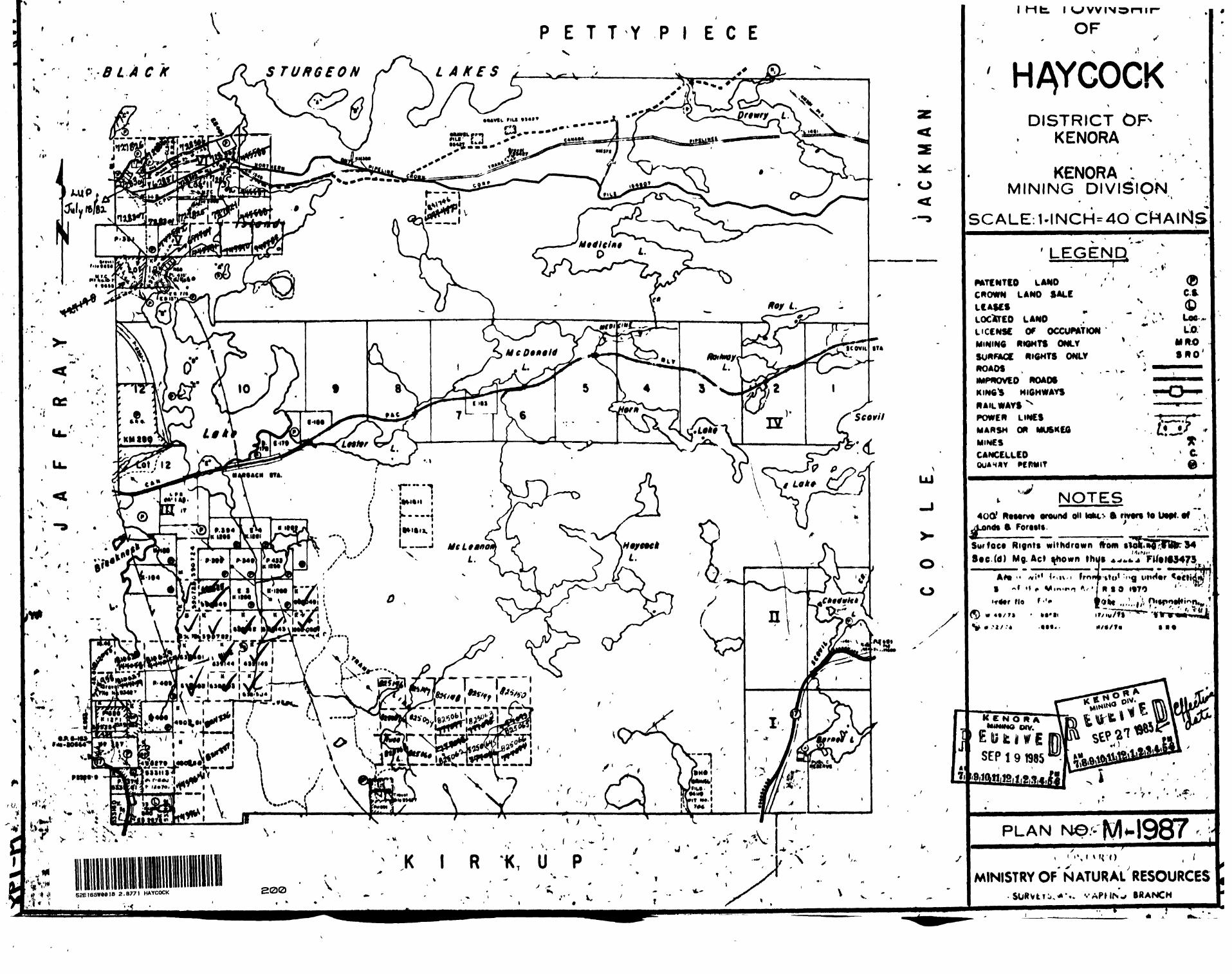
NTS 52E 16SW
The claim group is located between the Trans-Canada highway and the Canadian Pacific rail line in Haycock Township. Access to the claim group is from the north along an all-weather road which crosses the Canadian Pacifc Railway at Island Lake. The southern* half of the claim group can be reached from the Trans- Canada highway by a logging road.
Property Holders
G. Clark J. Doty J. Karwacki201 Mellick Ave., 611 2nd Ave, South, P.O. Box 595Kenora, Ontario. Kenora, Ontario. Kenora, Ontario.P9N 3C6 P9N 3X5
Assessment work submitted by; The above parties.
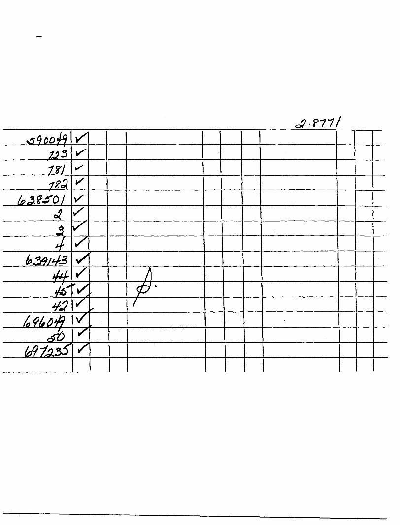
Claims covered by the survey:
697235590049590723590781-82638501-04639142-45
Date of survey;
July 21 till July 31, 1985
Geology;
From Ontario Government Preliminary Map P2618, (King, H.L. 1983)
" A large stock composed of diorite and quartz diorite underlies Haycock Township and parts of Jaffray Township, (the Island Lake Diorite/Quartz Diorite). Both phases are massive equigranular and medium grained. A variety of felsic dikes including quartz porphyry, quartz monzon- ite, pegmatite, and porphyritic grano-diorite intrude the stock "
J. C. Davies (1985) mapped the claim group during the spring of 1985 and made the following observations;
" The area is underlain by the Island Lake intrusion which may be zoned. Locally, basalt is predominant in the form of large blocks or abundant inclusions; the northern area of abundant inclusions is interpreted to mark the position of a syncline.
Known mineral occurrences consist mainly of tight, east-northeast to northeast striking shears in which minor pyrite is associated with thin quartz or felsite veins. Pyrite is also associated with inclusion-bearing fine-grained granodiorite. "
Summary of exploration and development on the property to date;
December 1983 VLF 590724August 1984 Geochem. 590049, 590723-24October 1984 Magnetic survey on all 16 claimsJune 1985 Geology on all 16 claims.December 1985 Present survey.
Instrument used in survey
Phoenix VLF-2, Serial #L 1053. Hort. Field Strengh measuredusing the 300 scale.
Method of Survey
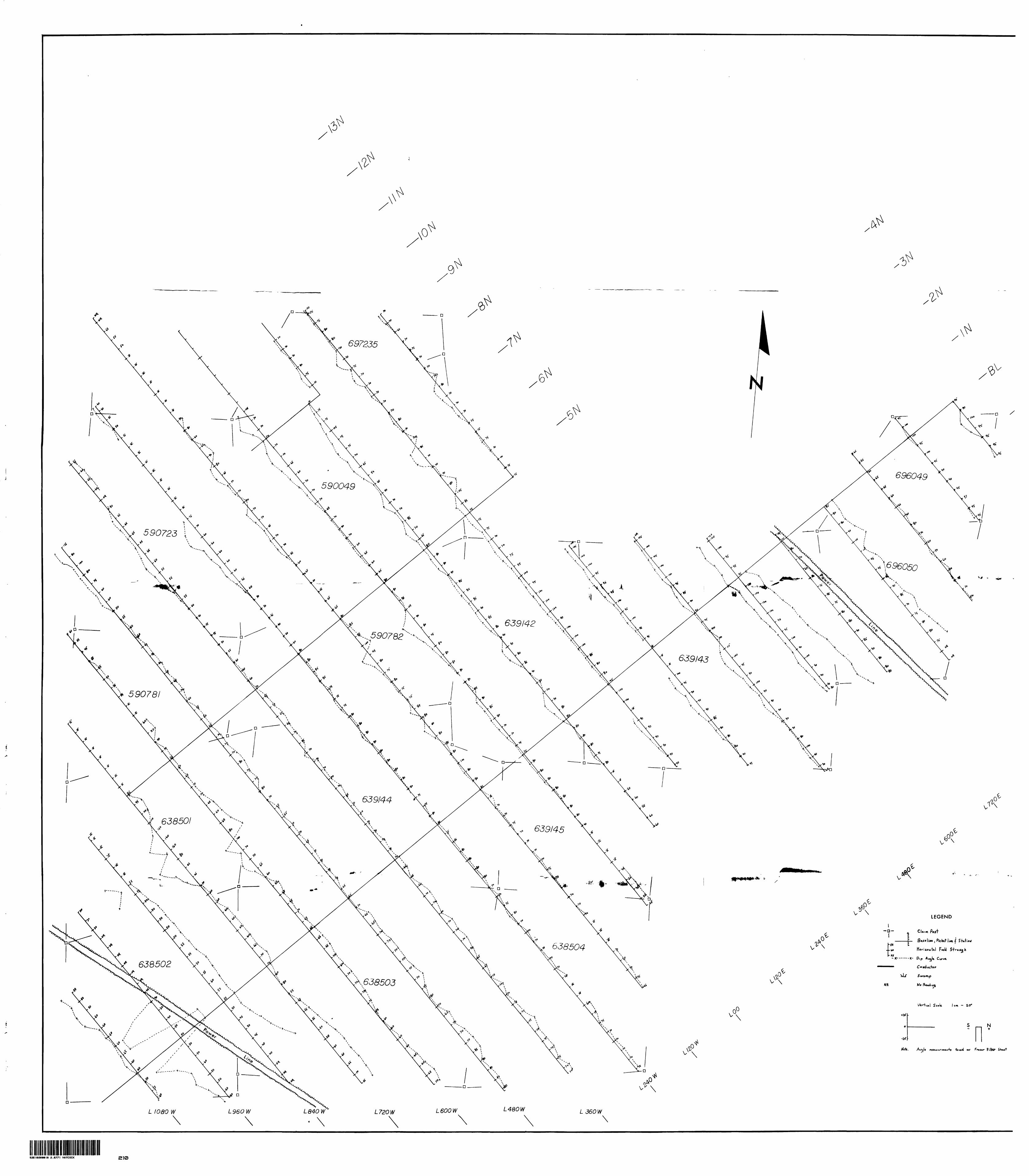
The standard VLF surveying technique was employed. Picket lines cut 120m apart along a base line orientated at N45 E. Readings were taken every 25m along the picket lines.
At every 25m station a Dip angle was taken and then a Horizontal Field Strengh reading at right angle to the Dip angle reading.
All reading were taken using Culter Maine.
Total number of stations
696 stations
Number of lines
1 Base line1 Tie line20 Picket lines
Number of line miles
21.2 line miles
Results
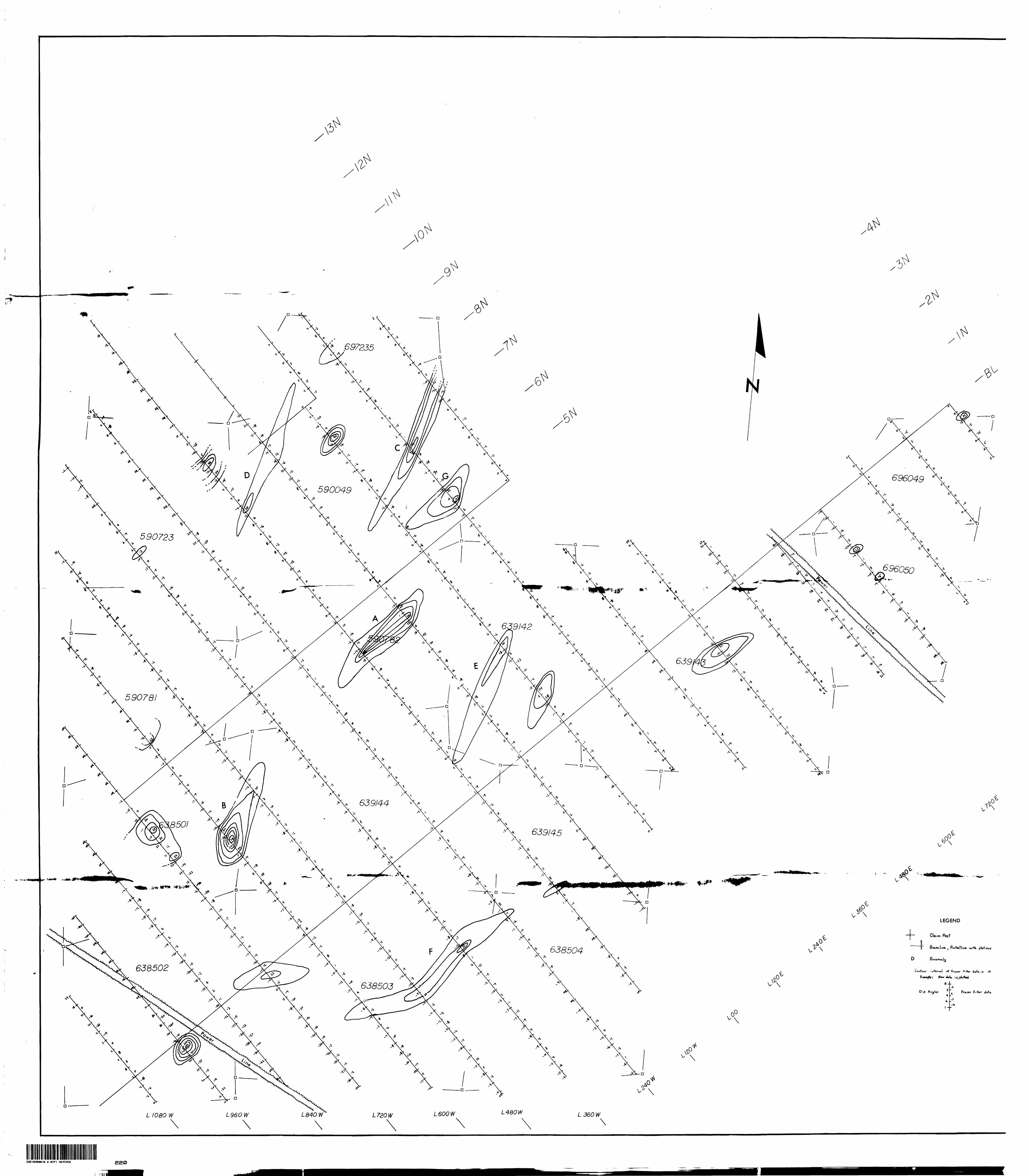
Readings from the VLF-2 survey were plotted on a map using a scale of 1:2500. Two map sheets are submitted with this report; 1) A profile plot of the Dip Angles and 2) a Fraser Filter contour plot.
From these plots 7 anomalous areas were detected and labelled A to G. The properties of these 7 anomalies are found in the table which follows.
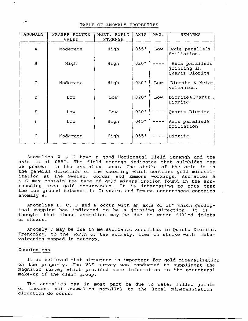
TABLE OF ANOMALY PROPERTIES
ANOMALY
A
B
C
D
E
F
G
FRASER FILTER VALUE
Moderate
High
Moderate
Low
Low
Low
Moderate
HORT. FIELD STRENGH
High
High
High
Low
Low
High
High
AXIS
055
020
020
020
020
045
055
MAG.
Low
Low
Low
____
----
____
REMARKS
Axis paralleJs f oiliat ion .
Axis parallels jointing in Quartz Diorite
Diorite & Meta- volcanics .
Diorite SQuartz Diorite
Quartz Diorite
Axis parallels f oiliation
Diorite
Anomalies A & G have a good Horizontal Field Strengh and the axis is at 055 . The field strengh indicates that sulphides may be present in the anomalous zone. The strike of the axis is in the general direction of the shearing which contains gold mineral ization at the Sweden, Gordan and Emmons workings. Anomalies A & G may contain the type of gold mineralization found in the sur rounding area gold occurrences. It is interesting to note that the low ground between the Treasure and Emmons occurrences contains anomaly A.
Anomalies B, C, D and E occur with an axis of 20 which geolog ical mapping has indicated to be a jointing direction. It is thought that these anomalies may be due to water filled joints or shears.
Anomaly F may be due to metavolcanic xenoliths in Quartz Diorite. Trenching, to the north of the anomaly, lies on strike with meta- volcanics mapped in outcrop.
Conclusions
It is believed that structure is important for gold mineralization on the property. The VLF survey was conducted to suppliment the magnitic survey which provided some information to the structural make-up of the claim group.
The anomalies may in most part be due to water filled joints or shears, but anomalies parallel to the local mineralization direction do occur.
l_ ommendat ions
The areas around all anomalies should be prospected; trenched, if nessary to uncover the anomlous zone; and sampled for gold mineralization.
If the reason for anomalies A & G can not be ascertained by this type of work a short drill hole into each may be warranted.
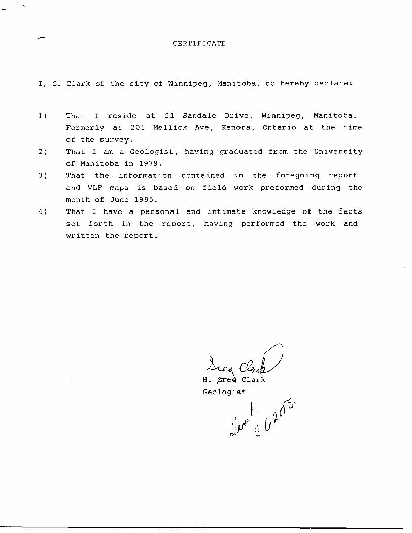
CERTIFICATE
I, G. Clark of the city of Winnipeg, Manitoba, do hereby declare:
1) That I reside at 51 Sandale Drive, Winnipeg, Manitoba.
Formerly at 201 Mellick Ave, Kenora, Ontario at the time
of the survey.
2) That I am a Geologist, having graduated from the University
of Manitoba in 1979.
3) That the information contained in the foregoing report
and VLF maps is based on field work preformed during the
month of June 1985.
4) That I have a personal and intimate knowledge of the facts
set forth in the report, having performed the work and
written the report.
H. jST^g Clark
Geologist
. T
Dec n .Minisiryof Report of WorkRelo'urces ( Geophysical, G eological,
Ontario Geochemical and Expenditures)r
iThe Mining
T ypp of Sui vey(sl 52E16SW0018 2 .8771 HAYCOCK 300
Claim Holilni(s)
C~L-k H II_«YC-; J /A
/YU|li<AAtMrus:.
Survey Cornpnny
Name and Address of Author (of Geo Technical report)
( \.A< ^ > Mefiu.k
tj ^jQosprrtoi's Licence No
H Jc-V/l , 1 K«^'.c£( ...yy.//VP.T. I . ... ....._
C^-Kur.0. P r ' *-'D... ,«, ,, ^
>. 1 Vr^| D>y I Mo. | Yr.
if £
"Total Miles of line Cut
Credits Requested per Each Claim in Columns at rightSpecial Provisions
For firs! survey:
Enter 40 days. (This includes line cutting)
For each additional survey: using the same grid:
Enter 20 days (for each)
Man Days
Complete reverse side
and enter total (s) here
Airborne Credits
Note: Special provisions
credits do not apply
to Airborne Surveys.
Geophysical
- Electromagnetic
- Magnetometer
- Rsdiometric
- Other
Geological
Geochemical
Geophysical
- Electromagnetic
- Magnetometer
- Radiometric
- Other
Geological
Geochemical
Electromagnetic
Magnetometer
Radiometric
Days per Claim
_2o_
Days per Claim
Days perClaim
Mining Claims Traversed (List in numerical sequence)
Expenditures (excludes power stripping)Type of Work Performed
Performed on Claim(s)
Calculation of Expenditure Days Credits
Total ExpendituresTotal
Days Credits
$Instructions
Total Days Credits may be apportioned at the claim holder's choice. Enter number of days credits per claim selected in columns at right.
Mining Claim
Prefix Number
5? OP*}
JiC^L
E xpend. Days Cr.
Mining Claim
Number
pv - c 1985" INING LANDS SECT
K E N O R / MINING PIV.
Ju OCT 3 0 19AMI
Expend. Days Cr.
ON
PM
Total number of mining claims covered by this
/.. report of work.
Date Recorded Holder or Agent (Signature)
Certification Ve/fying Report of Wqtk ^
I hereby certify that I have a personal and intimate knowledge of the facts set frfrth in the Report of Work annexed hereto, having performed the work
or witnessed same during and/or after its completion and the annexed report is true.
Name and Postal Address of Person Certifying
6/ IVP-'Date Certified Certified by (Signature)
^~~LjL-+>,
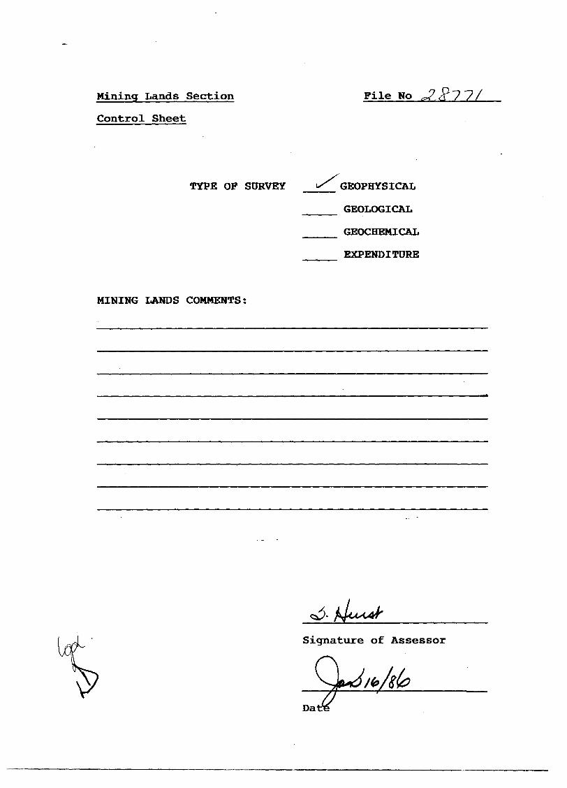
Mining Lands Section File No
Control Sheet
TYPE OP SURVEY «X GEOPHYSICAL
GEOLOGICAL
GEOCHEMICAL
EXPENDITURE
MINING LANDS COMMENTS:
Signature of Assessor
Da
0'
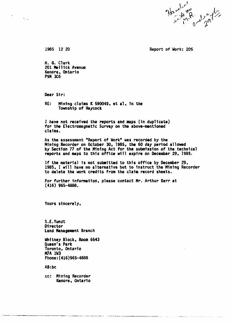
1985 12 20 Report of Work: 205
H. 6. Clark 201 MelUck Avenue Kenora, Ontario P9N 3C6
Dear Sir:
RE: Mining claims K 590049, et al, 1n the Township of Haycock
I have not received the reports and maps (1n duplicate) for the Electromagnetic Survey on the above-mentioned claims.
As the assessment "Report of Work" was recorded by the Mining Recorder on October 30. 1985, the 60 day period allowed by Section 77 of the Mining Act for the submission of the technical reports and maps to this office will expire on December 29, 1985.
If the material 1s not submitted to this office by December 29, 1985, I will have no alternative but to Instruct the Mining Recorder to delete the work credits from the claim record sheets.
For further Information, please contact Mr. Arthur Barr at (416) 965-4888.
Yours sincerely,
S.E.YundtDirectorLand Management Branch
Uhltney Block, Room 6643 Queen's Park Toronto, Ontario M7A 1W3 Phone:(416)965-4888
AB:bc
cc: Mining Recorder Kenora, Ontario
1*
X1
./
B LA C k
PETTY PI ECE
STURGEON LAKtS x
I— i* —— «. - i I W 1 W * X -^" '/" / jy\> ;̂ 'y: \ /J,,v;.»j^'i^«')....x'V 1v^» ^^
jr A* » r SK»H••"3T U""i'Trf A«%lkt»*>l
•r- / __ j•j \ vf \f/NU»M/t P/ V. I ^^,*\- -r»---H-
sssags 1«f '^V ». ,« % i
ir~^
K I R52E16SW«eiB 2.B771 HAYCOCK
ui
o
X
I Mt. I
OF
HAYCOCK^
DISTRICT OF KENORA
KENORA :MINING DIVISION•• '*
SCALE.MNCH=4O CHAINS
' LEGEND.
PATENTED LAND CROWN LANO SALE
LOCATED LANOLICENSE OF OCCUPATIONMINING RIGHTS ONLYSURFACE RIGHTS ONLYROAOS ,IMPROVED ROADSKING'S HIGHWAYS
RAILWAYS ^
POWER LINES
MARSH OR MUSKfG
MINESCANCELLED
* NOTES400! Rotor* oround oil taho ft rivort to Uopt. of
It a Fortttt '
Surfoct Rigntt withdrqwn from Soc (d) Mg. Act tjhown thrt *^
94M.Mn
•f*»r No r •'<•
(^) w 4t/r» • %••*V * •'*/ •'* ••••<
FUtl«4W
s
I ' I
PLAN NO - ^^1987 < . \
MINISTRY OF NATURAL RESOURCES* .» vAPMlNv BRANCH
A\
\
Porf
,Pi'cktt|itt£
Horixowfejl ficU 3Tr*»»a
X- P ,f» A w.lt
\
SaEIBSWMIB 2.8771 HAYCOCK 210

A
s>....
v
A
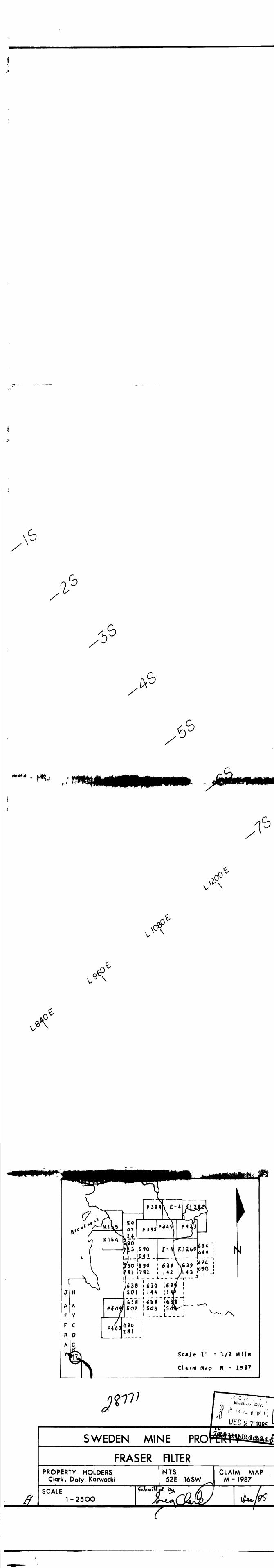
ScAle 1" - 1/2 Mile
CUim Map M - 1997
UFC 2 7 1985
SWEDEN MINE PROPERTY
VLF SurveyPROPERTY HOLDERS
Clark, Doty, KarwackiNTS
52 E 16SWCLAIM MAP
- 1987
SCALE1 - 25OO
Claim Past
.rJc, PicKctUfc wi*K
52E16SW89I8 2.8771 HAYCOCK £20
A
V \
V
VA
1" - 1/2 Mile
CUim Nap M - 1997
ft
SWEDENI AM
MINE pRora^siaiaa^FRASER
PROPERTY HOLDERS Clark , Doty, Karwacki
SCALE 1 -250O
^tV^MiVt
$
FILTERNTS
52 E 16 SW
^co£tCLAIM MAP
M - 1987
\b^p
T