Embed Size (px)
Citation preview
GEOPAK: MONITORING CLIMBERS AND CLIMATE ON MOUNT EVEREST OCTOBER 9, 19981
GEOPAK: MONITORING CLIMBERS AND CLIMATE ON MOUNT EVEREST
BY
MATTHEW B. LAU
SUBMITTED TO THE DEPARTMENT OF ELECTRICAL ENGINEERING AND COMPUTER SCIENCE
IN PARTIAL FULFILLMENT OF THE REQUIREMENTS FOR THE DEGREE OF
MASTER OF ENGINEERING IN ELECTRICAL ENGINEERING AND COMPUTER SCIENCE
AT THE MASSACHUSETTS INSTITUTE OF TECHNOLOGY
OCTOBER 9, 1998
COPYRIGHT 1998 MATTHEW B. LAU. ALL RIGHTS RESERVED.
THE AUTHOR HEREBY GRANTS TO M.I.T. PERMISSION TO REPRODUCE ANDDISTRIBUTE PUBLICLY PAPER AND ELECTRONIC COPIES OF THIS THESIS
AND TO GRANT OTHERS THE RIGHT TO DO SO.
AUTHOR_________________________________________________________________DEPARTMENT OF ELECTRICAL ENGINEERING AND COMPUTER SCIENCE
OCTOBER 9, 1998
CERTIFIED BY_____________________________________________________________MICHAEL J. HAWLEYTHESIS SUPERVISOR
ACCEPTED BY_____________________________________________________________ARTHUR C. SMITH
CHAIRMAN, DEPARTMENT COMMITTEE ON GRADUATE THESES
GEOPAK: MONITORING CLIMBERS AND CLIMATE ON MOUNT EVEREST OCTOBER 9, 19982
geoPak:MONITORING CLIMBERS AND CLIMATE ON MOUNT EVEREST
Sunr
ise
over
Lho
La,
pho
to ©
199
8, M
atth
ew L
au

GEOPAK: MONITORING CLIMBERS AND CLIMATE ON MOUNT EVEREST OCTOBER 9, 19983
GEOPAK: MONITORING CLIMBERS AND CLIMATE ON MOUNT EVEREST OCTOBER 9, 19984
TABLE OF CONTENTS:ACKNOWLEDGEMENTS .......................................................................................................................... 6ABSTRACT ............................................................................................................................................ 7
INTRODUCTION.................................................................................................................................. 8
THAT WAS THEN.................................................................................................................................... 9THIS IS NOW .......................................................................................................................................... 9GETTING FROM THEN TO NOW ...............................................................................................................10ISSUES AT HAND ..................................................................................................................................10
BACKGROUND ...................................................................................................................................11
THE GLOBAL POSITIONING SYSTEM ......................................................................................................12MARATHON MAN.................................................................................................................................12WEATHER STATIONS ON MT. EVEREST .................................................................................................13THE BIO PACKS....................................................................................................................................14
EVEREST 1998.....................................................................................................................................15
THE AMERICAN EVEREST EXPEDITION ..................................................................................................16THE EVEREST EXTREME EXPEDITION ....................................................................................................17THE DISTRIBUTION OF GEOPAKS ...........................................................................................................17
TECHNICAL SPECIFICATION .........................................................................................................18
SENSORS..............................................................................................................................................19GPS.................................................................................................................................................19Pressure ..........................................................................................................................................20Light................................................................................................................................................20Humidity .........................................................................................................................................20Temperature ....................................................................................................................................21
THE MICROCONTROLLER......................................................................................................................21MEMORY .............................................................................................................................................21RADIO .................................................................................................................................................21POWER ................................................................................................................................................22THE GEOPACKET ..................................................................................................................................22
RESULTS..............................................................................................................................................24
WHAT WENT WRONG...........................................................................................................................25Broken Relays..................................................................................................................................25The Radio Shadow ...........................................................................................................................26GPS Antenna Placement ..................................................................................................................26Battery Failure ................................................................................................................................26
WHAT WENT RIGHT .............................................................................................................................27Data Sets.........................................................................................................................................27
CONCLUSIONS ...................................................................................................................................29
THE NEED FOR A GEOPAK .....................................................................................................................30RADIO COVERAGE................................................................................................................................30MEMORY .............................................................................................................................................31HUMAN FACTORS.................................................................................................................................31DATA DISPLAYS...................................................................................................................................32IMPLICATIONS ......................................................................................................................................32FUTURE WORK.....................................................................................................................................33
REFERENCES......................................................................................................................................34
GEOPAK: MONITORING CLIMBERS AND CLIMATE ON MOUNT EVEREST OCTOBER 9, 19985
APPENDICES .......................................................................................................................................37
APPENDIX A: EXPEDITION TEAM MEMBERS ..........................................................................................38APPENDIX B: SENSOR CALIBRATION DATA ...........................................................................................39APPENDIX C: TRIMBLE TAIP “LN” MESSAGE .......................................................................................41APPENDIX D: GEOPACKET FORMAT ......................................................................................................42
TABLE OF FIGURES:FIGURE 1: GPS DATA AT BASE CAMP AND THE SOUTH COL ......................................................................27FIGURE 2: LIGHT, PRESSURE AND TEMPERATURE FROM BASE CAMP..........................................................28FIGURE 3: LIGHT AND PRESSURE FROM THE SOUTH COL............................................................................28FIGURE 4: COOLING TO –30C ON 13MAR98 ..............................................................................................39FIGURE 5: WARMING FROM –30C TO 30C ON 13MAR98............................................................................40
TABLE OF TABLES:TABLE 1: TRIMBLE "LN" MESSAGE DATUM ...............................................................................................41TABLE 2: GEOPACKET DATUM. .................................................................................................................42
GEOPAK: MONITORING CLIMBERS AND CLIMATE ON MOUNT EVEREST OCTOBER 9, 19986
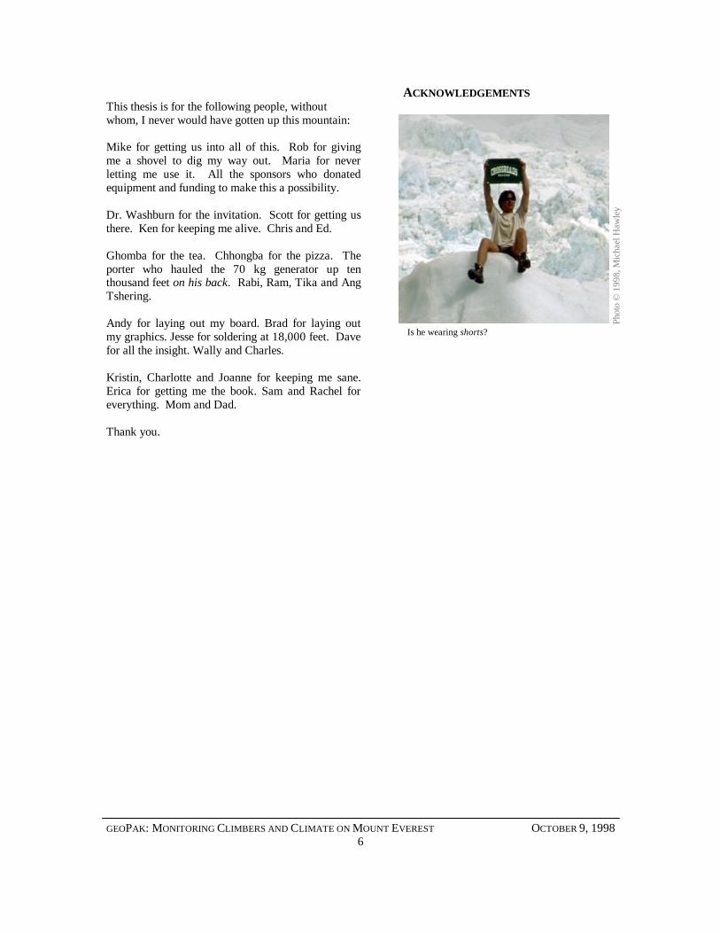
ACKNOWLEDGEMENTSThis thesis is for the following people, withoutwhom, I never would have gotten up this mountain:
Mike for getting us into all of this. Rob for givingme a shovel to dig my way out. Maria for neverletting me use it. All the sponsors who donatedequipment and funding to make this a possibility.
Dr. Washburn for the invitation. Scott for getting usthere. Ken for keeping me alive. Chris and Ed.
Ghomba for the tea. Chhongba for the pizza. Theporter who hauled the 70 kg generator up tenthousand feet on his back. Rabi, Ram, Tika and AngTshering.
Andy for laying out my board. Brad for laying outmy graphics. Jesse for soldering at 18,000 feet. Davefor all the insight. Wally and Charles.
Kristin, Charlotte and Joanne for keeping me sane.Erica for getting me the book. Sam and Rachel foreverything. Mom and Dad.
Thank you.
Pho
to ©
199
8, M
icha
el H
awle
y
Is he wearing shorts?

GEOPAK: MONITORING CLIMBERS AND CLIMATE ON MOUNT EVEREST OCTOBER 9, 19987
ABSTRACTThis “footprint” describes the geoPak, and its firsttest on Everest. The geoPak is a device designed tocollect and transmit information about its positionand surrounding environment. It uses the GlobalPositioning System (GPS) and low power sensors tocollect information about location, temperature,humidity, air pressure, and light. A radio transmitterthen sends this information to a remote base station,letting people far away monitor the ’Pak.
The geoPak is a piece of the Media Lab “BlackBoxes” project, begun in February, 1997 [1]. It wasdesigned with size and weight in mind, for use on Mt.Everest during the early climbing season of 1998.
In May of that year, the geoPaks were used tomonitor four climbers during their ascent from basecamp at 17,500 feet to the highest point in the world,more than two miles higher. Difficulties forced anend to tests at around 26,000 feet, but insights gainedfrom these experiments have led to an expansion ofthe project with revised goals.
This thesis describes the design and implementationof the first geoPak prototypes and their use onEverest. It also to outlines how the geoPak anddevices like it may someday impact not only theclimbing community, but also life at home.
Moonrise over the Khumbu Icefall
Pho
to ©
199
8, J
esse
Dar
ley
GEOPAK: MONITORING CLIMBERS AND CLIMATE ON MOUNT EVEREST OCTOBER 9, 19988
INTRODUCTION
Phot
o ©
199
8, M
icha
el H
awle
y
GEOPAK: MONITORING CLIMBERS AND CLIMATE ON MOUNT EVEREST OCTOBER 9, 19989
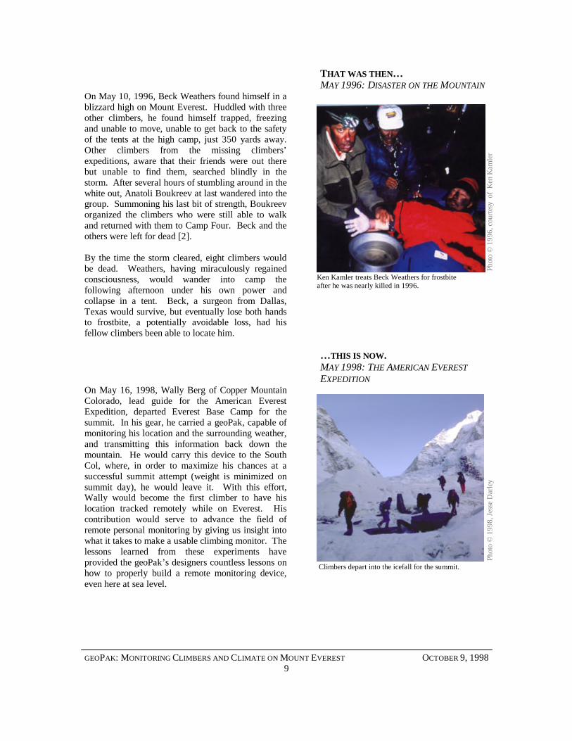
THAT WAS THEN…MAY 1996: DISASTER ON THE MOUNTAIN
On May 10, 1996, Beck Weathers found himself in ablizzard high on Mount Everest. Huddled with threeother climbers, he found himself trapped, freezingand unable to move, unable to get back to the safetyof the tents at the high camp, just 350 yards away.Other climbers from the missing climbers’expeditions, aware that their friends were out therebut unable to find them, searched blindly in thestorm. After several hours of stumbling around in thewhite out, Anatoli Boukreev at last wandered into thegroup. Summoning his last bit of strength, Boukreevorganized the climbers who were still able to walkand returned with them to Camp Four. Beck and theothers were left for dead [2].
By the time the storm cleared, eight climbers wouldbe dead. Weathers, having miraculously regainedconsciousness, would wander into camp thefollowing afternoon under his own power andcollapse in a tent. Beck, a surgeon from Dallas,Texas would survive, but eventually lose both handsto frostbite, a potentially avoidable loss, had hisfellow climbers been able to locate him.
… THIS IS NOW.MAY 1998: THE AMERICAN EVERESTEXPEDITION
On May 16, 1998, Wally Berg of Copper MountainColorado, lead guide for the American EverestExpedition, departed Everest Base Camp for thesummit. In his gear, he carried a geoPak, capable ofmonitoring his location and the surrounding weather,and transmitting this information back down themountain. He would carry this device to the SouthCol, where, in order to maximize his chances at asuccessful summit attempt (weight is minimized onsummit day), he would leave it. With this effort,Wally would become the first climber to have hislocation tracked remotely while on Everest. Hiscontribution would serve to advance the field ofremote personal monitoring by giving us insight intowhat it takes to make a usable climbing monitor. Thelessons learned from these experiments haveprovided the geoPak’s designers countless lessons onhow to properly build a remote monitoring device,even here at sea level.
Pho
to ©
199
8, J
esse
Dar
ley
Climbers depart into the icefall for the summit.
Pho
to ©
199
6, c
ourte
sy o
f K
en K
amle
r
Ken Kamler treats Beck Weathers for frostbiteafter he was nearly killed in 1996.
GEOPAK: MONITORING CLIMBERS AND CLIMATE ON MOUNT EVEREST OCTOBER 9, 199810
GETTING FROM THEN TO NOWTHE EVEREST EXTREME EXPEDITION
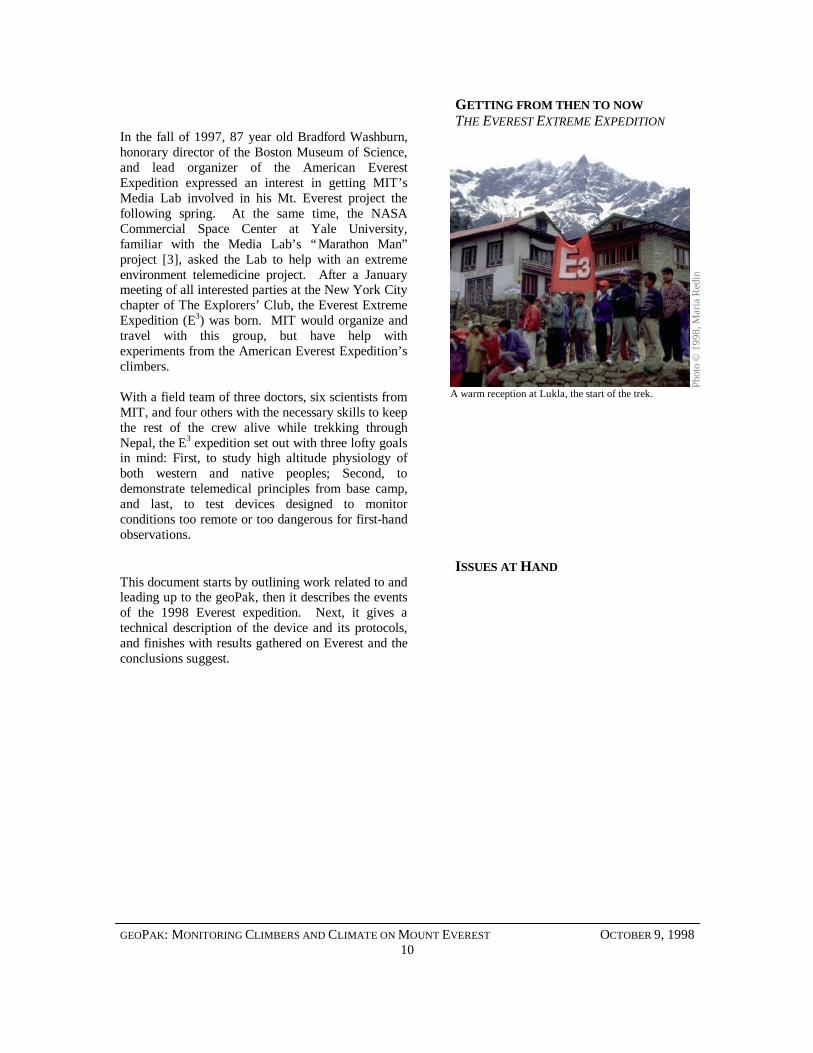
In the fall of 1997, 87 year old Bradford Washburn,honorary director of the Boston Museum of Science,and lead organizer of the American EverestExpedition expressed an interest in getting MIT’sMedia Lab involved in his Mt. Everest project thefollowing spring. At the same time, the NASACommercial Space Center at Yale University,familiar with the Media Lab’s “Marathon Man”project [3], asked the Lab to help with an extremeenvironment telemedicine project. After a Januarymeeting of all interested parties at the New York Citychapter of The Explorers’ Club, the Everest ExtremeExpedition (E3) was born. MIT would organize andtravel with this group, but have help withexperiments from the American Everest Expedition’sclimbers.
With a field team of three doctors, six scientists fromMIT, and four others with the necessary skills to keepthe rest of the crew alive while trekking throughNepal, the E3 expedition set out with three lofty goalsin mind: First, to study high altitude physiology ofboth western and native peoples; Second, todemonstrate telemedical principles from base camp,and last, to test devices designed to monitorconditions too remote or too dangerous for first-handobservations.
ISSUES AT HANDThis document starts by outlining work related to andleading up to the geoPak, then it describes the eventsof the 1998 Everest expedition. Next, it gives atechnical description of the device and its protocols,and finishes with results gathered on Everest and theconclusions suggest.
Phot
o ©
199
8, M
aria
Red
in
A warm reception at Lukla, the start of the trek.
GEOPAK: MONITORING CLIMBERS AND CLIMATE ON MOUNT EVEREST OCTOBER 9, 199811
BACKGROUND
A b
uddh
ist
puja
, pho
to ©
199
8, J
esse
Dar
ley
GEOPAK: MONITORING CLIMBERS AND CLIMATE ON MOUNT EVEREST OCTOBER 9, 199812
As one wise philosopher once put it, “Since the dawnof time, there have been only a handful of us thatcould tell where we are; navigating by the heavens,watching the movement of the sun, even sailing witha compass. Most of us just get drunk and wanderaround under the sky [4].” The geoPak doesn’tmeasure anything that hasn’t been measured already,but it does it in a smaller and more integratedpackage than has been available. This project marksthe first time anyone has climbed a mountain whilemonitoring both position and weather, and all simplyby carrying a small, sealed box in the top of theirpack.
THE GLOBAL POSITIONING SYSTEMDeveloped by the U.S. Department of Defense totrack vehicles and soldiers, the Global PositioningSystem (GPS) is a constellation of 24 satellites insuch an arrangement that at any given time, at leastfour are visible from any point on Earth [5]. Byfixing on the radio signals these “artificial stars”broadcast, a receiver can triangulate its position inthree dimensions and time to within millimeters, andaccurate to the second. Ten years ago, GPS receiverswere hundred pound boxes with unwieldy, meter-wide antennas to capture the weak radio signals fromthe satellites. Today, receivers are single boarddevices a few square inches in size, weighing lessthan an ounce.
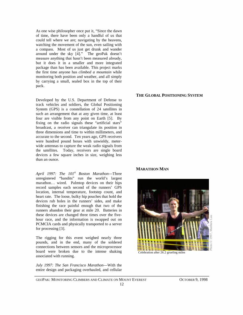
MARATHON MANApril 1997: The 101st Boston Marathon— Threeunregistered “bandits” run the world’s largestmarathon… wired. Palmtop devices on their hipsrecord samples each second of the runners’ GPSlocation, internal temperature, footstep count, andheart rate. The loose, bulky hip pouches that hold thedevices rub holes in the runners’ sides, and makefinishing the race painful enough that two of therunners abandon their gear at mile 20. Batteries inthese devices are changed three times over the five-hour race, and the information is swapped out onPCMCIA cards and physically transported to a serverfor processing [3].
The rigging for this event weighed nearly threepounds, and in the end, many of the solderedconnections between sensors and the microprocessorboard were broken due to the intense shakingassociated with running.
July 1997: The San Francisco Marathon— With theentire design and packaging overhauled, and cellular
Phot
o ©
199
7, M
atth
ew L
au
Celebration after 26.2 grueling miles
GEOPAK: MONITORING CLIMBERS AND CLIMATE ON MOUNT EVEREST OCTOBER 9, 199813
modems installed, the Marathon Man projectperforms admirably, following three runners from thestart at the Golden Gate Bridge to the finish at KezarStadium. In fact, the observations are so clear thatthey indicate a change in one runner’s stride evenbefore he calls in to report that he’s dropped outbecause of a foot problem [6].
Having learned of the necessity of comfort from thefirst marathon, the second incarnation of theMarathon Man belt weighed just over two poundsand restricted both vibration and discomfort byutilizing a specially designed neoprene belt pack.
The Marathon Man project also ran successfully twomore times, once in the New York City marathon,and once as part of a US Army Research Institute forEnvironmental Medicine (USARIEM) project [7].
WEATHER STATIONS ON MT.EVEREST
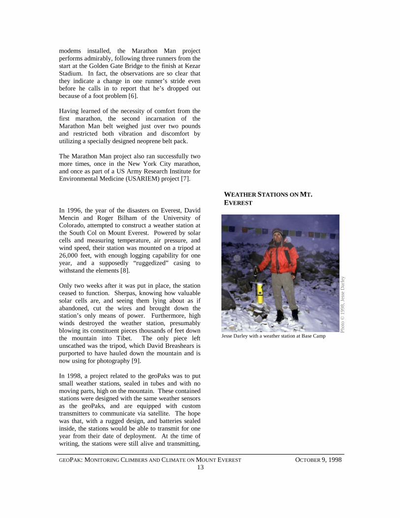
In 1996, the year of the disasters on Everest, DavidMencin and Roger Bilham of the University ofColorado, attempted to construct a weather station atthe South Col on Mount Everest. Powered by solarcells and measuring temperature, air pressure, andwind speed, their station was mounted on a tripod at26,000 feet, with enough logging capability for oneyear, and a supposedly “ruggedized” casing towithstand the elements [8].
Only two weeks after it was put in place, the stationceased to function. Sherpas, knowing how valuablesolar cells are, and seeing them lying about as ifabandoned, cut the wires and brought down thestation’s only means of power. Furthermore, highwinds destroyed the weather station, presumablyblowing its constituent pieces thousands of feet downthe mountain into Tibet. The only piece leftunscathed was the tripod, which David Breashears ispurported to have hauled down the mountain and isnow using for photography [9].
In 1998, a project related to the geoPaks was to putsmall weather stations, sealed in tubes and with nomoving parts, high on the mountain. These containedstations were designed with the same weather sensorsas the geoPaks, and are equipped with customtransmitters to communicate via satellite. The hopewas that, with a rugged design, and batteries sealedinside, the stations would be able to transmit for oneyear from their date of deployment. At the time ofwriting, the stations were still alive and transmitting,
Phot
o ©
199
8, J
esse
Dar
ley
Jesse Darley with a weather station at Base Camp
GEOPAK: MONITORING CLIMBERS AND CLIMATE ON MOUNT EVEREST OCTOBER 9, 199814
even though they are buried in the deep snow of themonsoon season.
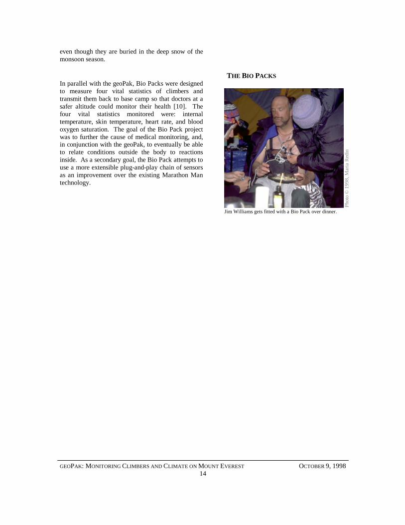
THE BIO PACKSIn parallel with the geoPak, Bio Packs were designedto measure four vital statistics of climbers andtransmit them back to base camp so that doctors at asafer altitude could monitor their health [10]. Thefour vital statistics monitored were: internaltemperature, skin temperature, heart rate, and bloodoxygen saturation. The goal of the Bio Pack projectwas to further the cause of medical monitoring, and,in conjunction with the geoPak, to eventually be ableto relate conditions outside the body to reactionsinside. As a secondary goal, the Bio Pack attempts touse a more extensible plug-and-play chain of sensorsas an improvement over the existing Marathon Mantechnology.
Pho
to ©
199
8, M
aria
Red
in
Jim Williams gets fitted with a Bio Pack over dinner.
GEOPAK: MONITORING CLIMBERS AND CLIMATE ON MOUNT EVEREST OCTOBER 9, 199815
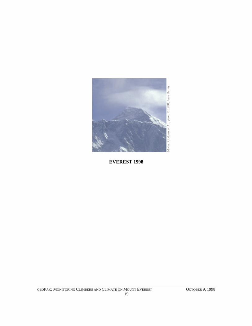
EVEREST 1998 M
othe
r God
dess
of A
ll, p
hoto
© 1
998,
Jes
se D
arle
y
GEOPAK: MONITORING CLIMBERS AND CLIMATE ON MOUNT EVEREST OCTOBER 9, 199816
The American press surrounding Mt. Everest hasbeen, as news media will be, slightly flawed in itsreporting of expeditions to the mountain in 1998.Both the American Everest Expedition and theEverest Extreme Expedition went to the mountainwith scientific goals, but the media has ignored theimportant distinction between the two groups, namelythe particular projects they worked on. E3 wasprimarily interested in medical research, while theAEE performed geological research. Crossing theboundary, however, both groups collaborated on thetesting of the geoPak. The following sections outlinethe specific goals of each group, and their role in thedevelopment and testing of the geoPak.
The expedition participants for both groups are listedin Appendix A
THE AMERICAN EVERESTEXPEDITION
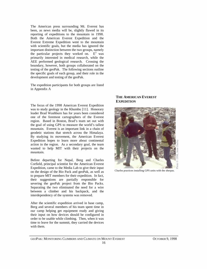
The focus of the 1998 American Everest Expeditionwas to study geology in the Khumbu [11]. Honoraryleader Brad Washburn has for years been consideredone of the foremost cartographers of the Everestregion. Based in Boston, Brad’s team set out withthe goal of using GPS to measure the world’s tallestmountain. Everest is an important link in a chain ofgeodetic stations that stretch across the Himalaya.By studying its movement, the American EverestExpedition hopes to learn more about continentalaction in the region. As a secondary goal, the teamwanted to help MIT with their projects on themountain.
Before departing for Nepal, Berg and CharlesCorfield, principal scientist for the American EverestExpedition, came to the Media Lab to give their inputon the design of the Bio Pack and geoPak, as well asto prepare MIT members for their expedition. In fact,their suggestions are partially responsible forsevering the geoPak project from the Bio Packs.Separating the two eliminated the need for a wirebetween a climber and his backpack, and theinterdependency of the systems was removed.
After the scientific expedition arrived in base camp,Berg and several members of his team spent time inour camp helping get equipment ready and givingtheir input on how devices should be configured inorder to be usable while climbing. Then, when it wastime to leave for the summit, they carried the deviceswith them.
Phot
o ©
199
8, J
esse
Dar
ley
Charles practices installing GPS units with the sherpas.
GEOPAK: MONITORING CLIMBERS AND CLIMATE ON MOUNT EVEREST OCTOBER 9, 199817
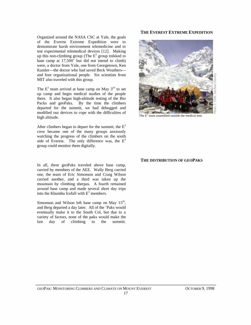
THE EVEREST EXTREME EXPEDITIONOrganized around the NASA CSC at Yale, the goalsof the Everest Extreme Expedition were todemonstrate harsh environment telemedicine and totest experimental telemedical devices [12]. Makingup this non-climbing group (The E3 group trekked tobase camp at 17,500’ but did not intend to climb)were, a doctor from Yale, one from Georgetown, KenKamler— the doctor who had saved Beck Weathers—and four organizational people. Six scientists fromMIT also traveled with this group.
The E3 team arrived at base camp on May 3rd to setup camp and begin medical studies of the peoplethere. It also began high-altitude testing of the BioPacks and geoPaks. By the time the climbersdeparted for the summit, we had debugged andmodified our devices to cope with the difficulties ofhigh altitude.
After climbers began to depart for the summit, the E3
crew became one of the many groups anxiouslywatching the progress of the climbers on the southside of Everest. The only difference was, the E3
group could monitor them digitally.
THE DISTRIBUTION OF GEOPAKSIn all, three geoPaks traveled above base camp,carried by members of the AEE. Wally Berg carriedone, the team of Eric Simonson and Craig Wilsoncarried another, and a third was taken up themountain by climbing sherpas. A fourth remainedaround base camp and made several short day tripsinto the Khumbu Icefall with E3 members.
Simonson and Wilson left base camp on May 15th,and Berg departed a day later. All of the ’Paks wouldeventually make it to the South Col, but due to avariety of factors, none of the paks would make thelast day of climbing to the summit.
Phot
o ©
199
8, M
icha
el H
awle
y
The E3 team assembled outside the medical tent.
GEOPAK: MONITORING CLIMBERS AND CLIMATE ON MOUNT EVEREST OCTOBER 9, 199818
TECHNICAL SPECIFICATION P
hoto
© 1
998,
Mic
hael
Haw
ley
GEOPAK: MONITORING CLIMBERS AND CLIMATE ON MOUNT EVEREST OCTOBER 9, 199819
This section is included for those interested in thedetails of the geoPak construction. The followingsections describe the components of the geoPak.
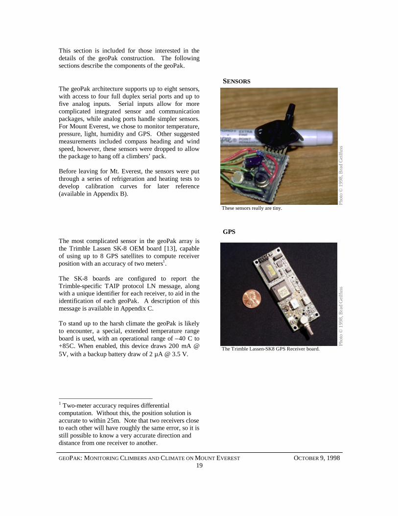
SENSORSThe geoPak architecture supports up to eight sensors,with access to four full duplex serial ports and up tofive analog inputs. Serial inputs allow for morecomplicated integrated sensor and communicationpackages, while analog ports handle simpler sensors.For Mount Everest, we chose to monitor temperature,pressure, light, humidity and GPS. Other suggestedmeasurements included compass heading and windspeed, however, these sensors were dropped to allowthe package to hang off a climbers’ pack.
Before leaving for Mt. Everest, the sensors were putthrough a series of refrigeration and heating tests todevelop calibration curves for later reference(available in Appendix B).
GPSThe most complicated sensor in the geoPak array isthe Trimble Lassen SK-8 OEM board [13], capableof using up to 8 GPS satellites to compute receiverposition with an accuracy of two meters1.
The SK-8 boards are configured to report theTrimble-specific TAIP protocol LN message, alongwith a unique identifier for each receiver, to aid in theidentification of each geoPak. A description of thismessage is available in Appendix C.
To stand up to the harsh climate the geoPak is likelyto encounter, a special, extended temperature rangeboard is used, with an operational range of –40 C to+85C. When enabled, this device draws 200 mA @5V, with a backup battery draw of 2 µA @ 3.5 V.
1 Two-meter accuracy requires differentialcomputation. Without this, the position solution isaccurate to within 25m. Note that two receivers closeto each other will have roughly the same error, so it isstill possible to know a very accurate direction anddistance from one receiver to another.
Phot
o ©
199
8, B
rad
Gei
lfuss
These sensors really are tiny.
The Trimble Lassen-SK8 GPS Receiver board.Ph
oto
© 1
998,
Bra
d G
eilfu
ss
GEOPAK: MONITORING CLIMBERS AND CLIMATE ON MOUNT EVEREST OCTOBER 9, 199820
PRESSURE
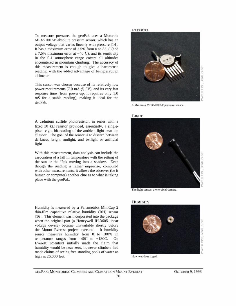
To measure pressure, the geoPak uses a MotorolaMPX5100AP absolute pressure sensor, which has anoutput voltage that varies linearly with pressure [14].It has a maximum error of 2.5% from 0 to 85 C (anda 7.5% maximum error at –40 C), and its sensitivityin the 0-1 atmosphere range covers all altitudesencountered in mountain climbing. The accuracy ofthis measurement is enough to give a barometricreading, with the added advantage of being a roughaltimeter.
This sensor was chosen because of its relatively lowpower requirements (7.0 mA @ 5V), and its very fastresponse time (from power-up, it requires only 1.0mS for a stable reading), making it ideal for thegeoPak.
LIGHT
A cadmium sulfide photoresistor, in series with afixed 10 kΩ resistor provided, essentially, a single-pixel, eight bit reading of the ambient light near theclimber. The goal of the sensor is to discern betweendarkness, bright sunlight, and twilight or artificiallight.
With this measurement, data analysis can include theassociation of a fall in temperature with the setting ofthe sun or the ’Pak moving into a shadow. Eventhough the reading is rather imprecise, combinedwith other measurements, it allows the observer (be ithuman or computer) another clue as to what is takingplace with the geoPak.
HUMIDITY
Humidity is measured by a Panametrics MiniCap 2thin-film capacitive relative humidity (RH) sensor[16]. This element was incorporated into the packagewhen the original part (a Honeywell IH-3605 linearvoltage device) became unavailable shortly beforethe Mount Everest project executed. It humiditysensor measures humidity from 0 to 100% intemperature ranges from –40C to +180C. OnEverest, scientists initially made the claim thathumidity would be near zero, however climbers hadmade claims of seeing free standing pools of water ashigh as 26,000 feet.
Pho
to ©
199
8, B
rad
Gei
lfuss
Phot
o ©
199
8, B
rad
Gei
lfuss
A Motorola MPX5100AP pressure sensor.
The light sensor: a one-pixel camera.
Pho
to ©
199
8, B
rad
Gei
lfuss
How wet does it get?
GEOPAK: MONITORING CLIMBERS AND CLIMATE ON MOUNT EVEREST OCTOBER 9, 199821
TEMPERATURE
A National Semiconductor LM335 providestemperature data [15]. This is a relatively standardtemperature sensor with a very low supply currentrequirement (the LM335 can operate as low as400µA @ 5V) which maintains a linear outputaccurate to within one degree between –40 C and+100 C.
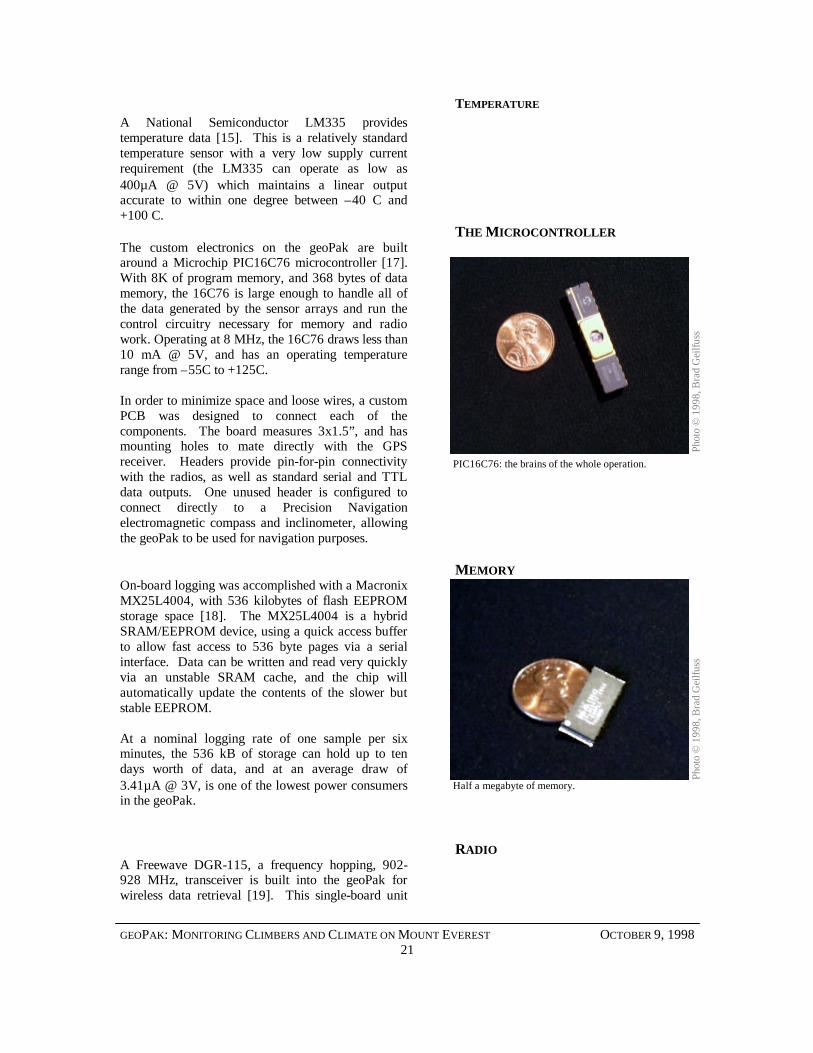
THE MICROCONTROLLERThe custom electronics on the geoPak are builtaround a Microchip PIC16C76 microcontroller [17].With 8K of program memory, and 368 bytes of datamemory, the 16C76 is large enough to handle all ofthe data generated by the sensor arrays and run thecontrol circuitry necessary for memory and radiowork. Operating at 8 MHz, the 16C76 draws less than10 mA @ 5V, and has an operating temperaturerange from –55C to +125C.
In order to minimize space and loose wires, a customPCB was designed to connect each of thecomponents. The board measures 3x1.5”, and hasmounting holes to mate directly with the GPSreceiver. Headers provide pin-for-pin connectivitywith the radios, as well as standard serial and TTLdata outputs. One unused header is configured toconnect directly to a Precision Navigationelectromagnetic compass and inclinometer, allowingthe geoPak to be used for navigation purposes.
MEMORYOn-board logging was accomplished with a MacronixMX25L4004, with 536 kilobytes of flash EEPROMstorage space [18]. The MX25L4004 is a hybridSRAM/EEPROM device, using a quick access bufferto allow fast access to 536 byte pages via a serialinterface. Data can be written and read very quicklyvia an unstable SRAM cache, and the chip willautomatically update the contents of the slower butstable EEPROM.
At a nominal logging rate of one sample per sixminutes, the 536 kB of storage can hold up to tendays worth of data, and at an average draw of3.41µA @ 3V, is one of the lowest power consumersin the geoPak.
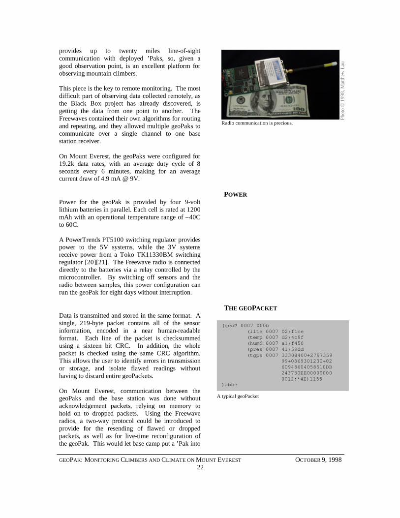
RADIOA Freewave DGR-115, a frequency hopping, 902-928 MHz, transceiver is built into the geoPak forwireless data retrieval [19]. This single-board unit
PIC16C76: the brains of the whole operation.
Phot
o ©
199
8, B
rad
Gei
lfuss
Half a megabyte of memory.
Pho
to ©
199
8, B
rad
Gei
lfuss
GEOPAK: MONITORING CLIMBERS AND CLIMATE ON MOUNT EVEREST OCTOBER 9, 199822
provides up to twenty miles line-of-sightcommunication with deployed ’Paks, so, given agood observation point, is an excellent platform forobserving mountain climbers.
This piece is the key to remote monitoring. The mostdifficult part of observing data collected remotely, asthe Black Box project has already discovered, isgetting the data from one point to another. TheFreewaves contained their own algorithms for routingand repeating, and they allowed multiple geoPaks tocommunicate over a single channel to one basestation receiver.
On Mount Everest, the geoPaks were configured for19.2k data rates, with an average duty cycle of 8seconds every 6 minutes, making for an averagecurrent draw of 4.9 mA @ 9V.
POWERPower for the geoPak is provided by four 9-voltlithium batteries in parallel. Each cell is rated at 1200mAh with an operational temperature range of –40Cto 60C.
A PowerTrends PT5100 switching regulator providespower to the 5V systems, while the 3V systemsreceive power from a Toko TK11330BM switchingregulator [20][21]. The Freewave radio is connecteddirectly to the batteries via a relay controlled by themicrocontroller. By switching off sensors and theradio between samples, this power configuration canrun the geoPak for eight days without interruption.
THE GEOPACKETData is transmitted and stored in the same format. Asingle, 219-byte packet contains all of the sensorinformation, encoded in a near human-readableformat. Each line of the packet is checksummedusing a sixteen bit CRC. In addition, the wholepacket is checked using the same CRC algorithm.This allows the user to identify errors in transmissionor storage, and isolate flawed readings withouthaving to discard entire geoPackets.
On Mount Everest, communication between thegeoPaks and the base station was done withoutacknowledgement packets, relying on memory tohold on to dropped packets. Using the Freewaveradios, a two-way protocol could be introduced toprovide for the resending of flawed or droppedpackets, as well as for live-time reconfiguration ofthe geoPak. This would let base camp put a ’Pak into
(geoP 0007 000b (lite 0007 02)f1ce (temp 0007 d2)4c9f (humd 0007 a1)f450 (pres 0007 41)59dd (tgps 0007 33308400+2797359
99+0869301230+02 60948604058510DB
243730EE00000000 0012;*4E)1155
)abbe
Radio communication is precious.
Phot
o ©
199
8, M
atth
ew L
au
A typical geoPacket

GEOPAK: MONITORING CLIMBERS AND CLIMATE ON MOUNT EVEREST OCTOBER 9, 199823
“emergency mode” for constant sampling, or feeddifferential correction information directly to theGPS receiver.
The format for the geoPacket is described in moredetail in Appendix D.
GEOPAK: MONITORING CLIMBERS AND CLIMATE ON MOUNT EVEREST OCTOBER 9, 199824
RESULTS
Daw
n on
Mt.
Was
hing
ton,
pho
to ©
199
8, M
atth
ew L
au
GEOPAK: MONITORING CLIMBERS AND CLIMATE ON MOUNT EVEREST OCTOBER 9, 199825
This section details the geoPak’s 1998 expedition onMount Everest. Overall, results were mixed,however it is worth indicating that the purpose of theexpedition was to further the development of thegeoPak and other experimental devices, not to usethese devices to perform a study.
The first few sections of this chapter discussunanticipated difficulties, and failures in the system,while the last section shows the data that wascollected. In short, the reader gets the bad news first,and the good news last.
WHAT WENT WRONG
As with any project, not everything went exactly asplanned on Mount Everest. To compound the typicalproblems caused by broken or malfunctioningcomponents, environmental conditions and a lack ofoxygen decreased the reliability of both the electricalcomponents and the people working on them.
BROKEN RELAYS
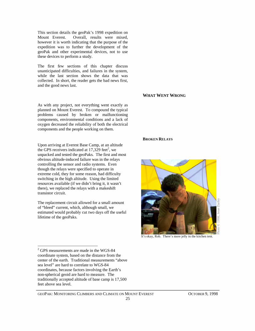
Upon arriving at Everest Base Camp, at an altitudethe GPS receivers indicated at 17,329 feet2, weunpacked and tested the geoPaks. The first and mostobvious altitude-induced failure was in the relayscontrolling the sensor and radio systems. Eventhough the relays were specified to operate inextreme cold, they for some reason, had difficultyswitching in the high altitude. Using the limitedresources available (if we didn’t bring it, it wasn’tthere), we replaced the relays with a makeshifttransistor circuit.
The replacement circuit allowed for a small amountof “bleed” current, which, although small, weestimated would probably cut two days off the usefullifetime of the geoPaks.
2 GPS measurements are made in the WGS-84coordinate system, based on the distance from thecenter of the earth. Traditional measurements “abovesea level” are hard to correlate to WGS-84coordinates, because factors involving the Earth’snon-spherical geoid are hard to measure. Thetraditionally accepted altitude of base camp is 17,500feet above sea level.
Phot
o ©
199
8, J
esse
Dar
ley
It’s okay, Rob. There’s more jelly in the kitchen tent.
GEOPAK: MONITORING CLIMBERS AND CLIMATE ON MOUNT EVEREST OCTOBER 9, 199826
THE RADIO SHADOW
In the days before the ascent, we were faced with thechallenge of finding a suitable place to place arepeater in order to maintain line-of-sight radiocommunications. Being restricted to staying belowthe Khumbu Icefall on the route, our only real chancefor good coverage was to place the repeater behindbase camp on the peak of Kala Pattar, at 18,800 feet,on the opposite edge of the Khumbu Glacier from theclimbing route.
In this position, the repeater would be able tomaintain line-of-sight from base camp to the top ofthe icefall, and above camp two. The unfortunatepart of this location is that, the climbers would be outof view of the repeater in a “radio shadow” behindthe west shoulder of Everest from the top of theicefall until just above camp two. This would causeone full day of occlusion, during which time the’Paks would be out of range. Short on time andunable to find a more suitable location, it wasdecided to let the units log data during the silence.
GPS ANTENNA PLACEMENT
Probably the most avoidable human factors camefrom the placement of the GPS antennas. On anascent of Mount Everest, climbers are, by necessity,extremely concerned with the positioning of weightin their climbing packs. Because of this, the geoPakswere sometimes buried so that the GPS antenna couldnot receive satellite signals. Reluctant to hang thegeoPak on the exterior of their riggings, climberswould, on occasion, put them deep in theirbackpacks, where the light and GPS sensors wereuseless. Other data was collected during those times,but there are still holes in the data resulting fromthese placements.
BATTERY FAILURE
Everything built into the geoPak was specified tooperate down to –40 C, but, in a somewhatsignificant oversight, not everything was tested orrated to operate at half an atmosphere. As a result,some batteries leaked fluid somewhere between18,000 feet (in the icefall), and 26,000 feet (the SouthCol). This failure was by far the most significant infailure in the geoPak, and caused the greatest loss ofdata. In one pack, three of four batteries burst,causing the radio to shut down, and the logging to
GEOPAK: MONITORING CLIMBERS AND CLIMATE ON MOUNT EVEREST OCTOBER 9, 199827
work only during the day, when the one remainingbattery was warm enough to provide enough currentto run the system.
As a result of failing radio communications andhaving no way of knowing if the devices werelogging even though they weren’t transmitting, thedecision to not carry the geoPaks to the summit wasmade as to not jeopardize any climber’s summit bid.
WHAT WENT RIGHTEven with all of the failures, the geoPak project onMount Everest still had its successes. In fact,breaking components and discovering design flawswere both goals of taking them to altitude. Inaddition, the ’Paks were able to collect some data.The next section describes what was brought back.
DATA SETS
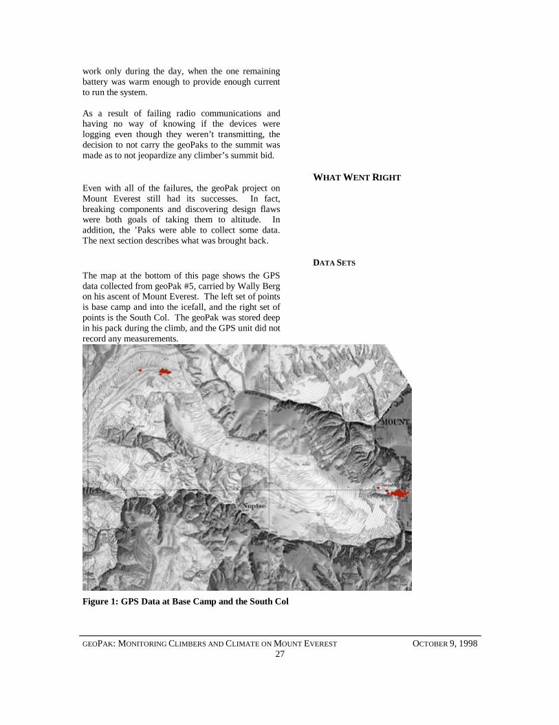
The map at the bottom of this page shows the GPSdata collected from geoPak #5, carried by Wally Bergon his ascent of Mount Everest. The left set of pointsis base camp and into the icefall, and the right set ofpoints is the South Col. The geoPak was stored deepin his pack during the climb, and the GPS unit did notrecord any measurements.
Figure 1: GPS Data at Base Camp and the South Col
GEOPAK: MONITORING CLIMBERS AND CLIMATE ON MOUNT EVEREST OCTOBER 9, 199828
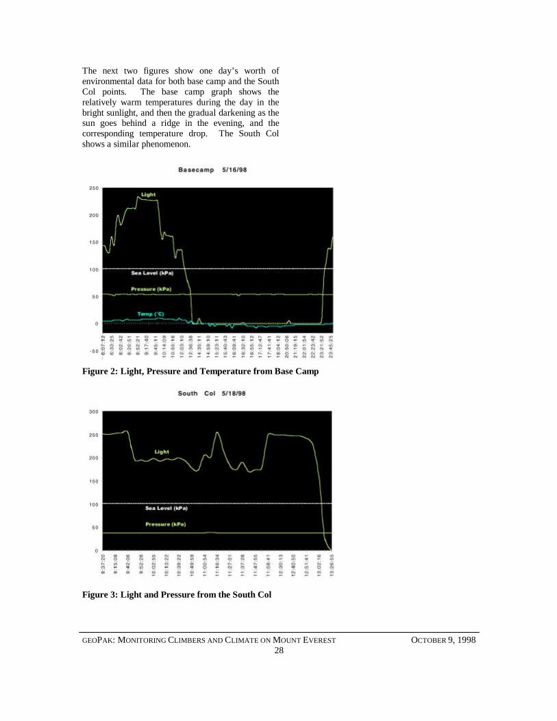
The next two figures show one day’s worth ofenvironmental data for both base camp and the SouthCol points. The base camp graph shows therelatively warm temperatures during the day in thebright sunlight, and then the gradual darkening as thesun goes behind a ridge in the evening, and thecorresponding temperature drop. The South Colshows a similar phenomenon.
Figure 2: Light, Pressure and Temperature from Base Camp
Figure 3: Light and Pressure from the South Col
GEOPAK: MONITORING CLIMBERS AND CLIMATE ON MOUNT EVEREST OCTOBER 9, 199829
CONCLUSIONS
Wor
kin’
on
the
Yak
Tra
in, p
hoto
© 1
998,
Jes
se D
arle
y
GEOPAK: MONITORING CLIMBERS AND CLIMATE ON MOUNT EVEREST OCTOBER 9, 199830
While the lack of a large body of data from MountEverest is a significant disappointment, the goal ofthe expedition was, as stated before, to advance thedevelopment of the geoPak and other remotemonitoring devices. In that regard, the trip has beenconsidered by all involved to be a success. Thissection outlines the conclusions arrived at as a resultof the expedition.
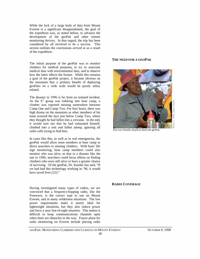
THE NEED FOR A GEOPAKThe initial purpose of the geoPak was to monitorclimbers for medical purposes, to try to associatemedical data with environmental data, and to observehow the latter effects the former. While this remainsa goal of the geoPak project, it became obvious onthe mountain that a primary benefit of deployinggeoPaks on a wide scale would be purely safetyrelated.
The disaster in 1996 is far from an isolated incident.As the E3 group was trekking into base camp, aclimber was reported missing somewhere betweenCamp One and Camp Two. For four hours, there washigh drama on the mountain as other members of histeam scoured the face just below Camp Two, wherethey thought he had fallen into a crevasse. In the end,it would turn out that he had exhausted himself,climbed into a tent and fallen asleep, ignoring allradio calls trying to find him.
In cases like this, as well as in real emergencies, thegeoPak would allow team members at base camp todirect searchers to missing climbers. With basic lifesign monitoring, base camp members could alsomonitor who was alive, so that in a disaster like theone in 1996, searchers could focus efforts on findingclimbers who were still alive or have a greater chanceof surviving. Of the geoPak, Dr. Kamler has said, “Ifwe had had this technology working in ’96, it wouldhave saved lives [22].”
RADIO COVERAGEHaving investigated many types of radios, we areconvinced that a frequency-hopping radio, like theFreewave, is the correct type to use on MountEverest, and in many wilderness situations. The lowpower requirements make it nearly ideal forlightweight situations, but they also reduce powerand force a near line-of-sight situation. This makes itdifficult to keep communications channels openwhen there are obstacles in the way. Future plans forradio monitoring on Everest include placing radio
Phot
o ©
199
8, M
aria
Red
in
Ken was initially skeptical about the geoPak.
GEOPAK: MONITORING CLIMBERS AND CLIMATE ON MOUNT EVEREST OCTOBER 9, 199831
repeaters above the icefall to maintain a reliable linkon the part of the mountain that was in the “shadow”in 1998. Experiments involving radio transmissionof GPS data from the summit to base camp did,however, prove that radio performance over longdistances is excellent.
This current configuration is tailored to Everest, butcommunications is a fragile platform. If the geoPakis to be redeployed in other situations, it will benecessary to replace the radios with other devicesbetter suited to the conditions. In North America,established mobile protocols such as CDPD andcellular provide a widespread solution to thesedifficulties.
MEMORYThe geoPak’s memory module proved itself adequatein its performance, but extracting data fromrecovered units would have been much easier if thememory had been removable. Instead of opening thegeoPak to put it into data-recovery mode, it would bemuch easier to have removable media to store thedata. Future designs of the geoPak are investigatingthe possibility of using PCMCIA-type cards asstorage.
HUMAN FACTORSThe geoPak is as small as was feasible for aprototype, multi-board device, and 1.4 pounds doesnot seem like a lot of weight to carry in a backpack.Mountain climbers, however, carry only about fifteento twenty pounds of (non-clothing) equipment ontheir final day of climbing, and two pounds getsexcessive. On the subject of weight, a veteranmountaineer remarked, “Climbers cut theirtoothbrushes in half to minimize the weight theycarry. Anything you can do to cut down how much[the geoPaks] weigh, do it [23].”
Minimization of components continues naturally.The GPS is responsible for almost half the weight ofthe package (considering receiver, antenna, andpower requirements), but smaller GPS boardsrequiring less power continue to be introduced. Evenso, size will continue be an issue until the geoPak canbe put on a single board with all componentsintegrated.
GEOPAK: MONITORING CLIMBERS AND CLIMATE ON MOUNT EVEREST OCTOBER 9, 199832
DATA DISPLAYSIn recovering data from the geoPak, it becameapparent that existing numerical displays andquantitative graphs are adequate only for a small setof people trained to understand the implications ofenvironmental readings. For most people,temperature is about the only variable that can beunderstood with any intuition. Knowing that thehumidity is 32% doesn’t mean very much to theaverage person. Likewise, knowing a set of GPScoordinates isn’t helpful without a very detailed mapof the area, or directions to a destination.
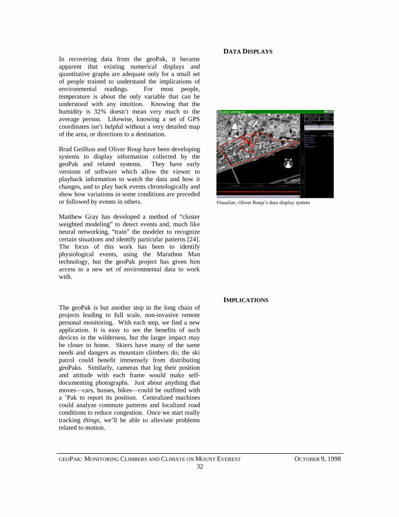
Brad Geilfuss and Oliver Roup have been developingsystems to display information collected by thegeoPak and related systems. They have earlyversions of software which allow the viewer toplayback information to watch the data and how itchanges, and to play back events chronologically andshow how variations in some conditions are precededor followed by events in others.
Matthew Gray has developed a method of “clusterweighted modeling” to detect events and, much likeneural networking, “train” the modeler to recognizecertain situations and identify particular patterns [24].The focus of this work has been to identifyphysiological events, using the Marathon Mantechnology, but the geoPak project has given himaccess to a new set of environmental data to workwith.
IMPLICATIONSThe geoPak is but another step in the long chain ofprojects leading to full scale, non-invasive remotepersonal monitoring. With each step, we find a newapplication. It is easy to see the benefits of suchdevices in the wilderness, but the larger impact maybe closer to home. Skiers have many of the sameneeds and dangers as mountain climbers do; the skipatrol could benefit immensely from distributinggeoPaks. Similarly, cameras that log their positionand attitude with each frame would make self-documenting photographs. Just about anything thatmoves— cars, busses, bikes— could be outfitted witha ’Pak to report its position. Centralized machinescould analyze commute patterns and localized roadconditions to reduce congestion. Once we start reallytracking things, we’ll be able to alleviate problemsrelated to motion.
Visualize, Oliver Roup’s data display system
GEOPAK: MONITORING CLIMBERS AND CLIMATE ON MOUNT EVEREST OCTOBER 9, 199833
FUTURE WORKIn addition to continued work on the geoPak, newdevices are continually being developed in the fieldof remote personal monitoring. Recently, a prototype“Bio Suit” was tested in Italy to monitor aprofessional motorcycle rider’s comfort and safety.Current work on the suit involves using sensorsincorporated into his safety gear to deploy airbags inthe suit to help prevent injury in the event of a crash[25]. Sensors and research from the geoPak havecontributed to this project.
We plan to continue the geoPak project and toredesign the system with an eye towards making itmore of a tracking device instead of a measuringdevice. Perhaps next year, on Mount Everest, everyclimber will have their own “little black box” thatkeeps base camp apprised of their situation.
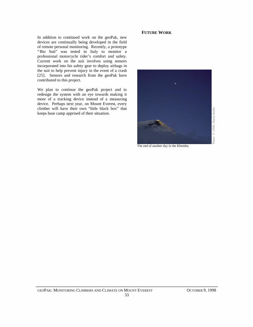
The end of another day in the Khumbu.
Phot
o ©
199
8, M
aria
Red
in
GEOPAK: MONITORING CLIMBERS AND CLIMATE ON MOUNT EVEREST OCTOBER 9, 199834
REFERENCESA
you
ng la
ma,
pho
to ©
199
8, M
aria
Red
in
GEOPAK: MONITORING CLIMBERS AND CLIMATE ON MOUNT EVEREST OCTOBER 9, 199835
[1] Hawley, Michael. 1997. Black Boxes, Research prospectus, MIT Media Lab, Cambridge,Massachusetts.
[2] Krakauer, Jon. 1997. Into Thin Air, Villard Books, New York, New York.
[3] Redin, Maria. 1998. Marathon Man. Cambridge, MEng. Thesis, MIT Department of ElectricalEngineering and Computer Science, Cambridge, Massachusetts
[4] Vaughn, Dave. 1997. Personal communication, Boston, Massachusetts.
[5] Hurn, Jeff. 1989. GPS: A Guide to the Next Utility, Trimble Navigation, Sunnyvale, California.
[6] Data from the Marathon Man project is available at http://ttt.www.media.mit.edu/SF.
[7] Hoyt, R., M. Buller, M. Redin, R. Poor, S. Oliver, W. Matthew, W. Latzka, A.Young, D. Redmond, andC. Kearns. 1997. War Fighter Physiological Status Monitoring – Results of DismountedBattlespace Battle Lab Concept Experimentation Program Field Study on Soldier PhysiologicalMonitoring. Natick, Massachusetts: United States Army Research Institute of EnvironmentalMedicine. TR97.
[8] Mencin, David. 1998. Personal communication, Everest Base Camp, Khumbu, Nepal.
[9] Washburn, Bradford. 1998. Personal Communication, Cambridge, Massachusetts.
[10] Poor, Robert and Maria Redin. 1998. Research. Web page available fromhttp://www.everest.org/Everest/bio.html.
[11] American Everest Expedition. 1998. Web page available fromhttp://everest.mountainzone.com/98.
[12] Everest Extreme Expedition. 1998. Web pages available fromhttp://www.everest.org,http://www.explorers.org.
[13] Trimble Navigation. 1997. Lassen-SK8TM Embedded GPS Module System Designer ReferenceManual. Trimble Navigation, Sunnyvale, California.
[14] Data Sheet: MPX5100/D. 1997. Motorola, Inc., Denver, Colorado.
[15] Data Sheet: LM135/LM235/LM335, LM135A/LM235A/LM335A, 1995. National SemiconductorCorporation, Arlington, Texas.
[16] Data Sheet: MiniCap 2 Relative Humidity Sensor, 1997. Panametrics, Waltham, Massachusetts
[17] Data Sheet: PIC16C7X, 1997. Microchip Technology Inc., 1997
[18] Data Sheet: MX25l4004, 1996. Macronix International Co., Ltd. Hsin Chu, Taiwan, R.O.C.
[19] Freewave Wireless Data Transceiver User Manual, 1998. Freewave Technologies, Inc. Boulder,Colorado.
[20] Data Sheet: PT5100 Series, 1998. Power Trends, Inc., Warrenville, Illinois.
GEOPAK: MONITORING CLIMBERS AND CLIMATE ON MOUNT EVEREST OCTOBER 9, 199836
[21] Data Sheet: TK113xxB, 1997. TOKO, Inc., Mount Prospect, Illinois.
[22] Kamler, Kenneth, interview on ABC Nightline, 18 May, 1998.
[23] Breashears, David. 1998. Personal communication, Cambridge, Massachusetts.
[24] Gray, Matthew K. 1998. Research. Web page available at: http://www.media.mit.edu/~mkgray/army.
[25] Gray, Steven. 1998. Research.
GEOPAK: MONITORING CLIMBERS AND CLIMATE ON MOUNT EVEREST OCTOBER 9, 199837
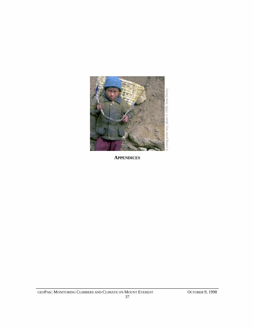
APPENDICES
A y
oung
por
ter b
oy, p
hoto
© 1
998,
Jes
se D
arle
y
GEOPAK: MONITORING CLIMBERS AND CLIMATE ON MOUNT EVEREST OCTOBER 9, 199838
APPENDIX A: EXPEDITION TEAMMEMBERS
The 1998 American Everest Expedition:Bradford Washburn, Honorary LeaderWally Berg, Expedition LeaderCharles Corfield, Science ManagerDavid Mencin, Base Camp ManagerEric SimonsonGreg Wilson
The 1998 Everest Extreme Expedition:Scott Hamilton, Expedition LeaderDr. Kenneth Kamler, Expedition DoctorDr. Christian Macedonia, GeorgetownDr. Vincent Grasso, Yale/Nasa CSCEdward MattesProfessor Michael Hawley, MITJesse Darley, MITMatthew Lau, MITNatalia Marmasse, MITR. Dunbar Poor, MITMaria Redin, MITRichard Satava, Jr., Base Camp ManagerJames Bruton, Communications Specialist
GEOPAK: MONITORING CLIMBERS AND CLIMATE ON MOUNT EVEREST OCTOBER 9, 199839
APPENDIX B: SENSOR CALIBRATIONDATA
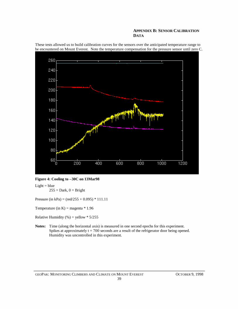
These tests allowed us to build calibration curves for the sensors over the anticipated temperature range tobe encountered on Mount Everest. Note the temperature compensation for the pressure sensor until zero C.
Figure 4: Cooling to –30C on 13Mar98
Light = blue255 = Dark, 0 = Bright
Pressure (in kPa) = (red/255 + 0.095) * 111.11
Temperature (in K) = magenta * 1.96
Relative Humidity (%) = yellow * 5/255
Notes: Time (along the horizontal axis) is measured in one second epochs for this experiment.Spikes at approximately t = 700 seconds are a result of the refrigerator door being opened.Humidity was uncontrolled in this experiment.
GEOPAK: MONITORING CLIMBERS AND CLIMATE ON MOUNT EVEREST OCTOBER 9, 199840
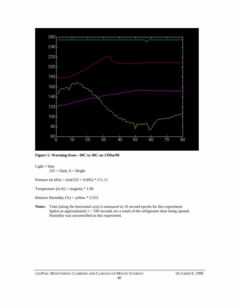
Figure 5: Warming from –30C to 30C on 13Mar98
Light = blue255 = Dark, 0 = Bright
Pressure (in kPa) = (red/255 + 0.095) * 111.11
Temperature (in K) = magenta * 1.96
Relative Humidity (%) = yellow * 5/255
Notes: Time (along the horizontal axis) is measured in 10 second epochs for this experiment.Spikes at approximately t = 590 seconds are a result of the refrigerator door being opened.Humidity was uncontrolled in this experiment.
GEOPAK: MONITORING CLIMBERS AND CLIMATE ON MOUNT EVEREST OCTOBER 9, 199841
APPENDIX C: TRIMBLE TAIP “LN”MESSAGE
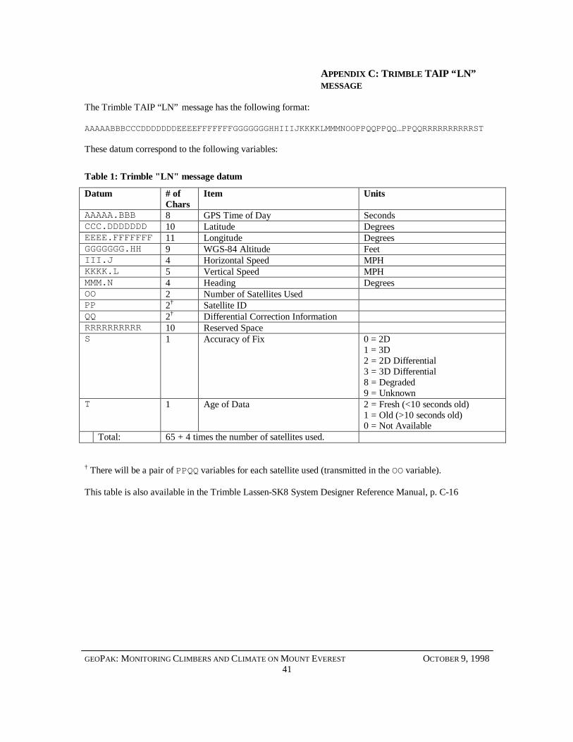
The Trimble TAIP “LN” message has the following format:
AAAAABBBCCCDDDDDDDEEEEFFFFFFFGGGGGGGHHIIIJKKKKLMMMNOOPPQQPPQQ…PPQQRRRRRRRRRRST
These datum correspond to the following variables:
Table 1: Trimble "LN" message datum
Datum # ofChars
Item Units
AAAAA.BBB 8 GPS Time of Day SecondsCCC.DDDDDDD 10 Latitude DegreesEEEE.FFFFFFF 11 Longitude DegreesGGGGGGG.HH 9 WGS-84 Altitude FeetIII.J 4 Horizontal Speed MPHKKKK.L 5 Vertical Speed MPHMMM.N 4 Heading DegreesOO 2 Number of Satellites UsedPP 2† Satellite IDQQ 2† Differential Correction InformationRRRRRRRRRR 10 Reserved SpaceS 1 Accuracy of Fix 0 = 2D
1 = 3D2 = 2D Differential3 = 3D Differential8 = Degraded9 = Unknown
T 1 Age of Data 2 = Fresh (<10 seconds old)1 = Old (>10 seconds old)0 = Not Available
Total: 65 + 4 times the number of satellites used.
† There will be a pair of PPQQ variables for each satellite used (transmitted in the OO variable).
This table is also available in the Trimble Lassen-SK8 System Designer Reference Manual, p. C-16
GEOPAK: MONITORING CLIMBERS AND CLIMATE ON MOUNT EVEREST OCTOBER 9, 199842
APPENDIX D: GEOPACKET FORMAT
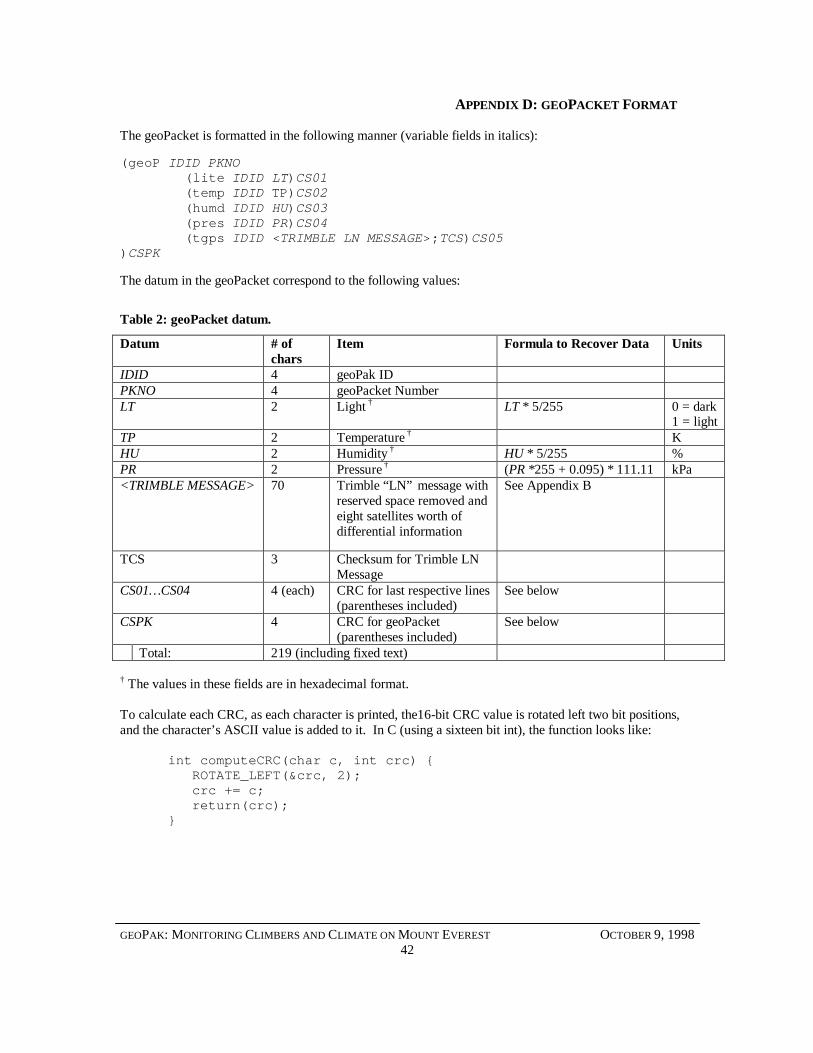
The geoPacket is formatted in the following manner (variable fields in italics):
(geoP IDID PKNO (lite IDID LT)CS01 (temp IDID TP)CS02 (humd IDID HU)CS03 (pres IDID PR)CS04 (tgps IDID <TRIMBLE LN MESSAGE>;TCS)CS05)CSPK
The datum in the geoPacket correspond to the following values:
Table 2: geoPacket datum.
Datum # ofchars
Item Formula to Recover Data Units
IDID 4 geoPak IDPKNO 4 geoPacket NumberLT 2 Light † LT * 5/255 0 = dark
1 = lightTP 2 Temperature † KHU 2 Humidity † HU * 5/255 %PR 2 Pressure † (PR *255 + 0.095) * 111.11 kPa<TRIMBLE MESSAGE> 70 Trimble “LN” message with
reserved space removed andeight satellites worth ofdifferential information
See Appendix B
TCS 3 Checksum for Trimble LNMessage
CS01… CS04 4 (each) CRC for last respective lines(parentheses included)
See below
CSPK 4 CRC for geoPacket(parentheses included)
See below
Total: 219 (including fixed text)
† The values in these fields are in hexadecimal format.
To calculate each CRC, as each character is printed, the16-bit CRC value is rotated left two bit positions,and the character’s ASCII value is added to it. In C (using a sixteen bit int), the function looks like:
int computeCRC(char c, int crc) ROTATE_LEFT(&crc, 2); crc += c; return(crc);