Embed Size (px)
Citation preview

GEOPAK SURVEYGEOPAK SURVEY
PROCESSING FIELD DATA ANDPROCESSING FIELD DATA AND SURFACES

CAiCE
CAiCE is no longer being supported or updated. It may eventually be shelved by Autodesk.y y
At some point CAiCE may fail to load or run in Windows.
FDOT has no control over these triggers.
As long as CAiCE continues to work FDOT will include updated resource files in the state kit to support CAiCE.
What happens if CAiCE is gone tomorrow?
A greater reliance on MicroStation and GEOPAK.

GEOPAK SURVEYGEOPAK SURVEY
Unlike Data Acquisition, GEOPAK SURVEY is a Complete Package
In FDOT – Under Utilized
Can process raw field observations
- Build Control files
- Supports OBS Taping, SOE, Eccentricitypp p g y
- Uses Ray Hintz’s least square adjustments and applies Geodesy.

GEOPAK SURVEYGEOPAK SURVEY
Using GEOPAK Survey is an excellent way to import existing CAiCE Survey Points and Survey Chains into MicroStation and GEOPAK.
Using the CDGTOV8 Converter has limitations.- Limited levels – all text and the point symbol end up p y p
on the same level- CAiCE does not support true type fonts- Points and Chains must be imported using an INPUT- Points and Chains must be imported using an INPUT
file- Does not build a dataset so surfaces are problematic
to build in GEOPAK with data from INPUT filesto build in GEOPAK with data from INPUT files
GEOPAK SURVEYGEOPAK SURVEY
GEOPAK Survey requires a project file (PRJ).
Project files (PRJ) control all aspects of data handling and preferences, including but not limited to:- SMD file for Roadway or Right of Way- GPK file and how it is populatedGPK file and how it is populated- Control file, Projections and Adjustments- Settings for processing and reduction of raw data
C ti f D t t Vi li ti d S l- Creation of Datasets, Visualizations and Scale- Settings for DTM creation

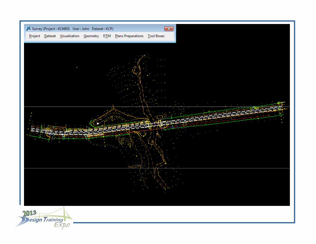
SURVRD01 DGNSURVRD01.DGN
Introducing the Survey Development Model
Was added for the purposes of developing surveying deliverables in Civil 3D
QC Inspector considers the SURVRD##.DGN an “open file” (will always pass QC).
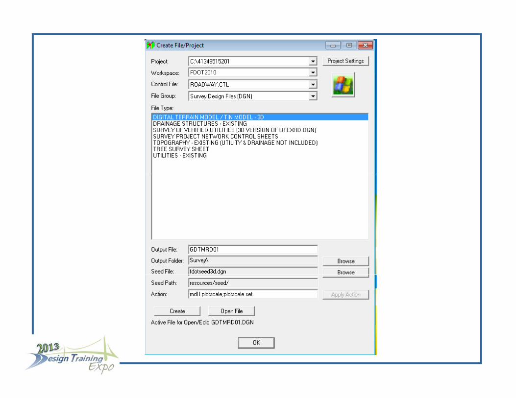
In the Create File/Project program, will be added to the list of survey files under Roadway Design/Survey.


PROJECT PREFERENCESPROJECT PREFERENCES
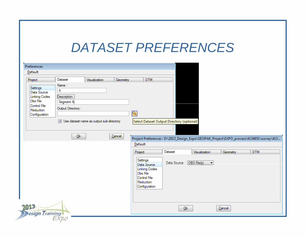
DATASET PREFERENCESDATASET PREFERENCES
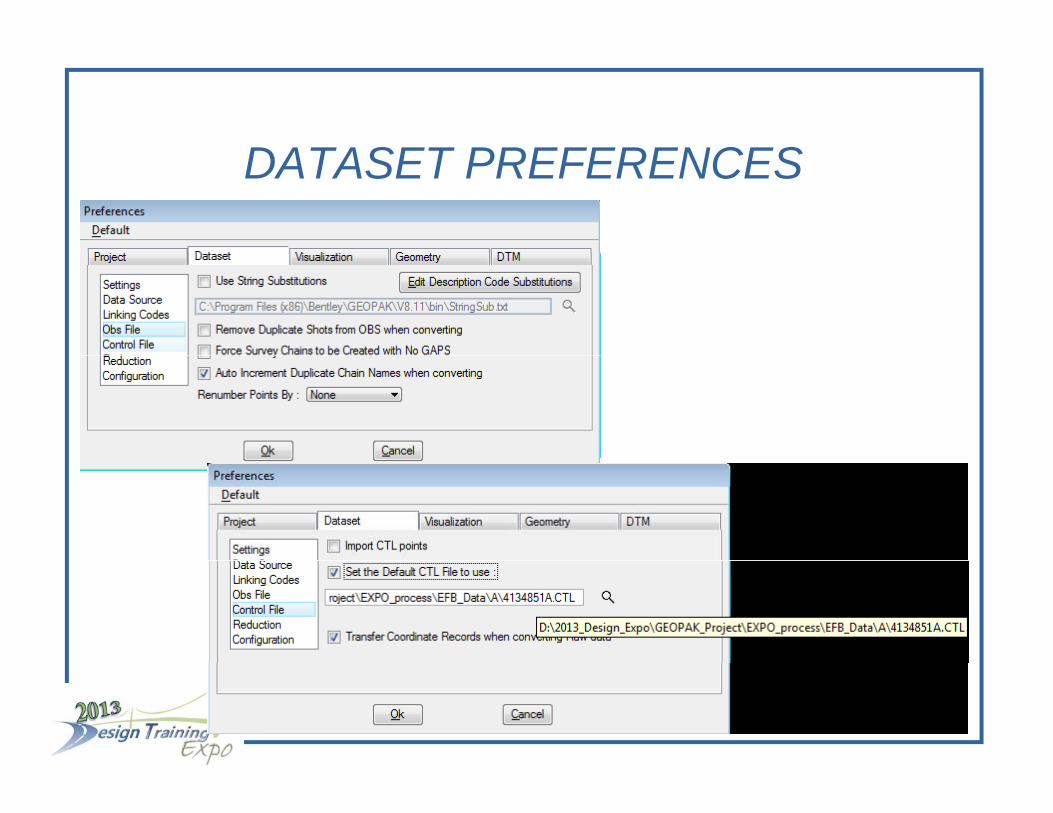
DATASET PREFERENCESDATASET PREFERENCES
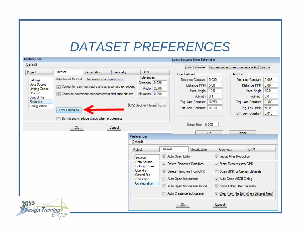
DATASET PREFERENCESDATASET PREFERENCES

VISUALIZATION PREFERENCESVISUALIZATION PREFERENCES
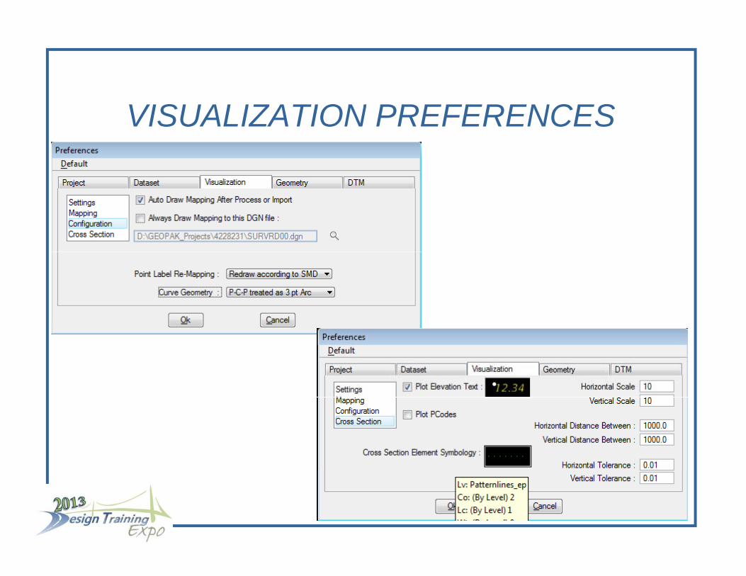
VISUALIZATION PREFERENCESVISUALIZATION PREFERENCES

GEOMETRY PREFERENCESGEOMETRY PREFERENCES
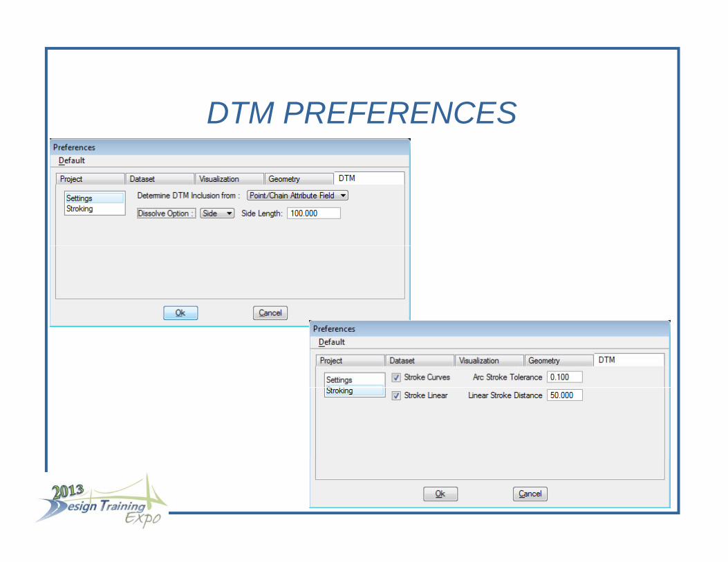
DTM PREFERENCESDTM PREFERENCES
Processing/Reduction of OBS Segments f EFBfrom EFB
Set the Control File
Make a New Dataset from the Segment OBS
Reduce the Dataset
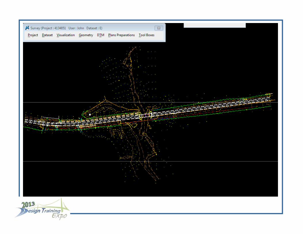
G hi ill b i li d d th GPK fil ill b Graphics will be visualized and the GPK file will be populated with survey points and survey chains
R t f ll t Repeat for all segments
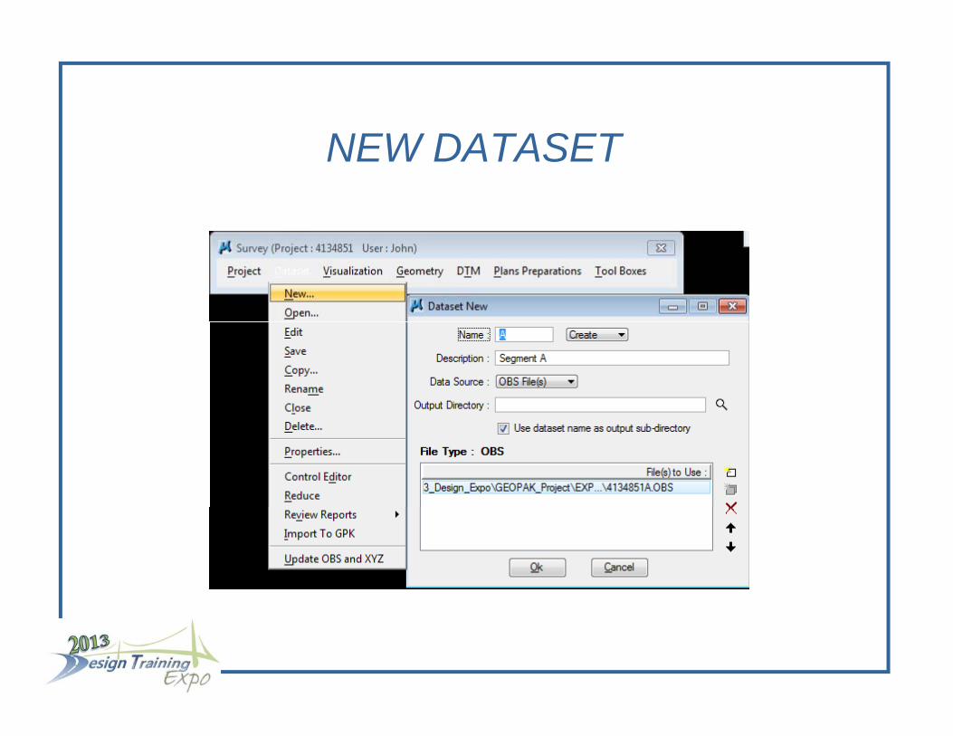
NEW DATASETNEW DATASET

DATASET EDITORDATASET EDITOR
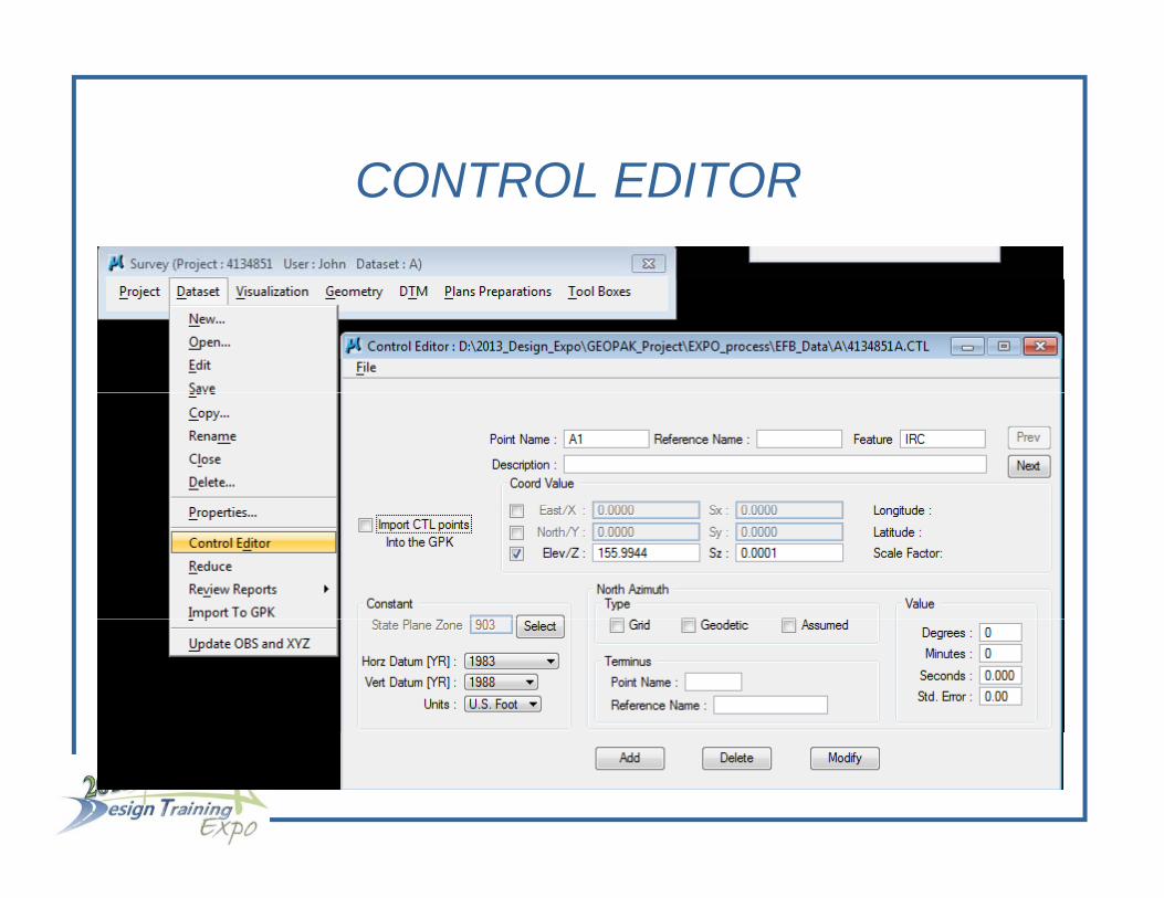
CONTROL EDITORCONTROL EDITOR
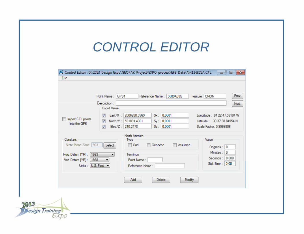
CONTROL EDITORCONTROL EDITOR

CONTROL EDITORCONTROL EDITOR

REDUCEREDUCE


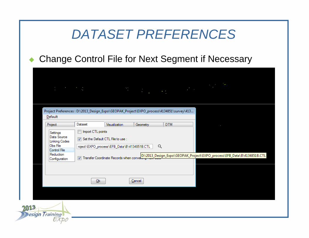
DATASET PREFERENCES
Change Control File for Next Segment if Necessary

N t NEW DATASETNext NEW DATASET
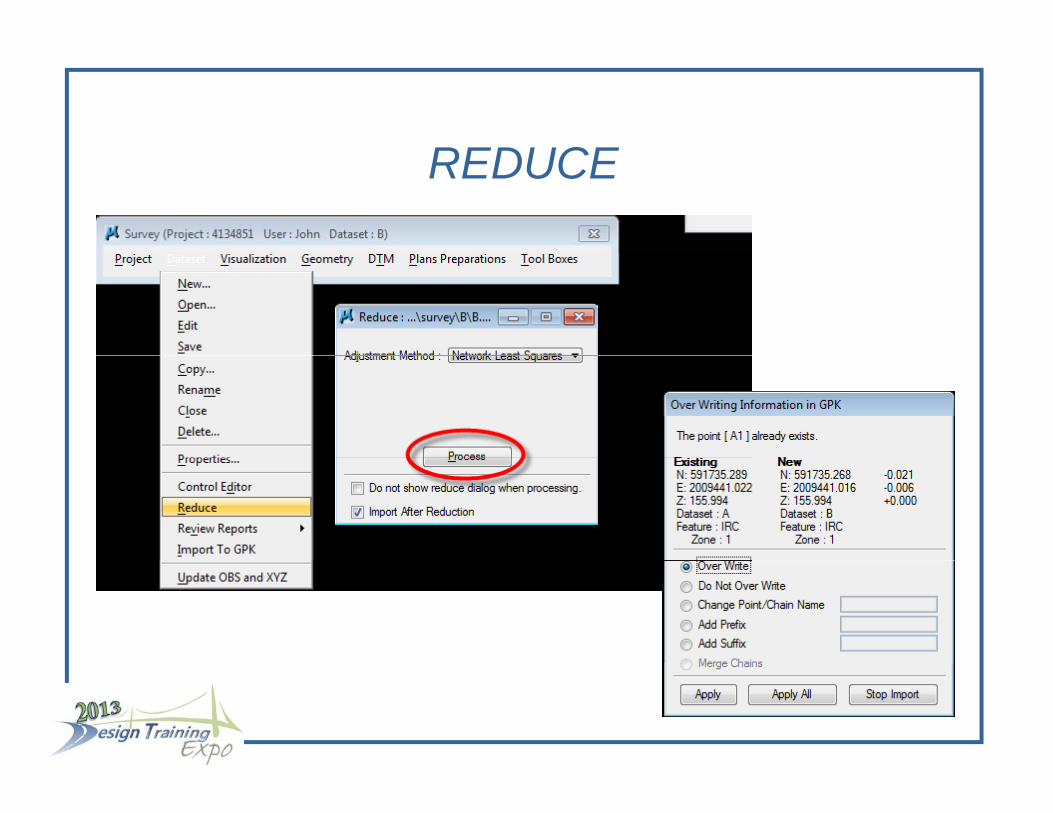
REDUCEREDUCE

REPEAT THIS PROCESS TO REDUCE ALL SEGMENTSALL SEGMENTS
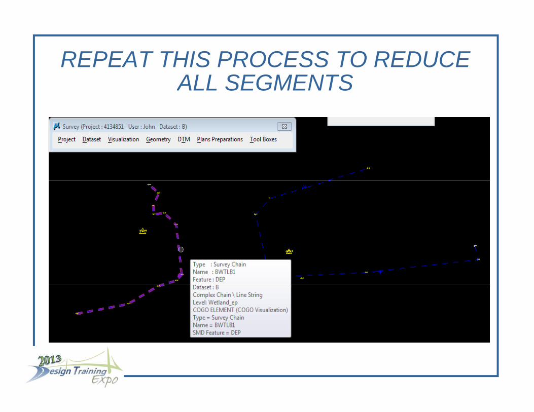
REPEAT THIS PROCESS TO REDUCE ALL SEGMENTSALL SEGMENTS


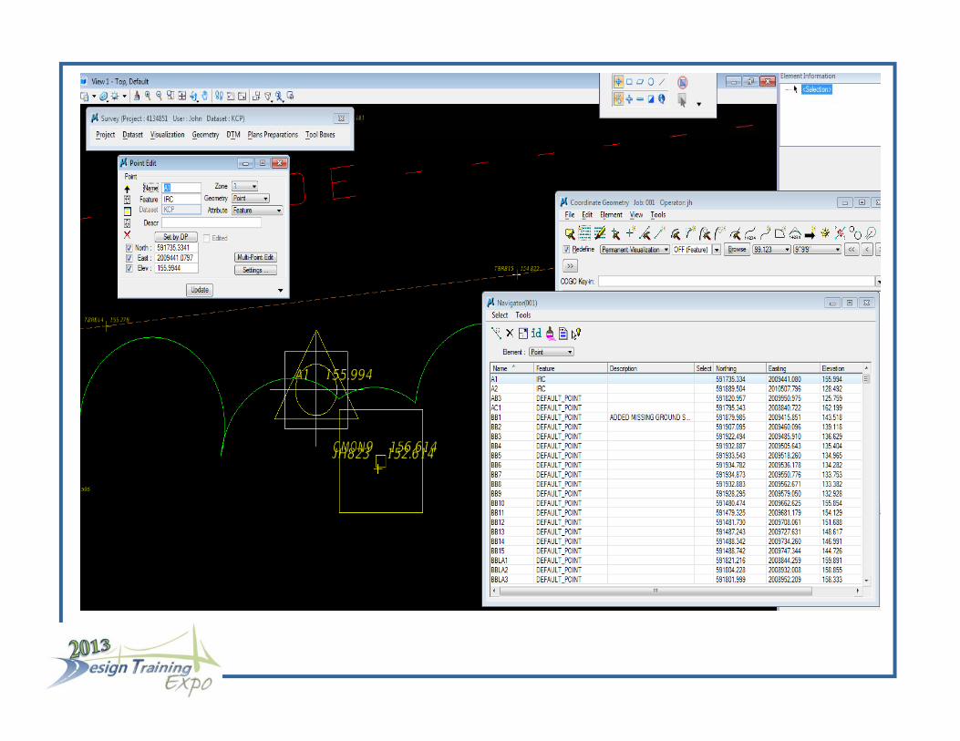
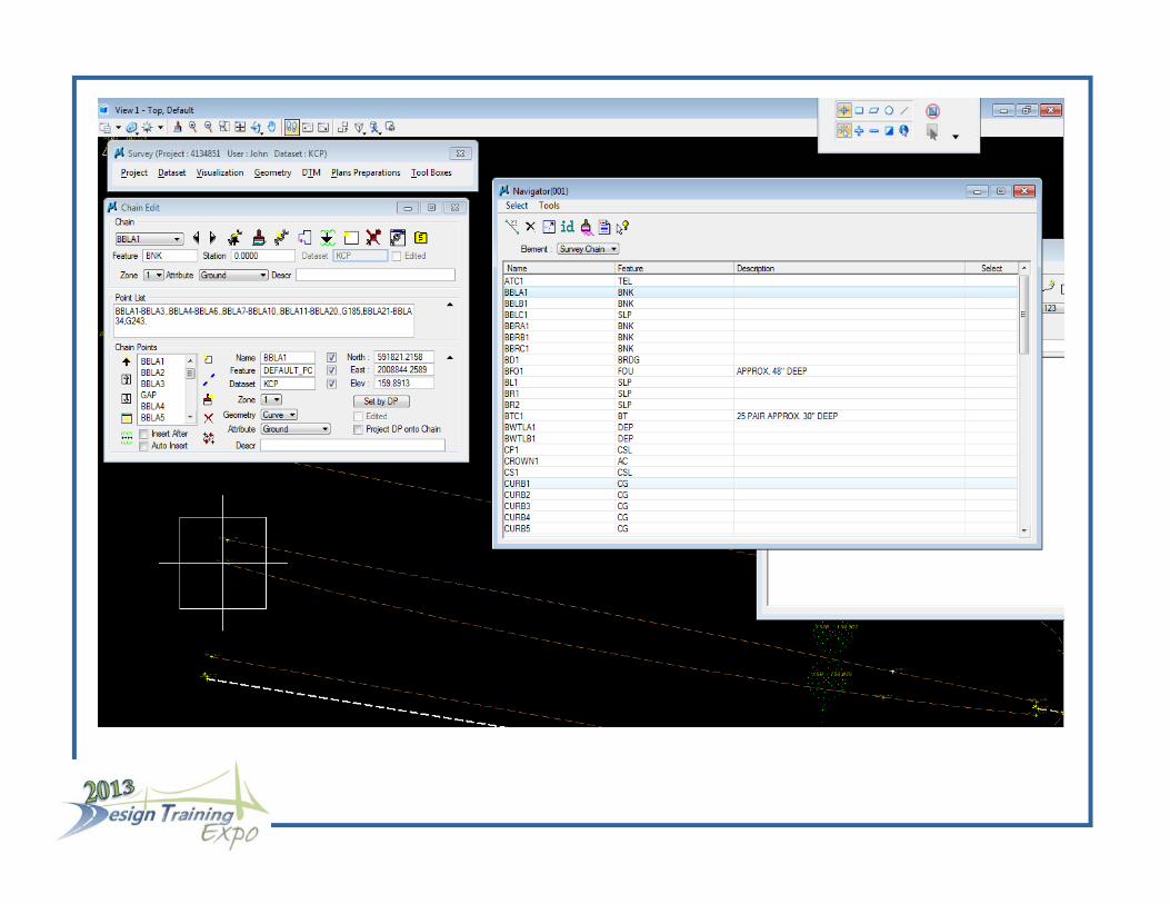
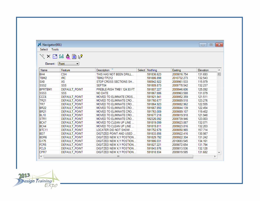
P i t d Ch i EditiPoint and Chain Editing
Point and Chain Editing can be done directly from the GPK Navigator
Double Click on the point in Navigator to pull up the point editor
Import the Dataset into the GPK
Graphics will be visualized and the GPK file will be populated with survey points and survey chains
Note that an OBS file, with all CAiCE chain edits, has been created
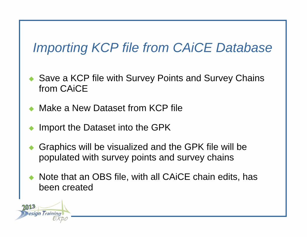
I ti KCP fil f CAiCE D t bImporting KCP file from CAiCE Database
Save a KCP file with Survey Points and Survey Chains from CAiCE
Make a New Dataset from KCP file
Import the Dataset into the GPK
Graphics will be visualized and the GPK file will be populated with survey points and survey chains
Note that an OBS file, with all CAiCE chain edits, has been created
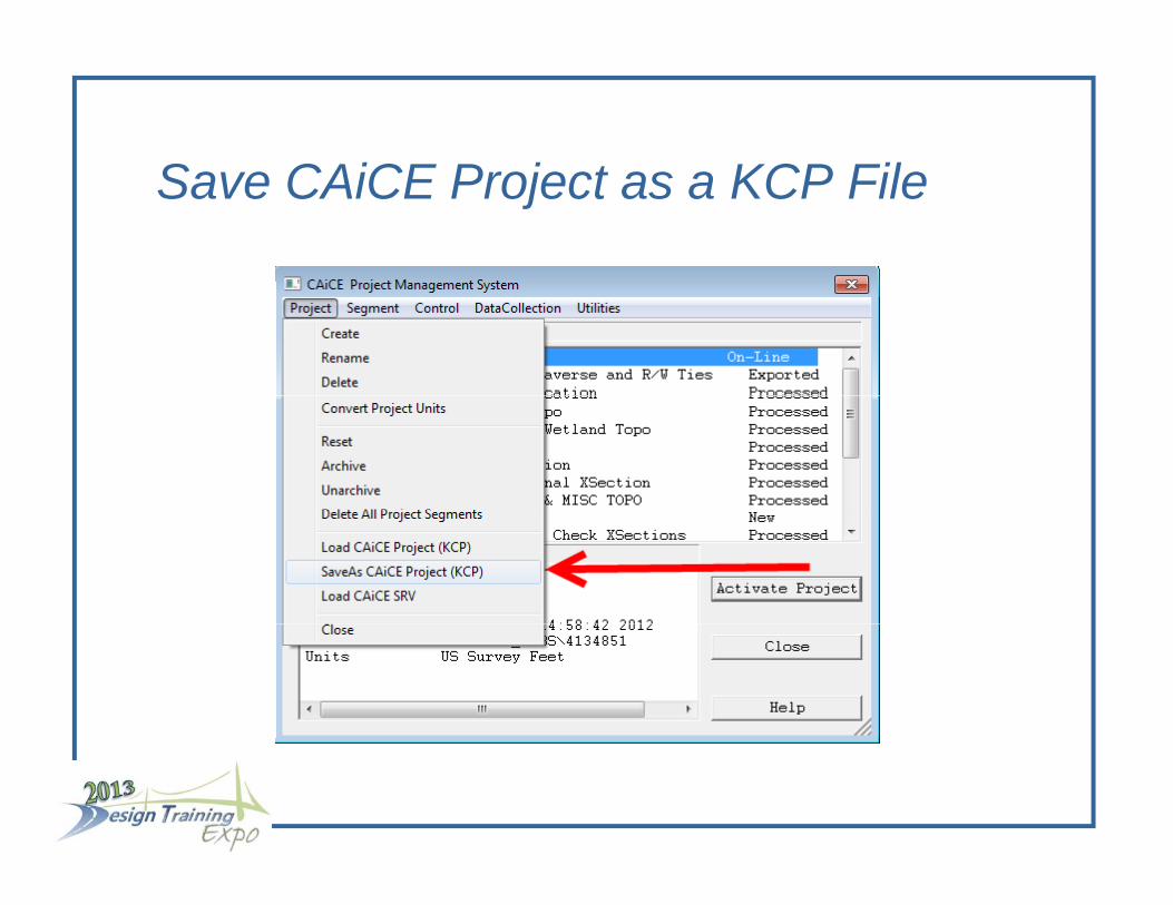
S CAiCE P j t KCP FilSave CAiCE Project as a KCP File

DATASET PREFERENCESDATASET PREFERENCES

DATASET PREFERENCES
In the GEOPAK Survey Project Preferences there are differences in the Dataset Preferences
The Dataset will be the KCP file not the individual EFB Segmentsg

DATASET PREFERENCES
The Data Source will be a KCP file and there will not be a control file

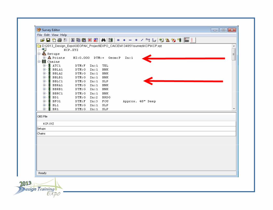
NEW DATASETNEW DATASET

O th D t t Edit t li t fOpen the Dataset Editor to see a list of Survey Points and Survey Chains

I t KCP D t t T GPKImport KCP Dataset To GPK

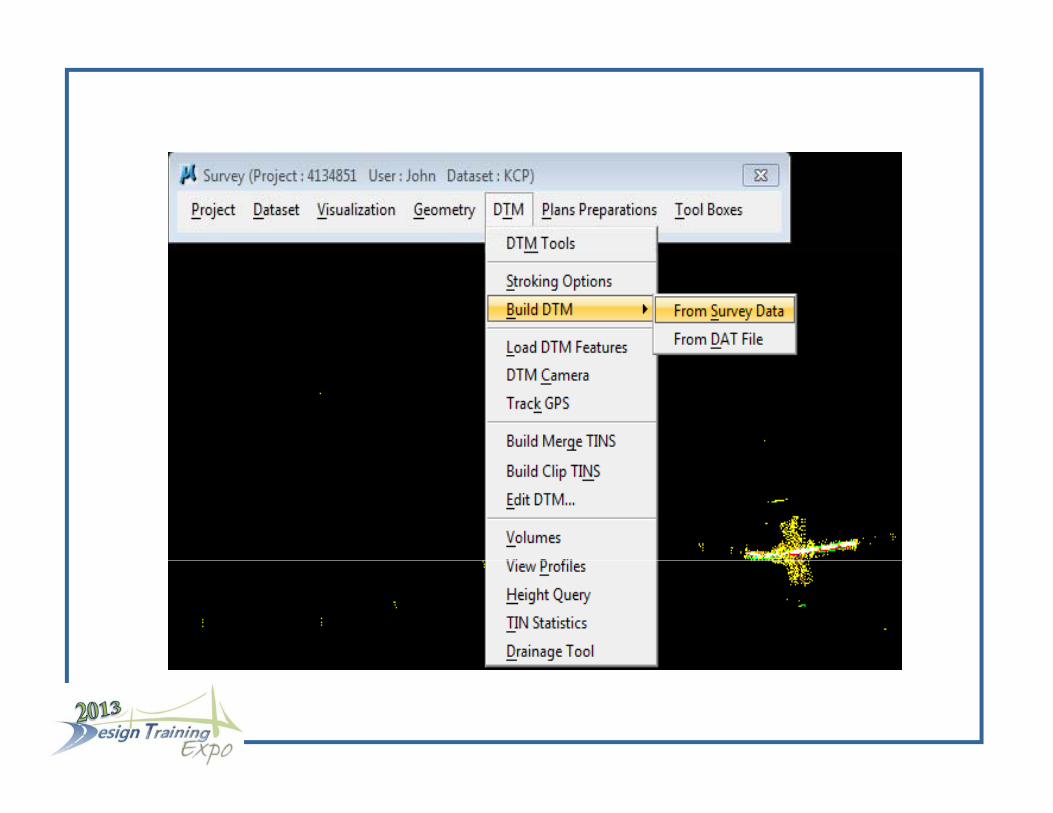
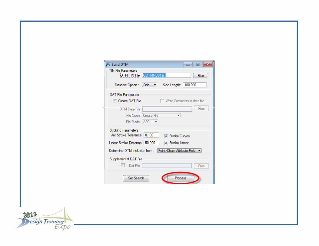
S f TIN Fil F S i D tSurface TIN File From Surveying Data
GEOPAK builds a TIN file from the Surveying Data
Select “Build DTM > From Survey Data”
Select “Set Search”
“Ch k M k” th D t t d l t “M D t il” “Check Mark” the Datasets and select “More Detail”
Use the “More Detail” dialogue box to query the i t tt ib t t b ild f TIN filappropriate attributes to build your surface TIN file
Hit the Process button to build the TIN file


Oth DTM S l ti S t f N tOther DTM Selection Sets of Note