Embed Size (px)
Citation preview

Physicai
Sci .Li
2^
C3
A3
N0.2nn
2California. Division of Minesand Geology, Bulletin.

II.G.D. JiilU^Wtf^Ai
Physical
ScLLib.
TIM
24
OB
A3
no. 200
OLOGY OF THE $,
.METROPOLITAN AREACALIFORNIA
Del Mar, La JoUa, Point Loma,
La Mesa, Poway, and SWV4 Escondido
7V2 minute quadrangles

THE LIBRARY
OF
THE UNIVERSITY
OF CALIFORNIA
DAVIS

o GEOLOGY OF THESAN DIEGO METROPOLITAN AREA, CALIFORNIAPrepared in cooperation witli the City of San Diego
SECTION AWESTERN SAN DIEGO METROPOLITAN AREADel Mar, La Jolla, and Point Loma 7V2 minute quadranglesby Michael P. Kennedy
SECTION B
EASTERN SAN DIEGO METROPOLITAN AREALa Mesa, Poway, and SWV4 Escondido 7V2 minute quadrangles
by Michael P. Kennedy and Gary L. Peterson
BULLETIN 200
1975
P
CALIFORNIA DIVISION OF MINES AND GEOLOGY1416 9TH STREET, ROOM 1341
SACRAMENTO, CA 95814
UCD LIBRARY(1)

STATE OF CALIFORNIAEDMUND G. BROWN JR., GOVERNOR
THE RESOURCES AGENCYCLAIRE T. DEDRICK, SECRETARY FOR RESOURCES
DEPARTMENT OF CONSERVATIONLEWIS A. MORAN, DIRECTOR
DIVISION OF MINES AND GEOLOGYTHOMAS E. GAY JR., ACTING STATE GEOLOGIST
\fn f
III
«
(^ »

CONTENTS
SECTION A - WESTERN SAN DIEGO METROPOLITAN AREA
ABSTRACT 9
INTRODUCTION 11
GEOLOGIC SETTING 13
PRE-EOCENE DEPOSITS 14
Santiago Peak Volcanlcs 14
Gabbro of the Southern California Bathollth 14
Rosario Group 15
Lusardi Formation 15
Point Loma Formation 15
Cabrillo Formation 15
EOCENE DEPOSITS 15
La Jolla Group 15
Mount Soledad Formation 16
Delmar Formation 16
Torrey Sandstone 16
Ardath Shale 18
Scripps Formation 18
Friars Formation 18
Poway Group 19
Stadium Conglomerate 19
Mission Valley Formation 19
Pomerado Conglomerate 19
FACIES RELATIONSHIPS OF THE EOCENE ROCKS 20
EOCENE BIOSTRATIGRAPHY 20
POST-EOCENE DEPOSITS 29
IVIiocene 29
Andesite Dike 29
Pliocene and Pleistocene 29
San Diego Formation 29
Lindavista Formation 29
Bay Point Formation 29
Pleistocene and Holocene Surficial Deposits 30
Stream-Terrace Deposits 30
Landslide Deposits 30
Alluvium and Slope Wash 35
Beach Deposits 35
Artificially Compacted Fill 35
STRUCTURE AND SEISMIC HISTORY 35
REFERENCES CITED 38
SECTION B - EASTERN SAN DIEGO METROPOUTAN AREA
ABSTRACT 43
INTRODUCTION 45
PRE-EOCENE DEPOSITS 45
Basement Complex 45
Santiago Peak Volcanics 45
Plutonic Rocks of the Southern California Bathoiith 47
Rosario Group 47
Lusardi Formation 47
EOCENE DEPOSITS 47
La Jolla Group 47
Friars Formation 48
Poway Group 48
Stadium Conglomerate 48
Mission Valley Formation 49
Pomerado Conglomerate 49
(3)

POST-EOCENE DEPOSITS 49Pliocene and Pleistocene Rocks 49San Diego Formation 49Llndavista Formation 50
Pleistocene and Holocene Surflclal Deposits 50Stream- Terrace Deposits 50Landslide Deposits 50Alluvium and Slope Wash 51
STRUCTURE AND SEISMIC HISTORY 51
MINERAL RESOURCES 53REFERENCES CITED 56
(4)

ILLUSTRATIONS
SECTION A - WESTERN SAN DIEGO METROPOLITAN AREA
Plate 1A. Geology of the Del Mar quadrangle In pocketPlate 2A. Geology of the La Jolla quadrangle In pocketPlate 3A. Geology of the Point Loma quadrangle In pocket
Photo 1. The San Diego coastal area and adjacent Peninsular Ranges provinceshowing boundaries of the Del Mar, La Jolla, and Point Loma quad-rangles 11
Photo 2. Unconformity between the Eocene and Upper Cretaceous rocks located300 meters north of Tourmaline Street in Pacific Beach, looking northeast 16
Photo 3. Small slump that has occurred within the Ardath Shale as a result of slopeundercutting and incompetent rock, looking southeast 30
Photo 4, Torrey Pines State Park landslide, looking east 30Photo 5. Landslides that have occurred as a result of oversteepened slopes associ-
ated with an erosional scarp, looking southeast along the Mount Soledadfault 31
Photo 6. Ancient landslide deposits underlain by rocks of the Upper CretaceousRosario Group on Point Peninsula, looking west 31
Photo 7. Fort Rosecrans landslide on Point Loma Peninsula, looking west 31Photo 8. Sunset Cliffs located on the northern part of the Point Loma Peninsula,
looking east 35
Figure 1, Index map 12Figure 2. Columnar section of the San Diego continental margin 13Figure 3, Diagrammatic sketch of the basement complex and superjacent strata. . 14
Figure 4. Block diagrams of the interrelationship between Eocene fades in the SanDiego coastal area 17
Figure 5. Model of transgressive and regressive deposition 21Figure 6. Relationship of biostratigraphy to lithostratigraphy 23Figure 7. Index map of fossil mollusk localities 24Figure 8. Index map of fossil calcareous nannoplankton localities 25Figure 9. Index map of fossil mammal localities 26
Table 1 . Clay mineral analyses 32
SECTION B- EASTERN SAN DIEGO METROPOLITAN AREA
Plate IB. Geology of the SW 1/4 Escondido quadrangle In pocketPlate 2B. Geology of the Poway quadrangle In pocketPlate 38. Geology of the La Mesa quadrangle In pocket
Figure 1 , Location map 46Figure 2. Columnar section of the San Diego continental margin 47Figure 3. Schematic diagram of lithostratigraphic variations in the Poway Group
and modern erosion surface 48
Table 1 . Atterberg limits and particle size distribution 52Table 2. Mines, quarries, and pits in the La Mesa, Poway, and SW 1/4 Escondido
quadrangles 54
(5)

<f
SECTION A
Del Mar, La Jolla,
and Point Lomaquadrangles
(#

ABSTRACT
The Del Mar, La Jolla, and Point Loma quadrangles are underlain by sedimentary rocks of
Late Cretaceous, Eocene, Pliocene, Pleistocene, and Holocene age that rest with angular un-
conformity on a Mesozoic metamorphic and plutonic rock basement complex. The Tertiary andQuaternary sedimentary succession was deposited unconformably on the Upper Cretaceous strata
In a northwest-trending basin herein referred to as the San Diego embayment. The most ahundant
rocksj3i_tlie-San^Diego embayment a^re gently folded and faulted Eocene marine, lagoonal and non-
marine rocks that form a northwest-trending, eastward-thinning section. These strata were laid
down upon the older rocks during a period of regional tectonic downwarping.
The jH:g-F"ne.ne rock s of the area from oldest to youngest belong to the Upper Jurassic San-
tiago Peak Volcanics. mid-Cretaceous southern California batholiih. and the Upper Cretaceous
Rosario Group. The Santiago Peak Volcanics are mildly metamorphosed and occur in the sub-
surface throughout most of the southern California continental margin but are exposed in only a
-few places within this area. The rocks consist of interlayered meta-andesite, meta-quartz latite,
meta-shale, tuff, slate, and quartzite. A meager marine molluscan fauna from the meta-shale in-
dicates a Late Jurassic (Portlandian) age. The Santiago Peak Volcanics are intruded by rocks of
the southern California batholith. The batholithic rocks that crop out in the mapped area are mostly
gabbros. These rocks are locally deeply weathered and difficult to distinguish from overlying non-
marine Eocene strata that have been largely derived from detritus of plutonic origin. Deformation,
uplift, and unroofing of the batholith occurred prior to the deposition of the Upper Cretaceous
clastic marine and nonmarine strata of the Rosario Group. The basal formation of the Rosario
Group is the Lusardi Formation, a nonmarine boulder fanglomerate that was deposited along the
western margin of the tectonic highlands upon the weathered surface of the plutonic and metamor-phic rock. Clasts in the Lusardi Formation are composed of locally derived basement rocks. Goodexposures of the Lusardi Formation occur approximately 16 kilometers (km) north of Del Mar and 6
km east of Carlsbad where the conglomerate is overlain by the middle part of the Rosario Group,
marine sandstone and siltstone of the Point Loma Formation. The Point Loma Formation is Cam-panian and Maestrichtian in age and underlies most of the Point Loma Peninsula and the hills
southeast of La Jolla. It is conformably overlain by the uppermost part of the Rosario Group, marine
sandstone and conglomerate of the Maestrichtian Cabrillo Formation.
Nine partially intertonguing middle and upper Eocene formations composed of siltstone, sand-
stoneT and conglomerate were deposited during two major transgressive-regressive cycles upon an
_erosional surface of mild relief following uplift and erosion of the Upper Cretaceous strata. The suc-
cession is in excess of 700 meters (m) thick and grades from nonmarine fan and dune deposits on
~\Ue east through lagoonal and nearshore beach and beach-bar deposits to marine continental shelf
deposits on the west near the present-day coastline. The age and environmental interpretation of
the rocks is based on the mapped distribution of the lithofacies and by presence of fossil
calcareous nannoplankton and foraminifers in the continental shelf succession, mollusks in the
nearshore rocks, and vertebrate land animals in the nonmarine sequence. Flame structures and
current ripple marks in the continental shelf deposits, cross bedding in the nearshore deposits, and
cobble imbrications and paleo-stream gradients in the deltaic, lagoonal, and fluviatile deposits
combined with their petrologic content indicate that the sediments were derived from local source
areas to the east.
The nonmarine facies of the Eocene formations are typically well indurated and cemented. The
lagoonal facies are soft, friable, and poorly cemented. The nearshore facies are well indurated, well
sorted, and locally concretionary. The marine deposits are typically fine grained, well indurated, and
well cemented.
Rocks of the Pliocene San Diego Formation, where preserved, rest unconformably upon the
Eocene strata. The San Diego Formation Is in turn overlain by the Lindavista Formation, a com-bin^atTorPoT nearshore marine, beach, and nonmarine strata composed mostly of sandstone and
cOrrglomerate. The Lindavista Formation was deposited on a broad wave cut terrace that extends
~acr5ss the entire width of the area. The late Pleistocene Bay Point Formation and Holocene sur-
ficial deposits complete the stratigraphic record.
(9)

Tectonic deformation within the area can be divided into two episodes: (1) pre- mid-Cretaceous,and (2) late Tertiary and Quaternary. The Santiago Peak Volcanics were chaotically deformed andpartly overturned during the first episode. The less deformed rocks that have been faulted and gen-tly folded by the later episode include those of Upper Cretaceous and later age. Sediments ap-
proximately 100,000 years in age have been vertically offset in excess of 20 m by youthful faults that
transect the area. The most prominent of these include the Rose Canyon. Mount Soledad. OldTown, and Point Loma faults. Speculation has been made in recent literature that the Rose Canyonfault is related to the active Newport-lnglewood structural zone on the north and the San Miguelfault in northern Baja California on the south. Forty-four earthquakes of Richter magnitudes bet-
ween 2.5 and 3.7 (M 2.5 and M 3.7) and having epicentral localities within the greater San Diegoarea have been recorded by the California Institute of Technology Seismological Laboratory since
1950. It has been shown that the area has had a strain release of between 1 and 16 equivalent
magnitude 3 earthquakes/400 km? for the 29-year period between 1934 and 1963.
Seismically triggered landslides have occurred in the sea cliffs at Point Loma, La Jolla, andTorrey Pines. Most of the mapped landslides, however, are gravity slides attributable to soft in-
competent material, ground water penetration, and oversteepened slopes.
Sand and gravel deposits useable for concrete, bituminous, and ceramic aggregate underlie a
large part of the area. Clay deposits useable for ceramics, fire clay, and expansible clay are also
abundant but have not been exploited. The clay deposits are widespread and closely associatedwith expansive soils and surficial landsliding.
(10)

Photo 1. The San Diego coastal area and adjacent Peninsular Range Province showing boundaries of the Del Mar, La Jclla, andPoint Loma quadrangles.
GEOLOGY OF THE WESTERN SAN DIEGO METROPOLITANAREA, CALIFORNIADel Mar, La Jolla, and Point Loma quadrangles
by Michael P. Kennedy"!
INTRODUCTIONIn 1965 the California Division of Mines and
Geology in cooperation with the City of San Diegobegan a comprehensive geologic investigation aimedat a better understanding of the geologic hazardsthat exist within the greater San Diego metropolitanarea (Kennedy, 1967, 1969). This report is oneproduct of that investigation and is complementedby a similar report on the La Mesa, Poway, andSWi/-* Escondido quadrangles (Kennedy and Peter-
son, 1975). Together the Del Mar, La Jolla, andPoint Loma quadrangles are approximately 350square kilometers (km^) in extent and constitute the
western part of the greater San Diego metropolitanarea (figure I and photo 1 ).
The western San Diego metropolitan area is un-
derlain by valuable sand, gravel, and clay resources
deemed feasibly extractable in today's market for
'Geologist, Californij 1 of Mines and Geology
use in the north county, Del Mar, La Jolla, Miramar,Lindavista and Point Loma areas. The are a is un- -
derlain primarily by sedimentary rocITiTiowever, oc-
casional outcrops of plutonic and metamorphicrocks do occur. Very small surficial landslides
(mostly unmapped due to scale of map) associated
with expansible clay deposits in the northern andeastern parts of the area are abundant. These land-_
slides are closely associated with the outcrops of
Friars and Dclmar Formations. The rock units map-ped and discussed herein are shown in diagram-matic relationship in figure 2.
Previous investigations that have beenespecially useful in this study include a groundwater investigation by A.J. Ellis (1919), a
stratigraphic and paleontologic thesis of the La Jolla
quadrangle by M.A. Hanna (1926), studies of the
Pliocene deposits of San Diego by L.G. Hertlein andU.S. Grant IV (I 939, 1944), a monograph on the
mineral resources of San Diego County by F.H.
(11)

CALIFORNIA DIVISION OF MINES AND GEOLOGY BULL. 200
^ y<> LAKE HODGES
^/h ^^AR'i !|3?T^^S.W. 1/4 ESCONDIDO QUADRANGLE
...'Tr "\ LZk^ p.,„„,.„ (PiQtelB
WOODSON MOUNTAIN
POWAYQUADRANGLE
-^ (Plate 2B)
/
QUADRANGLE(Plate 3B)
Figure 1. Index map stiowlng the location of the Del Mar, La Jolla. and Point Loma quadrangles.

1975 GEOLOGY OF THE SAN DIEGO METROPOLITAN AREA, CALIFORNIA 13
C»
COLUMNAR SECTION OF THE SAN DIEGO CONTINENTAL MARGIN
QbpI
'^''P- S°y Point Formation
Qin ••••I Qln, Lindovisto Formation
Tsd, Son Diego Formation
Tp, Pomerodo Conglomerate
Tmv, Mission Valley Formation
Tst, Slodium Conglomerate
Tf, Friars Formation
Tsc, Scripps Formotion
Ta, Ardoth Stiale
Tt, Torrey Sandstone
Td, Delmar Formation
Tms, Mount SoledodFormation
Kcss, Cabrillo Formation(sandstone part)
Kccg, Cabrillo Formation(conglomerate part)
Kp, Point Loma Formation
Kl, Lusardi Formation
Jsp, Santiago Peak Volcan
Kg, Granitic rocks of the
southern California
bathollth
Figure 2 Columnar section of the San Diego continental
margin.
Weber (1963), and the San Diego-El Centregeologic map sheet by R.G. Strand (1962).
The author would like to extend special thanks
to D.M. Morton and G.W. Moore of the UnitedStates Geological Survey for encouragement, help in
the field, and many valuable discussions pertinent to
this study. Acknowledgment is due also to M.O.Woodburne and M.A. Murphy of the University of
California Riverside and Professor A.O. Woodfordof Pomona College for long interest in this studyand enthusiastic help in the field and laboratory; to
D. Bukry, D.J. Golz, C.R. Givens, J. P. Kern, ED.Milow, W.J. Zinsmeister, and the late E.C. Allisonfor assistance in the paleontologic aspects; A.K.Baird for help in petrographic aspects; P.K. Morton,C.H. Gray, Jr., G.B. Cleveland, B.W. Troxel, F.H.Weber, Jr., Y.H. Smitter, R.G. Strand, G.L. Peter-
son, and J.I. Ziony for many interesting discussionsin the field and for reviewing the maps andmanuscript.
GEOLOGIC SETTING
Pre-Eocene rocks in the southern PeninsularRanges of California are subdivided into four majorunits. From oldest to youngest they include the Bed-ford Canyon Formation, Santiago Peak Volcanics,southern California batholith, and the RosarioGroup. Together these units form the basement
complex upon which the younger sedimentary suc-cession rests. See figure 2 and cross sections
A-A' (plate lA), B-B', C-C (plate 2A), and D-D"(plate 3A).
The Santiago Peak Volcanics (Black MountainVolcanics of Hanna, 1926) rest with angular un-
conformity on the Bedford Canyon Formation wherethe latter has been preserved. The Bedford CanyonFormation is not known to exist at the surface in
this area. In the Santa Ana Mountains to the north,
the Santiago Peak Volcanics have an exposed length
of 1 30 km (Larsen, I 948), and to the south they ex-
tend from the international boundary to near the
center of Baja California (Allison, 1964). They oc-
cur in the subsurface throughout most of the
southern California continental margin (Hertlein
and Grant, 1944; Gray et ai, 1971).
The Santiago Peak Volcanics have undergonemild metamorphism and have been intruded byrocks of the southern California batholith. Theplutonic rocks of the batholith that crop out in the
mapped area are gabbros, which have a steeply in-
clined contact with the older metamorphic rock.
The southern California batholith forms the
backbone of the Peninsular Ranges of southernCalifornia and Baja California and is nearly 1,500km in length extending from the Transverse Rangeson the north to the southern part of the Baja Califor-
nia peninsula on the south. The batholithic rockswithin the study area were named and described byLarsen (1948).
Deposition of Upper Cretaceous clastic marineand nonmarine strata followed the emplacement,uplift, unroofing, and deformation of the southern
California batholith (figure 3). The basal formation
of the clastic succession is the Lusardi Formation, a
nonmarine boulder fanglomerate that forms the base
of the Rosario Group. The Lusardi Formation waslaid down along the western margin of the tectonic
highlands and upon a deeply weathered surface of
the plutonic and metamorphic rock (Peterson andNordstrom, 1970). The clasts of the Lusardi For-
mation are composed essentially of these two rock
types, suggesting a local source area (Nordstrom,1970). The Point Loma Formation is the in-
termediate formation of the Rosario Group. It un-
derlies most of the Point Loma Peninsula and the
hills southeast of La Jolla and is conformablyoverlain by marine sandstone and conglomerate of
the Cabrillo Formation. The Cabrillo Formation is
the uppermost formation of the Rosario Group andis also exposed at Point Loma and La Jolla.
The pre-Eocene basement terrain is locally
decomposed to depths of 50 meters. In most areas
where Eocene rock rests directly on the basementrock, the early Tertiary surface (sub-La Jolla un-
conformity, figure 3) is marked by residual clay
deposits of montmorillonite that grade downward to
fresh basement rock and upward into the Eocenesedimentary rock. The decomposed granitic rock
and clay were primary sources of sediment for the
Eocene depositional basin and give rise to the
granitic appearance of the arkosic sandstone of
these sedimentary facies.

14 CALIFORNIA DIVISION OF MINES AND GEOLOGY BULL. 200
l^^-^l Rocks of Eocene and later age
L'^\y-\^ Rocks of the Rosario Group
I^S^xl Rocks of the southern California batholith
IW;V/| Rocks of the Santiago Peak Volcanics
Sub-La JollaPresent day unconformity
topography
Sub-Rosariounconformity
Intrusive contact betweenthe Santiago Peak Volcanics
and the southern California
batholith
Figure 3. Diagrammatic sketchof the basement complex and
superjacent strata.
PRE-EOCENE DEPOSITS
Santiago Peak Volcanics
The Santiago Peak Volcanics comprise an
elongate belt of mildly metamorphosed volcanic,
volcaniclaslic, and sedimentary rocks that crop out
from the southern edge of the Los Angeles basin
southward into Mexico. They were originally named"Black Mountain Volcanics" (Hanna, 1926, p. 199-
204) for exposures in the northeast part of the area.
Larsen (1948) substituted the name— Santiago PeakVolcanics— as the name "Black Mountain" was pre-
empted.
The volcanic rocks range in composition frombasalt to rhyolite but are predominantly dacite andandesite. The succession is typified by a widevariety of breccia, agglomerate, volcanicconglomerate, and tine-grained tuff and tuff breccia.
Highly silicified rock—probably tuff and a variety of
dark, dense, tine-grained hornfels—occur locally. In
the Del Mar quadrangle, fossil-bearing marinesedimentary rocks are interbedded with the volcanic
and volcaniclastic rocks. Included with the Santiago
Peak Volcanics are a number of small mildlymetamorphosed gabbroic to granodioritic plutonswhich arc considered to have been feeders for the
volcanics rather than parts of the southern Califor-
nia batholith.
The Santiago Peak Volcanics, which formelevated peaks immediately east of the area at BlackMountain, are hard and extremely resistant to
weathering and erosion. Most of the volcanic rocksarc dark greenish gray where fresh and weathergrayish red to dark reddish brown. The soil
developed on the Santiago Peak Volcanics is the
color of the weathered rock and s upports the growthof dense chaparral.
Age estimates for the Santiago Peak Volcanicshave ranged from Late Triassic (Hanna. 1926) to
mid-Cretaceous (Milow and Ennis, 1961 ). Fife et al.
(1967) reported latest Jurassic (Portlandian) fossils
from a marine clastic part of the succession near
Del Mar, and to date this constitutes the mostreliable age for these rocks in the San Diego area.
Gabbro of the
Southern California Batholith
Larsen (1948) named the batholithic rocks in
the San Diego coastal area the Woodson MountainGranodioriie, the Bonsall Tonalite, and the SanMarcos Gabbro. Though most of the plutonic rocksin proximity to San Diego are quartz diorite andgranodiorite, only gabbro crops out within this area.
The gabbro varies considerably in texture and com-position but generally is coarse grained and darkgray. The chief mineral constituents are calcic feld-
spar and pyroxene with minor amounts of quartz
and biotite.
Potassium-argon dates (Evernden and Kistler,
1970) from a gabbro located 20 km northeast of DelMar near San Marcos, and a quartz diorite located
10 km southeast of Escondido are, respectively, 101
and 105 million years. A lead-alpha date on zircon
from quartz diorite in the Woodson Mountain area,
20 km southeast of Escondido, is 105 ± 10 million
years (Bushee ct al. 1963).
Throughout most of its exposure, the gabbro is
weathered and difficult to distinguish from overlying
sedimentary formations, which are largely com-posed of weathered plutonic basement rock. Careful
examination for relict features, such as small quartz
veins, is necessary to distinguish the weathered rockfrom the overlying sedimentary strata.

1975 GEOLOGY OF THE SAN DIEGO METROPOLITAN AREA, CALIFORNIA 15
Rosario GroupThe Upper Cretaceous Rosario Group is com-
posed of clastic sedimentary rocks of marine andnonmarine origin assigned to the Lusardi, Point
Loma, and Cabrilio Formations.
Lusardi FormationThe basal formation of the Rosario Group, the
Lusardi Formation, was named by Nordstrom(1970) for exposures of boulder conglomerate near
the confluence of Lusardi Creek and the San
Dieguito River, 2 km north of the area in the RanchoSanta Fe quadrangle.
These rocks consist of cobble and boulder
conglomerate, with occasional thin lenses of
medium-grained sandstone. Some of the clasts are
10 m in diameter. The Lusardi Formation at the ex-
posures within the northeast quarter of the Del Marquadrarigle, and within theType'area to the north,
has a maximum thickness of 125 meters. At the
Holderness No. 1 well, 1 7 km southeast of the tip of
the Point Loma Peninsula, rocks considered to
belong to the Lusardi Formation are 82 m thick,
whereas at the Point Loma No. 1 well, 10 km north
of Point Loma, these rocks are 295-376 m thick
(Hertlein and Grant, 1944, p. 38). The Lusardi For-
mation at its type area is unconformably overlain byEocene rocks, but 16 km to the north near Carlsbad,
it is overlain conformably by siltstone and sand-
stone of the Point Loma Formation (Kennedy andMoore, 1971b).
The Lusardi Formation is considered to b e Late
Cretaceous in age because it contains quartz diorite
bouIdeHlleroded from the mid-Cretaceous southernCalifornia, batholith, which has a minimum age of
105± 10 million years (Bushee et al., 1963), and it
is overlain by the Point Loma Formation which con-tains Upper Cretaceous (Campanian) Foraminifera(Sliter, 1968).
The Lusardi Formation is lithologically
equivalent to the Trabuco Formation of the Santa
Ana Mountains on the north (Nordstrom, 1970), to
an unnamed fanglomerate near the base of the
Williams Formation, also in the Santa Ana Moun-tains (Morton, 1972, p. 39), and to the RedondoFormation of Flynn (I 970) in northern Baja Califor-
nia.
Point Loma Formation
The Point Loma Formation, the intermediate
part of the Rosario Group, crops out along the seacliffs on the west side of the Point L.oma Pemns4ila,
and in the La Jolla sea cliffs from Bird Rock to LaJoUa Shores Beach (plates 2A, 3A). At its type locality
at the tip of Point Loma, it has an exposed thickness
of 83 meters. The^ocks there are interbedded fine-
grained dusky-yellow sandstone and olive -gray clay
shale that occur in graded beds about 30 cen-
timeters (cm) thick.
Scuba-diving observations- 1860 m offshore
from the type locality show that ledgy pavement-likesandstone, similar to that in the lower half of the ex-
posed section, continues to a depth of at least 37 m
(Turner et al., 1 968, p. 8). With a shoreline dip of 6°
E., it is postulated that 190 m of section may be ad-
ded below low-tide level to the observed thicknessof the formation. This submarine information, com-bined with interpolation from well logs, suggeststhat the total thickness of the Point Loma Formationat its type locality is about 300 m (section D-D').
Fossil Foraminifera and calcareous nan-noplankton indicate a Late Cretaceous age for the
Point Loma Formation (filter, 1968; Bukry andKennedy, 1969). Foraminifera from near the base of
the formation at Carlsbad are middle to upper Cam-panian in age, whereas those from the uppermostbeds are lower Maestrichtian in age (Sliter, 1968).
The exposed part of the Point Loma Formationcorrelates with the Williams Formation and the up-
per part of the Ladd Formation in the Santa AnaMountains (Popenoe et at., 1960) and with the mid-dle part of Seal's (1924) Formacion Rosario in nor-
thern Baja California.
Cabrilio Formation
The Cabrilio Formation, the uppermost unit of
the Rosario Group, is exposed on the Point LomaPeninsula from the southern tip north to Sunset
Cliffs. At Pacific Beach in the sea cliffs, it is ex-
posed from 300 m south of False Point to Bird Rockon the north and at La Jolla in an S-shaped belt
around the noses of the Pacific Beach syncline andMount Soledad anticline. In the sea cliff at its type
section 250 m east of the new Point Lomalighthouse, it consists of massive medium-grainedsandstone and cross-bedded cobble conglomeratecontaining fresh plutonic and metavolcanic clasts
but lacking red porphyritic rhyolite-tuff cobblescharacteristic of nearby Eocene rocks.
Throughout the mapped area, the Cabrilio For-
mation conformably overlies the Point Loma For-
mation. The formation is 8 1 m thick at its type
locality, where it is uncontorrnaSTy overlain by
Pleistocene deposits. Along the sea cliff at False
Point, it has a thickness of 170 meters.
A clam from the east flank of Mount Soledadwithin the lower 5 m of the Cabrilio Formation has
been identified as "Pharella" alta (Gabb) and
assigned to the Maestrichtian (L. Saul, written com-munication, 1969). The Cabrilio Formationcorrelates with the upper part of the FormacionRosario of Beal (1924) in northern Baja California
and possibly with the upper part of the Williams
Formation in the Santa Ana Mountains.
EOCENE DEPOSITS
La Jolla GroupThe La Jolla Group (La Jolla Formation of
Hanna, 1926) ranges from moderately deep-water,
fine-grained siltstone, to sandy beach and lagoonal
facies, and coarse-grained continental sandstone
and conglomerate. Deep water fine-grained facies
predominate to the southwest, whereas the lagoonal

16 CALIFORNIA DIVISION OF MINES AND GEOLOGY BULL. 200
and continental facies are more abundant to the nor-
theast. These units include six partly intertonguing
and partially time equivalent formations, which fromoldest to youngest, are the Mount Soledad For-
mation. Delmar Formation, Torrey Sandstone, Ar-dath Shale. Scripps Formation, and Friars For-mation (figure 4).
Mount Soledad Formation
Southwest of the Rose Canyon fault, which in
Rose Canyon displaces rocks on its southwest side
(figure 4;plate 2A; section B-B' ). an Eocene marine
cobhic conglomerate and sandstone unit, designatedthe Mount Soledad Conglomerate (part of the RoseCanyon Shale Member of Hanna, 1926), rests un-conformably on Upper Cretaceous rocks of the
Cabrillo Formation. This formation crops out
around the Mount Soledad anticline in La Jolla andnorthern Pacific Beach and south of Mission Bay onthe southwest Hank of the Pacific Beach syncline
(plates 2A, 3A). Block diagrams 3, 5, and 6 (figure4)
show the stratigraphic relationship of the MountSoledad Formation and the overlying and partly in-
tertonguing Ardath Shale, Delmar Formation, andTorrey Sandstone. At its type locality on MountSoledad, the formation is 69 m thick and consists of
cobble conglomerate with minor beds of sandstone.The conglomerate content of the formation is
variable to the southeast where it is locally com-posed entirely of medium-grained sandstone. Theconglomerate commonly overlies similar UpperCretaceous conglomerate of the Cabrillo Formation.The presence of distinctive red porphyritic, sodarhyolite-tuff clasts in the Mount Soledad Formationdifferentiates it from the Cabrillo Formation. Thisdifference is easily seen at a sea-cliff exposure 300m northwest of the end of Tourmaline Street in
Pacific Beach where the two conglomerates are in
contact (photo 2). The sandstone is moderately well
sorted, subangular to subrounded, poorly indurated,and well bedded. It consists of quartz (75-80 per-
cent), potassium feldspar (20-25 percent).
'.yiii^^-i^^-'i.-.^-i-^'^;. '.«T-itaNS<rvT>,>, -><TSw?I^'*i'..-',<.',---iiiyor;:
Photo 2. Uncontormity between the Eocene and UpperCretaceous rocks located 300 meters north of TourmalineStreet in Pacific Beach, looking northeast. The Eocene rockscontain soda rhyolite-tuff clasts not found in the UpperCretaceous conglomerates
plagioclasc (1-2 percent), biotite (1-2 percent), anda trace of epidote, pyroxene, and hematite.
The Ardath Shale, conformably overlying the
Mount Soledad Formation, contains fossils whichare lower middle Eocene in age (Bukry and Ken-nedy, 1969). The Mount Soledad Formationcorrelates with the basal part of the Santiago For-
mation in the Santa Ana Mountains (Kennedy andMoore, 1971a).
Delmar Formation
The Delmar Formation (Delmar Sand Memberof Hanna, 1926) is exposed from the northern edgeof the area mapped for 9 km south to Soledad Valleywhere it is overlain by younger rocks(plate 1 A).Thestratigraphic relationship of the Delmar Formationwith the Mount Soledad Formation, Torrey Sand-stone, and Ardath Shale is shown in figure 4.
Most of the Delmar Formation is duskyyellowish-green sandy claystone interbedded with
medium-gray coarse-grained sandstone. Severalresistant beds composed of Ostrea idriaensis Gabband other brackish-water mollusks indicate a
lagoonal origin. The sandstone is typically com-posed of quartz (80-85 percent), potassium feldspar
(10-15 percent), plagioclase (1-2 percent), biotite
(2-3 percent), and a trace of hematite, topaz,
glauconite, and pyroxene. The claystone is com-posed of montmorillonite and kaolinite.
The base of the formation is not exposed but is
presumed to rest unconformably on UpperCretaceous or older rocks (section A-A' ) or con-formably on the Mount Soledad Formation as docorrelative formations to the north and south (sec-
tion B-B' ). In its type section near the town of DelMar and throughout the area, it is overlain
gradationally by the Torrey Sandstone, with which it
is also partly equivalent (figure 4). In the subsurface15 km north near Carlsbad, the Delmar Formationgrades into the Santiago Formation, and its boun-dary with the Santiago Formation occurs directly
below the northernmost depositional limit of the
overlying Torrey Sandstone (Kennedy and Moore,1971a).
The Delmar Formation is considered to be mid-dle Eocene in age because it is correlative in part
with the Mount Soledad Formation on the south, the
Santiago Formation on the north, and contains a rich
Domcngine molluscan assemblage.
Torrey SandstoneThe Torrey Sandstone (Torrey Sand Member of
Hanna, 1926) crops out continuously from the nor-
thern boundary of the area 12 km south to TorreyPines Golf Course and inland about 10 km (plates 1 A,2A). It has a maximum thickness of 60m and is com-posed of arkosic sandstone which is white to light
brown, medium to coarse grained, subangular, andmoderately well indurated. It is massive and broadly
cross-bedded. The sandstone consists of quartz (85-
90 percent), orthoclase (5-10 percent), plagioclase
(less than 1 percent), biotite (1-5 percent), and a
trace of hematite, epidote, zircon, tourmaline,
pyroxene, and amphibole. At the type section at

1975 GEOLOGY OF THE SAN DIEGO METROPOLITAN AREA, CALIFORNIA 17
Cretaceousond
Juro$$ic
nlrali nlI 1 ^ ti-J ^U. 1 1 p
dnojt) o||op on
^\

CALIFORNIA DIVISION OF MINES AND GEOLOGY BULL. 200
Torrey Pines grade on Highway 101, the contactwith the underlying Deimar Formation consists of
an alternating gradation between white sandstonebeds above the dusky yellow-green t'ossiliferous
claystone beds below. Approximately 13 km to the
north, the Torrey Sandstone grades into and is
overlain by the Santiago Formation. In SoledadValley the lower part grades into and is overlain bythe Ardath Shale and the upper part by the ScrippsFormation (Kennedy and Moore, 1971a). Thedistribution and stratigraphic relationship of the
Torrey Sandstone with respect to its related facies is
shown in figure 4.
The Torrey Sandstone is believed to have beendeposited along a submerging coast on an arcuatebarrier beach that enclosed and then later tran-
sgressed over Deimar lagoonal sediments. Its
deposition was arrested when submergence slowedand the shoreline retreated. Although the TorreySandstone contains only a few poorly preservedfossils and fossil casts, its middle Eocene age is fir-
mly established by its interfingering relationshipwith the well-dated Ardath Shale.
Ardath Shale
The Ardath Shale (part of the Rose CanyonShale Member of Hanna, 1926) crops out along the
sea cliffs from Bathtub Rock in Torrey Pines State
Park, south to the pier at Scripps Institution ofOceanography, where it is overlain by Pleistocenedeposits (plates 1 A, 2A). From Rose Canyon it can betraced south to the northeast corner of Mission Bay,where it is overlain by younger rocks. In the nor-thwest corner of the area, it thins below the ScrippsFormation as it grades into the Torrey Sandstonebelow. The stratigraphic relationship between the
Ardath Shale and formations with which it in-
terfingers is illustrated in figure 4. The Ardath Shaleis predominantly weakly fissile, olive-gray shale.
Concretionary beds containing molluscan fossils are
common. Expansible claystone locally comprises as
much as 25 percent of the unit and landslides are
commonly associated with those areas. Sieveanalyses indicate that the particle size distribution
is 81 percent silt, 16 percent clay, and 3 percentsand. The clay is mostly kaolinite but mont-morillonite is also present. The sand consists ofquartz (70-75 percent), potassium feldspar (15-20percent), biotite (5-10 percent), plagioclase (less
than I percent), and a trace of zircon, tourmaline,pyroxene, and amphibole.
The base of the Ardath Shale is not exposed at
its type section in Rose Canyon (Kennedy andMoore, 1971a), but underlying outcrops at the typelocality of the Mount Soledad Formation, 1 km to
the west, reveal the contact on the Mount SoledadFormation to be conformable. The Ardath Shale is
estimated to be 70 m thick at its type locality. It
grades alternatingly and conformably into the
overlying Scripps Formation.
Abundant fossils, including mollusks andcalcareous nannoplankton, permit an assignment ofthe Ardath Shale to the lower middle Eocene (Bukryand Kennedy, 1969). The unit correlates with the
basal part of the Torrey Sandstone and with the mid-dle part of the Santiago Formation.
Scripps Formation
The Scripps Formation (part of the RoseCanyon Shale Member of Hanna, 1926) underliesmuch of the area from east of Del Mar on the northto the mouth of Mission Valley on the south (plates
I A-3A). Along the coast, it extends from the middleof Torrey Pines Park to Scripps Institution ofOceanography. The type section of the Scripps For-mation is 1 km north of Scripps Pier, on the northside of the mouth of Blacks Canyon (Kennedy andMoore, 1971a). Here it consists of 56 m of paleyellowish-brown, medium-grained sandstone andoccasional cobble-conglomerate interbeds. Thesandstone is composed of subangular grains ofquartz (75-80 percent), potassium feldspar (15-20percent), biotite (2-5 percent), plagioclase (less than1 percent), and a trace of epidote, pyroxene, tour-
maline, sphene, and apatite. Both the basal contactwith the Ardath Shale and the upper contact w ith the
Friars Formation are conformable. Figure 4
illustrates the stratigraphic relationship between the
Scripps Formation and related facies. Severaltongues belonging to the Scripps Formation occur in
the section. The largest of these is mapped in the
vicinity of Sorrento Valley (plate lA).
Fossils are present but are less common in the
Scripps Formation than in the underlying ArdathShale. Because of its close conformity and partial in-
tcrgradation with the Ardath Shale, the Scripps For-mation is considered to be middle Eocene. To the
north near Encinitas it correlates with the upper part
of the Torrey Sandstone and, farther to the north in
the Santa Ana Mountains, with the middle part ofthe Santiago Formation.
Friars Formation
The middle and late Eocene Friars Formation(part of the Rose Canyon Shale Member of Hanna.1926) is the uppermost unit of the La Jolla Group.The rocks are nonmarine and lagoonal sandstoneand claystone named for exposures along the northside of Mission Valley near Friars Road in the LaJolla quadrangle (Kennedy and Moore. 1971a). Thesandstone is composed of quartz (75-80 percent),
potassium feldspar (10-15 percent), biotite (5-10percent), plagioclase (less than 1 percent), and a
trace of amphibole. pyroxene, hematite, and tour-
maline. The claystone is composed of mont-morillonite and kaolinite. Friars Formation is
predominantly a nonmarine and nearshore marinefacies which reaches a maximum thickness of 50 mbetween Mission Valley and Carmel Valley. Thesandstone is typically massive, yellowish gray,
medium grained, and poorly indurated withsubangular to subrounded grains. Caliche-rich sand-stone beds are locally interlayered with darkgreenish-gray sandy claystone. Cobble conglomeratelenses and tongues of Huviatile origin are charac-teristic of the easternmost exposures. The Friars
Formation rests unconformably on rocks of the
basement complex and conformably on the Scripps

1975 GEOLOGY OF THE SAN DIEGO METROPOLITAN AREA, CALIFORNIA 19
Formation. It is in turn overlain by other sedimen-tary deposits of Eocene, Pleistocene, and Holoceneage. The Friars and Delmar Formations are
lithologicaiiy identical in their central and nor-
theastern exposures, and they have been un-
differentiated in these areas on the geologic map.
The stratigraphic relationship between the
Friars Formation and related facies is diagram-
matically illustrated in figure 4.
Poway GroupThe Poway Group (Poway Conglomerate of
Hanna, 1926) includes three partly intertonguing
and partially time equivalent formations, the
Stadium Conglomerate, the Mission Valley For-
mation, and the Pomerado Conglomerate. Theserocks are primarily nonmarine in their easternmostexposures and nearshore marine and lagoonal in
their westernmost exposures.
Stadium ConglomerateThe type section of the Stadium Conglomerate
lies near the boundary between the La Jolla and LaMesa quadrangles along the northern wall of
Mission Valley near San Diego Stadium (Kennedyand Moore, 1971a). At the type section the for-
mation consists of a massive cobble conglomeratewith a dark yellowish-brown coarse-grained sand-stone matrix. The conglomerate contains dispersedlenses of fossiliferous crossbedded sandstone. Thefossils include calcareous nannoplankton of late?
Eocene age.
The Stadium Conglomerate is moderately well
sorted with an average clast size in the cobble range.
Clasts having diameters as large as .05 m do occurbut are rare. The sandstone matrix constitutes less
than 20 percent of the unit, but in local stratigraphic
sections individual sandstone beds and lenses con-stitute 50 percent of the unit.
The highly distinctive "Poway" clasts that occuronly within Cenozoic deposits of southern Califor-
nia and that typify the Stadium Conglomerate con-sist predominantly (up to 85 percent) of slightly
metamorphosed rhyolitic to dacitic volcanic andvolcaniclastic rocks and up to 20 percent quartzite.
The source area for these clasts is controversial,
and potential sources from the Mojave Desert to
Sonora, Mexico, have been proposed (DeLisle etal.,
1965; Merriam, 1968; Woodford et al.. 1968;Minch, 1972). Based on direction of pinching andcobble imbrication, the clasts within the StadiumConglomerate were deposited within the San Diegoembayment by a westward-flowing river system.Based on clast size the conglomerates wereprobably derived from a now eroded source within
150 km of their present position (Kennedy, 1973a).
The Stadium Conglomerate is conformably un-derlain by the Friars Formation and is conformablyoverlain by the Mission Valley Formation. Thestratigraphic relationship between the StadiumConglomerate and genetically related Eoceneconglomerate to the east is shown in figure 4.
Mission Valley Formation
The Mission Valley Formation, a predominan-tly marine sandstone unit, lies conformably upon the
Stadium Conglomerate and is in turn conformablyoverlain by the Pomerado Conglomerate. It has a
maximum thickness of 60 m and was named for ex-posures along the south wall of Mission Valley onthe west side of State Highway 163 (Kennedy andMoore, 1971a). The sandstone is characteristically
soft and friable, light olive gray, fine to mediumgrained, and composed mostly of quartz andpotassium feldspar. The grains are subangular to
subrounded and locally range in size from coarse to
very fine sand. Plagioclase and biotite are also
present but generally constitute less than 2 percent
each. Cobble conglomerate tongues within the
Mission Valley Formation, similar to StadiumConglomerate, comprise up to 30 percent of sec-
tions measured in the easternmost exposures of the
area but less than 1 percent of sections measuredalong the westernmost outcrops.
Because of the friable nature of the MissionValley Formation, it lacks the bold topographic ex-
pression displayed by the Stadium Conglomerate.Interbeds and tongues of claystone of brackish
water origin locally compose 20 percent of the sec-
tion. The clay is primarily montmorillonile but
kaolinite is also present. The Mission Valley For-
mation thins from the west to the east (figure 4) andpinches out in the eastern part of the Poway and LaMesa quadrangles. The rocks are often fossiliferous
and contain a molluscan fauna in the western andcentral exposures and a land-mammal fauna in the
eastern exposures. One molluscan assemblage,collected from the uppermost beds of the formation
in a road cut 200 m due east of the Miramar Reser-
voir filtration plant (elevation 238 m) at Lat. 32°
54.8' N.; Long. 117° 05.7" W., is reported by C.R.
Givens (written communication, 1970) to be charac-
teristic of the upper Eocene (Tejon Stage) andcorrelative with the upper Eocene of Europe.
Pomerado Conglomerate
The Pomerado Conglomerate, the uppermostft)rmation of the Poway Group, has a maximumthickness of 55 meters. It was named for exposureslocated at the divide between Carroll Canyon andPoway Valley along Pomerado Road east of the area
in the Poway quadrangle (Peterson and Kennedy,1974). The Pomerado Conglomerate is late Eocenein age and is a massive cobble conglomeratelithologicaiiy identical to the StadiumConglomerate. The contact between the MissionValley Formation and Pomerado Conglomerate is
conformable and gradational. The PomeradoConglomerate is characterized by occasional thin
beds, lenses, and tongues of light-brown medium-grained sandstone. One of the largest of these,
which crops out east of the area near MiramarReservoir in the Poway quadrangle, is designatedthe Miramar Sandstone Member (Peterson and Ken-nedy, 1974). Lithologicaiiy the Miramar SandstoneMember is identical to the Mission Valley For-mation but is stratigraphically higher and wholly

20 CALIFORNIA DIVISION OF MINES AND GEOLOGY BULL. 200
contained within the Pomerado Conglomerate. It has
a maximum thickness of 10 m in its type area and is
considered to be late Eocene in age based on its
superpositional relationship with the PomeradoConglomerate and Mission Valley Formations.
FACIES RELATIONSHIPS OFTHE EOCENE ROCKS
The Eocene rocks of the San Diego embaymentwere laid down on a narrow continental shelf andadjacent margin that extended northwest andsoutheast for more than 50 kilometers. Subsidenceof the basin and repeated change in sediment tlux
resulted in alternating advances and retreats of the
shoreline. The advances are recorded by the
deposition of time-lransgressive rock units and the
retreats by their time-regressive counterparts (Ken-nedy, 1971; 1973).
Nonmarine lagoonal and nearshore marinefacies were deposited on the east and marine con-
tinental shelf facies on the west side of the SanDiego embayment. There are two lithostratigraphic
groups divided into nine intertonguing formations
that together are approximately 700 m thick. Theformational names are those of Kennedy and Moore(1971a) and Peterson and Kennedy (1974).
y- The two groups are the La Jolla and Poway. The/^ La Jolla Group is slratigraphically lower and lies
/ predominantly west of the Poway Group. Deltaic
conglomerate and sandstone, lagoonal sandstone/ and claystone, beach sandstone, and marine shale
/ constitute the La Jolla Group. Deltaic conglomerate\ and sandstone, lagoonal sandstone, and littoral
sandstone and siltstone comprise the Poway Group./ Figure 4 illustrates the interrelationships of the
rocks and the contact between the groups.
Deposition occurred continuously in the San' Diego embayment for a period of nearly 10 million
years during which time the regional tectonic down-warping of the basin took place. The subsidence is
marked in the stratigraphic record by two prominentmarine transgressions and two intervening
/^egressions.
There are two somewhat conflicting hypothesesused to explain the development of cyclic sedimen-tation of this type (Sears et al.. 1941). The cyclic
stratigraphic succession that forms by either of the
two is an intertonguing sequence of strata havingtime regressive and transgressive parts (i.e., marine,littoral, beach, nonmarine) that grade laterally andvertically with respect to each other.
One hypothesis or model, which has been rejec-
ted for the development of the San Diego em-bayment, involves alternating upward and downwardmovement of the marine basin and adjacent con-tinental land mass to create the necessary change in
sea level. The erosion of previously depositedmaterials by waves, during times when uplift oc-
curred faster than sedimentation, would have
removed parts of the cyclic facies. The cycles in the
San Diego embayment are gradational, complete,and considered to have originated under different
conditions. (^
Another model, and the one suggested for the
development of the Eocene facies here, is basedupon continuous subsidence of the sedimentarybasin with changes occurring in both the rate of sub-sidence and rate of sedimentation. Regressivedeposits are formed by the slowing of subsidenceand/or an increase in sedimentation which creates
the outward building of the shoreline andshallowing by infilling of the basin. During periods
of more rapid subsidence and/or the slowing ofsedimentation rate, the basin deepens and tran-
sgressive deposits are laid down.
Figure 5 is a diagrammatic illustration of the
second model. Beginning at the top of figure 5 with
diagram A, subsidence is occurring at a rapid rate
with respect to sediment influx. This shows the
initial development of the lagoon, beach, and near-
shore deposits. Diagrams B and C illustrate later
time but with continued conditions as representedby A. Note that these units are time-transgres'sive
and that sea level has advanced over the old land
surface. Beginning with diagram D either a slowing
in the rate of subsidence has occurred or the
sedimentation rate has increased or both. As a
result of this change, the first regressive deposits
are formed and the shoreline retreats.
A period of rapid subsidence and high sediment-
ation marks the beginning of the first transgression,
recorded by the deposition of the Delmar For-
mation, Torrey Sandstone, and Ardath Shale. Thesesediments transgressed eastwardly over and beyondthe Mount Soledad Formation into pre-Eocenebasement rock (section B-B'). The Ardath Shale
rests conformably upon the Mount Soledad For-
mation at the type section of the Mount SoledadFormation located 600 m east of Easter Cross in LaJolla. The Torrey Sandstone rests gradationally
upon the Mount Soledad Formation at the base of
Indian Trail in the sea cliffs 3300 m north of
Scripps pier and at the intersection of Carmel Valley
and Soledad Valley (plate lA). The conglomerateshown within the lower Delmar Formation is con-sidered to represent the transitional facies betweenthe Delmar and Mount Soledad Formations.
As shown in figure 4 and plates 1 A-3A ,the tran-
sgressive nature of these stratigraphic units is in-
dicated by their superpositional and lateral relation-
ship. The lagoonal deposits are predominantly low
in the section and lie to the east and northeast of the
beach-bar and marine deposits. The beach andbeach-bar deposits grade laterally eastward anddownward into lagoonal deposits and westward andupward into marine deposits. Marine deposits are
high in the section and lie to the west of the beach
and lagoonal deposits.
A slowing in subsidence and/or an increase in
sedimentation to a degree that allowed infilling of
the embayment at a greater rate than subsidencemarks the beginning of a retreating shoreline andthe development of regressive deposition.

1975 GEOLOGY OF THE SAN DIEGO METROPOLITAN AREA, CALIFORNIA 21
1
22 CALIFORNIA DIVISION OF MINES AND GEOLOGY BULL. 200
As shallowing occurred the lagoonal. beach,
and marine deposits migrated westward creating a
reversal in their superpositional relationship (figure
4), Again the lagoonal rocks lie predominantly onthe cast and marine rocks predominantly on the
west, but the regressive lagoonal rocks comprise the
upper part of the stratigraphic sequence and the
marine rocks the lower part.
The regressive lagoonal equivalent of the tran-
sgressive Delm.'r Formation is the Friars Formationand that of the beach-bar Torrey Sandstone is the
Scripps Formation. The Ardath Shale also has a
trangressive and regressive phase; however, thesehave not been separated, as they constitute a con-tinuous section that is lithologically homogeneous.
Interbeds, tongues, and lenses of cobbleconglomerate composed of exotic tuffaceous clasts,
mostly of rhyolitic composition, and the primarysediment of a significant westwardly or nor-
thwestwardly flowing river system are abundant in
this part of the section. The direction of transport is
indicated primarily by cobble imbrication andpaleostream channel mapping (Minch. 1972). In the
central and eastern part of the embayment, thick
deposits of these clasts form the Stadium andPomerado Conglomerates.
Renewed subsidence and/or a slowing ofdeposition marked a second transgressive cycle androcks of nearshore marine and nonmarine origin
were laid down. The transgressive nature of the
strata can be detected by the superpositional andgradational relationship between and within the
Mission Valley Formation and the StadiumConglomerate. The Mission Valley Formation is the
continuum and regressive equivalent of the ScrippsFormation (figure 4).
A final regressive conglomerate unit, the
Pomerado Conglomerate (figure 4), has been preser-ved high in the stratigraphic succession. One shortperiod transgression marked by the Miramar tonguenear the Miramar Reservoir in the Powayquadrangle is the uppermost marine sandstone of
the column.
of the Tertiary mammal chronology can be directly
compared with invertebrate chronologies (figure 6).
Four major fossil groups have been collected
from the Eocene rocks of the San Diego embayment.These include I) mammals, 2) mollusks, 3)
calcareous nannoplankton, and 4) Foraminifera(figures 7-9).
1) Mammalian fossils were collected from the Ar-
dath Shale, Friars Formation. StadiumConglomerate, and Mission Valley Formation. Thecollection has been studied (Golz. 1971, 1973) andfound to be correlative In its stratlgraphically up-
permost part with the North American Uinta CMammal Age and in Its lowest part with Bridgerian
Mammal Age.
2) Molluscan fossils were collected from MountSoledad Formation. Delmar Formation, Torrey Sand-stone. Ardath Shale. Scripps Formation. Friars For-
mation, and Mission Valley Formation, The fossils
have been correlated, using West Coast (Califor-
nia) Molluscan Stages, with the Tejon Stage in the
stratlgraphically uppermost part of the section, the
"Transition Stage" in the intermediate part, and the
Domengine Stage in the lower part (Hanna. 1926;
Moore, 1968; C. R. Givens, written communication.1973).
3) Calcareous nannoplankton have been collected
from the Ardath Shale. Scripps Formation, StadiumConglomerate, and Mission Valley Formation. Theflora in the stratlgraphically lowest part of the sec-tion IS indicative of the middle Eocene. Lutetian
Stage of Europe (Bukry and Kennedy. 1969). Theflora from the uppermost beds collected is sparse
and is questionably correlative with the lower part
of the upper Eocene (D. Bukry. written com-munication, 1971).
4) Foraminifera have been collected from the Ar-
dath Shale. Scripps Formation, Friars Formation,
and Stadium Conglomerate. The fauna from the
stratlgraphically uppermost part of the section hasbeen reported by Mallory (1959) to be correlative
with his Narizian Stage (late Eocene age) and that
from the lower part of the section with his Ulatlsian
Stage (middle Eocene age). Stelneck and Gibson(1971) have studied Foraminifera from both the Ar-
dath Shale and Stadium Conglomerate and report a
middle Eocene and late middle Eocene age respec-tively.
EOCENE BIOSTRATIGRAPHYThe Eocene lithostratigraphic succession
discussed in the preceding pages contains fossil
organisms representative of deep water marine, lit-
toral marine, lagoonal, and nonmarine fluviatile en-vironments. These fossils together indicate that the
boundary between the middle and late Eocene lies
lies near the boundary between the La Jolla andPoway Groups in the central exposed part of the SanDiego embayment and that the middle and late
Eocene boundary falls within the Uintan MammalAge (Golz and Kennedy, 1971). This is later,
relative to the base of the Uintan, than originally
proposed (Wood et al.. 1941). The Eocene suc-cession of the San Diego embayment is presently theonly place known in North America where this part
The discussion that follows establishes the
fossil composition of each of the ninelithostratigraphic units within the Eocene San Diegoembayment and relates the West Coast (California)
molluscan stages to the North American MammalAges and these two chronologies to the Eocene of
Europe by way of correlations based on planktoniccalcareous nannoplankton zones.
A relatively rich molluscan assemblage hasbeen collected from the middle part of the MountSoledad Formation at localities I and 2 (figure 7;
(plates 2A, 3A). These localities combined are repre-
sented by M I in figure 6. The assemblage from these
localities includes TurriiclUi iivasana iippliniw Hanna,Ficopsis coopcriiina Stewart, and Tejonia lajollacnsis
(Stewart), all of which are restricted to the middleEocene Domengine Stage of California (Givens,1974).

1975 GEOLOGY OF THE SAN DIEGO METROPOLITAN AREA, CALIFORNIA 23
GEOLOGICCOLUMN

24 CALIFORNIA DIVISION OF MINES AND GEOLOGY BULL. 200
^
Figure 7. Index map of fossil mollusk localities. (See plates 1A-3A and plate 2B (Kennedy and Peterson. 1975) for detailed locations.]

1975 GEOLOGY OF THE SAN DIEGO METROPOLITAN AREA, CALIFORNIA 25
Figure 8. Index map of fossil calcareous nannoplankton localities. (See plates 1A, 2A and plate 2B, 3B (Kennedy and Peterson, 1975)
for detailed locations.)

26 CALIFORNIA DIVISION OF MINES AND GEOLOGY BULL. 200
^LACM 65190
UCMP V687I
vUCMP V6893
Figure 9. Index map of fossil mammal localities. (See plates 1A. 2A and plate 3B (Kennedy and Peterson, 1975) for detailed locations.)

1975 GEOLOGY OF THE SAN DIEGO METROPOLITAN AREA, CALIFORNIA 27
Fossil mollusks, calcareous nannoplankton,
mammals, and Foraminifera have been collected
from the Ardath Shale. The molluscan fauna wascollected from localities 6 through 16 (figure 7;
plates lA,2A).The localities combined are indicated
by M3 in figure 6. The calcareous nannoplanktonflora was collected from localities 1 through 1 1
(figure 8 ; plates 1 A,2A). These localities combined are
indicated by Nl in figure 6. Fossil mammals have
been collected from Los Angeles County Museumlocalities LACM 6673, LACM (CIT) 456, and
LACM 1401 and from the University of California,
Berkeley, locality UCMP V6884 (figure 9; plates 1 A,
2A). These localities are combined in figure 6 as
VI. Foraminifera have been collected from the
Ardath Shale at a locality 1.5 km north of its type
section in Rose Canyon (Steineck and Gibson, 1 971 ).
This locality is indicated by Fl in figure 6.
The molluscan assemblage collected includes
Turritella uvasana applinae Hanna, f(copii.9 cooperiana
Stewart, and Tejonia lajollaensis (Stewart), all of
which are restricted to the Domengine Stage of
California (Givens, 1974). Calcareous nan-noplankton from localities 6 through 9 occur at the
same stratigraphic interval as mollusks fromlocalities 10 and 11. Nannoplankton locality 9
(figure 8;plate 2A), locality L 1 3 of Bukry and Ken-nedy (1969), yields fossils indicative of an early
middle Eocene age (Discoaster sublodoensis zone).
These include Coccolithus eopelagicus (Bram\ene andRiedel), Coccolithus pelagicus (Wallich), Helicopon-
tospaera seminulum lophota (Bramlette and Sullivan),
Discoaster distinctus Martini, and Discoaster bar-
hadiensis Tan. Calcareous nannoplankton, also of
early middle Eocene age {Discoaster sublodoensis
zone), were collected from locality 1 1 (figure 8;
plate 2A) in Rose Canyon from the type section of
Hanna's (1926) Rose Canyon Shale Member.Steineck and Gibson (1971, p. 477) collected fromthis same locality and reported that the "occurrence
of Subhotina patagonica Todd in both the RoseCanyon Shale and Cozy Dell Formation suggests
time-equivalence of the two units (early middleEocene in age)."
The fossil mammals collected from the Ardath
Shale have been reported by Golz (1973) to be of
Uinta A or Bridgerian Age. However, since these
land animals were transported to a marine
depositionai environment, it is possible that they are
older than the early middle Eocene rocks in which
they lie.
The Ardath Shale is conformably andgradationally overlain by richly fossiliferous rocks
of the Scripps Formation. Fossil mollusks werecollected within the stratigraphically lower and in-
termediate part of the Scripps Formation from
localities 17 through 23 (figure 7; plates 1 A, 2A) and
are indicated together as M4 in figure 6. Molluskswere also collected from the upper part of the
Scripps Formation near its contact with the Friars
Formation at localities 24 and 25 (figure 7; plate 2A)and are indicated together as M5 in figure 6.
A molluscan assemblage from a conglomerateat the base of the Scripps Formation 400 m north of
its type section at locality I 7 (figure 7; plate 1 A) in-
cludes Turritella andersoni lawsoni Dickerson,Turritella uvasana applinae Hanna, Tejonia lajollaensis
(Stewart), and Ficopsis cooperiana Stewart. Thesefossils together indicate a Domengine Age (Givens,
1974). An assemblage from locality 25 (figure 7;
plate 2A) 20 m below the contact between the Scripps
Formation and the overlying Friars Formation about400 m west of the type section of the Friars includes
Nekewis io (Gabb) and Ectinochilus conalifer
supraplicatus (Gabb). The upper part of the Scripps
Formation based on the co-occurrence of these
species is considered to belong to the "Transition
Stage" and to be middle or late Eocene in age (C. R.
Givens, written communication, 1973).
The Scripps Formation is in part laterally
equivalent to and in part conformably overlain by
rocks of the Friars Formation. Mollusks werecollected within the Friars Formation from near the
gradational boundary with the underlying Scripps
Formation at localities 26 and 27 (figure 7; plate 2A).
These localities, combined because of their close
stratigraphic proximity to locality 24 and 25, also
are indicated by M5 in figure 6. The mammal fauna
was collected from seven localities in the MissionValley-Mission Gorge region. These include the
University of California, Riverside, localities UCRRV 7046, RV 67112, RV 7047, RV 7049, RV7050, RV 68151, and RV 68152; University of
California, Berkeley, localities UCMP V6872, V6873, and V6888; and Los Angeles County Museumlocalities LACM (CIT) 250 and 314 (figure 9;
Kennedy and Peterson, 1975, plate 38 ). Theselocalities together are indicated by V2 in figure 6.
The molluscan fauna collected includes Nekewis
io (Gabb) and Ectinochilus canalifer supraplicatus
(Gabb). These species together suggest that the
lower part of the Friars Formation belongs to the
"Transition Stage" and is middle and late Eocene in
age (Givens, 1 974).
The mammalian fauna collected from the Friars
Formation has been studied by Golz (1973). Hereports that the stage of evolution of the artiodactyl
fauna from the Friars Formation in the upper
Tecolote Creek and Mission Valley-Mission Gorgearea is indicative of Uinta B Age.
Fossil calcareous nannoplankton, mammals,and planktonic Foraminifera have been collected
from the Stadium Conglomerate. The nannoplanktonwere collected from a siltstone interbed at locality
14 (figure 8;plate 3B, Kennedy and Peterson, 1 975)near the intersection of Murphy Canyon and
Mission Valley. This locality is indicated as N2 in
figure 6. The mammalian fauna was collected from
Los Angeles County Museum locality LACM 1723
and from University of California, Berkeley, locality
UCMP V6840(figure9; plate3B, Kennedy and Peter-
son, 1975). Together these localities are indicated
as V3 in figure 6. The Foraminifera were collected
from nannoplankton locality 14 by Steineck and
Gibson (1971). This locality is indicated as F2 in
figure 6.
The nannofossils collected includeReticulofenestra umbilica (Levin) and Discoaster

28 CALIFORNIA DIVISION OF MINES AND GEOLOGY BULL. 200
tlistinctus Martini. Because Reticulofenestra umbilica
ranges trom the upper middle Eocene to lowerOligocene, the age of these samples based on nan-
not'ossils is questionable.
The mammalian fauna, which occurssiratigraphically higher and to the east of the marinefauna and flora,,has been correlated with the Uinta Bor low Uinta C (Golz, 1973).
Foraminifera from the Murphy Canyon locality
include Cloborotaloides stiieri Bolli and Trun-
coroialoides coUacteus Finlay (Steineck and Gibson,1971, p. 478). Though Steineck and Gibson state
that this "co-occurrence suggests equivalence with
upper middle Eocene strata", Jenkins (1965, figure
2) considers that the occurrence of these twospecies indicates a restricted upper Eocene age. Theforaminiferal assemblage collected from the StadiumConglomerate lies near the boundary between the
middle and upper Eocene based upon the coccolith
assemblage with which it is interbedded.
The Stadium Conglomerate is conformablyoverlain by richly fossiliferous strata of the MissionValley Formation. The fossils include mollusks,calcareous nannoplankton, and mammals. Themollusks were collected from localities 28 through
33 (figure 7;plate2A; and plate 2B , Kennedy andPeterson, 1975). These localities combined are in-
dicated by M6 in figure 6. The fossil nannoplanktonwere collected from locality 15 (figure 8; plate 2B,Kennedy and Peterson, 1975). This locality is
shown by N3 in figure 6. The fossil mammals havebeen collected from University of California, River-
side, locality UCR RV 7048, University of Califor-
nia, Berkeley, locality UCMP V6871 and LosAngeles County Museum locality LACM 65190(figure 9; plate 3B, Kennedy and Peterson, 1975).Together these localities are indicated as V4 in
figure 6.
The molluscan fauna collected from localities
28 through 32 include Tellina tehachapii Andersonand Hanna, Matroccillisia undersoni Dickerson, andCrassdtellii uvusuna s. s. Gabb. These species whenconsidered together are characteristic of the upperEocene Tejon Stage of California (Givens, 1974).
Mollusks collected from locality 33 which is ap-
proximately 25 m stratigraphically higher in the sec-
lion than locality 28 include Tiirritella uvasanasiiri^eanti (Anderson and Hanna) which Givens(1973) considers restricted to the upper part of the
Tejon Stage.
The calcareous nannoplankton flora collected
from locality 15 is sparse but includes several
distinctive species including Reticulofenesiru iim-
hilica (Levin) and Discoaswr distinctus Martini, whichtogether suggest either a late middle Eocene or early
Eocene age.
The artiodactyl fauna collected from the
Mission Valley Formation has been reported byGolz (1973) to belong to a stage of evolution
correlative with the Uinta C.
The Mission Valley Formation is conformablyoverlain by rocks of the Pomerado Conglomerateand no fossils have been found in these rocks. A late
Eocene age has been assigned to the PomeradoConglomerate at its type locality on the basis of its
superpositional and gradational relationship with
the underlying fossiliferous Mission Valley For-mation at its type locality.
The biostratigraphic relationship between fossil
mollusks, calcareous nannoplankton, Foraminifera,and mammals with respect to the lithostratigraphy
of the Eocene San Diego embayment is illustrated in
figure 6. As discussed in the preceding pages, eachof the fossil localities shown in figure 6 is a com-posite of many field localities that occur at or very
near the same stratigraphic horizon. These com-posite localities have been plotted with respect to
their relative vertical and horizontal stratigraphic
position within the lithostratigraphic regime. Theboundaries and postulated interrelationships of the
West Coast (California) Marine Stages. EuropeanStages, Epochs, Series, and absolute (radiometric)time scale in millions of years are also shown.
Composite mollusk locality M5 and compositemammal locality V2 lie within a few meters of the
same stratigraphic level and are considered to becorrelative in age. The molluscan fauna belongs to
the "Transition Stage" and the mammalian fauna to
the Uinta B Mammal Age of North America.Similarly, composite mollusk locality M6 and mam-mal locality V4 lie at the same stratigraphic interval.
These are Tejon and Uinta C in age respectively.
Givens (1974) has correlated the Tejon Stage of the
southern California Ventura Basin with the upperEocene of Europe, on the basis of species also
reported here from composite locality M6. Thecalcareous nannoplankton from composite locality
N3 which lies at the same stratigraphic interval as
locality M6, are also suggestive of a late Eocene age.
Calcareous nannoplankton from compositefossil locality Nl within the middle part of the Ar-
dath Shale have been correlated with the Discoasier
siiblodoensis zone (Bukry and Kennedy, 1969). Theflora of this zone has previously been reported fromthe Canoas Siltstone Member of the KreyenhagenFormation on Garza Creek near Oil City, California;
from the middle Lutetian strata at Gibret, France;and from the Lutetian strata of the Paris basin in
France (Bouche, 1962).
The fossil molluscan assemblage collected fromcomposite locality M5 is indicative of the "Tran-sition Stage". Givens (1974) has shown that the
"Transition Stage" of southern California, as
originally defined by Clark and Vokes (1936),overlaps the middle-upper Eocene boundary as
established in the same strata by planktonic
correlations with type Eocene strata in Europe.
Composite locality V2 also lies at the samestratigraphic interval at locality M5 and is therefore
considered to likewise lie near the middle upperEocene boundary. The fossils from compositelocalities F2 and N2 are stratigraphically higher
than those from localities M5 and V2 and are con-
sidered to he from rocks that are at least late middleEocene age. The fossils from composite localities
M3, VI , and Fl lie at the same stratigraphic interval

1975 GEOLOGY OF THE SAN DIEGO METROPOLITAN AREA, CALIFORNIA 29
as those from Nl and are, therefore, also middleEocene in age.
In conclusion, composite localities N3, M6, andV4 lie within the Mission Valley Formation and are
late Eocene in age. Composite localities Nl, M3,Fl , and VI lie within the Ardath Shale and are mid-dle Eocene in age. The boundary between the mid-dle and late Eocene lies intermediate between these
two units within parts of the Scripps Formation,Friars Formation, and Stadium Conglomerate.
POST-EOCENE DEPOSITS
Miocene
Andesite DikeAn andesite dike is located approximately 600 m
north of the Scripps Institution of Oceanographypier(plate 2A).The rock is black, fine grained, andhas flow structures and columnar joints. The dike
strikes approximately N. 45° E., but its intersection
with Eocene rock in the sea cliff cannot be seen. Thedike has been observed by scuba diving to extend
from the beach directly beneath the U.S. FisheryOceanography Center for a distance of ap-
proximately 400 m to the southwest (W. Reetz, per-
sonal communication, 1971). A whole-rockpotassium-argon analysis of this rock, which showssome evidence of wall-rock assimilation, gave an age
of 10.9±1.1 million years (J.W. Hawkins, personal
communication, 1970).
Pliocene and Pleistocene
Pliocene and Pleistocene rocks include marinesandstone and conglomerate of the upper Pliocene
San Diego Formation, marine and nonmarine sand-
stone of the lower Pleistocene Lindavista For-
mation, and lagoonal and nonmarine sandstone of
the upper Pleistocene Bay Point Formation.
San Diego Fornnation
The San Diego Formation (Dall, 1898) is mid-dle or late Pliocene in age (Hertlein and Grant,1 944; Cleveland, 1 960). It crops out from the lowersouth-facing slopes of Mount Soledad at Pacific
Beach south to near San Diego Civic Center andalong the north-facing slopes of Mission Valleyfrom near Old Town to the eastern boundary of the
area. These exposures, attaining a maximumthickness of 30 m, are composed of yellowish-brown, fine- to medium-grained, poorly induratedsandstone. Cobble conglomerate, thin beds of ben-
tonite, marl, and brown mudstone further charac-
terize the section. The thickness of the San DiegoFormation increases markedly to the south, where it
has been reported to attain a maximum thickness of
400 m (Hertlein and Grant, 1939). The lower 200 mof this section correlates to the south with the
Miocene-Pliocene Rosarito Beach Formation in
northern Baja California. The cobble conglomeratebeds are composed primarily of Poway-type clasts,
but some beds contain up to 50 percent clasts ofgranitic and meiavolcanic rocks derived from the
local basement complex. The bentonite is light
brown, waxy to earthy, expansible, and very soft.
The San Diego Formation rests unconformablyon the older pre-Pliocene rocks and is overlain bythe Lindavista Formation. It is separated from the
overlying Lindavista Formation in some places byan unconformity, but in other places the contact is
gradational.
Lindavista Formation
The Lindavista Formation was named by Hanna(1926) for exposures at the Lindavista railroad
siding in the La Jolla quadrangle (Lat 32° 53' N.;
Long 1 1 7° 1 r W.). The formation consists of near-
shore marine and nonmarine sediments depositedon a 10 kilometer-wide wave-cut platform (Lin-
davista Terrace of Hanna, 1926) following the
deposition of the middle or late Pliocene San DiegoFormation (Hertlein and Grant, 1944) and prior to
the deposition of the fossiliferous late Pleistocene
(Sangamon) Bay Point Formation (Kern, 1971). Amolluscan fauna from the Lindavista Formation, in-
cluding the extinct species Pecten bellus. not knownfrom the late Pleistocene, suggests an early
Pleistocene or late Pliocene age for these rocks (G.Kennedy, 1973). The Lindavista Formation is
predominantly composed of moderate reddish-brown interbedded sandstone and conglomerate.Ferruginous cement, mainly hematite, gives the Lin-davista Formation its characteristic color and a
resistant nature.
Both the coarse-grained and fine-grained rocks
of the Lindavista Formation have been largely
derived from the older sedimentary rocks within the
San Diego embayment. Where iron staining, so com-mon to the Lindavista Formation, extends down-ward into the underlying Eocene rocks, the twobecome difficult to differentiate.
Bay Point Fornnation
The Bay Point Formation (Hertlein and Grant,
1939) is widespread and well exposed in the area
adjacent to the present-day coastline. It is composedmostly of marine and nonmarine, poorly con-
solidated, fine- and medium-grained, pale brown,fossiliferous sandstone.
The fossils found occur between and 30 mabove mean high tide and include mollusks,Foraminifera, and ostracods. These together in-
dicate a brackish water estuarine depositional en-
vironment and a late Pleistocene (Sangamon) age
(Kern, 1971).
The marine part of the Bay Point Formation in-
terfingers with unfossiliferous sandstone that lies
generally more than 30 m but less than 60 m abovesea level. This part of the Bay Point Formation is
considered to be nonmarine slope wash; however, it
has not been differentiated on the geologic map.
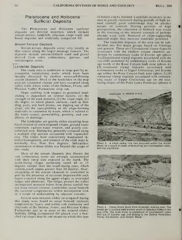
30 CALIFORNIA DIVISION OF MINES AND GEOLOGY BULL. 200
Pleistocene and HoloceneSurficial Deposits
The Pleistocene and Holocene surficial
deposits are detrital materials which includestream-terrace, landslide, alluvium, slope wash, andbeach deposits and artificially compacted fill.
Stream-Terrace Deposits
Stream-terrace deposits occur very locally as
thin veneer along the larger drainage courses. Thedeposits include unconsolidated sand and gravel
derived from older sedimentary, igneous, andmetamorphic rocks.
ILandslide Deposits
The study area is underlain in large part by in-
competent sedimentary rocks which have beenbroadly dissected by shallow westward-flowingstream channels. Most of the landslides in the maparea are rotational slumps and have occurred alongvalley walls where rocks of the Delmar, Friars, andMission Valley Formations crop out.
Slope stability with respect to potential land-sliding is dependent on several factors: (1) the
strength of the rock material, (2) the slope angle, (3)the degree to which planar surfaces, such as bed-ding, joint, and fault planes, are dipping out of the
slope, (4) the susceptibility of the slope-formingmaterials to saturation by water, which is related to
the water source, permeability, porosity, and con-ditions of drainage.
The landslides are gravity slides resulting frombasal erosion of oversieepened slopes, ground watersaturation, surface-water erosion, and poorly con-solidated rock. Sliding has generally occurred alonga multiple slip surface associated with expansibleclay The slides have consistently maintained in-
ternal homogeneity, and rotation of the slide mass is
normally less than five degrees. Subsurfaceexamination of these slides was beyond the scope ofthis study.
Most of the stream channels that dissect the
soft sedimentary cover are strongly asymmetricalwith their steep side exposed to the north. Thenorth-facing slopes commonly stand 10 to 15
degrees steeper than the south-facing ones, whichseldom reach angles greater than 30 degrees. Over-steepening of the stream channels is controlled in
part by the presence of resistant impermeable rocklayers exposed along the upper slopes as erosionalledges and platforms. The ledges protect the softer
incompetent material below from direct rainfall butnot from stream erosion. Landslides occur beneaththe resistant conglomerate within incompetent rockas a result of undercutting by adjacent streams.
Several man-induced slides investigated duringthis study were found to occur beneath resistant
conglomerate layers and within soft sandstone andclaystone of the Delmar, Friars, and Mission ValleyFormations just as in most of the natural slides.
Stability filling (compacted till placed over a ben-ched cut slope) may be one means by which this type
of failure can be avoided. Landslide incidence in thearea is greatly increased during periods of high an-nual rainfall; good subdrainage may be anothermeans of control. During periods of highprecipitation, the saturation of bedrock may resultin the lowering of the internal strength of perhapsalready weak rock. Removal of slope-supportingmaterial might then increase landslide potential.
The landslide deposits of the area can be sub-divided into tlve major groups based on lithology
and genesis. These are (1 )rotational slump depositsassociated with the shallow stream channels un-derlain by sedimentary rocks of Eocene age (photo3);(2)rotational slump deposits associated with the
sea cliffs underlain by sedimentary rocks of Eoceneage north of the Rose Canyon fault zone (photo 4);
(3) rotational slump deposits associated withsedimentary rocks of Upper Cretaceous and Eoceneage within the Rose Canyon fault zone (photo 5);(4)rotational slump deposits associated with sedimen-tary rocks of Upper Cretaceous age on the east-
facing slopes of the Point Loma Peninsula (photos 6
Photo 3. A small slump that has occurred within the ArdathShale as a result of slope undercutting and incompetent rocks,looking southeast.
**'Z'A
^^^^^l^p^r^^-^^^
,^^^^^^:i-i*'^^^^^
-"^i:-
mPhoto 4. Torrey Pines State Park landslide, looking east. Thelandslide is located 2400 meters south ol Soledad Valley in thesea cliffs. The slide mass is composed of incompetent rocksthat are of Eocene age and belong to the Delmar Formation,Torrey Sandstone, and Ardath Shale.

1975 GEOLOGY OF THE SAN DIEGO METROPOLITAN AREA, CALIFORNIA 31
and 7); (5) rockfall deposits associated with
sedimentary rocks of Upper Cretaceous andPleistocene age in the sea cliffs between the RoseCanyon fault zone and the tip of Point Loma Penin-
sula (photo 8; Kennedy, 1973b).
Eighteen clay samples were collected from for-
mations that have high landslide incidence. Thesesamples were analyzed for their particle size
distribution, clay mineral content, and Atterberg
limits.
Table 1 presents the results of the Atterberg
tests and the quantity of the individual size fractions
from the particle size distribution tests.
For engineering purposes the clay fraction is
defined as less than 0.002 millimeter (mm), the silt
fraction from 0.002 to 0.074 mm, and the sand frac-
tion from 0.074 to 2.0 millimeters. The liquid limit
(LL) is defined as the minimum moisture content at
which the material behaves as a liquid using this
lest. The plastic limit (PL) is defined as the
minimum moisture content at which the samplebehaves plastically using this specified test
procedure. The plasticity index (PI) is the numerical
difference between the liquid limit and the plastic
limit. The plasticity index is then the range of
moisture content over which the sample behaves
plastically. There exists a direct relationship bet-
ween the liquid limit and "compression index," andbetween the liquid limit and the "coefficient of con-
solidation" (Terzaghi and Peck, 1968), whereas an
inverse relationship exists between the plasticity in-
dex and "shear resistance."
TRACE OF THE MOUNT SOLEDAD FAULT
LANDSLIDE" DEPOSITS
The stated median particle size was taken fromihe 50 percent cumulative level of particle size
distribution graphs. The arithmetic mean of the
median particle sizes among all the samples is 0.016mm (16 microns), which is in the lower portion of
the silt range.
Associations between plasticity index, particle
size, and the percentage of clay-sized particles are
readily observed from the data of table 1. Themedium-plasticity samples (PI = 10 to 20) have an
average median particle size of 47 microns. High-plasticity samples (PI = 20 to 40) have an average
median particle size of 14 microns. The very-high-
plasticity samples (PI > 40) have a mean particle
size of 6 microns.
Most landslides have occurred in rocks that
have a plasticity index greater than 20. Surficial
slumping of slopes underlain by rocks of the Delmarand Friars Formations and Ardath Shale is mostabundant where the plasticity index is greater than
35. Expansion cracks are especially well developedand up to 50 centimeters (cm) deep and 5-10 cmwide in much of the area underlain by the Delmarand Friars Formations where the plastic index is
greater than 40.
Photo 6. Ancient landslide deposits underlain by rocks of the
Upper Cretaceous Rosarlo Group on Point Loma Peninsula,
looking west.
FORT ROSECRANS LANDSLIDES
Photo 5. Landslides that have occurred as a result of
oversteepened slopes associated with an erosional
scarp, looking southeast along the Mount Soledad fault.
Photo 7. Fort Rosecrans landslide on Point Loma Peninsula,
looking west. This slide mass Is presently moving toward the
east at a rate of approximately 10 centimeters per year.

32 CALIFORNIA DIVISION OF MINES AND GEOLOGY BULL. 200
S^l
M o
°Z-z-—JO
"1,^ -="< fe
gets
8>>i; 2
T3 5>-
—1^ —i f
S>2-2 "
•a (U . ^- S
— >fM 2 o,o-'.*. E 3
-t; '-' C^ [?o<
2 rtp! nvi
"o1:1 S^ S * =
u i>"-..2_o o
J "^3^*^ "^ "S O
- - • -i e^^-"
O.S OJ.
« O „
- M 3 «— Cr^C 2 ?•
_>.
C t^ f« k o" O o«> °
° c „•5 "2 e
.2~'*-'"^
S g.2!bg2a^ ft, J3^
<j— Hh_o
£5=;.= i I'
.i 3l' a.
;«
S «(-%> o
C Sj M
;;* 2
M O >c »j o•5 3-^
S o —> >- .
«•- rt
OrXsS
S — T)
O 3 U^»*= §-5
2§«- Oi/^
o ga •
;iQ-S5
" E

1975 GEOLOGY OF THE SAN DIEGO METROPOLITAN AREA, CALIFORNIA 33

34 CALIFORNIA DIVISION OF MINES AND GEOLOGY BULL. 200

1975 GEOLOGY OF THE SAN DIEGO METROPOLITAN AREA, CALIFORNIA 35
Photo 8. Sunset Cliffs located on tfie northern part of the Point Loma Peninsula, looking east. The arcuate coastline develop-ment here is the result of rockfall landsliding.
Alluvium and Slope WashAlluvium consists primarily of poorly con-
solidated stream deposits of silt, sand, and cobble-sized particles derived from bedrock sources that lie
within or near the area. These deposits intertonguewith Holocene slope wash that commonly mantlesthe lower valley slopes throughout coastal SanDiego County. Alluvium and slope wash are mostlyundifferentiated on the geologic maps.
Slope wash deposits are poorly cc.isolidated
surficial materials derived chiefly from nearby soil
and decomposed bedrock sources. The slope washis deposited along the flanks of the lower valley
slopes by the actions of gravity and surface water.
Thick deposits of slope wash are especially commonon the Delmar Formation, Ardath Shale, ScrippsFormation, and Friars Formation where deep soil
horizons have developed. Expansive clay materials
deposited as slope wash yield the hummockytopography developed on rocks of lagoonal and non-marine origin.
Beach Deposits
The beach deposits are composed of un-consolidated sand and silt. They mantle those parts
of the present day sea coast where erosional con-ditions are slow. They are derived from many sour-ces as a result of longshore drift and alluvial
discharge from the major stream courses.
Artificially Compacted Fill
Artificial fill consists of artificially compactedearth materials derived from many sources. Onlylarge areas underlain by artificial fill have beendelineated on the geologic maps.
STRUCTUREAND SEISMIC HISTORY
r--I Faults in the San Diego coasial area lie within a
regional northwest-striking right-lateral fault system
jthat includes the active Mission Creek, San An-
I dreas, San Jacinto, and Elsinore fault zones to the
east and the Agua Blanca, San Clemente, and Ram-part fault zones to the west. Within the study area
the faults comprise two prominent sets. One set
strikes parallel to the regional grain, whereas the
other set strikes northeast. Faults belonging to bothof these sets have displaced rocks of the late
Pleistocene Bay Point Formation which has, on the
basis of a rich nearshore molluscan fauna, beenassigned an age of approximately 100,000 years
(Kern, 1971).
The most prominent faults within the northweststriking set belong to the Rose Canyon fault zone.

36 CALIFORNIA DIVISION OF MINES AND GEOLOGY BULL. 200
These faults juxtapose nearly flat-lying Eocene,Pliocene, and Pleistocene rocks with steeply tilted
Upper Cretaceous and Eocene rocks. The RoseCanyon fault has been considered a southern ex-
tension of the Nevvport-Inglewood fault zone(Corey, 1954; Emery, 1960; King, 1969; Moore,1972) and a northern extension of both the LosBuenos and the San Miguel faults (Wiegand, 1970;Moore and Kennedy, 1970; Moore, 1972). If the
Rose Canyon-Los Buenos fault zone is continuous,
it has an onshore length of 65 km and extends fromLa Jolla on the north to near El Rosarila in northern
Baja California on the south. If the Rose Canyonfault zone is continuous with the San Miguel fault,
the onshore length of this segment is over 250 kmand extends from La Jolla on the north to near San
Miguel in northern Baja California on the south.
The mapped northern offshore extension of the
Rose Canyon fault zone extends from La Jolla to
within 45 km of the southern onshore termination of
the Newport-Inglewood fault zone (Moore, 1972).
Point Loma and Mount Soledad are fault blocks that
were uplifted along the Rose Canyon fault zone in
part after the deposition of the Lindavista For-
mation. At least 135 m of vertical separation can bemeasured in the vicinity of Mount Soledad and LaJolla (plate 2A). The direction of the vertical
movement at La Jolla is west side up, whereas at
Mission Bay it is west side down (sections B-B', C-C). At least 1 00 m of separation has been shown onthe Rose Canyon fault zone in the Mission Bay area
with the west side down (Peterson, 1970). Possibly
the Mount Soledad block rotated along an axis nor-
mal to the strike of the fault zone thereby elevating
Mount Soledad along the northwest side of the zoneand sinking Mission Bay along the southwest side.
This tilted block model is supported by the fact that
a 30 m high wave-cut platform upon which the Lin-
davista Formation originally was deposited, on the
south-facing slopes of Mount Soledad, is inclined to
the south and extends nearly continuously from anelevation of over 250 m at the north to near sea level
at the south.
Steep folds associated with the nor-theasternmost part of the Mount Soledad block (sec-
tion B-B') are considered to be in part the result of
compression developed by strike-slip movement.The rotation of Mount Soledad was questionablycaused by flexure associated with the change in
strike of the Rose Canyon and Mount Soledad faults
between LaJollaCove and Rose Canyon (plate 2A).The Tertiary and younger rocks that lie immediatelywest of the fault zone are not deformed and they
make a strike-slip model and compressional folding
logical. It has been suggested that the Rose Canyonfault is part of a regional right-lateral strike-slip
fault system. The distribution of the San Diego For-mation along the Rose Canyon fault zone betweenPacific Beach and Tecolote Canyon(plate 2A) is in-
terpreted as resulting from 4 km of right-lateral
strike-slip motion on the Rose Canyon fault.
Horizontal slickensides measured on the RoseCanyon fault at La Jolla and Mount Soledad further
suggest strike-slip faulting.
In the northern coastal part of the area at
Torrey Pines State Park and in the southern part of
the area at Point Loma, the structural grain of the
area is nearly perpendicular to the Rose Canyonfault zone. The average strike of the grain is 30 to
40 degrees east of north. The separation along mostof the faults is vertical and ranges from 1 cm to 100m.
Several northeast striking faults displacePleistocene and younger(?) deposits. The CarmelValley fault south of Del Mar (plate lA) has ap-
proximately 2 m of vertical separation, involving the
Lindavista Formation at lat 32° 55' 10" N.; long117° 14' 50" W. Along this same fault at lat 32° 55'
20" N.; long 117° 14' 50" W., the late Pleistocene
Bay Point Formation has been tilted approximately10 degrees. It is speculated, however, that at least
part of this dip is initial and related to its
deposition. A small fault on the east side of the
Point Loma Peninsula, located at lat 32° 40' 40" N.;
long 1 17° 14' 15" W., also displaces rocks of the
Bay Point Formation. The separation on this fault is
dip-slip and on the order of 3 meters. The Bay Point
Formation is also faulted by a small northeaststriking fault that intersects the Point Loma fault at
an oblique angle(plate3A).The vertical separation of
the Bay Point Formation related to this fault and the
Point Loma fault together is in excess of 30 meters.
The possibility of Holocene fault activity in the
area is not ruled out, though no direct field evidencesupports this fact. Holocene faulting is indirectly
postulated by the fact that historic seismicity mightbe related to faulting on the Rose Canyon fault zonein the San Diego Bay area and by subbottomacoustic profiles that show probable Holocenesediments offset on the sea floor at a point ap-
proximately 25 km north of La Jolla along the trace
of the Rose Canyon fault (Moore. 1972).
Forty-four earthquakes of Richter magnitude2.5 to 3.7 (M 2.5-3.7) have been recorded within the
greater San Diego area by the California Institute of
Technology Seismological Laboratory since 1950.Three of these which occurred in the vicinity of SanDiego BayonJune21 and22andJuly 14, 1964, hadepicenter localities within a few kilometers of SanDiego and magnitudes of 3.7, 3.6, and 3.5, respec-
tively.
In addition to earthquakes originating in the San
Diego area, ground shaking has been felt there
initiated by earthquakes that have had epicenters upto 100 km away. Several of these earthquakes have
caused damage in San Diego and are worthy of men-tion.
The 1933 Long Beach earthquake (M 6.6)
caused minor damage throughout northwestern SanDiego County and was felt sharply as far south as
San Diego. The epicenter is shown by the California
Institute of Technology Seismological Laboratory to
have been south of Long Beach along the inferred
trace of the Newport-Inglewood fault zone.
On November 4, 1949. and on February 9,
1956, earthquakes felt sharply in San Diego oc-
curred on the Valecitos-San Miguel fault in northern
Baja California. The 1949 earthquake (M 5.7) had

1975 GEOLOGY OF THE SAN DIEGO METROPOLITAN AREA, CALIFORNIA 37
an epicentral distance of approximately 75 kmsoutheast of the San Diego Civic Center. Theepicenter of the 1956 earthquake (M 6.8) was ap-
proximately 1 75 km south of San Diego. Three af-
tershocks of this earthquake, with magnitudesgreater than 6, occurred in 1956 on February 9, 14,
and 15. Ground rupture of 20 km was associated
with this earthquake in the vicinity of the epicenter
(Shor and Roberts, 1958).
Several earthquakes (M > 5) have been recor-
ded on the Agua Blanca fault in northern Baja
California during the past 30 years with epicentral
distances within 125 km of San Diego. Holocenefault scarps in the area between Ensenada and SantoTomas suggest surface rupture has occurred in at
least the past few thousand years.
During the past 35 years, earthquakes located
in the Imperial Valley and Salton Trough area werefelt in western San Diego County. Three of
these—the 1940 Imperial Valley earthquake (M7.1), the 1951 Superstition Hills earthquake (M5.6), and the 1968 Borrego Mountain earthquake (M6.5)—caused minor damage to structures in the SanDiego coastal area and initiated landsliding of seacliff property at Point Loma, La Jolla, and TorreyPines State Park (Kennedy, 1973).
The February 9, 1971, San Fernando earth-
quake (M 6.4) was felt sharply throughout the
southern California coastal area. The intensity of
the earthquake at San Diego was V (Scott, 1971 ) onthe Modified Mercalli scale. Minor damage wasreported as far south as the Mexican border, andtwo small landslides occurred at Sunset Cliffs as a
direct result of the initial shock.
Allen et al. (1965) show a strain release ofO.25to 4 (M 3) earthquakes/100 km2 for the 29-yearperiod between 1934 and 1963 for the San Diegoarea.
38 CALIFORNIA DIVISION OF MINES AND GEOLOGY BULL. 200
REFERENCES CITED
Allen. C.R.. et al., 1965, Relationship between selsmlclty andgeologic structure In the southern Calitornia region:
Seismologlcal Soc of America Bull., v. 55, no. 4, p. 753-797.
Allison. E.C.. 1964. Geology o( areas bordering Gulf of Califor-
nia: American Assoc. Petroleum Geologists f^em 3, p. 3-
29.
Beal. CM.. 1924, Informe sobre la exploracion geologica de la
Baja California: Boletin Petroleo. v. 17, p. 417-473.
Berggren, W.A., 1969, Rates of evolution in some Cenozoicplanktonic Foraminifera: Micropaleo, v. 15, no. 3.
Bouche, P.M., 1962. Nannofossiles calcaires du Lutetien dubassin de Paris: Rev. f\^icropaleontologie, v 5. p. 75-103.
Bukry. David, and Kennedy. MP.. 1969, Cretaceous and Eocenecoccoliths at San Diego. California, in Short contributions to
California geology California Division of Mines and GeologySpecial Report 100, p. 33-43.
Bushee, J., Holden, J., Geyer, B., and Gastil, G., 1963, Lead-alpha dates for some basement rocks of southwesternCalifornia: Geol. Soc. America Bull., v. 74. p. 803-806.
Clark. B.L.. and Vokes, HE.. 1936, Summary of marine Eocenesequence of western North America: Geol. Soc. AmericaBull.. V. 47. p. 851-876, 2 pIs., 3 figs.
Cleveland. G.B.. 1960. Geology of the Otay clay deposit, SanDiego County, California: California Div. Mines Spec. Rept.
64, p. 16.
Corey, W.H., 1954. Tertiary basins of southern California, in
Geol. of southern California: California Div. Mines Bull. 170,
chpt. 3, p. 73-83.
Dall, W.H., 1898, 18th Ann. Rept.correlation table opp. p. 334.
U.S. Geol. Survey, pt. 2.
DeLisle, M., Morgan. J, R., Heldenbrand, J., and Gastil, G., 1965,
Lead-alpha ages and possible sources of metavolcanicrock clasts in the Poway Conglomerate, southwest Califor-
nia: Geol. Soc. America Bull., v. 76, p. 1069-1074.
Ellis. A.J.. 1919, Geology, western part of San Diego County,California: U.S. Geol. Survey Water-Supply Paper 446, p. 50-
76.
Emery. K.O.. 1960, The sea off southern California, a modernhabitat of petroleum; New York, London, John Wiley, 366 p.,
map.
Evernden, J,F.. and Kistler. R.W.. 1970, Chronology of em-placement of Mesozoic batholithic complexes in California
and western Nevada: U.S. Geol. Survey Prof. Paper 623. 42
P
Fife, D.L., Minch, J. A., and Crampton. P.J., 1967, Late JurassicAge of the Santiago Peak Volcanics, California: Geol. Soc.America Bull., v. 78, p. 299-304.
Flynn, C.J . 1970. Post-batholithic geology of the La Gloria-
Press Rodriguez area, Baja California, Mexico: Geol. Soc.America Bull., v. 81, p. 1789-1806.
Givens, C.R., 1974, Eocene Molluscan biostratigraphy of thePine Mountain area, Ventura County, California: Universityof California, Dept. Geol. Sci. Bull., v. 109. 107 p.
Golz, D.J., 1971, SelenodonI Artiodactyls from the Eocene of
southern California: Geol Soc. America Abstracts with
Program, v. 6, p. 125.
Golz, D.J., 1973, The Eocene Artiodactyla of southern Califor-nia: Unpublished Ph.D. dissertation. University of Califor-nia, Riverside
Golz, D.J., and Kennedy, MP. 1971, Comparison of Mammalianand Invertebrate Chronologies in the Eocene of southernCalifornia: Geol. Soc. America Abstracts with Program, v
6. p. 125.
Gray, C.H., Jr . Kennedy, MP., and Morton, P K., 1971, Petroleumpotential of southern coastal and mountain area, Califor-
nia: American Assoc Petroleum Geologists, Mem. 15, p.
372-383.
Hanna. M.A., 1926, Geology of the La Jolla quadrangle, Califor-
nia: University of California, Dept. Geol. Sci. Bull., v. 16, p.
187-246.
Hertlein, L.G., and Grant. U.S.. IV, 1939. Geology and oil
possibilities of southwestern San Diego County: California
Jour Mines and Geol., v. 35, p. 57-78.
Hertlein, L.G., and Grant, U.S., IV, 1944, The geology andpaleontology of the marine Pliocene of San Diego, Califor-
nia, pt. 1, Geology: San Diego Soc. Nat History Mem., v 2,
p. 1-72.
Jenkins, D.G , 1965. Planktonic Foraminiferal Zones and NewTaxa from the Danian to lower Miocene of New Zealand:New Zealand Jour. Geol. Geophys., v. 8, p. 1088-1126.
Kennedy, G.L., 1973, Early Pleistocene Invertebrate Faunulefrom the Lindavista Formation, San Diego, California: SanDiego Soc. Nat. History Transactions, v. 17, p. 119-128.
Kennedy, M.P., 1967, Preliminary report, engineering geology of
the city of San Diego, California: California Div. of Minesand Geology open tile, 21 p., 3 maps, scale 1:24,000.
Kennedy. MP. 1969, Preliminary geologic maps of portions of
San Diego city. California: California Division of Mines andGeology open file reports 69-1 (Del Mar sheet). 68-10 (Del
Mar - La Jolla sheet), 69-13 (La Jolla - Point Loma sheet),
69-14 (Point Loma sheet), scale 1:9,6000.
Kennedy. MP.. 1971, Eocene shoreline fades in the San Diegocoastal area, California: Geol, Soc. America Abstracts with
Program, v. 6 p. 142.
Kennedy, MP., 1973a, Stratigraphy of the San Diego em-bayment, California: Unpublished Ph.D. dissertation,
University of California, Riverside.
Kennedy, MP., 1973b, Sea cliff erosion at Sunset Cliffs, SanDiego, California: California Div. Mines and Geology,California Geology, v. 26, p. 27-31.
Kennedy, M.P., and Moore, G.W., 1971a, Stratigraphic relations
of upper Cretaceous and Eocene formations, San Diegocoastal area, California: American Assoc. PetroleumGeologists Bull., v. 55, p. 709-722.
Kennedy. MP., and Moore, G.W.. 1971b. Stratigraphy and struc-
ture of the area between Oceanside and San Diego,California: geologic road log, in Elders W.A.. ed., 1971,
Geological excursions in southern California: Geol. Soc,America Cordilleran Section Meeting, Riverside, California,
field trip guidebook.
Kennedy, MP., and Peterson, G.L., 1975, Geology of the LaMesa, Poway. and SW 1/4 Escondido quadrangles, easternSan Diego metropolitan area, California: California Div.
Mines and Geology Bull. 200B.
Kern, J. P., 1971, Paleoenvironmental analysis of a late
Pleistocene estuary in southern California: Journal Paleo..
V. 45, p. 810-823.
King, P.B., 1969. The tectonics of North America: U.S. Geol.
Survey Prof Paper 628, 94 p., map scale 1:5,000,000.
1975 GEOLOGY OF THE SAN DIEGO METROPOLITAN AREA, CALIFORNIA 39
Larsen, E.S., 1948, Batholith and associated rocks of Corona,Elsinore, and San Luis Rey quadrangles, southern Califor-
nia: Geol. Soc. America Mem. 29, 182 p.
Mallory, V.S., 1959, Lower Tertiary biostratigrapfiy of theCalifornia coast ranges: American Assoc, Petrol. Geol.,
297 p.
Merriam, R., 1968, Geologic reconnaissance of northwestSonora: Stanford University Pub. Geol. Sci., v. 11, p. 287.
Milow, E.D., and Ennis, D.B., 1961, Guide to geologic field trip of
southwestern San Diego County: Geol. Soc. America, Cor-dilleran Sec, 57th Ann. Mtg., Guidebook, p. 23-43.
Minch, J.A., 1967, Stratigraphy and structure of the Tijuana-Rosarito Beach area, northwestern Baja California,Mexico: Geol. Soc. America Bull., v. 78, p. 1155-1178.
Minch, J. A., 1972, The late Mesozoic-early Tertiary framework of
continental sedimentation, northern Peninsular Ranges,Baja California, Mexico: Unpublished Ph.D. dissertation.University of California, Riverside.
Moore, E.J., 1968, Fossil mollusks of San Diego County: SanDiego Soc. Nat. History Occasional Paper 15, 76 p.
Moore, G. W., 1972, Offshore extension of the Rose Canyonfault, San Diego, California: U.S. Geol. Survey Prof. Paper800-C. p. C113-C116.
Moore, G.W., and Kennedy, M.P., 1970, Coastal geology of theCalifornia—Baja California border area: American Assoc.Petroleum Geologists Guidebook, Pacific Sections, fall
field trip p. 4-9.
Morton, P.K., 1972, Geologic guidebook to the northern Penin-sularRanges, Orange and Riverside Counties, Califomia:Prepared jointly by National Assoc, of Geol. Teachers andSouth Coast Geological Soc, for N.A.G.T. far western sec-tion meeting, Chapman College, Orange, California.
Nordstrom, C.W., 1970, Lusardi Formation— a post-batholithicCretaceous conglomerate north of San Diego, Califomia:Geol. Soc. America Bull., v. 81, p. 601-605.
Peterson, G.L., 1970, Quaterlnlary deformation of the San Diegoarea, southwestern Califomia: American Assoc. PetroleumGeologists Guidebook, Pacific Section, fall field trip, p.
120-126.
Peterson, G.L., and Kennedy, M.P., 1974, Lithostratigraphicvariations in the Poway Group near San Diego, Califomia:San Diego Soc. Nat. History Transactions, v. 17, p. 251-258.
Peterson, G.L., and Nordstrom, C.E., 1970, Sub-La Jolla un-conformity in the vicinity of San Diego, California:
American Assoc. Petroleum Geologists Bull., v. 54, p. 256-274.
Popenoe, W.P,. Imlay, R.W., and Murphy, M.A., 1960, Correlationof the Cretaceous formations of the Pacific coast (UnitedStates and northwestern Mexico): Geol. Soc America Bull.,
V. 71, p. 1491-1540.
Scott, N.H., 1971, Preliminary report on felt area and intensity,In The San Fernando, California, earthquake of February 9,
1971: U.S. Geol. Survey Prof. Paper 733, p. 153-154.
Sears, J.D., Hunt, C.B , and Hendricks, T.A., 1941, Tran-sgressive and regressive Cretaceous deposits in southernSan Juan Basin, New Mexico: U.S. Geol. Survey Prof. Paper193-F, p. 100-121.
Shor, G.G., and Roberts, E., 1958. San Miguel, Baja CaliforniaNorte, earthquakes of February. 1956: a field report:
Seismological Society of America Bull., v. 48, p. 101-116.
Slitter, W.V., 1968, Upper Cretaceous Foraminifera fromsouthern California and northwestern Baja California,Mexico: The University of Kansas Pubs.. Art. 7, Ser. no. 49,
p. 141.
Steineck, P.L., and Gibson, J.M., 1971, Age and correlation ofthe Eocene Ulatisian and Narizian stages, California:Geol. Soc. America Bull., v. 82, p. 477-480.
Strand, R.G., 1961. Geologic map of California—San Diego-ElCentre sheet: California Div. Mines and Geology.
Terzaghi, K., and Peck, R.B., 1967, Soil mechanics in
engineering practice: Wiley and Son, New York, 729 p.
Turner, H.C., Ebert, E.E., and Given, R.R., 1968, The Marine en-vironment offshore from Point Loma. San Diego County:California Department of Fish and Game. Fish Bull. 140.
Weber, F.H., Jr., 1963, Geology and mineral resources of SanDiego County, Califomia: California Div. Mines andGeology County Rept. 3, 309 p.
Wiegand, J.W., 1970, Evidence of a San Diego Bay-Tijuanafault: Assoc, of Engineering Geologists Bull., v. 7, p. 107-
121.
Wood, H.E., Chaney, R.W., Clark, J., Colbert. E.H.. Jepsen, G.L..
Reeside, J.B.. Jr., and Stock, C., 1941, Nomenclature andcorrelation of the North American Continental Tertiary:
Geol. Soc. America Bull., v. 52, p. 1-48.
Woodford, A.O., Welday, E.E., and Merriam, R., 1968. Siliceous
tuff clasts in the upper Paleogene of southern California:
Geol. Soc. America Bull., v. 79, p. 1461-1486.


SECTION B
La Mesa, Poway,and SlVi/4 Escondido
quadrangles


ABSTRACT
The La Mesa, Poway, and SWV4 Escondido 7.5-minute quadrangles cover approximately 380 squarekilometers (km?) within the eastern and northeastern San Diego metropolitan area. The geology of the
area consists of two principal rock units: 1) an igneous and metamorphic basement complex and 2) a
superjacent sedimentary succession of strata.
The basement complex is composed of the Upper Jurassic Santiago Peak Volcanics, a structurally
complex, mildly metamorphosed unit composed of andesitic volcanic and volcaniclastic rocks and mid-
Cretaceous rocks of the southern California batholith. Metamorphism of the Santiago Peak Volcanics,
emplacement of the batholithic rocks, uplift, and carving of an erosion surface with relief in excess of 500meters (m) was completed by Late Cretaceous time.
The post-batholithic superjacent sedimentary succession was deposited on this high relief erosion
surface. Mapped stratal units include the Upper Cretaceous Lusardi Formation; the Eocene Friars For-
mation, Stadium Conglomerate, Mission Valley Formation, and Pomerado Conglomerate; the Pliocene
San Diego Formation; the Pleistocene Lindavista Formation; and Holocene landslide, alluvial, slope
wash and stream-terrace deposits.
The most abundant rocks of the sedimentary succession are middle and upper Eocene fossiliferous
strata of marine, lagoonal, and nonmarine origin related to two major transgressive and regressive
depositional episodes. The Lindavista Formation caps the older rocks throughout much of the area andwas deposited during a marine regressional event following a marine planation. Later uplift of these
deposits is indicated by the presence of fossiliferous marine strata that now lie at an elevation of 165 m.
above sea level.
Seismically the area is quiet; however, it lies within a part of southern California considered to be a
region of tectonic activity. Forty-four earthquakes of Richter magnitude between 2.5 and 3.7 (M 2.5 to M3.7) have been recorded by the California Institute of Technology Seismological Laberatory since 1950that have had epicentral localities within the greater San Diego metropolitan area.
No known Holocene faults exist in the area. However, the Pleistocene Lindavista Formation has beenfaulted in several places. One of these faults lies within the Mission Valley River drainage, south of Mis-
sion Gorge, where the Lindavista Formation has been offset at least 20 meters. A fault near CollwoodBoulevard and Montezuma Road in the southern part of the area also cuts rocks of the Lindavista Forma-tion and is considered to be a northern branch of the La Nacion fault.
Sand and gravel deposits useable for concrete, bituminous, and ceramic aggregate underlie a large
part of the area. Clay deposits useable for ceramics, fire clay, and possibly lightweight aggregate are
also abundant but have not been exploited. These widespread clay deposits are expansible, and closely
associated with landslides, especially in those areas directly underlain by the Friars Formation.
The landslides mapped are rotational slumps that have occurred as the result of incompetent rock,
saturation, expansible clay, and oversteepened valley slopes. Surficial landslides are associated with
slopes steeper than 25 degrees that are underlain by rocks of the Friars and Mission Valley Formationsthroughout the area.
(43)
#
GEOLOGY OF THE EASTERN SAN DIEGO METROPOLITANAREA, CALIFORNIALa Mesa, Poway, and SWV4 Escondido quadrangles
by Michael P. Kennedy^ and Gary L. Peterson2
INTRODUCTIONIn 1965 the California Division of Mines and
Geology, in cooperation with the City of San Diego,began a comprehensive geologic investigation of the
greater San Diego metropolitan area. This report
deals with the geology of the eastern half of that in-
vestigation, A similar report has been written on the
western half and includes the geology of the DelMar, La Jolla, and Point Loma quadrangles (Ken-nedy, 1975).
The La Mesa, Poway, and SW 1/4 Escondidoquadrangles comprise more than 25 percent of the
greater San Diego metropolitan area (figure 1 ). Thisarea is underlain by San Diego's richest sand,
gravel, and crushed stone resources, deemedfeasibly extractable in today's market for use in the
Mission Valley, Mira Mesa, Poway, and Escondidosuburbs. These resources and others, including rich
clay deposits, are being rapidly covered by urbandevelopment. The clay deposits, which are locally
expansible, in turn constitute a serious geologichazard to development.
The geologic mapping and detailed descriptionsof the rock units are intended to be used as aids in
planning for land use and future development. Thestratigraphic relationship between the rock units un-derlying the study area and those that underlie the
area to the west (discussed by Kennedy, 1975) are
shown in figure 2.
Previous geologic investigations that have beenespecially useful in this study include a groundwater investigation by A.J. Ellis (1919), a
stratigraphic and paleontologic study of the La Jolla
quadrangle by M.A. Hanna (1926), two papers ongeology and paleontology of the San Diego area byL.G. Hertlein and U.S. Grant IV (1939, 1944), and a
monograph on the mineral resources of San DiegoCounty by F.H. Weber, Jr. (1963).
The authors would like to extend special thanksto D.M. Morton and G.W. Moore of the UnitedStates Geological Survey for their suggestions andcontributions pertinent to the results of this study.
Acknowledgment is due also to M.O. Woodburne,P.K. Morton, G.B. Cleveland, F.H. Weber, Jr., C.H.Gray, Jr., M.A. Murphy, J. P. Kern, R.G. Strand, andY.H. Smitter for their enthusiastic help, interesting
discussions, and review of the maps and manuscript.
PRE-EOCENE DEPOSITS
Basement ComplexThe basement complex consists of two principal
rock units: (1) the Upper Jurassic Santiago PeakVolcanics, a succession of deformed and metamor-Geologist. Cahlornia Division ol Mines ana Geology-San Diego State University
phosed volcanic, volcaniclastic, and sedimentaryrocks; and (2) mid-Cretaceous plutonic rocks of the
southern California batholith, which intrude the
Santiago Peak Volcanics.
Santiago Peak VolcanicsThe Santiago Peak Volcanics comprise an
elongate belt of mildly metamorphosed volcanic,
volcaniclastic, and sedimentary rocks that crop outfrom the southern edge of the Los Angeles basin
southward into Mexico (Gray et al., 1971). Theserocks were mapped in the San Diego area by Hanna(1926, p. 199-204) as "Black Mountain Volcanics,"but that name was pre-empted, and Larsen (1948)suggested the substitute--Santiago Peak Volcanics.
The volcanic rocks range in composition frombasalt to rhyolite but are predominantly dacite andandesite. The succession is typified by a widevariety of breccia, agglomerate, volcanicconglomerate, and fine-grained tuff-breccia. Highlysilicified rock (probably tufO and a variety of dark,
dense, fine-grained hornfels occur locally. To the
west, some local, thin, fossil-bearing marinesedimentary rocks are interbedded with the volcanic
and volcaniclastic rocks. Included with the SantiagoPeak Volcanics are a number of small plutons of
mildly metamorphosed gabbro. These are herein in-
cluded with the Santiago Peak Volcanics becausethey are metamorphosed and were probably feeders
for the volcanic rocks rather than parts of the
batholith.
The Santiago Peak Volcanics are hard and ex-tremely resistant to erosion and form topographichighs. Most of the volcanic rocks are dark greenishgray where fresh but weather grayish red to darkreddish brown. The soil developed on the SantiagoPeak Volcanics is the color of the weathered rockand supports the growth of dense chaparral.
Within a narrow 2-kilometer-long belt, ap-proximately I km northwest of Rancho Bernardo in
the Escondidoquadrangle(plate IB), a succession oflow-grade metamorphic slate and quartzite cropsout. These rocks were considered by Larsen (1948)to belong to the Bedford Canyon Formation. Withinthe northeastern part of the Poway quadrangle, a
similar succession was included by Hanna within
his "Black Mountain Volcanics." In this study the
rocks at both of these exposures have been includedin the Santiago Peak Volcanics. Although they differ
somewhat from more characteristic Santiago PeakVolcanics, the difference is not deemed enough to
correlate them with the Bedford Canyon Formation.
Age estimates for the Santiago Peak Volcanicshave ranged from Late Triassic (Hanna, 1926) to
mid-Cretaceous (Milow and Ennis, 1961). HoweverFife et al. ( 1 967) showed them to be latest Jurassic
(Portlandian) based on fossils from sedimentary in-
terbeds.
(45)

46 CALIFORNIA DIVISION OF MINES AND GEOLOGY BULL. 200
Figure 1. Index map showing the location of the La Mesa. Poway, and SW 1/4 Escondido 7.5-minute quadrangles.

1975 GEOLOGY OF THE SAN DIEGO METROPOLITAN AREA, CALIFORNIA 47
COLUMNAR SECTION OF THE SAN DIEGO CONTINENTAL MARGIN
QbpI
'^''P- ^"^ Point Formation
OIn, LIndovista Formation
Tsd, San Diego Formation
Tp, Pomerado Conglomerate
Tmv, Mission Valley Formation
Tst, Stadium Conglomerate
Tf, Friars Formation
Tsc, Scripps Formation
To, Ardatti Stiale
Tt, Torrey Sandstone
Td, Delmor FormationTms, Mount Soledad
FormationKcss, Cobrillo Formation
(sandstone port)
Kccg, Cabrillo Formation(conglomerate port)
Kp, Point Loma Formation
Kl, Lusardi Formation
Jsp, Santiago Peak Volcan
Kg, Granitic rocks of ttie
souttiern California
batliollth
Figure 2. Columnar section of the San Diego continental
margin.
Plutonic Rocks of theSouthern California Batholith
Plutonic rocks of the southern Californiabatholith in the area are quartz diorite and gabbro.The quartz diorite is typically coarse grained, light
gray and contains large phenocrysts of plagioclaseand potassium feldspar. Hornblende and biotite arepresent in small amounts. The gabbro varies con-siderably in texture and composition but is mostlymedium to coarse grained and medium to dark gray.
The chief minerals are calcic feldspar and pyroxene,and the accessory minerals include trace amounts ofquartz and biotite.
Potassium-argon dates of a gabbro near SanMarcos and a quartz diorite 10 km southeast ofEscondido are respectively 101 and 105 million
years (Evernden and Kistler, 1970). A lead-alphadate on zircon from quartz diorite in the WoodsonMountain area, 20 km southeast of Escondido, is
105 ± 10 million years (Bushee et aL. 1963).
Throughout most of the area, the granitic rocksare deeply weathered. Spheroidal boulders, formedas a result of the weathering, range in size from 0.5meter to 10 meters. The batholithic rocks whereweathered are locally very difficult to distinguishfrom the overlying Eocene Friars Formation, whichis largely composed of debris derived from the
weathered plutonic basement rock. Carefulexamination for relict primary features in the
plutonic rocks or sedimentary structures in the
overlying rocks is necessary to distinguish the
weathered basement rock from the sedimentarystrata.
Rosario GroupThe Rosario Group consists of marine and non-
marine clastic rocks that, oldest to youngest, in-
clude the Lusardi Formation, the Point Loma For-mation, and the Cabrillo Formation. Only rocks ofthe Lusardi Formation crop out in the La Mesa-Poway-Escondido area.
Lusardi Formation
The Lusardi Formation, in its type area nearRancho Santa Fe, is a very poorly sorted, deeplyweathered boulder conglomerate (Nordstrom,1970). The few exposures of the Lusardi Formationthat occur in the mapped area are in a narrow belt
that extends northeastward from the city of Poway(plate 2B). These deposits fill a former stream chan-nel, but the present topography is reversed, with the
conglomerate now capping a long narrow ridge. Themodern drainage is deeply incised into the granitic
rocks on either side of the ridge.
The Lusardi Formation at this locality consistsof poorly sorted, angular to well-rounded clasts that
range in size from granules to boulders; some of the
boulders exceed 3 m in diameter. The matrix is a
medium- to fine-grained quartz and feldspar-rich
sandstone that comprises about 50 percent of the
unit.
The largest and most abundant clasts includecoarse-grained diorite, quartz diorite, and medium-grained granodiorite. These rock types, togetherwith minor amounts of aplite and vein quartz, con-stitute about 60 percent of the clasts in the LusardiFormation. Other clasts include a variety of fine- to
very fine-grained, greenish-gray, and dark-graymetamorphosed tuff. Some of the most distinctive
and abundant of these clasts have finely crenulatedflow banding on weathered surfaces and are veryfine grained, dark, and structureless on fresh sur-faces. Less distinctive but abundant clasts are fine-
grained black hornfels and volcanic rocks.
Most of the rock types found in the LusardiFormation-are common to the coarse fraction of the
Rosario Group as a whole and are considered to bederived largely from local plutonic and metamorphicrocks (Peterson, 1971).
The Lusardi Formation rests unconformably ongranitic rocks of the southern California batholith
and is in turn overlain by the Eocene StadiumConglomerate. The character and distribution of the
deposits suggest that the clasts of the Lusardi For-mation originated east of the area mapped andflowed through a long, narrow, fairly steep-walledriver channel in the vicinity of Poway. The LusardiFormation lies buried below the San Diego coastal
area from the vicinity of Carlsbad south to the
Mexican Border (Kennedy and Moore, 1971).
EOCENE DEPOSITS
La Jolla GroupThe La Jolla Group (Eocene) is composed of
intertongued marine, lagoonal, and nonmarine silt-

48 CALIFORNIA DIVISION OF MINES AND GEOLOGY BULL. 200
stone, sandstone, and conglomerate. These rocks,
though partially age equivalent, are from oldest to
youngest the Mount Solcdad Formation, Del MarFormation, Torrey Sandstone, Ardaih Shale, ScrippsFormation, and Friars Formation (Kennedy andMoore, 1971). Only the Friars Formation crops outin the La Mesa-Poway-Escondido area.
Friars FormationThe Friars Formation is a nonmarine and
lagoonal sandstone named for exposures along the
north side of Mission Valley near Friars Road in the
La Jolla quadrangle (Kennedy and Moore, I 971 ). Amolluscan fauna collected from the type section in-
cludes Nekewis to (Gabb) and Ectinochilus canalifcr
supraplicarus (Gabb). These species together are in-
dicative of the west coast Californian molluscan"Transition stage" and a late middle Eocene age(Givens, 1974).
Most of the area is underlain by the nonmarinefacies, which reaches a maximum thickness of 150m and consists of sandstone with interbeds ofclaystone. The sandstone is massive, yellowish gray,
medium grained, poorly indurated, and caliche-rich.
The claystone is dark greenish gray, well indurated,and expansible. Fluviatile cobble conglomerate len-
ses and tongues that thicken markedly to the east are
especially characteristic of the exposures along the
eastern margin of the area.
Throughout the mapped area, the Friars For-mation rests unconformably on the basement com-plex and is overlain by sedimentary deposits ofEocene, Pleistocene, and Holocene age.
Landslides are common in the clay-rich part ofthe formation. The clay is predominantly mont-morillonite, but kaolinite is also present. Sixteenclay samples were collected and physical charac-teristics were analyzed. The results are presentedon table 1 and are discussed below under LandslideDeposits.
Poway GroupThe Poway Conglomerate of Ellis (1919) is one
of the most widespread and distinctive rock units in
southern California. It crops out primarily in the
eastern part of the San Diego area and is the
dominant formation in the Poway and La Mesaquadrangles (plates 2B,3B). The rock is mostly non-marine sandstone and coarse cobble conglomeratecomposed largely of clasts that have been describedin detail by Bellemin and Merriam (1958), DeLisleet al. (1965), Woodford et al. (1968), and Peterson(1970a).
In a recent revision of the Eocene stratigraphicnomenclature of the San Diego area (Kennedy andMoore, 1971), the Poway Conglomerate was raisedto the Poway Group and three formations wererecognized within it: a lower conglomeratedesignated the Stadium Conglomerate, an in-
termediate sandstone designated the Mission ValleyFormation, and an unnamed upper conglomerateformation. This upper conglomerate unit has been
subsequently designated the PomeradoConglomerate (Peterson and Kennedy, 1974).
The arrangement of the three formations in the
Poway Group is schematically illustrated in figure 3.
The Mission Valley Formation interlongues with the
underlying Stadium Conglomerate. Where the
Mission Valley Formation pinches out and the
Pomerado Conglomerate overlies the StadiumConglomerate in the eastern part of the area, the twounits cannot be distinguished. On the geologic map,where this situation exists, a dashed contact line in-
dicates the approximate location of the boundarybetween these formations.
.? °7i\° °l'° o°o°
Figure 3. Schematic diagram o( lithostratigraphic variations
in the Poway Group and modern erosion surface.
Stadium ConglomerateThe type section of the Stadium Conglomerate
lies within the SW 1/4 La Mesa quadrangle and is
approximately 1 km west of Murphy Canyon Roadalong the northern wall of Mission Valley near SanDiego Stadium (Kennedy and Moore, 1971). At the
type section it consists of a cobble conglomeratewith a dark yellowish-brown coarse-grained sand-stone matrix. The massive conglomerate containsdispersed lenses of fossiliferous crossbedded sand-stone. The fossils include calcareousnannoplankton, mollusks. and Foraminifera. Thenannoplankton include Reticulofenestra umbilica(Levin) and Discoaster distinctus Martini. Thesespecies when considered with the entire flora collec-
ted indicate a middle or late Eocene age (Kennedy,1973).
The Stadium Conglomerate is moderately well
sorted with clasts of cobble size predominating.Boulders as large as 0.5 m in diameter do occur but
are extremely rare. Fine-grained rocks within the
Stadium Conglomerate generally constitute less than20 percent of the unit, but locally sandstone bedsand lenses may comprise as much as 50 percent ofthe unit.
The highly distinctive "Poway" clasts consistpredominantly (up to 80 percent) of mildlymetamorphosed rhyolitic to dacitic volcanic andvolcaniclastic rocks and up to 10 percent quartzite.
This suite of clasts first appears in the Eocene for-
mations of the San Diego area and is typical ofstratal units such as the Stadium Conglomerate andPomerado Conglomerate. The clasts also are abun-dant and characteristic in later stratal units such as
the Pliocene San Diego Formation, the PleistoceneLindavista Formation, and the various Quaternarysurficial deposits.
The volcanic and pyroclastic clasts of the
Poway suite are distinctively different from the local
1975 GEOLOGY OF THE SAN DIEGO METROPOLITAN AREA, CALIFORNIA 49
Santiago Peak Volcanics and no local quartzite out-
crops, which compare to the quartzite clasts in the
Eocene conglomerate, are known. The provenanceof the "Poway" clasts has provoked considerablecontroversy, and widely differing source areas
ranging from the Mojave Desert to Sonora, Mexico,have been proposed (DeLisle et al.. 1965; Merriam,1968; Woodford et al.. 1968; Minch, 1972). Thedirection of stratigraphic thinning, cobble im-
brications, and cross-bedding within the StadiumConglomerate imply that the clasts were transportedinto their present position from an easterly direc-
tion.
The Stadium Conglomerate conformablyoverlies the Friars Formation and is conformablyoverlain by the Mission Valley Formation.
Mission Valley FormationThe Mission Valley Formation is composed of
marine, lagoonal, and nonmarine sandstone that lies
conformably upon the Stadium Conglomerate and is
conformably overlain by the PomeradoConglomerate. The Mission Valley Formation has a
maximum thickness of 60 m and was named for ex-
posures along the south wall of Mission Valley onthe west side of State Highway 163 in the adjacentLa Jolla quadrangle (Kennedy and Moore, 1971).The sandstone is characteristically soft and friable,
light olive gray, and fine to medium grained. It is
locally interstratified with carbonate cemented beds.Cobble conglomerate tongues within the MissionValley Formation, which are identical to the
Stadium Conglomerate in lithology, comprise up to
30 percent of sections measured in the easternmostexposures but less than 15 percent of sections
measured in the western part of the area.
Due to the friable nature of the Mission ValleyFormation, it lacks the bold topographic expressionof the resistant conglomerate formations that lie
stratigraphically above and below. Thin deposits ofconglomeratic slope wash commonly mask the
Mission Valley Formation in the eastern part of the
area, where it is overlain by the PomeradoConglomerate. The slopes developed in this area are
relatively steep on the Pomerado Conglomerate,shallow on the Mission Valley Formation, and steepon the Stadium Conglomerate. An understanding ofthese topographic relationships helps to determinethe distribution of the Mission Valley Formation in
areas where it is covered by surficial deposits.
The Mission Valley Formation thins from westto east (figure 3), pinching out in the eastern part ofthe Poway and La Mesa quadrangles(plates 2B, 3B).The rock contains an upper Eocene molluscanfauna. An assemblage collected from the uppermostbeds of the Mission Valley Formation in a road cut
200 m due east of the Miramar Reservoir filtration
plant (elevation 238 m) at Lat 32° 54.8' N.; Long1 17° 05.7' W. includes Tellina tehachapii Andersonand Hanna, MacrocaUista Anderson! Dickerson,Crassatella uvasana s.s. Gabb, and Turritella uvasanasargeanti (Anderson and Hanna). These specieswhen considered together are indicative of the upperEocene age (Tejon Stage) and correlative with the
upper Eocene of Europe (Givens, 1974).
Pomerado ConglomerateThe Pomerado Conglomerate is the uppermost
formation of the Poway Group and has a maximumthickness of 55 meters. It was named for exposureslocated at the divide between Carroll Canyon andPoway Valley along Pomerado Road (Peterson andKennedy, 1974). The Pomerado Conglomerate is a
massive cobble conglomerate, lithologically iden-tical to the Stadium Conglomerate. The contact bet-
ween the Mission Valley Formation and PomeradoConglomerate is conformable and gradational. Eastof the pinch-out of the Mission Valley Formation,where the Pomerado Conglomerate rests directly onthe Stadium Conglomerate, the contact is based onan eastern projection of the feather edge of the
Mission Valley Formation along an assumedhorizontal surface.
Both the Stadium Conglomerate and PomeradoConglomerate are characterized by occasional thin
beds, lenses, and tongues of light brown medium-grained sandstone. Most of these are not large
enough to map. Locally they constitute up to about20 percent of the formation.
A 10 m thick sandstone lens, designated the
Miramar Sandstone Member of the PomeradoConglomerate (Peterson and Kennedy, 1974), cropsout in the vicinity of Miramar Reservoir.Lithologically, the Miramar Sandstone Member is
nearly identical to the Mission Valley Formation butis stratigraphically higher and wholly containedwithin the Pomerado Conglomerate. Its outcroppingcharacteristics and topographic expression are alsovery similar to those of the Mission Valley For-mation.
The Pomerado Conglomerate and associatedMiramar Sandstone Member have not yieldedfossils; but, on the basis of its stratigraphic
relationship with the underlying fossiliferous
Mission Valley Formation (figure 3) , it is assignedto the upper Eocene.
POST-EOCENE DEPOSITS
Pliocene and Pleistocene RocksThe Pliocene and Pleistocene rocks include
marine sandstone and conglomerate of the PlioceneSan Diego Formation, marine and nonmarine sand-stone of the late Pliocene or early Pleistocene Lin-
davista Formation, and lagoonal and nonmarinesandstone of the late Pleistocene Bay Point For-mation. The Bay Point Formation is not present in
the La Mesa-Poway-Escondido quadrangles.
San Diego Formation
The San Diego Formation (Dall, 1898), middleor late Pliocene in age, crops out along the upperpart of the north facing slopes of Mission Valley.
These exposures, which attain a maximum thicknessof 30 m, are typically yellowish-brown, fine- to
medium-grained, poorly indurated sandstone. Cob-ble conglomerate beds, bentonite, marl, and brownmudstone further characterize the section. The SanDiego Formation increases to the south, where it

50 CALIFORNIA DIVISION OF MINES AND GEOLOGY BULL. 200
has a maximum thickness of about 400 m (Hertlein
and Grant, 1939). The lower 200 m of this section
correlates with the Miocene-Pliocene RosaritoBeach Formation in northern Baja California. Thecobble-conglomerate stringers are composedprimarily of "Poway-type" clasts ; but, in some beds,clasts of granitic and metavolcanic rocks, derivedfrom the local basement, comprise up to 50 percentof the total. The bentonite is light brown, waxy to
earthy, expansible, and soft.
The San Diego Formation rests unconformablyon rocks of the Poway Group and is overlain by the
Lindavista Formation, Locally it is separated fromthe Lindavista Formation by an unconformity, but
elsewhere the bedding of the two units is parallel
and appears gradational.
Lindavista Formation
The Lindavista Formation was named by Hanna(1926) for exposures at the Lindavista railroad
siding 4 km west of the mapped area within the LaJolla 7.5 minute quadrangle. The formation consists
of nearshore marine, beach, and nonmarinesediments deposited on a 10 km wide wave-cut plat-
form (Lindavista Terrace of Hanna, 1926) during a
period of time that post-dates the San Diego For-mation of middle or late Pliocene age and pre-datesthe fossiliferous late Pleistocene (Sangamon Stage)
Bay Point Formation. A fossil molluscan faunafound in the Lindavista Formation near Lat. 32°48.5' N.; Long. 1 17° 6.25' W., includes the extinct
species Pecten bellus. Because this species is notknown from the late Pleistocene, the Lindavista For-mation at this locality is considered to be earlyPleistocene in age (G. Kennedy, 1973).
The Lindavista Formation in the mapped area is
reddish-brown sandstone and conglomerate.Ferruginous cement, mainly hematite, gives the Lin-davista Formation its characteristic color and a
resistant, ledgy nature.
Both the coarse and fine-grained rocks of theLindavista Formation have been largely derivedfrom Eocene formations of the area, particularly thePoway Group. Iron-staining is common to the Lin-davista Formation, and, where it extends downwardinto the underlying Eocene rocks, the two becomedifficult to differentiate. A particularly difficult areafor separating the Lindavista Formation from ex-tensively stained Stadium Conglomerate lies eastand southeast of Miramar Naval Air Station in thevicinity of Camp Elliott. The upper surface of theLindavista Formation is commonly characterized by"mima mounds" or "Prairie Mounds," small mound-like hills up to about 10 m in diameter and 1 m highwhich are useful in differentiating this unit from therocks of the Poway Group.
Pleistocene and HoloceneSurficial Deposits
The Pleistocene and Holocene surficialdeposits include stream-terrace, landslide,alluvium, and slope wash deposits.
St re a nn -Terrace Deposits
Stream-terrace deposits have been preserved in
only a few places in the mapped area. These includea poorly consolidated, conglomeratic sand depositnear the confluence of Sycamore Canyon and the SanDiego River channel, approximately 2 km west ofSantee, and a coarse-grained sand deposit at themouth of Mission Gorge near Mission Valley. Alsounmapped conglomeratic stream-terrace depositsare found in several road cuts excavated for the oldMission Gorge highway, approximately 0.5 km nor-theast of the gaging station shown on plate 3B.
Landslide Deposits
The area is underlain in large part by in-
competent sedimentary rocks which have beenbroadly dissected by shallow weslward-tTowingstreams. Most of the landslides in the map area are
rotational slumps and have occurred along valley
walls where rocks of the Friars and Mission ValleyFormations occur. The sliding, commonlyassociated with soft, expansible clay beds within
these units, is the result of the combined factors ofincompetent rock, ground water, steep slope angle,
and basal undercutting of slopes by streams.
Most of the stream channels that dissect the
soft sedimentary cover are strongly asymmetricalwith their steep side exposed to the north. Theseslopes are commonly I to 15 degrees steeper thanthose facing south which seldom reach anglesgreater than 30 degrees. The over-steepening is con-trolled in part by the presence of resistant im-permeable rock layers (Pomerado and StadiumConglomerate) exposed along the upper slopes as
erosional ledges and platforms. The ledges protect
the softer incompetent material directly beneaththem (Friars and Mission Valley Formations) fromerosion. Westward-thinning conglomerate tonguesof the Pomerado and Stadium Conglomerates cropout along the upper valley slopes over a large part ofthe area that lies between Rancho Bernardo andFortuna Mountain(plates 2B, 3B). Landslides occurbeneath these beds in the soft sandstone andclaystone of the Friars and Mission Valley For-mations.
Several man-induced slides in the Rancho Ber-nardo area were studied, and all were found to occurbeneath resistant conglomerate layers within the
soft sandstone and claystone. Stability filling (com-pacted fill placed over a benched cut slope) may beone means by which this type of failure can beavoided. Because landslide incidence is greatly in-
creased during periods of high rainfall, as a result oflowered internal rock strength, subdrainage may beanother means of slope control.
Slopes steeper than 30 degrees underlain byclay-rich facies of the Friars Formation in the Ran-cho Bernardo, Poway Valley, and Mission Gorgeareas are mantled with surficial landslide debris
that coalesces with slope wash and alluvium in the
valley bottoms. Sixteen samples of claystone werecollected from these areas (plates 1 B-3B) and analyz-ed for their physical properties.

1975 GEOLOGY OF THE SAN DIEGO METROPOLITAN AREA, CALIFORNIA 51
The results of Atterberg tests and the quantity
of individual size fractions from particle size
distribution tests of these samples are shown in
table 1.
For engineering purposes the clay fraction is
defined as less than 0.002 millimeter (mm), the silt
fraction from 0.002 to 0.074 mm, and sand from0.074 to 2.0 millimeters. The liquid limit (LL) is
defined as the minimum moisture content at whichthe material behaves as liquid using this test. Theplastic limit (LP) is defined as the minimummoisture content at which the sample behavesplastically using this specified test procedure. Theplasticity index (IP) is the numerical difference bet-
ween the liquid limit and the plastic limit. Theplasticity index is then the range of moisture contentover which the sample behaves plastically. Thereexists a direct relationship between the liquid limit
and "compression index," and between the liquid
limit and the "coefficient of consolidation," whereasan inverse relationship exists between the plasticity
index and "shearing resistance" (lerzaghi and Peck,1967).
The stated median particle size was taken fromthe 50 percent cumulative level of particle size
distribution graphs. The arithmetic mean of the
median particle sizes among all the samples is 0.016mm (16 microns), which is in the lower portion ofthe silt range.
Associations between plasticity index, particle
size, and the percentage of clay-size particles are
readily observed from the data of table 1. Themedium-plasticity samples (IP=il0 to 20) have anaverage median particle size of 47 microns. High-plasticity samples (IP = 20 to 40) have an averagemedian particle size of 14 microns. The very-high-plasticity samples (IP > 40) have a mean particle
size of 6 microns. A direct relationship betweenhigher plasticity and landslide incidence can be seenby comparing this data with field observations in
that both the surficial and bedrock landslides in theareas sampled are more abundant with an increasein the plasticity index. Nearly all of the landslidesmapped have occurred in rocks with a plasticity in-
dex greater than 20.
Alluvium and Slope WashAlluvium in the area consists primarily of
poorly consolidated stream deposits of silt, sand,and cobble-sized particles derived from bedrocksources that lie within and to the east of the studyarea. The alluvium is intertongued with Holoceneslope wash that generally mantles the lower valleyslopes throughout the area. For this reason,alluvium and slope wash have not been dif-
ferentiated in most areas.
The slope wash deposits consist primarily ofpoorly consolidated surficial materials derived fromnearby soil and decomposed bedrock sources. Thisreworked debris is deposited along the flanks of the
lower valley slopes by the action of gravity and sur-face water. Thick deposits of slope wash are com-monly associated with thick soil horizons developedon the Friars and Mission Valley Formations. Ex-
pansive clay horizons weathered from bedrock sour-ces and deposited as slope wash yield the hum-mocky topography that is common to much of this
area.
STRUCTUREAND SEISMIC HISTORY
The oldest rocks in the study area, the upperJurassic Santiago Peak Volcanics are massive, com-plexly deformed, and their structure within the mappedarea is not readily decipherable. They have undergonelow-grade metamorphism and have been intruded byrocks of the mid-Cretaceous southern Californiabatholith.
Regional uplift followed deformation,metamorphism, and batholithic intrusion near the close
of the Mesozoic Era, and deep-seated batholithic rockswere extensively exposed. An erosion surface having in
excess of 500 m relief was developed on these rocks,
setting the stage for deposition of sedimentary rocks in
the Late Cretaceous and Tertiary periods (Petersonand Nordstrom, 1970).
The basement rocks have acted as a rigid platformfrom Late Cretaceous time to the present and the post-
batholithic sedimentary rocks deposited upon them areonly slightly deformed and mostly flat-laying (section
A-A', B-B'). Mapping of the rock units over a broadarea has demonstrated that inclinations locally associ-
ated with Tertiary and Quaternary faulting are rarely
greater than 2 degrees.
Evidence for Late Cenozoic uplift and faulting
within the mapped area is abundant (Moore and Ken-nedy, 1970; Peterson, 1970b; Moore, 1972; Ziony andBuchanan, 1972). Uplift of the Lindavista terrace is
evident in that the early Pleistocene shoreline associ-
ated with the present landward extension of the Lin-davista Formation lies at an altitude of nearly 1 65 m in
the western part of the Poway and La Mesa quad-rangles.
The Poway terrace, which is extensively developedin the eastern part of the Poway and La Mesa quad-rangles, lies at an altitude of about 275 to 325 meters.
Hanna ( 1 926) and others consider the Poway terrace to
be the result of Pleistocene marine planation like that
of the Lindavista terrace. Possibly this planar surface is
a stripped structural surface developed on the resistant
upper surface of the Pomerado Conglomerate.
Pleistocene or younger faults in the study area oc-cur in the vicinity of Collwood Boulevard and Mon-tezuma Road, Murphy Canyon, and Mission Gorge. Apost-Lindavista fault is inferred to coincide with at
least the southern part of Murphy Canyon and the
southern part of Mission Gorge because the LindavistaFormation lies topographically higher on the west side
of these canyons.
Holocene seismic activity along several faults that
lie within 10 km of the area is supported by (1) thehistoric seismicity believed to be associated with theRose Canyon fault zone in the San Diego Bay area and(2) subbottom acoustic profiles showing Holocene sedi-
ments offset on the sea floor at a location 25 km northof La Jolla within the Rose Canyon fault zone (Moore,1972).

52 CALIFORNIA DIVISION OF MINES AND GEOLOGY BULL. 200

1975 GEOLOGY OF THE SAN DIEGO METROPOLITAN AREA, CALIFORNIA 53

54 CALIFORNIA DIVISION OF MINES AND GEOLOGY BULL. 200
clay, and lightweight aggregate. Table 1 summarizesthe physical properties of 16 clay samples collected
from the Friars Formation.The mineral resources and mineral industry of
San Diego County are discussed in detail by Weber
(1963). The mines, pits, and quarries in the area are
listed in table 2. Mineral-resource inventories are
made annually by the Natural Resources Division,
San Diego County Department of Agriculture, andare available to the public through the agency.
Table 2. Mines, quarries, and pifs in the La Mesa, Poway, and SE'A Escondido quadrangles.
Mines, quarries, or pits*

1975 GEOLOGY OF THE SAN DIEGO METROPOLITAN AREA, CALIFORNIA 55
Table 2. Mines,
S6 CALIFO!..
THIS BOOK IS DUE ON THE LAST DATESTAMPED P'V
. . >Li -J." '' >GY BULL. 200
REFERENCES CITEDBellemin. G.J.. and Merriam, R., 1958. Petrology and origin of
the Poway conglomerate, San Diego County. California;
Geol. Soc. America Bull., v. 69. p. 199-220.
Bukry, David, and Kennedy, MP., 1969. Cretaceous and Eocenecoccoliths at San Diego. California, in Stiort contributions to
California geology: California Division of f^ines and Geology
Special Report lOO. p. 33-43.
Bushee. J., Holden, J., Geyer, B., and Gastil, G., 1963. Lead-alpfia dates for some basement rocks of southwesternCalifornia Geol. Soc. America Bull., v. 74, p. 803-806.
Dall, W.H., 1898, 18th Ann. Rept.; U.S. Geol. Survey, pt. 2,
correlation table opp. p. 334.
DeLisle, M.. Morgan, J.R., Heldenbrand. J., and Gastil. G., 1965,
Lead-alpha ages and possible sources of metavolcanic
rock clasts in the Poway conglomerate, southwest Califor-
nia: Geol. Soc. America Bull., v. 76, p. 1069-1074.
Ellis, A.J., 1919, Geology, western part of San Diego county,
California: U.S. Geol. Survey Water-Supply Paper 446. p. 50-
76.
Kem, J. P.. 1971, Paleoenvironmental analysis of a late
Pleistocene estuary in southern California: Journal of
Paleo., V. 45, p. 810-823.
Larsen, E.S., 1948, Bathollth and associated rocks of Corona,Elsinore. and San Luis Rey quadrangles, southern Califor-
nia: Geol. Soc. America Mem. 29. 182 p
Merriam, R., 1968, Geologic reconnaissance of northwestSonora: Stanford University Pubs. Geol. Sci., v. 11, p. 287.
Milow, E.D., and Ennis, D.B.. 1961. Guide to geologic field trip of
southwestern San Diego County: Geol. Soc. America Cor-dilleran Sec. 57th Ann. Mtg., Guideljook, p. 23-43.
Minoh, J. A., 1972, The late Mesozoic—early Tertiary frameworkcf continental sedimentation, northem peninsular ranges,Baja California, Mexico: Unpublished Ph.D. Dissertation,
University of California, Riverside.
Moore, G.W., 1972, Offshore extension of the Rose Canyonfault, San Diego, California: U.S. Geol. Survey Prof. Paper800-C.
Evernden, J.F., and Kistler, R.W., 1970, Chronology of em-placement of Mesozoic batholithic complexes in California
and western Nevada: U.S. Geol. Survey Prof. Paper 623, 42
P
Fife, D.L., Minch, J. A., and Crampton, P.J., 1967, Late Jurassic
Age of the Santiago PeaV Volcanics. California: Geol. Soc.
America Bull., v. 78, p. 299-304.
Givens. C.R., 1974, Eocene molluscan biostratigraphy of the
Pine Mountain area, Ventura County, California: University
of California, Dept. of Geol. Sci. Bull., v. 109, 107 p.
Gray, C.H., Jr.. Kennedy, MP., and Morton. P.K.. 1971. Petroleumpotential of southern coastal and mountain area. Califor-
nia: American Assoc. Petroleum Geologists, Mem. 15. p.
372-383.
Hanna, M.A., 1926, Geology of the La Jolla quadrangle. Califor-
nia: University of California. Dept. Geol. Sci. Bull., v. 16, p.
187-246.
Henlein, L.G., and Grant. U.S., IV., 1939, Geology and oil
possibilities of southwestern San Diego County: California
Journal Mines and Geol., v. 35. p. 57-78,
Heniein, L.G.. and Grant, U.S., IV, 1944, The geology andpaleontology of the marine Pliocene of San Diego. Califor-
nia, pt. 1. Geology: San Diego Soc. Nat. History Mem., v. 2,
p. 1-72.
Kennedy, G L.. 1973. Early Pleistocene invertebrate faunulefrom the Lindavista Formation, San Diego. California: SanDiego Soc. of Nat History. Transactions, v. 17, p. 119-128.
Kennedy, MP.. 1973. Stratigraphy of the San Diego embayment.California: Unpublished Ph D. dissertation. University of
California, Riverside.
Kennedy, M.P., 1975, Geology of the Del Mar. La Jolla and Point
Loma quadrangles. San Diego metropolitan area, SanDiego County, California: California Div. Mines andGeology Bull. 200A.
Kennedy, M.P., and Moore. G W.. 1971. Stratigraphic relations of
upper Cretaceous and Eocene Formations. San Diegocoastal area, California: American Assoc. PetroleumGeologists Bull., v. 55, p. 709-722.
Moore, G.W., and Kennedy, M.P., 1970, Coastal geology of the
California-Baja California border area: American Assoc.Petroleum Geologists Guidebook, Pacific Section tall field
trip, p. 4-9.
Nordstrom, C.E., 1970. Lusardi Formation— a post-toatholithic
Cretaceous conglomerate north of San Diego. California:
Geol. Soc. America Bull., v. 81. p. 601-605
Peterson, G.L.. 1970a, Distinctions between Cretaceous andEocene conglomerates in the San Diego area, south-
western California: American Assoc. Petroleum GeologistsGuidebook. Pacific Section fall field trip. p. 90-98.
Peterson. G.L., 1970b. Quaternary deformation of the San Diegoarea, southwestern California: American Assoc. Petroleum
Geologists Guidetx)ok, Pacific Section fall field trip. p. 120-
126.
Peterson. G.L, 1971. Stratigraphy of the Poway area, south-
western Califorpip- San Diego Soc. Nat. History Tran-
sactions, V. 16, no.
Peterson, G.L., and Kennedy. MP.. 1974, Lithostratigraphic
variations in the Poway Group near San Diego, California:
San Diego Soc. of Nat. History Transactions, v. 17, p. 251-
258.
Shor, G.G., Jr., and Roberts, E., 1958. San Miguel, Baja Califor-
nia Norte, earthquakes of February, 1956; a field report;
Seismological Society of America Bull., v. 48, p. 101-116.
Terzaghi, K., and Peck, R.B., 1967, Soil mechanics In
engineering practice: John Wiley and Son, New York, 729 p.
Weber, F.H . Jr , 1963, Geology and mineral resources of SanDiego County. California: California Div. Mines andGeology County Rept. 3, 309 p.
Woodford. A.O., Welday. E.E.. and Merriam, R.. 1968. Siliceous
tuff clasts in the upper Paleocene of southern California;
Geol. Soc. America Bull . v. 79, p. 1461-1486.
Ziony. J. I., and Buchanan. J.M.. 1972, Preliminary report onrecency of faulting in the greater San Diego area, Califor-
nia; U.S. Geol. Survey Open-File Rept., 16 p.
ir

THIS BOOK IS DUE ON THE LAST DATE
THIS BOOK IS DUE ON THE LAST DATE
STAMPED BELOW
BOOKS REQUESTED BY ANOTHER BORROWER
ARE SUBJECT TO IMMEDIATE RECALL
mMAR 1 ^ 2000
Physical Sciences Ubraiy
4 2000
L2mji^-
/received
APR 2 '-^ /Jcai
LIBRARY, UNIVERSITV:,^ CALIFORNIA, DAVIS
PhySiMjSwfiO^^SaWs'eS/f'atronRenew.htnnl
Automated Phone Renewal (24-hour): (530) 752-1132
D4613(4/99)M
.'UL 1 im6
PSL

3 1175 00495 9238
—fj.'-?- i-ltCtS

STATE OF CALIFORNIATHE RESOURCES AGENCY
DEPARTMENT OF CONSERVATION
PREPARED IN
THE CITY

PREPARED IN COOPERATIONWITH
THE CITY OF SAN DIEGO
2HC3
GEOLOGY OF THE DEL MAR QUADRANGLESAN DIEGO COUNTY, CALIFORNIA
by Michael P. Kennedy
SCALE 1 24000
CONTOUR INTERVAL 20 FEETDOTTED LINES REPRESENT lOFOOT CONTOURS
DATUM IS MEAN SEA LEVELDEPTH CURVES AND SOUNDINGS IN FEET— DATUM IS MEAN LOWE
EXPLANATION
[q7]ArtiBcial fill
8 >o
i ^ cg en ^
Landslide deposits
Stream-terrace deposita
Bay Point Formation
I
Poway and La Jolla Groups
TmB. Mitaion VaUey Fomaiion: Tat. Stadium C«n-glomeratt: Tf, Friars Formalion; Tacu. Scrippa Par-ninftoR (upper (oniTue); Tac, Scrippa FomuUton; Ta.Ardath Shale: Tf. Torrey Sanihtonc: Td. DelmarFornuitum: Td A Tf, Delmar and Friara FormationuiuliffeTerUiaitd. Conglomerate marked by circle pat-
tern, aandatone marker bed ahown by dot patttm.
Lusardi Formation
EH
Santiago Peak Volcanics

:ontrol by USGS and USC & GS
2.000' -
i.ooo* -

TORREY PINES FAULT
SALK FAULT
SYMBOLS
Contact
{dashed where approximatety located:dotted where cQnce<Ued)
Fault, showing dip
{dathed whtre appToximatelu located;dotted where ameeaird: V. upthrown
aide; D. dotDnihrown tide; jr-jr^^ ihear toru).
Anticline, showingdirection of plunge.
HSyncline, showingdirection of plunge.
X-Strike and dip of bedding.
aLandslide with direction of movement
indicated by arrows.
Clay sample locality.
Fossil mollusk locality.
Fossil coccolith locality.
Fossil vertebrate locality.
LOCATION MAP
11 If 11

CALIFORNIA DIVISION OF MINES AND GEOLOGY
JAMES E SLOSSON. STATE GEOLOGIST
STATE OF CALIFORNIATHE RESOURCES AGENCY
DEPARTMENT OF CONSERVATION
PREPARED IN COOPEWITH
THE CITY OF SAN [

PREPARED m COOPERATIONWITH
THE CITY OF SAN DIEGOSAN D EGO METROPOLITAN AREA
BULLETIN 200 PLATE 3A
30
GEOLOGY OF THE POINT LOMA QUADRANGLESAN DIEGO COUNTY, CALIFORNIA
by Miohapl P. KennedySCALE 1 24000
DATUM IS MEAN SEA LEVELDEPTH CURVES AND SOUNDINGS IN FEET—DATUM IS I
1975
EXPLANATION
Beach aand
I LOWER LOW WATER
Alluvium
Landslide deposits
I QbpI
Bay Point Formation
Lindavista Formation
Mount Soledad Formati<
Mission Valley Formation
Rosario Group•formalion {aandilone pari): Kec. CaI (conclomerate pari); Kj>. PoitU Loma
Contact
(dtuhed where approrimalcly loco
Fault, showing dip
(dathed wherf appranmateiy located;dolled where concealed; U. uplhrown
\' D. douftUhrown nde; -jTinjr^' nhear i

-H-"
»y. «3
P A C I F/ I C
OCEAN
117'15'3A""'6 15'
TOPOGRAPHIC BASE M/
Control by USGS and USC & G

Strike and dip of bedding.
Strike of vertical joint.
Landslide with direction of
indicated by arroT.
Fossil moUusk locality.
LOCATION MAP
. 20027 GEOLOGY \- CHAEL P KENNEDY. 1970
ROSE CANYON FAULT ZONE
ISMEcoan« roeki undlfTsra

STATE OF CALIFORNIATHE RESOURCES AGENCY
DEPARTMENT OF CONSERVATION
PREPARED IN COOPERATIONWITH
THE CITY OF SAN DIEGO
'9Si2'30"
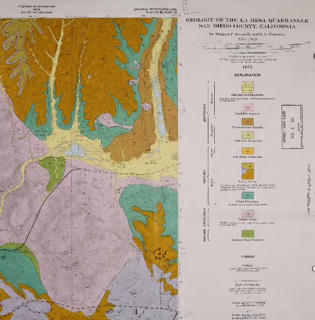
PREPARED IN COOPERATIONWITH
THE CITY OF SAN DIEGO
'96 |2'30" *97;
;i 760 000
SAN DIEGO METROPOLITAN AREA a ,
BULLETIN 200, PLATE 3B117*00"
GEOLOGY OF THE LA MESA QUADRANGLESAN DIEGO COUNTY, CALIFORNIA
by Michapl P. Kennedy and G. L. Pet-
SCALE 1 24000
contour interval 20 feet:d lines represent io-foot contour
datum is mean sea level
1975
EXPLANATION
Alluvium and Slopewash
Qstc, Slopewfuh: Qai & Qno. Alluvium and i
Landslide deposits
Lindavista Formation
San Diego Formation
Poway Group
Tp, Pomerado ConotomercUe: Tmv, Mission Vailey
Formation: Tsl. Sladium ConglomeriUe. Co '
Granite rocks
i of Ike eouthem Cali-
Santiago Peak Volcanics
Fault, showing dip
(daehed where approximalely located;
doUed where concealed; U. uptkr&wn

OPOGRAPH C BASE
ConliolbyUSGSanc

Fault, showing dip
{dashed where approzimaleii/ located;' " ' ' ere eonceaie<' "
: D. downlhdolled where eonceaied: U. uplhrovm
Landslide with direction of movementindicated by arrows.
Clay sample locality.
Pit, quarry, or mine.
Fossil coccolith locality.
Fossil vertebrate locality.
^^..

STATE OF CALIFORNIATHE RESOURCES AGENCY
DEPARTMENT OF CONSERVATION
PREPARED IN COOPERATIONWITH
THE CITY OF SAN DIEGO

PREPARED IN COOPERATIONWITH
THE CITY OF SAN DIEGO
GEOLOGY OF THE POWAY QUADRANGLESAN DIEGO COUNTY, CALIFORNIA
by Michael P. Kennedy and G. L. Pet
SCALE 1 24000
1975
EXPLANATION
Alluvium and Slopewash
Qw), Slopewuk; Qal & Qni). ^Wt*i-iut.
Landslide deposits
Lindavista Formation
Poway Group
Tp. Pomertulo Conolof
atone Tongue of Pomeru.. _ ..ion Valley Formaiion: Ttl, Stadium Co'Ujiomerate.
Friars Formation
Lusardi Formation
Santiago Peak Volcanics
8 I
c - '2
5 5> T


'oximatelu located:
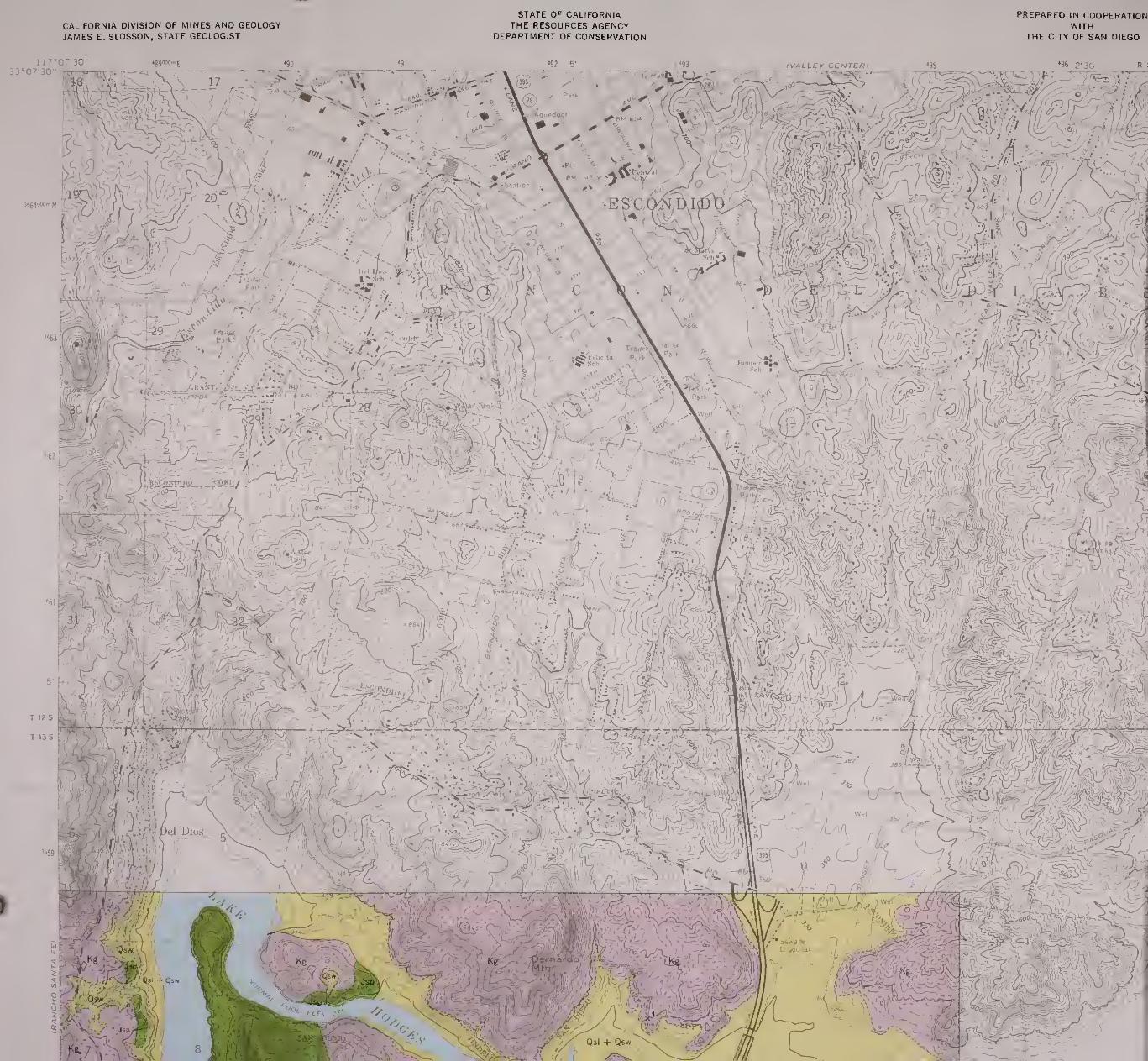
CALIFORNIA DIVISION OF MINES AND GEOLOGYJAMES E. SLOSSON, STATE GEOLOGIST
STATE OF CALIFORNIATHE RESOURCES AGENCY
DEPARTMENT OF CONSERVATION
PREPARED IN COOPERATIONWITH
THE CITY OF SAN DIEGO

PREPARED IN COOPERATIONWITH
THE CITY OF SAN DIEGO
2HSAN DIEGO METROPOLITAN AREA (^3
BULLETIN 200, PLATE IB p^ ^
GEOLOGY OF THE SOUTHWEST QUARTEROF THE ESGONDIDO QUADRANGLESAN DIEGO COUNTY, CALIFORNIA
by Michael P. Kennedy
SCALE 1:24000
1000 2000 4000 5000
Granite rocks
UndiffereiituUed oranilic rocks of the aoulhem Cali-
fornia batholith.
Santiago Peak Volcanics
Contact
idaahed where approximatdy located:
dotted where concealed)
dTIFault, showing dip
{dashed where approximately located:
CONTOUR INTERVAL 20 FEETDOTTED LINES REPRESENT 10 FOOT CONTOURS
DATUM IS MEAN SEA LEVEL
1975
EXPLANATION

Control by USGS and USC & G

I
Contact
(dtuhed where approximalely located:
dotted where coTicealed)
Fault, showing dip
(dfuhed where approximately located;
dotted where conceaied; U, upthrownside; D, downthrown aide).
Strike and dip of bedding"^
in sedimentary rocks.
Strike and dip of beddingin metasedimentary rocks.
Strike and dip of joint.
Strike of vertical joint.
Landslide with direction of movementindicated by arrows.
LOCATION MAP
L^
GEOLOGY MAPPED BY MICHAEL P KENNEDY. 1971
^