Embed Size (px)
Citation preview
Geography 101
Mrs. Dillard
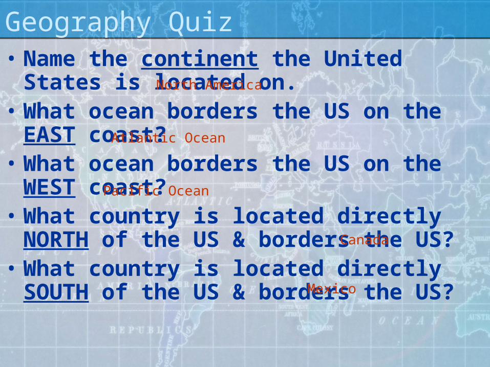
• Name the continent the United States is located on.
• What ocean borders the US on the EAST coast?
• What ocean borders the US on the WEST coast?
• What country is located directly NORTH of the US & borders the US?
• What country is located directly SOUTH of the US & borders the US?
Geography Quiz
North America
Atlantic Ocean
Canada
Pacific Ocean
Mexico

Geographical Features• Bay: Part of a large body of water that extends
into a shoreline• Beach: The shore of a body of water, usually
sandy or pebbly.• Canyon: A deep valley with steep sides
between hills or mountains may have a stream or river.
• Cape: A piece of land extending into the water, smaller than a peninsula
• Cave: A hollow beneath the earth’s surface, often having an opening in the side of a hill or cliff.

Geographical Features• Channel/Strait: A narrow waterway that
connects 2 larger bodies of water.• Coast: Land along a sea or ocean• Delta: Land that is formed by mud, silt,
and sand deposited at the mouth of a river. Usually 3 sided, triangle.
• Desert: Dry, barren land• Forest: Dense growth of trees and
underbrush
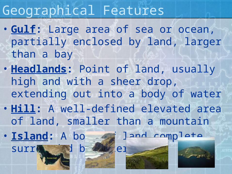
Geographical Features• Gulf: Large area of sea or ocean,
partially enclosed by land, larger than a bay
• Headlands: Point of land, usually high and with a sheer drop, extending out into a body of water
• Hill: A well-defined elevated area of land, smaller than a mountain
• Island: A body of land complete surrounded by water
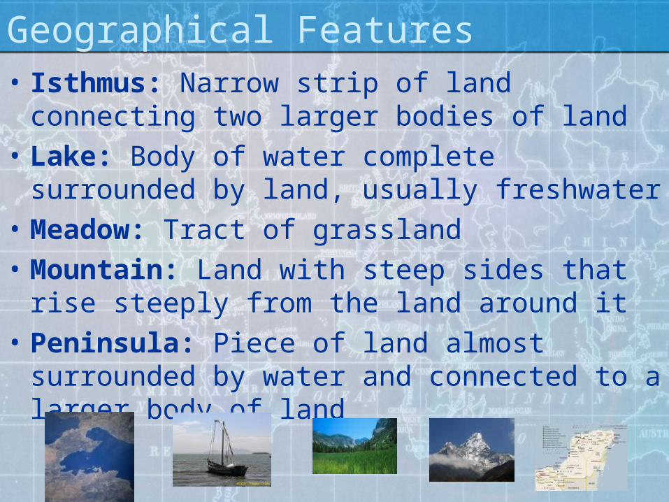
Geographical Features• Isthmus: Narrow strip of land connecting
two larger bodies of land• Lake: Body of water complete
surrounded by land, usually freshwater• Meadow: Tract of grassland• Mountain: Land with steep sides that
rise steeply from the land around it• Peninsula: Piece of land almost
surrounded by water and connected to a larger body of land

Geographical Features• Plain: An almost level area of land that
stretches for miles• Plateau: A elevated plain raised sharply
above the surround land, at least on one side• River: A natural stream of water that
empties into an ocean or lake, usually fed along its course by tributaries
• Swamp: Low land region saturated by water• Valley: Low land between hills or
mountains

Continents or Countries?• Africa• North America• Antarctica• United Kingdom• Ireland• Europe• Asia• China

Where in the WORLD?• Where is the equator?
• Zero degrees latitude
• Where is the Prime Meridian?• Zero degrees longitude
• Where is the International Date Line?• 180 degree longitude
• What is longitude?• LONG, lines run North to South
• What is latitude?• Ladder, lines run East to West

Latitude• Measure of distance
North to South of the Equator (0 degrees)
• Also called parallels• The equator divides
the world into Northern and Southern hemispheres
• Latitude lines are 30 degrees apart
QuickTime™ and a decompressor
are needed to see this picture.

Longitude• Measured in distance
east or west of the Prime Meridian (0 degrees)
• Prime Meridian passes through Greenwich, England
• International Date Line: 180 degrees
• Divides the world into Eastern & Western hemispheres
QuickTime™ and a decompressor
are needed to see this picture.
QuickTime™ and a decompressor
are needed to see this picture.

What’s the difference??• Continent: large land mass,
separated from others by water.• 7 continents: Asia, Antarctica, Africa,
North America, South America, Australia, and Europe
• Country: Extended expanse of land• Around 195 countries, currently• Examples?