Embed Size (px)
Citation preview
www.digitalglobe.com Corporate (U.S.) +1.303.684.4561 or +1.800.496.1225 | London +44.20.8899.6801 | Singapore +65.6389.4851
DATA SHEE T
Features » Very high resolution
» Industry-leading geolocation accuracy
» High capacity over a broad range of collection types
» Direct downlink to customer sites available
» Frequent visits at high resolution
Benefits » Provides highly detailed imagery
for precise map creation, change detection, and in-depth image analysis
(Note: imagery must be re-sampled to 50 cm for non-US government customers)
» Geolocate features to less than 5 m to create maps in remote areas, maximizing the utility of available resources
» Collects, stores, and downlinks a greater supply of frequently updated global imagery products than competitive systems
» Stereoscopic collection on a single pass ensure image continuity and consistency of quality
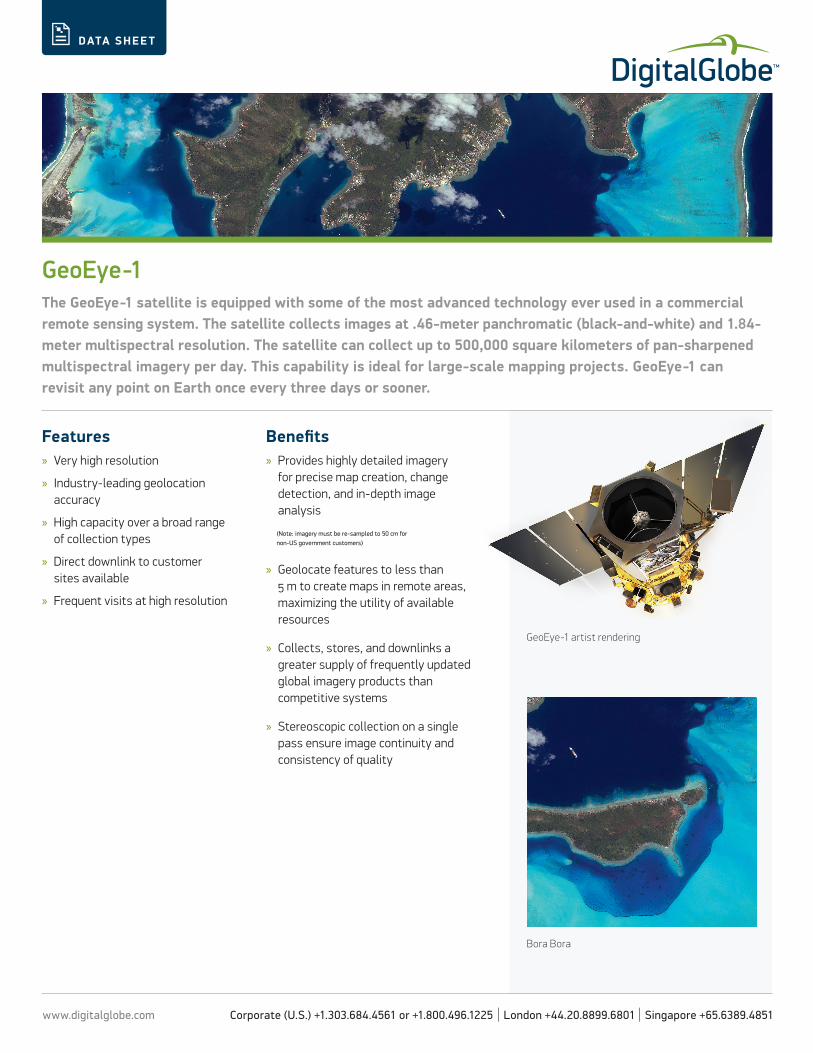
GeoEye-1The GeoEye-1 satellite is equipped with some of the most advanced technology ever used in a commercial remote sensing system. The satellite collects images at .46-meter panchromatic (black-and-white) and 1.84-meter multispectral resolution. The satellite can collect up to 500,000 square kilometers of pan-sharpened multispectral imagery per day. This capability is ideal for large-scale mapping projects. GeoEye-1 can revisit any point on Earth once every three days or sooner.
GeoEye-1 artist rendering
Bora Bora
www.digitalglobe.com Corporate (U.S.) +1.303.684.4561 or +1.800.496.1225 | London +44.20.8899.6801 | Singapore +65.6389.4851
DATA SHEE T
DIGITALGLOBE CONSTEL L ATION » GEOE YE-1
DS-GE1 01/14
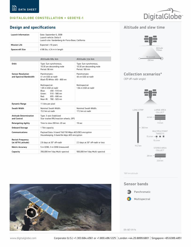
Altitude and slew time
Collection scenarios* (300 off-nadir angle)
Altitude770 km
200 km
19 seconds
LARGE AREACOLLECT
MULTIPLE POINTTARGETS
STEREO AREACOLLECT
LONG STRIP
360 km
15.2 km
15.4 km
15.4 km
28 km
224 km
44 km
112 km
Panchromatic
Sensor bands
Multispectral
Design and specifications
Launch Information Date: September 6, 2008Launch vehicle: Delta IILaunch site: Vandenberg Air Force Base, California
Mission Life Expected >10 years
Spacecraft Size 4186 lbs, 4.34 m in length
Altitude 681 km Altitude 770 km
Orbit Type: Sun-synchronous,10:30 am descending nodePeriod: 98 min
Type: Sun-synchronous,10:30 am descending nodePeriod: 100 min
Sensor Resolutionand Spectral Bandwidth
Panchromatic: 41 cm GSD at nadirBlack & White: 450 - 800 nm
Multispectral: 1.65 m GSD at nadirBlue: 450 - 510 nm Green: 510 - 580 nmRed: 655 - 690 nm Near-IR: 780 - 920 nm
Panchromatic46 cm GSD at nadir
Multispectral1.84 m GSD at nadir
Dynamic Range 11-bits per pixel
Swath Width Nominal Swath Width: 15.3 km at nadir
Nominal Swath Width: 17.3 km at nadir
Attitude Determination and Control
Type: 3-axis StabilizedStar tracker/IRU/reaction wheels, GPS
Retargeting Agility Time to slew 200 km: 20 sec 19 sec
Onboard Storage 1 Tbit capacity
Communications Payload Data: X-band 740/150 Mbps AES/DES encryptionHousekeeping: X-band 64 kbps AES encryption
Revisit Frequency(at 40°N Latitude) 2.6 days at 30° off-nadir 2.3 days at 30° off-nadir or less
Metric Accuracy 5 m CE90, 3 m CE90 (measured)
Capacity 350,000 km 2/day Multi-spectral 500,000 km 2/day Multi-spectral
*681 km altitude