Embed Size (px)
DESCRIPTION
Fundamentals of some issues in small hydropower development in guyana according to the gea.
Citation preview
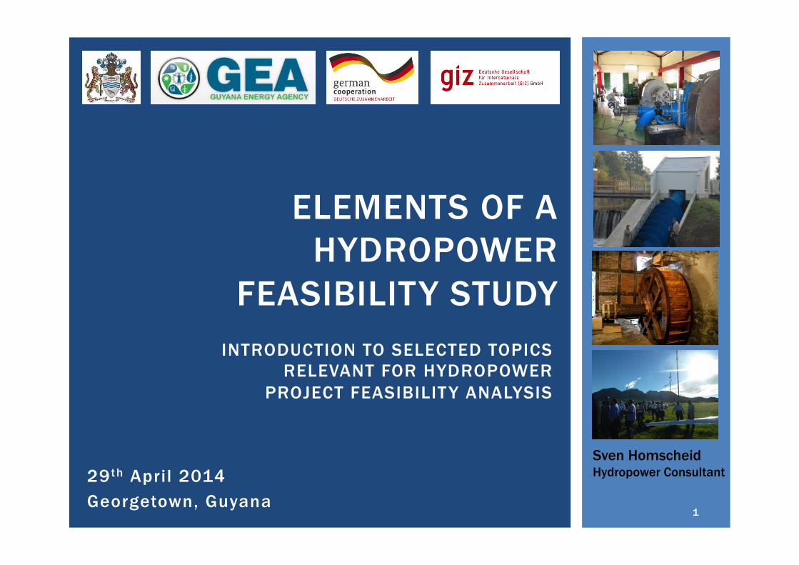
29th April 2014 Georgetown, Guyana
ELEMENTS OF A HYDROPOWER
FEASIBILITY STUDY
Sven Homscheid Hydropower Consultant
INTRODUCTION TO SELECTED TOPICS RELEVANT FOR HYDROPOWER
PROJECT FEASIBILITY ANALYSIS
1
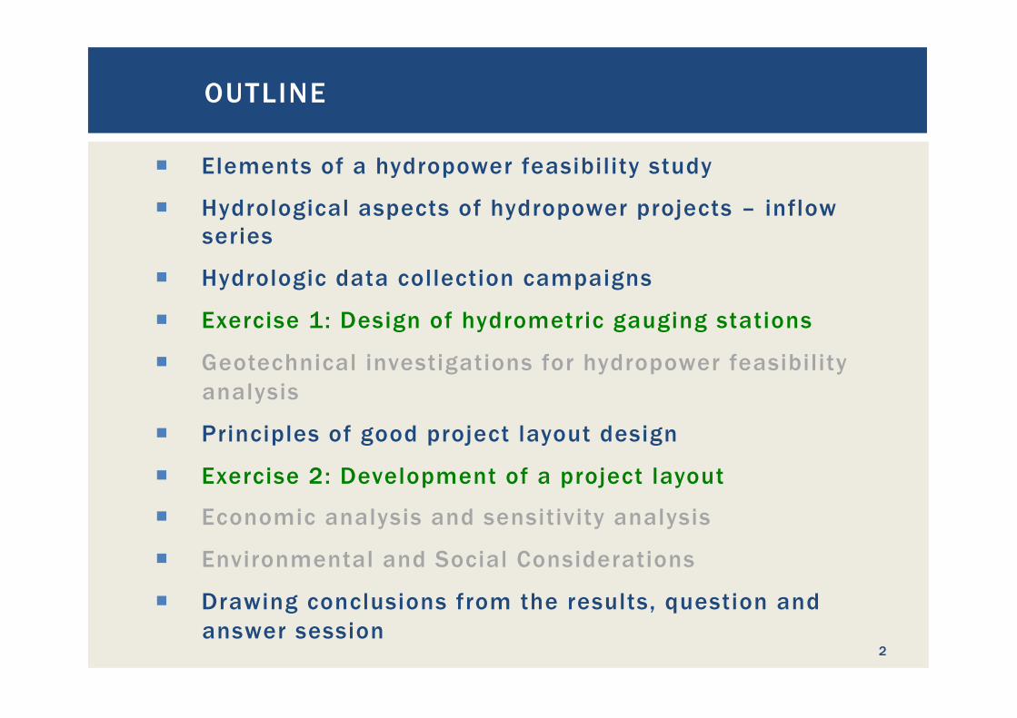
¡ Elements of a hydropower feasibility study
¡ Hydrological aspects of hydropower projects – inflow series
¡ Hydrologic data collection campaigns
¡ Exercise 1: Design of hydrometric gauging stations
¡ Geotechnical investigations for hydropower feasibility analysis
¡ Principles of good project layout design
¡ Exercise 2: Development of a project layout
¡ Economic analysis and sensitivity analysis
¡ Environmental and Social Considerations
¡ Drawing conclusions from the results, question and answer session
OUTLINE
2
ELEMENTS OF A HYDROPOWER
FEASIBILITY STUDY
3
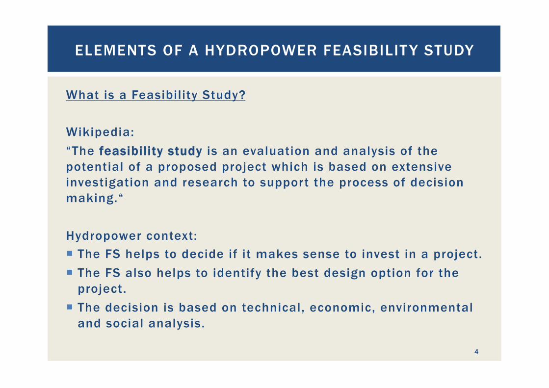
What is a Feasibility Study? Wikipedia: “The feasibility study is an evaluation and analysis of the potential of a proposed project which is based on extensive investigation and research to support the process of decision making.“
Hydropower context: ¡ The FS helps to decide if it makes sense to invest in a project. ¡ The FS also helps to identify the best design option for the
project. ¡ The decision is based on technical, economic, environmental
and social analysis.
ELEMENTS OF A HYDROPOWER FEASIBILIT Y STUDY
4
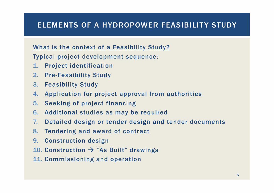
What is the context of a Feasibility Study? Typical project development sequence: 1. Project identification 2. Pre-Feasibility Study 3. Feasibility Study 4. Application for project approval from authorities 5. Seeking of project financing 6. Additional studies as may be required 7. Detailed design or tender design and tender documents 8. Tendering and award of contract 9. Construction design 10. Construction à “As Built” drawings 11. Commissioning and operation
ELEMENTS OF A HYDROPOWER FEASIBILIT Y STUDY
5
What does a Feasibility Study contain?
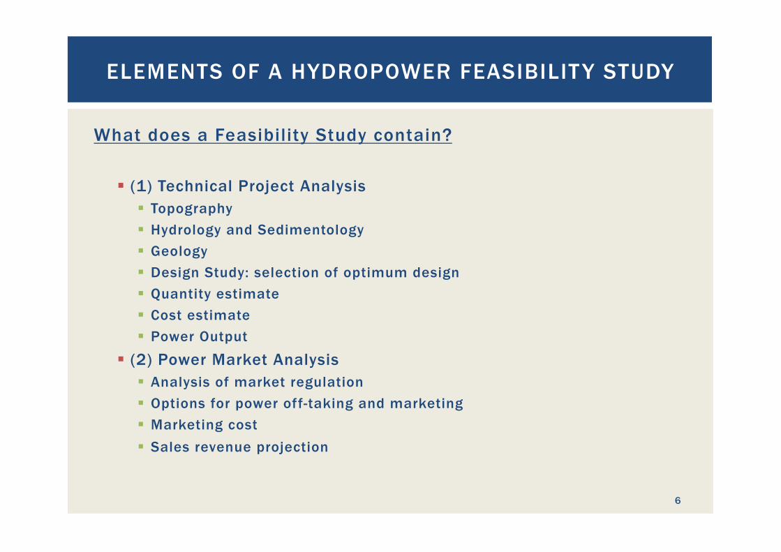
§ (1) Technical Project Analysis § Topography § Hydrology and Sedimentology § Geology § Design Study: selection of optimum design § Quantity estimate § Cost estimate § Power Output
§ (2) Power Market Analysis § Analysis of market regulation § Options for power off-taking and marketing § Marketing cost § Sales revenue projection
ELEMENTS OF A HYDROPOWER FEASIBILIT Y STUDY
6
What does a Feasibility Study contain? (continued)
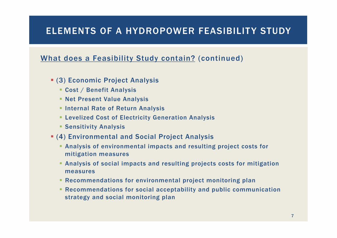
§ (3) Economic Project Analysis § Cost / Benefit Analysis § Net Present Value Analysis § Internal Rate of Return Analysis § Levelized Cost of Electricity Generation Analysis § Sensitivity Analysis
§ (4) Environmental and Social Project Analysis § Analysis of environmental impacts and resulting project costs for
mitigation measures § Analysis of social impacts and resulting projects costs for mitigation
measures § Recommendations for environmental project monitoring plan § Recommendations for social acceptability and public communication
strategy and social monitoring plan
ELEMENTS OF A HYDROPOWER FEASIBILIT Y STUDY
7
What does a Feasibility Study contain? (continued)
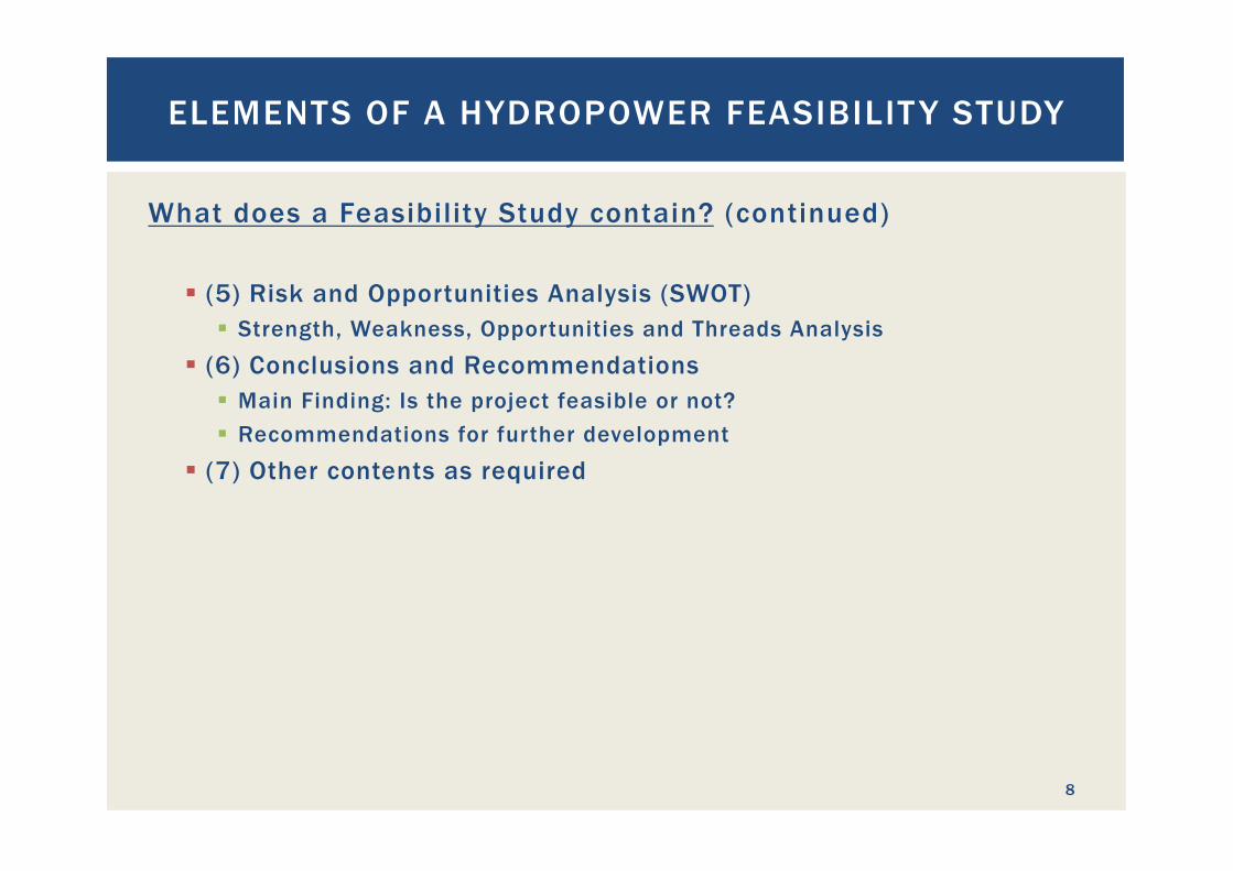
§ (5) Risk and Opportunities Analysis (SWOT) § Strength, Weakness, Opportunities and Threads Analysis
§ (6) Conclusions and Recommendations § Main Finding: Is the project feasible or not? § Recommendations for further development
§ (7) Other contents as required
ELEMENTS OF A HYDROPOWER FEASIBILIT Y STUDY
8
HYDROLOGICAL ASPECTS OF
HYDROPOWER PROJECTS
- INFLOW SERIES -
9
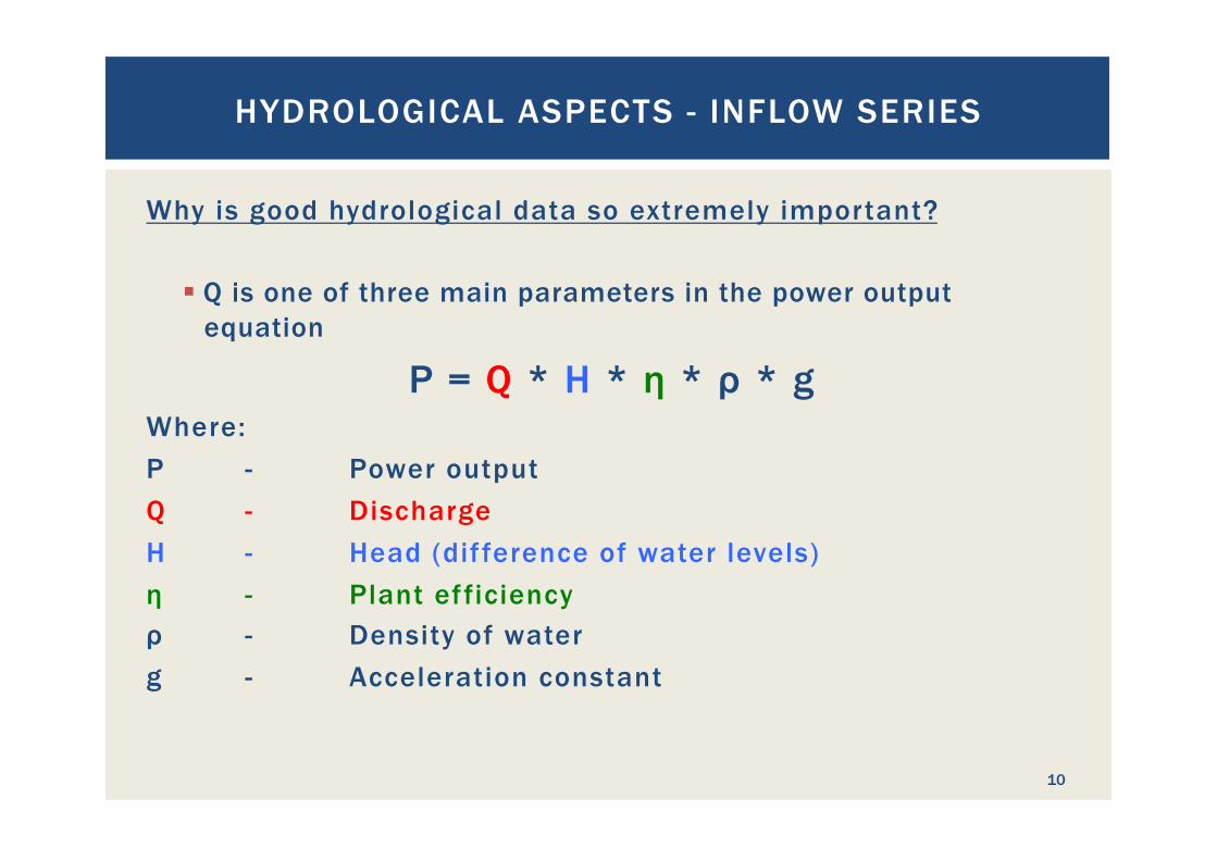
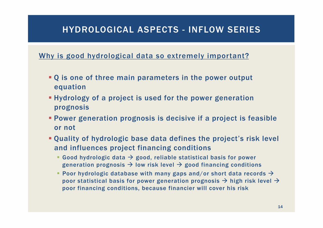
Why is good hydrological data so extremely important?
§ Q is one of three main parameters in the power output equation
P = Q * H * η * ρ * g Where: P - Power output Q - Discharge H - Head (dif ference of water levels) η - Plant efficiency ρ - Density of water g - Acceleration constant
HYDROLOGICAL ASPECTS - INFLOW SERIES
10
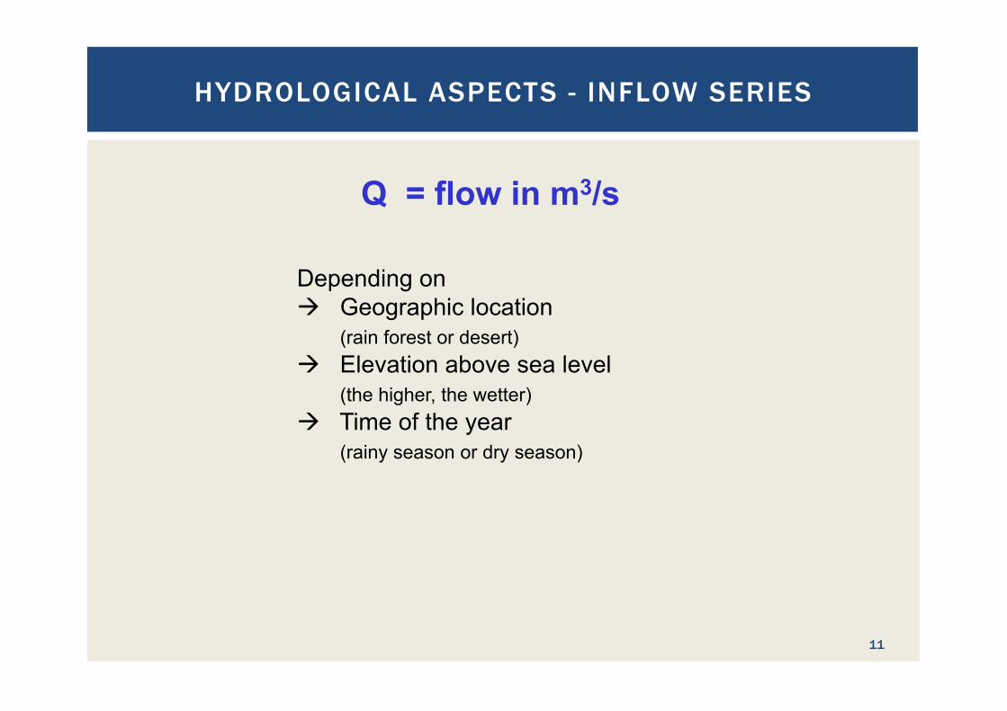
Q = flow in m3/s
Depending on à Geographic location
(rain forest or desert) à Elevation above sea level
(the higher, the wetter) à Time of the year
(rainy season or dry season)
HYDROLOGICAL ASPECTS - INFLOW SERIES
11
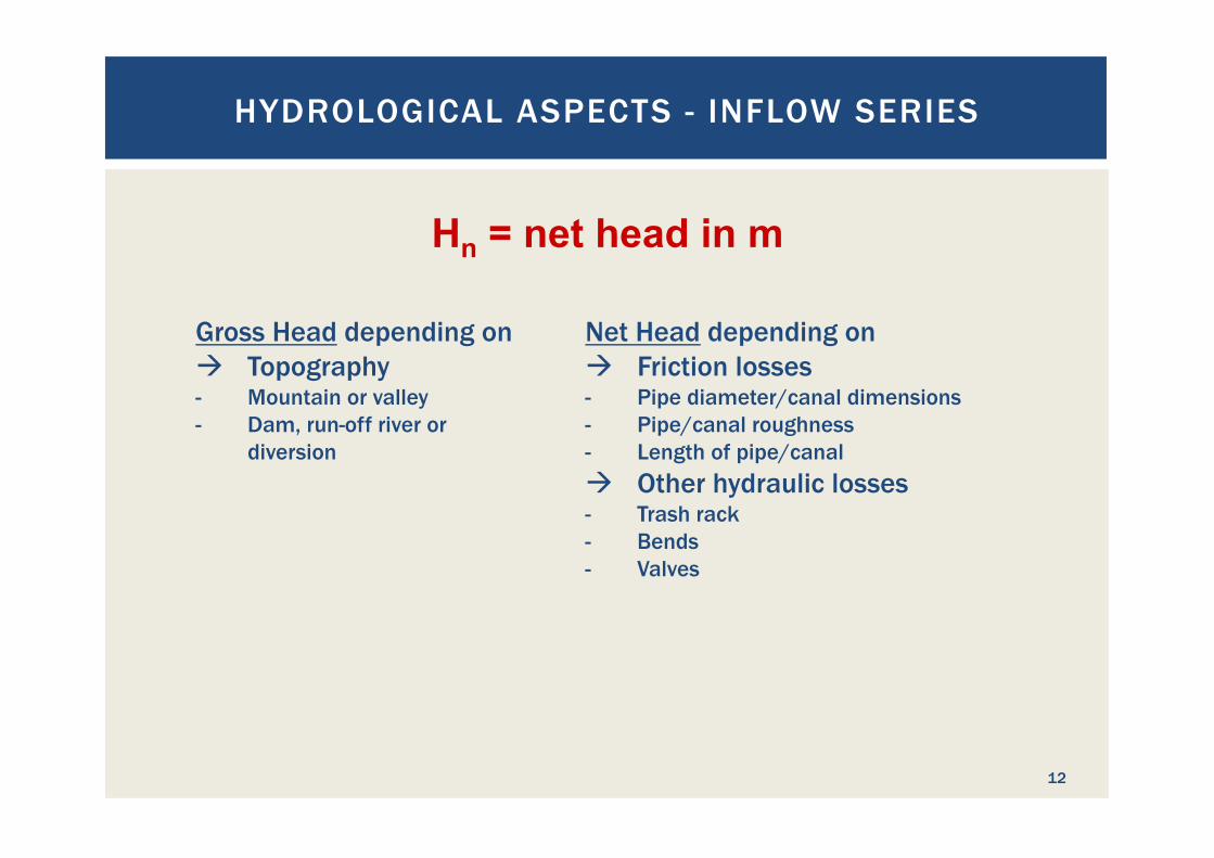
Gross Head depending on à Topography - Mountain or valley - Dam, run-off river or
diversion
Hn = net head in m
Net Head depending on à Friction losses - Pipe diameter/canal dimensions - Pipe/canal roughness - Length of pipe/canal à Other hydraulic losses - Trash rack - Bends - Valves
HYDROLOGICAL ASPECTS - INFLOW SERIES
12
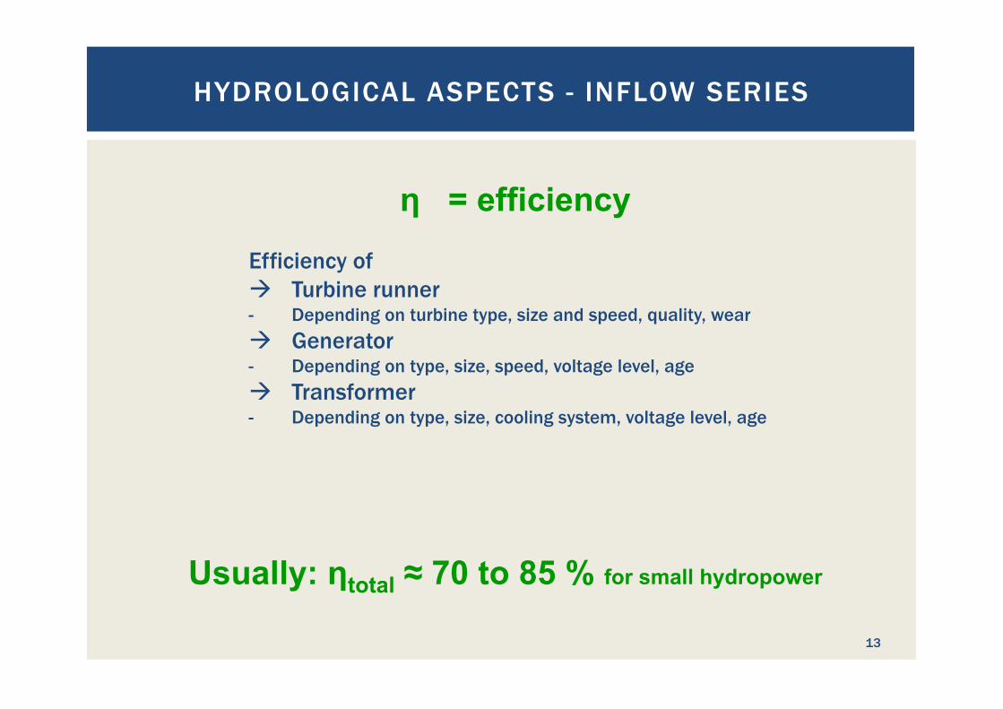
Efficiency of à Turbine runner - Depending on turbine type, size and speed, quality, wear à Generator - Depending on type, size, speed, voltage level, age à Transformer - Depending on type, size, cooling system, voltage level, age
η = efficiency
Usually: ηtotal ≈ 70 to 85 % for small hydropower
HYDROLOGICAL ASPECTS - INFLOW SERIES
13
Why is good hydrological data so extremely important?
§ Q is one of three main parameters in the power output equation
§ Hydrology of a project is used for the power generation prognosis
§ Power generation prognosis is decisive if a project is feasible or not
§ Quality of hydrologic base data defines the project’s risk level and influences project financing conditions § Good hydrologic data à good, reliable statistical basis for power
generation prognosis à low risk level à good financing conditions § Poor hydrologic database with many gaps and/or short data records à
poor statistical basis for power generation prognosis à high risk level à poor financing conditions, because financier will cover his risk
HYDROLOGICAL ASPECTS - INFLOW SERIES
14
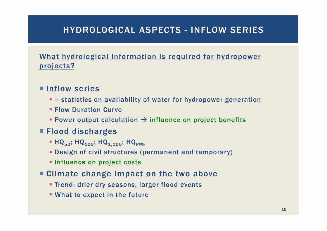
What hydrological information is required for hydropower projects? ¡ Inflow series
§ = statistics on availability of water for hydropower generation § Flow Duration Curve § Power output calculation à influence on project benefits
¡ Flood discharges § HQ50; HQ100; HQ1,000; HQPMF
§ Design of civil structures (permanent and temporary) § Influence on project costs
¡ Climate change impact on the two above § Trend: drier dry seasons, larger flood events § What to expect in the future
HYDROLOGICAL ASPECTS - INFLOW SERIES
15
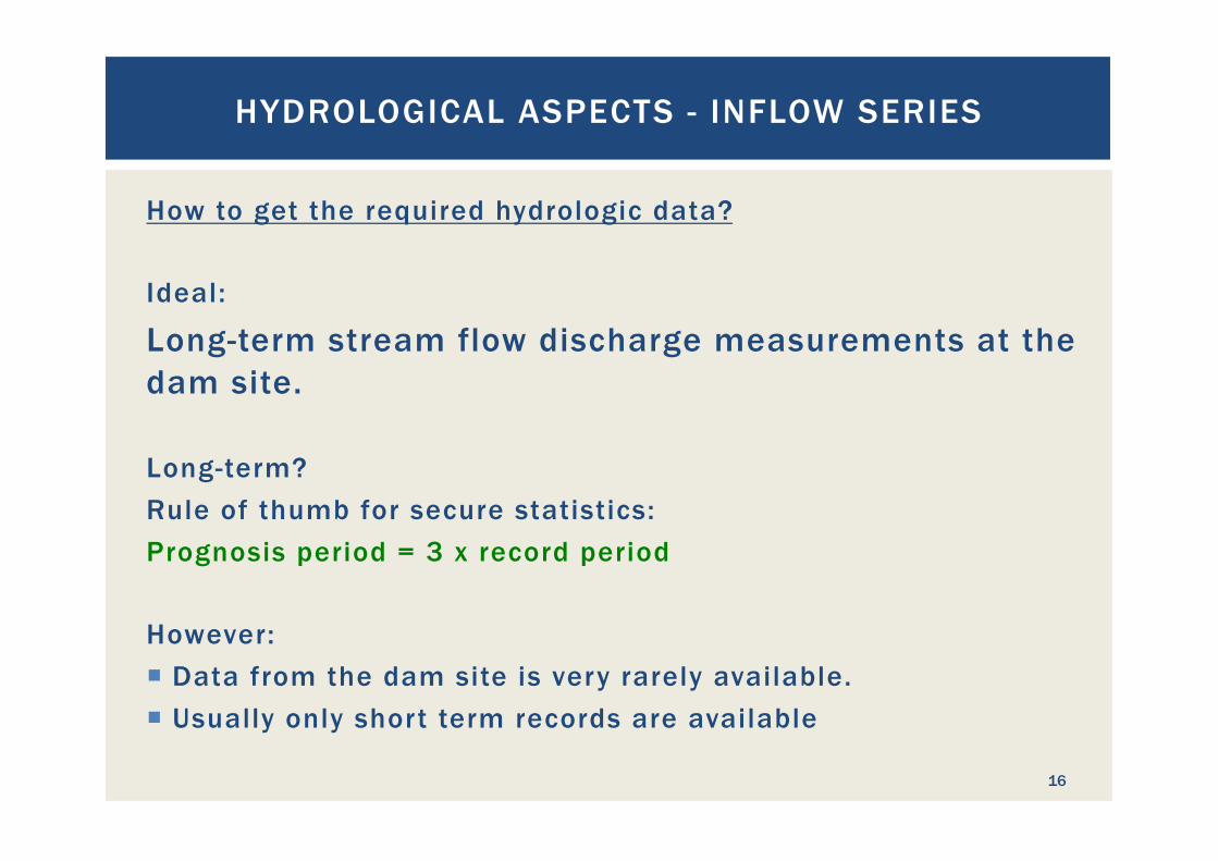
How to get the required hydrologic data? Ideal:
Long-term stream flow discharge measurements at the dam site. Long-term? Rule of thumb for secure statistics: Prognosis period = 3 x record period However: ¡ Data from the dam site is very rarely available. ¡ Usually only short term records are available
HYDROLOGICAL ASPECTS - INFLOW SERIES
16
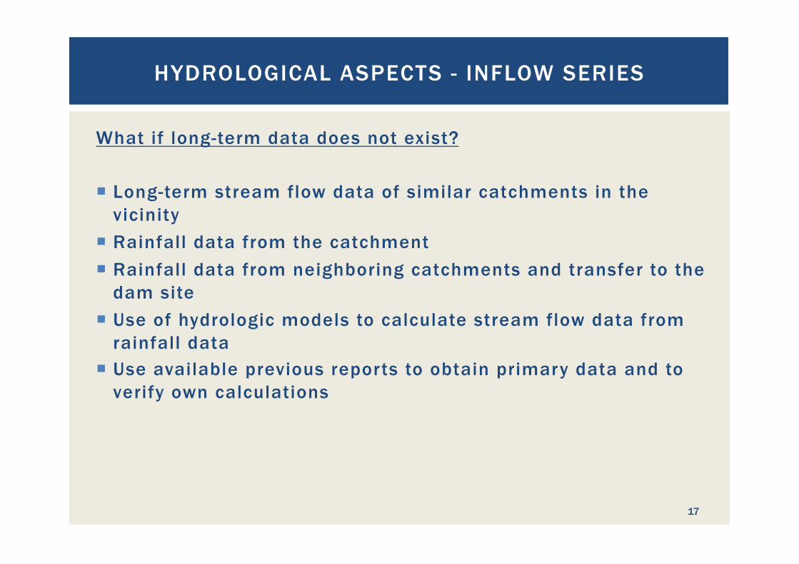
What if long-term data does not exist? ¡ Long-term stream flow data of similar catchments in the
vicinity ¡ Rainfall data from the catchment ¡ Rainfall data from neighboring catchments and transfer to the
dam site ¡ Use of hydrologic models to calculate stream flow data from
rainfall data ¡ Use available previous reports to obtain primary data and to
verify own calculations
HYDROLOGICAL ASPECTS - INFLOW SERIES
17
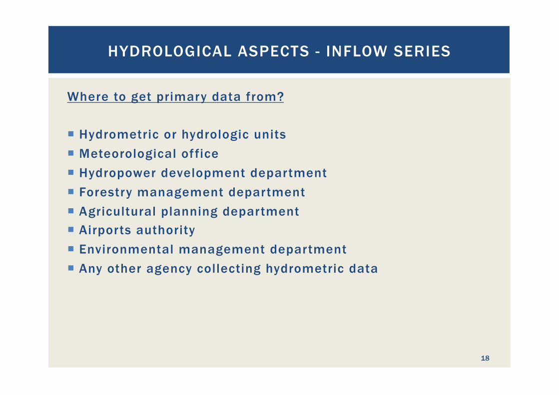
Where to get primary data from? ¡ Hydrometric or hydrologic units ¡ Meteorological office ¡ Hydropower development department ¡ Forestry management department ¡ Agricultural planning department ¡ Airports authority ¡ Environmental management department ¡ Any other agency collecting hydrometric data
HYDROLOGICAL ASPECTS - INFLOW SERIES
18
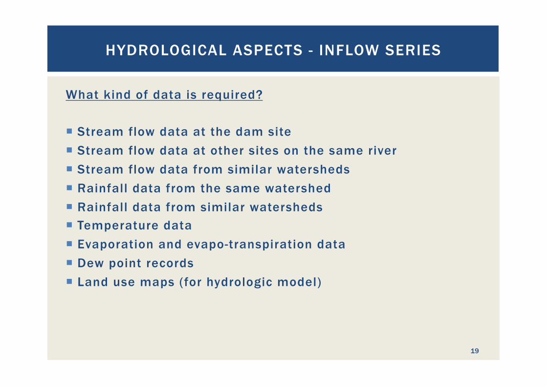
What kind of data is required? ¡ Stream flow data at the dam site ¡ Stream flow data at other sites on the same river ¡ Stream flow data from similar watersheds ¡ Rainfall data from the same watershed ¡ Rainfall data from similar watersheds ¡ Temperature data ¡ Evaporation and evapo-transpiration data ¡ Dew point records ¡ Land use maps (for hydrologic model)
HYDROLOGICAL ASPECTS - INFLOW SERIES
19
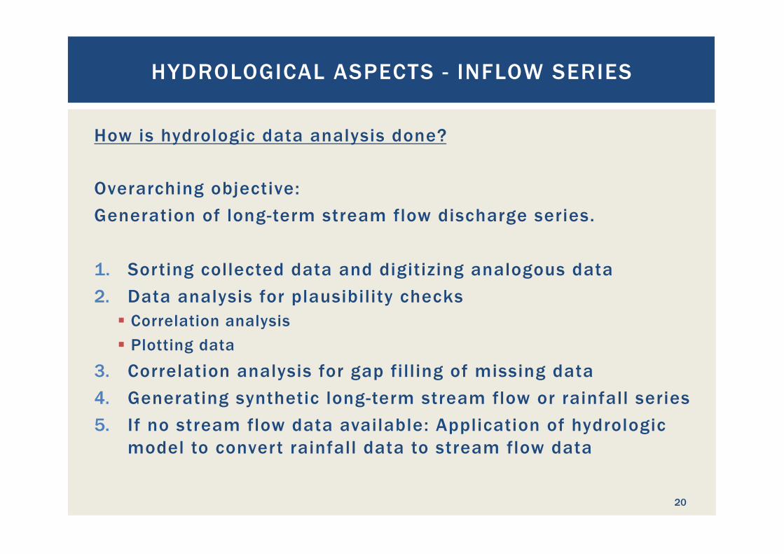
How is hydrologic data analysis done? Overarching objective: Generation of long-term stream flow discharge series. 1. Sorting collected data and digitizing analogous data 2. Data analysis for plausibility checks
§ Correlation analysis § Plotting data
3. Correlation analysis for gap filling of missing data 4. Generating synthetic long-term stream flow or rainfall series 5. If no stream flow data available: Application of hydrologic
model to convert rainfall data to stream flow data
HYDROLOGICAL ASPECTS - INFLOW SERIES
20
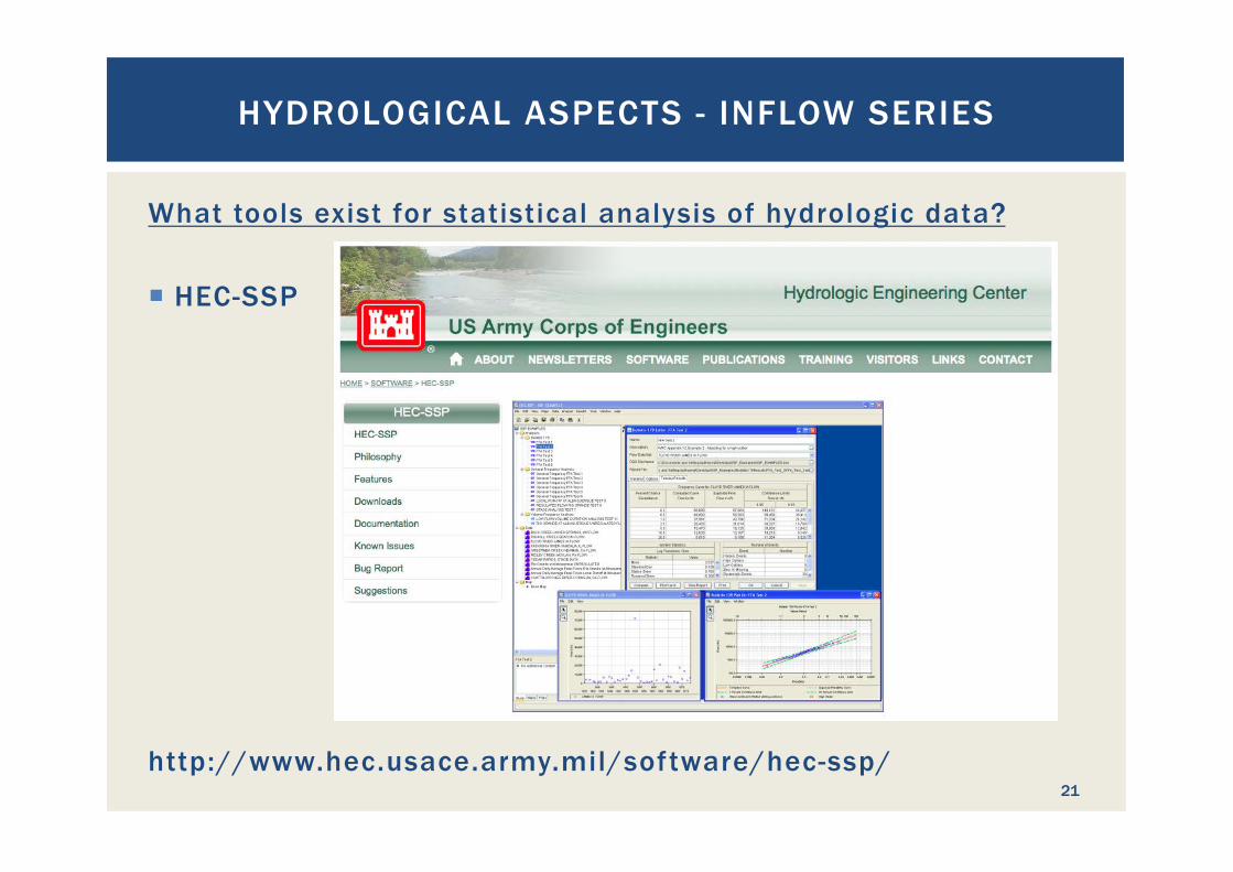
What tools exist for statistical analysis of hydrologic data?
¡ HEC-SSP
http://www.hec.usace.army.mil/software/hec-ssp/
HYDROLOGICAL ASPECTS - INFLOW SERIES
21
What tools exist for statistical analysis of hydrologic data? ¡ HEC-SSP ¡ Microsoft Excel and additional statistic ad-ons ¡ Other commercial software like
§ NCSS (www.ncss.com) § HyStat (http://www.hystat.de/default_e.htm)
HYDROLOGICAL ASPECTS - INFLOW SERIES
22
What is a synthetic inflow series? ¡ If no recorded stream flow data is available that can be used
as inflow series, an inflow series needs to be generated. ¡ Use of hydrologic and statistical models to produce long-term
series of daily average stream flow discharge data without gaps
¡ Any gaps in the series will be filled by application of statistical methods
¡ The synthetic series must reflect the real variability of water availability
¡ Discharge data is referenced to the point where water is abstracted for hydropower purposes
HYDROLOGICAL ASPECTS - INFLOW SERIES
23
How does a storage reservoir influence water availability?
Run-off river ß à Reservoir storage
¡ If a storage reservoir is available, storage must be simulated to reflect § water levels, § surface evaporation and § storage volume
¡ The ability to store water defines the possible functions of the hydropower project: § Base load supply § Peak-load supply § Pumped storage
HYDROLOGICAL ASPECTS - INFLOW SERIES
24
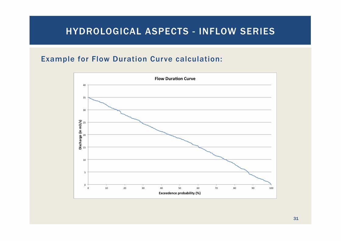
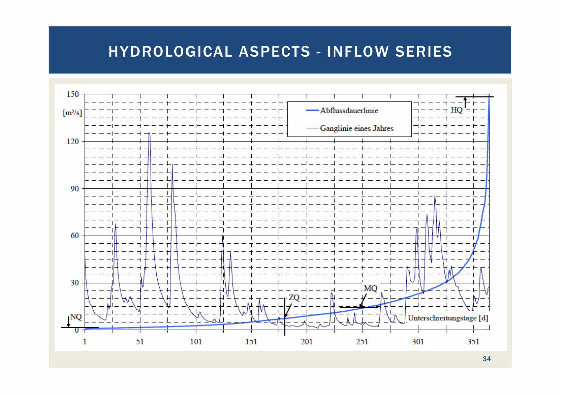
What is a Flow Duration Curve? The Flow Duration Curve (FDC) is a statistical evaluation of a time series of stream flows to obtain its exceedance probability, either in %, or in days per year referring to a statistically average year. The daily values are sorted to get the flow duration curve. ¡ The FDC tells for how long what amount of water will be
available ¡ The FDC is the basis to select the design (turbine) discharge
for the project
HYDROLOGICAL ASPECTS - INFLOW SERIES
25
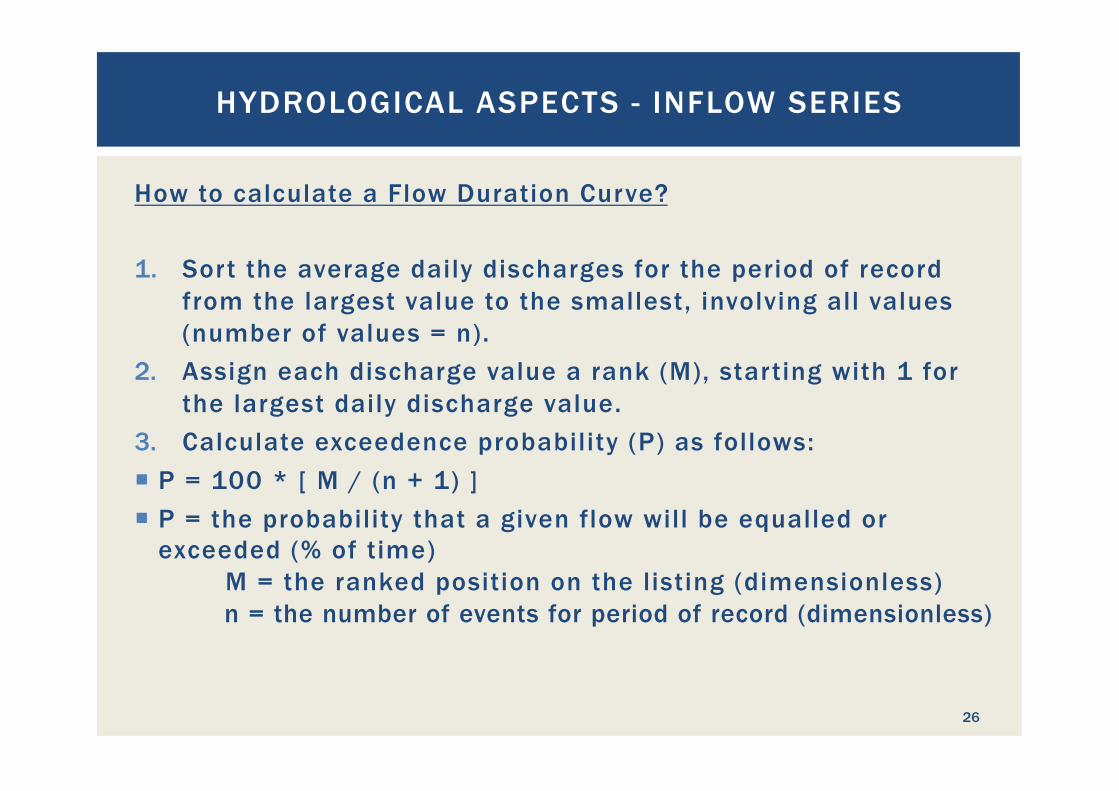
How to calculate a Flow Duration Curve? 1. Sort the average daily discharges for the period of record
from the largest value to the smallest, involving all values (number of values = n).
2. Assign each discharge value a rank (M), starting with 1 for the largest daily discharge value.
3. Calculate exceedence probability (P) as follows: ¡ P = 100 * [ M / (n + 1) ] ¡ P = the probability that a given flow will be equalled or
exceeded (% of time) M = the ranked position on the listing (dimensionless) n = the number of events for period of record (dimensionless)
HYDROLOGICAL ASPECTS - INFLOW SERIES
26
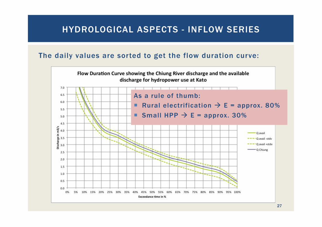
The daily values are sorted to get the flow duration curve:
HYDROLOGICAL ASPECTS - INFLOW SERIES
27
As a rule of thumb: ¡ Rural electrification à E = approx. 80% ¡ Small HPP à E = approx. 30%
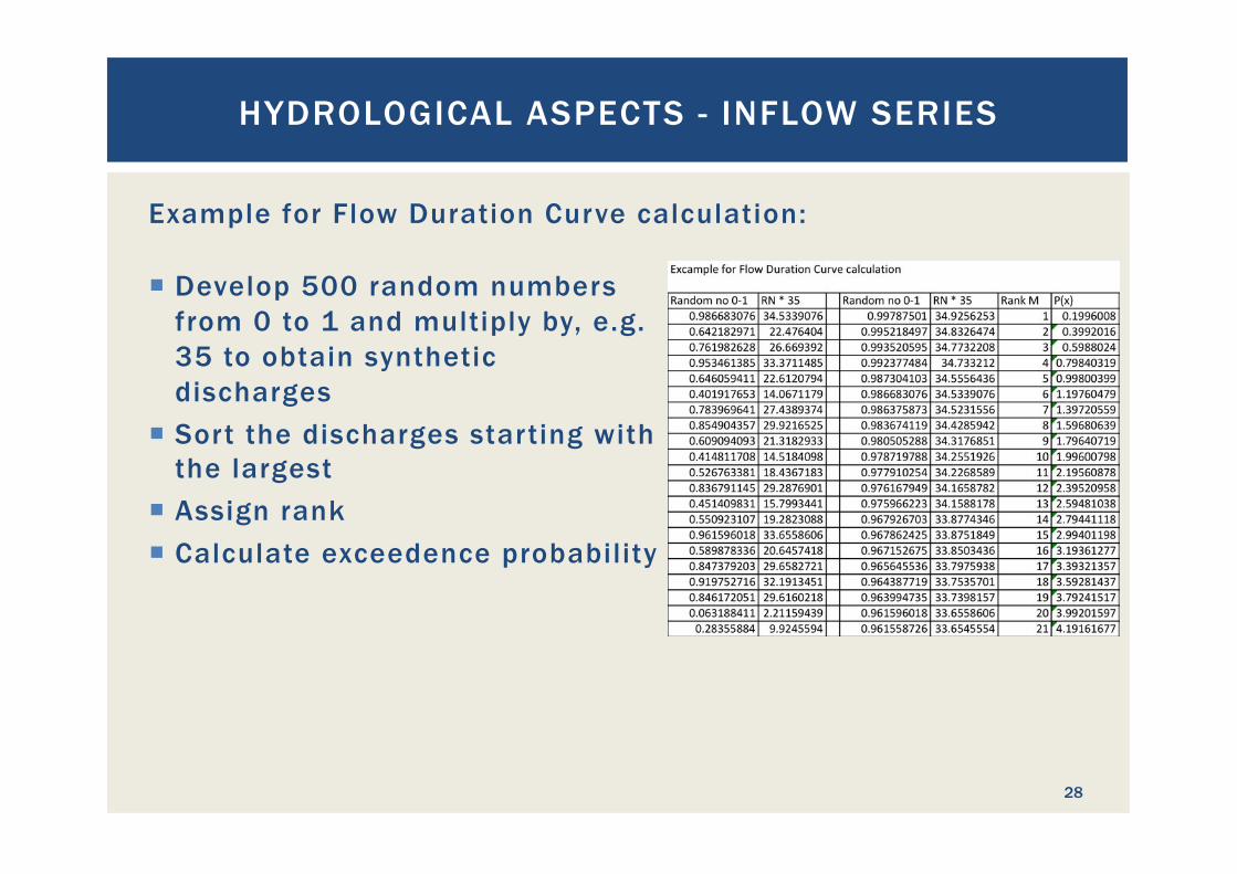
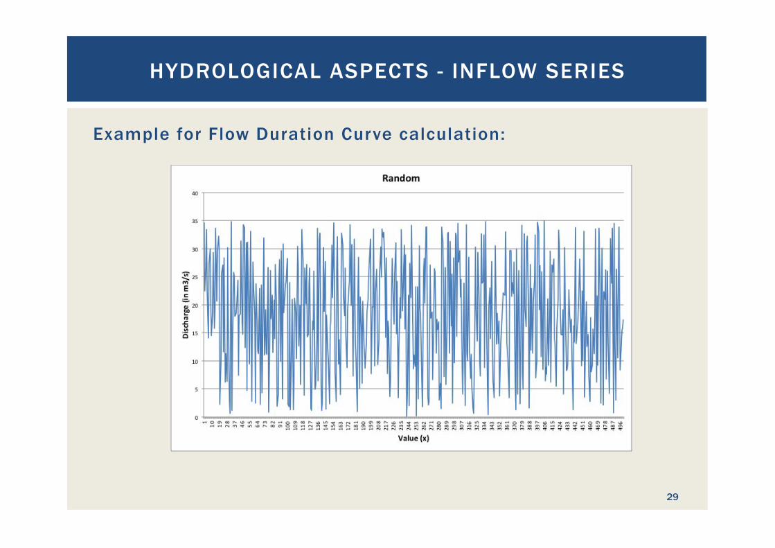
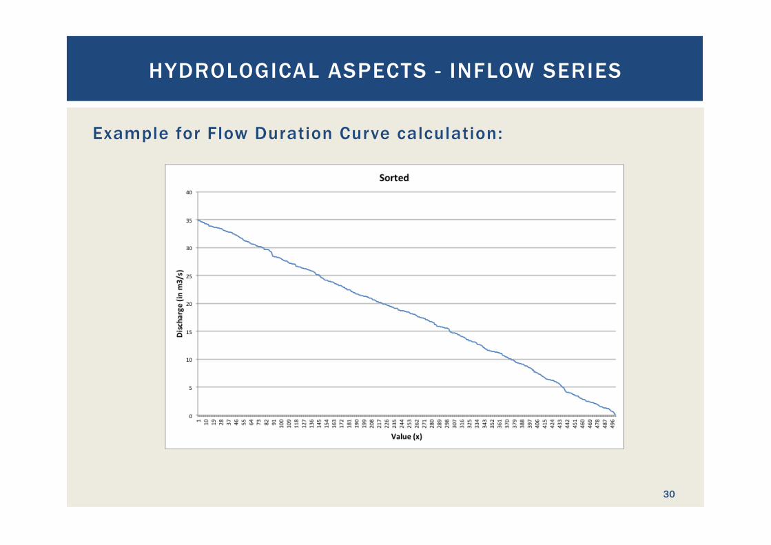
Example for Flow Duration Curve calculation:
HYDROLOGICAL ASPECTS - INFLOW SERIES
28
¡ Develop 500 random numbers from 0 to 1 and multiply by, e.g. 35 to obtain synthetic discharges
¡ Sort the discharges starting with the largest
¡ Assign rank ¡ Calculate exceedence probability
Example for Flow Duration Curve calculation:
HYDROLOGICAL ASPECTS - INFLOW SERIES
29
Example for Flow Duration Curve calculation:
HYDROLOGICAL ASPECTS - INFLOW SERIES
30
Example for Flow Duration Curve calculation:
HYDROLOGICAL ASPECTS - INFLOW SERIES
31
How to use the Flow Duration Curve? ¡ The FDC shows the flows that are available with a certain
exceedence probability ¡ From this data all discharges that cannot be used for
hydropower are subtracted to obtain the potentially available discharge
¡ All discharges larger than the design discharge of the hydropower plant are set equal to the design discharge
HYDROLOGICAL ASPECTS - INFLOW SERIES
32
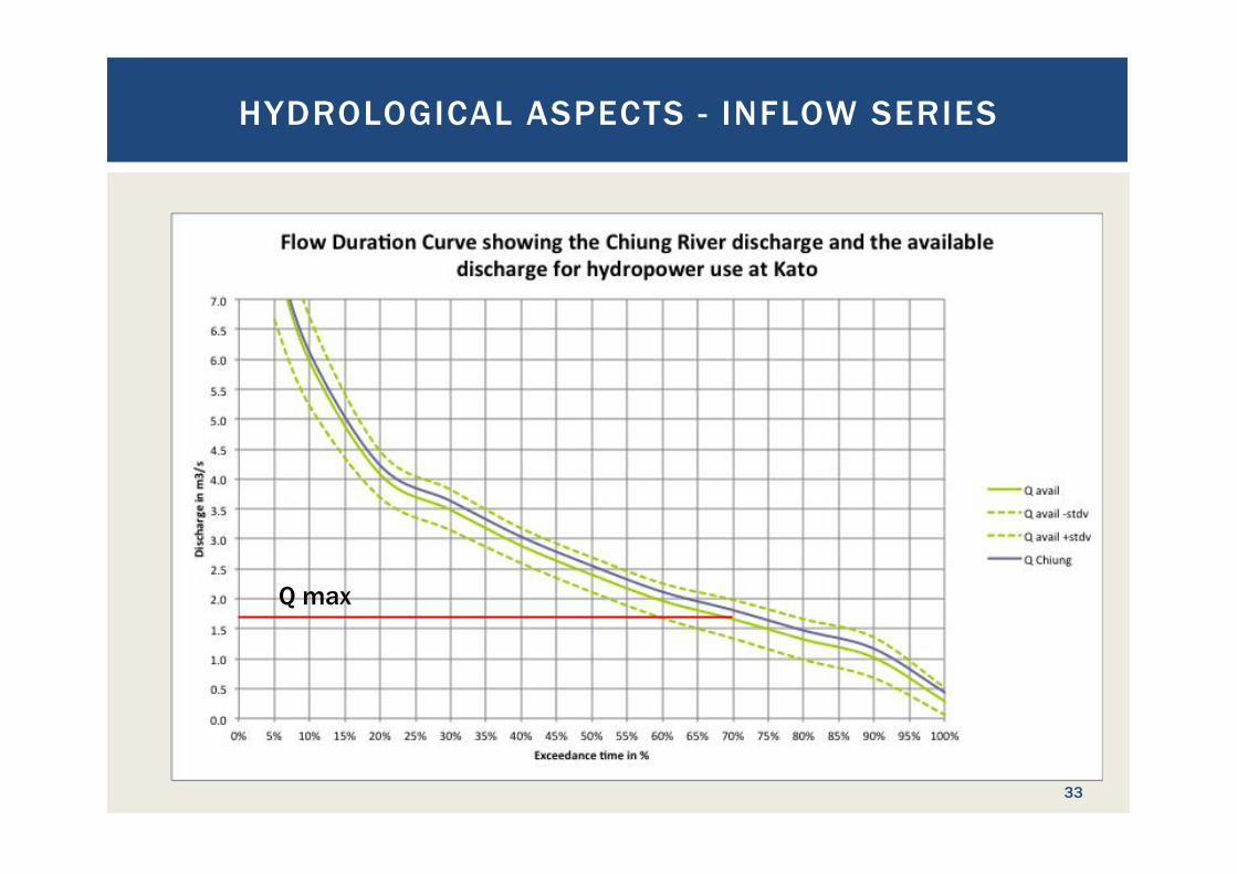
HYDROLOGICAL ASPECTS - INFLOW SERIES
33
Q max
HYDROLOGICAL ASPECTS - INFLOW SERIES
34
How to use the Flow Duration Curve? ¡ The FDC shows the flows that are available with a certain
exceedence probability ¡ From this data all discharges that cannot be used for
hydropower are subtracted to obtain the potentially available discharge
¡ All discharges larger than the design discharge of the hydropower plant are set equal to the design discharge
¡ The remaining values are converted into power and integrated over the respective time intervals. For this purpose, the FDC is often discretized in 1, 5 or 10 % steps.
¡ The discharge is converted via the respective power curve into power output of the plant
HYDROLOGICAL ASPECTS - INFLOW SERIES
35
How to use the Flow Duration Curve? (continued) ¡ For the conversion of the plant’s power output, the head H
changes according to the hydraulic losses in the pipes that depend on the plant discharge
¡ Also the plant efficiency changes with varying discharge ¡ The plant power output is calculated for the discrete
exceedence probabilities of the FDC and integrated to obtain the average annual electricity generation.
¡ Abstractions are made for down times of the generators to obtain realistic power output
HYDROLOGICAL ASPECTS - INFLOW SERIES
36
How to calculate design flood discharges? ¡ From (measured or synthetic) flow series frequency
distribution functions for flood discharges are developed ¡ This is either based on maximum yearly flows or, if those are
not available, maximum monthly flows over a period of time ¡ The longer the records, the more reliable the results ¡ By fitting several probability distribution functions, a best
fitting function will be identified and is then used to calculate the design flood discharges
HYDROLOGICAL ASPECTS - INFLOW SERIES
37
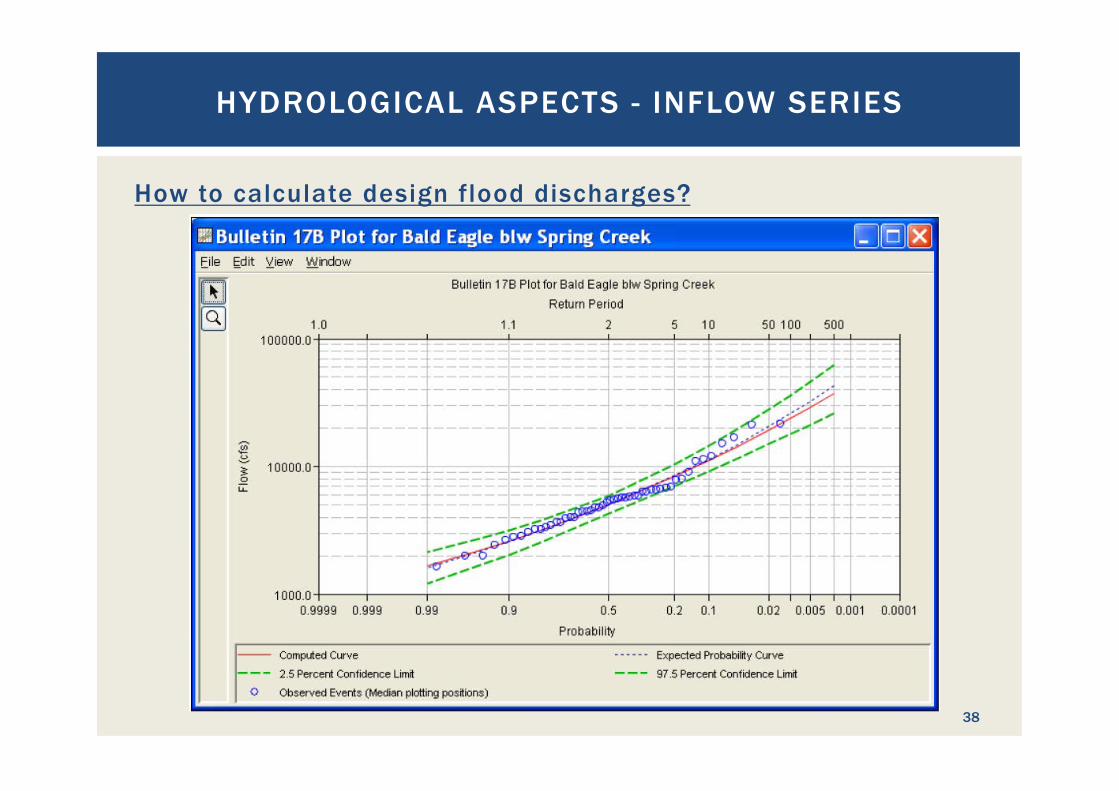
How to calculate design flood discharges?
HYDROLOGICAL ASPECTS - INFLOW SERIES
38
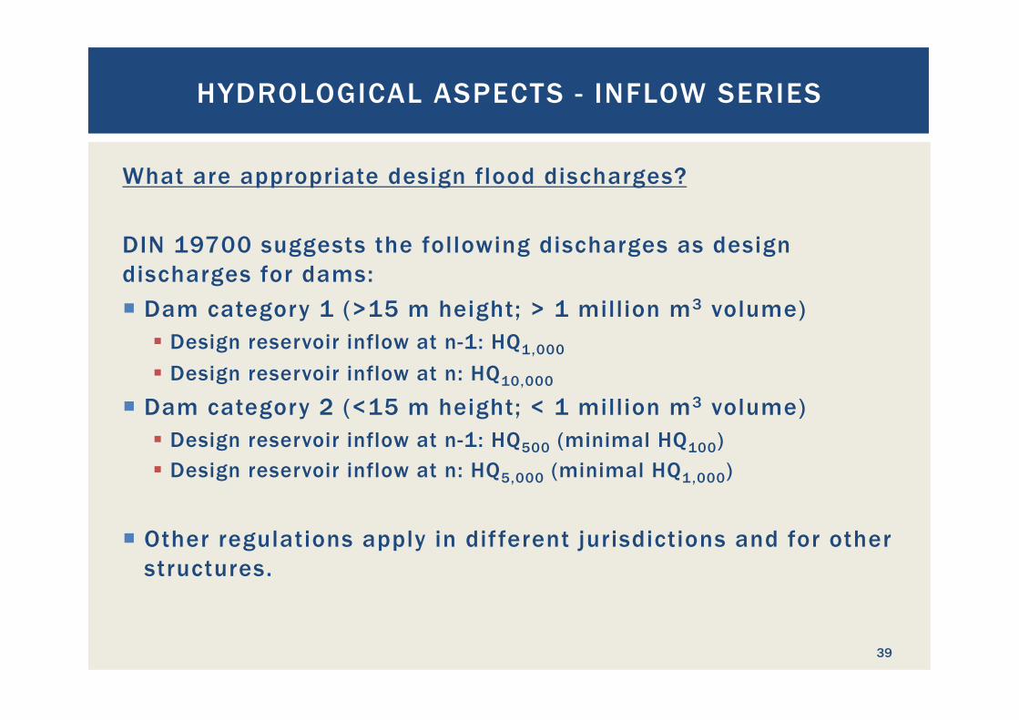
What are appropriate design flood discharges? DIN 19700 suggests the following discharges as design discharges for dams: ¡ Dam category 1 (>15 m height; > 1 million m3 volume)
§ Design reservoir inflow at n-1: HQ1,000
§ Design reservoir inflow at n: HQ10,000
¡ Dam category 2 (<15 m height; < 1 million m3 volume) § Design reservoir inflow at n-1: HQ500 (minimal HQ100)
§ Design reservoir inflow at n: HQ5,000 (minimal HQ1,000)
¡ Other regulations apply in different jurisdictions and for other structures.
HYDROLOGICAL ASPECTS - INFLOW SERIES
39
HYDROLOGIC DATA COLLECTION CAMPAIGNS
40
What data is collected during a measuring campaign? ¡ Stream flow discharge data over a long period Ø At the dam site if possible, or Ø In the same watershed if possible, or Ø In a similar watershed not too far away
¡ Rainfall data ¡ Temperature data ¡ Evaporation and evapo-transpiration ¡ Sediment freight ¡ Water quality
HYDROLOGIC DATA COLLECTION CAMPAIGNS
41
¡ Data collection should start as early as possible in advance of a project because long term data series are required
¡ Minimum data record periods are, depending on project size, 2 to 20 years
¡ The comprehension of a hydrologic data collection campaign depends on the size of the project
Ø For larger projects more parameters will be required Ø Larger projects need longer time series to reduce the planning
risk Ø Larger projects will also have bigger budgets for data
collection campaigns ¡ Data collection should not stop before the project construction
commences, preferably data collection is done continuously
HYDROLOGIC DATA COLLECTION CAMPAIGNS
42
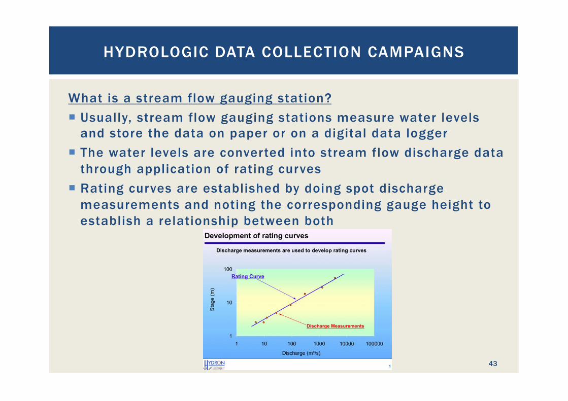
What is a stream flow gauging station? ¡ Usually, stream flow gauging stations measure water levels
and store the data on paper or on a digital data logger ¡ The water levels are converted into stream flow discharge data
through application of rating curves ¡ Rating curves are established by doing spot discharge
measurements and noting the corresponding gauge height to establish a relationship between both
HYDROLOGIC DATA COLLECTION CAMPAIGNS
43
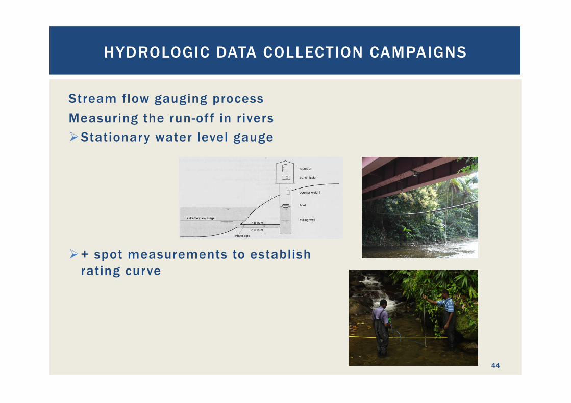
Stream flow gauging process Measuring the run-off in rivers Ø Stationary water level gauge
Ø + spot measurements to establish rating curve
HYDROLOGIC DATA COLLECTION CAMPAIGNS
44
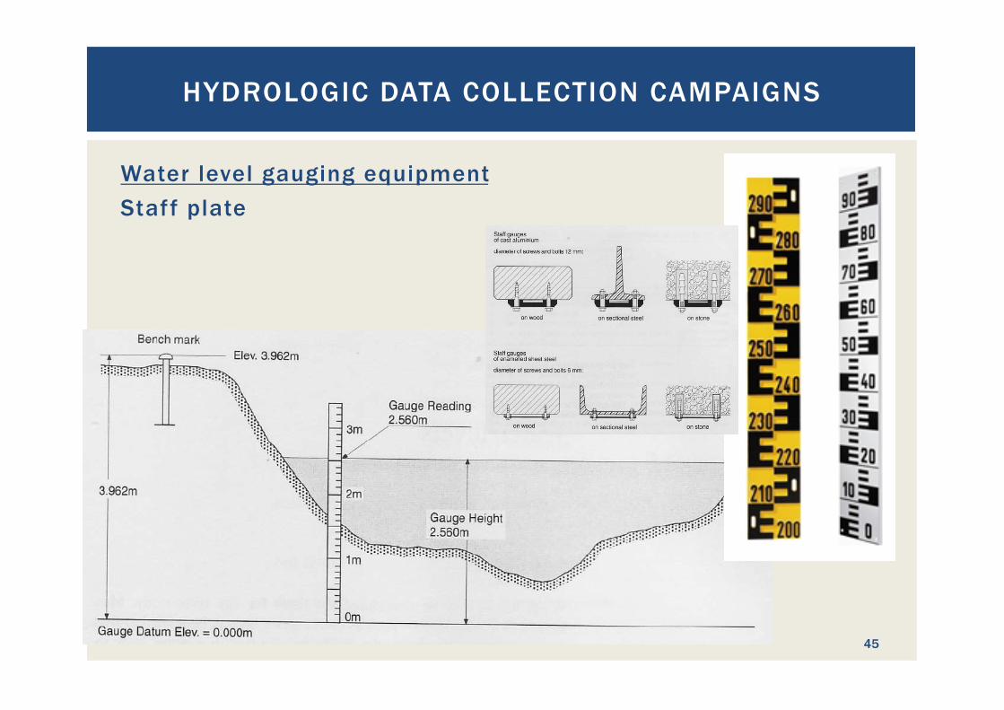
Water level gauging equipment Staff plate
HYDROLOGIC DATA COLLECTION CAMPAIGNS
45
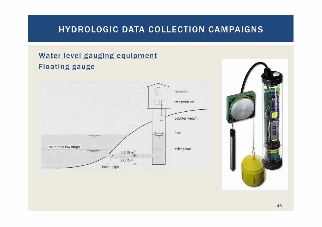
Water level gauging equipment Floating gauge
HYDROLOGIC DATA COLLECTION CAMPAIGNS
46
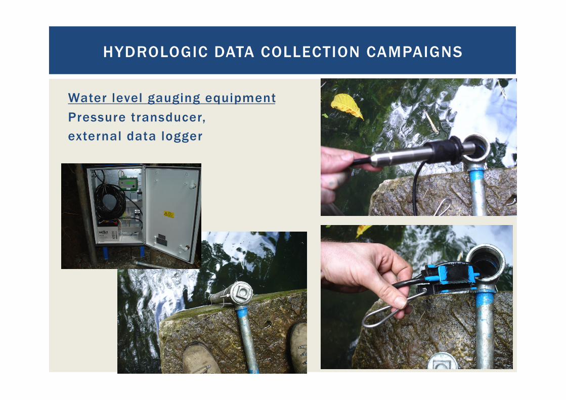
Water level gauging equipment Pressure transducer, external data logger
HYDROLOGIC DATA COLLECTION CAMPAIGNS
47
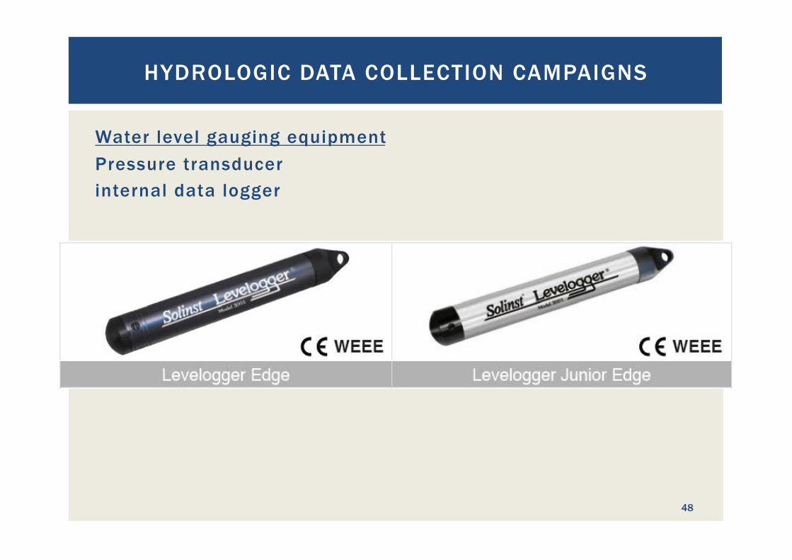
Water level gauging equipment Pressure transducer internal data logger
HYDROLOGIC DATA COLLECTION CAMPAIGNS
48
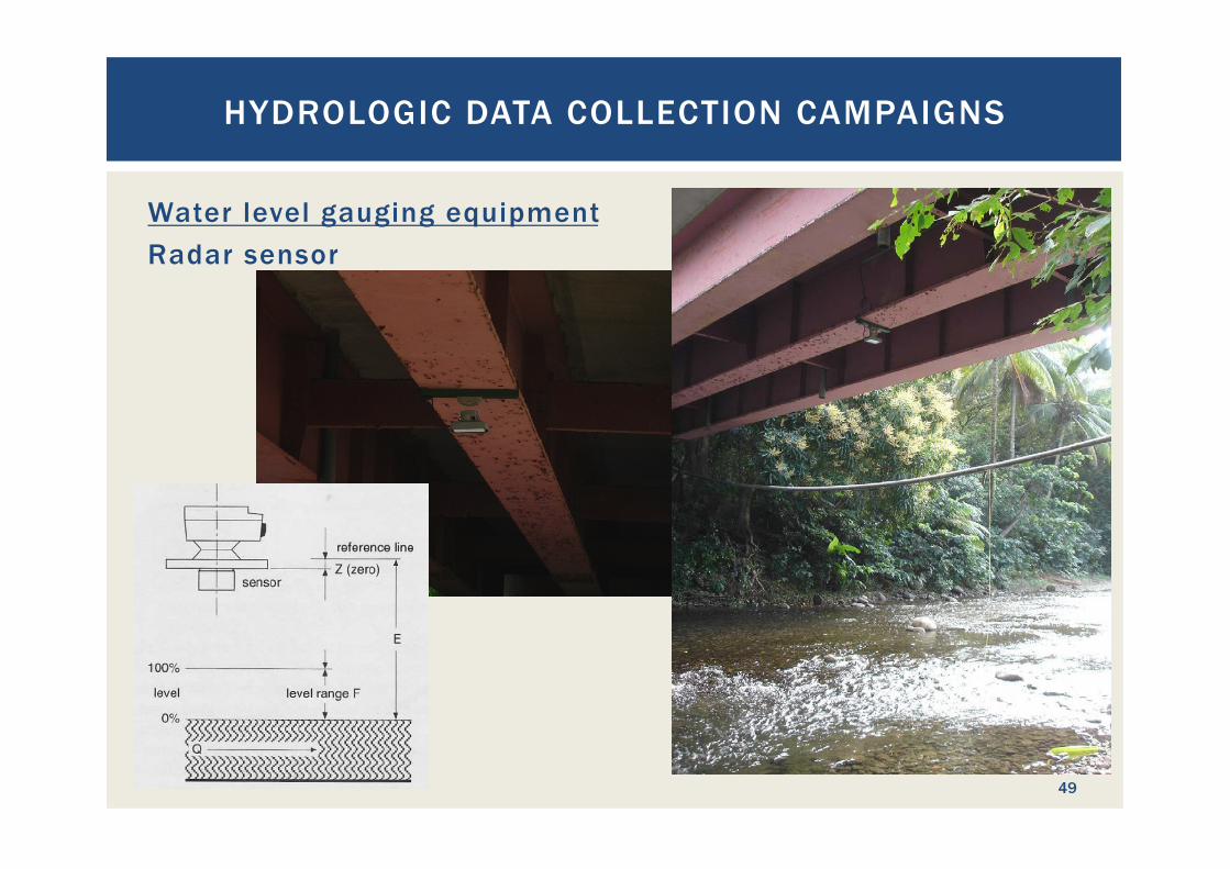
Water level gauging equipment Radar sensor
HYDROLOGIC DATA COLLECTION CAMPAIGNS
49
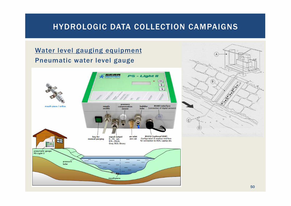
Water level gauging equipment Pneumatic water level gauge
HYDROLOGIC DATA COLLECTION CAMPAIGNS
50
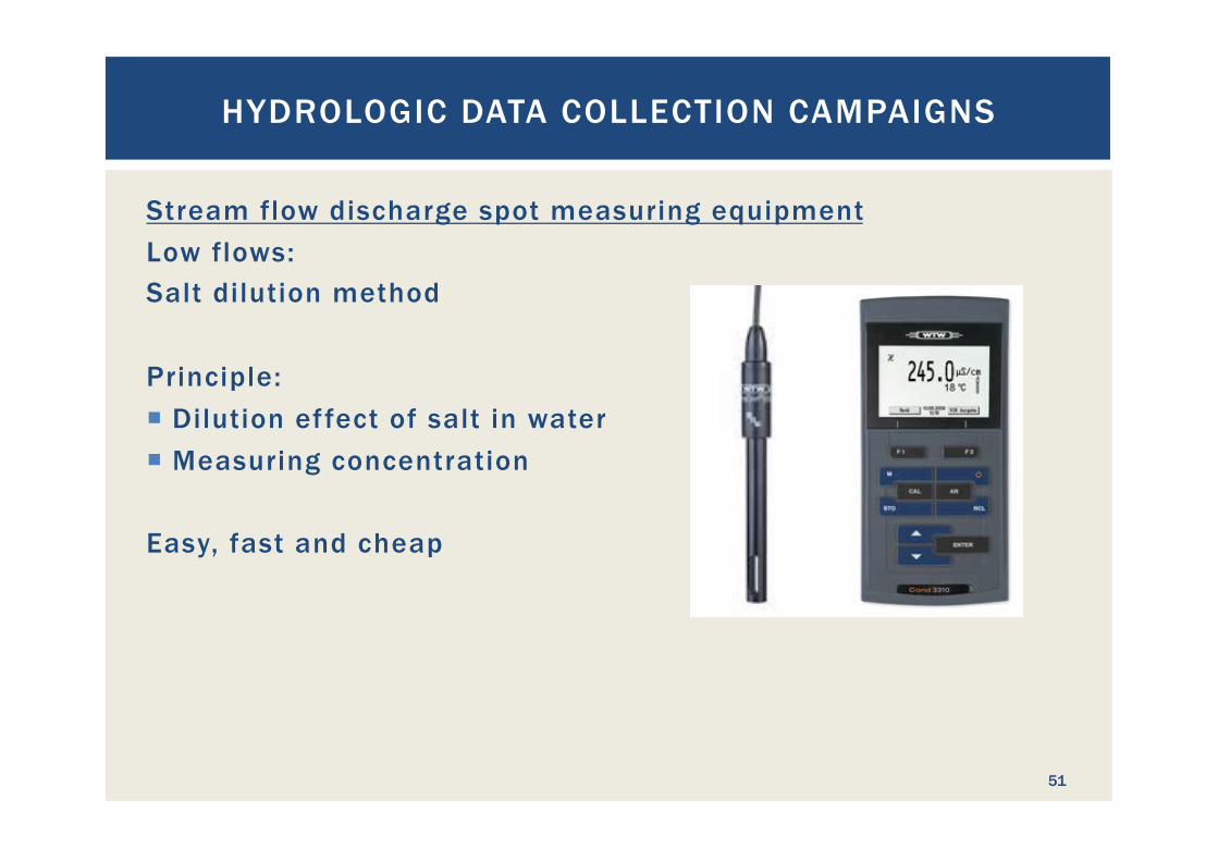
Stream flow discharge spot measuring equipment Low flows: Salt dilution method Principle: ¡ Dilution effect of salt in water ¡ Measuring concentration
Easy, fast and cheap
HYDROLOGIC DATA COLLECTION CAMPAIGNS
51
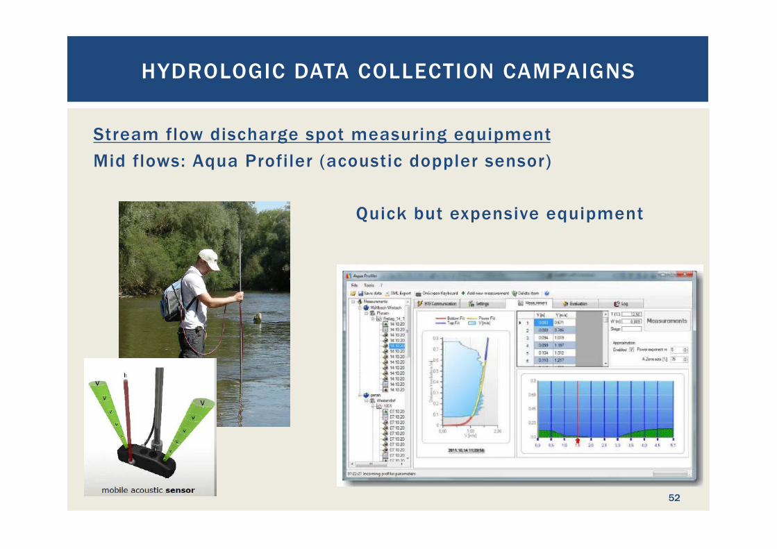
Stream flow discharge spot measuring equipment Mid flows: Aqua Profiler (acoustic doppler sensor)
Quick but expensive equipment
HYDROLOGIC DATA COLLECTION CAMPAIGNS
52
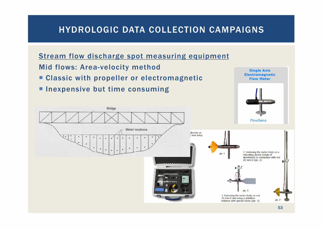
Stream flow discharge spot measuring equipment Mid flows: Area-velocity method ¡ Classic with propeller or electromagnetic ¡ Inexpensive but time consuming
HYDROLOGIC DATA COLLECTION CAMPAIGNS
53
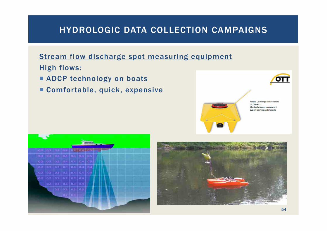
Stream flow discharge spot measuring equipment High flows: ¡ ADCP technology on boats ¡ Comfortable, quick, expensive
HYDROLOGIC DATA COLLECTION CAMPAIGNS
54
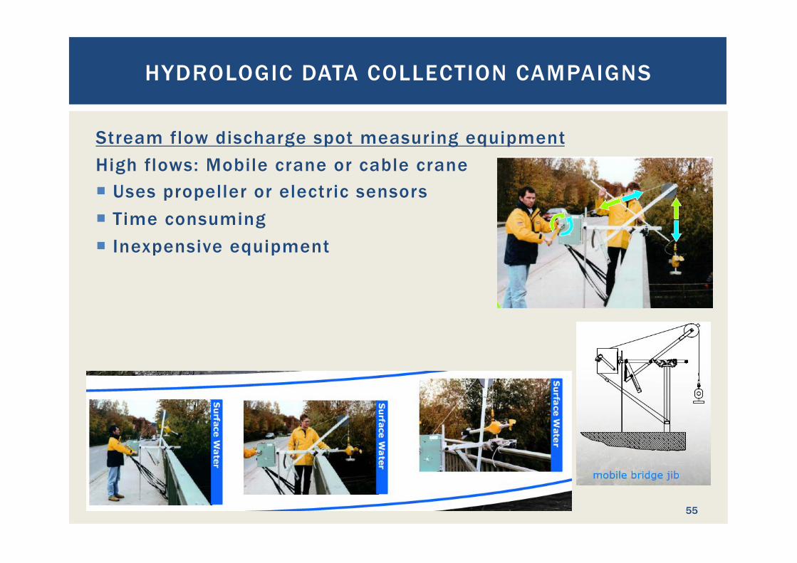
Stream flow discharge spot measuring equipment High flows: Mobile crane or cable crane ¡ Uses propeller or electric sensors ¡ Time consuming ¡ Inexpensive equipment
HYDROLOGIC DATA COLLECTION CAMPAIGNS
55
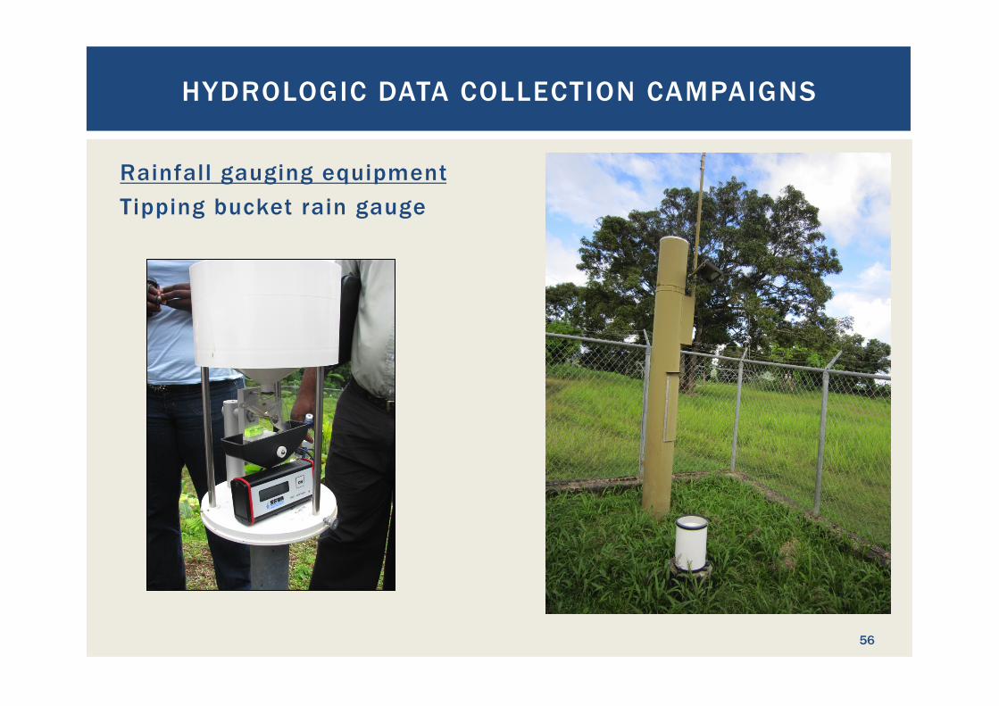
Rainfall gauging equipment Tipping bucket rain gauge
HYDROLOGIC DATA COLLECTION CAMPAIGNS
56
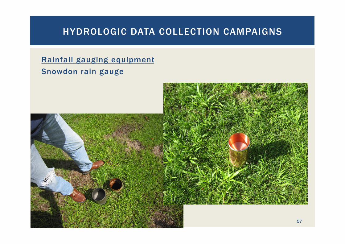
Rainfall gauging equipment Snowdon rain gauge
HYDROLOGIC DATA COLLECTION CAMPAIGNS
57
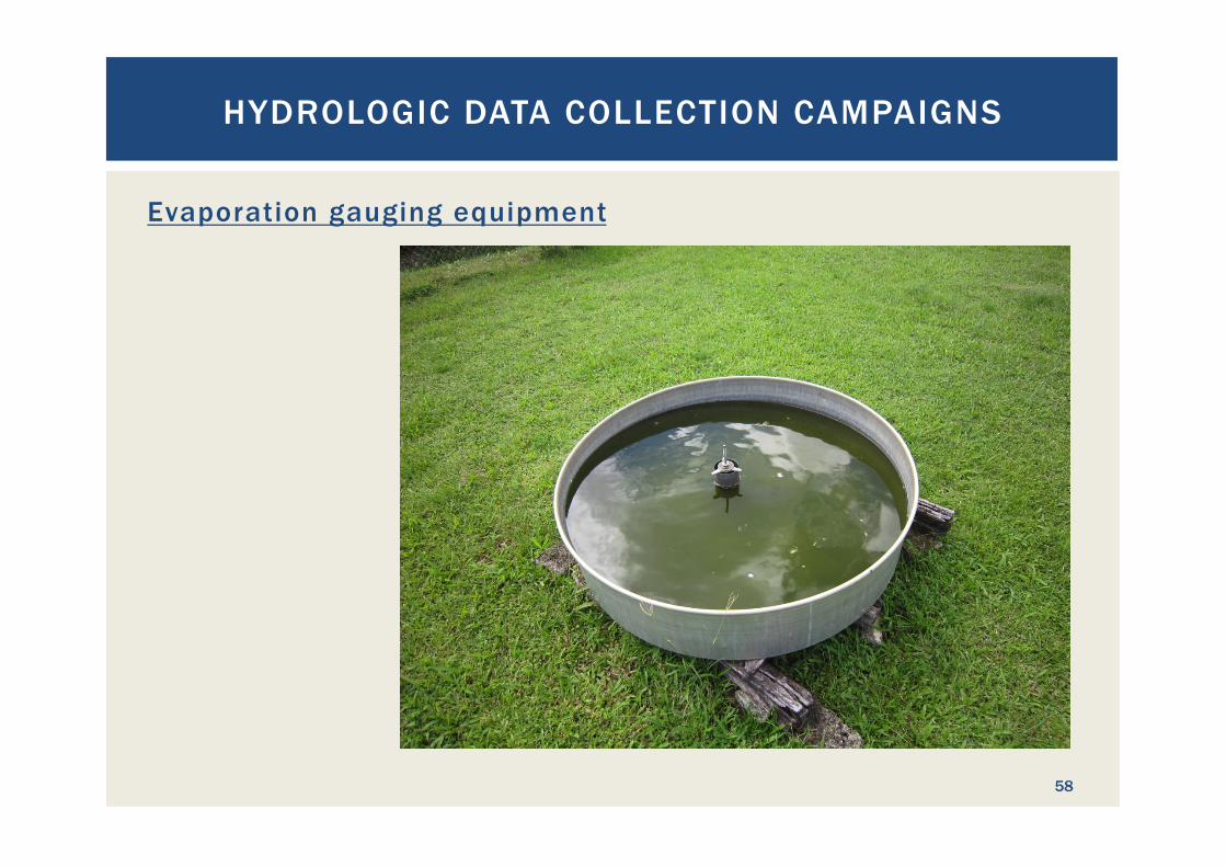
Evaporation gauging equipment
HYDROLOGIC DATA COLLECTION CAMPAIGNS
58
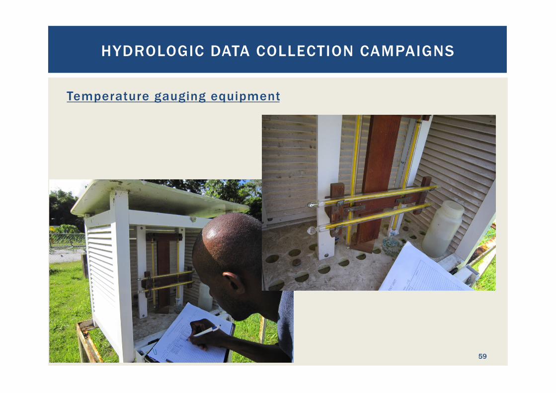
Temperature gauging equipment
HYDROLOGIC DATA COLLECTION CAMPAIGNS
59
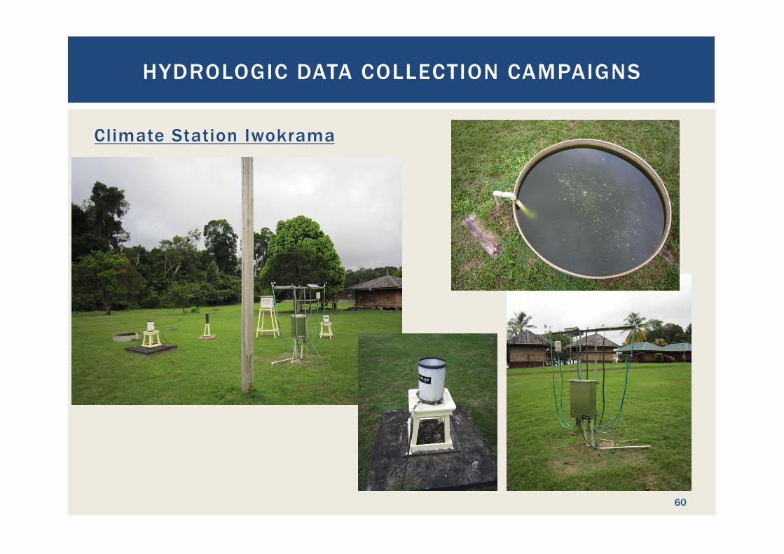
Climate Station Iwokrama
HYDROLOGIC DATA COLLECTION CAMPAIGNS
60

Where is the best location to measure stream flow discharges? ¡ The permanent gauging location should be:
§ Easily accessible § At a location where the riverbed does not change much; otherwise a
measuring weir would be required, which is very costly. § If possible use bridge cross sections § If the river describes a bend, select the outside of the bend as
sedimentation is more likely to occur on the inside § Select a site that is somewhat protected from damage through debris
and boulders that the river transports during floods § Imagine the state of the river during extremely high floods and
double check if the location would still be suitable § Protected from vandalism and theft. Solar panels are popular
souveniers for passers-by.
¡ Remember: the gauging site must be visited regularly for data retrieval and station maintenance
HYDROLOGIC DATA COLLECTION CAMPAIGNS
61
Where is the best location to measure stream flow discharges? ¡ The spot measuring location should be:
§ Easily accessible § Preferably in the same cross section as the permanent gauging site § Gauging location and gauging equipment need to fit each other. The
salt dilution method does not work at the lower Essequibo, and a bridge crane does not work in small creeks.
¡ The gauging site must be visited at dif ferent water levels and discharges to establish a proper rating curve
HYDROLOGIC DATA COLLECTION CAMPAIGNS
62
When to use telemetry for data retrieval? What is telemetry? - Transferring data via remote data broadcasting, such as GSM,
VHF radio, internet, telephone modem
¡ Basic consideration: data, that is not measured cannot be brought back
¡ Consequently: lost data records cannot be brought back ¡ à Gauged data is very valuable ¡ Therefore, data records are often broadcasted daily ¡ Also: broadcasting for weather forecasting and early warning
stations where real-time data is required
HYDROLOGIC DATA COLLECTION CAMPAIGNS
63
Telemetry Pros and Cons: Pro: ¡ Real-time data can be collected, including threshold alarms ¡ Status of the gauging station, including battery voltage level,
is communicated regularly ¡ Less visits to the station are required ¡ Enables data collection even from very remote locations ¡ Remote re-programming of data loggers possible Contra: ¡ Additional cost for equipment procurement ¡ Depending on technology regular charges for data
transmission ¡ More maintenance required for the high-tech equipment ¡ Operators tend to neglect telemetric station’s maintenance if
no error is reported
HYDROLOGIC DATA COLLECTION CAMPAIGNS
64
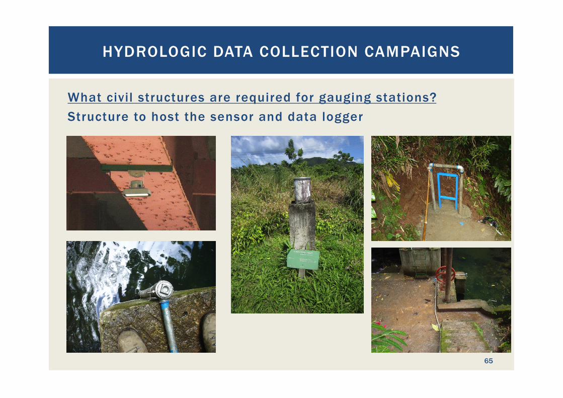
What civil structures are required for gauging stations? Structure to host the sensor and data logger
HYDROLOGIC DATA COLLECTION CAMPAIGNS
65
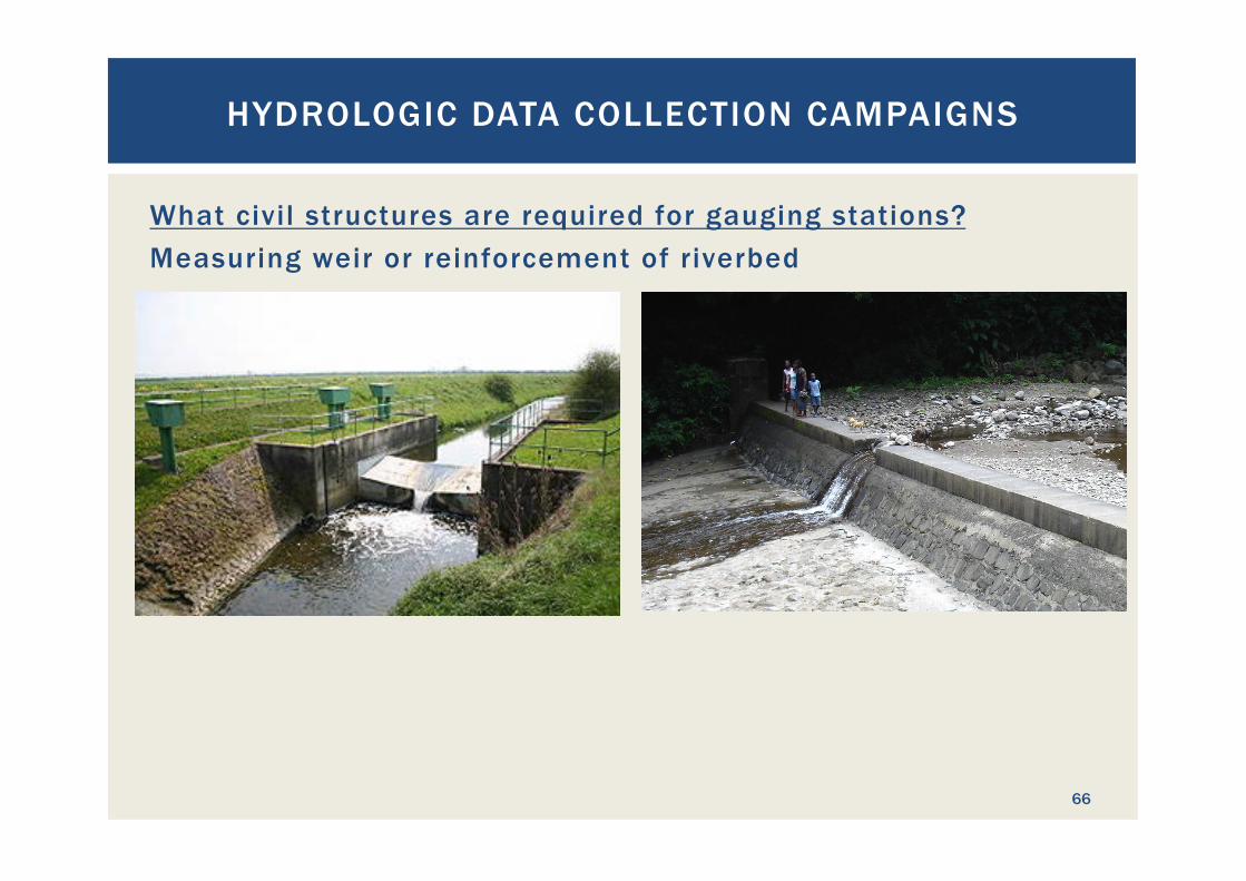
What civil structures are required for gauging stations? Measuring weir or reinforcement of riverbed
HYDROLOGIC DATA COLLECTION CAMPAIGNS
66
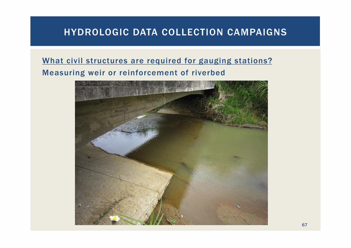
What civil structures are required for gauging stations? Measuring weir or reinforcement of riverbed
HYDROLOGIC DATA COLLECTION CAMPAIGNS
67
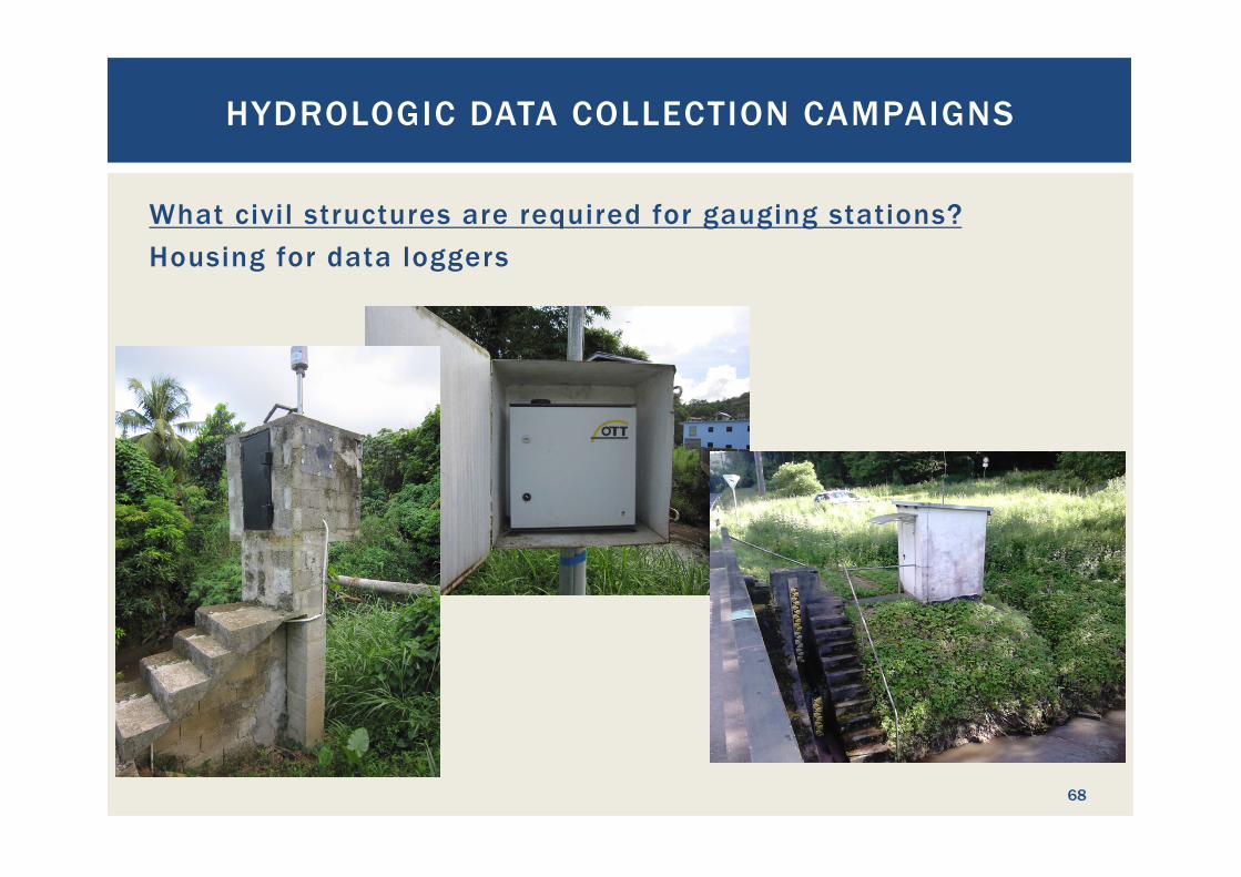
What civil structures are required for gauging stations? Housing for data loggers
HYDROLOGIC DATA COLLECTION CAMPAIGNS
68
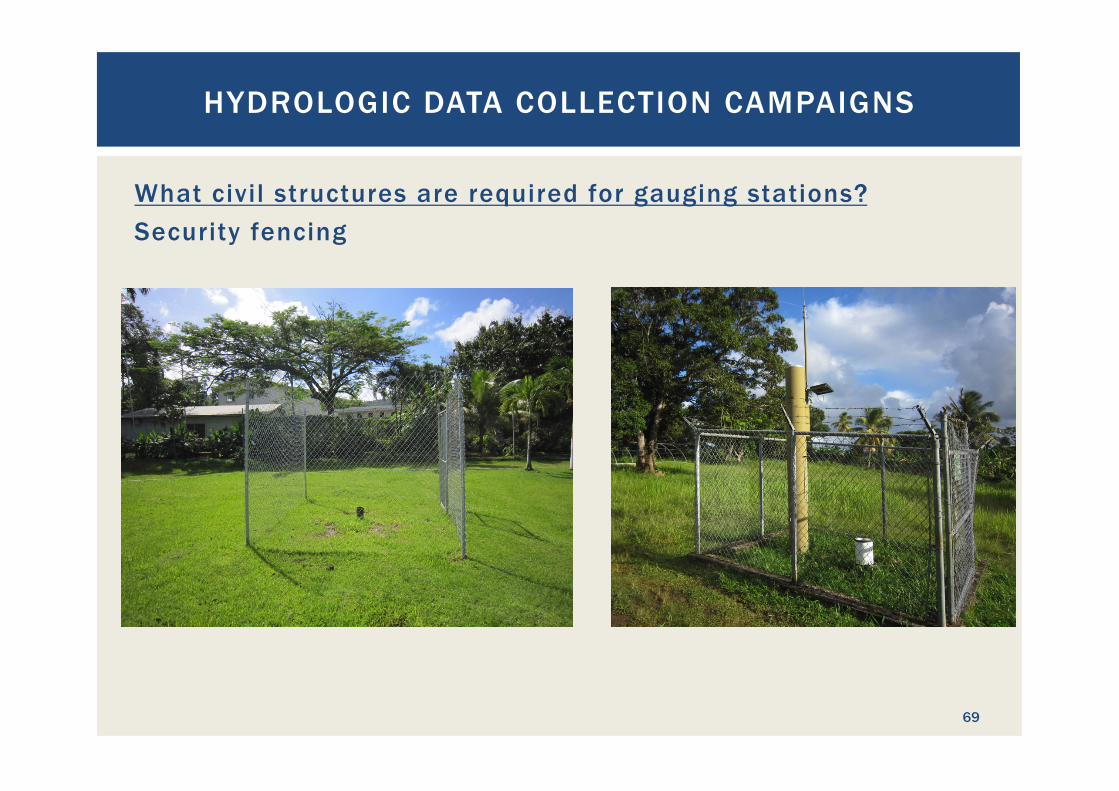
What civil structures are required for gauging stations? Security fencing
HYDROLOGIC DATA COLLECTION CAMPAIGNS
69
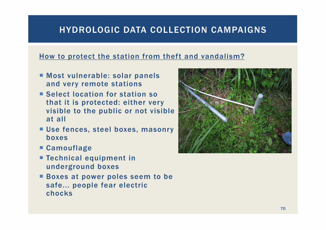
How to protect the station from theft and vandalism?
HYDROLOGIC DATA COLLECTION CAMPAIGNS
70
¡ Most vulnerable: solar panels and very remote stations
¡ Select location for station so that it is protected: either very visible to the public or not visible at all
¡ Use fences, steel boxes, masonry boxes
¡ Camouflage ¡ Technical equipment in
underground boxes ¡ Boxes at power poles seem to be
safe... people fear electric chocks
EXERCISE 1: DESIGN OF HYDROMETRIC GAUGING
STATIONS
71
First Exercise: Situation: ¡ The Troumassee River shown on the map was earmarked for
hydropower use ¡ The hydrometric gauging stations shown on the map are
available Challenge: ¡ Design the hydrometric station design for the project area
§ Identify required data to be collected § Identify best locations for the required gauging stations § Select equipment, including power supply § Design civil structures § Define operation and maintenance program
EXERCISE 1: DESIGN OF HYDROMETRIC GAUGING STATIONS
72

This chapter was not presented!
GEOTECHNICAL INVESTIGATIONS FOR
HYDROPOWER FEASIBILITY ANALYSIS
73

Why geotechnical investigations? ¡ To avoid that:
GEOTECHNICAL INVESTIGATIONS FOR HYDROPOWER FEASIBILIT Y ANALYSIS
74
What are geotechnical investigations (GI)? ¡ Physical field and laboratory tests to investigate the
mechanical properties of the underground
¡ GI are a combination of § Geology § Mechanics § Statics § Chemistry § Geohydrology
¡ GI reduce the construction risk and allow proper structural and foundation design
¡ Good GI safe money!
GEOTECHNICAL INVESTIGATIONS FOR HYDROPOWER FEASIBILIT Y ANALYSIS
75
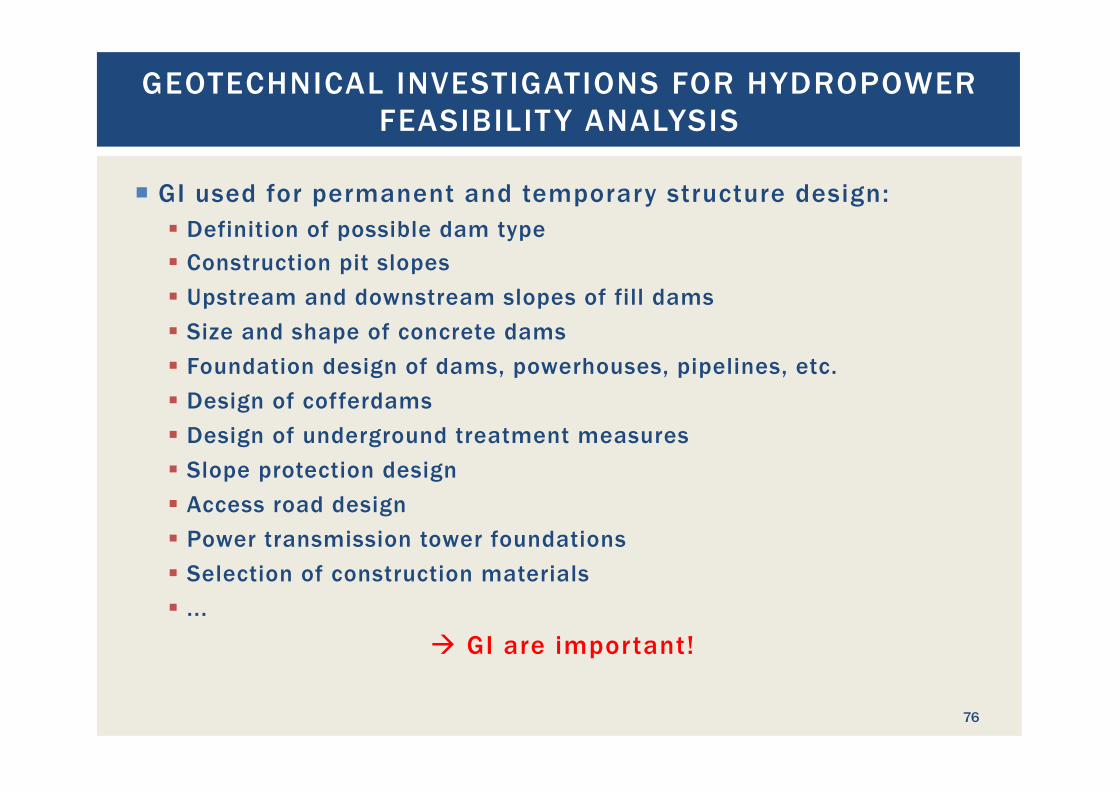
¡ GI used for permanent and temporary structure design: § Definition of possible dam type § Construction pit slopes § Upstream and downstream slopes of fill dams § Size and shape of concrete dams § Foundation design of dams, powerhouses, pipelines, etc. § Design of cofferdams § Design of underground treatment measures § Slope protection design § Access road design § Power transmission tower foundations § Selection of construction materials § ...
à GI are important!
GEOTECHNICAL INVESTIGATIONS FOR HYDROPOWER FEASIBILIT Y ANALYSIS
76
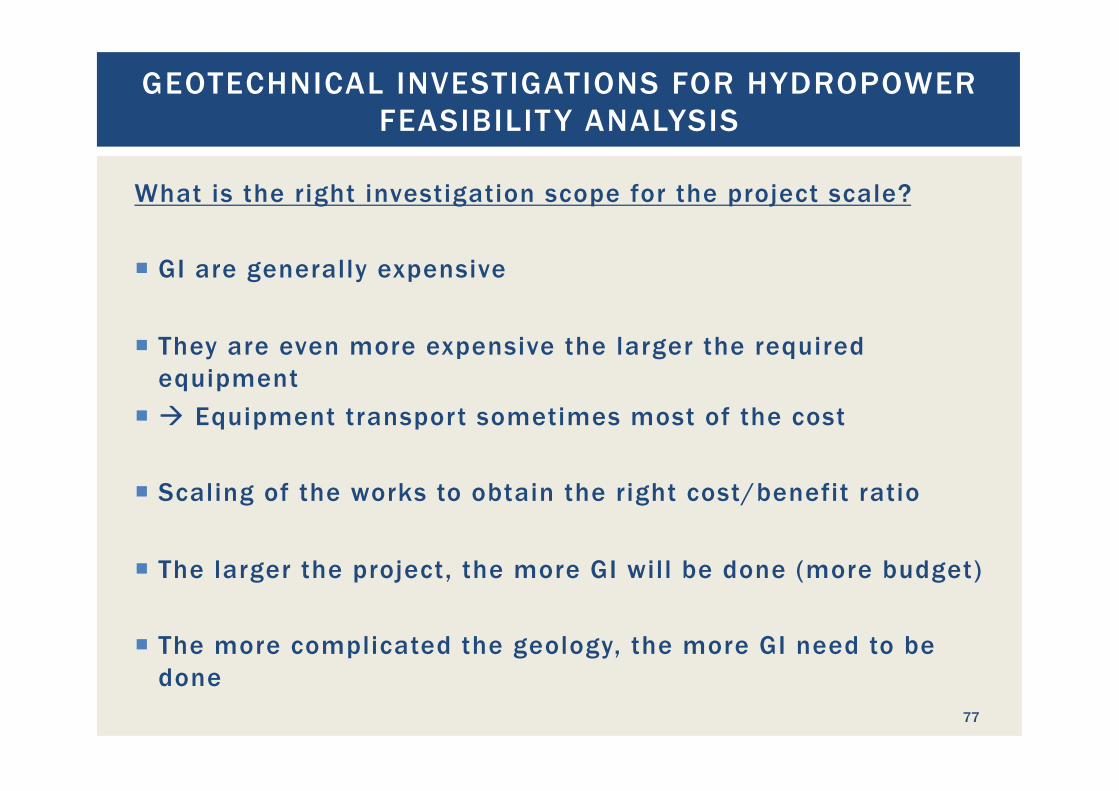
What is the right investigation scope for the project scale?
¡ GI are generally expensive
¡ They are even more expensive the larger the required equipment
¡ à Equipment transport sometimes most of the cost
¡ Scaling of the works to obtain the right cost/benefit ratio
¡ The larger the project, the more GI will be done (more budget)
¡ The more complicated the geology, the more GI need to be done
GEOTECHNICAL INVESTIGATIONS FOR HYDROPOWER FEASIBILIT Y ANALYSIS
77
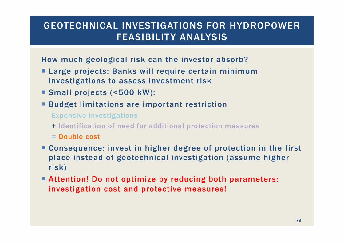
How much geological risk can the investor absorb? ¡ Large projects: Banks will require certain minimum
investigations to assess investment risk ¡ Small projects (<500 kW): ¡ Budget limitations are important restriction
Expensive investigations + Identification of need for additional protection measures = Double cost
¡ Consequence: invest in higher degree of protection in the first place instead of geotechnical investigation (assume higher risk)
¡ Attention! Do not optimize by reducing both parameters: investigation cost and protective measures!
GEOTECHNICAL INVESTIGATIONS FOR HYDROPOWER FEASIBILIT Y ANALYSIS
78
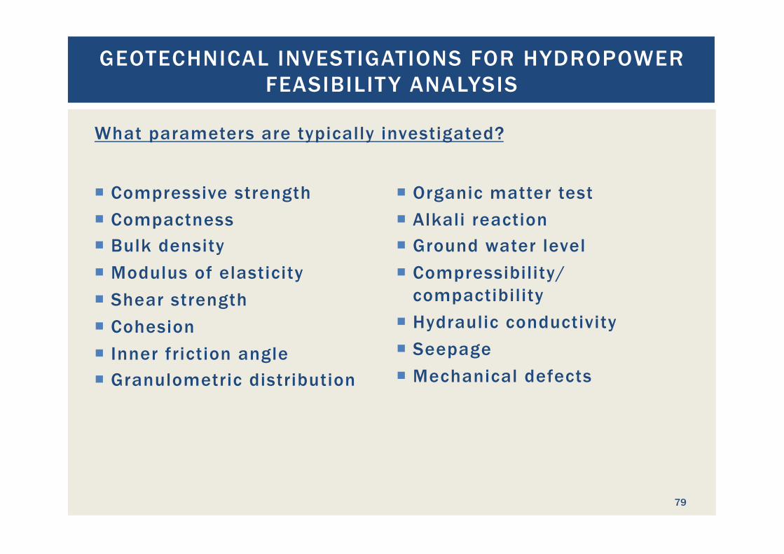
¡ Compressive strength ¡ Compactness ¡ Bulk density ¡ Modulus of elasticity ¡ Shear strength ¡ Cohesion ¡ Inner friction angle ¡ Granulometric distribution
¡ Organic matter test ¡ Alkali reaction ¡ Ground water level ¡ Compressibility/
compactibility ¡ Hydraulic conductivity ¡ Seepage ¡ Mechanical defects
GEOTECHNICAL INVESTIGATIONS FOR HYDROPOWER FEASIBILIT Y ANALYSIS
79
What parameters are typically investigated?
GEOTECHNICAL INVESTIGATIONS FOR HYDROPOWER FEASIBILIT Y ANALYSIS
80
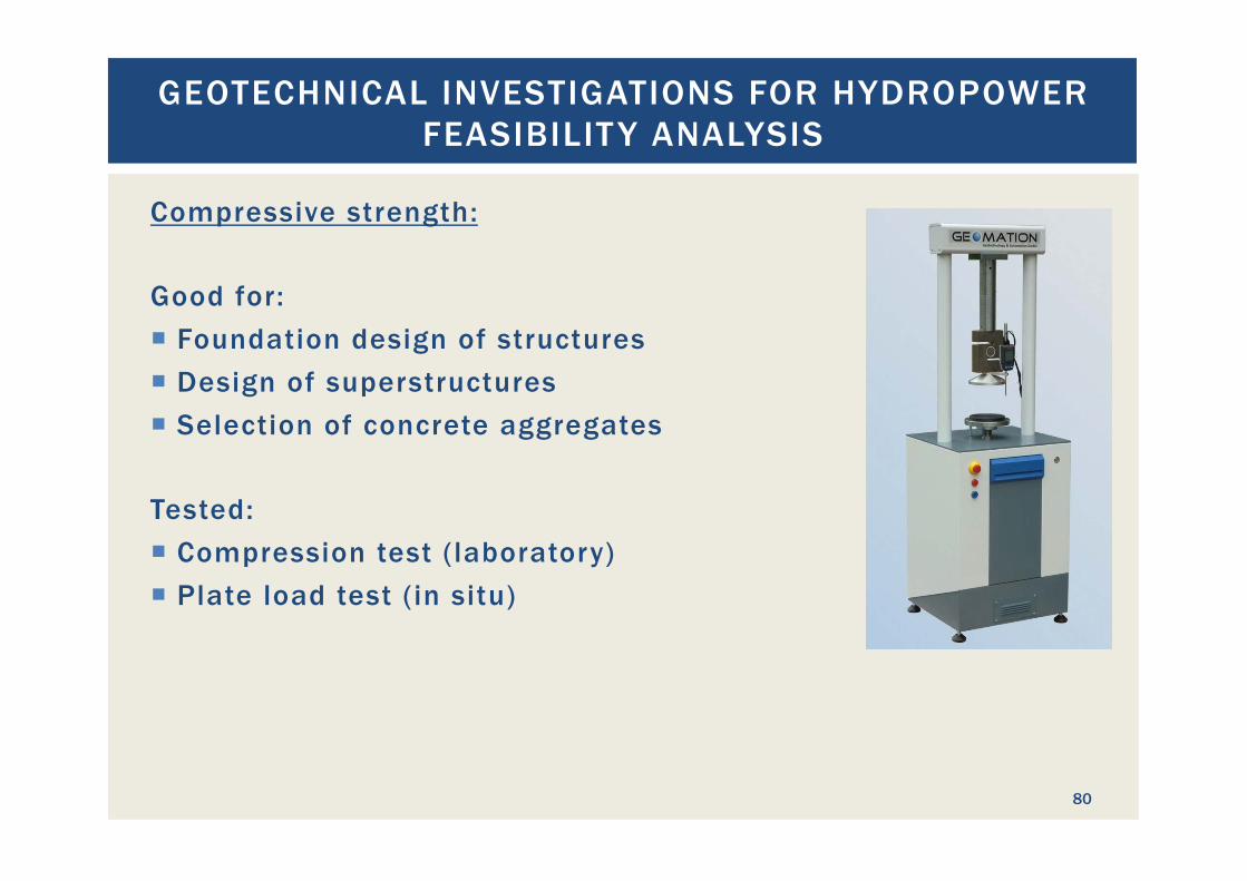
Compressive strength: Good for: ¡ Foundation design of structures ¡ Design of superstructures ¡ Selection of concrete aggregates Tested: ¡ Compression test (laboratory) ¡ Plate load test (in situ)
GEOTECHNICAL INVESTIGATIONS FOR HYDROPOWER FEASIBILIT Y ANALYSIS
81
Compactness: Good for: ¡ Structural engineering (load definition) Tested: ¡ Density of undisturbed sample (lab) ¡ Proctor test (lab)
GEOTECHNICAL INVESTIGATIONS FOR HYDROPOWER FEASIBILIT Y ANALYSIS
82
Bulk density: Good for: ¡ Structural calculations (load) ¡ Quantity estimates Tested: ¡ Laboratory:
§ Mercury displacement § Submerged weighing § Volumetric and weight measuring of specimen
¡ Field tests: § Various volume displacement methods
GEOTECHNICAL INVESTIGATIONS FOR HYDROPOWER FEASIBILIT Y ANALYSIS
83
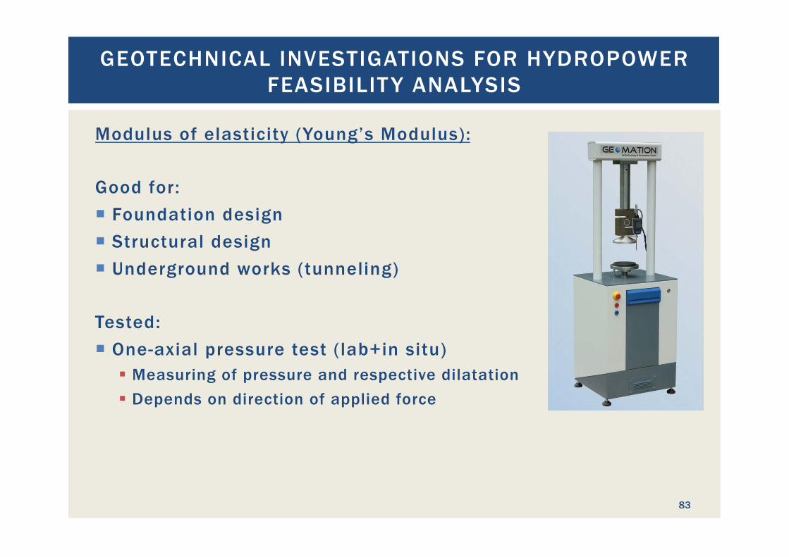
Modulus of elasticity (Young’s Modulus): Good for: ¡ Foundation design ¡ Structural design ¡ Underground works (tunneling) Tested: ¡ One-axial pressure test (lab+in situ)
§ Measuring of pressure and respective dilatation § Depends on direction of applied force
GEOTECHNICAL INVESTIGATIONS FOR HYDROPOWER FEASIBILIT Y ANALYSIS
84
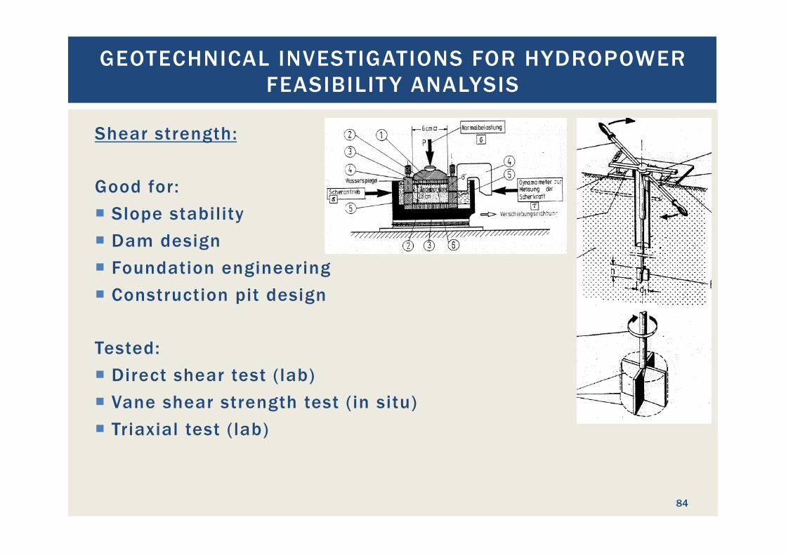
Shear strength: Good for: ¡ Slope stability ¡ Dam design ¡ Foundation engineering ¡ Construction pit design Tested: ¡ Direct shear test (lab) ¡ Vane shear strength test (in situ) ¡ Triaxial test (lab)
GEOTECHNICAL INVESTIGATIONS FOR HYDROPOWER FEASIBILIT Y ANALYSIS
85
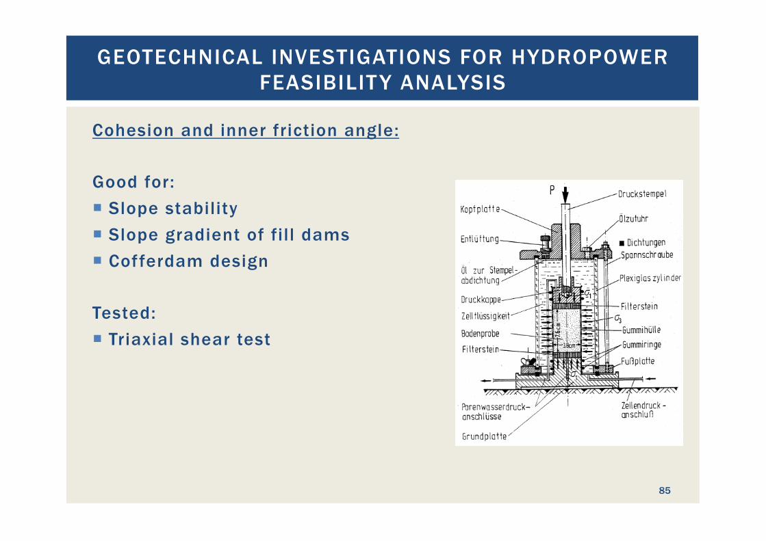
Cohesion and inner friction angle: Good for: ¡ Slope stability ¡ Slope gradient of fill dams ¡ Cofferdam design Tested: ¡ Triaxial shear test
GEOTECHNICAL INVESTIGATIONS FOR HYDROPOWER FEASIBILIT Y ANALYSIS
86
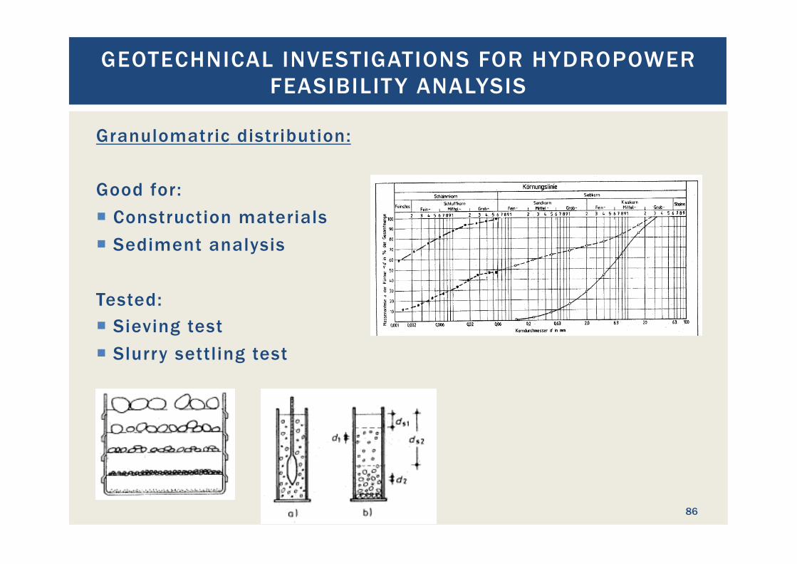
Granulomatric distribution: Good for: ¡ Construction materials ¡ Sediment analysis Tested: ¡ Sieving test ¡ Slurry settling test
GEOTECHNICAL INVESTIGATIONS FOR HYDROPOWER FEASIBILIT Y ANALYSIS
87
Organic matter test: Good for: ¡ Construction material testing ¡ Foundation engineering Tested: ¡ Incineration test
§ Incinerating soil at 550°C § Weighing mass before and after glowing
GEOTECHNICAL INVESTIGATIONS FOR HYDROPOWER FEASIBILIT Y ANALYSIS
88
Alkali reaction: Good for: ¡ Concrete aggregates ¡ Foundation engineering (no direct contact with fresh concrete) Tested: ¡ ASTM C 227: Mortar-Bar Method ¡ ASTM C289: Chemical Method ¡ ASTM C1260: Mortar-Bar-Test ¡ ASTM C1293: Length Change Test ¡ ASTM C1567: Accelerated Mortar-Bar Method
GEOTECHNICAL INVESTIGATIONS FOR HYDROPOWER FEASIBILIT Y ANALYSIS
89
Ground water level: Good for: ¡ Foundation design ¡ Construction pit design ¡ Structural design (load) Tested: ¡ Ground water wells ¡ Test pits
GEOTECHNICAL INVESTIGATIONS FOR HYDROPOWER FEASIBILIT Y ANALYSIS
90
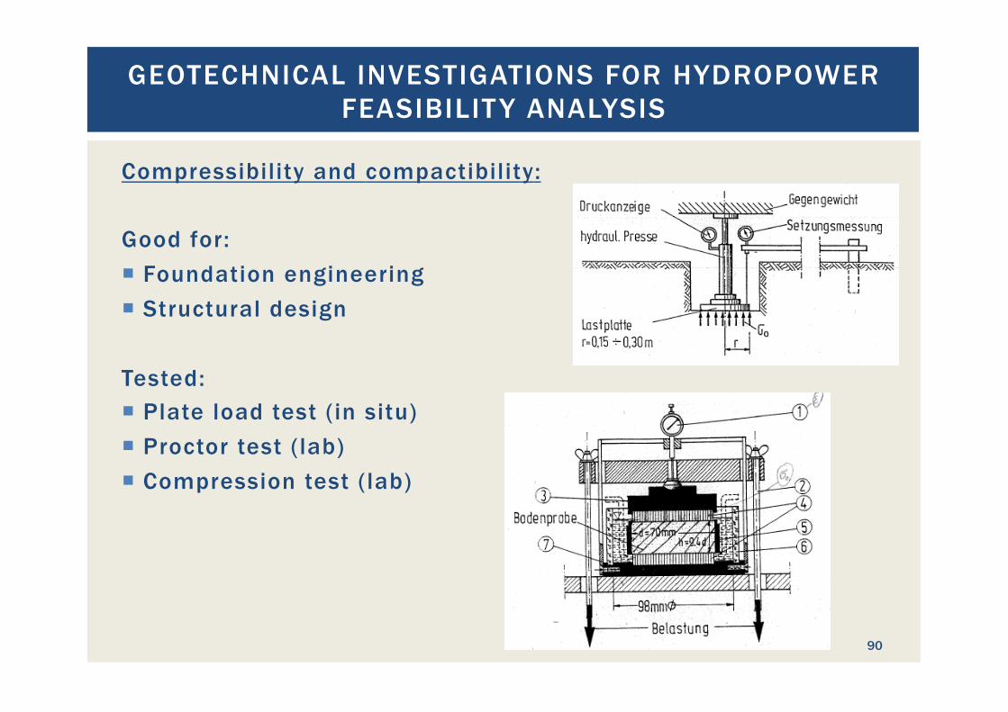
Compressibility and compactibility: Good for: ¡ Foundation engineering ¡ Structural design Tested: ¡ Plate load test (in situ) ¡ Proctor test (lab) ¡ Compression test (lab)
GEOTECHNICAL INVESTIGATIONS FOR HYDROPOWER FEASIBILIT Y ANALYSIS
91
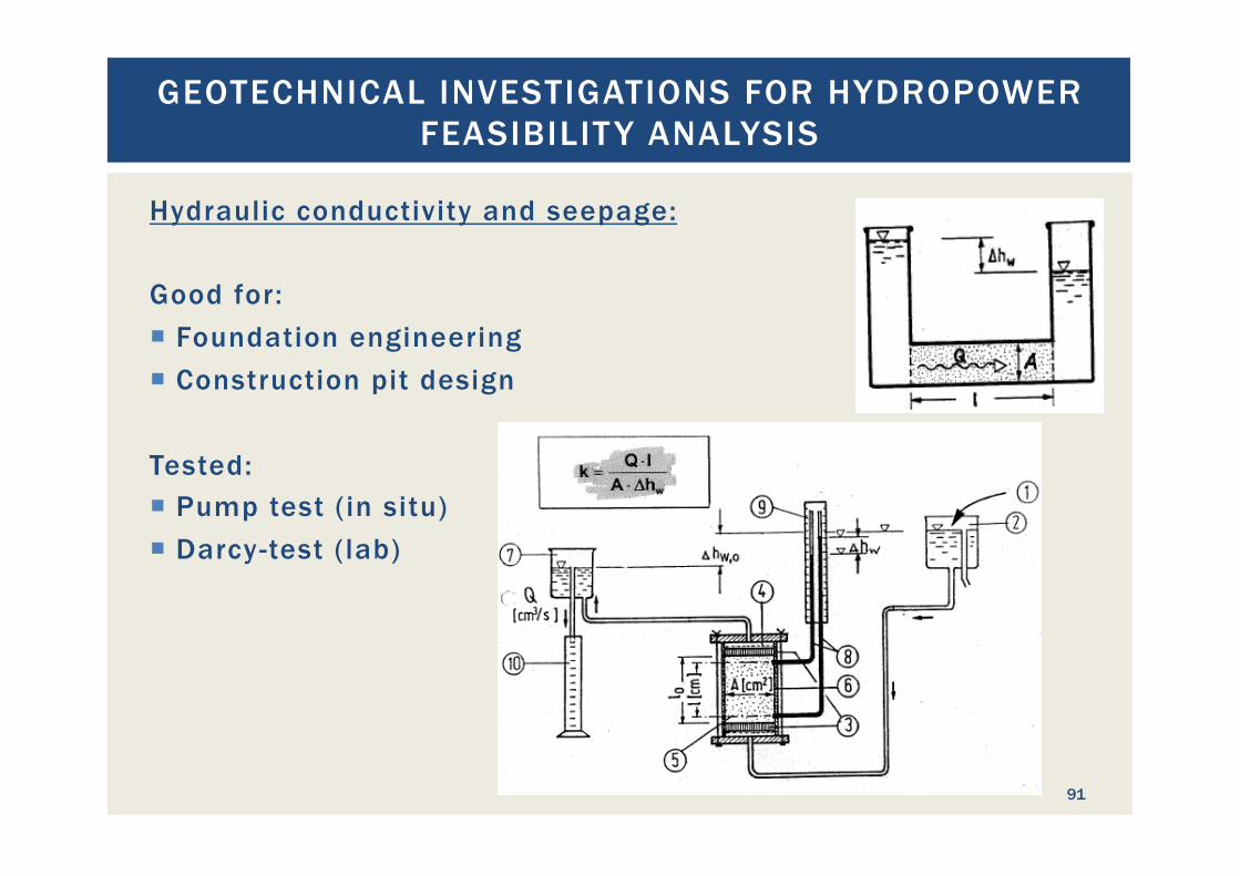
Hydraulic conductivity and seepage: Good for: ¡ Foundation engineering ¡ Construction pit design Tested: ¡ Pump test (in situ) ¡ Darcy-test (lab)
GEOTECHNICAL INVESTIGATIONS FOR HYDROPOWER FEASIBILIT Y ANALYSIS
92
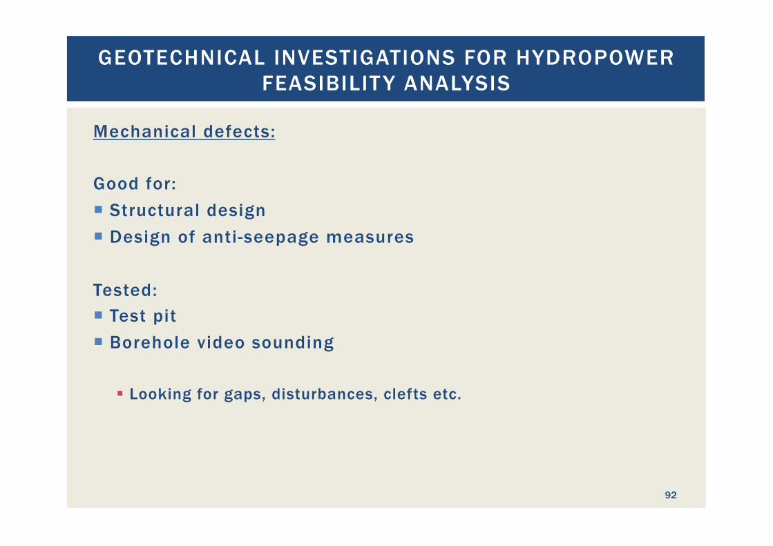
Mechanical defects: Good for: ¡ Structural design ¡ Design of anti-seepage measures Tested: ¡ Test pit ¡ Borehole video sounding
§ Looking for gaps, disturbances, clefts etc.
GEOTECHNICAL INVESTIGATIONS FOR HYDROPOWER FEASIBILIT Y ANALYSIS
93
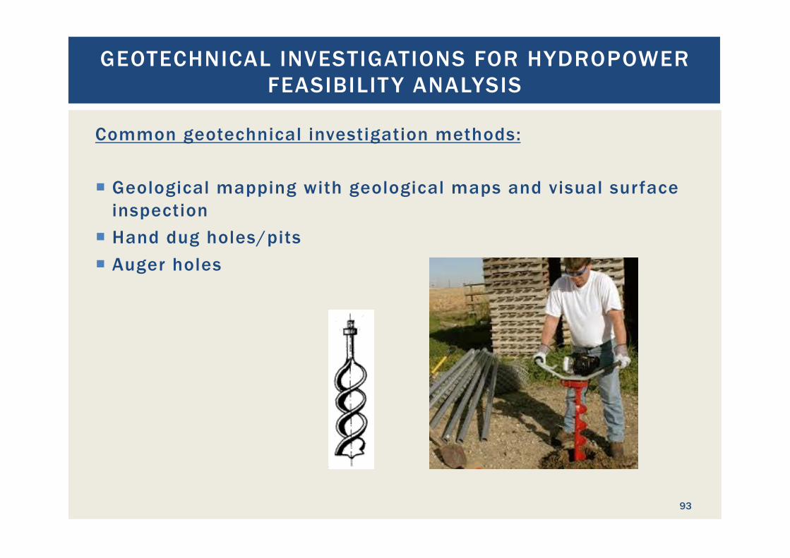
Common geotechnical investigation methods: ¡ Geological mapping with geological maps and visual surface
inspection ¡ Hand dug holes/pits ¡ Auger holes
GEOTECHNICAL INVESTIGATIONS FOR HYDROPOWER FEASIBILIT Y ANALYSIS
94
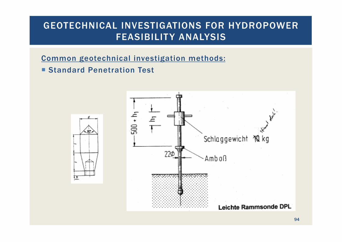
Common geotechnical investigation methods: ¡ Standard Penetration Test
GEOTECHNICAL INVESTIGATIONS FOR HYDROPOWER FEASIBILIT Y ANALYSIS
95
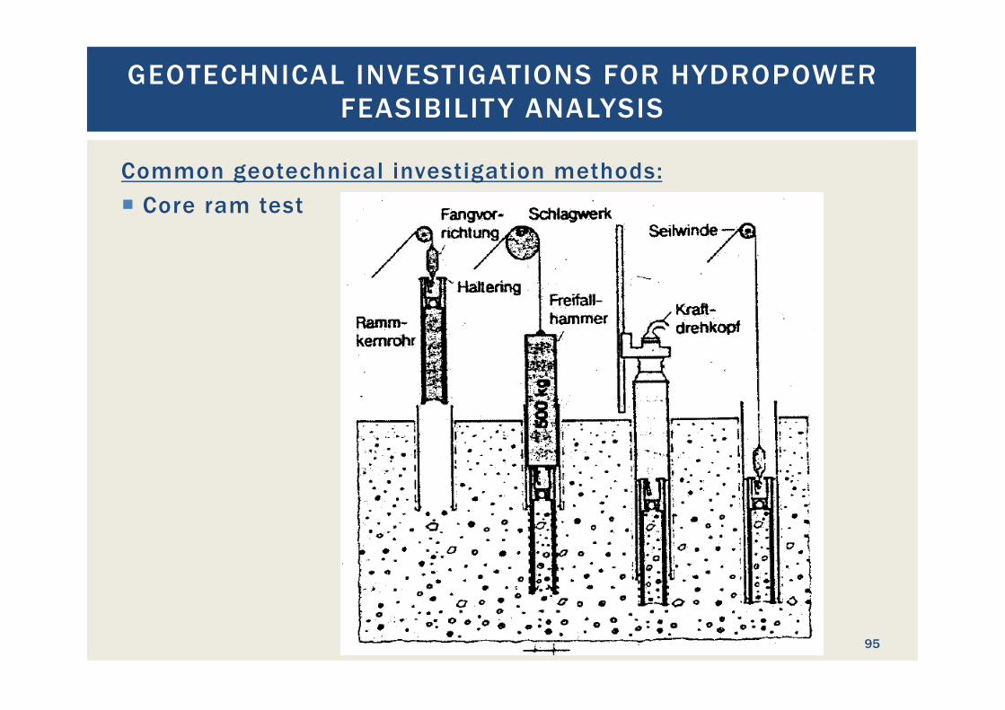
Common geotechnical investigation methods: ¡ Core ram test
GEOTECHNICAL INVESTIGATIONS FOR HYDROPOWER FEASIBILIT Y ANALYSIS
96
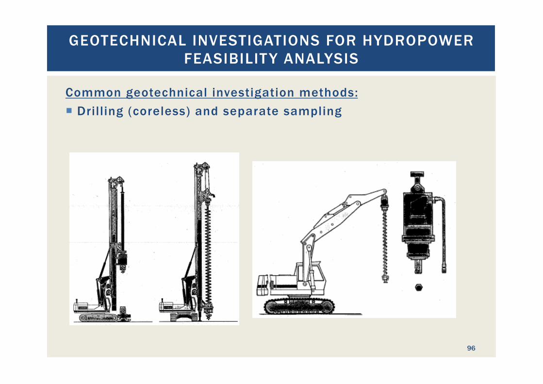
Common geotechnical investigation methods: ¡ Drilling (coreless) and separate sampling
GEOTECHNICAL INVESTIGATIONS FOR HYDROPOWER FEASIBILIT Y ANALYSIS
97
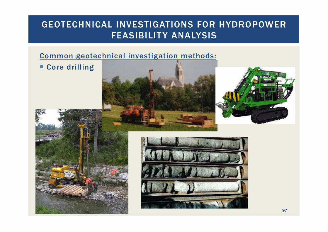
Common geotechnical investigation methods: ¡ Core drilling
GEOTECHNICAL INVESTIGATIONS FOR HYDROPOWER FEASIBILIT Y ANALYSIS
98
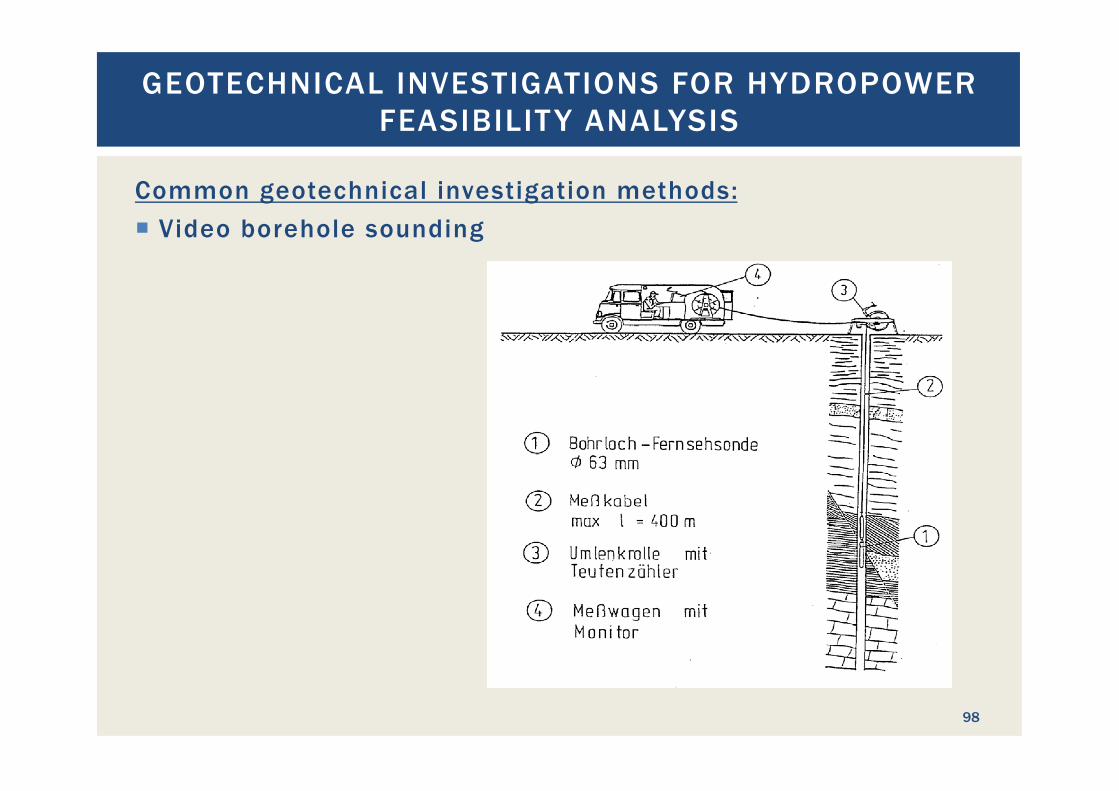
Common geotechnical investigation methods: ¡ Video borehole sounding
GEOTECHNICAL INVESTIGATIONS FOR HYDROPOWER FEASIBILIT Y ANALYSIS
99
Common geotechnical investigation methods: ¡ Geophysics
§ Geoseismic with geophones and hydrophones § Electric resistance
¡ Advantage: linear visualization of underground ¡ Needs one or more reference core drillings for calibration of
test results
GEOTECHNICAL INVESTIGATIONS FOR HYDROPOWER FEASIBILIT Y ANALYSIS
100
How expensive are geotechnical investigations? ¡ Cost depends heavily on comprehension and technology ¡ Access to the site is an important parameter ¡ Relatively most expensive: site installation ¡ Additional drill meters are not expensive ¡ Geophysics tend to be inexpensive for the degree of detail it
produces ¡ GI cost for large scale projects can be several million US$

PRINCIPLES OF GOOD PROJECT LAYOUT
DESIGN
101
First some bad examples:
PRINCIPLES OF GOOD PROJECT LAYOUT DESIGN
102

TOTORA PAMPA, BOLIVIA
103
Totora Pampa, Bolivia
TOTORA PAMPA, BOLIVIA
104
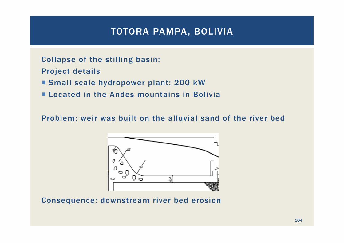
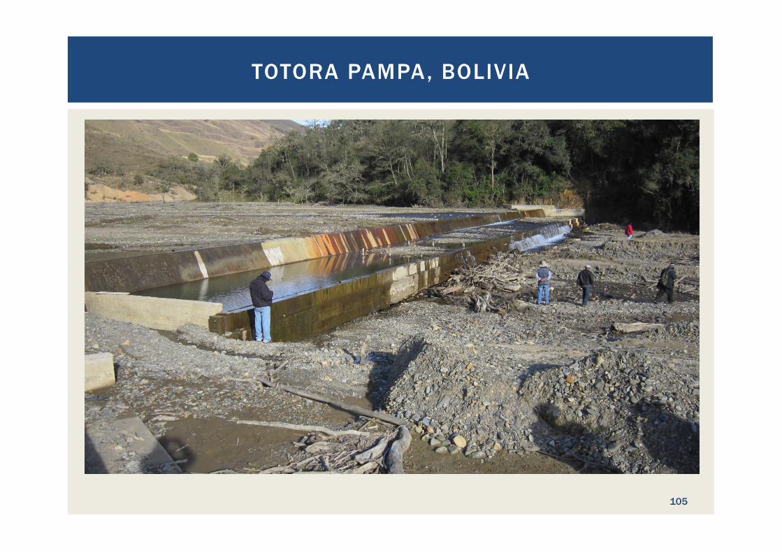
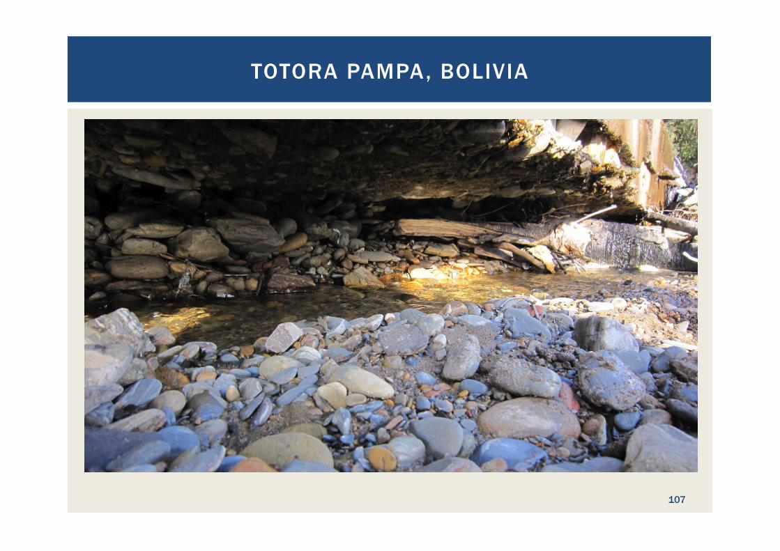
Collapse of the stilling basin: Project details ¡ Small scale hydropower plant: 200 kW ¡ Located in the Andes mountains in Bolivia Problem: weir was built on the alluvial sand of the river bed Consequence: downstream river bed erosion
TOTORA PAMPA, BOLIVIA
105

TOTORA PAMPA, BOLIVIA
106
TOTORA PAMPA, BOLIVIA
107

TOTORA PAMPA, BOLIVIA
108

Moco Moco, Guyana
MOCO MOCO, GUYANA
109
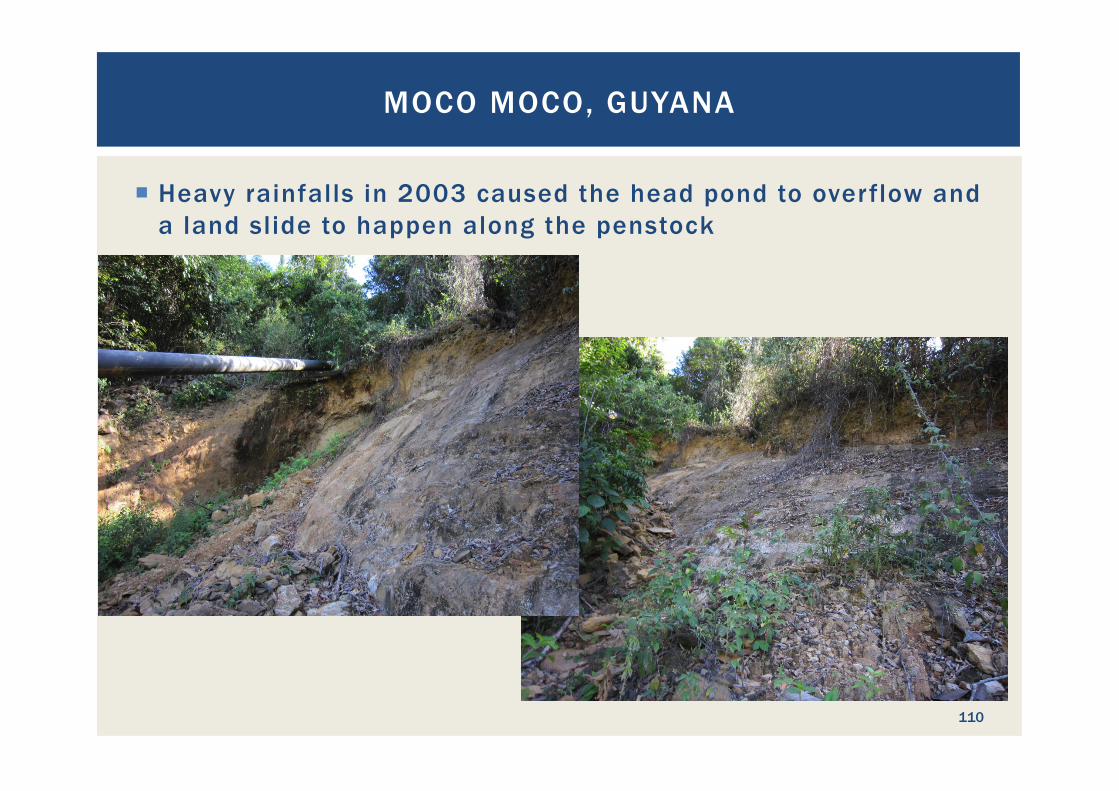
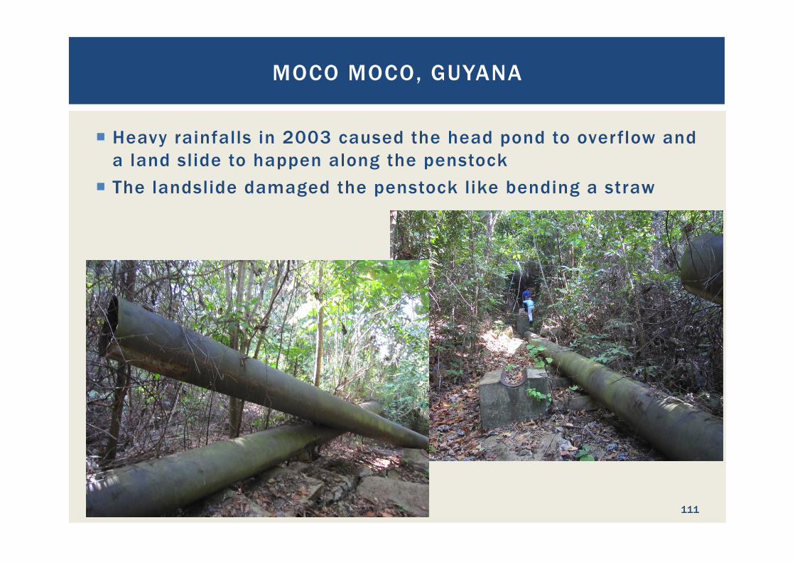
¡ Heavy rainfalls in 2003 caused the head pond to overflow and a land slide to happen along the penstock
MOCO MOCO, GUYANA
110
¡ Heavy rainfalls in 2003 caused the head pond to overflow and a land slide to happen along the penstock
¡ The landslide damaged the penstock like bending a straw
MOCO MOCO, GUYANA
111
¡ Heavy rainfalls in 2003 caused the head pond to overflow and a land slide to happen along the penstock
¡ The landslide damaged the penstock like bending a straw ¡ Consequently, a diesel generator was installed in Lethem to
supply the electricity needs ¡ The electricity was fed back towards the hydropower
powerhouse ¡ Due to the lack of load side over voltage protection a short
circuit occurred in the control board of the HPP and a fire destroyed the control system
MOCO MOCO, GUYANA
112

¡ Due to the lack of load side over voltage protection a short circuit occurred in the control board of the HPP and a fire destroyed the control system
MOCO MOCO, GUYANA
113
!

Prime cause of the damage:
¡ Overestimation of the underground stability, presumably due to the lack of geotechnical investigations during the design phase
MOCO MOCO, GUYANA
114
Prime cause of the damage:
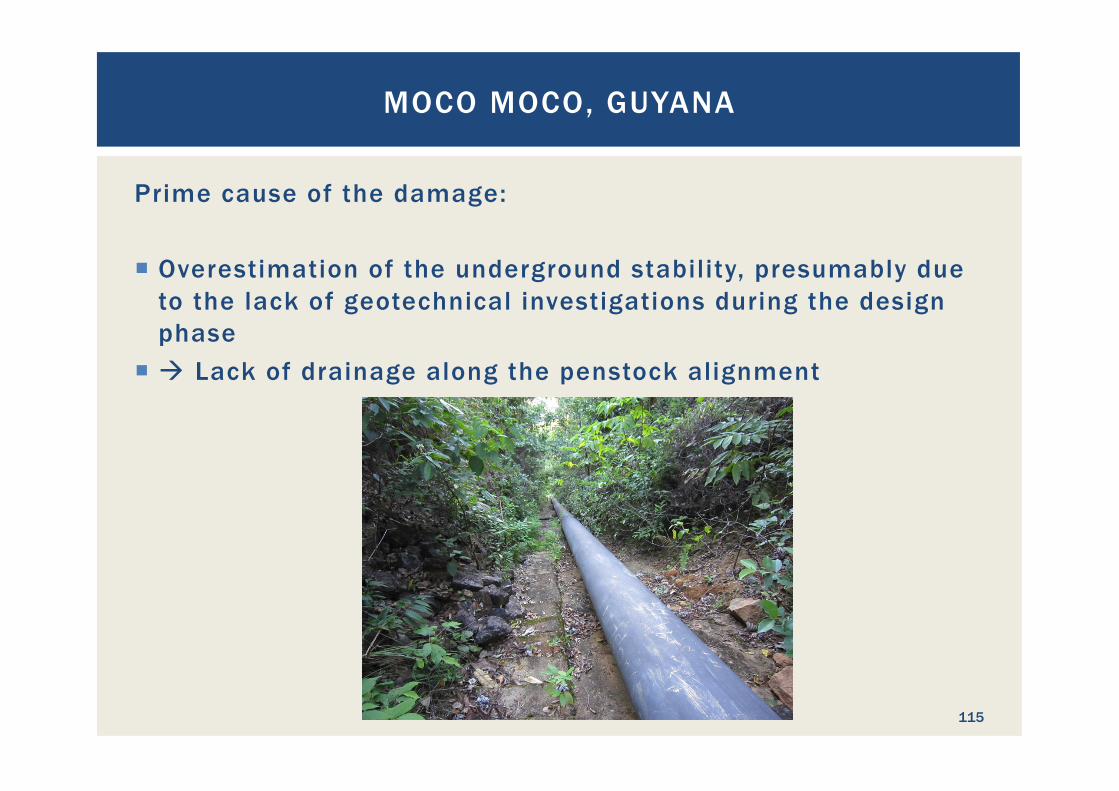
¡ Overestimation of the underground stability, presumably due to the lack of geotechnical investigations during the design phase
¡ à Lack of drainage along the penstock alignment
MOCO MOCO, GUYANA
115

Now: Some guidelines for good project designs
PRINCIPLES OF GOOD PROJECT LAYOUT DESIGN
116
¡ When visiting a site for the first time, or watching a topo map, an initial project layout should be visualized
¡ Logically: Upstream = water in; Downstream = water out ¡ Dam and reservoir or Run-Off River? ¡ Pressure head
§ High head (h > 50 m) § Medium head (15 m < h < 50 m) § Low head (h < 15 m)
¡ Water availability ¡ General geology
§ Solid rock § Soil and rock § Soil and sand
¡ Look for good geology for the various structures!
PRINCIPLES OF GOOD PROJECT LAYOUT DESIGN
117
¡ Try to avoid areas of high population density for project design à avoid need for resettlement and lengthy disputes
¡ Try to maximize the hydropower potential of each site with the layout design. If the potential is more than the power needed for supply, a stage wise construction can be envisaged.
¡ Integrate environmental considerations (fish ladders, minimum flow donation, and so on) in your design to avoid additional cost when these items are required later in the process
¡ Consider sediment handling to be a serious aspect ¡ Do not omit the bottom outlet at dams and reservoirs ¡ Design with realistic redundancy: black start hydropower plant
instead of diesel generators ¡ Do not save on safety aspects
PRINCIPLES OF GOOD PROJECT LAYOUT DESIGN
118
What elements do hydropower projects contain?
PRINCIPLES OF GOOD PROJECT LAYOUT DESIGN
119
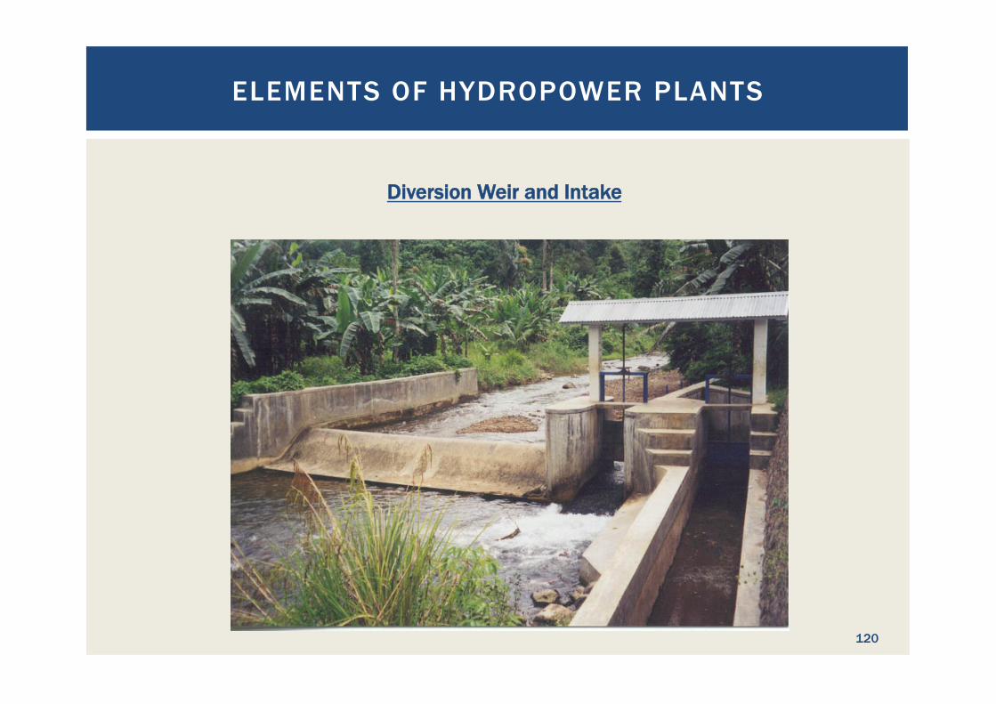
Diversion Weir and Intake
ELEMENTS OF HYDROPOWER PLANTS
120
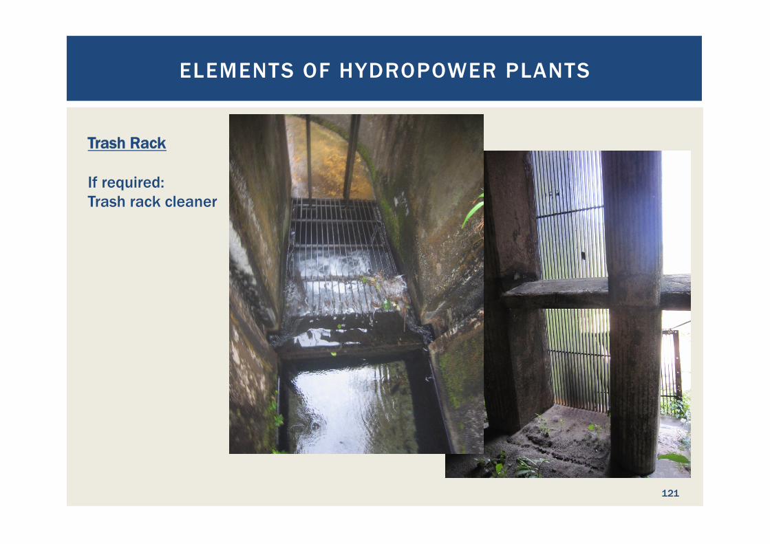
Trash Rack If required: Trash rack cleaner
ELEMENTS OF HYDROPOWER PLANTS
121
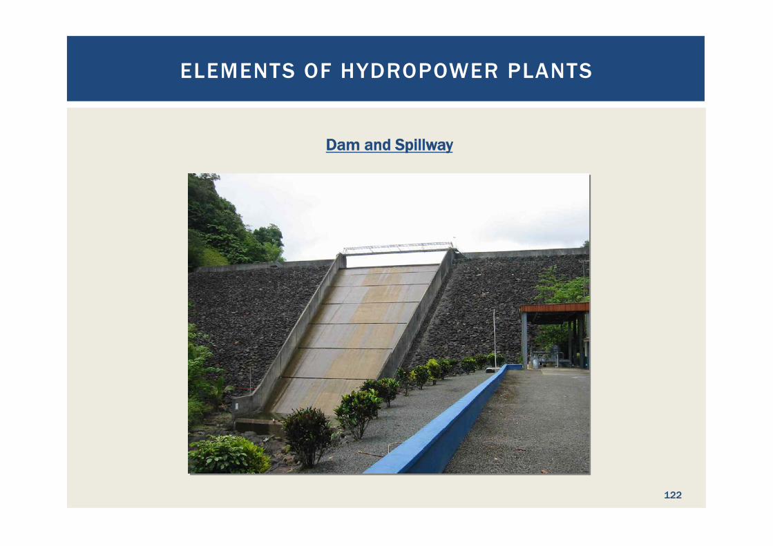
Dam and Spillway
ELEMENTS OF HYDROPOWER PLANTS
122
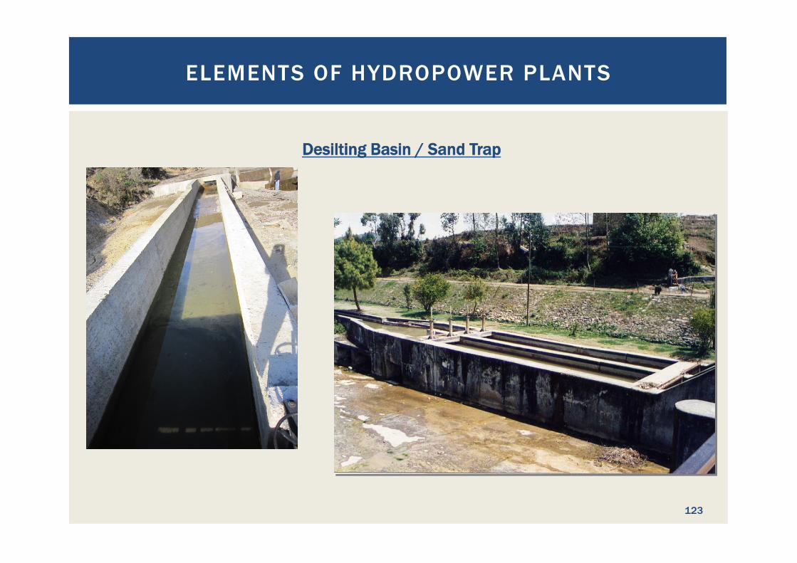
Desilting Basin / Sand Trap
ELEMENTS OF HYDROPOWER PLANTS
123
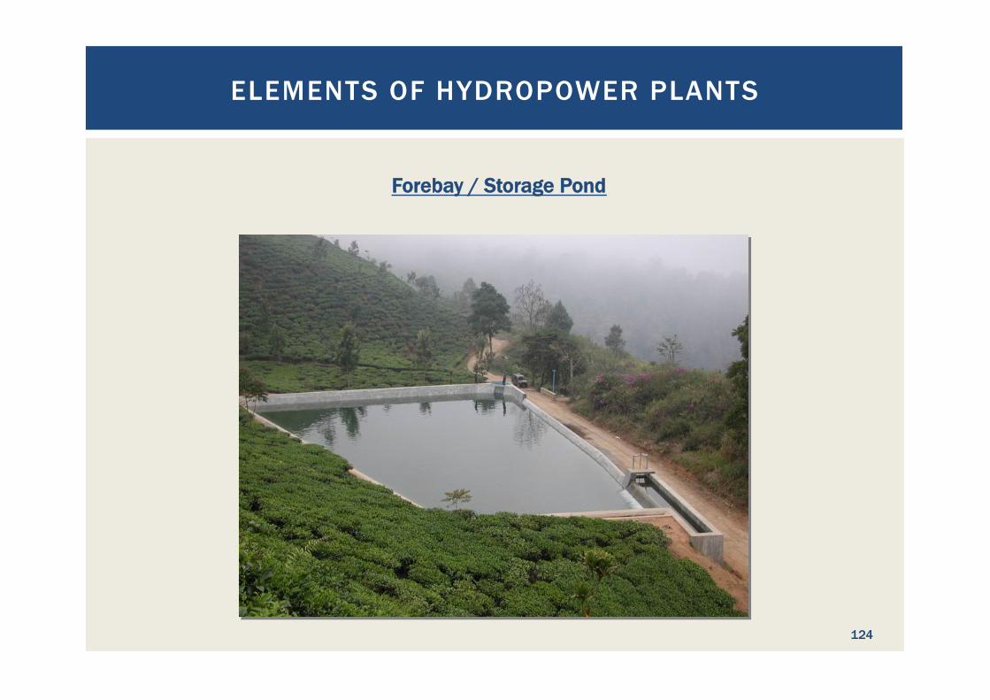
Forebay / Storage Pond
ELEMENTS OF HYDROPOWER PLANTS
124
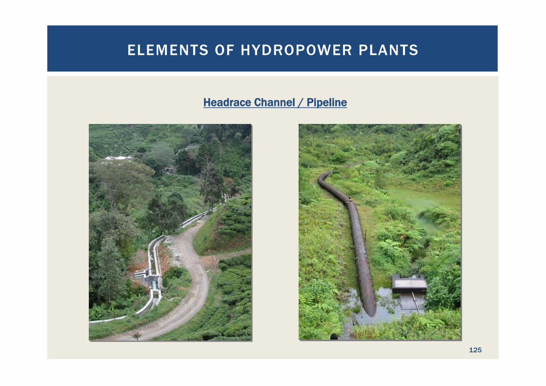
Headrace Channel / Pipeline
ELEMENTS OF HYDROPOWER PLANTS
125
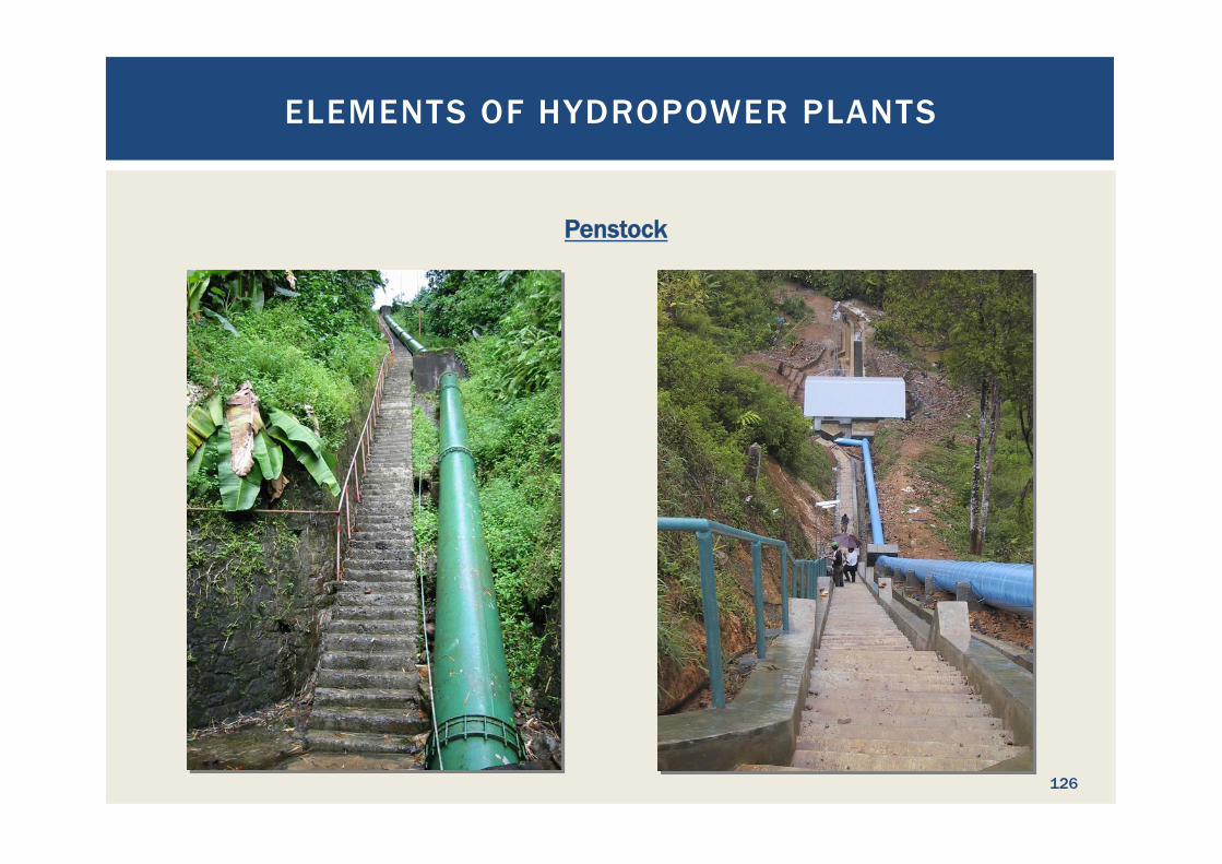
Penstock
ELEMENTS OF HYDROPOWER PLANTS
126
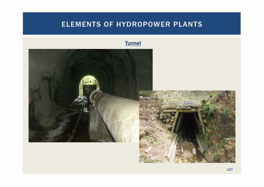
Tunnel
ELEMENTS OF HYDROPOWER PLANTS
127
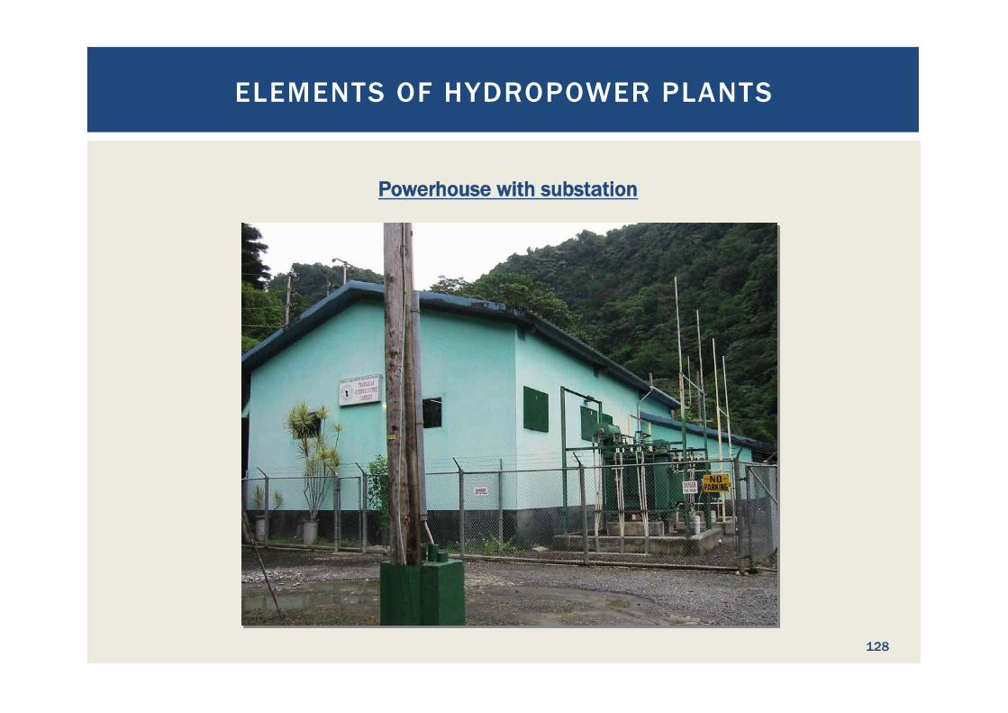
Powerhouse with substation
ELEMENTS OF HYDROPOWER PLANTS
128
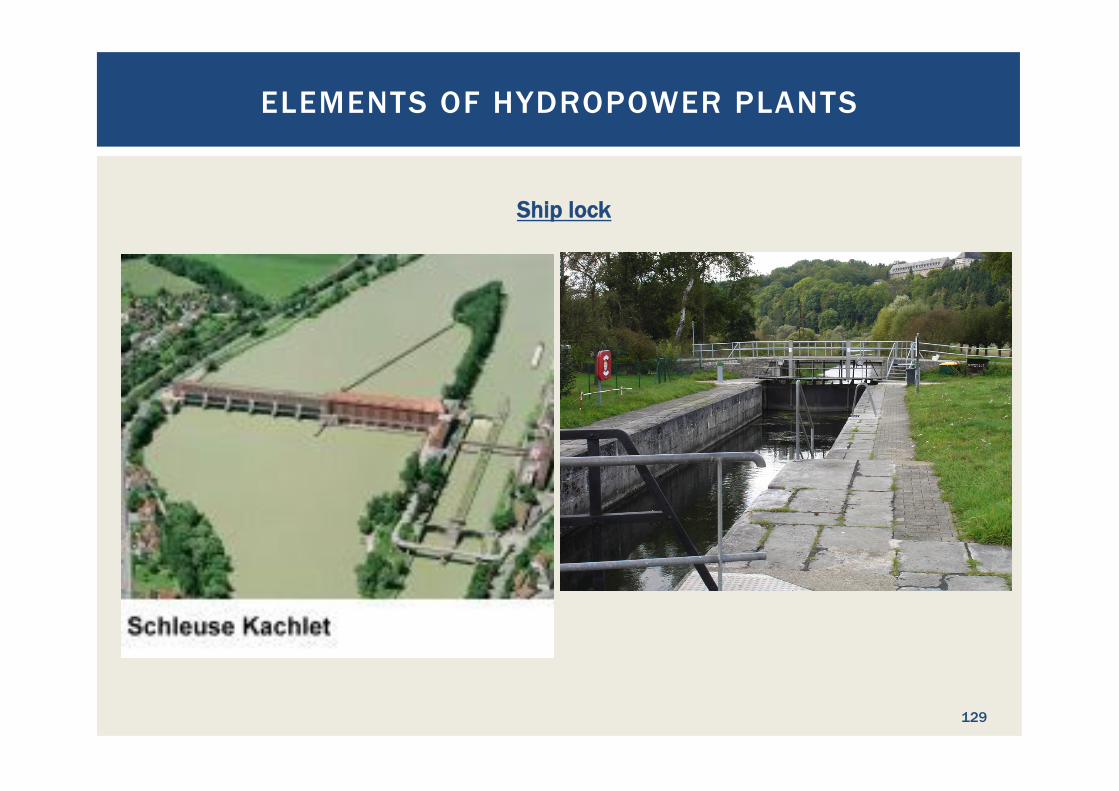
Ship lock
ELEMENTS OF HYDROPOWER PLANTS
129

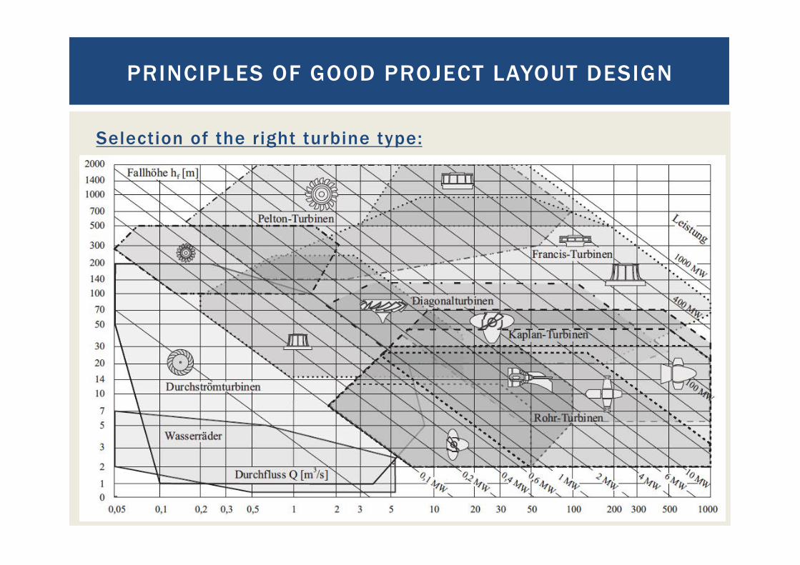
Selection of the right turbine type
PRINCIPLES OF GOOD PROJECT LAYOUT DESIGN
130
Selection of the right turbine type:
PRINCIPLES OF GOOD PROJECT LAYOUT DESIGN
131
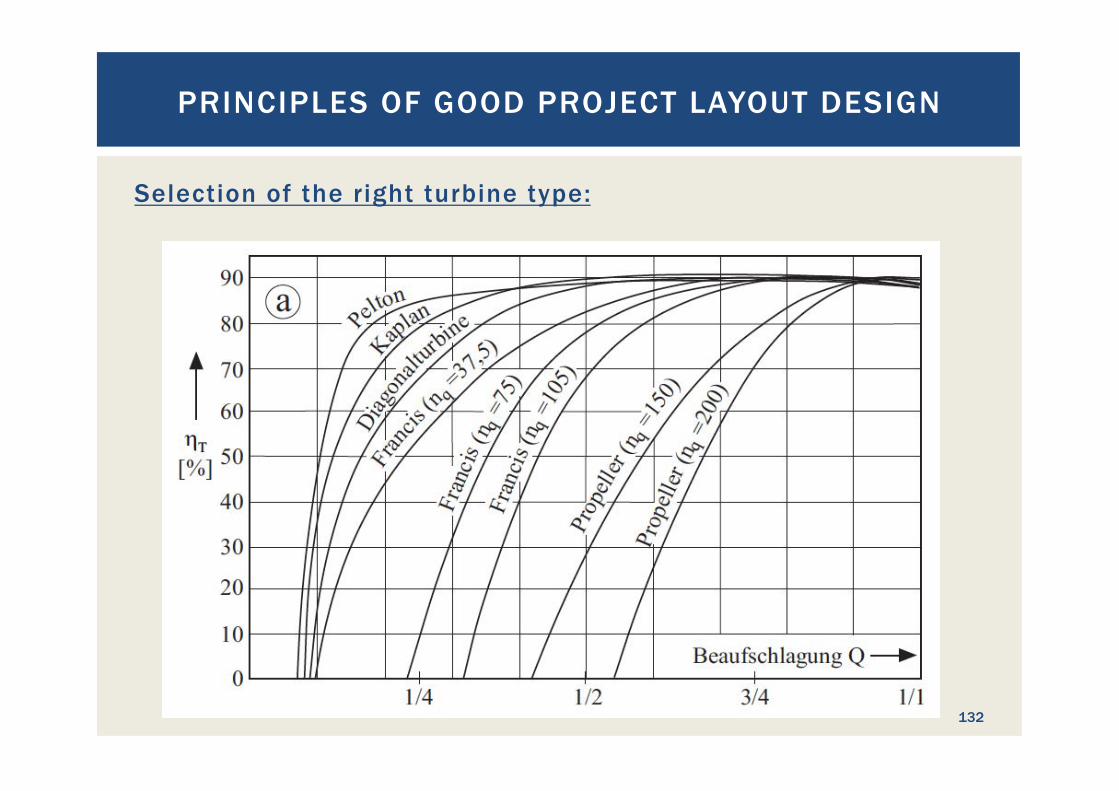
Selection of the right turbine type:
PRINCIPLES OF GOOD PROJECT LAYOUT DESIGN
132
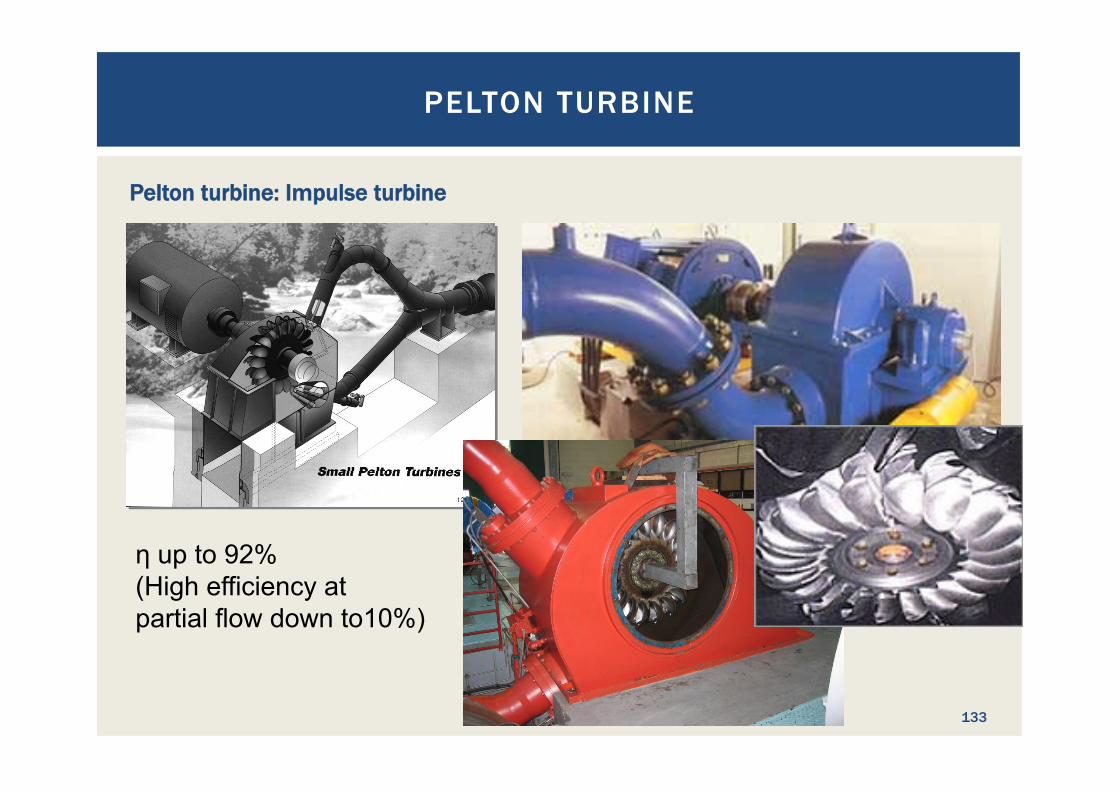
Pelton turbine: Impulse turbine
η up to 92% (High efficiency at partial flow down to10%)
PELTON TURBINE
133
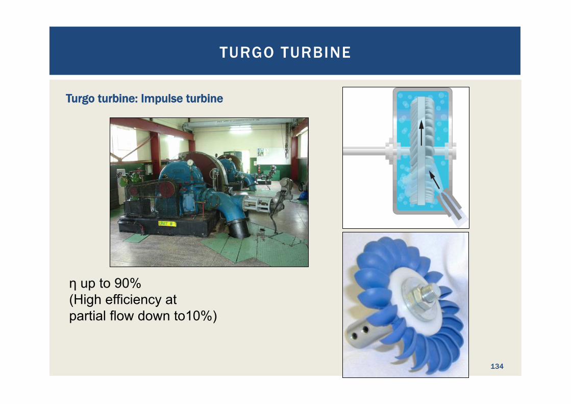
Turgo turbine: Impulse turbine
η up to 90% (High efficiency at partial flow down to10%)
TURGO TURBINE
134
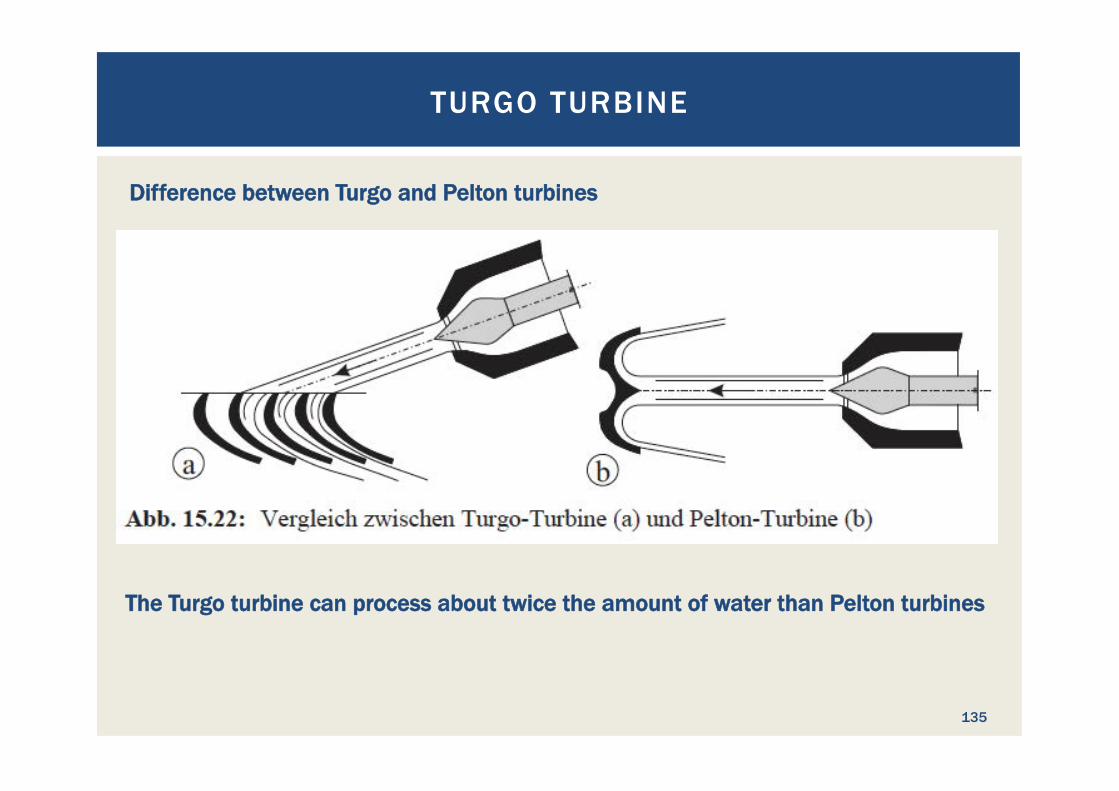
Difference between Turgo and Pelton turbines
TURGO TURBINE
135
The Turgo turbine can process about twice the amount of water than Pelton turbines
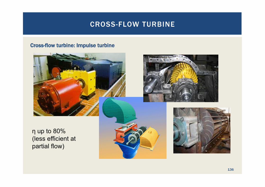
Cross-flow turbine: Impulse turbine
η up to 80% (less efficient at partial flow)
CROSS-FLOW TURBINE
136

Cross-flow turbine: Impulse turbine
CROSS-FLOW TURBINE
137
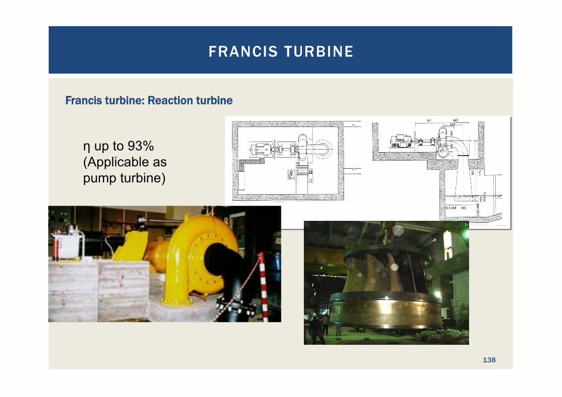
Francis turbine: Reaction turbine
η up to 93% (Applicable as pump turbine)
FRANCIS TURBINE
138

FRANCIS TURBINE
139
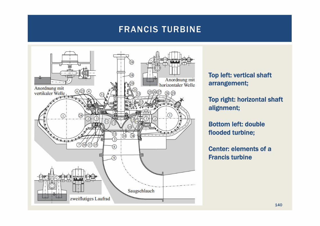
Francis shaft (a) and spiral (b) turbine arrangements
FRANCIS TURBINE
140
Top left: vertical shaft arrangement; Top right: horizontal shaft alignment; Bottom left: double flooded turbine; Center: elements of a Francis turbine
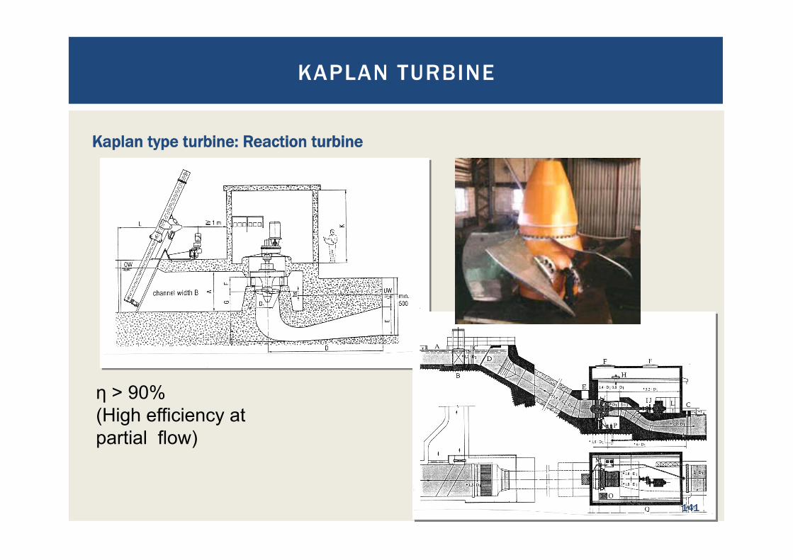
Kaplan type turbine: Reaction turbine
η > 90% (High efficiency at partial flow)
KAPLAN TURBINE
141
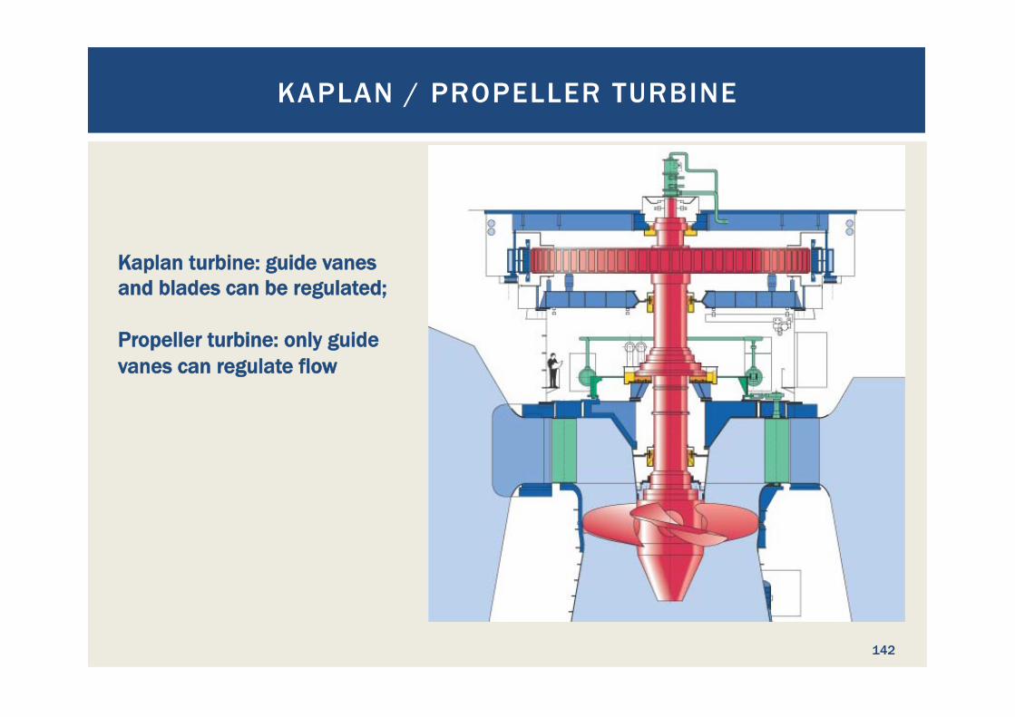
Kaplan turbine: guide vanes and blades can be regulated; Propeller turbine: only guide vanes can regulate flow
KAPLAN / PROPELLER TURBINE
142
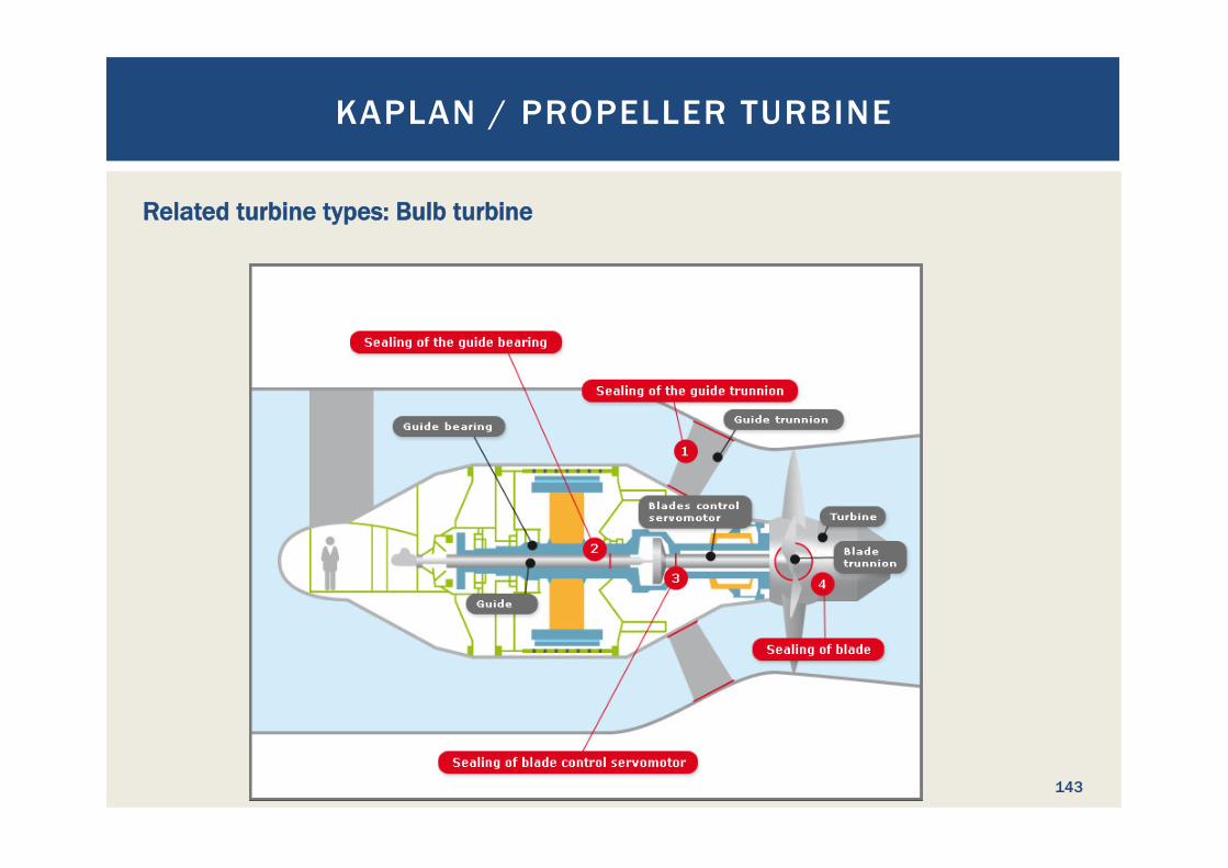
Related turbine types: Bulb turbine
KAPLAN / PROPELLER TURBINE
143
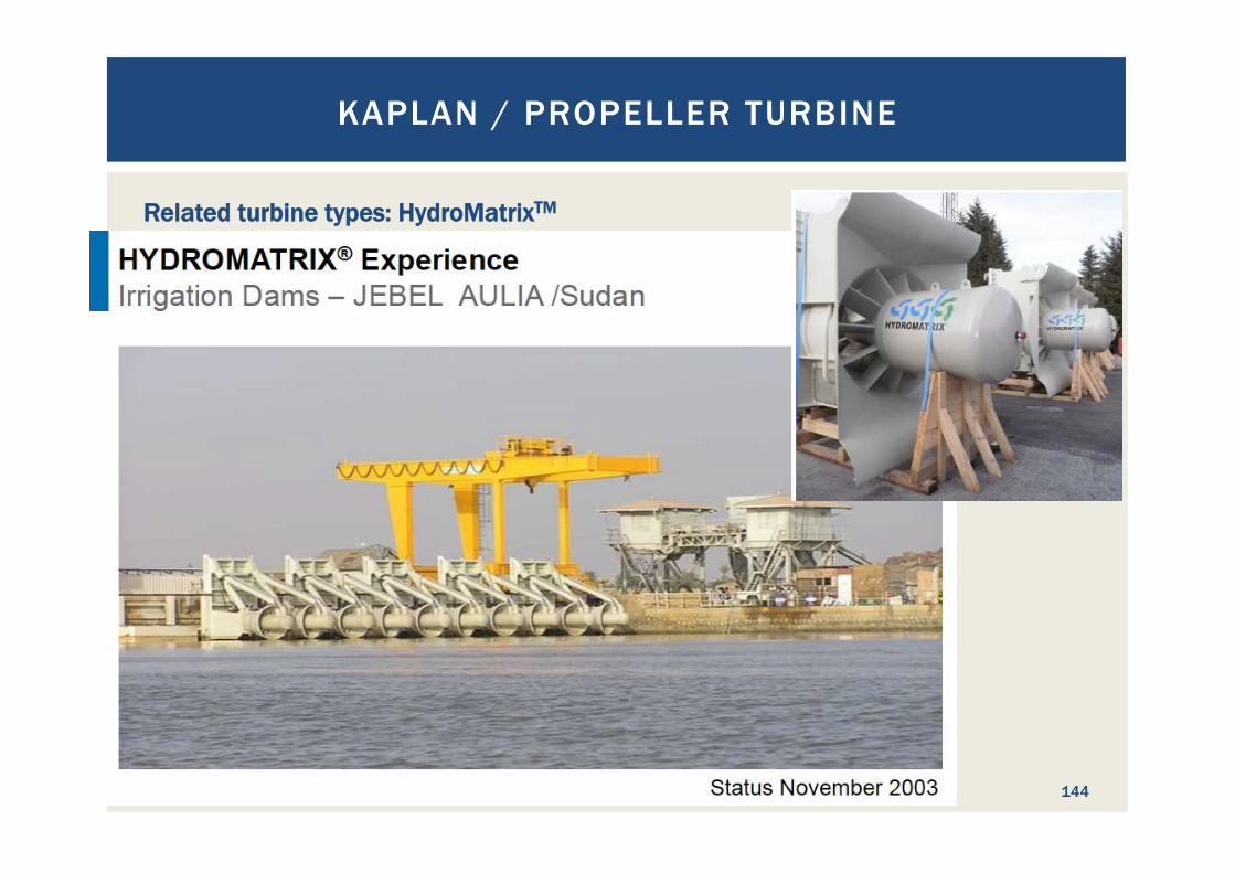
Related turbine types: HydroMatrixTM
KAPLAN / PROPELLER TURBINE
144
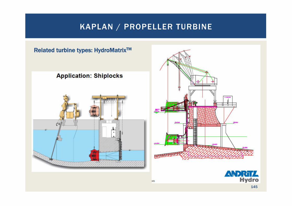
Related turbine types: HydroMatrixTM
KAPLAN / PROPELLER TURBINE
145
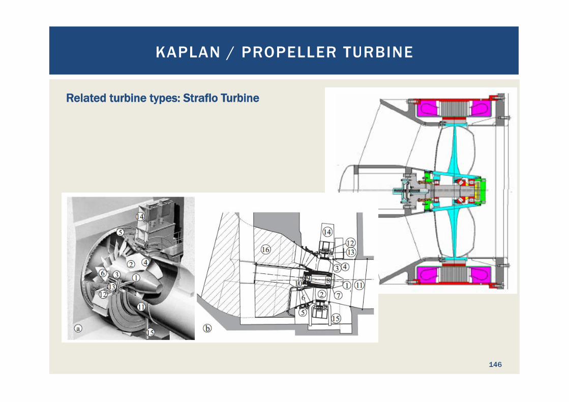
Related turbine types: Straflo Turbine
KAPLAN / PROPELLER TURBINE
146

Related turbine types: S-Bulb turbines
KAPLAN / PROPELLER TURBINE
147
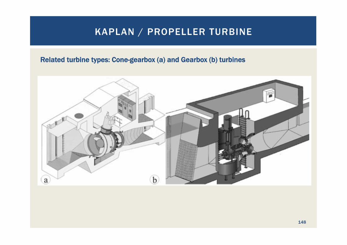
Related turbine types: Cone-gearbox (a) and Gearbox (b) turbines
KAPLAN / PROPELLER TURBINE
148
149
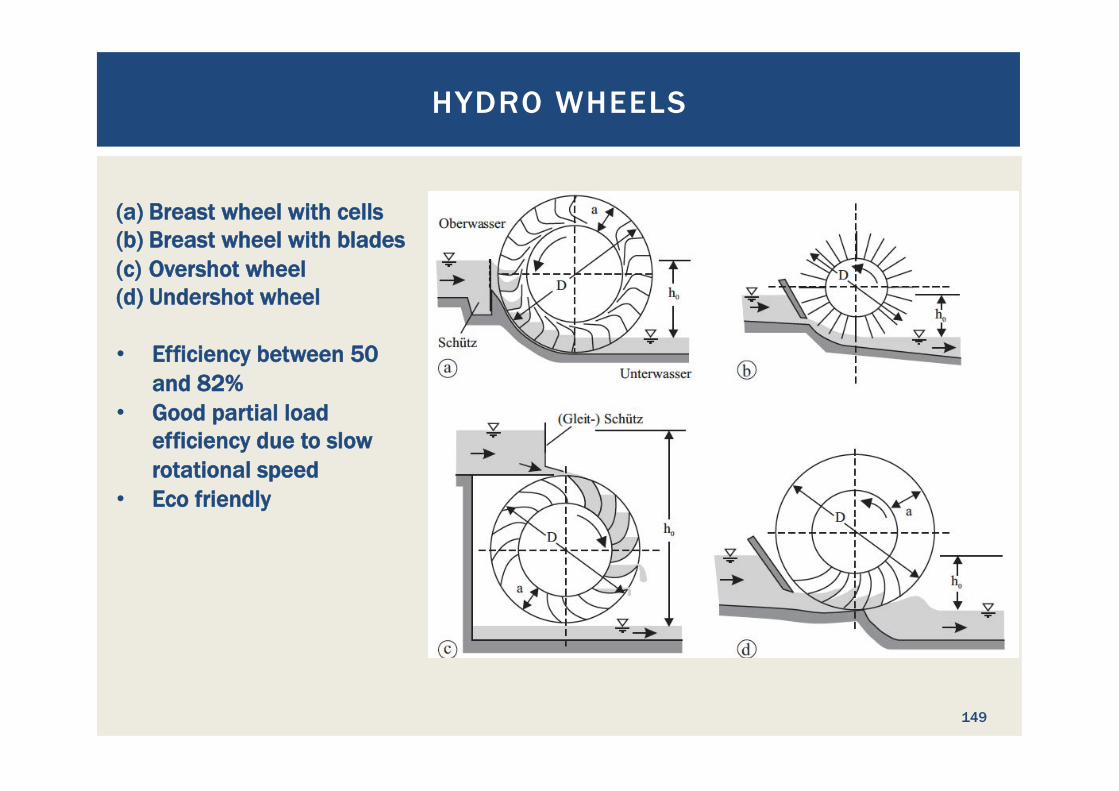
HYDRO WHEELS
(a) Breast wheel with cells (b) Breast wheel with blades (c) Overshot wheel (d) Undershot wheel
• Efficiency between 50 and 82%
• Good partial load efficiency due to slow rotational speed
• Eco friendly
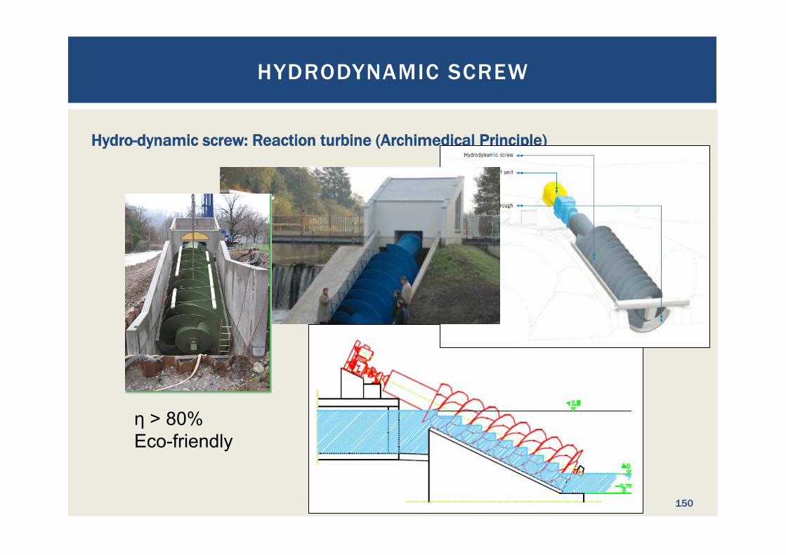
Hydro-dynamic screw: Reaction turbine (Archimedical Principle)
η > 80% Eco-friendly
HYDRODYNAMIC SCREW
150
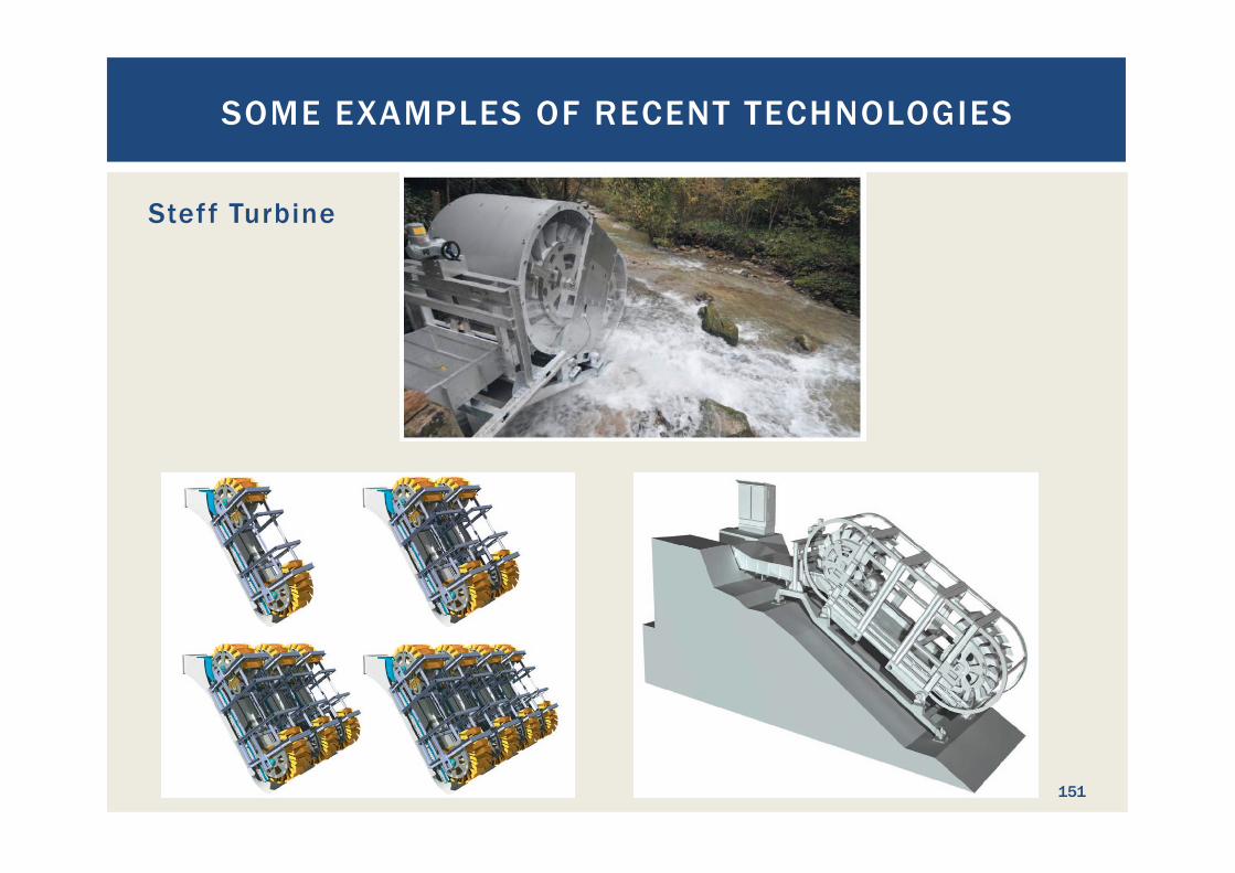
Steff Turbine
SOME EXAMPLES OF RECENT TECHNOLOGIES
151

EXERCISE 2: DEVELOPMENT OF A
PROJECT LAYOUT
152
EXERCISE 2: DEVELOPMENT OF A PROJECT LAYOUT
153
Second exercise: Situation: ¡ The Troumassee River was earmarked for hydropower use ¡ The topographic map shows the situation
Challenge: ¡ Design the initial project layout to be used for feasibility study
to maximize the use of the site’s hydropower potential § Define the location of the structures, such as weir, dam, powerhouse,
pipelines, power lines, access roads § Select the type of the structures, such as weir type, headrace canal or
pipeline, turbine type, ... § Draw project layout in the map and sketches of the structures on
separate papers

This chapter was not presented!
ECONOMIC ANALYSIS AND SENSITIVITY
ANALYSIS
154

ECONOMIC ANALYSIS AND SENSITIVIT Y ANALYSIS
155
What is economic analysis? A systematic approach to determining the optimum use of scarce resources, involving comparison of two or more alternatives in achieving a specific objective under the given assumptions and constraints. Economic analysis takes into account the opportunity costs of resources employed and attempts to measure in monetary terms the private and social costs and benefits of a project to the community or economy. (Source: ht tp ://www.businessdict ionar y.com/def in i t ion/economic -analys is .html#ixzz2z jnCgz7x)
ECONOMIC ANALYSIS AND SENSITIVIT Y ANALYSIS
156
Economic Analysis: ¡ allows identification of the optimum hydropower project
configuration ¡ Can compare hydropower projects with other means to provide
electricity ¡ Is used to optimize even individual structures, such as tunnels
and cofferdams ¡ Expresses all benefits and costs in monetary terms to
compare them ¡ Can be used to determine the profitability of a project ¡ Gives the answer to the question “Is the project economically
feasible?”
ECONOMIC ANALYSIS AND SENSITIVIT Y ANALYSIS
157
What input data is required? For the analysis of an entire hydropower project: ¡ All project development cost ¡ All construction cost ¡ All re-investments over the analysis time span ¡ Operation and maintenance costs ¡ Environmental and social costs ¡ Project benefits from power sales ¡ Other project benefits (emission certificate trading, subsidies,
secondary income, ...) ¡ Residual value of the project at the end of the analysed period
ECONOMIC ANALYSIS AND SENSITIVIT Y ANALYSIS
158
What input data is required? For the analysis of an entire hydropower project: (continued) ¡ Time when the costs and benefits incur ¡ Financial parameters
§ Discount rate § Loan interest rate and repayment time § Share of equity § Price escalation rates
¡ All costs are discounted to reference point in time
ECONOMIC ANALYSIS AND SENSITIVIT Y ANALYSIS
159
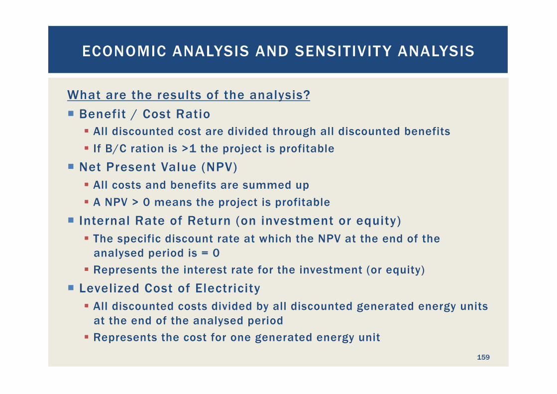
What are the results of the analysis? ¡ Benefit / Cost Ratio
§ All discounted cost are divided through all discounted benefits § If B/C ration is >1 the project is profitable
¡ Net Present Value (NPV) § All costs and benefits are summed up § A NPV > 0 means the project is profitable
¡ Internal Rate of Return (on investment or equity) § The specific discount rate at which the NPV at the end of the
analysed period is = 0 § Represents the interest rate for the investment (or equity)
¡ Levelized Cost of Electricity § All discounted costs divided by all discounted generated energy units
at the end of the analysed period § Represents the cost for one generated energy unit
ECONOMIC ANALYSIS AND SENSITIVIT Y ANALYSIS
160
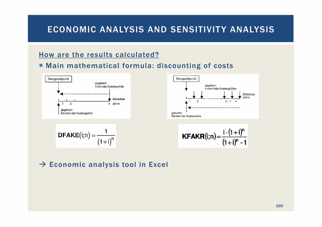
How are the results calculated? ¡ Main mathematical formula: discounting of costs
à Economic analysis tool in Excel

ECONOMIC ANALYSIS AND SENSITIVIT Y ANALYSIS
161
What is a sensitivity analysis (SA)? ¡ The input parameters of an economic analysis underlie
uncertainties ¡ Sensitivity Analysis: vary the value of critical parameters and
repeat EA ¡ Results of a SA show under which conditions the feasibility of
a project changes ¡ SA quantifies the risk emerging from parameter uncertainties ¡ Typical parameters to vary are
§ Discount rate § Electricity sales tariff § Project investment cost § Loan interest rate § Share of equity § Price escalations
ECONOMIC ANALYSIS AND SENSITIVIT Y ANALYSIS
162
How are the results of an economic analysis and sensitivity analysis used? Different interpretations: ¡ Private project developers
§ Consider projects as investment § Usually want to see high IRR (> 12%) and NPV § Are willing to take higher risk if the prospective profit is high enough
¡ Public developers § Are happy with lower IRR (say 6-8 %) and if NPV is above 0 § Seek to reduce project risks § Usually represent a public interest, such as electricity supply
¡ Banks § Need to reduce risks significantly to protect investors’ money § Follow borrower with IRR and NPV requirements but adjust their
lending conditions to reflect lending risk

This chapter was not presented!
ENVIRONMENTAL AND SOCIAL
CONSIDERATIONS
163
Importance: ¡ Requirement (legal in most countries and/or for
financiers) ¡ For macroeconomic cost-benefit analysis ¡ For microeconomic viability of the project ¡ Anticipated irreversible adverse impacts on the
environment may result in the discontinuation of projects!
ENVIRONMENTAL IMPACT ASSESSMENT
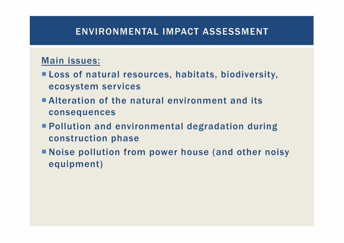
Main issues: ¡ Loss of natural resources, habitats, biodiversity,
ecosystem services ¡ Alteration of the natural environment and its
consequences ¡ Pollution and environmental degradation during
construction phase ¡ Noise pollution from power house (and other noisy
equipment)
ENVIRONMENTAL IMPACT ASSESSMENT
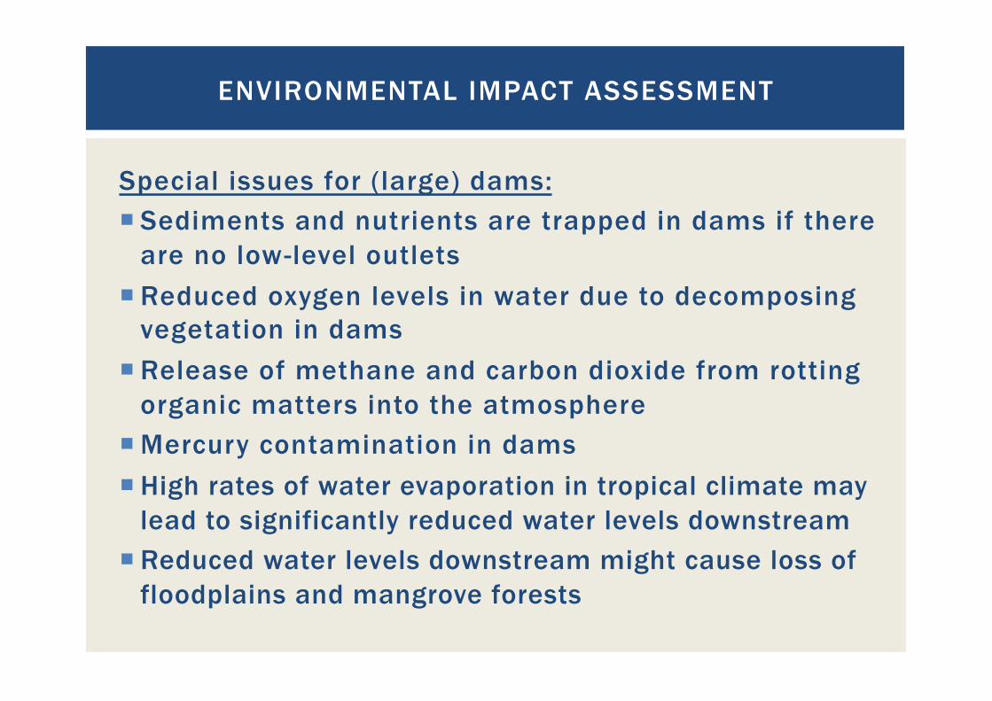
Special issues for (large) dams: ¡ Sediments and nutrients are trapped in dams if there
are no low-level outlets ¡ Reduced oxygen levels in water due to decomposing
vegetation in dams ¡ Release of methane and carbon dioxide from rotting
organic matters into the atmosphere ¡ Mercury contamination in dams ¡ High rates of water evaporation in tropical climate may
lead to significantly reduced water levels downstream ¡ Reduced water levels downstream might cause loss of
floodplains and mangrove forests
ENVIRONMENTAL IMPACT ASSESSMENT
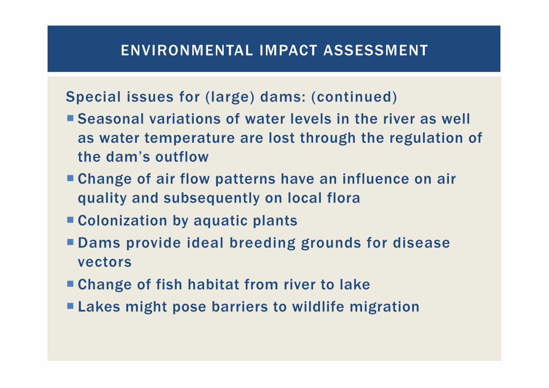
Special issues for (large) dams: (continued) ¡ Seasonal variations of water levels in the river as well
as water temperature are lost through the regulation of the dam’s outflow
¡ Change of air flow patterns have an influence on air quality and subsequently on local flora
¡ Colonization by aquatic plants ¡ Dams provide ideal breeding grounds for disease
vectors ¡ Change of fish habitat from river to lake ¡ Lakes might pose barriers to wildlife migration
ENVIRONMENTAL IMPACT ASSESSMENT
Are mitigation measures for all issues encountered possible? How much do they cost?
ENVIRONMENTAL IMPACT ASSESSMENT

Importance: ¡ Requirement in some countries and for some
financiers ¡ For macroeconomic cost-benefit analysis ¡ For microeconomic viability of the project ¡ Information, communication and consultation with
affected people is essential for a successful project! People who are angry because they feel their concerns are ignored may find ways to stop the project.
SOCIAL IMPACT ASSESSMENT
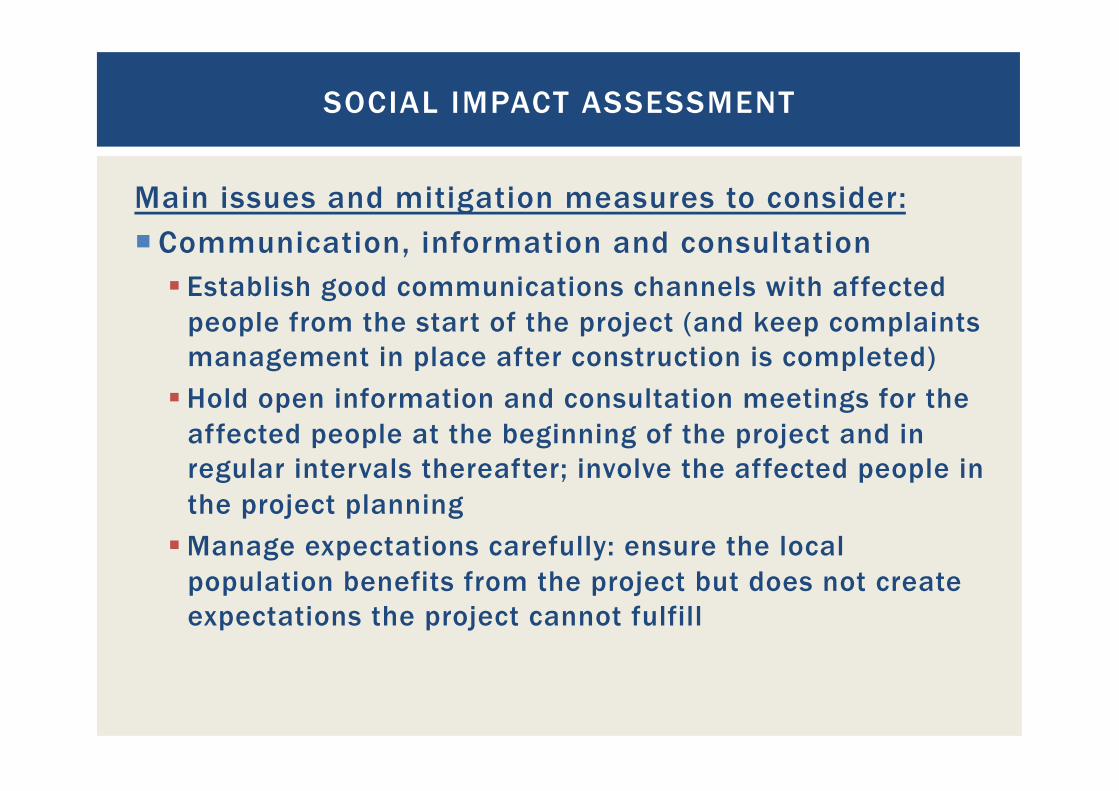
Main issues and mitigation measures to consider: ¡ Communication, information and consultation
§ Establish good communications channels with affected people from the start of the project (and keep complaints management in place after construction is completed)
§ Hold open information and consultation meetings for the affected people at the beginning of the project and in regular intervals thereafter; involve the affected people in the project planning
§ Manage expectations carefully: ensure the local population benefits from the project but does not create expectations the project cannot fulfill
SOCIAL IMPACT ASSESSMENT

Main issues and mitigation measures to consider: (Continued) ¡ Resettlement:
§ Negotiate fair deals with communities that have to be resettled
§ Transparent decision-making processes and consultations with the communities are essential
§ Pay attention to the following: § Land rights (customary and statutory land rights might be
overlapping, people might not have official land titles) § Water rights § Gender equality § Indigenous people’s rights
SOCIAL IMPACT ASSESSMENT

Main issues and mitigation measures to consider: (Continued) ¡ Compensation:
§ For loss of houses and land, livelihoods, cultural/ religious goods and places, community services
§ Also consider communities downstream whose livelihoods might be endangered through changes in the ecosystems
§ Might include training and initial resources for uptake of new livelihoods
SOCIAL IMPACT ASSESSMENT
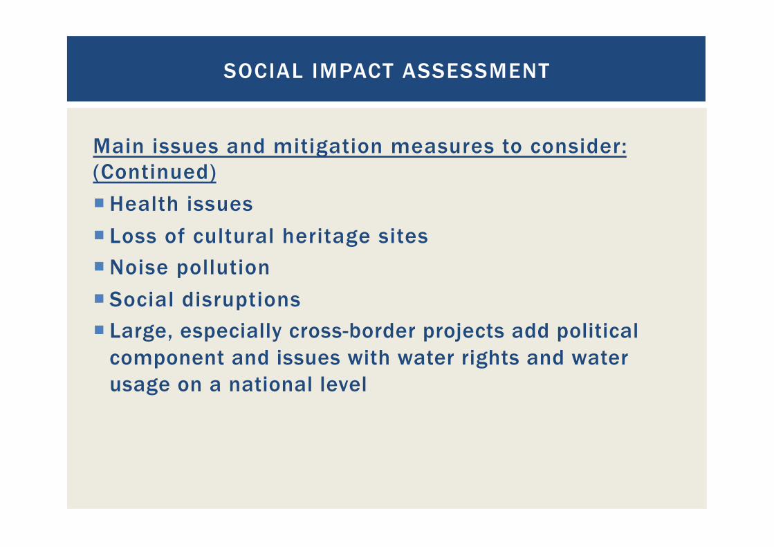
Main issues and mitigation measures to consider: (Continued) ¡ Health issues ¡ Loss of cultural heritage sites ¡ Noise pollution ¡ Social disruptions ¡ Large, especially cross-border projects add political
component and issues with water rights and water usage on a national level
SOCIAL IMPACT ASSESSMENT
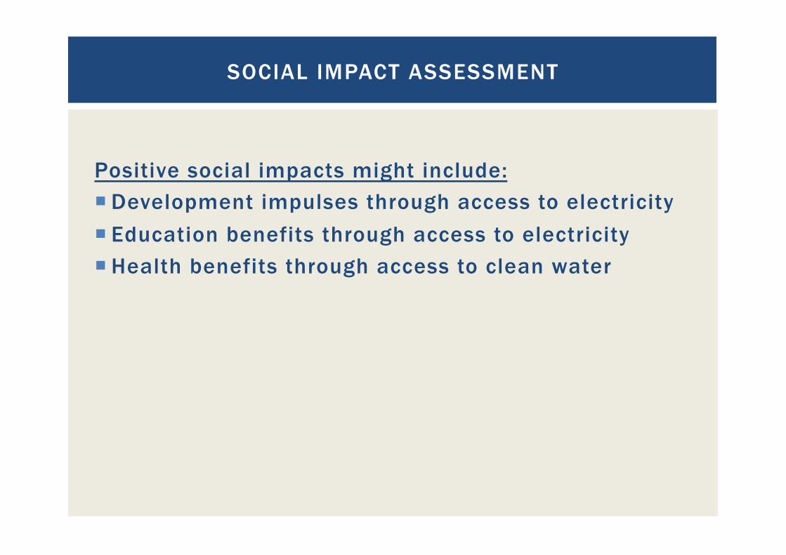
Positive social impacts might include: ¡ Development impulses through access to electricity ¡ Education benefits through access to electricity ¡ Health benefits through access to clean water
SOCIAL IMPACT ASSESSMENT

The positive and negative impacts must be put in relation to one another!
SOCIAL IMPACT ASSESSMENT
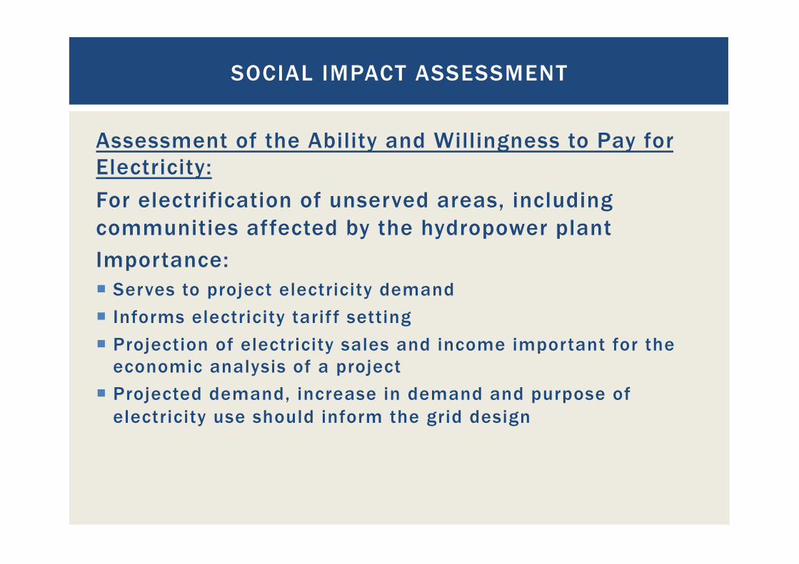
Assessment of the Ability and Willingness to Pay for Electricity: For electrification of unserved areas, including communities affected by the hydropower plant Importance: ¡ Serves to project electricity demand ¡ Informs electricity tarif f setting ¡ Projection of electricity sales and income important for the
economic analysis of a project ¡ Projected demand, increase in demand and purpose of
electricity use should inform the grid design
SOCIAL IMPACT ASSESSMENT
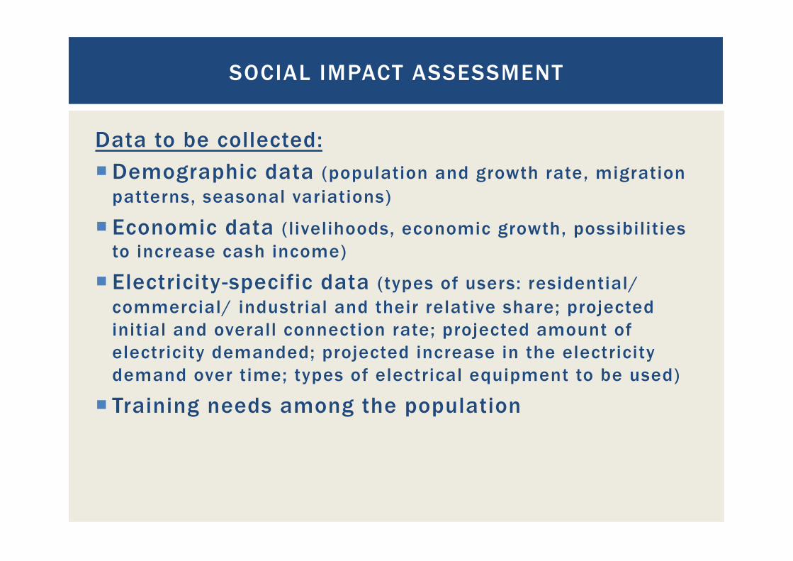
Data to be collected: ¡ Demographic data (population and growth rate, migration
patterns, seasonal variations)
¡ Economic data (livelihoods, economic growth, possibilities to increase cash income)
¡ Electricity-specific data (types of users: residential/ commercial/ industrial and their relative share; projected initial and overall connection rate; projected amount of electricity demanded; projected increase in the electricity demand over time; types of electrical equipment to be used)
¡ Training needs among the population
SOCIAL IMPACT ASSESSMENT
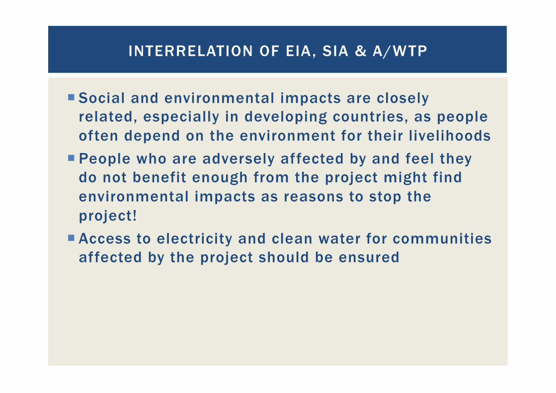
¡ Social and environmental impacts are closely related, especially in developing countries, as people often depend on the environment for their livelihoods
¡ People who are adversely affected by and feel they do not benefit enough from the project might find environmental impacts as reasons to stop the project!
¡ Access to electricity and clean water for communities affected by the project should be ensured
INTERRELATION OF EIA, SIA & A/WTP

Conclusions:
¡ The importance of ESIAs must not be underestimated
¡ ESIAs should not be viewed as additional bureaucratic hurdles to overcome, but as an instrument to inform the debate about the costs and benefits of a proposed project and its viability
¡ Impact mitigation costs must be considered in the economic viability analysis of a project
¡ Local population must participate in the benefits of the project and not just bear the costs
ENVIRONMENTAL & SOCIAL IMPACT ASSESSMENT
Conclusions (continued)
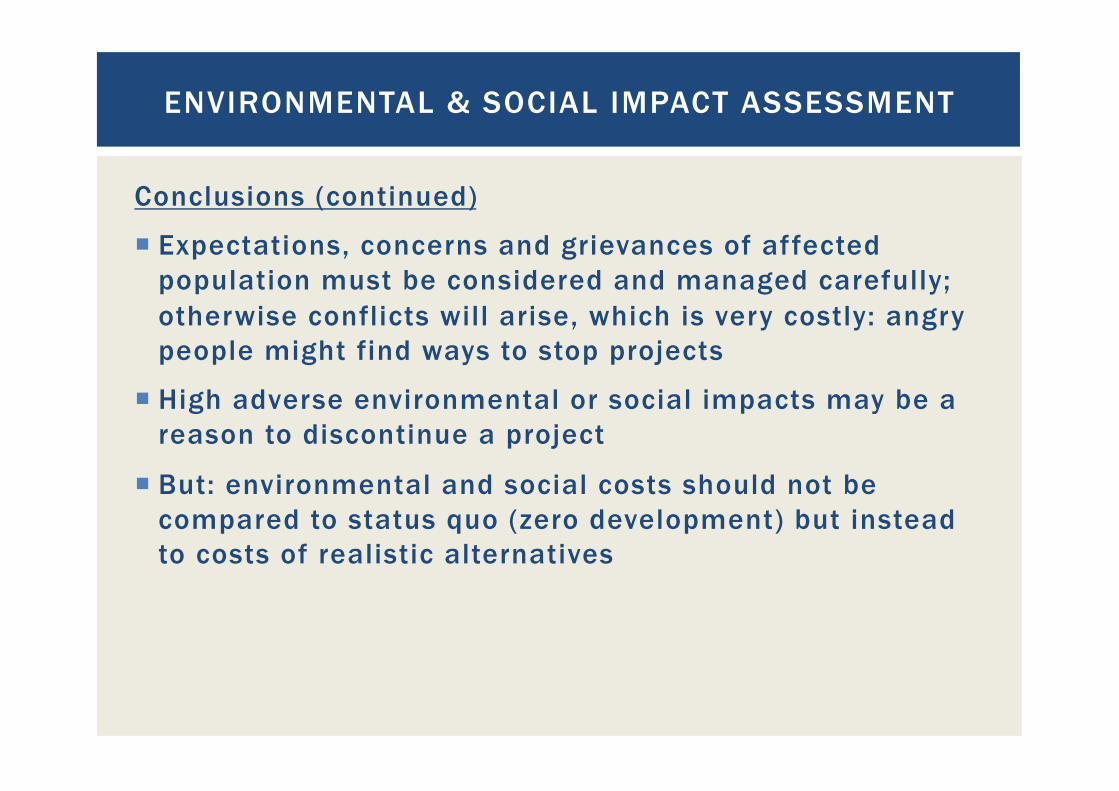
¡ Expectations, concerns and grievances of affected population must be considered and managed carefully; otherwise conflicts will arise, which is very costly: angry people might find ways to stop projects
¡ High adverse environmental or social impacts may be a reason to discontinue a project
¡ But: environmental and social costs should not be compared to status quo (zero development) but instead to costs of realistic alternatives
ENVIRONMENTAL & SOCIAL IMPACT ASSESSMENT

DRAWING CONCLUSIONS FROM THE RESULTS,
QUESTION AND ANSWER SESSION
181

DRAWING CONCLUSIONS FROM THE RESULTS, QUESTION AND ANSWER SESSION
182
Questions? Comments?

CONTACT E-mail: [email protected] Web: http://www.sven-homscheid.com
THANK YOU FOR YOUR ATTENTION!
183

¡ „Hydrometry“; Boiten; Edition 2003; ISBN 90-5410-423-6 ¡ www.ott.com ¡ www.seba-hydrometrie.com ¡ www.wikipedia.com ¡ www.geomation.com ¡ www.geotechnik-dunkel.de ¡ „Wasserkraftanlagen“; Giesecke; Mosonyi; 2003; ISBN
3-540-44391-6 ¡ „Hydraulik fuer Bauingenieure“; Heinemann/Paul; ISBN
3-519-05082-x
REFERENCES
184