Embed Size (px)
Citation preview

Friso Penninga TU Delft
Sander Oude Elberink ITC Enschede
3D Topography

3D Topography
3D data modelling 3D DBMS Analysis3D data acquisition

3D Topography
3D data modelling
Objective: develop a data structure capable of handling large data volumes and offers support for querying, analysis and validation.
Model characteristics:• full 3D decomposition of space, • apply a tetrahedron structure • based on Poincaré simplicial homology as mathematical foundation

3D Topography
3D data modelling
Results:•A new innovative approach to 3D data modelling:•validation and analysis through topology•reduces data storage (stored in one single-column table!)•no explicit updates of topology and less dimensional simplexes•full control over orientation •based on a solid theoretical foundation (100 years old math)

3D Topography
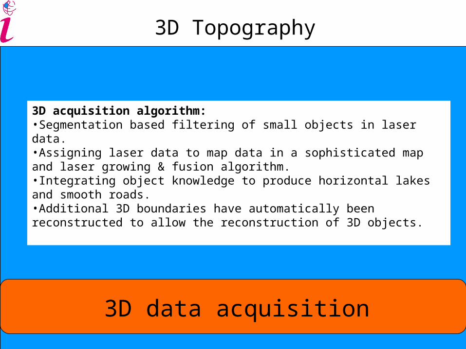
3D data acquisition
Objective: develop an automated 3D data acquisition method, by integrating laser altimetry data with 2D GIS data.
3D Topography
3D data acquisition
3D acquisition algorithm:•Segmentation based filtering of small objects in laser data. •Assigning laser data to map data in a sophisticated map and laser growing & fusion algorithm.•Integrating object knowledge to produce horizontal lakes and smooth roads. •Additional 3D boundaries have automatically been reconstructed to allow the reconstruction of 3D objects.

3D Topography
3D data acquisition
P2
P1
P1
P2
P2
P3
P3

3D Topography
3D data acquisition
1 road12 polygons1000 m2 5 correct laser points>150 false laser points
Data fusion problem

3D Topography
3D data acquisition
Data fusion solution:Combined map & laser growing

3D Topography
3D data acquisition
BeeldbankVenW.nl

3D Topography
3D data acquisition
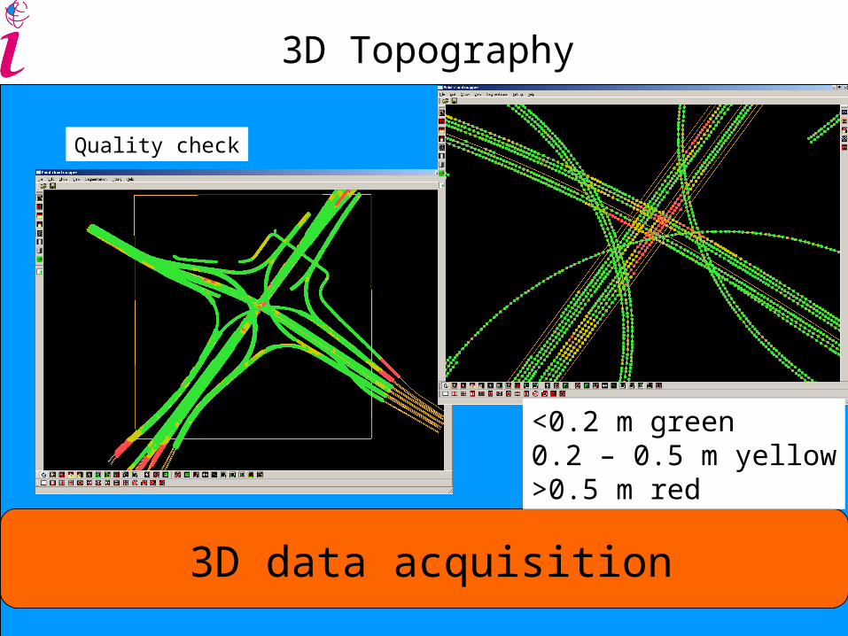
Results Quality check
3D Topography
3D data acquisition
Quality check
<0.2 m green0.2 – 0.5 m yellow>0.5 m red

3D Topography
www.gdmc.nl/3Dtopo
Contact: Peter van Oosterom