Embed Size (px)
Citation preview
Calhoun ISD Social Studies Curriculum Design Project
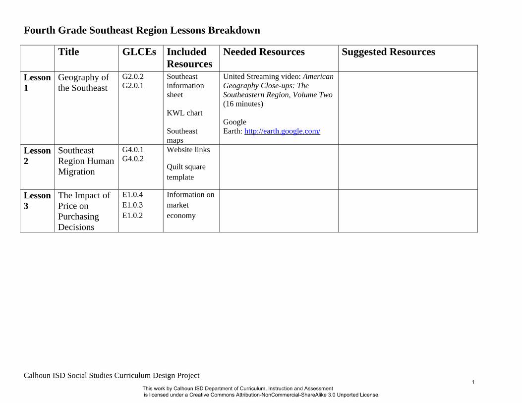
Fourth Grade Southeast Region Lessons Breakdown Title GLCEs Included
Resources Needed Resources Suggested Resources
Lesson 1
Geography of the Southeast
G2.0.2 G2.0.1
Southeast information sheet KWL chart Southeast maps
United Streaming video: American Geography Close-ups: The Southeastern Region, Volume Two (16 minutes) Google Earth: http://earth.google.com/
Lesson 2
Southeast Region Human Migration
G4.0.1 G4.0.2
Website links
Quilt square template
Lesson 3
The Impact of Price on Purchasing Decisions
E1.0.4 E1.0.3 E1.0.2
Information on market economy
This work by Calhoun ISD Department of Curriculum, Instruction and Assessment is licensed under a Creative Commons Attribution-NonCommercial-ShareAlike 3.0 Unported License.
1
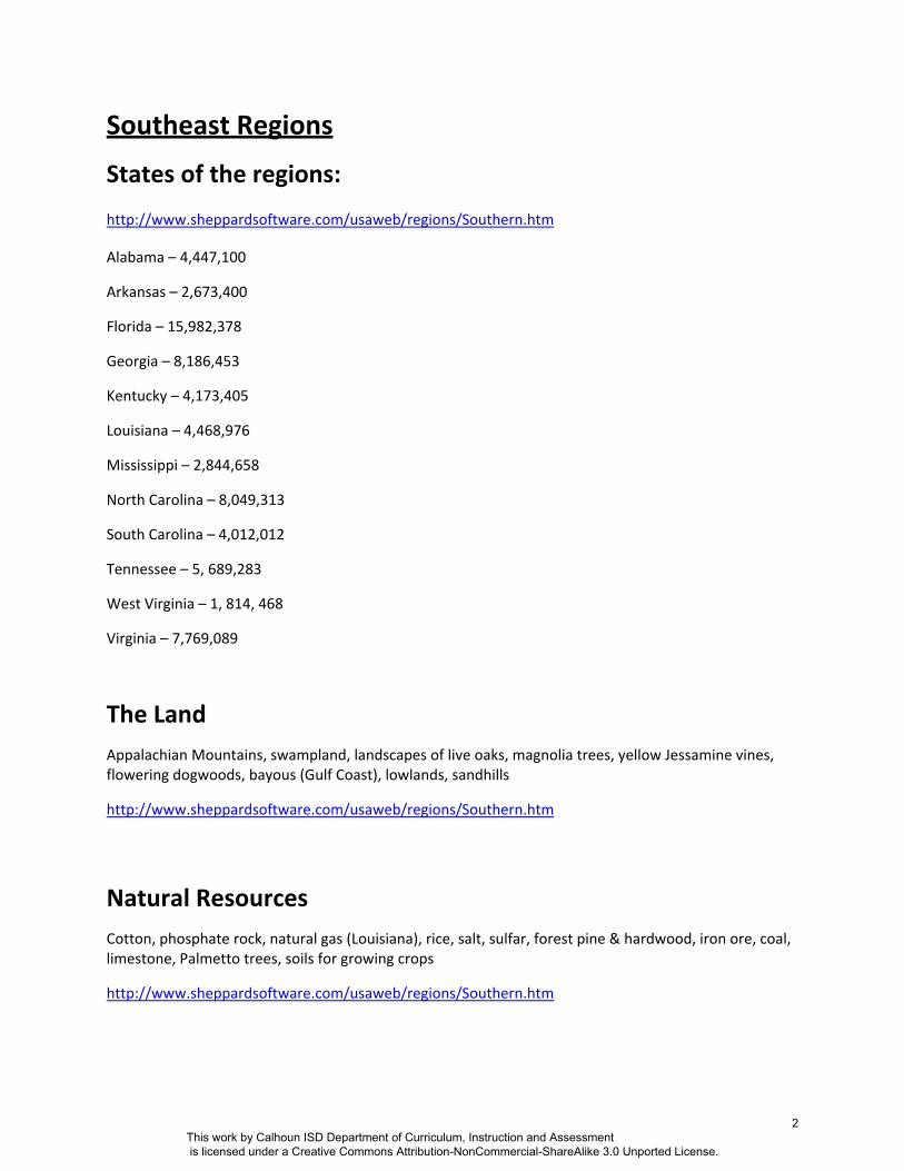
Southeast Regions
States of the regions:
http://www.sheppardsoftware.com/usaweb/regions/Southern.htm
Alabama – 4,447,100
Arkansas – 2,673,400
Florida – 15,982,378
Georgia – 8,186,453
Kentucky – 4,173,405
Louisiana – 4,468,976
Mississippi – 2,844,658
North Carolina – 8,049,313
South Carolina – 4,012,012
Tennessee – 5, 689,283
West Virginia – 1, 814, 468
Virginia – 7,769,089
The Land Appalachian Mountains, swampland, landscapes of live oaks, magnolia trees, yellow Jessamine vines, flowering dogwoods, bayous (Gulf Coast), lowlands, sandhills
http://www.sheppardsoftware.com/usaweb/regions/Southern.htm
Natural Resources Cotton, phosphate rock, natural gas (Louisiana), rice, salt, sulfar, forest pine & hardwood, iron ore, coal, limestone, Palmetto trees, soils for growing crops
http://www.sheppardsoftware.com/usaweb/regions/Southern.htm
This work by Calhoun ISD Department of Curriculum, Instruction and Assessment is licensed under a Creative Commons Attribution-NonCommercial-ShareAlike 3.0 Unported License.
2
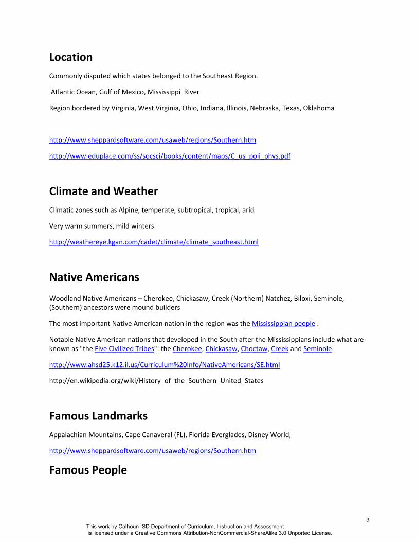
Location Commonly disputed which states belonged to the Southeast Region.
Atlantic Ocean, Gulf of Mexico, Mississippi River
Region bordered by Virginia, West Virginia, Ohio, Indiana, Illinois, Nebraska, Texas, Oklahoma
http://www.sheppardsoftware.com/usaweb/regions/Southern.htm
http://www.eduplace.com/ss/socsci/books/content/maps/C_us_poli_phys.pdf
Climate and Weather Climatic zones such as Alpine, temperate, subtropical, tropical, arid
Very warm summers, mild winters
http://weathereye.kgan.com/cadet/climate/climate_southeast.html
Native Americans
Woodland Native Americans – Cherokee, Chickasaw, Creek (Northern) Natchez, Biloxi, Seminole, (Southern) ancestors were mound builders
The most important Native American nation in the region was the Mississippian people .
Notable Native American nations that developed in the South after the Mississippians include what are known as "the Five Civilized Tribes": the Cherokee, Chickasaw, Choctaw, Creek and Seminole
http://www.ahsd25.k12.il.us/Curriculum%20Info/NativeAmericans/SE.html
http://en.wikipedia.org/wiki/History_of_the_Southern_United_States
Famous Landmarks Appalachian Mountains, Cape Canaveral (FL), Florida Everglades, Disney World,
http://www.sheppardsoftware.com/usaweb/regions/Southern.htm
Famous People
This work by Calhoun ISD Department of Curriculum, Instruction and Assessment is licensed under a Creative Commons Attribution-NonCommercial-ShareAlike 3.0 Unported License.
3
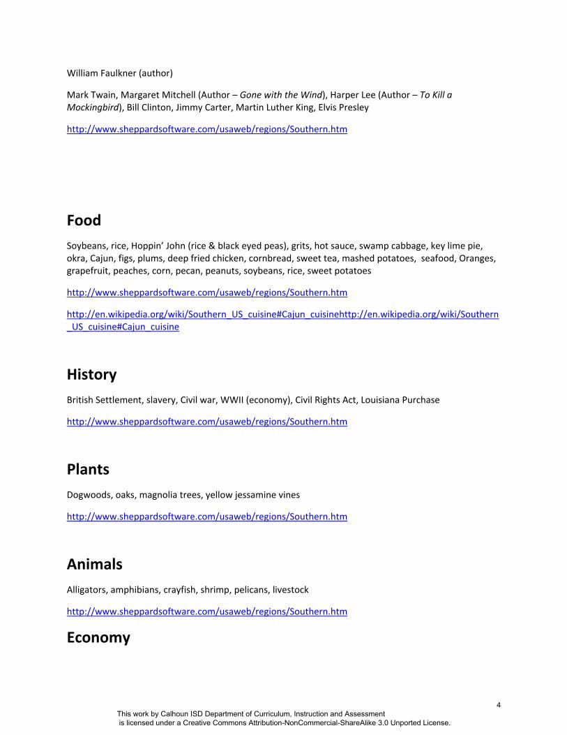
William Faulkner (author)
Mark Twain, Margaret Mitchell (Author – Gone with the Wind), Harper Lee (Author – To Kill a Mockingbird), Bill Clinton, Jimmy Carter, Martin Luther King, Elvis Presley
http://www.sheppardsoftware.com/usaweb/regions/Southern.htm
Food Soybeans, rice, Hoppin’ John (rice & black eyed peas), grits, hot sauce, swamp cabbage, key lime pie, okra, Cajun, figs, plums, deep fried chicken, cornbread, sweet tea, mashed potatoes, seafood, Oranges, grapefruit, peaches, corn, pecan, peanuts, soybeans, rice, sweet potatoes
http://www.sheppardsoftware.com/usaweb/regions/Southern.htm
http://en.wikipedia.org/wiki/Southern_US_cuisine#Cajun_cuisinehttp://en.wikipedia.org/wiki/Southern_US_cuisine#Cajun_cuisine
History British Settlement, slavery, Civil war, WWII (economy), Civil Rights Act, Louisiana Purchase
http://www.sheppardsoftware.com/usaweb/regions/Southern.htm
Plants Dogwoods, oaks, magnolia trees, yellow jessamine vines
http://www.sheppardsoftware.com/usaweb/regions/Southern.htm
Animals Alligators, amphibians, crayfish, shrimp, pelicans, livestock
http://www.sheppardsoftware.com/usaweb/regions/Southern.htm
Economy
This work by Calhoun ISD Department of Curriculum, Instruction and Assessment is licensed under a Creative Commons Attribution-NonCommercial-ShareAlike 3.0 Unported License.
4
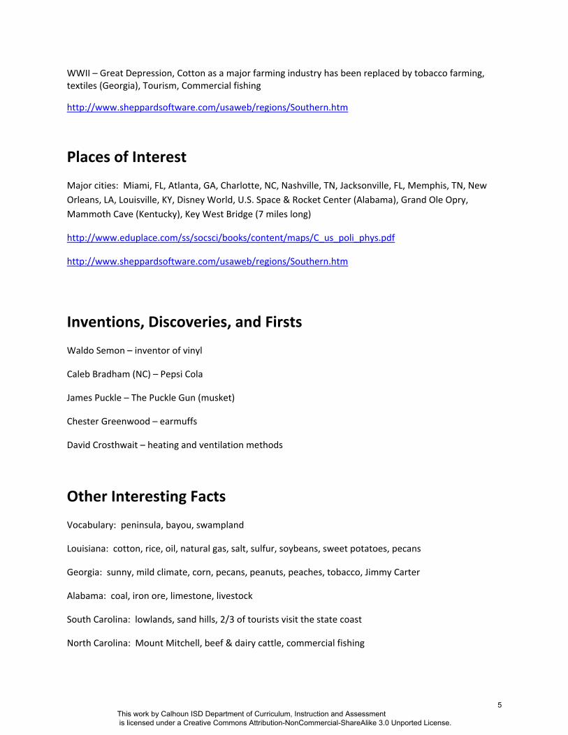
WWII – Great Depression, Cotton as a major farming industry has been replaced by tobacco farming, textiles (Georgia), Tourism, Commercial fishing
http://www.sheppardsoftware.com/usaweb/regions/Southern.htm
Places of Interest
Major cities: Miami, FL, Atlanta, GA, Charlotte, NC, Nashville, TN, Jacksonville, FL, Memphis, TN, New Orleans, LA, Louisville, KY, Disney World, U.S. Space & Rocket Center (Alabama), Grand Ole Opry, Mammoth Cave (Kentucky), Key West Bridge (7 miles long)
http://www.eduplace.com/ss/socsci/books/content/maps/C_us_poli_phys.pdf
http://www.sheppardsoftware.com/usaweb/regions/Southern.htm
Inventions, Discoveries, and Firsts
Waldo Semon – inventor of vinyl
Caleb Bradham (NC) – Pepsi Cola
James Puckle – The Puckle Gun (musket)
Chester Greenwood – earmuffs
David Crosthwait – heating and ventilation methods
Other Interesting Facts
Vocabulary: peninsula, bayou, swampland
Louisiana: cotton, rice, oil, natural gas, salt, sulfur, soybeans, sweet potatoes, pecans
Georgia: sunny, mild climate, corn, pecans, peanuts, peaches, tobacco, Jimmy Carter
Alabama: coal, iron ore, limestone, livestock
South Carolina: lowlands, sand hills, 2/3 of tourists visit the state coast
North Carolina: Mount Mitchell, beef & dairy cattle, commercial fishing
This work by Calhoun ISD Department of Curriculum, Instruction and Assessment is licensed under a Creative Commons Attribution-NonCommercial-ShareAlike 3.0 Unported License.
5
Additional resources
Country map (United States):
http://www.eduplace.com/ss/socsci/books/content/maps/C_us_poli_phys.pdf
http://cg043.k12.sd.us/regions%20of%20the%20US%20webquest/southeast_region.htm
http://www.ipl.org/div/kidspace/stateknow/
This work by Calhoun ISD Department of Curriculum, Instruction and Assessment is licensed under a Creative Commons Attribution-NonCommercial-ShareAlike 3.0 Unported License.
6
Market Economy
Ports (imports and exports, shipping goods)
Research Triangle Park
Appalachian Mountains –largest coal deposit
Louisiana – largest oil deposit
Geography
Great Smoky Mountains, Ozark Mountains, Ouachita Mountains, Appalachian Mountains
Federal Government
Mississippi River
Florida – peninsula
Wetlands, beaches, swamp, coastal plain, mountains, plateaus
Settlement & Migration
Chesapeake Bay‐ important industry
Cumberland Gap
Missouri Compromise
Tourism
Cuba
Environment & Society
Climate (mild, warm, sunny, wet, sun belt)
Tourism
Immigration
This work by Calhoun ISD Department of Curriculum, Instruction and Assessment is licensed under a Creative Commons Attribution-NonCommercial-ShareAlike 3.0 Unported License.
7
Fourth Grade Southeast Region Lesson 1 Title: Geography of the Southeast Grade Level: Fourth Unit of Study: Southeast Region GLCE: G2.0.2 Compare human and physical characteristics of a region to which Michigan belongs (e.g. Great Lakes, Midwest) with those of another region in the United States (i.e. Southeast region). G2.0.1 Describe ways in which the United States can be divided into different regions. Abstract: Students will identify physical and human characteristics of the Southeast region so that they may make comparisons to their home state. Key Concepts: Use maps of human and physical characteristics to ask geographic questions about regions. For example, we can observe that Michigan belongs to a region with common physical characteristics, such as bordering the Great Lakes. We can also ask a geographic question like, “What do people do there?” By making similar observations and finding answers to the same question about another region in the United States, we can then compare two regions. Sequence of Activities: 1. The students will create a K-W-L chart for the geography of the Southeast.
2. Distribute K-W-L Charts and have students label it, “Southeast Geography”.
3. Begin by having a classroom discussion of what kind of landforms students think are in the Southeast Region. Students may fill in “K” portion of K-W-L.
4. As a class and individually, identify what students want to know and record these questions under “W” on K-W-L chart.
5. Distribute student maps of Southeast region and have students record/label physical characteristics, such as the Appalachian Mountains, Everglades National Park, Mississippi Delta, Gulf Coast, and Atlantic Coastal Plain. Geographic features can be viewed/displayed in detail from Google Earth. www.earth.google.com
6. Identify other physical regions that may reside in the Southeast region (Gulf Coast States, Atlantic Coast, Appalachian States, Sun Belt etc).
7. Show and discuss annual rainfall in the Southeast region and how it compares to the United States. (See link below)
8. Show video found on United Streaming: American Geography Close-ups: The Southeastern Region, Volume Two (16 minutes).
9. Students will complete K-W-L by filling in what they learned under “L”.
10. Students need to write a 3-pararaph summary and response.
This work by Calhoun ISD Department of Curriculum, Instruction and Assessment is licensed under a Creative Commons Attribution-NonCommercial-ShareAlike 3.0 Unported License.
8
Fourth Grade Southeast Region
Calhoun ISD Social Studies Curriculum Design Project
• Paragraph 1 identifies and describes the geographic features found in the Southeast region.
• Paragraph 2 compares similarities and differences between the Southeast region and their home state in geographic terms.
• In paragraph 3, students will choose one physical feature found in the Southeast that they would like to visit and explain why they chose it.
Connections: English Language Arts: Students are able to write a comparative response. Resources: Southeast Region map: http://www.public.asu.edu/~clukinbe/southeastus.pdf Annual Rainfall Map (U.S.): http://maps.howstuffworks.com/united-states-annual-rainfall-map.htm Climate map (U.S.): http://maps.howstuffworks.com/united-states-climate-map.htm For viewing physical features use Google Earth United Streaming Video: www.unitedstreaming.com search: American Geography Close-ups: The Southeastern Region, Volume Two
This work by Calhoun ISD Department of Curriculum, Instruction and Assessment is licensed under a Creative Commons Attribution-NonCommercial-ShareAlike 3.0 Unported License.
9
Fourth Grade Southeast Region
Calhoun ISD Social Studies Curriculum Design Project
Lesson 3
Title: The Impact of Price on Purchasing Decisions
Grade Level: Fourth grade
Unit of Study: Economics
GLCE:
E1.0.4: Students will explain how price affects decisions about purchasing goods and services
(i.e. substitute goods).
E1.0.3: Describe how positive and negative incentives influence behavior in a market economy.
E1.0.2: Describe some characteristics of a market economy.
Abstract: Students will make choices about purchasing goods based on a budget. Students will
have to choose substitute goods or take advantage of incentives to stay within budget guidelines.
Key Concepts: Market economy, Incentives, Substitute goods
Sequence of Activities (2 days):
Introduction:
1. Ask students:
Would you prefer Kmart or Nike brand shoes?
Would you rather attend a water park or go to the beach?
Would you rather eat name brand or generic cereal?
2. Discuss with students why people must choose a substitute good versus a name brand.
(Responses should address comparing prices to make a decision when purchasing
goods/services.)
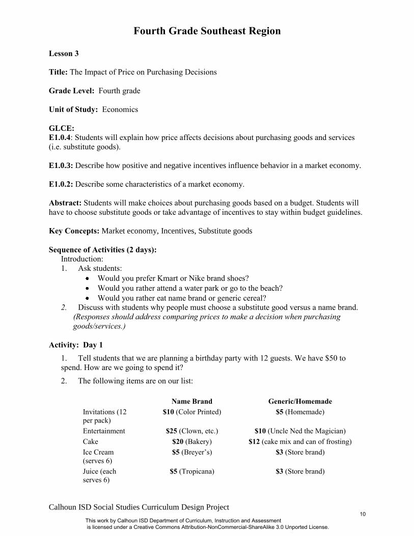
Activity: Day 1
1. Tell students that we are planning a birthday party with 12 guests. We have $50 to
spend. How are we going to spend it?
2. The following items are on our list:
Name Brand Generic/Homemade
Invitations (12
per pack)
$10 (Color Printed) $5 (Homemade)
Entertainment $25 (Clown, etc.) $10 (Uncle Ned the Magician)
Cake $20 (Bakery) $12 (cake mix and can of frosting)
Ice Cream
(serves 6)
$5 (Breyer’s) $3 (Store brand)
Juice (each
serves 6)
$5 (Tropicana) $3 (Store brand)
This work by Calhoun ISD Department of Curriculum, Instruction and Assessment is licensed under a Creative Commons Attribution-NonCommercial-ShareAlike 3.0 Unported License.
10
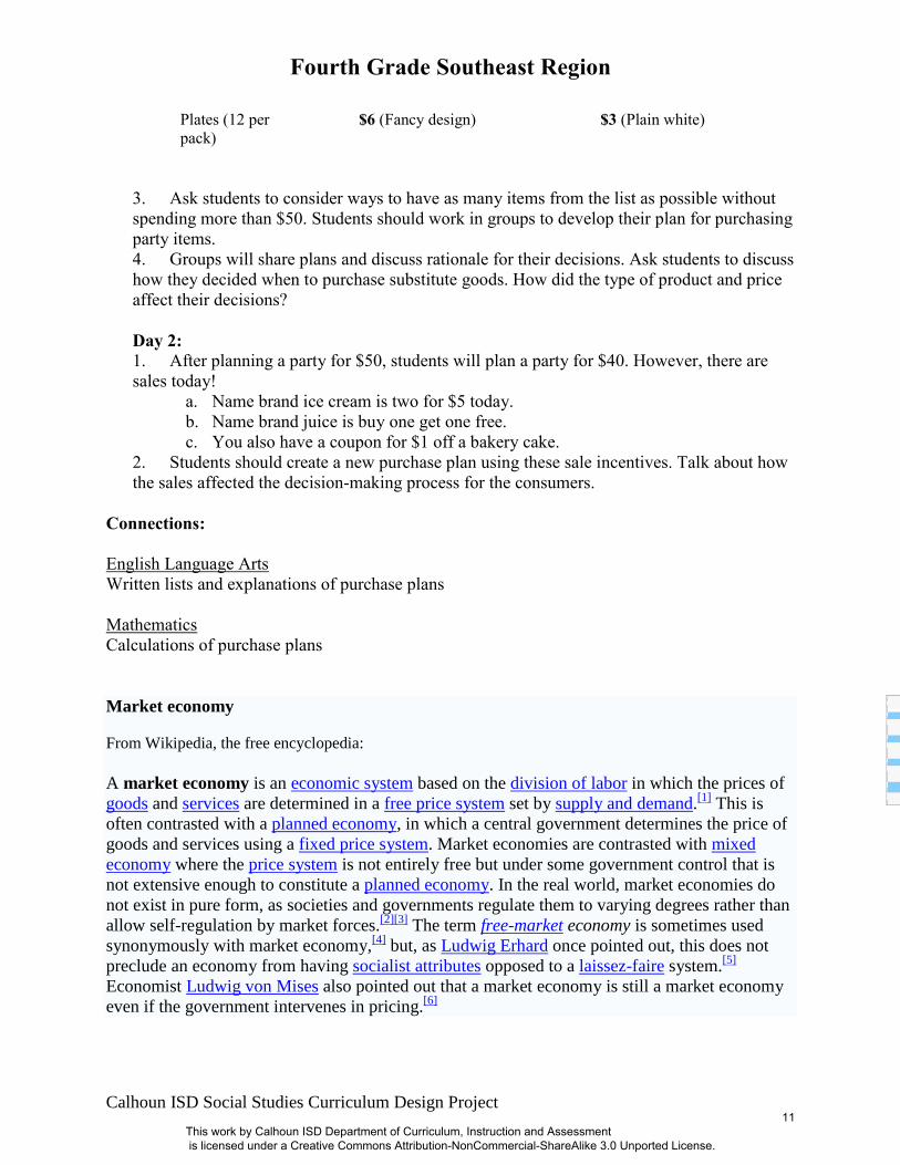
Fourth Grade Southeast Region
Calhoun ISD Social Studies Curriculum Design Project
Plates (12 per
pack)
$6 (Fancy design) $3 (Plain white)
3. Ask students to consider ways to have as many items from the list as possible without
spending more than $50. Students should work in groups to develop their plan for purchasing
party items.
4. Groups will share plans and discuss rationale for their decisions. Ask students to discuss
how they decided when to purchase substitute goods. How did the type of product and price
affect their decisions?
Day 2:
1. After planning a party for $50, students will plan a party for $40. However, there are
sales today!
a. Name brand ice cream is two for $5 today.
b. Name brand juice is buy one get one free.
c. You also have a coupon for $1 off a bakery cake.
2. Students should create a new purchase plan using these sale incentives. Talk about how
the sales affected the decision-making process for the consumers.
Connections:
English Language Arts
Written lists and explanations of purchase plans
Mathematics
Calculations of purchase plans
Market economy
From Wikipedia, the free encyclopedia:
A market economy is an economic system based on the division of labor in which the prices of
goods and services are determined in a free price system set by supply and demand.[1]
This is
often contrasted with a planned economy, in which a central government determines the price of
goods and services using a fixed price system. Market economies are contrasted with mixed
economy where the price system is not entirely free but under some government control that is
not extensive enough to constitute a planned economy. In the real world, market economies do
not exist in pure form, as societies and governments regulate them to varying degrees rather than
allow self-regulation by market forces.[2][3]
The term free-market economy is sometimes used
synonymously with market economy,[4]
but, as Ludwig Erhard once pointed out, this does not
preclude an economy from having socialist attributes opposed to a laissez-faire system.[5]
Economist Ludwig von Mises also pointed out that a market economy is still a market economy
even if the government intervenes in pricing.[6]
This work by Calhoun ISD Department of Curriculum, Instruction and Assessment is licensed under a Creative Commons Attribution-NonCommercial-ShareAlike 3.0 Unported License.
11
Fourth Grade Southeast Region
Calhoun ISD Social Studies Curriculum Design Project
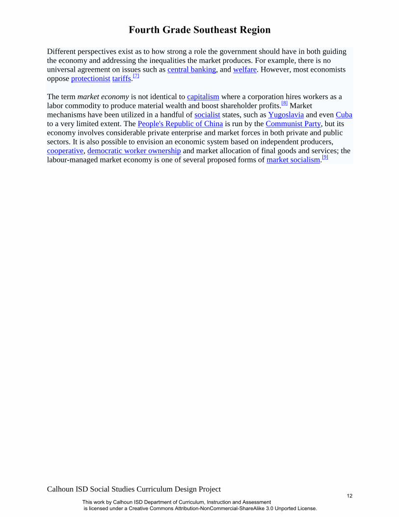
Different perspectives exist as to how strong a role the government should have in both guiding
the economy and addressing the inequalities the market produces. For example, there is no
universal agreement on issues such as central banking, and welfare. However, most economists
oppose protectionist tariffs.[7]
The term market economy is not identical to capitalism where a corporation hires workers as a
labor commodity to produce material wealth and boost shareholder profits.[8]
Market
mechanisms have been utilized in a handful of socialist states, such as Yugoslavia and even Cuba
to a very limited extent. The People's Republic of China is run by the Communist Party, but its
economy involves considerable private enterprise and market forces in both private and public
sectors. It is also possible to envision an economic system based on independent producers,
cooperative, democratic worker ownership and market allocation of final goods and services; the
labour-managed market economy is one of several proposed forms of market socialism.[9]
This work by Calhoun ISD Department of Curriculum, Instruction and Assessment is licensed under a Creative Commons Attribution-NonCommercial-ShareAlike 3.0 Unported License.
12
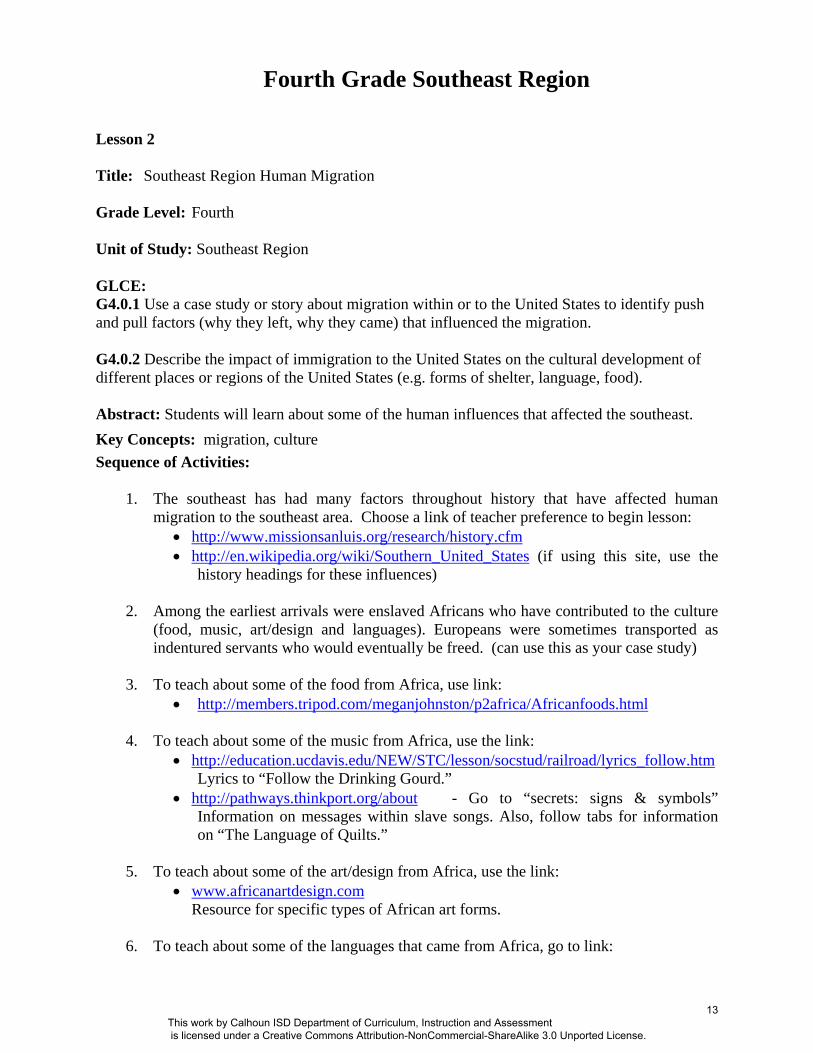
Fourth Grade Southeast Region Lesson 2 Title: Southeast Region Human Migration Grade Level: Fourth Unit of Study: Southeast Region GLCE: G4.0.1 Use a case study or story about migration within or to the United States to identify push and pull factors (why they left, why they came) that influenced the migration. G4.0.2 Describe the impact of immigration to the United States on the cultural development of different places or regions of the United States (e.g. forms of shelter, language, food). Abstract: Students will learn about some of the human influences that affected the southeast. Key Concepts: migration, culture Sequence of Activities:
1. The southeast has had many factors throughout history that have affected human migration to the southeast area. Choose a link of teacher preference to begin lesson:
• http://www.missionsanluis.org/research/history.cfm • http://en.wikipedia.org/wiki/Southern_United_States (if using this site, use the
history headings for these influences)
2. Among the earliest arrivals were enslaved Africans who have contributed to the culture (food, music, art/design and languages). Europeans were sometimes transported as indentured servants who would eventually be freed. (can use this as your case study)
3. To teach about some of the food from Africa, use link:
• http://members.tripod.com/meganjohnston/p2africa/Africanfoods.html 4. To teach about some of the music from Africa, use the link:
• http://education.ucdavis.edu/NEW/STC/lesson/socstud/railroad/lyrics_follow.htm Lyrics to “Follow the Drinking Gourd.”
• http://pathways.thinkport.org/about - Go to “secrets: signs & symbols” Information on messages within slave songs. Also, follow tabs for information on “The Language of Quilts.”
5. To teach about some of the art/design from Africa, use the link:
• www.africanartdesign.com Resource for specific types of African art forms.
6. To teach about some of the languages that came from Africa, go to link:
This work by Calhoun ISD Department of Curriculum, Instruction and Assessment is licensed under a Creative Commons Attribution-NonCommercial-ShareAlike 3.0 Unported License.
13
Fourth Grade Southeast Region
Calhoun ISD Social Studies Curriculum Design Project
• http://africanlanguages.com/
7. Divide the class into groups with each being responsible for one component of African culture that was brought to the Southeast (food, music, art/design languages).
• Each student in the group will create a 9-square quilt block (see below for template) to show a contribution for their component (food, music, art/design language).
• The contribution should be shown in the center square. • The mathematics concepts of translation, rotation, and reflection, as well as
symmetry, can be incorporated here either in individual student quilt blocks or in the quilt as a whole.
8. These migration influences have affected the development of the southeast. Follow up
with a discussion of modern human migration to the southeast (retired people, warm weather, etc).
Connections: Mathematics: Students also study transformations (reflection, rotation, translation) and symmetry in 4th grade. This terminology should be connected in the quilt activity. (If your district uses Investigations ©, this pattern can be found in the Shapes program. Otherwise, use link to print pattern http://www.mathwire.com/templates/quiltmats.pdf .) Additional Resources: http://teacher.scholastic.com/activities/bhistory/underground_railroad/plantation.htm An interactive journey along the Underground Railroad with photographs and primary sources.
This work by Calhoun ISD Department of Curriculum, Instruction and Assessment is licensed under a Creative Commons Attribution-NonCommercial-ShareAlike 3.0 Unported License.
14