Embed Size (px)
Citation preview
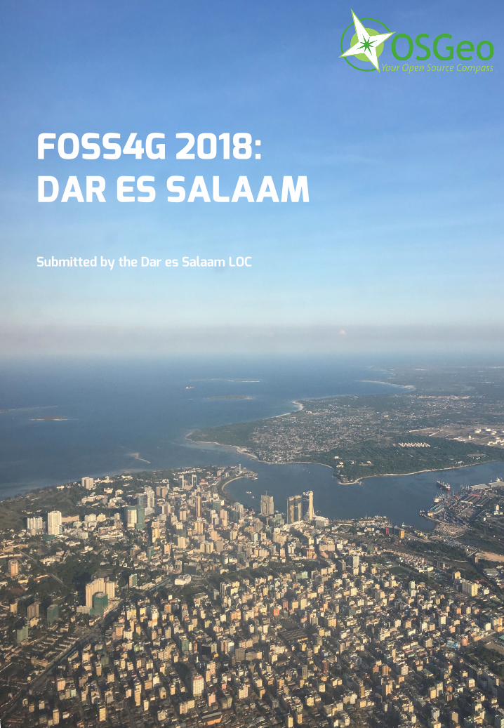
FOSS4G 2018:DAR ES SALAAM
Submitted by the Dar es Salaam LOC
Table of Contents
Introduction and Vision 3
Location and Timing 5 Our City: Dar es Salaam 5 Timing 5 Venue 6 Accommodation 7 Participation Statement 7
Our Community 8 The Dar LOC 8
Co-Chairs 8 Our Committee 9
Supporting Institutions 13 Professional Conference Support 13 Dar es Salaam’s Open Source, Geo and Innovation Community 14
Ramani Huria 14 COSTECH 14 Sahara Sparks 14 D-Lab 15 Humanitarian Development Innovation Fund 15 TZGISUG 15
Partnering with OSGeo 15
The Conference Program 16 Workshops 18 Main Conference 20
Commitment to a Diverse, Impactful Program 20 Code Sprint and Closing Party: Zanzibar 20 Extra Curricular Activities 21
Tourism in Tanzania 22 Zanzibar 22 Safaris and Inland Travel 23 Makumbusho Village Museum 24
Dar es Salaam’s Budget 25 The Chair’s Budgetary Statement 25 Sponsorship 25 Costs 26
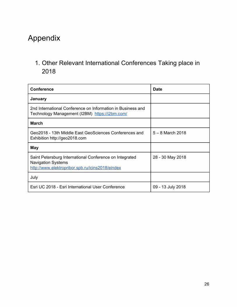
Appendix 27 Other Relevant International Conferences Taking place in 2018 27
1
Introduction and Vision Karibu! - Welcome! - To the East African haven of peace of Dar es Salaam. Our Local Organising Committee (LOC) is pleased to submit this proposal to the OSGeo community to host FOSS4G 2018 in Dar es Salaam, Tanzania. We’ve seen how a FOSS4G event can catalyse the geo community in the host country. Now is the time for Africa! Free and open source software in Sub-Saharan Africa is still in its infancy, but here is where the principles of FOSS4G can have the largest impact, in setting the FOSS4G agenda, together we can build the foundations for generations to come. FOSS4G Dar should be seen as a FOSS4G Africa, quite distinct from FOSS4G 2008 in Cape Town which because of its geography had a localised impact. Tanzania is accessible to much more of Africa as well as the Middle East and Arabian Peninsula and Indian subcontinent and so taps into a new 'impact zone' for OSGeo. Our vision is for an accessible and inclusive FOSS4G that complements the existing OSGeo stable while empowering the Open Data, Participatory Mapping and Internet of Things work currently underway. This ranges from locating schools to the instrumentation of communities with cheap, open source, 3D printed weather stations that improve community resilience to climate change. Location and geography are at the heart of these challenges: FOSS4G 2018 in Dar es Salaam would invigorate our existing projects, bringing them to new users and developers while supporting and nurturing the existing community. Our strong conference program reflects our vision for a diverse and inclusive FOSS4G. The conference program will be driven by our LOC and synchronise with the technology and innovation communities in Dar es Salaam and across Africa. Our LOC is truly international, strongly rooted in Tanzania and will deliver our expansive vision, deepen OSGeo community engagement locally and strengthen the international community. Our LOC consists of a constellation of stars from the local and international OSGeo community, with experience at all levels of organising conferences and FOSS4Gs, such as Dr Mark Iliffe - FOSS4G 2013 LOC, Ramani Huria lead, Msilikale Msilanga - Ramani Tandale lead, Ketty Adoch - Map Uganda Lead, Tim Sutton - QGIS Project Chair, InaSafe project lead, FOSS4G 2008 LOC; Gavin Fleming - Kartoza, FOSS4G 2008 Chair; Professor Maria Brovelli - OSGeo Board Member, Pierre-André Le Ny, Le Ny Conseil, Co-founder of OSGeo French Local Chapter, FOSS4G-FR 2016 LOC, GIS Expert; Ragnvald Larsen Organiser Tanzania GIS Users Group; Professor Juma Lungo, Director of the Tanzanian Data -Lab and others. Our LOC is capable and ready for the challenge ahead. Our strong LOC is mirrored by the institutions that also support us, from community groups in Tanzania to international NGOs and commercial organisations. Our LOC will build on this successful geo and technology environment in Dar es Salaam, key to which is Ramani Huria, the world’s largest community mapping project. This has engaged communities across the city, mapping over 3.5 million people, pioneering new technologies and approaches such as participatory mapping, UAVs and streetview cameras while building new open source tools - giving back to the community.
2
Our bid does not require financial backing from OSGeo. Based upon the strength of the organising committee and an existing seed commitment of $100,000 from the World Bank , we wish to make this 1
FOSS4G the most accessible yet. We wish to have a sub $500 price point for all, while offering scholarships and discounts for those who would most benefit from attending a FOSS4G, this would be done in consultation with the OSGeo Community. This would be further complemented with fundraising, by sponsorship from organisations and institutions in-country and globally, with remaining profit to be reinvested in the local community, in collaboration with the local and global OSGeo community, leaving behind a geospatial legacy for generations to come. As one of Africa’s fastest growing cities, Dar es Salaam is a hub for innovation and experimentation, with the Tanzanian Data Lab, Ramani Huria and other startups/open source projects coming from the city. The city is bursting with heritage and history and is ideally placed for activities, ranging from safaris to sailing. Transportation around the city will make moving across the city a breeze. The newly operational Bus Rapid Transit system allows for cheap, quick access across the city, for arrivals a new terminal at Julius Nyerere International Airport (JNIA) currently under construction will be ready in mid-2017. JNIA has direct connections to travel hubs across the world, including Dubai, Amsterdam, Nairobi, Istanbul, Zurich and Addis Ababa. Dar es Salaam is emerging as one of Africa’s global cities and as a regional hub for East Africa with an ever growing population of 6 million. The city itself has a historic quarter showcasing its colonial past surrounded by the architecture of modern Africa. Within easy reach of the city is the Mikumi National Park for an amazing safari experience or sandy beaches for reef diving and sundowners. A short 60min ferry from the city is the UNESCO World Heritage Site of Zanzibar, with its winding streets and historic architecture at the start of the Spice trail. Flights to and from North America/Europe are around $800, with some stopping via Arusha for Mount Kilimanjaro, the tallest mountain in Africa and the Ngorongoro Crater. To summarise:
● The centre of technological innovation, social and academic life in Tanzania; ● A vibrant city of many cultures and warm hospitality; ● A gateway to African sights, such as world beating safaris, heritage and world leading beaches; ● A historic centre surrounded by the construction of a new Africa; ● At the centre of East Africa, within easy reach of the world; ● The conference for 2018 ...
A FOSS4G in Dar es Salaam would not just impact the city or the country but would reverberate throughout the region, catalysing our community and leaving a legacy for the next generation.
Dar es Salaam stands ready for FOSS4G in 2018. We look forward to welcoming you to our haven of peace.
Karibu Dar es Salaam, Karibu FOSS4G 2018!
1 Committed to raise participation and awareness of open source geospatial tools and methods to build capacity within local Tanzanian communities and government.
3
Location and Timing
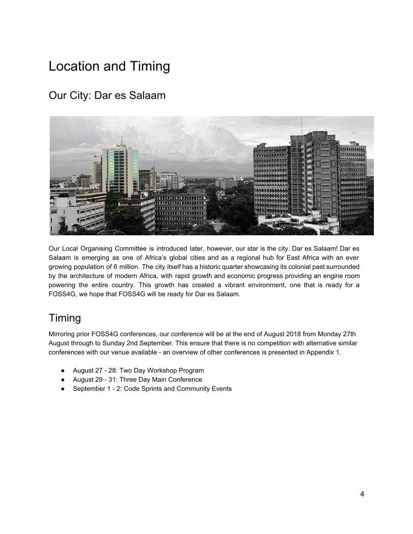
Our City: Dar es Salaam
Our Local Organising Committee is introduced later, however, our star is the city. Dar es Salaam! Dar es Salaam is emerging as one of Africa’s global cities and as a regional hub for East Africa with an ever growing population of 6 million. The city itself has a historic quarter showcasing its colonial past surrounded by the architecture of modern Africa, with rapid growth and economic progress providing an engine room powering the entire country. This growth has created a vibrant environment, one that is ready for a FOSS4G, we hope that FOSS4G will be ready for Dar es Salaam.
Timing Mirroring prior FOSS4G conferences, our conference will be at the end of August 2018 from Monday 27th August through to Sunday 2nd September. This ensure that there is no competition with alternative similar conferences with our venue available - an overview of other conferences is presented in Appendix 1.
● August 27 - 28: Two Day Workshop Program ● August 29 - 31: Three Day Main Conference ● September 1 - 2: Code Sprints and Community Events
4
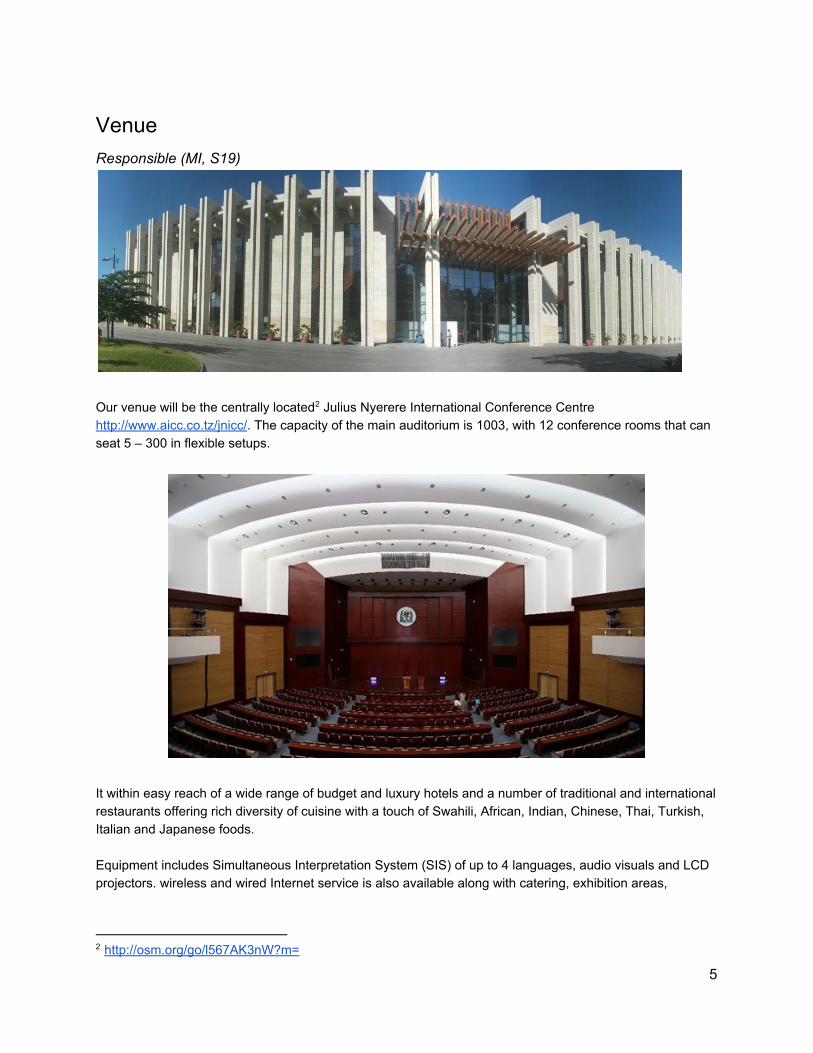
Venue Responsible (MI, S19)
Our venue will be the centrally located Julius Nyerere International Conference Centre 2
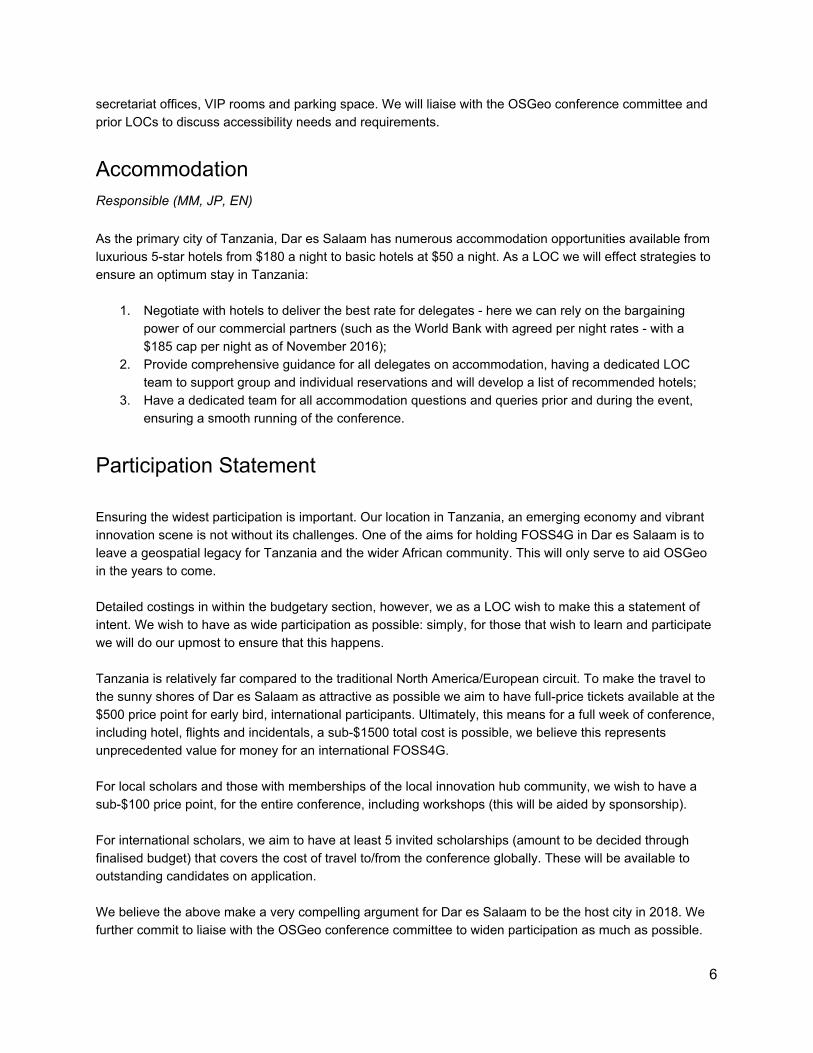
http://www.aicc.co.tz/jnicc/. The capacity of the main auditorium is 1003, with 12 conference rooms that can seat 5 – 300 in flexible setups.
It within easy reach of a wide range of budget and luxury hotels and a number of traditional and international restaurants offering rich diversity of cuisine with a touch of Swahili, African, Indian, Chinese, Thai, Turkish, Italian and Japanese foods. Equipment includes Simultaneous Interpretation System (SIS) of up to 4 languages, audio visuals and LCD projectors. wireless and wired Internet service is also available along with catering, exhibition areas,
2 http://osm.org/go/l567AK3nW?m=
5
secretariat offices, VIP rooms and parking space. We will liaise with the OSGeo conference committee and prior LOCs to discuss accessibility needs and requirements.
Accommodation Responsible (MM, JP, EN) As the primary city of Tanzania, Dar es Salaam has numerous accommodation opportunities available from luxurious 5-star hotels from $180 a night to basic hotels at $50 a night. As a LOC we will effect strategies to ensure an optimum stay in Tanzania:
1. Negotiate with hotels to deliver the best rate for delegates - here we can rely on the bargaining power of our commercial partners (such as the World Bank with agreed per night rates - with a $185 cap per night as of November 2016);
2. Provide comprehensive guidance for all delegates on accommodation, having a dedicated LOC team to support group and individual reservations and will develop a list of recommended hotels;
3. Have a dedicated team for all accommodation questions and queries prior and during the event, ensuring a smooth running of the conference.
Participation Statement Ensuring the widest participation is important. Our location in Tanzania, an emerging economy and vibrant innovation scene is not without its challenges. One of the aims for holding FOSS4G in Dar es Salaam is to leave a geospatial legacy for Tanzania and the wider African community. This will only serve to aid OSGeo in the years to come. Detailed costings in within the budgetary section, however, we as a LOC wish to make this a statement of intent. We wish to have as wide participation as possible: simply, for those that wish to learn and participate we will do our upmost to ensure that this happens. Tanzania is relatively far compared to the traditional North America/European circuit. To make the travel to the sunny shores of Dar es Salaam as attractive as possible we aim to have full-price tickets available at the $500 price point for early bird, international participants. Ultimately, this means for a full week of conference, including hotel, flights and incidentals, a sub-$1500 total cost is possible, we believe this represents unprecedented value for money for an international FOSS4G. For local scholars and those with memberships of the local innovation hub community, we wish to have a sub-$100 price point, for the entire conference, including workshops (this will be aided by sponsorship). For international scholars, we aim to have at least 5 invited scholarships (amount to be decided through finalised budget) that covers the cost of travel to/from the conference globally. These will be available to outstanding candidates on application. We believe the above make a very compelling argument for Dar es Salaam to be the host city in 2018. We further commit to liaise with the OSGeo conference committee to widen participation as much as possible.
6
Our Community
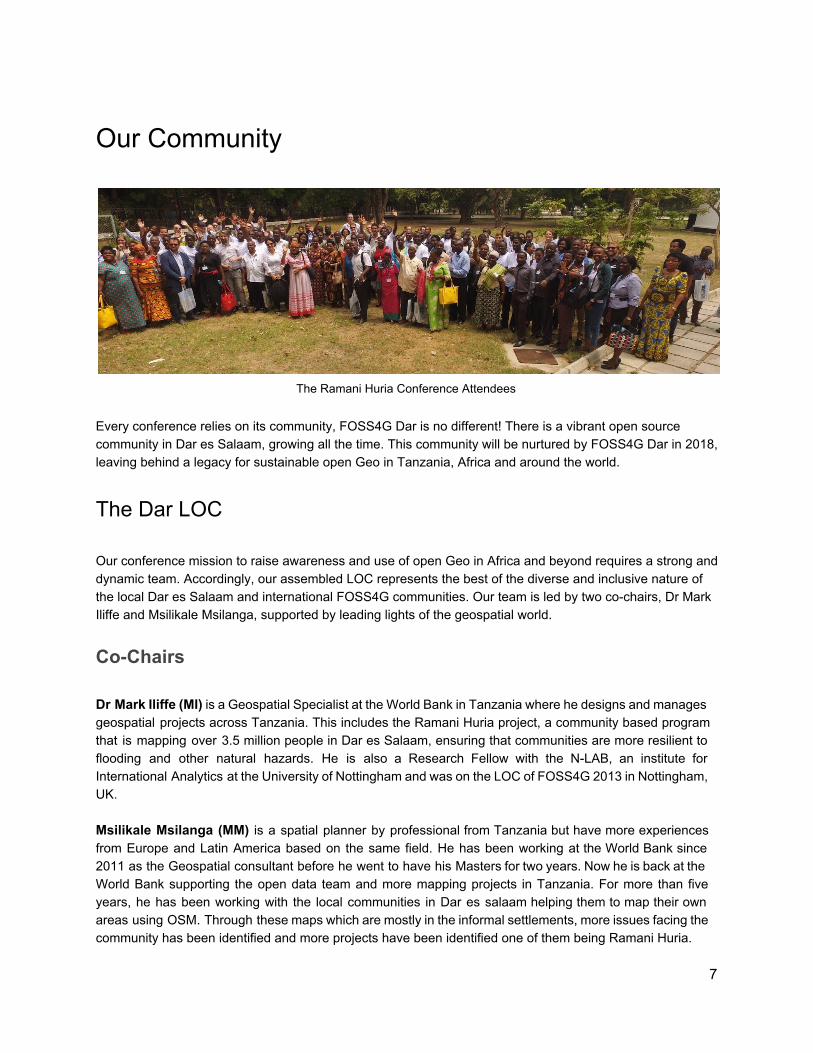
The Ramani Huria Conference Attendees
Every conference relies on its community, FOSS4G Dar is no different! There is a vibrant open source community in Dar es Salaam, growing all the time. This community will be nurtured by FOSS4G Dar in 2018, leaving behind a legacy for sustainable open Geo in Tanzania, Africa and around the world.
The Dar LOC Our conference mission to raise awareness and use of open Geo in Africa and beyond requires a strong and dynamic team. Accordingly, our assembled LOC represents the best of the diverse and inclusive nature of the local Dar es Salaam and international FOSS4G communities. Our team is led by two co-chairs, Dr Mark Iliffe and Msilikale Msilanga, supported by leading lights of the geospatial world.
Co-Chairs Dr Mark Iliffe (MI) is a Geospatial Specialist at the World Bank in Tanzania where he designs and manages geospatial projects across Tanzania. This includes the Ramani Huria project, a community based program that is mapping over 3.5 million people in Dar es Salaam, ensuring that communities are more resilient to flooding and other natural hazards. He is also a Research Fellow with the N-LAB, an institute for International Analytics at the University of Nottingham and was on the LOC of FOSS4G 2013 in Nottingham, UK. Msilikale Msilanga (MM) is a spatial planner by professional from Tanzania but have more experiences from Europe and Latin America based on the same field. He has been working at the World Bank since 2011 as the Geospatial consultant before he went to have his Masters for two years. Now he is back at the World Bank supporting the open data team and more mapping projects in Tanzania. For more than five years, he has been working with the local communities in Dar es salaam helping them to map their own areas using OSM. Through these maps which are mostly in the informal settlements, more issues facing the community has been identified and more projects have been identified one of them being Ramani Huria.
7
Our Committee
Pierre-André Le Ny (PN) Pierre-André Le Ny, is a trained cartographer, geographer and GIS expert. He is a former student of the University of Rennes II and received a Master’s Degree in Geographical Information Sciences (SIGMA: Science de l’Information Géoréférencée pour la Maîtrise de l’environnement et l’Aménagement des territoires) co-habilited by Institut National Polytechnique,, ENSAT and the University of Toulouse 1. Le Ny Conseil is a commercial enterprise providing geomatic tools and geospatial expertise. His owner and unique employee has been working for a long time both on geo-collaborative processes and on multidimensional data, especially temporal. He is a member of OSGeo-FR (Francophone Local Chapter) and co-organization member of FOSS4G-FR 2014 and 2016. Maria Antonia Brovelli (MB) Degree with honors in Physics, PhD in Geodesy. She is Professor of GIS and Remote Sensing at Politecnico di Milano. From 2001 to 2011 she was the Head of the Geomatics Laboratory of the Politecnico di Milano and from 2006 to 2011 she lectured also GIS at ETH of Zurich. Since 2011 she is Vice Rector for the Como Campus of Politecnico di Milano. She is chair of ISPRS WG IV/4 “Collaborative crowdsourced cloud mapping (C3M)”, Associate Editor of Applied Geomatics Journal (Springer); Member of the Board of the Italian Photogrammetric and Topography Society (SIFET); One of the Directors of OSGeo; Member of the Advisory Board of the ICA-OSGeo Labs Network, Chair of the “Capacity Building Working Group” of the UN Open GIS Initiative, Member of the UN_GGIM Academic Network Task Team. She organized (in Como) the first WebMGS Conference in 2010 and the FOSS4G Europe in 2015. In 2015, she was awarded the Sol Katz Prize by OSGeo. Hessel Winsemius (HW) Hessel Winsemius is an expert in large-scale hydrology, climate change and hydrological modelling. In September 2009, he obtained his PhD degree Cum Laude on the use of large-scale satellite observations as complementary data for the establishment of hydrological models in the Zambezi basin. At Deltares, Hessel has been active in projects, requiring specialist knowledge on hydrological and hydraulic modelling, global hydrology, model calibration, prediction of effects of climate change and land cover change, operational forecasting, use of large datasets, and uncertainty estimation. He is able to translate publicly available global data into information that can be readily used in hydrological, hydraulic and risk models. A recent example includes his work on "Participatory Terrain Data and Modelling", one of the GFDRR-DFID Challenge Fund projects, in which a participatory approach to establish high resolution terrain data from OpenStreetMap data was piloted. He is active in international projects in Southern Africa, Asia, United States and the Caribbean. Hessel’s work has a strong focus on globally applicable methods to flood risk assessment: he is one of the core developers of the Global Flood Risk with IMAGE Scenarios (GLOFRIS) model, nowadays widely used to gain understanding in flood risk globally, its variability and changes due to climate and socio-economic change, and the underlying model to the Aqueduct Global Flood Analyzer (http://www.wri.org/floods/). He is author and co-author of many peer-reviewed papers. He leads a Deltares focal subject on Multi-Resolution
8
Modelling with BIG data. Yves Barthélemy (YB) Yves has a Masters degree in Tropical Ecology and a Master degree in Geo-Information. Yves is currently working as Geospatial Advisor at the State University of Zanzibar (SUZA) where he is raising capacity in Geospatial information with a strong focus on environmental monitoring under the framework of ZANSEA project. These last months he has been coordinating the WorldBank Zanzibar Mapping Initiative, a project aiming at covering Zanzibar with drone imagery. For the last 10 years, he has been consulting for UNEP Post Conflict and Disaster Management Branch as Geospatial expert for several missions: Afghanistan, Nigeria, Ivory Coast, Haiti, Sudan, Rwanda, Japan, as well as for others international organisations and private companies (RioTinto, Statoil, BritishGas, WildLifeConservation Society, VEOLIA, UBISOFT and others) through his company OBSCOM. Additionally, from 2000 to 2005, Yves was application engineer at Spot Image, where he was successively in charge of renewable resources and disaster management applications. Tim Sutton (TS) Having taken his first steps in FOSSGIS with UMN Mapserver on Linux back in 1998, a FOSS4G2018 in Dar es Salaam will mark 20 years of using and contributing to FOSSGIS projects for Tim. He has been involved in the development of QGIS since 2002 and is active in the FOSSGIS community - serving as charter member in OSGEO, co-organiser of FOSS4G2008 in Cape Town, blogging and sharing his knowledge through the contributions to the development of open content such as the ‘Gentle Introduction to GIS’ and ‘The QGIS Training Manual’. Tim has also created a host of other Open Source projects which you can find on GitHub. Born in South Africa and passionate about the possibilities of human upliftment that FOSSGIS presents, Tim sees huge potential in events like FOSS4G2018 to bootstrap a whole new swathe of practitioners and contributors into the FOSSGIS community. Jorieke Vyncke (JV) Jorieke has been with the Humanitarian OpenStreetMap Team (HOT) since 2011 and is board member and secretary of the ngo since 2015. She has been working to support and set up local OpenStreetMap-communities in Cameroon, CAR, Senegal, DRC, Mali and Bangladesh. Nowadays she works on mapping and digital tools & strategy at the Belgian Development Agency (BTC). First in the field in Mali, today in the headquarters in Brussels. Ragnvald Larsen (RL) Ragnvald holds a masters degree in Geography from The Norwegian University of Science and Technology. His first accomplishments as a GIS practitioner was when he established a national database for hiking trails for the Norwegian Trekking Association in in 1995-2001. He lived and worked in Tanzania for almost two years in 2004-2006 working with the Tanzania Wildlife Research Institute in Arusha. His primary focus there was survey information systems and databases. Over the years he has been involved in many national level GIS analysis projects. Among the bigger ones is the Norwegian wilderness analysis. He is involved in remote sensing projects under the Norwegian Space centre and the Norwegian Mapping authority. Through his work in the Norwegian Environmental Agency he is currently contributing to development cooperation projects in several African countries. Through his work he always tries to find and use free and open source gis solutions that work with people. Larsen is also a coordinator of the Tanzania GIS User Group.
9
Prof. Evaristo Joseph Liwa (EL) He is a Professor of Remote Sensing, GIS and Satellite Oceanography and former Dean School of Geospatial Science and Technology at Ardhi University, Tanzania. He holds M. App. Sci. Of University of Glasgow (Scotland), Msc. degree in Geography and Topographic Science (Photogrammetry and Remote Sensing, Cartography and Digital Mapping) and PhD degree in Oceanography and Coastal Sciences of Louisiana state University. He has more than 20 years experience in teaching Geographical Information Systems (GIS), remote sensing, image processing cartography, spatio-temporal analysis. Prof. Liwa is currently a Council member of National Council of Professional Surveyors (NCPS) and Board member of Architects and Quantity Surveyors registration Board in Tanzania. Prof. Liwa is a former Program manager – Africa Region at the National Science Foundation (USA) as part of the Dean John Knauss Marine Policy Fellowship to enhance collaborative research between Sub-Saharan Africa and the U S A and a Lead Coordinator of International Workshop to enhance Science in Sub-Saharan Africa (National Science Foundation Virginia (USA). Dr. Joseph Stephen Mayunga (JM) Dr Mayunga is a lecturer in the Center for Information and Communication Technology (CICT), at Ardhi University, Tanzania. He holds a PhD in Urban and Regional Sciences from Texas A&M University, in the United States. He also holds a Master of Science (MSc.) degree in Geographical Information Systems and Remote Sensing, specializing in Urban Planning and Management from the International Institute for Geo-Information Sciences and Earth Observation (ITC), the Netherlands and He also holds an Adv. Dip. in Urban and Regional Planning of Ardhi University. Dr. Mayunga has more than fifteen years of Research and teaching experience in Geographical Information Systems (GIS), Remote sensing applications and supervision of PhD and Msc students at Ardhi University. He has been involved in various training, research and consultancy projects in Tanzania related to urban and regional sciences, disaster risk management and the application of geographical information system (GIS) and remote sensing. Giuseppe Sollazzo (GS) Giuseppe is a technology and data expert, and Open Data advocate. He received the Open Data Institute Award as “Individual Champion” of Open Data in 2016. He works as an IT analyst in the UK Higher Education sector. A long standing advocate of Open Data, Giuseppe leads the provision of research data services at St George’s, University of London. In 2013, the UK Minister for the Cabinet Office Francis Maude appointed him to the Open Data User Group, a ministerial advisory panel that helped shape the UK Government Open Data and Transparency agenda. Giuseppe has written and spoken extensively on the topic and is a co-founder of Open Data Camp, the UK-wide unconference on Open Data. Daniel K. Nanghaka (DN) Daniel is a an open source activist, Open Data advocate and seats on the Free and Open Source Foundation for Africa (FOSSFA) Council and Pilot Program Coordinator - Africa Region (Internet Corporation for Assigned Names and Numbers - ICANN At Large) on Outreach and Engagement. Not only is he is the Executive Director of ILICIT Africa an organisation whose aim is to enhance Livelihoods through Integration of ICT. Previously he has been an IBM Fellow and Nokia Fellow but also a member of the Google Earth Trainers Network and a GIS Trainer. A Trainer of Trainees in Information Collaboration for Development (United Nations Institute for Training and Research - UNITAR), and also the brains behind an ongoing project - EWERDIMA (Early Warning Early Response Disaster Management). Previous works include review of the FOSS Policy of Uganda, Data Privacy and Protection and current finalising an Assessment Report of Disaster Risk of Bududa, Uganda among others.
10
Gavin Fleming (GF) Gavin Fleming is co-founder of a GIS startup, Kartoza, which provides open source geospatial consulting services. He is a registered Professional GISc Practitioner, a Charter Member of OSGeo, on the advisory board of the Centre for Geographic Information Science (CGIS) at the University of Pretoria, on the National Council of GISSA (Geoinformation Society of South Africa) and has an MSc in Population Genetics. He has twenty years GIS experience, eleven of which have been with a wide range of FOSS GIS tools. Gavin is passionate about Open Source Software, Open Data and other Open philosophies that lead to interoperability, empower people and help maximise returns on government spending. He is also convinced that Free and Open Source GIS software is mature and ready to integrate with or replace existing expensive alternatives, in line with various Governments' Open Source policies. After bringing FOSS4G 2008 to South Africa and working almost exclusively with FOSS since then he has picked up a surge in demand and usage of FOSS GIS in all sectors and coupled with that, a growing base of service providers and related resources. He strongly believes that FOSS4G 2018 in Dar es Salaam, besides meeting or exceeding the high bar that previous FOSS4G events have set, will provide a tremendous boost in the region and is committed to helping make it a success. Dr. Juma Lungo (JL) Dr. Juma Lungo is the Manager for the Tanzania Open Data Lab (dLab) also a database systems lecturer at the University of Dar-es-Salaam in Tanzania. He is a pioneer in the use of cutting-edge technology to drive social change through the use of Free and Open Source Software (FOSS) and more recently he joined the Open Data (OD) Initiatives. Through the dLab, Lungo and the team are establishing a data hub that anchor, incubate and amplify the innovative use of Open Data as well as connecting various stakeholders of open data. Lungo is a University of Oslo alumnus where he completed a Ph.D in Information Systems. Enock Seth Nyamador (EN) Enock Seth Nyamador is Computer Engineer, living in Tarkwa in Ghana. He is Developer and the Founder OpenStreetMap Ghana community. He's a GIS enthusiast, Open Data & FOSS advocate. Currently he is working with other GIS enthusiasts on a School Mapping project to introduce OpenStreetMap and GIS to students in Ghana. Enock is interested in Data Visualization, Open Source Software and websites development. He is a team member of the Ghana Volunteer Program which organizes the National Volunteers Day to encourage volunteerism in Ghana. Enock also supports and contributes to other Open Source projects; such as Wikimedia Foundation, Humanitarian OpenStreetMap Team (HOT) and YouthMappers.
Supporting Institutions Our LOC is complemented by endorsements from a wide range of local and international commercial, parastatal, non-profit and governmental institutions:
● World Bank
11
● UNESCO-IHE ● Ramani Huria ● Deltares ● Kartoza ● BTC ● D-Lab ● State University of Zanzibar ● Ardhi University ● Humanitarian OpenStreetMap Team ● Tanzania GIS Users Group ● OSGeo Africa ● HOT ● University of Dar es Salaam ● The City of Dar es Salaam ● Mapbox ● Sensefly ● Millennium Challenge Corporation ● Obscom
This group will form the nucleus of our push for sponsorship and exhibitions, with a dedicated LOC team resolving sponsorship and partner relationships.
Professional Conference Support As per our Letter of Intent, the Dar LOC will procure the services of a Professional Conference Organiser (PCO). We will engage Studio19 , a Dar es Salaam based PCO, with experience of hosting conferences of 3
this scale (Sahara Sparks ) and geo conferences (Ramani Huria ). 4 5
Importantly, Studio19 align and associate themselves with the vision of our conference. Studio19 has a demonstrable track record in delivering geo conferences in Dar es Salaam, having been the PCO for the Ramani Huria closing conference, attended by over 250 national and international attendees.
Dar es Salaam’s Open Source, Geo and Innovation Community Dar es Salaam is a hub of regional hub of innovation with a growing open source community. Numerous projects and communities have emerged from this fertile environment. To demonstrate the diverse nature of Dar es Salaam tech ecosystem, exemplar projects and institutions include:
3 http://studio19.co.tz/ 4 http://www.saharasparks.com/ 5 http://ramanihuria.org/kongamano-ramani-huria/
12
Ramani Huria Dar Ramani Huria (swahili for “dar open map”), is a community-based mapping project in Dar es Salaam, 6
Tanzania that builds flood resilience in communities across dar. This project has trained teams of local university students and community members from throughout Dar es Salaam to create highly detailed local area maps of the most flood-prone areas of the city. Every year during the rainy season, Dar is prone to suffering from devastating floods that wipe out roads and take out houses, resulting in a risk to life and infrastructure alike. By collaborating with communities to map residential areas, roads, streams, floodplains, and other relevant features, Ramani Huria is stimulating greater aware- ness and engagement in disaster prevention. The maps have been combined with InaSAFE, a free software that enables users to run realistic natural disaster scenarios for better planning and response. as an added benefit, these maps will be publicly available online, available for download on the project website, and also in printed form to the local governing bodies of each neighbourhood.
COSTECH The Tanzanian Commission of Science and Technology (COSTECH) is a parastatal organization with the 7
responsibility of co-ordinating and promoting research and technology development activities in the country. It is the chief advisor to the Government on all matters pertaining to science and technology and their application to the socio-economic development of the country.
Sahara Sparks Sahara Sparks is the Innovation and Technology Entrepreneurship event, which promotes early stage 8
companies by providing them with the opportunity to be exposed, pitch and exhibit their products and services, to find investors and potential partners.
D-Lab The Tanzanian Data Lab (dLab) is an open working space where data from multiple sectors and sources 9
can be combined, processed, and shared to drive better policies and decision-making. The dLab is a center of activity, connecting the data revolution to national priorities, global commitments and diverse programs and investments. It serves as an anchor for the Data Collaboratives for Local Impact (DCLI) program, enabling data analysis and use to become more prominent in decision making in Tanzania.
6 ramanihuria.org 7 www.costech.or.tz 8 www.saharasparks.com 9 www.dlab.or.tz
13
The dLab activities include training in data literacy and analysis, focused content-area data analytics, and the development of “use cases” to showcase how data can be used to improve lives. The dLab will support the development of a roadmap, assisting the country to monitor progress toward meeting the Sustainable Development Goals (SDGs).
Humanitarian Development Innovation Fund The UK’s Department for International Development (DfID) Humanitarian Development Innovation Fund is 10
a $50m+ program that aims to identify and support innovations that have the potential to create social impact in education, health and, water, sanitation and hygiene (WASH) across Tanzania. With a focus on market driven solutions, HDIF catalyses the development, testing and scaling of innovative models of service delivery, information and communication technologies for development (ICT4D), and product solutions in health, education and WASH.
TZGISUG The Tanzania GIS Users Group (TZGISUG) supports users and enthusiasts of GIS in Tanzania. The 11
TZGISUG website and email list are intended to be an informal question-and-answer and online resource for beginners and advanced users alike.
10 www.hdif-tz.org 11 http://www.tzgisug.org/wp/
14
Partnering with OSGeo In 2004 the first FOSS4G was organized in Bangkok, a lot changed. Today we can call FOSS4G the largest technical geospatial Open Source event in the world! And this would never have been possible without the time, money and endless energy OSGeo has put in it. Partnering with OSGeo is beyond question. What our question is, is how we can best honour and make use of the skills and experiences of the OSGeo community. Accordingly, to ensure strong valuable links with the OSGeo board/community we are committed to:
● Having representatives of OSGeo Board member in the LOC; ● Providing OSGeo both the physical space and the resources and personnel to staff that space
during the conference; ● Through the composition of the Dar LOC we have strong representation of previous LOC of
FOSS4Gs - both International: Cape Town (2008), Nottingham (2013) and Regional: France (2016) and have strong representation across OSGeo projects - eg. QGIS core team;
● Provide OSGeo with a “free” sponsorship for the highest level of sponsorship, including all privileges from advertising to booth space to free registrations;
● Evaluate, and capitalise experiences for next events; ● We will actively collaborate with the the Geo for All project, with Geo for All representation on our
LOC. Our unique location for OSGeo of Africa raises the stakes for ensuring participation for all that wish to come, working with Geo for All will support us in achieving this mission.
15
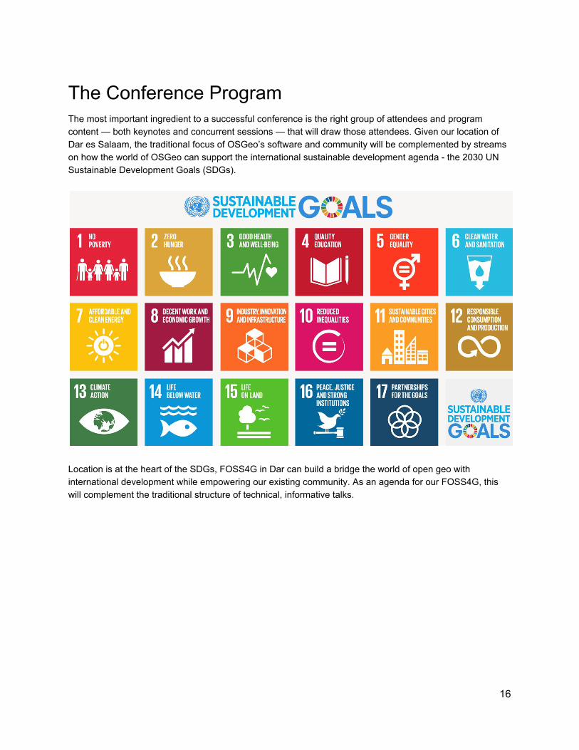
The Conference Program The most important ingredient to a successful conference is the right group of attendees and program content — both keynotes and concurrent sessions — that will draw those attendees. Given our location of Dar es Salaam, the traditional focus of OSGeo’s software and community will be complemented by streams on how the world of OSGeo can support the international sustainable development agenda - the 2030 UN Sustainable Development Goals (SDGs).
Location is at the heart of the SDGs, FOSS4G in Dar can build a bridge the world of open geo with international development while empowering our existing community. As an agenda for our FOSS4G, this will complement the traditional structure of technical, informative talks.
16
Workshops (Responsible RL, MM, TS) We are pleased to present the workshop component of this conference. The two days of workshop sessions will be an exciting lead up to the start of the conference. Workshops are an integral component of a well designed and informative conference. In our conference we aim to facilitate greater and deeper exchange of resources and information. It will also allow attendees to dig into new technologies and learn new tools and methods. They will help fulfill OSGeo’s mission of helping people learn about GeoSpatial open source projects and they will support the networking of like minded people. Workshops offer an opportunity for that special one-to-one networking of leaders and learners in the FOSS4G arena. Workshop Highlights At the time of the conference State University of Zanzibar will have completed a full drone based survey of the Zanzibar and Pemba islands. Covering a total of 2,500 square kilometers at a resolution of mostly 7.5 cm this project will be an excellent case. Lessons learned will include drone imagery management, processes to establish derived products, workflow systems, big data processing and open source tools, and more. We will facilitate for the use of this data in tools workshops. Wildlife research/management and environmental management in general relies heavily on open source GIS tools. We aim at having central practitioners and facilitators giving lectures on both their own use of the tools as well as showcasing results based on their research and management activities. We will facilitate for back to back code sprints for current open source projects. The projects will be given an opportunity to present their work in relevant workshop tracks. Workshop Facilities The conference venue has capacity to host 7 concurrent workshops possible (5 x 30 seats, 2 x 25 seats) in a classroom layout. We plan to hold two days of workshops, what means we will be able to host 28 workshop sessions of four hours each (morning and afternoon sessions). Should demand for hosting workshops exceed these 28 sessions, we can extend the workshop roster by holding additional workshops in the nearby “National Museum”, a brief 5 minute walk away. The settings for the workshops will be intimate, providing prime opportunities for attendees to network and learn. To further facilitate this interactive environment, each workshop will be designed optimally for 20–30 attendees, with larger rooms available at the venues for more popular workshops and/or co-located meetings. Most workshops will be Bring Your Own Device (BYOD). Workshop attendees will be provided a customized OSGEO-Live USB thumb drive or DVD containing the software, materials, and tools for their machines, and we will create an online repository on Github for instructors to upload materials if needed. Loan machines will be secured for those attendees without their own devices, this will further support the inclusivity of the workshops, to raise participation and awareness across the wider community.
17
Attendance Requirements In order to maximise the outreach potential of the conference, we intend to allow ‘workshop only’ registrations so that day visitors could come and ‘skill up’ on specific tools and workflows that they are interested in. Conference attendees will get preferential workshop registration. Workshop Tracks The workshops will be split into tracks that will focus on various components of FOSS technology, information, application and education. These tracks include:
1. Hands-on Technical Sessions - This will be the largest track and will involve a variety hands-on workshops, with various levels of difficulty. The goal of each session is that each attendee can walk away with hard skills. A class of beginner, intermediate, and advanced will be applied to each track in order to ensure that attendees are able to self-assess their suitability for attending the workshop. Themes which we suggest be covered are:
● Wildlife management; ● Remote sensing systems; ● Primary mapping of civil infrastructure; ● Open source tools; and ● Workshops that enable monitoring/achievement of the Sustainable Development Goals
2. Sponsor Led Sessions - This track will be dedicated to the technologies and educational efforts of OSGeo and FOSS4G sponsors (e.g. Sensefly, WorldBank, Deltares etc)
3. Maptime Tanzania - Focus of track will be on geographic fundamentals, introductory sessions, 12
and expanding entry-level access to the FOSS4G community. 4. Open drone imagery and the open source workflow. We look at project management challenges,
survey methods, open source software and more. 5. FOSS4G for students is a track that will focus on low entry sessions tuned towards high school
and undergraduate university students interested in geography, technology, and programming. Workshop Costs Workshop cost for the half-day sessions will be $50 per participant, and instructors will be compensated by a 50% reduction in the conference ticket, on sessions taught. By being amenable to co-locating events, the conference should be able to attract a wider audience and will help attendees get the most out of their travel funds.
12 http://maptime.io/tanzania/
18
Main Conference (Responsible MI,JV, GF) Following previous successful FOSS4G’s such as Cape Town, Nottingham and Bonn we will have a traditional program structure, i.e.:
● Plenary keynotes from internationally recognised leaders; ● Three 1.5 hour sessions each day of concurrent tracks (precise number of tracks to be decided after
RfP has ended), these tracks will be themed. These themes will be decided in collaboration within the LOC and consultation with the wider OSGeo community;
● Invited talks and plenary discussions to chart a future vision of our community, followed by panels of industry leaders. These will be held at the end of each main conference day, to instigate discussion into the evening.
● A peer-reviewed academic track. Complementing our main conference track, we will also hold competitive poster, and a map design competitions. There will be prizes and eternal glory for the winners of these competitions. To ensure a relaxed atmosphere for networking, at breaks of 30 minutes and a lunch of 90 minutes will be integrated into the conference program.
Commitment to a Diverse, Impactful Program Our community is strong, its strength comes through its diversity. As the showcase event for OSeo, FOSS4G in Dar es Salaam will be no different. As a LOC we are committed to having the best presentations yet at a FOSS4G. We will draw from all areas: Business, Government, Non-Profit, NGOs, Parastatals and Academia. Accordingly our program committee will be drawn from the LOC with invitations extended to OSGeo luminaries and experts to ensure a high quality, timely and impactful program.
Code Sprint and Closing Party: Zanzibar (Responsible YB, PN) The two days following the conference, we propose to organise to hold the code sprint and closing party on Zanzibar Island. The code sprint will be held at the State University of Zanzibar on the Tunguu Campus . A 13
call for proposals will be launched few months before the event but the campus offers enough rooms to accept every interested group. A shuttle bus service shall be ran from town to the campus to ensure accessibility for all.
13 SUZA University - Tunguu Campus: http://osm.org/go/l5_uXtM90-?m=
19
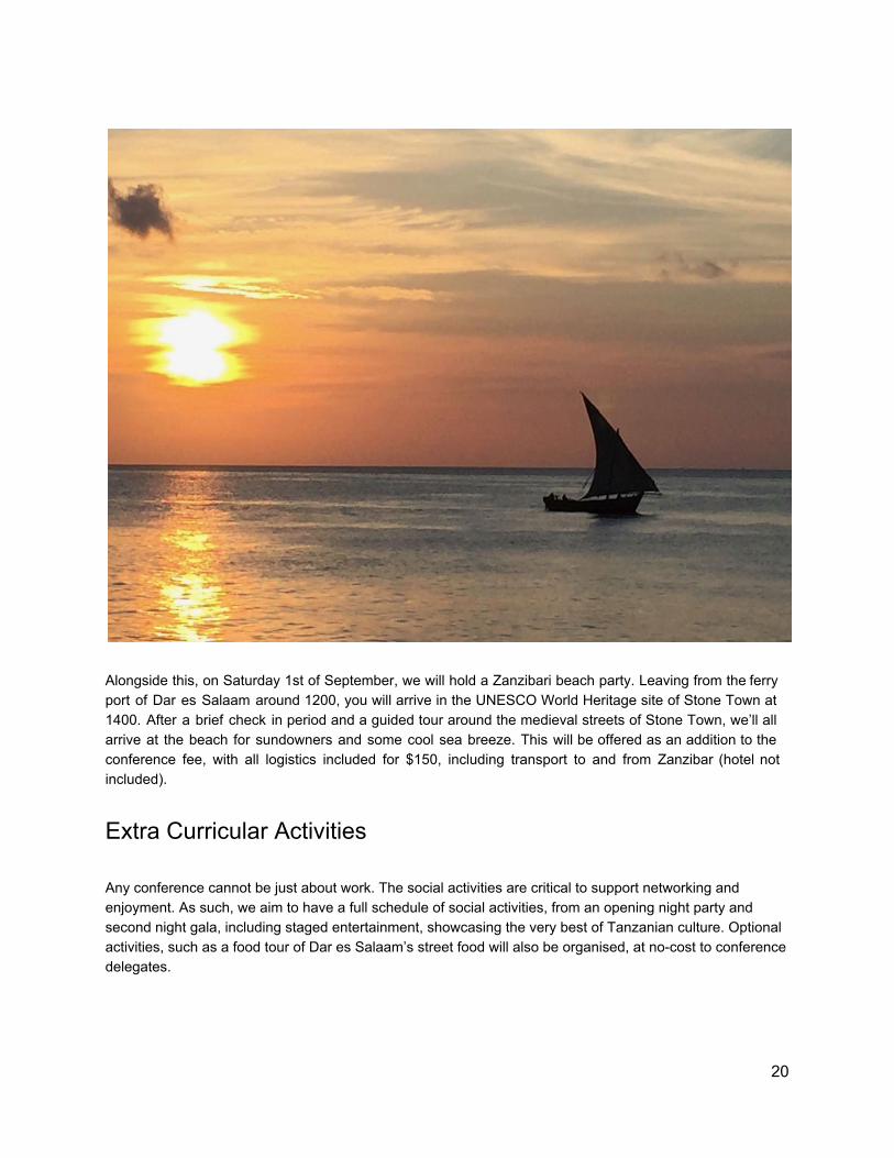
Alongside this, on Saturday 1st of September, we will hold a Zanzibari beach party. Leaving from the ferry port of Dar es Salaam around 1200, you will arrive in the UNESCO World Heritage site of Stone Town at 1400. After a brief check in period and a guided tour around the medieval streets of Stone Town, we’ll all arrive at the beach for sundowners and some cool sea breeze. This will be offered as an addition to the conference fee, with all logistics included for $150, including transport to and from Zanzibar (hotel not included).
Extra Curricular Activities Any conference cannot be just about work. The social activities are critical to support networking and enjoyment. As such, we aim to have a full schedule of social activities, from an opening night party and second night gala, including staged entertainment, showcasing the very best of Tanzanian culture. Optional activities, such as a food tour of Dar es Salaam’s street food will also be organised, at no-cost to conference delegates.
20
Tourism in Tanzania Tanzania is a tourist destination in its own right. There are a multitude of potential activities for the conference goer, but also plenty to keep travelling company happy too - a selection of what is possible is here, our LOC will provide more a detailed tourism guide as part of the conference pack.
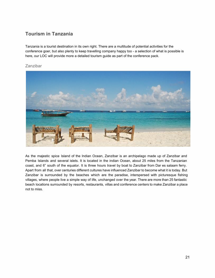
Zanzibar
As the majestic spice Island of the Indian Ocean, Zanzibar is an archipelago made up of Zanzibar and Pemba Islands and several islets. It is located in the indian Ocean, about 25 miles from the Tanzanian coast, and 6” south of the equator. It is three hours travel by boat to Zanzibar from Dar es salaam ferry. Apart from all that, over centuries different cultures have influenced Zanzibar to become what it is today. But Zanzibar is surrounded by the beaches which are the paradise, interspersed with picturesque fishing villages, where people live a simple way of life, unchanged over the year. There are more than 25 fantastic beach locations surrounded by resorts, restaurants, villas and conference centers to make Zanzibar a place not to miss.
21
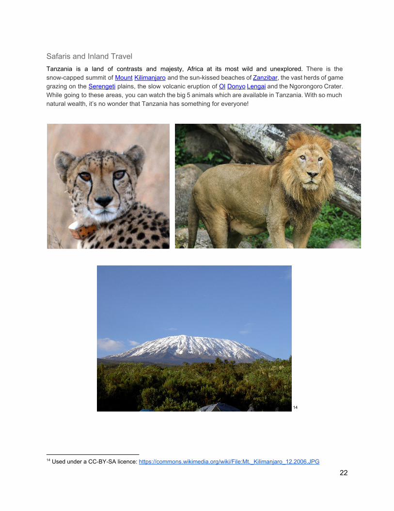
Safaris and Inland Travel Tanzania is a land of contrasts and majesty, Africa at its most wild and unexplored. There is the snow-capped summit of Mount Kilimanjaro and the sun-kissed beaches of Zanzibar, the vast herds of game grazing on the Serengeti plains, the slow volcanic eruption of Ol Donyo Lengai and the Ngorongoro Crater. While going to these areas, you can watch the big 5 animals which are available in Tanzania. With so much natural wealth, it’s no wonder that Tanzania has something for everyone!
14
14 Used under a CC-BY-SA licence: https://commons.wikimedia.org/wiki/File:Mt._Kilimanjaro_12.2006.JPG
22
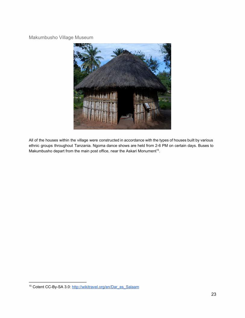
Makumbusho Village Museum
All of the houses within the village were constructed in accordance with the types of houses built by various ethnic groups throughout Tanzania. Ngoma dance shows are held from 2-6 PM on certain days. Buses to Makumbusho depart from the main post office, near the Askari Monument . 15
15 Cotent CC-By-SA 3.0: http://wikitravel.org/en/Dar_es_Salaam
23
Dar es Salaam’s Budget
The Chair’s Budgetary Statement The past few months have been a turbulent time for economic forecasts, for an event with as many moving parts as FOSS4G, this challenge is amplified. Our presented budget is deliberately conservative. We have a 15% contingency fund. We recognise that Dar es Salaam breaks the mould of historical FOSS4G host cities. Our minimal attendance figure stands at 500 delegates, on which, we will make a surplus of $1,800, with a contingency of $36,950. With more realistic attendee figures of 650 - 750, we stand to make a surplus of $13,700 and $21,700 respectively, still at 15% contingency. Obviously, this would be re-invested into the OSGeo community after the event, we would seek a 50:50 split between setting up a local Tanzanian OSGeo chapter and providing back to the OSGeo community. We would seek discussions with the OSGeo conference board to finalise this budget, ensuring that expectations are set and understood on both boards, OSGeo and the Dar LOC. We feel that our proposed conference fees while low at $500 for an early bird rate, will act as a driver for more inclusive participation across the African continent. This has the additional intention to raise the attractiveness of FOSS4G Dar for international participants, including those who would not usually consider Tanzania for an international conference. With a projected total spend for delegates of $1,500 including conference fee, flights, accommodation and incidents, we believe that this will be the most affordable FOSS4G yet for international delegates. By offering $100 tickets for local community members, we widen our opportunity further, this is further complemented by 5 x $1,500 scholarships for outstanding applicants. This all considered, we aim to generate at least $389,000 of revenue, with 500 delegates as the minimum viable number. To increase this, we will aggressively pursue traditional avenues for participants for our FOSS4G, by advertising as far and wide as possible internationally and pursue the local and regional tech and start innovation ecosystems.
Sponsorship We believe that we have the potential to raise more than sufficient sponsorship to support our FOSS4G. East Africa is a new impact area for open geo, and initial discussions with sponsors are excited at the new market opportunities. We are also backed by a firm commitment from the World Bank of $100,000 to support the conference in widening participation for the local community. Our LOC will implement the following strategies to ensure high levels of sponsorship:
● Formation of a dedicated sponsorship and partner team, providing all sponsors with a point of contact and liaison;
● The LOC has several members from companies who have expressed a strong desire to sponsor FOSS4G/have committed funds already;
● Develop a tailored sponsorship plan for the conference, from “Tanzanite” at $100,000 through Platinum ($15,000), Gold ($7,500) and Silver ($5,000) levels.
24
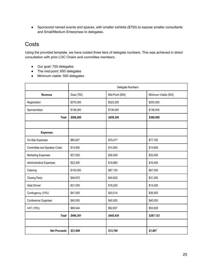
● Sponsored named events and spaces, with smaller exhibits ($750) to expose smaller consultants and Small/Medium Enterprises to delegates.
Costs Using the provided template, we have costed three tiers of delegate numbers. This was achieved in direct consultation with prior LOC Chairs and committee members:
● Our goal: 750 delegates ● The mid-point: 650 delegates ● Minimum viable: 500 delegates
Delegate Numbers
Revenue Goal (750) Mid-Point (650) Minimum Viable (500)
Registration $370,000 $323,200 $253,000
Sponsorships $136,000 $136,000 $136,000
Total $506,000 $459,200 $389,000
Expenses
On-Site Expenses $80,627 $79,477 $77,752
Committee and Speaker Costs $14,900 $14,900 $14,900
Marketing Expenses $27,500 $26,500 $25,000
Administrative Expenses $22,300 $19,960 $16,450
Catering $100,500 $87,100 $67,000
Closing Party $46,875 $40,625 $31,250
Gala Dinner $21,000 $18,200 $14,000
Contingency (15%) $47,055 $43,014 $36,953
Conference Organiser $40,000 $40,000 $40,000
VAT (19%) $68,544 $62,657 $53,828
Total $484,301 $445,434 $387,133
Net Proceeds $21,699 $13,766 $1,867
25
Appendix
1. Other Relevant International Conferences Taking place in 2018
Conference Date
January
2nd International Conference on Information in Business and Technology Management (I2BM) https://i2bm.com/
March
Geo2018 - 13th Middle East GeoSciences Conferences and Exhibition http://geo2018.com
5 – 8 March 2018
May
Saint Petersburg International Conference on Integrated Navigation Systems http://www.elektropribor.spb.ru/icins2018/eindex
28 - 30 May 2018
July
Esri UC 2018 - Esri International User Conference 09 - 13 July 2018
26