Embed Size (px)
Citation preview
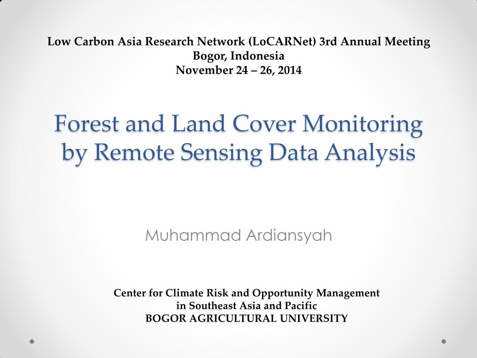
Forest and Land Cover Monitoring by Remote Sensing Data Analysis
Muhammad Ardiansyah
Low Carbon Asia Research Network (LoCARNet) 3rd Annual Meeting Bogor, Indonesia
November 24 – 26, 2014
Center for Climate Risk and Opportunity Management in Southeast Asia and Pacific
BOGOR AGRICULTURAL UNIVERSITY
Introduction • Since 1980ies, information about forest and land
cover is importance for description and study of
environment
• Forest and land cover: o the easiest detectable indicator of human intervention
o a critical parameter for environmental databases
• Since 1980ies also, o the use of remote sensing data for supporting research on global change
and sustainability is tremendous
o Land use and land cover change became a key topic within global
change research program (IGBP, ISSC, IAI, APN, START, GCTE, NASA-
LCLUC, GLP, GOFC-GOLD)
• Why tropical forests are of particular interest in environmental study dealing with land cover and land use change ? o Tropical land is home to more than 55% of global
population and human activities related to land use
o Tropical ecosystem harbour a biodiversity, deforestation and land cover conversion
o Tropical forest consist of a major terrestrial carbon sink and sources of emission.

• Tropical forests are under significant threat
• Deforestation directly cause carbon release to the atmosphere and accounts for one fifth of human induced emission of CO2 (IPCC 2007)
• In Indonesia, forest and land cover change are significant components of Indonesia’s emissions profile (SNC, 2009)
• Since deforestation is almost occurring in tropical forests, thus the necessity of developing tool and providing spatially base data for monitoring deforestation and forest degradation has been underlined during COP13 in Bali
• Several effort to map land cover in the tropic region and to monitor forest cover change have been done in the past, however the scope of forest monitoring is much broader.
• 3 groups of research: o LCLUC and carbon dynamics o LCLUC and biological conservation o Vegetation activity and climate variability
• Remote sensing data provide most reliable data source for accurately and objectively estimates change in forest over large area, particularly in remote area and difficult to access.
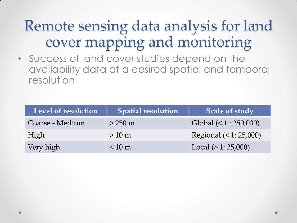
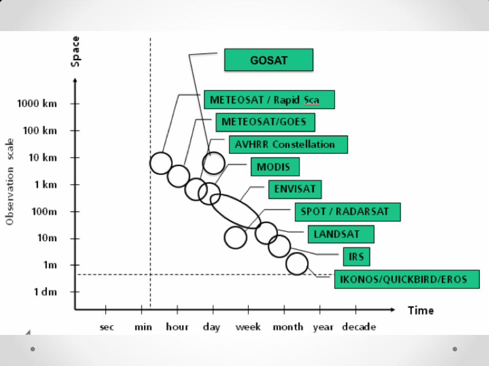
Remote sensing data analysis for land cover mapping and monitoring
• Success of land cover studies depend on the availability data at a desired spatial and temporal resolution
Level of resolution Spatial resolution Scale of study
Coarse - Medium > 250 m Global (< 1 : 250,000)
High > 10 m Regional (< 1: 25,000)
Very high < 10 m Local (> 1: 25,000)
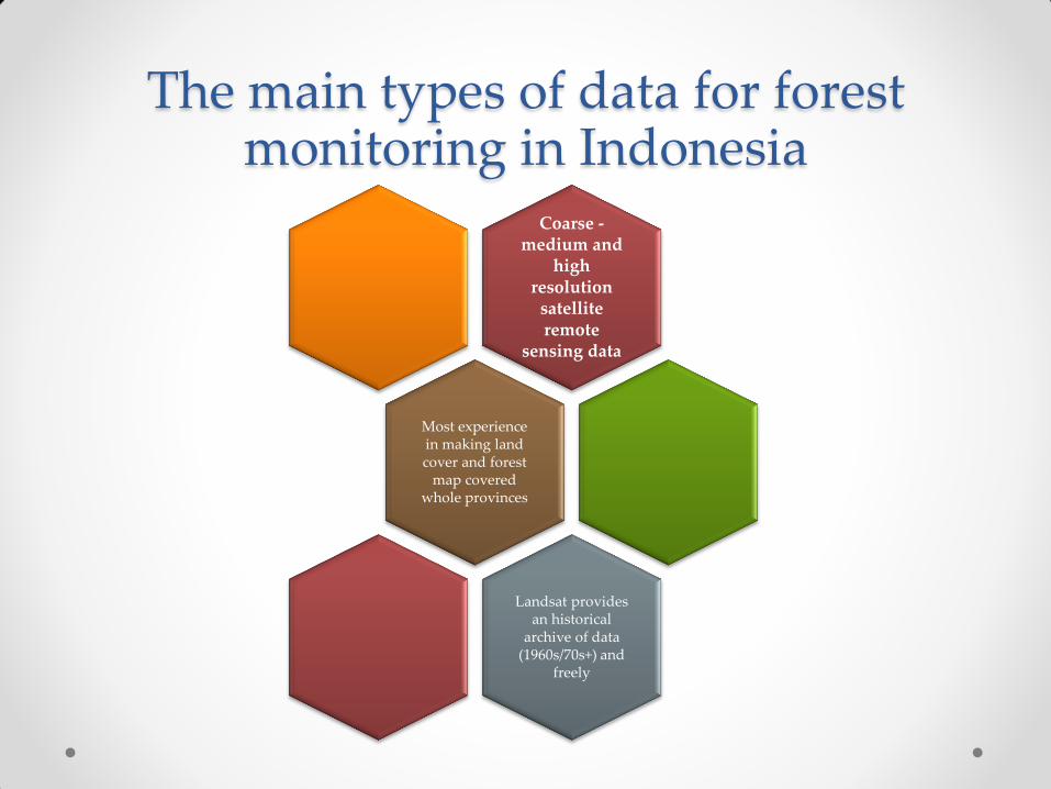
The main types of data for forest monitoring in Indonesia
Coarse - medium and
high resolution
satellite remote
sensing data
Most experience in making land cover and forest
map covered whole provinces
Landsat provides an historical
archive of data (1960s/70s+) and
freely
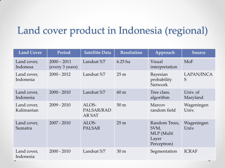
Land Cover Period Satellite Data Resolution Approach Source
Land cover, Indonesa
2000 – 2011 (every 3 years)
Landsat 5/7 6.25 ha Visual interpretation
MoF
Land cover, Indonesia
2000 - 2012 Landsat 5/7 25 m Bayesian probability Network
LAPAN/INCAS
Land cover, Indonesia
2000 - 2010 Landsat 5/7 60 m Tree class. algorithm
Univ. of Maryland
Land cover, Kalimantan
2009 - 2010 ALOS-PALSAR/RADAR SAT
50 m Marcov random field
Wageningen Univ.
Land cover, Sumatra
2007 - 2010 ALOS-PALSAR
25 m Random Trees, SVM, MLP (Multi Layer Perceptron)
Wageningen Univ.
Land cover, Indonesia
2000 - 2010 Landsat 5/7 30 m Segmentation ICRAF
Land cover product in Indonesia (regional)
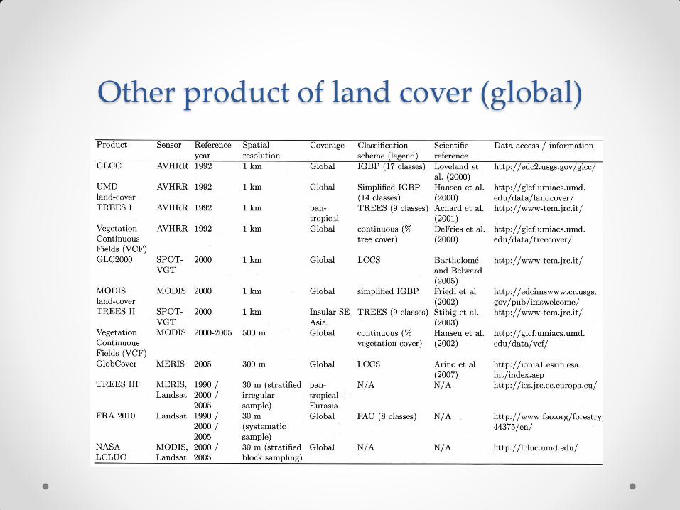
Other product of land cover (global)
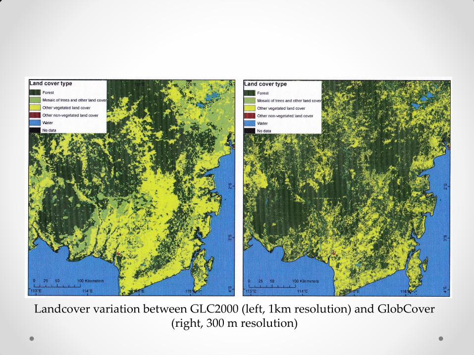
Landcover variation between GLC2000 (left, 1km resolution) and GlobCover (right, 300 m resolution)
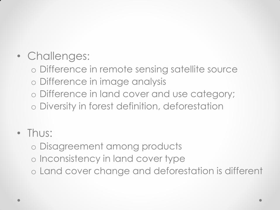
• Challenges: o Difference in remote sensing satellite source
o Difference in image analysis
o Difference in land cover and use category;
o Diversity in forest definition, deforestation
• Thus: o Disagreement among products
o Inconsistency in land cover type
o Land cover change and deforestation is different
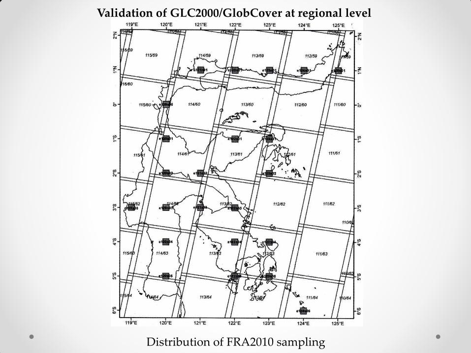
Distribution of FRA2010 sampling
Validation of GLC2000/GlobCover at regional level
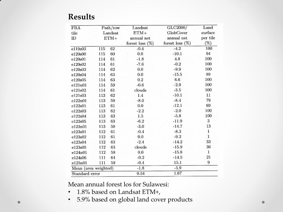
Mean annual forest los for Sulawesi: • 1.8% based on Landsat ETM+, • 5.9% based on global land cover products
Results
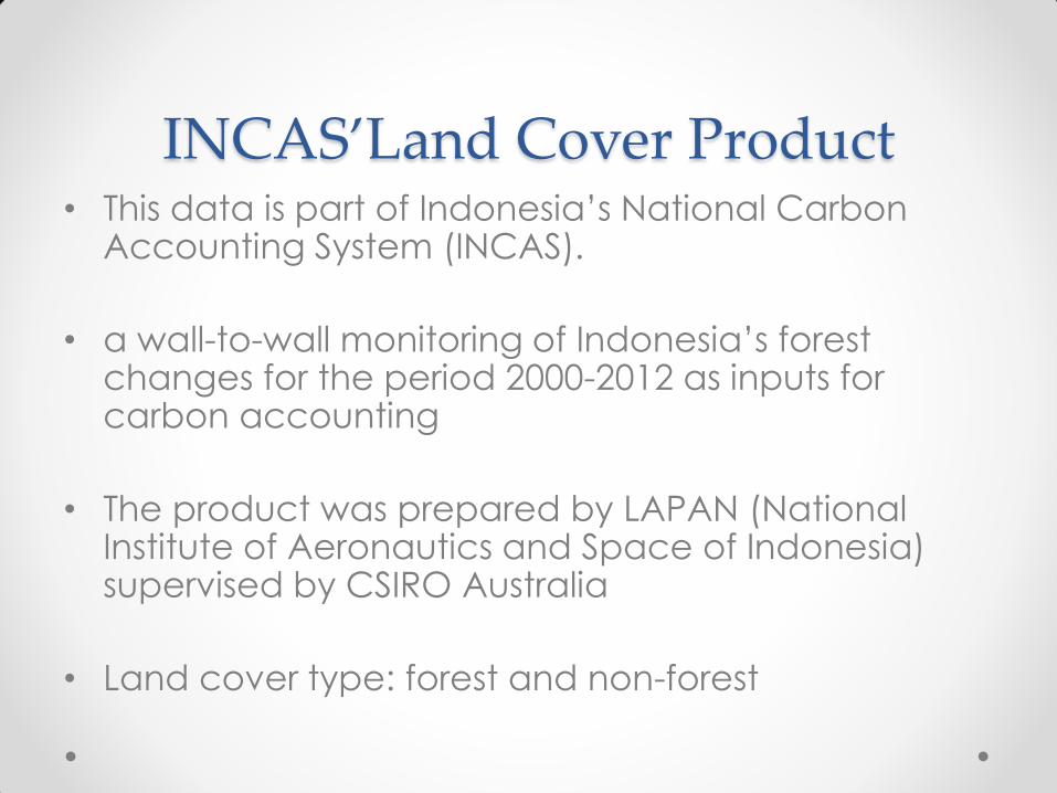
INCAS’Land Cover Product • This data is part of Indonesia’s National Carbon
Accounting System (INCAS).
• a wall-to-wall monitoring of Indonesia’s forest changes for the period 2000-2012 as inputs for carbon accounting
• The product was prepared by LAPAN (National Institute of Aeronautics and Space of Indonesia) supervised by CSIRO Australia
• Land cover type: forest and non-forest
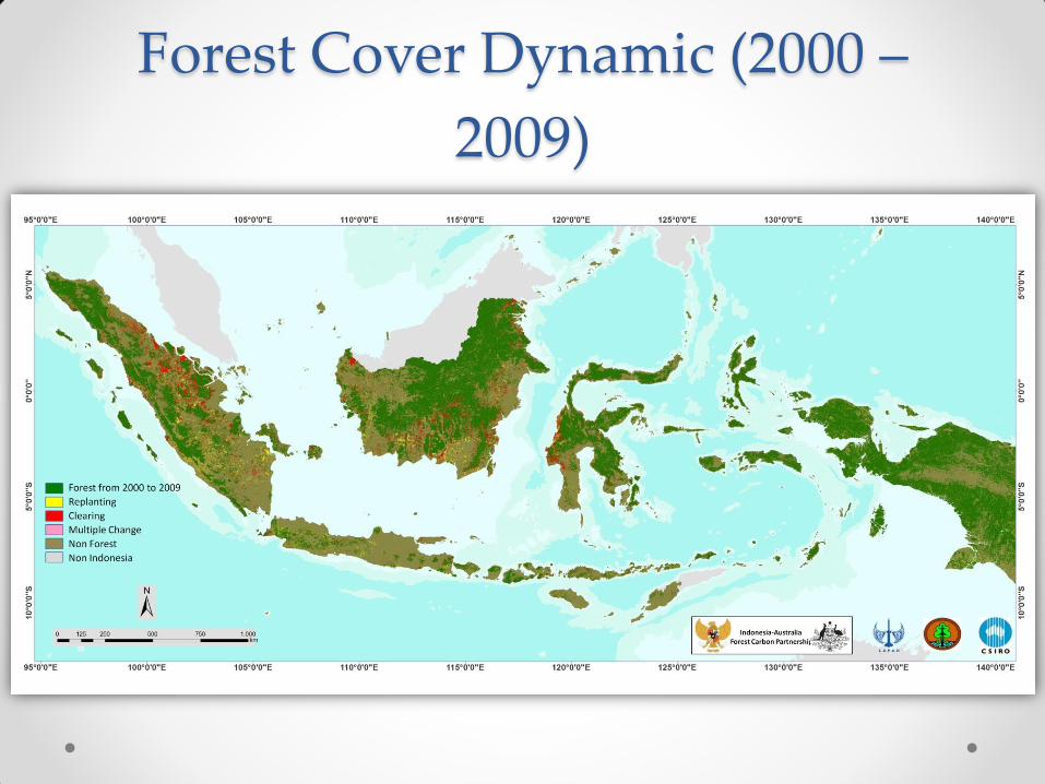
Forest Cover Dynamic (2000 –
2009)
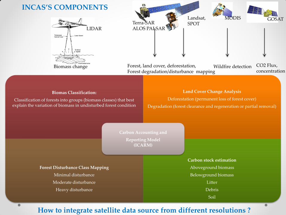
Biomas Classification:
Classification of forests into groups (biomass classes) that best explain the variation of biomass in undisturbed forest condition
Land Cover Change Analysis
Deforestation (permanent loss of forest cover)
Degradation (forest clearance and regeneration or partial removal)
Forest Disturbance Class Mapping
Minimal disturbance
Moderate disturbance
Heavy disturbance
Carbon stock estimation
Aboveground biomass
Belowground biomass
Litter
Debris
Soil
Carbon Accounting and
Reporting Model (ICARM)
GOSAT MODIS Landsat, SPOT Terra-SAR
ALOS PALSAR
CO2 Flux, concentration
Wildfire detection Forest, land cover, deforestation, Forest degradation/disturbance mapping
Biomass change
How to integrate satellite data source from different resolutions ?
INCAS’S COMPONENTS
LIDAR
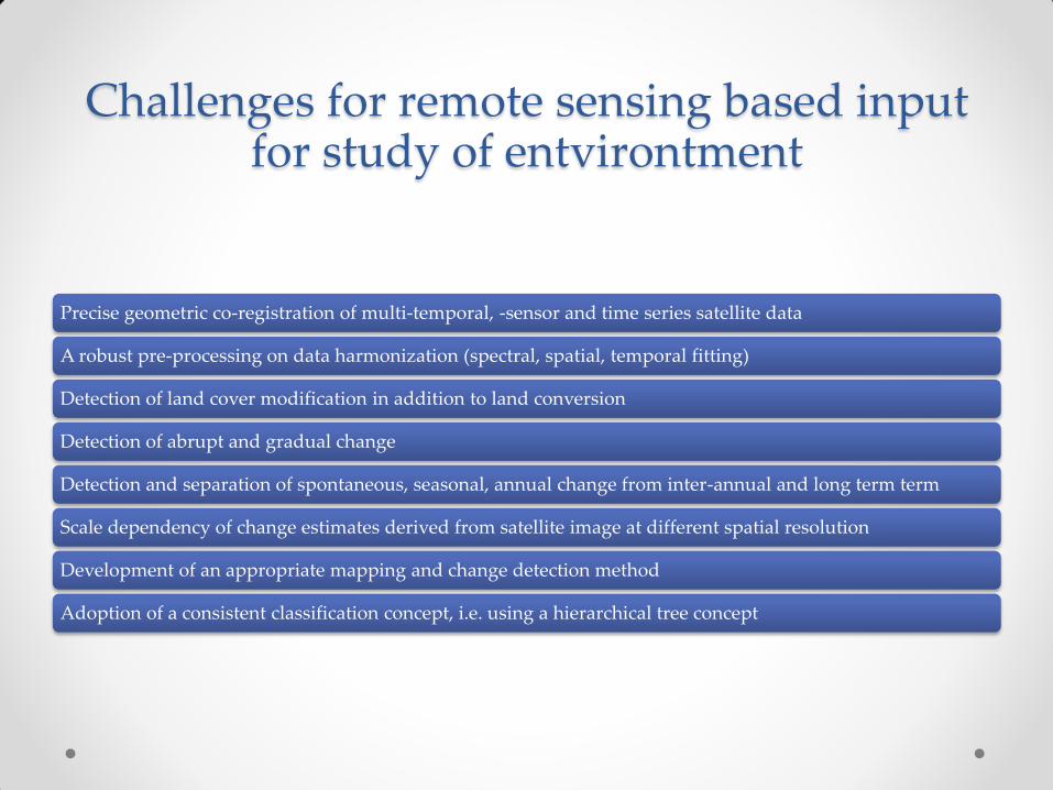
Challenges for remote sensing based input for study of entvirontment
Precise geometric co-registration of multi-temporal, -sensor and time series satellite data
A robust pre-processing on data harmonization (spectral, spatial, temporal fitting)
Detection of land cover modification in addition to land conversion
Detection of abrupt and gradual change
Detection and separation of spontaneous, seasonal, annual change from inter-annual and long term term
Scale dependency of change estimates derived from satellite image at different spatial resolution
Development of an appropriate mapping and change detection method
Adoption of a consistent classification concept, i.e. using a hierarchical tree concept
Concluding remarks
• Development of comprehensive and reliable
operational monitoring concept for forest and land
cover change needs:
o a robust pre-processing on data harmonization (spectral,
spatial, and temporal fitting)
o Integration of single mapping approaches
o a data use policy on existing and planned multi-spectral
satellite system and development of a multi-sensor
•