Embed Size (px)
Citation preview
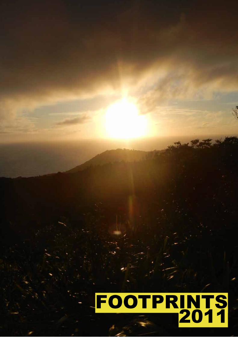
FOOTPRINTS2011
2
CaptainAnton Gulley
SeCretaryChristina Fullerton
treaSurerNico Thorburn
OfficerGear
Andrew Hudson
Hut Harry Aitken
SaFety/inStruCtional
Matthew Lillis
publiCationTony Siu
SoCialRosanna Walton Georgia Yarrow
tripTom Goodman
Club Captain ReporttHiS iS a very Good year For tHe trampinG Club; re-Cord memberSHip, a StronG FinanCial poSition, muCH repair work on tHe Hut and a reCord number oF tripS.
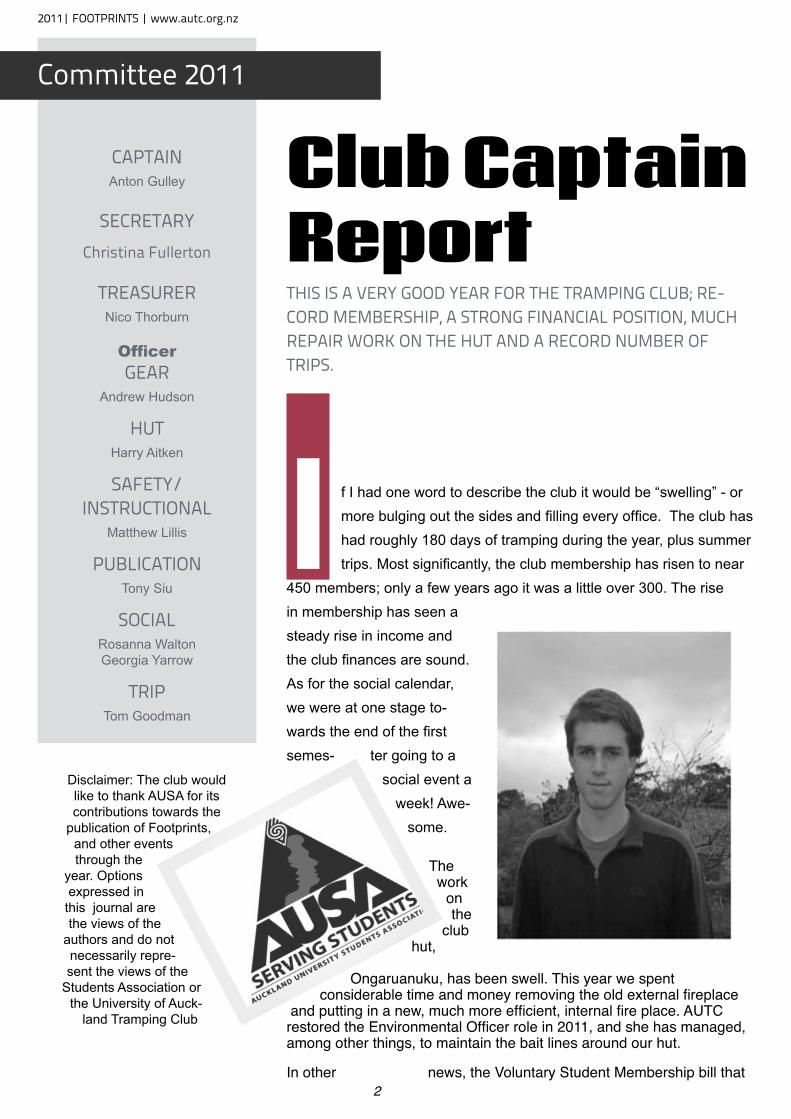
I f I had one word to describe the club it would be “swelling” - or more bulging out the sides and filling every office. The club has had roughly 180 days of tramping during the year, plus summer trips. Most significantly, the club membership has risen to near
450 members; only a few years ago it was a little over 300. The rise in membership has seen a steady rise in income and the club finances are sound. As for the social calendar, we were at one stage to-wards the end of the first semes- ter going to a
social event a week! Awe-
some.
The work
on the
club hut,
Ongaruanuku, has been swell. This year we spent considerable time and money removing the old external fireplace
and putting in a new, much more efficient, internal fire place. AUTC restored the Environmental Officer role in 2011, and she has managed, among other things, to maintain the bait lines around our hut.
In other news, the Voluntary Student Membership bill that
Disclaimer: The club would like to thank AUSA for its contributions towards the
publication of Footprints, and other events through the
year. Options expressed in
this journal are the views of the
authors and do not necessarily repre-sent the views of the
Students Association or the University of Auck-
land Tramping Club
2011| FOOTPRINTS | www.autc.org.nz
Committee 2011
3
passed in October will have a dramatic effect on the administration of the club. The short version is that the University is now far more restricted in terms of how they can fund clubs such as AUTC, and how they fund the Auckland University Students’ Association. In particular, the Students’ Association – which owns and funds AUTC – will undergo major funding cuts for next year. Rest assured that the club will reasonably continue in its current form in the short term.
The next few years will be interesting for the club: will the club swell so much that the belt breaks, revealing what it is really made of, or will the club acquire some pants with an elastic waist band?
I would like to thank everybody in the club who got involved and contributed, from the very smallest things like helping the trip leader sort out transport, to organising multi-day adventures. It all makes a huge difference to the community that is the Auckland University Tramping Club.
Also, around the middle of the year I was asked by AUSA to pick up a box that had been dropped of at their reception for us. Inside it was assorted tramping gear such as pots, knives and an emergency shelter. A handwritten note provided no identity of the donor. The note simply invited us among other things to enjoy ourselves in the hills. So whoever you are thanks very much, I personally have used the shelter and I’m sure the other things will be just as useful.
Towards the end of the year we received a small package with a similar hand written note, inside the package was a pair of men’s black undies. To respect your generosity I have taken these undies on nearly every tramping trip since.
Anton Gulley
Officer (cont.)
memberSHipAnna Luo
alpineCraig Smith
HutHarry Aitken
web Sitealastair mcdowell
environmentalSarah Wyse
arCHiveSBrian Davis
preSidentJohn Cater
General Committee memberS
Helen Liley
Jessica Shaw
viCe preSidentSAnthea Johnson
Andrew BaddeleyCharis Wong
Kathleen CollierRichard Greatrex
Rion Gulley
www.autc.org.nz | FOOTPRINTS |2011
4
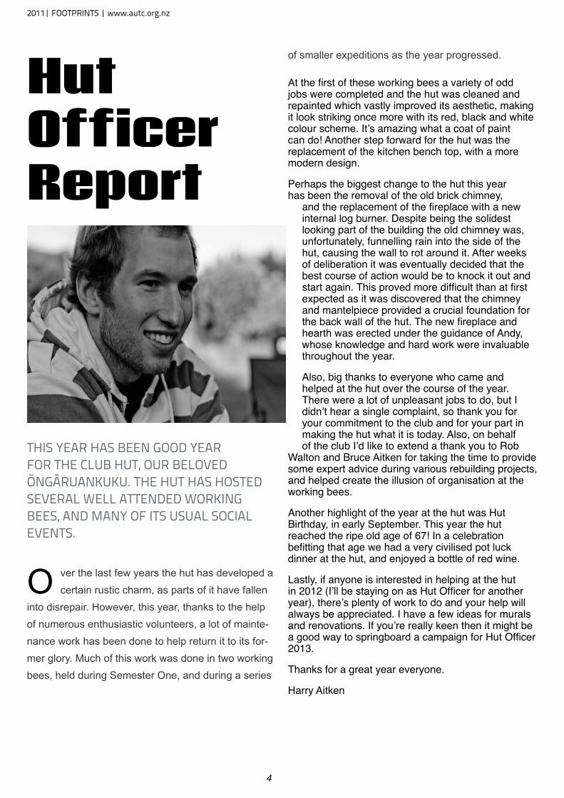
Hut Officer Report
tHiS year HaS been Good year For tHe Club Hut, our beloved ŌnGāruankuku. tHe Hut HaS HoSted Several well attended workinG beeS, and many oF itS uSual SoCial eventS.
O ver the last few years the hut has developed a certain rustic charm, as parts of it have fallen
into disrepair. However, this year, thanks to the help of numerous enthusiastic volunteers, a lot of mainte-nance work has been done to help return it to its for-mer glory. Much of this work was done in two working bees, held during Semester One, and during a series
of smaller expeditions as the year progressed.
At the first of these working bees a variety of odd jobs were completed and the hut was cleaned and repainted which vastly improved its aesthetic, making it look striking once more with its red, black and white colour scheme. It’s amazing what a coat of paint can do! Another step forward for the hut was the replacement of the kitchen bench top, with a more modern design.
Perhaps the biggest change to the hut this year has been the removal of the old brick chimney,
and the replacement of the fireplace with a new internal log burner. Despite being the solidest looking part of the building the old chimney was, unfortunately, funnelling rain into the side of the hut, causing the wall to rot around it. After weeks of deliberation it was eventually decided that the best course of action would be to knock it out and start again. This proved more difficult than at first expected as it was discovered that the chimney and mantelpiece provided a crucial foundation for the back wall of the hut. The new fireplace and hearth was erected under the guidance of Andy, whose knowledge and hard work were invaluable throughout the year.
Also, big thanks to everyone who came and helped at the hut over the course of the year. There were a lot of unpleasant jobs to do, but I didn’t hear a single complaint, so thank you for your commitment to the club and for your part in making the hut what it is today. Also, on behalf of the club I’d like to extend a thank you to Rob
Walton and Bruce Aitken for taking the time to provide some expert advice during various rebuilding projects, and helped create the illusion of organisation at the working bees.
Another highlight of the year at the hut was Hut Birthday, in early September. This year the hut reached the ripe old age of 67! In a celebration befitting that age we had a very civilised pot luck dinner at the hut, and enjoyed a bottle of red wine.
Lastly, if anyone is interested in helping at the hut in 2012 (I’ll be staying on as Hut Officer for another year), there’s plenty of work to do and your help will always be appreciated. I have a few ideas for murals and renovations. If you’re really keen then it might be a good way to springboard a campaign for Hut Officer 2013.
Thanks for a great year everyone.
Harry Aitken
2011| FOOTPRINTS | www.autc.org.nz
5
Archive*MISSING TWO DAYS* younG auCkland ClimberS*ruapeHu party oF Fourteen CauGHt in Se-vere SnowStorm * SIX EXHAUSTED RETURN TO CHATEAU*T hese were the main headlines in
the now-defunct Auckland Star on the afternoon of Monday 31 August 1931 that lead off an exercise book
full of newspaper cuttings. They tell the story of a party from the Auckland University College Field Club and are the oldest item in this Club’s archives; they pre-date the formation of the College Tramping Club in the following April. The massive search, the nights out in the cold, the rescue of most of the party and the final discovery of one body in the Makatote Valley three weeks later were the biggest news item in 1931 after the Napier earthquake and were a fac-tor in the decision to form a Tramping Club distinct from the Field Club.
Club members have, over the intervening nearly 80 years, collected a variety of materials that give a picture of the Club’s life, which reflect changes in University life and changes in tramping, mountaineering and social life in New Zealand. Perhaps of no great interest to current members they provide a window into our past, sometimes remarkably familiar at other times strangely different. The most complete formal (and sometimes informal) record of the Club’s life is Footprints which was first published in 1944, initially a cyclostyled magazine and now, as you read this, a technically sophisticated journal with coloured photographs. The University library holds a complete set as do one or two individuals; the Auckland Public Library and the Alexander Turnbull Library in Wellington hold incomplete sets. Following the Club’s revival in 1942 and in to 1943 one member kept a manuscript log book/scrap book recounting club trips and activities; the writer Alan Horsman later became professor of English at Otago University. This was followed through until the 1960s with scrap books/photograph albums covering club activities and including newspaper cuttings about newsworthy club trips (usually involving accidents) or notable doings
by club members.
The University Library in its Special Collections on the ground floor holds nine boxes of material from the mid-1930s to the late 1970s, mostly minutes, reports and correspondence. These are available to any member of the public with the natural precautions covering the handling of such documents. Of course it’s doubtful if past secretaries, sending requests for transport or hut bookings knew that their efforts would now be housed with such care.
Of significant interest, at least to past members, are the first eight hut books from O’Nuku right back to the Opening Day on Sunday 27 August 1944. The books record the varying history of the hut and the way it has been used, from the days in the 1950s and 60s when it was a locked Club hut regularly visited by students each weekend until later days when it became more a venue for Hut Birthday or Bush School parties and the like and when improved transport allowed people to travel further afield at weekends. We also have the Hut Book for Glacier Hut a small hut beside their main Lodge leased to us by the Ruapehu Ski Club in the late 1940s.
The club has mainTained good records of commiTTee meeTings including The firsT minuTe book covering The years from april 1932 To march 1945; The minuTes of The founding meeTing were copied and included in The 1982 Jubilee hisTory. There are also numerous membership lisTs, accounTs, “exTended Trip record books” and The like
David Gauld and I have been going through the collection of papers and books that have been variously housed in the Club locker at Uni and various President’s wardrobes and garages and we hope to able to compile a list of all the material that’s held. It’s planned to transfer all the items we, and others, currently hold to the Library’s collection to ensure their long term safe keeping.
In the meantime, keep up those records and hang on to them, they’ll be the ‘primary sources’ for your successors writing the Club’s Centenary History in 2032.
Brian Davis
www.autc.org.nz | FOOTPRINTS |2011
6
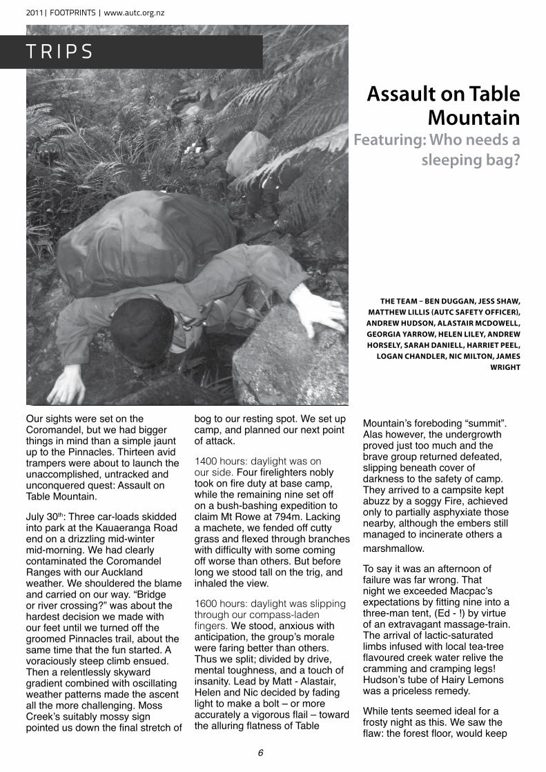
Our sights were set on the Coromandel, but we had bigger things in mind than a simple jaunt up to the Pinnacles. Thirteen avid trampers were about to launch the unaccomplished, untracked and unconquered quest: Assault on Table Mountain.
July 30th: Three car-loads skidded into park at the Kauaeranga Road end on a drizzling mid-winter mid-morning. We had clearly contaminated the Coromandel Ranges with our Auckland weather. We shouldered the blame and carried on our way. “Bridge or river crossing?” was about the hardest decision we made with our feet until we turned off the groomed Pinnacles trail, about the same time that the fun started. A voraciously steep climb ensued. Then a relentlessly skyward gradient combined with oscillating weather patterns made the ascent all the more challenging. Moss Creek’s suitably mossy sign pointed us down the final stretch of
bog to our resting spot. We set up camp, and planned our next point of attack.
1400 hours: daylight was on our side. Four firelighters nobly took on fire duty at base camp, while the remaining nine set off on a bush-bashing expedition to claim Mt Rowe at 794m. Lacking a machete, we fended off cutty grass and flexed through branches with difficulty with some coming off worse than others. But before long we stood tall on the trig, and inhaled the view.
1600 hours: daylight was slipping through our compass-laden fingers. We stood, anxious with anticipation, the group’s morale were faring better than others. Thus we split; divided by drive, mental toughness, and a touch of insanity. Lead by Matt - Alastair, Helen and Nic decided by fading light to make a bolt – or more accurately a vigorous flail – toward the alluring flatness of Table
Mountain’s foreboding “summit”. Alas however, the undergrowth proved just too much and the brave group returned defeated, slipping beneath cover of darkness to the safety of camp. They arrived to a campsite kept abuzz by a soggy Fire, achieved only to partially asphyxiate those nearby, although the embers still managed to incinerate others a marshmallow.
To say it was an afternoon of failure was far wrong. That night we exceeded Macpac’s expectations by fitting nine into a three-man tent, (Ed - !) by virtue of an extravagant massage-train. The arrival of lactic-saturated limbs infused with local tea-tree flavoured creek water relive the cramming and cramping legs! Hudson’s tube of Hairy Lemons was a priceless remedy.
While tents seemed ideal for a frosty night as this. We saw the flaw: the forest floor, would keep
Assault on Table Mountain
Featuring: Who needs a sleeping bag?
The Team – Ben Duggan, Jess shaw, maTThew LiLLis (auTC safeTy OffiCer),
anDrew huDsOn, aLasTair mCDOweLL, geOrgia yarrOw, heLen LiLey, anDrew hOrseLy, sarah DanieLL, harrieT PeeL,
LOgan ChanDLer, niC miLTOn, James wrighT
2011| FOOTPRINTS | www.autc.org.nz
t r i p S
7
our boots forever thawed,while those who snored, in canvas walls, would wake to socks of stiff cardboard.
July 31st: For Matt, dawn could not come too soon. Matt, Helen and Alastair shook off their bright plastic duvets when the morning came at last. Although these shielded off the rain, of which there was none, they had transformed their heat-breathing bodies into rainstorms of their own. The condensation was sensational, but it was the small price we paid for the luxury of a sleeping bag.
Nevertheless, we had overcome
the test and were bestowed golden cloaks of adulating Coromandel sunlight in reward. Those who remained unconscious in ice-covered tents were soon awoken by the sound of Matt celebrating the coming of dawn – and a stunning one at that. After much cursing and shaking off frost, our tents were packed away, breakfast was had and we were ready to set off.
Now that the excitement and enthrallment that Table Mountain had provided for so many of us had passed, the cruel reality of a HARD five-hour slog through calf-deep mud to reach the sanctuary of the Pinnacles Hut dawned on us. Despite the task, after much huffing, puffing and some truly spectacular falls, we eventually arrived – muddy and sore. We
dumped our packs, and laid into our feast of filled tortillas with gusto, smothered with lashings of low fat mayo (much to the dismay of Hudson).
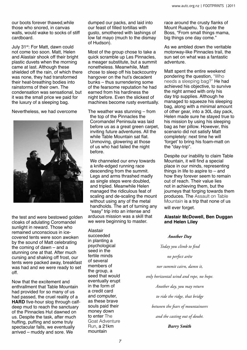
Most of the group chose to take a quick scramble up Les Pinnacles, a meager substitute, but a summit nonetheless. Meanwhile, Matt chose to sleep off his backcountry hangover on the hut’s decadent bunks – thus surrendering some of the fearsome reputation he had earned from his hardiness the night before. Even the slickest of machines become rusty eventually.
The weather was stunning – from the top of the Pinnacles the Coromandel Peninsula was laid before us as a great green carpet, inviting future adventures. All the while Table Mountain sat flat. Unmoving, glowering at those of us who had failed the night before.
We channeled our envy towards a knife-edged running race descending from the summit. Legs and arms thrashed madly as single steps were doubled, and tripled. Meanwhile Helen managed the ridiculous feat of scaling and de-scaling the mount without using any of the metal handholds. The art of turning any “easy” trip into an intense and
arduous mission was a skill that we were beginning to master.
Alastair succeeded in planting a psychological seed in the fertile minds of several members of the group, a seed that would eventually erupt in the form of a credit card and computer, as these brave souls paid their money down to enter The Goat Adventure Run, a 21km mountain
race around the crusty flanks of Mount Ruapehu. To quote the Boss, “From small things mama, big things one day come.”
As we ambled down the veritable motorway-like Pinnacles trail, the sun set on what was a fantastic adventure.
Matt spent the entire weekend pondering the question, “Who needs a sleeping bag?” He had achieved his objective, to survive the night armed with only his day trip supplies. Although he managed to squeeze his sleeping bag, along with a minimal amount of other gear, into a 30L day pack, Helen made sure he stayed true to his mission by using his sleeping bag as her pillow. However, this scenario did not satisfy Matt completely: next time he will ‘forget’ to bring his foam-matt on the “day-trip”.
Despite our inability to claim Table Mountain, it will find a special place in our minds, representing things in life to aspire to – and how they forever seem to remain out of reach. Their value lies not in achieving them, but the journeys that forging towards them produces. The Assault on Table Mountain is a trip that none of us will ever forget.
Alastair McDowell, Ben Duggan and Helen Liley
Another Day
Today you climb to find
no perfect arête
nor summit cairn, damn it,
only horizontal wind and rope, no hope.
Another day, you may return
to ride the ridge, that bridge
between the fears of mountaineers
and the casting out of doubt.
Barry Smith
www.autc.org.nz | FOOTPRINTS |2011
8
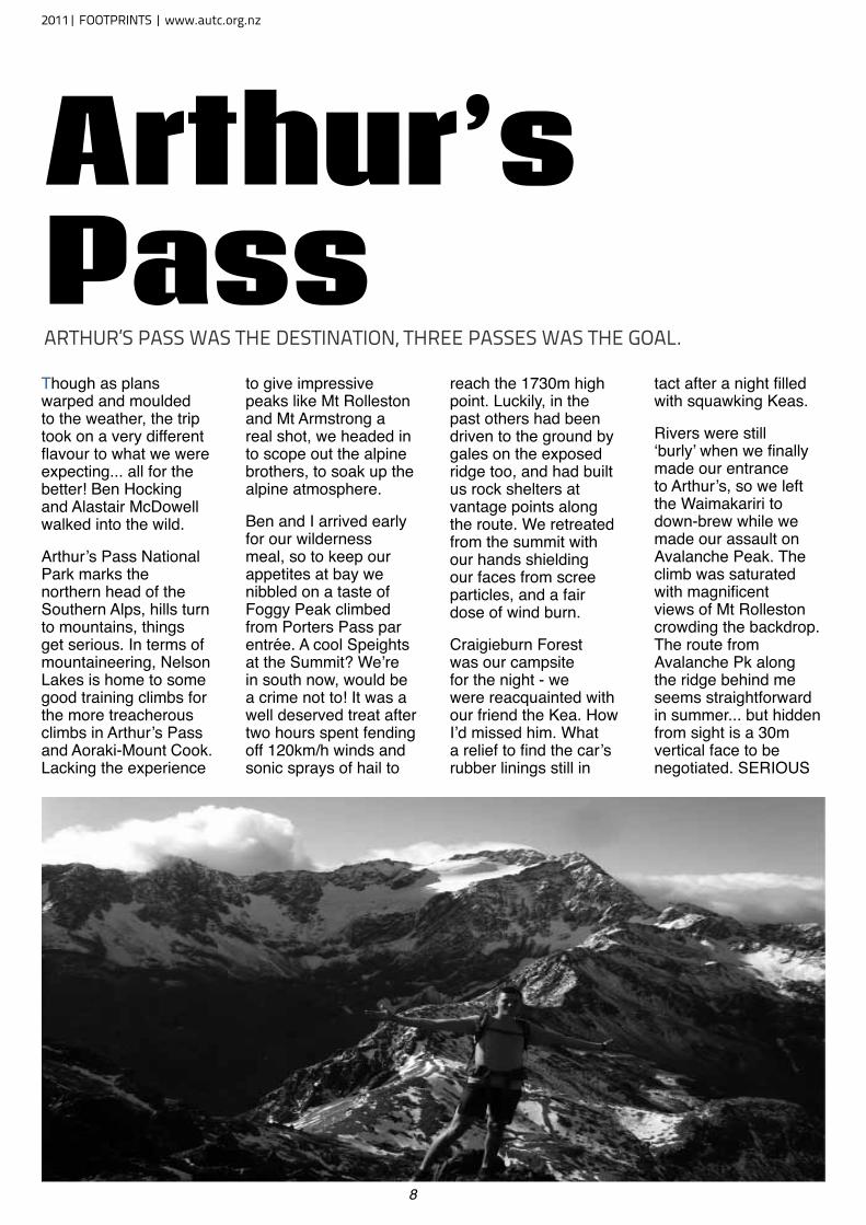
Though as plans warped and moulded to the weather, the trip took on a very different flavour to what we were expecting... all for the better! Ben Hocking and Alastair McDowell walked into the wild.
Arthur’s Pass National Park marks the northern head of the Southern Alps, hills turn to mountains, things get serious. In terms of mountaineering, Nelson Lakes is home to some good training climbs for the more treacherous climbs in Arthur’s Pass and Aoraki-Mount Cook. Lacking the experience
to give impressive peaks like Mt Rolleston and Mt Armstrong a real shot, we headed in to scope out the alpine brothers, to soak up the alpine atmosphere.
Ben and I arrived early for our wilderness meal, so to keep our appetites at bay we nibbled on a taste of Foggy Peak climbed from Porters Pass par entrée. A cool Speights at the Summit? We’re in south now, would be a crime not to! It was a well deserved treat after two hours spent fending off 120km/h winds and sonic sprays of hail to
reach the 1730m high point. Luckily, in the past others had been driven to the ground by gales on the exposed ridge too, and had built us rock shelters at vantage points along the route. We retreated from the summit with our hands shielding our faces from scree particles, and a fair dose of wind burn.
Craigieburn Forest was our campsite for the night - we were reacquainted with our friend the Kea. How I’d missed him. What a relief to find the car’s rubber linings still in
tact after a night filled with squawking Keas.
Rivers were still ‘burly’ when we finally made our entrance to Arthur’s, so we left the Waimakariri to down-brew while we made our assault on Avalanche Peak. The climb was saturated with magnificent views of Mt Rolleston crowding the backdrop. The route from Avalanche Pk along the ridge behind me seems straightforward in summer... but hidden from sight is a 30m vertical face to be negotiated. SERIOUS
Arthur’s PassartHur’S paSS waS tHe deStination, tHree paSSeS waS tHe Goal.
2011| FOOTPRINTS | www.autc.org.nz
9
STUFF.
I was plagued with regret having not brought the tent to spend a night on a tussocky flat section below the peak would have been fabulous. Instead we spent two hours sleeping on the high plateau, dwarfed beneath Mt Rolleston.
By Tuesday the rivers had finally receded, so we tackled the Waimakariri river traverse. The mostly easy going route along the wide glaciated valley flats, but further upstream the river gorged forcing us to cross each of the half dozen braids. We paired up for the wilder torrents, and with Mt Harper and Mt Speight dominating the end of the valley, we successfully made it to Carrington Hut. The hut was filled with hot and sweaty DoC workers, and now 5pm there was no way our day was over just yet...
Considering that it was now 6pm. We were determined not to suffer their same misery - 7 hours in we’d still have to move fast, and stretch the daylight hours to the limit. The route along the rocky White River was almost non existent, and as the darkness closed in the cairns began to blend into the sea of boulders. With dusk came a showcase of colours etched into the cool sky beyond Mt Carrington. Colours morphed, intensified and faded with each weary turn of the head.
All the while, we could see our goal - Barker Hut - neartly perched on the huge rocky buttress at the end of the valley. As we finally neared closer
and began the last climb, our hearts sank. We had reached what would later be infamously referred to as: The Chasm of Doom. Each of the three hanging glaciers above Barker leaked gushing tributary flows into the main White River - the Cahill glacial stream had gouged out a deep chasm now filled with white water.
Our final obstacle, we scoured the banks for a safe place to cross. 9:30pm, night vision weakening, we helped each other across the thigh-deep current, making sure each foot placement was secure - a firm forearm grip,
and Ben pulled me onto land. Our adrenaline was racing now, even though we’d crossed quite safely. Now it really was one big push to top out on the 100m high outcrop - RELIEF. Ben climbed up a few minutes later, and was ecstatic. 10:15pm, almost twelve hours had elapsed when we finally opened the wooden door to Barker Hut.
In the morning we were able to take stock of what a prime location the hut was in. Three high glaciers poured into the gorges flowing around the hut’s rocky foundation. From the hut we eyed up
the four painful hours of river-bashing that had consumed late last night. From the 3-walled toilet, my eyes followed the White Glacier to 2300m, where Mount Murchison - highest in Arthurs Pass - claimed his spot one hundred metres above.
After sleeping off our mountain hangovers, Ben & I set off to explore the route to the base of Murchison. While lunching on a moraine spur, we scoped out the ascent along the leading ridge to Kahutea Col, where snatching a summit would be simple. We made it to the snowline, a rock
dislodged, I sprained a thumb... Sunbathing on the glacier seemed like a far better idea. And so it was. You can’t be epic all the time.
As our final night at Barker Hut dimmed, we watched misty cloud passing over Harman Pass way below, and creeping our Way. Without warning, our screens were blank. Minutes later, the white-out had passed. Hours later the hut rattled furiously and shook at its supports - a fantastic shelter for Cantabrians - the whole night wind powerful as a magnitude
7 earthquake blitzed
Barker to oblivion. For once we were glad to not be in a tent!
Suited up in full weather gear, we braved the return journey with the assurance that we knew the route. Misty rain accumulated, and the rivers rose noticeably, so to cross the Taipoiti we jumped in the ‘Clough Cableway’ keen for a novelty crossing. This ancient piece of machinery was built to remember a 16 year old who had died crossing the raging White river.
Three thick iron cables hung across the 30m wide river, holding a small cart to be manually winched across. It was great flying across the river, the cable whizzing past my face, rain in my face, river gushing way below. Not so great was getting my hand caught between the pulley and wire - if I wasn’t wearing gloves my hand could have been seriously injured. My screams to Ben across the river were drowned out in the rain. Luckily he was tired and released the winch...
Somehow, the return trip still took just shy of 12 hours. Mission and a half! Returning to Nelson along the West Coast completed our deluxe South Island tour. This was Ben’s first real taste of South Island tramping, he bravely pushed himself to his limits, and was hugely satisfied with the trip. There’s so much to do in this huge adventure playground, and we’ll surely be back to claim some summits in the near future!
Alastair McDowell
Reading the hut book warned us of the short yet difficult passage to come... “If you sleep in and start your tramp at 1pm arriving at Carrington by 5pm it would be foolish to
think that you would be able to reach Barker Hut before dark... If you decided to attempt
such an adventure you would most likely find yourself camping just below Barker Hut on a ROCKY outcrop and returning feeling like a LOSER but thankful to be ALIVE. We speak
from experience...”
www.autc.org.nz | FOOTPRINTS |2011
10
Drowning in Dusky
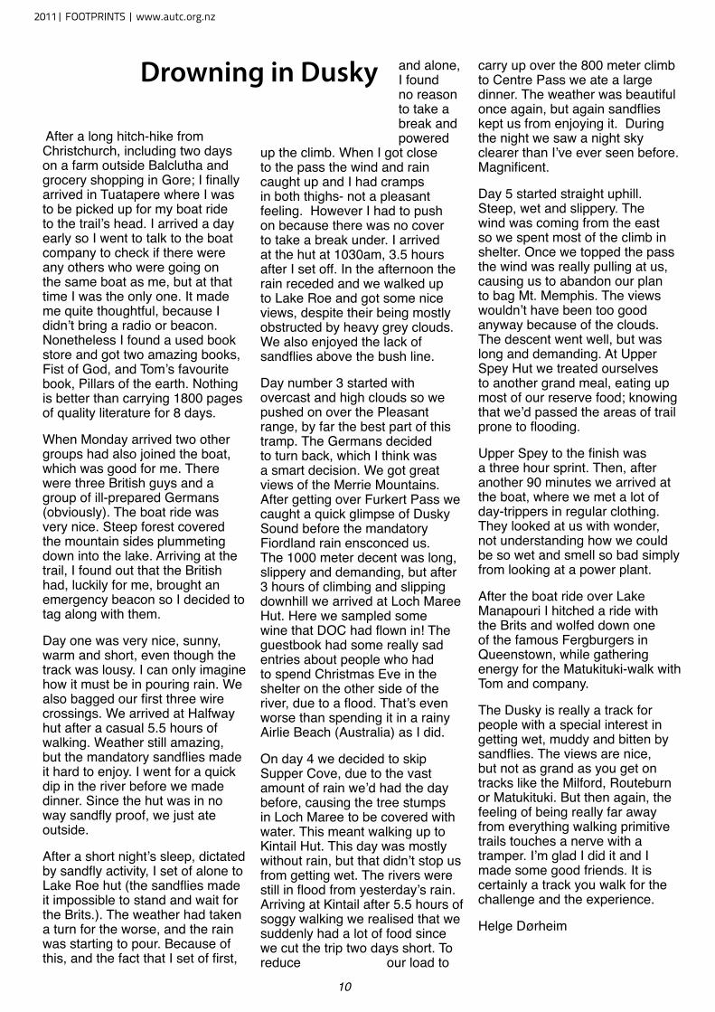
After a long hitch-hike from Christchurch, including two days on a farm outside Balclutha and grocery shopping in Gore; I finally arrived in Tuatapere where I was to be picked up for my boat ride to the trail’s head. I arrived a day early so I went to talk to the boat company to check if there were any others who were going on the same boat as me, but at that time I was the only one. It made me quite thoughtful, because I didn’t bring a radio or beacon. Nonetheless I found a used book store and got two amazing books, Fist of God, and Tom’s favourite book, Pillars of the earth. Nothing is better than carrying 1800 pages of quality literature for 8 days.
When Monday arrived two other groups had also joined the boat, which was good for me. There were three British guys and a group of ill-prepared Germans (obviously). The boat ride was very nice. Steep forest covered the mountain sides plummeting down into the lake. Arriving at the trail, I found out that the British had, luckily for me, brought an emergency beacon so I decided to tag along with them.
Day one was very nice, sunny, warm and short, even though the track was lousy. I can only imagine how it must be in pouring rain. We also bagged our first three wire crossings. We arrived at Halfway hut after a casual 5.5 hours of walking. Weather still amazing, but the mandatory sandflies made it hard to enjoy. I went for a quick dip in the river before we made dinner. Since the hut was in no way sandfly proof, we just ate outside.
After a short night’s sleep, dictated by sandfly activity, I set of alone to Lake Roe hut (the sandflies made it impossible to stand and wait for the Brits.). The weather had taken a turn for the worse, and the rain was starting to pour. Because of this, and the fact that I set of first,
and alone, I found no reason to take a break and powered
up the climb. When I got close to the pass the wind and rain caught up and I had cramps in both thighs- not a pleasant feeling. However I had to push on because there was no cover to take a break under. I arrived at the hut at 1030am, 3.5 hours after I set off. In the afternoon the rain receded and we walked up to Lake Roe and got some nice views, despite their being mostly obstructed by heavy grey clouds. We also enjoyed the lack of sandflies above the bush line.
Day number 3 started with overcast and high clouds so we pushed on over the Pleasant range, by far the best part of this tramp. The Germans decided to turn back, which I think was a smart decision. We got great views of the Merrie Mountains. After getting over Furkert Pass we caught a quick glimpse of Dusky Sound before the mandatory Fiordland rain ensconced us. The 1000 meter decent was long, slippery and demanding, but after 3 hours of climbing and slipping downhill we arrived at Loch Maree Hut. Here we sampled some wine that DOC had flown in! The guestbook had some really sad entries about people who had to spend Christmas Eve in the shelter on the other side of the river, due to a flood. That’s even worse than spending it in a rainy Airlie Beach (Australia) as I did.
On day 4 we decided to skip Supper Cove, due to the vast amount of rain we’d had the day before, causing the tree stumps in Loch Maree to be covered with water. This meant walking up to Kintail Hut. This day was mostly without rain, but that didn’t stop us from getting wet. The rivers were still in flood from yesterday’s rain. Arriving at Kintail after 5.5 hours of soggy walking we realised that we suddenly had a lot of food since we cut the trip two days short. To reduce our load to
carry up over the 800 meter climb to Centre Pass we ate a large dinner. The weather was beautiful once again, but again sandflies kept us from enjoying it. During the night we saw a night sky clearer than I’ve ever seen before. Magnificent.
Day 5 started straight uphill. Steep, wet and slippery. The wind was coming from the east so we spent most of the climb in shelter. Once we topped the pass the wind was really pulling at us, causing us to abandon our plan to bag Mt. Memphis. The views wouldn’t have been too good anyway because of the clouds. The descent went well, but was long and demanding. At Upper Spey Hut we treated ourselves to another grand meal, eating up most of our reserve food; knowing that we’d passed the areas of trail prone to flooding.
Upper Spey to the finish was a three hour sprint. Then, after another 90 minutes we arrived at the boat, where we met a lot of day-trippers in regular clothing. They looked at us with wonder, not understanding how we could be so wet and smell so bad simply from looking at a power plant.
After the boat ride over Lake Manapouri I hitched a ride with the Brits and wolfed down one of the famous Fergburgers in Queenstown, while gathering energy for the Matukituki-walk with Tom and company.
The Dusky is really a track for people with a special interest in getting wet, muddy and bitten by sandflies. The views are nice, but not as grand as you get on tracks like the Milford, Routeburn or Matukituki. But then again, the feeling of being really far away from everything walking primitive trails touches a nerve with a tramper. I’m glad I did it and I made some good friends. It is certainly a track you walk for the challenge and the experience.
Helge Dørheim
2011| FOOTPRINTS | www.autc.org.nz
11
“Sam” was alone. Below him was 800m down to the black rock moraine of the Godley Glacier and, above him was 1.5km
of vertical whiteness up to Mount Sefton. To the left were the huge ice cliffs that guarded the south-east flanks of the Sierra Range. To the right were the terraced basins that each year were slowly eroding away to nothing. The wind was a gale, but that was not a deterrent; the sun was out, and his focus was on a new variant of the eastern approach to Sefton.
“Creeeashhh”. A two tonne bit of ice detached from the ice cliffs of Mount Sefton and headed to the valley floor. Flicking his day bag over his shoulder and grabbing his two ice climbing axe, Sam set off. Adrenalin pumped through his veins: it was him and the climb. He was strong, and he kept on going up. 50m from the summit, when negotiating a bit of vertical ice he decided to put the rope on for the summit pitch. 40m to go, 30m to go, 20m to go . . . “Creeeashhh!”
“Arghhhh!”
An ice bolder smacked Sam square in the face. He hung limp in his harness, blood poured from his cheek and his eye, the deafening wind rattled his bones. In not too long a time, his harness would cut the blood supply to his legs, and he would lose them. Soon after that, if the minus five degree temperatures and minus twenty wind chill did not get him first, he would be dead. Slowly, he regained consciousness. He could hardly see out of his right eye, but the wind numbed his face and he could not feel the rest of the damage. “Not far to go,” he thought, and he climbed in a half-conscious state to the summit.
The easiest way down was north to Welcome Pass and Scott’s Creek. Putting the rope away, he trudged the 45⁰ ice slope to the pass for four hours.
He could not find the Pass. “This was an easy way down,” he thought. “The pass and the way should be obvious”. Admitting defeat, he found an ice pillar to shelter him from the wind and, after eating a few muesli bars and some chocolate, he went to sleep. 15 degrees, 70km per hour winds. Sleep tight.
At about 2am, too cold to sleep, he headed back up Sefton, and along the ridge towards Copland Pass. The ridge was graded more difficultly than anything he had done so far. It was razor sharp and covered in sharp rocky spikes that blocked his travel; if he grabbed a piece of rock, it would likely break off in his hand. Some sections were like walking a tight rope . . . On a fraying rope . . . In a gale. It took about 18 hours to complete the 5km of ridge travel. Upon arriving at Copland Pass, he headed west. Why west, when his gear and food was east, who knows? Eight hours later, and now down to his last half a muesli bar, he arrived at Douglas Rock Hut. Finding nothing to eat but three 20kg bags of cement, he decided to harden up and keep on walking. Four hours later, at 3am, he was at a two-storey tourist hut known as Welcome Flat. The tourists did not appreciate being woken by a man whose eye was blacker than night, and face more swollen than the standard house cat. Three hunters eventually took pity on Sam, and gave him some food.
The next morning, they escorted him out of the hut and down the seven hour flat track. This was when we met Sam, walking slowly, his face swollen, his feet badly blistered in boots equivalent to ski boots. But most impressively of all, four 60cm antlers were stuck out of the back of his pack, all from one very large dear head.
Sam forced a smile and boasted to us “I did the traverse”.
Less than one week later, Sam had made his way back round to Mount Cook Village and, despite the pleas from the alpine guides, summitted Mount Cook on his own. This brought the number of alpine trips he had done to a grand total of three.
Retold to Anton Gulley and Andy Thompson
Copland Vallley, November 2011
The Tale of a Mad Australian.
Andy Thompson and Anton
spent some time in the
Copland Valley, relaxing in
hot pools and not climbing;
they meet “Sam” and told
them this story.
www.autc.org.nz | FOOTPRINTS |2011
12
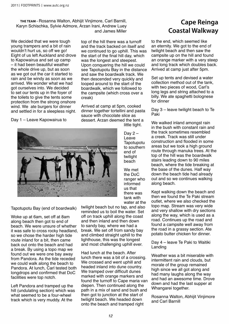
We decided that we were tough young trampers and a bit of rain wouldn’t hurt us, so off we go! Eight of us left Auckland and drove to Kapowairua and set up camp – it had been beautiful weather the whole drive up, but as soon as we got out the car it started to rain and be windy as soon as we arrived. We wonder what we had got ourselves into. We decided to set our tents up in the foyer of the toilets to give the tents some protection from the strong onshore wind. We ate burgers for dinner and settled in for a sleepless night.
Day 1 – Leave Kapowairua to
Tapotupotu Bay (end of boardwalk)
Woke up at 6am, set off at 8am along beach then got to end of beach. We were unsure of whether it was safe to cross rocky headland, so we chose the harder high tide route inland for a bit, then came back out onto the beach and had a break. By using a topo map we found out we were one bay away from Pandora. As the tide receded we could walk along the beach to Pandora. At lunch, Carl tested both longdrops and confirmed that DoC facilities were top notch.
Left Pandora and tramped up the hill (undulating section) which was what seemed to be a four-wheel track which is very muddy. At the
top of the hill there was a turnoff and the track backed on itself and we continued to go uphill. This was the start of the final hill day, which was the longest and steepest. Upon conquering the hill we could see Tapotupotu Bay in the distance and saw the boardwalk track. We then descended very quickly and looped around to the start of the boardwalk, which we followed to the campsite (which cross over a creak)
Arrived at camp at 5pm, cooked dinner together tortellini and pasta sauce with chocolate slice as dessert. Arzan deemed the tent a
little tight.
Day 2 – Leave Tapotupotu to southern end of twilight beach
We met the DoC ranger who informed us that there was tank with water at the
twilight beach but no tap, and also reminded us to boil the water. Set off on track uphill along the coast and then inland and then down to sandy bay, where we had a break. We set off from sandy bay and climbed straight uphill to the lighthouse, this was the longest and most challenging uphill ever.
Had lunch at the beach. After lunch there was a bit of a crossing. We crossed and went uphill and headed inland into dune country. We tramped over difficult dunes marked with orange markers and found the turnoff to Cape maria van diepen. Then continued along the path in a mix of sand and bush and then got to junction at the start of twilight beach. We headed down onto the beach and tramped right
to the end, which seemed like an eternity. We got to the end of twilight beach and then saw the campsite up on the hill and found an orange marker with a very steep and long track which doubles back. Arrived at camp just after 5pm.
Set up tents and devised a water collection method out of the tank, with two pieces of wood, Carl’s long legs and string attached to a billy. We ate spaghetti bolognese for dinner
Day 3 – leave twilight beach to Te Paki
We walked inland amongst rain in the bush with constant rain and the track sometimes resembled a creek. Track was still under construction and flooded in some areas but we took a high ground route through manuka trees. At the top of the hill was the boardwalk stairs leading down to 90 miles beach, where the tide breaking at the base of the dunes. Half way down the beach tide had already out and so we continues walking along beach.
Kept walking down the beach and then we found the Te Paki stream outlet, where we also checked the topo map. Stream was very wide and very shallow with dry sections along the way, which is used as a road. Continues up the road and found a campsite well away from the road in a grassy section. Ate potato butter chicken for dinner.
Day 4 – leave Te Paki to Waitiki Landing
Weather was a bit miserable with intermittent rain and clouds, but morale of the group remained high since we all got along and had many laughs along the way and had an awesome time. Drove down and had the last supper at Whangarei together.
Rosanna Walton, Abhijit Vinjimore and Carl Barnill
Cape Reinga Coastal Walkway
The Team – Rosanna Walton, Abhijit Vinjimore, Carl Barnill, Karyn Schischka, Sylvie Admore, Arzan Irani, Andrew Luey
and James Miller
2011| FOOTPRINTS | www.autc.org.nz
13
Ever since its creation in January 2010 my friend Timothy Burrell and I shared a dream of running the 77km Hillary Trail through Auckland’s Waitakere Ranges from Arataki and Muriwai.
One morning earlier this year, seven of us took that dream, gave it a cold hard stare… and ran off into the damn.
From the Arataki Visitor Centre, a series of iconic Waitakere tracks led us to Huia; muddy, rooty and rugged. This was a perfect warm-up for the meaty 400m ascent of the infamous Karamatura Track.
With anticipation of our favourite stretch in all the Waitakeres, we galloped along the Puriri Ridge Track towards Whatipu. Every so often we stopped to breathe in the gorgeous views, before forcing our eyes on the trail to negotiate the rocky descent.
By the time we reached the highest peak overlooking Whatipu, over three hours had passed. Refilling our hydration packs, we loaded them with electrolytes and chugged on towards Parahaha. Approaching noon and starting to swelter under the sun’s blaze, we were grateful for the natural shelter of coastal forest.
Normally three hours would be enough for a decent Sunday morning run, but today were barely quarter way through. As tough as ultra distance as ultra distance runs are physically, its just as important to adjust your mental perspective of distance and time otherwise the mind would be the first fuse to blow. Thinking about the finish way too early during a big day like this often my downhill, so today I ticked off
each beach as a chain of smaller finish lines.
Our general strategy was to be conservative in the first half. But that plan was put aside on the fabulously flowing-down hills into Parahaha. Letting gravity do the work, I did my best to imitate the Tarahumara Indian runners celebrated in Christopher McDougall’s Born to Run, and just hung on for the ride to arrive to Karekare feeling exhilarated and refreshed, rather than broken and stiff.
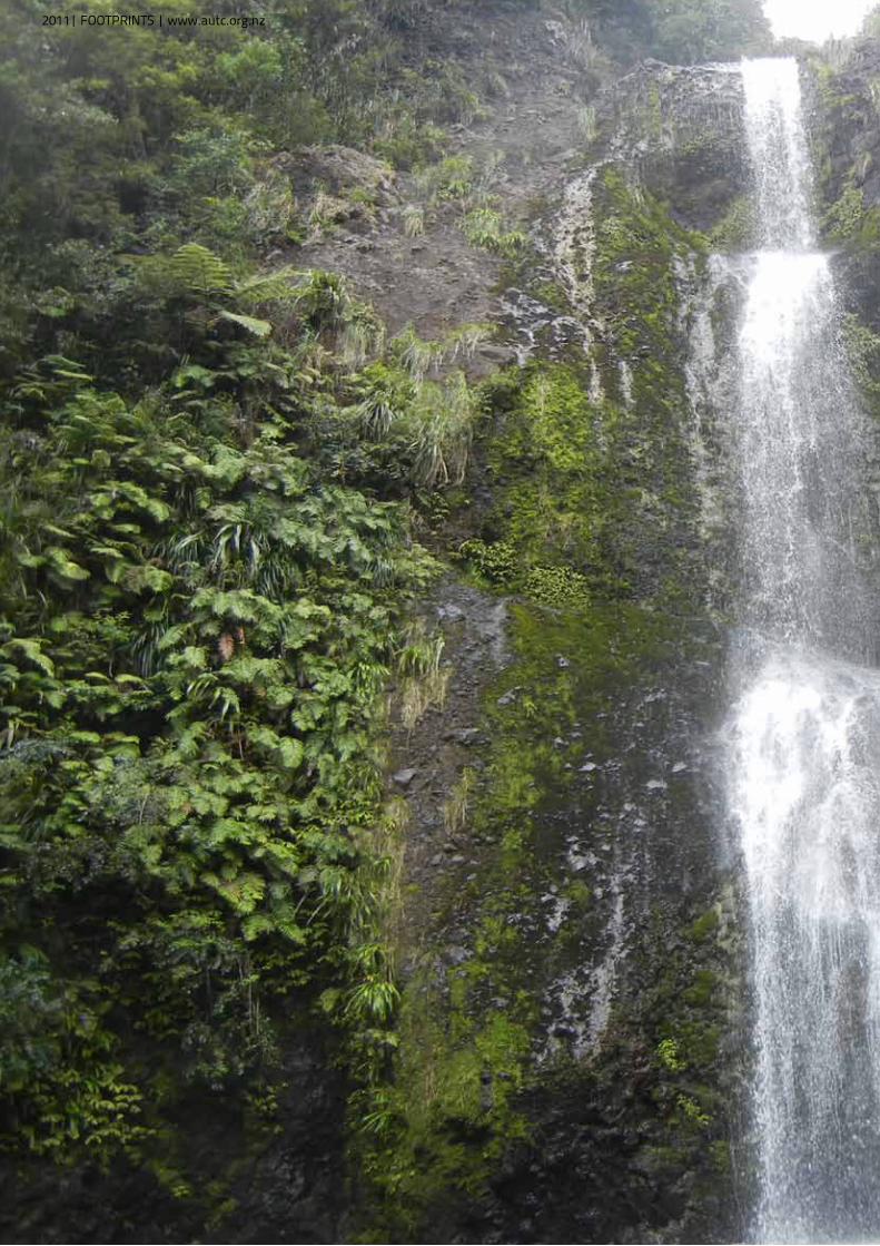
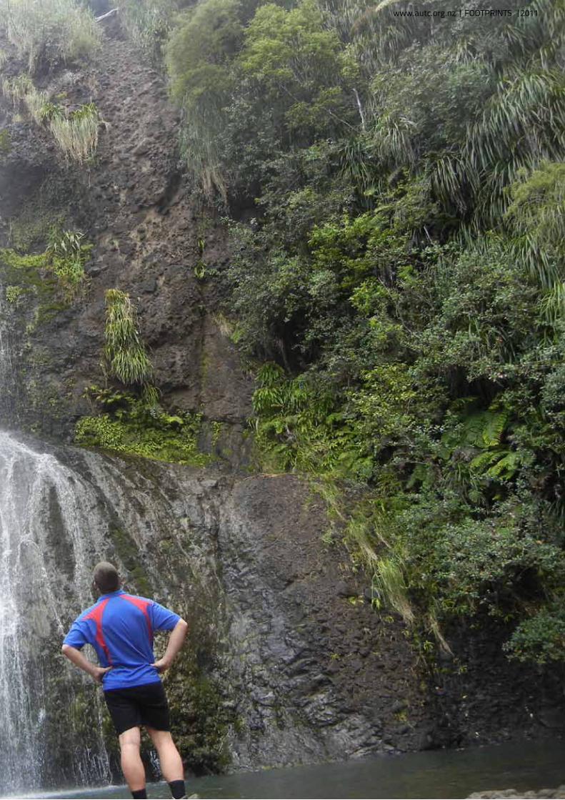
There is short section of road before dropping down into Piha via some nicely groomed tracks. Peppered with dense network of tracks, Piha is a popular sport for day walkers, especially in summer. Sure enough, the pool at the base of the Kitekite Falls (Waitakeres’ highest at 80m) was packed with picnickers, but we didn’t hesitate diving headfirst into the water to wash off miles out of tiring legs and emerging feeling fresher than when we started.
With just over a marathon under our belts, we made the most of our belts, we made the most of our Piha lunch break. The running time 7.5hr compared to three hours for a road marathon, reflects the difficulty of the terrain. When running the Hillary Trail, be prepared to cover between 5-8km an hour.
The climb out of Piha is steep, but rewarded with spectacular views of secular views of secluded bays trapped by sheer hillsides. Further north, we were in awe of the sand dunes
– sharp, rippling slopes towering about Lake Wainamu. Hill-reps to save another day, we thought.
We followed the stream towards Bethels Beach and the start of Te Henga Trail, which is the final stretch in the Hillary Trail. More than 60km through, blisters and chafing began to take to take a toll. But a last rendezvous with our support crew set us up for the final grind.
‘Stunning’ is an apt description for this high coastal trail. Winding its way around the coastline, waves surged and crashed against the
rocks below and before long the gannet colonies of Muriwai were within sight.
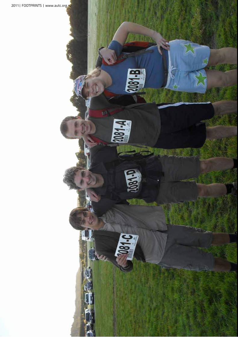
The Hillary Trail – running it or tramping it – is an ambition undertaking, but a great achievement. For seven endurance junkies it as a challenge we felt privileged to complete; a real adventure in the name of our greater adventurer.
Clocking in at 77km, fit runners can get through it in a day, whiles trampers can expect four days with three nights camping. Auckland has long deserved a great mulit-day trail of its own, so before travelling to the Kepler, Milford or Heaphy, check out the Hillary Trail and ‘knock the bastard off’.
“Fit runner can get through it in a day while trampers can expect to take four days”
Running Hillary Trail Auckland’s only multi-day track makes an epic trail run, writes Alastair McDowell
www.autc.org.nz | FOOTPRINTS |2011
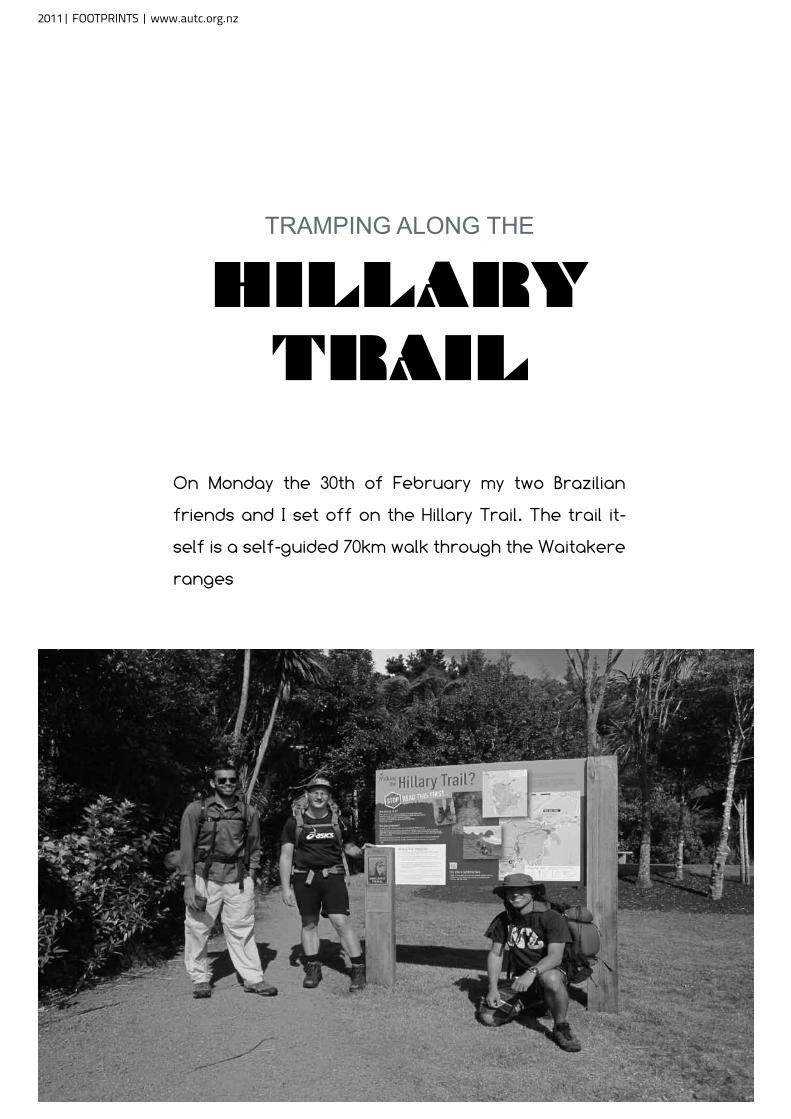
TRAMPING ALONG THE
HILLARY TRAIL
On Monday the 30th of February my two Brazilian
friends and I set off on the Hillary Trail. The trail it-
self is a self-guided 70km walk through the Waitakere
ranges
2011| FOOTPRINTS | www.autc.org.nz
The Hillary Trail is designed to show many different types of terrain. Including climbing, beach walking, scrambling, river crossing, beach walking, waterfalls, and cliff top walking to name a few.
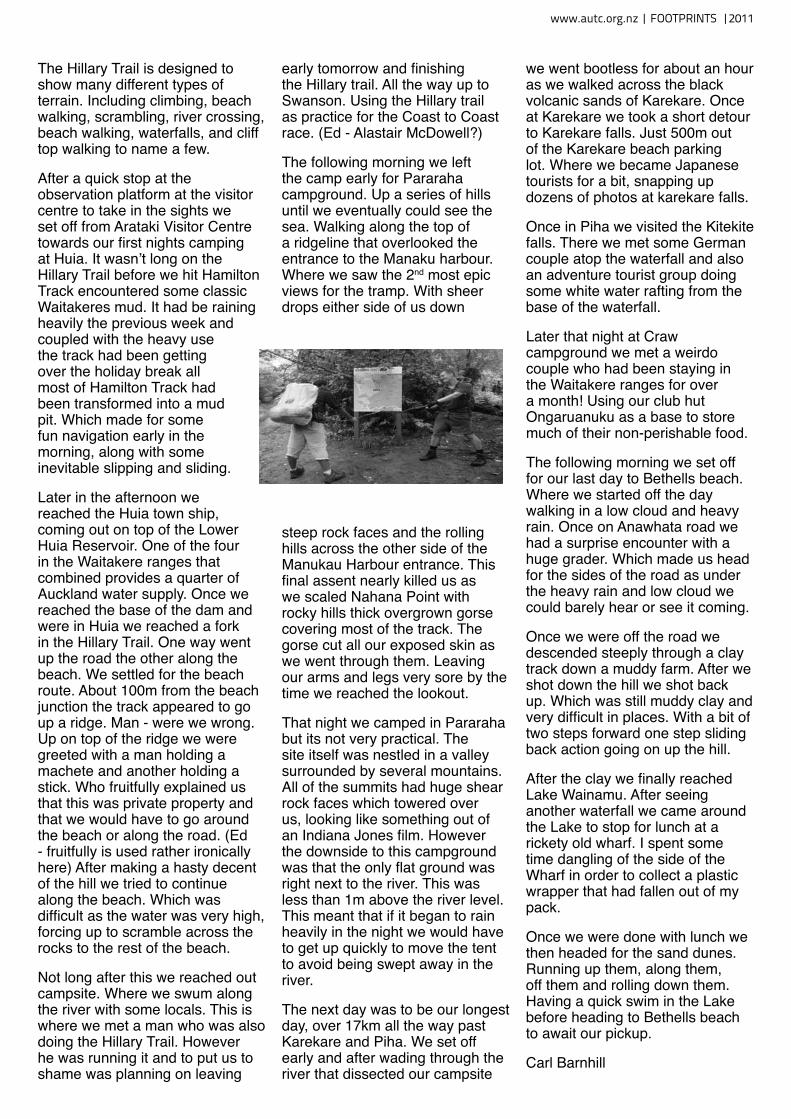
After a quick stop at the observation platform at the visitor centre to take in the sights we set off from Arataki Visitor Centre towards our first nights camping at Huia. It wasn’t long on the Hillary Trail before we hit Hamilton Track encountered some classic Waitakeres mud. It had be raining heavily the previous week and coupled with the heavy use the track had been getting over the holiday break all most of Hamilton Track had been transformed into a mud pit. Which made for some fun navigation early in the morning, along with some inevitable slipping and sliding.
Later in the afternoon we reached the Huia town ship, coming out on top of the Lower Huia Reservoir. One of the four in the Waitakere ranges that combined provides a quarter of Auckland water supply. Once we reached the base of the dam and were in Huia we reached a fork in the Hillary Trail. One way went up the road the other along the beach. We settled for the beach route. About 100m from the beach junction the track appeared to go up a ridge. Man - were we wrong. Up on top of the ridge we were greeted with a man holding a machete and another holding a stick. Who fruitfully explained us that this was private property and that we would have to go around the beach or along the road. (Ed - fruitfully is used rather ironically here) After making a hasty decent of the hill we tried to continue along the beach. Which was difficult as the water was very high, forcing up to scramble across the rocks to the rest of the beach.
Not long after this we reached out campsite. Where we swum along the river with some locals. This is where we met a man who was also doing the Hillary Trail. However he was running it and to put us to shame was planning on leaving
early tomorrow and finishing the Hillary trail. All the way up to Swanson. Using the Hillary trail as practice for the Coast to Coast race. (Ed - Alastair McDowell?)
The following morning we left the camp early for Pararaha campground. Up a series of hills until we eventually could see the sea. Walking along the top of a ridgeline that overlooked the entrance to the Manaku harbour. Where we saw the 2nd most epic views for the tramp. With sheer drops either side of us down
steep rock faces and the rolling hills across the other side of the Manukau Harbour entrance. This final assent nearly killed us as we scaled Nahana Point with rocky hills thick overgrown gorse covering most of the track. The gorse cut all our exposed skin as we went through them. Leaving our arms and legs very sore by the time we reached the lookout.
That night we camped in Pararaha but its not very practical. The site itself was nestled in a valley surrounded by several mountains. All of the summits had huge shear rock faces which towered over us, looking like something out of an Indiana Jones film. However the downside to this campground was that the only flat ground was right next to the river. This was less than 1m above the river level. This meant that if it began to rain heavily in the night we would have to get up quickly to move the tent to avoid being swept away in the river.
The next day was to be our longest day, over 17km all the way past Karekare and Piha. We set off early and after wading through the river that dissected our campsite
we went bootless for about an hour as we walked across the black volcanic sands of Karekare. Once at Karekare we took a short detour to Karekare falls. Just 500m out of the Karekare beach parking lot. Where we became Japanese tourists for a bit, snapping up dozens of photos at karekare falls.
Once in Piha we visited the Kitekite falls. There we met some German couple atop the waterfall and also an adventure tourist group doing some white water rafting from the base of the waterfall.
Later that night at Craw campground we met a weirdo couple who had been staying in the Waitakere ranges for over a month! Using our club hut Ongaruanuku as a base to store much of their non-perishable food.
The following morning we set off for our last day to Bethells beach. Where we started off the day walking in a low cloud and heavy rain. Once on Anawhata road we had a surprise encounter with a huge grader. Which made us head for the sides of the road as under the heavy rain and low cloud we could barely hear or see it coming.
Once we were off the road we descended steeply through a clay track down a muddy farm. After we shot down the hill we shot back up. Which was still muddy clay and very difficult in places. With a bit of two steps forward one step sliding back action going on up the hill.
After the clay we finally reached Lake Wainamu. After seeing another waterfall we came around the Lake to stop for lunch at a rickety old wharf. I spent some time dangling of the side of the Wharf in order to collect a plastic wrapper that had fallen out of my pack.
Once we were done with lunch we then headed for the sand dunes. Running up them, along them, off them and rolling down them. Having a quick swim in the Lake before heading to Bethells beach to await our pickup.
Carl Barnhill
www.autc.org.nz | FOOTPRINTS |2011
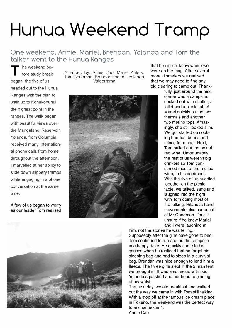
T he weekend be-fore study break
began, the five of us headed out to the Hunua Ranges with the plan to walk up to Kohukohunui, the highest point in the ranges. The walk began with beautiful views over the Mangatangi Reservoir. Yolanda, from Columbia, received many internation-al phone calls from home throughout the afternoon. I marvelled at her ability to slide down slippery tramps while engaging in a phone conversation at the same time.
A few of us began to worry as our leader Tom realised
that he did not know where we were on the map. After several more kilometers we realised that we may need to find any old clearing to camp out. Thank-
fully, just around the next corner was a campsite, decked out with shelter, a toilet and a picnic table! Mariel quickly put on two thermals and another two merino tops. Amaz-ingly, she still looked slim. We got started on cook-ing burritos, beans and mince for dinner. Next, Tom pulled out the box of red wine. Unfortunately, the rest of us weren’t big drinkers so Tom con-sumed most of the mulled wine, to his detriment. With the five of us huddled together on the picnic table, we talked, sang and laughed into the night, with Tom doing most of the talking. Hilarious hand movements also came out of Mr Goodman. I’m still unsure if he knew Mariel and I were laughing at
him, not the stories he was telling.Supposedly after the girls have gone to bed, Tom continued to run around the campsite in a happy daze. He quickly came to his senses when he realised that he forgot his sleeping bag and had to sleep in a survival bag. Brendan was nice enough to lend him a fleece. The three girls slept in the 2 man tent we brought in. It was a squeeze, with poor Yolanda squashed and her head beginning at my waist. The next day, we ate breakfast and walked out the way we came in with Tom still talking. With a stop off at the famous ice cream place in Pokeno, the weekend was the perfect way to end semester 1. Annie Cao
Attended by: Annie Cao, Mariel Ahlers, Tom Goodman, Brendan Feather, Yolanda
Valderrama
Hunua Weekend Tramp One weekend, Annie, Mariel, Brendan, Yolanda and Tom the talker went to the Hunua Ranges

Those who participated (in various states of sobriety and undress): Harry Aitken, Bruce Ait-
ken, Anton Gulley, Rion Gulley, Bruce Gulley, Andy Baddeley, Craig Smith, Kathleen Collier, Pe-
ter Luk, Nico Thorburn, Tom Goodman, Richard Greatrex,
Jen Waite, Charis Wong, Christina Fullerton, Rosanna
Walton, Fiona Walton, Jane Dudley, Michael McLeod, Car-
oline du Preez, Stephen Alley, probably quite a few others.
W e decided that the fireplace needed to come out and be replaced by an inter-nal one (which would ideally yield
some warmth). This necessitated the demolition of the old brick chimney, and tearing out and replacing much of the back wall. As might be imagined, it also necessitated absolutely absurd amounts of tolerance on the part of everybody present, as a minimum of six engineers ar-gued for hours at a time about how to smash down a wall. (Ed - LOL) It was pretty sad to see the old fireplace come down, as it’s been there for an awful long time, and was bloody solidly built. We still have the bits of wood though. (If anyone’s interested in, say, carving them into some wicked cool totem poles, I think Harry would like to be in touch)
Apart from the actual destruction (mostly carried out with somewhat indecent enthusiasm by Anton and Andy), lots of other people did lots of other very useful things
which were much appreciated. A shiny new kitchen bench was put in,
and very tastefully varnished. The old window frames were pulled apart, reconstructed where necessary and re-painted. Flashing was added down all the corners (cut far too accurately, thanks to Mr. Aitken’s amazing battery-powered circular saw). Most of the hut and the new toilet block were creosoted, thanks to sterling work by a variety of dubious looking characters in boiler suits. Some track work was done, some spring cleaning was done, I think Richard may have played around with the drains a bit, and I’m pretty sure someone cleared the cupboard of its usual detritus of dead rats. Some attempt was even made at stapling building paper under the floor for insulation, which mostly just resulted in Rion and me getting covered head to toe in muck and spiderwebs.
Major thanks must go to the following: Hut Officer Harry for getting the ball rolling (and for his piss-poor effort at cutting a bevelled skirting board for the fireplace); Harry’s Dad Bruce for being our technical advisor, and for restraining his laughter and mockery to a level which could still be interpreted as respectful; Anton for his efforts at co-ordinating, and for looking amazing in a pair of fake breasts; Mr and Mrs Gulley for their generous assistance and donations of food; Andy and Peter for finally getting the chimney up and finished over at least three different weekends. Harry is awesome, and his Dad is even cooler.
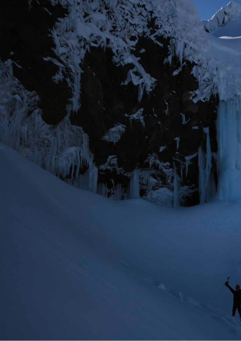
Hut Working
Bee
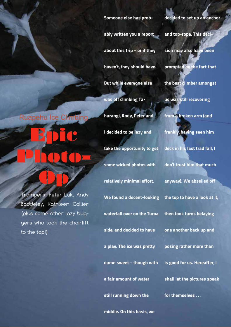
Someone else has prob-
ably written you a report
about this trip – or if they
haven’t, they should have.
But while everyone else
was off climbing Ta-
hurangi, Andy, Peter and
I decided to be lazy and
take the opportunity to get
some wicked photos with
relatively minimal effort.
We found a decent-looking
waterfall over on the Turoa
side, and decided to have
a play. The ice was pretty
damn sweet – though with
a fair amount of water
still running down the
middle. On this basis, we
decided to set up an anchor
and top-rope. This deci-
sion may also have been
prompted by the fact that
the best climber amongst
us was still recovering
from a broken arm (and
frankly, having seen him
deck in his last trad fall, I
don’t trust him that much
anyway). We abseiled off
the top to have a look at it,
then took turns belaying
one another back up and
posing rather more than
is good for us. Hereafter, I
shall let the pictures speak
for themselves . . .
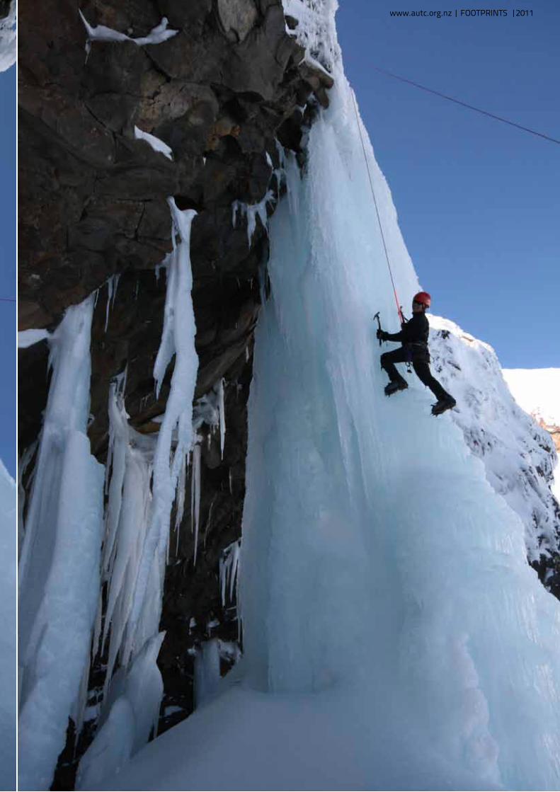
Ruapehu Ice Climbing
Epic Photo-
OpTrampers: Peter Luk, Andy
Baddeley, Kathleen Collier
(plus some other lazy bug-
gers who took the chairlift
to the top!)
19
www.autc.org.nz | FOOTPRINTS |2011
20
2011| FOOTPRINTS | www.autc.org.nz
21
www.autc.org.nz | FOOTPRINTS |2011
22
2011| FOOTPRINTS | www.autc.org.nz
23
www.autc.org.nz | FOOTPRINTS |2011

24
2011| FOOTPRINTS | www.autc.org.nz
25
www.autc.org.nz | FOOTPRINTS |2011
26
2011| FOOTPRINTS | www.autc.org.nz

27
www.autc.org.nz | FOOTPRINTS |2011
The Kold: Hannah Norton, Lois Cooper, Joseline Canio
The Krazy: Thomas Goodman, Alastair McDowell
The Konstipated: Aidan Thorp (here because he is immune to cold and is far too sensible to be lumped with Alastair and Tom)
H aving been up Tongariro, Ngaruhoe and Ruapehu during the 2011 winter season, the
time was ripe (or so I felt) to knock off the last of the four North Island peaks- Taranaki. Throw in a visit to Syme Hut, and you’re on!
After a year of almost perfect weather, it was never
going to last, and in the week leading up to the trip, metservice and metvuw were not looking promising. Meanwhile, Alastair, for reasons best known to himself, was putting his faith in a previously unknown ‘mountain forecast’ website, with its predictions of sunny weather, low winds, and a summit for sure.
Finally, on Friday morning, all three websites showed the same forecast. The weather was going to be rubbish.
“Run to the east!” we said, and a last minute trip to the Kaimanawa Ranges was jacked up. Sheltered by his older brothers, Ngaruhoe and Tongariro, we would escape the worst of Taranaki’s rain dance. Up at 4am and out of town by 6am (a time that, frankly, I’m amazed I managed to convince the others to be awake for), we arrived at the gateway to the
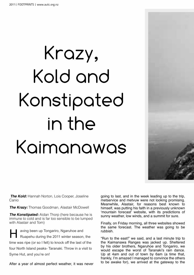
Krazy, Kold and
Konstipated in the
Kaimanawas
2011| FOOTPRINTS | www.autc.org.nz

Umakarikari mountain range fuelled up on day-old bread from Tokoroa bakery.
The cautious advice of DoC in Turangi –“Did we realise it might be cold up in the Kaimanawas?” – caused a certain degree of bemusement in some members of the party. The following recommendation that we venture up Tongariro instead left us all slightly bewildered. Perhaps it was because I kept my mouth shut, but we were able to convince them that we weren’t entirely unprepared, and off we went to meet Lois at “the intersection of the roads to Ohakune, National Park, and Turangi!” Helpful.
After meeting up with Lois and delivering a bike, our next task was navigating a maze of roads to the carpark. With four people and packs in the car, off-roading took on a whole new meaning; winces of pain
were issuing from the back seat and the undercarriage almost in unison, a harmony of agony.
Once our fearless leader had packed, and re-packed his pack, we began the 500m ascent to the bushline. The views weren’t as impressive as we’d hoped, but it was an opportunity to down a seriously unhealthy amount of chocolate.
From there we picked our way across the range towards Sharp Cone. The sparse, rolling ridge-line snaked along into the cloud and out of sight. The blustery wind gave the place character; this was wild country. Meanwhile, the high winds gave Aidan and Alastair a chance to unfurl their true colours; flying their All Blacks flags from their packs on the summit of Umakarikari, proud to be Kiwis.
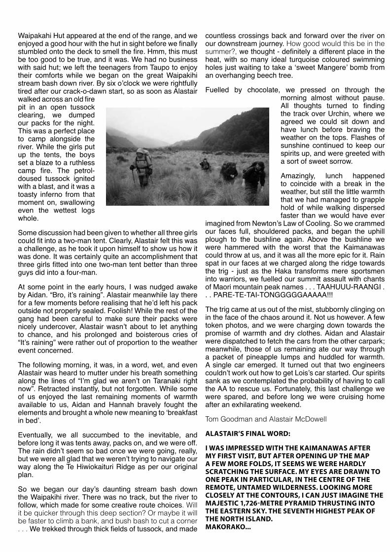
Waipakahi Hut appeared at the end of the range, and we enjoyed a good hour with the hut in sight before we finally stumbled onto the deck to smell the fire. Hmm, this must be too good to be true, and it was. We had no business with said hut; we left the teenagers from Taupo to enjoy their comforts while we began on the great Waipakihi stream bash down river. By six o’clock we were rightfully tired after our crack-o-dawn start, so as soon as Alastair walked across an old fire pit in an open tussock clearing, we dumped our packs for the night. This was a perfect place to camp alongside the river. While the girls put up the tents, the boys set a blaze to a ruthless camp fire. The petrol-doused tussock ignited with a blast, and it was a toasty inferno from that moment on, swallowing even the wettest logs whole.
Some discussion had been given to whether all three girls could fit into a two-man tent. Clearly, Alastair felt this was a challenge, as he took it upon himself to show us how it was done. It was certainly quite an accomplishment that three girls fitted into one two-man tent better than three guys did into a four-man.
At some point in the early hours, I was nudged awake by Aidan. “Bro, it’s raining”. Alastair meanwhile lay there for a few moments before realising that he’d left his pack outside not properly sealed. Foolish! While the rest of the gang had been careful to make sure their packs were nicely undercover, Alastair wasn’t about to let anything to chance, and his prolonged and boisterous cries of “It’s raining” were rather out of proportion to the weather event concerned.
The following morning, it was, in a word, wet, and even Alastair was heard to mutter under his breath something along the lines of “I’m glad we aren’t on Taranaki right now”. Retracted instantly, but not forgotten. While some of us enjoyed the last remaining moments of warmth available to us, Aidan and Hannah bravely fought the elements and brought a whole new meaning to ‘breakfast in bed’.
Eventually, we all succumbed to the inevitable, and before long it was tents away, packs on, and we were off. The rain didn’t seem so bad once we were going, really, but we were all glad that we weren’t trying to navigate our way along the Te Hiwiokaituri Ridge as per our original plan.
So we began our day’s daunting stream bash down the Waipakihi river. There was no track, but the river to follow, which made for some creative route choices. Will it be quicker through this deep section? Or maybe it will be faster to climb a bank, and bush bash to cut a corner . . . We trekked through thick fields of tussock, and made
countless crossings back and forward over the river on our downstream journey. How good would this be in the summer?, we thought - definitely a different place in the heat, with so many ideal turquoise coloured swimming holes just waiting to take a ‘sweet Mangere’ bomb from an overhanging beech tree.
Fuelled by chocolate, we pressed on through the morning almost without pause. All thoughts turned to finding the track over Urchin, where we agreed we could sit down and have lunch before braving the weather on the tops. Flashes of sunshine continued to keep our spirits up, and were greeted with a sort of sweet sorrow.
Amazingly, lunch happened to coincide with a break in the weather, but still the little warmth that we had managed to grapple hold of while walking dispersed faster than we would have ever
imagined from Newton’s Law of Cooling. So we crammed our faces full, shouldered packs, and began the uphill plough to the bushline again. Above the bushline we were hammered with the worst that the Kaimanawas could throw at us, and it was all the more epic for it. Rain spat in our faces at we charged along the ridge towards the trig - just as the Haka transforms mere sportsmen into warriors, we fuelled our summit assault with chants of Maori mountain peak names . . . TAAHUUU-RAANGI . . . PARE-TE-TAI-TONGGGGGAAAAA!!!
The trig came at us out of the mist, stubbornly clinging on in the face of the chaos around it. Not us however. A few token photos, and we were charging down towards the promise of warmth and dry clothes. Aidan and Alastair were dispatched to fetch the cars from the other carpark; meanwhile, those of us remaining ate our way through a packet of pineapple lumps and huddled for warmth. A single car emerged. It turned out that two engineers couldn’t work out how to get Lois’s car started. Our spirits sank as we contemplated the probability of having to call the AA to rescue us. Fortunately, this last challenge we were spared, and before long we were cruising home after an exhilarating weekend.
Tom Goodman and Alastair McDowell
aLasTair’s finaL wOrD:
i was imPresseD wiTh The Kaimanawas afTer my firsT visiT, BuT afTer OPening uP The maP a few mOre fOLDs, iT seems we were harDLy sCraTChing The surfaCe. my eyes are Drawn TO One PeaK in ParTiCuLar, in The CenTre Of The remOTe, unTameD wiLDerness. LOOKing mOre CLOseLy aT The COnTOurs, i Can JusT imagine The maJesTiC 1,726-meTre PyramiD ThrusTing inTO The easTern sKy. The sevenTh highesT PeaK Of The nOrTh isLanD. maKOraKO...
trip down tHe manGatawHiri GorGe
The following are the stalwarts who braved the terrors of the Mangatawhiri gorge: Cecil Segedin, Cam Reid, Don Mackenzie, Alan Murphy, Graham Noonan, and Jimmy Pendergrast
Friday night was as wet and black as possible, but it did not deter the party from catching the Papakura trains (I say trains as the leader and Don missed the first train and gave the rest of the party a miserable hour’s wait on the Papakura station). However once the party assembled, packs was soon shouldered (groans) and the six stepped out into the inky wetness
The trip to Hunua Falls, although all road work, did not seem so bad at night, and at about 1.30 a.m. the party arrived at the camping spot, about 20 yards from the falls.
It takes a high degree of skill to get into a sleeping bag whilst rain pours down in torrents. The best way seems to be the following:
Discard all clothes
Quickly grab a towel and wriggle into sleeping bag.
There attempt to dry yourself with mentioned towel.
Body heat and the absorbent qualities of the bag and a blanket will do the rest.
By the time you have to get up, the steamy, turkish bath interior of the bag is quite pleasant.
Breakfast on Saturday morning was a triumph. Despite the rain, dry wood was found in holes in rocks etc. and a fine pan-full of scrambled eggs was enjoyed by all.
The weather cleared up for the rest of the day, and the party crossed the swing bridge and started on the steep, slippery climb up the zigzag. The route was down into Cossey’s
Creek valley then over the dividing range and down into the Otau valley where lunch was eaten beside the Wairoa stream. Most of the party had a dip under a small waterfall, and Cecil managed to secure a photo of Graham clothed in nothing but this waterfall and a pair of boots.
A deserted orchard provided us with few dozen half ripe apples.
After a stiff climb, the summit of the divide and a horse track was reached, and from there we had a splendid view of the Moumoukai valley and the Mangatawhiri stream.
On again, and down the valley where milk was obtained from a kind farmer. After a 4 mile trek down the road, camp was made beside a ford across the Mangatawhiri river. That night according to the Roman custom, the party lay down to the Mighty Meal.
1. Soup - eaten from a communal pot; this gradually developed into an eating competition or rather drinking and there can be no doubt that Cam was the victor.
2. Beef stew and lots and lots of vegetables.
3. Apples, which really were cooked!
It rained again that night.
Sunday dawned F I N E.
After breakfast all gear likely to be damaged by water was packed inside waterproof sleeping bags in preparation for the descent of the gorge.
At the end of the valley, the party entered the river, and clad only in shorts, socks, putties, boots and in some cases a hat, set to work to the art of Aquatramping. The idea, by the way, was discovered the week before when Peter Hutch., who was on a survey trip with Jimmy P., slipped over a waterfall and fell into a deep pool - 40lb pack and all. Just as Jimmy P. was on the verge of diving in after him, he reappeared on the surface, and supported by his pack bobbed gently across to shore!
In Aquatramping one uses the buoyancy of the blankets etc. in the waterproof bag inside the pack to
keep one afloat in the deeper parts of the stream.
The party soon caught on to the idea, in fact, Cam Reid thought it superb, and insisted on jumping off every high rock. The descent of the gorge cannot be described adequately. A thick forest (including some beech) comes right to the edge of the rock wall which hems in the stream. The river at some places is forced to flow between walls no more than 4 feet apart; Whew! what a thrill when your feet leave the bottom and you enter one of these water races!
Everybody had a great time and voted the Mangatawhiri gorge a few hundred times greater than that of the Anawhata. Decisions were made that members of the T.C. must be shown the gorge.
The descent took about 5 hours, and at 2.30 the cleared plains of the Mangatawhiri valley were reached.
A fire was made, clothes dried, and lunch eaten. Incidentally Muff produced a tinned plum pudding which was wolfed enthusiastically, but which later was blamed for causing severe indigestion to most members of the party.
The trip (or was it a race?) from here to Pokeno, 9 miles away, along motor roads had better not be described but at any rate, the party caught the train which turned out to be late anyway, and a well washed batch of trampers arrived back in Auckland at 10pm.
Note: the following conclusions were reached after the Survey Trip and are enclosed for guidance of others wishing to make the trip:
This is a long and fairly tough tramp; Good equipment is essential: Good Boots; A really waterproof sleeping bag cover; Puttees are essential for the river work; No person should attend unless so equipped. They only hinder the rest of the party; Need to travel light; People must realise that they will need to spend up to 5 hours in the water; If a camp could be made after the descent of the gorge, and the long trip to Pokeno made in an easy fashion, it would be great improvement; and finally it is a jolly good tramp.
32
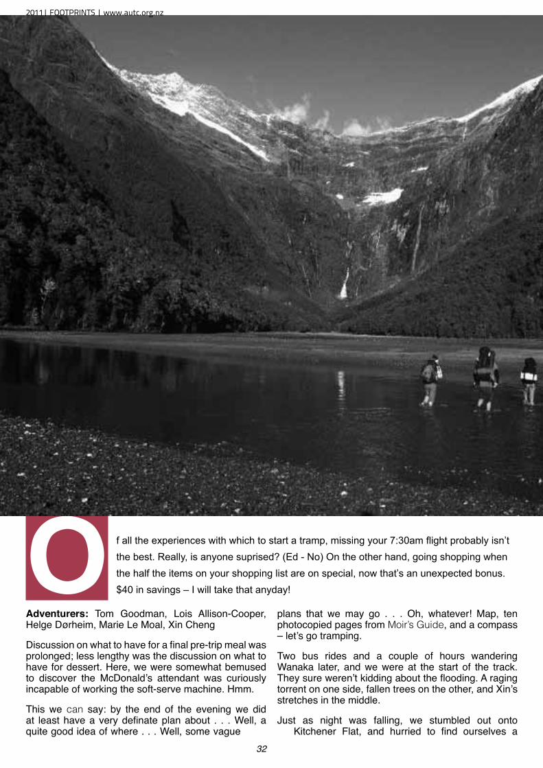
O f all the experiences with which to start a tramp, missing your 7:30am flight probably isn’t the best. Really, is anyone suprised? (Ed - No) On the other hand, going shopping when the half the items on your shopping list are on special, now that’s an unexpected bonus. $40 in savings – I will take that anyday!
Adventurers: Tom Goodman, Lois Allison-Cooper, Helge Dørheim, Marie Le Moal, Xin Cheng
Discussion on what to have for a final pre-trip meal was prolonged; less lengthy was the discussion on what to have for dessert. Here, we were somewhat bemused to discover the McDonald’s attendant was curiously incapable of working the soft-serve machine. Hmm.
This we can say: by the end of the evening we did at least have a very definate plan about . . . Well, a quite good idea of where . . . Well, some vague
plans that we may go . . . Oh, whatever! Map, ten photocopied pages from Moir’s Guide, and a compass – let’s go tramping.
Two bus rides and a couple of hours wandering Wanaka later, and we were at the start of the track. They sure weren’t kidding about the flooding. A raging torrent on one side, fallen trees on the other, and Xin’s stretches in the middle.
Just as night was falling, we stumbled out onto Kitchener Flat, and hurried to find ourselves a
2011| FOOTPRINTS | www.autc.org.nz
decent tent site. A quick meal and it was off to bed, full of excitement for the days ahead.
The next day, we were greeted with some slightly inclement weather. While Helge was sufficiently eager to get out and nab photos of the surrounds, for everyone else, motivation was – shall we say – dampened, and breakfast was had somewhat leisurely. Eventually, I sensed my fellow tent occupants were geting somewhat restless, and with some trepidation proposed a nice little walk up to the head of the valley, where we would be greeted with ‘great views’ of the
waterfall off Mount Avalanche.
Usually this would be a simple stroll along the wide, braided river flats. However the flooded river forced us instead to bush-bash our way along the side of the valley. As we were walking along, Helge reminded us that nine out of ten people agree that what we were doing was actually quite stupid. After intitally agreeing, I corrected him: ten out of ten people agreeed that this was quite stupid, and I was number seven. After an hour, we reached our intended destination for the previous night, the Rock of Ages Bivouac. This was the
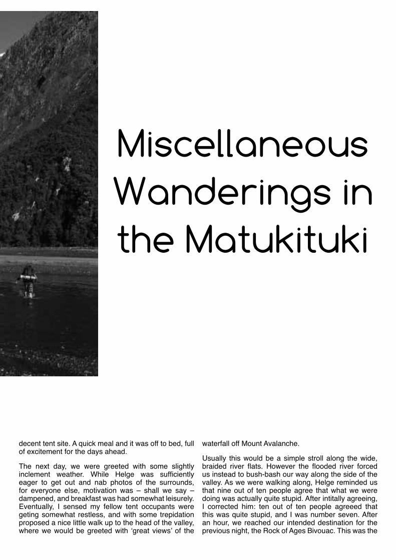
Miscellaneous Wanderings in the Matukituki
34
opportunity for some much needed sugar, in the form of licorice allsorts and jelly snakes.
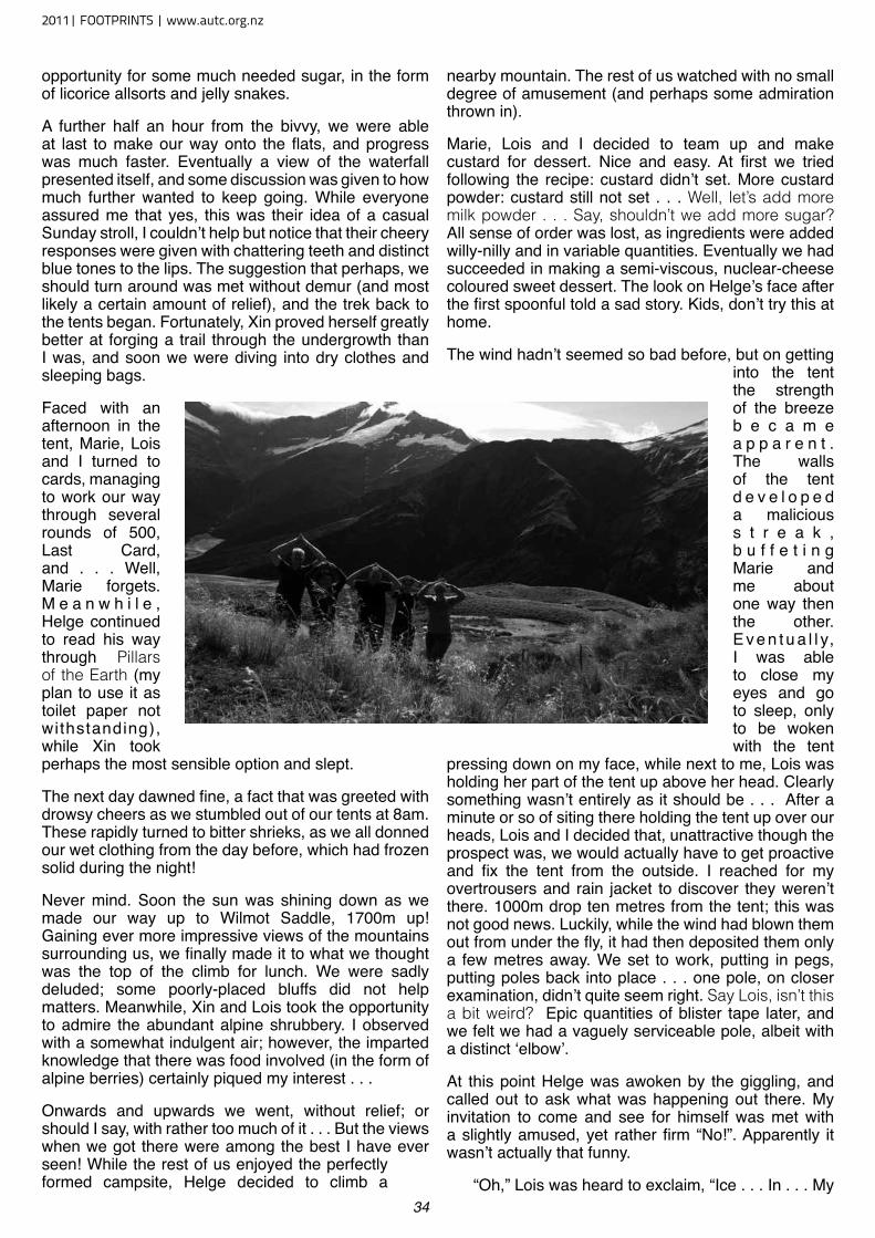
A further half an hour from the bivvy, we were able at last to make our way onto the flats, and progress was much faster. Eventually a view of the waterfall presented itself, and some discussion was given to how much further wanted to keep going. While everyone assured me that yes, this was their idea of a casual Sunday stroll, I couldn’t help but notice that their cheery responses were given with chattering teeth and distinct blue tones to the lips. The suggestion that perhaps, we should turn around was met without demur (and most likely a certain amount of relief), and the trek back to the tents began. Fortunately, Xin proved herself greatly better at forging a trail through the undergrowth than I was, and soon we were diving into dry clothes and sleeping bags.
Faced with an afternoon in the tent, Marie, Lois and I turned to cards, managing to work our way through several rounds of 500, Last Card, and . . . Well, Marie forgets. M e a n w h i l e , Helge continued to read his way through Pillars of the Earth (my plan to use it as toilet paper not withstanding), while Xin took perhaps the most sensible option and slept.
The next day dawned fine, a fact that was greeted with drowsy cheers as we stumbled out of our tents at 8am. These rapidly turned to bitter shrieks, as we all donned our wet clothing from the day before, which had frozen solid during the night!
Never mind. Soon the sun was shining down as we made our way up to Wilmot Saddle, 1700m up! Gaining ever more impressive views of the mountains surrounding us, we finally made it to what we thought was the top of the climb for lunch. We were sadly deluded; some poorly-placed bluffs did not help matters. Meanwhile, Xin and Lois took the opportunity to admire the abundant alpine shrubbery. I observed with a somewhat indulgent air; however, the imparted knowledge that there was food involved (in the form of alpine berries) certainly piqued my interest . . .
Onwards and upwards we went, without relief; or should I say, with rather too much of it . . . But the views when we got there were among the best I have ever seen! While the rest of us enjoyed the perfectly formed campsite, Helge decided to climb a
nearby mountain. The rest of us watched with no small degree of amusement (and perhaps some admiration thrown in).
Marie, Lois and I decided to team up and make custard for dessert. Nice and easy. At first we tried following the recipe: custard didn’t set. More custard powder: custard still not set . . . Well, let’s add more milk powder . . . Say, shouldn’t we add more sugar? All sense of order was lost, as ingredients were added willy-nilly and in variable quantities. Eventually we had succeeded in making a semi-viscous, nuclear-cheese coloured sweet dessert. The look on Helge’s face after the first spoonful told a sad story. Kids, don’t try this at home.
The wind hadn’t seemed so bad before, but on getting into the tent the strength of the breeze b e c a m e a p p a r e n t . The walls of the tent d e v e l o p e d a malicious s t r e a k , b u f f e t i n g Marie and me about one way then the other. E v e n t u a l l y, I was able to close my eyes and go to sleep, only to be woken with the tent
pressing down on my face, while next to me, Lois was holding her part of the tent up above her head. Clearly something wasn’t entirely as it should be . . . After a minute or so of siting there holding the tent up over our heads, Lois and I decided that, unattractive though the prospect was, we would actually have to get proactive and fix the tent from the outside. I reached for my overtrousers and rain jacket to discover they weren’t there. 1000m drop ten metres from the tent; this was not good news. Luckily, while the wind had blown them out from under the fly, it had then deposited them only a few metres away. We set to work, putting in pegs, putting poles back into place . . . one pole, on closer examination, didn’t quite seem right. Say Lois, isn’t this a bit weird? Epic quantities of blister tape later, and we felt we had a vaguely serviceable pole, albeit with a distinct ‘elbow’.
At this point Helge was awoken by the giggling, and called out to ask what was happening out there. My invitation to come and see for himself was met with a slightly amused, yet rather firm “No!”. Apparently it wasn’t actually that funny.
“Oh,” Lois was heard to exclaim, “Ice . . . In . . . My
2011| FOOTPRINTS | www.autc.org.nz
35
boot . . .”. Definitely time to get back inside.
The following morning, the sun rose somewhat limply behind a layer of low cloud. And this is summer? Little time was spent in debate; it was time to seek out new pastures. Soon, we reached Sisyphus Peak, touted in Moir’s Guide as providing “the best view in the East Matukituki”. Five minutes spent agreeing that we couldn’t actually see a thing, and we were away . . .
Our route down was, let us say, creative at times. It certainly didn’t conform to OSH guidelines. Scree, loose slate, tussock, a few cliffs, and then a vertical rock scramble. Several sudden drops were encountered, flat places few and far between. We were all rather grateful when after eight hours of near-vertical descent we found ourselves following a gentle river towards the flats.
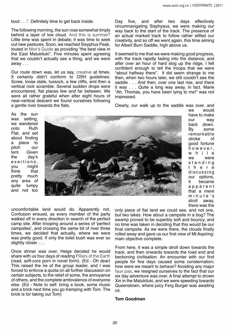
As the sun was setting, we wandered onto Ruth Flat, and set about finding a place to pitch our tent. Given the day’s e x e r t i o n s , you might think that pretty much any area of quite lumpy and not too
uncomfortable land would do. Apparently not. Confusion ensued, as every member of the party walked off in every direction in search of the perfect camp site. After trooping around a series of ‘perfect campsites’, and crossing the same bit of river three times, we decided that actually, where we were was pretty good. If only the toilet bush was ever so slightly closer . . .
Once dinner was over, Helge decided he would share with us four days of reading Pillars of the Earth (read, soft-core porn in novel form). (Ed - Oh dear) This raised the ire of the group leader, and I was forced to enforce a quota on all further discussion on certain subjects, to the relief of some, the annoyance of others, and the complete ambivalence of everyone else. (Ed - Note to self: bring a book, some music and a brick next time you go tramping with Tom. The brick is for taking out Tom)
Day five, and after two days effectively circumnavigating Sisphysus, we were making our way back to the start of the track. The presence of an actual marked track to follow rather stifled our creativity, and so off we went again, this time aiming for Albert Burn Saddle, high above us.
It seemed to me that we were making good progress, with the track rapidly fading into the distance, and after over an hour of hard slog up the ridge, I felt confident enough to tell the troops that we were “about halfway there”. It did seem strange to me then, when two hours later, we still couldn’t see the saddle . . . And then, over one last rise, and there it was . . . Quite a long way away, in fact. Marie “Ah, Thomas, you have been lying to me!” was not impressed.
Clearly, our walk up to the saddle was over, and we would have to make our way back down. By some remarkable stroke of good fortune h o w e v e r , w h i l e we were s t a n d i n g t h e r e d i s c u s s i n g our options, it became a p p a r e n t that a mere m i n u t e ’ s stroll away, there was the
only piece of flat land we could see, and not one, but two lakes. How about a campsite in a bog? The swamp proved to be superbly soft and bouncy, and no time was taken in deciding that this would be our final campsite. As we were there, the clouds finally rolled away and gave us our first view of Mt Aspiring: main objective complete.
From here, it was a simple stroll down towards the track, and then onwards towards the road end and beckoning civilisation. An encounter with our first people for five days caused some consternation; how were we meant to behave? Avoiding any major faux pas, we resigned ourselves to the fact that our six day adventure was over. A final attempt to drown Xin in the Matukituki, and we were speeding towards Queenstown, where juicy Ferg Burger was awaiting us.
Tom Goodman
www.autc.org.nz | FOOTPRINTS |2011
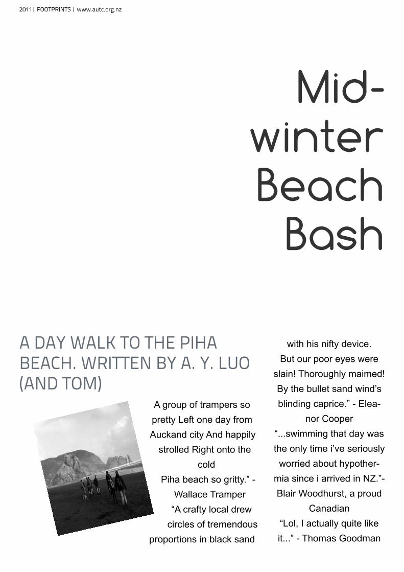
a day walk to tHe piHa beaCH. written by a. y. luo (and tom)
A group of trampers so pretty Left one day from Auckand city And happily
strolled Right onto the cold
Piha beach so gritty.” - Wallace Tramper
“A crafty local drew circles of tremendous
proportions in black sand
with his nifty device.But our poor eyes were
slain! Thoroughly maimed!By the bullet sand wind’s blinding caprice.” - Elea-
nor Cooper“...swimming that day was the only time i’ve seriously worried about hypother-
mia since i arrived in NZ.”- Blair Woodhurst, a proud
Canadian“Lol, I actually quite like it...” - Thomas Goodman
Mid-winter Beach
Bash
2011| FOOTPRINTS | www.autc.org.nz
Mt Pirongia
W E M E T U P AT T H E q U A D , A L L 8 O F U S O N A W A R M T H U R S D Ay
M O R N I N G . S E T T I N G O F L AT E F R O M T H E q U A D A F T E R A q U I C k B R I E F -I N G , H E L D U P B y S O M E O F A U C k -L A N D T R A F F I C . D R I v I N G T O P I R O N -G I A , A S M A L L M O U N TA I N R A N G E j U S T S O U T H O F H A M I LT O N
From there we rendezvoused at the end of Grey road near a private lodge. Which wasn’t for us as we would be getting spending the night at Pahautea hut. Which was about 1000m higher than the car park.
The walk started off very easy. Along a nature walk for school kids that was maintained by the lodge. Before long we took a fork of the nature walk and the tramp really began. Flights upon flights of stairs were there waiting for us. There would have been more that 4 dozen of them. These stairs went on continuously for over an hour and really put a good strain on all of the group’s leg muscles.
After the end of the stairs (for now) we reached the Ruapane peak where we stopped for lunch and took in our first major views. Although we were only part way up Mt Pirongia we could see for miles. From
there we could see out to the sea and also with Amanda even spotting a windmill farm just up against the end of the horizon.
From there we powered on to the Pirongia Summit. The next sections of track took us an hour longer than we expected. With the track being poorly maintained relatively untraveled and being incredibly steep in places. So steep in fact that in certain parts there were chains bolted into the Mountain. Allowing us to abseil down and rock climb up in places. Even though it was hard going everyone had a good time during this stage. With the scrambling adding a bit of variety to what otherwise would be your average 2 day walk up a mountain.
Once we reached the viewing platform we were about 1000m up. This gave the group an epic sense of achievement. Seeing just how far we had come in only one day. With the raised viewing platform giving us for a 360 degree view. From the platform we could see the roads we had arrived on far away in the distance along with the several different peaks we had all climbed to reach the top that day. Along with the scenery that is typical more being that high up on top of a mountain.
For that night we stayed in Pahautea hut. There it didn’t rain when we heard in raining below us. Instead the clouds flew through the campsite. Reducing visibility to something out of a horror movie and
www.autc.org.nz | FOOTPRINTS |2011
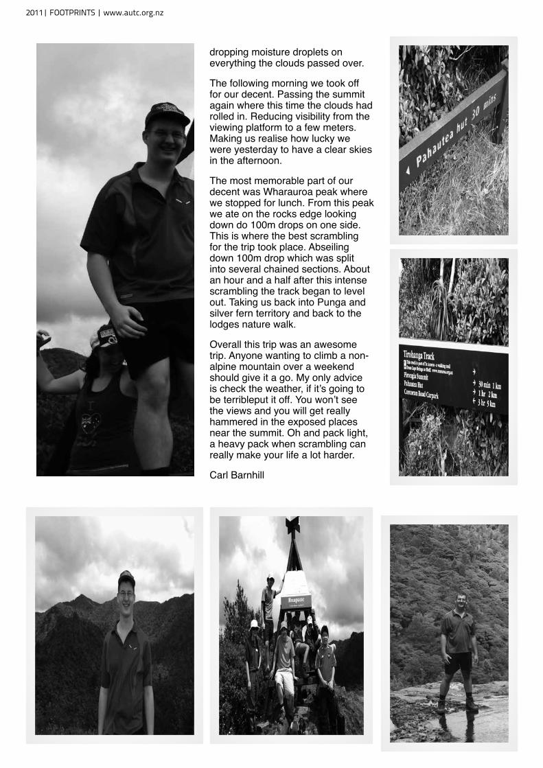
dropping moisture droplets on everything the clouds passed over.
The following morning we took off for our decent. Passing the summit again where this time the clouds had rolled in. Reducing visibility from the viewing platform to a few meters. Making us realise how lucky we were yesterday to have a clear skies in the afternoon.
The most memorable part of our decent was Wharauroa peak where we stopped for lunch. From this peak we ate on the rocks edge looking down do 100m drops on one side. This is where the best scrambling for the trip took place. Abseiling down 100m drop which was split into several chained sections. About an hour and a half after this intense scrambling the track began to level out. Taking us back into Punga and silver fern territory and back to the lodges nature walk.
Overall this trip was an awesome trip. Anyone wanting to climb a non-alpine mountain over a weekend should give it a go. My only advice is check the weather, if it’s going to be terribleput it off. You won’t see the views and you will get really hammered in the exposed places near the summit. Oh and pack light, a heavy pack when scrambling can really make your life a lot harder.
Carl Barnhill
2011| FOOTPRINTS | www.autc.org.nz
39
OxfamT r a i l
SeriouSly
T his is what happens when you get a group to write
the trip report, each person add-ing a word-at-a-time.
O rder was roughly: Matt (Walker) Nico (Support
Crew) Richard (Walker) Tom (Support Crew) Nick (Walker) Annie (Support crew) Anna (Support crew) Laurien (sup-port crew) and back to Matt. Eli (Walker) left just in time to miss then fun!
O nce upon my big long trail there was four crazy
bastards. “Damn!” they said. Some fascinating groping did occur by cougars who where rather scintillating. Fernando trembled; “She’s aching all over me!”. Besides that, there upon a delicious soup was consumed, and lathered blisters burst (which where rather pus-y), oozed, voluptuously. Nico slept soundly and we drew phallus’s across his chest. Porn shouldn’t happen too often without women observing men while wild drink-ing occurs sinfully. Hop-a-long trailed behind. However, she was gasping for breath eager to kill the checkout lady. Pirates
are unwelcome in Countdown. We rebelled. Tom charged ahead forgetting his very long trouser snake which dangled uselessly above Nicks’. Lillis (Matt) who drank excessively from faucets of leadership, transformed majestically. Unfor-tunately, Riddler (Eleanor) flew into Lillis causing deformation of his rocks. Meanwhile, teams of inspired admirers signed our chests of steel, coated with sweat. Vast chocolate skinned hobos drove maliciously.
Seriously.
Nico Thorburn
www.autc.org.nz | FOOTPRINTS |2011
FOR THE LOVE OF PIESriCHmond ranGeS, 2011.
tramperS: riCHard Greatrex, andy baddeley, katHleen Collier.
S ome time last year, Rich-
ard got it into his head
that we should do a trip in the
Richmond Ranges.
Richmond is that bit in Nelson that’s sort of like the poor, dis-inherited youngest brother in a fairy tale, on account of not being kahurangi or Abel Tasman.
2011| FOOTPRINTS | www.autc.org.nz
FOR THE LOVE OF PIESriCHmond ranGeS, 2011.
tramperS: riCHard Greatrex, andy baddeley, katHleen Collier.
www.autc.org.nz | FOOTPRINTS |2011
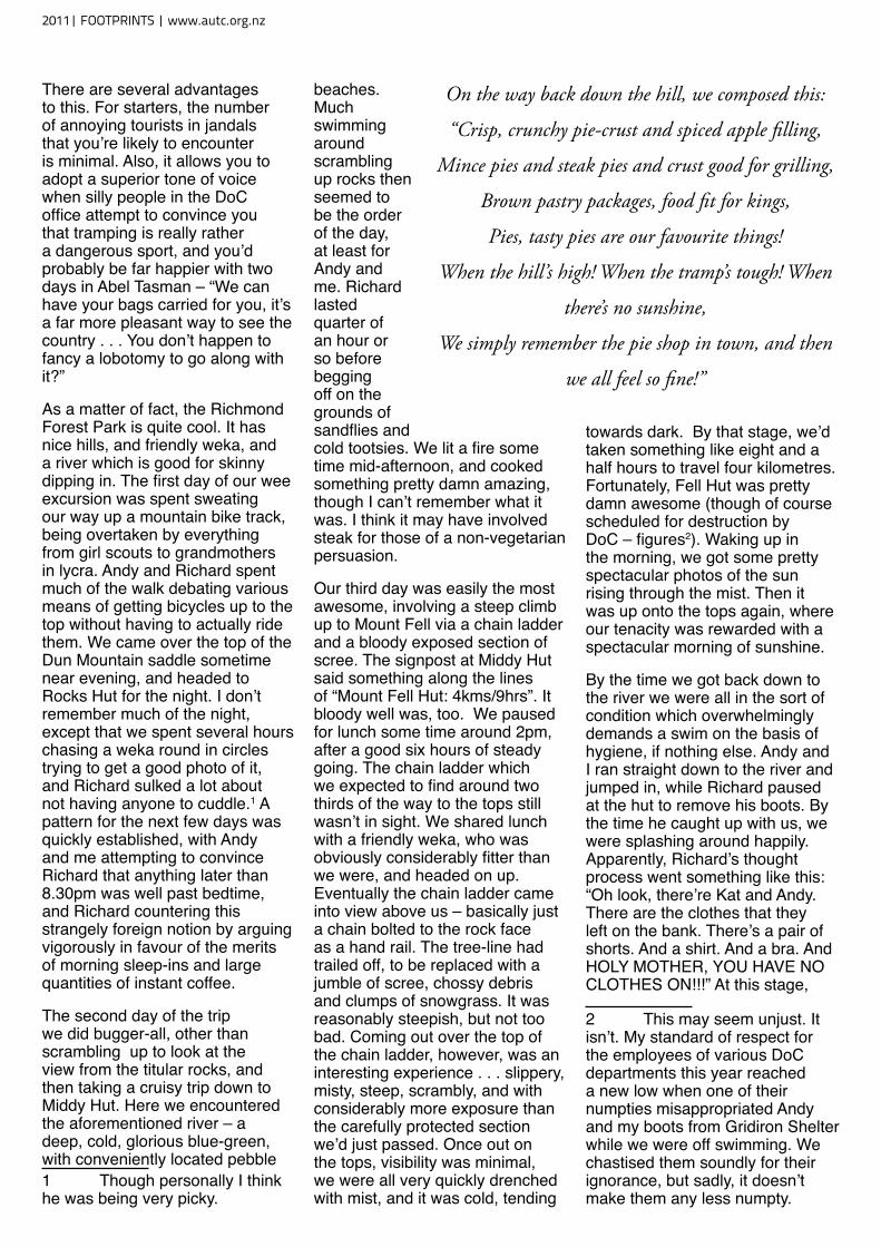
There are several advantages to this. For starters, the number of annoying tourists in jandals that you’re likely to encounter is minimal. Also, it allows you to adopt a superior tone of voice when silly people in the DoC office attempt to convince you that tramping is really rather a dangerous sport, and you’d probably be far happier with two days in Abel Tasman – “We can have your bags carried for you, it’s a far more pleasant way to see the country . . . You don’t happen to fancy a lobotomy to go along with it?”
As a matter of fact, the Richmond Forest Park is quite cool. It has nice hills, and friendly weka, and a river which is good for skinny dipping in. The first day of our wee excursion was spent sweating our way up a mountain bike track, being overtaken by everything from girl scouts to grandmothers in lycra. Andy and Richard spent much of the walk debating various means of getting bicycles up to the top without having to actually ride them. We came over the top of the Dun Mountain saddle sometime near evening, and headed to Rocks Hut for the night. I don’t remember much of the night, except that we spent several hours chasing a weka round in circles trying to get a good photo of it, and Richard sulked a lot about not having anyone to cuddle.1 A pattern for the next few days was quickly established, with Andy and me attempting to convince Richard that anything later than 8.30pm was well past bedtime, and Richard countering this strangely foreign notion by arguing vigorously in favour of the merits of morning sleep-ins and large quantities of instant coffee.
The second day of the trip we did bugger-all, other than scrambling up to look at the view from the titular rocks, and then taking a cruisy trip down to Middy Hut. Here we encountered the aforementioned river – a deep, cold, glorious blue-green, with conveniently located pebble 1 Though personally I think he was being very picky.
beaches. Much swimming around scrambling up rocks then seemed to be the order of the day, at least for Andy and me. Richard lasted quarter of an hour or so before begging off on the grounds of sandflies and cold tootsies. We lit a fire some time mid-afternoon, and cooked something pretty damn amazing, though I can’t remember what it was. I think it may have involved steak for those of a non-vegetarian persuasion.
Our third day was easily the most awesome, involving a steep climb up to Mount Fell via a chain ladder and a bloody exposed section of scree. The signpost at Middy Hut said something along the lines of “Mount Fell Hut: 4kms/9hrs”. It bloody well was, too. We paused for lunch some time around 2pm, after a good six hours of steady going. The chain ladder which we expected to find around two thirds of the way to the tops still wasn’t in sight. We shared lunch with a friendly weka, who was obviously considerably fitter than we were, and headed on up. Eventually the chain ladder came into view above us – basically just a chain bolted to the rock face as a hand rail. The tree-line had trailed off, to be replaced with a jumble of scree, chossy debris and clumps of snowgrass. It was reasonably steepish, but not too bad. Coming out over the top of the chain ladder, however, was an interesting experience . . . slippery, misty, steep, scrambly, and with considerably more exposure than the carefully protected section we’d just passed. Once out on the tops, visibility was minimal, we were all very quickly drenched with mist, and it was cold, tending
towards dark. By that stage, we’d taken something like eight and a half hours to travel four kilometres. Fortunately, Fell Hut was pretty damn awesome (though of course scheduled for destruction by DoC – figures2). Waking up in the morning, we got some pretty spectacular photos of the sun rising through the mist. Then it was up onto the tops again, where our tenacity was rewarded with a spectacular morning of sunshine.
By the time we got back down to the river we were all in the sort of condition which overwhelmingly demands a swim on the basis of hygiene, if nothing else. Andy and I ran straight down to the river and jumped in, while Richard paused at the hut to remove his boots. By the time he caught up with us, we were splashing around happily. Apparently, Richard’s thought process went something like this: “Oh look, there’re Kat and Andy. There are the clothes that they left on the bank. There’s a pair of shorts. And a shirt. And a bra. And HOLY MOTHER, YOU HAVE NO CLOTHES ON!!!” At this stage,
2 This may seem unjust. It isn’t. My standard of respect for the employees of various DoC departments this year reached a new low when one of their numpties misappropriated Andy and my boots from Gridiron Shelter while we were off swimming. We chastised them soundly for their ignorance, but sadly, it doesn’t make them any less numpty.
On the way back down the hill, we composed this:
“Crisp, crunchy pie-crust and spiced apple filling,
Mince pies and steak pies and crust good for grilling,
Brown pastry packages, food fit for kings,
Pies, tasty pies are our favourite things!
When the hill’s high! When the tramp’s tough! When
there’s no sunshine,
We simply remember the pie shop in town, and then
we all feel so fine!”
2011| FOOTPRINTS | www.autc.org.nz
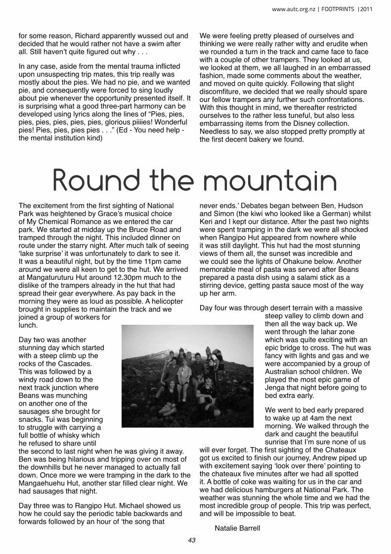
43
for some reason, Richard apparently wussed out and decided that he would rather not have a swim after all. Still haven’t quite figured out why . . .
In any case, aside from the mental trauma inflicted upon unsuspecting trip mates, this trip really was mostly about the pies. We had no pie, and we wanted pie, and consequently were forced to sing loudly about pie whenever the opportunity presented itself. It is surprising what a good three-part harmony can be developed using lyrics along the lines of “Pies, pies, pies, pies, pies, pies, pies, glorious piiiies! Wonderful pies! Pies, pies, pies pies . . .” (Ed - You need help - the mental institution kind)
We were feeling pretty pleased of ourselves and thinking we were really rather witty and erudite when we rounded a turn in the track and came face to face with a couple of other trampers. They looked at us, we looked at them, we all laughed in an embarrassed fashion, made some comments about the weather, and moved on quite quickly. Following that slight discomfiture, we decided that we really should spare our fellow trampers any further such confrontations. With this thought in mind, we thereafter restricted ourselves to the rather less tuneful, but also less embarrassing items from the Disney collection. Needless to say, we also stopped pretty promptly at the first decent bakery we found.
Round the mountain The excitement from the first sighting of National Park was heightened by Grace’s musical choice of My Chemical Romance as we entered the car park. We started at midday up the Bruce Road and tramped through the night. This included dinner on route under the starry night. After much talk of seeing ‘lake surprise’ it was unfortunately to dark to see it. It was a beautiful night, but by the time 11pm came around we were all keen to get to the hut. We arrived at Mangaturuturu Hut around 12.30pm much to the dislike of the trampers already in the hut that had spread their gear everywhere. As pay back in the morning they were as loud as possible. A helicopter brought in supplies to maintain the track and we joined a group of workers for lunch.
Day two was another stunning day which started with a steep climb up the rocks of the Cascades. This was followed by a windy road down to the next track junction where Beans was munching on another one of the sausages she brought for snacks. Tui was beginning to struggle with carrying a full bottle of whisky which he refused to share until the second to last night when he was giving it away. Ben was being hilarious and tripping over on most of the downhills but he never managed to actually fall down. Once more we were tramping in the dark to the Mangaehuehu Hut, another star filled clear night. We had sausages that night.
Day three was to Rangipo Hut. Michael showed us how he could say the periodic table backwards and forwards followed by an hour of ‘the song that
never ends.’ Debates began between Ben, Hudson and Simon (the kiwi who looked like a German) whilst Keri and I kept our distance. After the past two nights were spent tramping in the dark we were all shocked when Rangipo Hut appeared from nowhere while it was still daylight. This hut had the most stunning views of them all, the sunset was incredible and we could see the lights of Ohakune below. Another memorable meal of pasta was served after Beans prepared a pasta dish using a salami stick as a stirring device, getting pasta sauce most of the way up her arm.
Day four was through desert terrain with a massive steep valley to climb down and then all the way back up. We went through the lahar zone which was quite exciting with an epic bridge to cross. The hut was fancy with lights and gas and we were accompanied by a group of Australian school children. We played the most epic game of Jenga that night before going to bed extra early.
We went to bed early prepared to wake up at 4am the next morning. We walked through the dark and caught the beautiful sunrise that I’m sure none of us
will ever forget. The first sighting of the Chateaux got us excited to finish our journey, Andrew piped up with excitement saying ‘look over there’ pointing to the chateaux five minutes after we had all spotted it. A bottle of coke was waiting for us in the car and we had delicious hamburgers at National Park. The weather was stunning the whole time and we had the most incredible group of people. This trip was perfect, and will be impossible to beat.
Natalie Barrell
www.autc.org.nz | FOOTPRINTS |2011
44
Round the Mountain - Trail Guide
RUNNERS: Alastair McDowell, Kristian Day and Ruby Muir
NEARBY TOWN/CITY: Whakapapa Village, Tongariro National Park
EXACT LOCATION: Walk up Bruce Rd, past DOC info centre, past Shelter.
Whakapapaiti track begins down lane to the right off Bruce Rd.
TOTAL ROUTE DISTANCE: 65km
TOTAL ASCENT & DESCENT: Around 2,000m
TIME TO COMPLETE: Elite-12hrs; Weekend Warrior -16hrs+; Non-stop tramping–20 hours
TYPE OF TRAIL RUN: Loop. Best run anti-clockwise, starting/ending at Whakapapa Village. This way you tackle the tough “Goat” section first on fresh legs, and finish on the easy, board-walked “Tussock Traverse” section over Tama Saddle.
DIFFICULTY: Very Very Hard.
DEFINING CHARACTERISTICS: Sub-Alpine, technical, remote
START GPS: Latitude -39.20316060 S, Longitude 175.53980827 E
FINISH GPS: Same as start
BEST MAP/S: NZ Topo50 BH34, BH35, BJ34, BJ35
(Mostly on BJ34)
RUN IT: The best time to run the Ruapehu circuit is between October – May, as this is an all-day affair you’ll want to maximize daylight hours, and being a remote alpine environment, bad weather can also make this run dangerous. Plenty of food, thermals and a wind/rain-proof jacket are essential. Water is not so much an issue, you can fill up at each hut (spaced roughly 2-3 hours run apart), and also in the clean streams and rivers. Ruapehu’s eastern side is particularly remote. Once you pass Ohakune Mountain Road and venture into the desert, you are miles away from civilization. In good conditions however, this all adds to the experience!
Begin your run before dawn and head along the Whakapapaiti track, through lush Beech forest and crossing several bridged stream crossings until you reach the Whakapapaiti Stream. You will cross to the west side, where you make your way through muddy tussock lands, re-cross at the forked section of the stream shortly before reaching the hut. About 2 hours in, you should wake up the trampers and invite yourself in for some morning coffee fresh off the primus.
2011| FOOTPRINTS | www.autc.org.nz
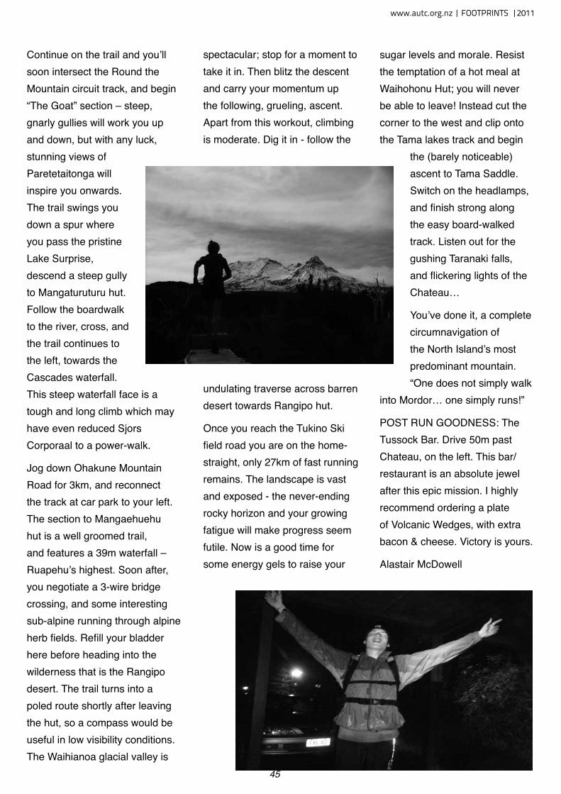
45
Continue on the trail and you’ll soon intersect the Round the Mountain circuit track, and begin “The Goat” section – steep, gnarly gullies will work you up and down, but with any luck, stunning views of Paretetaitonga will inspire you onwards. The trail swings you down a spur where you pass the pristine Lake Surprise, descend a steep gully to Mangaturuturu hut. Follow the boardwalk to the river, cross, and the trail continues to the left, towards the Cascades waterfall. This steep waterfall face is a tough and long climb which may have even reduced Sjors Corporaal to a power-walk.
Jog down Ohakune Mountain Road for 3km, and reconnect the track at car park to your left. The section to Mangaehuehu hut is a well groomed trail, and features a 39m waterfall – Ruapehu’s highest. Soon after, you negotiate a 3-wire bridge crossing, and some interesting sub-alpine running through alpine herb fields. Refill your bladder here before heading into the wilderness that is the Rangipo desert. The trail turns into a poled route shortly after leaving the hut, so a compass would be useful in low visibility conditions. The Waihianoa glacial valley is
spectacular; stop for a moment to take it in. Then blitz the descent and carry your momentum up the following, grueling, ascent. Apart from this workout, climbing is moderate. Dig it in - follow the
undulating traverse across barren desert towards Rangipo hut.
Once you reach the Tukino Ski field road you are on the home-straight, only 27km of fast running remains. The landscape is vast and exposed - the never-ending rocky horizon and your growing fatigue will make progress seem futile. Now is a good time for some energy gels to raise your
sugar levels and morale. Resist the temptation of a hot meal at Waihohonu Hut; you will never be able to leave! Instead cut the corner to the west and clip onto the Tama lakes track and begin
the (barely noticeable) ascent to Tama Saddle. Switch on the headlamps, and finish strong along the easy board-walked track. Listen out for the gushing Taranaki falls, and flickering lights of the Chateau…
You’ve done it, a complete circumnavigation of the North Island’s most predominant mountain. “One does not simply walk
into Mordor… one simply runs!”
POST RUN GOODNESS: The Tussock Bar. Drive 50m past Chateau, on the left. This bar/restaurant is an absolute jewel after this epic mission. I highly recommend ordering a plate of Volcanic Wedges, with extra bacon & cheese. Victory is yours.
Alastair McDowell
www.autc.org.nz | FOOTPRINTS |2011
46
According to NIWA’s historical weather data the max wind gust on our first day of Snowschool was 101.9km/h.On a scale of 1 to awesome we unanimously agreed the climb up to the hut was about a 36. It was whether the scale went up to 37 or 1005 that caused the most arguments. Our first climb certainly inspired in us huge respect for anyone and everyone who consistently braves the alpine environment on their quests for summits, slopes and glimpses of rare mountain-dwelling hominids.
After 4hrs of solid slog up the mountain we were scrambling up yet another cliff when I heard the pace of the feet ahead of me quicken from a trudge for the first time in hours. The top of the ridge was in sight. I bent my head upwards, dislodging several kilos of accumulated ‘Ruapehu rime’ and through the haze of pelting snow latched my eyes on the hut. One by one we were blustered and billowed over the ridge onto the plateau. From there many variations on forward movement propelled our troop toward the hut and flung them panting, flailing and grinning from ear to ear into the sharps room. Inside the hut a ‘hi 5s all round for survival’ kind of feeling upped our general morale and we set about painstakingly chipping ourselves free of our icy outer-layers and frozen packs. Once we were all sufficiently reanimated (mostly due to long periods of group de-frosting in the drying room) the suggestion box was cast open for the afternoon’s activities. Submissions ranged from lowering our metabolic rates and hibernating for the next three days to Kat and Andy’s more energetic suggestion of a naked hut run- with ice axes of course. In the end we compromised with a theory session on avalanche risk factors and a fun game of hide and seek the avalanche transistor.
Day two dawned, the wind had dropped slightly and the volleys of icy bullets had become much less frequent so we waddled out of the hut to practice self-arresting. We teetered on the edge of the void before rocketing down a specially constructed chute; one by one plunging our picks into the side of the mountain before holding on for dear life as we desperately attempted to slow our acceleration. Ok, so, admittedly the hill was gently sloping and only around 7m high, but points were given for enthusiasm and the
best screams. Once we were all fairly competent we set out in search of steeper slopes suited to a well known and widely used alpine technique: ‘training’, preferably backwards. As exhilarating as this may sound the amount of fresh powder meant the ride was less an icy, fast-paced rollercoaster and more like a snowplough on low gear with the breaks on. With the adrenalin still pumping in our veins we dug a hobbit-sized snow-cave and constructed, as an afterthought, half an igloo.
After a quick lunch break, consisting mainly of hot tea and a nana-nap, we were back out in the snow. This time the pressure was on: avalanche transistor retrieval, for real this time, well... sort of. We split into teams for an intense afternoon that made us all realise that finding someone buried metres beneath the snow is no mean feat. Again the message of respecting and understanding the alpine environment was firmly hammered home.
The fresh mountain air and full on days seemed to work their magic and by dinner time we were all famished. Burgers and mulled wine lulled many into a happy haze and we were serenaded by Kat’s giggles for much of the evening.
What we didn’t expect was Friday’s weather. Cloudless skies, visibility for miles, and not a breath of wind; perfect for a meander up to the summit. So it was crampons on and an alpine start-ish. The climb was glorious and the views breathtaking. We got up to Glacier Knob and had lunch around the iced over Dome shelter. After a bit of a gnarly duck-walk down to Crater Lake we headed back home with the sun in our eyes and the snow skidding beneath our bums.
All too soon we had gathered our gear from the hut, made our way down from the ridge and were standing once again at the ski field car park doing our best to look like seasoned mountaineers. I don’t know if we succeeded but there is photographic evidence that we were all knackered but stoked. Thanks to Kat and Andy for support, knowledge, smiles and amazing food! Peace out to all the skater-boys.
Snowschool - Too Cool For School
A group of students went Ruapehu for the club’s annual Snowschool, writes Sylvie Admore
2011| FOOTPRINTS | www.autc.org.nz
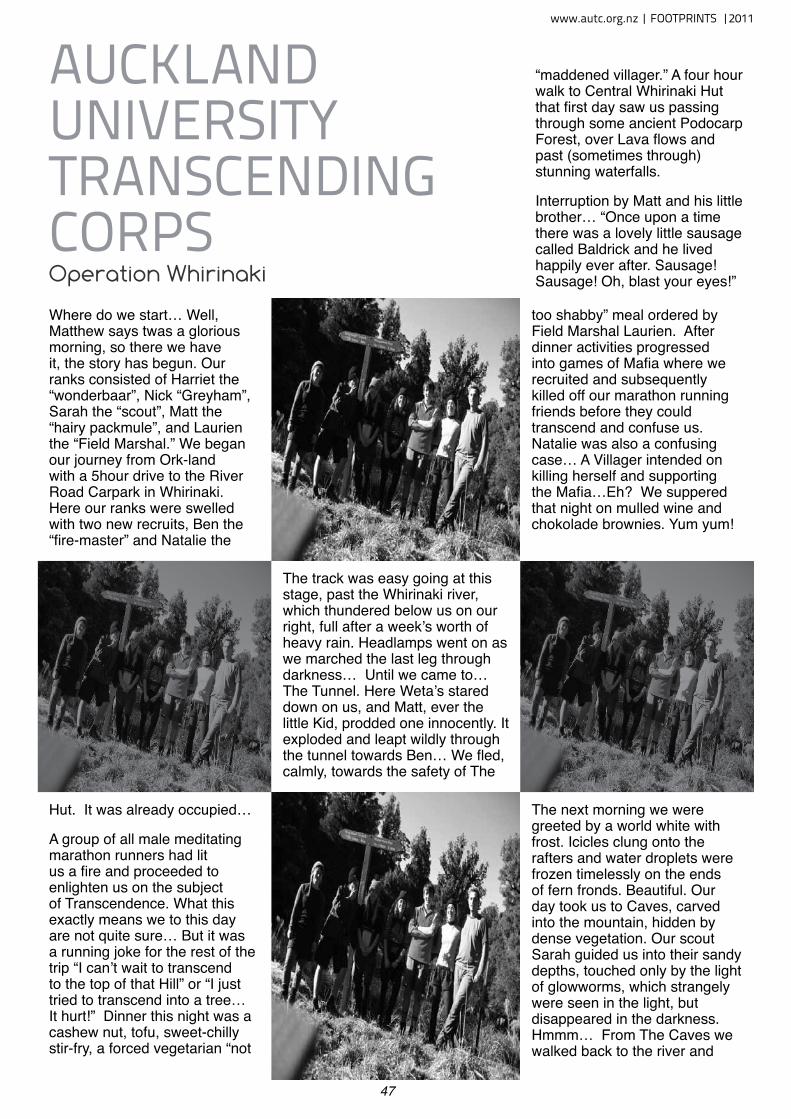
47
The track was easy going at this stage, past the Whirinaki river, which thundered below us on our right, full after a week’s worth of heavy rain. Headlamps went on as we marched the last leg through darkness… Until we came to… The Tunnel. Here Weta’s stared down on us, and Matt, ever the little Kid, prodded one innocently. It exploded and leapt wildly through the tunnel towards Ben… We fled, calmly, towards the safety of The
Where do we start… Well, Matthew says twas a glorious morning, so there we have it, the story has begun. Our ranks consisted of Harriet the “wonderbaar”, Nick “Greyham”, Sarah the “scout”, Matt the “hairy packmule”, and Laurien the “Field Marshal.” We began our journey from Ork-land with a 5hour drive to the River Road Carpark in Whirinaki. Here our ranks were swelled with two new recruits, Ben the “fire-master” and Natalie the
“maddened villager.” A four hour walk to Central Whirinaki Hut that first day saw us passing through some ancient Podocarp Forest, over Lava flows and past (sometimes through) stunning waterfalls.
Interruption by Matt and his little brother… “Once upon a time there was a lovely little sausage called Baldrick and he lived happily ever after. Sausage! Sausage! Oh, blast your eyes!”
auCkland univerSity tranSCendinG CorpSOperation Whirinaki
Hut. It was already occupied…
A group of all male meditating marathon runners had lit us a fire and proceeded to enlighten us on the subject of Transcendence. What this exactly means we to this day are not quite sure… But it was a running joke for the rest of the trip “I can’t wait to transcend to the top of that Hill” or “I just tried to transcend into a tree… It hurt!” Dinner this night was a cashew nut, tofu, sweet-chilly stir-fry, a forced vegetarian “not
too shabby” meal ordered by Field Marshal Laurien. After dinner activities progressed into games of Mafia where we recruited and subsequently killed off our marathon running friends before they could transcend and confuse us. Natalie was also a confusing case… A Villager intended on killing herself and supporting the Mafia…Eh? We suppered that night on mulled wine and chokolade brownies. Yum yum!
The next morning we were greeted by a world white with frost. Icicles clung onto the rafters and water droplets were frozen timelessly on the ends of fern fronds. Beautiful. Our day took us to Caves, carved into the mountain, hidden by dense vegetation. Our scout Sarah guided us into their sandy depths, touched only by the light of glowworms, which strangely were seen in the light, but disappeared in the darkness. Hmmm… From The Caves we walked back to the river and
www.autc.org.nz | FOOTPRINTS |2011

A jello in mountain time maketh brine.
A healthy car de-mister maketh for a drive as dull as a blister.
Reports of a bluff from a professional DOC buff are always the former at
worst.
A reckless boot sizing earns a late rising.
In Response To JAMes K. BAxTeR.Into the wide valley, we came also
schist-stumbling from the jagged passTo camp beside the swollen Matukituki
Clumsy with weariness, by the tumult of snow-waters,To boil the billy and make tea,
exalting in the cosiness of smoke.
For us, the land is guide and guardian,Quiescent now, whose breath
Is sursurus of whispering grass, dry reeds.Matukituki, like the spread thighs or the encircling arms
of papatuanuku;Where we lie cradled in the rush and chatter of stones.
STOAT PANCAKES
ANYONE?
On Saturday 21st January, Sarah
Daniell, Nico Thorburn and I head-
ed out to the rangers station at the
Cascades in the Waitakere Rang-
es. Promoted by Ark in the Park
as an information morning for new
stoaters, we were keen on learning
how to trap these deadly but cute
creatures. A stoat can kill up to 80
native birds a month and the Ark
volunteers are doing all they can to
eliminate the pests.
Using eggs as a visual lure and
rabbit meat as a scent lure, we
learnt how to set the stoat traps. It
was also a relief to know that there
is no blood and guts when a stoat is
trapped. The stoat simply becomes
rather squashed, like a pancake.
Ark in the Park is an organisation
formed with the collaboration of
Forest and Bird and Auckland Re-
gional Council. It is a conservation
project based at the Cascade Kauri
Park in the Waitakere Ranged. By
controlling non-native pests and
predators it helps to restore the
ecology of the area to its natural
state. As an organisation run by
volunteers, the Ark is always look-
ing for extra helping hands. They
run sessions mid week and on the
weekend. If you are interested in
predator control, bird monitoring,
weed removal, track maintenance
and more, please visit http://www.
arkinthepark.org.nz
took the path towards Mangamate Hut. This path quickly disappeared and turned into a stream where we navigated by orange markers, often times hard to spot. The River swelled as we walked, gaining volume and turbulence. Our boots were bathtubs for our feet, thermals clinging to legs in a rather sub-optimal fashion. It was a magical place though, moss clinging to trees, birdcalls and the river and forest steaming as rays of sun melted the nighttime frost. Our stream-bashing finally took us to a hill which when climbed took us to a saddle where our hut stood waiting. We were cold and wet, but a fire successfully lit by Ben after several hours and foot massages given freely by Nick had us all happy and warm. Dinner this night was a rich feta cheese pasta meal called “Penne Mediterranean”. Yum yum again!
The Last day of Operation Whirinaki saw us back to the stream after putting on cold wet boots, half frozen in the night. The Stream quickly progressed
into a gushing river where mutual river crossings became rather necessary. Easy-medium trip my arse… We clambered up and over banks and around vegetation, through the River and got rather stuck in various patches of mud. One patch required two members of the group, who were stuck up to their bottoms in mud, to be pulled out, groaning, by their friends. The bridge was a welcome sight. It meant an end to the stream bashing, which although a hell of a lot of fun, got rather cold after 2 whole days of it… From here the track was once again well-formed, almost wheelchair friendly and it took us right back to the carpark from whence we started.
Operation Whirinaki was successfully completed. The ranks headed back to the land of Orks with a craving for salty fries and hot coffee and an appreciation for the world of warm showers and fluffy pillows. However, if asked, we would gladly repeat this mission.
Matthew Lillis and Laurien Heijs
2011| FOOTPRINTS | www.autc.org.nz
Meanderings in the Shire- Whirinaki Pushing on in the approach, despite burnt out derelict looking semi-demolished houses, and a road as bad as any I experienced in Cambodia, albeit Thomas’s shocks are slightly better than the vehicle I saw rural Cambodia from!Leader: Thomas Goodman
Mortals: Stephen Allely, Sarah Daniell, Marie la Moal, Nawfal Mudafar, Lawrence Wong
This is the REAL rural NZ, back woods Bay of Plenty on approach to Whirinaki forest park. Arriving to a hut at 10pm after 4 hours nocturnal tramping, one party spies the distinctive climbing boots of one member of the other party - that were allegedly meant to be circumnavigating the other way round the 3 day Whirinaki loop. No worries, nice to see ya. We all made it through the dodgy slips and dark labyrinthine forest to the resting place of Central Whiri Hut. Full moon, empty head. That’s a half haiku. Very economical. Hardly an alpine start, but earlier than the previous day 3pm commencement. Diversion to caves, claustrophobia-testing limestone/sandstone subterranean cathedral linked to a network of crawl holes.
Sun-drenched clearing a welcome rest after underground exploration. Gollum nowhere to be found. Yet. Surviving wasp attack on day three lunch, mostly in a Buddhist way. But not totally. But hey, mitigating factor, global bee populations are in freefall. And wasps don’t make honey. What the hell do wasps provide to the food chain? Sure the leader / ecology major could tell us but we are off crashing through the bush before you can say “peanut butter has
1%trans fat but the same protein proportion as tuna.” Beautiful rivers, wet rivers everywhere. Growing from tributaries, rolling over rock, tumbling through chasms. And a track that is having an identity crisis as to which side of said river it wishes to wend.
Avoiding stinging nettles scattered malevolently around the track, particularly ubiquitous on day 3. Cleverly avoiding repeating said leader’s previous year’s augmentation of loop length with extraneous loop by not diverting down said route on last few km. Rushes and swamps and swamps and rushes. But no rush for us, and we survive the swamp, although a certain tramper looked like they were being swallowed whole by the hungry Papa earth god thingy. The fellowship is intact. The ring is here somewhere... but do we really want it?
What of Gandalf with his crooked staff and bivouac branded gear? Tis said he leads a rival company of middle earthians. No less powerful nor less brutish than this clan of 6. Equal in number but faster and fleeter of foot, heed their warnings to leave Mangamate promptly or risk being left forsaken with but one chariot in the car park - the other bolted already. Alas, an injury and a limping elf holding up our company for the final leg. Young he is, and strong his heart. He continues, dragging one leg useless behind like dead meat. We cajole him on and on down the meandering forest path, verdant of leaf and crisp autumnal skies ahead. Noodles at Hobbit/Jacksonville on return to northern skies, and who needs a heater when you have air con to chill away the condensation in April? Who indeed.
Stephen Allely
www.autc.org.nz | FOOTPRINTS |2011