Embed Size (px)
Citation preview
OPEN FILE REPORT 136
GEOLOGY OF THE NORTHEASTERN DATIL MOUNTAINS,
SOCORRO AND CATRON COUNTIES, NEW MEXICO
Richard W. Harrison
Submitted i n P a r t i a l F u l f i l l m e n t of the Requirements f o r the Degree of
> las te r of Science i n Geology
New Mexico I n s t i t u t e of Mining and Technology
Socorro, New Mexico
September, 1980
CONTENTS
ABSTRACT ..................................................... INTRODUCTION ................................................. 1
Purpose of the Investigation ............................ 1
Location and Accessibility .............................. 3
Previous Works .......................................... 5
Methods of Investigation ................................. 8
Acknowledgements ........................................ 9
STRATIGRAPHY AND PETROLOGY ................................... 11
Pre-Oligocene Rocks ..................................... 11
Tertiary Volcanic Rocks ................................. 11 .
Spears Group ....................................... 12
Dog Springs Volcanic Complex .................... 15
Volcaniclastic Sedimentary Unit of Chavez Canyon .......................................... 43
Tuff of Datil Well .............................. 50
Tuff of Main Canyon ............................. 5 4
Middle Sedimentary-Unit ......................... 62
.Tuff of Blue Canyon ............................. 65
Hells Mesa Tuff .................................... 74
Volcaniclastic Rocks of South Crosby Peak .......... 81 Tuff of South Crosby Peak ....................... 83
A-L Peak Formation ................................. 86
Lower Member ................................... * 8 8
Twin Peaks Basaltic Andesite .................... 97
Pinnacles Member ................................ 99
Basalts of Blue Mesa ................................ 103
Mafic Dikes ........................................ 105
111
Surficial Deposits ...................................... 108
CONCLUSIONS ..................................... Geologic evolution of the northeastern Dati
Stratigraphy Around the Northern Margin of
I
............ 122
............ 124 Mountains . . 124
he Plains of t San Agustin ........................................... 127
REFERENCES ................................................... 129
IV
PLATES
1 - Geologic map and sections o f the northeastern Datil Mountains, Socorro and Catron Counties, New Mexico (in pocket)
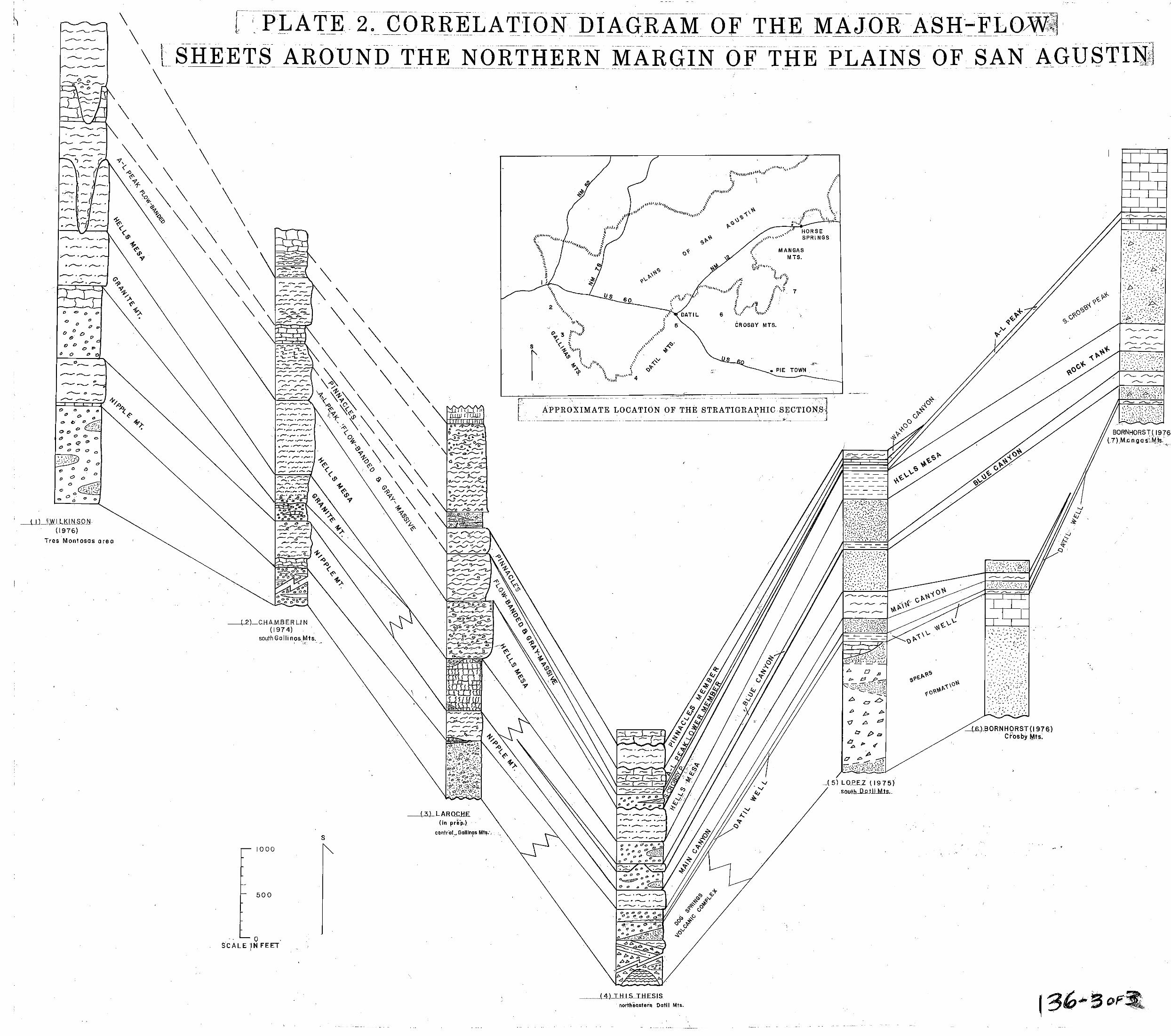
2 - Correlation diagram of the major ash-flow sheets around poclcet) the northern margin of the Plains o f San Agustin (in
3 - Tectonic sketch map around the northern margin o f the Plains of San Agustin (in pocket)
TABLES
1 - Modal analyses in volume percent of the quartz-latite tuff breccia in the Dog Springs volcanic complex ......... 20
2 - Modal analyses in volume percent of the tuff of Blue Canyon ................................................... 71
3 - Modal analyses in volume percent of the A-L Peak Formation................................................gZ
FIGURES
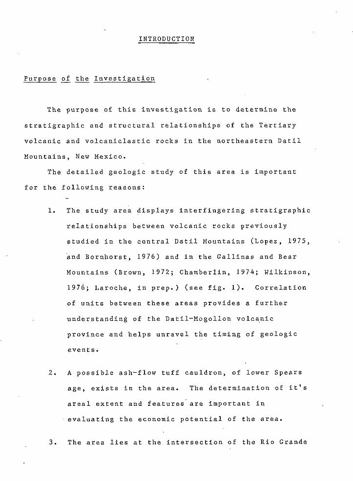
1 - Diagram showing relationship between this study area and previous and present study areas.........................Z
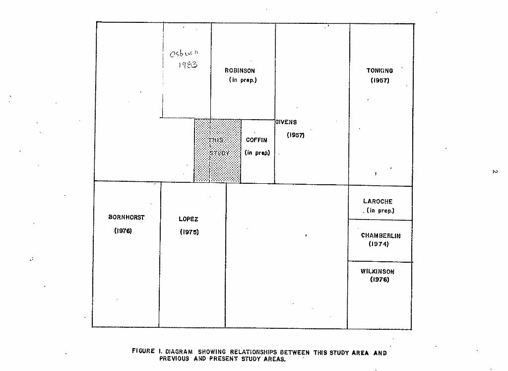
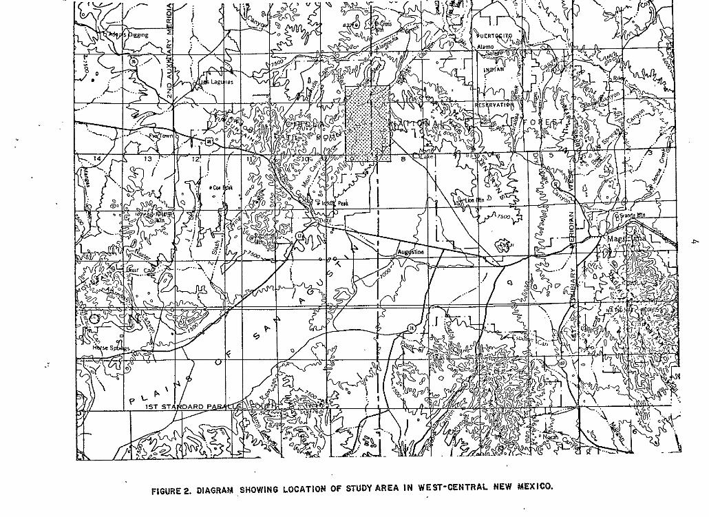
2 - Diagram showing location of study area in west-central New Mexico...............................................4
3 - Composite stratigraphic column of the northeastern Datil Mountains................................................l3
V
4 - Photograph showing a heterolithic quartz-latite tuff . breccia outcrop in the Dog Srings volcanic complex ....... 17
5 - Photograph showing a closeup of a monolithic tuff breccia in the Dog Springs volcanic complex....... ............... 17
6 - Photomicrograph of quartz-latite tuff breccia of the Dog Springs volcanic complex.......................... ....... 19
7 - Photomicrograph of laharic breccia of the Dog Springs volcanic complex ......................................... 19
8 - Photograph of a megabreccia limestone block in the Dog Springs volcanic complex ................................. 26
9 - Photograph of megabreccia blocks(?) of biotite-rich ash-flow tuff in th Dog Springs volcanic complex.........27
10 - Photograph of sedimentary rocks associated with the ash-flow tuff megabreccia block shown in figure 9........27
e 11 - Photograph of laharic breccias in the Dog Springs
volcanic complex........... .............................. 29
12 - Photograph o f a autobrecciated rhyodacite dike in the Dog Springs volcanic complex 32 .. .............................
13 - Photograph of autobrecciated rhyodacite showing the angularity, wide range in size, and monolithic composition of clasts...... .............................. 32
14 - Photograph of monolithic, autobrecciated quartz-latite intrusive in the Dog Springs volcanic complex.. .......... 35
15 - Schematic diagram showing the possible formation of the Dog Springs volcanic complex........................... . .42
16 - Photograph of an outcrop of the feldspathic sandstone member of the unit of Chavez Canyon ...................... 45
e 17 - Photograph of the conglomerate member of the
VI
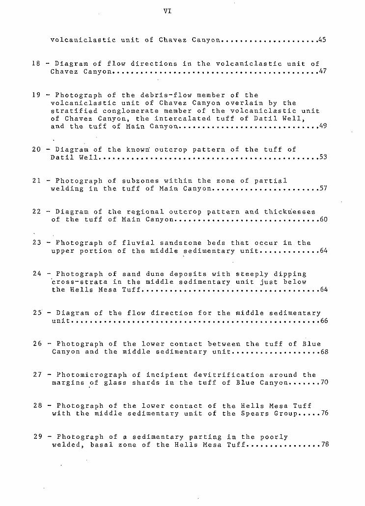
v o l c a n i c l a s t i c u n i t o f C h a v e z C a n y o n . . . . . . . . . . . . . . . . . .... 45
1 8 - D i a g r a m o f f l o w d i r e c t i o n s i n t h e v o l c a n i c l a s t i c u n i t o f Chavez Canyon ............................................ 4?
19 - P h o t o g r a p h o f t h e d e b r i s - f l o w m e m b e r o f t h e v o l c a n i c l a s t i c u n i t o f C h a v e z C a n y o n o v e r l a i n b y t - h e
o f C h a v e z C a n y o n , t h e i n t e r c a l a t e d t u f f o f D a t i l Well, s t r a t i f i e d c o n g l o m e r a t e member of t h e v o l c a n i c l a s t i c u n i t
a n d t h e t u f f o f M a i n C a n y o n . . ............................ 49
2 0 - D i a g r a m o f t h e k n o w a o u t c r o p p a t t e r n o f t h e t u f f o f D a t i l Well...............................................53
2 1 - P h o t o g r a p h o f s u b z o n e s w i t h i n t h e z o n e o f p a r t i a l w e l d i n g i n t h e t u f f o f M a i n C a n y o n . . . . ................... 57
22 - D i a g r a n o f t h e r e g i o n a l o u t c r o p p a t t e r n a n d t h i c k n e s s e s o f t h e t u f f o f M a i n C a n y o n .............................. -60
2 3 - P h o t o g r a p h o f f l u v i a l s a n d s t o n e b e d s t h a t o c c u r i n t h e u p p e r p o r t i o n o f t h e m i d d l e s e d i m e n t a r y u n i t . . . . . . . . . . . . . 6 4
24 - P h o t o g r a p h o f s a n d d u n e d e p o s i t s w i t h s t e e p l y d i p p i n g ' c r o s s - s t r a t a i n t h e m i d d l e s e d i m e n t a r y u n i t j u s t b e l o w t h e H e l l s Mesa Tuff......................................64
25 - D i a g r a m o f t h e f l o w d i r e c t i o n f o r t h e m i d d l e s e d i m e n t a r y unit......................................................66
2 6 - P h o t o g r a p h o f t h e l o w e r c o n t a c t b e t w e e n t h e t u f f o f B l u e C a n y o n a n d t h e m i d d l e s e d i m e n t a r y u n i t . . . . . . . . . . . . . . . . . . . 6 8
27 - P h o t o m i c r o g r a p h o f i n c i p i e n t d e v i t r i f i c a t i o n a r o u n d t h e m a r g i n s o f g l a s s s h a r d s i n t h e t u f f o f B l u e C a n y o n ....... 70
2 8 - P h o t o g r a p h o f t h e l o w e r c o n t a c t o f t h e H e l l s M e s a T u f f w i t h t h e m i d d l e s e d i m e n t a r y u n i t o f t h e S p e a r s G r o u p ..... 76
29 - P h o t o g r a p h o f a s e d i m e n t a r y p a r t i n g i n t h e p o o r l y w e l d e d , b a s a l z o n e o f t h e He l l s Mesa Tuf f . . . . . . . . . . . . . . . . 78
VI1
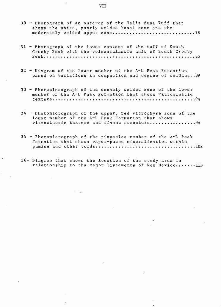
30 - Photograph of an outcrop of the Hells Mesa Tuff that shows the white, poorly welded basal zone and the moderately welded upper zone..............................78
3 1 - Photograph of the lower contact of the tuff of South Crosby Peak with the volcaniclastic unit of South Crosby Peak.........................................~..........,85
32 - Diagram of the lower member of the A-L Peak Formation based on variations in compaction and degree of welding...89
3 3 - Photomicrograph of the densely welded zone of the lower member o f the A-L Peak Formation that shows vitroclastic texture ................................................... 94
34 - Photomicrograph of the upper, red vitrophyre zone o f the lower member of the A-L Peak Formation that shows vitroclastic texture and fiamme structure................94
35 - Photomicrograph of the pinnacles menber o f the A-L Peak Formation that shows vapor-phase mineralization within pumice and other voids. . . . . . . . . . . . . . . . . . . . . . . . . . . . . . . . . . . lOZ
36- Diagram that shows the location of the study area in relationship to the major lineaments of New Mexico.......ll3
VI11
ABSTRACT
The northeastern Datil Mountains has had a complex
geologic history from the Oligocene to the present. In the
early Oligocene (about 37 to 3 4 m.y. B.P.), intermediate
volcanism resulted in the forma.tion of the Dog Springs
volcanic complex. .This complex consists of quartz-latitic to
andesitic vents, domes and pyroclastic and epiclastic
breccias.
After the erosional leveling of the rocks of the Dog
Springs volcanic complex, the northeastern Datil Mountains
were characterized by a period of basinal filling with little
e ' tectonic disturbance. The basin was filled with
volcaniclastic sedimentary rocks that show an overall
fining-upward sequence and the intercalated tuff of Datil
Well, tuff of Main Canyon, tuff of Blue Canyon, and Hells
Mesa Tuff (about 3 % m.y. B . P . ) .
Shortly after deposition of the Hells Mesa Tuff,
extensional deformation associated with the Rio Grande rift
created a southeast-plunging synformal downwarp in the
northeastern Datil Mountains. Volcanic rocks deposited under
the influence of this downwarp include the unit of South
Crosby Peak and the A-L Peak Formation (30 to 3 % m.y. B.P.).
Northeast-trending, high-angle normal faulting began in the
late Oligocene to early Miocene and continued into the
Holocene. The youngest volcanic unit in the northeastern
Datil Mountains is the Pliocene ( ? ) basalt of Blue Mesa. 0
IX
Correlations of Oligocene volcanic units made by this
thesis include: the Dog Springs volcanic complex with
portions of Lopez's (1975) and Bornhorst's (1976) Spears
Formation; the Magdalena Project's tuff of Nipple Mountain
with Lopez's (1975) and Bornhorst's (1976) tuff of Main
Canyon; Chapin's (1974-b) Hells Mesa Tuff with Bornhorst's
(1976) tuff of Rock Tank; and the pinnacles member of the A-L
Peak Formation with Lopez's (1975) and Bornhorst's (1976)
tuff of Wahoo Canyon.
6
INTRODUCTION
Purpose of the Investigation ”
The purpose of this investigation is to determine the
stratigraphic and structural relationships of the Tertiary
volcanic and volcaniclastic rocks in the northeastern Datil
Mountains, New Mexico.
The detailed geologic study of this area is important
for the following reasons:
1.
2.
3 .
*
The study area displays interfingering stratigraphic
relationships between volcanic rocks previously
studied in the central Datil Mountains (Lopez, 1.975,
and Bornhorst, 1 9 7 6 ) and in the Gallinas and Bear
Mountains (Brown, 1 9 7 2 ; Chamberlin, 1 9 7 4 ; Wilkinson,
1 9 7 6 ; Laroche, in prep.) (see fig. 1). Correlation
of units between these areas provides a further
understanding of the Datil-Mogollon volca,nic
province and helps unravel the timing of geologic
events.
A possible ash-flow tuff cauldron, of lower Spears
age, exists in the area. The determination of it’s
areal extent and features are important in
evaluating the economic potential of the area.
The area lies at the intersection of the Rio Grande
2 ..
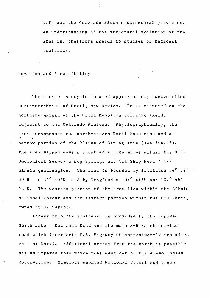
3
rift and the Colorado Plateau structural provinces.
An understanding of the structural evolution o f the
area is, therefore useful to studies of regional
tectonics.
Location and Accessibility
The area of study is located approximately twelve miles
north-northeast of Datil, New Mexico. It is situated on the
northern margin of the Datil-Nogollon volcanic field,
adjacent to the Colorado Plateau. Physiographically, the
area encompasses the northeastern Datil Mountains ana a
narrow portion of the Plains of San Agustin (see fig. 2).
The area mapped covers about 48 square miles within the U . S .
Geological Survey's Dog Springs and Cal Ship Mesa 7 1 / 2
minute quadrangles. .The area is bounded by latitudes 34' 2 2 '
30"N and 34' 15'N, and by longitudes 107' 41'W and 107 ' 46'
42"W. The western portion of the area lies within the Cibola
National Forest and the eastern portion within the H-H Ranch,
owned by J. Taylor.
Access from the southeast is provided by the unpaved
North Lake - Red Lake Road and the main H-H Ranch service road which intersects U.S. Highway' 60 approximately ten miles
east of Datil. Additional access from the north is possible
via an unpaved road which runs west out o f the Alamo Indian
Reservation. Numerous unpaved National Forest and ranch
4
5
roads provide access to within about a mile and a half of any
point in the study area.
Previous Works
The earliest geologic investigation in the Datil
Mountains was conducted by Herrick ( 1 9 0 0 ) as part of a
regional reconnaissance survey o f western Socorro and
Valencia counties. Be interpreted the Datil Mountains as
composed of trachyte and rhyolite intrusives.
Winchester (1920) gave the name Datil Formation to the
entire Tertiary sequence of tuffs, rhyolites, sandstones, and
conglome'rates that form the Datil Mountains. His type
section, however was measured about 20 miles to the east of
the Datil Mountains in the northern Bear Mountains. Wilpolt
and others ( 1 9 4 6 ) separated the lower arkosic rocks and
mudstones from Winchester's Datil Formation and renamed them
the Baca Formation.
Tonking (1957), from work in the Puerticito quadrangle
at the north end of the Bear Mountains, expanded the Datil
Formation to include the basaltic and basaltic-andesite rocks
above Winchester's section. Thus, the Datil Formation of
Tonking included the complete sequence of volcanic and
sedimentary rocks above the Eocene Baca Formation and below
the graben-fill sedimentary rocks of the late Tertiary Santa
Fe Group. He subdivided the Datil Formation into a lower,
6
quartz-latite Spears Member; a middle, rhyolite Hells Mesa
Member; and an upper, basaltic-andesite La Jara Peak Member.
Givens (1957) informally subdivided the Hel ls Mesa
Member of the Datil Formation into seven units bn the basis
of stratigraphic position, degree o f welding, color and
composition. His map o f the Dog Springs 15-minute quadrangle
in part overlaps the study area and represents the only
previous, detailed geologic map of the area. Willard and
Givens (1958) published a reconnaissance geologic map of the
Datil 30-minute quadrangle.
Willard (1959) compiled a reconnaissance map of northern
Catron and Socorro counties, to the west o f this study area,
in which he subdivided the Datil Formation into
interfingering latite facies, volcanic sedimentary facies,
rhyolite facies, and andesite facies. He also tentatively
correlated the La Jara Peak Member of the Datil Formation
with the Mangas basalts of the Mangas Mountains, and observed
that the Mangas basalts regionally rested unconformably on
all facies of the Datil Formation. Following Willard's
observations,. Weber (1963) excluded the La Jara Peak Member
from the Datil Formation and reassigned it to a post-Datil
sequence of basalts and basaltic-andesites. Later Weber
(1971) raised the Datil Formation to group status and Chapin
(1971-a) raised the Spears, Hells Mesa, and La Jara Peak
Members to formation status.
0
From work in the Bear Mountains, Brown (1972) informally
subdivided the Hells Mesa Formation into seven mappable
7
units: the tuff of Goat Springs, a lower and an upper tuff
of Bear Springs, the tuff of Allen Well, and three
intercalated andesite intervals. Deal and Rhodes (1974)
renamed the tuffs of Bear Springs the A-L Peak Rhyolite for
exposures o n the northeastern flank of A-L Peak, in the
northern San Mateo Mountains. Chapin (1974-b) restricted the
Hells Mesa Formation to the basal unit of Tonking's Hells
Mesa Member which consists of crystal-rich, quartz-rich,
quartz-latite to rhyolite ash-flow tuff, correlative to
Brown's (1972) tuff of Goat Springs.
Lopez (1975) mapped the area surrounding Datil, New
Mexico, immediately to the southwest of this study area, and
divided the rocks of the Datil Group into two stratigraphic
sections on opposite sides of a major fault. In the northern
section, Lopez's upward sequence' consists of the Spears
Formation, a lower sedimentary unit, the rhyolite tuff of
Main Canyon, a middle sedimentary unit, the rhyolite tuff of
Blue Canyon, an upper sedimentary unit, the Hells Mesa
Rhyolite, the A-L Peak Rhyolite, the basaltic-andesite of
Twin Peaks, and the tuff of Wahoo Canyon. In'the southern
section, his upward sequence consists of the Spears
Formation, th.e rhyolite tuff of Horse Springs, the rhyolite
tuff of Ary Ranch, the rhyolite tuff of Crosby Mountain, the
A-L Peak Rhyolite, the basaltic-andesite of.Twin Peaks, and
the tuff of Wahoo Canyon. Bornhorst (1976) described a
stratigraphy similar to Lopez's southern section in the
Crosby Mountains.
8
I n a d d i t i o n , s e v e r a l m a s t e r s t h e s e s h a v e e x t e n d e d t h e
T e r t i a r y v o l c a n i c s t r a t i g r a p h y a n d s t r u c t u r e w e s t w a r d f r o m
t h e B e a r M o u n t a i n s i n t o t h e G a l l i n a s M o u n t a i n s a s p a r t o f t h e
New M e x i c o B u r e a u o f M i n e s a n d M i n e r a l R e s o u r c e s ' M a g d a l e n a
P r o j e c t . S i m o n ( 1 9 7 3 ) m a p p e d t h e S i l v e r H i l l a r e a , w e s t of
M a g d a l e n a , N e w N e x i c o ; G h a m b e r l i n ( 1 9 7 4 ) c o n d u c t e d a s t u d y of
t h e C o u n c i l R o c k a r e a i n t h e s o u t h e a s t e r n G a l l i n a s M o u n t a i n s ;
a n d W i l k i n s o n ( 1 9 7 6 ) s t u d i e d t h e g e o l o g y o f t h e T r e s M o n t o s a s
- Cat M o u n t a i n a rea .
L a r o c h e ( i n p r e p . ) i s c o n d u c t i n g a n i n v e s t i g a t i o n o f t h e
c e n t r a l G a l l i n a s M o u n t a i n s a r e a . A n o t h e r c o n c u r r e n t thes i s
i s b e i n g p r e p a r e d by C o f f i n ( i n p r e p . ) i n t h e n o r t h w e s t e r n
G a l l i n a s M o u n t a i n s , i m m e d i a t e l y t o t h e e a s t o f t h i s s t u d y
a r e a .
M e t h o d s & I n v e s ' t i g a t i o n
D e t a i l e d g e o l o g i c m a p p i n . g w a s c o n d u c t e d a t a 1 : 2 4 , 0 0 0
s c a l e u s i n g t h e U . S . G e o l o g i c a l S u r v e y ' s Dog S p r i n g s a n d Ca l
S h i p M e s a 7 1 / 2 m i n u t e t o p o g r a p h i c q u a d r a n g l e m a p s . U.S.
F o r e s t S e r v i c e c o l o r a r e a l p h o t o g r a p h s o f t h e F.16-CIB s e r i e s ,
1 9 7 4 - 7 5 , w e r e u s e d a s a g u i d e t o t h e l o c a t i o n a n d
c o n f i g u r a t i o n o f o u t c r o p s . F i e l d w o r k was d o n e d u r i n g t h e
summer and f a l l o f 1 9 7 9 a n d s p r i n g o f 1 9 8 0 .
T h i n - s e c t i o n a n a l y s i s p r o v i d e d p e t r o g r a p h i c
c h a r a c t e r i s t i c s o f t h e r o c k s a n d h e l p e d t o s u p p o r t f i e l d
e
9
correlations. Modal analyses of the volcanic units were made
by the author using a Zeiss microscope equipped with a Swift
automatic point counter. Plagioclase compositions were
determined via the Rittmann Zone method using an universal
stage. .Volcanic rock names introduced by this thesis were
adapted from the classification scheme of Lipman ( 1 9 7 5 , p. 5,
fig. 3 ) .
The southeastern portion of the study-area lies within
the Plains of San Agustin. The spelling used in this thesis
is adopted from the original Spanish name for the plains.
The U.S . Geological Survey's preferred spelling is Augustin.
e Acknowledgements
Appreciation is due to the various people who aided in
the preparation of this thesis. Primary. regards are extended
to Dr. C.E. Chapin, who suggested the problem and provided
knowledge, criticism and encouragement; and to the New Mexico
Bureau of Mines and Mineral Resources which supported the
' thesis. Special thanks go to Bob Osburn, who spent time in
the field and provided many geologic insights; Greg Coffin,
who worked in an adjoining field area and communicated many
geologic observations; and to Dr. Richard Chamberlin, who
played the role of a friendly 'Devil's Advocate.' Additional
thanks go to Dr. C.T. Smith and Dr. D. Norman, who served on
the thesis committee and reviewed the manuscript. And a very
10
special, personal thanks goes to my wife Brenda, who provided
inspiration and spent considerable time typing this thesis.
11
STRATIGRAPHY AND PETROLOGY
Pre-Oligocene Rocks
Pre-Oligocene rocks crop out only in the northwestern
corner of this st
Lake fault. The
dipping at about
by Fitzsimmons (1
udy area, on the upthrown side o f the Red
area is structurally a gentle monocline
4' to the south. This slope was refered to
957) as the Mogollon Slope, and interpreted
as the southern boundary o f the Colorado Plateau. The rocks
exposed on the slope belong to the Cretaceous Mesaverde Group
and the Eocene Baca Formation (Snyder, 1971). The Mesaverde
Group, in this study area, consist of yellowish-green
sandstones, siltstones, and mudstones. The overlying rocks
o f the Baca Formation consist o f terrestial red t o white
sandstones, conglomerates, siltstones, and mudstones.
Studies o f the pre-Oligocene rocks of this area are by to /
Robinson (in prep.), Snyder (1971), Gadway (1959), Dane and
others (1957), Givens (1957), Pike (19471, and Winchester
e
? @
(1920).
Tertiary Volcanic and Volcaniclastic Rocks
The rocks in the northeastern Datil Mountains consist
predominantly o f welded ash-flow tuffs, lava flows and
intercalated volcaniclastic sedimentary rocks of Tertiary
* age. These rocks crop out throughout the entire study area
except where they are buried by younger gravel deposits and
alluvium. Of these rocks, Oligocene volcanic and
volcaniclastic rocks dominate, and are divisible into four
units. From oldest to youngest, these are the Spears Group,
the Hells Mesa Tuff, the volcaniclastic rocks o f South Crosby
Peak, and the A-L Peak Formation (see fig. 3 ) . The lower
portion of the Spears Group in the northeastern Datil
Mountains consists of a volcanic complex of unknown
thickness. Above this complex, a maximum total thickness for
the Oligocene rocks is estimated to be about 2300 ft (700m).
A maximum of about 100 ft (30m) of post-Oligocene basaltic
rocks overlie the Oligocene units.
Spears Group
The name Spears Ranch Member of the Datil Formation was
initially given by Tonking (1957) to the quartz-latite tuffs
and andesitic volcaniclastic rocks lying above the arkosic
rocks of the Eocene Baca Formation and below the rhyolite
Hells Mesa member of the Datil Formation. Tonking's type
section is located approximately 1 mile south of the Guy
Spears Ranch Headquarters in sec. 8, T.IN., R.4W. Weber
(1971) raised the Datil Forma~tion to group status and Chapin
(1971-a) raised the Spears Member to formation' status.
..
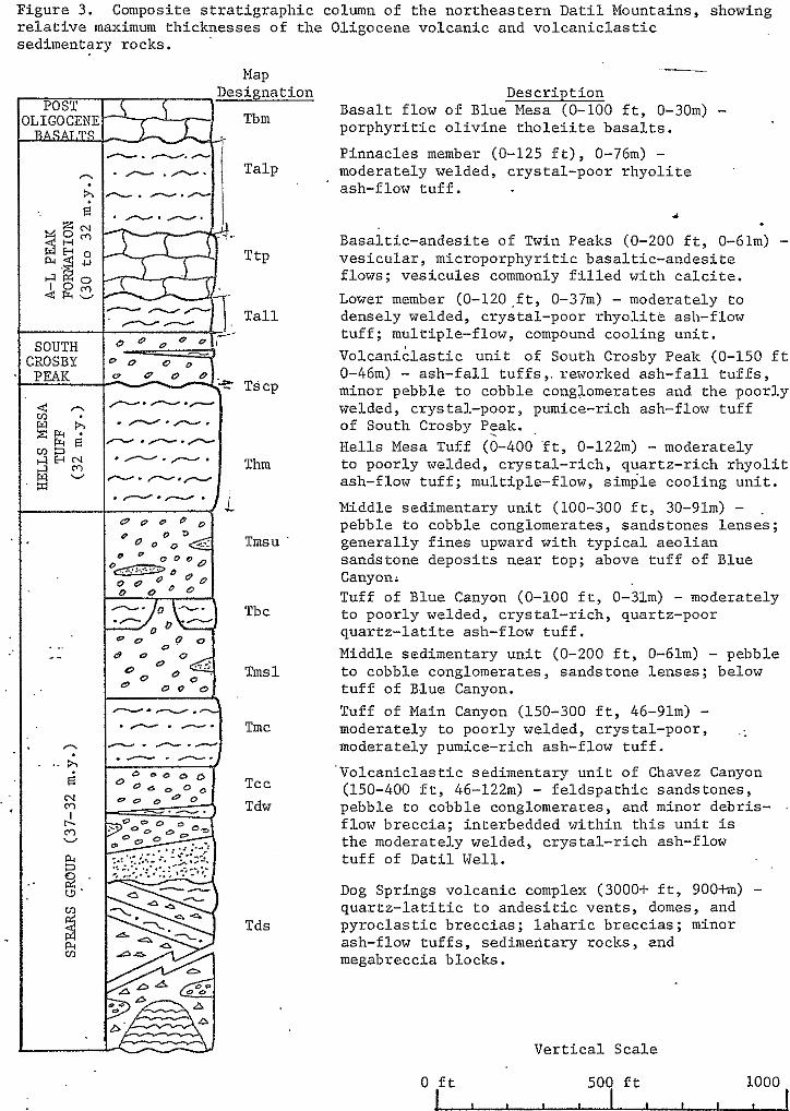
Figure 3. Composite s t r a t i g r a p h i c column of the northeastern Datil Mountains, showing r e l a t i v e maximum th icknesses o f the Ol igocene vo lcanic and vo lcanic las t ic sedimentary rocks.
Map Designation
POST ILIGOCENE Tbm
Tmsu
Tbc
Tms 1
Tmc
Tcc Tdw
Tds
Ver t i ca l Sca le
0 f t I , , , 504 f t I I 1,000 ! f t
-
Descript ion Basalt flow of Blue Mesa (0-100 f t , 0-30m) - p o r p h y r i t i c o l i v i n e t h o l e i i t e b a s a l t s .
Pinnacles member (0-125 f t ) , 0-76m) - moderately welded, ,crystal-poor rhyol i te ash-flow t u f f .
1
Basal t ic-andesi te of Twin Peaks (0-200 f t , 0-6lm) .- ves i cu la r , m ic roporphyr i t i c basa l t i c - andes i t e f lows; vesicules commonly f i l l e d w i t h c a l c i t e . Lower member (0-120,ft , 0-37m) - moderately to densely welded, crystal-poor rhyolite ash-flow tuff ; mult iple-f low, compound cool ing un i t . V o l c a n i c l a s t i c u n i t of South Crosby Peak (0-150 f t , 0-46m) - ash- fa l l tu f fs , . rewor lced ash- fa l l tu f fs , minor pebble to cobble conglomerates and the poorly welded, crystal-poor, pumice-rich ash-flow tuff of South Crosby Peak. ,
Hells Mesa Tuff (0-400 . f t , 0-122m) - moderately
ash-flow tuff ; mult iple-f low, s imple cool ing u n i t . to poorly welded, crystal-rich, quartz-rich r h y o l i t e
Middle sedimentary unit (100-300 f t , 30-91m) - . pebble to cobble conglomerates, sandstones lenses; genera l ly fines upward wi th t yp ica l aeo l i an sandstone deposi ts near top; above tuff of Blue Canyon; Tuff of Blue Canyon (0-100 f t , 0-3lm) - moderately
quar tz - la t i te ash- f low tuf f . to poorly welded, crystal-r ich, quar tz-poor
Middle sedimentary unit (0-200 f t , 0-61m) - pebble to cobble conglomerates, sandstone lenses; below tuff of Blue Canyon. Tuff of Main Canyon (150-300 f t , 46-91m) - moderately to poorly welded, crystal-poor, .: moderately pumice-rich ash-flow tuff.
Volcaniclast ic sedimentary uni t of Chavez Canyon (150-400 f t , 46-122m) - fe ldspa th ic sands tones , pebble to cobble conglomeraces, and minor debris- f low brecc ia ; in te rbedded wi th in th i s un i t is the moderately welded, crystal-rich ash-flow tu f f of Datil Well.
Dog Springs volcanic complex (3000-b f t , 900fm) -
p y r o c l a s t i c b r e c c i a s ; l a h a r i c b r e c c i a s ; minor q u a r t z - l a t i t i c t o a n d e s i t i c v e n t s , domes, and
megabreccia blocks. ash-flow tuffs , sedimentary rocks, and
.
14
Certain stratigraphic features of the Spears in this
study area render it's formation status impracticable. As
defined by the Code of Stratigraphic Nomenclature, " A
formation is a body of rock characterized by lithological
homogeneity." The stratigraphic interval occupied by the
Spears contains rock types varying from rhyolite ash-flow
tuffs, to quartz-latite ash-flow tuffs and tuff breccias, to
basaltic-andesite flows, to volcaniclastic deposits of
conglomerates, sandstones and mudflows. In addition, most of
the ash-flow tuff sheets within the Spears possess the
characteristics of distinctive lithology and mappability,
which warrent them formation status in their own right. It
is therefore informally proposed that the Spears be elevated
to group status and that the major ash-flow tuffs and other
mappable units within the Spears be elevated to formation
status. Fornalization of this pr-oposal is in preparation by
C.E. Chapin and G.R. Osburn.
The Spears Group is the basal Tertiary volcanic unit of
the northern Datil-Mogollon volcanic field. In that sense,
it is temporally correlative to the Rubio Peak Formation of
Jicha (1954), Elston (1957), and Jones and others (1967),
which represents the basal Tertiary volcanic un'it of the
southern portion of the volcanic field. Both units are of
intermediate, andesite to quartz-latite composition. The
Spears Group is also probably corre'lative to the lower
andesite unit of Stearns (1962) and the epiclastic volcanic
rocks o f Ratte and others (1967), located along the
15
northwestern margin of the Datil-Mogollon volcanic field. A
similarity can be drawn between these rocks and the San Juan,
Lake Fork, and Conejos Formations of intermediate composition
in the San Juan volcanic field, Colorado (Lipman and others,
1970).
- Dog Springs Volcanic Complex
Speculations on the existence of a volcanic complex and
a possible ash-flow tuff caldera grew out of the mapping of
B. Robinson (in prep.) in the southern portion of the D-Cross
7 1/2' quadrangle. There, a thick accumulation of volcanic
rocks apparently cross cut rocks of the Cretaceous Mesaverde
Group and Eocene Baca Formation. Reconnaissance of the area
by C.E. Chapin and G.R. Osburn revealed the presence of
several thousand feet'of quartz-latite tuff breccias,
rhyodacite autobrecciated rocks and minor quartz-latite
ash-flow tuffs. The geologic mapping of the Dog Springs 7
1/2' minute quadrangle and the eastern portion of the Cal
Ship Mesa 7 1/2' quadrangle, by this thesis and a thesis in
preparation by G. Coffin, documents the existence of an
Oligocene volcanic complex in this region. The complex is
herein referred to as the Dog Springs volcanic complex, for
exposures of it's various rock types along Dog Springs Canyon
in secs. 29-32, T.ZN., R.8W.
1 G
tuff breccias
The dominant roclc type of the Dog Springs volcanic
complex in this study area is hornblende quartz-latite tuff
breccia. The term tuff breccia is adopted from Parsons
( 1 9 6 7 ) and applies to "volcanic breccias with a large
percentage of fine-grained tuffaceous matrix." The term was
I originally defined by Norton ( 1 9 1 7 ) . Minor amounts of
hornblende quartz-latite ash-flow tuffs and lavas are
associated with the tuff breccias. I '
Both heterolithic and monolithic tuff breccias are
recognized in the complex. The two types grade into each
other with diffuse boundaries and share a similar matrix of
pyroclastic material, which is identical to the ash-flow
tuffs of the Dog Springs volcanic complex. Phenocrysts of
feldspar, hornblende and biotite are most prominent, and
e
there is a notable absence of vesicular and scoriaceous
material.
! Outcrops of the tuff breccias are generally massive and '
seldom show stratification. The few exposures that do show
bedding are typically alternating sequences'of fine-grained
lava flows and thin breccia flows. Exposures of the breccias
are usually limited to hill crests and valleys, with slopes
typically covered by debris.
The heterolithic tuff breccias contain angular to
subrounded clasts, which are nonsorted and are extremely
heterogenous as to size (see fig. 4 ) . The size range of the 0
17
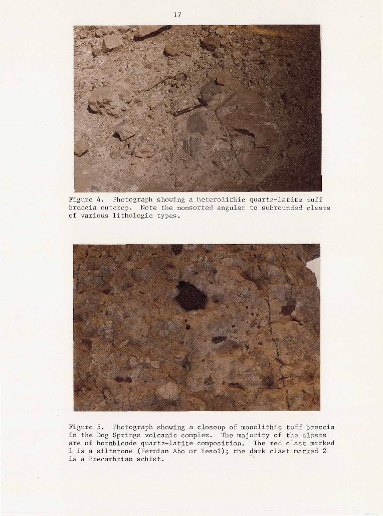
Figure 4 . Photograph showing a l icLero l i th ic quar tz - ra r l re EUII breccia outcrop. Note the nonsorted angular t o subrounded c las ts of var ious l i tho logic types .
in the Dog Springs volcanic complex. The major i ty of t h e c l a s t s 5. Photograph showing a closeup of monol i th ic tu f f b recc ia
are of hornblende quartz-lati te composition. The r ed clast marked 1 i s a s i l t s t o n e (Permian Ab0 o r Yeso?); the dark clast marked 2 i s a Precambrian schist .
.I
18
clasts is from a few millimeters across to megabreccia blocks
several hundred meters in diameter. Clast compositions
include Precambrian schists, amphibolites and granitic
gneisses; red siltstones (Permian Abo and Yeso?); limestones
(Permian San Andres or Pennsylvanian Madera?); and minor
siltstones and sandstones.
The monolithic tuff breccias are volumetrically far
greater than the heterolithic type. In essence, however they
are never truely monolithic in that'they almost invariably
contain a few percent of heterolithic fragments of the same
lithologies previously mentioned (see fig. 5 ) . Yet, they are
considered monolithic in that they are composed of
essentially one clast type. This clast type is of hornblende
quartz-latite composition and is extremely similar to that o f
the matrix of the tuff breccias. The clasts are subrounded
to angular and generally 2 centimeters,or less in diameter.
The clasts usually have a light-gray color which contrasts to
the usual brownish color of the matrix. .
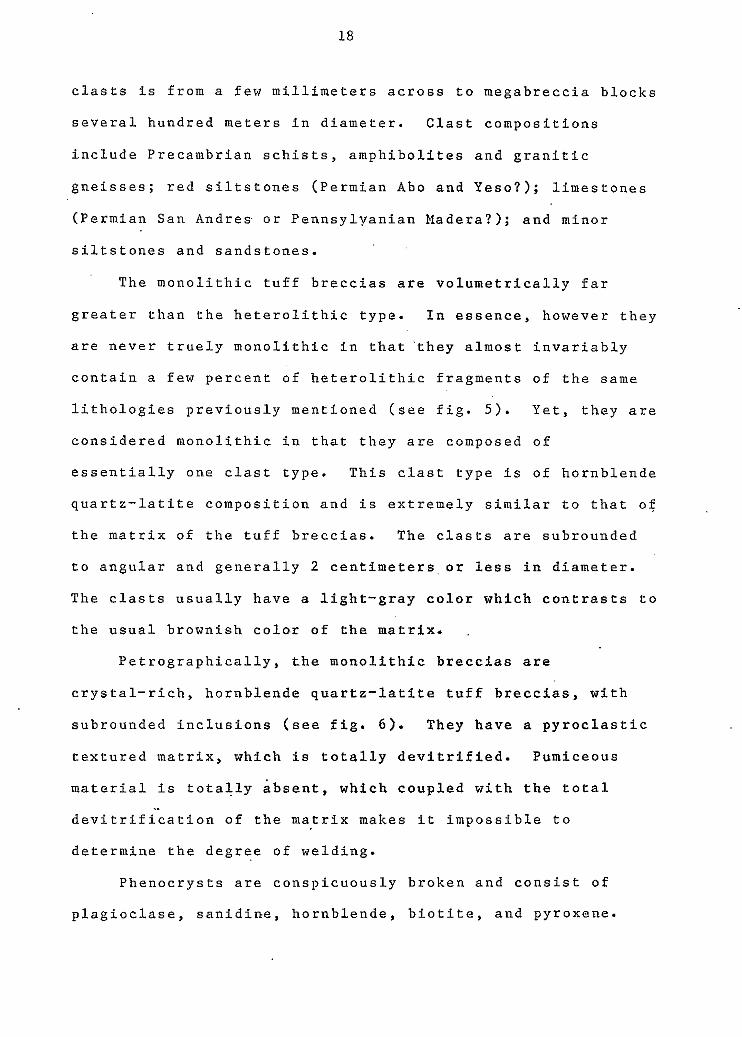
Petrographically, the monolithic breccias are
crystal-rich, hornblende quartz-latite tuff breccias, with
subrounded inclusions (see fig. 6 ) . They have a pyroclastic
textured matrix, which is totally devitrified. Pumiceous
material is totally absent, which coupled with the total
devitrification o f the matrix makes it impossible to
determine the degree of welding.
-
Phenocrysts are conspicuously broken and consist of
plagioclase, sanidine, hornblende, biotite, and pyroxene.
19
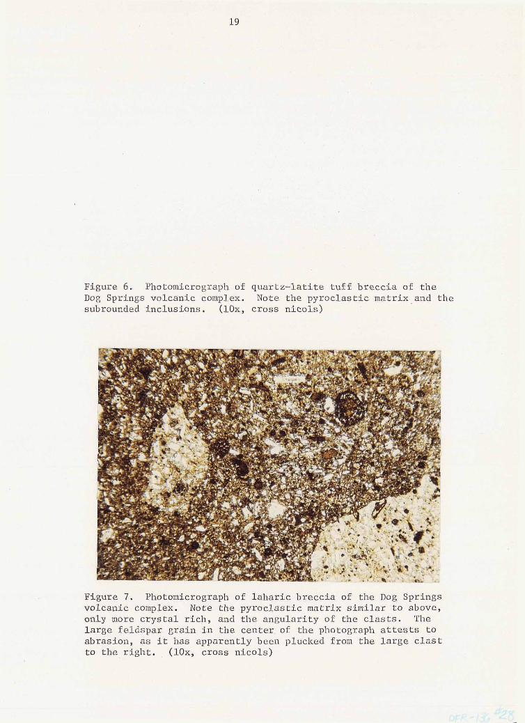
Figure 6. Photomicrograph of q u a r t z - l a t i t e t u f f b r e c c i a of t h e Dog Springs volcanic complex. Note the py roc la s t i c ma t r ix and t h e subrounded inclusions. ( lox, cross nicols)
Figure 7. Photomicrograph of l a h a r i c b r e c c i a of the Dog Springs volcanic complex. Note the pyroc las t ic mat r ix s imi la r to above , only more c r y s t a l r i c h , and the angu la r i ty of t h e c l a s t s . The l a rge f e ldspa r g ra in i n t he cen te r , of the photograph attests t o abras ion , as i t has apparently been plucked from t h e l a r g e c l a s t t o t h e r i g h t . . ( lox , c ross n ico ls )
20
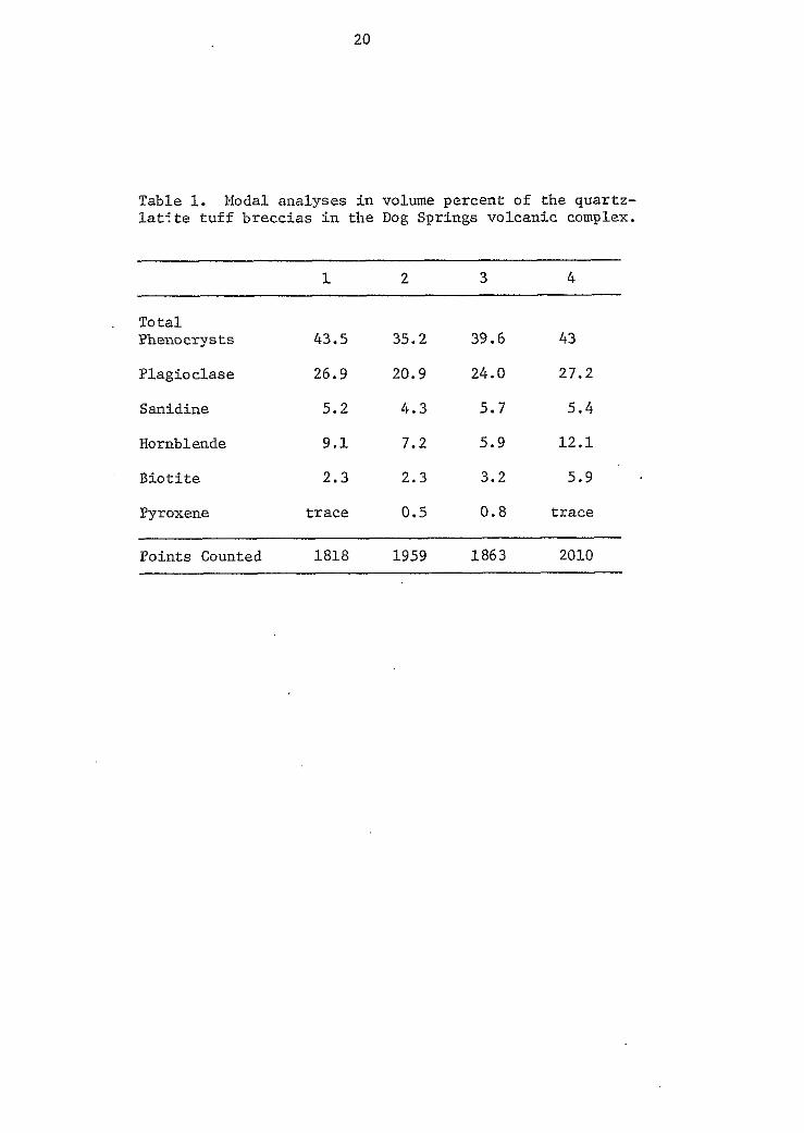
Table 1. Modal ana lyses in volume percent of the quar tz - l a t ' t e t u f f b r e c c i a s i n t h e Dog Springs volcanic complex.
1 2 3 4
To t a l Phenocrysts 43.5 35.2 39.6 43
Plagioc lase 26.9 20.9 24.0 27.2
Sanidine 5.2 4 .3 5.7 5 .4
Hornblende 9.1 7.2 5.9 12 .1
B i o t i t e 2.3 2.3 3.2 5.9
Pyroxene t r a c e 0.5 0 . 8 t r a c e
Points Counted 1818 1959 1863 2010
21
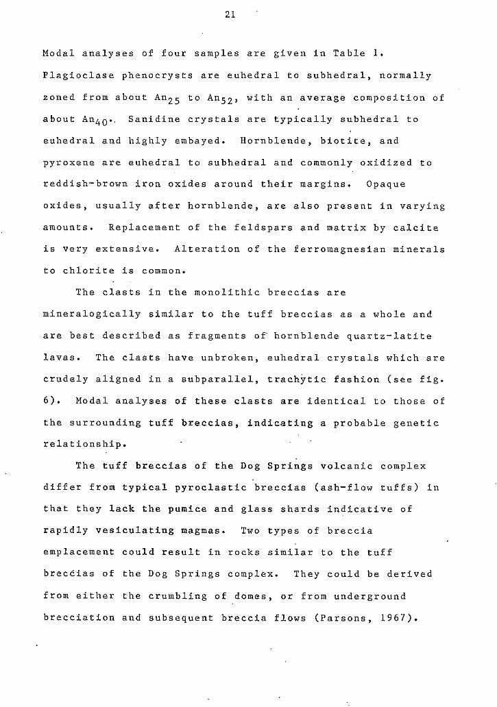
Modal analyses of four samples are given in Table 1.
Plagioclase phenocrysts are euhedral to subhedral, normally
zoned from about An25 to An52, with an average composition of
about An4o.. Sanidine crystals are typically subhedral to
euhedral and highly embayed. Hornblende, biotite, and
pyroxene are euhedral to subhedral and commonly oxidized to
reddish-brown iron oxides around their margins. Opaque
oxides, usually after hornblende, are also present in varying
amounts. Replacement of the feldspars and matrix by calcite
is very extensive. Alteration of the ferromagnesian minerals
to chlorite is common.
The clasts in the monolithic breccias are
mineralogically similar to the tuff breccias as a whole and
are best described as fragments o f hornblende quartz-latite
lavas. The clasts have unbroken, euhedral crystals which are
crudely aligned in a subparallel, trachytic fashion (see fig.
6). Modal analyses of these clasts are identical to those of
the surrounding tuff breccias, indi.cating a probable genetic
relationship.
The tuff breccias of the Dog Springs volcanic complex
differ from typical pyroclastic 'breccias (ash-flow tuffs) in
that they lack the pumice and glass shards indicative of
rapidly vesiculating magmas. Two types of breccia
emplacement could result in rocks similar to the tuff
breccias of the Dog Springs complex. They could be derived
from either the crumbling of domes, or from underground
brecciation and subsequent breccia flows (Parsons, 1967).
22
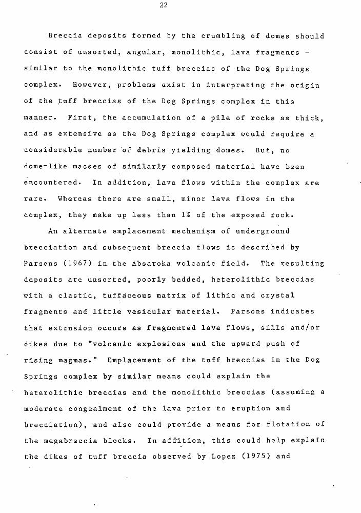
Breccia deposits formed by the crumbling of domes should
e consist of unsorted, angular, monolithic, lava fragments - similar to the monolithic tuff breccias of the Dog Springs
complex. However, problems exist in interpreting the origin
of the tuff breccias of the Dog Springs complex in this
manner. First, the accumulation of a pile of rocks as thick,
and as extensive as the Dog Springs complex would require a
considerable number 'of debris yielding domes. But, no
dome-like masses of similarly composed material have been
encountered. In addition, lava flows within the complex are
rare. Whereas there are small, minor lava flows in the
complex, they make up less than 1% of the .exposed rock.
An alternate emplacement mechanism of underground
e brecciation and subsequent breccia flows is described by
Parsons ( 1 9 6 7 ) in the Absaroka volcanic field. The resulting
deposits are unsorted, poorly bedded, heterolithic breccias
with a clastic, tuffaceous matrix of lithic and crystal
fragments and little vesicular material. Parsons indicates
that extrusion occurs as fragmented lava flows, sills and/or
dikes due to "volcanic explosions and the upward push of
rising magmas." Emplacement of the tuff breccias in the Dog
Springs complex by similar means could explain the
heterolithic breccias and the monolithic breccias (assuming a
moderate congealment of the lava prior to eruption and
brecciation), and also could provide a means for flotation of
the megabreccia blocks. In addition, this could help explain
the dikes of tuff breccia observed by Lopez ( 1 9 7 5 ) and
e
23
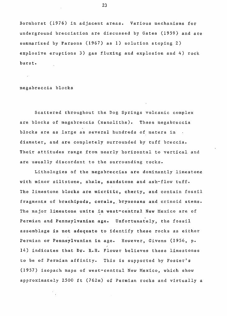
Bornhorst (1976) in adjacent areas. Various mechanisms for
a underground brecciation are discussed by Gates (1959) and are
summarized by Parsons (1967) as 1) solution stoping 2)
explosive eruptions 3 ) gas fluxing and explosion and 4 ) rock
burst.
megabreccia blocks
Scattered throughout the Dog Springs volcanic complex
are blocks of megabreccia (xenoliths). These megabreccia
blocks are as large as several hundreds of meters in .
diameter, and are completely surrounded by tuff breccia.
Their attitudes range from nearly horizontal to vertical and
are usually discordant to the surrounding rocks.
Lithologies of the megabreccias are dominantly limestone
with minor siltstone, shale, sandstone and ash-flow tuff.
The limestone blocks are micritic, cherty, and contain fossil
fragment.s of brachipods, corals,,bryozoans and crinoid stems.
The major limestone units in west-central New Mexico are of
Permian and Pennsylvanian age. Unfortunately, the fossil
assemblage is not adequate to identify these rocks as either
Permian or Pennsylvanian in age. However, Givens (1956, p.
1 4 ) indicates that Dr.
to be of Permian affin
(1957) isopach maps o f
approximately 2500 ft
R.H. Flower believes these limestones
ity. This is supported by Foster's
west-central New Mexico, which show
(762m) of Permian rocks and virtually a
24
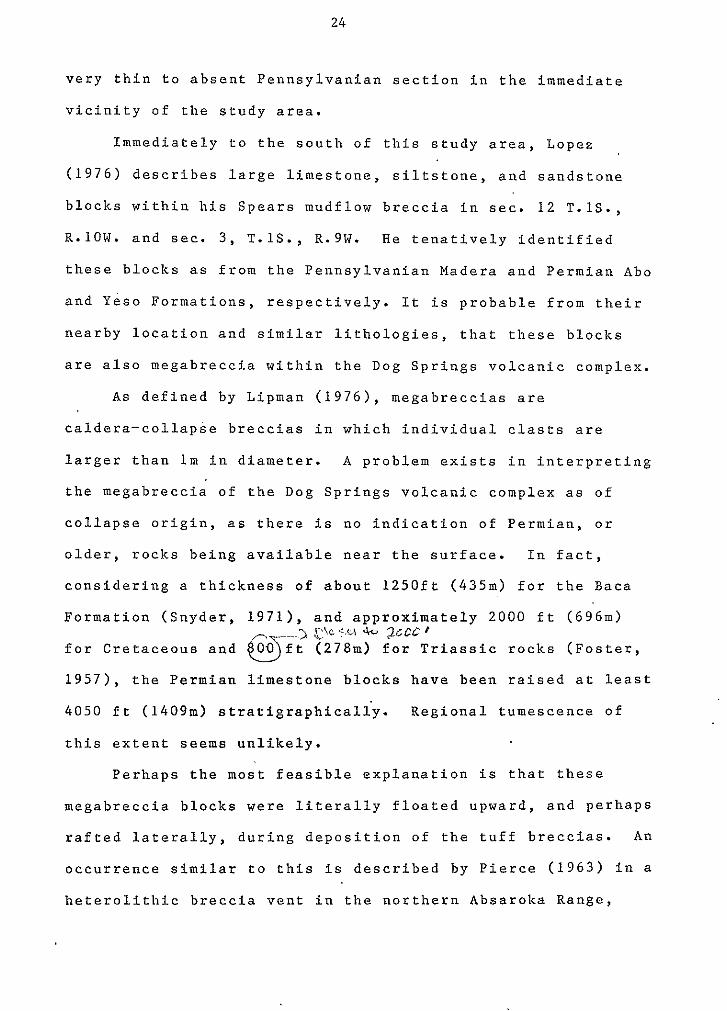
very thin to absent Pennsylvanian section in the immediate
vicinity of the study area.
Immediately to the south of this study area, Lopez
(1976) describes large limestone, siltstone, and sandstone
blocks within his Spears mudflow breccia in sec. 12 T.lS.,
R-lOW. and sec. 3, T.lS., R.9W. He tenatively identified
these blocks as from the Pennsylvanian Madera and Permian Ab0
and Yeso Formations, respectively. It is probable from their
nearby location and similar lithologies, that these blocks
are also megabreccia within the Dog Springs volcanic complex.
A s defined by Lipman (1976), megabreccias are
caldera-collapse breccias in which individual clasts are
larger than lm in diameter. A problem exists in interpreting
the megabreccia of the Dog Springs volcanic complex as of
collapse origin, as there is no indication of Permian, or
older, rocks being available near the surface. In fact,
considering a thickness of about 1250ft (435m) for the Baca
Formation (Snyder, 1971), and approximately 2000 ft (696m)
for Cretaceous and 00 ft (278m) for Triassic rocks (Foster,
1957), the Permian limestone blocks have been raised at least
4 0 5 0 f t (1409m) stratigraphicaliy. Regional tumescence of
this extent seems unlikely.
0 C k 5.u .k. zccc 8
Perhaps the most feasible explanation is that these
megabreccia blocks were literally floated upward, and perhaps
rafted laterally, during deposition of the tuff breccias. An
occurrence similar to this is described by Pierce (1963) in a
heterolithic breccia vent in the northern Absarolca Range,
25
where a 700-ft-long block of Paleozoic limestone was lifted
nearly 1000 ft (300m) within a 2-mile-diameter vent. Pierce
described the block's margins as brecciated and the fragments
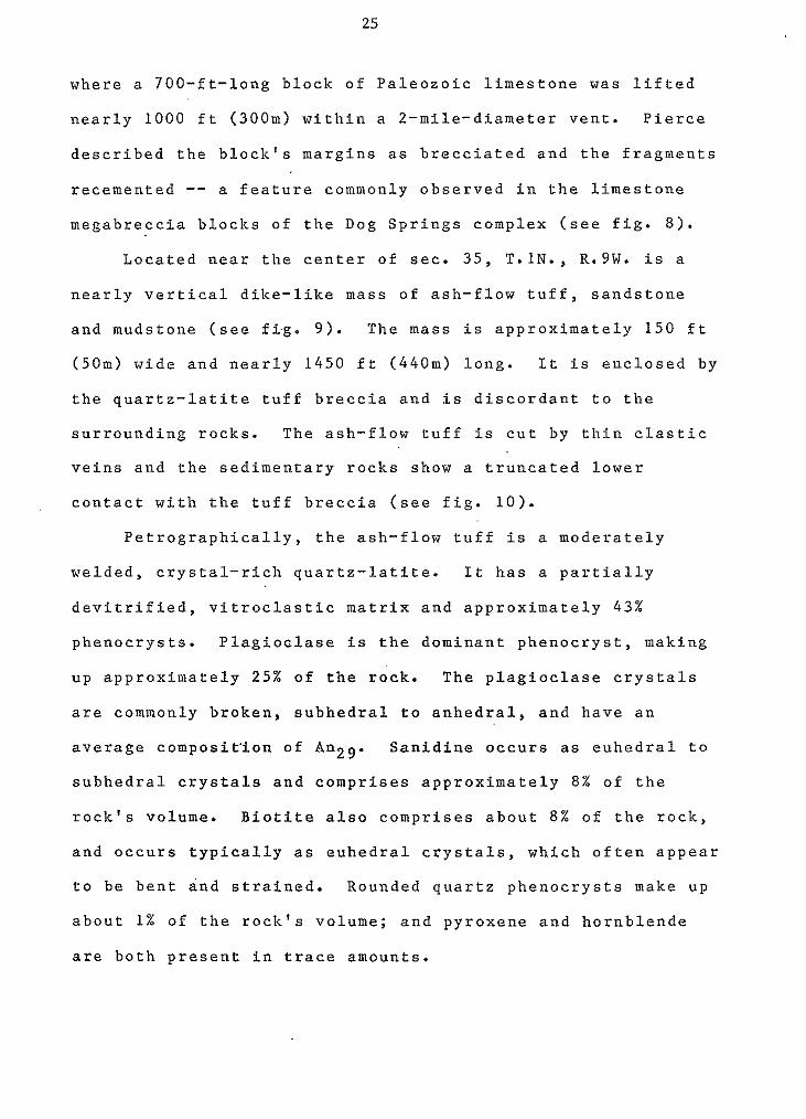
recemented -- a feature commonly observed in the limestone megabreccia blocks of the Dog Springs complex (see fig. 8 ) .
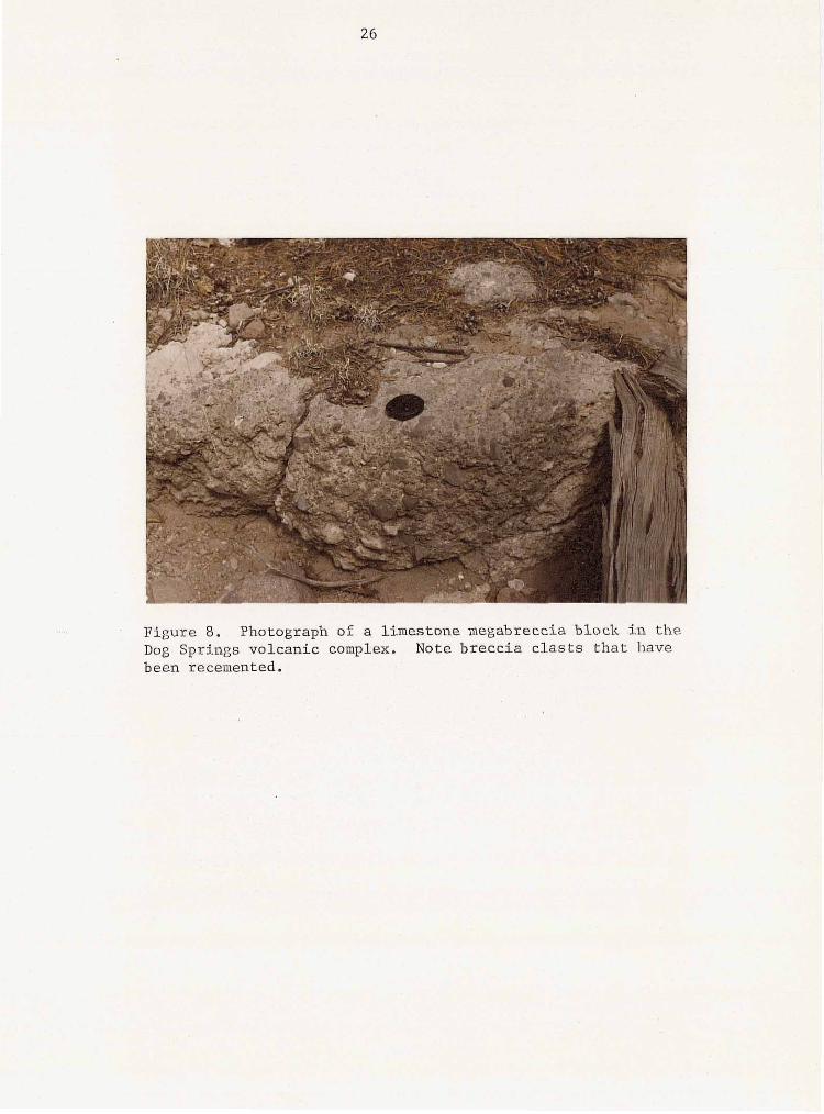
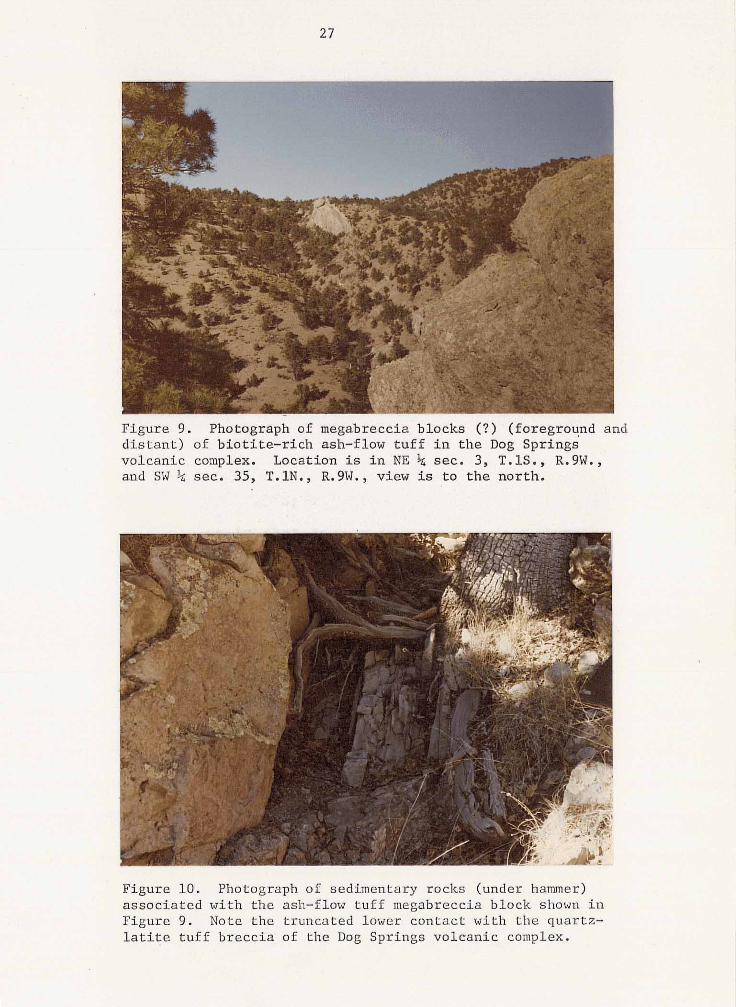
Located near the center of sec. 35, T. IN., R.9W. is a
nearly vertical dike-like mass of ash-flow tuff, sandstone
and mudstone (see fi-g. 9). The mass is approximately 150 ft
(50m) wide and nearly 1450 ft (440m) long. It is enclosed by
the quartz-latite tuff breccia and is discordant to the
surrounding rocks. The ash-flow tuff is cut by thin clastic
veins and the sedimentary rocks show a truncated lower
contact with the tuff breccia (see fig. 10).
Petrographically, the ash-flow tuff is a moderately
welded, crystal-rich quartz-latite. It has a partially
devitrified, vitroclastic matrix and approximately 4 3 %
phenocrysts. Plagioclase is the dominant phenocryst, making
up approximately 25% o f the rock. The plagioclase crystals
are commonly broken, subhedral to anhedral, and have an
average composition of Anz9. Sanidine occurs as euhedral to
subhedral crystals and comprises approximately 8 % of the
rock's volume. Biotite also comprises about 8% of the rock,
and occurs typically as euhedral crystals, which often appear
to be bent and strained. Rounded quartz phenocrysts make up
about 1% of the rock's volume; and pyroxene and hornblende
are both present in trace amounts.
26
Figure 8. Photograph of a limestone megabreccia block in the
been recemented. Dog Springs volcanic complex. Note breccia clasts that have
. .
27
Figure 9. Photograph 'of megabreccia' blocks (?) ' (foreground and d i s t a n t ) of b io t i t e - r i ch a sh - f low tu f f i n t he DOL! Springs volcanic complex. Location is in NE k sec. 3, T.lS., R;9W., and SW % sec.. 35, T.lN., R.9W., view is t o the north.
"
Figure 10. Photograph of sedimentary rocks (under hamer) assoc ia ted wi th the ash-flow tuff megabreccia block shown i n Figure 9 . Note the truncated lower contact with the quartz- l a t i t e t u f f b r e c c i a of t he Dog Springs volcanic complex.
28
The origin of these rocks is problematical. They could
represent either the intrusion of younger rocks, or the
collapse of older rocks into the Dog Springs complex. The
presence of clastic veins, vertically bedded sediments and
the apparent truncation of the bottom of the mass favor a
collapse origin. Lipman; (1976, p . 1 4 0 3 ) has interpreted
andesitic megabreccia blocks in the San Juan Caldera,
Colorado, with dimensions similar to those o f this
megabreccia block and al'so having, associated c1ast.i.c veins
and basal s.edimentary r0ck.s as being of collapsed origin.
Reconnaissance in the northwestern Datil Mountains has
revealed the presence of an ash-flow tuff of lithology'
similar to these rocks. However, it's stratigraphic
relationship to the Dog Springs complex is unknown. Further
geological mapping in that region is re.quired to determine
the relationships between these units.
laharic breccias
Interbedded with the tuff breccias are numerous laharic
breccia deposits. These breccias have a characteristic
appearance of light-gray, porphrytic clasts set in a dark
red-brown, sandy to muddy matrix (see fig. 11). They are
unsorted and poorly'bedded. The laharic breccias are
gradational into the tuff breccias.
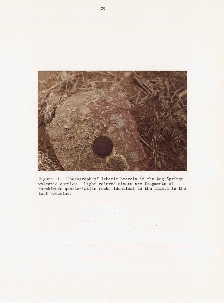
Figure 11. Photograph of l ahar ic b recc ia in the Dog Springs volcanic complex. Light-colored c las ts are f ragments of hornblende quar tz - la t i te rocks ident ica l t o t h e c l a s t s i n t h e tu f f b recc i a s .
30
The clasts in the laharic breccias are identical to the
clasts in the monolithic tuff breccias, both petrographically
and in hand specimen. They are angular to subrounded in
shape, have a trachytic texture, and compositionally are
hornblende quartz-latite (see fig. 7) . The laharic breccias
differ from the monolithic tuff breccias in that their matrix
i s redder, finer-grained, and more crystal-rich and the
clasts show more ang.ularity and abrasion.
Two methods have been envisioned for the formation o f
laharic breccias. 1) They are the result of the saturation
and remobilization of.the tuff breccias after initial
deposition (Anderson, 1 9 3 3 ; Parsons, 1 9 6 7 ) ; or 2 ) the tuff
brecci.as grade outward into laharic breccias during.initia1
deposition. The latter could result from eruptions through
crater lakes, eruptions accompanied by heavy rain falls
(Anderson, 1 9 3 3 ) , or even when pyroclastic flows encounter
streams (Williams, 1 9 5 6 ) . Both mechanisms could have played
a role in the formation of the laharic breccias in the Dog
Springs complex.
rhyodacite intrusive and extrusive rocks
The youngest volcanic rocks of the Dog Springs complex
are rhyodacite intrusive, extrusive rocks, and associated
debris-flow deposits. These rocks are dominantly
autobrecciated,, however they have minor, massive,
unbrecciated por
31
tions which are irregular in shape. Under
0 Wright and Bowes' (1963) breccia classification, the
.brecciated rocks would be termed friction breccias. The term
applies to autoclastic volcanic breccia which "forms by the
disruption of lava by further movement after part of the mass
has congealed." Lipman (1975) has referred to similar rocks
as explosion-breccias. Whether the autobrecciated rocks of
the Dog Springs complex are of explosive derivation, or are
the result of the frictional tearing apart of highly viscous
magma is undetermined, therefore the term autobreccia is
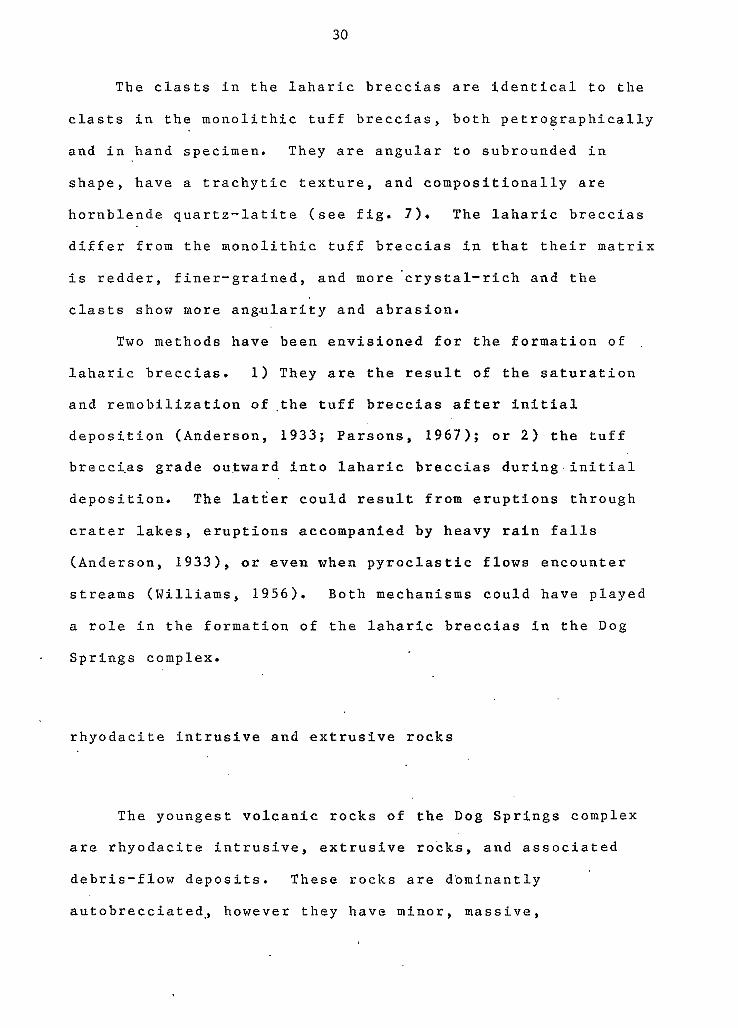
preferred. The rhyodacitic rocks intrude 'the quartz- latite
tuff breccias in the form of plugs, vents, and dikes (See
fig. 1 2 ) . Minor rhyodacitic flow-breccias [friction-breccias
which form by unconfined lava flow (Fisher, 1960, p. 974)]
are interbedded within the quartz-latite tuff breccias.
In the study area, the rhyodacitic rocks crop out
throughout the exposed Dog Springs complex. However, a
north-trending belt of vents occurs through the center of the
area, with three individual vents located in 1) the
north-central portion of sec. 3 , T . l S . , , R.9W.; 2 ) in secs. 2 3
and 26, T.1N. , R.9W.; and 3 ) in sees. 1, 11, and 12, T.lN.,
R.9W. These vent areas are exposed through several hundreds
of feet of topographic relief, with no apparent bottom. They
cover areas ranging from approximately If4 to 1 square mile.
Attitudes within the vents are chaotic and commonly very
steep. The vents are frequently cut by small faults,
probably contemporaneous with deposition, and numerous small,
32
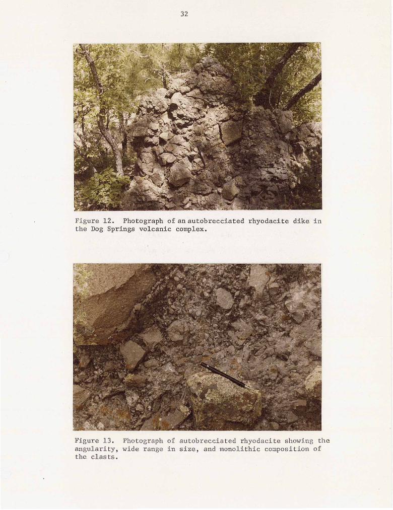
Figure 12. Photograph ofanautobrecciated rhyodaci te dike i n t h e Dog Springs volcanic complex.
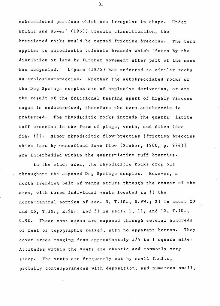
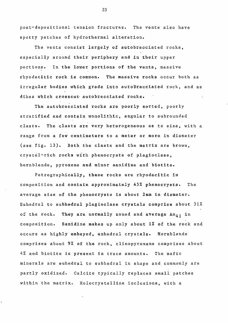
Figure 13. Photograph of autobrecciated rhyodacite showing the angularity, wide range i n s t z e , and monolithic composition of t he clasts .
33
post-depositional tension fractures. The vents also have
spotty patches of hydrothermal alteration.
The vents consist largely of autobrecciated rocks,
especially around their periphery and in their upper
portions. In the lower portions of the vents, massive
rhyodacitic rock is co.mmon. The massive rocks occur both as
irregular bodies which grade into autotirecciated rock, and as
dikes which crosscut. autobrecciated rocks.
The autobrecciated rocks are poorly sorted, poorly
stratified and contain monolithic, angular to subrounded
clasts. The clasts are very heterogeneous as to size, with a
range from a few centimeters to a meter or more in diameter
(see fig. 13). Both the clasts and the matrix are brown,
crystal-rich rocks with phenocrysts of plagioclase,
hornblende, pyroxene and minor sanidine and biotite.
Petrographically, these rocks are rhyodaci'tic in
composition and contain approximately 4 5 % phenocrysts. The
average size of the phenocrysts is about 2mm in diameter.
Euhedral to subhedral plagioclase crystals comprise about 31%
of the rock. They are normally zoned and average Anh1 in
composition. Sanidine makes up only about 1% of the rock and
occurs a s highly embayed, anhedral crystals. Hornblende
comprises about 9% of the rock, clinopyroxene comprises about
4 % and biotite is present in trace amounts. The mafic
minerals are euhedral to subhedral in shape and commonly are
partly oxidized. Calcite typically replaces small patches
within the matrix. Holocrystalline inclusions, with a
34
mineralogy similar to the rhyodacitic rocks occur in minor
amounts. The rock's matrix consists of fine-grained
plagioclase microlites with interstitial micro-crystalline
material. There is an overall sub-parallel, pilotaxitic
texture.
other intrusive' rocks
Two additional,, volumetrically minor i-ntrusive rocks
occur in the Dog Springs complex. For simplicity, these
minor intrusives have been mapped with the rhyodacite '
intrusive and extrusive rocks. Porphyritic quartz-latite
intrusions occur in scattered outcrops in the central part of
the study area, usually adjacent t o rhyodacite intrusions.
No obvious age relationships are apparent.
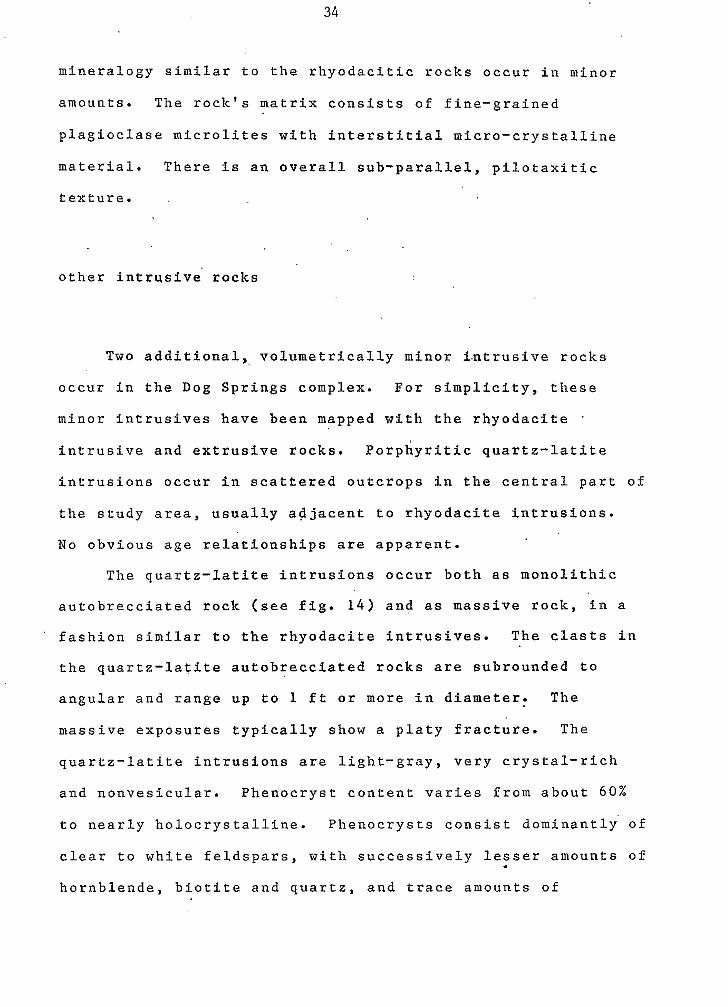
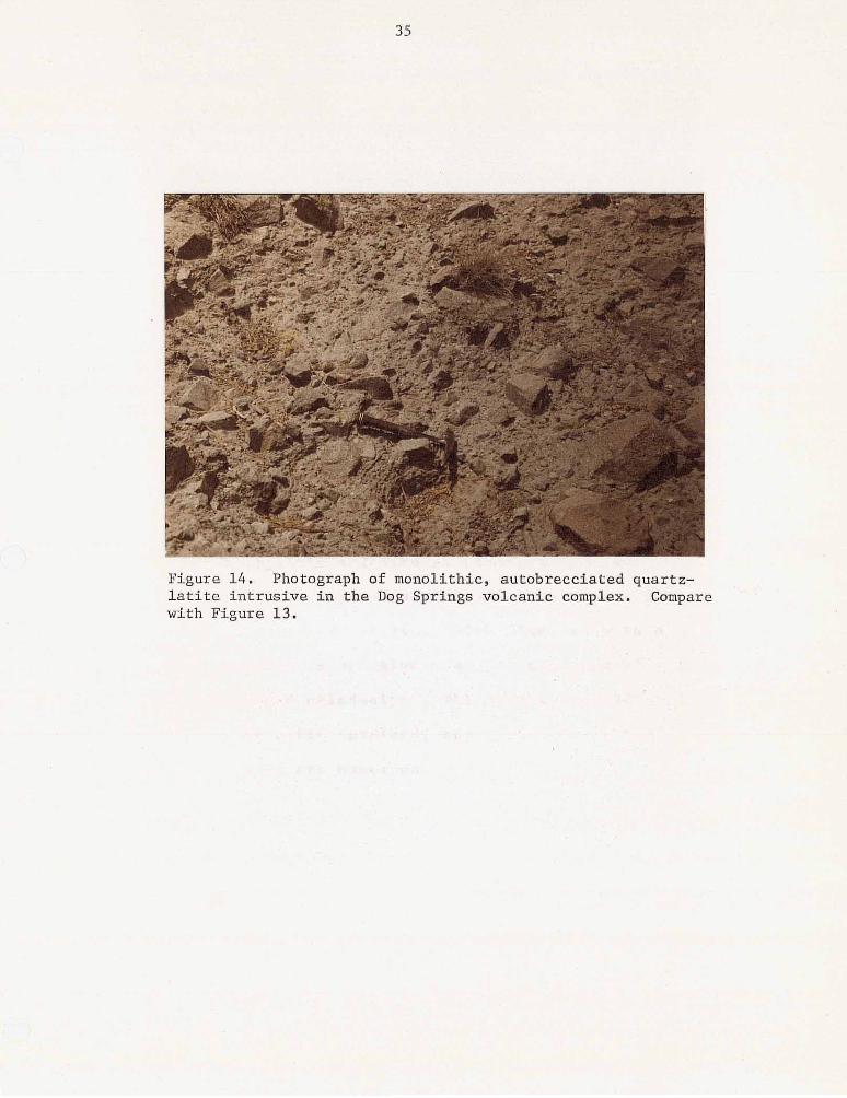
The quartz-latite intrusions occur both a s monolithic
autobrecciated rock (see fig. 1 4 ) and as massive rock, in a
fashion similar to the rhyodacite intrusives. The clasts in
the quartz-latite autobrecciated rocks are subrounded to
angular and range up to 1 ft or more in diameter. The
massive exposures typically show a platy fracture. The
quartz-latite intrusions are light-gray, very crystal-rich
and nonvesicular. Phenocryst content varies from about 6 0 %
to nearly holocrystalline. Phenocrysts consist dominantly of
clear to white feldspars, with successively lesser amounts of
hornblende, biotite and quartz, and trace amounts of
35
Figure 1 4 . Photograph of monoltthic, autobrecciated quartz- l a t i t e i n t r u s i v e i n t h e Dog Springs volcanic complex. Compare with Figure 13.
36
magnetite. Feldspar, hornblende and biotite phenocrysts are
generally euhedral to subhedral. Quartz' grains are typically
rounded. The phenocrysts are relatively large and range from
about lmm to 6mm in diameter. The matrix is light-gray,
fine-grained and commonly silicified. The rocks also show
small solution cavities lined with celadonite.
The second minor intrusive rock is a reddish-brown
porphyritic andesite. .A principle exposure .of the andesite
is in SE 114 sec. 1, T.1N., R...8W., where it crops out as a
small hill surrounded by 'Tertiary piedmont deposits. In the
familar pattern, these rocks occur in both monolithic
autobrecciated and massive forms. I
. .
The porphyritic andesite is fine-grained and
crystal-rich. Phenocrysts cons1s.t of white and reddish-brown
feldspars, pyroxene and olivine, with minor amounts of
magnetite. The ferromagnesian minerals are commonly altered
to iron-oxides and celadonite. The matrix is reddish in
color and shows a fine-grained, sugary texture. Minute
solution cavities are numerous. .
sedimentary rocks
Sedimentary rocks compose less than 1% of the Dog
Springs complex. They consis't of very-fine-grained,
e mafic-rich, feldspathic sandstones and finely laminated
37
mudstones. The mudstones are only a few inches thick and
e discontinuous laterally. The sandstones achieve localized
thicknesses of 20-30 ft (6-9m) and are also discontinuous
laterally.. Both sandstones and mudstones are interbedded
with the tuff breccias.
genesis of the Dog Springs volcanic complex
The Dog Springs volcanic complex lies on the extreme
northern margin o f the Datil-Mogollon volcanic field.
Stratigraphic relationships indicate that it's age is very
near the Eocene-Oligocene boundary, making it possibly the
oldest known major volcanic source area asociated with the
Datil-Mogollon volcanic field. A K-Ar date o f 37.1 m.y.
(Burke and others, 1963; Weber, 1971) for a hornblende-
bearing tuff breccia.from the Joyita Hills area, Socorro
County possibly correlates to rocks from the Dog Springs
complex.
The geologic processes which formed the Dog Springs
complex are at present enigmatic. Deposition from
stratavolcanoes seems unlikely, due to the conspicuous lack
o f stratification and t o the uncharacteristic presence of
exotic megabreccia blocks. The possibility that the complex
formed by the crumbling of domes is discussed in the 'tuff
breccia' section. Another possibility which should be
considered is the caldera forming, pyroclastic eruptive
38
process which is most prominent in the Datil-Mogollon
volcanic field. Similarities between the Dog Springs
volcanic complex and 0the.r caldera structures are:
1 ) A fault pattern which is discordant to regional
structural trends. Faults associated with the Rio Grande
rift in this region are dominantly northeasterly and
northerly (see plate 3). Major east-trending and
northwest-trending faults occur within the outcrop area of
the Dog Springs complex. Unfortunately, large segments of
what could be a caldera margin and associated ring faults
have not yet been mapped. Futher investigations around the
margin of the Dog Springs complex will be useful in '
determining the true nature of the volcanic complex.
2 ) The Dog Springs complex represents a thick
accumulation of dominantly volcanic rocks. Cross sections
through the complex indicate a thickness on the order of
several thousand feet. Such a thickness is consistant with
caldera structures.
3) The Dog Springs complex has an apparent centralized
location in relation to a possible ash-flow tuff outflow
facies. Since caldera collapse is the result of voluminous
ash-flow tuff ejection (Smith, 1960-b; Smith, 1 9 7 9 ) , an
outflow facies is usually required for collapse. Possible
outflow facies from the Dog Springs complex have been
observed in reconnaissance near Madre Mountain, west o f the
complex, by R. Chamberlin (oral commun., 1980); and on Nigger
Head Mountain, east of the complex, by C.E. Chapin, G.R.
39
Osburn and S. Cather (oral commun., 1980). In addition,
samples-from the Sun Oil Co. San Agustin Plains unit #1 oil
test, located in sec. 2 9 , T.3S., R.9W., show the presence o f
a hornblende quartz-latite ash-flow tuff in the lower part of
the Tertiary volcanic section. This tuff may represent a
southerly outflow sheet.
There are, however, inconsistencies between the Dog
Springs complex and the'general caldera model.
1 ) From this study, caldera collapse cannot be
documented. The only possible caldera margin in this study
area is along the Red Lake fault, which is a through-going
fault of considerable length (see plate 3 ) . The entire fault
cannot be of caldera collapse origin. However, the fault
0 could be tangent to a caldera structure and a segment of the
fault could represent a caldera margin.
In addition, collapse breccias are not identifiable in
the Dog Springs complex. Such breccias would be expected to
contain clasts of the -3aca Formation and Mesaverde Group.
However, both are notably absent. The only rock of possible
collapse origin in the Dog Springs complex is the ash-flow
tuff megabreccia block, and neither it's stratigraphic
position, nor it's origin are known.
Another problem in interpreting the Dog Springs complex
as a collapse structure lies in the fact that younger
volcanic and volcaniclastic rocks do not appear to puddle in
a depression. Neither the volcaniclastic rocks of Chavez
Canyon, nor the tuff of Main Canyon show appreciable
40
thickening in the area. A possible explanation for this lies
in the angular unconformity which occurs between the Dog e Springs complex and the overlying strata.
2 ) The conspicuous lack of pumice seems to indicate that
the volcanic rocks were not derived from a volatile charged,
vesiculating magma characteristic of caldera-forming
processes. In contrast, the tuff breccias of the Dog Springs
complex appear to be.the result of a more viscous, quieter
eruption of slowly upwelling magma, capable o f lifting large
megabreccia blocks several thousands of feet.
Given the present knowledge of the Dog Springs complex,
perhaps the best explanation for it's origin is a model
similar to that proposed by Gates (1959) for breccia pipes in
the Shoshone Range, Nevada - only on a much larger scale. a \ The two basic assumptions of this model are that brecciation
occurred underground, prior to extrusion, and that volatiles
played an important part in the eruptions.
The major difficulty in applying Gates' model for the
formation of breccia pipes to the Dog Springs complex lies in
the respective magnitudes of the volcanic centers. The
breccia pipes that Gates describes average about 1 mile in
longest dimension, while the Dog Springs complex is on the
order of 10-15 miles in diameter. It is not proposed that
the events outlined occurred in an orifice 10-15 miles
-across. Rather, it is suggested that they occured in
numerous centers (perhaps fissures and/or pipes, etc.) which
spread over an area 10-15 miles in diameter. The size Of
e
41
individual orifices must have been on the order of 1 / 4 mile
0 in diameter, or greater, in order to accommodate the
megabreccia blocks.
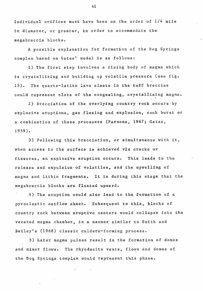
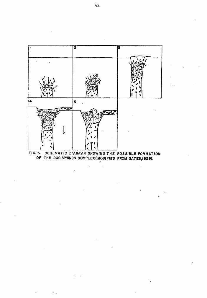
A possible explanation for formation of the Dog Springs
complex based on Gates' model is as follows:
1) The first step involves a rising body of magma which
is crystallizing and building up volatile pressure (see fig.
15). The quartz-latite lava clasts in the tuff breccias
could represent clots of the congealing, crystallizing magma.
2 ) Brecciation of the overlying country rock occurs by
explosive eruptions, gas fluxing and explosion, rock burst or
a combination of these processes (Parsons, 1 9 6 7 ; Gates,
1 9 5 9 ) .
3 ) Following this brecciation, or simultaneous with it,
when access to the surface is achieved via cracks or
fissures, an explosive eruption occurs. This leads to the
release and expulsion'of volatiles, and the upwelling of
magma and lithic fragments. It is during this stage that the
megabreccia blocks are floated upward.
. 4 ) The eruption could also lead to the formation'of a
pyroclastic outflow sheet. Subsequent to this, blocks of
country rock between eruptive centers would collapse into the
vacated magma chamber, i n a manner similar to Smith and
Bailey's ( 1 9 6 8 ) classic caldera-forming process.
5 ) Later magma pulses result in the formation of domes
and minor flows. The rhyodacite vents, flows and domes of
the Dog Springs complex would represent this phase.
I
42
I
:IG.15. SCHEMATIC C OF THE DOOSPRIN
! 3 I
i COMPLEXfMODIFIED FROM GATEqI9591-
.' .
43
Volcaniclastic Sedimentary Unit of Chavez Canyon "
The sedimentary rocks occupying the stratigraphic
interval bztween the Dog Springs volcanic complex and the
tuff of Main Canyon have been informally named the
volcaniclastic sedimentary unit of Chavez Canyon by Coffin
(in prep.) for exposures along Chavez Canyon in secs. 27 and
3 4 , T.Z.N., R.8W. This unit is probably correlative in part
to the feldspathic sedimentary unit of Lopez ( 1 9 7 5 ) , and to a
combination of the conglomerate and sandstone members of the
Spears Formation and the first volcanic sedimentary unit of
Bornhorst ( 1 9 7 6 ) . In addition, Chavez Canyon is correlative
to the uppermost portion of Givens' ( 1 9 5 7 ) Spears Ranch
Member of the Datil Formation.
In this study area, the Chavez Canyon unit is divisible
into three sedimentary members: a feldspathic sandstone
member, a pebble to cobble conglomerate member, and a minor
interlayered debris-flow breccia member. The three members
are interfingered with one another and show gradational
contacts. In general, the sandstone member underlies the
conglomerate member. However, in the extreme northwestern
part of the area,, approximately 200 ft (60m) of conglomerate
is present beneath the sandstone and another 2 5 ft (8m) is
interbedded within the sandstone. Also interfingered within
this unit, in the southern part o f the area, is the rhyolitic
ash-flow tuff of Datil Well. The unit of Chavez Canyon
directly overlies the Dog Springs volcanic complex with
44
marked angular unconformity. The contact is relatively sharp
and shows relief of 1 5 0 ft (46m) or less. 0
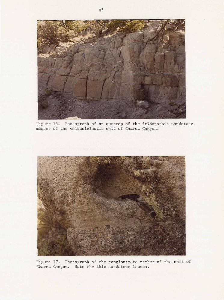
sandstone member
The sandstone member is composed dominantly of
mafic-rich, feldspathic sandstone beds, with minor lenses of
pebble conglomerates (see fig. 1 6 ) . The sandstone beds are
typically planar, with occasional large-scale trough cross
bedding. The pri.ncipa1 exposures of this member are in the
north-central portion o f the study area where it forms a
continuous belt, and in the northern part o f the Blue Mesa
Plateau. Unfortunately, these rocks typically form steep,
vegetated or talus-covered slopes and are poorly exposed.
The sandstone member is covered to the south and west, which
makes it impossible to determine it's tota'l areal extent. In
this study area the sands'tone member is usually from 1 7 5 to
200 ft (50 to 60m) thfck. Coffin (in prep.) reports
thicknesses of 300 ft (100m) in the eastern half o f the Dog
Springs quadrangle.
e
. .
The sandstone member of the unit of Chavez' Canyon is
whitish-gray, friable, medium- to coarse-grained and consists
of approximately 7 0 % feldspar grains and 30% ferromagnesian
grains in a clay matrix. The ferromagnesian minerals are
dominantly hornblende with subordinate biotite. Quartz is
virtually absent and lithic fragments are scarce. Tension
45
Figure 16. Photograph of an outcrop of the.feldspathic sandstone member of the volcaniclastic unit of Chavez Canyon.
~.
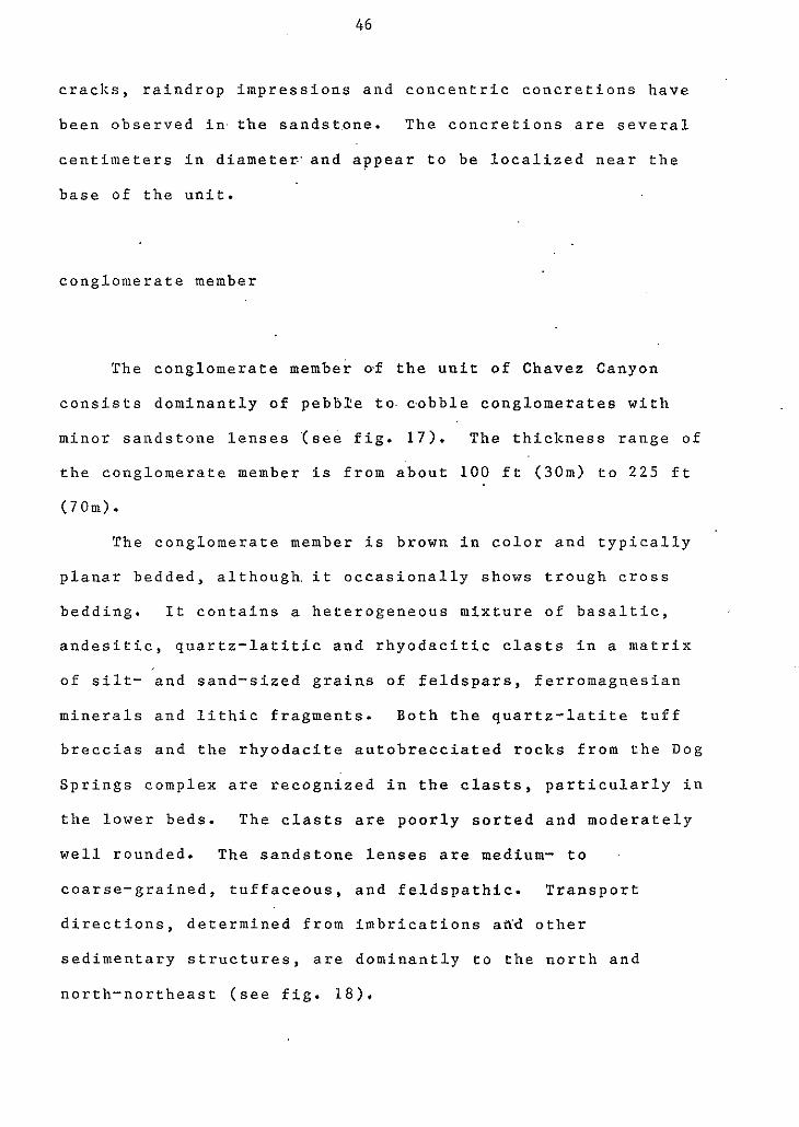
Figure 17. Photograph of the conglomerate member of the unit Chavez Canyon. Note the thin sandstone lenses.
O f
46
cracks, raindrop impressions and concentric concretions have
been observed in.the sandst.one. The concretions are several
centimeters in diameten'and appear to be localized near the
base of the unit.
conglomerate member
The conglomerate member of the unit of Chavez Canyon
consists dominantly of pebbxe to- cobble conglomerates with
minor sandstone lenses '(see fig. 17). The thickness range of
the conglomerate member is from a'bout 100 ft (30m) to 225 ft
(70m).
The conglomerate member is brown in color and typically
planar bedded, although, it occasionally shows trough cross
bedding. It contains a heterogeneous mixture o f basaltic,
andesitic, quartz-latitic and rhyodacitic clasts in a matrix
o f silt- and sand-sized grains of feldspars, ferromagnesian
minerals and lithic fragments. Both the quartz-latite tuff
breccias and the rhyodacite autobrecciated rocks from the Dog
Springs complex are recognized in the clasts, particularly in
the lower beds. The clasts are poorly sorted and moderately
well rounded. The sandstone lenses are medium- to
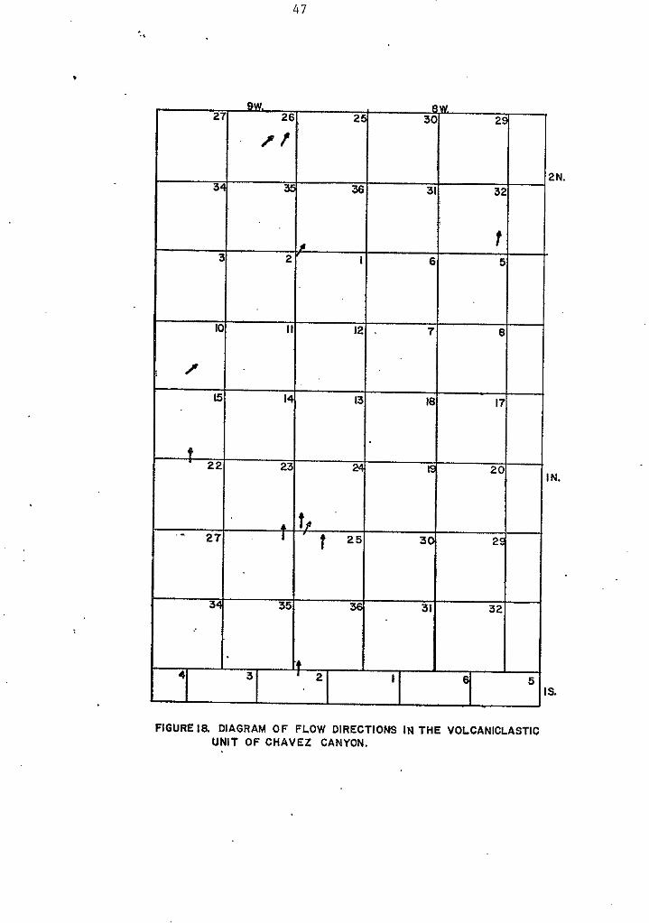
coarse-grained, tuffaceous, and feldspathic. Transport
directions, determined from imbrications aiSd other
sedimentary structures, are dominantly to the north and
north-northeast (see fig. 18).
.I
47
FIGURE la DIAGRAM OF FLOW DIRECTIONS IN THE VOLCANICLASTIC UNIT O F CHAVEZ CANYON.
48
These deposits are typical o f bolson deposits that
accumulate in arid basins. Analogies can be drawn to the
Miocene Popotosa Formation (Bruning, 1973) and the
Pliocene-Pleistocene Sierra Ladrones Formation (Machette,
1977).
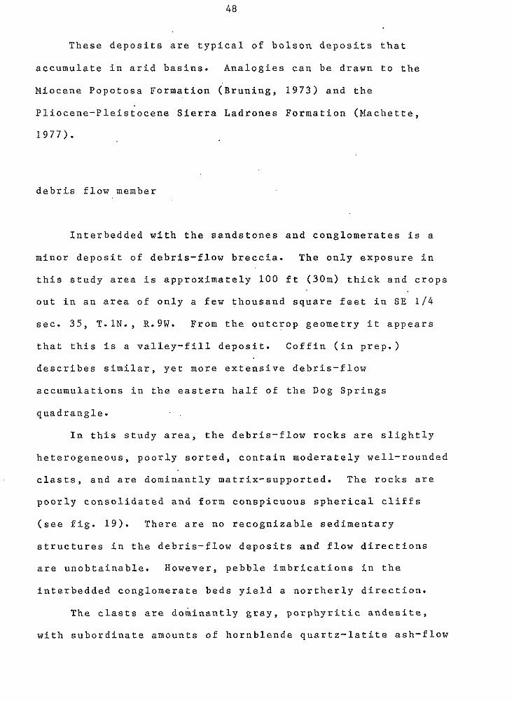
debris flow member
Interbedded with the sandstones and conglomerates is a
minor deposit o f debris-flow breccia. The only exposure in
this study area is approximately 100 ft (30m) thick and crops
out in an area of only a few thousand square feet in SE 1/4
see. 35, T.lN., R.9W. From the outcrop geometry it appears
that this is a valley-fill deposit. Coffin (in prep.)
describes similar, yet more extensive debris-flow
accumulations in the eastern half of the Dog Springs
quadrangle.
In this study area, the debris-flow rocks are slightly
heterogeneous, poorly sorted, contain moderately well-rounded
clasts, and are dominantly matrix-supported. The rocks are
poorly consolidated and form conspicuous spherical cliffs
(see fig. 19). There are no recognizable sedimentary
structures in the debris-flow deposits and flow directions
are unobtainable. However, pebble imbrications in the
interbedded conglomerate beds yield a northerly direction.
The clasts are dominantly gray, porphyritic andesite,
a with subordinate amounts of hornblende quartz-latite ash-flow
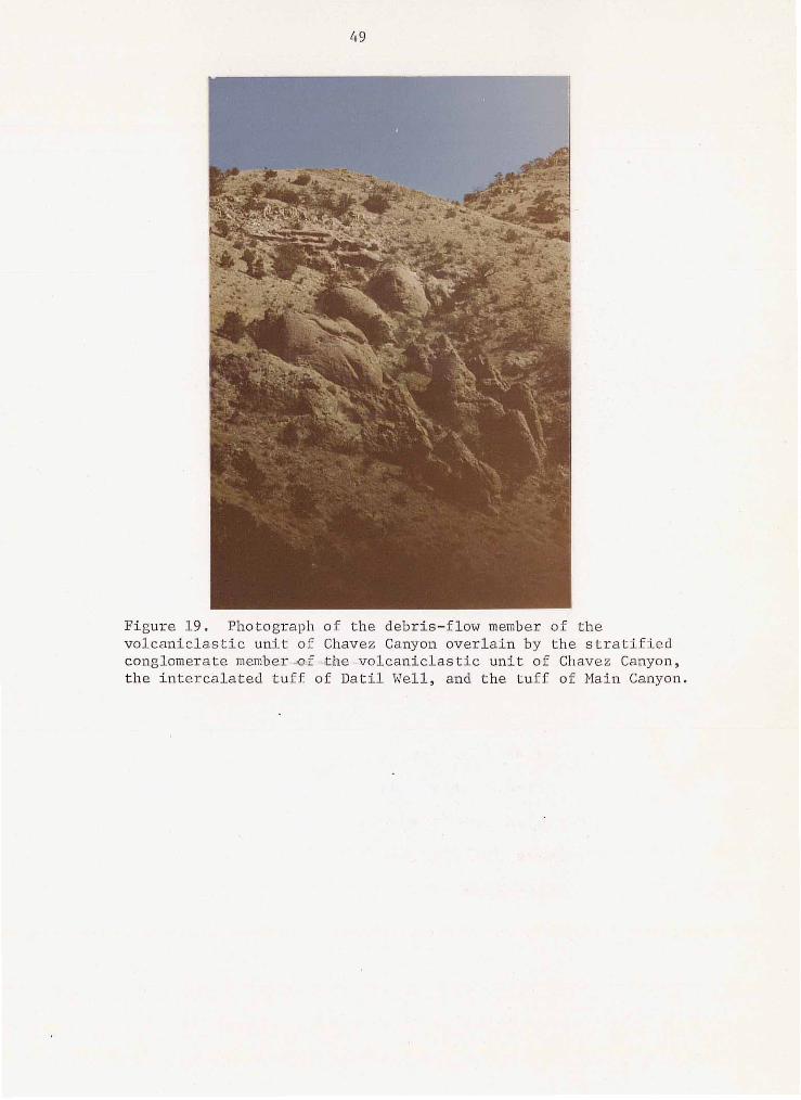
49
Figure 19. Photograph o f the debris-flow member of t he v o l c a n i c l a s t i c u n i t o f Chavez Canyon ove r l a in by t h e s t r a t i f i e d conglomerate memb,er.d .&he.-volcaniclastic unit of Chavez Canyon, t h e i n t e r c a l a t e d t u f f of D a t i l Well, and t h e t u f f of Main Canyon,
50
tuffs and tuff breccias, and minor, gray aphanitic andesites.
Their size range is from a few centimenters to a meter or
more in diameter and they are moderately well rounded.
The porphyritic andesite clasts are characterized by
large (greater than lcm) phenocrysts of plag.ioclase with
mindr phenocrysts of clinopyroxene. This andesite is
possibly the same as Lopez's (1975) upper porphyritic
andesite member of the Spears Formation, and Bornhorst's
( 1 9 7 6 ) porphyritic andesite of White tlouse Ca'nyon.
" Tuff of Datil Well
The tuff of Datil Well is a light-gray, moderately
welded, crystal-rich quartz-latite ash-flow tuff. The name
was proposed by Lopez (1975) for "the rhyolite ash-flow tuff
which overlies the Spears Formation'! and a type locality was
sited as near the Datil Well Campground in sec. 3, T. Z S . , R.
1OW. The subsequent correlation of the tuff of Nipple
Mountain with the tuff of Main Canyon by both Coffin (in
prep.) and this thesis, places the tuff of Datil Well
stratigraphically within the Spears Group, as previously
defined by this thesis. Therefore, Lopez's stratigraphic
assignment should be modified, but his descriptions and type
locality appear sound.
In the study area, the tuff of Datil Well forms a single
V-shaped outcrop in the SE 1 / 4 , SE 1 / 4 , Sec. 35, T. lN, R.
51
9W. The tuff is approximately 50 ft (15m) thick and is both
overlain and underlain by the conglomerate member of the unit
of Chavez Canyon. The outcrop forms a prominent ledge within
the conglomerate member (see.fig. 19) and has a sharp lower
a
contact and a gradational upper contact with them.
In hand specimen, the tuff of Datil Well is a
light-gray, fine-grained porphyritic ash-flow tuff. It has a
crystal-poor basal zone which grades upward into a
crystal-rich rock with 2 0 to 25% phenocrysts. Sanidine is by
far the most abundant phenocryst and occurs as distinct
lath-shaped crystals which occasionally display. an
irridescent hue. Characteristic apple-green pyroxene and
bronze, euhedral biotite crystals are present in minor
amounts. Lithic fragments, as much as several centimenters
in diameter, of a porphyritic basaltic-andesite are common.
Approximately 10% gray, moderately compacted pumice is also
present.
e
Petrographically, the tuff is a'moderately welded,
porphyritic rock with an almost totally devitrified
vitroclastic matrix. Sanidine phenocrysts comprise from 18
to 22% of the rock. They occur as broken, subhedral to
euhedral crystals, from less than 0.5mm to about 5mm in
length, and are commonly twinned by the Carlsbad law. A
light-green clinopyroxene is the next most abundant
phenocryst and occurs as fractured, dominantly subhedral
crystals. Clinopyroxene comprises 1 to 2% o f the rock.
These pyroxene crystals have 2 V ' s of about. 60' and extinction
52
angles of about 47O, which indicates that they are probably
an augite species. Red-brown biotite makes up about 1 % of
the tuff, with quartz and plagioclase present in trace
amounts. The plagioclase has an average composition of about
An4 3
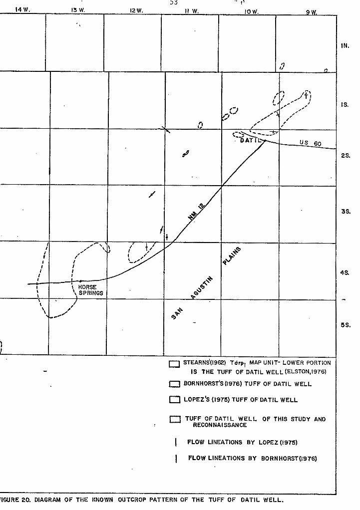
The source area for the tuff of Datil.Wel1 is unknown
and the tuff's overall areal extent is poorly known. The
tuff has previously been mapped by Lopez ( 1 9 7 5 ) in the
central Datil Mountains and by Bornhorst (1976 ' ) in the Crosby
Mountains area; Elston ( 1 9 7 6 ) has suggested it% correlation
with the lower part of Stearns' ( 1 9 6 2 ) Tdrpl map unit. Thus,
the known outcrop pattern o f the tuff lies in a northeast-
trending belt along the northwest-margiwof the Plains of San
Agustin ( s e e fig. 2 0 ) . The single outcrop in this thesis
area represents the northeasternmost 'exposure o f the tuff of
Datil Well and is very near the ash-flow sheet's distal
margin. ...
Flow direction studies by Lopez ( 1 9 7 5 ) and Bornhorst I .
( 1 9 7 6 ) indicate possible source areas either to the west or
to the southwest of this study area (see fig. 2 0 ) .
Reconnaissance to the west, in the western Datil Mountains
and Sawtooth Mountains, has revealed no occurrences of the
tuff of Datil Well, This fact, coupled with the tuff's
outcrop pattern indicates a most probable buried source under
the southwestern Plains of San Agustin, or even further to
the southwest.
I3 W.
,,e'
,.-\ I f
i
I
I HORSE 't. SPRINGS I ,
-e' I'
f
I
? ,)
us 60
IS THE TUFF OF DATIL WELL(ELSTON,i976)
0 BORNHORST'S(i976) TUFF OF DATlL WELL
0 LOPEZ'S (1975) TUFF OF DATlL WELL
0 TUFF OF DATIL WELL OF THIS STUDY AND RECONNAISSANCE
PLOW LINEATIONS BY LOPEZ(1975)
I FLOW LINEATIONS BY BORNHORST(1976)
I
FIGURE 20. DIAGRAM OF THE KNOWN OUTCROP PATTERN OF THE TUFF OF DATIL WELL,
IN.
IS.
2s.
3s.
4s
-
5s.
54
Tuff of Main Canyon "-
The tuff of Main Canyon is a white to light-gray, poorly
to moderately welded, crystal-poor, moderately pumice-rich,
rhyolite to quartz-latite ash-flow tuff. Lopez (1975)
proposed the name for exposures of the tuff along the Main
Canyo'n drainage system, approximately 7 miles (11 km) north
of the town of Datil, in sec. 1 and 12, T . l S . , R.1OW. This
tuff corresponds to the Hells Mesa unit 1 of Givens (1957),
which he describes as "the most persistent unit in the Hells
Mesa member" throughout the Datil and northern Gallinas
Mountains.
An informal. name, the tuff of Nipple Mountain, was
first use'd by Brow'n (1972) and later by Chapin (1974-b) for
the pink, moderately to densely welded, crystal-poor ash-flow
tuff capping Nipple Mountain, 4.5 miles (7 km) northeast of
Magdalena, New Mexico. This name was thereafter used by the
various theses of the Magdalena Project and the areal extent
of the tuff was traced westward through the Tres Nontosas - central Gallinas Mountains region by Chamberlin (1974),
Wilkinson (1976) and Laroche (in prkp.). Chamberlin also
. .
redefined the tuff to include the "turkey track" andeslte
flows commonly found near the base of the tuff. These flows,
however are discontinuous in the central Gallinas Mountains
(Laroche, in prep.) and are totally absent in the
northwestern Gallinas and northeastern Datil Mountains.
55
Through reconnaissance of the northeas,tern Gallinas
Mountains and the mapping of the northeastern Datil and
northwestern Gallinas Mountains by Coffin (in prep.) and
this thesis, t.he physical correlation between Lopez's tuff of
Main Canyon and the Magdalena Project's tuff of Nipple
Mountain has been established. The name, tuff o f Main
Canyon, appears to be more suitable for this unit because
it's stratigraphic position is better exposed in Main Canyon
than o n Nipple Mountain and the tuff i s propylitically
altered on Nipple Mountain,-whereas it i s relatively fresh in
Main Canyon.
e
A s with most of the ash-flow tuffs in the study area,
the tuff of Main Canyon crops out in two distinct patterns.
In the central and east-central portions of the area, the
tuff forms a broad continuous dip slope which defines the
western limb and the n o s e of a southeast plunging synform.
The second pattern occurs in the western portion of the area,
where the tuff of Main Canyon outcrops as the capping of
isolated hills and minor dip slopes within a complexly
faulted region. The tuff has a maximum thickness of about
300 ft (91m) in the east-central and southeastern parts of
the study area and thins to approximately 2 0 0 f t (61m) in the
western portion of the study area.
The tuff's outcrop characteristics are dominated by
broad, Juniper- and Pinon-covered dip slopes with steep
bluffs along the margins. The bluffs reach as much as 150 ft
56
( 4 6 m) in height, with well-developed columnar joints and
* aprons of talus.
Throughout the field area, the tuff of Main Canyon
conformably overlies the volcaniclastic sedimentary unit of
Chavez Canyon. The tuff's lower contact is relatively sharp
and it's upper contact with the middle sedimentary unit is
gradational. The attitudes of the tuff and the two
sedimentary units are virtually parallel throughout the area.
This fact, coupled with the indistinguishable nature of the
two sedimentary units, indicates relatively continuous
sedimentation with little tectonic disturbance during the
deposition of the tuff.
The tuff of Main Canyon, in this study area, is a
multiple-flow, sinple cooling unit as defined by Smith
(1960-a). The unit displays a vertical zonation typical of
the distal margins of Smith's type A and B ash-flow sheets
(Smith 1960a, plate 20) and, in fact probably represents a
gradation between the two types. The zones consist of a
lower, poorly to nonwelded basal zone which is thin and
intermittent in this area, but becomes more prominent to the
east (Coffin, in prep.); a midd.le zone of partial welding;
and an upper, very soft, nonwelded zone, which 'is commonly
absent due to erosion.
e
The middle partially welded zone can be further divided
into distinct cooling structures (see fig. 21). These
structures are a lower, massive, columnar-jointed layer; a
middle platey layer; and an upper, massive layer which also
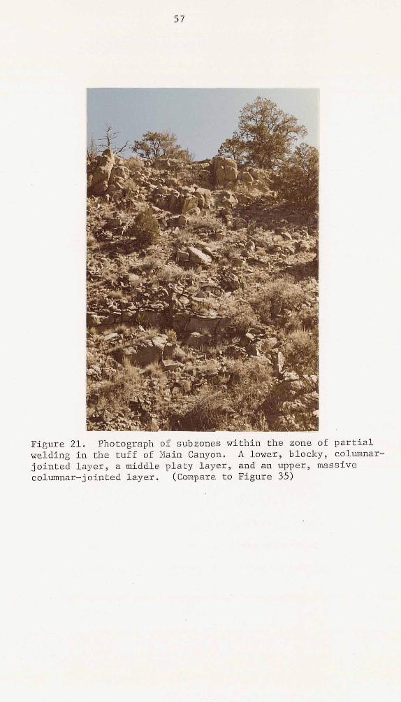
1s
58
has columnar joints. A similar sequence of structures is
developed within the Hells Mesa Tuff in this area (see fig.
30). Within the tuff of Main Canyon, the lower, massive
layer is the most densely welded and the degree of welding
decreases upward. Throughout much of the area, the tuff
consists predominantly of the upper, poorly welded, massive
layer.
Structures similar to these have been described by Spry
( 1 9 6 1 ) in columnar jointed basalt flows. His three divisions
include the colonnade which is the lowest zone and consists
of regular, straight vertical columns; the entablature zone , which consists of twisted and curved fractures; and an upper
colonnade, which shows crude columnar jointing. The
resemblance between these basaltic structures and the
structures within the partially welded zone of the rhyolitic
tuff o f Main Canyon (and the' Hells Mesa Tuff) probably are
the result o f similar. responses to the thermal stresses
brought on by cooling.
Deposition of the tuff of Main Canyon by multiple flows
is indicated by otherwise inexplicable changes in pumice
content. In the southern Gallinas Mountains - Tres Montosas area, Chamberlin ( 1 9 7 4 ) and Wilkinson ( 1 9 7 6 ) describe
distinct cooling breaks within this unit occupied by
andesitic to latitic lava flows. However, no visible cooling
breaks or partings were observed in this study area.
In hand specimen, the tuff of Main Canyon is a white to
light-gray, poorly to moderately welded, crystal-poor
59
ash-flow tuff. The pumice content varies from about 30% of
virtually uncollapsed, white pumice in the poorly welded
zones to about 10% of partially collapsed pumice in the
moderately welded zones. The phenocrysts vary in reverse
fashion from about 10% in the moderately welded zones to
about 4 % in the poorly welded zones. Euhedral to subhedral
laths of feldspars dominate, making up from 3 to 9% of the
rock; with minor biotite and quartz visible. Occasional
subrounded to rounded fragments of a reddish-brown, vesicular
basaltic-andesite, with an average long dimension of 2mm, are
also present. Minute specks of magnetite are detectable.
Petrographically, this unit is a poorly to moderately
welded, crystal-poor rhyolite ash-flow tuff. It has a
partially devitrified, vitroclastic matrix. Phenocrysts vary
from about 4 to 10% with subhedral t o euhedral sanidine
crystals in the majority. Plagioclase and 'biotite each
comprise 1% or less of the rock. Quartz, clinopyroxene and
opaque oxides are present in trace amounts. The plagioclase
has an average composition of about An29. A characteristic
feature of the tuff is the abundance of relatively large
white pumice, as much as 5cm in long dimension. Axiolitic
structures are also commonly found within the pumice.
The source area of the tuff o f Main Canyon is unknown.
The known outcrop and thickness patterns of the tuff indicate
a possible buried source beneath the eastern Plains of San
Agustin or further south (see fig. 22). The flow direction
lineations of Lopez (1975) and Bornhorst (1976) could be
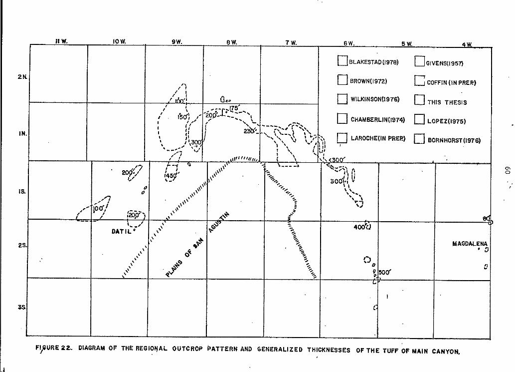
60 ''
,
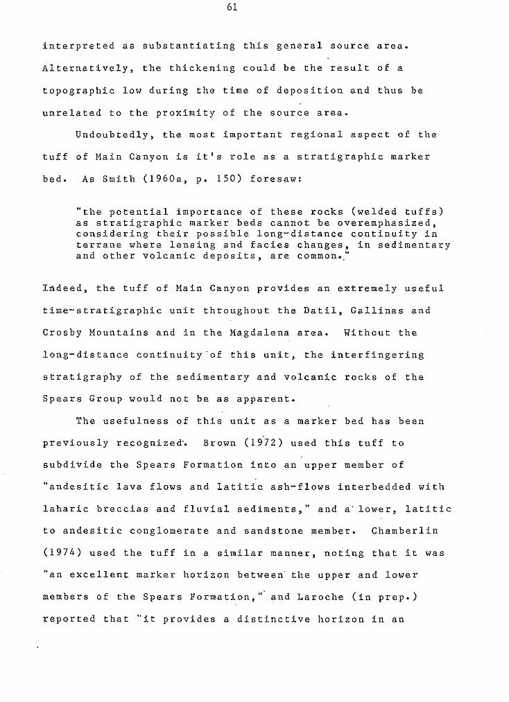
61
interpreted as substantiating this general source area.
Alternatively, the thickening could be the result of a
topographic low during the time of deposition and thus be
unrelated to the proximity o f the source area.
Undoubtedly, the most important regional aspect of the
tuff of Main Canyon is it's role as a stratigraphic marker
bed. As Smith (1960a, p. 150) foresaw:
"the potential importance of these rocks (welded tuffs) as stratigraphic marker beds cannot be overemphasized, considering their possible long-distance continuity in
and other volcanic deposits, are common.." terrane where lensing and facies changes, in sedimentary
Indeed, the tuff of Main Canyon provides an extremely useful
time-stratigraphic unit throughout the Datil, Gallinas and
Crosby Mountains and in the Magdalena area. Without the
long-distance continuity'of this unit, the interfingering
stratigraphy of the sedimentary and volcanic rocks of the
Spears Group would not be as apparent.
The usefulness of this unit as a marker bed has been
previously recognized. Brown (19'72) used this tuff to
subdivide the Spears Formation into an upper member of
"andesitic lava flows and latitic ash-flows interbedded with
laharic breccias and fluvial sediments," and a'lower, latitic
to andesitic conglomerate and sandstone member. Chamberlin
(1974) used the tuff in a similar manner, noting that it was
"an excellent marker horizon between' the upper and lower
members of the Spears Formation," and Laroche (in prep.)
reported that "it provides a distinctive horizon in an
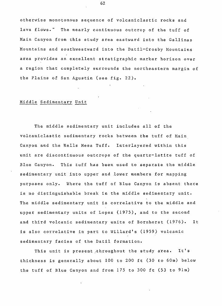
62
otherwise monotonous sequence of volcaniclastic rocks and
lava flows." The nearly continuous outcrop of the tuff of
Main Canyon from this study area eastward into the Gallinas
Mountains and southwestward into the Datil-Crosby Mountains
area provides an excellent stratigraphic marker horizon over
a region that completely surrounds the northeastern margin of
the Plains of San hgustin (see fig. 22).
Middle Sedimentary Unit
The middle sedimentary unit includes all of the
volcaniclastic sedimentary rocks between the tuff of Main.
Canyon and the Hells Mesa Tuff. Interlayered within this
unit are discontinuous outcrops of the quartz-latite tuff of
Blue Canyon. This tuff has been used to separate the middle
sedimentary unit into upper and lower members for mapping
purposes only. Where the tuff of Blue Canyon is absent there
is no distinguishable break in the middle sedimentary unit.
The middle sedimentary unit is correlative to the middle and
upper sedimentary units of Lopez (1975), and to the second
and third volcanic sedimentary units of Bornhorst (1976). It
is also correlative in part to Willard's (1959) volcanic
sedimentary facies of the Datil formation.
This unit is present,.throughout the study a'rea. It's
thickness is generally about 100 to 200 ft (30 to 6Om) below
the tuff of Blue Canyon and from 175 to 300 ft (53 to 91m)

63
above the tuff of Blue Canyon. In areas.where the tuff of
Blue Canyon is absent, the middle sedimentary unit generally
thins to about 100 ft (30m). These areas undoubtedly reflect
topographic highs that existed between deposition of the tuff
of Main Canyon and Hells Mesa Tuff. The middle sedimentary
unit typically forms steep vegetated slopes when capped by
tuffs and low rounded, vegetated hills when not capped by a
more resistant rock type.
The rocks of the middle sedimentary unit represent a
continuation of the arid, basinal deposition that began with
the sedimentary unit of Chavez Canyon. The lower two-thirds
' of the middle sedimentary unit consists of pebble to cobble
conglomerate beds, with minor sandstone lenses. Occasional
boulder conglomerates are also present. These lower rocks
are very similar to the conglomerate member of the unit of
Chavez Canyon. The upper one-third of the middle sedimentary
unit, however develops increasing amounts of aeolian and
fluvial sandstone beds upward (see fig. 23 and 24). Directly
beneath the Hells Mesa Tuff the middle sedimentary unit
becomes exclusively sandstone deposits.
These upper beds are light-brown, well-sorted,
fine-grained, friable, argillaceous, feldspathic sandstones.
The grains are sub-rounded, with low sphericity and consist
dominantly of feldspar, lithic fragments, and biotite, with
minor quartz. These sandstones occur both as sand dune
deposits, with steeply dipping cross stratification; and as
massive sandstone beds of fluvial o'rigin. The sand dune
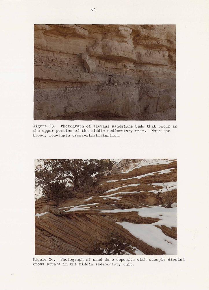
64
Figure 23. Photograph of fluvial sandstone beds that occur in the upper portion of the middle sedimentary unit. Note the broad, low-angle cross-stratification.
Figure 24; Photograph of sand dunc’deposits with steeply dipping cross strata in the middle sedimentary unit.
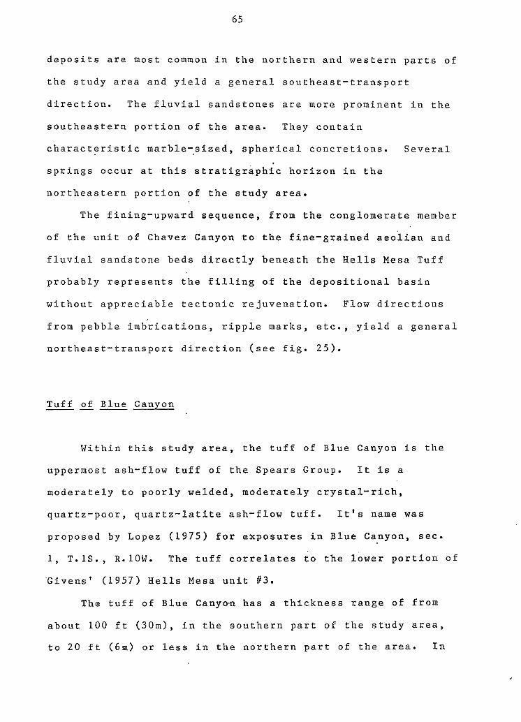
65
deposits are nost common in the northern and western parts of
the study area and yield a general southeast-transport
direction. The fluvial sandstones are more prominent in the
southeastern portion of the area. They contain
characteristic marble-sized, spherical concretions. Several
springs occur at this stratigraphic horizon in the
northeastern portion of the study area.
The fining-upwa,rd sequence, from the conglomerate member
of the unit of Chavez Canyon to the fine-grain'ed aeoiian and
fluvial sandstone beds directly beneath the Hells Mesa Tuff
probably represents the filling of the depositional basin
without appreciable tectonic rejuvenation. Flow directions
from pebble imbrications, ripple marks, etc., yield a general
northeast-transport direction (see fig. 25).
Tuff of Blue Canyon -"
Within this study area, the tuff of Blue Canyon is the
uppermost ash-flow tuff of the Spears Group. It is a
moderately to poorly welded, moderately crystal-rich,
quartz-poor, quartz-latite ash-flow tuff. It's name was
proposed by Lopez ( 1 9 7 5 ) for exposures in Blue Canyon, sec.
1, T.lS., R.1OW. The tuff correlates t o the lower portion o f
'Givens' (1957) Hells Mesa unit i13.
The tuff of Blue Cany0.n has a thickness range of from
about 100 ft (30m), in the southern part of the study area,
to 20 ft (6m) or less in the northern part of the area. In
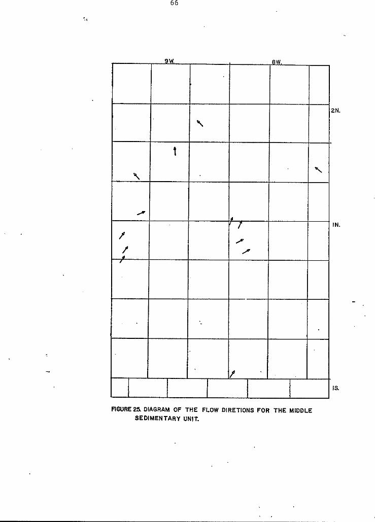
e
e
FIGURE25 DIAGRAM OF THE FLOW DlRETlONS FOR THE MIDDLE SEDIMENTARY UNIT.
e
. . 1
60
67
at least two localities the tuff is absent from it's
stratigraphic position, having apparently pinched out against
topographic highs during deposition. Coffin (in prep.)
reports that the tuff completely pinches out' approximately 4
miles to the east of this study area.
. The tuff crops out as a moderate ledge former in a
nearly continuous belt in the eastern portion of the study
area. In the western part of the area, the tuff of Blue
Canyon occurs as discontinuous thin ledges and as caps on
hills. Both upper and lower contacts between the tuff and
the middle sedimentary unit are sharp (see fig. 2 6 ) and
conformable.
In hand specimen, the tuff of Blue Canyon is a tan to
light-gray, moderately to poorly welded, moderately
crystal-rich ash-flow.tuff. Phenocrysts of plagioclase,
sanidine and biotite comprise from 1 5 - 2 4 % of rock, with minor
amounts of clinopyroxene, hornblende and quartz present. The
rock is characterized by a dominance of plagioclase,
generally subordinate sanidine, a relatively large amount of
biotite and an almost total lack of quartz. The feldspar
grains typically occur as euhedral to subhedral laths,
generally 2 to 4 mm in long dimension and are frequently
weathered to clays. The biotite phenocrysts are euhedral,
both black and bronze in color, and range from 2 to 5 mm in
diameter. Quartz is present in minor ambunts and occurs as
rounded grains generally less than 2 mm in diameter.
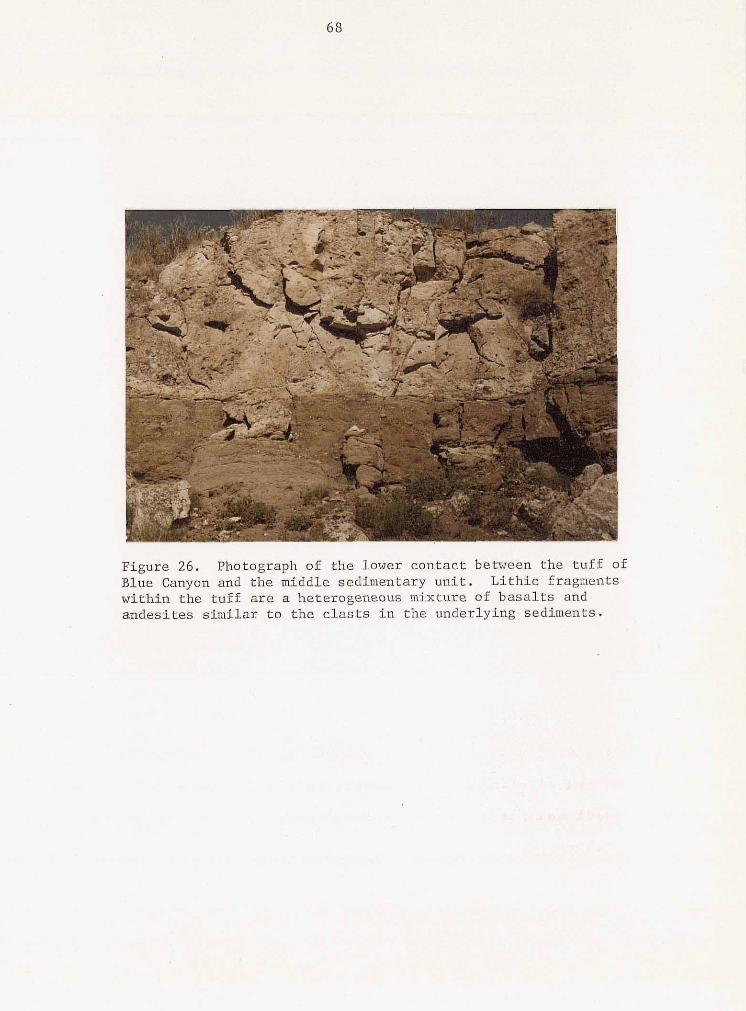
89
69
In this study area, there is little vertical variation
0 in composition or welding in the tuff of Blue Canyon, with
the exception of a poorly to non-welded basal zone which is
extremely discontinuous. However, several lateral variations
d o occur. From south to north, the tuff becomes
progressively thinner and eventually pinches out ent2rely.
Also, the tuff becomes progressively less welded northward.
And finally, whereas phenocryst content does not change
appreciably, there is a notable increase in abundance of
I I
t , I lithic fragments northward. These lithic fragments' are very
1 middle sedimentary unit. They consist dominantly of
similar to the clasts of the underlying conglomerates of the
aphanitic and porphyritic andesites, with minor basaltic and
ash-flow tuff rocks. They are generally well rounded and
range in size from a few millimeters to several centimeters
in diameter. Since the tuff is near it's distal margin,
where topographic controls are their greatest, the lithic
fragments are probably inclusions derived from slope talus
and stream channels. '
Petrographically, the tuff of Blue Canyon is a
fine-grained, partially devitrified, quartz-latite ash-flow
tuff. It's matrix has a vitroclastic texture.' Incipient
devitrification around glass shards and vesicles is common
(see fig. 27). Total phenocryst content varies from about 1 6
to 21% (see table 2), with about equal amounts o f sanidine
and plagioclase, minor amounts of biotite and a fraction of a
percent of quartz, clinopyroxene, hornblende and opaque
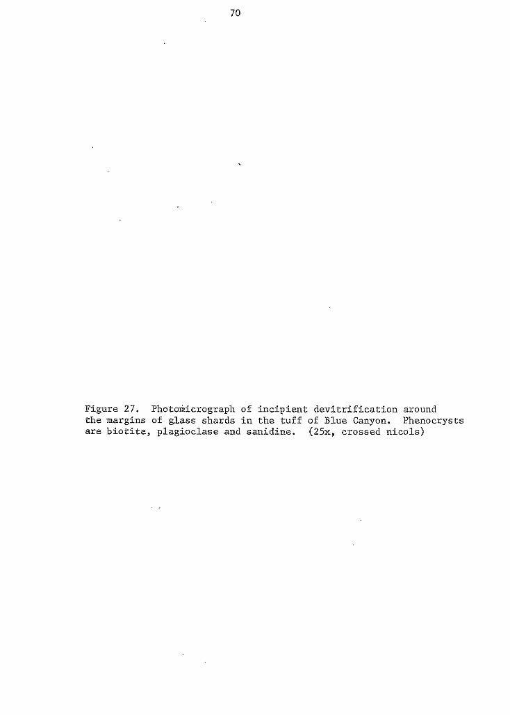
70
0
e
Figure 27. Photokicrograph of incipient devitrification around
are biotite, plagioclase and sanidine. (25x, crossed nicols) the margins of glass shards in the tuff of Blue Canyon. Phenocrysts
e
-
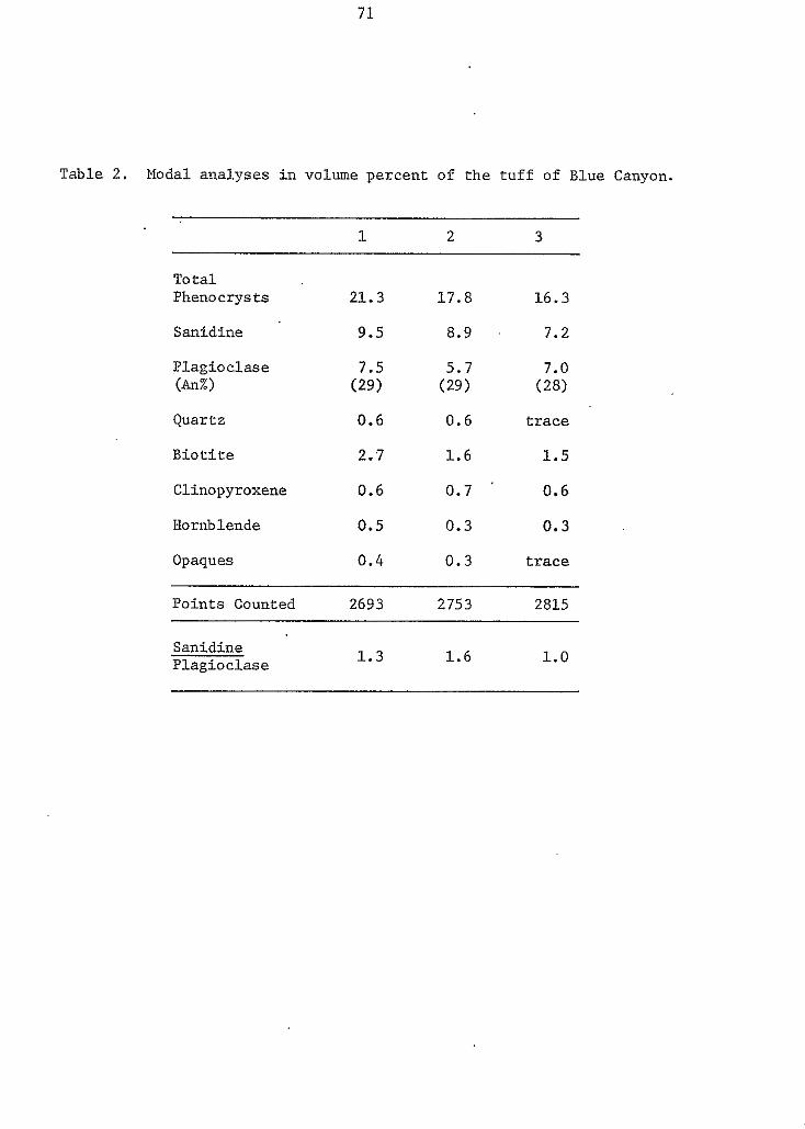
71
Table 2. Modal a n a l y s e s i n volume percent of t h e t u f f of Blue Canyon.
1 2 3
Total Phenocrysts 21.3
Sanidine 9.5
P lag ioc lase (An%) ( 2 9 )
7.5
Quartz 0.6
B i o t i t e 2.7
Clinopyroxene 0.6
Hornblende 0.5
Opaques 0.4
17.8
8.9
(29) 5.7
0.6
1 . 6
0.7
0.3
0.3
16.3
7.2
7.0 (28)
t r a c e
1.5
0.6
0 . 3
t r a c e
Points Counted 2693 2753 2815
Sanidine P lag ioc lase 1.3 1.6 1.0
72
oxides. Plagioclase occurs as euhedral to subhedral laths
which.typically display albite twinning. The plagioclase is
normally zoned and has an average composition of about An2~9.
Sanidine is present as subhedral to euhedral crystals which
frequently show carlsbad twinning. Both feldspars have a
size range from about 0.2 to 2.5 mm. The ferromagnesian
minerals are dominated by euhedral to subhedral biotite
crystals, with varying amounts of euhedral to subhedral
clinopyroxene and hornblende. These ferromagnesian.crystals
range in size from about 0 . 2 t o 1 . 5 mm.
The stratigraphic correlation of the tuff of Blue Canyon
is at present uncertain. Other units which have been .
described in the stratigraphic interval immediately below the
Hells Mesa Tuff are: Deal's ( 1 9 7 3 ) crystal-rich latite
ash-flow tuff of the Spears Formation, Chamberlin's ( 1 9 7 4 )
upper latite tuffs of the Spears Formation, Wilkinson's
( 1 9 7 6 ) tuff of Granite Mountain, and Spradlin's ( 1 9 7 6 )
Spear's unit #14.
Similarities between these tuffs and the tuff of Blue
Canyon are:
1 ) A common stratigraphic position as the first
ash-flow tuff below the quartz-rich Hells Mesa Tuff.
2 ) A conspicuous lack of quartz.
3 ) An occurrence of ferromagnesian minerals, dominantly
biotite, as 1 0 % or more of the total phenocrysts.
4 ) Similar total feldspar to total ferromagnesian
e ratios.
73
Differences between these tuffs and the tuff of Blue
Canyon are:
1 ) An approximate 2 to 1 ratio in phenocryst content.
(The tuff of Blue Canyon contains approximately 20%
phenocrysts, while the other tuffs contain about 4 0 %
phenocrysts.)
2 ) Variations in mineral ratios, particularly sanidine
to plagioclase (sanidine/plagioclase in the tuff o f Granite
Mountain is commonly as low as 1 / 9 ; and in Blue Canyon is
usually within the range of 1/1 t o l/Z).
Three possibilities are envisioned f o r these'
quartz-poor, quartz-latite to latite tuffs of , the upper
Spear's Group.
1 ) Nearly simultaneous eruptions of minor ash flows
from two ( o r more) source areas with similar magma
compositions, or
2 ) Sequential minor eruptions o f a zoned magma from a
single source area, or
3 ) A single eruptive event, resulting in a laterally
zoned ash-flow sheet. ( A decrease in phenocryst content away
from the vent area is common, due to crystal settling and a
decrease in compaction. In fact, a notable decrease in
phenocryst content is found in the Hells Mesa Tuff and the
ash-flow tuffs of the A-L Peak Formation within the region,
and the tuff of Main Canyon shows an inverse relationship
between compaction and phenocryst content. However, the
phenocryst ratios should remain approximately the same.)
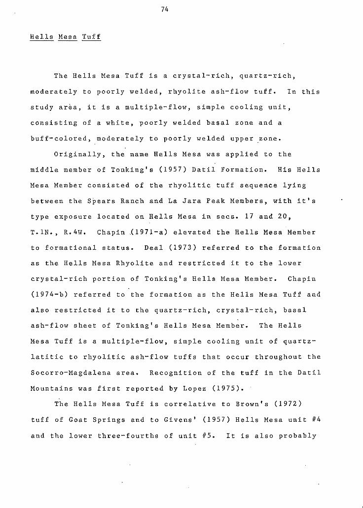
74
Hel l s Mesa T u f f "-
The H e l l s M e s a T u f f i s a c r y s t a l - r i c h , q u a r t z - r i c h ,
m o d e r a t e l y t o p o o r l y w e l d e d , r h y o l i t e a s h - f l o w t u f f . In t h i s
s t u d y a r e a , i t i s a m u l t i p l e - f l o w , s i m p l e c o o l i n g u n i t ,
c o n s i s t i n g o f a w h i t e , p o o r l y w e l d e d b a s a l z o n e a n d a
b u f f - c o l o r e d , m o d e r a t e l y t o p o o r l y w e l d e d u p p e r z o n e .
O r i g i n a l l y , t h e name He l l s Mesa w a s a p p l i e d t o t h e
m i d d l e m e m b e r o f T o n k i n g ' s ( 1 9 5 7 ) D a t i l F o r m a t i o n . H i s H e l l s
Mesa Member c o n s i s t e d o f t h e r h y o l i t i c t u f f s e q u e n c e l y i n g
b e t w e e n t h e S p e a r s Ranch a n d L a J a r a P e a k M e m b e r s , w i t h i t ' s
t y p e e x p o s u r e l o c a t e d on H e l l s Mesa i n secs . 1 7 a n d 2 0 ,
T . l N . , R.4W. C h a p i n i 1 9 7 1 - a ) e l e v a t e d t h e Hells Mesa Member
t o f o r m a t i o n a l s t a t u s . Deal ( 1 9 7 3 ) r e f e r r e d t o t h e f o r m a t i o n
a s t h e Hel l s M e s a R h y o l i t e a n d r e s t r i c t e d i t t o t h e l o w e r
c r y s t a l - r i c h p o r t i o n o f T o n k i n g ' s He l l s Mesa Member. Chapin
( 1 9 7 4 - b ) r e f e r r e d t o t h e f o r m a t i o n as t h e H e l l s M e s a T u f f a n d
a l s o r e s t r i c t e d i t t o t h e q u a r t z - r i c h , c r y s t a l - r i c h , b a s a l
a s h - f l o w s h e e t o f T o n k i n g ' s H e l l s Mesa Member. The He l l s
Mesa T u f f i s a m u l t i p l e - f l o w , s i m p l e c o o l i n g u n i t o f q u a r t z -
l a t i t i c t o r h y o l i t i c a s h - f l o w t u f f s t h a t o c c u r t h r o u g h o u t t h e
S o c o r r o - M a g d a l e n a a r e a . R e c o g n i t i o n o f t h e t u f f i n t h e D a t i l
M o u n t a i n s was f i r s t r e p o r t e d b y L o p e z ( 1 9 7 5 ) .
The Hells Mesa Tuf f i s c o r r e l a t i v e t o B r o w n ' s ( 1 9 7 2 )
t u f f o f G o a t S p r i n g s a n d t o G i v e n s ' ( 1 9 5 7 ) H e l l s Mesa u n i t #4
a n d t h e l o w e r t h r e e - f o u r t h s o f u n i t #5. I t i s a l s o p r o b a b l y
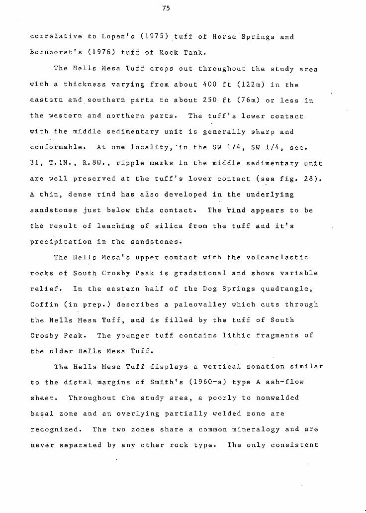
75
correlative to Lopez's (1975) tuff of Horse Springs and
Bornhorst's (1976) tuff of Rock Tank.
The Hells Mesa Tuff crops out throughout the study area
with a thickness varying from about 4 0 0 ft (122m) in the
eastern and,southern parts to about 250 ft (76m) or less in
the western and northern parts. The tuff's lower contact
with the middle sedimentary unit is generally sharp and
conformable. At one 1ocality;in the SW 1 / 4 , SW 1 / 4 , sec.
3 1 , T.lN., R.8W., ripple marks in the middle sedimentary unit
are well preserved at the tuff's lower contact (see fig. 2 8 ) .
A thin, dense rind has also developed in the underlying
sandstones just below this contact. The rind appears to be
the result of leaching of silica from the tuff and it.'s
0 precipitation in the sandstones.
The Hells Mesa's upper contact with the volcanclastic
rocks of South Crosby Peak is gradational and shows variable
relief. In the eastern half of the Dog Springs quadrangle,
Coffin (in prep.) describes a paleovalley which cuts through
the Hells Mesa Tuff, and is filled by the tuff of South
Crosby Peak. The younger tuff contains lithic fragments of
the older Hells Mesa Tuff.
The Hells Mesa Tuff displays a vertical zonation similar
to the distal margins o f Smith's (1960-a) type A ash-flow
sheet. Throughout the study area, a poorly to nonwelded
basal zone and an overlying partially welded zone are
recognized. The two zones share a common mineralogy and are
never separated by any other rock type. The only consistent
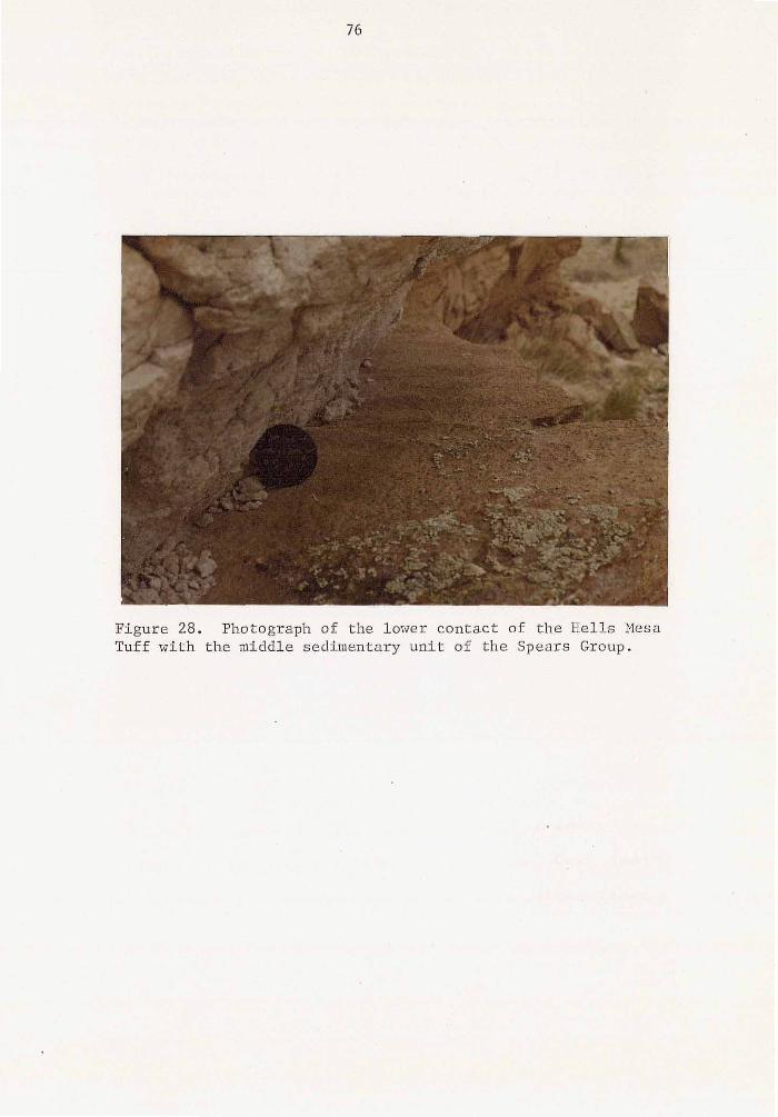
Figure 28. Photograph of the lower contact of the Hel l s Mesa Tuff with the middle sedimentary u n i t of the Spears Group.
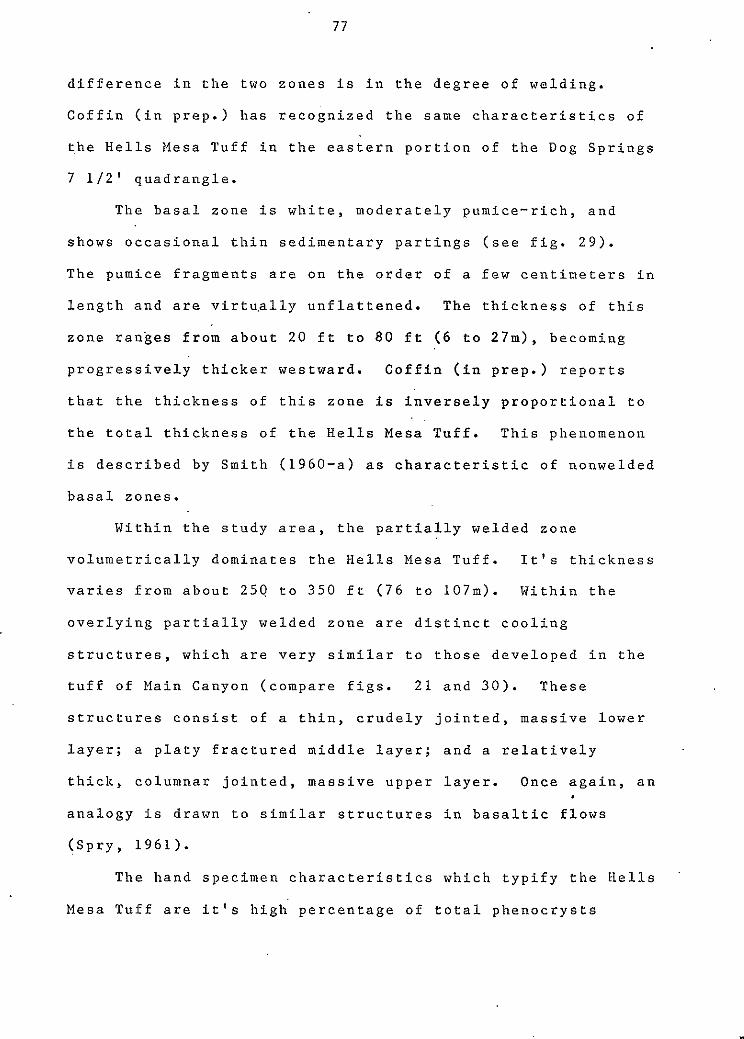
77
difference in the two zones is in the degree of welding.
Coffin (in prep.) has recognized the same characteristics of
a the Hells Mesa Tuff in the eastern portion of the Dog Springs
7 112' quadrangle.
The basal zone is white, moderately pumice-rich, and
shows occasional thin sedimentary partings (see fig. 29).
The pumice fragments are on the order of a few centineters in
length and are virtu,ally unflattened. The thickness of this
zone ranges from about 20 ft to 80 ft ( 6 to 27m), becoming
progressively thicker westward. Coffin (in prep.) reports
that the thickness of this zone is inversely proportional to
the total thickness of the Hells Mesa Tuff. This phenomenon
is described by Smith (1960-a) as characteristic of nonwelded
a basal zones.
Within the study area, the partially welded zone
volumetrically dominates the Hells Mesa Tuff. It's thickness
varies from about 250 to 350 ft (76 to 107m). Within the
overlying partially welded zone are distinct cooling
structures, which are very similar to those developed in the
tuff of Main Canyon (compare figs. 21 and 30). These
structures consist of a thin, crudely jointed, massive lower
layer; a platy fractured middle layer; and a relatively
thick, columnar jointed, massive upper layer. Once again, an
analogy is drawn to similar structures in basaltic flows
(Spry, 1961).
The hand specimen characteristics which typify the Hells
Mesa Tuff are it's high percentage of total phenocrysts
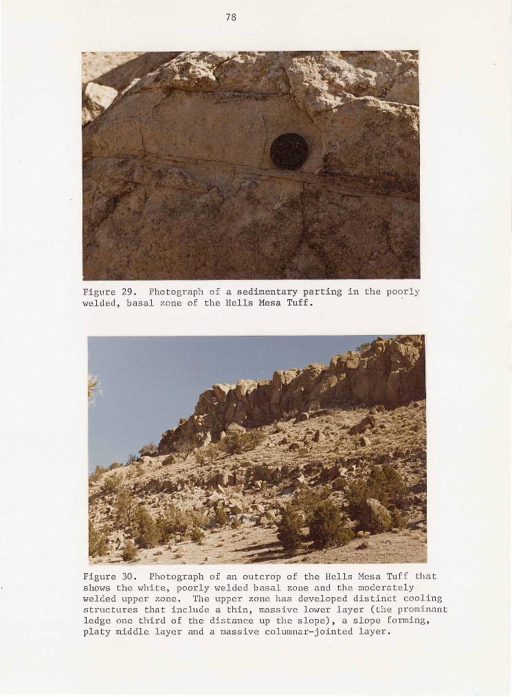
70
Figure 29. Photograph of a sedimentary par t ing i n the poorly welded, basal zone of t h e Hells Mesa Tuff.
Figure 30. Photograph of an outcrop of the Hells Mesa Tuff t h a t shows the white, poorly welded basal zone and the moderately welded upper zone. The upper zone has developed distinct cooling
ledge one third of t he d is tance up the s lope ) , a slope forming, s t ruc tu res t ha t i nc lude a th in , massive lower layer ( the prominant
p la ty middle l ayer and a massive columnar-jointed layer.
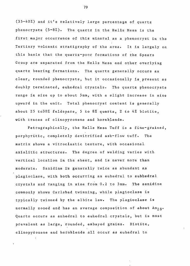
79
(35-40%) and it's relatively large percentage of quartz
phenocrysts (5-8%). The quartz in the Hells Mesa is the
first major occurrence of this mineral as a phenocryst in the
Tertiary volcanic stratigraphy o f the area. It is largely o n
this basis that the quartz-poor formations o f the Spears
Group are separated from the Hells Mesa and other overlying
quartz bearing formations. The quartz generally occurs as
clear, rounded phenocrysts, but it occasionally is present as
doubly terminated, euhedral crystals. The quartz phenocrysts
range in size up to about 5mm, with a slight increase in size
upward in the unit. Total phenocryst content is generally
about 25 to30% feldspars, 5 to 8 % quartz, 2 to 4 % biotite,
with traces of clinopyroxene and hornblende.
Petrographically, the Hells Mesa Tuff is a fine-grained,
porphyritic, completely devitrified ash-flow tuff. The
matrix shows a vitroclastic texture, with occasional
axiolitic structures. The degree of welding varies with
vertical location in the sheet, and is never more than
moderate. Sanidine ia generally twice as abundant a.s
plagioclase, with both occurring as euhedral to subhedral
crystals and ranging in size fro'm 0.2 to 3mm. The sanidine
commonly shows Carlsbad twinning, while plagioclase is
typically twinned by the albite law. The plagioclase is
normally zoned and has an average composition.of about An28.
Quartz occurs as anhedral to euhedral crystals, but is most
prevalent as large, rounded, embayed grains. Biotite,
clinopyroxene and hornblende all occur as euhedral to
80
subhedral crystals. Magnetite grains are present in trace
amounts throughout the rock.
The llells Mesa Tuff is the largest ash-flow sheet of the
northern Datil-Mogollon volcanic field. It has been
described in the Joyita Hills (Spradlin, 1975), in the
Magdalena Mountains (Blakestad, 1978; Osburn, 1978; Petty,
1979; Allen, 1979; Bowring, 1980; Donze, 1980; Roth, 1980),
in the San Mateo Mountains (Deal, 1973; Deal and Rhodes,
1976), in the Bear Mountains (Brown, 1972; Simon, 1973;
Massingill, 1979; Mayerson, 1979), in the Gallinas Mountains
(Chamberlin, 1974; Wilkinson, 1976; Laroche, in prep.;
Coffin, in prep.), in the northern part of the Black Range
(Fodor,.1976), and in the Datil Mountains (Lopez, 1976; this
thesis). The tentative correlative of Bornhorst's (1976) tuff
of Rock Tank with the Hells Mesa Tuff made by this thesis
possibly extends the tuff into the Crosby Mountains and even
further westward.
This correlation is based on two important similarities
between the tuff of Rock Tank and the Hells Mesa Tuff.
First, they occupy the same stratigraphic position, lying
above the tuff of Blue Canyon and below the volcaniclastic
rocks of South Crosby Peak and the A-L Peak Formation (see
plate 2). Second, both Hells Mesa and Rock Tank are
crystal-rich, rhyolite ash-flow tuffs with nearly identical
mineralogy and total phenocryst content. In addition, both
represent the lowest stratigrahic ash-flow tuff to contain
prominent quartz phenocrysts and both show a regionally
81
a t y p i c a l z o n a t i o n f r o m a m o r e m a f i c b a s e t o a more s i l i c i c
e t o p ( B r o w n 1 9 7 2 ; Deal , 1 9 7 3 ; B o r n h o r s t , 1 9 7 6 ) . F r o m t h e
d e s c r i p t i o n s o f t h e t u f f o f R o c k T a n k b y L o p e z ( 1 9 7 5 ) a n d
B o r n h o r s t ( 1 9 7 6 ) a s a w h i t e t o p i n k i s h - w h i t e , p o o r l y w e l d e d
a s h - f l o w t u f f , i t a p p e a r s t h a t t h e t u f f o f R o c k T a n k i s
p r o b a b l y t h e p o o r l y t o n o n - w e l d e d b a s a l z o n e o f t h e H e l l s
Mesa T u f f . F o l l o w i n g t h i s i n t e r p r e t a t i o n , t h e n , t h e H e l l s
Mesa Tuff i s a p e r f e c t e x a m p l e o f S m i t h ' s ( 1 9 6 0 - a ) s i m p l e
c o o l i n g u n i t w h i c h b e c o m e s i n c r e a s i n g l y l e s s w e l d e d a w a y f r o m
i t ' s s o u r c e . T h e s o u r c e a r e a f o r t h e He l l s Mesa T u f f i s t h e
N o r t h B a l d y - S o c o r r o c a l d e r a ( C h a p i n a n d o t h e r s , 1 9 7 8 ;
E g g l e s t o n , i n p r e p . ) .
T h e f o u r p u b l i s h e d d a t e s o n t h e H e l l s M e s a T u f f a r e 29 .4
m.y. a n d 3 1 . 8 m.y. by Weber and Basse t t ( 1 9 6 3 ) , a n d 3 1 . 9 m.y.
a n d 3 2 . 3 m.y. b y B u r k e a n d , o t h e r s ( 1 9 6 3 ) . T h e 3 1 . 9 m.y.
s a m p l e was c o l l e c t e d by R.W. F o s t e r , o f t h e N e w M e x i c o B u r e a u
o f M i n e s a n d M i n e r a l R e s o u r c e s , f r o m t h i s s t u d y a r e a . T h e
s a m p l e d l o c a t i o n i s in t h e SE 1 1 4 , SE 1 1 4 , s e c . 7 , T . l N . ,
R .8W.; 34' 1 9 ' 11" N . , 107' 4 2 ' 54"W.
e
V o l c a n i c l a s t i c " U n i t o f S o u t h C r o s b y P e a k
T h e v o l c a n i c l a s t i c u n i t o f S o u t h C r a s b y P e a k c o n s i s t s o f
p e b b l e t o c o b b l e c o n g l o m e r a t e s , a s h - f a l l t u f f s , r e w o r k e d
a s h - f a l l t u f f s , t u f f a c e o u s s a n d s t o n e s a n d t h e m i n o r a s h - f l o w
t u f f o f S o u t h C r o s b y P e a l c . T h e s e r o c k s l i e b e t w e e n t h e He l l s
I
82
Mesa Tuff and the A-L Peak Formation. The unit was named by
Bornhorst (1976) for exposures on South Crosby Peak in secs.
25, 26 and 3 6 , T.ZS., R.11W. It is correlative to Lopez's
(1975) tuff of Crosby Mountain.
The unit has a maximum thickness of about 200 ft (61m)
in the southeastern part of the study area and thins to 50 ft
(15m) and less in the western part. At some localities, it
is absent. The unit'.s lower contact with the Hells Mesa Tuff
is gradational and reflects moderate relief. It's upper
contact with the lower member of the A-L Peak Formation is
generally sharp. The sedimentary rocks are conformable to
both the Hells Mesa Tuff and the A-L Peak Formation.
Within this study area, the unit of South Crosby Peak is
divisible into two members: A lower pebble to cobble
conglomerate member and an upper ash-fall tuff, tuffaceous
sandstone, ash-flow tuff member. The lower member is the
more wide spread. It's thickness is generally only 50 ft
(15m) o r less throughout the study area, except for a
localized thickening'to about 200 ft (61m) in the extreme
western part of the study area, near the Red Lake fault.
This nember contains clasts of aphanitic basalts, porphyritic
andesites, quartz-latite to rhyolite flow rocks and densely
welded Hells Mesa Tuff. The matrix consists of dominantly
sand-sized grains of quartz, feldspar and biotite.
The upper member consists of interbedded ash-fall tuffs,
tuffaceous sandstones, minor pebble conglomerates and the
tuff of South Crosby Peak. This member occurs mainly in a
83
n o r t h - n o r t h e a s t - t r e n d i n g b e l t t h r o u g h t h e s o u t h e a s t e r n p a r t
o f t h e s t u d y a r e a , w h e r e i t a p p a r e n t l y f i l l e d a t o p o g r a p h i c
low. I t ' s t h i c k n e s s t h e r e i s a b o u t 1 0 0 t o 1 5 0 f t ( 3 0 t o
45m). I t ' s p r e s e n c e t h r o u g h o u t t h e r e s t o f t h e a r e a i s
s c a t t e r e d a n d m i n o r . T h e a s h - f a l l t u f f s o c c u r a s t h i n
p e r s i s t a n t l a y e r s o f m o t t l e d p i n k i s h - w h i t e , n o n w e l d e d p u m i c e
f r a g m e n t s , a n d s h o w c r u d e f i n i n g - u p w a r d s e q u e n c e s . T h e u p p e r
p o r t i o n s o f i n d i v i d u a l a s h - f a l l s c o m m o n l y s h o w s e d i m e n t a r y
r e w o r k i n g . L i t h i c f r a g m e n t s a n d g r a i n s o f f e l d s p a r a n d
q u a r t z a r e a b u n d a n t . T h e i r s i z e r a n g e i s f r o m a b o u t 1 t o
3mm.
T u f f o f S o u t h C r o s b y P e a k "
I n f e r b e d d e d w i t h i n t h e v o l c a n i c l a s t i c u n i t o f S o u t h
C r o s b y P e a k i s a p u m i c e - , r i c h , c r y s t a l - p o o r , r h y o l i t e a s h - f l o w
t u f f . T h e n a m e t u f f o f C r o s b y M o u n t a i n was i n i t i a l l y
p r o p o s e d b y R. C. R h o d e s a n d T. 3 . B o r n h o r s t f o r t h i s t u f f
f r o m e x p o s u r e s o n C r o s b y M o u n t a i n , S e c . 2 5 , T . Z S . , R11W.
( L o p e z , 1 9 7 5 , p . 4 4 ) . T h i s n a m e was l a t e r c h a n g e d b y
B o r n h o r s t ( 1 9 7 6 ) t o t h e v o l c a n i c l a s t i c r o c k s o f S o u t h C r o s b y
P e a k ; t h e t y p e s e c t i o n w a s c h a n g e d t o Secs . 2 5 , 2 6 , a n d 3 6 ,
T . 2 S . , R. low.; a n d t h e a s h - f l o w t u f f l o w e r e d t o m i n o r m e m b e r
s t a t u s . T h e n a m e t u f f o f S o u t h C r o s b y P e a k i s h e r e i n u s e d i n
r e f e r e n c e t o t h i s a s h - f l o w t u f f .
84
The tuff crops out only in the southeastern part of the
study area, with it's principle exposure in secs. 1 and 2 ,
T.lS, R.YW. It has a maxinum thickness of about 25 ft (8m)
and rapidly pinches out northwestward. The tuff forms a
massive ledge within the sedimentary rocks and displays a
sharp lower contact (see fig. 31) and a gradational u'pper
contact.
In hand specimen, the tuff of South Crosby Peak is a
white, poorly welded, pumice-rich, crystal-poor ash-flow
tuff. The pumice fragments show very minor flattening and
are pale yellow in color. Sparse crystals of black biotite,
quartz, sanidine and hornblende are visible. Lithic
fragments, generally 2 to 4 mm in diameter, of dark
basaltic-andesite and red rhyolite or latite comprise about
5% of the rock. e
Petrographically, the tuff contains approximately 10.5%
total phenocrysts. Subhedral sanidine crystals dominate,
comprising about 7% of the rock's volume. Plagioclase
comprises approximately 2% of the rock and has an average
composition of about An3,,. Rounded quartz and euhedral
biotite each comprise about 1% of the rock. Pyroxene and
hornblende are present in trace amounts. The m'atrix shows a
partially devitrified vitroclastic texture with relatively
undeformed glass shards. Unflattened pumice fragments
comprise approximately 20% of the rock, and lithic fragments
of basaltic-andesite and densely welded rhyolite ash-flow
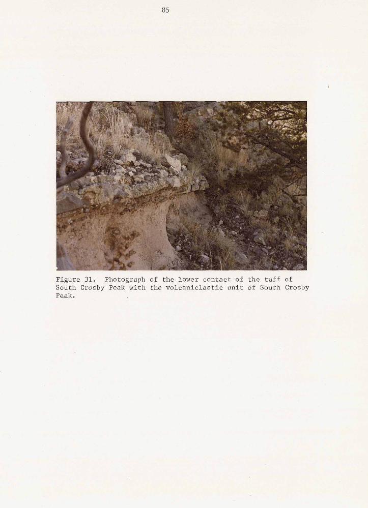
85
Figure 31. Photograph of the lower contact of the t u f f of
Peak. South Crosby Peak with the volcaniclast ic uni t of South Crosby
tuff (Hells Mesa Tuff?) make up about 5% of the rock's
volume.
The tuff of South Crosby Peak is a regionally minor
ash-flow sheet, cropping out only along the northwestern
margin 0.f the Plains of San Agustin in the Datil and Crosby
Mountains. It's maximum thickness is 300 ft (91m), reported
by Lopez (1975) in the southern Datil Mountains. The
thinness and the discontinuous nature of the tuff in this
study area suggests that was deposited in valleys near it's
distal margin. Coffin (in prep.) describes a paleovalley
filled by the tuff of South Crosby Peak near the east'ern
margin of this study area. The fill is topographically lower
than the Hells Mesa Tuff and contains lithic fragments' of the
Hells Mesa Tuff.
There have been no age dates calculated on the tuff of
South Crosby Peak. However, it is bracketed between the
32-m.y.-old Hells Mesa Tuff and the 28 to 30-m.y.-old A-L
Peak Formation. The suggested source area for the tuff (and
possibly the ash-fall tuffs) is the Crosby Mountain
volcano-tectonic depression (Bornhorst, 1976).
A-L Peak Formation "
The A-L Peak Formation is a composite ash-flow sheet,
consisting of three generally recognized ash-flow tuff
members -- the lower gray-massive; the middle flow-banded and
a7
the upper pinnacles members (Chapin & Deal, 1 9 7 6 ) . Two
0 distinct ash-flow tuff member~s, separated by basaltic
andesite flows, are identifiable in this study area. The
lower member is a multiple-flow, compound cooling unit
(flow-banded,and gray-massive members?) and the upper member
is a multiple-flow, simple cooling unit, equivalent to the
pinnacles member.
The formation was initially named the A-L Peak Rhyolite
by Deal and Rhodes ( 1 9 7 4 ) , for exposures on the northeast
flank of A-L Peak (secs. 3 , 33, 3 4 , and 35, T.4S., R.6W.), in
the northern San Mateo Mountains. The name A-L Peak Tuff
used in this report is adopted from Chapin and others' ( 1 9 7 8 )
reference to the formation. A fission-track age date of 3 1 . 8
m.y. was reported for Deal's A-L Peak Rhyolite in the San
.Mate0 Mountains (Smith and others, 1 9 7 6 ) . However, recent 0
stratigraphic and geochemical studies have shown that Deal's
A-L Peak Rhyolite is not the same stratigraphic unit as the
A-L Peak Tuff of the Magdalena Project (Chapin, 1 9 8 0 , oral
commun. ). The A-L Peak Tuff is correlative to the upper part of
Tonking's ( 1 9 5 7 ) Hells Mesa Member of the Datil Formation and
to Brown's ( 1 9 7 2 ) tuff of Bear Springs. The lower cooling
unit corresponds to the upper portion of Givens' ( 1 9 5 7 ) Hells
Mesa unit 115; the intercalated basaltic-andesite to his Hells
Mesa unit # 6 ; and the upper cooling unit (pinnacles member)
to his Hells Mesa unit i17. Lopez ( 1 9 7 4 ) and Bornhorst ( 1 9 7 6 )
refer to the lower cooling unit as the A-L Peak Rhyolite; to
88
the basaltic-andesite interval as the basaltic-andesite of
Twin P.eaks; and to the upper cooling unit as the tuff of
Wahoo Canyon. The A-L Peak Formation is also possibly
correlative to the tuff of Davis Canyon of southwestern New
Mexico (J. Ratte, 1980, oral commun.).
lower member
Within this study area, the lower member o f the A-L Peak
Formation is a multiple-flow, compound cooling unit. The
lower member is thickest in the southwestern portion of the
study area, where it i iabout 150 ft (45m) thick. In the
southeastern part of the study area, the lower member has a
thickness of about 90 to 100 ft (27 to 30m) and shows
considerable vertical variation in welding and compaction.
An upward sequence '(see fig. 32) begins with a lower 10 ft
(3m) of light-brown, massive, moderately-welded tuff, which
has only slightly compacted foliation at the base, and grades
upward into approximately 22 ft (7m) o f densely welded,
red-brown tuff with well-developed eutaxitic foliation.
Within this densely welded tuff are lenses o f black,
vitrophyre; containing brown sperulites, from 1 to 4mm in
diameter, enclosed within the black obsidian. The lower 12
f t (3.7m) of this densely welded zone is massive, the next 8
ft (2.4m) develops a platy nature and the upper 2 ft (0.6m)
is massive in character. This relatively thin, upper massive
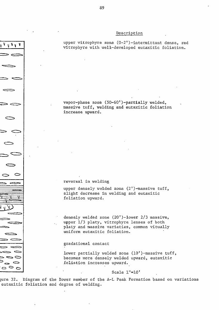
89
Descript ion
upper vitrophyre zone (O-Z')-intermittant dense, red v i t rophyre wi th wel l -deve loped eu tax i t ic fo l ia t ion .
vapor-phase zone (50-60')-partially welded, massive tuff, welding and eu tax i t i c f o l i a t i o n increase upward.
r eve r sa l i n we ld ing
upper densely welded zone (Z')-massive tuff, s l i g h t d e c r e a s e i n welding and eutaxit ic f o l i a t i o n upward.
, , upper 1 / 3 p la ty , v i t rophyre l enses o f bo th densely welded zone (20')-lower 2/3 massive,
platy and massive v a r i e t i e s , common v i t u a l l y uni form eu tax i t ic fo l ia t ion .
g rada t iona l contac t
lower p a r t i a l l y welded zone (lO')-massive t u f f , becomes more densely welded upward, e u t a x i t i c f o l i a t i o n i n c r e a s e s upward.
Scale 1"=10'
90
layer shows a slight decrease in welding and eutaxitic
foliation.
0 Overlying this basal.sequence, with a marked reversal in
welding, is a relatively thick, 50 to 60 ft (15 to 18m),
vapor-phase zone. This zone grades from a moderately welded
tuff upward into a more densely welded tuff with
well-developed eutaxitic foliation. The entire sequence is
discontinuously capped by a thin, red vitrophyre zone. The
rocks of this upper vitrophyre zone have a dull, resinous
luster typical of pitchstones. .
To the west and north, the lower member thins to 50 ft
(Ism) or less, due largely to the disappearance of the
vapor-phase zone. The flows associated with the vapor-phase
zone appear to have puddled in a topographic low located in
the southeastern part of the study area. The topographic low
apparently deepens t o the northeast as Coffin (in prep.)
reports thicknesses o f 100 to 150 ft (30 to 46m) for the
lower member of the A-L Peak Formation. In addition to the
northwest-thinning, the lower part of the ash-flow sheet
becomes increasingly less welded to the northwest and grades
into a light-brown, poorly welded, moderately pumice-rich
tuff.
In the southwestern portion of the study area, the lower
member conformably overlies the unit of South Crosby Peak.
However, in other portions of the study area the lower member
lies upon the unit of South Crosby Peak, the Hells Mesa Tuff,
and the middle sedimentary unit with slight angular
91
unconformity. The lower member lies beneath the
basaltic-andesite of T~win Peaks throughout most of the field
area, with the exception of the northwestern part of the area
where the basaltic-andesite of Twin Pealcs is absent. There,
the lower member lies directly beneath the pinnacles member
of the A-L Peak Tuff. The overlying units are conformable
with the lower member of the A-L Peak Formation throughout
the study are, with the exception of two outcrops along the
Blue Mesa Plateau where the pinnacles member of the A-L Peak
Formation overlies the lower member of the A-L Peak Formation
with slight angular unconformity.
0
Petrographically, the. lower member consists of densely
to moderately welded, crystal-poor rhyolite ash-flow tuffs
(see table 3 ) . The total phenocryst content ranges from
about 3 to 7% with euhedral to subhedral sanidine crystals by
far the dominant phenocryst. The sanidine phenocrysts are
from 0.5mm to 2mm in length and commonly show Carlsbad
twinning. Biotite, rounded quartz, plagioclase and
clinopyroxene all occur in minor amounts, with sphene and
magnetite present in trace amounts. The ferromagnesian
minerals are commonly rimmed or totally replaced by opaque
oxides. Lithic fragments vary from less than 2'% to about 5%.
e
The vapor-phase minerals are intergrowths of euhedral
alkali feldspars and quartz. The crystals lining the pumice
are generally coarser grained than those nearer the center,
which have a fine-grained, sugary texture. Many of the vapor
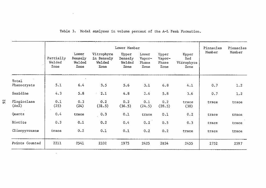
To t a l Phenocrysts
Sanidine
2 Plagioc lase (AnZ)
Quartz
B i o t i t e
Clinopyroxene
Points Counted
Table 3. Modal analyses i n volume percent of the A-L Peak Formation.
Lower Member
P a r t i a l l y Densely in Densely Densely Vapor- Vapor- Red Lower Vitrophyre Upper Lower Upper Upper
Welded Welded Welded Welded Phase Phase Vitrophyre Zone Zone Zone Zone Zone Zone Zone
5 .1 6 .4 3.5 5.6 3.1 6.8 4 .1
4.3 5.8 2.1 4.8 2.6 5 .8 3.6
( 2 5 ) 0.1
( 2 4 ) 0.3
(31.5) 0 .2 0 .2 0.1 0.2
(36.5) (24.5) (28.5) t r a c e
( 3 8 )
0 .4 t r a c e 0.3 0.1 t r ace 0 . 1 0.2
0.3 0.1 0.2 0.4 0.2 0.5 0 . 3
t r a c e 0.2 0.1 0.1 0.2 0.2 t r a c e
2211 2541 2102 19 75 2425 2834 2455
Pinnacles Pinnacles Member Member
0.7 1.2
0 .7 1.2
t r a c e t r a c e
t r ace t r a c e
t r a c e t r a c e
t r a c e t r a c e
2 752 259 7
93
phase minerals are partially altered to clays and/or coated
with secondary silica. a Whereas the phenocryst mineralogy and abundance are very
similar throughout the lower member, petrographic variations
other than those in welding do occur. In particular, these
variations occur in primary textures and structures, in type
and extent of crystallization, and in the An content o f the
plagioclase phenocrysts.
The lower, partially welded zone has a slightly
devitrified, vitroclastic matrix with minor axiolitic
structures developed in the pumice. Plagioclase has an
a.verage composition of An25. This zone grades upward iato
the densely welded zone.
The densely welded zone has a slightly devitrified
matrix with a vitroclastic texture. It also has
well-developed eutaxitic structure (see fig. 33) and common
axiolitic and spherulitic structures in the pumice.
Plagioclase has an average composition of about An24. The
vitrophyre in this zone also has a slightly devitrified
matrix with a strong eutaxitic structure. Glass shards are
well defined and commonly wrap around crystals and lithic
fragments. The pumice fragments are characterized by crystal
aggregates of quartz and alkali feldspars and commonly show
fiamme structure. The plagioclase crystals have a
composition of about An31.
The upper partially welded zone has a partially
devitrified matrix with a eutaxitic structure. The
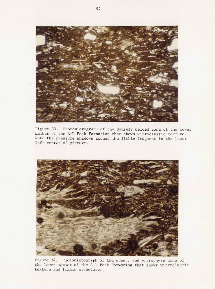
94
Figure 3 4 . Photomicrograph of the upper, red vi t rophyre zone of the lower member of the A-L Peak Formation that shows v i t r o c l a s t i c t e x t u r e and fiamme s t r u c t u r e .
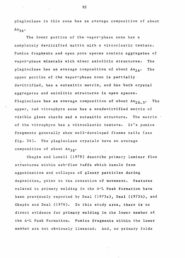
95
plagioclase in this zone has an average composition of about
An3 6'
The lower portion of the-vapor-phase zone has a
completely devitrified matrix with a vitroclastic texture.
Pumice fragments and open pore spaces contain aggregates of
vapor-phase minerals with minor axiolitic structures. The
plagioclase has an average composition of about Anz4. The
upper portion of the vapor-phase zone is partially
devitrified, has a eutaxitic matrix, and has both crystal
aggregates and axiolitic structures in open spaces.
Plagioclase has an average composition of.about The
upper, red vitrophyre zone has a nondevitrified matrix'of
visible glass shards and a eutaxitic structure. The matrix
of the vitrophyre has a vitroclastic texture. It's pumice
fragments generally show well-developed fiamme tails (see
fig. 34). The'plagioclase crystals have an ave'rage
composition of about An38.
e
Chapin and Lowell (1979) describe primary laminar flow
structures within ash-flow tuffs which result from
aggutination and collapse of glassy particles during
deposition, prior to the cessation of movement. Features
related t o primary welding in the A-L Peak Formation have
been previously reported by Deal (1973a), Deal (1973b), and
Chapin and Deal (1976). In this study area, there is no
direct evidence for primary welding in the lower member of
the A-L Peak Formation. Pumice fragments within the lower
member are not obviously lineated. And, no primary folds
96
were observed. However, i.n the southeastern part of the
study area where attitudes of the units consistently dip from * ten to fifteen degrees to the southeast, measured attitudes
on flattened pumice fragments and gas cavities in the lower
member of the A-L Peak Formation are as high as forty degrees
to the southeast: Thus, the possibility of low amplitude
folds is indicated by such anomalously high foliation
attitudes.
The stratigraphic nature of the A-L PeSk Formation is
extremely complex, and at the present is poorly understood.
For this reason, correlations between the lower member
described in this thes-ls and either the flow-banded o r .
gray-massive members of Chapin and Deal ( 1 9 7 6 ) is not
attempted.
It is suggested, however, that the lower member of the
A-L Peak Formation in this area is stratigraphically and
petrologically equivalent to the lower and middle members of
Chamberlin's ( 1 9 7 4 ) A-L Peak Formation, to a portion o f
Wilkinson's ( 1 9 7 6 ) A-L Peak Tuff, and to Lopez's ( 1 9 7 5 ) and
Bornhorst's ( 1 9 7 6 ) A-L Peak Rhyolite Tuff (see plate 2 ) . The
probable source area for the lower member o f the A-L Peak
Formation is the Magdalena Caldron described by Blakestad
( 1 9 7 8 ) , Allen ( 1 9 8 0 ) , Bowring ( 1 9 8 0 ) , Donze ( 1 9 8 0 ) , and Roth
( 1 9 8 0 ) .
Characteristics which the lower member of the A-L Peak
Formation in this area has in common with the above mentioned
units are:
97
1) They all are multiple flow, compound cooling units.
2 ) They all have similar phenocryst mineralogy and
percentage [an exception to this is the minor amount, 0.1 to
0 . 2 % , of clinopyroxene present in this study area and to the
southwest (Lopez, 1 9 7 5 ; Bornhorst, 1 9 7 6 ) which has not been
observed to the east (Chamberlin, 1 9 7 4 ; Wilkinson, 1 9 7 6 ) l .
a
3 ) They are all stratigraphically above the Hells Mesa
Tuff.
4 ) Most of the units show some indication of primary
laminar flow structures [Bornhorst ( 1 9 7 6 ) does not mention
such structures].
A possible stratigraphic marker horizon across these units is
a dense, black vitrophyre horizon which occurs near the base
of Deal's ( 1 9 7 3 ) A-L Peak Rhyolite in the San Mateo
Mountains; near the base of Chamberlin's ( 1 9 7 4 ) middle
cooling unit of the'A-L Peak Formation in the Gallinas
Mountains; near the base o f the.lower member in this area;
and near the base of Lopez's ( 1 9 7 5 ) A-L Peak Rhyolite in the
southern Datil Mountains.
basaltic-andesite of Twin Peaks
Intercalated between the lower member of the A-L Peak
Formation and the pinnacles member is the basaltic-andesite
of Twin Peaks. The name was proposed by Lopez ( 1 9 7 5 ) for
98
exposures on Twin Peaks, secs. 18 and 1 9 , T.2S., R . 9 N . This I
e unit correlates with Givens' (1957) Hells Mesa unit 6.
The Twin Peaks is a multiple flow unit that crops out
discontinuously,throughout the southern two-thirds of the
study area. The most prominent exposures of this unit occur
adjacent to the Plains of San Agustin where it reaches a
maximum thickness of about 200 ft (61m). A similar thickness
is observed in the extreme southwestern corner of the study
area. It thins to 50 ft (15m) or less to the west and is
absent from the northern one-third of the area.
The basaltic-andesite of Twin Peaks commonly caps the
highest peaks in the area, but it is not a major
bluff-former. Instead, it characteristically forms rounded
e crests coated with basaltic-andesite rubble. As a result,
the lower contact is typically obscured and is mapped as the
uppermost occurrence of float from the lower member of the
A-L Peak Formation. Where the pinnacles.member of the A-L
Peak FLormation overlies the basaltic-andesite of Twin Peaks,
it occurs in small patches filling shallow depressions and
generally has a sharp contact.
In hand specimen, the basaltic-andesite of Twin Peaks is
a dark-gray, vesicular, microporphyritic rock.. Small (less
than lmm) phenocrysts of plagioclase, pyroxene, and olivine
are recognizable under a hand lens. The vesicles are
commonly lined with calcite.
Petrographically, this unit consists of 3 t o 4%
phenocrysts of dominantly euhedral to subhedral olivine and
99
minor pyroxene, partly to completely oxidized to goethite
and/or iddingsite(?). The phenocrysts have an average size
of about Imm. The matrix is composed of plagioclase
microlites, about 0.3mm in length, enclosed in subhedral
clinopyroxene and black glass. The plagioclase makes up
approximately 50% of the matrix and has an average
composition of about A n 4 6 .
Similar basaltic-andesites, occupying the same
stratigraphic interval between the flow-banded and pinnacles
members of the A-L Peak Formation, are described by Brown
( 1 9 7 2 ) in the Bear Mountains, by Blakestad ( 1 9 7 8 ) in the
Kelly mining district, and by Chamberlin ( 1 9 8 0 ) in the
Lemitar Mountains. No radiometric dates have yet been
obtained o n these basaltic-andesites. Samples of the Twin
Peaks basaltic-andesite from this study area have been
collected by C. E. Chapin for future dating.
pinnacles member
The upper member of the A-L. Peak Formation is a
very-crystal-poor, moderately pumice-rich, moderately welded
rhyolite ash-flow tuff. It is also a multiple-flow, simple
cooling unit. The pinnacles member crops out as isolated
patches throughout virtually the entire area, with a normal
thickness of about 20 to 4 0 ft ( 6 t o 12m). One atypical
hill located in the northwest.ern part of the area, adjacent
@ to the Red Lake fault, is capped by approximately 2 0 0 ft
100
(61m) of the pinnacles member. This anomalous thickness is
probably due to the tuff's filling of a paleostream channel
or other topographic low.
In the southeastern part of the study area, the pinnacles
member occurs both as a planar outflow sheet that conformably
overlies the basaltic-andesite of Twin Peaks, and as a
channel fill that unconformably overlies the middle
sedimentary unit and. the Hells Mesa Tuff. The channel fill
trends west-northwest, at nearly right angles t o the present
day axis of the synform. Along Blue Mesa; in the Red Lake
fault zone, the pinnacles member overlies the Hells Mesa Tuff
with angular unconformity. These relationships indicate that
1) between the time of deposition of the lower and pinnacles
members o,f the A-L Peak Formation there was movement along
the Red Lake fault zone (possibly associated with relative
uplift of the Colorado Plateau), and 2) that a synformal
basin, similar to the present day synform, was developing
simultaneously..
In hand specimen, the pinnacles member is a light-gray,
crystal-poor, moderately pumice-rich ash-flow tuff. It is
moderately welded with a' well-developed eutaxitic structure.
Compacted pumice fragments often reach 3 to 4 in. ( 8 to 10cm)
in long dimension. No prominent lineations were identified
in the study area. Sparse, large laths of sanidine are
practically the only phenocrysts present and these comprise
only 1 to 3 % of the rock's volume. Occasionally the sanidine
phenocrysts show a chatoyant blue color. Biotite, quartz and
101
pyroxene phenocrysts are visible in trace amounts.
Vapor-phase crystals are prominent inside pumice fragments
and other open spaces. Lithic fragments, generally from 2 to
5mm in diameter and dominantly andesitic in composition,
comprise from 2 to 5% of the rock.
Modal analyses of two thin sections of the pinnacles
member are given in Table 3. These rocks are composed of a
brown, partially devitrified, vitroclastic matrix with from 1
to 3 % total phenocrysts. Sanidine is the most common
phenocryst and is usually euhedral, ranging from 2 to 6mm in
length, and commonly displays Carlsbad twinning. Many of the
sanidine crystals are fractured and highly embayed. Biotite,
pyroxene, quartz and plagioclase are present in trace
amounts. The only plagioclase crystal found in the two thin
sections was normally zoned from An26 t o An32.
A characteristic petrographic feature of the pinnacles
member is the conspicuous vapor-phase crystallization in
pumtce fragments and open pore spaces. The crystals are an
aggregate of euhedral alkali feldspar and cristobalite which
appear to grow in.ward away from the pumice walls (see fig.
35). Alteration of the alkali feldspars to clay and the
development of secondary silica in the form of chalcedony are
both common.
It is becoming apparent that the pinnacles member of the
A-L Peak Formation forms an extensive ash-flow sheet that
crops out around most o f the San Agustin Plains. Westward
extension of the stratigraphy from the Magdalena area by
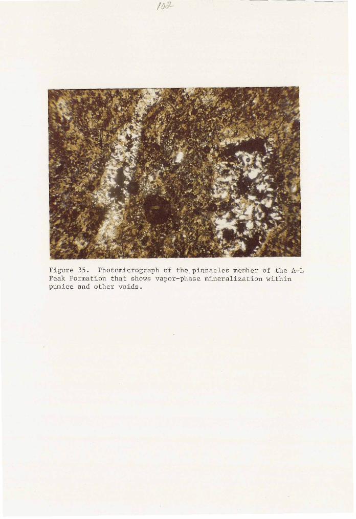
Figure 35. Photomicrograph of the,pinnacles member of the A-L Peak Formation that shows vapor-phase mineralization within pumice and other voids.
S i m o n ( 1 9 7 3
L a r o c h e ( i n
103
, C h a m b e r l i n ( 1 9 7 4 ) , W i l k i n s o n ( 1 9 7 6 ) , a n d
p r e p . ) , t r a c e d t h e p i n n a c l e s member i n t o t h e
c e n t r a l G a l l i n a s M o u n t a i n s , a d j a c e n t t o t h e Dog S p r i n g s 1 5 '
q u a d r a n g l e m a p p e d b y G i v e n s ( 1 9 5 7 ) . The c o r r e l a t i o n b e t w e e n
t h e p i n n a c l e s m e m b e r a n d G i v e n s ' H e l l s Mesa u n i t # 7 i s h e r e i n
made o n t h e b a s i s o f common s t r a t i g r a p h i c p o s i t i o n a n d common
m i n e r a l o g y a n d t e x t u r e s . L o p e z ( 1 9 7 5 ) a n d F o d o r ( 1 9 7 8 ) h a v e
c o r r e l a t e d a m i n e r a l o g i c a l l y a n d s t r a t i g r a p h i c a l l y s i m i l a r
t u f f i n t h e n o r t h e r n B l a c k R a n g e w i t h G i v e n s ' ( 1 9 5 7 ) H e l l s
Mesa u n i t #7. T h i s t u f f was n a m e d t h e t u f f o f Wahoo Canyon
b y F o d o r ( 1 9 7 8 ) a n d a t y p e s e c t i o n was g i v e n b y E l s t o n ( 1 9 7 8 )
in secs. 2, 3 , 4 , 9 , 1 0 a n d 11, T. 85., R.9W. The rnapp'ing
p e r f o r m e d ' f o r t h i s t h e s i s has c o n f i r m e d t h e c o r r e l a t i o n
b e t w e e n G i v e n s ' H e l l s Mesa u n i t 1'17 a n d L o p e z ' s ( 1 9 7 5 ) t u f f o f
Wahoo Canyon. I t t h u s a p p e a r s g e o l o g i c a l l y s o u n d t o e x t e n d
t h e c o r r e l a t i o n o f t h e p i n n a c l e s member t o F o d o r ' s ( 1 9 7 8 )
t u f f o f W a h o o C a n y o n . T h e p i n n a c l e s m e m b e r c a n p o s s i b l y b e
f u r t h e r e x t e n d e d , a r o u n d t h e s o u t h e r n m a r g i n o f t h e P l a i n s o f
S a n A g u s t i n b y t h e c o x r e l a t i o n o f t h e t u f f o f Wahoo Canyon
w i t h a p o r t i o n o f S t e a r n ' s ( 1 9 6 2 ) T d r p 2 u n i t , a s p r o p o s e d b y
F o d o r ( 1 9 7 8 ) .
B a s a l t o f B l u e Mesa _"
T h e b a s a l t o f B l u e Mesa i s t h e n a m e h e r e i n a p p l i e d t o
t h e p o s t - O l i g o c e n e b a s a l t f l o w s t h a t c a p t h e B l u e Mesa
104
Plateau in the northwest-portion o f this study area and
imnediately to the north in the D-Cross Mountain 7 1/2 minute
quadrangle. Givens (1957) referred to these rocks as the
Santa Fe basalts and considered them to be part of the Santa
Fe Formation.
These basaltic rocks crop out as isolated patches in the
northwestern corner of this study area, with a maximum
thickness of approxi.mately 80 ft (24m). They typically form
steep bluffs, with crude columnar jointing. Within the study
area, they conformably overlie the Hells Mesa Tuff and rocks
of the Dog Springs volcanic complex.
In hand specimen, these basalts are -dark, greenish-gray,
porphyritic rocks. Phenocrysts of plagioclase, green augite
and relatively unaltered olivine are recognizable, all 2mm or
less in size.
Petrographically, they consist of approximately 3 6 %
plagioclase, 9 % ol'ivine, 4 % augite, 2% magnetite, and less
than 1% apatite phenocrysts in a fine-grained matrix. The
plagioclase has an average composition of about An5*,
occasionally shows partial resorption features, and has
augite-filled fractures. The plagioclase laths seldom exceed
2mm in length and commonly contain opaque inclusions. The
olivine occurs as euhedral to subhedral, strongly
birefringent crystals with occasional alteration rims. They
range in size from 0.5 to 2mm. The augite phenocrysts occur
as pale-green, anhedral to subhedral, prismatic crystals with
105
moderate birefringence. The apatite is present as euhedral
six-sided crystals, about lmm in diameter.
Stratigraphically, these basaltic rocks are the youngest
volcanic rocks in the area; they overlie older rocks with
angular unconformity. Givens ( 1 9 5 7 ) relates the basaltic
rocks of Blue Mesa to similar basaltic rocks that cap D-Cross
Mesa, Tres Ilermanos Mesa, and Table Mountain Mesa to the
north and northeast of this study area. However, at present
there are no age dates for any of these rocks and such a
correlation is not wa\rranted. Another possible source is a
poorly exposed basaltic vent at the northern end of the Blue
Mesa Plateau (B. Robinson, 1 9 8 0 , oral commun.).
Petrographically, these basaltic rocks resemble the
augite-bearing olivine basalts described by Aoki ( 1 9 6 7 ) from
the Pliocene olivine-tholeiites .of the Taos, New Mexico,
area. The Blue Mesa basalts also closely fit the
petrographic description of Lipman & Moench's ( 1 9 7 2 ) late
basalts of the Mount Taylor volcanic field. N o chemical data
on the basalt of Blue Mesa is yet available.
Mafic Dikes
Only three minor mafic dikes were found in the study
area. One is located in the northwestern corner of the area
along the southeastern margin of Blue Mesa Plateau. It is
about 480 f t (146m) long, 6 f t (2m) wide, strikes N40°W and
106
dips 60' to the southwest. This dike cuts through the Hells
Mesa Tuff and the middle sedimentary unit and is truncated to
the north by a fault. The dike is a fine-grained porphyritic
rock, containing phenocrysts of pyroxene, plagioclase and
olivine, with minor amounts of magnetite. Opaque minerals
after pyroxene and olivine are common. The matrix is a
very-fine-grained mosaic of the above minerals.
A second dike is located in the SW 1/4, sec. 24, T. lN.,
R.9W. It is about 15 ft (4.5m) wide, approximately 100 ft
(30m) long and strikes NIOoW with a near vertical dip. This
dike is fine-grained and vesicular, attesting to near-surface
emplacement. It has chilled margins which are more resistant
to weathering than the dike's center, giving the dike'a
concave upward surface expression. This dike cuts only the
Dog Springs complex, and it's relative age to the other
stratigraphic units is unknown. The strikes of these first
two dikes are in good agreement with the trend of other
Cenozoic dikes in west-central New Mexico (Dane and Bachman,
1965).
The third dike is located in the NW 1/4 sec. 25, T.lN.,
R.9W. (unsurveyed). It is about 10 ft (3m) wide and is
exposed for only about 20 ft (6m) along strike. It trends
approximately N4s0E, with a near vertical dip. This strike
is atypical to that of other dikes of the region (Dane and
Bachman, 1965). The dike cuts only rocks o f the Dog Springs
10 7
volcanic complex and is possibly more related t o it than the
other two mafic dikes.
The third dike is a fine-grained, porphyritic basalt
with phenocrysts of plagioclase, pyroxene, olivine, and
magnetite. The ferromagnesian minerals are partially altered
to iron-oxides. The matrix is dark-gray, very-fine-grained
and intensely silicified.
108
S u r f i c i a l D e p o s i t s
A l l u v i u m
P r e s e n t d a y s t r e a m d e p o s i t s were mapped a s Q u a t e r n a r y
a l l u v i u m . T h e d e p o s i t s i n c l u d e stream c h a n n e l s a n d t e r r a c e s ,
a n d c o n s i s t o f u n c o n s o l i d a t e d g r a v e l , s a n d a n d l o a m d e p o s i t s .
T h e s e d e p o s i t s a r e t h e r e s u l t o f a c t i v e i n c i s i o n b y p r e s e n t
s t r e a m c o u r s e s o n t h e e x i s t i n g t o p o g r a p h y .
C o l l u v i u m
C o l l u v i u m i l e p o s i t s , w i t h i n t h e s t u d y a r e a , c o n s i s t of
m o u n t a i n v a l l e y a n d h i l l s l o p e d e p o s i t s .
P i e d m o n t D e p o s i t s
T h e o l d e s t s u r f i c i a l d e p o s i t s i n t h e s t u d y a r ea a r e
p o o r l y - c o n s o l i d a t e d p i e d m o n t d e p o s i t s . T h e s e p i e d m o n t
d e p o s i t s c o n t a i n a h e t e r o g e n e o u s c o l l e c t i o n o f p e b b l e s ,
c o b b l e s a n d b o u l d e r s f r o m t h e e n t i r e T e r t i a r y v o l c a n i c p i l e
a s w e l l a s s a n d - a n d s i l t - s i z e d g r a i n s . L o c a l l y , t h e s e
g r a v e l s c a n t a k e a h o m o g e n e o u s n a t u r e . C a l i c h e z o n e s a r e
common i n t h e s o u t h e r n m o s t g r a v e l s .
109
Within the study area, two distinct piedmont surfaces
are recognized. The oldest, Tertiary or possibly early
Pleistocene in age, forms a large northeast-trending deposit
within the Dog Springs drainage basin and smaller deposits in
valleys around the North Lake Basin in the southeast-portion
of the study area. Givens ( 1 9 5 7 ) referred to the deposits in
the Dog Springs drainage basin as part of the Santa Fe
Formation and interpretted them as "either ( 1 ) the remnant
gravels of an old stream course, or (2) a sliver of the Santa
Fe formation preserved because of its proximity to the Red
Lake Valley fault." This deposit is as much as 1 5 0 ft (45m)
thick in this study area and shows a sequence of Oligocene
volcanic rocks overlain by dominantly porphyritic basaltic
rocks similar to the basalt of 61ue Mesa. The present day
drainage streams are incised as.much as 200 ft (61m) below
the base of the Tertiary piedmont deposit.
Remnants o f similar piedmont deposits occur as isolated
patches along Thompson Canyon, in valleys around the San
Agustin Plains, and as two large areas along the
south-central margin of the study area. These latter two
deposits are at an elevation of about 8 , 5 0 0 f t (2600m),
whereas the deposit in the Dog Springs drainage basin is at
an elevation of about 7400 ft to 7 5 0 0 ft ( 2 2 5 0 to 2290m).
The youngest piedmont deposits within the study area are
probably of Quaternary age. These deposits occur surrounding
the Dog Springs drainage basin and in the North Lake Basin.
110
They are graded to the present day topography and are incised
by active intermittent streams.
Additional Quaternary piedmont deposits are present
adjacent to large faults. These piedmont deposits consist
entirely of rock types derived from the topographicall-y high
fault block. In the case o f the.Red Lake fault, which s h o w s
reversed topography, deposits o f Tertiary rocks overlie the
Baca Formation and Mesaverde Group.
Landslides/Talus
Landslide and talus deposits occur -in many parts of the
study area. In general, these deposits were only mapped when
they obscured geologic contacts'or structure.
111
STRUCTURE
Regional Structure
The regional structure of west-central New Mexico has
evolved in a fashion similar to that of most of the
southwestern United States. During the Laramide orogeny, of
late Cretaceous - early Tertiary time, uplifts, folds and thrust faults resulted from compressional stresses due to the
convergence and subduction of the Farallon plate beneath the
North American plate (Atwater, 1 9 7 0 ; Christiansen and Lipman,
1 9 7 2 ) .
During the late Eocene ( 4 0 - 5 0 m.y.) a period of tectonic
quiessence allowed for the erosional development of an
extensive surface of low relief (Epis and Chapin, 1 9 7 5 ) . In
west-central New Mexico, detritus from the carving of this
surface formed the arkosic Baca Formation, which filled a
west-trending basin between Laramide highs (Snyder, 1 9 7 1 ) .
Upon this erosional surface, volcanic rocks from the
Datil-Mogollon volcanic field began to accumulate
approximately 37 m.y. ago. The initial volcanism was of
intermediate, calc-alkaline affinity (Eaton, 1 9 7 9 ) .
Approximately 3 2 m.y. ago, normal faulting accompanied by
bimodal volcanic eruptions began along the Rio Grande rift
(Chapin, 1 9 7 9 ; Eaton, 1 9 7 9 ) . The regional trend of the
faulting was north to north-northwest in central New Mexico.
112
However, in the vicinity of the San Agustin Plains, rift
e faulting has an anomalous northeast trend. Chapin (1971-b)
has interpreted the San Agustin Basin as a bifurcation o f the
Rio Grande rift, possibly controlled by the
northeast-trending Morenci lineament. Similar trending
basins have been described by Ratte and others (1969) in the
1 Blue Ridge Primitive Area southwest of Reserve, New Mexico.
Another possible lineament control on the west-central
New Mexico regional structure is the Tijeras lineament (see
fig. 3 6 ) . This lineament is well documented by Lisenbee and
I
, others (1979) east of Albuquerque and by Chapin and others
(1979) in the Riley-Puertecito area. It is possible that the
San Augustin Basin owes it's existenc~e to it's location
between the Morenci and Tijeras lineaments (Chapin, 1980, e ' oral commun.). Also, it is possible that the Tijeras
lineament served as a control for the Dog Springs volcanic
complex, in a role similar to that played by the Morenci and
Capitan lineaments on the calderas of the northeastern
Datil-Mogollon volcanXc field (Chapin and others, 1978).
Local Structure
The northeastern Datil Mountains can be divided
structurally into three domains, a homocline, a complexly
faulted zone, and a southeast-plunging synform (see plate 3 ) .
In this study area, the monocline occupies the extreme
e
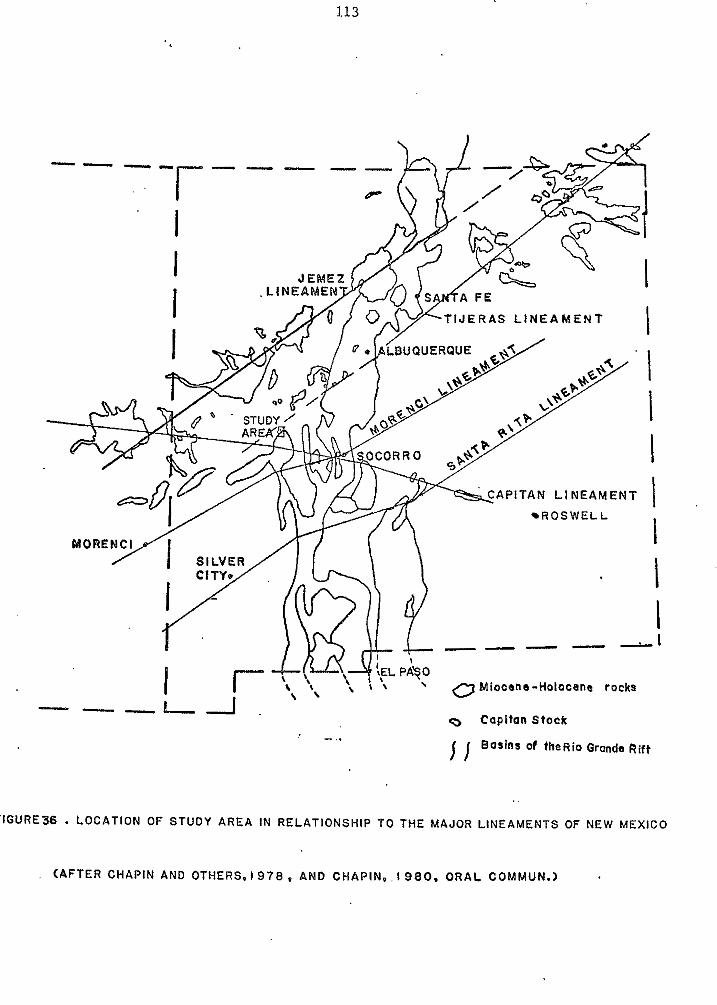
113
*
e
-""
J E R A S L I N E A M E N T
R O S W E L L
""-1
"-0,I. 0 tapl tan Stock
- .. j Basins d tkeRio Gronde R i f t ..
FIGURE36 - LOCATION OF STUDY AREA IN RELATIONSHIP TO THE MAJOR LINEAMENTS OF NEW MEXICO
(AFTER CHAPIN AND OTHERS. 1 9 7 8 , AND CHAPIN.. 1980. ORAL COMMUN.)
114
northwestern corner where rocks of the Tertiary Baca
Formation and the Cretaceous Mesaverde Group crop out.
Southwest from this area, the honocline extends well into the
Datil Mountains. The region has a gentle, southerly dip of
about 3 to 5'. and is virtually unfaulted. This structural
domain was referred to by Fitzsimmons (1957) as the Mogollon
Slope and was interpreted by him as the southern boundary of
the Colorado Plateau.
Southeast of the homocline is a complexly faulted
domain. ' The boundary between the two domains is the
northeast-trending Red Lake fault. In general, the majority
of the faults in the complexly faulted domain are parallel or
subparallel to the Red Lake fault. There are, however, two
additional trends. The most important of these is the
east-trending Thompson Canyon fault and related lesser faults
in the northeastern part of the study area. The second trend
consists of a series of northwest-trending faults which are
present throughout the area. The crisscrossing of faults
from all trends, with little or no change in displacement or
direction, indicates that the faults of various trends
developed nearly simultaneously. A large, diamond-shaped
horst block, which covers about 4 square miles in the
southern portion of the study area, provides some of the best
exposures of the Dog Springs volcanic complex.
The faults in the area studied are all high-angle normal
faults. Their stratigraphic throw ranges from 3000 ft+
115
(900m+) on the Red Lake fault to 50 ft (15m) or less on minor
faults. The few fault planes' that are measurable yield '
attitudes that are within 30' of vertical. The nearly
straight surface expressions of the faults are also
indicative of nearly vertical fault planes. The faulted
domain consists largely of horst and wedge-shaped graben
blocks.
The exact age of the beginning of the faulting is
difficult to ascertain, as rocks of all ages are displaced.
The rocks overlying the Dog Springs complex, reveal a long
period of tectonically undisturbed basin filling through
deposition of the Spears Group and the Hells Mesa Tuff..
Higher in the section, however local angular unconformities
exist between the Hells Mesa Tuff and the unit of South
Crosby Peak, between the lower member of the A-L Peak
Formation and the basaltic-andesite of Twin Peaks, and
between the Twin Peaks and the pinnacles members of the A-L
Peak Formation. While these unconformities do not directly
substantiate the beginning of regional structural
deformation, they do indicate a change in tectonic style away
from the conformable basin fill of the Spears Group and the
Hells Mesa Tuff. This change is particularly notable in the
complexly faulted domain.
Several lines of evidence indicate that faulting has
occurred from the late Tertiary through the Quaternary.
First, Tertiary piedmont deposits cover major faults along
the south-central margin of the study area. These gravel
116
deposits consist of cobbles from the A-L Peak Formation and
are at a present elevation of about 8500 ft (2600m). Second,
the Pliocene ( ? ) basalt of Blue Mesa is displaced by a
northeast-trending fault near the Red Lake fault. Third,
Tertiary piedmont gravels in the northeastern portion of the
Dog Springs quadrangle either abut against a scarp of the
Thompson Canyon fault, or are cut by the fault (Coffin, in
prep.). These deposits are equivalent to the deposits in the
Dog Springs drainage basin of this study area; the upper
portion of the Dog Springs' piedmont deposits consists
dominantly of basaltic debris from the unit of Blue Mesa.
Holocene faulting in the region can be documented along the
North Lake fault. This fault exists approximately 3 1 / 2
miles east of this study area and cuts alluvium in the North
Lake Basin (Givens, 1 9 5 7 ; Coffin, in prep.).
The third structural domain in the northeastern Datil
Mountains is a southeast-plunging synform. The synform
extends southeastward from the northwestern corner of the
study area into the North Lake Basin, where it probably veers
to a more southerly direction. Cross section B-B', plate 1 ,
is approximately along it's axis. The synform was first
noted by Givens ( 1 9 5 7 ) who described it and a small anticline
on it's eastern limb. An antiform is also present on it's
western limb, but appears more faulted than folded (see
cross-section A - A ' , plate 1). This antiform coincides with
the complexly faulted domain. The northwesternmost portion 0.
..- 11 I
e of the synform is downdropped into a graben structure bounded
on the northwest by the Red Lake fault and on the southeast
by an unnamed major fault system that trends north-south
through the center of the study area. Such a relationship
suggests that synformal development began prior to major
faulting.
The beginning of synclinal development appears to have
begun shortly after deposition of the Hells Mesa Tuff. The
Hells Mesa Tuff and older rocks show relatively uniform
thickness distributions throughout the area, considering the
expected gradual thinning downslope from their source. The
rocks overlying the Hells Mesa Tuff, however show irregular
a ' thickness distributions. In the southern portion of the
area, the volcaniclastic rocks of South Crosby Peak thin from
about 200 ft (61m) along the western limb of the synform to
50 ft (8m) or less in the complexly faulted domain. This
thinning is largely achieved by the omission of the upper
ash-fall tuffs and ash-flow tuffs.
A similar pattern is observed in both the lower member
and Twin Peaks members of the A-L Peak Formation. They have
a combined thickness of about 300 ft (91m) along the western
limb of the synform and thin to 50 ft (8m) or less
northwestward. The basaltic-andesite of Twin Peaks pinches
out entirely to the northwest. These units also show a
combined thickness of about 300 f t (91m) in the extreme
southwestern corner of the study area. The expected
!1S
thickening along the synformal axis is obscured in this study
area due to erosion.
Additional support for the development of the synform
during the late Oligocene is provided by paleovalleys filled
with the pinnacles member of the A-L Peak Formation. Two
remnants of one paleovalley are exposed in the south central
portion of the area. There, the pinnacles member overlies
the Hells Mesa Tuff and the upper portion of the middle
sedimentary unit with angular unconformity. The trend of the
two remnants is in a west-northwest-direction. From the
downcutting relationship of the two outcrops, it appears that
the paleovalley deepened to the southeast. . This
southeast-direction is parallel to the present drainage
pattern and to the present-day dip of beds along the western
limb of the southeast-plunging synform.
A second paleovalley filled with the pinnacles member of
the A-L Peak Formation is located in the northwestern portion
of the study area, along the southern end of the Blue Mesa
Plateau. In this paleovalley, approximately 2 0 0 ft (61m) of
the pinnacles member accumulated. This paleovalley trends
northwest and overlies the lower member of the A-L Peak
Formation with angular unconformity. The lower member in
turn lies with angular unconformity upon the Hells Mesa Tuff.
Cross section C-C', plate 1 , reveals the relationship betwen
the synform and the pinnacles' paleovalley fill.
A third paleovalley filled with the pinnacles member o f
the A-L Peak Formation is located in the SE 1 / 4 , sec. 2,
119
T.lN., R . 9 N . The exposure is small, but appears to trend
east-southeastward. The pinnacles member in this paleovalley
lies with angular unconformity upon the Twin Peaks member and
the lower member of the A-L Peak Formation and the unit of
South Crosby Peak. Coffin (in prep.) observes yet another
paleovalley along the eastern limb of the synform, which
displays similar relationships. These paleovalleys suggest
that a well-developed and incised drainage net existed during
deposition of the pinnacles member of the A-L Peak Formation
in contrast to the more subdued terrain that existed prior
to, and during, deposition of the Hells Mesa Tuff. The
southeast-direction of drainage for the paleovalleys is also
in contrast to the northerly drainage for pre-Hells. Mesa
sedimentary rocks.
Thus, it appears that the local structures in the
northeastern Datil Mountains began developing just prior to
A-L.Peak time, approximately 3 2 m.y. B.P., and that the
southeast-plunging synform and antiform developed prior to
faulting. Faulting began shortly after folding and
downdropped the northwestern portion of the synform. This
age appears in good agreement with the beginning of Rio
Grande rift extension (Chapin, 1979; Eaton, 1979). It is
probably not coincidental that the first major occurrence of
basaltic rocks in the study area also occurs at about this
time.
Structures similar to those found in the northeastern
Datil Mountains have been formed experimentally by Cloos
120
( 1 9 6 8 ) in experiments with clay models under tension.
Structure across the southern portion of the study area (see
cross section A-A', plate 1 ) is very similar to Cloos'
symmetrical graben formed by asymmetrical pull (see Cloos,
1968 , fig. 8, p. 4 2 5 ) . In both cases, most major faults are
down-to-basin, faults generally dip toward the basin, and
synform-like sags developed just prior to faulting. The
bedding in the study area does, however show greater rotation
than the bedding in Cloos' experiment. Additional structure.^
which resemble the structures of the northeastern Datil
Mountains have also been produced by Stewart (1971, fig. 1 2 ) ,
using a deep zone of asymmetrical extension on mortar.
Structures which can be definitely associated with the
Dog Springs volcanic complex are difficult to decipher in the
study area due to the imprint of later tectonics. Even the
possible existence of basement structures older than the Dog
Springs volcanic complex should be considered. The only
clear-cut structural margin of the complex in the study area
is along the Red Lake fault, where a segnent of the fault
runs tangential to the complex. Other possible structural
features related to the complex could be the relatively high
fault density and complexity o f the area, the abnormal
east-trending Thompson Canyon fault and related lesser
faults, and the arcuate fault pattern through the center of
the study area. Another possible basement influence on
faulting in the study area is suggested by the northeast and
e
121
northwest-trending shear zones and dikes that are restricted
to the Dog Springs volcanic complex. Several younger faults
show short deflections along similar trends.
122
ALTERATION AND MINERALIZATION
Hydrothermal alteration within the study area is
restricted to the Dog Springs volcanic complex, which is
propylitically altered throughout most of it's area. The
alteration mineral assemblage consists of chlorite, calcite
and very minor epidote. No pyrite was observed. The degree
of alteration varies considerably and commonly increases near
major faults. Even more pervasive than the propylitic
alteration in the Dog Springs complex is the occurrence of a
secondary green iron silicate. This is tentatively
identified as celadonite, since that mineral is most common
in intermediate volcanics.
Vein mineralization is virtually absent in the area. A
single, barren calcite vein, less than 1 0 ft (3m) long and
about 3 in. (8cm) wide, was encountered within the Dog
Springs volcanic complex. Manganese stains and dendrites are
common throughout the complex.
Several samples from the Dog Springs complex were fire
assayed for silver and gold by the chemistry lab of,the New
Mexico Bureau of Mines and Mineral Resources. Three of the
samples, collected from mildly propylitically altered
rhyodacite intrusive rock, yielded 0.25, 0.33, and 0.18
ounces of silver per ton. No gold was found in any o f the
samples. The sampled locations are the NE 1/4, sec. 2 9 ,
T.2N., R.8W. (unsurveyed); the SE 1/4, NW 1/4, sec. 3 6 ,
T.lN., R.8W. (unsurveyed); and near the midpoint (quarter e
123
corner) between secs. 26 and 27, T . Z N . , R . 9 i d . respectively.
The best economic potential in the study area lies in the
possibility of small supergene silver deposits at, or near,
the water table and in disseminated deposits.
124
CONCLUSIONS
Geologic evolution of the northeastern Datil Mountains
Utilizing the stratigraphic and structural relationships
observed in the study area, the following sequence o f events
is developed for the northeastern Datil Mountains.
1 ) During the early Oligocene (about 3 7 to 3 4 m.y.
B.P.), intermediate volcanism associated with the
Datil-Mogollon volcanic field began in the area with the
formation of the Dog Springs volcanic complex. This complex
is the earliest known source area within the volcanic field.
It lies on the northern periphery of the field, on the
boundary between the Colorado Plateau and the Rio Grande rift
structural provinces. The Dog Springs complex consists of
quartz-latitic to andesitic vents, domes and pyroclastic
breccias. Collapse is not positively identified from this
study. , Alteration and mineralization within the study area is
limited to the Dog Springs complex. Fire assays have shown
that highly propylitized rocks contain small amounts of
silver.
2 ) After the formation of the Dog Springs complex, a
period of erosion largely leveled the complex, such that it's
contact with the overlying sedimentary unit of Chavez Canyon
shows relief of 150 ff (46m) or less. This contact is an
125
angular unconformity, probably due to steeply dipping primary
attitudes within the complex.
3) The time period between the leveling of the Dog
Springs complex and the deposition of lower member of the A-L
Peak Formation (about 32 m.y. B.P.) is characterized by a
basinal accumulation of volcaniclastic sediments and ash-flow
tuffs. Sedimentary structures indicate a strong, northward
transport direction (see figs. 2 2 and 2 9 ) , away from the main
mass of the Datil-Mogollon volcanic pile.
The ash-flow tuffs which accumulated within this basin
are, from oldest to youngest, the tuff of Datil Well, the
tuff of Main Canyon, the tuff of Blue Canyon and the Hells
Mesa Tuff (about 32 m.y. B.P.). These tuffs are largely
conformable with the intercalated basin sediments.
The entire basinal fill shows a fining-upward sequence,
from the pebble to cobble conglomerates in the unit of Chavez
Canyon to fine-grained fluvial and aeolian sandstone beds
beneath the Hells Mesa Tuff. This is probably due to the
filling of the basin and a decrease in stream gradients.
4 ) Shortly after deposition of the Hells Mesa Tuff, the
northeastern Datil Mountains changed from a stable area of
deposition to one of erosion and deformation. A major
southeast-plunging synform and associated antiform developed
which controlled depositional thicknesses of the A-L Peak
Formation (about 32 m.y. B.P.). Paleovalleys controlled by
the synform are commonly filled with the pinnacles member of
the A-L Peak. Along the antiform, local angular
126 . .
unconformities exist between the Hells Mesa Tuff and the unit
of South Crosby Peak; between the unit of South Crosby Peak
and the lower member of the A-L Peak Formation; between the
lower member of the A-L Peak Formation and the
basaltic-andesite of Twin Peaks; and between the Twin Peaks
member and the pinnacles member. The pinnacles member of the
A-L Peak Formation represents the youngest Oligocene volcanic
unit within the area.
5) In the late Oligocene to early Miocene,
northeast-trending, high-angle normal faults associated with
R i o Grande rift extension cut the northeastern Datil
Mountains. The most important of these faults is the Red
Lake fault, which marks.the margin of the Colorado Plateau.
Another major fault system through the center of the study
area downdropped the northwest-por.tion of the synform
approximately 2500 ft (760m). Faulting continued through the
Miocene and Pliocene and into the Holocene.
6 ) The youngest volcanic event in the area resulted in
deposition of the Pli.ocene ( ? ) Blue Mesa basalt flows.
Possible source areas for these basalts are nearby vents to
the north of the Datil Mountains.
7 ) The youngest geological deposits in the area are
Tertiary and Quaternary piedmont deposits and Quaternary
alluvium.
127
8 S t r a t i g r a p h y a r o u n d t h e n o r t h e r n m a r g i n o f t h e P l a i n s o f S a n
A g u s t i n
C o r r e l a t i o n s o f t h e m a j o r a s h - f l o w s h e e t s a r o u n d t h e
n o r t h e r a m a r g i n o f t h e P l a i n s o f S a n A g u s t i n a r e a s f o l l o w s
( s e e p l a t e 2 ) :
1 ) T h e o l d e s t v o l c a n i c u n i t i n t h e a r e a i s t h e Dog
S p r i n g s v o l c a n i c c o m p l e x a n d i t ' s r e l a t e d o u t f l o w f a c i e s .
R o c k s o f t h e Dog S p r i n g s v o l c a n i c c o m p l e x a r e o n l y e x p o s e d i n
t h e extreme n o r t h e r n p o r t i o n s o f t h e D a t i l a n d G a l l i n a s
M o u n t a i n s a n d a r e c o r r e l a t i v e w i t h a n u n d i f f e r e n t i a t e d
p o r t i o n o f L o p e z ' s ( 1 9 7 5 ) a n d B o r n h o r s t ' s ( 1 9 7 6 ) S p e a r s
F o r m a t i o n . e 2 ) T h e o l d e s t e x t e n s i v e a s h - f l o w s h e e t i n t h e r e g i o n i s
t h e t u f f o f D a t i l Well. T h i s t u f f i s r e s t r i c t e d t o t h e
w e s t e r n m a r g i n o f P l a i n s o f S a n A g u s t i n a n d b e c o m e s
i n c r e a s i n g l y m o r e i m p o r t a n t t o t h e s o u t h w e s t , w h e r e i t ' s
p r o b a b l e s o u r c e l i e s .
3 ) O v e r l y i n g t h e t u f f o f D a t i l Well i s t h e t u f f o f M a i n
C a n y o n ( N i p p l e M o u n t a i n ) . T h i s i s t h e m o s t e x t e n s i v e ,
a s h - f l o w s h e e t i n t h e l o w e r p a r t o f t h e s t r a t i g r a p h i c
s e c t i o n . I t i s t h i c k e s t i n t h e Tres M o n t o s a s - C a t N o u n t a i n
a r e a , t h i n s w e s t w a r d , a n d p i n c h e s o u t b e t w e e n t h e C r o s b y a n d
N a n g a s M o u n t a i n s .
4 ) A l o n g t h e e a s t e r n m a r g i n o f t h e P l a i n s o f S a n
A g u s t i n , t h e t u f f o f G r a n i t e M o u n t a i n o v e r l i e s t h e t u f f o f
e M a i n C a n y o n , h o w e v e r a l o n g t h e w e s t e r n m a r g i n , t h e t u f f o f
128
B l u e C a n y o n o v e r l i e s t h e t u f f o f M a i n C a n y o n . T h e
s i m i l a r i t i e s a n d d i f f e r e n c s b e t w e e n t h e s e t w o t u f f s h a v e b e e n
l i s t e d i n t h e s e c t i o n o n t h e t u f f o f B l u e C a n y o n . W i t h o u t a
g o o d p h y s i c a l c o r r e l a t i o n , t h e s e s h o u l d b e t r e a t e d a s
s e p a r a t e u n i t s .
5 ) T h e m o s t p r o m i n e n t a s h - f l o w s h e e t . i n t h e r e g i o n i s
t h e He l l s Mesa T u f f ( R o c k T a n k ) . I t c r o p s o u t a r o u n d t h e
e n t i r e n o r t h e r n m a r g i n o f t h e p l a i n s , w i t h a minimum
t h i c k n e s s o f a b o u t 3 0 0 f t ( 9 1 m ) . T h e o n l y a p p r e c i a b l e c h a n g e
i n t h e t u f f t h r o u g h t h e r e g i o n i s t h e e x p e c t e d d e c r e a s e i n
w e l d i n g a w a y f r o m i t ' s s o u r c e i n t h e M a g d a l e n a R a n g e .
6 ) Above t h e He l l s Mesa T u f f i s t h e A-L P e a k F o r m a t i o n .
T h e d e n s e l y w e l d e d l o w e r m e m b e r o f t h e A-L P e a k F o r m a t i o n
e x t e n d s a c r o s s t h e e n t i r e r e g i o n , b u t t h i n s c o n s i d e r a b l y
w e s t w a r d . The u p p e r p i n n a c l e s m e m b e r ( W a h o o C a n y o n ) f o r m s a n
e x t e n s i v e a s h - f l o w s h e e t t h r o u g h o u t t h e G a l l i n a s a n d D a t i l
M o u n t a i n s , h o w e v e r i t i s a b s e n t i n t h e E l a n g a s M o u n t a i n s .
129
REFERENCES
Allen, P., 1 9 7 9 , Geology of the west flank of the Magdalena Mountains south of the Kelly mining district, Socorro
Mexico Institute of Mining and Technology, 1 5 3 p. County, New Mexico [unpublished M.S. thesis]: New
American Commission on Stratigraphic Nomenclature, 1 9 7 3 , Code
Oklahoma, the American Association o f Petroleum of Stratigraphic Nomenclature (third printing): Tulsa,
Geologists, Inc., 22p .
Anderson, C.A., 1 9 3 3 , The Tuscan Formation of northern
Geological Sciences Bull., Vol. 2 3 , p. 215-276. California: University of California Dept. of
Aoki, Ken-Ichiro, 1 9 6 7 , Petrography and petrochemistry of latest Pliocene olivine-tholeiites of Taos area,
Petrology, V. 1 4 , no. 3 , p 191-203. northern New Mexico, U . S . A . : Contr. Nineralogy and
e Atwater, T., 1 9 7 0 , Implications of plate tectonics for the
Geological Society of America Bu~ll. Vol. 81, p. Cenozoic tectonic evolution of western North America:
3513-3536.
B.lakestad, R.B., 1 9 7 8 , Geology o f the Kelly mining district,
University of Colorado, 1 2 7 p . Socorro County, New Mexico [unpublished N.S. thesis]:
JBornhorst, T.J., 1 9 7 6 , Volcanic geology of the Crosby Mountains and vicinity, Catron County, New Mexico
113 p. [unpublished P1.S. thesis]: University of New Mexico,
I ,
TBowring, S., 1 9 8 0 , The geology of the west-central Magdalena .I
Mountains, Socorro County, New Mexico [unpublished M.S. thesis]: New Mexico Institute o f Mining and Technology, 1 5 0 p.
Brown, D.M., 1 9 7 2 , Geology o f the southern Bear Mountains,
New Mexico Institute o f Mining and Technology, 110 p. Socorro County, New Mexico [unpublished M.S. thesis]:
130
Bruning, J.E., 1973, Origin of the Popotosa Formation, north-central Socorro County, New Mexico [unpublished Ph.D. dissertation]: New Mexico Institute o f Mining and Technology, 132 p.
Burke, W.H., I<enny,'G.S., Otto, J.B., and Walker, R.D., 1963, '." . Mexico, % Guidebook o f the Socorro region: New Mexico
Potas';ium-argon dates, Socorro and Sierra Counties, New
Geological Society, 14th Field Conference Guidebook, p. 224.
Chamberlin, R.M., 1974, Geology of the Council Rock District, ' 4
New Mexico Institute of Mining and Technology, 130 p. 'Socorro County, New Mexico [unpublished M.S. thesis]:
Chamberlin, R.M., 1980, Geologic framework o f the Socorro Peak geothermal area, Socorro County, New Mexico
Mines, 500 p. [unpublished P11.D. dissertation]: Colorado School of
23
Chapin, C.E., 1971-a, K-Ar age o f the La Jara Peak Andesite and its possible significance to mineral explorations in the Magdalena Mining District, New Mexico: Isochron/west, Vol. 2, p. 43-44.
Chapin, C.E., 1971-b, The Rio Grande Rift, Part I: Modifications and additions, in Guidebook of the San Luis Basin, Colorado: New M e z c o Geological Society, 22nd Field Conference, Guidebook, p. 191-201.
Chapin, C.E., 1974-a, Three-fold tectonic subdivision o f the v Cenozoic in the Cordilleran foreland of Colorado, New Mexico, Arizona: Geological Society of America Abstracts with Programs, Vol. 6 , p. 433.
Chapin, C.E., 1974-b, Composite stratigraphic column of the L/ Magdalena area: New Mexico Bureau of Mines and Mineral Resources Open-File Report 46.
Chapin, C.E., 1979, Evolution o f the Rio Grande rift: A 'l summary, Riecher, R.E., ed., Rio Grande Rift:
Geophysical Union, p. 1,-5. Tectonics and Magmatism: Washington, D.C., American
131
Chapin, C.E., and Seager, W.R., 1975, Evolution of the Rio
Mexico Geological Society, 26th Field Conference, Grande rift in the Socorro and Las Cruces areas: New
Guidebook, p . 297-321.
Chapin, C.E., and Deal, E.G., 1976, The A-L Peak Tuff, New J
Mexico: A composite ash-flow sheet (abs.): Geological Society of America Abstracts with Programs, Vol. 8, no. 5 , p. 575.
Chapin, C.E., Chamberlin, R.M., Osburn, G.R., White, D.L., ~
and Sanford, A.R., 1978, Exploration framework of the Socorro Geothermal Area, New Mexico: New Mexico Geological Society Special Publication 7, p . 115-129.
Chapin, C.E., and Lowell, G.R., 1979, Primary and secondary flow struccures in ash-flow tuffs of the Gribbles Run paleovalley, central Colorado, in Chapin, C.B., and Elston, W.R., eds., Ash-Flow Tuffs: Geological Society of America Special Paper 180, p . 137-154.
e Chapin, C.E., Osburn, G.R., H o o k , S.C., Massingill, G. L., and Frost, S.J., 1979, Coal, uranium, oil and gas potential of the Riley-Puertecito area, Socorro County, New Mexico: New Mexico Institute of Mining and Technology Open-File Report ERB 77-3302, 33 p .
v
Coffin, G,, in prep., Geology of the northwestern Gallinas t. Mountains, Socorro County, New Mexico [unpublished M.S. thesis]: New Mexico Institute of Mining and Technology.
Cloos, E., 1968, Experimental analysis of Gulf Coast fracture
Geologists Bull., V o l . 52, no. 3, p. 420-444. patterns: The American Association of Petroleum
Dane, C.H., and Bachman, G.O., 1965, Geologic map of New Mexico: U.S . Geological Survey, scale 1:500,000, 2 sheets.
Dane, C.H., Wanek, A.A., and Reeside, J.B., 1957, Reinterpretation of a section of Cretaceous rocks in ALamosa Creek Valley area, Catron and Socorro Counties, New Mexico: American Association of Petroleum Geologists Bull., Vol. 41, p . 181-196.
132
Deal, E.G., 1 9 7 3 , Geology of the northern part o f the San Mateo Mountains, Socorro County, New Mexico; A study of a rhyolite ash-flow tuff cauldron and the role of laminar flow in'ash-flow tuffs [unpublished Ph.D. dissertation]: University of New Mexico, 1 0 6 p.
Deal, E.G., and Rhodes, R.C., 1 9 7 6 , Volcano-tectonic structures in the San Mateo Mountains, Socorro County, New Mexico: New Mexico Geological Society Special Publication 5 , p. 51-56.
fl
Donze, M. 1 9 8 0 , Geology o f the Squaw Peak area, Magdalena Mountains, Socorro County, New Mexico [unpublished M.S. thesis]: New Mexico Institute o f Mining and Technology, 1 2 5 p.
' V
Eaton, G.P., 1 9 7 9 , A plate-tectonic model for late Cenozoic crustal spreading in the western United States, &
Magmatism: Washington, D.C., American Geophysical Union, Riecker, R.E., ed., Rio Grande Rift: Tectonics and
p. 7-32.
Eggleston, T., in prep., Geology of the central Chupadera Mountains,' Socorro County, New Mexico [unpublished M.S. thesis]: New Mexico Institute of Mining and Technology.
Elston, W.E., 1 9 5 7 , Geology and mineral resources of Dwyer quadrangle, Grant, Luna, and Sierra counties, New Mexico: New Mexico Bur.e.au'..of-Wiaes and Mineral Resources Bull. 3 8 , 8 6 p.
Elston, W.E., 1 9 7 6 , Glossary of stratigraphic terms of the Mogollon-Datil volcanic province, New Mexico: New Mexico Geological Society Special Pub. No. 5 , p p . 131-144.
Epis, R.C., and Chapin, C.E., 1 9 7 5 , Geomorphic and tectonic implication 0.f the post-Laramide, late Eocene erosional surface in the Southern Rocky Mountains, e Cenozoic history of the Southern Rocky Mountains: Geological Society o f America Memoir 1 4 4 , p . 4 5 - 7 4 .
c
Fisher, R.V., 1 9 6 0 , Classification of volcanic breccias: Bull. Geological Society of America, Vol. 7 1 , p. 973-982.
133
Fitzsimmons, J.P., 1959, The structure and geomorphology of west-central New Mexico -- a regional setting: New Mexico Geological Society, west central New Mexico, 10th Field Conference, Guidebook, p . 112-116.
Fodor, R.V., 1978, Volcanic geology of the northern Black Range., New Mexico: New Mexico Geological Society Special Pub. No. 5, pp. 68-70.
Foster, R.W., 1957, Stratigraphy o f west-central New Mexico,
Four Corners Geological- Society Guidebook, p . 62-72. in southwestern San Juan Basin, New Mexico, and Arizona:
Gadway, K.L., 1959, Cretaceous sedim'ents of the north plains and adjacent areas, McKinley, Valencia and Catron counties, New Mexico: New Mexico Geological Society, 10th Field Conference, Guidebook, p. 81-84.
Gates, O., 1959, Breccia Pipes in the Shoshone Range, Nevada: Economic Geology, Vol. 54, p. 790-815.
a Gilluly, J., 1963, The tectonic evolution of the western United States: London Geological SOC. Tran. Geol., Vol. 119, p. 150-174.
Givens, D.G., 1957, Geology of Dog Springs quadrangle, New Mexico: New Mexico Institute of Mining and Technology, Bull. 58, 37 p..
Herrick, C.L., 1900, Report of a geological reconnaissance in 5,'
western Socorro and Valencia counties, New Mexico: American Geology, Vol. 25, No. 6, p. 331-346.
Jicha, H. L., 1954, Geology and mineral deposits of Lake
Mexico: New Mexico Bureau of Mines and Mineral Resources Valley quadrangle, Grant, Luna and Sierra Counties, New
Bull. 37, 93p.
Jones, W. R., Hernon, R. M., and Moore, S. L., 1967, General geology of Santa Rita quadrangle, Grant County, New Mexico: U.S. Geological Survey Prof. Paper 555, 144p.
Laroche, T.M., in prep., Geology of the central Gallinas Mountains, Socorro County, New Elexico [unpublished M.S. thesis]: New Mexico Institute o f Mining and Technology.
j.1
134
Lipman, P.W., 1 9 7 5 , Evolution of the Platoro caldera complex and related rocks, southeastern San Juan Mountains, Colorado: U.S. Geological Survey, Prof. Paper 8 5 2 , 1 2 3 P.
Lipman, P . N . , 1 9 7 6 , Caldera-collapse breccias in the western
America, Vol. 8 7 , p. 1397-1410. San .'uan Mountains, Colorado, Geological Society of
Lipman, P.W., Steven, T.A., and Mehnert, H.H., 1 9 7 0 , Volcanic history of the San Juan Mountains, Colorado, as indicated by potassium-argon dating: Geological Society o f America Bull., Vol. 8 1 , p. 2329-2352.
Lipman, P.W. , and Moench, R.H., 1 9 7 2 , Basalts of the Mount Taylor volcanic field, New Mexico: Geological Society of American Bull., Vol. 8 3 , p. 1335-13&3.
Lisenbee, A.L., Woodward, L.A., and Connolly, J.R., 1 9 7 9 , Tijeras-Canoncito fault system - a major zone of ' recurrent movement in north-central New Mexico: New Mexico Geological Society, 3 0 t h Field Conference, Santa Fe country Guidebook, p. 89-99.
Lopez, D.A., 1 9 7 5 , Geology of the Datil area, Catron County,
Mexico, 72 p. New Mexico'[unpublished P1.S. thesis]: University of New
Lopez, D.A., and Bornhorst, T.J., 1 9 7 9 , Geologic map of the y Datil area, Catron County, New Mexico: U.S. Geological Survey Map 1-1098 , scale 1 : 5 0 , 0 0 0 , 1 sheet.
Lowell, G . R . , and Chapin, C.E., 1 9 7 2 , Primary compaction and flow foliation in ash-flow tuffs of the Gribbles Run
America, abs. with programs, Vol. 4 , No. 7 . p . 725. paleo-valley, central Colorado: Geological Society of
Machette, M., 1 9 7 7 , Geological map of San Acacia 7 1 1 2 minute quadrangle, Socorro County, New Mexico: U.S. Geological Survey geol. quad. map., G Q - 1 4 1 5 .
Massingill, G.E., 1 9 7 9 , Geology of Riley-Puertecito area, d southeastern margin of the Colorado Plateau, Socorro County, New Mexico [unpublished Ph.D. dissertation]: University of Texas, El l'aso, 301 p.
135
Mayerson, D.L., 1 9 7 9 , Geology of the Corkscrew Canyon - Abbe M.S. thesis]: New Mexico Institute of Mining and Spring area, Socorro County, New Mexico [unpublished
Technology, 1 2 5 p.
Norton, W . H . , 1 9 1 7 , A classification o f breccias: Journal of Geology, V o l . 2 5 , p. 160-194.
Osburn, G.R., 1 9 7 8 , Geology of the eastern Magdalena Mountains, Water Canyon t o Pound Ranch, Socorro County, New Mexico [unpublished M.S. thesis]: New Mexico Institute of Mining and Technology, 1 3 6 p .
Parsons, N . H . , 1 9 6 7 , Manner of emplacement of pyroclastic andesitic breccias: Bulletin Volcanologique, Tome 3 0 , p. 177-187.
Petty, D.M., 1 9 7 9 , Geology o f the southeastern Magdalena Mountains, Socorro County, New Mexico [unpublished M.S. thesis]: New Mexico Institute o f Mining and Technplogy, 157 p.
Pike, W.S., Jr., 1 9 4 7 , Intertonguing marine and non-marine upper Cretaceous deposits of New Mexico, Arizona, and
Memoir 24. southestern Colorado: Geological Society o f America
Ratte, J.C-., Landis, E.R., Gaskill, D.L., and Raabe, R.C.,
area, GreenBee County, Arizona, and Catron County, New 1 9 6 9 , Miner%+ resources of the Blue Range primitive
Mexico: U.S. Geological Survey Bull. 1261-E , 91 p .
Robinson, R., in prep., Geology o f the D-Cross 7 1 1 2 minute I’ quadrangle [unpublished PhD dissertation]: University o f Texas, El Paso.
Roth, S . , 1 9 8 0 , Geology of the Sawmill Canyon area, Magdalena v Mountains, Socorro County, New Mexico [unpublished M . S . thesis]: New Mexico Institute o f Mining and Technology.
Simon, D.B., 1 9 7 3 , Geology of the Silver Hill area, Socorro County, New Mexico [unpublished M.S. thesis]: New Mexico Institute o f Mining and Technology, 1 0 1 p.
136
Smith, E . I . ~ Aldrich, M. J . Jr., Deal, E.G., and Rhodes., J
R.C., 1976, Fission-track ages of Tertiary volcanic and plutonic rocks, Mogollon Plateau, southwestern New Mexico: New Mexico Geological Society Special Pub. No. 5, p. 117-118.
Smith, R.L., 1960-a, Zones and zonal variations in welded ash flows: U.S. Geological Survey Prof. Paper 354-F, p. 149-159.
Smith, R.L., 1960-b, Ash flows: Geological Society o f America .Bull., Vol. 71, p . 795-842.
Smith, R.L., 1979, Ash-flow magmatism, in Chapin, C.E., and Elston, W.E. , eds., Ash-flow tuffs? Geological Society of America Special Paper 180, p . 5-27. .
Snyder, 1971, Stratigraphic analysis of the Baca Formation, west-central New Mexico [ unpublished Ph.D. dissertation]: University of New Mexico, 160 p .
Spradlin, E . J . , 1976, Stratigraphy of Tertiary volcanic rocks, Joyita Hills area, Socorro County, New Mexico [unpublished M.S. thesis]: 'University of New Mexico, 73 P-
Sp.ry, A., 1961, The origin of columnar jointing, particularly in basalt flows: Journal of Geological Society Australia, Vol. 8, p. 191-216.
Stearns, C. E., 1962, Geology of the north half of the Pelona quadrangle, Catron County, New Mexico: New Mexico Bureau of Mines and Mineral Resources Bull. 78, 46p.
Stewart, J . H . , 1971, Basin and Range structure: a system of
Geological Society of America Bull., Vol. 82, p. horsts and grabens produced by deep-seated extensions:
1019-1044.
Tonking, W . H . , 1957, Geology of Puertecito quadrangle,
and Mineral Resources Bu11:41, 67 p. Socorro County, Ncw Mexico: New Mexico Bureau of >lines
137
, W e b e r , R . H . , 1 9 6 3 , C e n o z o i c v o l c a n i c r o c k s o f S o c o r r o C o u n t y , - i n G u i d e b o o k o f t h e S o c o r r o R e g i o n : New M e x i c o G e o l o g i c a l S o c i e t y , 1 4 t h F i e l d C o n f e r e n c e , G u i d e b o o k , p . 132-143.
Weber , R . H . , 1 9 7 1 , K - A r a g e s o f T e r t i a r y i g n e o u s r o c k s i n c e n t r a l a n d w e s t e r n N e w M e x i c o : I s o c h r o n / N e s t , V o l . 1, # l , p. 33-45.
Weber , R . H . , a n d B a s s e t t , W . A . , 1 9 6 3 , K - A r a g e s o f T e r t i a r y . v o l c a n i c a n d i n t r u s i v e r o c k s i n S o c o r r o a n d G r a n t s
C o u n t i e s , N e w M e x i c o , i n G u i d e b o o k o f t h e S o c o r r o r e g i o n : New M e x i c o G e l o g i c a l S u r v e y , 1 4 t h F i e l d C o n f e r e n c e , G u i d e b o o k , p. 202-223.
. -
W i l k i n s o n , W . H . , 1 9 7 6 , G e o l o g y o f t h e Tres M o n t o s a s - Cat M o u n t a i n a r e a , S o c o r r o C o u n t y , N e w M e x i c o [ u n p u b l i s h e d M.S. t h e s i s ] : New M e x i c o I n s t i t u t e o f M i n i n g a n d T e c h n o l o g y , 1 5 8 p .
Williams, H o w e l l , 1 9 5 6 , G l o w i n g a v a l a n c h e d e p o s i t s o f t h e
R e p o r t , V o l . 6 5 , p t . 3 , p . 57-89. S u d b u r y B a s i n : O n t a r i o D ' e p a r t m e n t o f M i n e s , 6 5 t h A n n u a l
W i l p o t t , R . H . , M a c A l p i n , A . J . , B a t e s , R . L . , a n d V o r b e , G . ,
P a l e o z o i c r o c k s o f J o y i t a H i l l s , L o s P i n o s M o u n t a i n s , 1 9 4 6 , G e o l o g i c map a n d s t r a t i g r a p h i c s e c t i o n s o f
a n d n o r t h C h u p a d e r a M e s a , V a l e n c i a , T o r r a n c e a n d S o c o r r o C o u n t i e s , New M e x i c o : U .S . G e o l o g i c a l S u r v e y O i l a n d G a s I n v . P r e l i m . map 61.
W i n c h e s t e r , D . E . , 1 9 2 0 , G e o l o g y o f A l a m o s a C r e e k v a l l e y ,
B u l l . 7 1 6 A . S o c o r r o C o u n t y , N e w M e x i c o : U.S. G e o l o g i c a l S u r v e y
W r i g h t , A . E . and Bowes , D . R . , 1 9 6 3 , C l a s s i f i c a t i o n o f v o l c a n i c b r e c c i a s : A d i s c u s s i o n : B u l l . G e o l o g i c a l S o c i e t y o f A m e r i c a , Vol. 7 4 , p. 79-86.
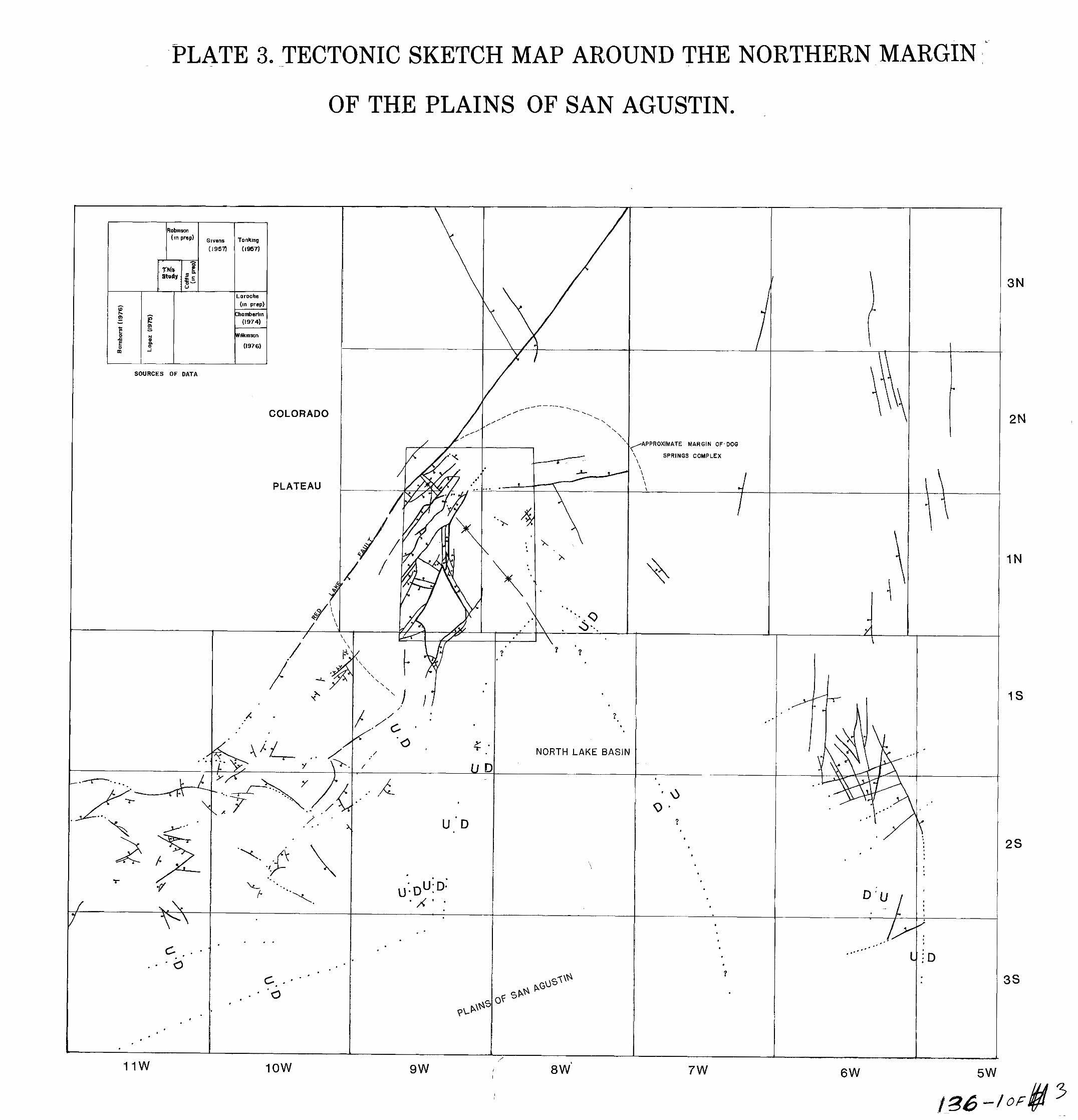
P ' LATE 3. TECTONIC S-KETCH MAP AROUND THE NORTHERN MARGIN:'
OF THE PLAINS OF SAN AGUSTIN.
3N
2N
I N
1s
2s
3s
L
SOURCES OF DATA
COLORADO
'. -APPROXIMATE MARGIN OF-DOG
SPRINGS COMPLEX l" \ \ \ \ i PLATEAU
/ \
/ \
? ?
? .
\ \
NORTH LAKE BASIN
' I
2 . . u - D c
\
.
' X " ;
I
c.:"
11w low 7w 6W 9w I 8 W' I 5w
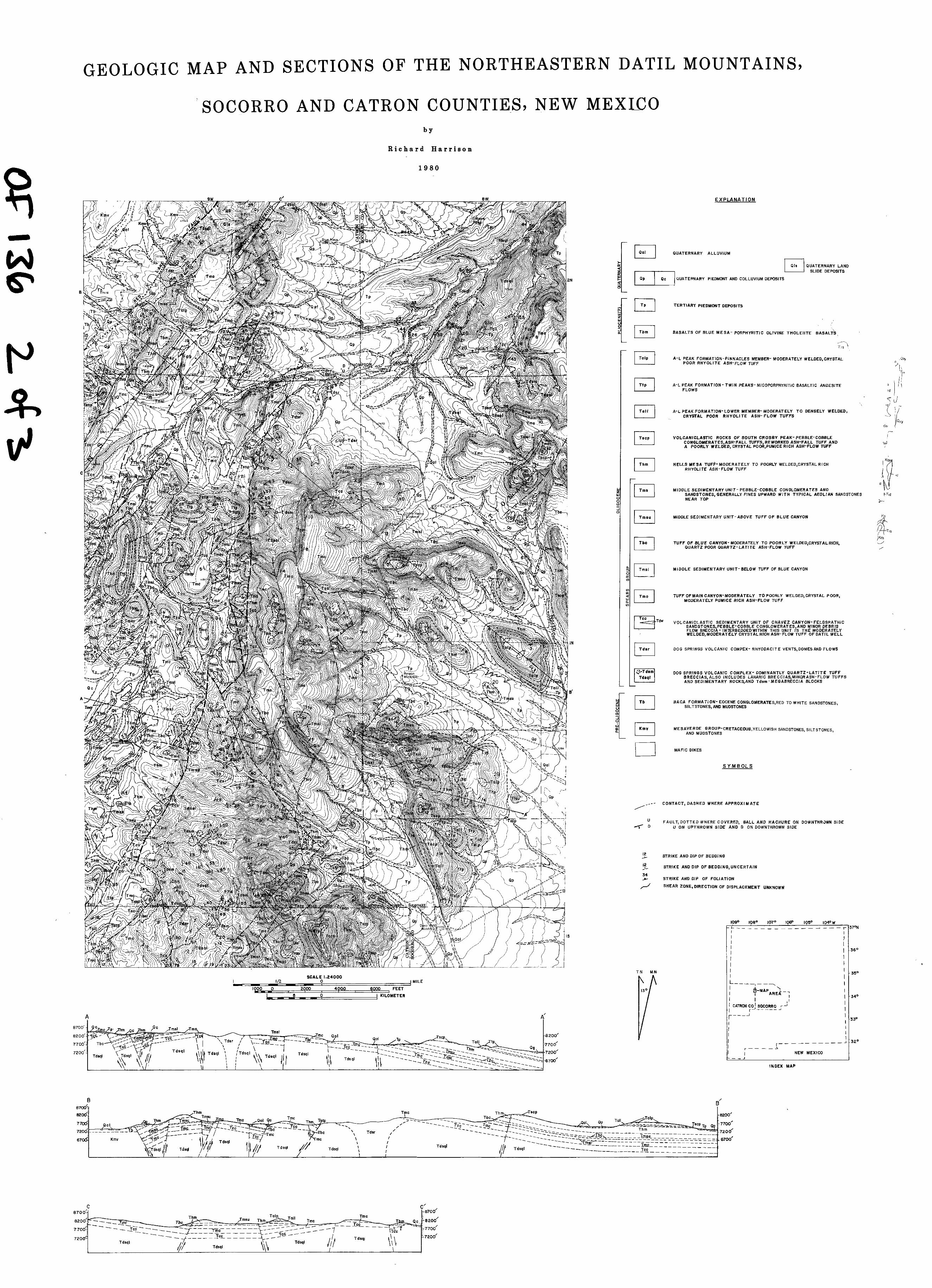
G E O L O G I C M A P A N D S E C T I O N S OF THE N O R T H E A S T E R N D A T I L M O U N T A I N S ,
' S O C O R R O ~~ A N D C A T R O N C O U N T I E - S , N E W M E X I 4 0 b y
R i c h a r d H a r r i s o n
1 9 8 0
EXPLANATION
I Qal 1 QUATERNARY ALLUVIUM
I 91s I QUATERNARY LAND SLIDE DEPOSITS
2. a a a
a
z F z
I QP I a c I QUATERNARY PIEDMONT AND COLLUVIUM DEPOSITS
L
TERTIARY PIEDMONT DEPOSITS
BASALTS OF BLUE MESA- PORPHYRIT IC OL IV INE THOLEI ITE BASALTS% \\
;;-I I" I T o l p I A-L PEAK FORMATION-PINNACLES MEMBER- MODERATELY WELDED,CRYSTAL
POOR RHYOLITE ASH-FLOW TUFF
A-L PEAK FORMATION- TWIN PEAKS- MlCOPORPHYRlTlC BASALTIC ANDESITE FLOWS
\ .~
A-L PEAK FORMATION-LOWER MEMBER- MODERATELY T O DENSELY WELDED, CRYSTAL POOR R H Y O L I T E A S H - F L O W T U F F S . - I T s c p I VOLCANICLASTIC ROCKS OF SOUTH CROSBY PEAK-PEBBLE-COBBLE CONGLOMERATES,ASH-FALL TUFFS REWORKED ASH-FALL TUFF AND A POORLY WELDED, CRYSTAL POOR~PUMICE RICH ASH-FLOW TUFF
HELLS MESA TUFP- MODERATELY TO POORLY WELDED~CRYSTAL RICH
I RHYOLITE ASH-FLOW TUFF
MIDDLE SEDIMENTARY UNIT- PEBBLE-COBBLE CONGLOMERATES AND SANDSTONES, GENERALLY FINES UPWARD WITH TYPICAL AEOLIAN SANDSTONES NEAR TOP
MIDDLE SEDIMENTARY UNIT- ABOVE TUFF OF BLUE CANYON
I I - . I I F] T U F F O F B L U E C A N Y O N - MODERATELY TO POORLY WELDED,CRYSTALRICH, QUARTZ POOR QUARTZ-LATITE ASH-FLOW TUFF
I I - I $1 I Tmsl 1 MIDDLE SEDIMENTARY UNIT-BELOW TUFF OF BLUE CANYON
I "I _. I T m c I TUFF OF MAIN CANYON-MODERATELY TO POORLY WELDED,CRYSTAL POOR, w v) a MODERATELY PUMICE RICH ASH-FLOW TUFF
VOLCANICLASTIC SEDIMENTARY UNIT OF CHAVEZ CANYON-FELDSPATHIC SANDSTONES,PEBBLE-COBBLE CONGLOMERATES,AND MINOR DEBRIS FLOW BRECCIA- INTERBEDDEDWITHIN THIS UNIT IS THE MODERATELY WELDED, MODERATELY CRYSTAL RICH ASH-FLOW TUFF OF DATIL WELL
I I F l DOG SPRINGS VOLCANIC COMPEX- RHYODACITE VENTS,DOMESAND FLOWS
I I - DOG SPRINGS VOLCANIC COMPLEX- DOMINANTLY QUARTZ-LATITE TUFF
Tdrql BRECCIAS,ALSO INCLUDES LAHARIC BRECCIAS,MINQRASH-FLOW TUFFS AND SEDIMENTARY ROCKS,AND Tdsm -MEGABRECCYA BLOCKS
L L
BACA FORMATION- EOCENE CONGLOMERATESIRED TO WHITE SANDSTONES, SILTSTONES, AND MUDSTONES
W a a AND MUDSTONES MESAVERDE GROUP-CRETACEOUS,YELLOWlSH SANDSTONES, SILTSTONES,
MAFIC DIKES
S Y M B O L S
/ _--- CONTACT, DASHED WHERE APPROXIMATE
U FAULT, DOTTED WHERE COVERED, BALL AND HACHURE ON DOWNTHR3WN SIDE 4 0 U ON UPTHROWN SIDE AND D ON DOWNTHROWN SIDE
4 12 STRIKE AND DIP OF BEDDING
STRIKE AND DIP OF BEDDING,UNCERTAIN 12 -1-
L 34 STRIKE AND DIP OF FOLIATION
r / SHEAR ZONE, DIRECTION OF DISPLACEMENT UNKNOWN
109O 108O 1 0 7 O 1060 1 0 5 O 104OW
I I
L C - """""- "" r
1 I
t37ON
I
I I
I
1 -36'
' -350 T N M N
S C A L E 1.24000
I I I /2 0 I MILE
1000 0 2000 4000 6000 F E E T
I " " I
5 0 \ KILOMETER
I I I
1 I
I r- -- ---
L"" , - -7
\ &MAPAREL - 1
I
I CATRON co / SOCORRO r J
I '
r-"! I 0
6' I