Embed Size (px)
Citation preview
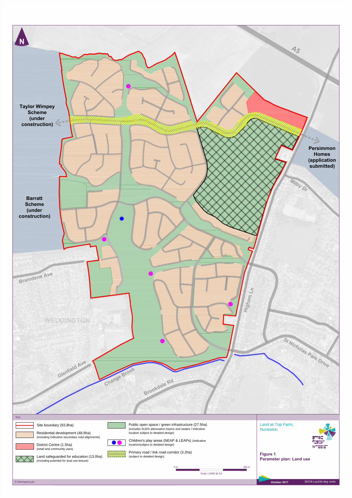
Key
Land at Top Farm,
Nuneaton
35378-Lea194.dwg smitv
October 2017
Figure 1
Parameter plan: Land use
Site boundary (93.8ha)
Residential development (48.6ha)
(including indicative secondary road alignments)
District Centre (1.5ha)
(retail and community uses)
Land safeguarded for education (13.0ha)
(including potential for dual use leisure)
© Getmapping plc.
300 m
Scale 1:5000 @ A3
0 m
Public open space / green infrastructure (27.5ha)
(includes SUDS attenuation basins and swales / indicative
location subject to detailed design)
Children's play areas (NEAP & LEAPs) (Indicative
location/subject to detailed design)
Primary road / link road corridor (3.2ha)
(subject to detailed design)