Embed Size (px)
Citation preview
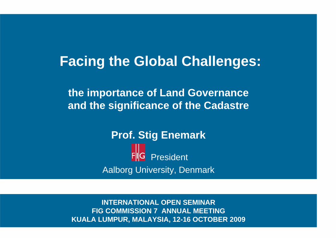
Facing the Global Challenges:
the importance of Land Governance and the significance of the Cadastre
Prof. Stig Enemark
President
Aalborg University, Denmark
INTERNATIONAL OPEN SEMINAR FIG COMMISSION 7 ANNUAL MEETING
KUALA LUMPUR, MALAYSIA, 12-16 OCTOBER 2009
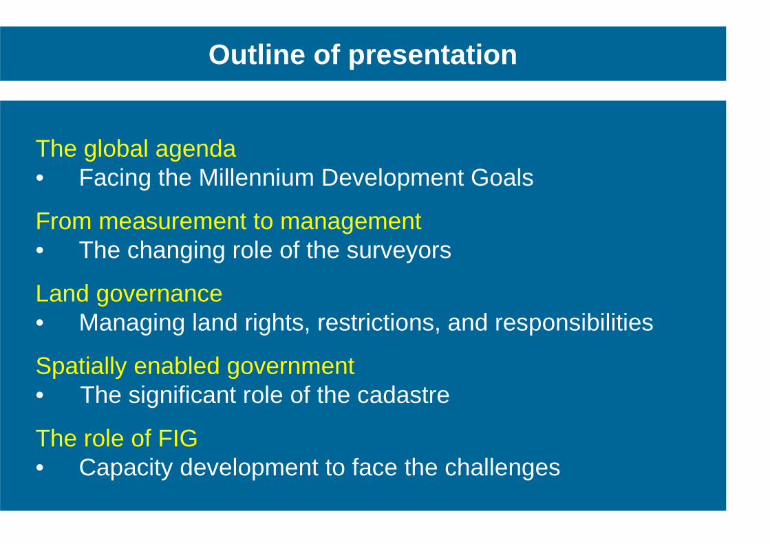
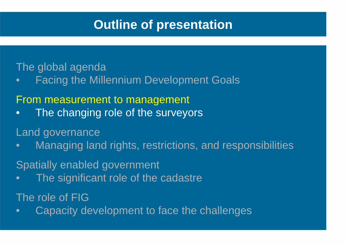
Outline of presentation
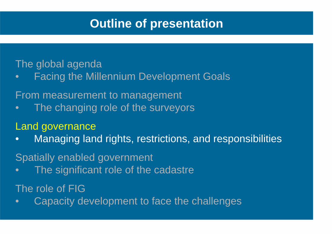
The global agenda • Facing the Millennium Development Goals
From measurement to management • The changing role of the surveyors
Land governance • Managing land rights, restrictions, and responsibilities
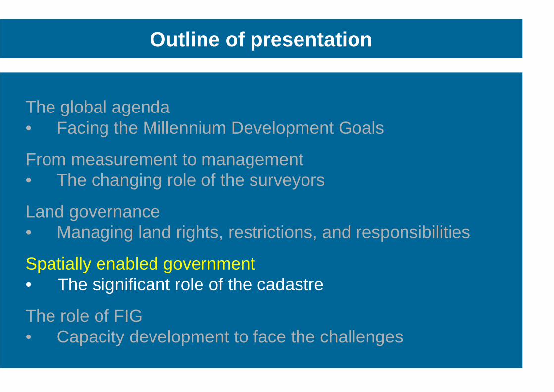
Spatially enabled government • The significant role of the cadastre
The role of FIG • Capacity development to face the challenges
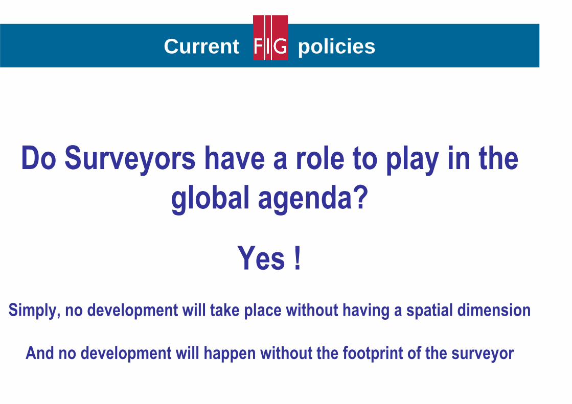
Current policies
Do Surveyors have a role to play in the
global agenda?
Yes !
Simply, no development will take place without having a spatial dimension
And no development will happen without the footprint of the surveyor
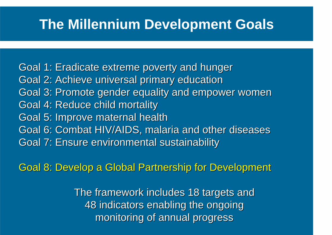
The Millennium Development Goals
Goal Goal 11: : Eradicate extreme poverty and hunger Eradicate extreme poverty and hunger Goal Goal 22: : Achieve universal primary education Achieve universal primary education Goal Goal 33: : Promote gender equality and empower women Promote gender equality and empower women Goal Goal 44: : Reduce child mortality Reduce child mortality Goal Goal 55: : Improve maternal health Improve maternal health Goal Goal 66: : Combat HIVCombat HIV//AIDSAIDS, , malaria and other diseases malaria and other diseases Goal Goal 77: : Ensure environmental sustainability Ensure environmental sustainability Goal Goal 88: : Develop a Global Partnership for DevelopmentDevelop a Global Partnership for Development
The framework includes The framework includes 1818 targets and targets and 4848 indicators enabling the ongoing indicators enabling the ongoing
monitoring of annual progressmonitoring of annual progress
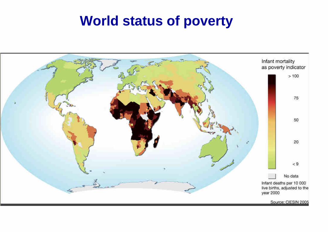
World status of poverty
32
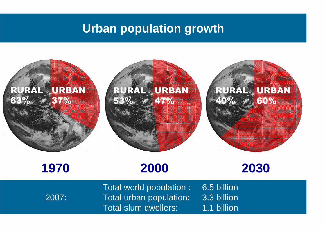
1970
RURAL
63%
URBAN
37%
2000 2030
RURAL
53%
URBAN
47%
RURAL
40%
URBAN
60%
Urban population growth
Total world population : 6.5 billion 2007: Total urban population: 3.3 billion Total slum dwellers: 1.1 billion
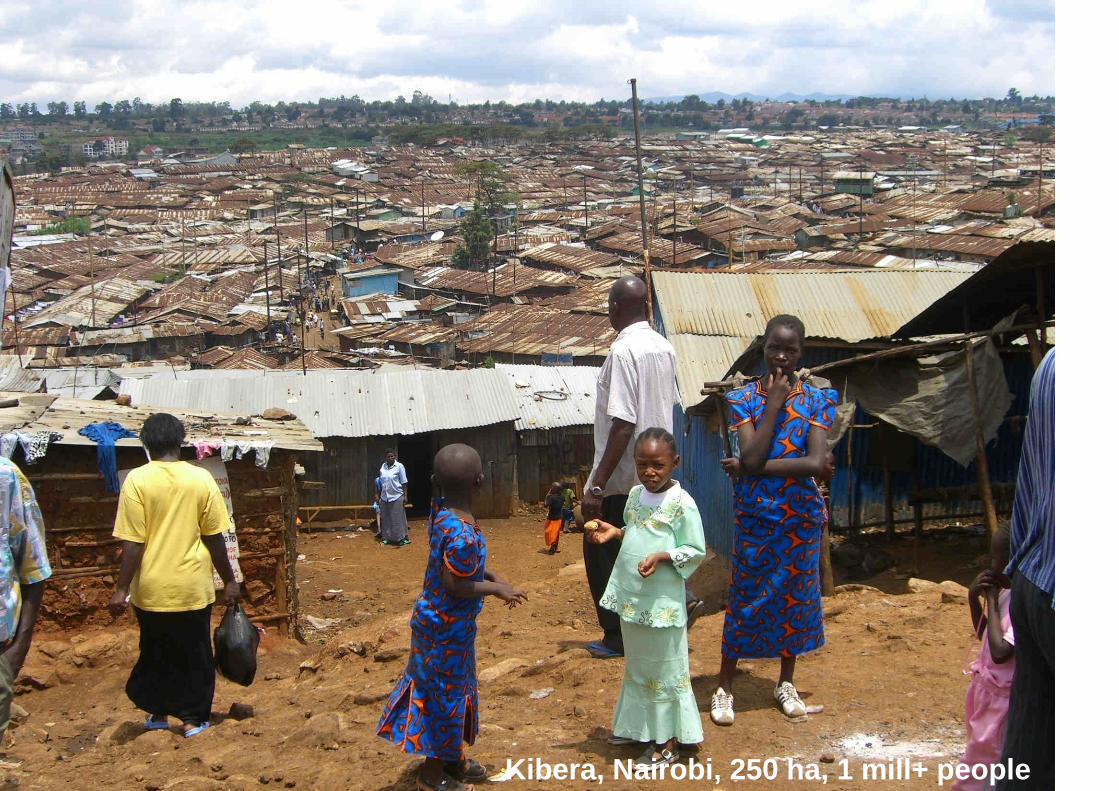
Kibera, Nairobi, 250 ha, 1 mill+ people
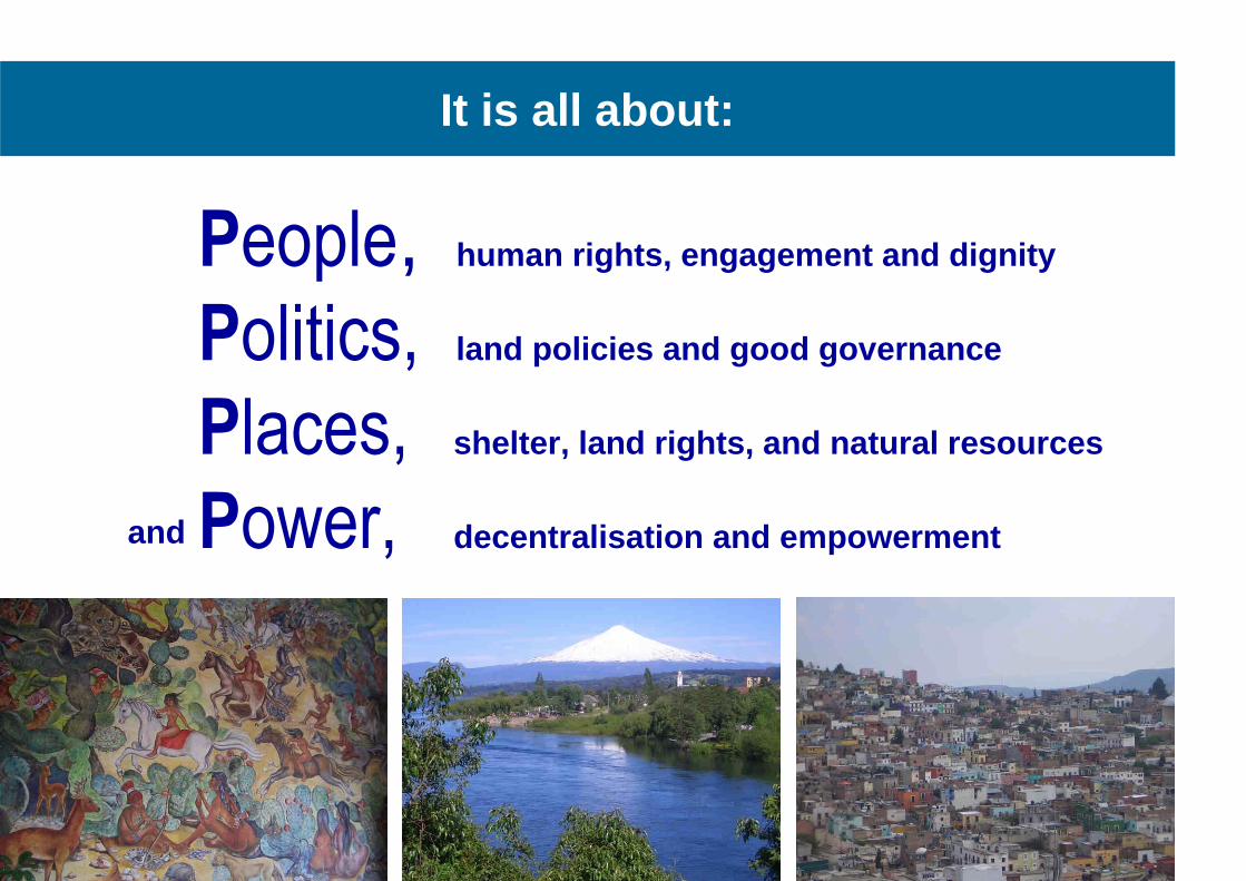
People, human rights, engagement and dignity
Politics, land policies and good governance Places, shelter, land rights, and natural resources
Power, decentralisation and empowerment
It is all about:
and
Outline of presentation
The global agenda • Facing the Millennium Development Goals
From measurement to management • The changing role of the surveyors
Land governance • Managing land rights, restrictions, and responsibilities
Spatially enabled government • The significant role of the cadastre
The role of FIG • Capacity development to face the challenges
Current policies
Is the role of the surveyors changing ?
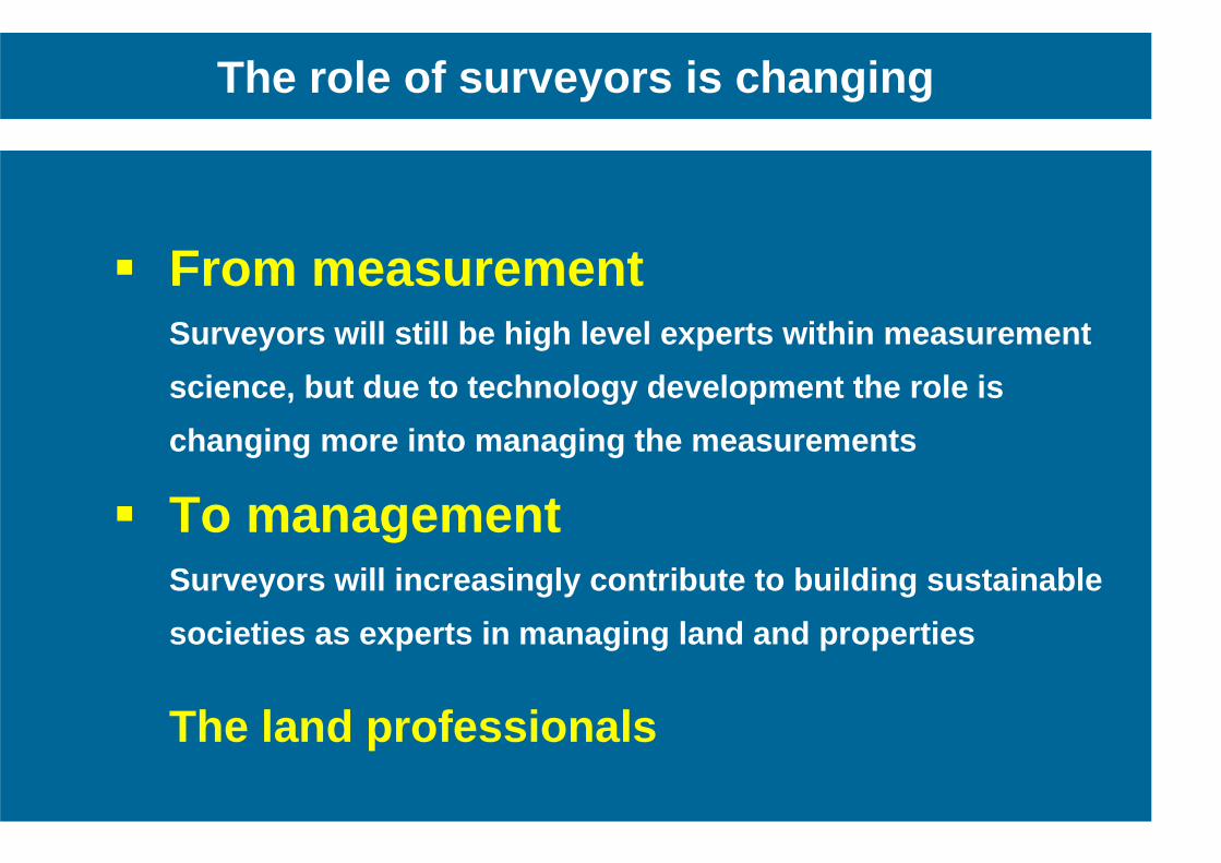
� From measurement
Surveyors will still be high level experts within m easurement
science, but due to technology development the rol e is
changing more into managing the measurements
� To management Surveyors will increasingly contribute to building sustainable
societies as experts in managing land and properti es
The land professionals
The role of surveyors is changing
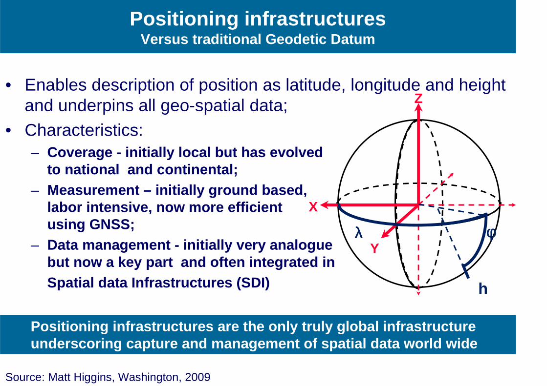
• Enables description of position as latitude, longitude and height and underpins all geo-spatial data;
• Characteristics: – Coverage - initially local but has evolved
to national and continental; – Measurement – initially ground based,
labor intensive, now more efficient using GNSS;
– Data management - initially very analogue but now a key part and often integrated in
Spatial data Infrastructures (SDI)
X
Y
Z
λλλλ φφφφ
h
Positioning infrastructures Versus traditional Geodetic Datum
Source: Matt Higgins, Washington, 2009
Positioning infrastructures are the only truly glob al infrastructure underscoring capture and management of spatial dat a world wide
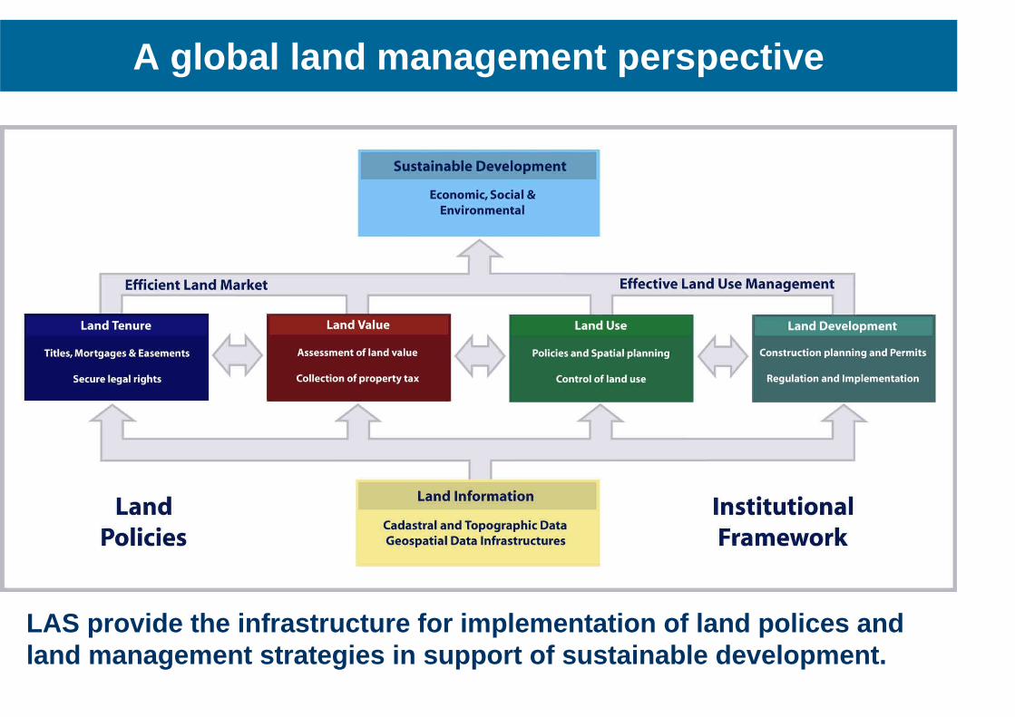
A global land management perspective
LAS provide the infrastructure for implementation o f land polices and land management strategies in support of sustainabl e development.
Outline of presentation
The global agenda • Facing the Millennium Development Goals
From measurement to management • The changing role of the surveyors
Land governance • Managing land rights, restrictions, and responsibilities
Spatially enabled government • The significant role of the cadastre
The role of FIG • Capacity development to face the challenges
Land governance is about the policies, processes and institutions by which land, property and natural resources are managed. This includes decisions on access to land; land rights; land use; and land development. Land governance is about determining and implementing sustainable land policies.
Land governance
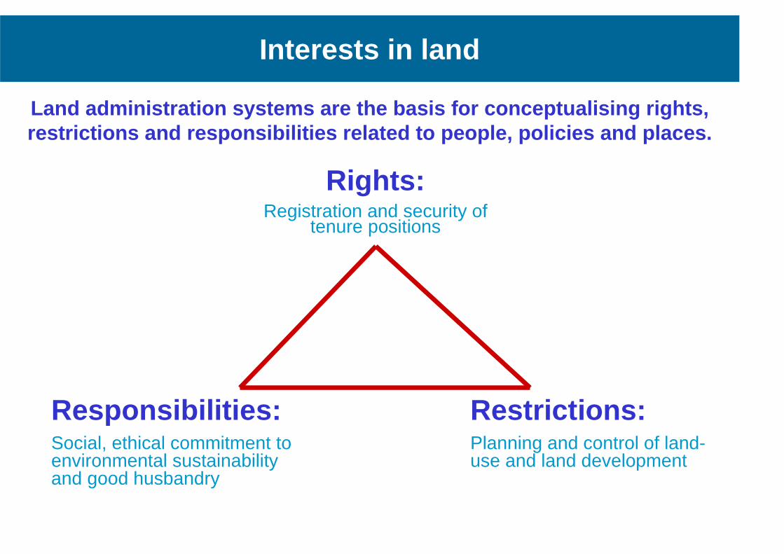
Land administration systems are the basis for conce ptualising rights, restrictions and responsibilities related to people , policies and places.
Responsibilities: Social, ethical commitment to environmental sustainability and good husbandry
Rights: Registration and security of
tenure positions
Restrictions: Planning and control of land-use and land development
Interests in land
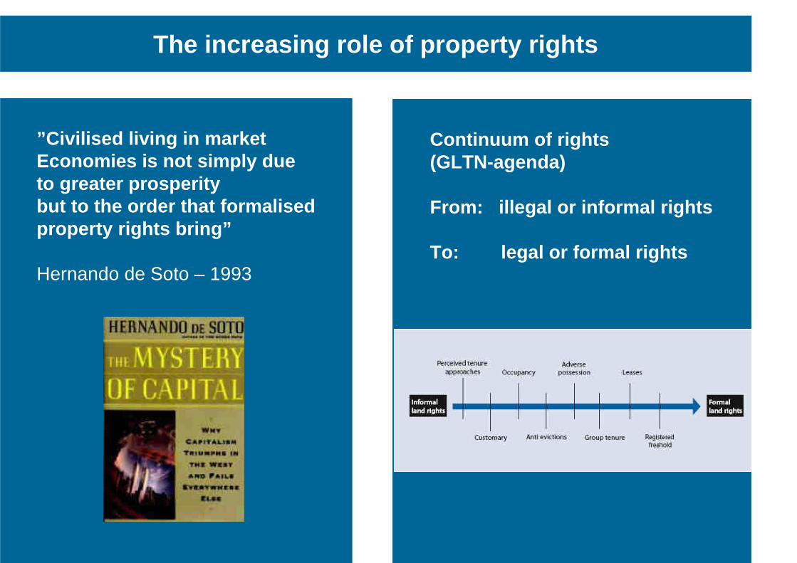
The increasing role of property rights
”Civilised living in market Economies is not simply due to greater prosperity but to the order that formalised property rights bring” Hernando de Soto – 1993
Continuum of rights (GLTN-agenda) From: illegal or informal rights To: legal or formal rights
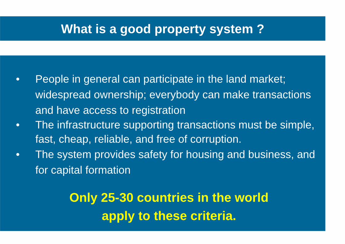
What is a good property system ?
• People in general can participate in the land market;
widespread ownership; everybody can make transactions and have access to registration
• The infrastructure supporting transactions must be simple, fast, cheap, reliable, and free of corruption.
• The system provides safety for housing and business, and for capital formation
Only 25-30 countries in the world apply to these criteria.
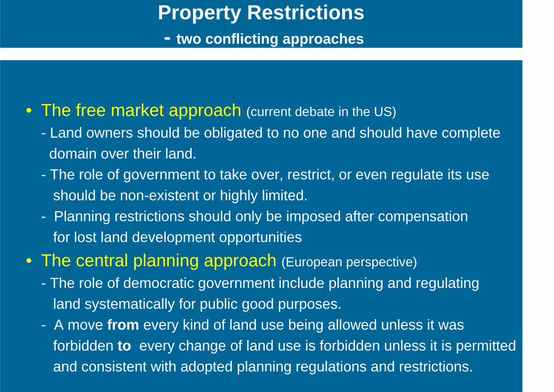
• The free market approach (current debate in the US)
- Land owners should be obligated to no one and should have complete domain over their land. - The role of government to take over, restrict, or even regulate its use should be non-existent or highly limited. - Planning restrictions should only be imposed after compensation for lost land development opportunities • The central planning approach (European perspective)
- The role of democratic government include planning and regulating land systematically for public good purposes. - A move from every kind of land use being allowed unless it was forbidden to every change of land use is forbidden unless it is permitted and consistent with adopted planning regulations and restrictions.
Property Restrictions - two conflicting approaches
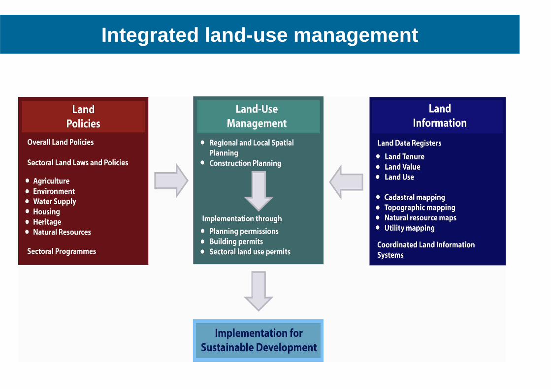
Integrated land-use management
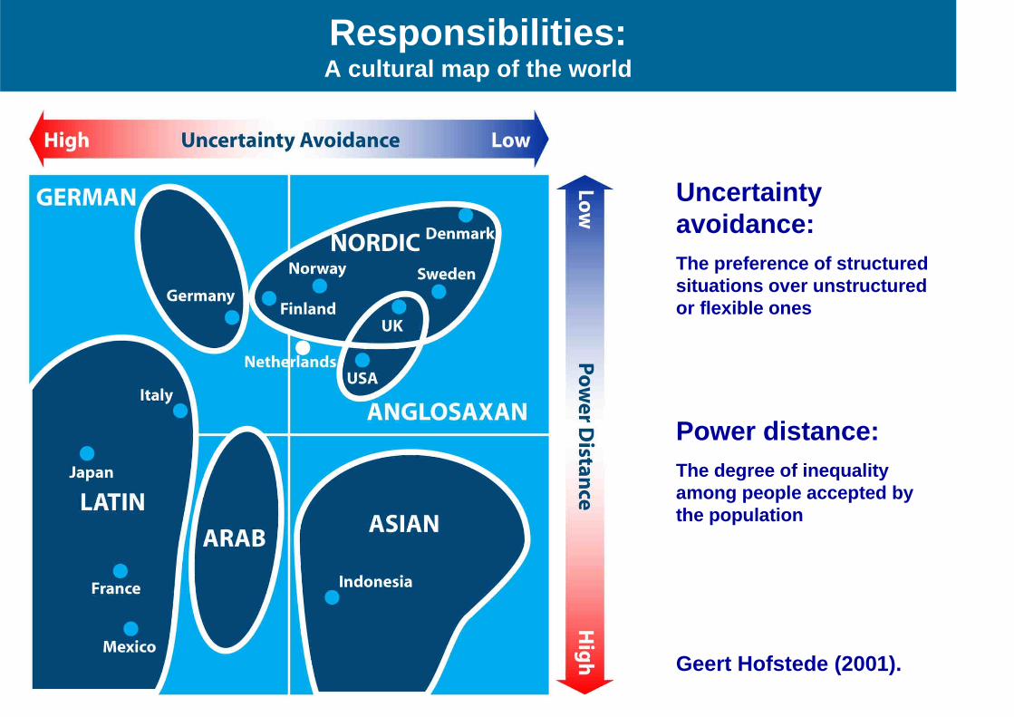
Responsibilities: A cultural map of the world
Uncertainty avoidance:
The preference of structured situations over unstructured or flexible ones Power distance:
The degree of inequality among people accepted by the population Geert Hofstede (2001).
Outline of presentation
The global agenda • Facing the Millennium Development Goals
From measurement to management • The changing role of the surveyors
Land governance • Managing land rights, restrictions, and responsibilities
Spatially enabled government • The significant role of the cadastre
The role of FIG • Capacity development to face the challenges
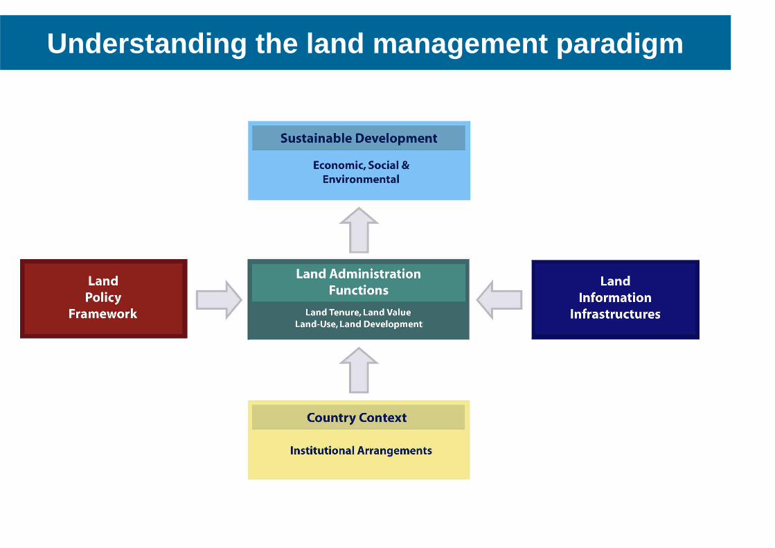
Understanding the land management paradigm
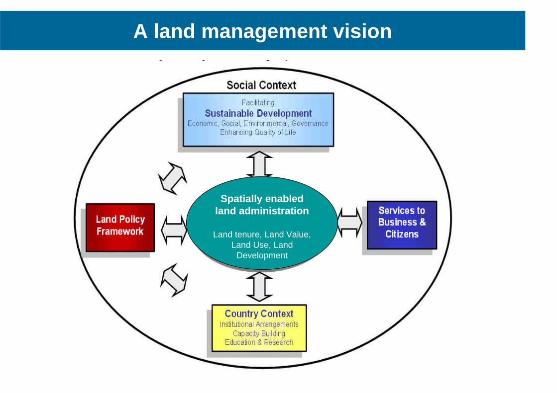
A land management vision
Spatially enabled land administration
Land tenure, Land Value, Land Use, Land
Development
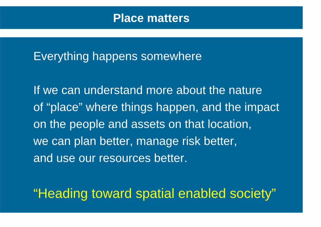
Everything happens somewhere If we can understand more about the nature of “place” where things happen, and the impact on the people and assets on that location, we can plan better, manage risk better, and use our resources better.
“Heading toward spatial enabled society” .
Place matters
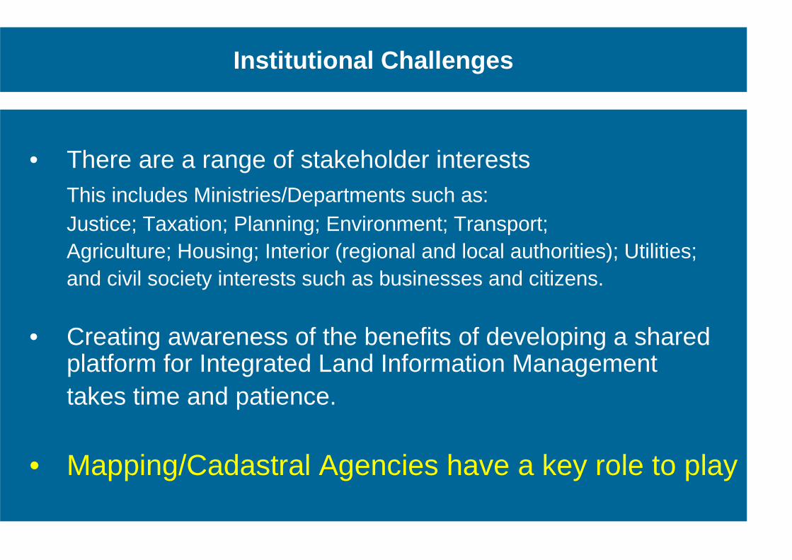
Institutional Challenges
• There are a range of stakeholder interests This includes Ministries/Departments such as: Justice; Taxation; Planning; Environment; Transport; Agriculture; Housing; Interior (regional and local authorities); Utilities; and civil society interests such as businesses and citizens.
• Creating awareness of the benefits of developing a shared platform for Integrated Land Information Management
takes time and patience.
• Mapping/Cadastral Agencies have a key role to play
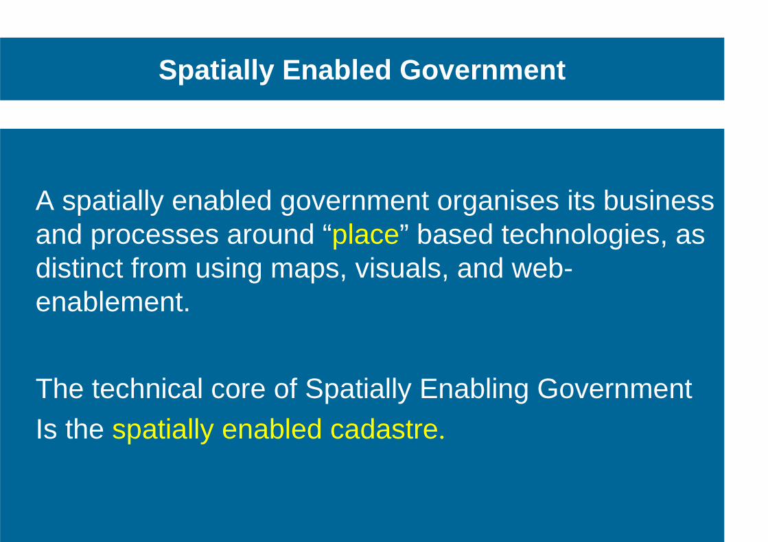
Spatially Enabled Government
A spatially enabled government organises its business and processes around “place” based technologies, as distinct from using maps, visuals, and web-enablement.
The technical core of Spatially Enabling Government Is the spatially enabled cadastre.
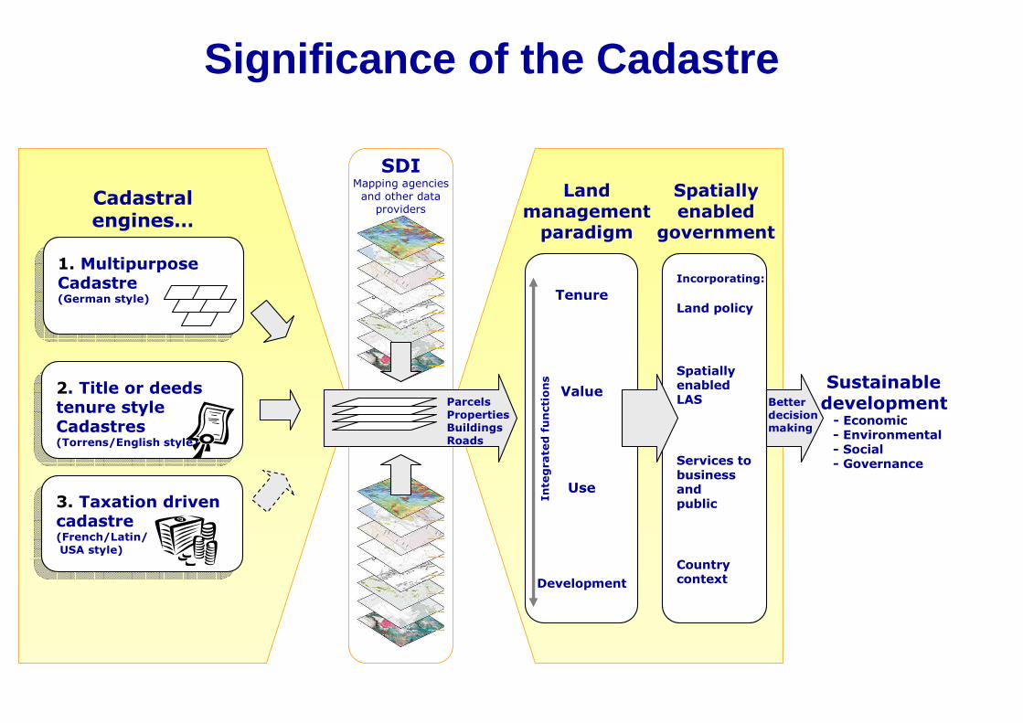
1. Multipurpose Cadastre (German style)
1. Multipurpose Cadastre (German style)
2. Title or deeds tenure style Cadastres (Torrens/English style)
2. Title or deeds tenure style Cadastres (Torrens/English style)
3. Taxation driven cadastre (French/Latin/
USA style)
3. Taxation driven cadastre (French/Latin/
USA style)
Tenure
Value
Use
Development
Incorporating:
Land policy
Spatially enabled LAS
Services to business and public
Country context
Sustainable development - Economic - Environmental - Social - Governance
Cadastral engines…
Land management paradigm
Spatially enabled
government
Parcels
Properties Buildings
Roads
Integrated functions
SDI Mapping agencies
and other data providers
Better
decision making
Significance of the Cadastre
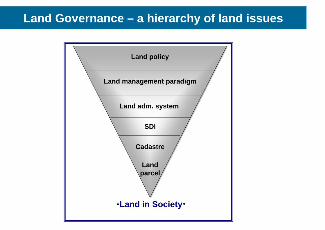
Land Governance – a hierarchy of land issues
“ Land in Society ”
Land policy
Land management paradigm
SDI
Cadastre
Land parcel
Land adm. system
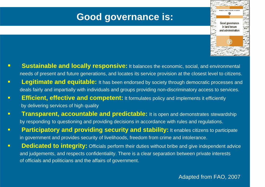
� Sustainable and locally responsive: It balances the economic, social, and environmental
needs of present and future generations, and locates its service provision at the closest level to citizens.
� Legitimate and equitable: It has been endorsed by society through democratic processes and
deals fairly and impartially with individuals and groups providing non-discriminatory access to services.
� Efficient, effective and competent: It formulates policy and implements it efficiently
by delivering services of high quality
� Transparent, accountable and predictable: It is open and demonstrates stewardship
by responding to questioning and providing decisions in accordance with rules and regulations.
� Participatory and providing security and stability: It enables citizens to participate
in government and provides security of livelihoods, freedom from crime and intolerance.
� Dedicated to integrity: Officials perform their duties without bribe and give independent advice
and judgements, and respects confidentiality. There is a clear separation between private interests of officials and politicians and the affairs of government.
Good governance is:
Adapted from FAO, 2007
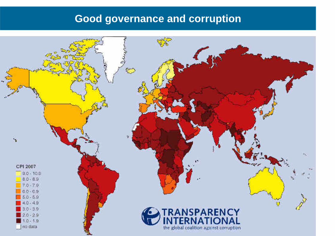
Good governance and corruption
Outline of presentation
The global agenda • Facing the Millennium Development Goals
From measurement to management • The changing role of the surveyors
Land governance • Managing land rights, restrictions, and responsibilities
Spatially enabled government • The significant role of the cadastre
The role of FIG • Capacity development to face the challenges
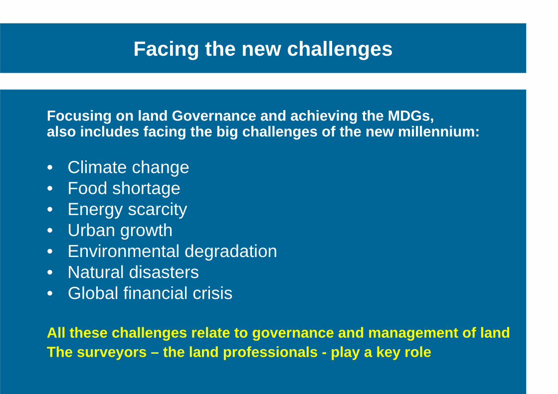
Facing the new challenges
Focusing on land Governance and achieving the MDGs, also includes facing the big challenges of the new millennium: • Climate change • Food shortage • Energy scarcity • Urban growth • Environmental degradation • Natural disasters • Global financial crisis All these challenges relate to governance and manag ement of land The surveyors – the land professionals - play a key role
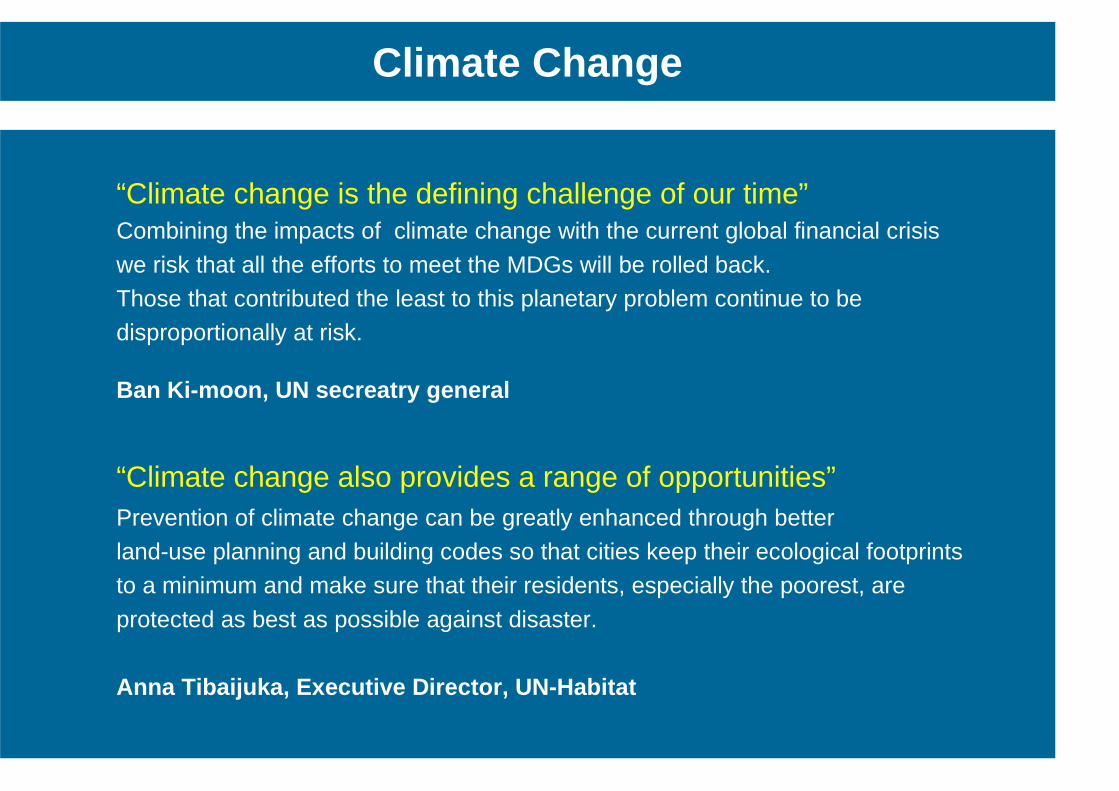
“Climate change is the defining challenge of our time” Combining the impacts of climate change with the current global financial crisis
we risk that all the efforts to meet the MDGs will be rolled back. Those that contributed the least to this planetary problem continue to be disproportionally at risk.
Ban Ki-moon, UN secreatry general
“Climate change also provides a range of opportunities” Prevention of climate change can be greatly enhanced through better land-use planning and building codes so that cities keep their ecological footprints to a minimum and make sure that their residents, especially the poorest, are
protected as best as possible against disaster. Anna Tibaijuka, Executive Director, UN-Habitat
Climate Change
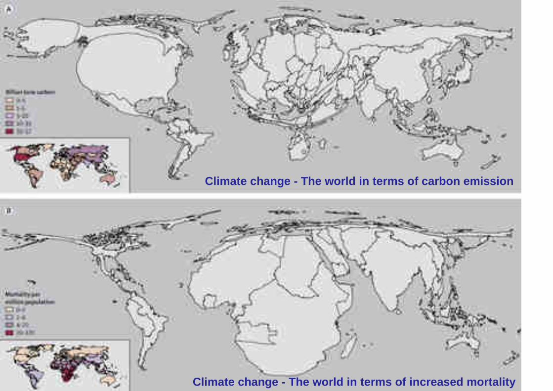
Climate change - The world in terms of carbon emiss ion
Climate change - The world in terms of increased mo rtality
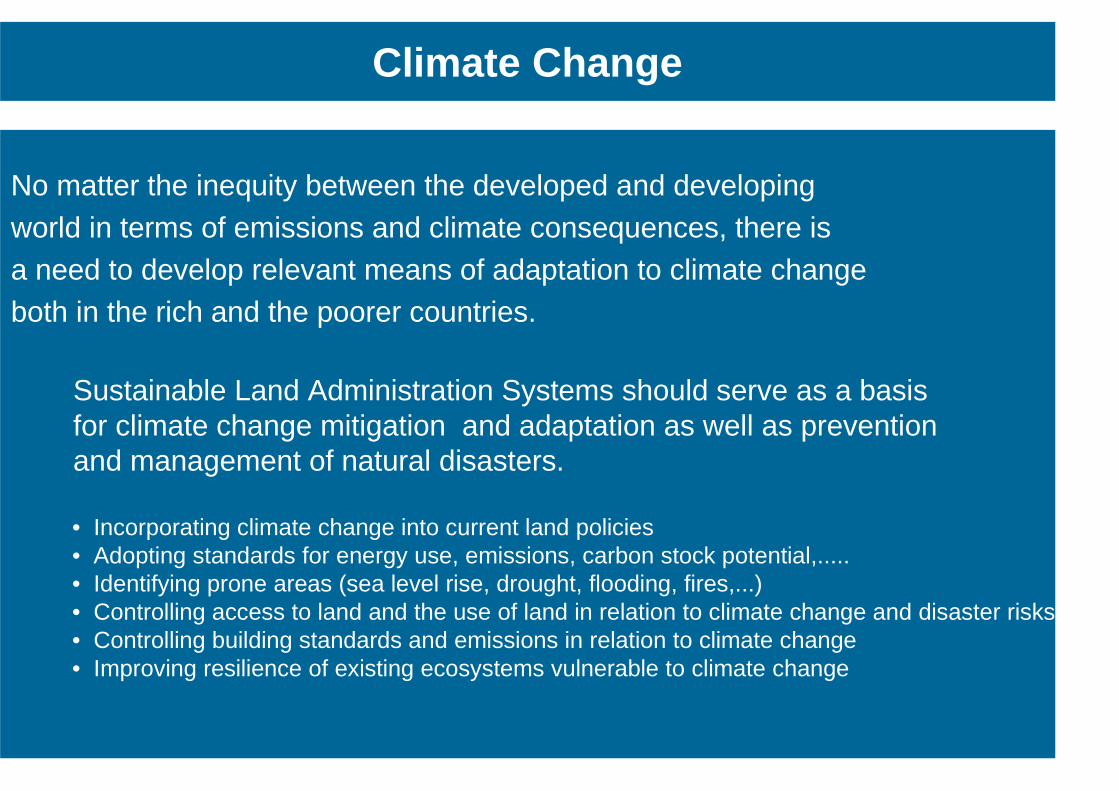
No matter the inequity between the developed and developing world in terms of emissions and climate consequences, there is a need to develop relevant means of adaptation to climate change both in the rich and the poorer countries.
Sustainable Land Administration Systems should serve as a basis for climate change mitigation and adaptation as well as prevention and management of natural disasters. • Incorporating climate change into current land policies • Adopting standards for energy use, emissions, carbon stock potential,..... • Identifying prone areas (sea level rise, drought, flooding, fires,...) • Controlling access to land and the use of land in relation to climate change and disaster risks • Controlling building standards and emissions in relation to climate change • Improving resilience of existing ecosystems vulnerable to climate change
Climate Change
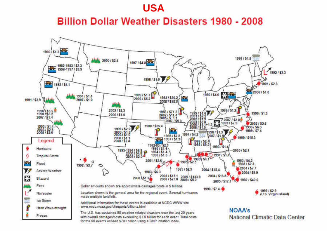
USA
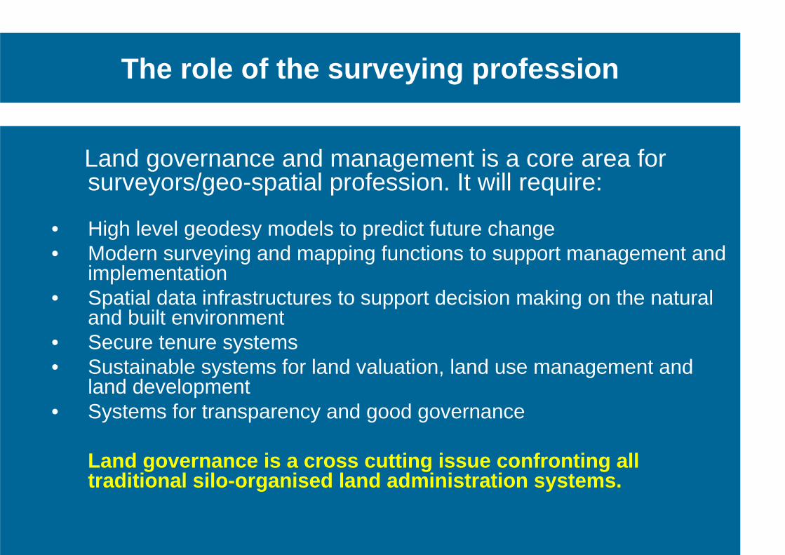
The role of the surveying profession
Land governance and management is a core area for
surveyors/geo-spatial profession. It will require: • High level geodesy models to predict future change • Modern surveying and mapping functions to support management and
implementation • Spatial data infrastructures to support decision making on the natural
and built environment • Secure tenure systems • Sustainable systems for land valuation, land use management and
land development • Systems for transparency and good governance Land governance is a cross cutting issue confrontin g all
traditional silo-organised land administration syst ems.
• Professional Development - Global forum for professional discussions and interactions through
conferences, symposia, commission working groups, …..
• Institutional Development - Capacity building through Institutional support for educational
and professional and institutional development at national level
• Global Development - Cooperation with the UN agencies, FAO, UN.Habitat and World Bank, and
sister organisations through Joint Board of Geospatial Information Societies.
• Information and Communication - website, annual review, publications • FIG Office - administration, finances,
The Role of
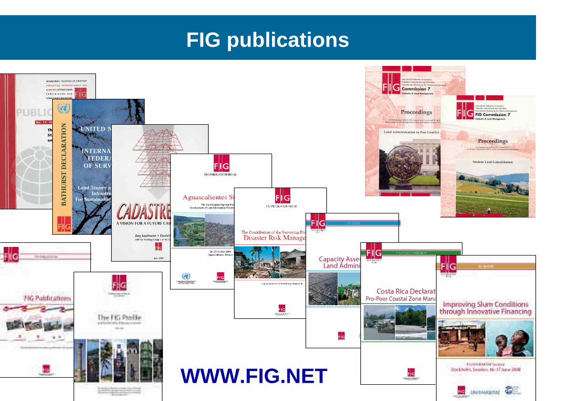
FIG publications
WWW.FIG.NET
intend to play a strong role in building the capacity to design, build and manage national surveying and land administration systems that facilitates sustainable Land Governance in support of the MDGs. “Building the capacity for taking the land policy agenda forward”
The role of
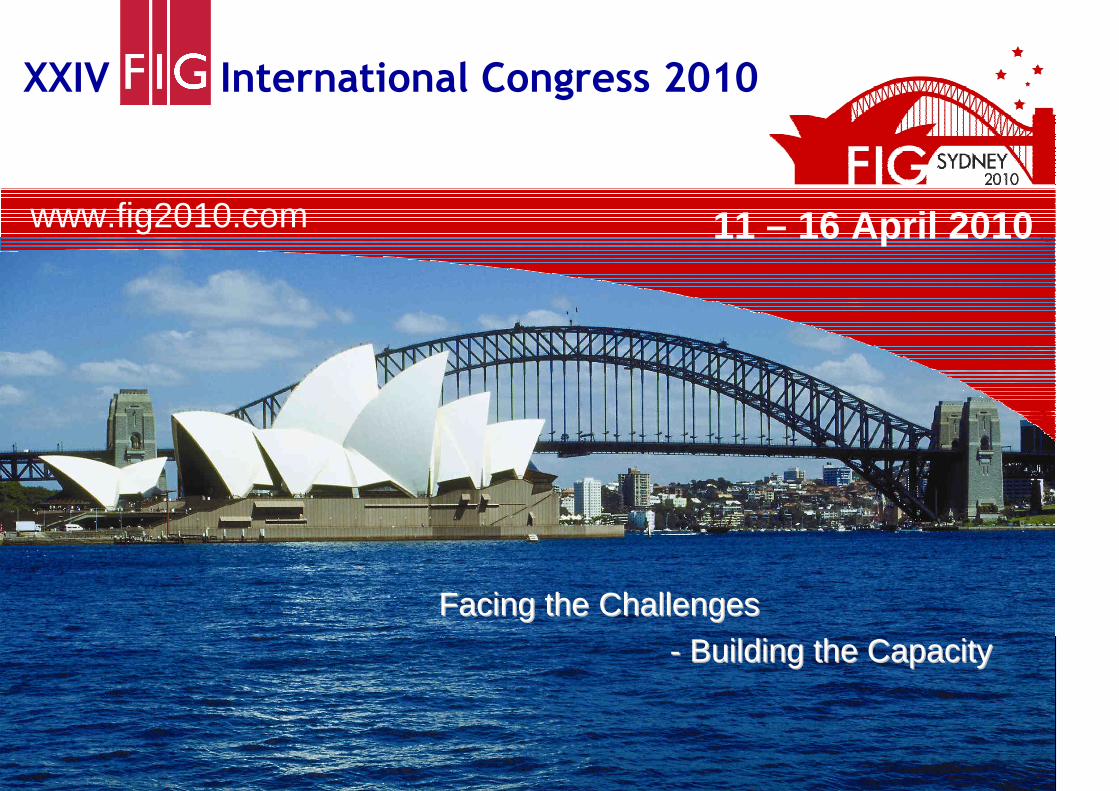
XXIV International Congress 2010
www.fig2010.com
11th – 16th April 2010 www.fig2010.com
We look forward to welcoming you to Sydney!
www.fig2010.com 11 – 16 April 2010
Facing the ChallengesFacing the Challenges
-- Building the Capacity Building the Capacity
Thank you For your attention