Embed Size (px)
Citation preview
An enjoyable 6 mile (9.5km) walk in two sections, making it ideal for a lunchtime stop in Capel village. There is an option to shorten the route by completing just the first loop of 3 miles (4.8km).
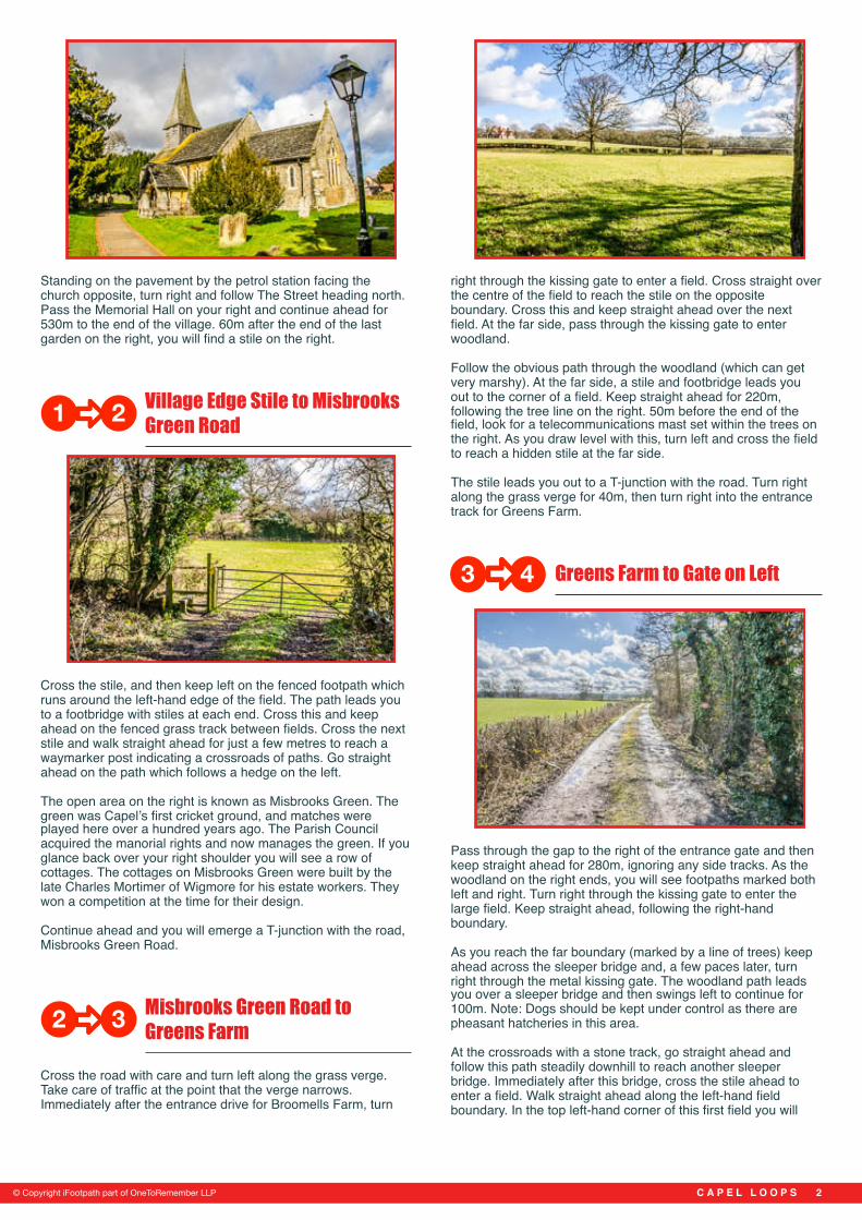
The walk passes through farmland and woodland, with beautiful wildflowers in the spring. There are good views to Leith Hill and the North Downs. This walk is part of the Explore Surrey collection, published through a collaboration between iFootpath and Surrey County Council.
If you are looking for refreshments, The Crown pub is at the start of the walk. There is also a petrol station with shop opposite, and a newsagent further south along The Street. Ordnance Survey Map: Explorer 146 Dorking, Box Hill & Reigate. This walk follows public footpaths and bridleways which cross private land. Information is included for your interest, but please respect people’s privacy, keep dogs under control and remember the Countryside Code.
Getting there Capel village is located in Surrey, close to the border with West Sussex, mid way between Dorking and Horsham. The walk starts from the Vicarage Lane bus stop on The Street, directly outside the church and The Crown pub in the centre of Capel village. For help with planning your journey by public transport please visit journeys.travelsmartsurrey.info. If you are coming by car, there is some street parking on The Street and Vicarage Lane (please park with respect for local residents). There is also a car park at the village hall, Memorial Hall, just off Mortimer Road (a one minute walk north along The Street).
Approximate post code RH5 5JY. Grid ref: TQ 176407.
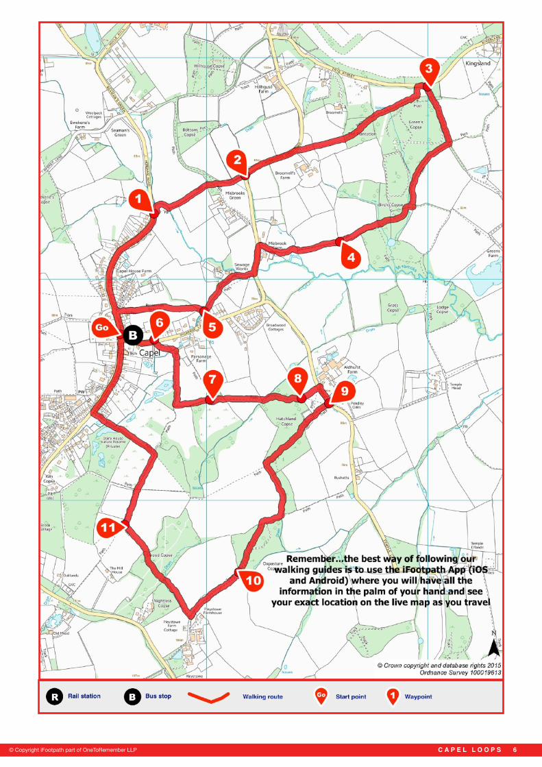
Walk Sections Start to Village Edge Stile
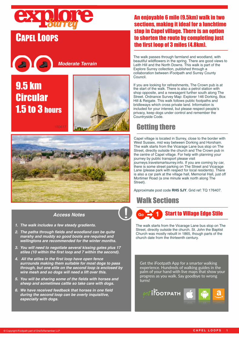
The walk starts from the Vicarage Lane bus stop on The Street, directly outside the church. St. John the Baptist Church was mostly rebuilt in 1865, though parts of the church date from the thirteenth century.
C A P E L L O O P S �1
1. The walk includes a few steady gradients. 2. The paths through fields and woodland can be quite
marshy and muddy so good boots are required and wellingtons are recommended for the winter months.
3. You will need to negotiate several kissing gates plus 17 stiles (10 within the first loop and 7 within the second).
4. All the stiles in the first loop have open fence surrounds making them suitable for most dogs to pass through, but one stile on the second loop is enclosed by wire mesh and so dogs will need a lift over this.
5. You will be sharing some of the fields with horses and sheep and sometimes cattle so take care with dogs.
6. We have received feedback that horses in one field during the second loop can be overly inquisitive, especially with dogs.
9.5 km Circular 1.5 to 3 hours
Access Notes
© Copyright iFootpath part of OneToRemember LLP
Moderate Terrain
180417
Go 1
CAPEL LOOPS
Get the iFootpath App for a smarter walking experience. Hundreds of walking guides in the palm of your hand with live maps that show your progress as you walk. Say goodbye to wrong turns!
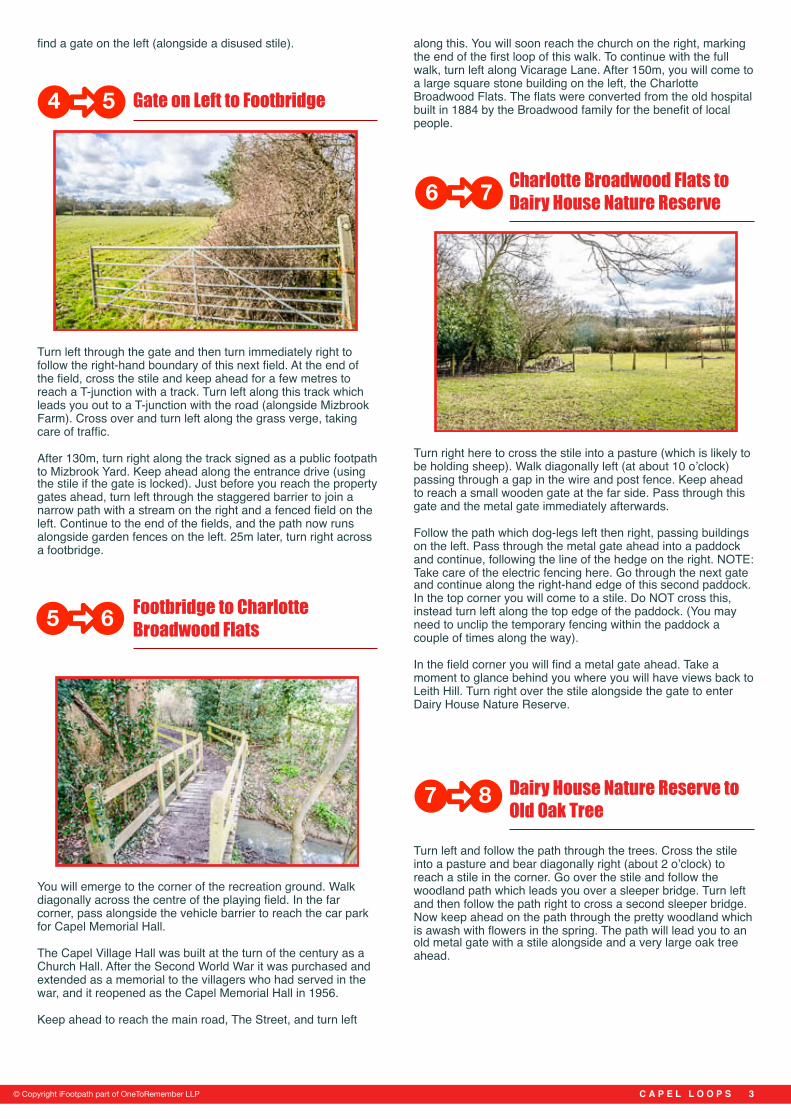
Standing on the pavement by the petrol station facing the church opposite, turn right and follow The Street heading north. Pass the Memorial Hall on your right and continue ahead for 530m to the end of the village. 60m after the end of the last garden on the right, you will find a stile on the right.
Village Edge Stile to Misbrooks Green Road
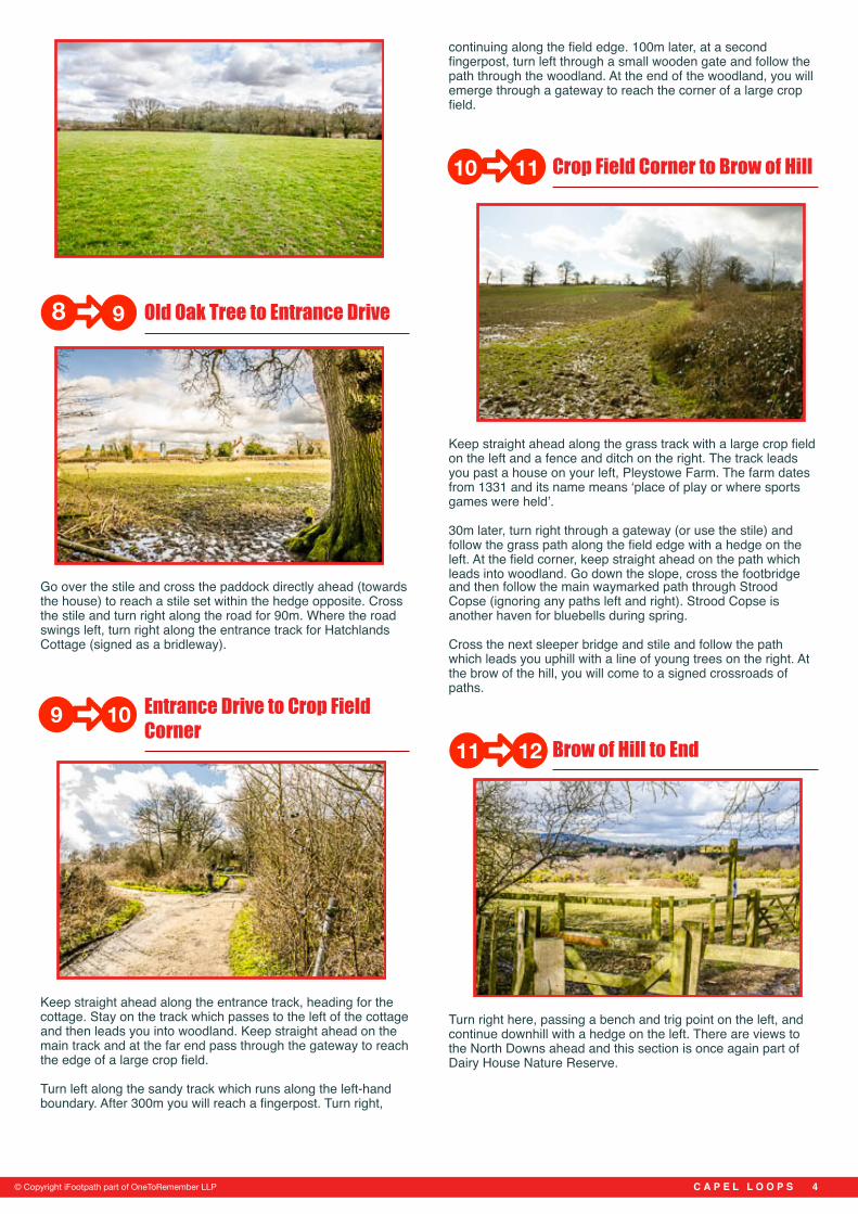
Cross the stile, and then keep left on the fenced footpath which runs around the left-hand edge of the field. The path leads you to a footbridge with stiles at each end. Cross this and keep ahead on the fenced grass track between fields. Cross the next stile and walk straight ahead for just a few metres to reach a waymarker post indicating a crossroads of paths. Go straight ahead on the path which follows a hedge on the left.
The open area on the right is known as Misbrooks Green. The green was Capel’s first cricket ground, and matches were played here over a hundred years ago. The Parish Council acquired the manorial rights and now manages the green. If you glance back over your right shoulder you will see a row of cottages. The cottages on Misbrooks Green were built by the late Charles Mortimer of Wigmore for his estate workers. They won a competition at the time for their design.
Continue ahead and you will emerge a T-junction with the road, Misbrooks Green Road.
Misbrooks Green Road to Greens Farm
Cross the road with care and turn left along the grass verge. Take care of traffic at the point that the verge narrows. Immediately after the entrance drive for Broomells Farm, turn
right through the kissing gate to enter a field. Cross straight over the centre of the field to reach the stile on the opposite boundary. Cross this and keep straight ahead over the next field. At the far side, pass through the kissing gate to enter woodland.
Follow the obvious path through the woodland (which can get very marshy). At the far side, a stile and footbridge leads you out to the corner of a field. Keep straight ahead for 220m, following the tree line on the right. 50m before the end of the field, look for a telecommunications mast set within the trees on the right. As you draw level with this, turn left and cross the field to reach a hidden stile at the far side.
The stile leads you out to a T-junction with the road. Turn right along the grass verge for 40m, then turn right into the entrance track for Greens Farm.
Greens Farm to Gate on Left
Pass through the gap to the right of the entrance gate and then keep straight ahead for 280m, ignoring any side tracks. As the woodland on the right ends, you will see footpaths marked both left and right. Turn right through the kissing gate to enter the large field. Keep straight ahead, following the right-hand boundary.
As you reach the far boundary (marked by a line of trees) keep ahead across the sleeper bridge and, a few paces later, turn right through the metal kissing gate. The woodland path leads you over a sleeper bridge and then swings left to continue for 100m. Note: Dogs should be kept under control as there are pheasant hatcheries in this area.
At the crossroads with a stone track, go straight ahead and follow this path steadily downhill to reach another sleeper bridge. Immediately after this bridge, cross the stile ahead to enter a field. Walk straight ahead along the left-hand field boundary. In the top left-hand corner of this first field you will
C A P E L L O O P S �2© Copyright iFootpath part of OneToRemember LLP
1 2
2 3
3 4
find a gate on the left (alongside a disused stile).
Gate on Left to Footbridge
Turn left through the gate and then turn immediately right to follow the right-hand boundary of this next field. At the end of the field, cross the stile and keep ahead for a few metres to reach a T-junction with a track. Turn left along this track which leads you out to a T-junction with the road (alongside Mizbrook Farm). Cross over and turn left along the grass verge, taking care of traffic.
After 130m, turn right along the track signed as a public footpath to Mizbrook Yard. Keep ahead along the entrance drive (using the stile if the gate is locked). Just before you reach the property gates ahead, turn left through the staggered barrier to join a narrow path with a stream on the right and a fenced field on the left. Continue to the end of the fields, and the path now runs alongside garden fences on the left. 25m later, turn right across a footbridge.
Footbridge to Charlotte Broadwood Flats
You will emerge to the corner of the recreation ground. Walk diagonally across the centre of the playing field. In the far corner, pass alongside the vehicle barrier to reach the car park for Capel Memorial Hall.
The Capel Village Hall was built at the turn of the century as a Church Hall. After the Second World War it was purchased and extended as a memorial to the villagers who had served in the war, and it reopened as the Capel Memorial Hall in 1956.
Keep ahead to reach the main road, The Street, and turn left
along this. You will soon reach the church on the right, marking the end of the first loop of this walk. To continue with the full walk, turn left along Vicarage Lane. After 150m, you will come to a large square stone building on the left, the Charlotte Broadwood Flats. The flats were converted from the old hospital built in 1884 by the Broadwood family for the benefit of local people.
Charlotte Broadwood Flats to Dairy House Nature Reserve
Turn right here to cross the stile into a pasture (which is likely to be holding sheep). Walk diagonally left (at about 10 o’clock) passing through a gap in the wire and post fence. Keep ahead to reach a small wooden gate at the far side. Pass through this gate and the metal gate immediately afterwards.
Follow the path which dog-legs left then right, passing buildings on the left. Pass through the metal gate ahead into a paddock and continue, following the line of the hedge on the right. NOTE: Take care of the electric fencing here. Go through the next gate and continue along the right-hand edge of this second paddock. In the top corner you will come to a stile. Do NOT cross this, instead turn left along the top edge of the paddock. (You may need to unclip the temporary fencing within the paddock a couple of times along the way).
In the field corner you will find a metal gate ahead. Take a moment to glance behind you where you will have views back to Leith Hill. Turn right over the stile alongside the gate to enter Dairy House Nature Reserve.
Dairy House Nature Reserve to Old Oak Tree
Turn left and follow the path through the trees. Cross the stile into a pasture and bear diagonally right (about 2 o’clock) to reach a stile in the corner. Go over the stile and follow the woodland path which leads you over a sleeper bridge. Turn left and then follow the path right to cross a second sleeper bridge. Now keep ahead on the path through the pretty woodland which is awash with flowers in the spring. The path will lead you to an old metal gate with a stile alongside and a very large oak tree ahead.
C A P E L L O O P S �3© Copyright iFootpath part of OneToRemember LLP
4 5
5 6
6 7
7 8
Old Oak Tree to Entrance Drive
Go over the stile and cross the paddock directly ahead (towards the house) to reach a stile set within the hedge opposite. Cross the stile and turn right along the road for 90m. Where the road swings left, turn right along the entrance track for Hatchlands Cottage (signed as a bridleway).
Entrance Drive to Crop Field Corner
Keep straight ahead along the entrance track, heading for the cottage. Stay on the track which passes to the left of the cottage and then leads you into woodland. Keep straight ahead on the main track and at the far end pass through the gateway to reach the edge of a large crop field.
Turn left along the sandy track which runs along the left-hand boundary. After 300m you will reach a fingerpost. Turn right,
continuing along the field edge. 100m later, at a second fingerpost, turn left through a small wooden gate and follow the path through the woodland. At the end of the woodland, you will emerge through a gateway to reach the corner of a large crop field.
Crop Field Corner to Brow of Hill
Keep straight ahead along the grass track with a large crop field on the left and a fence and ditch on the right. The track leads you past a house on your left, Pleystowe Farm. The farm dates from 1331 and its name means ‘place of play or where sports games were held’.
30m later, turn right through a gateway (or use the stile) and follow the grass path along the field edge with a hedge on the left. At the field corner, keep straight ahead on the path which leads into woodland. Go down the slope, cross the footbridge and then follow the main waymarked path through Strood Copse (ignoring any paths left and right). Strood Copse is another haven for bluebells during spring.
Cross the next sleeper bridge and stile and follow the path which leads you uphill with a line of young trees on the right. At the brow of the hill, you will come to a signed crossroads of paths.
Brow of Hill to End
Turn right here, passing a bench and trig point on the left, and continue downhill with a hedge on the left. There are views to the North Downs ahead and this section is once again part of Dairy House Nature Reserve.
C A P E L L O O P S �4© Copyright iFootpath part of OneToRemember LLP
98
109
1110
1211

Pass through the kissing gate and keep straight ahead following a fenced field on the left. You should be able to see the houses and church within Capel across to the left. At the end of the field turn left to join the enclosed path which leads you steadily downhill. At the bottom of the slope, pass through the kissing gate and keep ahead over the footbridge.
You will emerge to the corner of the village green. Keep ahead along the right-hand edge of the green, passing the pond on the left. At the road, turn right along the pavement. You will pass a number of interesting properties including the old chapel, the almshouses (built in 1871) and the old post office all on the right. Further along you will come to the bus stop outside the church where the walk began.
C A P E L L O O P S �5
Disclaimer
This walking route was walked and checked at the time of writing. We have taken care to make sure all our walks are safe for walkers of a reasonable level of experience and fitness. However, like all outdoor activities, walking carries a degree of risk and we accept no responsibility for any loss or damage to personal effects, personal accident, injury or public liability whilst following this walk. We cannot be held for responsible for any inaccuracies that result from changes to the routes that occur over time. Please let us know of any changes to the routes so that we can correct the information.Walking Safety
For your safety and comfort we recommend that you take the following with you on your walk: bottled water, snacks, a waterproof jacket, waterproof/sturdy boots, a woolly hat and fleece (in winter and cold weather), a fully-charged mobile phone, a whistle, a compass and an Ordnance Survey map of the area. Check the weather forecast before you leave, carry appropriate clothing and do not set out in fog or mist as these conditions can seriously affect your ability to navigate the route. Take particular care on cliff/mountain paths where steep drops can present a particular hazard. Some routes include sections along roads – take care to avoid any traffic at these points. Around farmland take care with children and dogs, particularly around machinery and livestock. If you are walking on the coast make sure you check the tide times before you set out.
© Copyright iFootpath part of OneToRemember LLP
This walk is part of the Explore Surrey collection, published through a collaboration
between iFootpath and Surrey County Council.
Surrey is the ideal place to explore the outdoors on foot. Whether you're an
adventurous walker or someone who prefers a short stroll, there's a walk to suit you.
If you would like to know more about Explore Surrey and find more walks please
visit
www.surreycc.gov.uk/explore
C A P E L L O O P S �6© Copyright iFootpath part of OneToRemember LLP