Embed Size (px)
Citation preview
EXPLORATION PLAN
For
AN ARIZONA LIMITED LIABILITY COMPANY
North Douglas Wildcat Prospect
In the Sulphur Springs Valley
Cochise County, Arizona
$5,569,756.00
Carmon Decker Bonanno PO Box 7 Bisbee, Arizona 85603 PH: 816-223-3712 FX: 816-214-5006

Page 2 of 95
Cautionary Statement Concerning
Forward-Looking Statements Certain statements contained herein that are not statements of historical fact may constitute “forward-looking statements” within the meaning of Section 21E of the Securities Exchange Act of 1934. These statements are subject to risks and uncertainties , as described below. Examples of forward-looking statements include, but are not limited to: (i) projections of revenues, income or loss, earnings or loss per share, capital expenditures, the payment or non-payment of dividends, capital structure and other financial terms, (ii) statements of plans and objectives of Gusher State Management, including plans or objectives relating to the Leasehold, land work, wells or other exploration (iii) statements of future economic performance, and (statements of assumptions underlying the statements described in (i), (ii) and (iii). Forward-looking statements can often be identified by the use of forward-looking terminology, such as “believes,” “expects,” “may,” “will,” “should,” “could,” “intends,” “plans,” “estimates” or “anticipates,” variations thereof or similar expressions. Forward-looking statements are not guarantees of future performance or results. They involve risks, uncertainties and assumptions. The company’s future results of operations, financial condition and business operations may differ materially from those expressed in these forward-looking statements. Investors are cautioned not to put undue reliance on any forward-looking statement. There are a number of factors that could cause the actual results to differ materially from those discussed in the forward-looking statements. Among the factors that could cause actual results to differ materially from those discussed in the forward looking statements are the following: the quality of the Gusher State LLC property with regard to, among other things, the existence of oil and gas reserves in economic quantities; the company’s ability to increase oil and gas reserves through exploration and development; fluctuation in oil and gas prices; demand for oil and gas; reliability and solvency of drilling contractors; the ability to retain key personnel; terrorist attacks in local or foreign regions; and changes in general economic conditions. Any forward-looking statement contained herein is made as of the date of this document. The Company does not undertake to publicly update or correct any forward-looking statements in the future.

Page 3 of 95
CONTENTS
SECTION PAGES
I. Term Sheet – Funding 5
II. Executive Summary- to explore and assess. 6 - 7
III. Exploration-Lease Map 8
a. Map of Proposed Exploration Holes. 9
b. Explanation 10
IV. Cash Flow Scenarios 11 - 12
a. Dineh Be Keyah Production 13 - 14
V. Development Strategies 15 - 16
VI. Management 17 - 19
VII. Assets 20 -
a. Lease Positions 21 - 22
b. State of Arizona Sample Lease 23 - 32
c. Private Lease 33 - 38
VIII. Geology Report 39 - 40
a. North Douglas Map Cross Section Points 41
b. North Douglas Cross Section 42
c. North Douglas Report on Cross Section 43
d. Map Larussia 44
e. Gulf Coast Sediments 45
f. Mexico into US Oil 46
g. Kerogenogenesis of Oil 47 - 54
h. Long Distance Migration of Oil 55 - 68
IX. Gusher State LLC Corp Docs
a. GS Operating Agreement 69 - 94
X. Mission Statement 95

Page 4 of 95
I. Term Sheet
Two Township Area of Interest
Township 22 South Range 27 East & Township 23 South Range 27 East
Acreage Ownership
ASLD Leases T22S R27E 13,145 Acres
ASLD Leases T 3S R27E 2,966 Acres
Private Acreage 2000 Acres
Total 18,111 Acres
Acreage Option 39,880 Acres
TOTAL Acres with Expanded Area Option 57,991 Acres
Total Costs
NRI 80%
Acreage Owned $200.00 / Acre X 18,111 Acres $3,622,200.00
Three Years Rents $1.00 / Acre X 18,111 Acres $57,991.00
Private Title Work $10.00 / Acre X 27,683 Acres $276,850.00
Acreage Option $20.00 / Acre X 39,880 Acres $797,615.00
Percha Shale Test- First Well 7,500’ $1,200.000.00
Two Wells Completed to 5,500’ @ $1.2 MM each $2,400,000.00
*One Quarter Carry on Acreage and First Well on Each 640 Acres.
Fifty-Percent Joint-Venture Available
Gusher State 50% Gusher State JV Partner 50%
25% Carry 25% Buy In 50%
Acreage Owned $2,414,800.00
Three Years Rents $19,330.00 $38,666.00
Private Title Work $92,276.00 $184,553.00
Acreage Option $531,743.00
Percha Shale Test- First Well to 7,500’ $400,000.00 $800,000.00
Two Wells Completed to 5,500’ $800,000.00 $1,600,000.00
Total $1,311,606.00 $5,569,756.00
Acreage Option- $200.00 / Acre X 39,880 Acres $5,317,333.00
*Acreage Option To Be Exercised Within 30 Days After Second Well
Page 5 of 95
II. Executive Summary Gusher State LLC is an independent, development stage exploration and production company which was organized as an Arizona limited liability company on February 24, 2012. The Principle(s) of the company, Gusher State LLC (of Kansas), have set up Gusher State LLC of Arizona for the purposes of drilling exploration and development wells and entering into joint-ventures, partnerships, and contracts advantageous to those endeavors. The North Douglas Prospect began in 2005 when Mr. Carmon Decker Bonanno received a proprietary library of oil and gas and mining files which spans nearly sixty years of collecting geological data in the United States with specific emphasis in Arizona. Among the geological archives there exists information not available on the public record, which includes various value-added geological datum such as seismic, magnetics, structure maps, original geological and hand-drafted studies performed by known masters of world class oil discoveries, and drilling and geologic information from test holes including DST, log information etc. It plans to initiate a venture to wildcat test drill one well to the Percha Shale formation for evaluation of horizontal drilling potential for oil and gas reserves at a depth of 7,500’, and two wells targeting a Devonian age reef or beech complex to 5,500’, and in Cochise County, Arizona. Based on study of its proprietary files, public records, show-holes, hydrocarbon seeps, and active acquisition of extensive hyperspectral satellite acquisitions, the principles of the company believe the area could be fed hydrocarbons though (1) Gulf of Mexico complex carrier beds, (2) kerogenogenesis of oil, and/or (3) shale generation—and that the structural and stratagraphic position is favorable for trapping large quantities of oil and gas on the North Douglas Wildcat Prospect. Gusher State LLC has progressed to its current drilling stage by utilizing its time and investment to (1) study the geology—and commission geophysical work to add to the datum, (2) fund a team to build abstracts for land work and land leases (3) lease acreage for drilling and (4) obtain and maintain political goodwill in the area. Gusher State LLC has leased 57,991 acres of oil and gas leases for exploration. These leases are available for 50% Joint Venture, or 50% ownership of Gusher State LLC for exploration drilling. The remaining 50% is to be held by Gusher State LLC as a 25% carry and a 25% purchased interest exercised by paying a 1/3rd contribution to the costs of carrying the project and drilling of three proposed wells. This is a standard 3/4 pays 100 deal. The core of the project is an area of two townships (T22S R27E & T23S R27E), where the data shows the best possibility for oil and gas production. Within this corridor Gusher State LLC owns 18,111 acres of leases which it values at $200.00/acre, or $3,622,200.00. The purchase price to a 50% JV partner is $2,414,800.00. Leases are at an 80% NRI, with a ten year term split into a $1.00/acre/year for the first five years and $2.00/acre/year for the second five, and a five year shut in royalty (15 years total) available

Page 6 of 95
for $3.00/acre/year. Carrying costs for three years rent at $1.00/acre is $57,991.00. The purchase price for the 50% JV partner is $38,666.00 Land work has been ongoing for 18 months and is nearing completion on 27,683 acres. The value for the land work is figured at $10.00/acre, or $276,683.00. The purchase price for the 50% JV partner is $184,553.00. The costs for drilling are expected to be $1,200,000.00 for a 7,500’ Percha Shale well, and $1,200,000.00 each for two wells completed to 5,500’. The drilling costs are expected to be high because of time delays caused by extensive testing of shows, and lack of infrastructure and services in the Cochise County Area. These are not turn-key wells. They will be drilled with all diligence and dispatch, and any unused funds returned to the company. The expected costs for three wells is $3,600,000.00. The price paid by the 50% JV partner will be $2,400,000.00. Upon successful discovery of a commercially productive hydrocarbon reservoir, the value of the leases is expected to increase. Secondary production through horizontal drilling in old fields in Kansas can ask $2,000.00/acre. Shale plays in Oklahoma, North Dakota and Texas can command much more. In order to keep costs down for an exploration package and spread risk and reward, 50% of the remaining 39,880 acres of oil and gas leases held by Gusher State LLC is available to be held at the $200.00 / acre price to the partnership by payment in advance of drilling of a non-refundable option fee of $20.00 / acre, or 797,615.00. The 50% Joint Venture partner would pay a non-refundable $531,743.00 for the option. Exercise of the Option would be due within 30 days of completion of the second well. The joint venture partner’s share of the exercised option would be $5,317,333.00. Gusher State LLC will pay $1,311,606.00 for its un-carried 25% interest. The total to be paid by the 50% Joint Venture Partner including the $20.00/acre option will be $5,569,765.00. Exercising the option would add a commitment of $5,317,333.00 Upon successful completion of the exploration program, development of the leases will be required, Gusher State LLC and the Joint Venture Partner will have to come to agreement on an acceptable development program, as discussed under the heading V. Development Strategies which could include, development from retained cash flow, farm outs, interest sales, etc.

Page 7 of 95
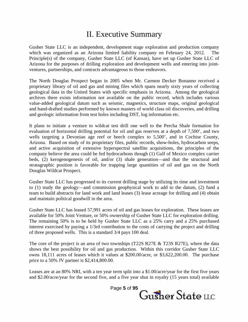
III. Exploration Initial exploration shall be commenced within the parameters of greatest possible success. This includes drilling locations in Township 22S R27E and Township 23S R27E, the ‘core acreage’.
Page 8 of 95
Proposed Drill Locations:
A
B
C
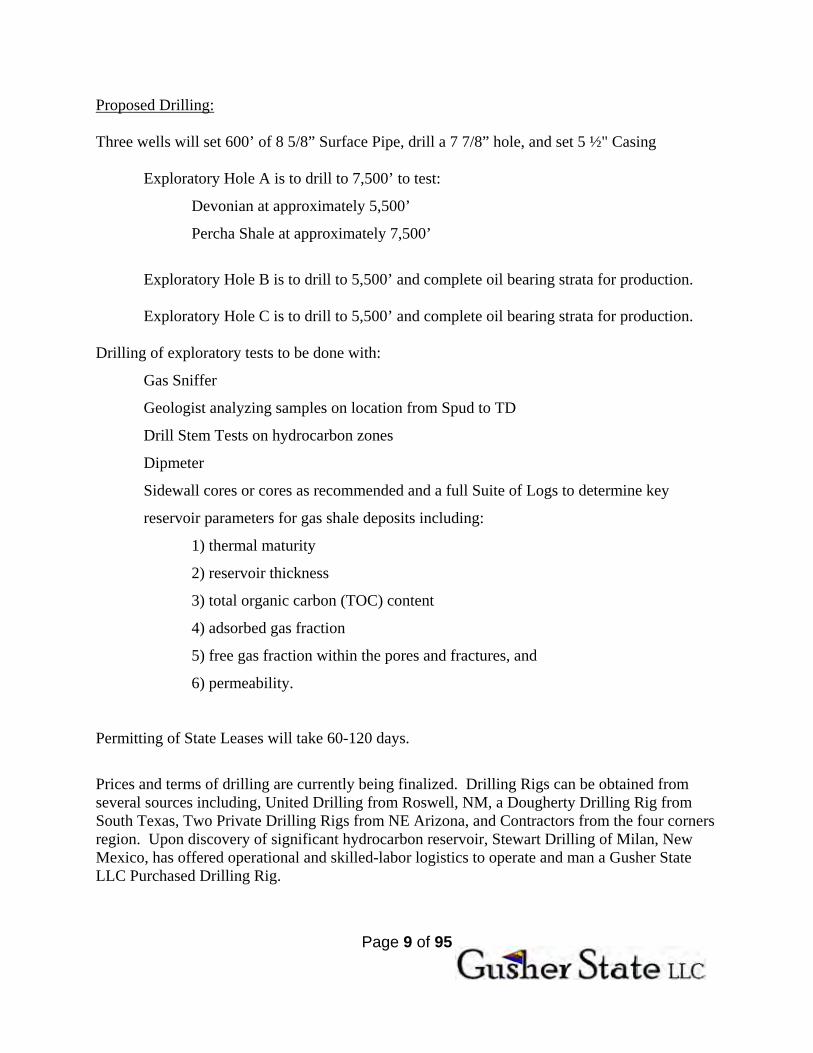
Page 9 of 95
Proposed Drilling: Three wells will set 600’ of 8 5/8” Surface Pipe, drill a 7 7/8” hole, and set 5 ½" Casing
Exploratory Hole A is to drill to 7,500’ to test:
Devonian at approximately 5,500’
Percha Shale at approximately 7,500’
Exploratory Hole B is to drill to 5,500’ and complete oil bearing strata for production. Exploratory Hole C is to drill to 5,500’ and complete oil bearing strata for production.
Drilling of exploratory tests to be done with:
Gas Sniffer
Geologist analyzing samples on location from Spud to TD
Drill Stem Tests on hydrocarbon zones
Dipmeter
Sidewall cores or cores as recommended and a full Suite of Logs to determine key
reservoir parameters for gas shale deposits including:
1) thermal maturity
2) reservoir thickness
3) total organic carbon (TOC) content
4) adsorbed gas fraction
5) free gas fraction within the pores and fractures, and
6) permeability.
Permitting of State Leases will take 60-120 days.
Prices and terms of drilling are currently being finalized. Drilling Rigs can be obtained from several sources including, United Drilling from Roswell, NM, a Dougherty Drilling Rig from South Texas, Two Private Drilling Rigs from NE Arizona, and Contractors from the four corners region. Upon discovery of significant hydrocarbon reservoir, Stewart Drilling of Milan, New Mexico, has offered operational and skilled-labor logistics to operate and man a Gusher State LLC Purchased Drilling Rig.

Page 10 of 95
IV. Possible Cash Flow Scenarios Because there is so little oil and gas production in the state of Arizona, it is impossible to predict flow rates for wells or the density of drilling. Cash flow scenarios are all speculative in nature. There is no guarantee that oil will be found, or that it will produce in commercial quantities. Cash flow scenarios are presented as possible outcomes and are not guaranteed. NRI is 80%.
Therefore calculation of interest is as follows: (Price paid for oil) X 80% X (Number of Barrels Sold) X (Percent Ownership)
Potential Cash Flow For One Oil Well BOPD 100 200 500 1,000 2,000
$/Day $7,200 $14,400 $45,000 $72,000 $144,000$/Month $216,000 $432,000 $1,350,000 $2,160,000 $4,320,000$/Year $2,592,000 $5,184,000 $16,200,000 $25,920,000 $51,840,000
$/Year 50% $1,296,000 $2,592,000 $8,100,000 $12,960,000 $25,920,000Calculated at 80% NRI - $90.00 Oil
Potential Cash Flow For Three Oil Wells BOPD 100 200 500 1,000 2,000
$/Day $21,600 $43,200 $108,000 $216,000 $432,000$/Month $648,000 $1,296,000 $3,240,000 $6,480,000 $12,960,000$/Year $7,884,000 $15,768,000 $39,420,000 $78,840,000 $157,680,000
$/Year 50% $3,942,000 $7,884,000 $19,710,000 $39,420,000 $78,840,000Calculated at 80% NRI - $90.00 Oil

Page 11 of 95
Cash Flow Scenarios:
Potential Cash Flow For One Hundred Wells BOPD Per Well 100 200 500
BOPD 10,000 20,000 50,000 $/Day $720,000 $1,440,000 $3,600,000$/Month $21,600,000 $43,200,000 $108,000,000$/Year $259,200,000 $518,700,000 $1,296,000,000Calculated at 80% NRI - $90.00 Oil
Historic Production:
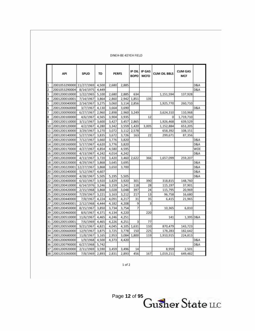
The only production in the state of Arizona was found in Northeast Arizona in the Dineh-Be-Keyah field in the 1960’s. Currently, 9 wells average 9 Bbls production each, totaling Arizona’s production rate of 81 Bbls/day.
2011 Estimates Daily Bbls Oil Production Annual Impact at $90 Oil
Texas 962,000+ $31,601,700,000.00+ Alaska 670,533+ $22,027,009,050.00+
California 536,000+ $17,607,000,000.00+ North Dakota 348,000+ $11,431,800,000.00+ New Mexico 177,000+ $5,814,450,000.00+ Oklahoma 147,000+ $4,828,950,000.00+
Arizona 81 $2,660,850.00 The Dineh-Be-Keyah field was discovered in 1967. With an overall footprint of approximately two square miles, 34 wells have averaged 547,000 Bbls cumulative oil production each.
34 Wells X $90.00 Oil X 547,000 Bbls = $1,673,820,000.00
Arizona’s only oil field has contributed over $1.5 Billion in adjusted economic impact.
Several of these wells IP’d at over 3,000 BOPD: These wells also sold prolific natural
gas.
3,000 BOPD X $90.00 X 80% = $216,000.00/day
*Using current oil prices serves as a quick approximation of inflation adjustment.
Page 12 of 95

Page 13 of 95

Page 14 of 95
V. Development Strategies After production is established, a development plan will have to be enacted to the benefit of all partners, and the project. The best case scenario will depend on the desires of the group moving forward. Given varying levels of success and/or enthusiasm and opportunity, different courses of action may be pursued. Prolific Production: Approximately 36 wells will hold the 57,991 acres owned by Gusher State LLC. Given the best case scenario, A percentage of any of the assets of the project can be sold or negotiated for:
1. Costs of drilling. 2. Checkerboards. 3. Carried Interests. 4. Farmouts.
1. Selling Acreage for Development
a. When the Dineh-Be-Keyah field struck in 1967, the Majors immediately leased all land surrounding, paying Lease Bonuses to the Native Americans of $3,000.00/acre.
b. Given similar activity, the 57,991 acres in hand could be worth $173,973,000.00. 2. Value of Land Work
a. The 18 months that our large ‘home-grown’ land team has already committed to the 39,880 acres of land work near completion would cost companies an average of $50.00-200.00/acre. This would give our completed land work a negotiable value of between $1,994,000.00 and 7,976,000.00.
b. The 18 month head start should also allow for quick lease acquisitions. i. It is presumed that Gusher State will be able to quickly acquire 8-20,000
acres of private land leases upon discovery of oil. 1. It is presumed that the Lease bonuses may be as high as
$200.00/acre on this block (costs $1,600,000.00-$4,000,000.00). 2. Given a $3,000.00/acre value as above, the head start could have a
cash value impact of between $24,000,000.00-$60,000,000.00 (net $22,400,000.00-$56,000,000.00.)
3. Competitive Advantage of Relationships in Mitigating a Land Rush a. If a ‘rush’ hits Cochise County, landmen will find a difficult ‘Grantee’, ‘Grantor’
system of recording in 41 books to be barely navigable, in a courthouse that is ill-equipped to fulfill requests or manage a rush.
b. Gusher State already has an ‘unofficial’ office within the ‘clerks’ office, and has developed strategic relationships and a body of trust between the county government and itself:
i. Given a ‘rush’ of magnitude beyond the scope of the county’s ability; Gusher State is poised to become sole approved contractor or one of a few

Page 15 of 95
approved contractors with access to the vault, to provide land work services that manage such a rush for the benefit of the county offices.
ii. In the event that Gusher State could not become a sole or proprietary contractor, it will have nearly singular access to critical Assessor records which affect the ability to complete chain of title searches.
iii. We will add critical value by being able to search title on leases we wish to acquire.
1. The only historical numbers from the state of Arizona to compare are from the Dineh Be Keyah field.
2. The 547,000 Bbls average X $90.00 oil X 80% NRI would Gross a well site income of $39,384,000.00
4. Split Zones a. Gusher State can enter into contracts on Percha Shale for Horizontal Development
separate for zones reserved for vertical development i.e., Devonian. i. If prolific production is found in the Devonian the value could be
$173.9MM as above. ii. Given a Percha Shale zone that calculates could conservatively bring an
additional $3,000.00/acre by splitting the zones, adding another $173,973,000.00 in value.
5. Cash Flow a. The Dineh Be Keyah had several wells IP at 3,000 BOPD. b. Annual runs of 3 wells at $90 oil and 80% NRI follow:
i. 100 BOPD = $7,884,000.00 ii. 500 BOPD = $39,420,000.00
iii. 1,000 BOPD = $78,840,000.00
Possible Sources of Funding for Development of Field Low High Devonian Acreage
57,991 Acres $3,000.00/Acre $173,973,000.00
Land Work 39,880 $50-200/Acre $22,400,000.00 $56,000,000.00 Percha Shale Acreage
57,991 Acres $3,000.00/Acre $173,973,000.00
Possible Asset Value Additional to Well Sites TOTAL $370,346,000.00 $403,946,000.00 Production 3 Wells
100-1,000 BOPD $7,884,000.00 $78,840,000.00
Possible Available Funds to Develop Field $449,186,000.00 $482,786,000.00

Page 16 of 95
VI. MANAGEMENT
Carmon Decker Bonanno Managing Member, Gusher State LLC.
Mr. Bonanno comes to Gusher State with over 40 years experience as an oil and gas Executive. He has bought, owned, drilled, and developed many oil projects over the past four decades and he has been instrumental in developing and implementing successful management systems for start-up ventures in Kansas, Oklahoma, Texas, New Mexico, Colorado and Arizona. Mr. Bonanno has vast experience in leasing, drilling, and operating oil and gas leases. He is currently a Managing Member of the Victory Family of Companies in Kansas, and he is President and owner of Arizona Oil and Gas Inc., Managing Member American Integrity LLC, and Managing Member of Gateway Commodity LLC-all Arizona Companies.
Christopher Allen Slocum Co-Manager, Gusher State LLC
As a member of Mr. Bonanno’s team for the last twelve years, Mr. Slocum is familiar with the processes and mechanisms of all phases of oil and gas exploration and management with particular skills in setting up and managing information, offices and technology, as well as liaising with technical personnel. He is also the owner of Slocum Royalty LLC, co-owner Victory Companies of Kansas,
Page 17 of 95
Vice-President of Arizona Oil and Gas, Inc, and co-manager of Gusher State LLC, American Integrity LLC and Gateway Commodity LLC.
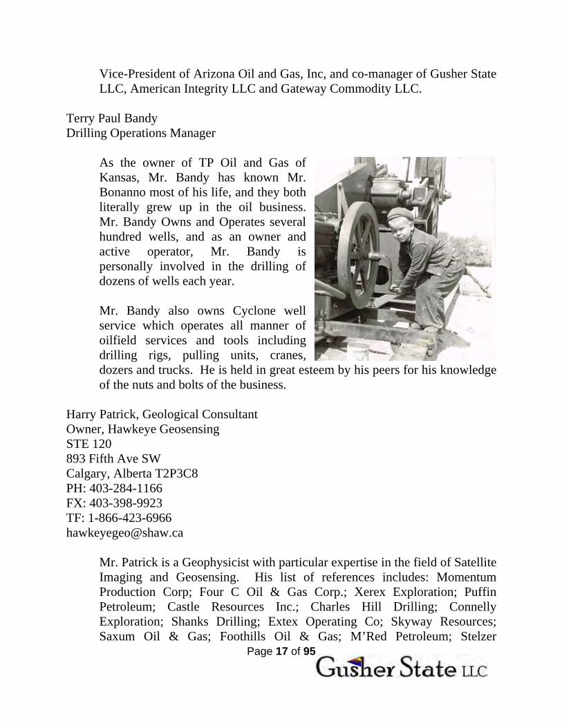
Terry Paul Bandy Drilling Operations Manager
As the owner of TP Oil and Gas of Kansas, Mr. Bandy has known Mr. Bonanno most of his life, and they both literally grew up in the oil business. Mr. Bandy Owns and Operates several hundred wells, and as an owner and active operator, Mr. Bandy is personally involved in the drilling of dozens of wells each year. Mr. Bandy also owns Cyclone well service which operates all manner of oilfield services and tools including drilling rigs, pulling units, cranes, dozers and trucks. He is held in great esteem by his peers for his knowledge of the nuts and bolts of the business.
Harry Patrick, Geological Consultant Owner, Hawkeye Geosensing STE 120 893 Fifth Ave SW Calgary, Alberta T2P3C8 PH: 403-284-1166 FX: 403-398-9923 TF: 1-866-423-6966 [email protected]
Mr. Patrick is a Geophysicist with particular expertise in the field of Satellite Imaging and Geosensing. His list of references includes: Momentum Production Corp; Four C Oil & Gas Corp.; Xerex Exploration; Puffin Petroleum; Castle Resources Inc.; Charles Hill Drilling; Connelly Exploration; Shanks Drilling; Extex Operating Co; Skyway Resources; Saxum Oil & Gas; Foothills Oil & Gas; M’Red Petroleum; Stelzer

Page 18 of 95
Consulting; International Energy Corp; D& J Oil Company; Davis Petroleum Corp; Sparks; IA Operating Inc; Laneer Resources; Arcadia Oil Company; Advanced Oil Corp; Sweet Exploration; Partee Drilling, Inc; Purvis Operating Co; Providence Energy Group; U. S. Energy Development Corp; Reh Oil & Gas, LLC; Victory Minerals LLC; Loewen Operator Inc, and Arizona Oil and Gas Inc. “Satellite imaging technology… uses data gathered by satellite that is processed through a specialized software program designed to measure levels of hydrocarbon emissions. The result is a two dimensional color image that reveals significant information about the geology in and around an oil formation.” “The most asked question is our success ratio and that is important to: HawkEye a known oil and gas area where we can obtain good basic data our percentage should be above 90% when the well is drilled to the basement. However in a wildcat area that percentage will be somewhat less until a good database is developed and the wells are drilled to the basement.”
Dr. Nicholas Short formerly of NASA, references some geochemical information in his 10,000 page introduction to satellite technology. He thereby states that: in addition to other data sets which are/can be acquired from satellite for the exploration of Oil and Gas--such as fault detection, gamma ray halos, surface alteration and chemical reduction, vegetation stress, etc.--direct hydrocarbon detection of C2-C4 is utilized by satellite spectral analysis of reflectance and absorbance at certain bands, which then can be run through a ratio algorithm to predict whether the hydrocarbon pool is oil, gas, or both, and even whether it is an economically viable production pool. This is why satellite interpretation is much more valuable than seismic interpretation as an exploration tool. Seismic will show you structure, but it will not show you hydrocarbons. Direct measurement of hydrocarbons allows for the exploration of stratagraphic traps; and it is capable of showing 'high and dry' locations on structure as well as other geological phenomena that may create 'non reservoir' portions 'dry hole locations' on structure.

Page 19 of 95
VII. ASSETS Gusher State LLC has acquired over 484 square miles of satellite work which shows prolific, world class oil field. Currently owns 57,991 acres of leases on ten year leases over the prospect area. Land and mineral work files have been built on another 27,683 acres. Satellite Work:

Page 20 of 95
Lease Positions:

Page 21 of 95
Lease Positions: PROJECT DATE LEASE # LEASE ACRES BATCH
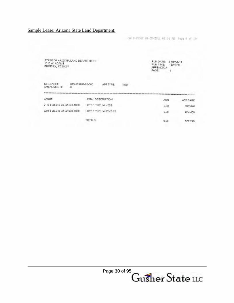
1. SSV 2011 Apr. 25 13-115761 957.24 2. SSV 2011 Apr. 25 13-115762 1,280.00 3. SSV 2011 Apr. 25 13-115763 2,560.00 4. SSV 2011 Apr. 25 13-115764 2,240.00 5. SSV 2011 Apr. 25 13-115765 640.00 6. SSV 2011 Apr. 25 13-115766 2,240.00 7. SSV 2011 Apr. 25 13-115767 2,157.83 12,075.07 8. SSV 2011 Jul. 27 13-115963 2,400.00 9. SSV 2011 Jul. 27 13-115964 2,292.59 10. SSV 2011 Jul. 27 13-115965 1,607.78 11. SSV 2011 Jul. 27 13-115966 2,400.34 12. SSV 2011 Jul. 27 13-115967 1,078.27 13. SSV 2011 Jul. 27 13-115968 862.61 14. SSV 2011 Jul. 27 13-115969 479.88 11,121.47 15. SSV 2011 Jul. 18 2011-17457 966.47 966.47 16. SSV 2011 Aug. 10 13-115993 2,467.23 17. SSV 2011 Aug. 10 13-115994 2,242.96 18. SSV 2011 Aug. 10 13-115995 1,960.00 19. SSV 2011 Aug. 10 13-115996 1,640.00 20. SSV 2011 Aug. 10 13-115997 2,532.64 21. SSV 2011 Aug. 10 13-115998 1,142.20 22. SSV 2011 Aug. 10 13-115999 960.00 23. SSV 2011 Aug. 10 13-116000 2,522.34 24. SSV 2011 Aug. 10 13-116001 1,920.00 25. SSV 2011 Aug. 10 13-116002 2,077.31 26. SSV 2011 Aug. 10 13-116006 633.72 27. SSV 2011 Aug. 10 13-116007 357.01 20,455.41 28. MOORE 2011 Sept. 07 13-116061 1,120.00 29. MOORE 2011 Sept. 07 13-116060 1,760.00 30. MOORE 2011 Sept. 07 13-116059 1,976.00 31. MOORE 2011 Sept. 07 13-116058 2,100.15 32. MOORE 2011 Sept. 07 13-116057 2,377.52 33. MOORE 2011 Sept. 07 13-116056 2,039.68 11,373.35 Gusher State LLC Acreage Holdings 55,991.77
Page 22 of 95
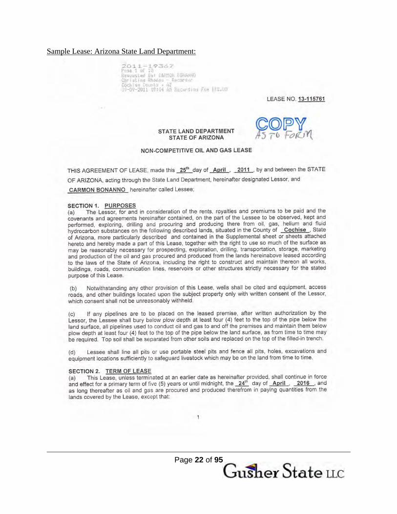
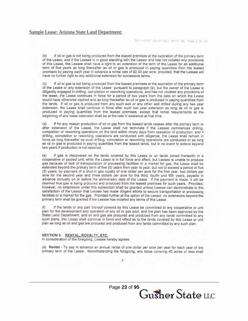
Sample Lease: Arizona State Land Department:
Page 23 of 95
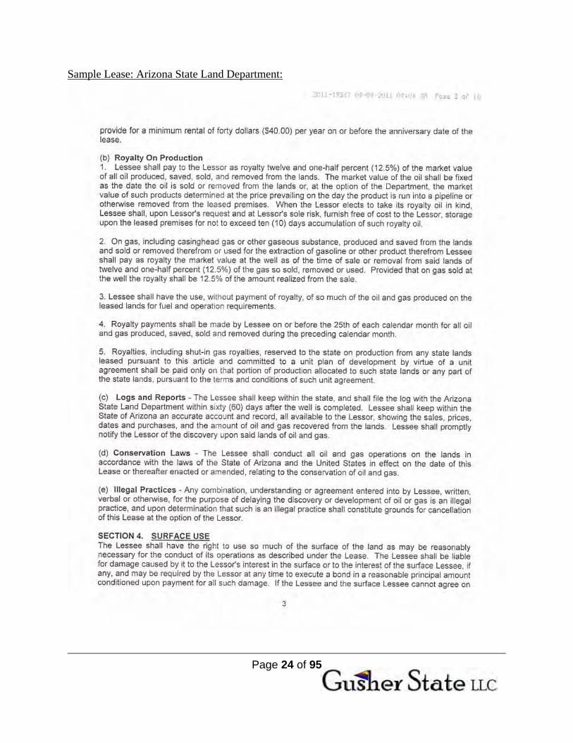
Sample Lease: Arizona State Land Department:
Page 24 of 95
Sample Lease: Arizona State Land Department:

Page 25 of 95
Sample Lease: Arizona State Land Department:

Page 26 of 95
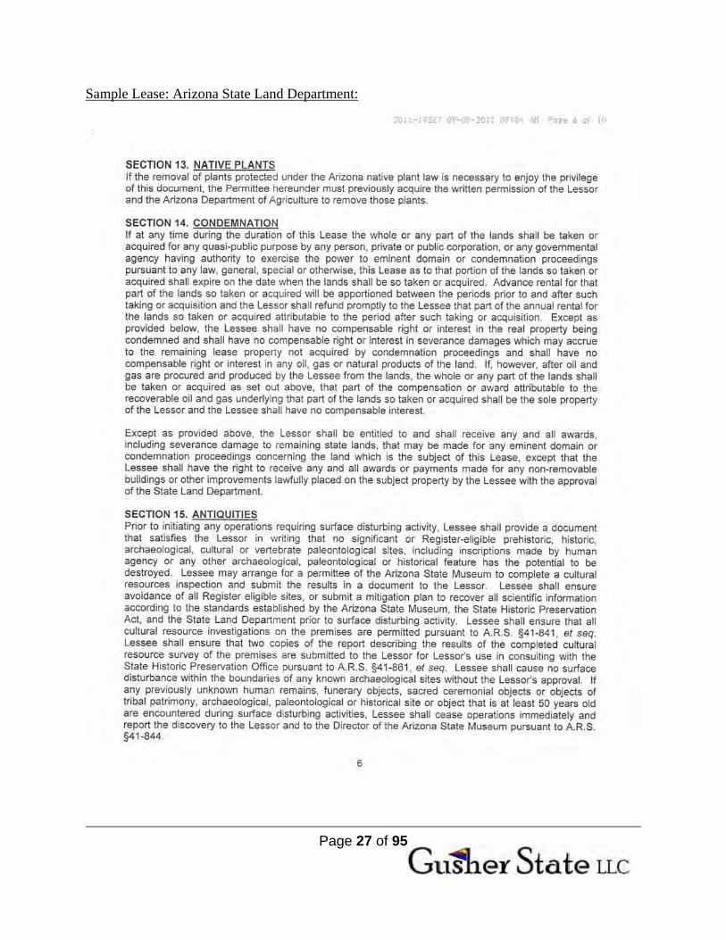
Sample Lease: Arizona State Land Department:
Page 27 of 95
Sample Lease: Arizona State Land Department:

Page 28 of 95
Sample Lease: Arizona State Land Department:
Page 29 of 95
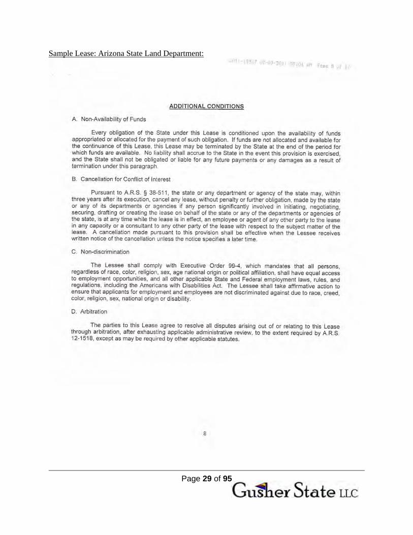
Sample Lease: Arizona State Land Department:
Page 30 of 95
Sample Lease: Arizona State Land Department:

Page 31 of 95
Sample Lease: Arizona State Land Department:

Page 32 of 95
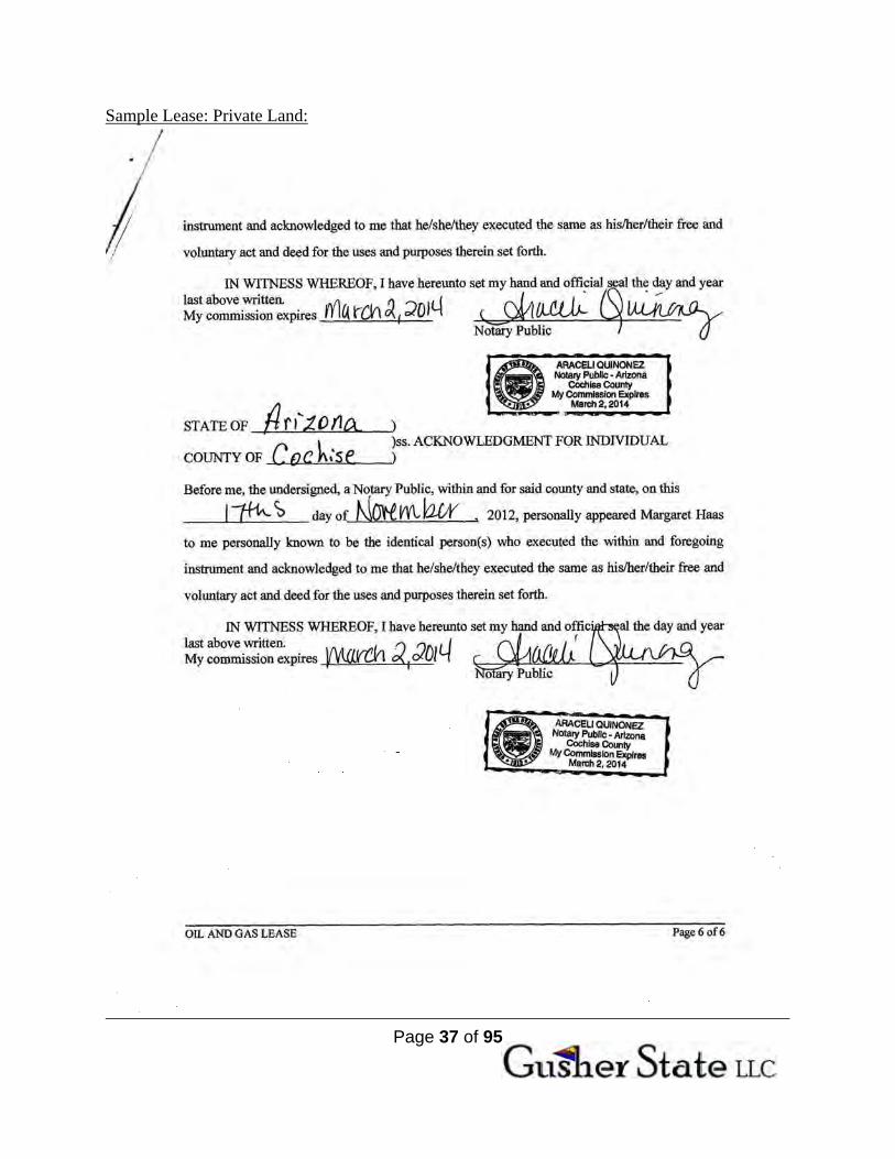
Sample Lease: Private Land:

Page 33 of 95
Sample Lease: Private Land:

Page 34 of 95
Sample Lease: Private Land:

Page 35 of 95
Sample Lease: Private Land:

Page 36 of 95
Sample Lease: Private Land:
Page 37 of 95
Sample Lease: Private Land:
Page 38 of 95
VIII. GEOLOGY Gusher State LLC will bring its experience and expertise in oil and gas development and operations to this proprietary data for the purposes of leasing, wildcatting and developing numerous oil fields covered by the acreage discussed above:
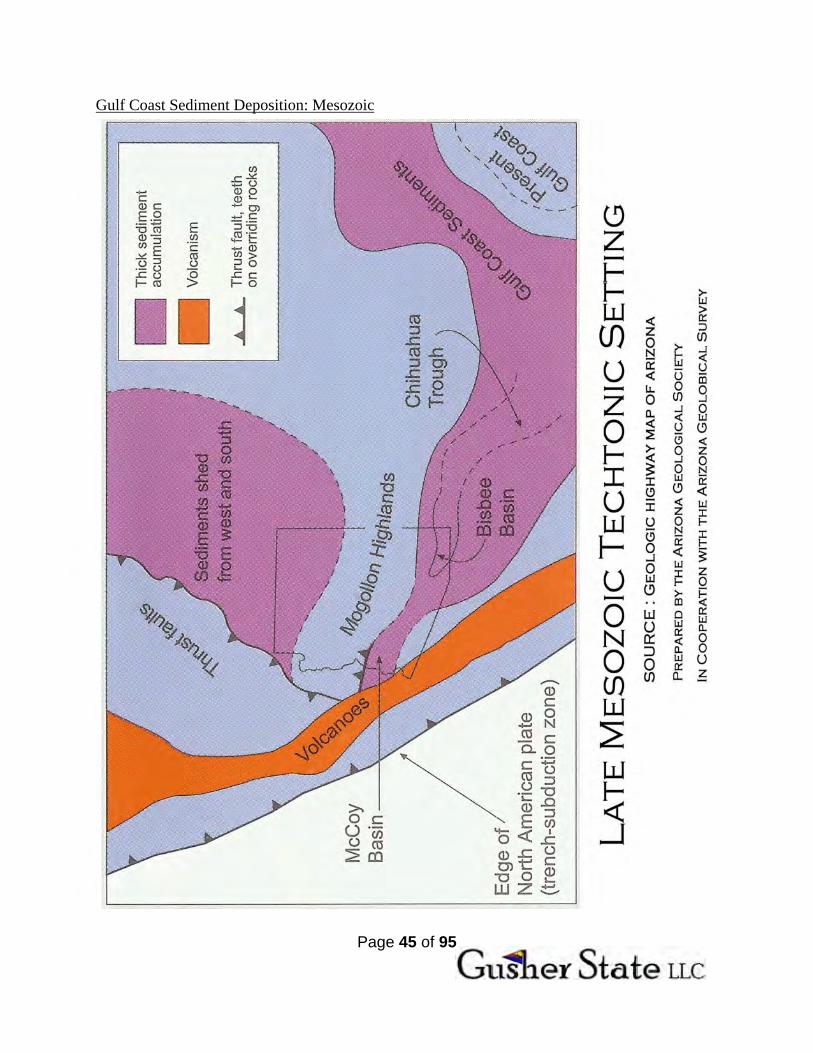
Over geologic time cyclic sedimentation has been caused by erosional forces like wind, glaciation and the rise and fall of the oceans. During the Mesozoic Era the Western Interior Seaway, almost a thousand miles wide at times, flooded one-third of North America, stretching from the Arctic Ocean to the Gulf of Mexico, splitting North America into two major islands. Deep marine sedimentation occurred as a wide variety of rock formations, comprised of algal reefoildal mounds, bioherms, coralline bioclastic carbonate banks, precipitates and back reef evaporates were built up on the floor of the interior seaway. Vast amounts of sediments moved from abysmal plains through the Chihuahua and Sahuaripa Troughs to rest across Texas, northern Mexico and southern Arizona.
Plate tectonics closed the Western Interior Seaway. The entire west coast of North
America was pushed eastward as the Mendocino Fracture Zone shoved the Farallon Plate north and east and under the northwest Pacific Coast, eventually foreshortening it into extinction and merging with the Juan de Fuca Plate, which itself is disappearing under the North American Plate near today’s USA/Canadian border. Effects of the Murray/Molokai Fracture Zone have opened up a waterway on the western coast of Mexico which became the Gulf of California with the Baja Peninsula tied to the west side of the San Andreas transform fault and the Pacific Plate. At the same time, the Cocos Plate was pushing Central America east, raising Belize and the Yucatan Peninsula from the sea, shutting in the south side of the Gulf of Mexico.
The tectonic events of the Pacific Plate shifting caused major events which changed the
landscape in Western North-America: Beginning in the Mississippian time, there was a general uplift of this entire region during the Paleozoic; the extreme tectonic activity of the Nevadan Orogeny occurring at the end of the Jurassic Age; the Laramide Orogenies of the Cenozoic Epoch and; and the most recent Basin and Range events distorted the entire south half of the state of Arizona. In fact, these events have compressed the state from east to west, shortening the distance across the width of Arizona by roughly 120 miles, severely fragmenting the entire rock column in Arizona.
The general uplift and the following orogeny exposed the buried rocks to massive
erosional effects. These ‘scalped’ hundreds of feet of rocks as each zone was lifted from their resting place on the floor of the old Western Interior Seaway. As these rocks were exposed to an array of erosional forces, even more fractures and fissures developed and the tectonic forces shattered hundreds of feet of brittle sediments into thousands of discrete reservoirs. Porosity channels, the ‘carrier beds’, were opened and enhanced by fluid movement, bringing oil and gas rich liquids up from source beds and carrying them into structural and stratigraphic traps. In some cases evaporates plugged, or capped porous formations, creating a variety of containment zones for oil and gas.
Page 39 of 95
After the Uplift period, the Nevadan Orogeny of the Mesozoic Era saw further faulting, with granite intrusives and volcanic outbursts, accompanied by intrusive magma and widespread lava flows. The process was repeated during events of the Cenozoic Era with the Laramide Orogeny reactivating and extending this system of phenomenon. These mountain building forces shattered and fractured the thousands of feet of Paleozoic rock already deposited as part of the prior depositional cycles and were followed by Basin and Range events that left the present day topographic configuration ranging from flat, scrub covered desert, to snow-capped mountain peaks.
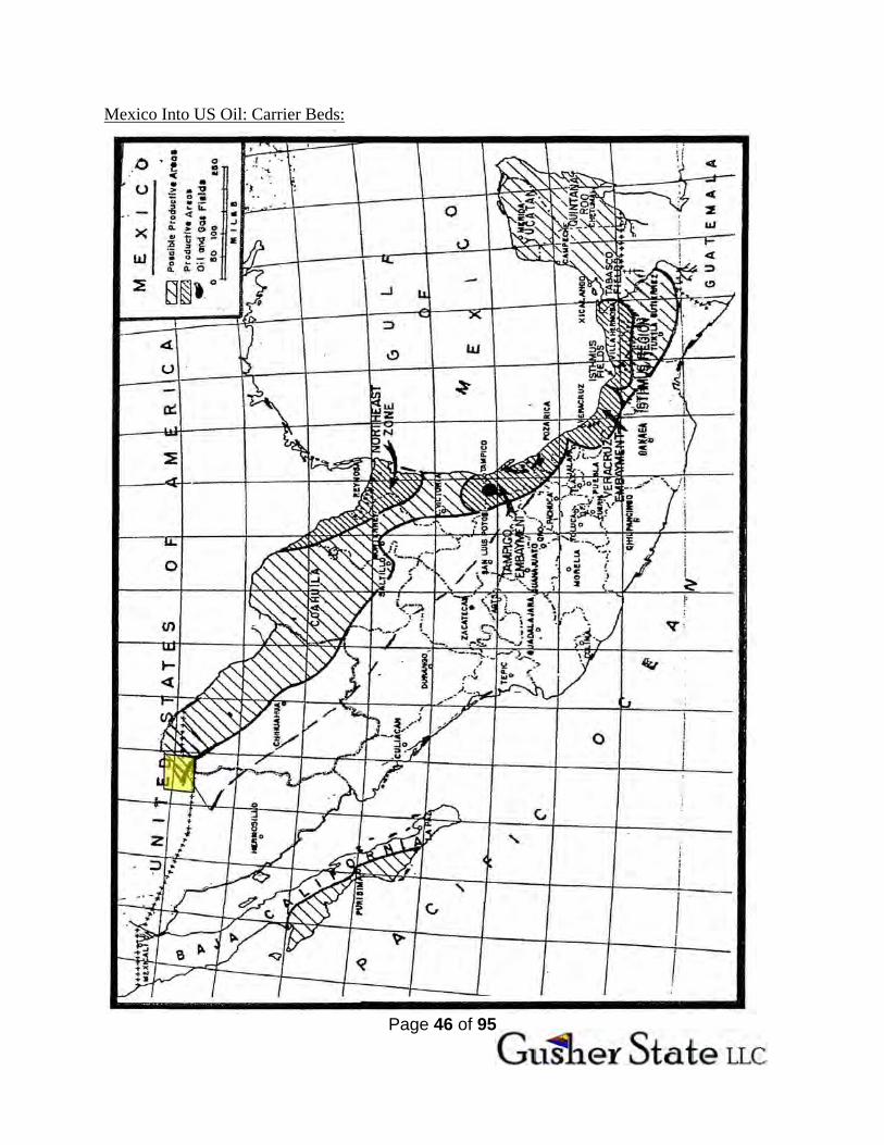
The ‘Gulf of Mexico Complex’ is comprised of the same age and type of reservoir quality
sedimentation throughout. Rich hydrocarbon generating shales feed oil and gas into stratigraphic and structural traps with in the Gulf of Mexico and its perimeter. So called ‘carrier beds’ consisting of especially porous rock formations act like a series of pipelines, allowing oil and gas to migrate through them into reservoir beds where they become trapped.
The Sulphur Springs valley itself acts as a funnel where oil and gas is channeled from
the Sahuaripa and Chihuahua troughs in Mexico north into the complex of structural and stratigraphic reservoirs within the valley, and the deeply faulted nature of the valley makes both pipelines and traps, feeding and holding hydrocarbons in the valley.
The same kind of reef limestones, planktonic organisms, calcareous algae/slate and other interstratified marine sedimentary formations found in Veracruz and Tampico Embayments tie into the rock types of southeast Arizona and Cochise County. Gulf Coast sediments are found across the southern extension of the Rio Grand Embayment and westward through the Chihuahua Trough into what some call the Bisbee Basin that is Cochise County.
The Sulphur Springs Valley is the same kind of intermountain basin that produced
prolific oil fields like those in the famous Railroad Valley region of Nevada basin that contains the Grant Canyon and Eagle Springs Oil Fields which have produced 20,000,000 barrels of oil from as little as 640 acres, with some wells flowing at a rate of 1,000-2,000 barrels of oil per day for several years. A major component of the Railroad Valley oil fields is that meteoric waters (rain-snow) enter porous rock outcrops in the mountains and then descend to depths well below the valley floor where they encounter elevated temperatures from crustal ‘hot-spots. As these heated waters ascend through the rock column, they encounter rich carbon saturated shale formations (i.e. 450’ thick Chainman Shale), ‘cooking’ the oil out of the rocks like the cracking tower of a modern refinery. The water then carries the freed oil upward into structural and stratigraphic traps.
Unlike the famous oil fields of Railroad Valley, the Sulphur Springs Valley Complex is
much closer to the source of hydrocarbons. The Chihuahua Trough acts as a pipeline for oil to migrate from the Gulf of Mexico into the Sulphur Springs Valley. Confined by mountains to the east and west the valley acts as a funnel, feeding hydrocarbons into several thousand feet of reservoir quality rocks. To the north, its migratory path is completely blocked by the Graham Uplift.
Because the geologic conditions of the Sulphur Springs Valley are favorable to
generation, migration and trapping of hydrocarbons, the shallow and near surface oil and gas shows found so often in Cochise County, Arizona are indicative of the giants hiding deep below. Most water wells drilled by ranchers and townsfolk since the late 1800’s have had oil/gas
Page 40 of 95
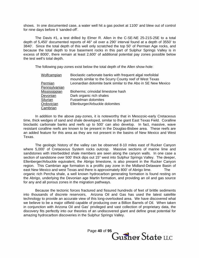
shows. In one documented case, a water well hit a gas pocket at 1100’ and blew out of control for nine days before it ‘sanded-off’.
The Davis #1, a test drilled by Elmer R. Allen in the C-SE-NE 25-21S-25E to a total
depth of 5,450’ documented reports of 46° oil over a 290’ interval found at a depth of 3550’ to 3840’. Since the total depth of this well only scratched the top 50’ of Permian Age rocks, and because the total depth to true basement rocks in this part of Sulphur Springs Valley is in excess of 8000’, there remain at least 2,600’ of additional potential pay zones possible below the test well’s total depth.
The following pay-zones exist below the total depth of the Allen show-hole:
Wolfcampian Bioclastic carbonate banks with frequent algal reefoildal mounds similar to the Scurry County reef of West Texas
Permian Leonardian dolomite bank similar to the Abo in SE New Mexico Pennsylvanian Mississippian Bioherms; crinoidal limestone hash Devonian Dark organic rich shales Silurian Fusselman dolomites Ordovician Ellenburger/Arbuckle dolomites Cambrian
In addition to the above pay-zones, it is noteworthy that in Mesozoic-early Cretaceous
time, thick wedges of sand and shale developed, similar to the giant East Texas Field. Coralline bioclastic carbonate banks and reefs up to 500’ can also develop. In fact, massive, wave resistant coralline reefs are known to be present in the Douglas-Bisbee area. These reefs are an added feature for this area as they are not present in the basins of New Mexico and West Texas.
The geologic history of the valley can be observed 8-10 miles east of Rucker Canyon
where 5,000’ of Cretaceous System rocks outcrop. Massive sections of marine lime and sandstones with interbedded shale members are seen along the canyon walls. In one case a section of sandstone over 500’ thick dips out 15° west into Sulphur Springs Valley. The deeper, Ellenberger/Arbuckle equivalent, the Abrigo limestone, is also present in the Rucker Canyon region. This Cambrian age formation is a prolific pay zone in the Midland-Delaware Basin of east New Mexico and west Texas and there is approximately 800’ of Abrigo lime. The organic rich Percha shale, a well known hydrocarbon generating formation is found resting on the Abrigo, underlying the Devonian age Martin formation, and providing an oil and gas source for any and all porous zones in the migration pathways.
Because the tectonic forces fractured and fissured hundreds of feet of brittle sediments
into thousands of discrete reservoirs, Arizona Oil and Gas has used the latest satellite technology to provide an accurate view of this long-overlooked area. We have discovered what we believe to be a major oilfield capable of producing over a Billion Barrels of Oil. When taken in conjunction with Arizona Oil and Gas’ privileged and vast collection of proprietary data, the discovery fits perfectly into our theories of an undiscovered giant and define great potential for amazing hydrocarbon discoveries in the Sulphur Springs Valley.

Page 41 of 95
North Douglas Cross-Section: Map:

Page 42 of 95
North Douglas Cross-Section:
Page 43 of 95
North Douglas Cross-Section: Paper:

Page 44 of 95
Map of Larussia: North America During Devonian Times:
Page 45 of 95
Gulf Coast Sediment Deposition: Mesozoic
Page 46 of 95
Mexico Into US Oil: Carrier Beds:

Page 47 of 95
ON THE ORIGIN OF KEROGEN, OIL, AND EVERYTHING ELSE or HOW TO MAKE AN OIL FIELD
BY THROWING HOT WATER ON A PERIDOTITE By
Stanley B. Keith
October, 2011
It is widely accepted that kerogen in black shales are a necessary precursor to oil generation at
oil window temperatures between 75 and 135o C. However, kerogen‐like materials also occur in
high energy cosmic settings (supergiant stars near the galactic center and carbonaceous
chrondrite meterorites) and terrestrial settings (mantle olivines, green schist facies, black
shales, hydrothermal metal deposits, experimental hydrothermal hydrolysis of kerogen rich
black shale source rocks, and – especially – its widespread occurrence in oceanic sourced
serpentinites). In addition, the presence of anomalous metal content in black shale kerogen,
well above that found in biospheric material, (elevated Ni, V, Co, Re, Os, and other PGE’s) is
highly anomalous to a low temperature biogenic model. The high temperature‐pressure setting
and anomalous metal chemistry require a reconsideration of the origin of kerogen as well as
that of the oil derivative.
Based on an extensive literature review and our own data, a new model is proposed for the
origin of oil that is consistent with the above observations and new hydrocarbon and metal
chemical data for serpentinites. It is suggested that most, if not all kerogen, originally formed by
hydrothermal metamorphism and hydrolysis of peridotite parents under green schist facies
conditions (Figure 1) in oceanic (Figure 2) and cratonic (Figure 3) settings and blue schist facies
conditions in flat subduction settings (Figure 4). In these settings a relatively hydrogen‐poor
aromatic kerogen type is initially formed by polymerization and chelation of aromatic
hydrocarbons around nickel porphyrin nuclei under highly reductive, non‐ionic supercritical
conditions that attend serpentinization (Figure 1) in ‘kitchens’ where the temperature ranges
between about 300 and 550o C. A buoyant coexisting kerogen and brine product is propelled
Page 48 of 95
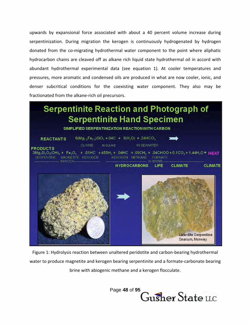
upwards by expansional force associated with about a 40 percent volume increase during
serpentinization. During migration the kerogen is continuously hydrogenated by hydrogen
donated from the co‐migrating hydrothermal water component to the point where aliphatic
hydrocarbon chains are cleaved off as alkane rich liquid state hydrothermal oil in accord with
abundant hydrothermal experimental data (see equation 1). At cooler temperatures and
pressures, more aromatic and condensed oils are produced in what are now cooler, ionic, and
denser subcritical conditions for the coexisting water component. They also may be
fractionated from the alkane‐rich oil precursors.
Figure 1: Hydrolysis reaction between unaltered peridotite and carbon‐bearing hydrothermal
water to produce magnetite and kerogen bearing serpentinite and a formate‐carbonate bearing
brine with abiogenic methane and a kerogen flocculate.

Page 49 of 95
Figure 2: Generation of oceanic serpentosphere. Serpentosphere coincides with the earth’s
oceanic Mohos and is initially formed by off spreading ridge serpentinization (hydrous
metamorphism) of the upper peridotitic mantle by deeply circulating oceanic water at green
schist facies metamorphic conditions. Once initiated, the process continues at a slow rate until
serpentospheres as much as 10 km thick may be formed in old oceanic lithosphere near
continental margins. To some extent, the serpentosphere as used here coincides with the
serpentine layer in the oceanic crust as originally envisioned by Hess (1955).

Page 50 of 95
Figure 3: Generalized Ultradeep Hydrocarbon (UDH) model for a Type II alkaline lherzolitic‐
sourced hydrothermal hydrocarbon system. In this geotectonic setting alkaline lherzolitic
peridotite diapirs initially generated in a normally dipping subduction zone are hydrously
metamorphosed in the middle crust by crustal fluid generated by dehydrations that
attended crustal thickening during prior orogenic events.
Implosion of supercritical metamorphic waters
UDH Oil Window
CONVENTIONAL OIL WINDOW
TYPE II HYDROTHERMAL

Page 51 of 95
Figure 4: Schematic block diagram showing development of deep‐sourced hydrocarbon‐
magnesium‐element rich brine developed by serpentinization of flatly subducting harzburgitic
peridotite and subsequent emplacement into a lacustrine exhalative lake environment/trap
during the Eocene (55 to 43 Ma) as proposed by Johnston and others (2010). This process
operated immediately to the northwest of Milagro and perhaps beneath Milagro in the Eocene.
HC + 1.2H2O = .35HC + .05H2C + .6CO2 + 1.475H2 (1)
Serpentine hydrothermal residual oil carbonate brine
Kerogen plume water refractory kerogen

Page 52 of 95
Only about 20% of the original kerogen is reacted to hydrothermal oil; the rest is carried as a
refractory residuum in hydrothermal brines to surface seep sites where it is expelled as a
chemical flocculate that mechanically accumulates in black shale chemically dominated
sediments along with dolomite, calcite, alkali salts, and minor metal sulfides brought by the
chemical brine component. The hydrocarbon petroleum and gas seepages are associated with
extensive chemical and mud volcanism that is co‐deposited in basin settings or mud volcanic
edifices.
In addition to the surface exhalations, extensive hydrocarbons and brines are coevally
deposited in more familiar reservoir settings such as porous sandstones during low
temperature hydrothermal diagenesis. In such cases, the more buoyant oil component pushes
the brine component to the sides where it precipitates its anomalous element component
marginal to and above the petroleum reservoir. Clay, carbonate, and or anhydrite cement
deposition above or lateral to the petroleum accumulation characteristically results in a self‐
sealing effect. Extensive deposits of hydrothermal dolomite typically form in more proximal
higher temperature settings more proximal to the hydrocarbon deposit – especially the more
alkane dominant, lower density (high gravity) hydrocarbon chemical facies. The entire process
has much in common with Mississippi Valley Pb‐Zn or Tennessee Valley Zn deposits.
The serpentine powered hydrocarbon generation process is global in scale and is associated
with the generation of a thin layer we have dubbed the ‘Serpentosphere.’ The serpentosphere
corresponds with the earth’s Mohorovic (Moho) transition from oceanic and continental crust
to peridotitic upper mantle and is formed hydrothermal metamorphic hydrolysis of the upper
mantle peridotite section in a manner similar to Figure 1 above. We propose that both the
oceanic and continental Moho transitions into peridotitic lithospheric mantle are or were
largely serpentinite. Solid state serpentinization products of hydrous metamorphism by carbon‐
dioxide rich seawater accumulate under the ocean basins in an oceanic serpentosphere Moho
layer similar to that originally proposed by Harry Hess (see Figure 2). The oceanic lizarditic

Page 53 of 95
serpentosphere begins within a few kilometers of the oceanic spreading centers and
continuously generates to thicknesses as much as 10 kilometers under old oceanic crusts near
continental margins. Additional higher pressure antigoritic serpentosphere is formed where
oceanic serpentospheres are subducted into the earth’s trench systems and during flat
subduction events are accreted to the base of the continental crustal lithosphere to form the
continental Moho (Figure 3). Significant volumes of serpentinization can take place in the
earth’s cratonic basements where incoming alkaline lherzolitic peridotites are hydrously
metamorphosed to serpentinite by carbon‐dioxide rich fluid dehydrational products of former
orogenic prograde metamorphisms associated with crustal thickening (Figure 4).
Serpentinization of incipient spreading center depleted peridotite can take place in incipient
continental rifts (African rift system) which then can evolve into mature continental margin
settings (offshore Brazil). The amount of total serpentinization in the above settings is
estimated to be at least 10 times that of all of the sediments that have accumulated in
sedimentary basins at the top of the earth’s crust and is certainly scale correct enough to
produce and have produced all of the hydrocarbons that have been generated throughout
earth history prior to the presence of significant biosphere mass (for example, the 2.0 Ga
supergiant Shunga hydrocarbon province in the Baltic Shield of northwest Russia).
The equation in Figure 1 also demonstrates that the serpentinization is also important to other
major planet scale geologic processes in addition to those that generate hydrocarbons. It has
been shown that organic acids like formate which are important early steps in the reaction
sequence that ultimately leads to the formation of DNA are formed from the serpentinization
process (indeed the current news cycle is alive with the story of DNA building block organic
molecules that have been recently found and have probably have formed as kerogen has on
carbonaceous meteorites [in addition to serpentine like phyllosilicates]). Carbon dioxide is a
major reaction product as is lesser methane of the serpentinization reaction. Such green house
gas production may have a major regulatory effect on global climate change as does the
exothermic heat production. The mechanical properties of serpentine as a semi‐plastic rheid
have major implications for plate tectonic mechanisms if the serpentosphere is real. In effect,

Page 54 of 95
the serpentosphere layer provides a tectonic grease for the earth’s plates to glide and slide
around on. The above observations strongly suggest that the serpentinization process may be
one of the most important chemical reactions that take place on this water‐rich planet (the only
one that we know of).
Liquid oil petroleum products from serpentinization can form in virtually all of the above
geotectonic settings. Petroleum is generated the forearc environment of normal dip subduction
(modern‐day Mariana serpentinite forearc mud volcanic belt and the paleo mid‐Miocene
serpentinte protrusion belt and associated southern Great Valley petroleum province).
Hydrocarbons are formed by serpentinization during flat subduction of oceanic depleted
harzburgitic peridotite (modern day south Caspian Sea/Trinidad hydrocarbon hydrocarbon‐
related mud volcanism and the paleo mid‐Eocene age, shallow subduction Green River
hydrocarbon region). Serpentinization of alkaline deep subduction generated enriched
lherzolitic peridotite ultimately leads to the production of heavier hydrocarbon plumes (the
Alberta heavy oil sands and Gulf of Mexico region. Serpentinization of depleted upper mantle
peridotite beneath incipient continental rifts (modern day African Rift system, and the evolved
continental rift margins (late Jurassic North Sea and early Cretaceous offshore Brazil) can lead
to world class hydrocarbon generation, migration, and entrapment.
As stated above, serpentinization has operated thoughout earth history and continues to
manufacture its hydrocarbon related product today. What modern explorationists need to do is
tap into ‘modern gas stations’ produced by active serpentinzation and the oil crisis will be
solved. Modern filling stations may have already been tapped and are being tapped at Eugene
Island in the Gulf of Mexico, the Ventura, Los Angeles Basins, and Santa Barbara Channel near
where the Murray fracture system comes onshore; the Amistad supergiant gas field near where
the Carnegie oceanic fracture zone comes onshore; the southern Caspian Sea active flat
subduction zone; and the Persian Gulf flat subduction zone. All of these locations have coupled
magnetic high and gravity low signatures consistent with serpentinization that is actively
generating modern‐day hydrocarbons. There is no geologic oil crisis; only a crisis of imagination
in the minds of men.

Page 55 of 95

Page 56 of 95

Page 57 of 95

Page 58 of 95

Page 59 of 95
Page 60 of 95

Page 61 of 95
Page 62 of 95

Page 63 of 95

Page 64 of 95

Page 65 of 95

Page 66 of 95
Page 67 of 95

Page 68 of 95

Page 69 of 95
IX. Operating Agreement of Gusher State LLC

Page 70 of 95
Page 71 of 95

Page 72 of 95

Page 73 of 95

Page 74 of 95
Page 75 of 95

Page 76 of 95

Page 77 of 95

Page 78 of 95

Page 79 of 95
Page 80 of 95

Page 81 of 95

Page 82 of 95

Page 83 of 95

Page 84 of 95

Page 85 of 95

Page 86 of 95

Page 87 of 95

Page 88 of 95
Page 89 of 95

Page 90 of 95

Page 91 of 95

Page 92 of 95

Page 93 of 95

Page 94 of 95

Page 95 of 95
X. MISSION STATEMENT
Mission Statement:
Gusher State LLC’s mission is to be at the helm of the oil and gas industry in Arizona by utilizing its proprietary data, leasing and wildcatting programs, and strategic partnerships to drive Arizona’s oil and gas industry.