Embed Size (px)
Citation preview
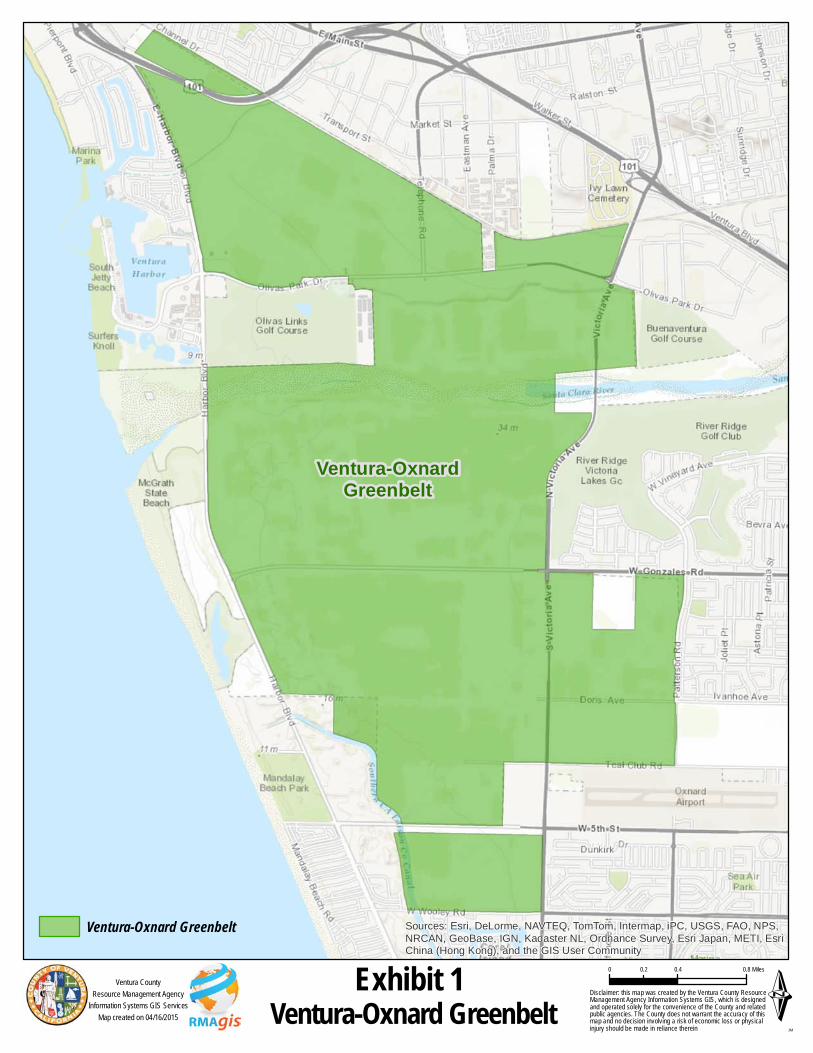
Ventura-OxnardGreenbelt
Sources: Esri, DeLorme, NAVTEQ, TomTom, Intermap, iPC, USGS, FAO, NPS,NRCAN, GeoBase, IGN, Kadaster NL, Ordnance Survey, Esri Japan, METI, EsriChina (Hong Kong), and the GIS User Community
ÉVentura-Oxnard Greenbelt Disclaimer: this map was created by the Ventura County ResourceManagement Agency Information Systems GIS, which is designedand operated solely for the convenience of the County and relatedpublic agencies. The County does not warrant the accuracy of thismap and no decision involving a risk of economic loss or physicalinjury should be made in reliance therein
0 0.4 0.80.2 Miles
JM
Ventura CountyResource Management Agency
Information Systems GIS ServicesMap created on 04/16/2015
Ventura-Oxnard Greenbelt
Exhibit 1
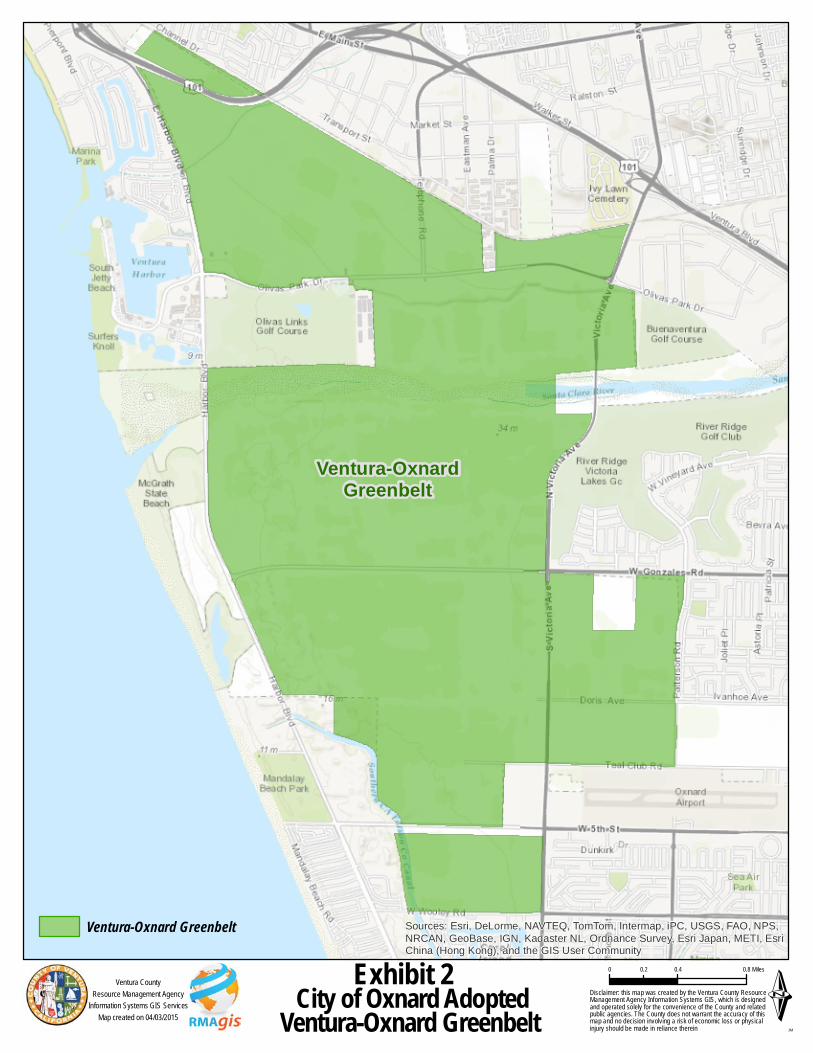
Ventura-OxnardGreenbelt
Sources: Esri, DeLorme, NAVTEQ, TomTom, Intermap, iPC, USGS, FAO, NPS,NRCAN, GeoBase, IGN, Kadaster NL, Ordnance Survey, Esri Japan, METI, EsriChina (Hong Kong), and the GIS User Community
ÉCity of Oxnard AdoptedVentura-Oxnard Greenbelt Disclaimer: this map was created by the Ventura County ResourceManagement Agency Information Systems GIS, which is designedand operated solely for the convenience of the County and relatedpublic agencies. The County does not warrant the accuracy of thismap and no decision involving a risk of economic loss or physicalinjury should be made in reliance therein
0 0.4 0.80.2 Miles
JM
Ventura CountyResource Management Agency
Information Systems GIS ServicesMap created on 04/03/2015
Ventura-Oxnard Greenbelt
Exhibit 2
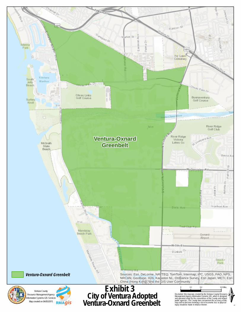
Ventura-OxnardGreenbelt
Sources: Esri, DeLorme, NAVTEQ, TomTom, Intermap, iPC, USGS, FAO, NPS,NRCAN, GeoBase, IGN, Kadaster NL, Ordnance Survey, Esri Japan, METI, EsriChina (Hong Kong), and the GIS User Community
ÉCity of Ventura AdoptedVentura-Oxnard Greenbelt Disclaimer: this map was created by the Ventura County ResourceManagement Agency Information Systems GIS, which is designedand operated solely for the convenience of the County and relatedpublic agencies. The County does not warrant the accuracy of thismap and no decision involving a risk of economic loss or physicalinjury should be made in reliance therein
0 0.4 0.80.2 Miles
JM
Ventura CountyResource Management Agency
Information Systems GIS ServicesMap created on 04/03/2015
Ventura-Oxnard Greenbelt
Exhibit 3