Embed Size (px)
Citation preview
Cambridge Archaeological Journalhttp://journals.cambridge.org/CAJ
Additional services for Cambridge Archaeological Journal:
Email alerts: Click hereSubscriptions: Click hereCommercial reprints: Click hereTerms of use : Click here
Excavations at Bolsay Farm, a Mesolithic Settlement on Islay
Steven Mithen, Bill Finlayson, Nyree Finlay and Mark Lake
Cambridge Archaeological Journal / Volume 2 / Issue 02 / October 1992, pp 242 253DOI: 10.1017/S0959774300000627, Published online: 22 December 2008
Link to this article: http://journals.cambridge.org/abstract_S0959774300000627
How to cite this article:Steven Mithen, Bill Finlayson, Nyree Finlay and Mark Lake (1992). Excavations at Bolsay Farm, a Mesolithic Settlement on Islay. Cambridge Archaeological Journal, 2, pp 242253 doi:10.1017/S0959774300000627
Request Permissions : Click here
Downloaded from http://journals.cambridge.org/CAJ, IP address: 144.82.107.37 on 30 Jan 2013
Steven Mithen et al.
Excavations at Bolsay Farm, aMesolithic Settlement on Islay
Steven Mithen, Bill FinlaysonNyree Finlay & Mark Lake
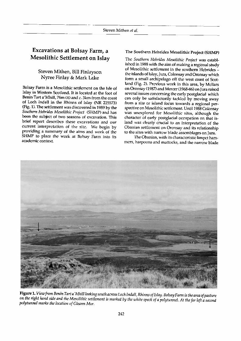
Bolsay Farm is a Mesolithic settlement on the Isle ofIslay in Western Scotland. It is located at the foot ofBenin Tart a'Mhill, 76m OD and c. 3km from the coastof Loch Indall in the Rhinns of Islay (NR 225573)(Fig. 1). The settlement was discovered in 1989 by theSouthern Hebrides Mesolithic Project (SHMP) and hasbeen the subject of two seasons of excavation. Thisbrief report describes these excavations and ourcurrent interpretation of the site. We begin byproviding a summary of the aims and work of theSHMP to place the work at Bolsay Farm into itsacademic context.
The Southern Hebrides Mesolithic Project (SHMP)
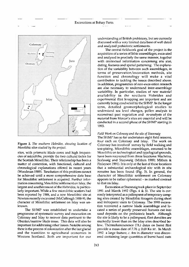
The Southern Hebrides Mesolithic Project was establ-ished in 1988 with the aim of making a regional studyof Mesolithic settlement in the southern Hebrides -the islands of Islay, Jura, Colonsay and Oronsay whichform a small archipelago off the west coast of Scot-land (Fig. 2). Previous work in this area, by Mellarson Oronsay (1987) and Mercer (1968-86) on Jura raisedseveral issues concerning the early postglacial whichcan only be satisfactorily tackled by moving awayfrom a site or island focus towards a regional per-spective on Mesolithic settlement. Until 1988 Colonsaywas unexplored for Mesolithic sites, although thecharacter of early postglacial occupation on that is-land was clearly crucial to an interpretation of theObanian settlement on Oronsay and its relationshipto the sites with narrow blade assemblages on Jura.
The Obanian, with its characteristic limpet ham-mers, harpoons and mattocks, and the narrow blade
Figure 1. View from Benin Tart a'Mhill looking south across Loch Indall, Rhinns of Islay. BolsayFarm is the area of pastureon the right hand side and the Mesolithic settlement is marked by the white speck of a polytunnel. At the far left a secondpolytunnel marks the location of Gleann Mor.
242
Excavations at Bolsay Farm
Figure 2. The southern Hebrides, showing location ofMesolithic sites studied by the project.
sites, with prismatic blade cores and high frequen-cies of microliths, provide the two cultural facies forthe Scottish Mesolithic. Their relationship has been amatter of contention, with functional, cultural andchronological explanations offered in recent years(Woodman 1989). Resolution of this problem cannotbe achieved until a more comprehensive data basefor Mesolithic settlement is acquired. Further infor-mation concerning Mesolithic settlement on Islay, thelargest and southernmost of the Hebrides, is particu-larly important. While a few microlithic scatters hadbeen reported by 1988, and a new Mesolithic site atNewton recently excavated (McCullough 1988-9), thecharacter of Mesolithic settlement on Islay was un-known.
The SHMP was established to undertake aprogramme of systematic survey and excavation onColonsay and Islay to recover data pertinent to theObanian/narrow blade issue. This data will also beimportant for addressing other issues. Notable amongthese is the process of colonization after the last glacialand the transition to agricultural economies inWestern Scotland. Both are important for our
understanding of British prehistory, but are currentlydiscussed with a very limited data base of well datedand analyzed prehistoric settlements.
The central fieldwork goal of the project is theacquisition of a series of lithic assemblages, excavatedand analysed in precisely the same manner, togetherwith contextual information concerning site size,dating, features and spatial patterning. The explana-tion of the variability between such assemblages, interms of preservation/excavation methods, sitefunction and chronology will make a vitalcontribution to tackling the issues described above.In addition, programmes of non-excavation researchare also necessary to understand inter-assemblagevariability. In particular, studies of raw materialavailability in the southern Hebrides andexperimental flint knapping are important and arecurrently being conducted by the SHMP. In the longerterm, detailed geomorphological studies tounderstand sea level changes, pollen analysis toreconstruct past vegetation and re-analysis of thematerial from Mercer's sites are essential and will beconducted in a second phase of the SHMP starting in1993.
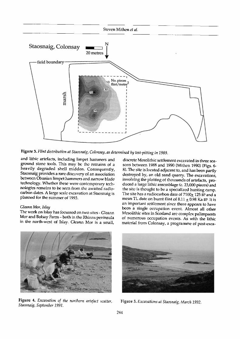
Field Work on Colonsay and the site of StaosnaigThe SHMP has so far undertaken eight field seasons,four each on Colonsay and Islay. The work onColonsay has involved survey by field walking andtest-pitting. Microlithic assemblages, assumed to beMesolithic on technological and typological grounds,have been recovered from three locations: Machrins,Scalasaig and Staosnaig (Mithen 1989; Mithen &Finlayson 1991). It is only at the last of these locationsthat a substantial archaeological site with in situremains has been found (Fig. 3). In general, thecharacter of Mesolithic settlement on Colonsayappears to be rather ephemeral - in marked contrastto that on Islay.
Excavation at Staosnaig took place in September1991 and March 1992 (Figs. 4 & 5). The site is cur-rently interpreted as a palimpsest of temporary camp-ing sites created by Mesolithic foragers during shortand infrequent visits to Colonsay. The 1990 excava-tion recovered a narrow blade assemblage and lo-cated a series of poorly preserved features cut intosand deposits on the prehistoric beach. Althoughthe site is likely to be a palimpsest, flint densities aremarkedly lower than on the Islay sites described be-low. Thermoluminesence (TL) dates on burnt flintprovide a mean date of 7.76 + 0.69 Ka BP. In March1992 a large feature, c. 4m in diameter was discov-ered containing large quantities of burnt hazel nuts
243
Steven Mithen et al.
Staosnaig, Colonsay N
Figure 3. Flint distribution at Staosnaig, Colonsay, as determined by test-pitting in 1989.
and lithic artefacts, including limpet hammers andground stone tools. This may be the remains of aheavily degraded shell midden. Consequently,Staosnaig provides a rare discovery of an associationbetween Obanian limpet hammers and narrow bladetechnology. Whether these were contemporary tech-nologies remains to be seen from the awaited radio-carbon dates. A large scale excavation at Staosnaig isplanned for the summer of 1993.
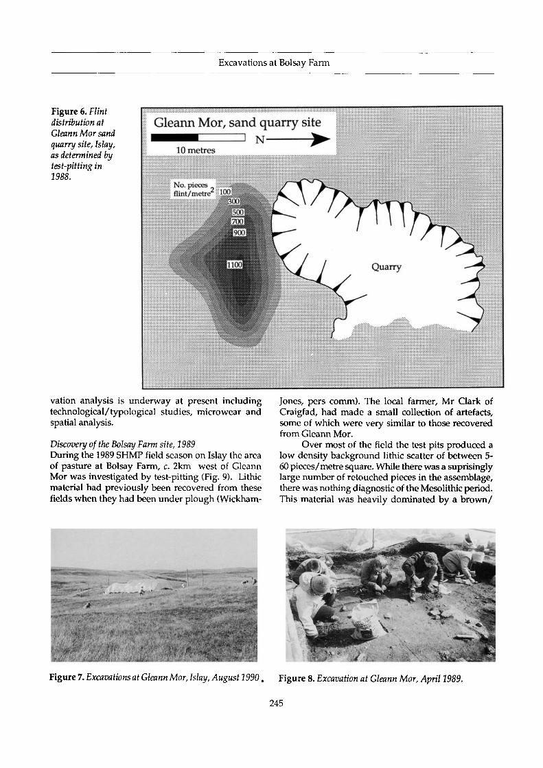
Gleann Mor, IslayThe work on Islay has focussed on two sites - GleannMor and Bolsay Farm - both in the Rhinns peninsulain the north-west of Islay. Gleann Mor is a small,
discrete Mesolithic settlement excavated in three sea-sons between 1988 and 1990 (Mithen 1990) (Figs. 6-8). The site is located adjacent to, and has been partlydestroyed by, an old sand quarry. The excavations,involving the plotting of thousands of artefacts, pro-duced a large lithic assemblage (c. 23,000 pieces) andthe site is thought to be a specialized hunting camp.The site has a radiocarbon date of 7100+ 125 BP and amean TL date on burnt flint of 8.11 + 0.98 Ka BP. It isan important settlement since there appears to havebeen a single occupation event. Almost all otherMesolithic sites in Scotland are complex palimpsestsof numerous occupation events. As with the lithicmaterial from Colonsay, a programme of post-exca-
' • • • * • • ; <
Figure 4. Excavation of the northern artefact scatter,Staosnaig, September 1991.
Figure 5. Excavations at Staosnaig, March 1992.
244
Excavations at Bolsay Farm
Figure 6. Flintdistribution atGleann Mor sandquarry site, Islay,as determined bytest-pitting in1988.
Gleann Mor, sand quarry siteD N -
10 metres
No. piecesflint/metre2 1 0 0 ^
vation analysis is underway at present includingtechnological/typological studies, microwear andspatial analysis.
Discovery of the Bolsay Farm site, 1989During the 1989 SHMP field season on Islay the areaof pasture at Bolsay Farm, c. 2km west of GleannMor was investigated by test-pitting (Fig. 9). Lithicmaterial had previously been recovered from thesefields when they had been under plough (Wickham-
Jones, pers comm). The local farmer, Mr Clark ofCraigfad, had made a small collection of artefacts,some of which were very similar to those recoveredfrom Gleann Mor.
Over most of the field the test pits produced alow density background lithic scatter of between 5-60 pieces/metre square. While there was a suprisinglylarge number of retouched pieces in the assemblage,there was nothing diagnostic of the Mesolithic period.This material was heavily dominated by a brown/
Figure 7. Excavations at Gleann Mor, Islay, August 1990, Figure 8. Excavation at Gleann Mor, April 1989.
245

Steven Mithen et al.
Figure 9. Test-pitting at Bolsay Farm, April 1989.
blade cores and microliths - an assemblage similar tothat which we were currently excavating at GleannMor. Moreover, the soil profile changed to include adeep deposit (c. lm) of varying sediments with astratigraphy too complex to understand in a 0.5mtest pit.
The immediate area around this test pit wasexplored by test pits at 10 and 5m intervals. Thesedemonstrated a discrete, high density scatter ofmicrolithic material in the north-west part of the field(Fig. 10) with technological and typological charact-eristics very similar to those in the assemblage fromGleann Mor.
Excavations at Bolsay Farm
honey coloured flint, whereas on local Mesolithic sites Two seasons of excavation have taken place at Bolsayit is usual to have a wider range of flint colours with Farm. In 1990 a 7 x 4m trench was excavated in thea dominance of grey. The soil profile in these test pits eastern half of the microlithic scatter. The specificconsisted of c. 20cm of plough soil directly overlying aim was to establish the stratigraphy of the site, withbrown/orange glacial sediment. In the northwest particular regard to the preservation of undisturbedportion of the field, however, this pattern was dramat- Mesolithic deposits, and to acquire material forically changed when one single test pit produced absolute dating. Owing to the unexpectedly largeover 500 pieces of worked flint including numerous quantities of lithic material discovered, only a 0.5 x
78m
1990 excavation
i
77m
Figure 10. Flint distributionat Bolsay Farm as determinedby test-pitting in 1989, andlocation of 1990 & 1992trenches.
76m
75m
, ' 1989 0.5m test pit ,"'
1992 excavation:
,. 74m
73m'
246

Excavations at Bolsay Farm
Figure 11.Stratigraphic
section exposed atBolsay Farm,
August 1990. Dr\ N.Debenham of the
British Museum isseen takingreadings for
thermoluminesencedating.
7.0m section of this trench was excavated through allcontexts to the natural (Figs. 11 & 13).
This excavation demonstrated that an extensivearea of Mesolithic occupation deposits was preservedat Bolsay Farm and consequently the 1992 excava-
tion aimed to acquire data for a spatial study of arte-fact distributions. To this end, a 20 x 15m trench wasopened (Fig. 12). Following removal of the topsoiland immediately underlying colluvial deposits bymechanical excavator, a 5cm thick layer of Mesolithicoccupation deposits (contexts 4 & 5, see below) wasremoved over the complete area in 4800 0.25cmquadrats. As with soil from the 1990 excavation, thatfrom each quadrat was washed through a 3mm sieveand finds 'picked' from the residue. Duringexcavation, samples were regularly taken for flotationand environmental analysis. Evidence was foundduring the excavation of later prehistoric activity onthe site in the form of pottery and a ground stoneaxe.
Stratigraphy and site formation (Figs. 13 & 14)At the base of the sequence at Bolsay Farm is a glacialmarine sediment. This is principally an orange claybut varies in character across the 1992 trench from anorange gravel at the northern end to a yellow/whitecoarse sand in the south. A series of deposits aresandwiched between this and the overlying topsoil.
..«*.
Figure 12. Excavationat Bolsay Farm, July 1992. The polythene sacks across the site contain soil from 0.25m quadrats andare being labelled for wet sieving.
247

Steven Mithen et al.
1 metre
Bolsay Farm, 1990North-east facing section
Stone lined drain
Figure 13. North-east facing section, Bolsay Farm 1990.
/ 1990 section(see fie. 13)
Figure 14.1992excavation plan, BolsayFarm, showing themajor contexts exposedfollowing removal ofploughsoil and contexts2 & 3. The two dashedlines mark the lm stripfor which debitagedensities are illustratedin Fig. 15.
2484 metres
Excavations at Bolsay Farm
Directly above the glacialsediment is a grey podsol(context 5) or, at the northernend of the trench, a morecompact pinky horizon witha higher clay and less organiccontent (4) which lenses outbetween the podsol and theglacial sediment. A series ofpoorly preserved featureswere found cut into this con-text. These two deposits raneast-west across the site fill-ing a linear depression whichis partly natural and partlyfrom an artificial cut. Ploughmarks were found cut into thesurface of context 5. Betweencontexts 4 and 5 (interpretedas Mesolithic occupationdeposits) and the topsoil wasc. 40cm of more (3) or less (2)compact brown soil, in whichthere were further ploughmarks. In the south-east partof the trench a thin lens ofpeaty sediment was sand-wiched between contexts 5and 3. A stone-built land-drain running east west hadbeen cut into the depositsprior to the modern topsoil.Further clay pipe drains run-ning approximately north-south had been laid cuttingthrough the topsoil. All thedeposits between the glacialsediment and the topsoil havesimilar fractions of silt, sandand clay and contain largequantities of flint artefacts.
The current inter-pretation of this soil profileand process of site formationcan be summarized in sixphases of cultural and naturalactivity at the site. Thissequence remains a working
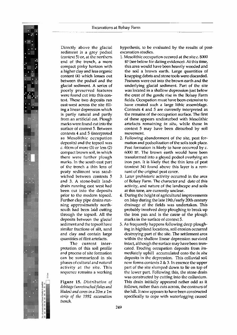
Figure 15. Distribution ofdebitage (unretouched flakes andblades) and cores in a 20m xlmstrip of the 1992 excavationtrench.
hypothesis, to be evaluated by the results of post-excavation studies.1. Mesolithic occupation occured at the site c. 8000
BP (see below for dating evidence). At this time,this area would have been heavily wooded andthe soil a brown earth. Large quantities ofknapping debris and stone tools were discarded.Features were cut into the brown earth and theunderlying glacial sediment. Part of the sitewas located in a shallow depression just belowthe crest of the gentle rise in the Bolsay Farmfields. Occupation must have been extensive tohave created such a large lithic assemblage.Contexts 4 and 5 are currently interpreted asthe remains of the occupation surface. The firstof these appears undisturbed with Mesolithicartefacts remaining in situ, while those incontext 5 may have been disturbed by soilmovement.
2. Following abandonment of the site, peat for-mation and podsolization of the soils took place.Peat formation is likely to have occurred by c.6000 BP. The brown earth would have beentransformed into a gleyed podsol overlying aniron pan. It is likely that the thin lens of peat(context 34) found above this layer is a rem-nant of the original peat cover.
3. Later prehistoric activity occurred in the areaof Bolsay Farm. The character and date of thisactivity, and nature of the landscape and soilsat this time, are currently unclear.
4. During the height of agricultural improvementson Islay during the late 19th/early 20th centurydrainage of the fields was undertaken. Thisprobably involved deep ploughing to break upthe iron pan and is the cause of the ploughmarks in the surface of context 5.
5. As frequently happens following deep plough-ing in highland locations, soil erosion occurreddestroying part of the site. The settlement areawithin the shallow linear depression survivedintact, although the surface may have been trun-cated. Eroding occupation deposits from im-mediately uphill accumulated onto the in situdeposits in the depression. This colluvial soilnow forms contexts 2 & 3. In essence the upperpart of the site slumped down to lie on top ofthe lower part. Following this, the stone drainwas constructed by cutting into the colluvium.This drain initially appeared rather odd as itfollows, rather than cuts across, the contours ofthe hill. It now appears to have been constructedspecifically to cope with waterlogging caused
249
Steven Mithen et al.
by the depression containing Mesolithic depos-its as it runs directly through the centre of these.Mr Clark, the local farmer, suggested that itdates to the 1920s on the basis of the herring-bone arrangement of stones in its base.
6. Finally there occurred a phase of soil formationduring which the modern plough soil wasformed. This was followed by a further phaseof drainage and current agricultural activitycausing plough marks on the surfaces of thecolluvial soil and of the in situ deposits in thenorthern part of the trench.
The artefact assemblagesThe finds are dominated by flint artefacts (e.g. Fig.16). The 1990 excavation produced 66,211 pieces ofworked stone. Flint beach pebbles dominated the rawmaterial with only minimal representation of othermaterials such as quartz, chalcedony and pitchstone.The likely source of flint is the west (Atlantic) coastof the Rhinns since the SHMP raw material surveyhas shown this to be particularly rich in flint beachpebbles. The majority of the flint artefacts excavatedin 1992 remains within sieve residue waiting to be'picked' during the 1993 post-excavation season. Theartefacts from a lm wide strip across the site werefully recovered and catalogued during the excava-tion. These amount to over 25,000 pieces, including c.800 microliths. As this constitutes approximately 8%of the area excavated in 1992 we suspect that thefinal assemblage from Bolsay Farm will amount tomore than 500,000 pieces. This sample derives fromprobably no more than 10% of the original volume ofoccupation deposits. Consequently, the site is likelyto have once had over 5 million pieces of workedstone.
Figure 15 shows the distribution of debitage(unretouched blades and flakes) and cores in this lmstrip at the northern end of the trench. Considerablespatial variability can be seen and once the wholesite has been processed in this manner a detailedspatial analysis of artefact distributions will be made.The following notes on the lithic assemblage are basedon that excavated in 1990. It is currently unclear howrepresentative this sample is of the site as a whole.
A breakdown of this assemblage into artefactclasses is given in Figure 17. In general, the technol-ogy is similar to that found in other narrow bladeassemblages and reflects on-site flint knapping andprobably a wide range of activities. Among themicroliths so far analyzed from the 1992 excavationhave been two broad blade microliths, generallythought of as preceeding narrow blade technologyand representing an earlier Mesolithic. The
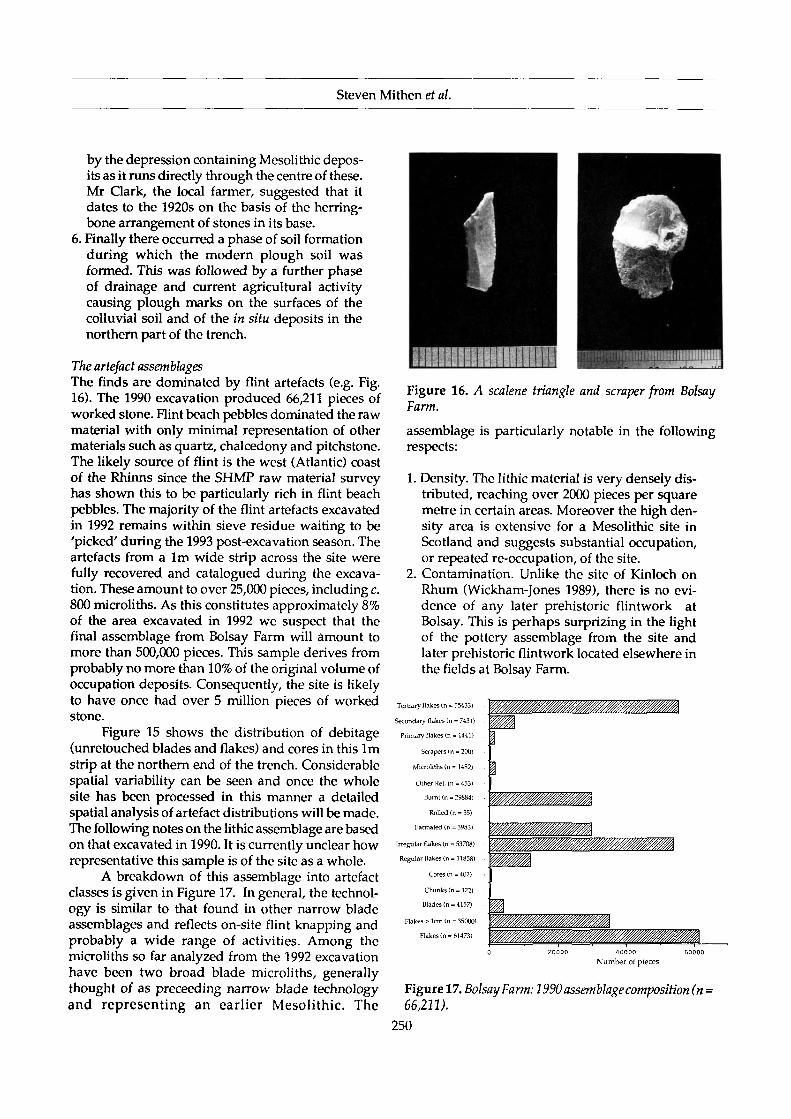
Figure 16. A scalene triangle and scraper from BolsayFarm.
assemblage is particularly notable in the followingrespects:
1. Density. The lithic material is very densely dis-tributed, reaching over 2000 pieces per squaremetre in certain areas. Moreover the high den-sity area is extensive for a Mesolithic site inScotland and suggests substantial occupation,or repeated re-occupation, of the site.
2. Contamination. Unlike the site of Kinloch onRhum (Wickham-Jones 1989), there is no evi-dence of any later prehistoric flintwork atBolsay. This is perhaps surprizing in the lightof the pottery assemblage from the site andlater prehistoric flintwork located elsewhere inthe fields at Bolsay Farm.
Tertiary flakes (n » 55433)
Secondary flakes (n = 7431)
Primary flakes (n = 1441)
Scrapers (n = 200)
Microliths (n = 1482)
Other Ret. (n = 453)
Burnt (n = 29884)
Rolled (n = 35)
Fatinated (n = 3983)
Irregular flakes (n =. 53708)
Regular flakes {n = 11858)
Cores <n = 402)
Chunks (ri= 122)
Blades (n = 4157)
Rakes > lcm (n = 35000)
Flakes (n = 61473)
40000Number of pieces
Figure 17. Bolsay Farm: 1990 assemblage composition (n •66,211).
250
Excavations at Bolsay Farm
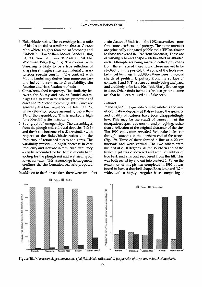
3. Flake/blade ratios. The assemblage has a ratioof blades to flakes similar to that at GleannMor, which is higher than that at Staosnaig andKinloch but lower than Mount Sandel (usingfigures from the in situ deposits at that site:Woodman 1985) (Fig. 18a). The contrast withStaosnaig is likely to be a true reflection ofknapping strategies since raw material charac-teristics remain constant. The contrast withMount Sandel may derive from numerous fac-tors including raw material availability, sitefunction and classification methods.
4. Cores/retouched frequency. The similarity be-tween the Bolsay and Mount Sandel assem-blages is also seen in the relative proportions ofcores and retouched pieces (Fig. 18b). Cores aregenerally at a low frequency, i.e. less than 1%,while retouched pieces amount to more than3% of the assemblage. This is markedly highfor a Mesolithic site in Scotland.
5. Stratigraphic homogeneity. The assemblagesfrom the plough soil, colluvial deposits (2 & 3)and the in situ horizons (4 & 5) are similar withrespect to the flake/blade ratios and thefrequency of retouched pieces and cores. Thevariability present - a slight decrease in corefrequency and increase in retouched frequency- can be accounted for by the use of only handsorting for the plough soil and wet sieving forlower contexts. This assemblage homogeneityconfirms the site formation scenario proposedabove.
In addition to the flint artefacts there were two other
E3 Flakes @ Blades
main classes of finds from the 1992 excavation - non-flint stone artefacts and pottery. The stone artefactsare principally elongated pebble tools (EPTs), similarto those recovered in 1992 from Staosnaig. These areof varying size and shape with bevelled or abradedends. Attempts are being made to collect phytolithsfrom the surface of these tools. These are yet to bestudied, but it is possible that some of the tools maybe limpet hammers. In addition, there were numeroussherds of prehistoric pottery from the surface ofcontexts 4 and 5. These are currently being analyzedand are likely to be Late Neolithic/Early Bronze Agein date. Other finds include a broken ground stoneaxe that had been re-used as a flake core.
FeaturesIn the light of the quantity of lithic artefacts and areaof occupation deposits at Bolsay Farm, the quantityand quality of features have been disappointinglylow. This may be the result of truncation of theoccupation deposits by erosion and ploughing, ratherthan a reflection of the original character of the site.The 1990 excavation revealed five stake holes cutthrough context 4 at the northern end of the trench(Fig. 19). Three of these formed a line at c. 20 cmintervals and were vertical. The two others wereinclined at c. 60 degrees. At the southern end of thetrench a pit was discovered and small quantities oftree bark and charcoal recovered from the fill. Thiswas both sealed by and cut into context 5. When theexcavation of this pit was completed in 1992, it wasfound to have a dumbell shape, 2.4m long and 1.2mwide, with a highly irregular base comprising a
Kinloch Staosnaig Gleann Mor Bolsay Mount Sandel Staosnaig Cleann Mor
Figure 18. Inter-assemblage comparisons of a) flake/blade ratios and b) frequencies of cores and retouched artefacts.
251

Steven Mithen et al.
Figure 19. Stokeholes cutting contextA, BolsayFarm 1990.
complex arrangement of concave cavities.A further ten features were discovered and ex-
cavated during the 1992 season. These were locatedin the northern half of the excavation and were eithercut into the glacial sediment or context 4 (one is cutinto context 5). Two of these were small stakeholesof less than 70mm in diameter and depth. No spatialpatterning is evident when these are viewed in con-junction with the stakeholes excavated in 1990. Thenorthern edge of the excavation truncated a circularpit 0.6m in diameter and 0.35m deep. This featurewas cut into the glacial sediment and filled with anuncompacted pink/brown sandy clay containingsmall charcoal flecks. The fill was separated from theoverlying layer (context 2) by an incipient iron-pan.Excavation of a trench through context 4 revealedthat this layer is truncated to the south west by anartificial cut c. 3m wide and at least 7m long. Thenorth side of the cut extended into the sterile subsoilresulting in a narrow horizontal terrace on an other-wise sloping surface. Whether this is a house plat-form or other large structure must remain specula-tive. This cut is filled by context 5 which also lensesout over the living surface to the north and the sterilesubsoil to the south
The remaining six features were shallow scrapesof less than 0.75m maximum dimension. Most ofthese were irregular in shape but with roughlystraight sides and a flat base. They were filled withsoil indistinguishable from, or derived from, context4. This is suggestive of features left open and filledby trampling, silting or deliberate levelling. Hencethey are probably the result of ephemeral or oppor-tunistic activity rather than, for example, systematicdisposal of rubbish - even the 1990 pit which pre-served a thin lens of bark contained very little or-ganic material.
Absolute dating.A radiocarbon date of 7250 + 145 BP from charcoalfound in the pit was obtained by Dr Roy Switsur inCambridge. Dr Nick Debenham from the British Mu-seum has conducted TL dating on burnt flints andsediments from the site. The mean TL date on burntflint from context 2 is 8.33 + 0.85 Ka BP, and fromcontext 5, 7.71 + 0.64 Ka BP. These are not signifi-cantly different and give a mean TL date for thesettlement of 7.93 Ka BP.
Summary
The final interpretation of Bolsay Farm must await aseries of post-excavation studies including catalo-guing of the large lithic assemblage, detailedtechnological studies on samples of cores andretouched artefacts, spatial analyses and microwearstudies. Comparisons will need to be made with theassemblages from Staosnaig and Gleann Mor - andhopefully with further sites to be discovered andexcavated during phase II of the SHMP. Interpret-ation of these assemblages will also draw upon theresults of experimental flint-knapping and rawmaterial survey. Moreover, micromorphologicalanalysis of the Bolsay sediments and other environ-mental studies may serve to refine, or possibly change,our current understanding of site formation andenable us to place this site in its palaeoecologicalcontext.
At present, we can simply note that the Meso-lithic settlement at Bolsay Farm is remarkable for thequantities of lithic debitage and retouched tools,particularly microliths. The most likely interpreta-tion is that these derive from many small occupationevents creating a large palimpsest of discardedmaterial. However, there may also have been one ora few large occupation events at Bolsay, perhaps tak-ing the form of a base camp for hunters using satel-lite sites such as Gleann Mor and Staosnaig. Theabsence of large features may be indicative of manysmall occupations, although it is likely that this partlyderives from truncation of the surviving deposits.Spatial analysis of artefact distributions may help toresolve the character of past occupation.
The reason for repeated occupation most likelylies with the local topography. The site is a fewhundred metres from Loch a'Bhogaidh which wouldhave been a large lake during the early postglacial. Itlies on the south side of a small rise and would havebeen usually down-wind and out of sight of deergrazing in the area of Ben Tart a'Mhill (assumingthat the prevailing winds were from the Atlantic).
252

Excavations at Bolsay Farm
Indeed, Mr Ken Aldridge, a local gamekeeper andhunter, suggested that the site is situated perfectlyfor hunting of deer in the modern landscape. This islargely treeless, in contrast to the early postglacial,but if the movements of deer were controlled princi-pally by topography this may provide an explana-tion for the obvious attractiveness of the Bolsay Farmsettlement to Mesolithic hunter-gatherers.
Steven MithenDepartment of Archaeology
University of ReadingWhiteknightsPO Box 217
ReadingRG6 2AH
Bill FinlaysonCentre for Field Archaeology
University of Edinburgh
Nyree Finlay20 Mortonhall
Park AvenueEdinburgh
Mark LakeDepartment of Archaeology
University of Cambridge
Acknowledgements
For financial support of the Southern HebridesMesolithic Project we would like to thank The BritishAcademy, The McDonald Institute, The Society ofAntiquaries of London, The Society of Antiquaries ofScotland, The Russell Trust and the Robert Kiln Trust.We also thank Historic Scotland for partly fundingthe 1992 excavation at Bolsay Farm. We are gratefulto the British Museum and Nick Debenham for thethermoluminesence dates and to Roy Switsur, Cam-bridge for the radiocarbon dates. Advice concerningthe interpretation of the soil profile at Bolsay waskindly given by Richard McPhail and Charlie French,and comments on the pottery by Ann MacSween.The excavations at Bolsay were made possible bykind permission of Mr Clark, Alan Clark and AlexClark of Craigfad Farm. We thank Gilbert Marshalland David Thomas for assisting with site supervisionat Bolsay. Of the many people who have given ushelp and advice on Islay since 1988 we wouldparticularly like to thank Dr Malcolm Ogilvie, MrKen Aldridge and the Islay Museum of Island Life.
References
McCullough, R., 1989. Excavations at Newton, Islay.Glasgow Archaeological Journal 15,21-53
Mellars, P., (ed) 1987. Excavations on Oronsay. Edin-burgh: Edinburgh University Press
Mercer, J., 1968. Stone tools from a washing limitdeposit of the highest post-glacial transgression,Lealt Bay, Isle of Jura. Proceedings of the Societyof Antiquaries of Scotland 100,1-46
Mercer, J., 1970. Flint tools from the present tidalzone, Lussa Bay, Isle of Jura. Proceedings of theSociety of Antiquaries of Scotland 102,1-30
Mercer, J., 1971. A regression time stone-workers'camp, 33ft OD, Lussa River, Isle of Jura. Proc-eedings of the Society of Antiquaries of Scotland103,1-32
Mercer, J., 1972. Microlithic and Bronze Age camps,75-26 ft OD, N.Carn, Isle of Jura. Proceedings ofthe Society of Antiquaries of Scotland 104,1-22
Mercer, J., 1974. Glenbatrick Waterhole, a microlithicsite on the Isle of Jura. Proceedings of the Societyof Antiquaries of Scotland 105,9-32
Mercer, J. 1980. Lussa Wood I: the late-glacial andearly post-glacial occupation of Jura. Proceedingsof the Society of Antiquaries of Scotland 110,1-32
Mercer, J. & Searight, S., 1986. Glengarrisdale: con-firmation of Jura's third phase. Proceedings ofthe Society of Antiquaries of Scotland 116,41-55
Mithen, S., 1989. New evidence for Mesolithic settle-ment on Colonsay. Proceedings of the Society ofAntiquaries of Scotland, 119,33-41
Mithen, S. 1990. Gleann Mor: A Mesolithic site onIslay. Current Archaeology 119,376-7
Mithen, S. & B. Finlayson., 1991. Red deer hunters onColonsay? The implications of Staosnaig for theinterpretation of the Oronsay middens. Proc-eedings of the Prehistoric Society 57(2), 1-8
Wickham-Jones, G, 1990. Rhum: Mesolithic and latersites at Kinlock. Edinburgh: Society of Antiquariesof Scotland Monograph Series, 7
Woodman, P.C., 1989. A review of the ScottishMesolithic: a plea for normality! Proceedings ofthe Society of Antiquaries of Scotland 119,1-32
Woodman, P.C., 1985. Excavations at Mount Sandel1973-77. Belfast: HMSO, Northern IrelandMonographs, No. 2
253