Embed Size (px)
Citation preview
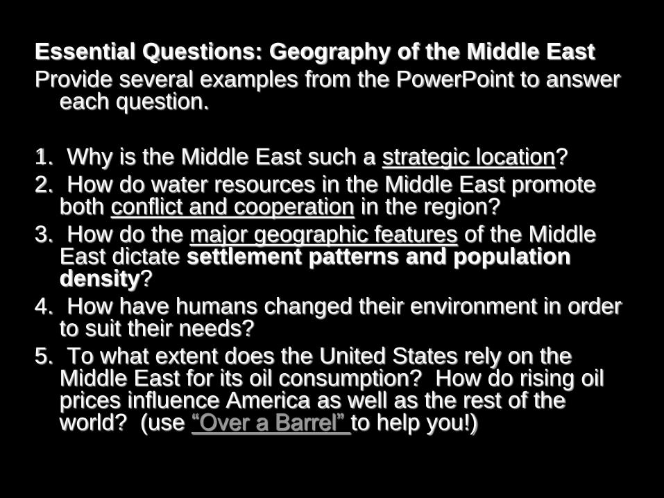
Essential Questions: Geography of the Middle East
Provide several examples from the PowerPoint to answer each question.
1. Why is the Middle East such a strategic location?
2. How do water resources in the Middle East promote both conflict and cooperation in the region?
3. How do the major geographic features of the Middle East dictate settlement patterns and population density?
4. How have humans changed their environment in order to suit their needs?
5. To what extent does the United States rely on the Middle East for its oil consumption? How do rising oil prices influence America as well as the rest of the world? (use “Over a Barrel” to help you!)
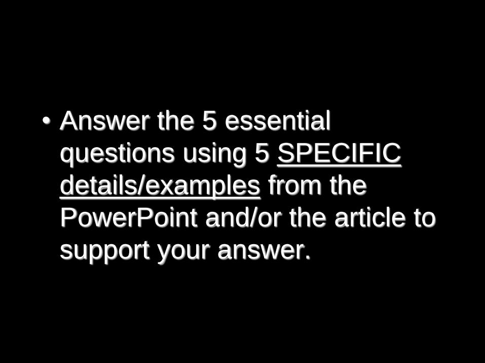
• Answer the 5 essential
questions using 5 SPECIFIC
details/examples from the
PowerPoint and/or the article to
support your answer.
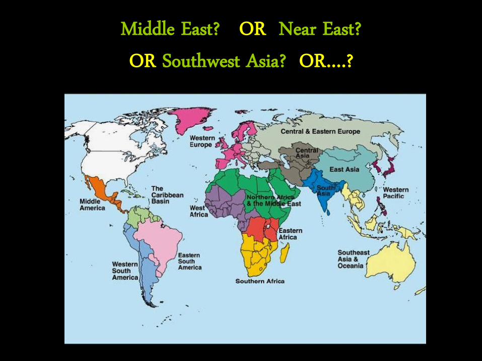
Middle East? OR Near East? OR Southwest Asia? OR….?
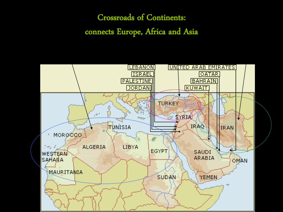
Crossroads of Continents:
connects Europe, Africa and Asia Africa Europe Asia
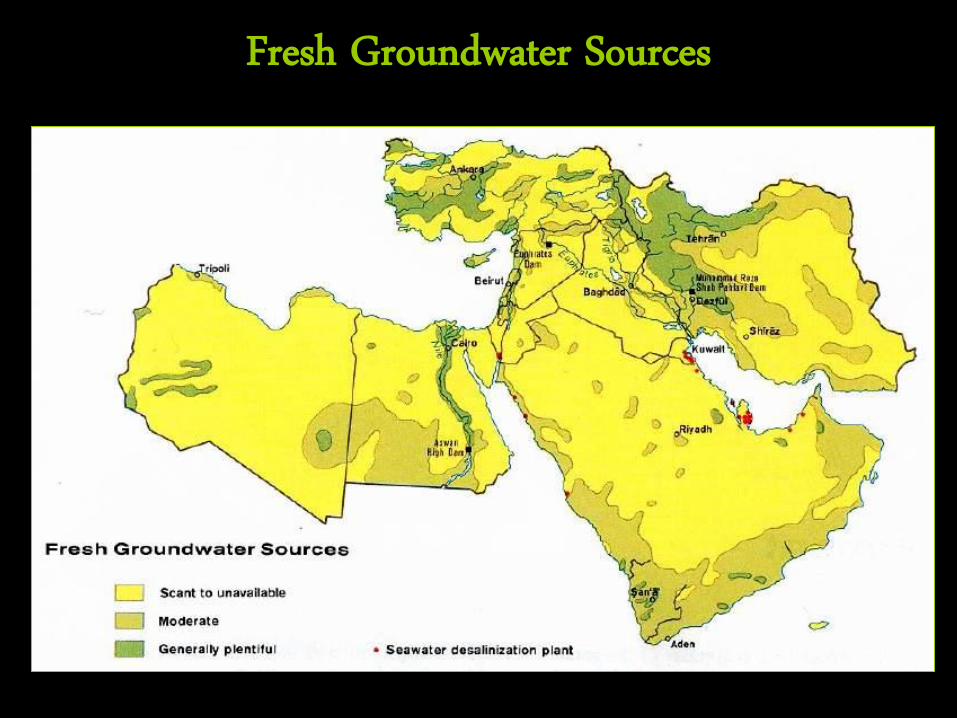
Fresh Groundwater Sources
• Water is the most precious resource for this region of deserts and steppe areas. – Many areas (ie. Nile River Valley) dependent on seasonal
floods. – The alluvial soil around the river and the delta regions
are especially good for farming – Some countries control other countries’ water supply –
This leads to conflict
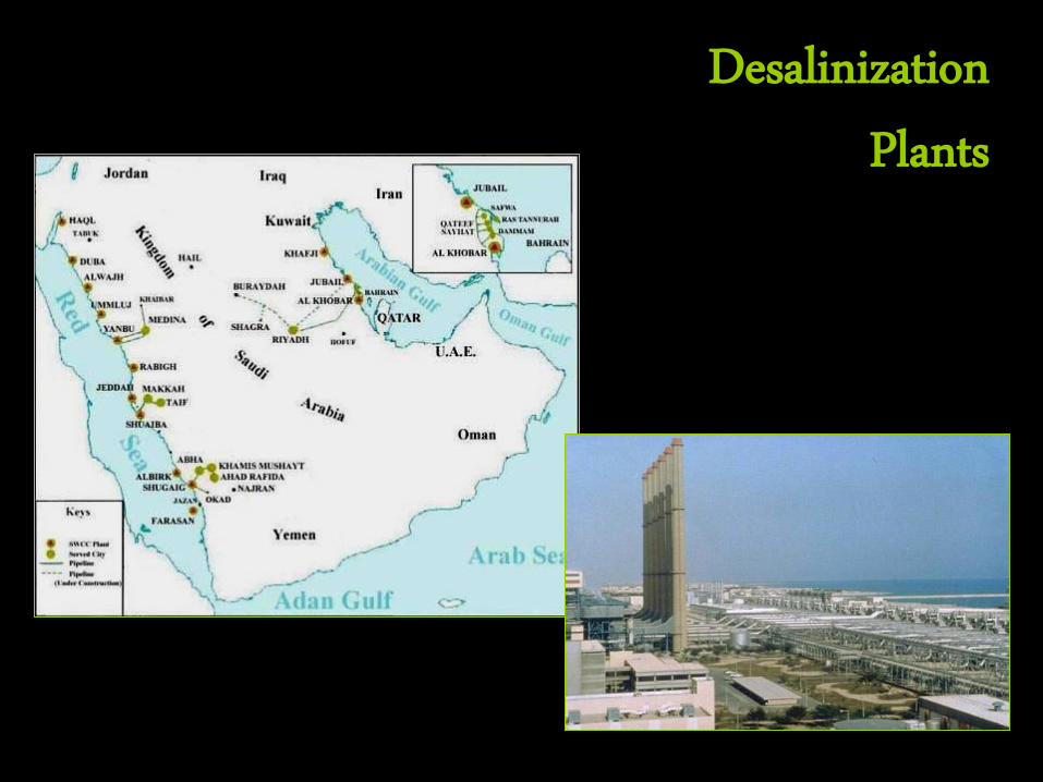
Desalinization Plants
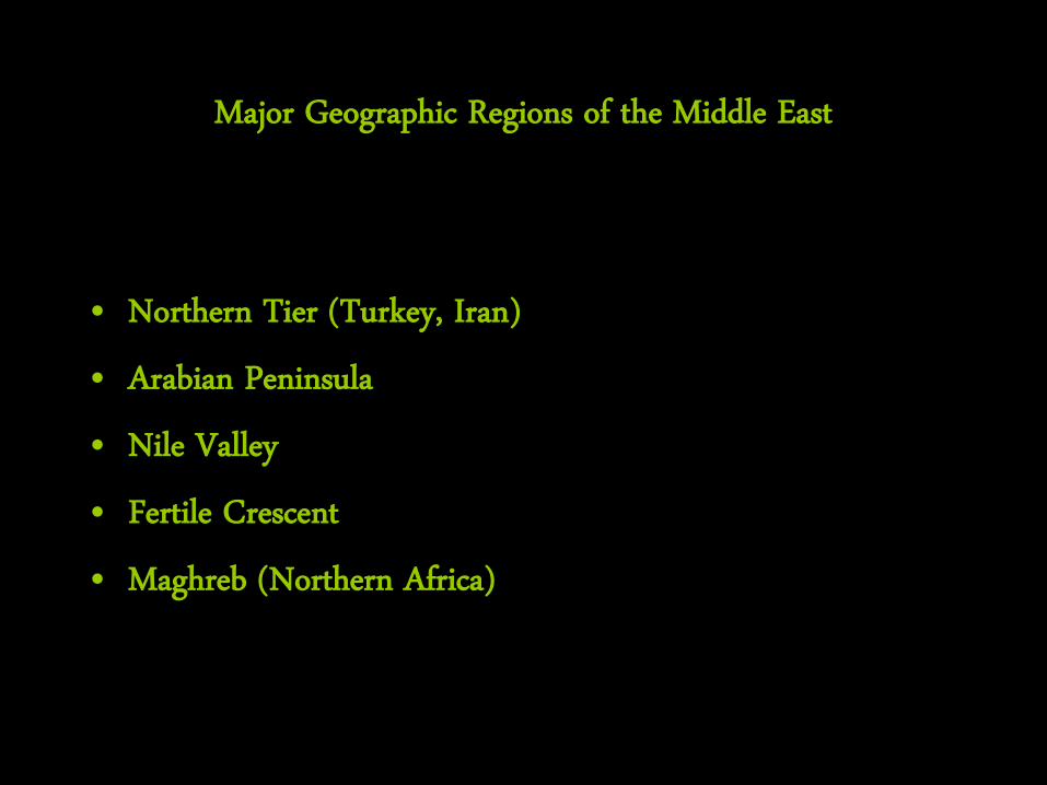
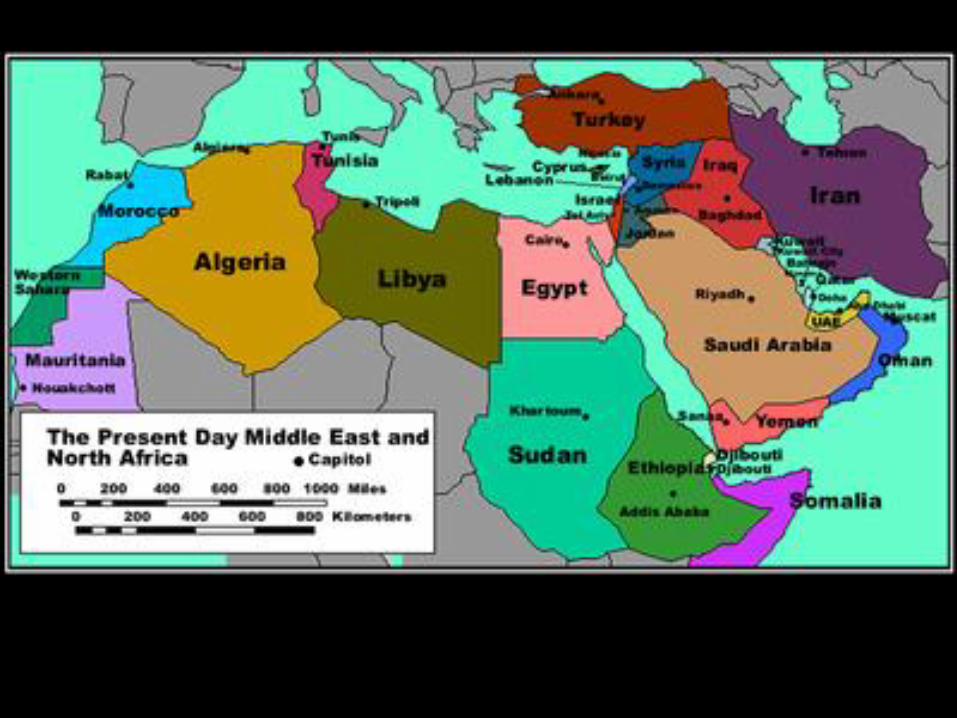
Major Geographic Regions of the Middle East
• Northern Tier (Turkey, Iran) • Arabian Peninsula • Nile Valley • Fertile Crescent • Maghreb (Northern Africa)
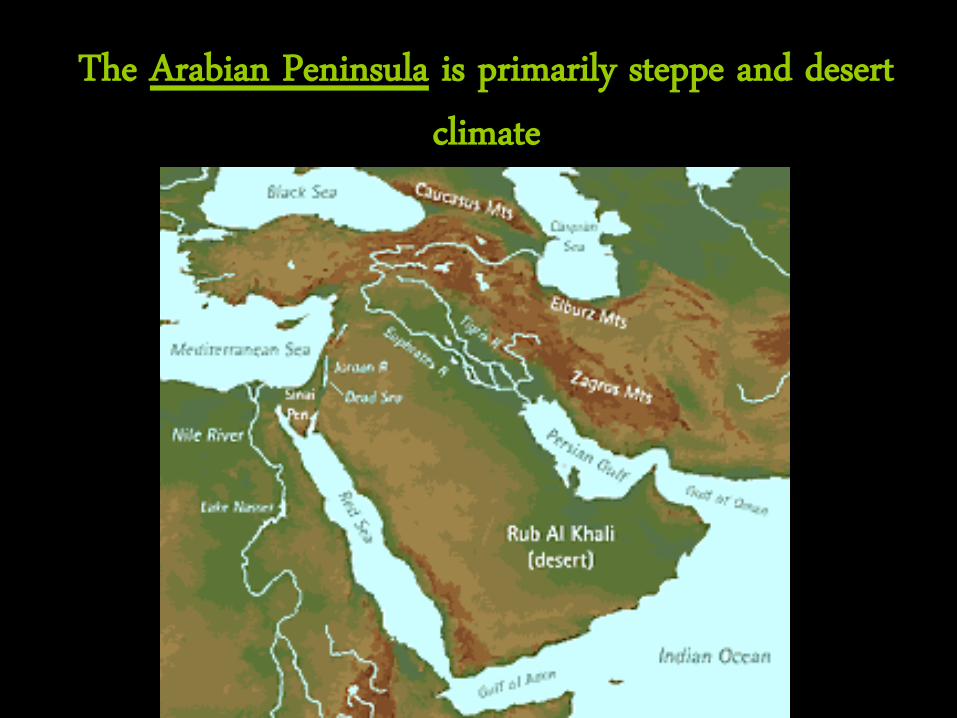
The Arabian Peninsula is primarily steppe and desert climate
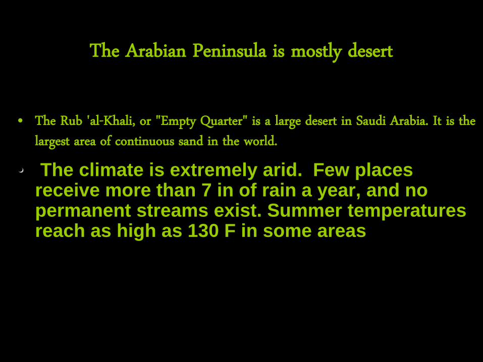
The Arabian Peninsula is mostly desert
• The Rub 'al-Khali, or "Empty Quarter" is a large desert in Saudi Arabia. It is the largest area of continuous sand in the world.
• The climate is extremely arid. Few places receive more than 7 in of rain a year, and no permanent streams exist. Summer temperatures reach as high as 130 F in some areas
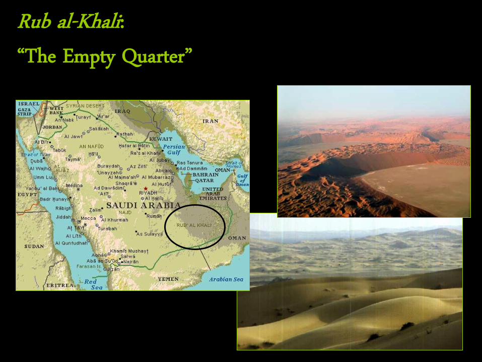
Rub al-Khali: “The Empty Quarter”
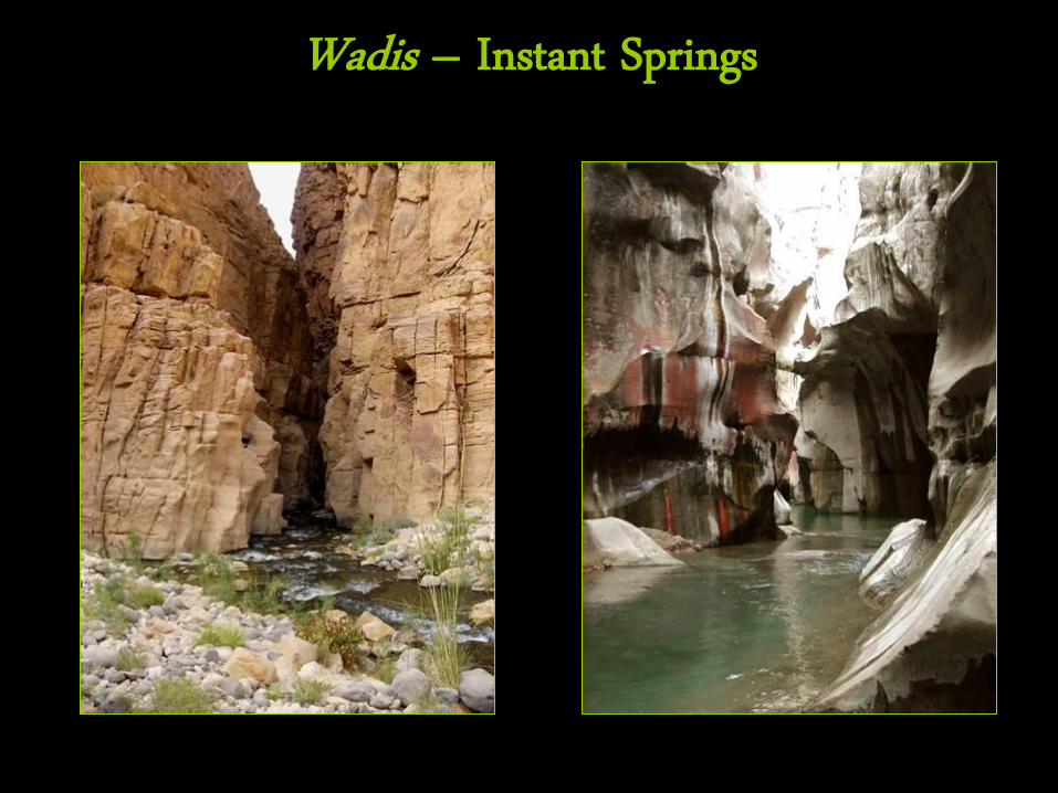
Wadis – Instant Springs
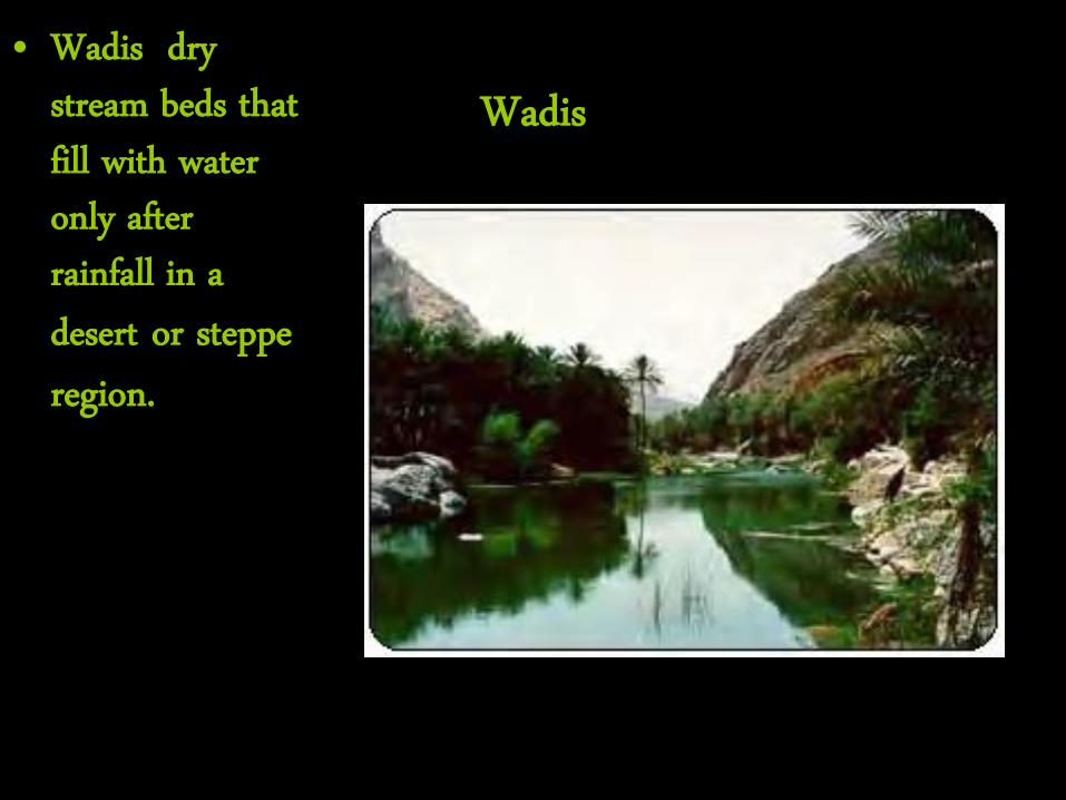
Wadis • Wadis dry
stream beds that fill with water only after rainfall in a desert or steppe region.
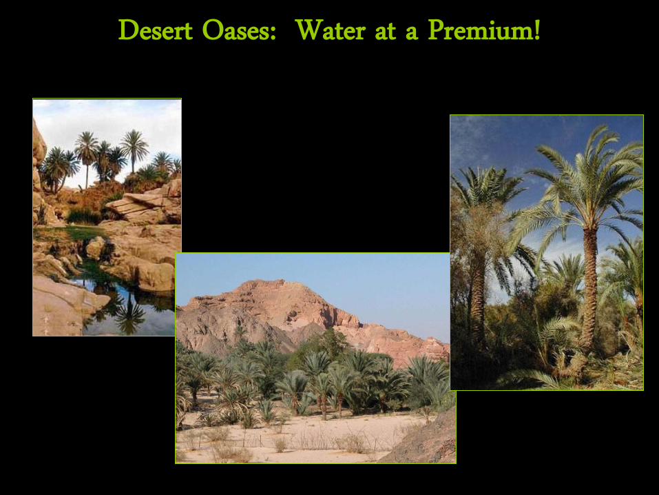
Desert Oases: Water at a Premium!
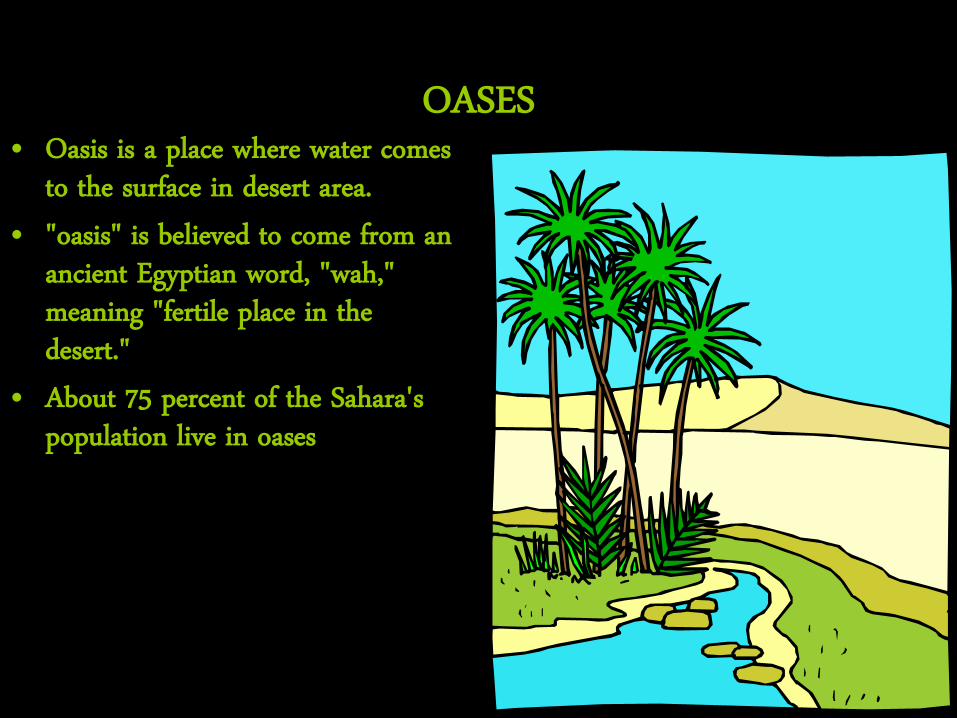
OASES • Oasis is a place where water comes
to the surface in desert area. • "oasis" is believed to come from an
ancient Egyptian word, "wah," meaning "fertile place in the desert."
• About 75 percent of the Sahara's population live in oases
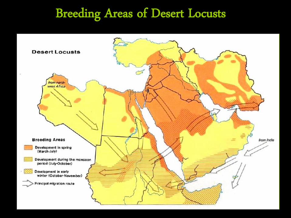
Breeding Areas of Desert Locusts
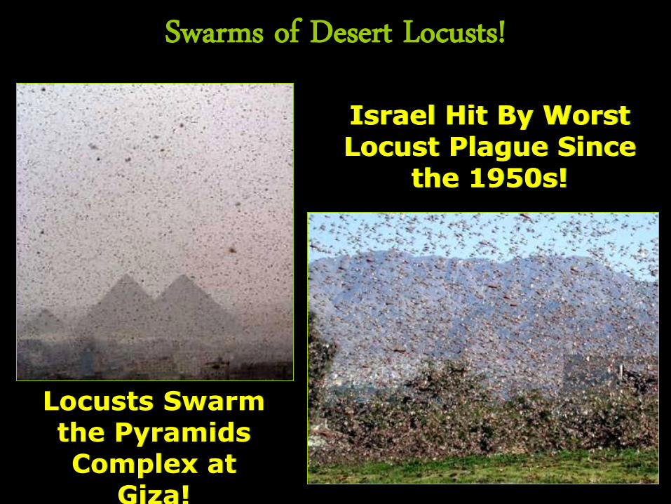
Swarms of Desert Locusts!
Locusts Swarm the Pyramids Complex at
Giza!
Israel Hit By Worst Locust Plague Since
the 1950s!
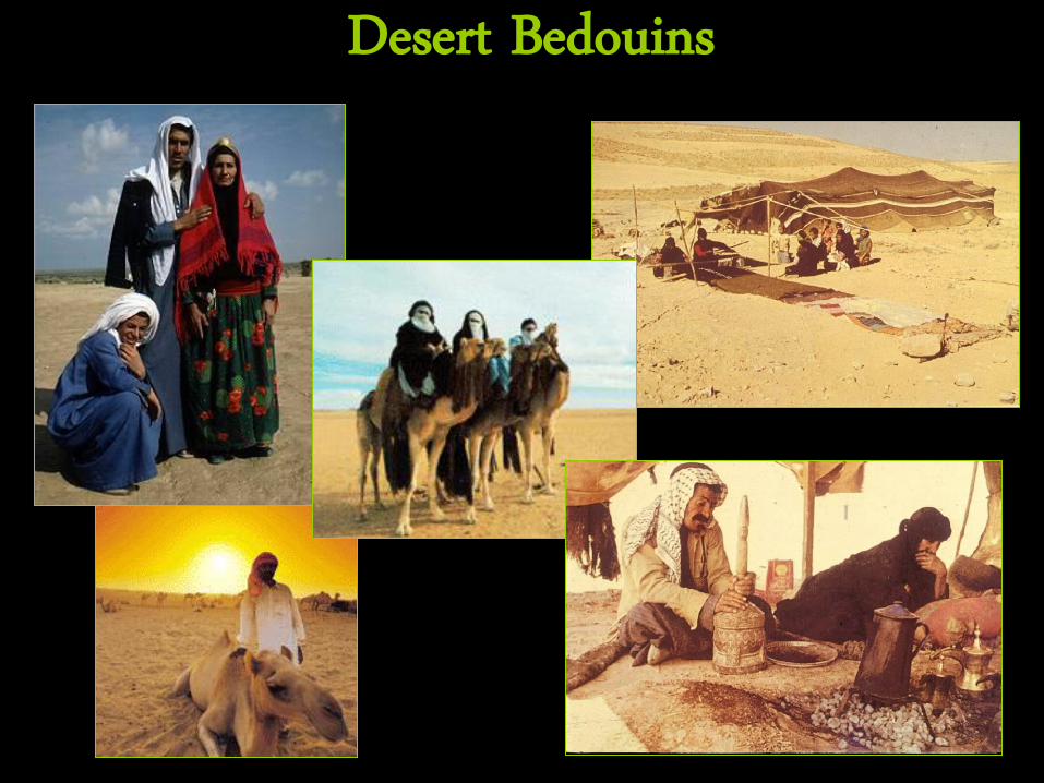
Desert Bedouins
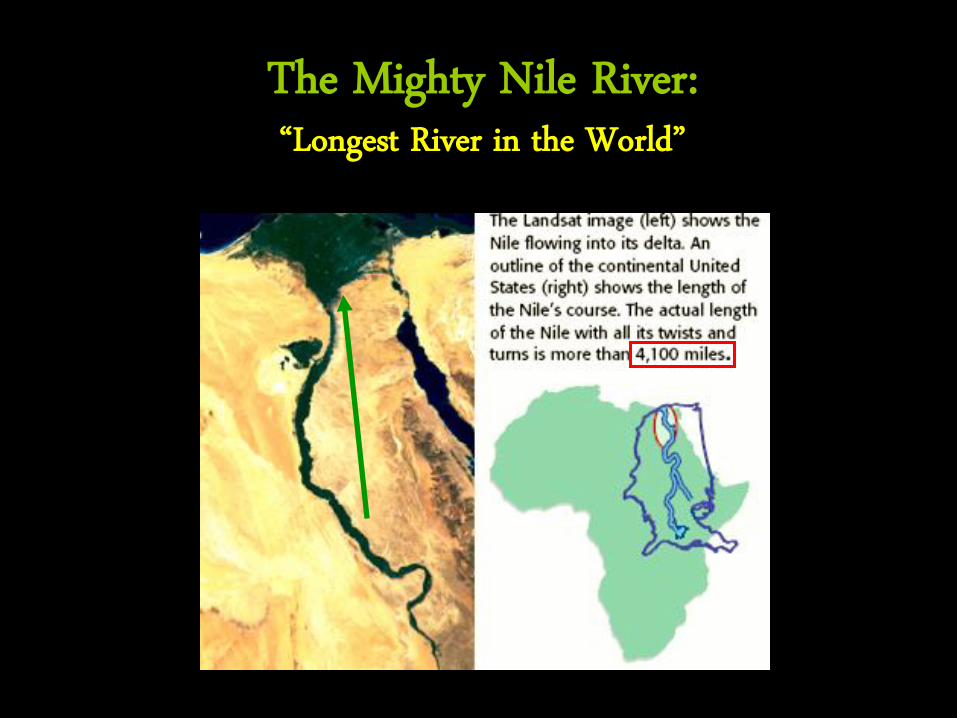
The Mighty Nile River: “Longest River in the World”
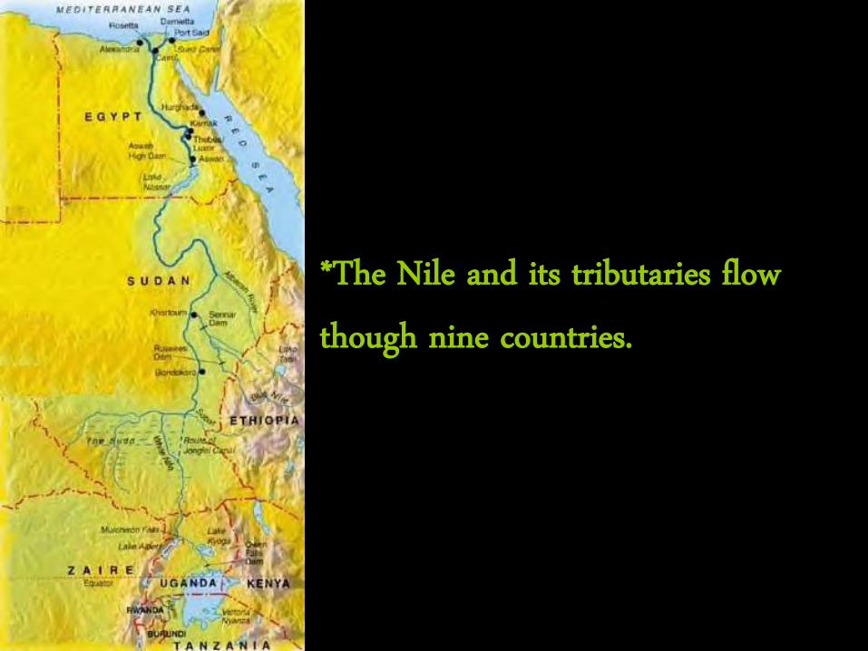
*The Nile and its tributaries flow though nine countries.
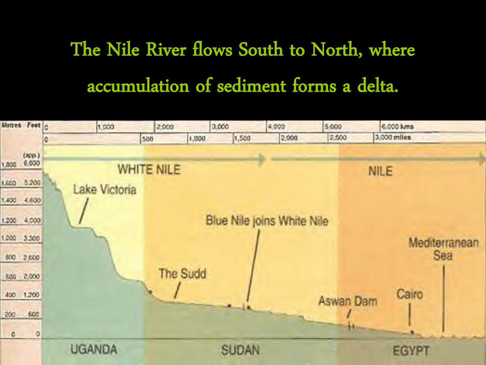
The Nile River flows South to North, where
accumulation of sediment forms a delta.
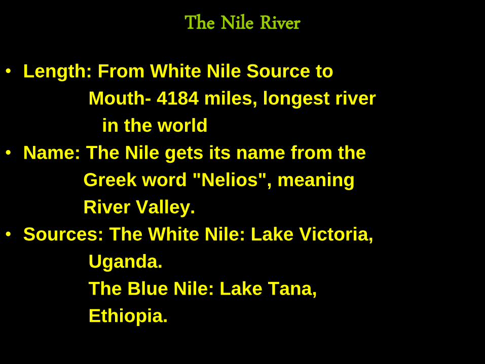
The Nile River
• Length: From White Nile Source to
Mouth- 4184 miles, longest river
in the world
• Name: The Nile gets its name from the
Greek word "Nelios", meaning
River Valley.
• Sources: The White Nile: Lake Victoria,
Uganda.
The Blue Nile: Lake Tana,
Ethiopia.
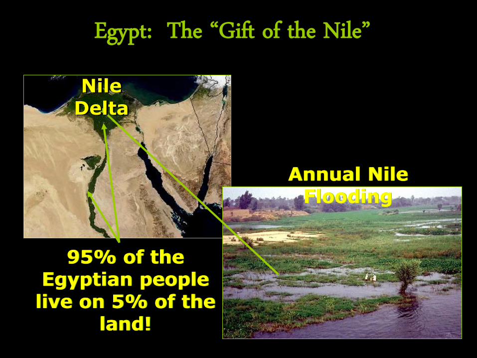
Egypt: The “Gift of the Nile”
Annual Nile Flooding
Nile Delta
95% of the Egyptian people
live on 5% of the land!
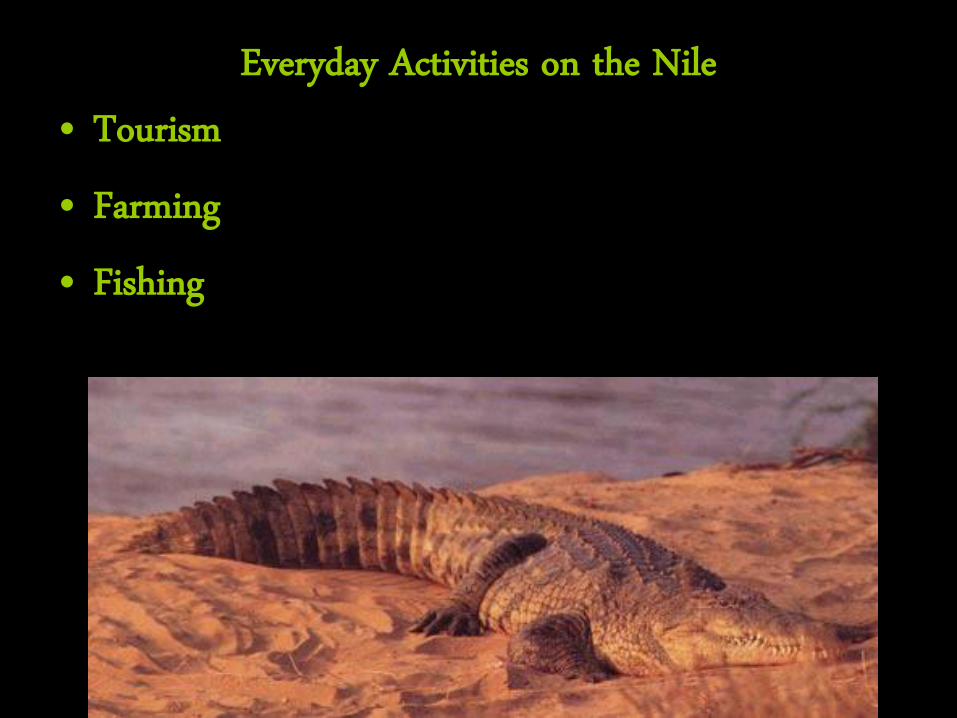
Everyday Activities on the Nile • Tourism • Farming • Fishing
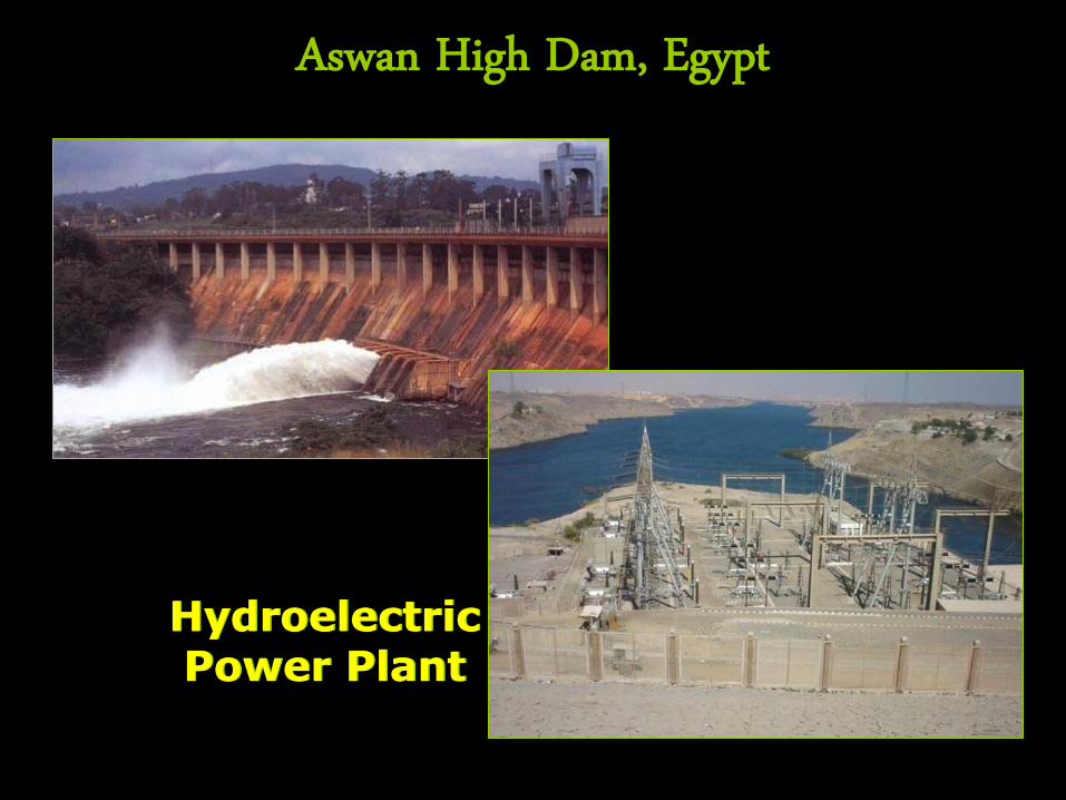
Aswan High Dam, Egypt
Hydroelectric Power Plant
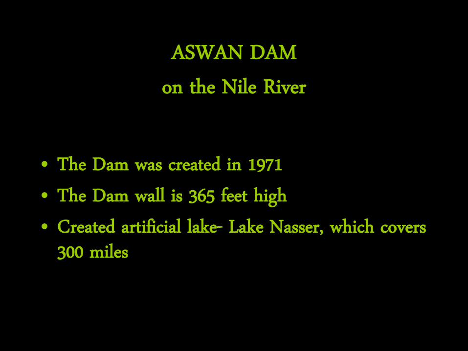
ASWAN DAM
on the Nile River
• The Dam was created in 1971 • The Dam wall is 365 feet high • Created artificial lake- Lake Nasser, which covers
300 miles
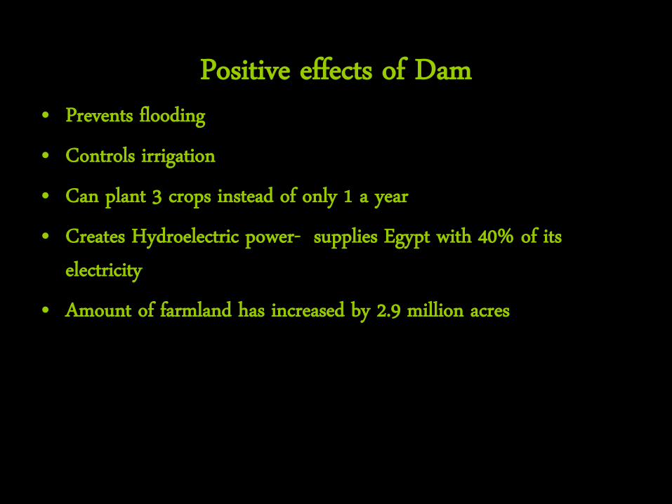
Positive effects of Dam • Prevents flooding • Controls irrigation • Can plant 3 crops instead of only 1 a year • Creates Hydroelectric power- supplies Egypt with 40% of its
electricity • Amount of farmland has increased by 2.9 million acres
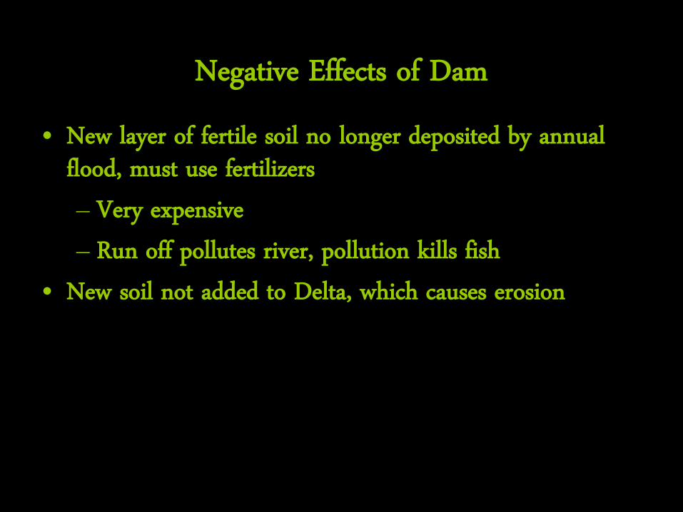
Negative Effects of Dam • New layer of fertile soil no longer deposited by annual
flood, must use fertilizers – Very expensive – Run off pollutes river, pollution kills fish
• New soil not added to Delta, which causes erosion
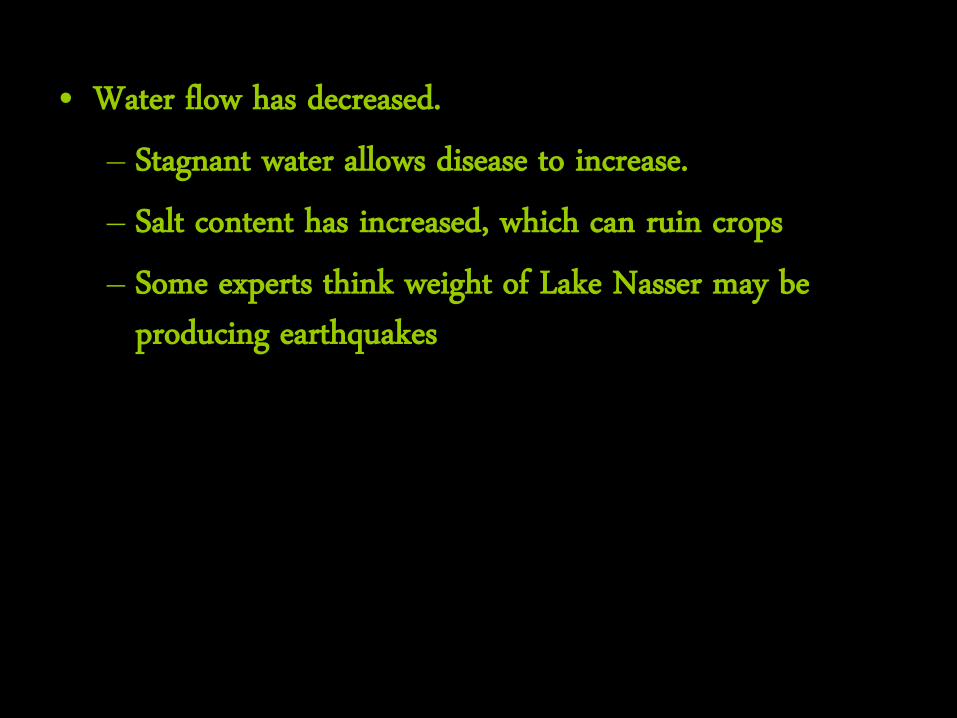
• Water flow has decreased. – Stagnant water allows disease to increase. – Salt content has increased, which can ruin crops – Some experts think weight of Lake Nasser may be
producing earthquakes
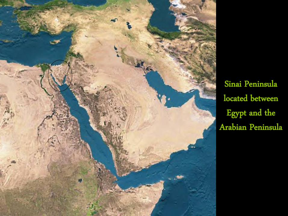
Sinai Peninsula located between Egypt and the
Arabian Peninsula
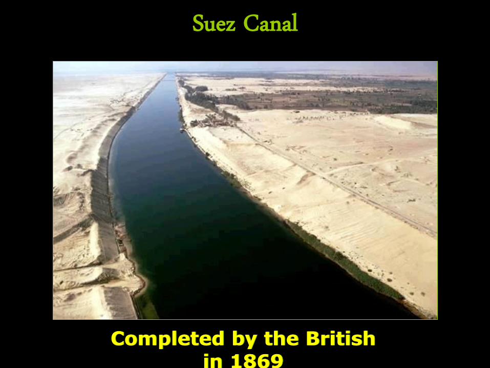
Suez Canal
Completed by the British in 1869
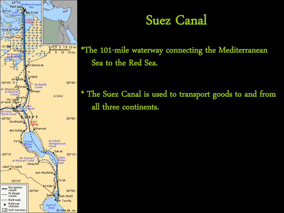
Suez Canal *The 101-mile waterway connecting the Mediterranean
Sea to the Red Sea. * The Suez Canal is used to transport goods to and from
all three continents.
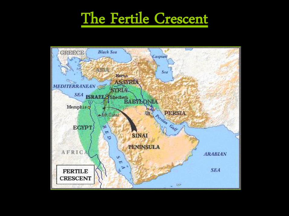
The Fertile Crescent
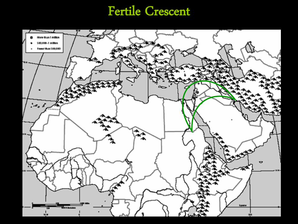
Fertile Crescent
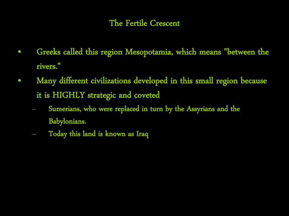
The Fertile Crescent
• Greeks called this region Mesopotamia, which means "between the rivers."
• Many different civilizations developed in this small region because it is HIGHLY strategic and coveted
– Sumerians, who were replaced in turn by the Assyrians and the Babylonians.
– Today this land is known as Iraq
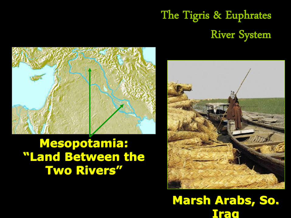
The Tigris & Euphrates River System
Mesopotamia: “Land Between the
Two Rivers”
Marsh Arabs, So. Iraq
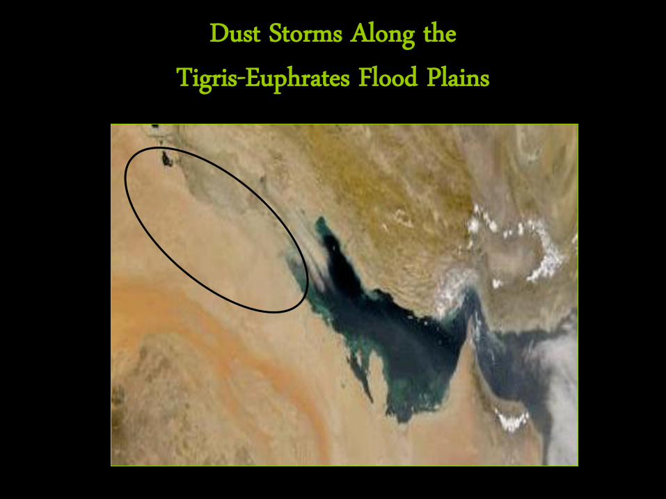
Dust Storms Along the Tigris-Euphrates Flood Plains
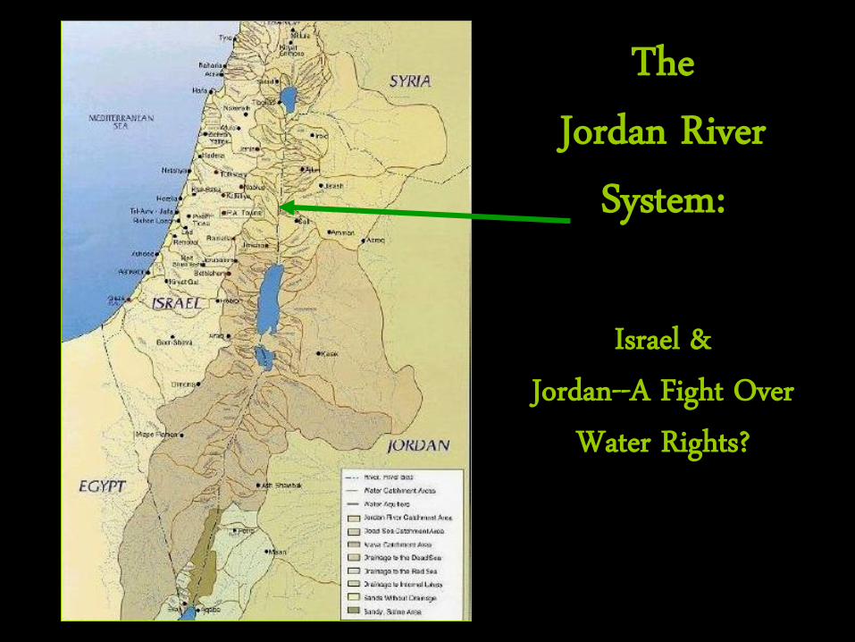
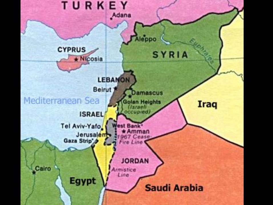
The Jordan River
System:
Israel & Jordan--A Fight Over
Water Rights?
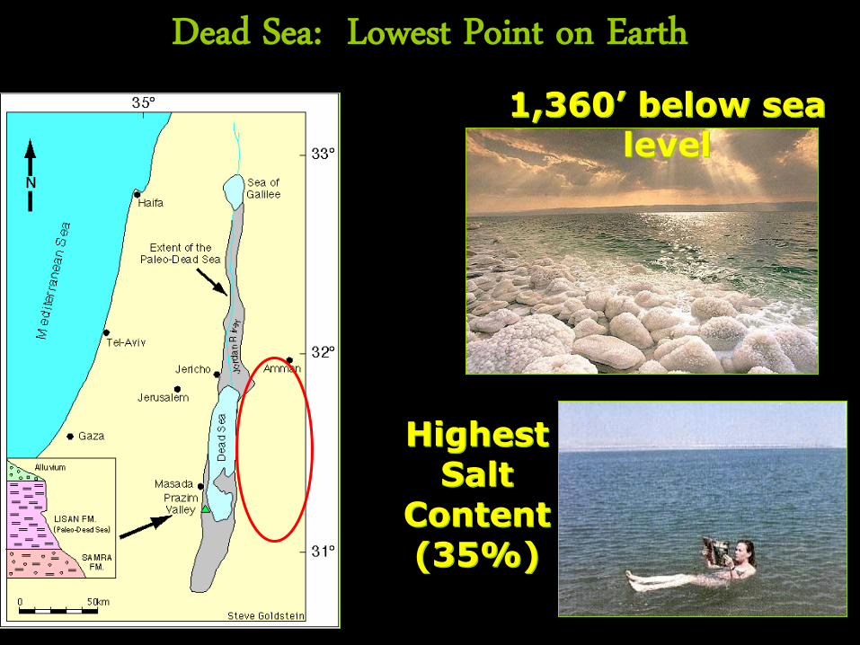
Dead Sea: Lowest Point on Earth
Highest Salt
Content (35%)
1,360’ below sea level
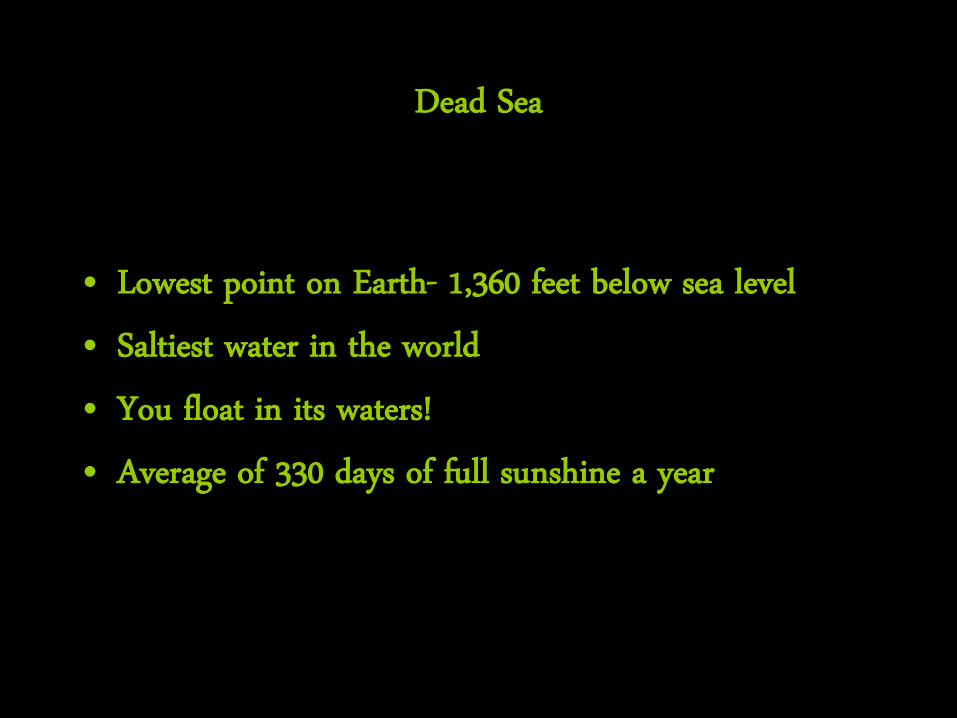
Dead Sea
• Lowest point on Earth- 1,360 feet below sea level • Saltiest water in the world • You float in its waters! • Average of 330 days of full sunshine a year

Dead Sea Floater
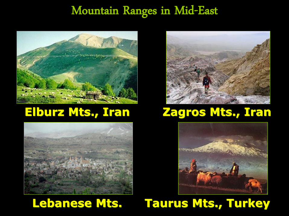
Mountain Ranges in Mid-East
Elburz Mts., Iran Zagros Mts., Iran
Lebanese Mts. Taurus Mts., Turkey
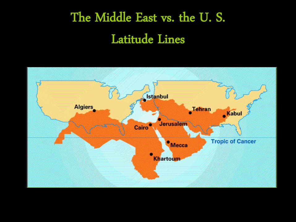
The Middle East vs. the U. S. Latitude Lines
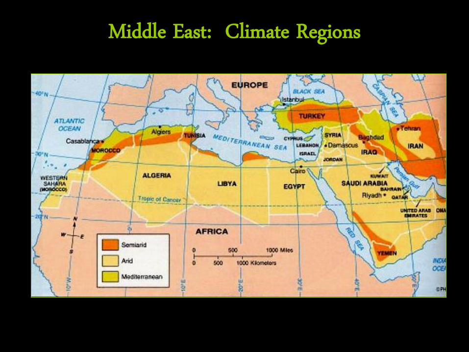
Middle East: Climate Regions
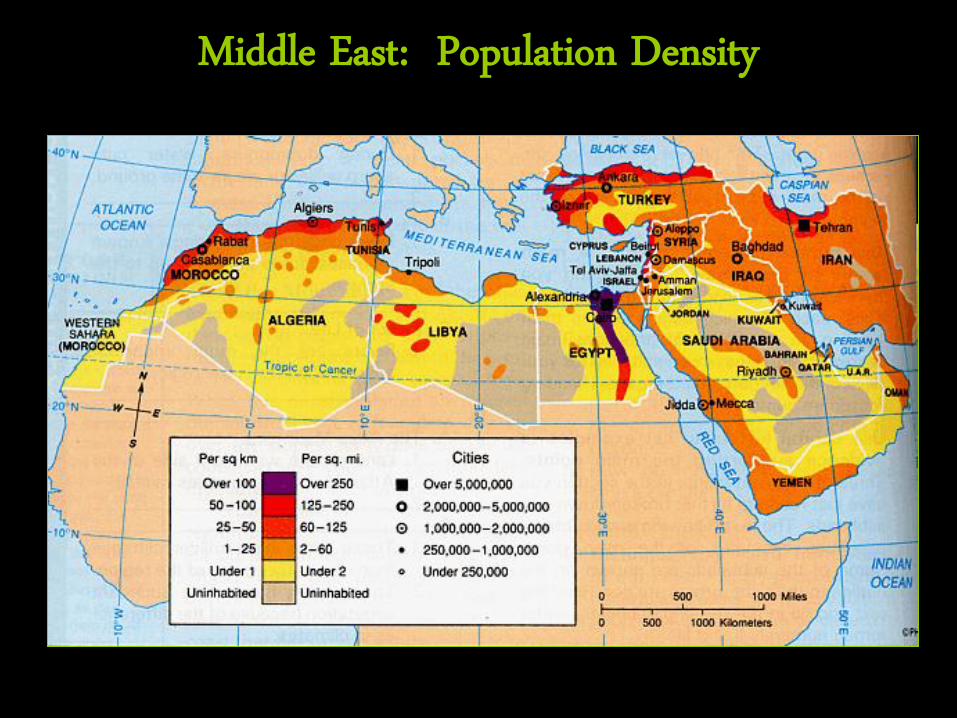
Middle East: Population Density
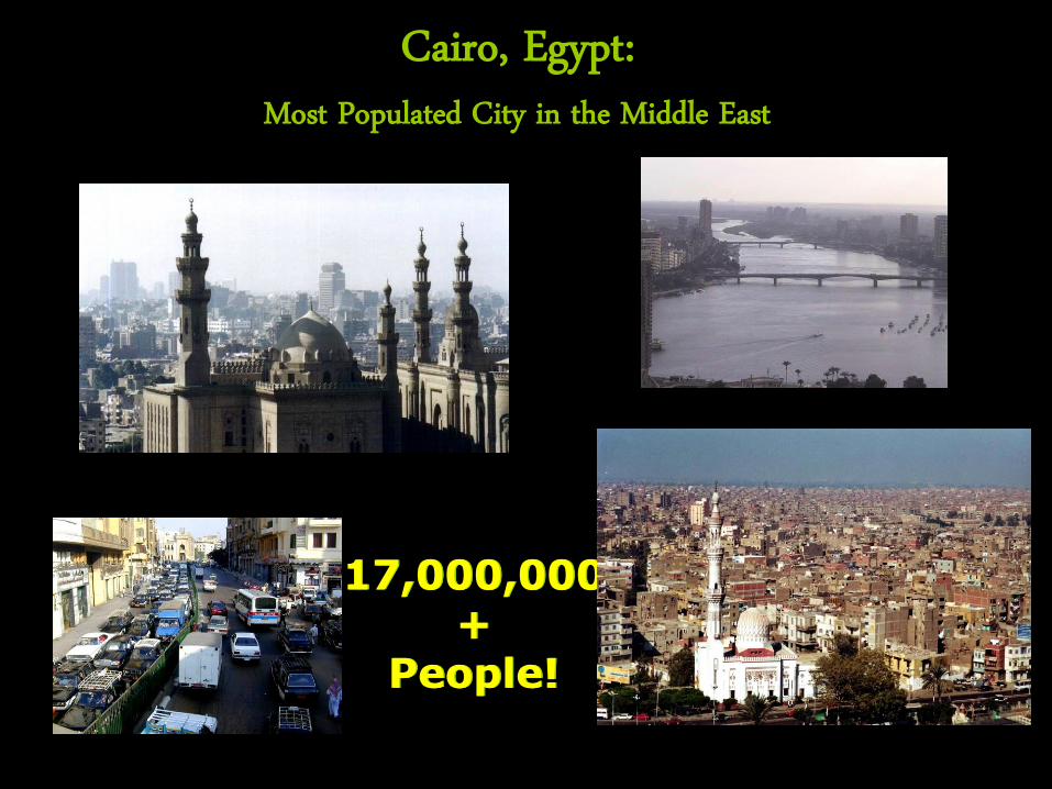
Cairo, Egypt: Most Populated City in the Middle East
17,000,000+
People!
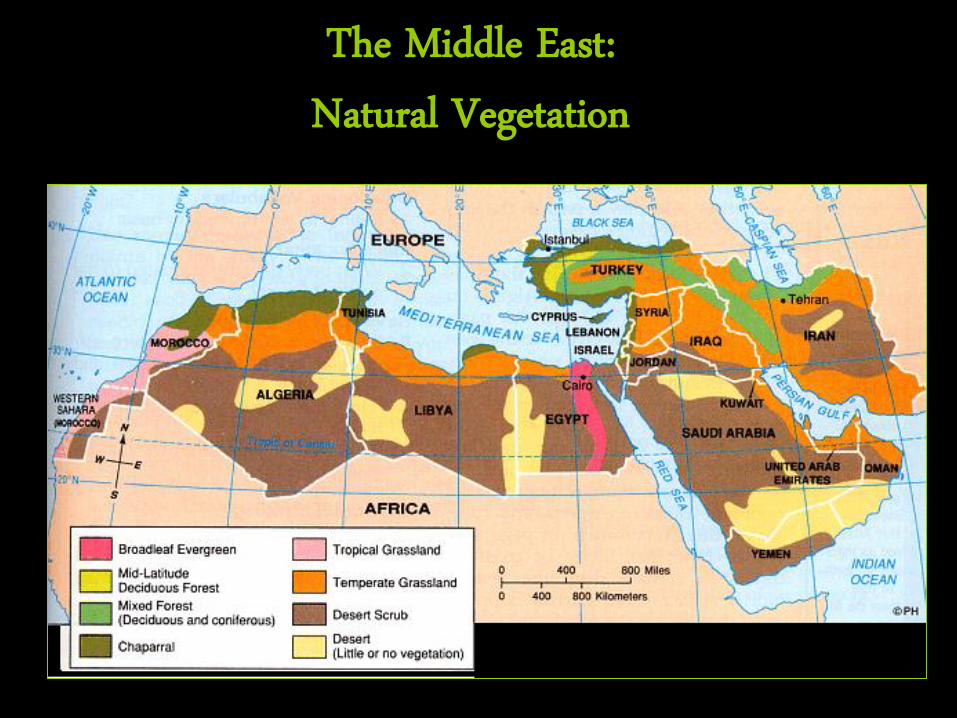
The Middle East: Natural Vegetation
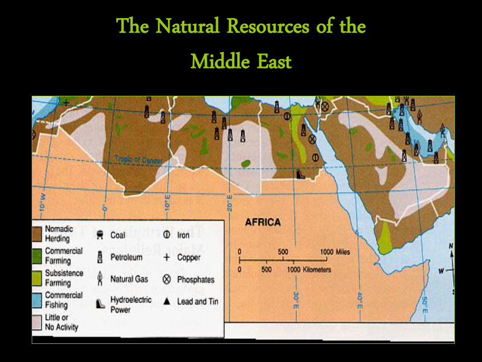
The Natural Resources of the Middle East
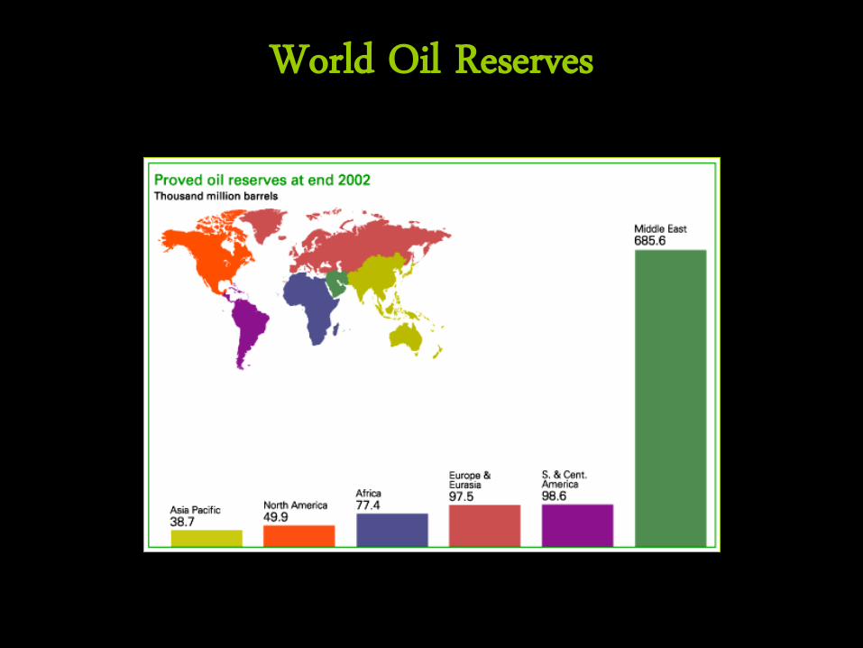
World Oil Reserves
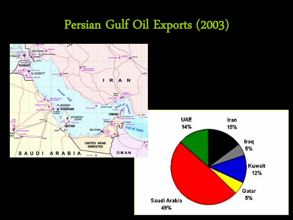
Persian Gulf Oil Exports (2003)
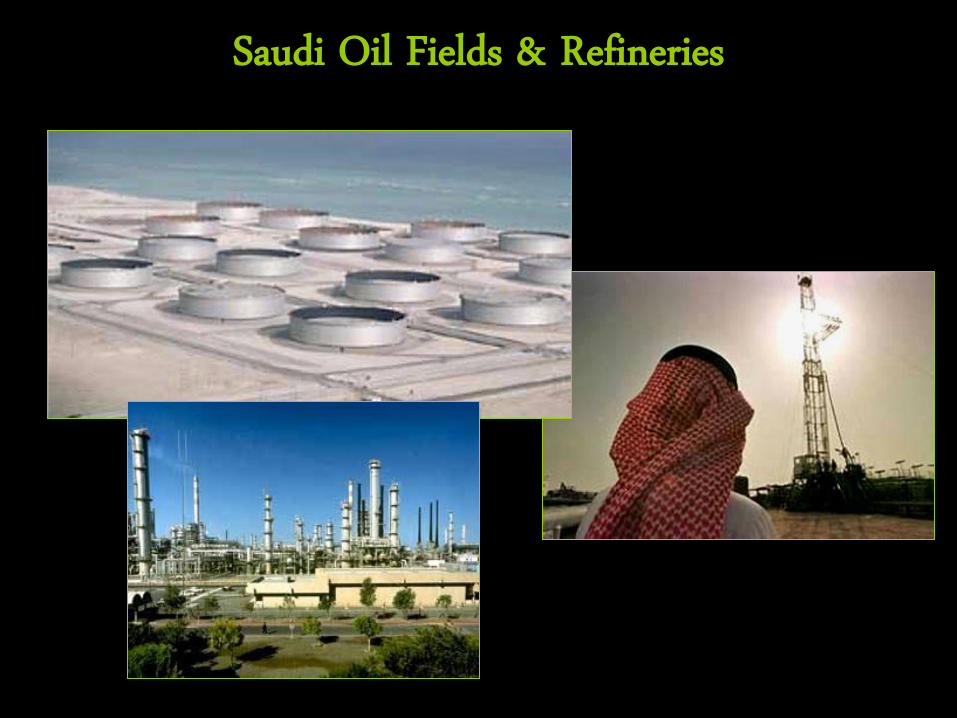
Saudi Oil Fields & Refineries
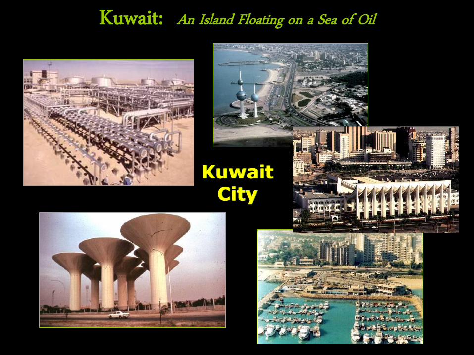
Kuwait: An Island Floating on a Sea of Oil
Kuwait City
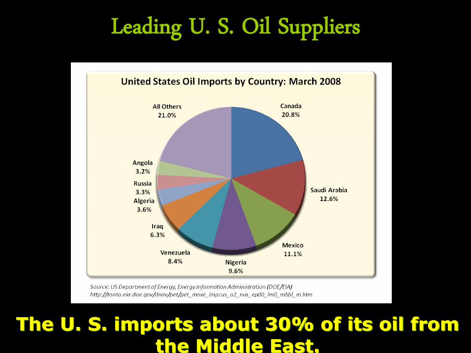
Leading U. S. Oil Suppliers
The U. S. imports about 30% of its oil from the Middle East.
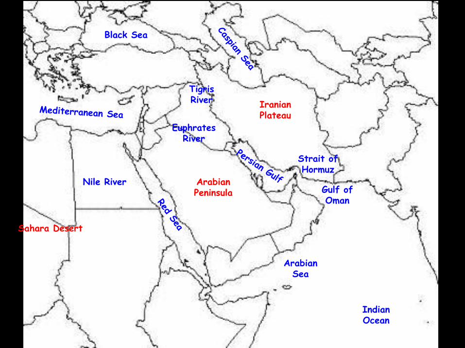
Tigris River
Nile River
Euphrates River
Indian Ocean
Black Sea
Gulf of Oman
Arabian Peninsula
Iranian Plateau
Sahara Desert
Arabian Sea
Strait of Hormuz