Embed Size (px)
DESCRIPTION
The Geography of the Middle East. The Middle East vs. the U. S. Latitude Lines. Middle East? OR Near East? OR Southwest Asia? OR….?. Bodies of Water. Tigris River. Mediterranean Sea. Euphrates River . Jordan River . Suez Canal . Strait of Hormuz. Persian Gulf. - PowerPoint PPT Presentation
Citation preview
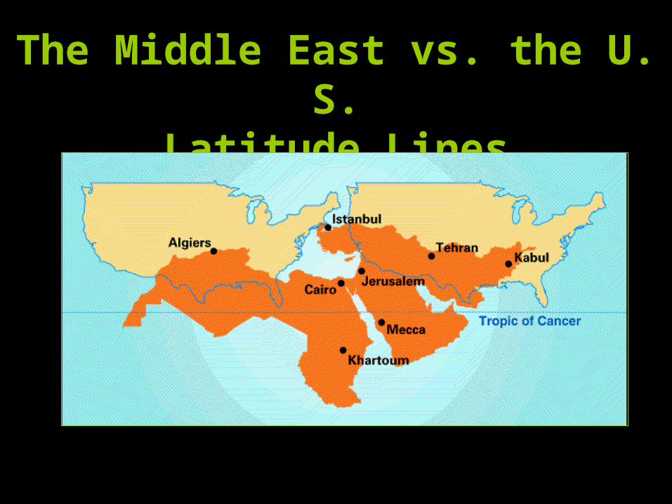
The Middle East vs. the U. S.
Latitude Lines
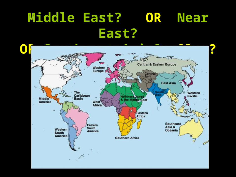
Middle East? OR Near East?OR Southwest Asia? OR….?
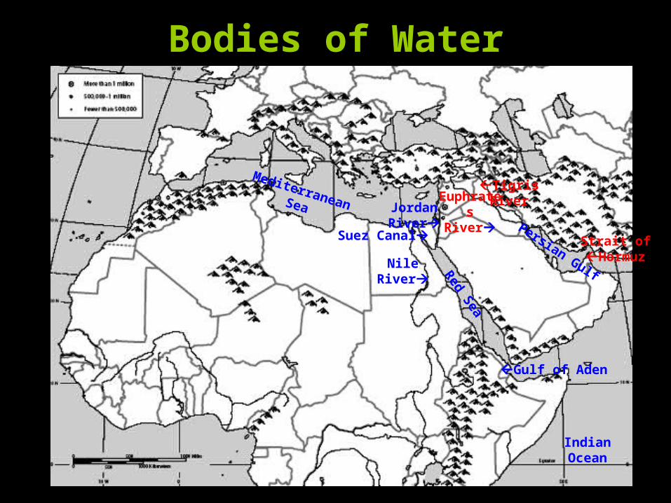
Bodies of Water
TigrisRiver
Nile River
Euphrates
RiverJordan River Persian Gulf
Mediterranean Sea
IndianOcean
Red Sea
Gulf of Aden
Strait ofHormuz
Suez Canal
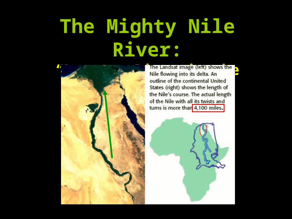
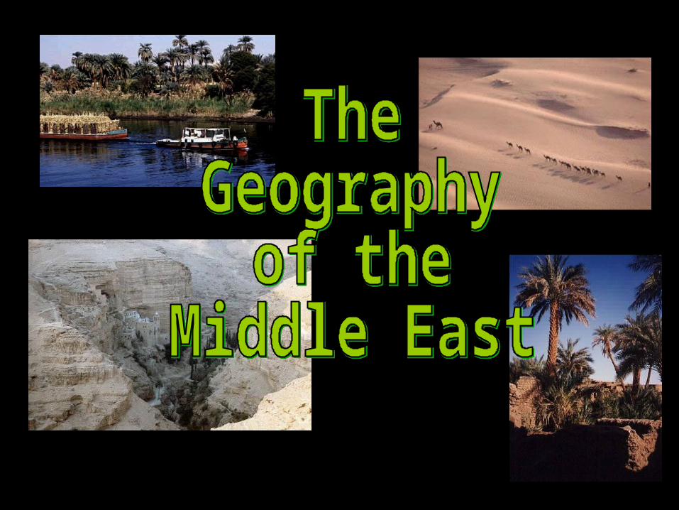
The Mighty Nile River:
“Longest River in the World”
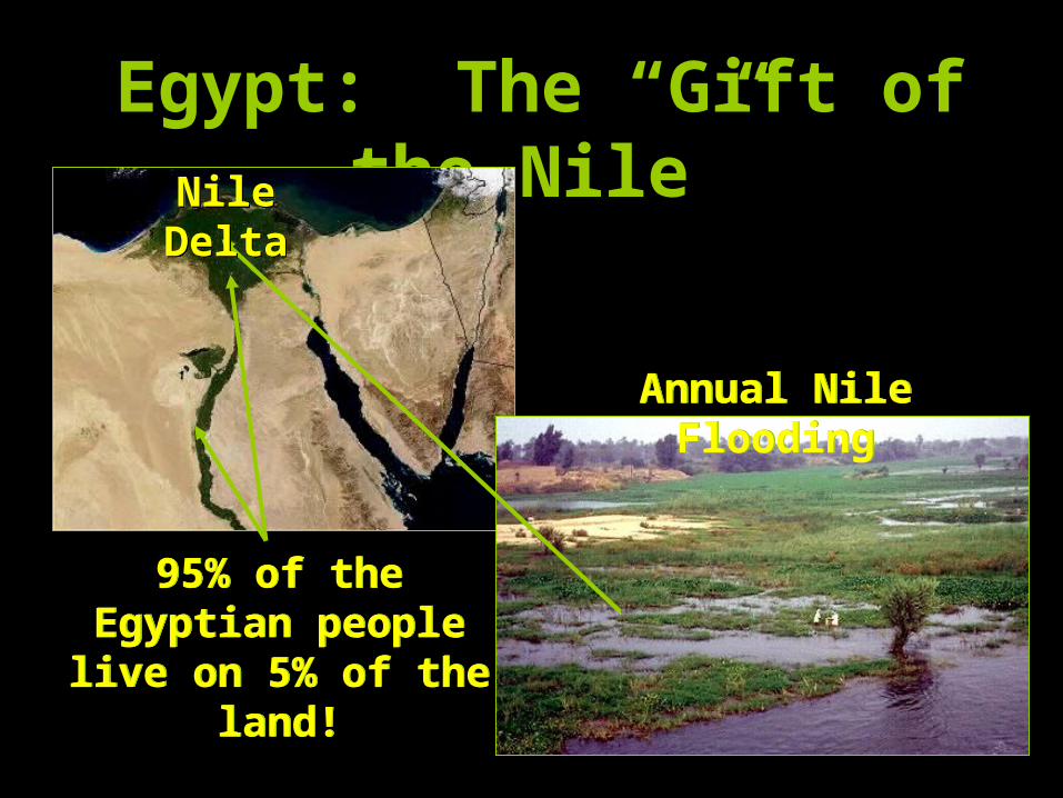
Egypt: The “Gift of the Nile”
Annual Nile Flooding
Annual Nile Flooding
Nile DeltaNile
Delta
95% of the Egyptian people live on 5% of the
land!
95% of the Egyptian people live on 5% of the
land!
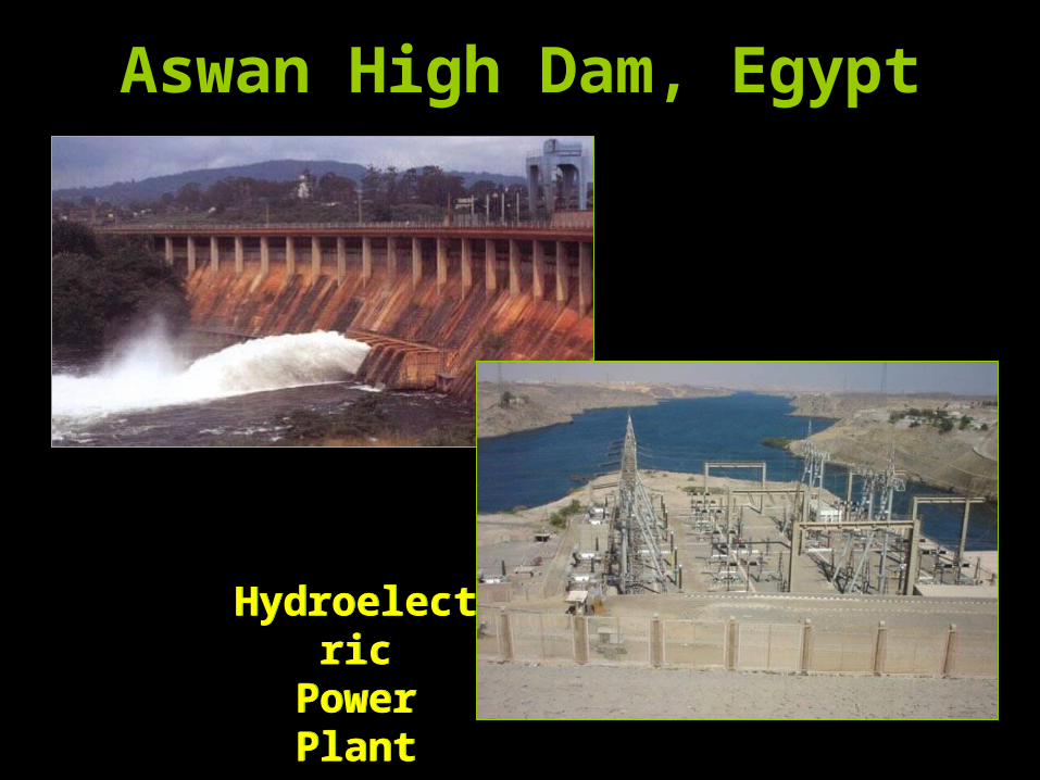
Aswan High Dam, Egypt
Hydroelectric
Power Plant
Hydroelectric
Power Plant
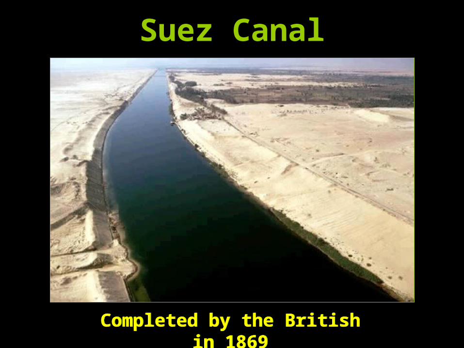
Suez Canal
Completed by the British in 1869
Completed by the British in 1869
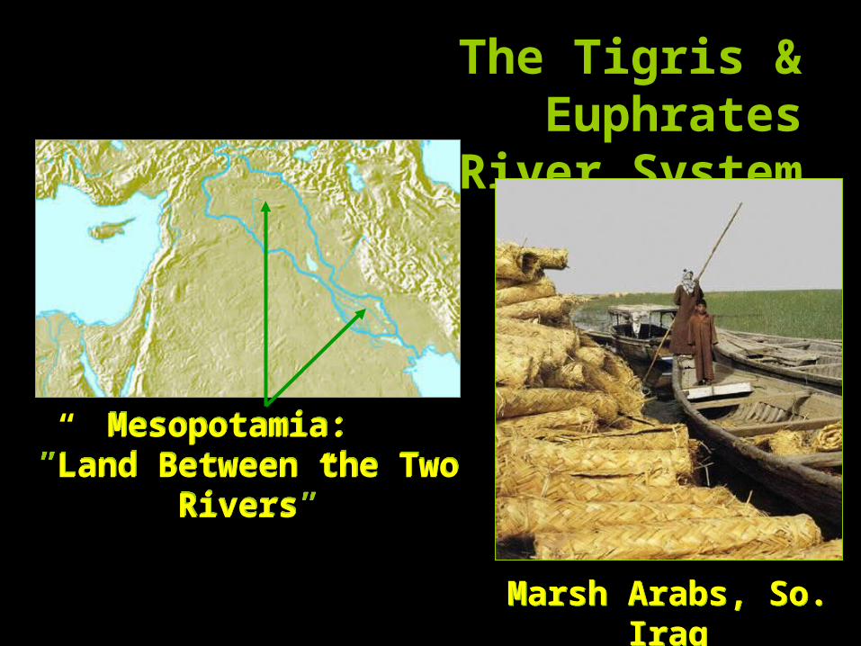
The Tigris & Euphrates
River System
Mesopotamia: ”Land Between the
Two Rivers”
Mesopotamia: ”Land Between the
Two Rivers”
Marsh Arabs, So. Iraq
Marsh Arabs, So. Iraq
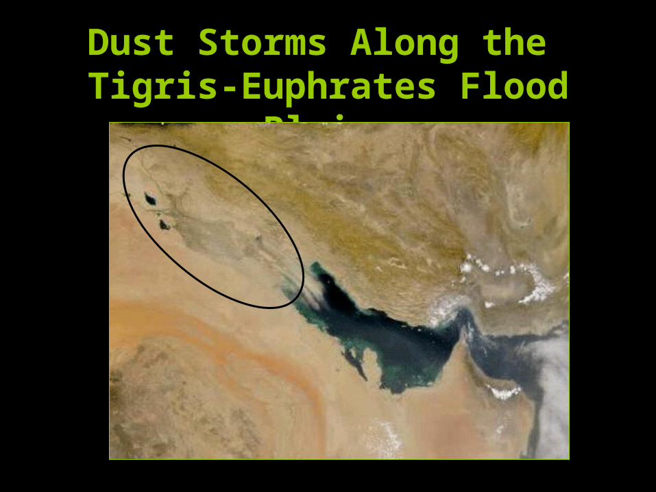
Dust Storms Along the Tigris-Euphrates Flood Plains
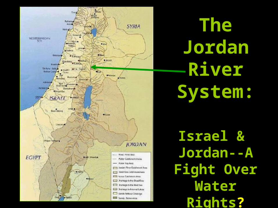
TheJordan River
System:
Israel & Jordan--A Fight Over
Water Rights?
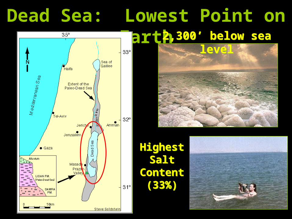
Dead Sea: Lowest Point on Earth
HighestSalt
Content(33%)
HighestSalt
Content(33%)
2,300’ below sea level
2,300’ below sea level
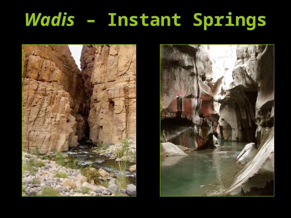
Wadis – Instant Springs
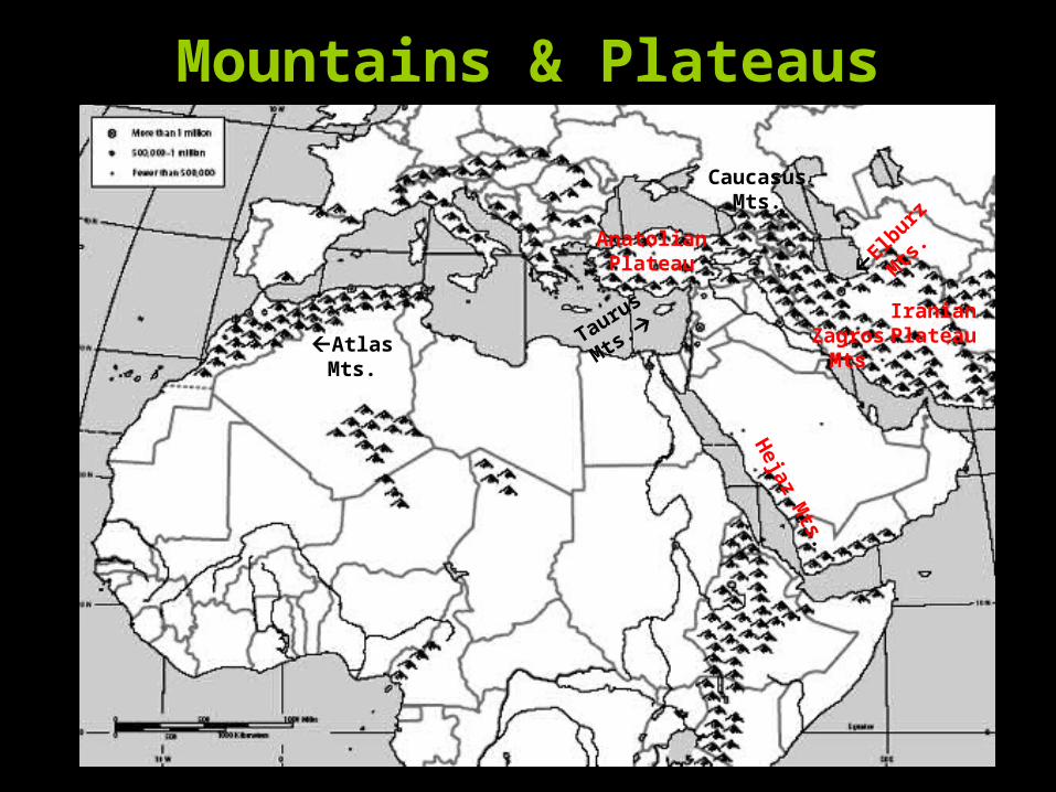
Mountains & Plateaus
Atlas Mts.
El
burz
Mts
.
Taurus
Mts. Zagros
Mts.
Iranian Plateau
AnatolianPlateau
Caucasus Mts.
Heja
z Mts.
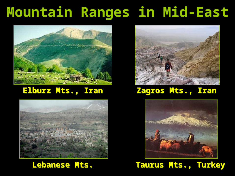
Mountain Ranges in Mid-East
Elburz Mts., IranElburz Mts., Iran Zagros Mts., IranZagros Mts., Iran
Lebanese Mts.Lebanese Mts. Taurus Mts., TurkeyTaurus Mts., Turkey
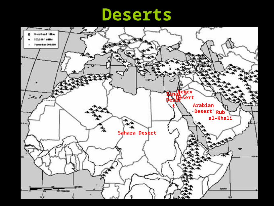
Deserts
Sahara Desert
ArabianDesert
NegevDesert
SinaiDeser
tRub
al-Khali
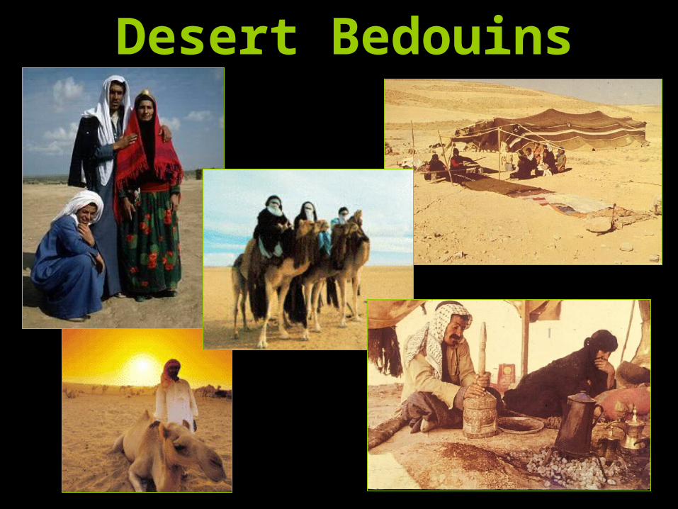
Desert Bedouins
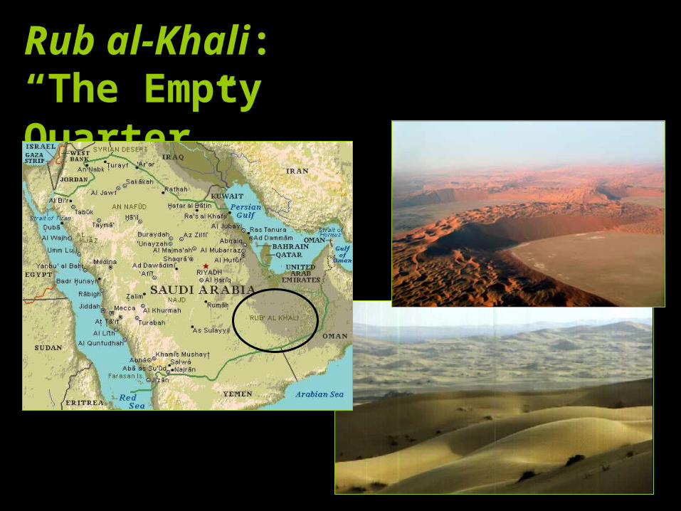
Rub al-Khali:“The Empty Quarter”
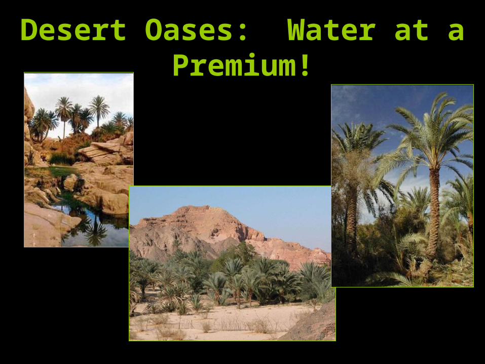
Desert Oases: Water at a Premium!
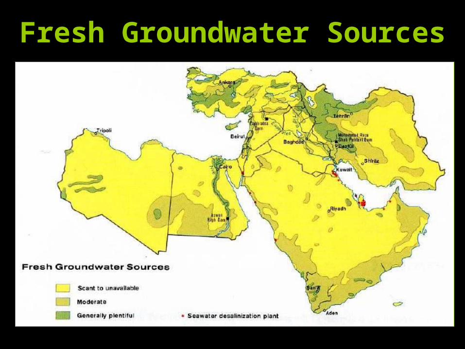
Fresh Groundwater Sources
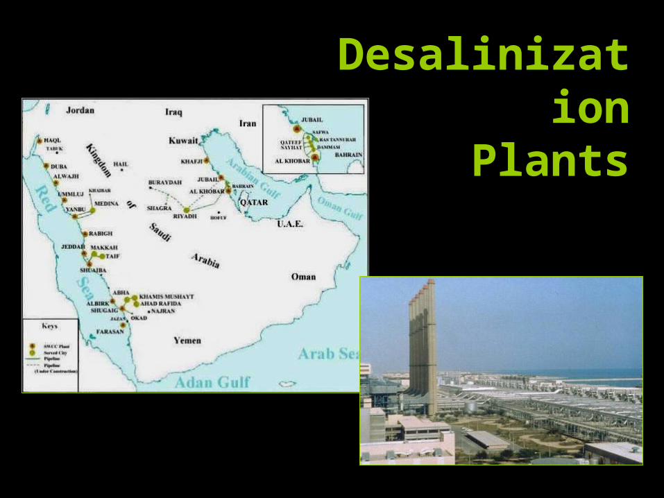
Desalinization
Plants
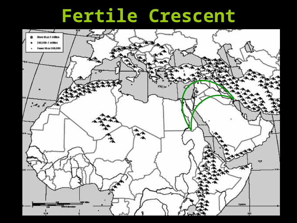
Fertile Crescent
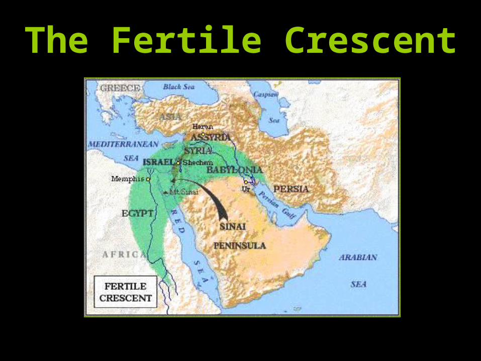
The Fertile Crescent
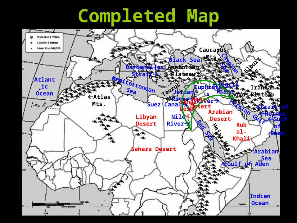
Completed Map
TigrisRiver
Nile River
Euphrates
RiverJordan River Persian Gulf
ArabianSea
Mediterranean Sea
IndianOcean
Red Sea
Black Sea
Gulf of Aden
Strait ofHormuz
Suez Canal
Dardanelles Strait
Atlantic
Ocean
Gulf of
Oman
Caspian
Sea
ArabianDesert
NegevDesert
SinaiDese
rt
Rubal-Khali
Atlas Mts.
El
burz
Mts
.
Taurus
Mts. Zagros
Mts.
Iranian Plateau
AnatolianPlateau
Caucasus Mts.
Heja
z Mts.Sahara Desert
Libyan Desert

Middle East: Climate Regions
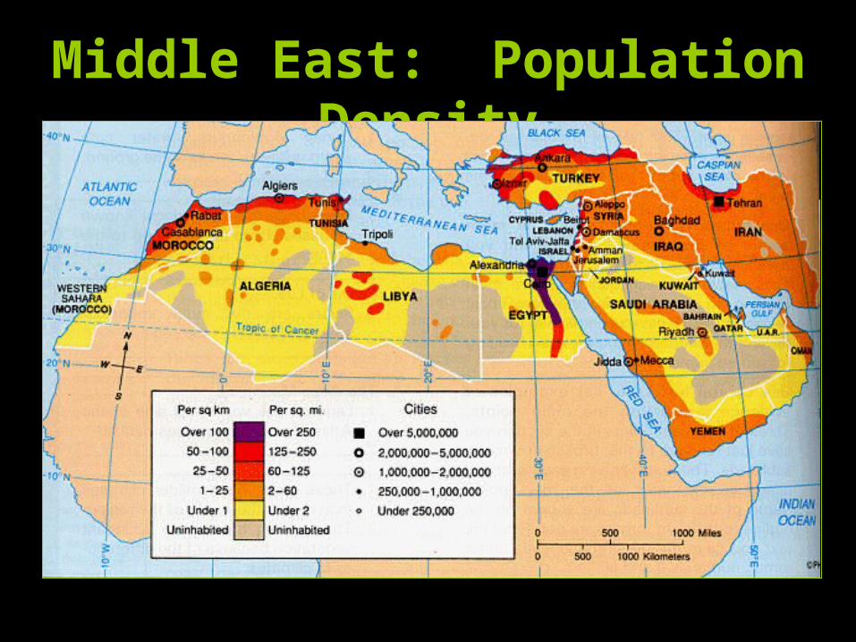
Middle East: Population Density
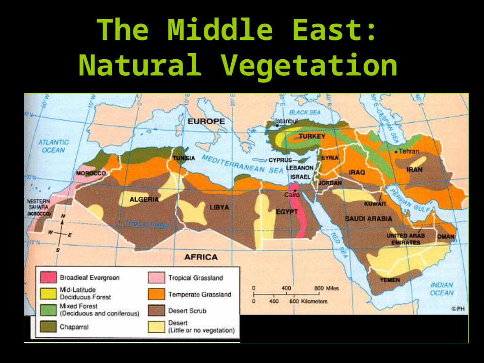
The Middle East:Natural Vegetation
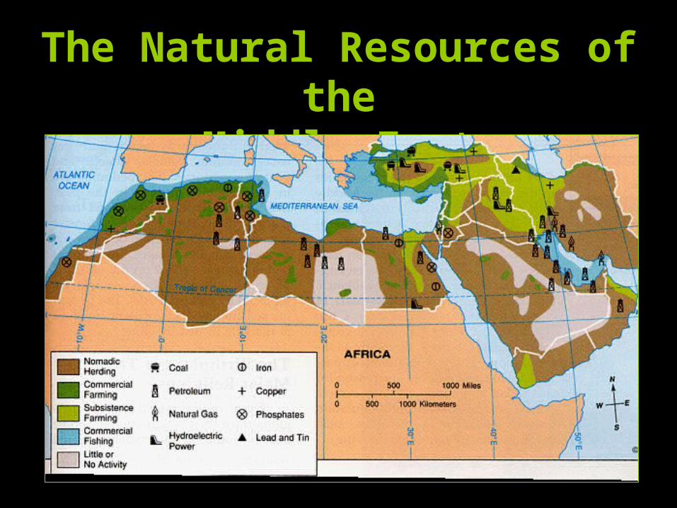
The Natural Resources of the
Middle East