Embed Size (px)
Citation preview

COLAC OTWAY SHIRE COUNCIL ELECTRIC LINE CLEARANCE MANAGEMENT PLAN 2013-14
1
ELECTRIC LINE CLEARANCE MANAGEMENT PLAN
MARCH 2013

COLAC OTWAY SHIRE COUNCIL ELECTRIC LINE CLEARANCE MANAGEMENT PLAN 2013-14
2
ELECTRIC LINE CLEARANCE MANAGEMENT PLAN SUBMITTED BY: Name: Adam Lehmann Manager Sustainable Assets Colac Otway Shire Council Date: March 2013 This Electrical Line Clearance Management Plan is prepared in accordance with Regulation 9 of the Electricity Safety (Electric Line Clearance) Regulations 2010. (a) Name, Address and Telephone Number of the Responsible Person. Name: Colac Otway Shire Council Business Address: 2-6 Rae St, PO Box 283 Colac VIC 3250 Email: [email protected] Telephone No.: (03) 5232 9400 Facsimile No.: (03) 5232 1046 Name of Chief Executive Officer: Rob Small (b) Name, Position, Address and Telephone Number of the Person who was responsible for the Preparation of the Plan. Name: Adam Lehmann Position: Manager Sustainable Assets Colac Otway Shire Council Address: 2-6 Rae St Colac VIC 3250 Telephone No.: (03) 5232 9484 Facsimile No.: (03) 5232 1046 Email: [email protected]
COLAC OTWAY SHIRE COUNCIL ELECTRIC LINE CLEARANCE MANAGEMENT PLAN 2013-14
3
(c) Name, position, address and telephone number of the persons who are responsible for carrying out the plan. Name: Greg Anderton Position: Manager - Cosworks Address: Pound Rd Elliminyt VIC 3250 Telephone No.: (03) 52329494 Facsimile No.: (03) 5232 1318 Email: [email protected] (d) The telephone number of a person who can be contacted in an emergency that requires clearance of an electric line that the responsible person is required to keep clear of vegetation. Name: Mark Robinson Team Leader Parks & Gardens Address: Pound Rd Elliminyt VIC 3250 Emergency Telephone No.: (03) 5232 9400 (After hours pager service operates) Email: [email protected] (e) The objectives of the plan.
The following are identified as key objectives of this Plan in fulfilling Council’s obligations as being a responsible person for the purposes of the relevant provisions of the Electrical Safety Act 1998.
§ To achieve compliance with the Electricity Safety (Electric Line Clearance) Regulations
2010; § To maintain a safe environment for the community; § Compliance with the Code of Practice for Powerline Clearance; § Works undertaken in accordance with AS 4373 – 2007 Pruning of Amenity Trees § Protection of areas of important vegetation; § Management of vegetation to maximise the amenity value of the Shire’s trees; § Provision of a safe working place for employees and contractors; and § Community satisfaction with the manner in which the necessary works are carried out
(f) The land the management plan applies.
Declared area(s) within the Colac Otway Shire are shown in Appendix 1.

COLAC OTWAY SHIRE COUNCIL ELECTRIC LINE CLEARANCE MANAGEMENT PLAN 2013-14
4
(g) The location of areas containing trees which may need to be cut or removed to ensure compliance with the Code and that are:
(i) Native
The street tree population of the City of Colac, represents an established, healthy, significant tree resource of varying ages, sizes and types.
The Southern part of the declared area is predominantly vegetated with native trees. Whilst not individually mapped, such trees are recorded in Council’s tree database. The predominant categories of vegetation located on public open space and in urban streets are:
North of Princes Highway (Murray Street)
Predominantly exotic species being generally fraxinus, ulmus and plane trees
South of Princes Highway (Murray Street)
Predominantly a mix of natives being generally melaleucas, eucalypts and agonis
The Declare Area managed by the Colac Otway Shire Council is classified as a Low Bushfire Risk Area and vegetation within the vicinity of overhead powerlines is managed accordingly.
(ii) Listed in the Planning Scheme to be of ecological, historical, or aesthetically
significant:
Colac Otway Planning Scheme identifies a number of places and precincts within Colac where tree controls are to apply. These are: § HO127 Manifold St Culverts, § HO114 Botanic Gardens Colac, § HO307 Residential Colac Precinct and § HO308 Memorial Square Precinct. The data sheets for these identified areas and precincts of heritage significance are included in Appendix 2.
The Colac Otway Shire Heritage Overlay provides that a permit is not required to remove, destroy or lop a tree if it relates to any action which is necessary to keep the whole or any part of a tree clear of an electric line provided the action is carried out in accordance with a Code of Practice prepared under Section 86 of the Electricity Safety Act 1998.
(iii) Trees of cultural or environmental significance:
There are no known trees of ecological or habitat significance for rare or endangered species listed in Councils declared areas within the vicinity of powerlines that require pruning or clearing to ensure compliance with the Code of Practice. No specific areas of vegetation of botanical or ecological significance are nominated in the Colac Otway Planning Scheme. No power lines pass through any area of threatened flora or fauna as declared under the Flora and Fauna Guarantee Act 1988.

COLAC OTWAY SHIRE COUNCIL ELECTRIC LINE CLEARANCE MANAGEMENT PLAN 2013-14
5
There are no known trees which are identified on the Victorian Aboriginal Heritage Register that are impacted on by Council’s vegetation management activities associated with powerline clearance.
(h) The means which the responsible person is required to use to identify a tree specified
in (g):
Council does not have specific maps which address predominant vegetation types. Council is in the process of compiling an overall list of trees, which when utilised with information contained in Planning Scheme overlays and other Council databases will further assist the programming of works around powerlines.
There are no known trees of ecological significance listed in Councils declared areas. Where these are identified in the future, all maps and information available to Council will be used to monitor these areas to ensure that minimal impact is made in the event of works being required.
Where appropriate, Council will undertake minimal pruning of vegetation as part of the pruning program of street trees and trees located in Public Open Space in the vicinity of powerlines. All pruning activities will comply with the standards and specifications as detailed in AS4373-2007 Pruning of Amenity Trees. Pruning may be undertaken using elevated work platforms or other similar methods in an effort to minimise overall site damage. The declared area managed by the Colac Otway Shire Council is predominantly a developed urban area and as such no habitat trees for rare or endangered species are known to exist. In the event that such trees are identified, the following process will be followed: Where Council intends to cut or remove a tree that has been identified as habitat for fauna listed as: a) Threatened in accordance with section 10 of the Flora and Fauna Guarantee Act 1988;
or b) Listed in the Threatened Invertebrate Fauna List with a conservation status in Victoria of
‘vulnerable’, ‘endangered’ or ‘critically endangered’; or c) Listed in the Threatened Vertebrate Fauna List with a conservation status in Victoria of
‘vulnerable’, ‘endangered’ or ‘critically endangered’.
Council will undertake cutting or removal of the tree outside of the breeding season for that species. Where it is not practicable to undertake cutting or removal of the tree outside of the breeding season for that species, translocation of the fauna will be undertaken wherever practicable. Should a tree be identified as either being of cultural significance or listed on the Victorian Aboriginal Heritage Register established under Aboriginal Heritage Act 2006, Council will contact either the Registered Aboriginal Party for the area or Aboriginal Affairs Victoria to determine the need for obtaining a Cultural Heritage Permit or the preparation of a Cultural Heritage Management Plan. No further pruning or clearing work associated with the identified tree will occur until all statutory requirements are fulfilled or it has been determined that permits, etc are not necessary for Council’s activities. The Colac Botanic Gardens has been included in the Victorian Heritage Register in recognition of their cultural, historical, and botanic significance. This heritage listing applies to the entire gardens precinct and includes certain exemptions for maintenance and management of the area. Trees in the vicinity of overhead electric lines within the Colac Botanic Gardens will be managed to comply with the clearance limits prescribed by the Code of Practice for Electric Line Clearance. The exemptions provided by the heritage listing and

COLAC OTWAY SHIRE COUNCIL ELECTRIC LINE CLEARANCE MANAGEMENT PLAN 2013-14
6
dependent on Council ensuring that all trees are managed and pruned in accordance with AS 4373-2007 Pruning of Amenity Trees (as amended) as a minimum standard. Any associated records will be filed in Council’s document management system and retained in accordance with the Retention and Disposal Authority for Records of Local Government Functions to ensure compliance with the Public Records Act 1973.
(i) The management procedures which the responsible person is required to adopt to
ensure compliance with the Code, which must include details of the methods proposed to be adopted for:
(i) Managing trees.
§ Council undertakes audits and inspections of clearance space (or more regular
surveillance and monitoring where required) to determine necessary pruning regime. § Assessment of potential regrowth by Council’s Surveillance Officer determining pruning
extent and frequency. § Council undertakes an annual tree pruning program on trees near powerlines within the
declared area. This program ensures the systematic maintenance of trees to a high aboricultural standard while maintaining required clearance distances.
§ Identified works assessed by the Surveillance Officer including any works advice from interested parties. Programming of work by Council to meet the Code of Practice for Powerline Clearance.
§ Responsive process for dealing with notified locations of non compliance with the Code. § Strategies are developed to provide alternatives to reduce dependence on vegetation
clearance (e.g. replacement of species, bundled cables, undergrounding of overhead powerlines, etc).
§ Ensure the removal of minimal tree vegetation as part of the annual tree pruning program on all street trees and trees within public open space in the vicinity of powerlines.
§ Recognise and maintain the trees health, shape, and aesthetic amenity value. § Address pruning requirements for specific trees and tree species. § Comply with the Standards and Specifications detailed in AS4373-2007 Pruning of
Amenity Trees.
(ii) Maintaining the clearance space, required by the Code, between electric lines and trees.
The following diagram outlines decision making process maintaining line clearance without unnecessary works.
Will branches of the tree breach Code clearance requirements?
IF NO – Inspect tree prior to next pruning cycle
IF YES – Can tree be pruned to allow for the appropriate clearance and regrowth within the pruning cycle without loss of amenity or increase of public risk?
IF NO – Consider options of a shorter pruning cycle, tree removal/ replanting, or cable replacement with aerial bundled or underground cable. Decision based on costs of options, tree value and surrounding environment of the tree.
IF YES – Prune tree as specified per AS 4373 – 2007 Pruning of Amenity Trees.

COLAC OTWAY SHIRE COUNCIL ELECTRIC LINE CLEARANCE MANAGEMENT PLAN 2013-14
7
Inspections
An inspection of the entire declared area shall be undertaken annually. The inspection will identify vegetation that is determined to be likely to breach the Code, along with any non-conformity identified. Hazards outside the clearance and regrowth spaces that may require correction will also be identified. Council shall maintain a record of all inspections within its centralised tree database. This information will be retained for future reference to determine appropriate pruning cycles. All inspections will be completed in sufficient time to allow Council to undertake the works and have identified clearance works completed prior to the introduction of the declared fire season. Trees identified by Council’s inspections or by any other interested party as liable to cause interference and or infringe the clearance space declared area will be assessed by Council’s Surveillance Officer. The assessment will be based on an estimate of anticipated tree growth rates from the previous year and on other occasions to accurately determine the required pruning needed. Council’s inspection processed include an assessment of tree growth rates, existing tree shape, existing tree types, and power distribution systems in specific areas.
Pruning Cycle Council’s nominal pruning cycle will be annually and over two (2) years (depending on location and species). Pruning or clearing required through emergency responses or otherwise will be conducted as required to ensure Code compliance. Based on the information gathered through inspections of the declared area, the pruning cycle is determined so the frequency of works ensures all trees remain within the Code requirements. Historical records will be maintained to determine the most effective pruning regimes whilst ensuring compliance with the Code. Due to growth rates, some identified species at specific locations will be pruned more regularly to ensure compliance with clearance spaces.
Standards
Council shall ensure that all trees are pruned in accordance with AS 4373-2007 Pruning of Amenity Trees (as amended) as a minimum standard. Qualified and experienced Council staff shall be employed to undertake all works. Training of staff is undertaken on an annual basis. The Team Leader, Parks and Gardens shall inspect the work carried out by Council staff throughout the period that active pruning is undertaken and shall directly supervise and audit the work. Records of any inspections shall be recorded and maintained in Council’s tree management systems.
Surveillance
Inspections are carried out during, and at the completion of the pruning works to ensure compliance with work specifications. The Surveillance Officer will observe and record clearance space maintenance ensuring sufficient pruning is completed to meet Code requirements during all weather conditions. This includes pruning to trees outside the clearance space which may cause interference.

COLAC OTWAY SHIRE COUNCIL ELECTRIC LINE CLEARANCE MANAGEMENT PLAN 2013-14
8
A record of all inspections completed by the Surveillance Officer is retained in Council’s centralised tree management database.
Powercor through its agent VEMCO, also conducts audits and forwards notices of non-compliance or required works to Council. Council prepares a program to address any particular issues identified as a matter of priority.
Hazardous Trees In a situation where Council identifies a tree that is likely to fall onto or otherwise come into contact with an electric line, Council will assess the tree using a suitably qualified arborist who holds the qualification of National Certificate Level IV in Horticulture and Arboriculture, including the ‘Assess Trees’ module, or an equivalent qualification and at least three (3) years of field experience in assessing trees. Where the arborist's assessment confirms the likelihood of contact with the electric line having regard to foreseeable local conditions including weather and ground instability, Council will remove or cut the hazard tree as per the Code. In the event of a hazard tree being identified as a culturally significant, environmentally significant or habitat tree, Council will where possible minimise the impact on the tree or fauna as previously outlined. For the purpose of this Plan, a hazard tree is a tree that possesses hazardous faults which if not actioned, will negatively impact distribution assets. These trees may possess characteristics such large cavities, severe decay, major cracks, etc. Emergency Pruning The nominal pruning cycle will be as determined, however pruning or clearing required through emergency responses or otherwise will be conducted as necessary to ensure compliance with the Code is maintained at all times. Surveillance will be undertaken and an appropriate pruning program will be implemented. More frequent pruning will occur for non-compliant vegetation. Should tree growth be such that clearance space is not maintained throughout the pruning cycle, non-complying trees will be pruned on a more regular basis. This will be documented and an assessment made annually. Urgent pruning will be done as soon as practical and as a matter of urgency. As part of such works Council will record where and when the cutting or removal was undertaken, identify why the cutting/removal was required and record when the last inspection of the tree occurred. All records will be filed at the Council office and kept for a minimum of 5 years. Council will undertake its urgent works in accordance with the Regulations and not remove or cut anymore than one meter from the minimum clearance space around the electric line. Notification and Consultation
Notification of Council’s program of works will be undertaken in accordance with the Electricity Safety (Electric Line Clearance) Regulation’s 2010. Council will ensure adequate notice is given to affected persons in regards to programmed line clearance works. Where Council intends to cut or remove a tree that is on public land or within the boundary of a private property which the responsible person neither occupies nor owns or where the tree is of cultural or environmental significance Council as the responsible person will give notice of the intended cutting or removal to all affected persons in accordance with the regulations.

COLAC OTWAY SHIRE COUNCIL ELECTRIC LINE CLEARANCE MANAGEMENT PLAN 2013-14
9
Prior to the commencement of works notice will be given in writing or by publication in a newspaper circulating generally in the locality of the land in which the tree is to be cut or removed at least 14 days and no more than 60 days before the intended works. Where the tree intended for cutting or removal is a tree of cultural or environmental significance, notice will include the impact of the cutting or removal of the tree and the actions to be taken to minimise that impact. Where the tree is within the boundary of a private property, Council will where relevant consult with the occupier or owner of the property. After undertaking emergency cutting or removal works, Council will, as soon as practicable after completion of the works, give notice to all affected persons; occupiers of the land on which the tree was cut or removed and where appropriate, the owner of the land on which the tree was removed.
Dispute Resolution Council is committed to sound decision making principles to ensure fair and reasonable outcomes for the community. Council Customer Service Charter provides an appeals process that enables community members to request a review of certain decisions and processes. If the dispute is unable to be resolved by the General Manager, Infrastructure & Services, resolution of the dispute will be applied with the following procedure: § Where the dispute exists with the Council as the service provider the matter will be
referred to an independent arbitrator acceptable to both parties involved. § If the dispute is over an alleged breach of the Code, the matter shall be referred to
Energy Safe Victoria for determination and advice. § If the dispute is over a breach of License Conditions by a Distribution Company, the
dispute will be taken to the Office of the Regulator General. § If the dispute is between the Council as a customer and a Distribution Company, then the
Energy and Water Ombudsman Victoria Limited should be contacted. § Where the matter is of a more technical nature, by an independent Arbitrator acceptable
to all parties involved in the dispute.
Alternative methods Council would meet and consult with the objector where necessary to establish details of the objection. If required an alternative methods may need to be investigated to achieve compliance with the Electricity Safety (Electric Line Clearance) Regulations 2010: To achieve an alternative Council could consider: § Use of aerial bundled cables; § Installation of underground cabling; § Street tree replacement and the upgrading of existing streetscapes with more appropriate
species; § Shortening of pruning cycle; § Realignment of existing powerlines; or § Modification of existing power line systems
Alternatives would be subject to funding by Council and distribution companies would be requested to provide an indication of their financial contribution to implement alternative methods.

COLAC OTWAY SHIRE COUNCIL ELECTRIC LINE CLEARANCE MANAGEMENT PLAN 2013-14
10
(j) A description of the measures to assess the performance of the responsible person under the management plan.
Ongoing assessments will be completed to ensure that all requirements outlined in this Plan are met. The following items will be measured as part of this assessment: § Preparation of the Electric Line Clearance Plan by 31 March of each year; § Number of annual inspections; § Number of trees in breach of the Code of Practice between pruning cycles; § Number of customer requests for pruning; § Number of requests from the relevant distribution company for pruning; § Number of customer complaints; and § Number of emergency clearances. Where remedial action can be satisfactorily carried out by Council staff or Council’s Contractor, this work will be corrected at the earliest possible date. Where assistance is required by the distribution company, e.g. emergency work, or attending to a non compliance issue, Council will make staff available where possible. Records of these assessments will be recorded in Council’s document management systems and retained for a minimum of five (5) years. (k) Details of the audit processes that must be used to determine the responsible
person’s compliance with the Code: The Council shall ensure that all vegetation is pruned according to AS 4373-2007 Pruning of Amenity Vegetation as amended, as a minimum standard. The Team Leader Parks & Gardens or their delegate shall inspect the work carried out by Council staff or contractors throughout the period that active pruning is taking place. A record of these inspections shall be kept, citing any evidence of sub standard pruning, and excess pruning or clearing in an effort to identify and promptly action non conformities. Internal audits shall be carried out at least annually to ensure that all requirements outlined in this Plan are being met and any non-conformity with the Code is identified. During the pruning cycle, random audits of works will be undertaken to confirm works have been coordinated and carried out according to the Code, relevant Australian Standards and comply with all occupational health and safety requirements relating to pruning, machinery handling, and traffic/pedestrian control. The General Manager Infrastructure & Services shall be responsible for conducting all audit procedures and the outcomes of such audits will be recorded and maintained in Council’s document management systems. Powercor through its agent VEMCO, also conducts audits and forwards the information to Council. This information is recorded and actioned according to the assessed priority. All non-conformances will be investigated further to determine their cause and any remedial actions will be implemented as soon as practicable or an agreed plan will be developed in order to address such issues.

COLAC OTWAY SHIRE COUNCIL ELECTRIC LINE CLEARANCE MANAGEMENT PLAN 2013-14
11
(l) The qualifications and experience that the responsible person must require of the persons who are to carry out the cutting or removal of trees.
All Contractors and/or Council employees used on tree clearing works must be suitably trained, qualified, and experienced and hold appropriate certificates that legally entitle them to undertake the outlined work. The qualifications required by Council are identified below and must include the satisfactory completion of an ESV approved training course in tree clearing, specifically a current Limits of Approach (Electrical Systems Identification and Power line Clearance Distances, Module NUE260) qualification or equivalent. All Contractors and/or Council employees must also follow the minimum distances specified in the Electricity Safety (Installation) Regulations 2009 when undertaking tree clearing works and comply with the limits of approach as outlined in the Code of Practice on Electrical Safety for Work on or Near High Voltage Electrical Apparatus (Blue Book). Notification will be provided to the owner of the electrical installations contained within the declared area prior to the commencement of pruning activities. Equipment used by contractors or employees is to have the suitable certification to enable use of the equipment legally on these works. The documents shall be sighted by the Contract Supervisor and updated as required. Where required all contractors and employees will have full accreditation to use Elevated Work Platforms and full knowledge of traffic control measures sufficient to meet the Code of Practice: Worksite Safety – Traffic Management incorporating AS1742.3 – 2002 Part 3. Training The following training and authorisation requirements and actions will be applied to ensure acceptable levels of competence required to demonstrate skills, knowledge and experience: § Both initial and refresher training are to be provided; § Skills and competence shall be maintained through regular refresher training; § All training to be provided by a Registered Training Organisation; § A record of the sighting of required certificates and associated documents shall be kept and
updated annually Accreditation The following certificates appropriate for the individual tasks carried out will be a minimum standard for any workers onsite.
§ NUE 260 Electrical Systems Identification and Power line Clearance Distances; § Chipper Operators Certificate; § Chainsaw Operators Certificate; § Limits of Approach procedures; § EWP Operator’s Certificate; § OH&S training; and § Worksite Traffic Management A record of required certificates and employee qualifications are located at Cosworks Depot, Pound Road, Elliminyt and is updated at least annually.

COLAC OTWAY SHIRE COUNCIL ELECTRIC LINE CLEARANCE MANAGEMENT PLAN 2013-14
12
Technical Standards
The following technical standards will apply or have regard in connection with electric line clearance work undertaken in accordance with this plan: § Electricity Safety Act 1998 § Electricity Safety (Electric Line Clearance) Regulations 2010 § Electricity Safety (Installation) Regulations 2009 § AS 4373 –2007 Pruning of Amenity Vegetation § Code of Practice on Electrical Safety for Work on or Near High Voltage Electrical Apparatus
(Blue Book) § Code of Practice for Electric Line Clearance § NUE 260 Electrical Systems Identification and Power line Clearance Distances. § Worksite Safety - Traffic Management Code of Practice The Colac Otway Shire - Electric Line Clearance Management Plan is made available to the public at Council’s Customer Service Centre located at 2-6 Rae Street, Colac during normal office hours
from 8:30 am to 5:00 pm Monday to Friday.
COLAC OTWAY SHIRE COUNCIL ELECTRIC LINE CLEARANCE MANAGEMENT PLAN 2013-14
APPENDIX 1
Map of Declared Area
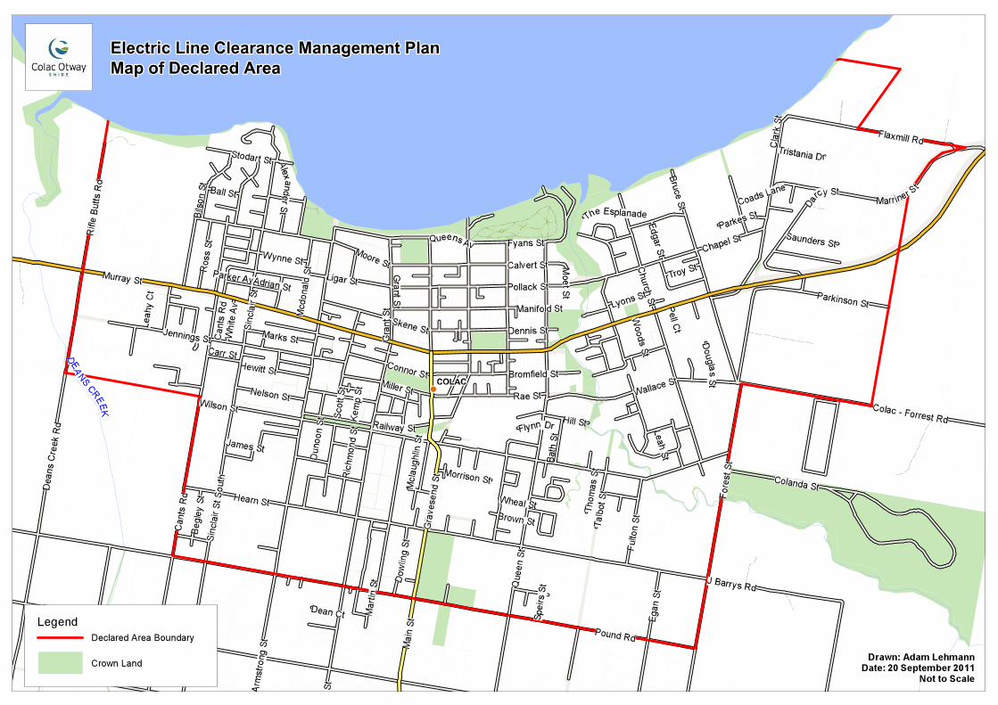
Drawn: Adam LehmannDate: 20 September 2011
Not to Scale
Legend
Crown Land
Declared Area Boundary
COLAC OTWAY SHIRE COUNCIL ELECTRIC LINE CLEARANCE MANAGEMENT PLAN 2013-14
APPENDIX 2
Areas of Vegetation Determined to be Historically or Culturally Important or of Outstanding Aesthetic Value
Colac Otway Heritage Study Volume II
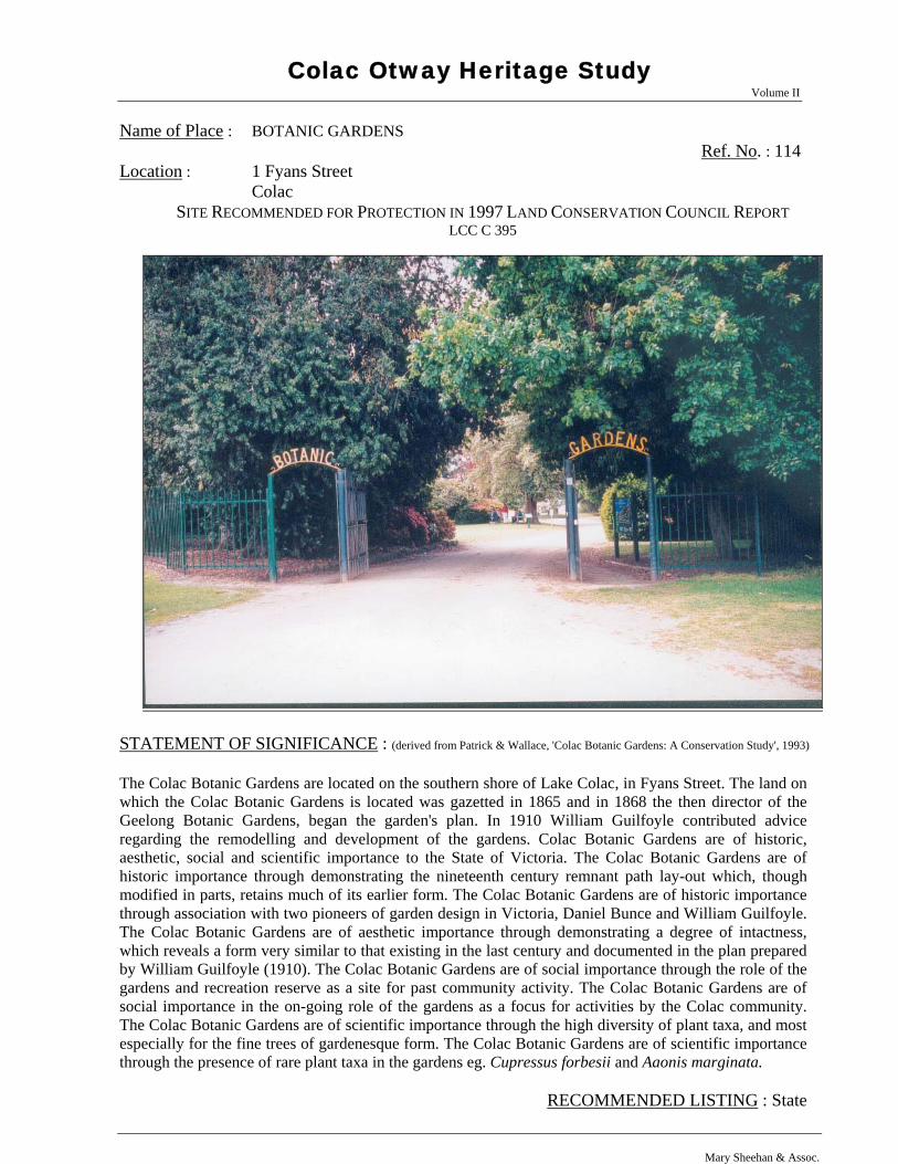
Name of Place : BOTANIC GARDENS Ref. No. : 114 Location : 1 Fyans Street Colac
SITE RECOMMENDED FOR PROTECTION IN 1997 LAND CONSERVATION COUNCIL REPORT LCC C 395
STATEMENT OF SIGNIFICANCE : (derived from Patrick & Wallace, 'Colac Botanic Gardens: A Conservation Study', 1993)
The Colac Botanic Gardens are located on the southern shore of Lake Colac, in Fyans Street. The land on which the Colac Botanic Gardens is located was gazetted in 1865 and in 1868 the then director of the Geelong Botanic Gardens, began the garden's plan. In 1910 William Guilfoyle contributed advice regarding the remodelling and development of the gardens. Colac Botanic Gardens are of historic, aesthetic, social and scientific importance to the State of Victoria. The Colac Botanic Gardens are of historic importance through demonstrating the nineteenth century remnant path lay-out which, though modified in parts, retains much of its earlier form. The Colac Botanic Gardens are of historic importance through association with two pioneers of garden design in Victoria, Daniel Bunce and William Guilfoyle. The Colac Botanic Gardens are of aesthetic importance through demonstrating a degree of intactness, which reveals a form very similar to that existing in the last century and documented in the plan prepared by William Guilfoyle (1910). The Colac Botanic Gardens are of social importance through the role of the gardens and recreation reserve as a site for past community activity. The Colac Botanic Gardens are of social importance in the on-going role of the gardens as a focus for activities by the Colac community. The Colac Botanic Gardens are of scientific importance through the high diversity of plant taxa, and most especially for the fine trees of gardenesque form. The Colac Botanic Gardens are of scientific importance through the presence of rare plant taxa in the gardens eg. Cupressus forbesii and Aaonis marginata.
RECOMMENDED LISTING : State
Mary Sheehan & Assoc.
Colac Otway Heritage Study Volume II
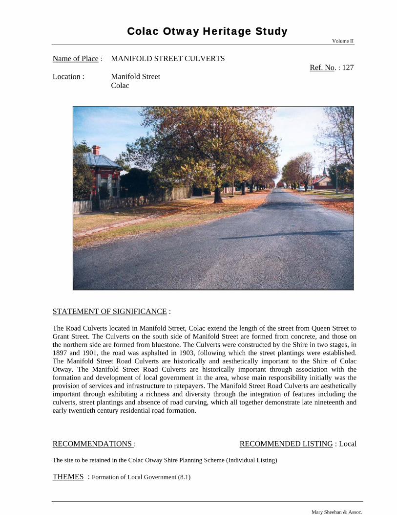
Name of Place : MANIFOLD STREET CULVERTS Ref. No. : 127 Location : Manifold Street Colac
STATEMENT OF SIGNIFICANCE : The Road Culverts located in Manifold Street, Colac extend the length of the street from Queen Street to Grant Street. The Culverts on the south side of Manifold Street are formed from concrete, and those on the northern side are formed from bluestone. The Culverts were constructed by the Shire in two stages, in 1897 and 1901, the road was asphalted in 1903, following which the street plantings were established. The Manifold Street Road Culverts are historically and aesthetically important to the Shire of Colac Otway. The Manifold Street Road Culverts are historically important through association with the formation and development of local government in the area, whose main responsibility initially was the provision of services and infrastructure to ratepayers. The Manifold Street Road Culverts are aesthetically important through exhibiting a richness and diversity through the integration of features including the culverts, street plantings and absence of road curving, which all together demonstrate late nineteenth and early twentieth century residential road formation. RECOMMENDATIONS : RECOMMENDED LISTING : Local The site to be retained in the Colac Otway Shire Planning Scheme (Individual Listing) THEMES : Formation of Local Government (8.1)
Mary Sheehan & Assoc.
HISTORY : The Shire of Colac was formed in 1864 under the terms of the Municipal Institutions Amendment Act (1863). The first task was to establish a local council, then it was necessary to construct a Shire Hall that would suitably define and create a distinction for the newly-formed government. The prominent architects Alexander Davidson and E G Ovey were commissioned and Colac’s Shire Hall was completed and ceremoniously opened in 1878. With this task completed, the councillors could then look to developing the less-exciting aspects of the infrastructure necessary for a town. Colac's streets were generally not formed until the 1870s, after the building of a meeting place for the council and suitable edifice, and the focus initially was on those areas, like Murray Street, that attracted the greater traffic. The construction of residential roads were delayed until funds became available, and it was not until the 1880s and 1890s that government grants were available for kerb and channel work. Manifold Street was kerbed and channelled in three separate works programs in 1897, 1901 and 1903. Contractor J Pell undertook the work. Asphalt was laid to the roadway in 1903 by Conway and Evans. The street works provide evidence of the growth of local government and the projects undertaken in providing the infrastructure of towns in the Shire. PHYSICAL DESCRIPTION : The Manifold Street road culverts, formed of concrete, extend along the south side of the road from Queen Street to Grant Street. On the north side the culvert is formed from bluestone and extends the length of Manifold, from Queen Street to Grant Street. The planting of exotic trees and the absence of guttering along the road verges is contiguous with early nineteenth century road forms, and adds to the aesthetic importance of the site. In the mid-twentieth century ramps were formed across the verges at various intervals to enable vehicular access to residential properties. Condition : Excellent Good Fair Poor Ruins Integrity : Highly intact Altered sympathetically Damaged/disturbed Altered unsympathetically
Shire of Colac Otway Heritage Study Volume II
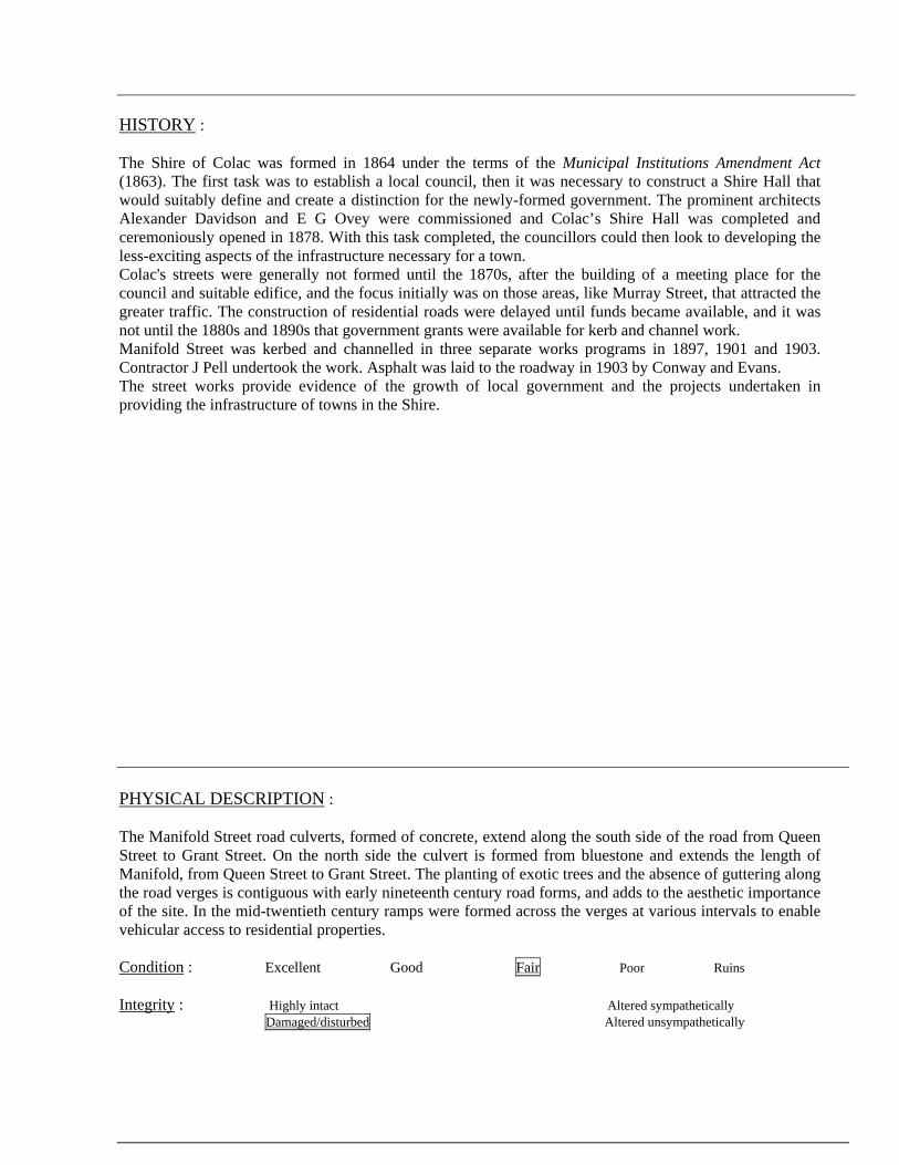
Name of Place : RESIDENTIAL PRECINCT Ref. No. : 307 Location : Fyans, Gellibrand, Manifold and Queen Streets Colac
STATEMENT OF SIGNIFICANCE : The Colac Residential Precinct is bounded to the north by Fyans Street; to the east by Queens Street; south by Manifold Street; and west by Gellibrand Street. The Colac Residential Precinct also extends south along Queen Street to Dennis Street and incorporates all those properties located on the east and west side of the street. The Precinct predominantly comprises single storey, exterior-painted weatherboard dwellings with corrugated iron clad roofs that were constructed in the late nineteenth and early twentieth centuries. The Precinct is distinguished by its street plantings, wide roads, grassy verges and deep culverts. The Colac Residential Precinct is of architectural, aesthetic and historic importance to the Shire of Colac Otway. The Colac Residential Precinct is of aesthetic importance in illustrating the principle characteristics of nineteenth century town planning in the grid format and wide road reserves. The Colac Residential Precinct is of architectural importance in demonstrating a continuum of residential styles incorporating modest Gothic; late Victorian Boom style; Federation and mid twentieth century brick dwellings that provide a 'map' in built form of Colac's residential development. The Colac Residential Precinct is of historic importance in demonstrating the evolution of Colac as an important regional centre, the residential development commencing initially in an area close to the churches, then later fanning out in a north east direction from an apex at Queen and Manifold Streets, adjacent to the original creek crossing and the civic precinct. RECOMMENDATIONS : RECOMMENDED LISTING : Local To be retained in the Colac Otway Shire Planning Scheme THEMES : Building Towns (5.1)
Shire of Colac Otway Heritage Study Mary Sheehan & Assoc. Recommendations - Places • 2
Assessment Date : 2000
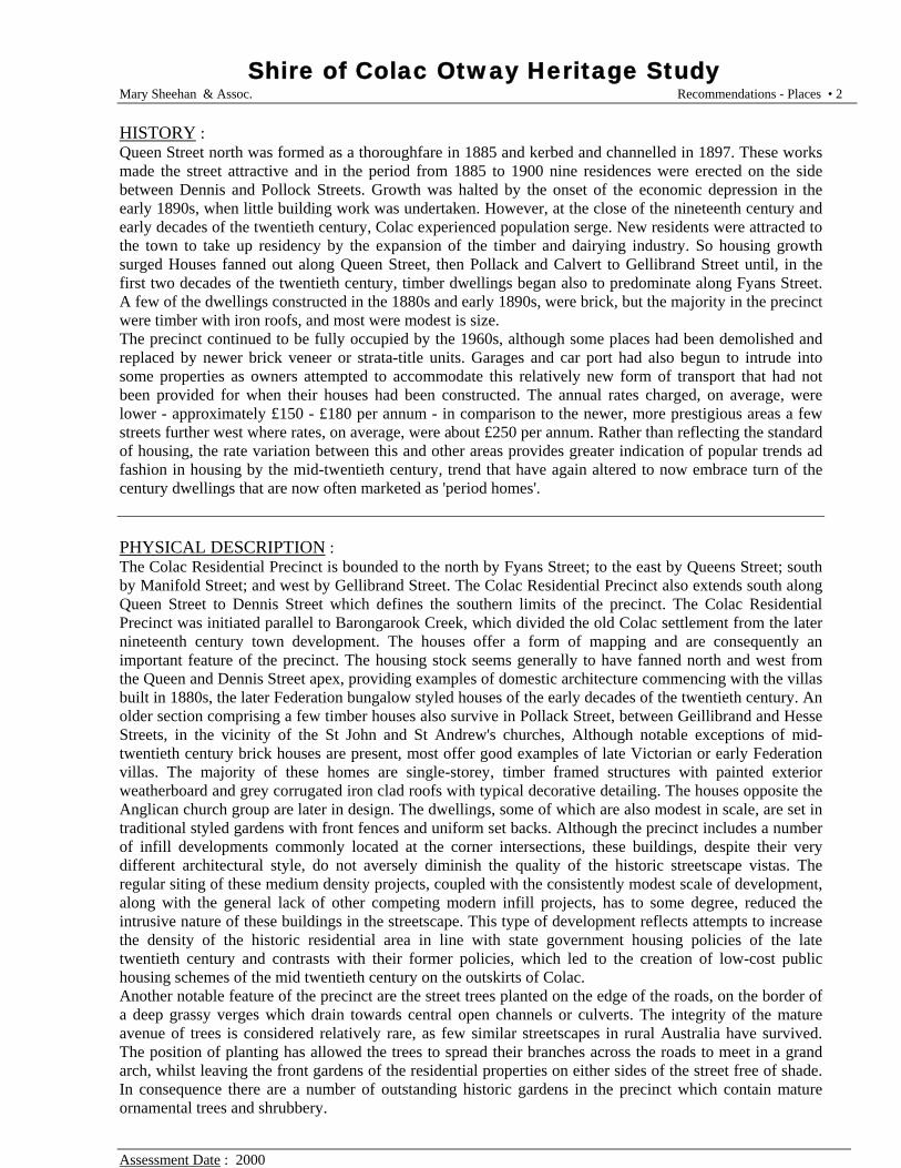
HISTORY : Queen Street north was formed as a thoroughfare in 1885 and kerbed and channelled in 1897. These works made the street attractive and in the period from 1885 to 1900 nine residences were erected on the side between Dennis and Pollock Streets. Growth was halted by the onset of the economic depression in the early 1890s, when little building work was undertaken. However, at the close of the nineteenth century and early decades of the twentieth century, Colac experienced population serge. New residents were attracted to the town to take up residency by the expansion of the timber and dairying industry. So housing growth surged Houses fanned out along Queen Street, then Pollack and Calvert to Gellibrand Street until, in the first two decades of the twentieth century, timber dwellings began also to predominate along Fyans Street. A few of the dwellings constructed in the 1880s and early 1890s, were brick, but the majority in the precinct were timber with iron roofs, and most were modest is size. The precinct continued to be fully occupied by the 1960s, although some places had been demolished and replaced by newer brick veneer or strata-title units. Garages and car port had also begun to intrude into some properties as owners attempted to accommodate this relatively new form of transport that had not been provided for when their houses had been constructed. The annual rates charged, on average, were lower - approximately £150 - £180 per annum - in comparison to the newer, more prestigious areas a few streets further west where rates, on average, were about £250 per annum. Rather than reflecting the standard of housing, the rate variation between this and other areas provides greater indication of popular trends ad fashion in housing by the mid-twentieth century, trend that have again altered to now embrace turn of the century dwellings that are now often marketed as 'period homes'. PHYSICAL DESCRIPTION : The Colac Residential Precinct is bounded to the north by Fyans Street; to the east by Queens Street; south by Manifold Street; and west by Gellibrand Street. The Colac Residential Precinct also extends south along Queen Street to Dennis Street which defines the southern limits of the precinct. The Colac Residential Precinct was initiated parallel to Barongarook Creek, which divided the old Colac settlement from the later nineteenth century town development. The houses offer a form of mapping and are consequently an important feature of the precinct. The housing stock seems generally to have fanned north and west from the Queen and Dennis Street apex, providing examples of domestic architecture commencing with the villas built in 1880s, the later Federation bungalow styled houses of the early decades of the twentieth century. An older section comprising a few timber houses also survive in Pollack Street, between Geillibrand and Hesse Streets, in the vicinity of the St John and St Andrew's churches, Although notable exceptions of mid-twentieth century brick houses are present, most offer good examples of late Victorian or early Federation villas. The majority of these homes are single-storey, timber framed structures with painted exterior weatherboard and grey corrugated iron clad roofs with typical decorative detailing. The houses opposite the Anglican church group are later in design. The dwellings, some of which are also modest in scale, are set in traditional styled gardens with front fences and uniform set backs. Although the precinct includes a number of infill developments commonly located at the corner intersections, these buildings, despite their very different architectural style, do not aversely diminish the quality of the historic streetscape vistas. The regular siting of these medium density projects, coupled with the consistently modest scale of development, along with the general lack of other competing modern infill projects, has to some degree, reduced the intrusive nature of these buildings in the streetscape. This type of development reflects attempts to increase the density of the historic residential area in line with state government housing policies of the late twentieth century and contrasts with their former policies, which led to the creation of low-cost public housing schemes of the mid twentieth century on the outskirts of Colac. Another notable feature of the precinct are the street trees planted on the edge of the roads, on the border of a deep grassy verges which drain towards central open channels or culverts. The integrity of the mature avenue of trees is considered relatively rare, as few similar streetscapes in rural Australia have survived. The position of planting has allowed the trees to spread their branches across the roads to meet in a grand arch, whilst leaving the front gardens of the residential properties on either sides of the street free of shade. In consequence there are a number of outstanding historic gardens in the precinct which contain mature ornamental trees and shrubbery.
Colac Otway Heritage Study Volume II
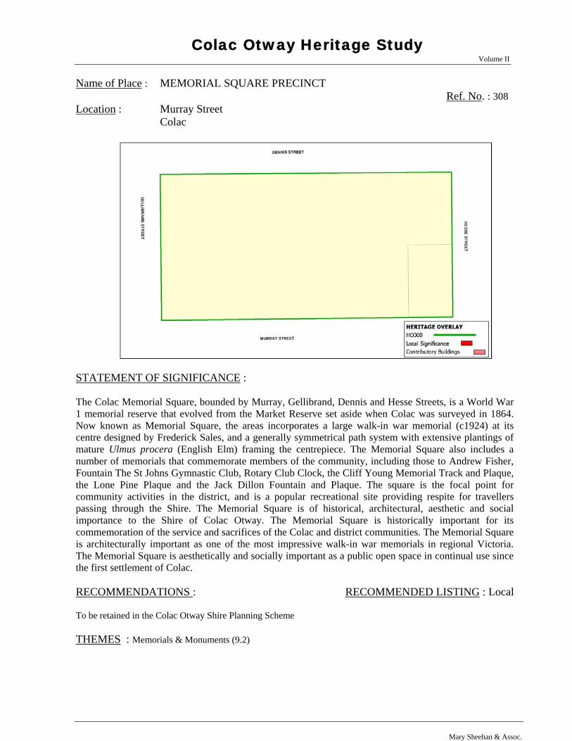
Name of Place : MEMORIAL SQUARE PRECINCT Ref. No. : 308 Location : Murray Street Colac
STATEMENT OF SIGNIFICANCE : The Colac Memorial Square, bounded by Murray, Gellibrand, Dennis and Hesse Streets, is a World War 1 memorial reserve that evolved from the Market Reserve set aside when Colac was surveyed in 1864. Now known as Memorial Square, the areas incorporates a large walk-in war memorial (c1924) at its centre designed by Frederick Sales, and a generally symmetrical path system with extensive plantings of mature Ulmus procera (English Elm) framing the centrepiece. The Memorial Square also includes a number of memorials that commemorate members of the community, including those to Andrew Fisher, Fountain The St Johns Gymnastic Club, Rotary Club Clock, the Cliff Young Memorial Track and Plaque, the Lone Pine Plaque and the Jack Dillon Fountain and Plaque. The square is the focal point for community activities in the district, and is a popular recreational site providing respite for travellers passing through the Shire. The Memorial Square is of historical, architectural, aesthetic and social importance to the Shire of Colac Otway. The Memorial Square is historically important for its commemoration of the service and sacrifices of the Colac and district communities. The Memorial Square is architecturally important as one of the most impressive walk-in war memorials in regional Victoria. The Memorial Square is aesthetically and socially important as a public open space in continual use since the first settlement of Colac. RECOMMENDATIONS : RECOMMENDED LISTING : Local To be retained in the Colac Otway Shire Planning Scheme THEMES : Memorials & Monuments (9.2)
Mary Sheehan & Assoc.
HISTORY : The earliest town plans of Colac show an area set aside for a Market Reserve in Murray Street. The reserve was not ever developed and remained a dust bowl in summer and mud heap in winter where farmers parked wagons. In 1873 the Minister for Lands advised the Colac Shire Council that he would set aside the land for a public park. This was eventually agreed to and the block was enclosed with a picket fence in 1875 and some 140 trees planted. In 1879 Council proposed to subdivide the reserve to allow commercial development along Murray Street but a violent public reaction thwarted this move. Nevertheless Council viewed the reserve as providing opportunities for various interest groups and allowed several structures to be built on it. In 1887 a fire station and tower was erected. In 1890 the Colac Bowling Club was permitted to build a club house and greens, and in 1901 a Library, masquerading as the South African War Memorial, was sited in the south east corner. The Library memorial plaque was later stolen and not replaced so the younger generation had no inkling of the Library’s true purpose after this. After the First World War the role of the reserve was critically looked at and a number of decisions made on its future. The Shire sponsored the War Memorial Movement and when sufficient funds were available, erected the memorial in the centre of the reserve. The fire station was removed as part of this renewal as well as general beautification works also being carried out. The reserve was then named The Memorial Square. The open space in the middle of town was still not immune from building over and in 1954 the Town Council proposed to construct a new Town Hall on the site. There was furious local opposition and the plan was dropped. However the community would accept an extension to the war memorial and this was carried out in 1957. By now the Colac community fully accepted the role of the Square as open space that was not to be compromised. The Library building was removed in 1970 and the Bowling Club relocated in 1992 in order to provide a free expanse of parkland. The City Council rejuvenated the Square in 1993 with a Federal Grant and works included renewal of pathways, installation of a playground and construction of a Town Plaza and Pergola. The architects were Green & Dale. The Memorial Square houses a number of monuments and plaques that reflect the spirit of the community and its response to national and local events. The centre piece of the Square is the First World War Memorial. A citizens committee devised the proposal to erect a Permanent Peace Memorial in the Market Square and, with Colac Shire Council approval and cooperation, undertook fund raising and a design competition for such a memorial. The chosen design was by Frederick Sales. The memorial is 50 feet high, 20 feet wide and 16 feet deep and is built on a base of heavy bluestone with a natural rock face. The front entrance comprises bluestone steps bordered by facing piers leading to the main entrance. A small panel carries the words “The Shire’s Tribute” and other panels bear the names of the many well-known battles during the conflict. The portals of the building are enclosed between two Corinthian columns 20 feet high supporting the pediment of the Corinthian order and carved leaves of the Acanthus decorate the tops of the columns. The chamber with a tiled floor, a lofty dome and panelled roof lists the names of 1546 servicemen who enlisted and 318 who died. All the stone in the structure, including the Corinthian columns, came from Waurn Ponds. A torch emblem tops the Memorial in a bowl 11 feet in diameter with the sculptured head of Mars, the God of War, facing the four points of the compass. The main superstructure above the base is Ballan yellow dressed stone with rich veins of colour markings. The official unveiling took place on 15 November 1924 and was performed by Sir Henry Chauvel. The memorial is the most magnificent anywhere in country Victoria and is only bettered by the larger walk-in structures at Geelong and Melbourne. The memorial to those who served in the Second World War and Korean War was constructed as a separate entity on the Murray Street side of the First World War memorial. In 1955 Architects Mason & Weinstock developed a contemporary design involving a low wall and two tall columns facing a pool of remembrance. The memorial was opened on 3 August 1957 by Lt. Governor Sir Edmund Herring. Since then there have been other plaques placed on the memorial complex recognising the conflicts in Malaya, Borneo, the Malayan Peninsula and Vietnam 1948 – 1972; Women who Served and the Garden of Peace (the latter two unveiled on 15 August 1995, being the 50th anniversary of the end of World War Two).
(History cont.) Other memorials and plaques within the Square include the (1) Fisher Memorial. A plaque commemorates the utterance of Andrew Fisher, leader of the Federal Labor (Opposition) Party, who in Colac on 31 July,
1914 said that Australia would fight the Germans to the last man and the last shilling after details of German aggression against its neighbours were announced. (2) St John’s Fountain The St Johns Gymnastic Club donated a polished granite drinking fountain in 1923. (3) Rotary Clock The Rotary Club movement donated a clock on an elevated metal standard on the Murray Street frontage, 23 February 1980. (4) Cliff Young Track Local resident Cliff Young rose to national attention in 1982 when he won the Sydney to Melbourne ultra marathon foot race. A running track around the Square was installed for the purposes of endurance running. A plaque to this effect was unveiled in 1982. (5) Lone Pine Plaque - An Aleppo Pine tree generated by seed from the original lone pine at Gallipoli was planted on the north side of the mound in 1995. A plaque records this. (6) Dillon Fountain. In 1972 Cr. Jack Dillon suggested that the Square be made more attractive by an illuminated fountain and this was installed and opened in 1974. The fountain was modelled on the El Alemain Fountain at Kings Cross. In 1993 the centrepiece fountain was removed and the basin converted to a reflective pool. PHYSICAL DESCRIPTION : The Town Square precinct comprises the Memorial Square, the former market square, the avenue of mature trees and other plantings, layout paths and all the historic structures and Memorials contained within the square bound by Murray, Hesse, Gellibrand and Dennis Streets, it also includes all those properties which overlook the square. These consists of the group of remodelled 1950s shop fronts along Murray Street, the former SEC Commission office building, the Sewell Building, and a small group of Inter War shops on Gellibrand street, the Italianate 19th century building and its associated development on Hesse streets and the remaining group of 19th century Victorian villas along Dennis Street, all these buildings contribute to the character and narrative history of the development of the Square, providing physical evidence of the precarious evolution of the former market square from an area used by farmers to hitch their wagons while attending the sales yards and auctions opposite, to community use of the space and the beautification work associated with the War Memorial Movement and unveiling of the First World War Memorial in 1924. The Memorial dominates the square, entitled “ The Shire’s Tribute” and is one of the most impressive and aesthetically outstanding structure in Victoria, carved out of Ballan stone standing 50 feet high designed by Frederick Sales to commemorate the 1,546 local servicemen who enlisted and 318 who died during war. It is designed like a neo-Palladian sacrificial temple of remembrance, associated with the Inter War Stripped Classical architectural style. A series of steps leads up to a raised chamber on a platform with domed panelled roof, accessed through 20ft stylized Doric/Corinthian columns in antis, with surmounting Greek entablature and pediment topped by a giant Grecian urn and torch with sculptured heads of Mars, god of war, facing the four points of the compass. The shrine is placed within a wider landscaped setting designed in 1955 by architects, Mason & Weinstock, using contemporary sandstone paving, upright free standing columns, terraced walls and pool of remembrance since turned into a rose garden, other features include walkways, and extensive modern playground, 1900 Federation style Chinese influenced timber band rotunda, standing in the middle of a large paved area surrounded by timber park benches and low clipped green hedge and tall globe landscape lighting, pergola, miscellaneous collection of park bench seating, toilet block and barbeque. The square has also become a reciprocal for a number of memorial plaques mainly granite cairns with attached bronze plaques gathered in a random fashion in one location at the Hesse Murray street corner.
(Physical Description cont.) Total number of trees: 54 Ages (est.): 100 (c1900) and 76 (pl. 1924)

Height: 20m (average) Canopy: 20m (average) Trunk Circumference: not measured (3.1m in 1986) Memorial Square is a World War 1 Memorial reserve developed from earlier parkland and bounded by Murray, Hesse, Dennis and Gellibrand Streets in central Colac. A park precinct, it is level in topography and its major elements comprising a c1924 [confirm] war memorial at its centre, and a geometric path system with extensive plantings of mature Ulmus procera (English Elm)framing this centrepoint. 54 trees assessed by NT in 1986 are a group planting which provides the context for the central memorial. Many perimeter trees precede the erection of the monument and appear to have been planted near or before the turn of the century (c1900), while trees closer to the memorial, especially those around the central circular path, date from the erection of the memorial (c1924), as confirmed by photographs of the time. Further investigation should confirm any changes to the path layout and alterations to other fabric, as well as the exact extent of plantings predating the war memorial.
Victorian Heritage Database place details - 20/9/2011COLAC BOTANIC GARDENS
Location:1-5 FYANS STREET COLAC, COLAC OTWAY SHIRE
Victorian Heritage Register (VHR) Number: H2259Listing Authority: VHRExtent of Registration:1. All the buildings marked as follows on Diagram 2259 held by the Executive Director. B1 Former curator's residence (now café)B2 Old brick toilet block2. All the features marked as follows on Diagram 2259 held by the Executive Director. F1 Bilson gates at Gellibrand Street entranceF2 TerracesF3 Lily pondF4 Cannon3. The circular driveway and paths marked P1 on Diagram 2259 held by the Executive Director.4. All of the land marked L1 on Diagram 2259 held by the Executive Director being parts of Crown Allotment25B and 25C, Township of Colac, and part of Crown Allotment 62A, Parish of Colac.
Statement of Significance:
The Colac Botanic Gardens occupy an elevated site of approximately 16 hectares north-east of the town centrebounded by the southern shores of Lake Colac, Gellibrand Street, Fyans Street and Barongarook Creek.
1

The main entrance to the Colac Botanic Garden is through the south-west entrance Bilson gates (1962) on thecorner of Fyans Street and Gellibrand Street where a carriage drive, lined with predominantly Quercus robur(English Oak) and few Quercus cerris (Turkey Oak), forms a row around the perimeter of the Gardens and isopen to vehicle access. The area enclosed by the drive has a network of winding paths and is mainly openlawn with specimen trees, shrubberies, some bedding plants together with a palm bed, rose garden, rosearbour, pond and fountain, and cannon (acquired 1904) near the south eastern gate. The curator's cottage(c.1924, now a café) is located at the western end of the gardens with playground equipment, picnic facilitiesand car parking at the eastern end. A caravan park occupies the north-east corner along Barongarook Creekadjacent to the lake shore.A steep escarpment planted with Pinus radiata (Monterey Pines) and specimen trees runs between the botanicgardens and the flat area around the shore of Lake Colac which contains remnant terracing, an old brick toiletblock with castellated roof (c1930s), a walking track, a fire brigade asphalt training track and shed, rotunda(1999), car parks, a rowing club, angling club, public toilets, boat ramp (1968) and jetty (1971). The escarpmentprovides separation between the two areas and provides extensive views from the Botanic Gardens over LakeColac. The site was temporarily reserved in 1865 for botanical and recreational purposes after a request from localresidents. Little progress was made until 1868 when Daniel Bunce, Director of the Geelong Botanic Gardens,was approached to lay out a plan for the garden. Implementation of the plan was slow with the construction ofa carriageway and planting of trees the only known details. Between c1875 -80, curators Reeves and McDonald made changes to the carriageway and introduced gardenbeds, curved paths, lawns and shady arbours. In the 1890s structures added to the gardens included a pavilionoverlooking the lake a conservatory in the south-eastern corner and a permanent rowing clubhouse on theedge of the lake joining the existing structures of piers, baths and a boat shed. Most of these structures havebeen removed.In 1910 William Guilfoyle, Director of the Melbourne Botanic Gardens, prepared a plan and a 'Report on theremodelling and development of the Colac Botanic Gardens', which are extant, suggesting some improvementsand remodelling to take advantage of the slope and vistas across over the lake which he considered had beenignored. This included simplifying the existing path system within the circular drive, and removal of borders andcrowded areas in favour of larger trees and clumps of shrubs and a palm and cordyline bed all of which wereimplemented. Curators Archibald Campbell (1911-40) and Dugald Leitch (1940-55) were responsible forimplementation of part of the Guilfoyle plan and maintaining the maturing Gardens but, with Guilfoyle's death in1912, any further influence ended. The last resident curator Donald Greenwood (1955-65) was responsible forthe addition of many native plants and in more recent times the gardens have more simplified planting and apark-like character. The Colac Botanic Gardens contains many rare plant species only found in historic gardens and severalsignificant and uncommon trees including four Cupressus forbesii (Tecate Cypress), a very large Sophorajaponica (Pagoda Tree), a Pittosporum tenuifolium 'Eila Keightley' (Kohuhu), a large Araucaria bidwillii (BunyaBunya Pine) and an outstanding Ulmus x hollandica 'Vegeta' (Huntington Elm). In March 1996, JamesGuilfoyle, grandson of William Guilfoyle, planted an Arbutus caneriensis (Canary Island Strawberry Tree). In2004 the Australian Plant Society planted an Otway Flora Bed on the eastern side of the Gardens.This site is on the land of the traditional owners.
Colac Botanic Gardens are of historical, aesthetic, and scientific (botanical) significance to the State ofVictoria.
Colac Botanic Gardens are of historical significance as an important example of a regional botanical garden,established in the nineteenth century in response to the increased wealth of Victoria with the discovery of goldand the desire to provide a place for recreation and education in keeping with European trends.
The Colac Botanic Gardens are of historical importance through the association with Daniel Bunce and WilliamGuilfoyle, two pioneers of botanic gardens and garden design in VictoriaThe Colac Botanic Gardens are of aesthetic significance due to their park - like character and elevated locationimmediately above the southern shore of Lake Colac, providing vistas across the lake. The gardens are ofaesthetic significance for the sub-tropical plant groups supported by Guilfoyle together with his gardenesquestyle. They are of aesthetic significance for the contrasting form and variety of trees and plants which includes
2

conifers, evergreen and deciduous plantings, together with the leaf shapes, colours and flowers, also contributeto the Garden's aesthetic quality and appealThe Colac Botanic Gardens are of scientific (botanical) significance for a number of rare plants and treesincluding four Cupressus forbesii (Tecate Cypress), the only known examples in Victoria, a large Sophorajaponica (Pagoda Tree), Pittosporum tenuifolium 'Eila Keightley' (Kohuhu), and large Araucaria bidwillii (BunyaBunya Pine) and an outstanding Ulmus x hollandica 'Vegeta' (Huntington Elm). .
Heritage Study
Year Construction Started
Architect / Designer
Architectural Style
Heritage Act Categories Heritage place
Municipality COLAC OTWAY SHIRE
Other names BOTANICAL GARDENS
History
3