Embed Size (px)
Citation preview

Effects of GNSS jammers and potential mitigation
approaches
Dr. Heidi KuusniemiResearch Manager
Finnish Geodetic Institute
Department of Navigation and PositioningFinland
United Nations/Latvia Workshop on theApplications of GNSS
14-18 May, 2012, Riga, Latvia

Content
•Introduction
•GPS and future GNSS
•Error and interference sources
•Interference classification
•Effects of jamming: test results
•Jamming and interference detection and mitigation approaches
•Conclusions
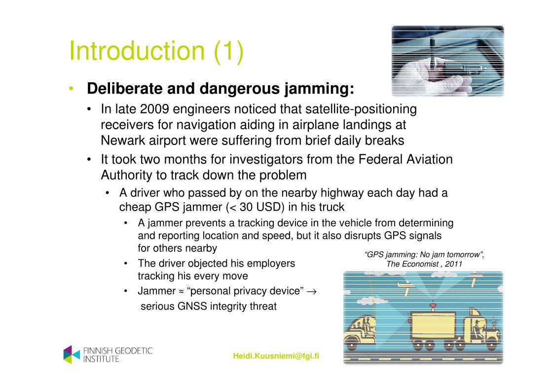
Introduction (1)
• Deliberate and dangerous jamming:
• In late 2009 engineers noticed that satellite-positioning receivers for navigation aiding in airplane landings at Newark airport were suffering from brief daily breaks
• It took two months for investigators from the Federal Aviation Authority to track down the problem
• A driver who passed by on the nearby highway each day had a cheap GPS jammer (< 30 USD) in his truck
• A jammer prevents a tracking device in the vehicle from determining and reporting location and speed, but it also disrupts GPS signals for others nearby
• The driver objected his employers tracking his every move
• Jammer ≈ “personal privacy device” →
serious GNSS integrity threat
“GPS jamming: No jam tomorrow”,
The Economist , 2011

Introduction (2)• Using jammers is illegal in most countries
• Still, jammers are gaining popularity to avoid e.g. road tolling, insurance billing, as well as tracking and location based monitoring
• Systems all over the world have been created to detect jamming/interference
• e.g. GAARDIAN in Britain, JLOC in the US
• Interference in Newark airport is still observed as often as several times per day
• the mitigations applied thus far have however reduced the frequency of incidents strong enough to affect navigation aiding in landings to several per week on average
• It has also been suggested that legislation is changed so that all smartphones would be required to search for jammers nearby and warn others in the vicinity
• Crowd-sourcing for interference detection?
• Also terrestrial beacons, back-ups to GNSS, are again gaining importance
4
S. Pullen, G. Gao, “GNSS
Jamming in the Name of
Privacy”, Inside GNSS,
March/April 2012, 34-43.

Satellite navigation – the GPS system• Satellite navigation is based on radio signals transmitted by Earth-orbiting satellites and
distance measurements between satellites and a user receiver
• A GNSS receiver 1) measures the signal travel time from the satellite to the Earth, and/or 2) computes the number of full carrier cycles between a satellite and a receiver
→ Range/distance measurements
• A receiver receives simultaneously information from multiple satellites through multiple channels
• When satellite locations are known, the user receiver location can be estimated based on the range measurements
USERS
� Range measurements
to satellites:
Location, speed and time computation
CONTROL SEGMENT
� Control center and ground stations
SATELLITES
� Carrier frequencies L1 (1575.42 MHZ) , L2 (1227.6 MHz) ja L5 (1176.45 MHz)
� Modulated onto the carrier signal:
� pseudorandom signals (codes)
� navigation data with satellite orbits
5

Future GNSS (1)
• In parallel to GPS, other satellite navigation systems have emerged or are under construction
• The Russian GLONASS completely functional, and undergoing further modernization
• European Galileo is being developed
• China’s Compass/Beidou-2 is being developed
• Also GPS is being modernized
• The systems are designed to be more and more resistant to interference
• The modernized and developed systems will include new carrier signal frequencies and new types of modulation codes
• GNSS, Global Navigation Satellite Systems:
6GPS32 SV operational
Galileo2 test-SV and 2 operational IOV satellites
Glonass24 SV operational
Compass /BeiDou 2,11 SV launched
Future GNSS (2)
• Adding new interoperable GNSS signals with improved modulations, signal carriers with subcarriers, longer codes and higher transmission power will improve the availability as well as the accuracy of satellite positioning
• Better resistance to cross-correlation
• Better multipath mitigation properties
• Better opportunities for weak signal acquisition with longer integration of data-less pilot signals
• Better resistance to interference
• However, multiple GNSSs induce more complicated signal processing
• In the future, all the available navigation signal frequencies (L1/E1, L2, L5/E5, E6) are more difficult to be jammed simultaneously

• Satellite measurements are noisy and erroneous since the signals attenuate on their way from the satellite to the receiver and bounce off e.g. buildings
• Most important sources of error:
• Satellite induced errors• Orbital errors• Clock errors
• Signal path related errors• Ionosphere• Troposphere• Multipath propagation
• Receiver induced errors• Various noise• Also errors caused by
the receiver operator/data processor
GNSS error sources
8
Orbital and clock errors
Ionosphere
Troposphere
Multipath propagation
Receiver induced errors

Interference sources (1)• The signals from GNSS satellites are very weak by the
time that user equipment receives and processes them• The minimum received power is
GPS L1 C/A: -128.5 dBm
Galileo E1: -127 dBm
• GNSS signals are thus especially vulnerable to radio frequency interference
• Unintentional interference• Free electrons in the ionosphere act as a retardant and accelerative
force on the GPS code and carrier phase measurements respectively• Massive solar flares can cause GPS devices to lose signals
• Terrestrial in-, near-, and out-of-band interference, as well as spurious emissions and/or harmonic interference from other systems, may disrupt GPS signal reception
• TV and telecommunications signals
• LightSquared was threatening in the US due to the interfere with GPS L1
• a 4G LTE wireless broadband communications network integrated with satellite coverage
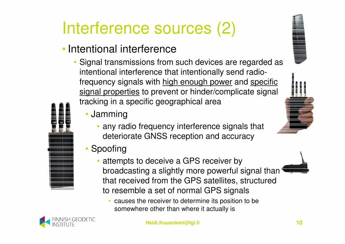
Interference sources (2)• Intentional interference
• Signal transmissions from such devices are regarded as intentional interference that intentionally send radio-frequency signals with high enough power and specific signal properties to prevent or hinder/complicate signal tracking in a specific geographical area
• Jamming
• any radio frequency interference signals that deteriorate GNSS reception and accuracy
• Spoofing
• attempts to deceive a GPS receiver by broadcasting a slightly more powerful signal than that received from the GPS satellites, structured to resemble a set of normal GPS signals
• causes the receiver to determine its position to be somewhere other than where it actually is

Interference classification (1)
11
• Interference signals can be continuous wave, wide-band or narrow-band radio frequency signals
• The higher power jamming signal, the more damage will be caused and the further it will reach
• Typically, jammers transmit interference signals in the L1/E1 band where the civilian consumer-grade navigation receivers operate (GPS, GLONASS and future Galileo)
• Typical jamming signal classification:• Class I: Continuous wave signal • Class II: Chirp signal with one saw-tooth function • Class III: Chirp signal with multi saw-tooth functions • Class IV: Chirp signal with frequency bursts
Kraus, T., R. Bauernfeind, B. Eissfeller (2011), ”Survey of In-Car Jammers – Analysis and Modeling of the RF signals and IF samples”, ION GNSS 2011, Portland, OR, USA, 19-23 Sept., 2011.

Interference classification (2)• Usually in-car jammers belong to the category of
narrowband interference
• Some of them have a continuous wave signal but the majority has a chirp signal with different complexity
• A typical chirp-jammer signal sweep time is 9 microseconds and a signal bandwidth of 20 MHz
12
Covert GPS L1 jammer
Spectrum
Frequency versus time

Effects of jamming
• Jamming deteriorates the positioning solution accuracy or alternatively totally loses the satellite signals and thus impairs the positioning availability
• Jamming affects the positioning receiver’s carrier-to-noise ratio C/N0 (dBHz)
• The effect of jamming can resemble receiving attenuated and multipath-deteriorated signals of dense urban areas
• the signal to noise ratio decreases and the GNSS signal to be received gets weaker and weaker
• GNSS receivers react differently to jamming
• The basic principle of GNSS receivers are the same but their internal processes and filters may mitigate the effect of a jamming signal being present differently

Covert GPS L1 jammer (14 $):
with special permission from the Finnish
Communications Regulatory Authority,
restricted to -30 dBm
(nominal 13 dBm)
Signal spectrum at L1
Analyzed jammers (1)
14
Instantaneous frequency

15
GPS L2-L5 TG-120D jammer (130 $):
with special permission from the Finnish
Communications Regulatory Authority,
restricted to -30 dBm
(nominal 33 dBm)
Signal spectrum at L2-L5
Analyzed jammers (2)
Instantaneous frequency

• The effects of the jammers on consumer grade GPS receivers were analyzed in a confined navigation laboratory at the Finnish Geodetic Institute
• Positioning solutions were analyzed with and without the jammers on 24 hours consecutively in the single-frequency case, and in shorter time steps with a dual-frequency receiver
• GNSS receivers:
• uBlox 5H and 5T
• Fastrax IT500 and IT600
• GPS inside Nokia N8
• NovAtel OEM4 (L1/L2)
16
GL, 28.3.2012
Test results (1)

• The jamming-to-signal (J/S) ratio in dB, is the ratio of the power of a jamming signal to that of a desired GNSS signal at a given point
• The maximum J/S ratios of around 15 and 25 dB were utilized in two test cases in addition to a no jamming test scenario
• Single-frequency:• L1 jamming effects were analyzed on 6 receivers
with the Covert GPS L1 jammer:• uBlox 5H, uBlox 5T, Fastrax IT500, Fastrax IT600, GPS receiver inside
the Nokia N8 smartphone, and the NovAtel OEM4• The datasets were obtained for 24-hour test duration in three different
cases: i) with no jamming, ii) with max J/S ≈ 15 dB, and iii) with max J/S ≈ 25 dB
• Dual-frequency:• L1 and L2 jamming effects were analyzed on the NovAtel OEM4 DL-
4plus (code-only processing) receiver with both the GPS L2-L5 and the Covert GPS L1 jammers simultaneously switched on
• max J/S ≈ 15 dB and max J/S ≈ 25 dB in 1-hour time-steps along with a no jamming test case where both the jammers were switched off
Test results (2)

19
• Single-frequency L1
• 24-h static tests to assess the effects of the jamming signal on consumer grade receivers
• Jamming-to-signal ratio 15 dB and 25 dB
• The maximum horizontal error was increased and positioning solution availability decreased when the jamming signal power was increased
Test results – single-frequency (2)
Mean (m) Std (m) Max (m) %
uBlox 5H
no jam 1.0 0.6 3.8 100
max J/S≈15 dB 1.4 0.7 4.6 100
max J/S≈25 dB 9.2 8.7 129.3 16
uBlox 5T
no jam 1.0 0.6 4.0 100
max J/S≈15 dB 1.5 0.8 6.5 100
max J/S≈25 dB 4.2 5.5 94 26
Fastrax IT500
no jam 2.2 1.0 5.3 100
max J/S≈15 dB 2.3 1.0 6.5 100
max J/S≈25 dB 3.7 5.2 85.4 16
Fastrax IT600
no jam 1.3 0.6 3.2 100
max J/S≈15 dB 1.3 0.7 3.2 100
max J/S≈25 dB 5.9 3.6 16.4 100
Nokia N8 GPS
no jam 2.6 2.4 32.4 100
max J/S≈15 dB 3.1 3.8 34.0 100
max J/S≈25 dB 3.9 2.2 22.4 16
NovAtel
no jam 1.0 0.7 4.8 100
max J/S≈15 dB 2.4 3.9 90.5 30
max J/S≈25 dB 5.4 7.3 92.1 8

20
Test results – single-frequency (3)
Positioning result around the true coordinates

21
Test results – single-frequency (4)
The solution availability when the maximum J/S was around 25 dB was only 16%

22
Test results – single-frequency (5)
Similar performances were observed
for the other tested receivers

Test results – dual-frequency (2)
Mean (m) Std (m)Max
(m)%
NovAtel
L1 & L2
no jam 0.8 0.4 2.8 100
max
J/S≈15 dB3.4 6.0 78.9 100
max
J/S≈25 dB3.5 2.6 26.6 11
• Both of the jammers were switched on, with a maximum J/S of around 15 dB and 25 dB in two consecutive tests
• The maximum horizontal error was increased and positioning solution availability decreased when the jamming signal powers were increased
• 1-hour datasets and code measurements only were, however, used in position computation

Test results – dual-frequency (3)
25Degradation in the C/N0 of the dual-frequency
signals in the dual-jammer test

• Modernized GNSS signals will take into account interference resistance
• Cross-correlation less probable
• Weaker and weaker signals can be acquired
• Intentional interference becomes more difficult when multi-GNSS frequencies and modulations are in use
• GNSS receivers can attempt to protect themselves towards interference in many ways with hardware and software
• both antenna-based and receiver-based solutions
• Antenna technology plays an important role in mitigating the effects of interference signals
Jamming detection (1)

• Typical mitigation approaches for civilian jamming mitigation include:
• Antenna Solutions • Controlled Radiation Pattern Antenna
• Adaptive Beamforming
• Receiver Solutions • Adaptive Notch Filtering
• Switching Frequencies (multi-GNSS / multi-frequency)
• Integrating GNSS with INS (inertial navigation system)
• Applying an interference suppression unit
• The jamming signals need to be detected first in order to mathematically model them and apply a mitigation approach
• Adaptive filtering with respect to • Time (chirp signals)
• Signal spectrum amplitude (narrow-band interference)
Jamming detection (2)
Conclusions
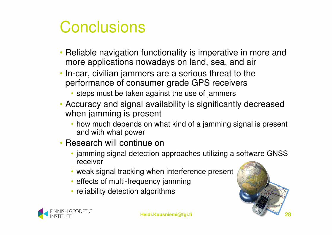
• Reliable navigation functionality is imperative in more and more applications nowadays on land, sea, and air
• In-car, civilian jammers are a serious threat to the performance of consumer grade GPS receivers
• steps must be taken against the use of jammers
• Accuracy and signal availability is significantly decreased when jamming is present
• how much depends on what kind of a jamming signal is present and with what power
• Research will continue on • jamming signal detection approaches utilizing a software GNSS
receiver
• weak signal tracking when interference present
• effects of multi-frequency jamming
• reliability detection algorithms

2nd International Conference and Exhibition on
Ubiquitous Positioning, Indoor Navigation and Location-Based Service
Helsinki, Finland, 3-4th October 2012
UPINLBS 2012
www.fgi.fi/upinlbs
Hilton HotelHelsinki