Embed Size (px)
Citation preview
ECOURBAN - AN ECOLOGICAL GIS FOR THE CITY OF BOURGAS,BULGARIA
Boris Rachev1, Venelin Todorov2, Atanas Sirekov2, Elena Racheva1,Nedjalko Nikolov1, Didi Velkova2
1 Technical University of Varna1, Studentska Str.
9010, Varna, Bulgaria2 Municipality of Bourgas26, Aleksandrovska Str.8000, Bourgas, Bulgaria
ECOURBAN Presentation 5th EC - GIS Workshop, 28-30 June 1999
2
EUROPEAN COMISSION DGIII-IndustryEUROPEAN COMISSION DGIII-IndustryRTD: Information Technologies, Software technologies and best practice, Project RTD: Information Technologies, Software technologies and best practice, Project NR. 960252NR. 960252
Urban Planning and Environmental MonitUrban Planning and Environmental Monit oring oring via GISvia GIS
in Eastern Europe in Eastern Europe
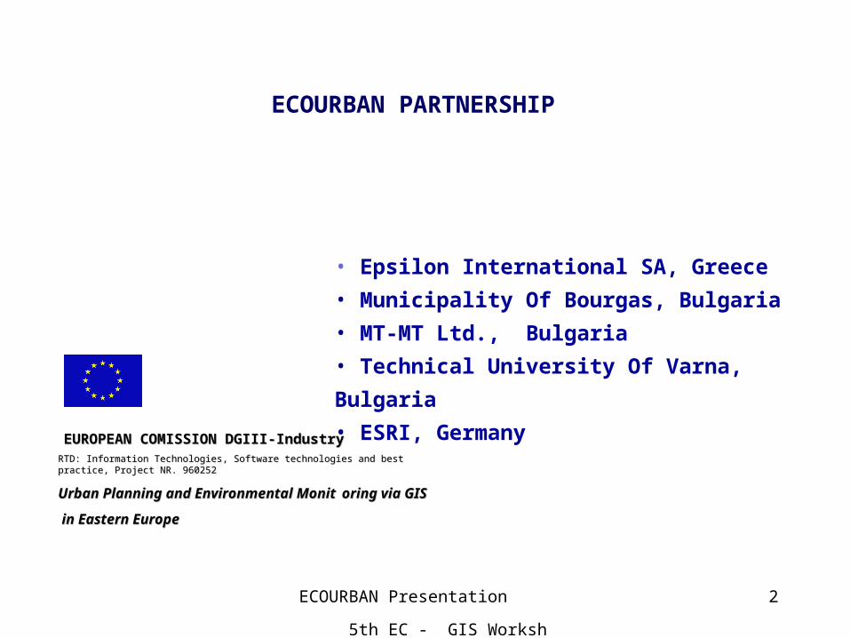
ECOURBAN PARTNERSHIP
• Epsilon International SA, Greece
• Municipality Of Bourgas, Bulgaria
• MT-MT Ltd., Bulgaria
• Technical University Of Varna, Bulgaria
• ESRI, Germany

ECOURBAN Presentation 5th EC - GIS Workshop, 28-30 June 1999
3
Main application goals* A new Approach for the Ecological GIS Synthesis and Analysis.
* Preparation of requirements to the GIS environmental application;
* Ensuring the available data;
* Requirements to the databases structures and contents have to be established.
* Preparing of the graphic database.
* Creation an environmental GIS application using the "Hierarchical Point to Point Model" (HPPM) of the real World which is especially created for the goals of the URBAN Project and a new relevant methodology, developed by Technical University of Varna, Department of Computer Sciences.
* Sharing the collected experience with organizations, companies and universities.
Application uses graphic and text data of the City of Bourgas with an area of about 1500 hectare.
ECOURBAN Presentation 5th EC - GIS Workshop, 28-30 June 1999
4
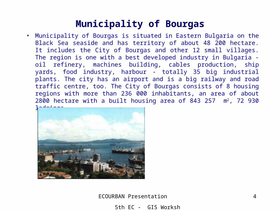
Municipality of Bourgas• Municipality of Bourgas is situated in Eastern Bulgaria on the Black Sea
seaside and has territory of about 48 200 hectare. It includes the City of Bourgas and other 12 small villages. The region is one with a best developed industry in Bulgaria - oil refinery, machines building, cables production, ship yards, food industry, harbour - totally 35 big industrial plants. The city has an airport and is a big railway and road traffic centre, too. The City of Bourgas consists of 8 housing regions with more than 236 000 inhabitants, an area of about 2800 hectare with a built housing area of 843 257 m2, 72 930 lodgings.
ECOURBAN Presentation 5th EC - GIS Workshop, 28-30 June 1999
5
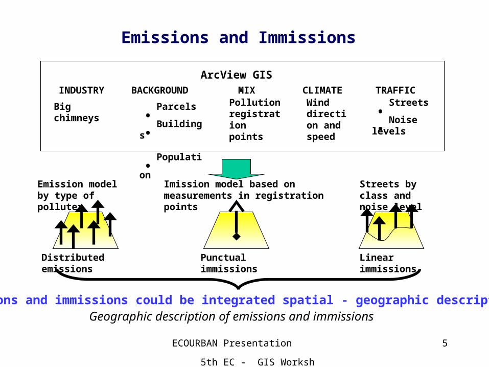
Emissions and Immissions
ArcView GISINDUSTRY MIX TRAFFIC
Big chimneys .Streets
.Noise levels
Pollution registration points
BACKGROUND
.Parcels
.Buildings
.Population
Streets by class and noise level
Emission model by type of polluter
CLIMATEWind direction and speed
Imission model based on measurements in registration points
Distributed emissions Punctual immissions Linear immissions
Emissions and immissions could be integrated spatial - geographic description.Geographic description of emissions and immissions
ECOURBAN Presentation 5th EC - GIS Workshop, 28-30 June 1999
6
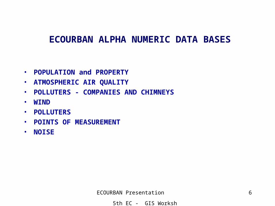
ECOURBAN ALPHA NUMERIC DATA BASES
• POPULATION and PROPERTY
• ATMOSPHERIC AIR QUALITY
• POLLUTERS - COMPANIES AND CHIMNEYS
• WIND
• POLLUTERS
• POINTS OF MEASUREMENT
• NOISE
ECOURBAN Presentation 5th EC - GIS Workshop, 28-30 June 1999
7
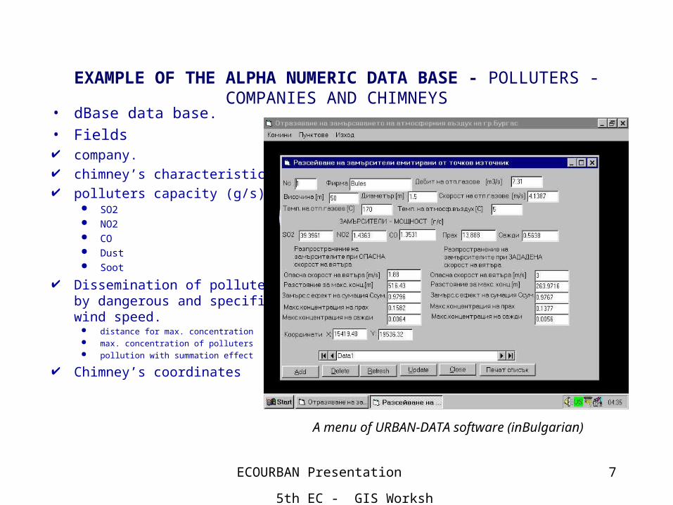
EXAMPLE OF THE ALPHA NUMERIC DATA BASE - POLLUTERS - COMPANIES AND CHIMNEYS
• dBase data base.• Fields company. chimney’s characteristics. polluters capacity (g/s).
SO2 NO2 CO Dust Soot
Dissemination of polluters by dangerous and specific wind speed.
distance for max. concentration max. concentration of polluters pollution with summation effect
Chimney’s coordinates
A menu of URBAN-DATA software (inBulgarian)
ECOURBAN Presentation 5th EC - GIS Workshop, 28-30 June 1999
8
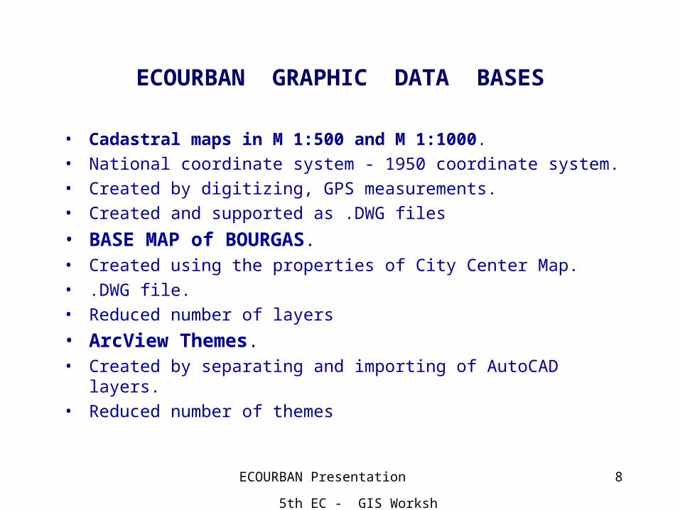
ECOURBAN GRAPHIC DATA BASES
• Cadastral maps in M 1:500 and M 1:1000.
• National coordinate system - 1950 coordinate system.
• Created by digitizing, GPS measurements.
• Created and supported as .DWG files
• BASE MAP of BOURGAS.• Created using the properties of City Center Map.
• .DWG file.
• Reduced number of layers
• ArcView Themes. • Created by separating and importing of AutoCAD layers.
• Reduced number of themes
ECOURBAN Presentation 5th EC - GIS Workshop, 28-30 June 1999
9
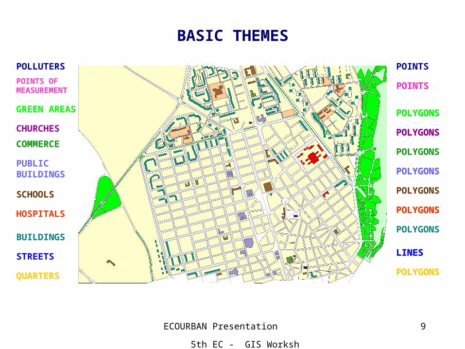
BASIC THEMES
QUARTERS
STREETS LINES
POLYGONS
BUILDINGS
HOSPITALS POLYGONS
SCHOOLS
PUBLIC BUILDINGS POLYGONS
COMMERCE
CHURCHES POLYGONS
GREEN AREAS POLYGONS
POINTS OF MEASUREMENT POINTS
POLLUTERS
LINES
POLYGONS
POLYGONS
POLYGONS
POLYGONS
POLYGONS
POLYGONS
POLYGONS
POLYGONS
POINTS
POINTS
ECOURBAN Presentation 5th EC - GIS Workshop, 28-30 June 1999
10
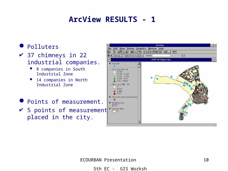
ArcView RESULTS - 1
Polluters 37 chimneys in 22 industrial
companies. 8 companies in South Industrial
Zone 14 companies in North Industrial
Zone
Points of measurement. 5 points of measurement
placed in the city.
ECOURBAN Presentation 5th EC - GIS Workshop, 28-30 June 1999
11
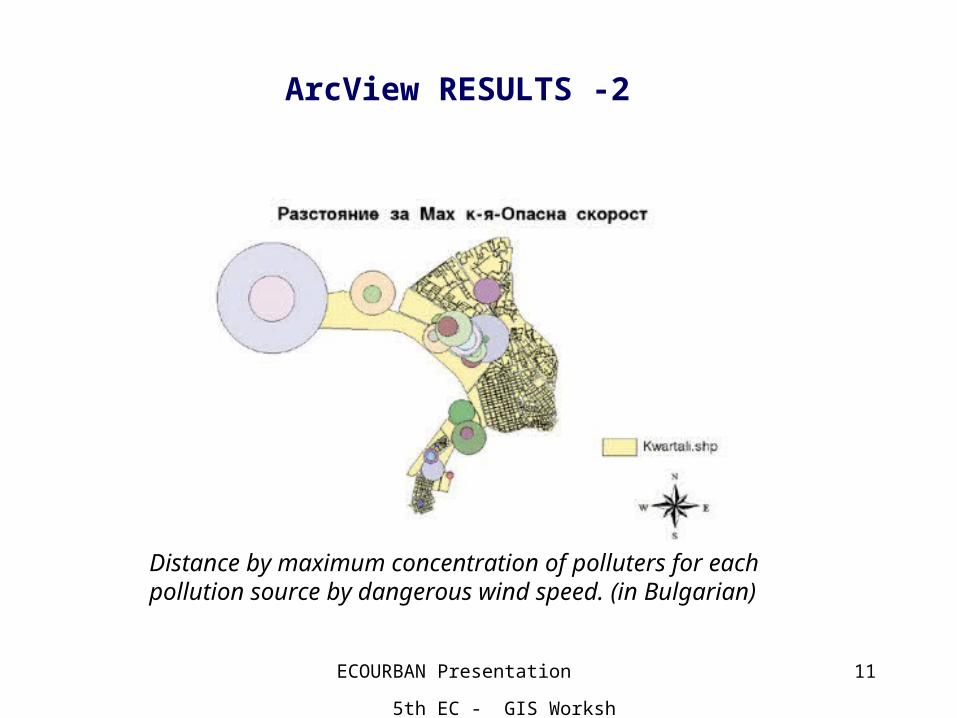
ArcView RESULTS -2
Distance by maximum concentration of polluters for each pollution source by dangerous wind speed. (in Bulgarian)
ECOURBAN Presentation 5th EC - GIS Workshop, 28-30 June 1999
12
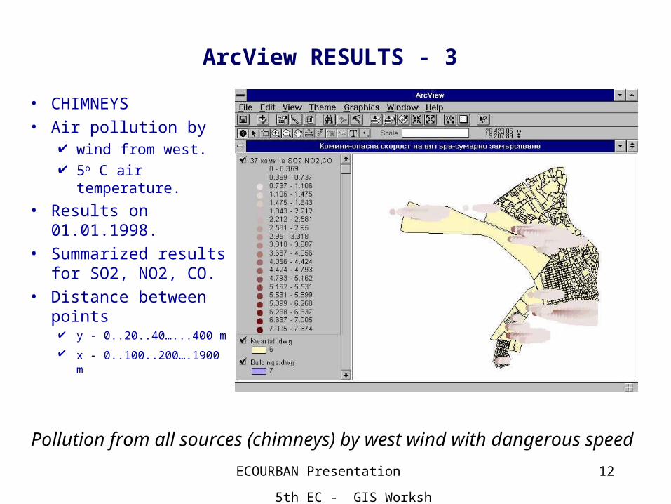
Pollution from all sources (chimneys) by west wind with dangerous speed
ArcView RESULTS - 3
• CHIMNEYS• Air pollution by
wind from west. 5o C air
temperature.
• Results on 01.01.1998.
• Summarized results for SO2, NO2, CO.
• Distance between points y - 0..20..40…...400 m
x - 0..100..200….1900 m
ECOURBAN Presentation 5th EC - GIS Workshop, 28-30 June 1999
13
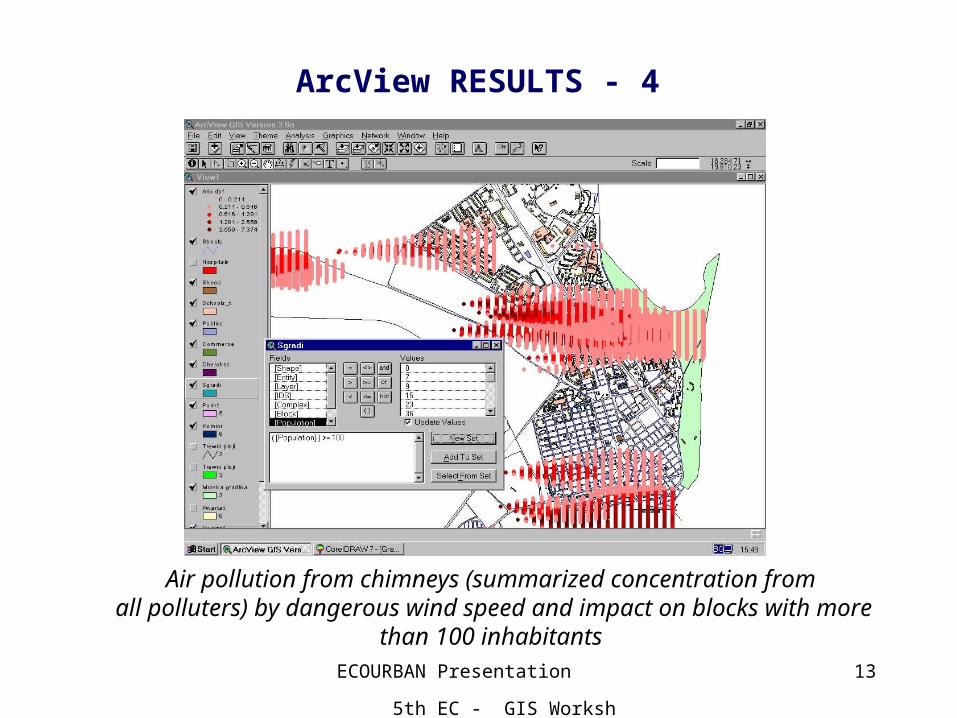
Air pollution from chimneys (summarized concentration from all polluters) by dangerous wind speed and impact on blocks with more
than 100 inhabitants
ArcView RESULTS - 4
ECOURBAN Presentation 5th EC - GIS Workshop, 28-30 June 1999
14
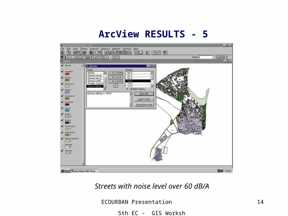
ArcView RESULTS - 5
Streets with noise level over 60 dB/A
ECOURBAN Presentation 5th EC - GIS Workshop, 28-30 June 1999
15
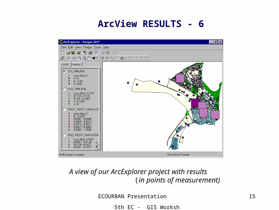
A view of our ArcExplorer project with results (in points of measurement)
ArcView RESULTS - 6
ECOURBAN Presentation 5th EC - GIS Workshop, 28-30 June 1999
16
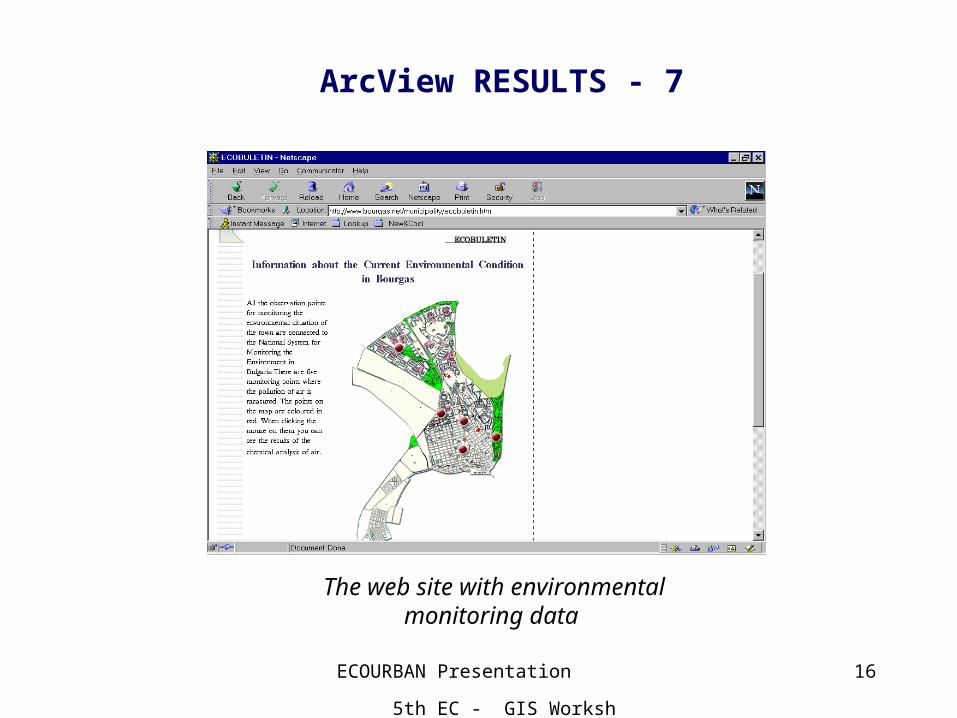
The web site with environmentalmonitoring data
ArcView RESULTS - 7
ECOURBAN Presentation 5th EC - GIS Workshop, 28-30 June 1999
17
Impact
• Modern technology transfer.• Way to develop global GIS solutions for our Municipality.• Data collection and actualization.• Contacts to potential GIS users.• Modern local government solutions.• Cooperation between local government, state authorities,
business, NGO’s.• Better service of citizens.• Successful international cooperation and future common
activities.• Better conditions for successful Bulgarian EU admittance and
participation.
ECOURBAN Presentation 5th EC - GIS Workshop, 28-30 June 1999
18
Conclusion
• ECOURBAN is a real GIS, which works in Bourgas Municipality in Bulgaria. This Information Technology supports the quality government decision making process in a very important area – Ecology.
• Generally, we think, that the ECOURBAN Project will ensure co-operation between municipalities with similar problems and infra-structures based on the new modern managerial and Information Tech-nologies. This way we hope to have more effective and useful relation-ships between our regions for a successful development and better opportunities for our citizens. ECOURBAN will outlive the Project and can be classified as a very classical GIS OF TOMORROW.