Embed Size (px)
Citation preview
Earthquake Hazards: A Brief Analysis of Seismotectonic Acivities in Myanmar Region
Professor Maung Maung AYE Rector-in-Charge (Retd.), Y.U.D.E.
President, Geographical Association of Myanmar (GAM) Patron & Chief Advisor, Myanmar Environment Institute (MEI)
E-mail: [email protected]
The First International Conference on Salween/Thanlwin/Nu Studies -“State of
Knowledge: Environmental Change, Livelihoods and Development”, hosted by the
Regional Centre for Social Science and Sustainable Development (RCSD), Faculty of
Social Science, Chiang Mai University, Thailand, organized by the Salween-Thanlwin-Nu
(STN) Studies Group, on 14-15 November, 2014
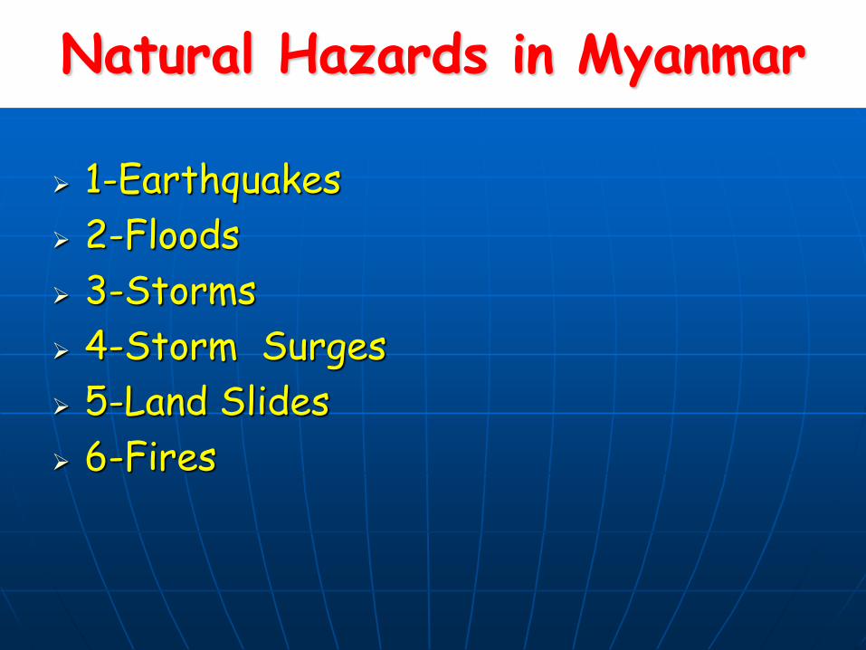
Natural Hazards in Myanmar
1-Earthquakes
2-Floods
3-Storms
4-Storm Surges
5-Land Slides
6-Fires
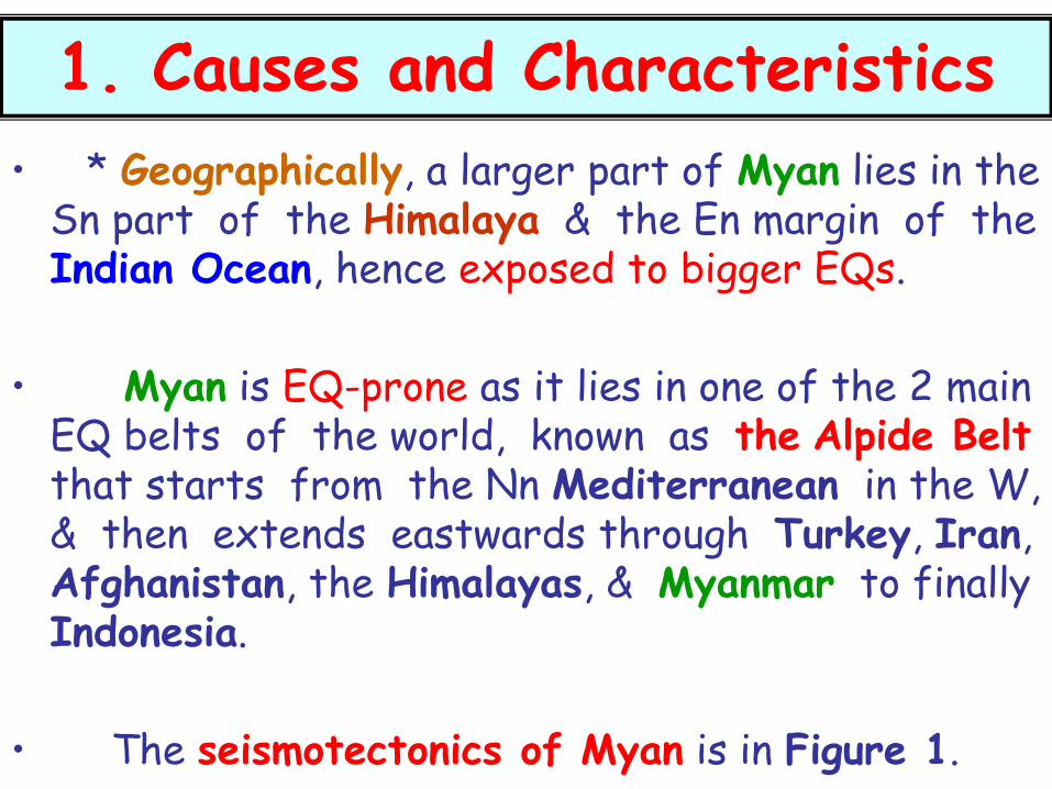
1. Causes and Characteristics
• * Geographically, a larger part of Myan lies in the Sn part of the Himalaya & the En margin of the Indian Ocean, hence exposed to bigger EQs.
• Myan is EQ-prone as it lies in one of the 2 main EQ belts of the world, known as the Alpide Belt that starts from the Nn Mediterranean in the W, & then extends eastwards through Turkey, Iran, Afghanistan, the Himalayas, & Myanmar to finally Indonesia.
• The seismotectonics of Myan is in Figure 1.
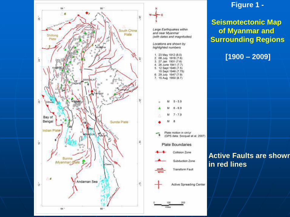
Figure 1 -
Seismotectonic Map
of Myanmar and
Surrounding Regions
Active Faults are shown
in red lines
[1900 – 2009]
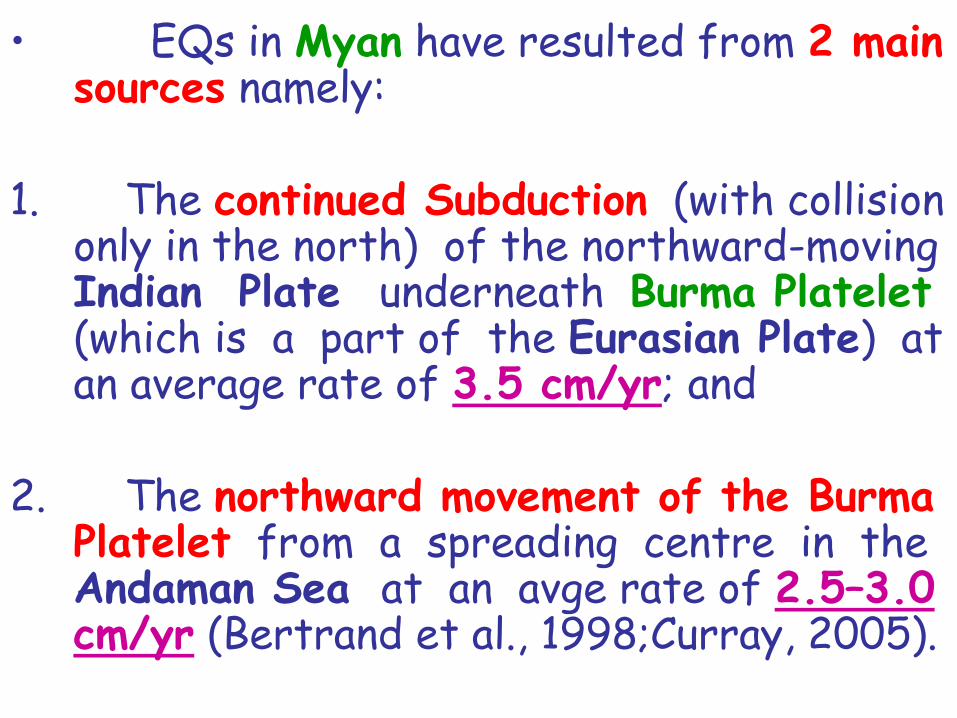
• EQs in Myan have resulted from 2 main sources namely:
1. The continued Subduction (with collision only in the north) of the northward-moving Indian Plate underneath Burma Platelet (which is a part of the Eurasian Plate) at an average rate of 3.5 cm/yr; and
2. The northward movement of the Burma Platelet from a spreading centre in the Andaman Sea at an avge rate of 2.5–3.0 cm/yr (Bertrand et al., 1998;Curray, 2005).

Background
Cause MANDALAY
YANGON
Figure 2
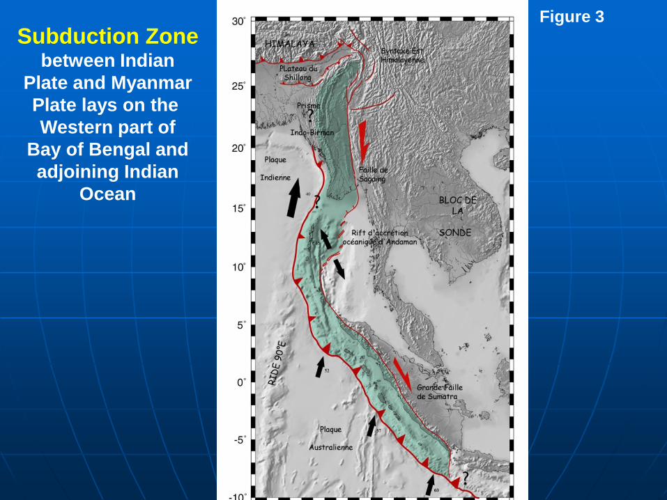
Subduction Zone between Indian
Plate and Myanmar
Plate lays on the
Western part of
Bay of Bengal and
adjoining Indian
Ocean
Figure 3
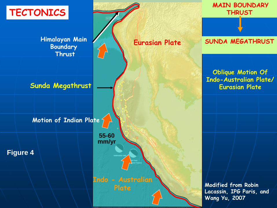
Indo - Australian Plate
Eurasian Plate Himalayan Main Boundary Thrust
55-60 mm/yr
Modified from Robin Lacassin, IPG Paris, and Wang Yu, 2007
Motion of Indian Plate
TECTONICS
Sunda Megathrust
Oblique Motion Of Indo-Australian Plate/
Eurasian Plate
MAIN BOUNDARY THRUST
SUNDA MEGATHRUST
Figure 4
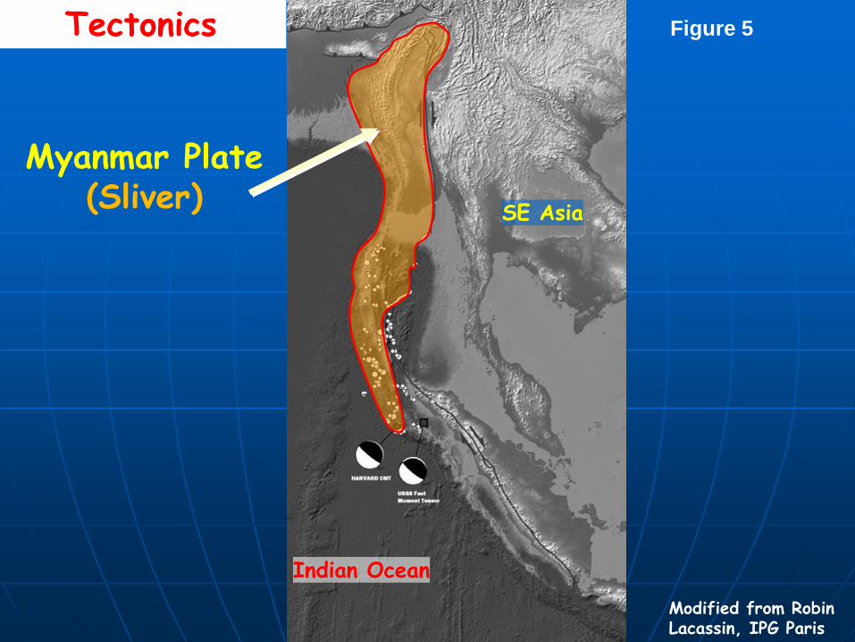
SE Asia
Indian Ocean
Tectonics
Modified from Robin Lacassin, IPG Paris
Myanmar Plate (Sliver)
Figure 5
• * Very large over-thrusts along the Wn Fold Belt have resulted from the former movement, & the Sagaing & related faults from the latter movement.
• Intermittent jerks along these major active faults have caused the majority of EQs in Myanmar.
• These Seismotectonic Processes are still going on.
• The occurrence of Intermediate-Focus EQs (focal depth 70–300 km) along the Wn Fold Belt is due to the Subduction.
• Shallow-Focus EQs (focal depth 0–70 km) along the Central Lowlands & En Highlands is mainly due to shallow-depth strike-slip (e. g., Sagaing Fault) and other faulting (Figure 2 ).
• * Generally, the shallow EQs tend to be more destructive than intermediate ones for the same magnitude.
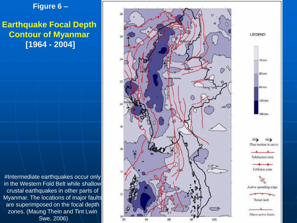
Figure 6 –
Earthquake Focal Depth
Contour of Myanmar
[1964 - 2004]
#Intermediate earthquakes occur only
in the Western Fold Belt while shallow
crustal earthquakes in other parts of
Myanmar. The locations of major faults
are superimposed on the focal depth
zones. (Maung Thein and Tint Lwin
Swe, 2006)
• * The major Seismotectonically Important Faults in Myanmar are . . . . .
1) Some unnamed major thrust faults in NWn Myanmar,
2) Kabaw Fault along the Kabaw Valley in Wn Myanmar,
3) Well-known Sagaing Fault, &
4) Kyaukkyan Fault situated W of Naungcho.
• *The well-known and seismologically very active Sagaing Fault (Win Swe, 1972 & 1981; Vigny et al., 2003; Soe Thura Tun, 2006) is the most prominent active fault in Myanmar, trending roughly N-S.
• It has been an originator of a large proportion of destructive EQs in Myanmar.
• This is due to the fact that many large urban centres lie on or near this fault.
• In fact, of the 5 major source zones in Myanmar, 3 lie around this large & dangerous fault.
• As shown at Figure 1, it is a right lateral strike-slip fault extending from S of Putao, W of Katha, through Sagaing, along the En flank of Bago Yomas, then through Bago, & finally into the Gulf of Mottama for a total distance of about 1500 km.
• * The EQs generated by sea-floor spreading in the Andaman Sea, however, are mostly small to moderate & shallow-focus.
2 Frequency & Extent of Earthquakes
As shown in Epicentral Map (Figure 3) and with reference to the seismo-tectonic map (Figure 1), the majority of the EQs in Myan are mainly confined to 3 zones.
• * Active Faults are shown in red lines (Earthquake data: ANSS Catalogue for the period 1950-2008; from other sources for 1912-1949; data are in Richter Magnitude)
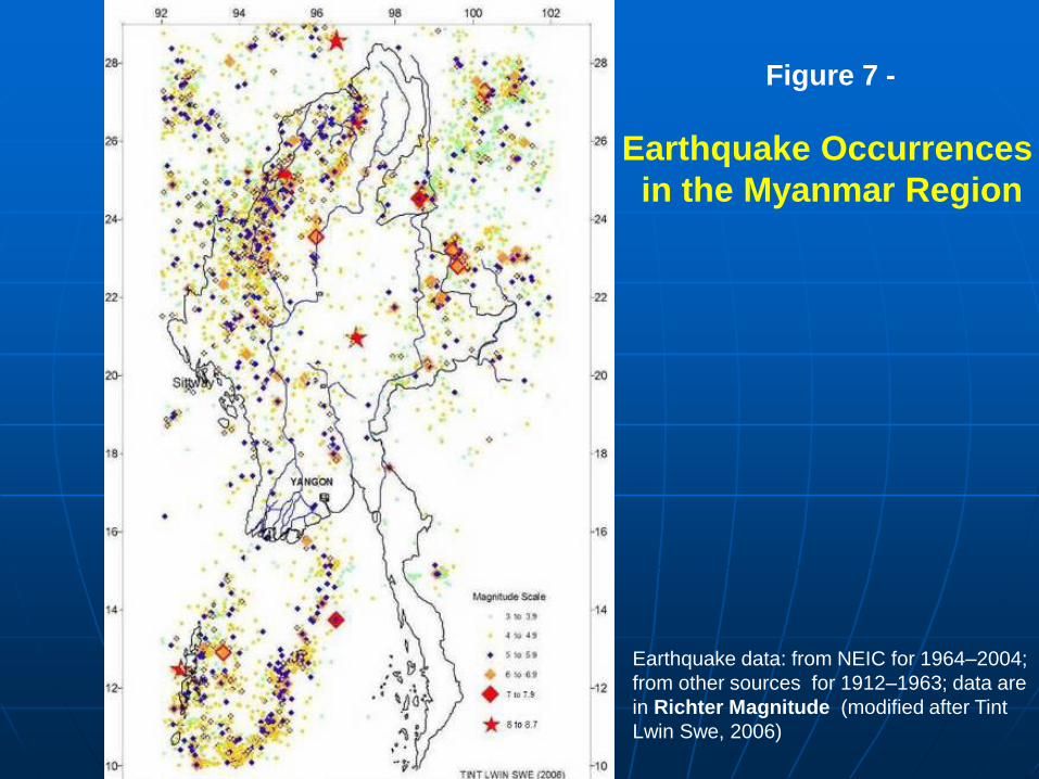
Figure 7 -
Earthquake Occurrences
in the Myanmar Region
Earthquake data: from NEIC for 1964–2004;
from other sources for 1912–1963; data are
in Richter Magnitude (modified after Tint
Lwin Swe, 2006)
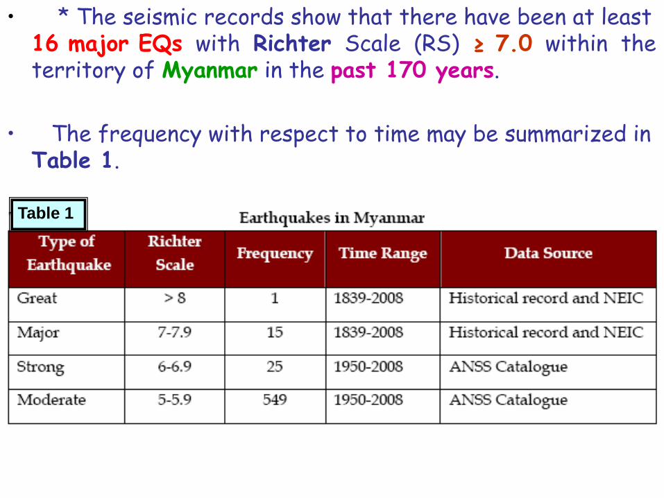
• * The seismic records show that there have been at least 16 major EQs with Richter Scale (RS) ≥ 7.0 within the territory of Myanmar in the past 170 years.
• The frequency with respect to time may be summarized in Table 1.
Table 1
3 Earthquake-Prone Locations
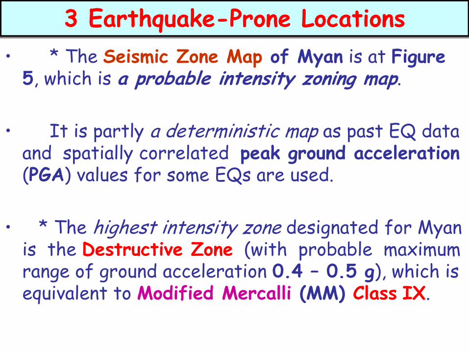
• * The Seismic Zone Map of Myan is at Figure 5, which is a probable intensity zoning map.
• It is partly a deterministic map as past EQ data and spatially correlated peak ground acceleration (PGA) values for some EQs are used.
• * The highest intensity zone designated for Myan is the Destructive Zone (with probable maximum range of ground acceleration 0.4 – 0.5 g), which is equivalent to Modified Mercalli (MM) Class IX.
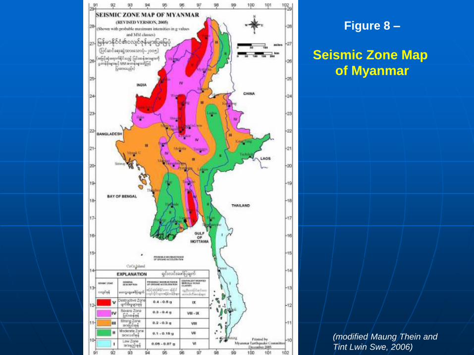
Figure 8 –
Seismic Zone Map
of Myanmar
(modified Maung Thein and
Tint Lwin Swe, 2006)
• There are 4 areas in that very vulnerable zone;namely, Bago-Phyu, Mandalay-Sagaing-Tagaung, Putao-Tanaing, and Kalay-Homalin areas.
• Although the latter 2 have major EQ hazards, they may be less vulnerable as are sparsely populated.
• Important cities & towns that lie in Zone IV (Severe Zone, with probable maximum range of ground acceleration 0.3 – 0.4 g) are
• Taungoo, Taungdwingyi, Bagan-Nyaung-U,
• Kyaukse, Pyin Oo Lwin, Shwebo, Wuntho,
• Hkamti, Haka, Myitkyina, Taunggyi, and
• Kunglong.
• Yangon straddles the boundary between Zone II & Zone III, with the old and new satellite towns in the En part in Zone III, and the original City in Zone II.
• * About 75 % of the Myan people are living in the rural areas.
• Most of their dwellings are still non-engineered structures, which are vulnerable to moderate to high intensity EQs.
• The rate of urban growth increases in some large cities like Yangon & Mandalay.
• Due to urbanization the vulnerability increases in cities and the level of disaster from EQ would increase in major cities.
• On the other hand, some large segments of the active faults have not exhibited any significant seismic activity in the past 50 to 75 years, indicating that the faults are apparently locked and stress is accumulating in those segments
• (e.g., the Sn segment of the Sagaing Fault that is close to Yangon and Bago cities, & the central segment that is close to Mandalay and Sagaing cities).
• This suggests that a national emergency plan for EQs and related disasters is in need, which should also include operating procedure for disaster preparedness and mitigation with strong support of scientific foresight.
• Vulnerable locations of the country can be studied also on seismotectonic map in which seismically active faults are shown in red lines in comparison with earthquake records (Figure 3).
4 Past Earthquake Events in Myanmar
• 4.1 Historical Earthquakes
• 4.2 Recent Earthquakes in Myanmar
• * Local historic records of tragic events indicate that the Sagaing fault is the principal source of seismic hazards in Myan.
• Table 2 summarizes important historical & recent EQs that have occurred in Myan, & a few instances of destruction are illustrated at Figure 3.
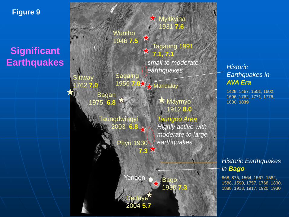
Tagaung 1991
7.1, 7.1
Wuntho
1946 7.5
Myitkyina
1931 7.6
Mandalay
Sagaing
1956 7.0
small to moderate
earthquakes
Taungdwingyi
2003 6.8
Maymyo
1912 8.0
Taungoo Area
Highly active with
moderate to large
earthquakes Phyu 1930
7.3
Bago
1930 7.3
Dedaye
2004 5.7
Historic Earthquakes
in Bago
868, 875, 1564, 1567, 1582,
1588, 1590, 1757, 1768, 1830,
1888, 1913, 1917, 1920, 1930
Historic
Earthquakes in
AVA Era
1429, 1467, 1501, 1602,
1696, 1762, 1771, 1776,
1830, 1839
Significant
Earthquakes
Yangon
Bagan
1975 6.8
Sittway
1762 7.0
Figure 9
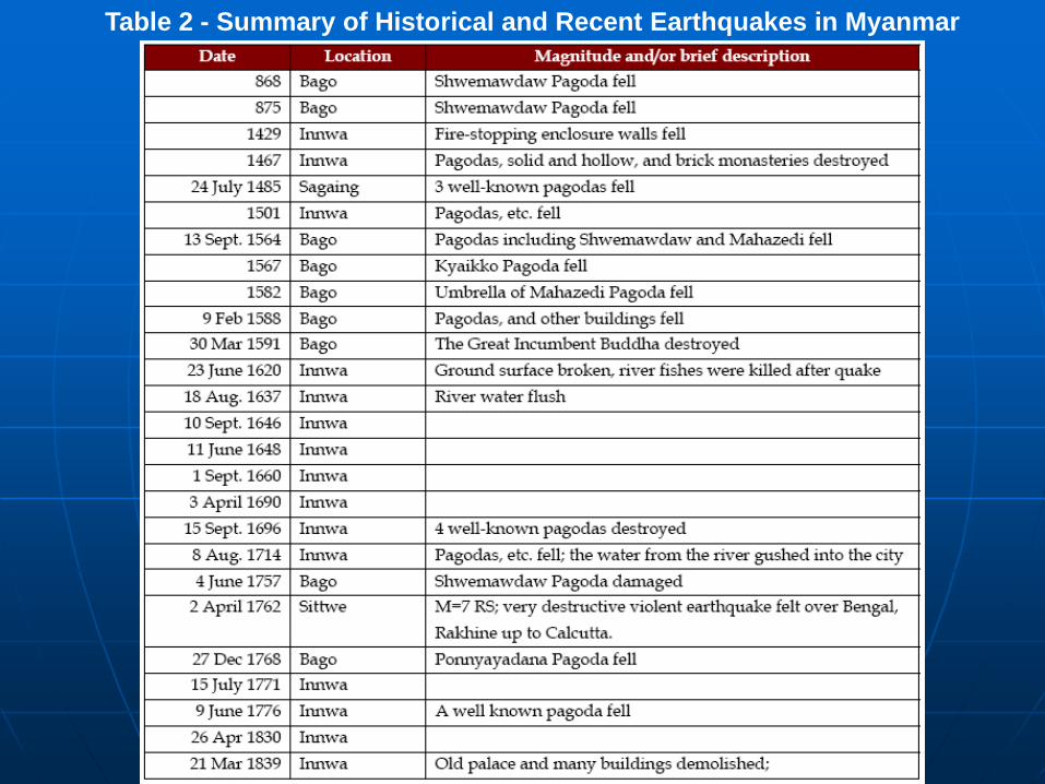
Table 2 - Summary of Historical and Recent Earthquakes in Myanmar
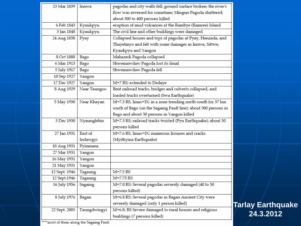
Tarlay Earthquake
24.3.2012
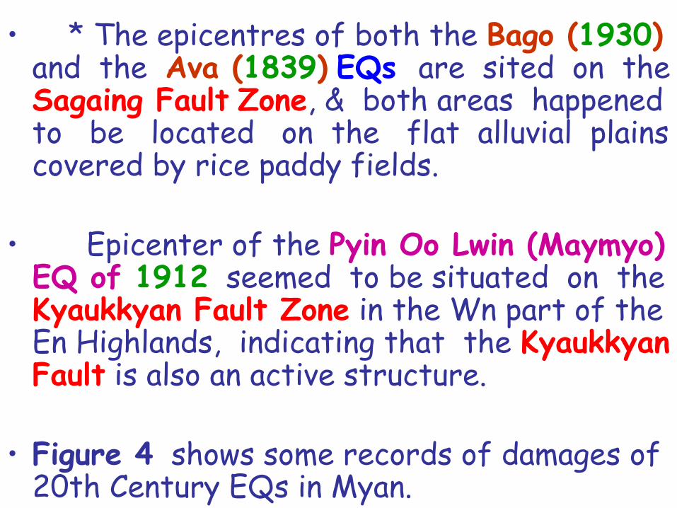
• * The epicentres of both the Bago (1930) and the Ava (1839) EQs are sited on the Sagaing Fault Zone, & both areas happened to be located on the flat alluvial plains covered by rice paddy fields.
• Epicenter of the Pyin Oo Lwin (Maymyo) EQ of 1912 seemed to be situated on the Kyaukkyan Fault Zone in the Wn part of the En Highlands, indicating that the Kyaukkyan Fault is also an active structure.
• Figure 4 shows some records of damages of 20th Century EQs in Myan.
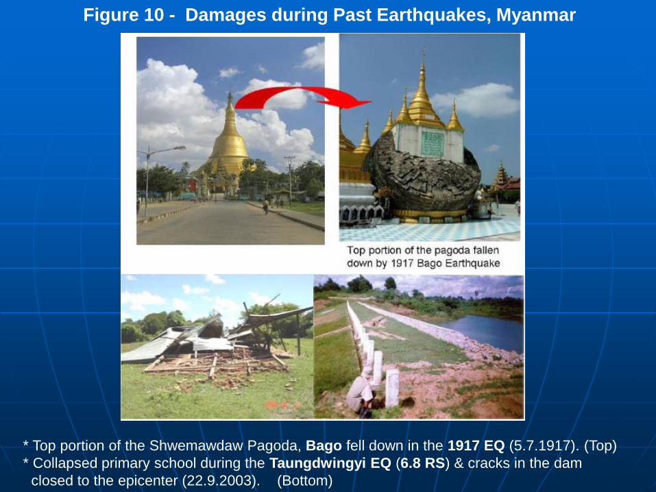
* Top portion of the Shwemawdaw Pagoda, Bago fell down in the 1917 EQ (5.7.1917). (Top)
* Collapsed primary school during the Taungdwingyi EQ (6.8 RS) & cracks in the dam
closed to the epicenter (22.9.2003). (Bottom)
Figure 10 - Damages during Past Earthquakes, Myanmar
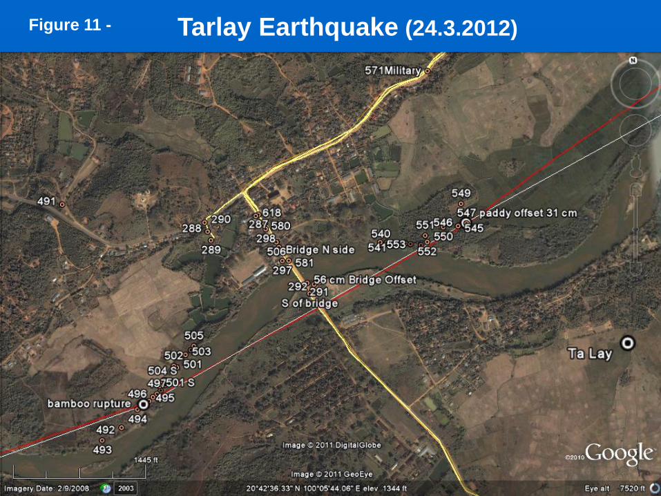
Tarlay Earthquake (24.3.2012) Figure 11 -
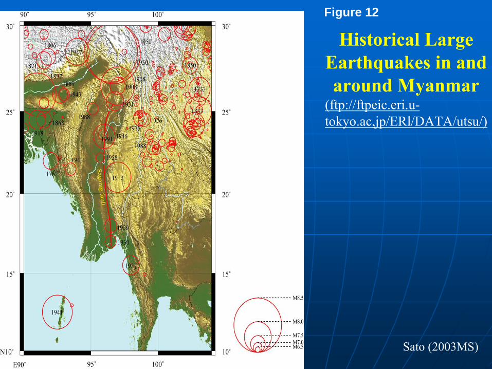
Historical Large
Earthquakes in and
around Myanmar (ftp://ftpeic.eri.u-
tokyo.ac,jp/ERl/DATA/utsu/)
Sato (2003MS)
Figure 12
5 Work on Earthquake Hazards
• 5.1 Seismic Zoning Map
• *The Seismic Zone Map of Myan(2005) was prepared by a team led by Dr Maung Thein during 2003 to 2005 with several detail observations & brainstorming.
• Tectonic activities in connection with EQ information from external sources are applied in the development of the map (Maung Thein and Tint Lwin Swe, 2006), deterministically and some intuitively.

Figure 13 –
Seismic Zone Map
of Myanmar
(modified Maung Thein and
Tint Lwin Swe, 2006)
• *As shown in the Map (Figure 5), 5 Seismic Zones are demarcated and named (from low to high)
1) Zone I (Low Zone), 2) Zone II (Moderate Zone), 3) Zone III (Strong Zone), 4) Zone IV (Severe Zone), and 5) Zone V (Destructive Zone) . . . . . • mainly following the nomenclature of the
European Macroseismic Scale 1992. (It should be mentioned that in some
countries, there are zones higher than Zone V as used here).
• In near future, the Probabilistic Seismic Hazard Assessment (PSHA) Map, indicating the level of EQ loading of 10 % in 50 years is going to be developed.
• During the years of 2005 to 2007, the Myanmar Geosciences Society (MGS), in collaboration with the MEC, sponsored some graduate students of the University of Yangon, for the preparation of preliminary Seismic Micro Zoning Maps for 4 seismically hazardous cities.
• These are Deterministic Maps.

• 5.2 Earthquake Resistant Design Code
• * In development of Building Code (Than Myint et al., 2007), the study of that of the other countries like Thailand, India, Indonesia and the UBC (Uniform Building Code of United States) are very helpful,
• But the background geological setting as well as the surface composition of geologic material, especially technical characteristics and distribution of rock and soil deposits of Myan, is quite different from that of other countries.
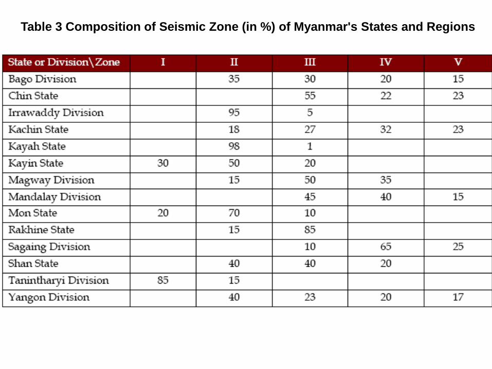
Table 3 Composition of Seismic Zone (in %) of Myanmar's States and Regions
6 Future Studies/Research
• *The seismotectonic research division of the Myanmar Earthquake Committee (MEC) has been studying regional & local EQ, & active faults in Myanmar in collaboration with international researchers.
• In this connection, the following issues can be considered for future work & research:
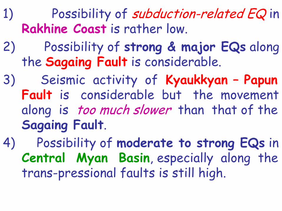
1) Possibility of subduction-related EQ in Rakhine Coast is rather low.
2) Possibility of strong & major EQs along the Sagaing Fault is considerable.
3) Seismic activity of Kyaukkyan – Papun Fault is considerable but the movement along is too much slower than that of the Sagaing Fault.
4) Possibility of moderate to strong EQs in Central Myan Basin, especially along the trans-pressional faults is still high.

Seismic Activities in Myanmar
Eastern Basin
Western Basin
90 95 100 105
15
20
25
30
Figure 14 -
7 Looking Forward
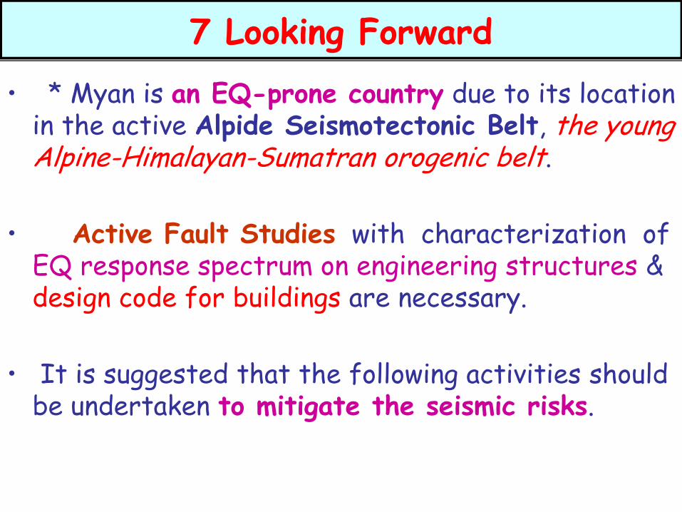
• * Myan is an EQ-prone country due to its location in the active Alpide Seismotectonic Belt, the young Alpine-Himalayan-Sumatran orogenic belt.
• Active Fault Studies with characterization of EQ response spectrum on engineering structures & design code for buildings are necessary.
• It is suggested that the following activities should be undertaken to mitigate the seismic risks.
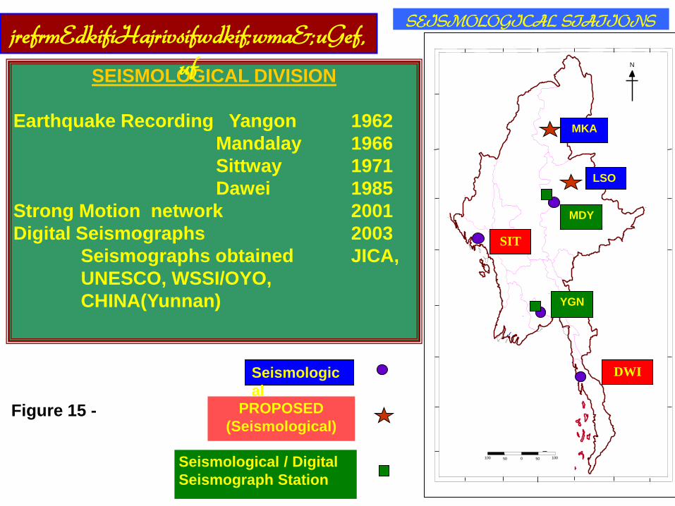
SEISMOLOGICAL DIVISION
Earthquake Recording Yangon 1962
Mandalay 1966
Sittway 1971
Dawei 1985
Strong Motion network 2001
Digital Seismographs 2003
Seismographs obtained JICA,
UNESCO, WSSI/OYO,
CHINA(Yunnan)
N
100 50 0 50 100
LSO
SEISMOLOGICAL STATIONS
MKA
MDY
SIT
YGN
Seismologic
al
PROPOSED
(Seismological)
Seismological / Digital
Seismograph Station
jrefrmEdkifiHajrivsifwdkif;wma&;uGef,
uf
DWI
Figure 15 -
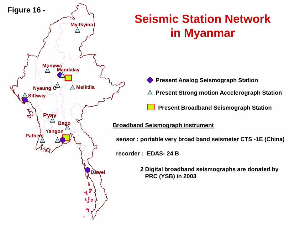
Seismic Station Network
in Myanmar
Mandalay
Yangon
Dawei
Sittway
Pyay
Present Strong motion Accelerograph Station
Present Analog Seismograph Station
Present Broadband Seismograph Station
Monywa
Myitkyina
Nyaung O Meiktila
Pathein
Bago Broadband Seismograph instrument
sensor : portable very broad band seismeter CTS -1E (China)
recorder : EDAS- 24 B
2 Digital broadband seismographs are donated by
PRC (YSB) in 2003
Figure 16 -
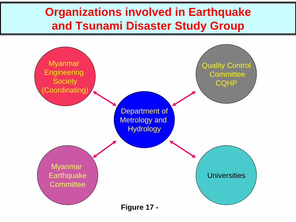
Organizations involved in Earthquake
and Tsunami Disaster Study Group
Universities
Myanmar
Earthquake
Committee
Quality Control
Committee
CQHP
Department of
Metrology and
Hydrology
Myanmar
Engineering
Society
(Coordinating)
Figure 17 -
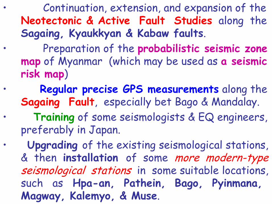
• Continuation, extension, and expansion of the Neotectonic & Active Fault Studies along the Sagaing, Kyaukkyan & Kabaw faults.
• Preparation of the probabilistic seismic zone map of Myanmar (which may be used as a seismic risk map)
• Regular precise GPS measurements along the Sagaing Fault, especially bet Bago & Mandalay.
• Training of some seismologists & EQ engineers, preferably in Japan.
• Upgrading of the existing seismological stations, & then installation of some more modern-type seismological stations in some suitable locations, such as Hpa-an, Pathein, Bago, Pyinmana, Magway, Kalemyo, & Muse.

Thank You All for
Your Time and Kind Attention
Professor Maung Maung AYE