Embed Size (px)
Citation preview

Earth Science Applications of Space Based Geodesy
DES-7355
Tu-Th 9:40-11:05
Seminar Room in 3892 Central Ave. (Long building)
Bob Smalley Office: 3892 Central Ave, Room 103
678-4929 Office Hours – Wed 14:00-16:00 or if I’m in my office.
http://www.ceri.memphis.edu/people/smalley/ESCI7355/ESCI_7355_Applications_of_Space_Based_Geodesy.html
Class 1 1

GRADING
70% homework assignments
~ weekly
Each assignment will be passed out 1‐2 weeks before it is due and should be worked on
throughout the given time period
10 % Attendance and participation
2
GRADING
20% Final Project
Each student will design, implement, and present a small scale space-based geodesy research project.
A project related to the student’s own research is encouraged.
Topic should be decided on and approved no later than October 19, 2010.
3
GRADING
20% Final Project
Presentation of results (20 mins.) will take place in lieu of a final exam on the last day of class - Dec. YY.
The project should be thoroughly documented and all scripts/programs/macros will be turned in as part of
the final grade.
4

Academic Honor Code
It is acceptable to work together/help one-another on homework to better understand the material.
It is acceptable (it will actually be essential) to refer to other books and published material provided that
these additional materials are cited appropriately in the homework (including web sites).
Each student should complete their own homework separately.
Simply copying the homework of another student or a single “group” homework is NOT acceptable.
5
No textbook –
We will have reading assignments from a number of sources.
6
Class notes will be available in pdf format, after class, on the class website.
http://www.ceri.memphis.edu/people/smalley/ESCI7355/ESCI_7355_Applications_of_Space_Based_Geodesy.html
Please let me know if there are any problems with the web page.
Note that the notes are not “static”, I will update them from time to time.
Please do not blindly print the notes out.
(but I will remove the background from the notes to save yellow toner.)
7
Some things you should buy if you are planning on using GPS in your research
Basic
Linear Algebra, Geodesy and GPS, Strang and Boore
8
Some things you should buy if you are planning on using GPS in your research
geodetic and technical
GPS Theory and Practice, 5th Revised Ed., B. Hofmann-Wellenhof, H. Lichtenegger, and J. Collins, Springer-Verlag, Wein, New York, 2001.
9
Some things you should buy if you are planning on using GPS in your research
geodetic and technical
Understanding GPS Principles and Applications, 2nd Ed., E.D. Kaplan, C. Hegarty (eds.), Artech House,
2006.
Global Positioning System: Theory and Applications, Volume 1 & 2, B. W. Parkinson, J. Spilker (Eds), Am. Inst. Aeronaut. Astronaut.,
Washington D.C., 1996. 10
Stuff from the internet
Tutorial – Ellipsoid, geoid, gravity, geodesy and geophysics
X. Li and H-J Götze
Geophysics, Vol 66, No 6, 1660-1668, Nov-Dec 2001.
www.lct.com/technical-pages/pdf/Li_G_Tut.pdf
11
More stuff from the internet
D. Sandwell
GEODYNAMICS- SIO 234
http://topex.ucsd.edu/geodynamics
Units 14 (2 parts), 15 (2 parts) and 16 (all on gravity).
12
More stuff from the internet
Basis of the GPS Technique: Observation Equations
G. Blewitt
Appears in “Geodetic Applications of GPS”, Swedish Land Survey.
http://www.nbmg.unr.edu/staff/pdfs/Blewitt%20Basics%20of%20gps.pdf
13
More stuff from the internet
GPS Data Processing Methodology: from Theory to Applications
G. Blewitt
GPS for Geodesy, p231-270, Springer-Verlag
http://www.nbmg.unr.edu/staff/pdfs/gps%20for%20geodesy.pdf
14
More stuff from the internet
GPS and Space Based Geodetic Methods
G. Blewitt
chapter in Treatise on Geophysics, Vol. 3., pp. 351-390, 2007.
Ed. Thomas Herring, Ed.-in-chief Gerald Schubert, Academic Press, Oxford, UK, ISBN: 0-444-51928-9.
http://www.nbmg.unr.edu/staff/pdfs/blewitt_treatise.pdf
15
More stuff from the internet
GPS Positioning Guide
Available from
Natural Resources Canada
http://www.geod.nrcan.gc.ca/publications/papers/gps_e.php
(plus lots other stuff)
16
1. Introduction.
Course objectives and overview
----------------------------------------
3) Ability to use results of modern Geodesy in multi-disciplinary studies.
2) Ability to use tools of modern Geodesy.
1) Understanding and appreciation of modern (satellite based) Geodesy.
17
Outline:
Shape of the Earth Physical vs. Geometric description (reference frame/
Coordinate system) Time
How GPS works (“trivial” overview) How GPS works (technical)
[orbits, estimation, observables, propagation, errors]
Processing
Applications – modeling 18
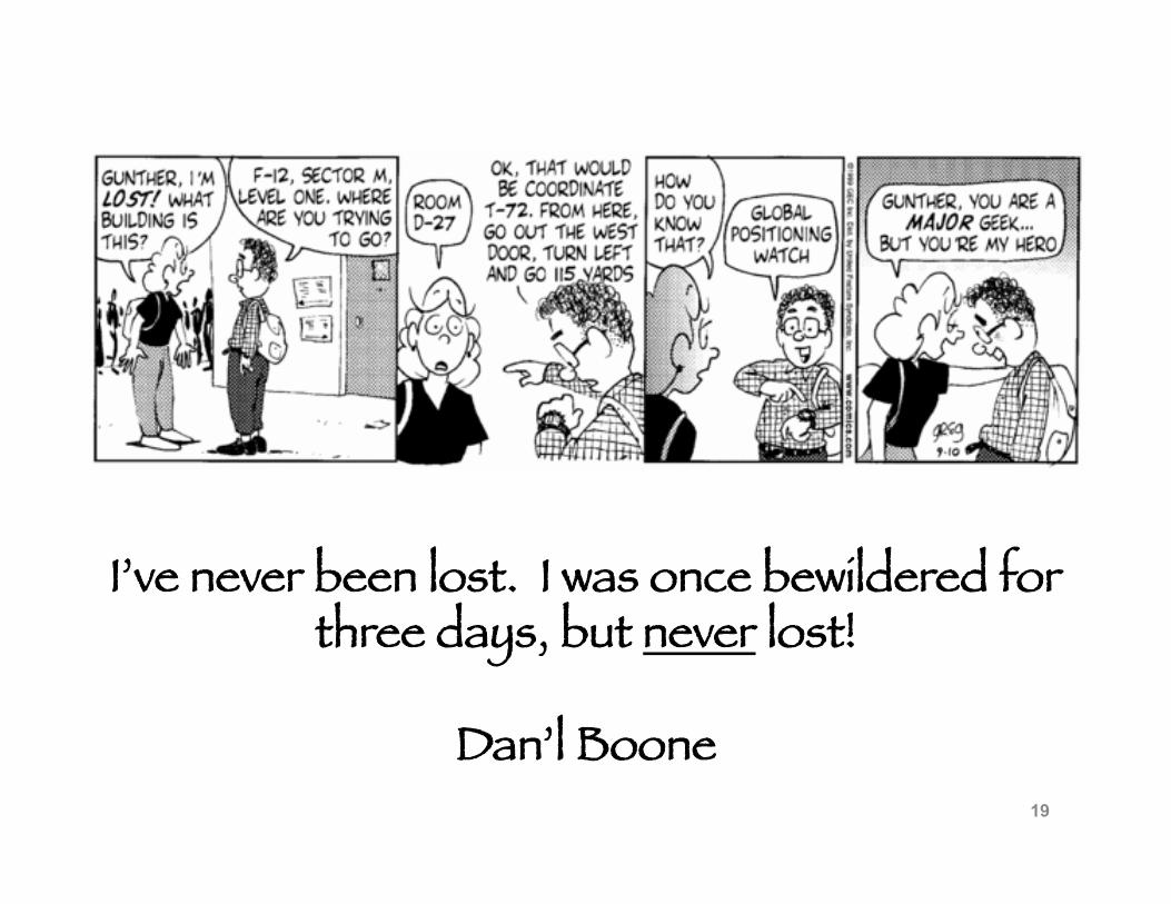
I’ve never been lost. I was once bewildered for three days, but never lost!
Dan’l Boone 19
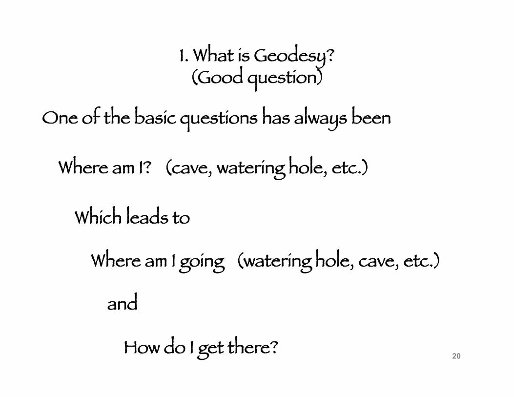
1. What is Geodesy? (Good question)
One of the basic questions has always been
Where am I? (cave, watering hole, etc.)
Which leads to
Where am I going (watering hole, cave, etc.)
and
How do I get there? 20
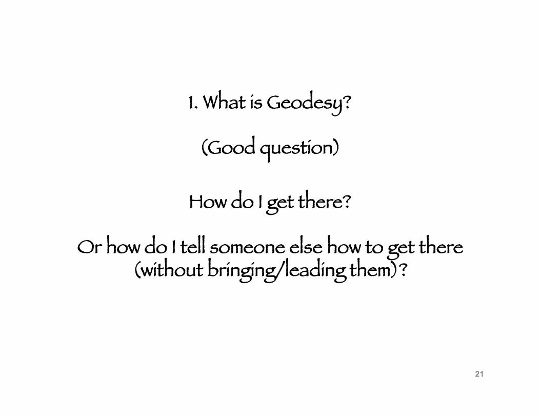
1. What is Geodesy?
(Good question)
How do I get there?
Or how do I tell someone else how to get there (without bringing/leading them)?
21
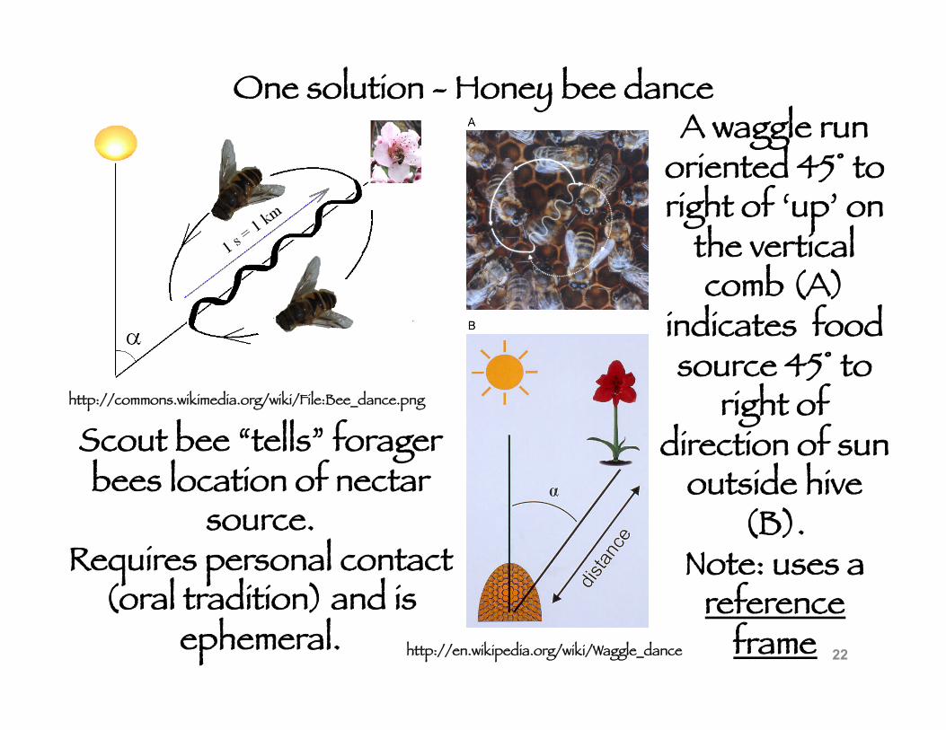
One solution - Honey bee dance
http://commons.wikimedia.org/wiki/File:Bee_dance.png
http://en.wikipedia.org/wiki/Waggle_dance
Scout bee “tells” forager bees location of nectar
source. Requires personal contact
(oral tradition) and is ephemeral.
A waggle run oriented 45° to right of ‘up’ on
the vertical comb (A)
indicates food source 45° to
right of direction of sun
outside hive (B).
Note: uses a reference
frame 22
1. What is Geodesy?
(Good question)
How do I get there?
Or how do I tell someone else how to get there (without bringing/leading them or having personal
contact)?
Early solution --------------
Mark trail (permanent) (or use landscape features)
23
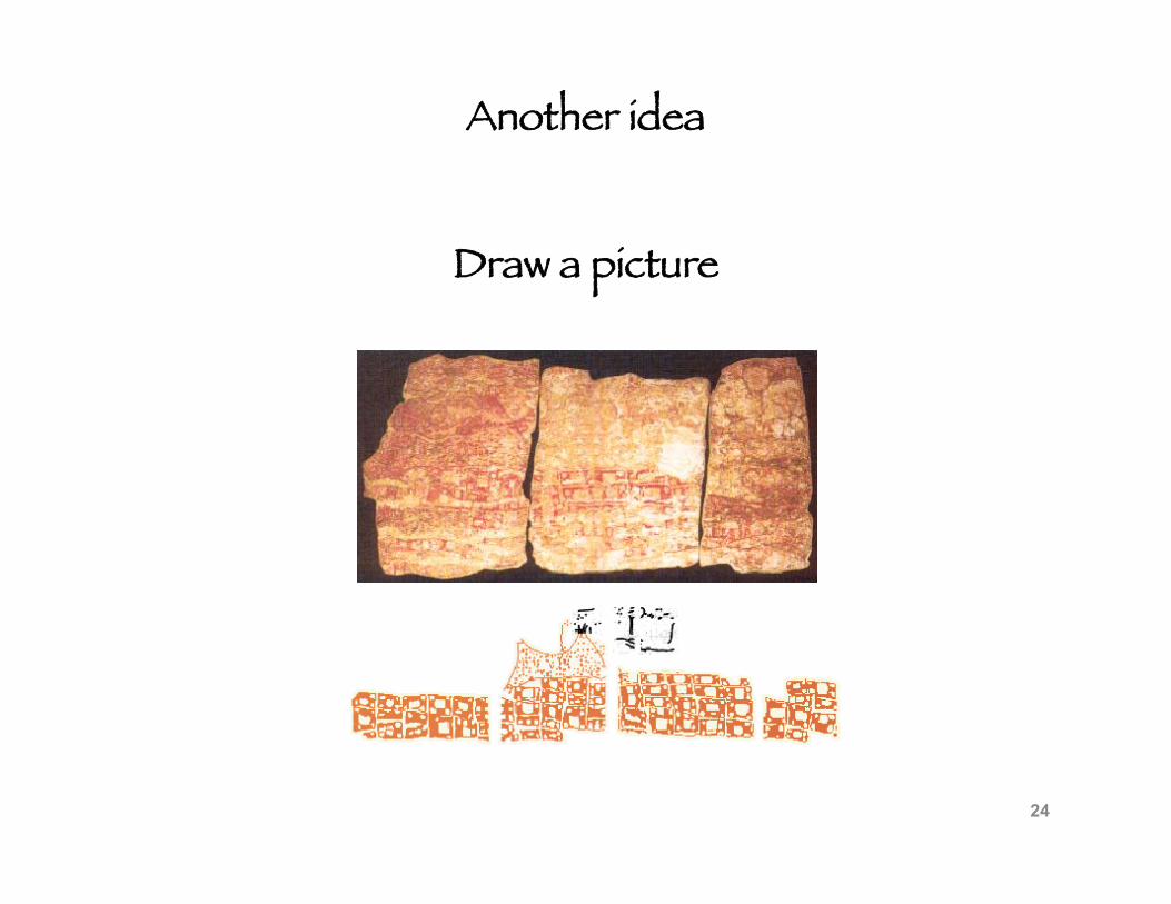
Another idea
Draw a picture
24
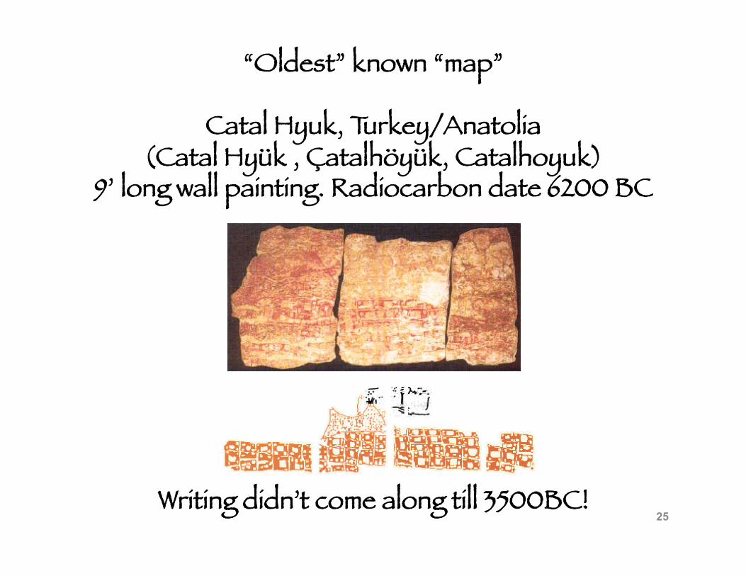
“Oldest” known “map”
Catal Hyuk, Turkey/Anatolia (Catal Hyük , Çatalhöyük, Catalhoyuk)
9’ long wall painting. Radiocarbon date 6200 BC
Writing didn’t come along till 3500BC! 25
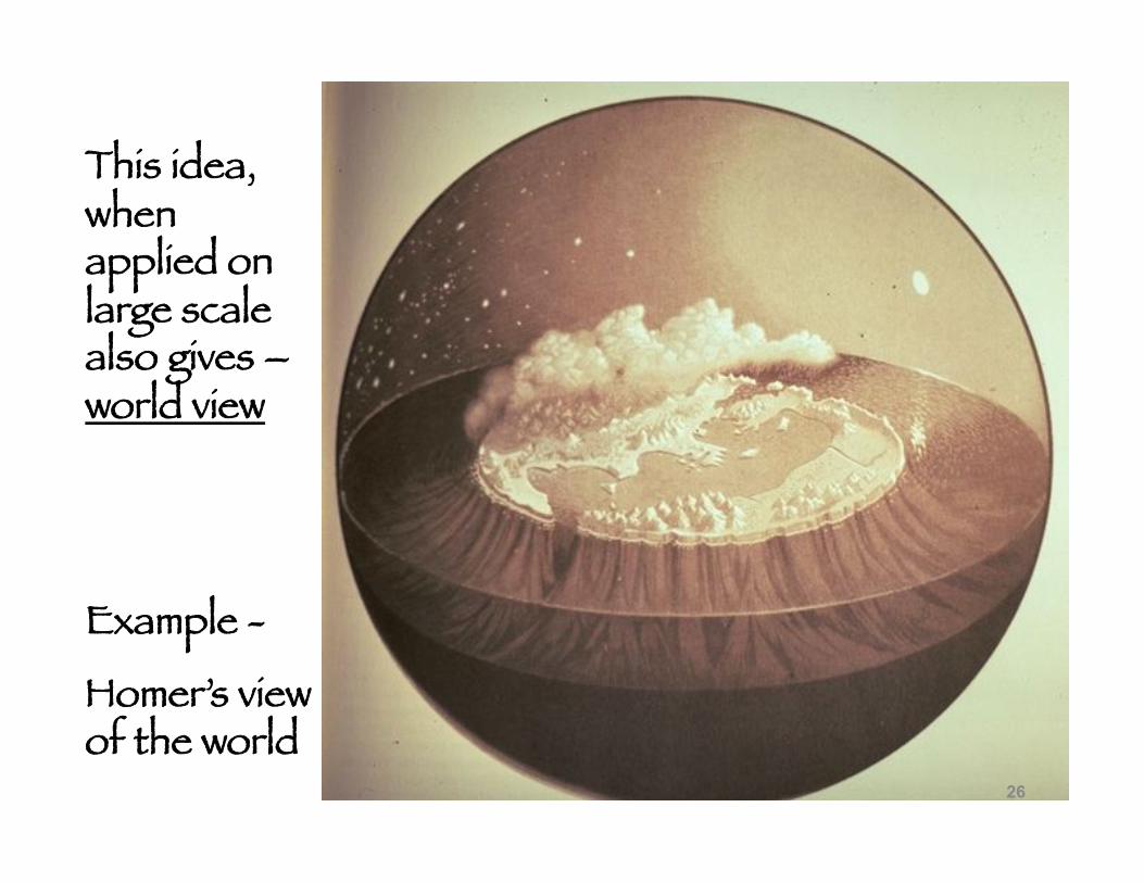
This idea, when applied on large scale also gives – world view
Example -
Homer’s view of the world
26
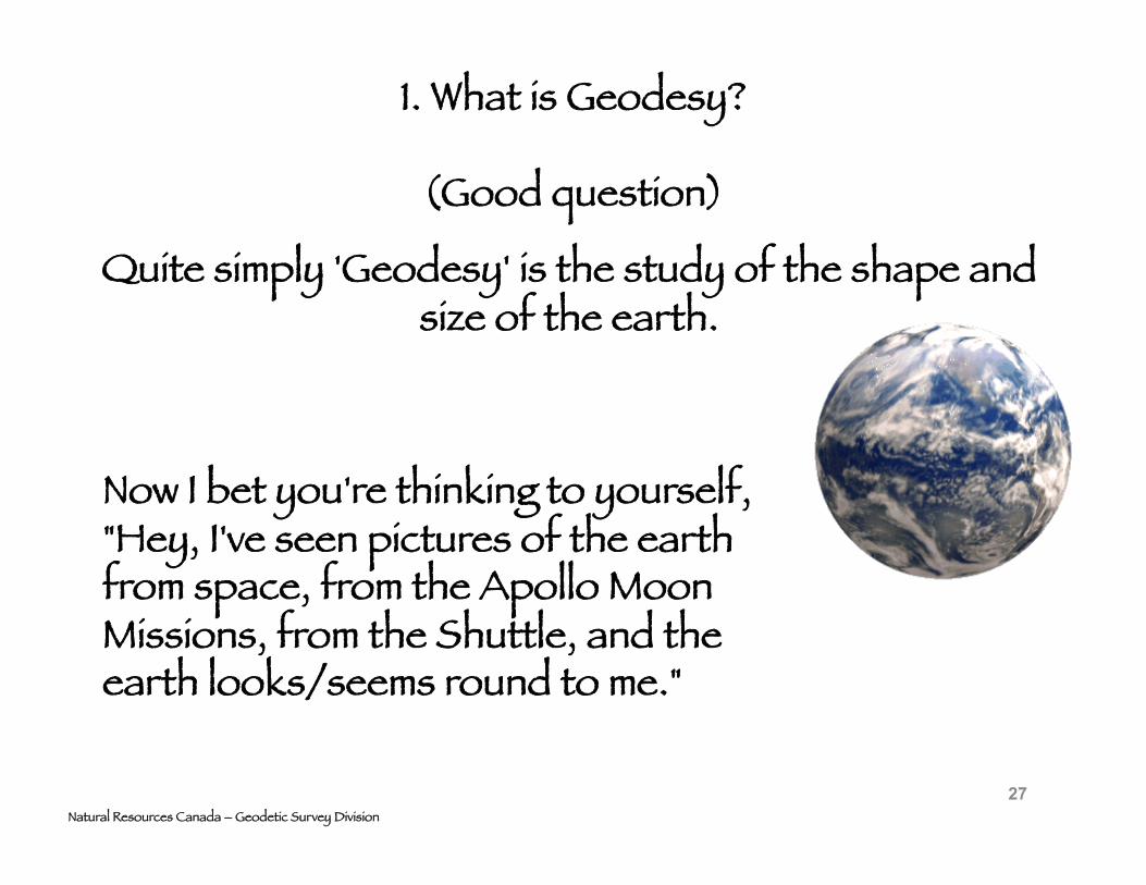
1. What is Geodesy?
(Good question)
Natural Resources Canada – Geodetic Survey Division
Quite simply 'Geodesy' is the study of the shape and size of the earth.
Now I bet you're thinking to yourself, "Hey, I've seen pictures of the earth from space, from the Apollo Moon Missions, from the Shuttle, and the earth looks/seems round to me."
27
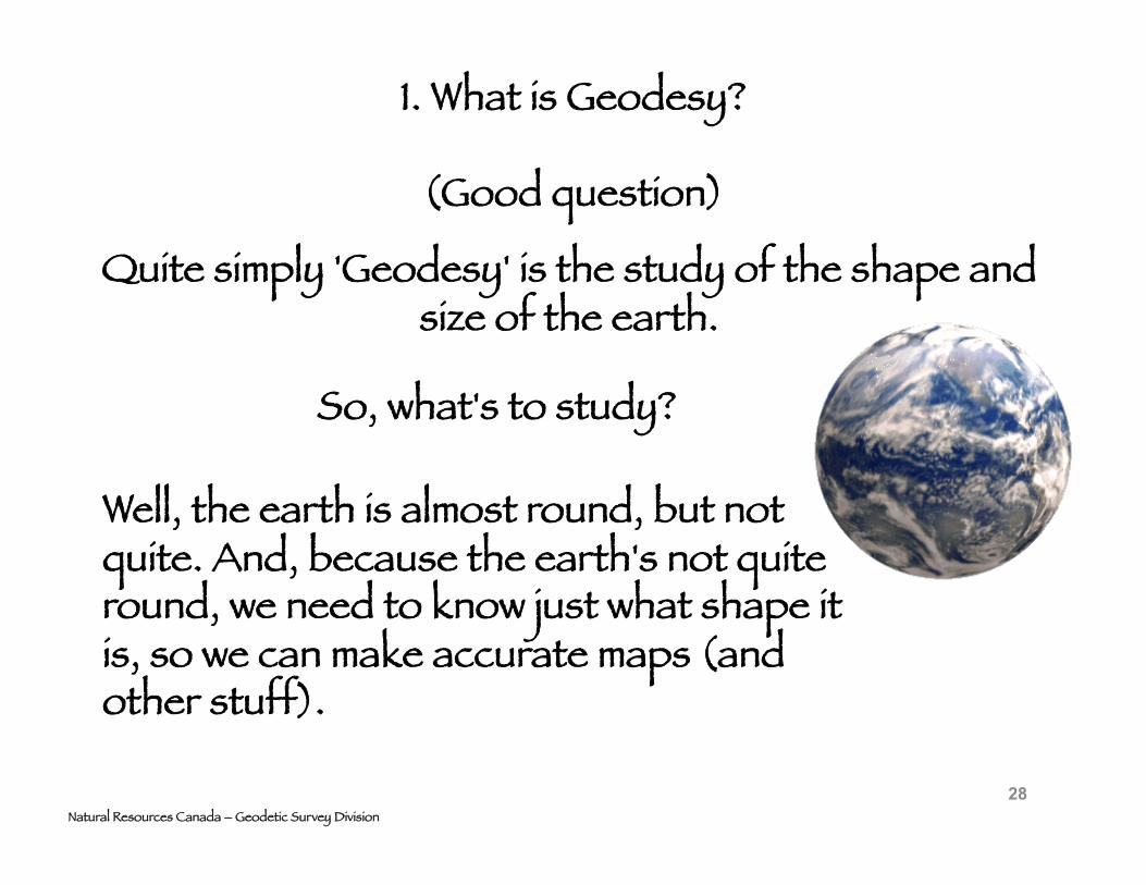
1. What is Geodesy?
(Good question)
Natural Resources Canada – Geodetic Survey Division
Quite simply 'Geodesy' is the study of the shape and size of the earth.
So, what's to study?
Well, the earth is almost round, but not quite. And, because the earth's not quite round, we need to know just what shape it is, so we can make accurate maps (and other stuff).
28
1. What is Geodesy?
Geodesy, traditionally defined as the study of the shape of the earth
from Greek - ge daisi : ge -, geo- earth + daiesthai, to divide
determining size/shape of earth [at a scale of 1:1!]
and accurate positioning/mapping
Geodesy is among the oldest of sciences. 29
1. What is Geodesy?
Geodesy, also traditionally includes the study of earth’s gravity.
1 - At large scale
why?
gravity is the physics controlling earth’s shape (earth is “fluid” in hydrostatic equilibrium)
2 - and gravity also has significant effects on the traditional methods of measuring the earth’s shape.
30
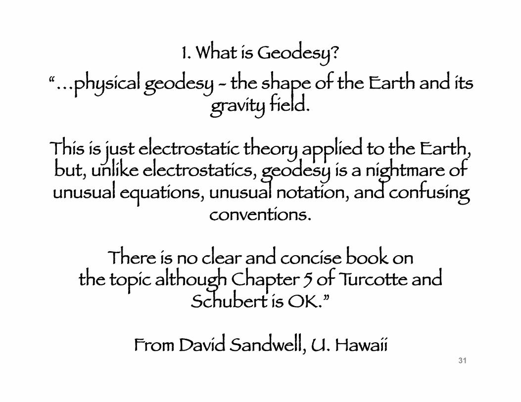
1. What is Geodesy? “…physical geodesy - the shape of the Earth and its
gravity field.
This is just electrostatic theory applied to the Earth, but, unlike electrostatics, geodesy is a nightmare of unusual equations, unusual notation, and confusing
conventions.
There is no clear and concise book on the topic although Chapter 5 of Turcotte and
Schubert is OK.”
From David Sandwell, U. Hawaii 31
1. What is Geodesy?
Modern Geodesy
continuation of traditional studies
plus
significant expansion based on
new technology
providing a several order magnitude improvement in surveying capability through the use of space based
surveying techniques 32
1. What is Geodesy?
Modern Geodesy
paradigm change to include changes in earth’s shape (plate movements, plate boundary deformation, GIA,
elastic loading, earthquakes, etc.)
33
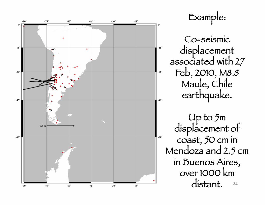
Example:
Co-seismic displacement
associated with 27 Feb, 2010, M8.8
Maule, Chile earthquake.
Up to 5m displacement of coast, 50 cm in
Mendoza and 2.5 cm in Buenos Aires,
over 1000 km distant. 34
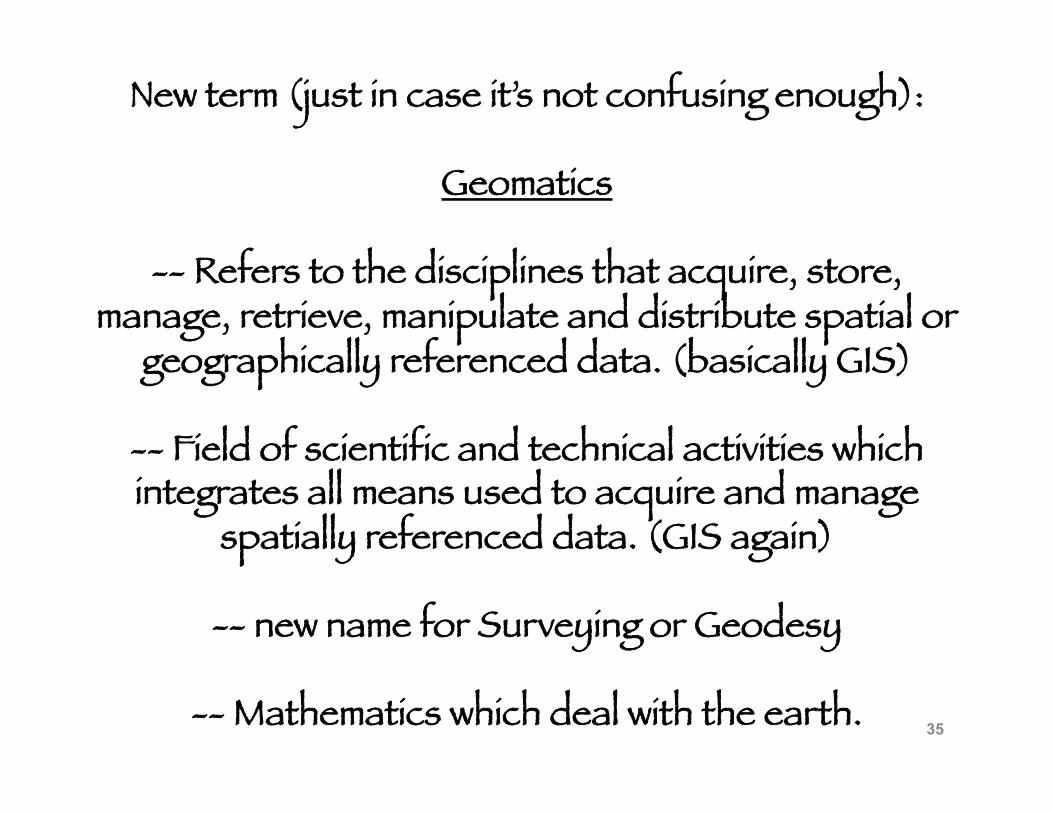
New term (just in case it’s not confusing enough):
Geomatics
-- Refers to the disciplines that acquire, store, manage, retrieve, manipulate and distribute spatial or
geographically referenced data. (basically GIS)
-- Field of scientific and technical activities which integrates all means used to acquire and manage
spatially referenced data. (GIS again)
-- new name for Surveying or Geodesy
-- Mathematics which deal with the earth. 35
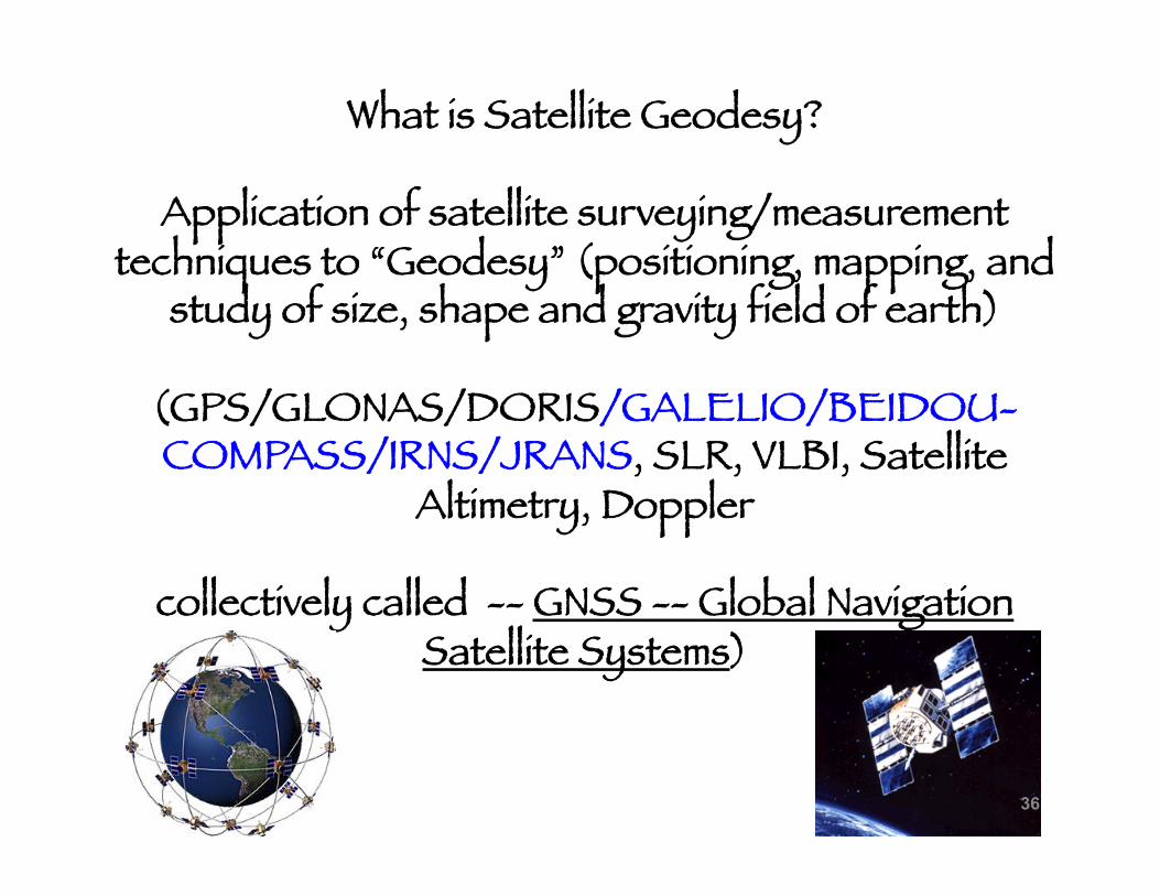
What is Satellite Geodesy?
Application of satellite surveying/measurement techniques to “Geodesy” (positioning, mapping, and
study of size, shape and gravity field of earth)
(GPS/GLONAS/DORIS/GALELIO/BEIDOU-COMPASS/IRNS/JRANS, SLR, VLBI, Satellite
Altimetry, Doppler
collectively called -- GNSS -- Global Navigation Satellite Systems)
36
What is Satellite Geodesy?
New definitions of “Geodesy” based on increase in precision (e.g. time variations from motions associated
with Plate Tectonics, Tides, Weather/Climate, etc.)
37
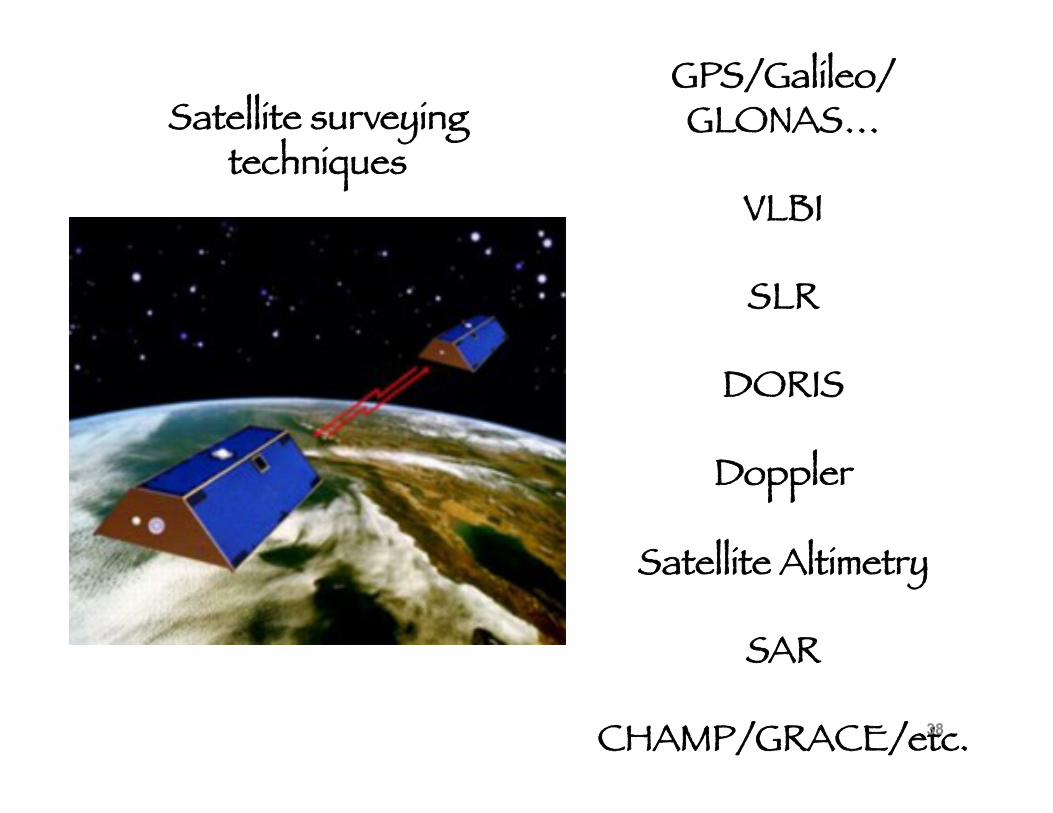
GPS/Galileo/GLONAS…
VLBI
SLR
DORIS
Doppler
Satellite Altimetry
SAR
CHAMP/GRACE/etc.
Satellite surveying techniques
38
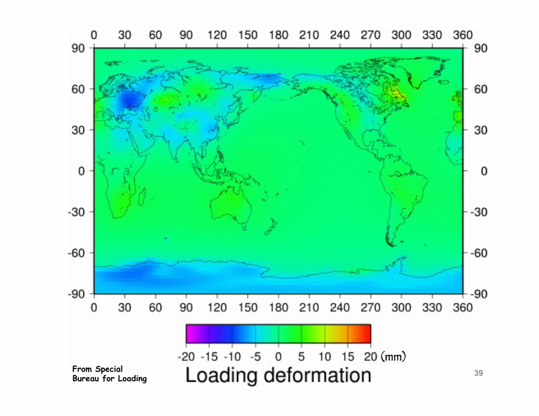
From Special Bureau for Loading
(mm) 39
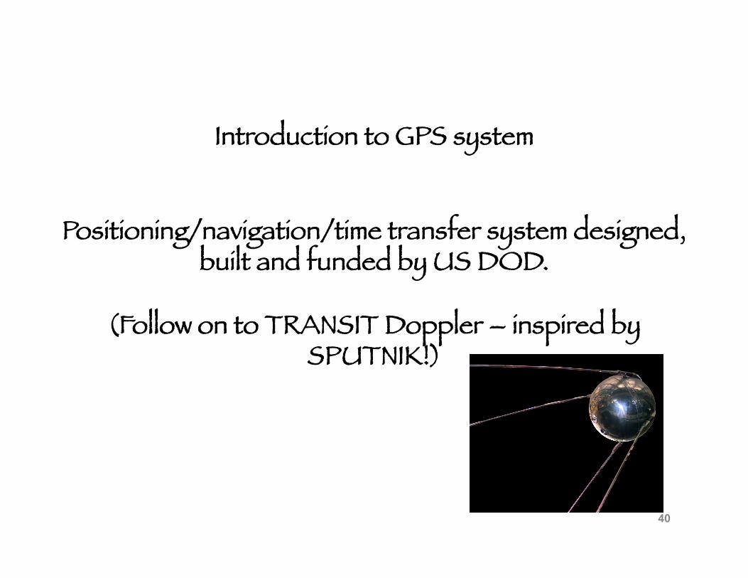
Introduction to GPS system
Positioning/navigation/time transfer system designed, built and funded by US DOD.
(Follow on to TRANSIT Doppler – inspired by SPUTNIK!)
40
Introduction to GPS system
Positioning/navigation/time transfer system designed, built and funded by US DOD.
After KAL 007 “incident” in 1983, President Regan ordered that GPS system design include degraded version for civilian use to prevent reoccurrence of
similar navigation errors.
41
Introduction to GPS system
Positioning/navigation/time transfer system designed, built and funded by US DOD.
somewhat unforeseen and definitely unplanned
Explosion of civilian use based on principally ground based technological/engineering developments
42
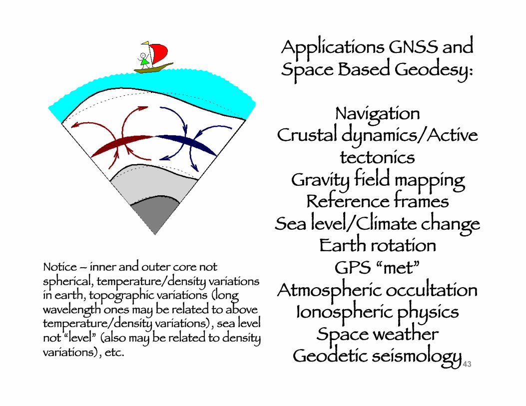
Applications GNSS and Space Based Geodesy:
Navigation Crustal dynamics/Active
tectonics Gravity field mapping
Reference frames Sea level/Climate change
Earth rotation GPS “met”
Atmospheric occultation Ionospheric physics
Space weather Geodetic seismology
Notice – inner and outer core not spherical, temperature/density variations in earth, topographic variations (long wavelength ones may be related to above temperature/density variations), sea level not “level” (also may be related to density variations), etc.
43
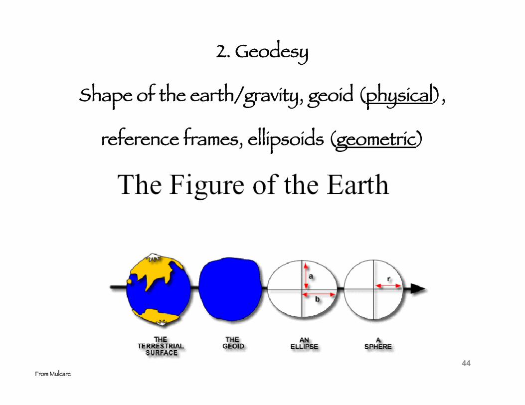
2. Geodesy
Shape of the earth/gravity, geoid (physical),
reference frames, ellipsoids (geometric)
From Mulcare 44
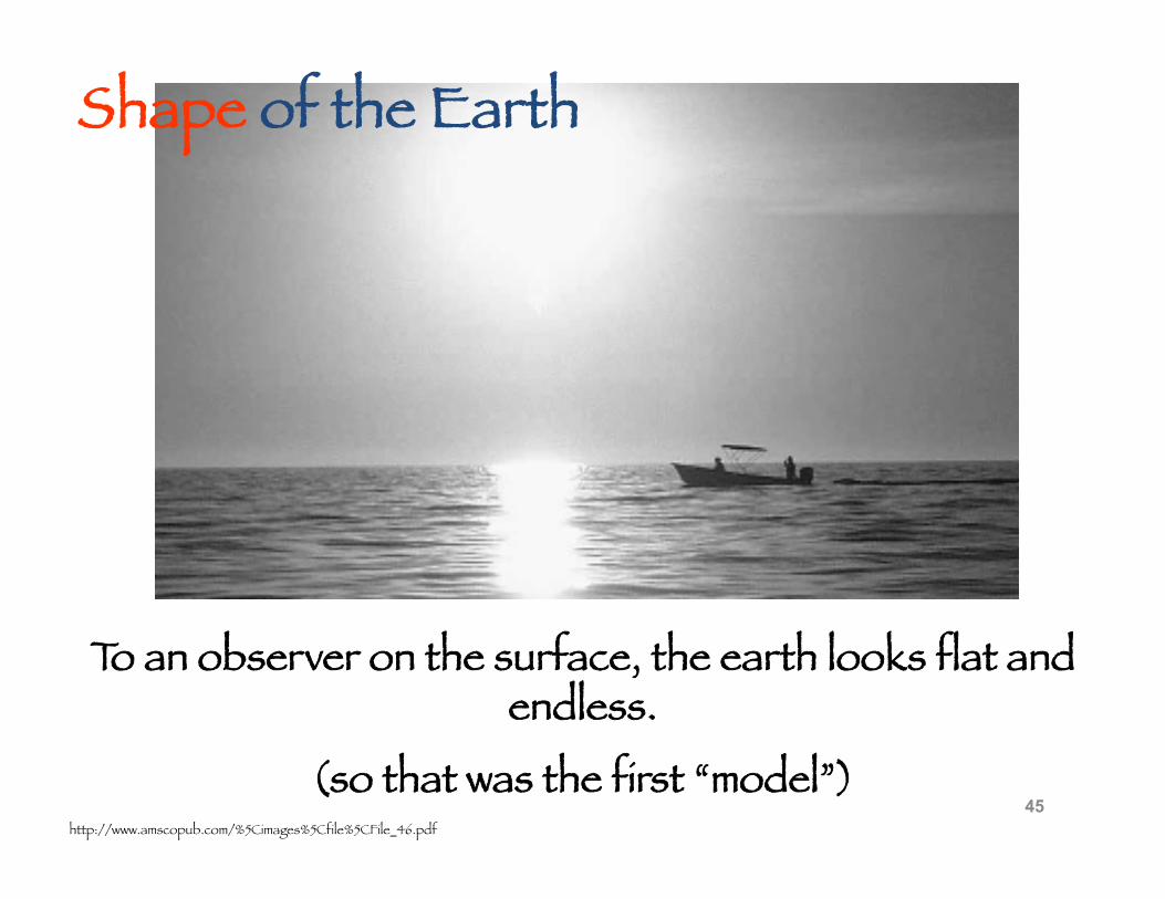
To an observer on the surface, the earth looks flat and endless.
(so that was the first “model”) http://www.amscopub.com/%5Cimages%5Cfile%5CFile_46.pdf
Shape of the Earth
45
46
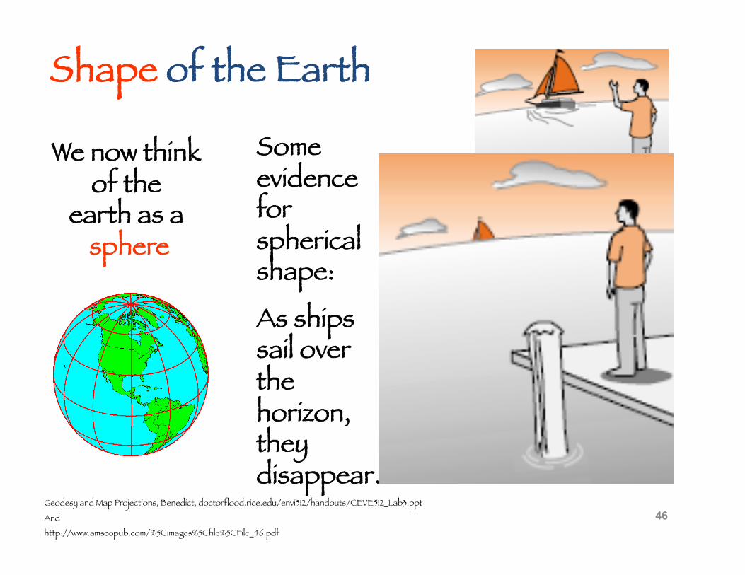
We now think of the
earth as a sphere
Geodesy and Map Projections, Benedict, doctorflood.rice.edu/envi512/handouts/CEVE512_Lab3.ppt
And
http://www.amscopub.com/%5Cimages%5Cfile%5CFile_46.pdf
Some evidence for spherical shape:
As ships sail over the horizon, they disappear.
Shape of the Earth
Geodesy and Map Projections, Benedict, doctorflood.rice.edu/envi512/handouts/CEVE512_Lab3.ppt 47
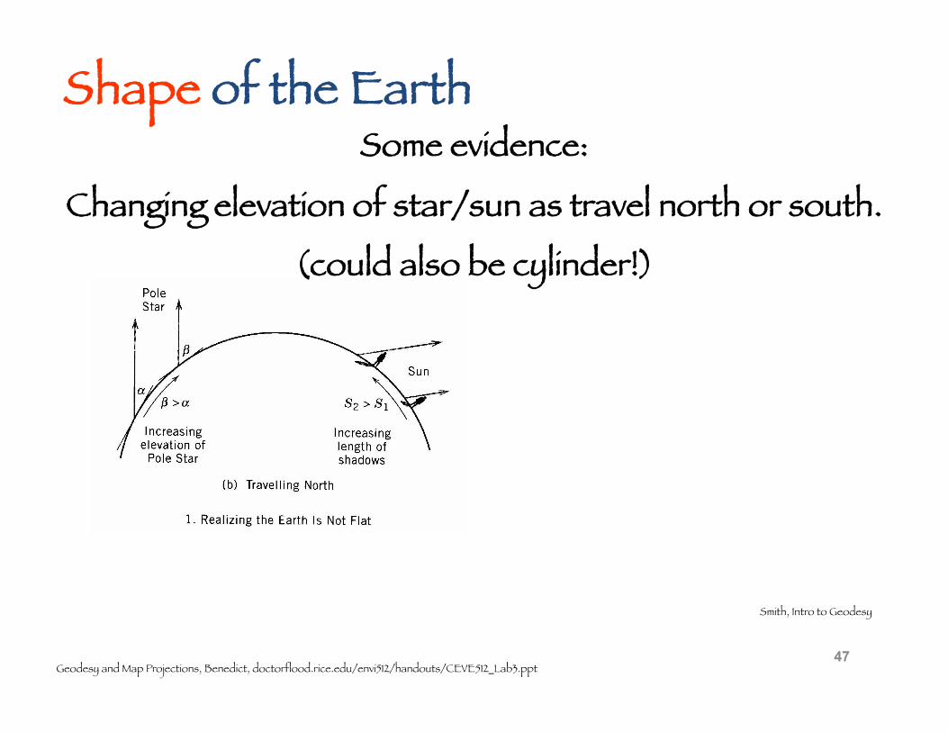
Smith, Intro to Geodesy
Shape of the Earth Some evidence:
Changing elevation of star/sun as travel north or south.
(could also be cylinder!)
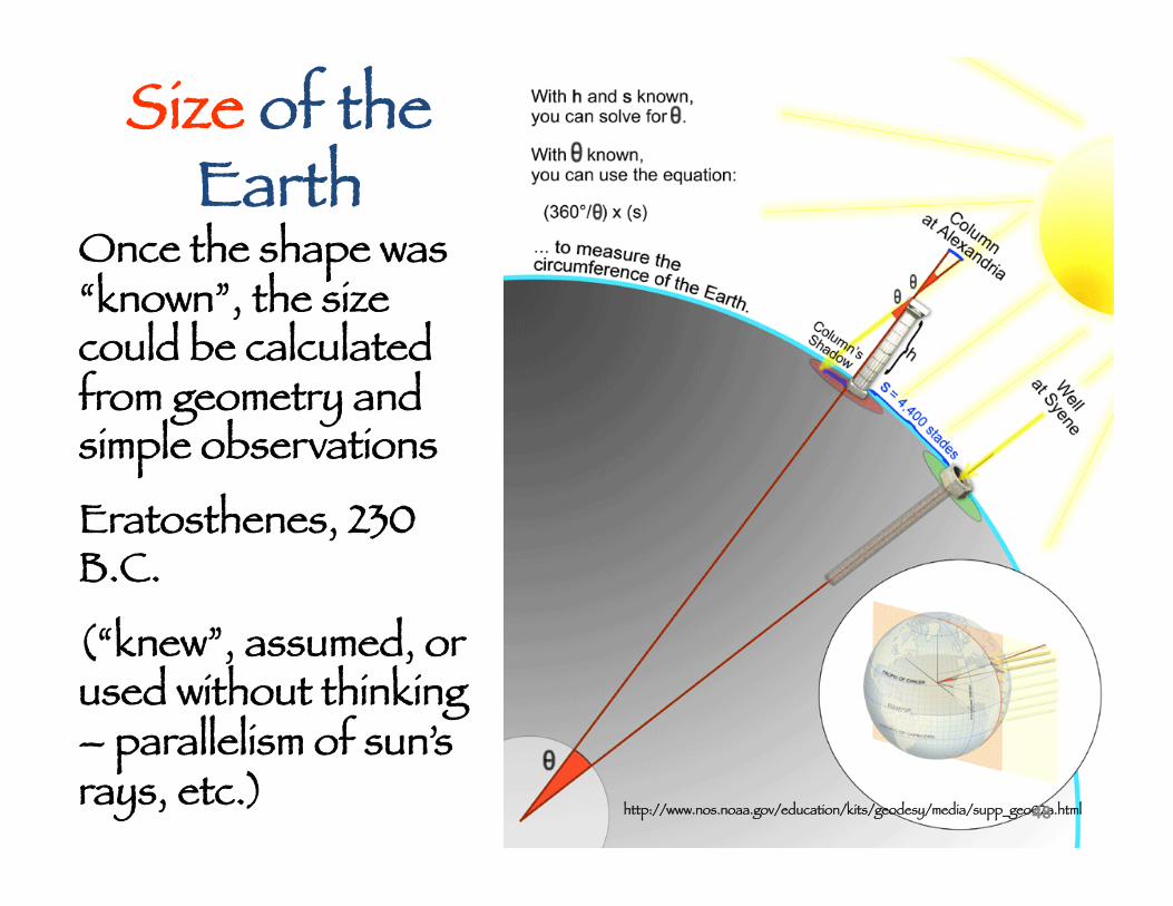
Size of the Earth
Once the shape was “known”, the size could be calculated from geometry and simple observations
Eratosthenes, 230 B.C.
(“knew”, assumed, or used without thinking – parallelism of sun’s rays, etc.)
http://www.nos.noaa.gov/education/kits/geodesy/media/supp_geo02a.html 48
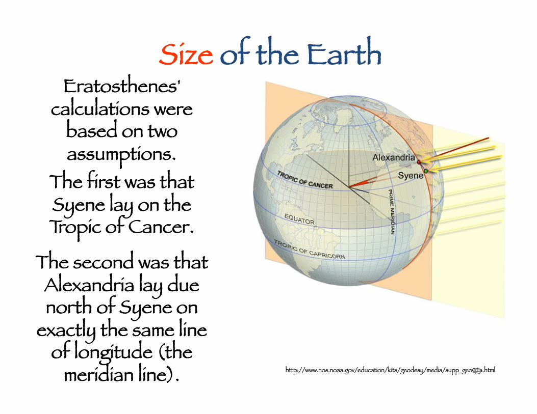
Size of the Earth
http://www.nos.noaa.gov/education/kits/geodesy/media/supp_geo02a.html
Eratosthenes' calculations were
based on two assumptions.
The first was that Syene lay on the Tropic of Cancer.
The second was that Alexandria lay due north of Syene on
exactly the same line of longitude (the
meridian line). 49
Eratosthenes was roughly correct about the size of the Earth
-- at least, that's what modern historians of science have concluded,
although there is apparently some lingering doubt about the exact size of the units of measurement
(stade = 184.81 m) which he was using.
---
And his two assumptions about the locations of the two places were not quite correct.
Dave Hanes , http://www.astro.queensu.ca/~hanes/p014/Notes/Topic_008.html 50
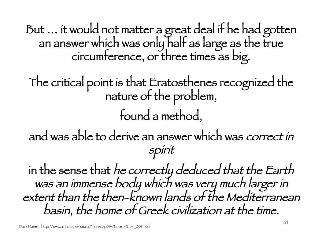
But … it would not matter a great deal if he had gotten an answer which was only half as large as the true
circumference, or three times as big.
Dave Hanes , http://www.astro.queensu.ca/~hanes/p014/Notes/Topic_008.html
The critical point is that Eratosthenes recognized the nature of the problem,
found a method,
and was able to derive an answer which was correct in spirit
in the sense that he correctly deduced that the Earth was an immense body which was very much larger in
extent than the then-known lands of the Mediterranean basin, the home of Greek civilization at the time.
51
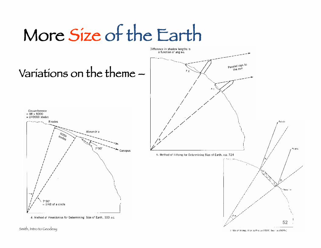
More Size of the Earth
Variations on the theme –
Smith, Intro to Geodesy 52
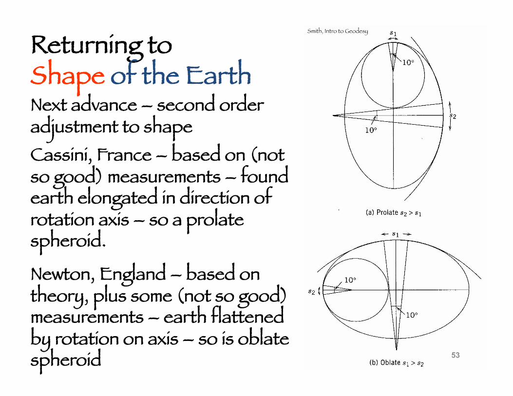
Next advance – second order adjustment to shape
53
Smith, Intro to Geodesy
Returning to Shape of the Earth
Cassini, France – based on (not so good) measurements – found earth elongated in direction of rotation axis – so a prolate spheroid.
Newton, England – based on theory, plus some (not so good) measurements – earth flattened by rotation on axis – so is oblate spheroid
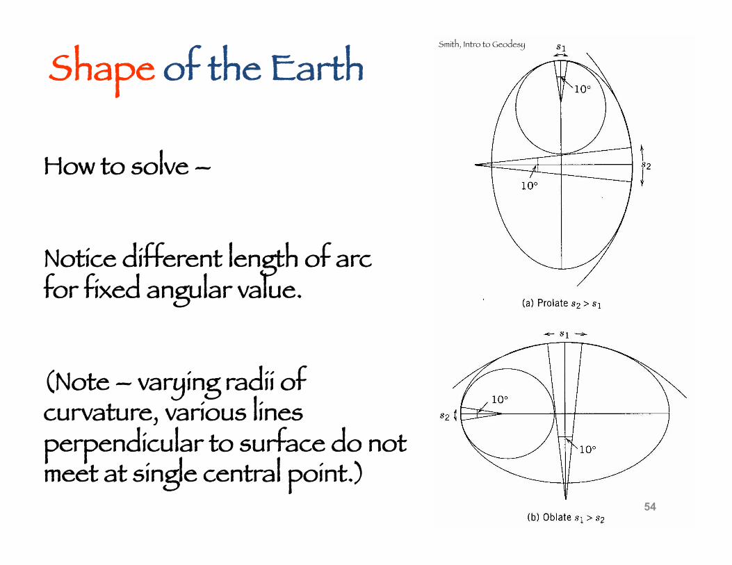
How to solve –
54
Smith, Intro to Geodesy
Shape of the Earth
Notice different length of arc for fixed angular value.
(Note – varying radii of curvature, various lines perpendicular to surface do not meet at single central point.)
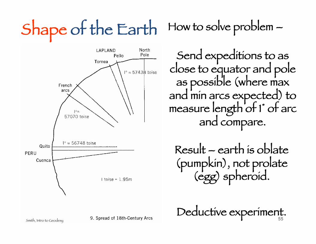
How to solve problem –
55 Smith, Intro to Geodesy
Shape of the Earth Send expeditions to as
close to equator and pole as possible (where max
and min arcs expected) to measure length of 1° of arc
and compare.
Result – earth is oblate (pumpkin), not prolate
(egg) spheroid.
Deductive experiment.
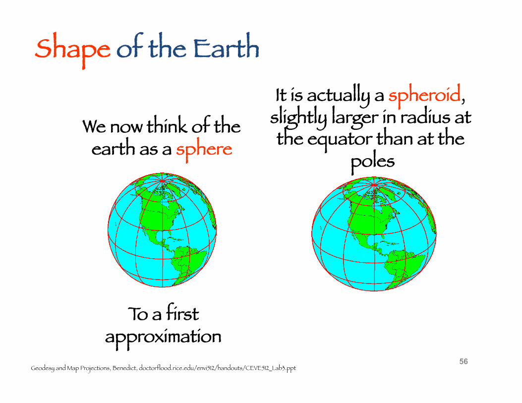
We now think of the earth as a sphere
It is actually a spheroid, slightly larger in radius at the equator than at the
poles
Geodesy and Map Projections, Benedict, doctorflood.rice.edu/envi512/handouts/CEVE512_Lab3.ppt
Shape of the Earth
To a first approximation
56
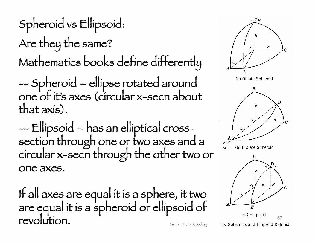
Spheroid vs Ellipsoid:
Are they the same?
Mathematics books define differently
Smith, Intro to Geodesy
-- Spheroid – ellipse rotated around one of it’s axes (circular x-secn about that axis). -- Ellipsoid – has an elliptical cross-section through one or two axes and a circular x-secn through the other two or one axes.
If all axes are equal it is a sphere, it two are equal it is a spheroid or ellipsoid of revolution. 57
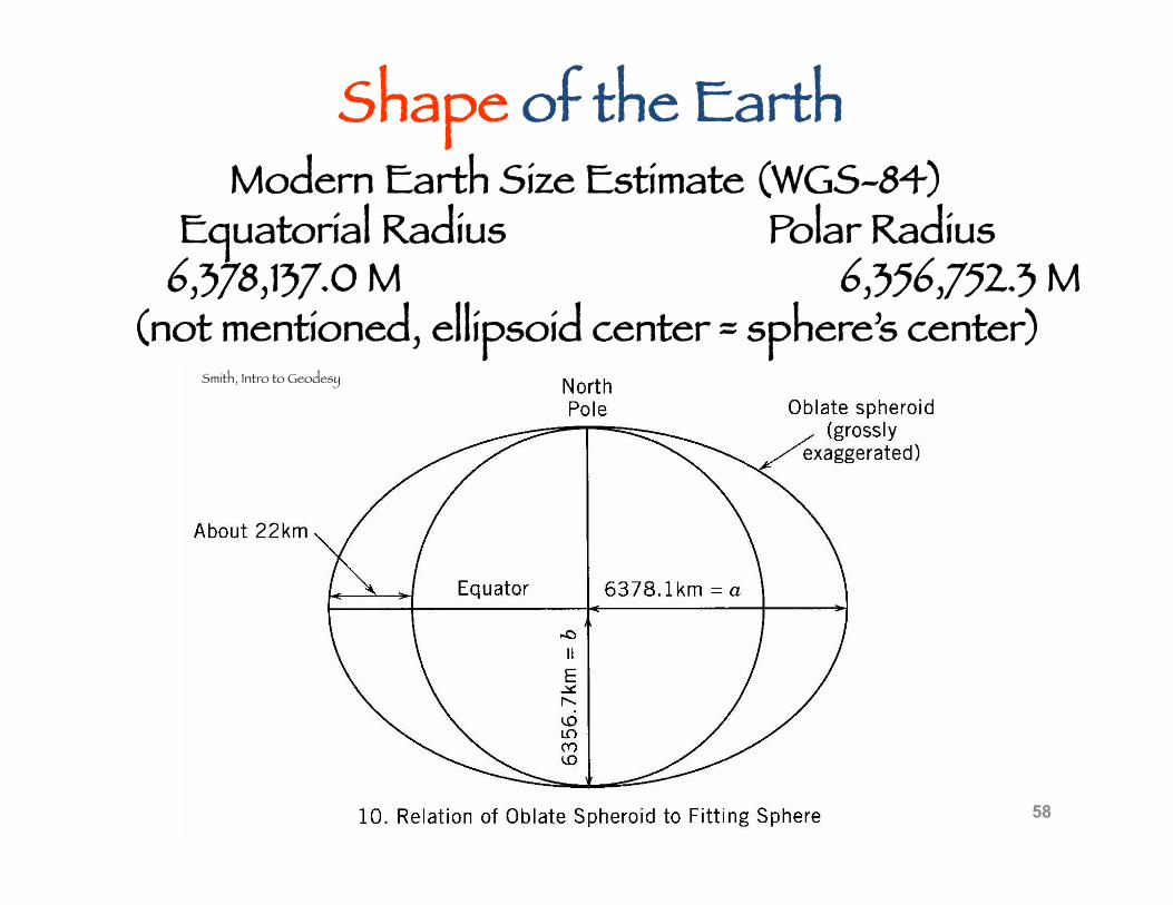
Modern Earth Size Estimate (WGS-84) Equatorial Radius Polar Radius
6,378,137.0 M 6,356,752.3 M (not mentioned, ellipsoid center = sphere’s center)
58
Smith, Intro to Geodesy
Shape of the Earth
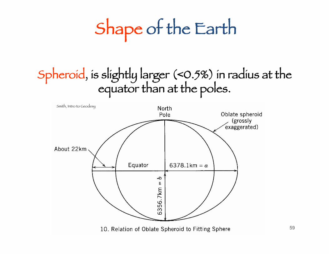
59
Smith, Intro to Geodesy
Shape of the Earth
Spheroid, is slightly larger (<0.5%) in radius at the equator than at the poles.
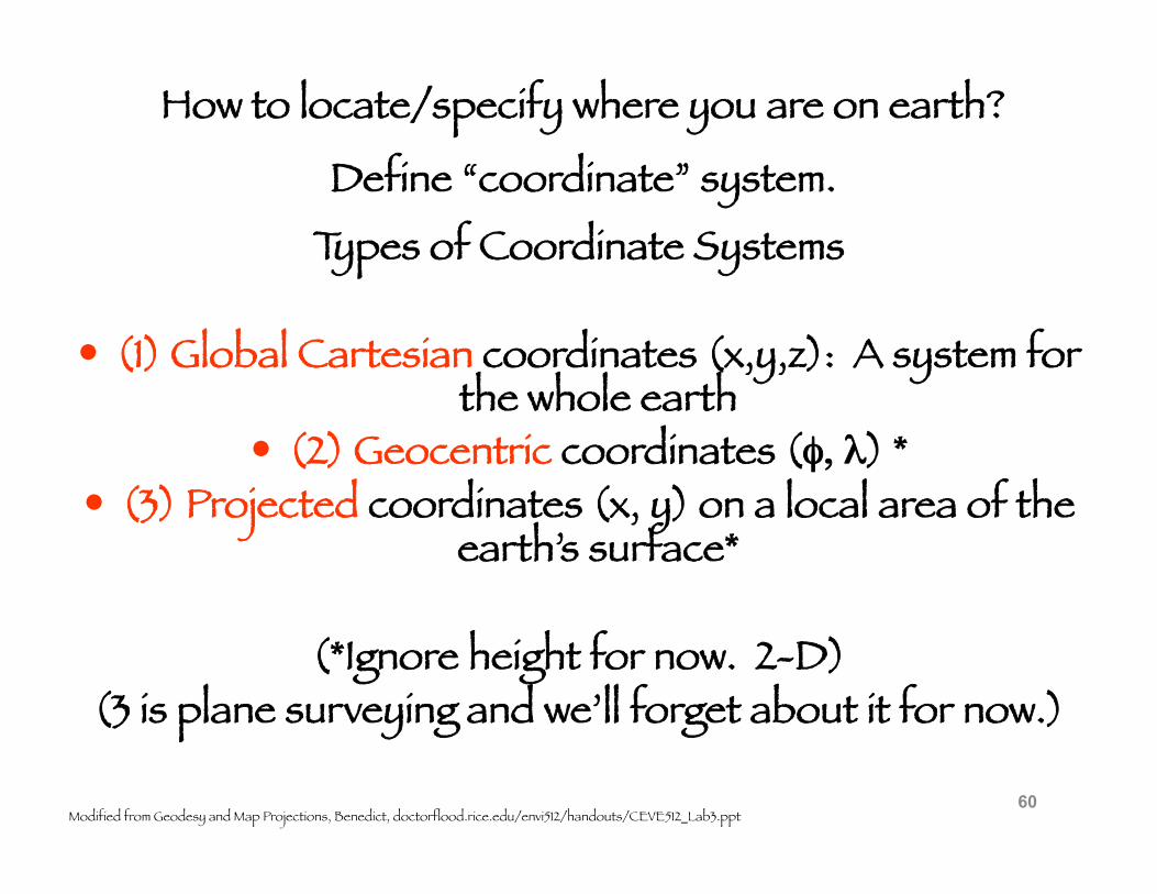
Types of Coordinate Systems
(1) Global Cartesian coordinates (x,y,z): A system for the whole earth
(2) Geocentric coordinates (φ, λ) * (3) Projected coordinates (x, y) on a local area of the
earth’s surface*
(*Ignore height for now. 2-D) (3 is plane surveying and we’ll forget about it for now.)
60 Modified from Geodesy and Map Projections, Benedict, doctorflood.rice.edu/envi512/handouts/CEVE512_Lab3.ppt
How to locate/specify where you are on earth?
Define “coordinate” system.
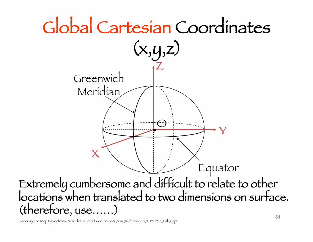
Global Cartesian Coordinates(x,y,z)
61
O
X
Z
Y
Greenwich Meridian
Equator
•
Extremely cumbersome and difficult to relate to other locations when translated to two dimensions on surface. (therefore, use……) Geodesy and Map Projections, Benedict, doctorflood.rice.edu/envi512/handouts/CEVE512_Lab3.ppt
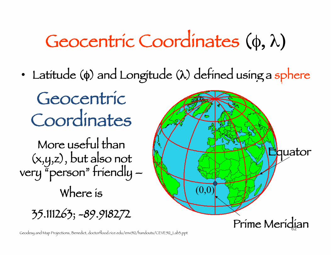
Geocentric Coordinates (φ, λ)
• Latitude (φ) and Longitude (λ) defined using a sphere
62 Geodesy and Map Projections, Benedict, doctorflood.rice.edu/envi512/handouts/CEVE512_Lab3.ppt
Geocentric Coordinates
(0,0)
Equator
Prime Meridian
More useful than (x,y,z), but also not
very “person” friendly –
Where is
35.111263; -89.918272
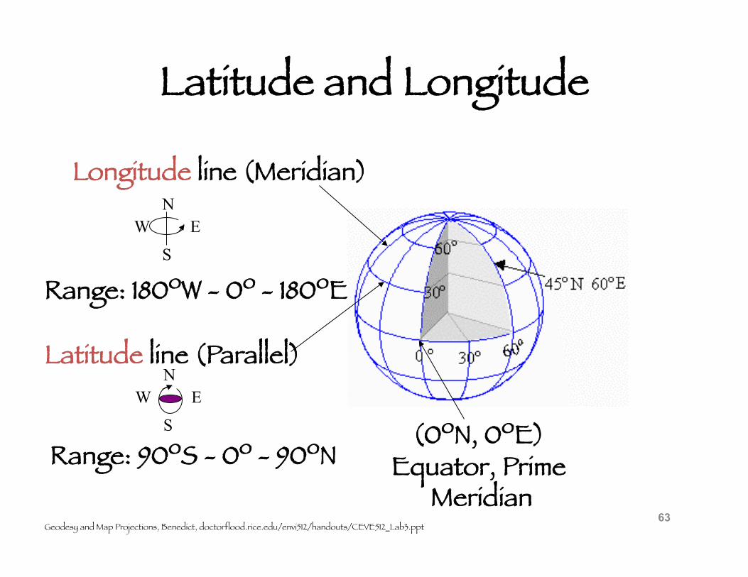
Latitude and Longitude
63
Longitude line (Meridian) N
S W E
Range: 180ºW - 0º - 180ºE
Latitude line (Parallel) N
S W E
Range: 90ºS - 0º - 90ºN (0ºN, 0ºE)
Equator, Prime Meridian
Geodesy and Map Projections, Benedict, doctorflood.rice.edu/envi512/handouts/CEVE512_Lab3.ppt
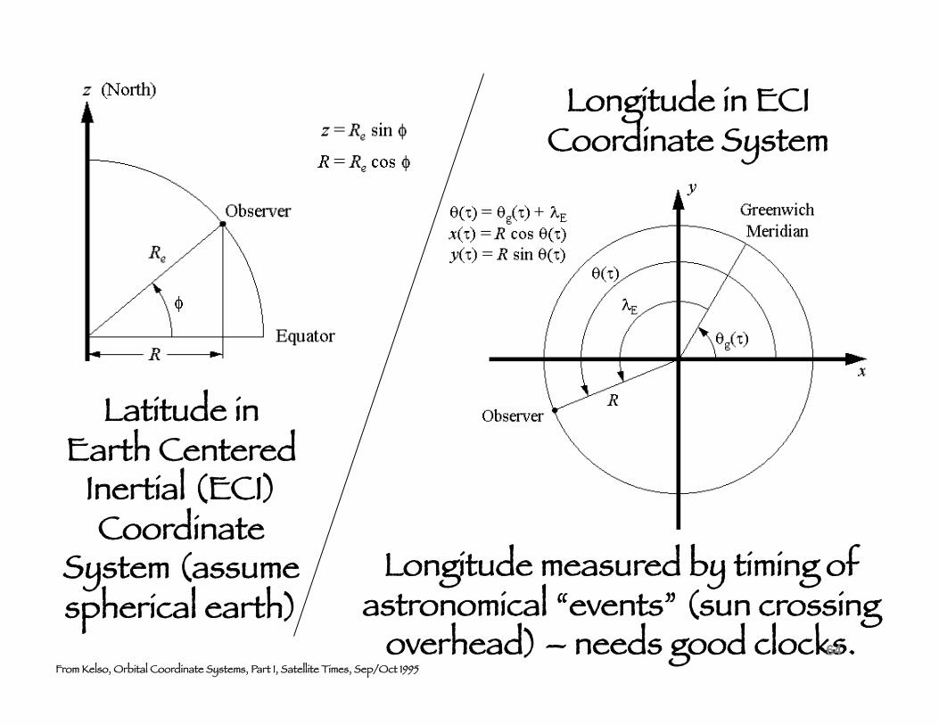
Latitude in Earth Centered
Inertial (ECI) Coordinate
System (assume spherical earth)
Longitude in ECI Coordinate System
From Kelso, Orbital Coordinate Systems, Part I, Satellite Times, Sep/Oct 1995
Longitude measured by timing of astronomical “events” (sun crossing
overhead) – needs good clocks. 64
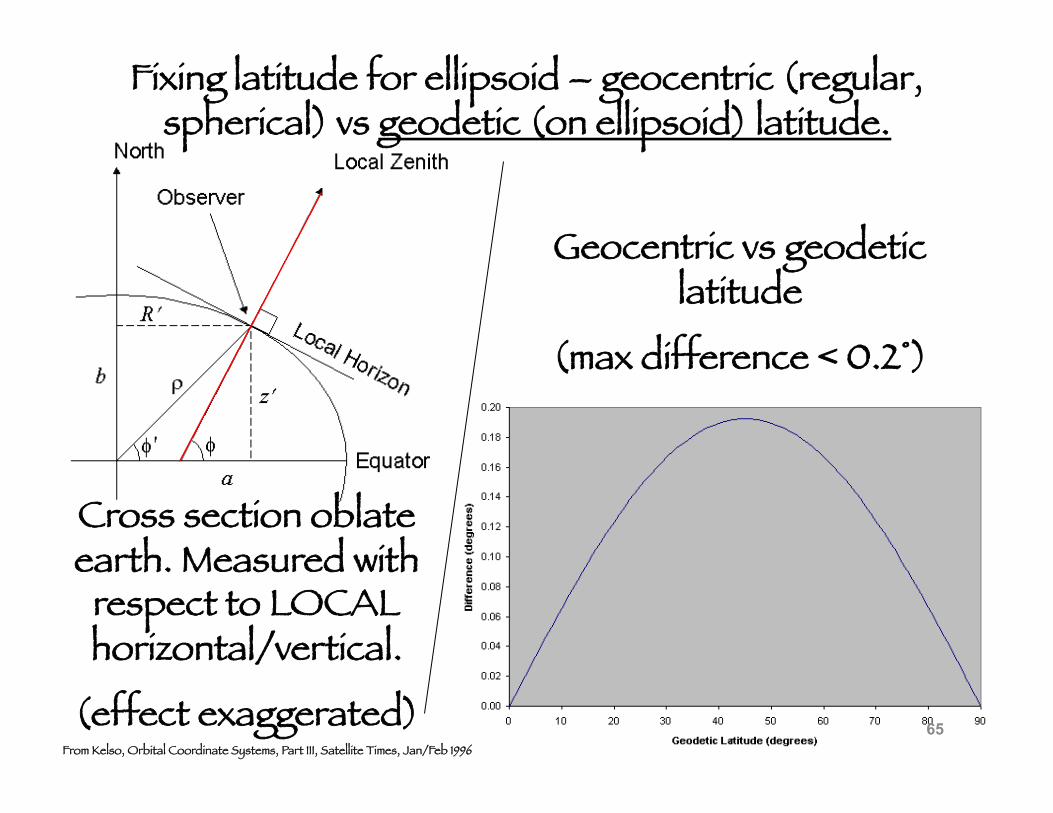
Cross section oblate earth. Measured with
respect to LOCAL horizontal/vertical.
(effect exaggerated) From Kelso, Orbital Coordinate Systems, Part III, Satellite Times, Jan/Feb 1996
Geocentric vs geodetic latitude
(max difference < 0.2°)
Fixing latitude for ellipsoid – geocentric (regular, spherical) vs geodetic (on ellipsoid) latitude.
65
Have to consider – third order adjustment to shape --
the Earth is not a perfect ellipsoid of revolution.
What to do?
Returning to Shape of the Earth
Globally – can make a “best fit” ellipsoid.
Regionally/Locally (“country”/continental size) – can make a “best fit” ellipsoid.
66
These “best fit” ellipsoids are used as a reference for the earth coordinate system are called “datums”.
We will start with the “simple” case – horizontal reference frame/datum.
Returning to Shape of the Earth
67
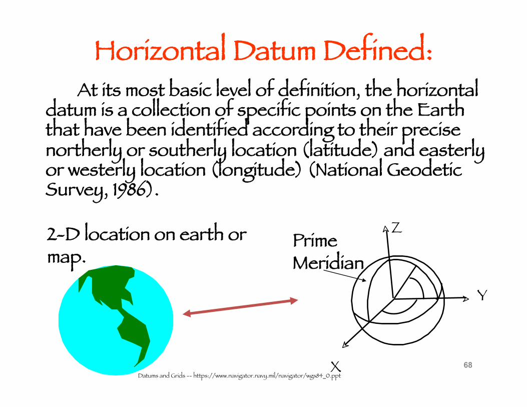
Horizontal Datum Defined: At its most basic level of definition, the horizontal datum is a collection of specific points on the Earth that have been identified according to their precise northerly or southerly location (latitude) and easterly or westerly location (longitude) (National Geodetic Survey, 1986).
68
Y
Prime Meridian
X
Z
Datums and Grids -- https://www.navigator.navy.mil/navigator/wgs84_0.ppt
2-D location on earth or map.
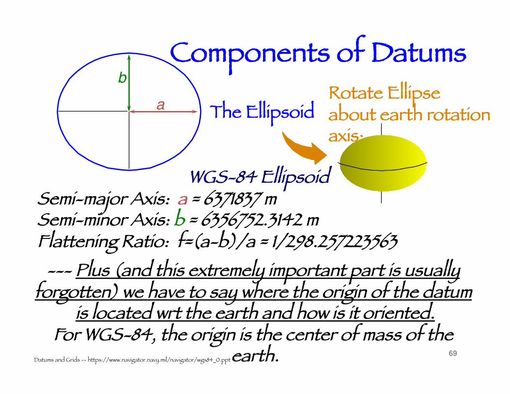
Components of Datums
69
WGS-84 Ellipsoid Semi-major Axis: a = 6371837 m Semi-minor Axis: b = 6356752.3142 m Flattening Ratio: f=(a-b)/a = 1/298.257223563
Rotate Ellipse about earth rotation axis:
The Ellipsoid a!b!
Datums and Grids -- https://www.navigator.navy.mil/navigator/wgs84_0.ppt
--- Plus (and this extremely important part is usually forgotten) we have to say where the origin of the datum
is located wrt the earth and how is it oriented. For WGS-84, the origin is the center of mass of the
earth.
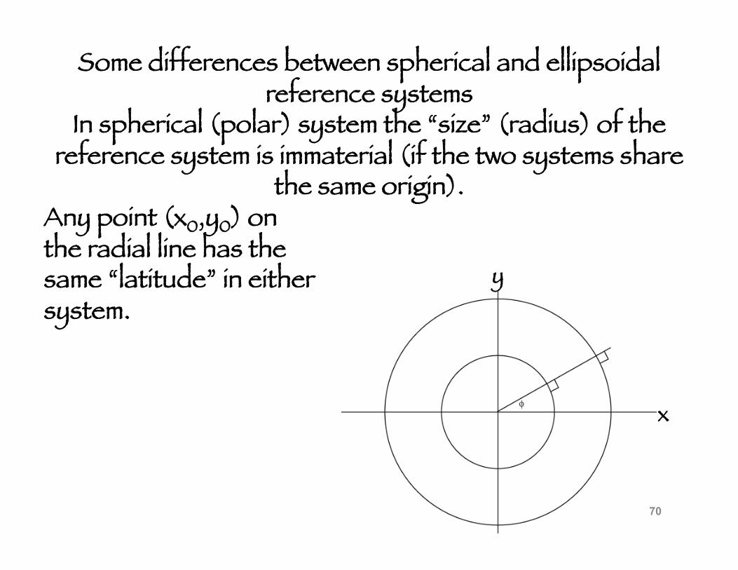
Some differences between spherical and ellipsoidal reference systems
In spherical (polar) system the “size” (radius) of the reference system is immaterial (if the two systems share
the same origin). Any point (x0,y0) on the radial line has the same “latitude” in either system.
x
y
70
x
y
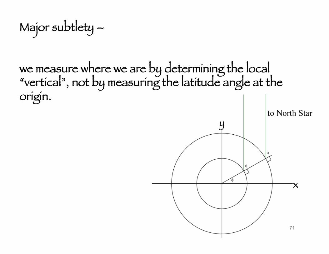
Major subtlety –
we measure where we are by determining the local “vertical”, not by measuring the latitude angle at the origin.
71
x
y
x
y
(x1,y1)
(x2,y2)
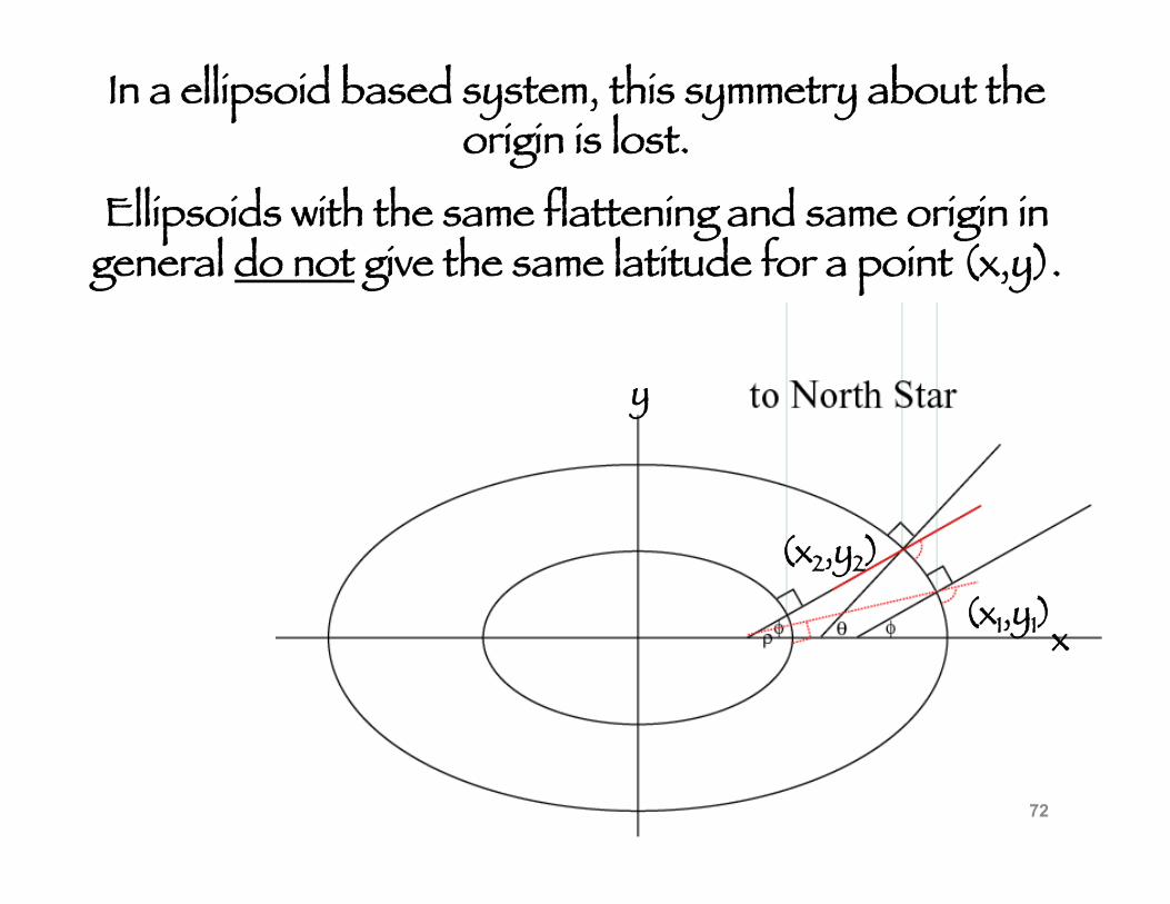
In a ellipsoid based system, this symmetry about the origin is lost.
Ellipsoids with the same flattening and same origin in general do not give the same latitude for a point (x,y).
72
x
y
x
y
(x1,y1)
(x2,y2)
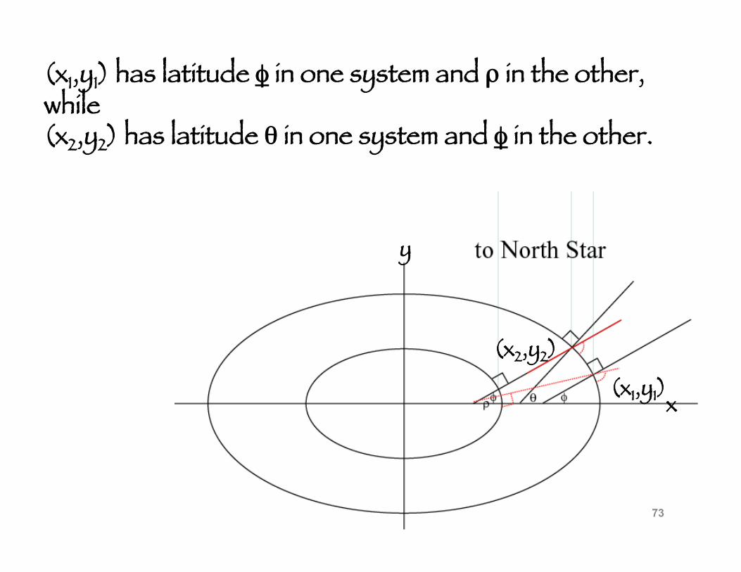
(x1,y1) has latitude φ in one system and ρ in the other, while (x2,y2) has latitude θ in one system and φ in the other.
73
x
y
x
y
(x1,y1)
(x2,y2)
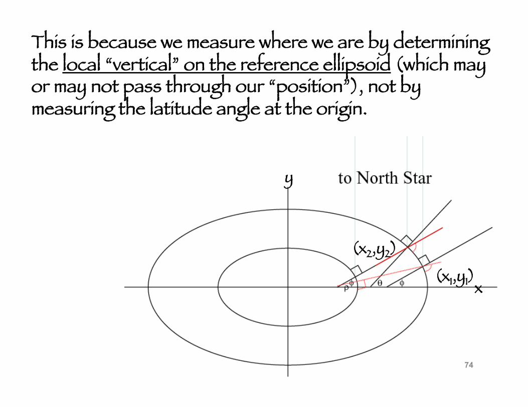
This is because we measure where we are by determining the local “vertical” on the reference ellipsoid (which may or may not pass through our “position”), not by measuring the latitude angle at the origin.
74
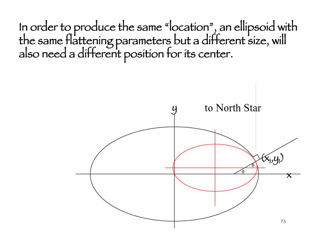
In order to produce the same “location”, an ellipsoid with the same flattening parameters but a different size, will also need a different position for its center.
x
y
(x1,y1)
75
www.evergladesplan.org/pm/recover/ recover_docs/mrt/ft_lauderdale.ppt
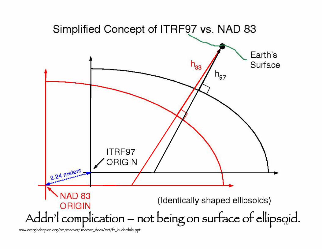
Addn’l complication – not being on surface of ellipsoid. 76
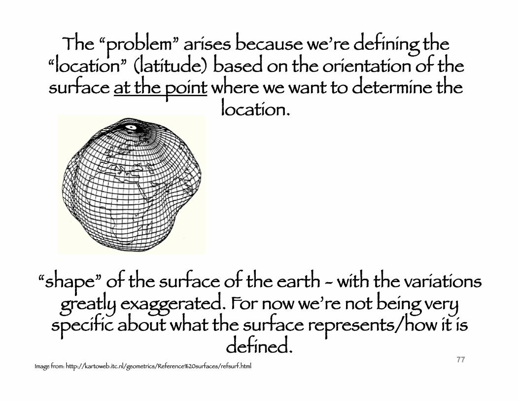
The “problem” arises because we’re defining the “location” (latitude) based on the orientation of the surface at the point where we want to determine the
location.
“shape” of the surface of the earth - with the variations greatly exaggerated. For now we’re not being very
specific about what the surface represents/how it is defined.
Image from: http://kartoweb.itc.nl/geometrics/Reference%20surfaces/refsurf.html 77
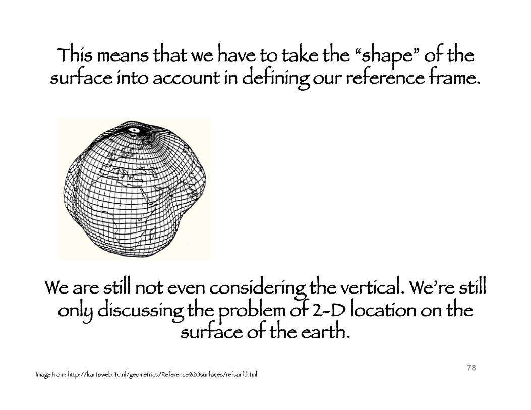
We are still not even considering the vertical. We’re still only discussing the problem of 2-D location on the
surface of the earth.
Image from: http://kartoweb.itc.nl/geometrics/Reference%20surfaces/refsurf.html
This means that we have to take the “shape” of the surface into account in defining our reference frame.
78


![The Dynamic Earth and Space Geodesy EATS 1010 3.0 [Fall 2011]](https://img.pdfslide.us/doc/110x75/56815032550346895dbe2fe5/the-dynamic-earth-and-space-geodesy-eats-1010-30-fall-2011.jpg)