Embed Size (px)
Citation preview
IRNAS.EU • @institute_irnas CC BY-SA 4.0IRNAS.EU • @institute_irnas CC BY-SA 4.0
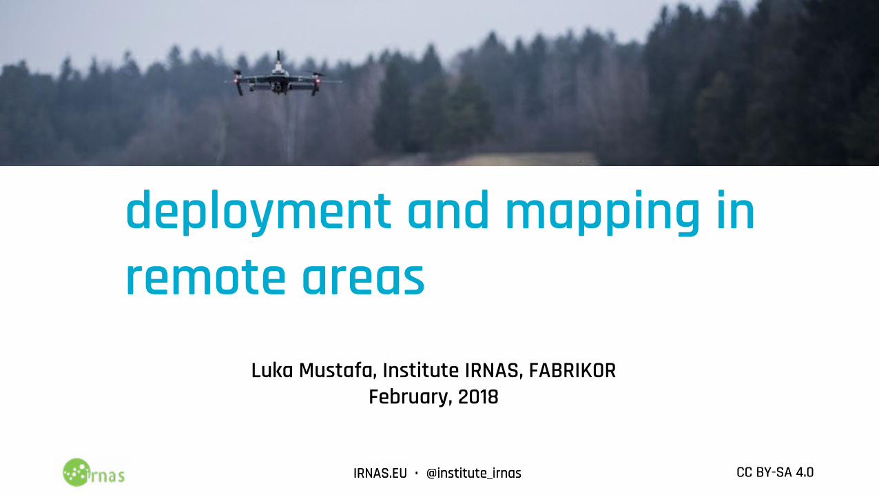
Drone assisted TTN deployment and mapping in remote areas
Luka Mustafa, Institute IRNAS, FABRIKORFebruary, 2018
IRNAS.EU • @institute_irnas CC BY-SA 4.0IRNAS.EU • @institute_irnas CC BY-SA 4.0
Who am I
Luka Mustafa - Musti (MEng)• electronics, telecoms, hardware hacking, …• Institute IRNAS Rače (non-profit development)• Shuttleworth Foundation Fellow• University College London: PhD studentAlso active in :• HAM radio S59DXX• wlan slovenija
IRNAS.EU • @institute_irnas CC BY-SA 4.0IRNAS.EU • @institute_irnas CC BY-SA 4.0
We build future-proof hardware!
Open hardware development Prototyping and manufacturing
We work together to rapidly develop well-tailored and cost-effective solutions for industry and science.
IRNAS.EU • @institute_irnas CC BY-SA 4.0IRNAS.EU • @institute_irnas CC BY-SA 4.0
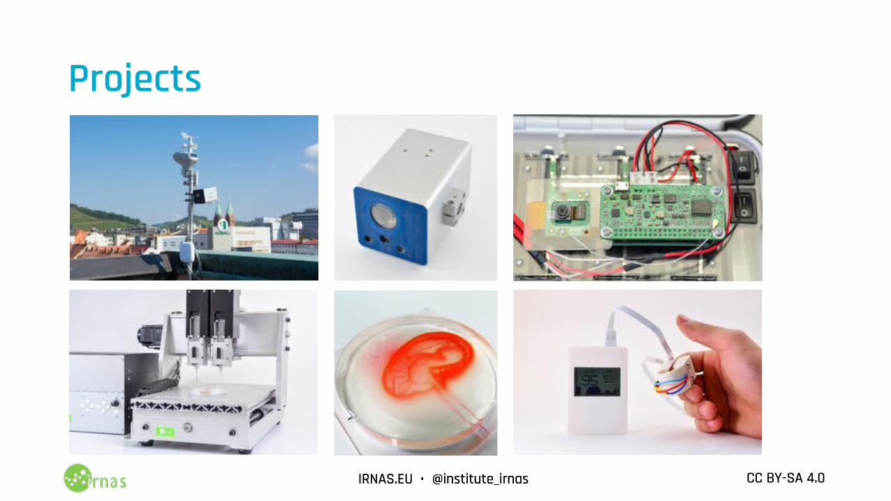
Projects
IRNAS.EU • @institute_irnas CC BY-SA 4.0IRNAS.EU • @institute_irnas CC BY-SA 4.0
Presentation outline
1. Motivation2. Technical solution3. Implementation4. Future-use
IRNAS.EU • @institute_irnas CC BY-SA 4.0IRNAS.EU • @institute_irnas CC BY-SA 4.0
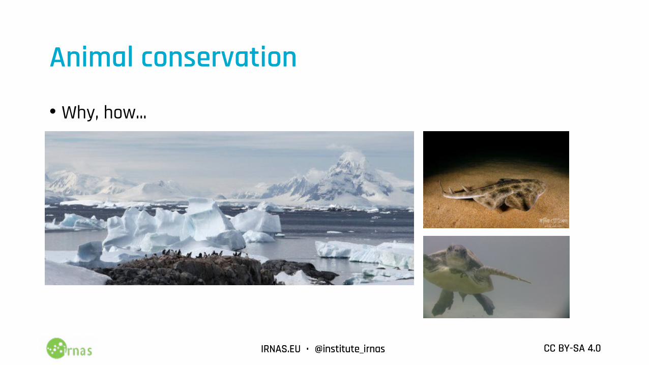
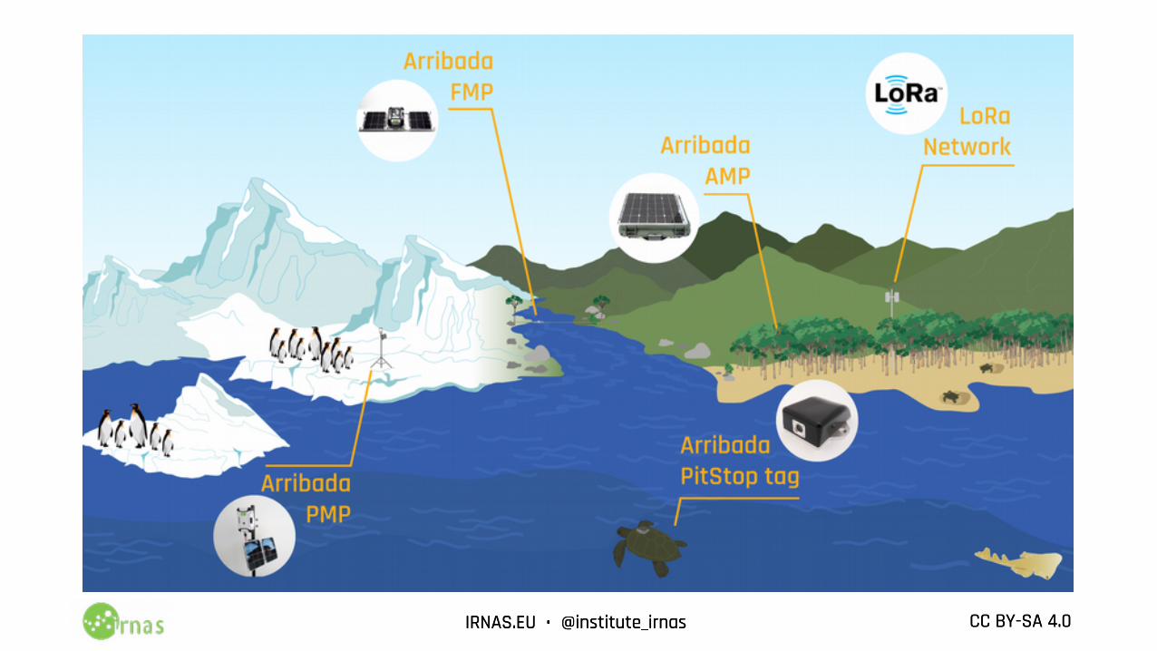
Animal conservation
• Why, how...
IRNAS.EU • @institute_irnas CC BY-SA 4.0IRNAS.EU • @institute_irnas CC BY-SA 4.0
IRNAS.EU • @institute_irnas CC BY-SA 4.0IRNAS.EU • @institute_irnas CC BY-SA 4.0
IRNAS.EU • @institute_irnas CC BY-SA 4.0IRNAS.EU • @institute_irnas CC BY-SA 4.0
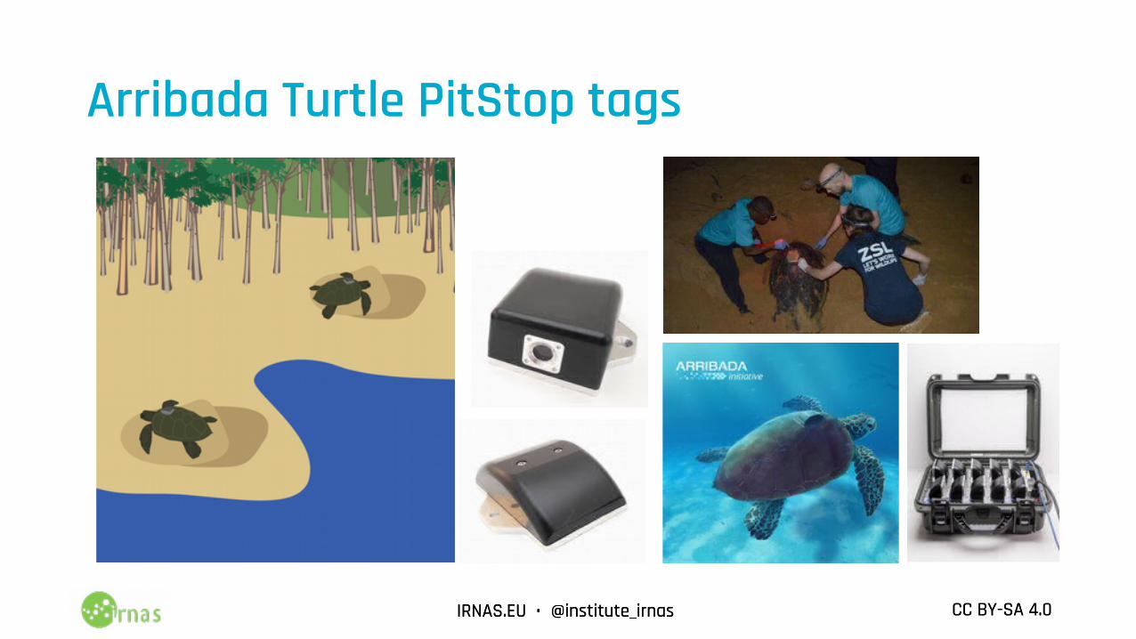
Arribada Turtle PitStop tags
IRNAS.EU • @institute_irnas CC BY-SA 4.0IRNAS.EU • @institute_irnas CC BY-SA 4.0
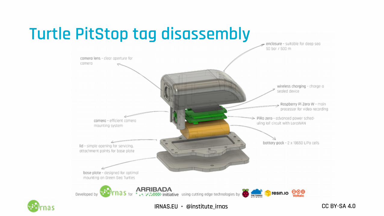
Turtle PitStop tag disassembly
IRNAS.EU • @institute_irnas CC BY-SA 4.0IRNAS.EU • @institute_irnas CC BY-SA 4.0
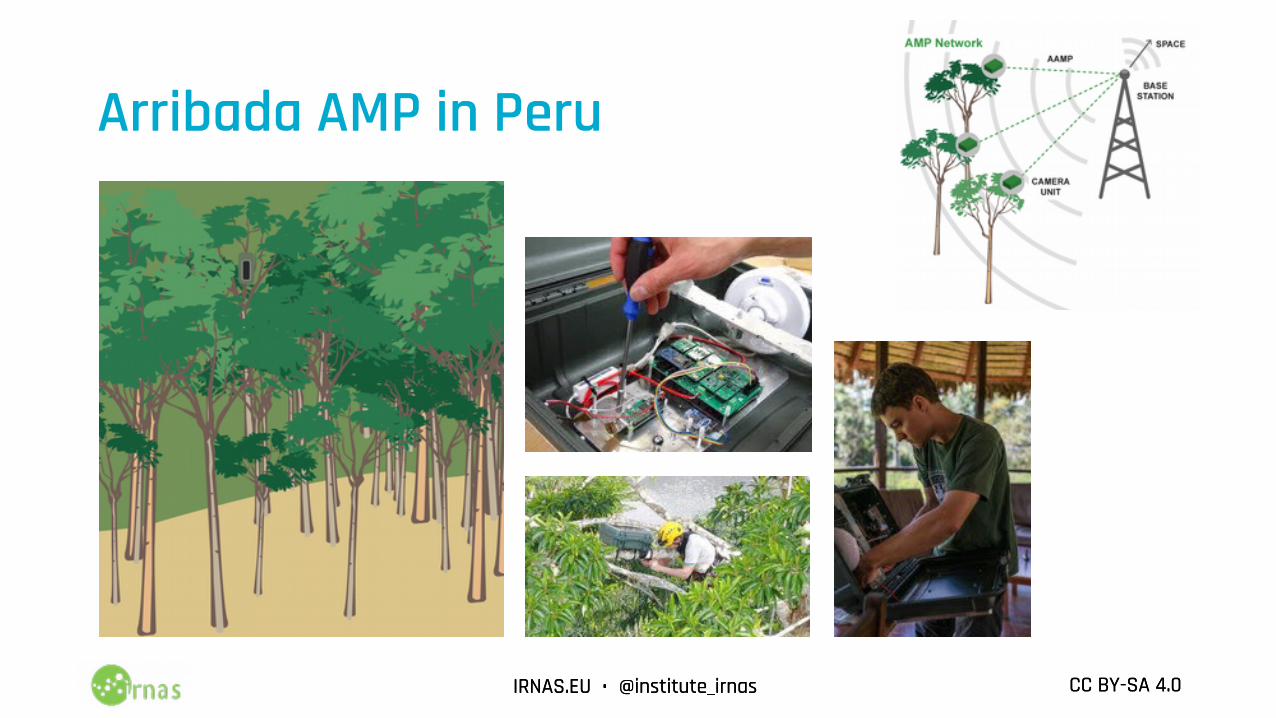
Arribada AMP in Peru
IRNAS.EU • @institute_irnas CC BY-SA 4.0IRNAS.EU • @institute_irnas CC BY-SA 4.0
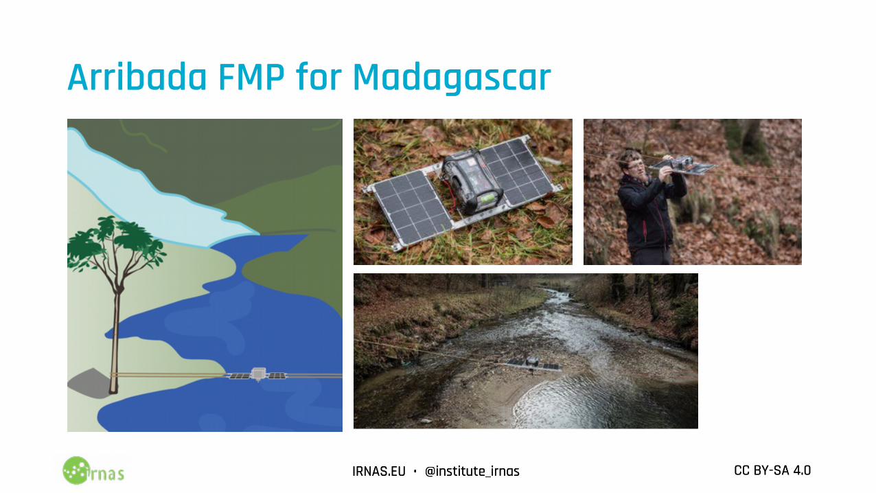
Arribada FMP for Madagascar
IRNAS.EU • @institute_irnas CC BY-SA 4.0IRNAS.EU • @institute_irnas CC BY-SA 4.0
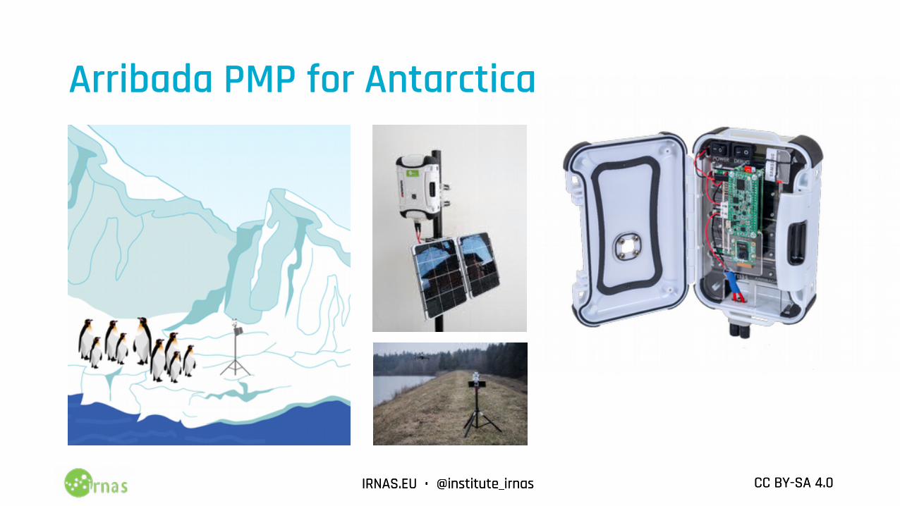
Arribada PMP for Antarctica
IRNAS.EU • @institute_irnas CC BY-SA 4.0IRNAS.EU • @institute_irnas CC BY-SA 4.0
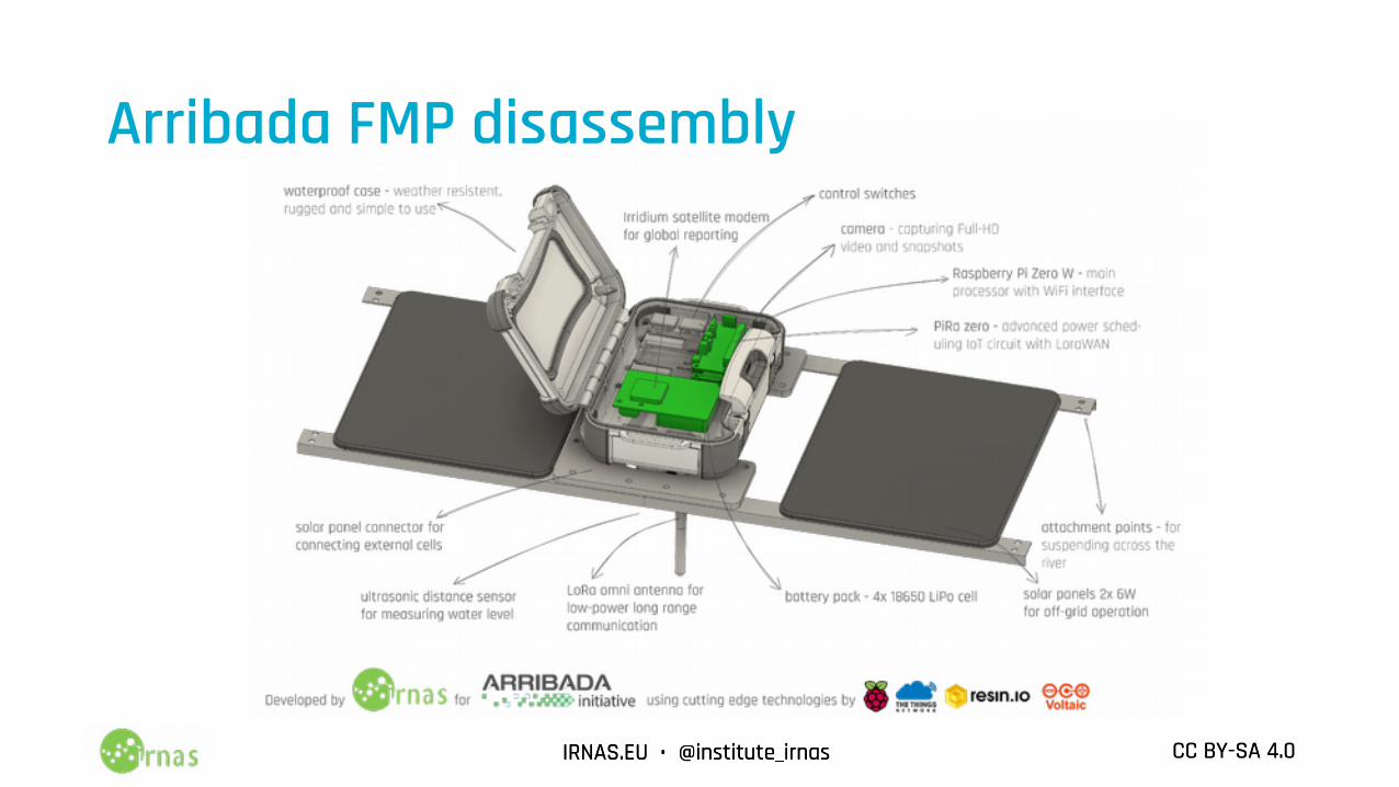
Arribada FMP disassembly
IRNAS.EU • @institute_irnas CC BY-SA 4.0IRNAS.EU • @institute_irnas CC BY-SA 4.0
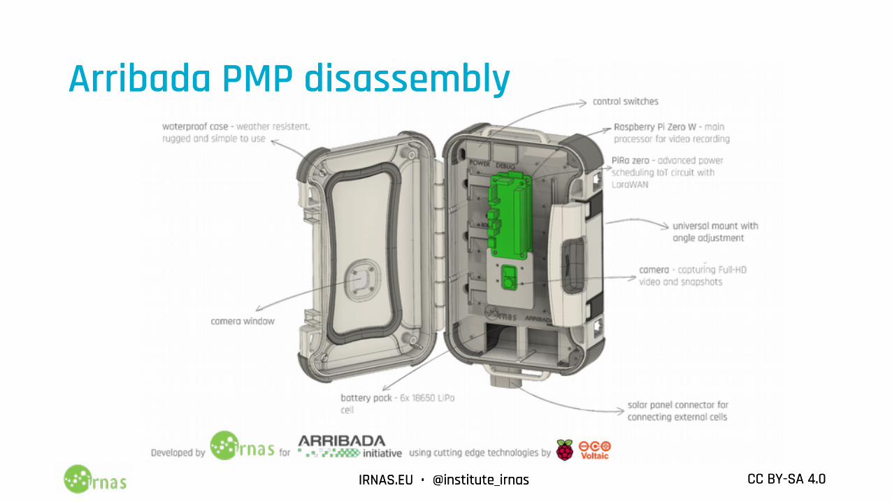
Arribada PMP disassembly
IRNAS.EU • @institute_irnas CC BY-SA 4.0IRNAS.EU • @institute_irnas CC BY-SA 4.0
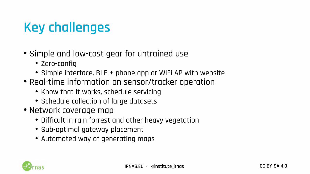
Key challenges
• Simple and low-cost gear for untrained use• Zero-config• Simple interface, BLE + phone app or WiFi AP with website
• Real-time information on sensor/tracker operation• Know that it works, schedule servicing• Schedule collection of large datasets
• Network coverage map• Difficult in rain forrest and other heavy vegetation • Sub-optimal gateway placement • Automated way of generating maps
IRNAS.EU • @institute_irnas CC BY-SA 4.0IRNAS.EU • @institute_irnas CC BY-SA 4.0
LoRaWAN to the rescue
• Low-cost battery efficient devices• SX1276 modules• Implemented in sensors of various kinds
• Simple gateways• RPi Zero + RAK831• WiFi, 3G or other uplink• PoE or solar powered• Mounted on a building or tree
• Easy to deploy
IRNAS.EU • @institute_irnas CC BY-SA 4.0IRNAS.EU • @institute_irnas CC BY-SA 4.0
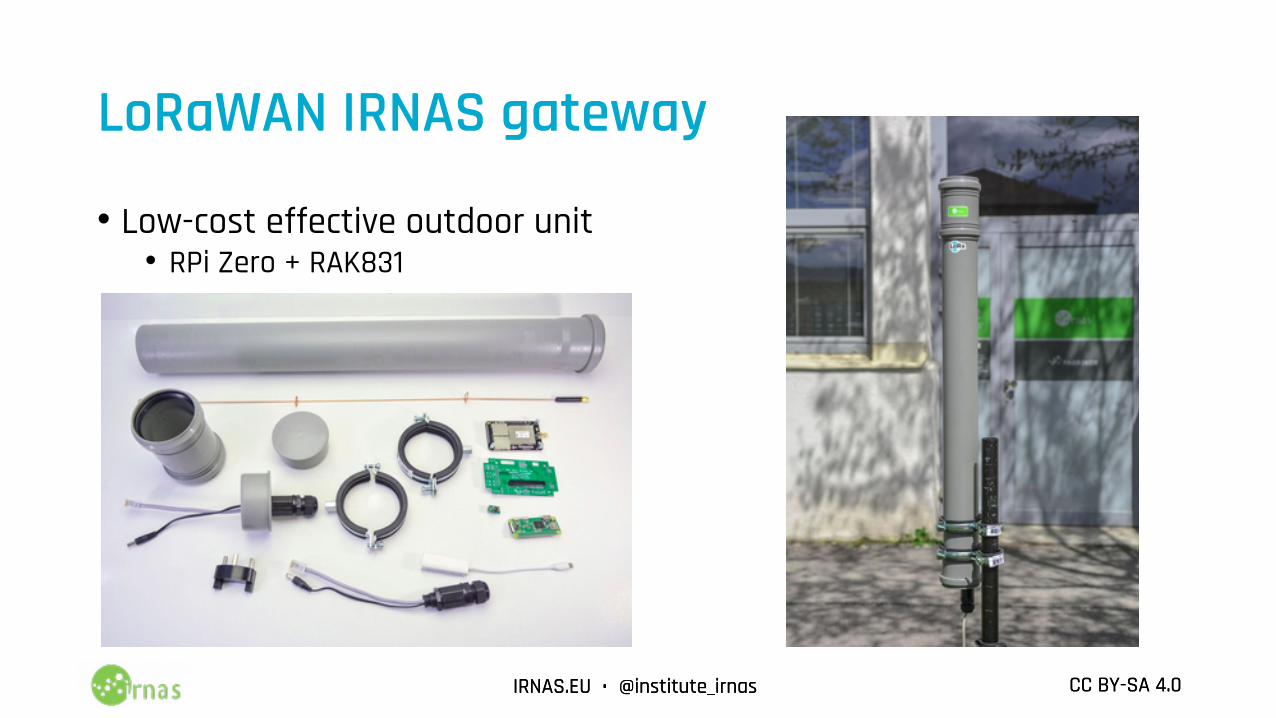
LoRaWAN IRNAS gateway
• Low-cost effective outdoor unit• RPi Zero + RAK831•
IRNAS.EU • @institute_irnas CC BY-SA 4.0IRNAS.EU • @institute_irnas CC BY-SA 4.0
Technical unknowns
• What is the coverage of a gateway?• TTNMapper for wardriving
• Hard to repeat, only at ground level• RadioMobile for estimating
• Inaccurate with heavly land cover (vegetation)• Inaccurate with gateways with obstructions
• How do I know a device works at a given location?• 20m up a tree• Floating in a pond• Swimming in the sea
• How do antennas and devices actually beahve?• Repeatable testing required
IRNAS.EU • @institute_irnas CC BY-SA 4.0IRNAS.EU • @institute_irnas CC BY-SA 4.0
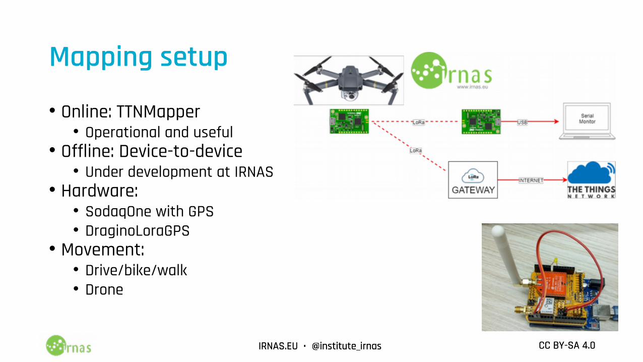
Mapping setup
• Online: TTNMapper• Operational and useful
• Offline: Device-to-device• Under development at IRNAS
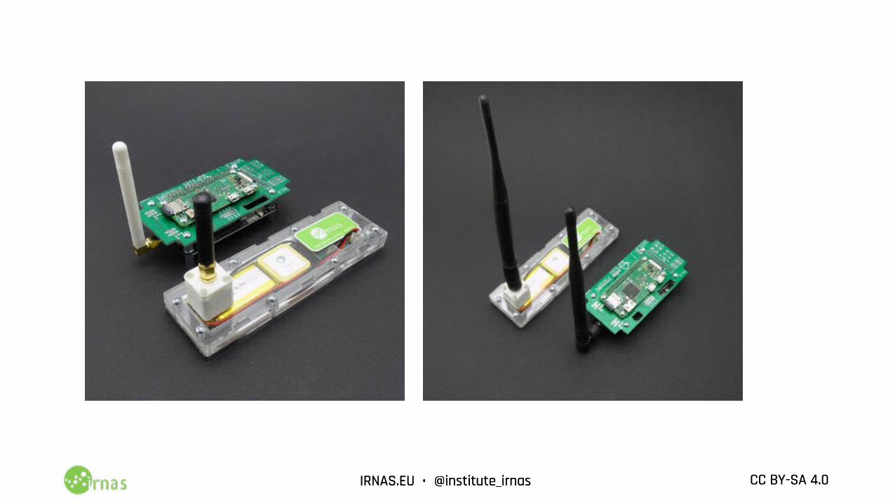
• Hardware:• SodaqOne with GPS• DraginoLoraGPS
• Movement:• Drive/bike/walk• Drone
IRNAS.EU • @institute_irnas CC BY-SA 4.0IRNAS.EU • @institute_irnas CC BY-SA 4.0
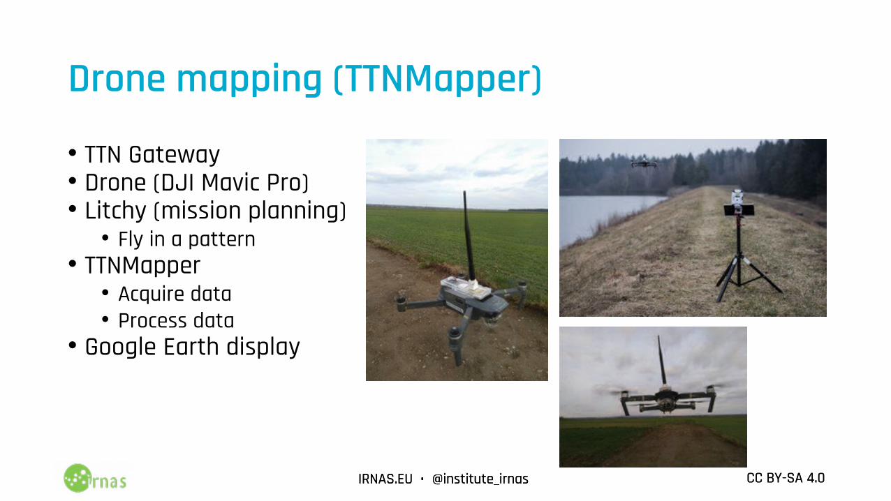
Drone mapping (TTNMapper)
• TTN Gateway• Drone (DJI Mavic Pro)• Litchy (mission planning)
• Fly in a pattern• TTNMapper
• Acquire data• Process data
• Google Earth display
IRNAS.EU • @institute_irnas CC BY-SA 4.0IRNAS.EU • @institute_irnas CC BY-SA 4.0
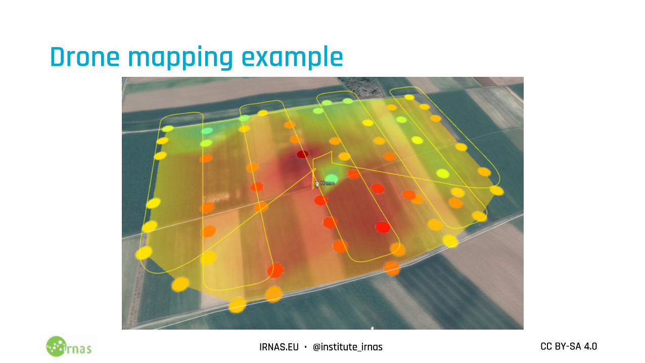
Drone mapping example
IRNAS.EU • @institute_irnas CC BY-SA 4.0IRNAS.EU • @institute_irnas CC BY-SA 4.0
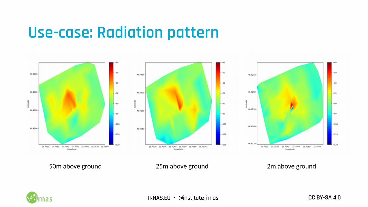
Use-case: Radiation pattern
50m above ground 25m above ground 2m above ground
IRNAS.EU • @institute_irnas CC BY-SA 4.0IRNAS.EU • @institute_irnas CC BY-SA 4.0
IRNAS.EU • @institute_irnas CC BY-SA 4.0IRNAS.EU • @institute_irnas CC BY-SA 4.0
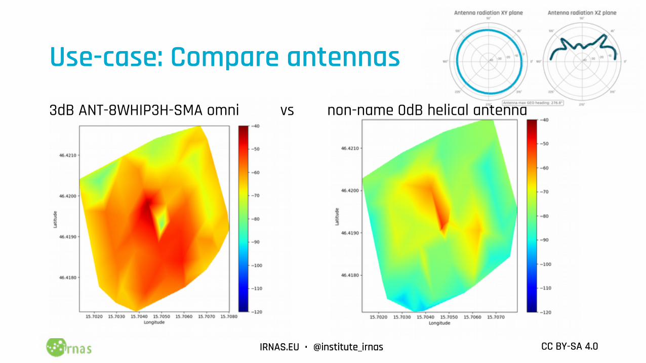
Use-case: Compare antennas
3dB ANT-8WHIP3H-SMA omni vs non-name 0dB helical antenna
IRNAS.EU • @institute_irnas CC BY-SA 4.0IRNAS.EU • @institute_irnas CC BY-SA 4.0
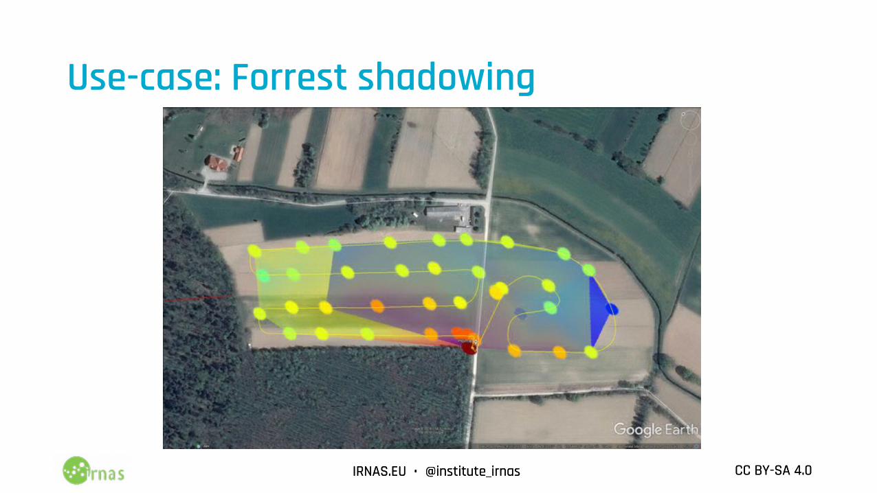
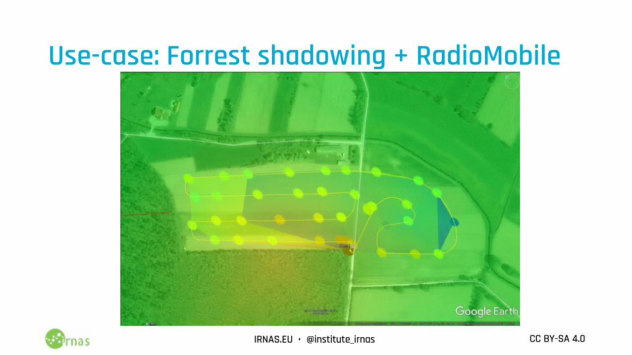
Use-case: Forrest shadowing
IRNAS.EU • @institute_irnas CC BY-SA 4.0IRNAS.EU • @institute_irnas CC BY-SA 4.0
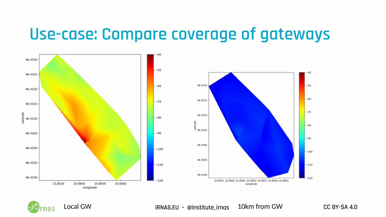
Use-case: Compare coverage of gateways
Local GW 10km from GW
IRNAS.EU • @institute_irnas CC BY-SA 4.0IRNAS.EU • @institute_irnas CC BY-SA 4.0
Use-case: Forrest shadowing + RadioMobile
IRNAS.EU • @institute_irnas CC BY-SA 4.0IRNAS.EU • @institute_irnas CC BY-SA 4.0
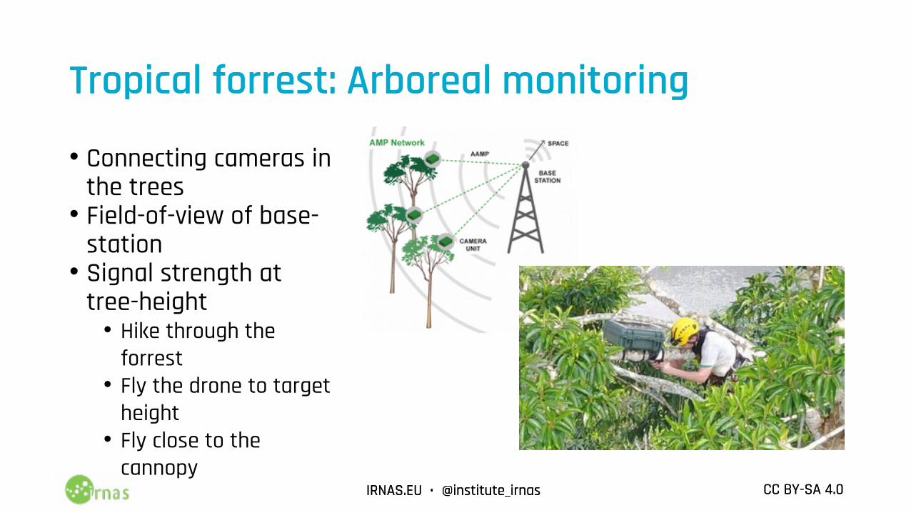
Tropical forrest: Arboreal monitoring
• Connecting cameras in the trees
• Field-of-view of base-station
• Signal strength at tree-height
• Hike through the forrest
• Fly the drone to target height
• Fly close to the cannopy
IRNAS.EU • @institute_irnas CC BY-SA 4.0IRNAS.EU • @institute_irnas CC BY-SA 4.0
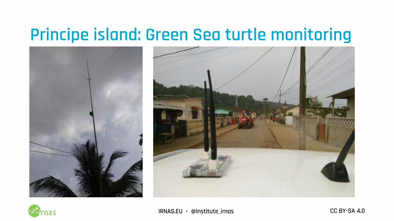
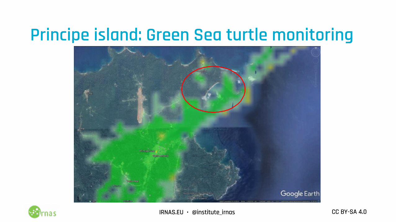
Principe island: Green Sea turtle monitoring
IRNAS.EU • @institute_irnas CC BY-SA 4.0IRNAS.EU • @institute_irnas CC BY-SA 4.0
Principe island: Green Sea turtle monitoring
IRNAS.EU • @institute_irnas CC BY-SA 4.0IRNAS.EU • @institute_irnas CC BY-SA 4.0
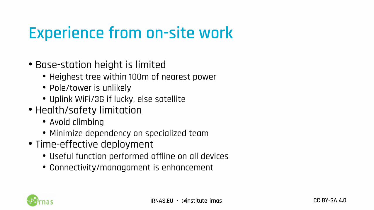
Experience from on-site work
• Base-station height is limited• Heighest tree within 100m of nearest power• Pole/tower is unlikely• Uplink WiFi/3G if lucky, else satellite
• Health/safety limitation• Avoid climbing• Minimize dependency on specialized team
• Time-effective deployment• Useful function performed offline on all devices• Connectivity/managament is enhancement
IRNAS.EU • @institute_irnas CC BY-SA 4.0IRNAS.EU • @institute_irnas CC BY-SA 4.0
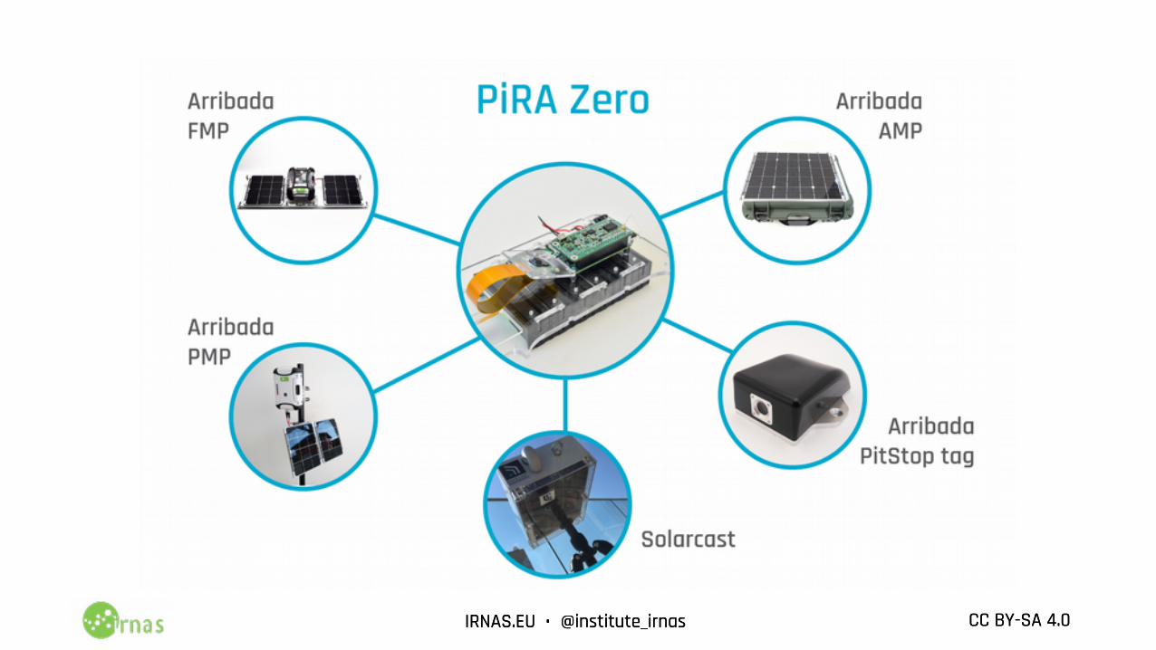
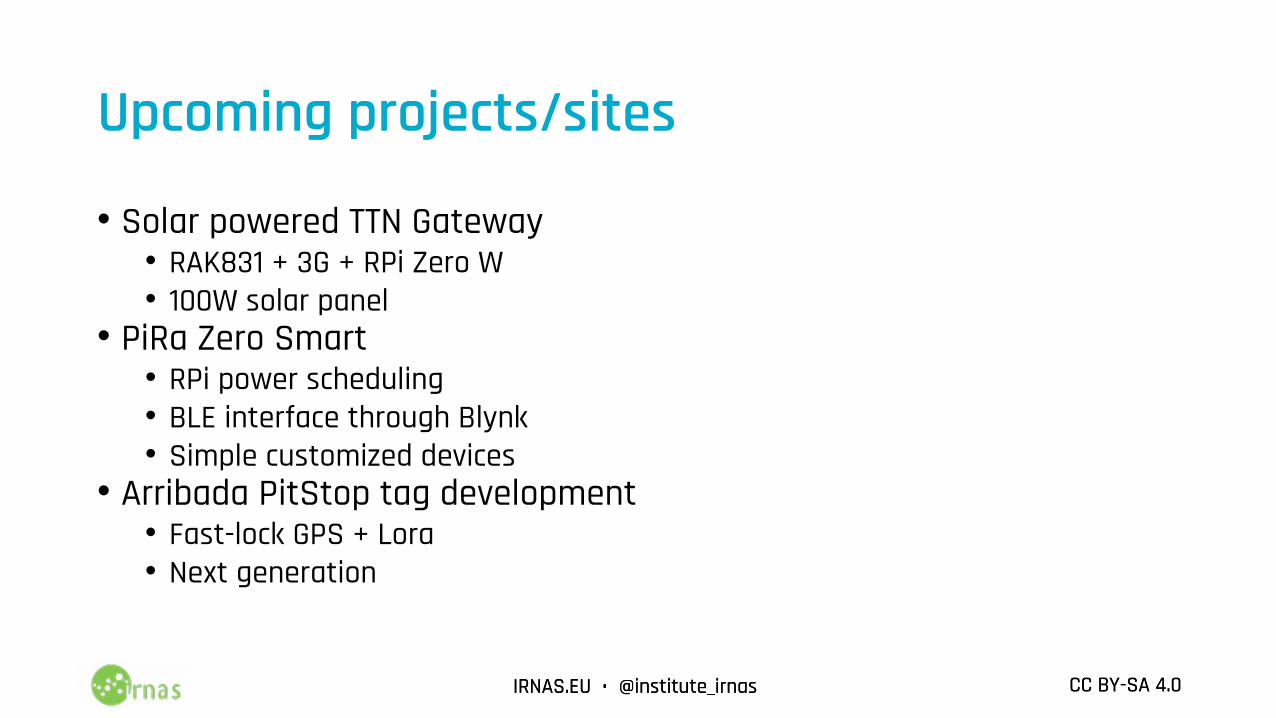
Upcoming projects/sites
• Solar powered TTN Gateway• RAK831 + 3G + RPi Zero W• 100W solar panel
• PiRa Zero Smart• RPi power scheduling• BLE interface through Blynk• Simple customized devices
• Arribada PitStop tag development• Fast-lock GPS + Lora• Next generation
IRNAS.EU • @institute_irnas CC BY-SA 4.0IRNAS.EU • @institute_irnas CC BY-SA 4.0
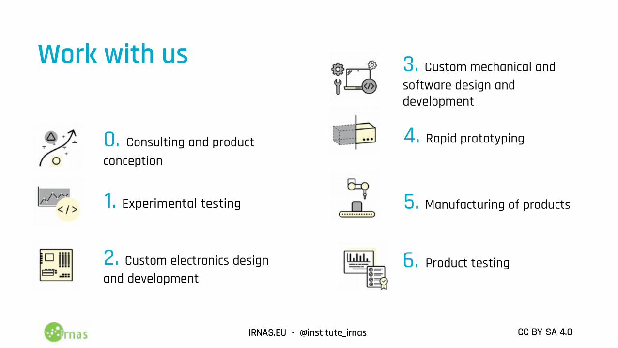
Work with us
0. Consulting and product conception
3. Custom mechanical and software design and development
2. Custom electronics design and development
1. Experimental testing
4. Rapid prototyping
5. Manufacturing of products
6. Product testing
IRNAS.EU • @institute_irnas CC BY-SA 4.0IRNAS.EU • @institute_irnas CC BY-SA 4.0
Thank you!Connect@[email protected]