Embed Size (px)
Citation preview

______________________________
DONATION AGREEMENT
DONATION OF REAL PROPERTY
BY
FISE LLC,
an Ohio limited liability
TO
CITY OF SOUTH EUCLID, OHIO,
an Ohio municipal corporation
_______________ ,2011

- 1 -
DONATION AGREEMENT
This DONATION AGREEMENT (this “Donation Agreement”) is entered into as of _______________, 2011, by and between FISE LLC, an Ohio limited liability company, having a tax mailing address at 25333 Cedar Road, Suite 300, Lyndhurst, Ohio 44124 (“Donor”) and CITY OF SOUTH EUCLID, OHIO, an Ohio municipal corporation, having an address at 1349 South Green Road, South Euclid, Ohio 44121 (the “Donee”).
R E C I T A L S:
WHEREAS, Donee is a municipality of the State of Ohio and the contribution will constitute a "charitable contribution" within the meaning of Section 170(c)(1) of the Internal Revenue Code of 1986, as amended (the “Code”).
WHEREAS, the Donor owns certain real property comprised of approximately 21.2286 acres of land located in the City of South Euclid, Cuyahoga County, Ohio, as more specifically described in Exhibit “A” attached hereto and incorporated herein by reference, together with all rights, privileges and appurtenances thereto belonging (the “Real Property”).
WHEREAS, the Real Property forms a part of a larger tract of land owned by Donor which, excepting the Real Property, is comprised of approximately 40.71 acres of land and which is intended to be utilized by the Donor for commercial purposes (the “Commercial Property”) as depicted on Exhibit “B” attached hereto and incorporated herein by reference;
WHEREAS, Donor is the owner of certain mineral rights upon, in part, the Real Property pursuant to the Oil and Gas Lease (as defined in paragraph 7 below), which generate a certain annual revenue in the form of royalties and which rights and royalties Donor intends to transfer and assign, as applicable, to Donee to be utilized, at Donee’s discretion, for annual maintenance of the Real Property;
WHEREAS, upon completion of certain conditions precedent, the Donor wishes to donate and contribute the Real Property to Donee and Donee wishes to accept such donation; and
WHEREAS, the parties hereto wish to specify the timing, conditions and terms of the donation.
W I T N E S S E T H:
1. Donation and Acceptance.
Donor agrees to donate, convey and transfer to Donee, and Donee agrees to receive and accept from the Donor, all of the Donor's right, title and interest in and to the Real Property subject to the terms, conditions and provisions hereof.
2. Donative Intent.
The Real Property is being donated by the Donor to Donee as a charitable gift.

- 2 -
3. Conveyance.
The conveyance by the Donor of the Real Property to Donee shall be by quit-claim deed in the form of Exhibit “C” attached hereto and incorporated herein by reference (“Deed”).
4. Title and Survey.
Donor shall provide to Donee a copy of the most recent title search completed with respect to the Real Property, and a copy of the Donor’s most recent survey of the Real Property. At Donee’s election and at its sole cost and expense, Donee may obtain an updated title commitment for an ALTA Owner’s Policy of Title Insurance insuring title to the Real Property to Donee to be issued by a title company acceptable to Donee. At Donee’s election, and Donee’s sole cost and expense, Donee may obtain an updated survey of, or surveyor’s certificate for the Real Property.
5. Subdivision.
Donor, at its sole cost and expense, shall perform all work necessary to subdivide the Real Property from the Commercial Property such that the Real Property shall be a separate tax parcel (the “Lot Split”). Donee shall cooperate with Donor in all respects in order to assure that the Lot Split is obtained without delay.
6. Easement.
In connection with Donor’s intended use of the Commercial Property, Donor will require certain easements over, across and upon the Real Property in the format attached hereto as Exhibit “D” (the “Easement Agreement”) for purposes of construction, installation, maintenance, monitoring and repairing certain storm water quality control systems. Donee shall execute the Easement Agreement in the time period set forth in Section 11 below and the Escrow Agent (as defined below) shall record the Easement Agreement at Donor’s cost and expense.
7. Oil and Gas Lease.
Donee acknowledges the existence of an oil and gas well on the Real Property, as well as certain pipelines and other improvements related thereto (the “Well”), installed in accordance with that certain Oil and Gas Lease dated as of September 1, 2005 by and between The Oakwood Club, Donor’s predecessor-in-interest (the “Club”) and Duck Creek Energy, Inc. (“Duck Creek”), as recorded on October 21, 2005 as Instrument Number 200510210950 of the Cuyahoga County Records (the “Original Oil and Gas Lease”), and amended by that certain First Amendment to Oil and Gas Lease by and between Donor and Duck Creek, dated as of February 8, 2011 and recorded on March 1, 2011 as Instrument Number 201103010089 of the Cuyahoga County Records (the “First Amendment to Oil and Gas Lease”) (together with the Original Oil and Gas Lease, the “Oil and Gas Lease”). In connection with and as part of the transaction contemplated herewith, Donor intends to Donate, transfer and assign all royalties associated with the gas Well to Donee and Donee agrees to receive and accept the same. At Closing, Donor shall notify Duck Creek of the transfer of ownership of the Real Property to Donee and, upon such transfer and notification, Donee shall have the rights under the Oil and Gas Lease to any applicable royalties due from the production of oil and gas from the Well. Donee acknowledges Donor’s rights pursuant to the First Amendment to Oil and Gas Lease (i) to relocate any and all existing tanks, pipelines and roadways on the Real Property and the

- 3 -
Commercial Property and (ii) to request Duck Creek to plug and abandon certain wells, including the Well. In the event Donor elects not to plug or abandon the Well but elects to disconnect the Well from the existing collection tanks, so long as Duck Creek has not elected to shut in the Well in accordance with the terms of Paragraph 8 of the Oil and Gas Lease, Donor agrees to provide, at Donor’s cost and expense, a collection and/or retrieval system at a location on the Real Property reasonably agreed upon among Donor, Donee and Duck Creek.
8. Donor Warranties and Representations.
Except as set forth in that certain Public Benefit Agreement attached hereto as Exhibit “E”, the Real Property is being conveyed on an “AS IS” “WHERE IS” basis in its present state and condition and the Donor disclaims all warranties and representations of any kind or nature, whether oral or written, express or implied, concerning the Real Property, any such personal property or the Donor, except as follows:
(a) The Donor is a duly organized and validly existing limited liability Donor under the laws of the State of Ohio and has all necessary power and authority to enter into this Donation Agreement and to perform and carry out the terms and conditions required of it hereunder.
(b) The Donor is not a “nonresident alien,” “foreign corporation,” “foreign partnership,” “foreign limited liability Donor,” “foreign trust” or “foreign estate” within the meaning of Code Section 1445 and any related Treasury Regulations.
9. Donee Warranties, Representations and Acknowledgements.
(a) Donee hereby warrants and represents to the Donor that it is a duly organized and validly existing chartered municipal corporation under the laws of the State of Ohio and a political subdivision of the State of Ohio and has all necessary power and authority to enter into this Donation Agreement and to perform and carry out the terms and conditions required of it hereunder.
(b) Donee acknowledges that (i) it has inspected the Real Property to its full and complete satisfaction with the full cooperation of the Donor, (ii) such inspection was undertaken by one or more persons of Donee’s choosing, and (iii) it had reasonable and full access to the Real Property for the purposes of its inspection. Donee acknowledges that it has not relied, and does not rely, upon any warranties, representations, or statements concerning the Real Property other than those that are specifically included in this Donation Agreement. Donee acknowledges the present state and condition of the Real Property and agrees to accept the Real Property, notwithstanding any known or unknown deficiencies or defects of or with respect to the Real Property, and agrees not to assert any claim or attempt to rescind the transfer and gift of the Real Property to Donee based on the state or condition of the Real Property.
10. The Donor's Documentation and Delivery of Instruments.

- 4 -
Prior to Closing or otherwise in the time periods specifically set forth herein, the following documents and instruments will be delivered by the Donor to Escrow Agent:
(a) The Deed, executed by the Donor, conveying to Donee all of the Donor’s right, title and interest in and to the Real Property;
(b) any documentation necessary to assign Donor’s interest and rights to royalties in the Well to Donee; and
(c) such other documents as may be reasonably necessary to effectuate the terms and conditions of this Donation Agreement.
11. Donee’s Documentation and Delivery of Instruments.
Prior to Closing or otherwise in the time periods specifically set forth herein, the following documents and instruments will be delivered by Donee to the Escrow Agent:
(a) The fully executed Easement Agreement;
(b) one (1) copy of Donee Acknowledgment (Part IV) of Section B of IRS Form 8283, executed by Donee by an official authorized to sign the tax returns for Donee or by a person specifically designated to sign Form 8283; and
(c) such other documents as may be reasonably necessary to effectuate the terms and conditions of this Donation Agreement.
12. Closing.
Donor has previously executed and delivered the Deed to Chicago Title Insurance Company in its capacity as escrow agent hereunder (the “Escrow Agent”) along with escrow instructions in the form attached hereto as Exhibit “C-1” (the “Escrow Instructions”). Within one (1) business day after the applicable ordinance effectively changing zoning of the Commercial Property from Class R-75 (One Family Residential) to Class C-2 (General Commercial Districts) becomes effective and the applicable ordinance authorizing the City to enter into this Donation Agreement also becomes effective, Donee shall execute and Deliver the Easement Agreement to the Escrow Agent. The Escrow Instructions shall require the Escrow Agent to hold the Deed and Easement Agreement in escrow until such time as Donor has received final non-appealable site plan and (if required) subdivision approval and issuance of a building permit by the City of South Euclid for Phase I of Donor’s development of the Commercial Property (as such term [i.e. Phase I] is specifically defined in that certain Development Agreement between Donor and Donee dated as of the date hereof) (a copy of which shall be delivered to Escrow Agent) (the “Filing Requirements”). Once the Filing Requirements are met, counsel for both Donor and Donee shall confirm to the Escrow Agent as such and the Escrow Agent shall immediately file the Deed and Easement of record and perform all other measures required to close out escrow and complete the transactions contemplated hereby (the “Closing”).
13. Charges.
- 5 -
Donor will be responsible for the payment of the cost of recording the Deed, the Easement Agreement, any Real Property transfer tax or conveyance fees, any costs of the Escrow Agent, and any other costs and expenses required to effectuate the transfer contemplated hereby.
14. Charitable Use.
Donee intends to use the Real Property exclusively for public purposes within the meaning of Code Section 170(c)(1).
15. Commissions and Fees.
The Donor and Donee each represents to the other that it has not dealt with any real estate agent or brokerage firm in connection with the transactions contemplated by this Donation Agreement and is not aware of any real estate commissions that are or will become due to any such agent or firm in connection with such transactions.
16. Miscellaneous.
(a) Relationship of the Parties. Notwithstanding any provision to the contrary in this Donation Agreement, the parties agree that their relationship with respect to the gift contemplated herein is one of donor and donee only, and no provision of this Donation Agreement shall be construed to create any other type of status or relationship between the parties with respect to such gift.
(b) Severability. If any one or more of the provisions contained herein shall for any reason be held to be invalid, illegal or unenforceable in any respect, such invalidity, illegality or unenforceability shall not affect any other provisions of this Donation Agreement, but this Donation Agreement shall be construed as if such invalid, illegal or unenforceable provisions had not been contained herein.
(c) Waiver. The failure of either party to insist, in any one or more instances, upon a strict performance of any of the terms and conditions of this Donation Agreement, or to exercise or fail to exercise any option or right contained herein, shall not be construed as a waiver or a relinquishment for the future of such right or option, but the same shall continue and remain in full force and effect. The continued performance by either party of this Donation Agreement with knowledge of the breach of any term or condition hereof shall not be deemed a waiver of such breach, and no waiver by either party of any provision hereof, shall be deemed to have been made, or operate as estoppel, unless expressed in writing and signed by such party.
(d) Notices. All notices herein authorized or required to be given to Donee shall be sent certified mail, registered mail or overnight express, postage prepaid, to Donee at:
City of South Euclid Attn: Mayor Georgine Welo
1349 South Green Road South Euclid, Ohio 44121

- 6 -
With a copy to:
Michael P. Lograsso City of South Euclid
1414 South Green Road, #310 South Euclid, Ohio 44121
or to such other address as Donee may from time to time designate in accordance with this Paragraph. All notices herein authorized or required to be given to the Donor shall be sent by certified mail, registered mail or overnight express, postage prepaid, to the Donor at:
FISE LLC The Offices at Legacy Village 25333 Cedar Road, Suite 300 Lyndhurst, Ohio 44124 Attn: Mitchell C. Schneider, President
With a copy to:
First Interstate Properties, Ltd. The Offices at Legacy Village 25333 Cedar Road, Suite 300 Lyndhurst, Ohio 44124 Attn: General Counsel
or to such other address as the Donor may from time to time designate in accordance with this Paragraph.
(e) Entire Agreement. This Donation Agreement sets for the complete understanding and agreement of the parties with respect to the Real Property and the transaction that is the subject of this Donation Agreement. No oral statements, representations or agreements other than this Donation Agreement shall have any force or effect and Donee and the Donor agree that they will not rely on any representations or agreements other than those contained in this Donation Agreement.
(f) Further Assurances. Either party, upon the request of the other party, shall execute and deliver such further documents and instruments as such other party may reasonably deem appropriate to carry out the terms and conditions of this Donation Agreement, provided that such further documents and instruments are consistent with the terms and conditions of this Donation Agreement.
(g) Survival. All agreements, representations, warranties and indemnifications hereunder shall be considered to have been relied upon and shall survive the execution and delivery of this Donation Agreement and the conveyance of the Real Property being conveyed hereunder.

- 7 -
(h) Headings. The headings in this Donation Agreement are for the purposes of reference only and shall not affect or define the meanings hereof.
(i) Exhibits. The Exhibits attached hereto are a part of this Donation Agreement.
17. Applicable Law and Binding Effect.
This Donation Agreement shall be construed and interpreted in accordance with the laws of the State of Ohio. This Donation Agreement shall inure to the benefit of and be binding upon the parties hereto and their respective successors and assigns.
18. Counterparts.
This Donation Agreement may be signed in multiple identical counterparts with the same effect a if the signatures thereof and hereto were upon the same instrument.
[SIGNATURE PAGE FOLLOWS]

- 8 -
EXECUTED on the date first written above.
FISE LLC, an Ohio limited liability Donor By: Mitchell C. Schneider Its: Managing Member
CITY OF SOUTH EUCLID, OHIO By: Its:
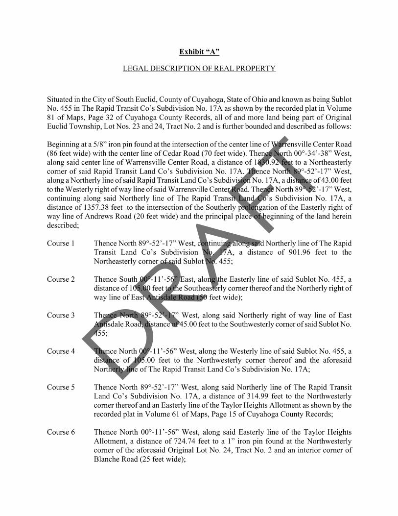
Exhibit “A”
LEGAL DESCRIPTION OF REAL PROPERTY
Situated in the City of South Euclid, County of Cuyahoga, State of Ohio and known as being Sublot No. 455 in The Rapid Transit Co’s Subdivision No. 17A as shown by the recorded plat in Volume 81 of Maps, Page 32 of Cuyahoga County Records, all of and more land being part of Original Euclid Township, Lot Nos. 23 and 24, Tract No. 2 and is further bounded and described as follows:
Beginning at a 5/8” iron pin found at the intersection of the center line of Warrensville Center Road (86 feet wide) with the center line of Cedar Road (70 feet wide). Thence North 00°-34’-38” West, along said center line of Warrensville Center Road, a distance of 1830.92 feet to a Northeasterly corner of said Rapid Transit Land Co’s Subdivision No. 17A. Thence North 89°-52’-17” West, along a Northerly line of said Rapid Transit Land Co’s Subdivision No. 17A, a distance of 43.00 feet to the Westerly right of way line of said Warrensville Center Road. Thence North 89°-52’-17” West, continuing along said Northerly line of The Rapid Transit Land Co’s Subdivision No. 17A, a distance of 1357.38 feet to the intersection of the Southerly prolongation of the Easterly right of way line of Andrews Road (20 feet wide) and the principal place of beginning of the land herein described; Course 1 Thence North 89°-52’-17” West, continuing along said Northerly line of The Rapid
Transit Land Co’s Subdivision No. 17A, a distance of 901.96 feet to the Northeasterly corner of said Sublot No. 455;
Course 2 Thence South 00°-11’-56” East, along the Easterly line of said Sublot No. 455, a
distance of 105.00 feet to the Southeasterly corner thereof and the Northerly right of way line of East Antisdale Road (50 feet wide);
Course 3 Thence North 89°-52’-17” West, along said Northerly right of way line of East
Antisdale Road, distance of 45.00 feet to the Southwesterly corner of said Sublot No. 455;
Course 4 Thence North 00°-11’-56” West, along the Westerly line of said Sublot No. 455, a
distance of 105.00 feet to the Northwesterly corner thereof and the aforesaid Northerly line of The Rapid Transit Land Co’s Subdivision No. 17A;
Course 5 Thence North 89°-52’-17” West, along said Northerly line of The Rapid Transit
Land Co’s Subdivision No. 17A, a distance of 314.99 feet to the Northwesterly corner thereof and an Easterly line of the Taylor Heights Allotment as shown by the recorded plat in Volume 61 of Maps, Page 15 of Cuyahoga County Records;
Course 6 Thence North 00°-11’-56” West, along said Easterly line of the Taylor Heights
Allotment, a distance of 724.74 feet to a 1” iron pin found at the Northwesterly corner of the aforesaid Original Lot No. 24, Tract No. 2 and an interior corner of Blanche Road (25 feet wide);

Course 7 Thence North 89°-56’-50” East, along the Northerly line of said Original Lot No. 24, Tract No. 2 and a Southerly right of way line of said Blanche Road, distance of 1269.91 feet to a drill hole found in old fence post foundation at the intersection with the Easterly right of way line of aforesaid Andrews Road;
Course 8 Thence South 00°-25’-43” West, along the aforesaid Southerly prolongation of the
Easterly right of way line of Andrews Road, a distance of 728.76 feet to the principal place of beginning and containing 21.2286 Acres (924,719 Square Feet) of land according to a survey made by Thomas J. Neff, Jr. Registered Surveyor No. 7065-Ohio in November of 2010.
The subject premises being the same land conveyed to FISE LLC by deed recorded
in A.F.N. 201012291035 and 2011 of Cuyahoga County Records. The basis of bearings for the premises surveyed is North 89°-56’-50” East as the
Northerly line of said Original Lot No. 24, Tract No. 2 and a Southerly right of way line of said Blanche Road as evidenced in the Taylor Heights Allotment as shown by the recorded plat in Volume 61 of Maps, Page 15 of Cuyahoga County Records.
Be the same more or less, but subject to all legal highways and easements of record.

Exhibit “B”
Drawing Depicting the Commercial Property
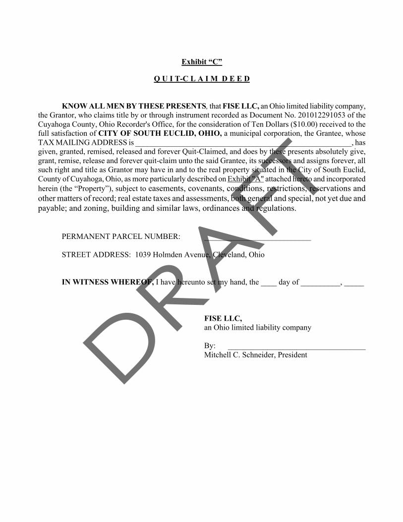
Exhibit “C”
Q U I T-C L A I M D E E D
KNOW ALL MEN BY THESE PRESENTS, that FISE LLC, an Ohio limited liability company,
the Grantor, who claims title by or through instrument recorded as Document No. 201012291053 of the Cuyahoga County, Ohio Recorder's Office, for the consideration of Ten Dollars ($10.00) received to the full satisfaction of CITY OF SOUTH EUCLID, OHIO, a municipal corporation, the Grantee, whose TAX MAILING ADDRESS is _______________________________________________________, has given, granted, remised, released and forever Quit-Claimed, and does by these presents absolutely give, grant, remise, release and forever quit-claim unto the said Grantee, its successors and assigns forever, all such right and title as Grantor may have in and to the real property situated in the City of South Euclid, County of Cuyahoga, Ohio, as more particularly described on Exhibit "A" attached hereto and incorporated herein (the “Property”), subject to easements, covenants, conditions, restrictions, reservations and other matters of record; real estate taxes and assessments, both general and special, not yet due and payable; and zoning, building and similar laws, ordinances and regulations.
PERMANENT PARCEL NUMBER: ___________________________ STREET ADDRESS: 1039 Holmden Avenue, Cleveland, Ohio
IN WITNESS WHEREOF, I have hereunto set my hand, the ____ day of __________, _____
FISE LLC, an Ohio limited liability company
By: ___________________________________
Mitchell C. Schneider, President

STATE OF OHIO ) ) SS: COUNTY OF CUYAHOGA )
BEFORE ME, a Notary Public, in and for said county and state, personally appeared the above-named FISE LLC, an Ohio limited liability company, by MITCHELL C. SCHNEIDER, its President, who acknowledged that he did sign the foregoing instrument on behalf of said company and that the same is his free act and deed, both individually and on behalf of said company. IN TESTIMONY WHEREOF, I have hereunto set my hand and official seal at Cleveland, Ohio, this __________ day of __________________, _______.
____________________________________________________ NOTARY PUBLIC My Commission Expires: ______________________________ THIS INSTRUMENT PREPARED BY: First Interstate Properties Ltd. The Offices at Legacy Village 25333 Cedar Road, Suite 300 Lyndhurst, Ohio 44124

EXHIBIT "A"
LEGAL DESCRIPTION
Situated in the City of South Euclid, County of Cuyahoga, State of Ohio and known as being Sublot No. 455 in The Rapid Transit Co’s Subdivision No. 17A as shown by the recorded plat in Volume 81 of Maps, Page 32 of Cuyahoga County Records, all of and more land being part of Original Euclid Township, Lot Nos. 23 and 24, Tract No. 2 and is further bounded and described as follows:
Beginning at a 5/8” iron pin found at the intersection of the center line of Warrensville Center Road (86 feet wide) with the center line of Cedar Road (70 feet wide). Thence North 00°-34’-38” West, along said center line of Warrensville Center Road, a distance of 1830.92 feet to a Northeasterly corner of said Rapid Transit Land Co’s Subdivision No. 17A. Thence North 89°-52’-17” West, along a Northerly line of said Rapid Transit Land Co’s Subdivision No. 17A, a distance of 43.00 feet to the Westerly right of way line of said Warrensville Center Road. Thence North 89°-52’-17” West, continuing along said Northerly line of The Rapid Transit Land Co’s Subdivision No. 17A, a distance of 1357.38 feet to the intersection of the Southerly prolongation of the Easterly right of way line of Andrews Road (20 feet wide) and the principal place of beginning of the land herein described; Course 1 Thence North 89°-52’-17” West, continuing along said Northerly line of The Rapid
Transit Land Co’s Subdivision No. 17A, a distance of 901.96 feet to the Northeasterly corner of said Sublot No. 455;
Course 2 Thence South 00°-11’-56” East, along the Easterly line of said Sublot No. 455, a
distance of 105.00 feet to the Southeasterly corner thereof and the Northerly right of way line of East Antisdale Road (50 feet wide);
Course 3 Thence North 89°-52’-17” West, along said Northerly right of way line of East
Antisdale Road, distance of 45.00 feet to the Southwesterly corner of said Sublot No. 455;
Course 4 Thence North 00°-11’-56” West, along the Westerly line of said Sublot No. 455, a
distance of 105.00 feet to the Northwesterly corner thereof and the aforesaid Northerly line of The Rapid Transit Land Co’s Subdivision No. 17A;
Course 5 Thence North 89°-52’-17” West, along said Northerly line of The Rapid Transit
Land Co’s Subdivision No. 17A, a distance of 314.99 feet to the Northwesterly corner thereof and an Easterly line of the Taylor Heights Allotment as shown by the recorded plat in Volume 61 of Maps, Page 15 of Cuyahoga County Records;
Course 6 Thence North 00°-11’-56” West, along said Easterly line of the Taylor Heights
Allotment, a distance of 724.74 feet to a 1” iron pin found at the Northwesterly corner of the aforesaid Original Lot No. 24, Tract No. 2 and an interior corner of Blanche Road (25 feet wide);
Course 7 Thence North 89°-56’-50” East, along the Northerly line of said Original Lot No. 24,
Tract No. 2 and a Southerly right of way line of said Blanche Road, distance of

1269.91 feet to a drill hole found in old fence post foundation at the intersection with the Easterly right of way line of aforesaid Andrews Road;
Course 8 Thence South 00°-25’-43” West, along the aforesaid Southerly prolongation of the
Easterly right of way line of Andrews Road, a distance of 728.76 feet to the principal place of beginning and containing 21.2286 Acres (924,719 Square Feet) of land according to a survey made by Thomas J. Neff, Jr. Registered Surveyor No. 7065-Ohio in November of 2010.
The subject premises being the same land conveyed to FISE LLC by deed recorded
in A.F.N. 201012291035 and 2011 of Cuyahoga County Records. The basis of bearings for the premises surveyed is North 89°-56’-50” East as the
Northerly line of said Original Lot No. 24, Tract No. 2 and a Southerly right of way line of said Blanche Road as evidenced in the Taylor Heights Allotment as shown by the recorded plat in Volume 61 of Maps, Page 15 of Cuyahoga County Records.
Be the same more or less, but subject to all legal highways and easements of record.

Exhibit “C-1”
Escrow Instructions
[To Be Attached]

Exhibit “D”
EASEMENT AGREEMENT
This Easement Agreement (“Easement Agreement”) is made and entered into as of the ___ day of _____________, 2011 by and between the CITY OF SOUTH EUCLID, OHIO, an Ohio municipal corporation (“Grantor”) and FISE LLC, an Ohio limited liability company (“Grantee”). RECITALS:
A. Grantor is the owner of certain real estate located in the City of South Euclid, Cuyahoga County, Ohio more specifically described on Exhibit “A” attached hereto and incorporated herein by reference (the “Grantor Property”).
B. Grantee is the owner of certain real estate located immediately adjacent to the Grantor Property and more specifically described on Exhibit “B” attached hereto and incorporated herein by reference (the “Grantee Property”), which Grantee intents to develop into a commercial retail development.
C. Grantor and Grantee entered into a Donation Agreement dated as of ___________, 2011 (the “Donation Agreement”), whereby, among other things, Grantor agreed to grant to Grantee certain easements over a portion of the Grantor Property for purposes of constructing, operating, monitoring, repairing and replacing certain storm water detention basins and related systems.
D. Capitalized terms not defined herein shall have the meanings ascribed in the Donation Agreement.
NOW THEREFORE, in consideration of Ten Dollars ($10.00) and other good and valuable consideration, the receipt and sufficiency of which are hereby acknowledged, and in consideration of the mutual covenants, promises and agreements herein contained, Grantor and Grantee hereby agree as follows:
1. Grant of Construction Easement. Grantor hereby grants, bargains, sells, conveys and releases to Grantee, for the benefit of the Grantee Property and Grantee’s successors and assigns, a non-exclusive temporary construction easement over, across and upon the Grantor Property (the “Construction Easement”) to complete the construction and installation (and/or reconstruction or relocation as provided in Section 4 hereof) of the storm water detention basins and all related systems, including, without limitation, drainage pipes, lines and related improvements (collectively, the “Detention Systems”) including, but not limited to, ingress and egress of vehicles and persons transporting construction materials and equipment and for the temporary storage of equipment and materials being utilized in connection with such construction.
2. Grantee Covenants. Grantee covenants, represents and agrees that all work necessary to complete the construction of the Detention Systems will be performed and completed at Grantee’s sole cost and expense in a good and workmanlike manner, free of mechanic’s liens and in compliance with all applicable laws, ordinances, rules and regulations; that all such work shall be

3
performed only after Grantee has obtained all necessary governmental approvals and permits relating to construction of the Detention Systems on the Grantor Property. Upon completion of construction, Grantee shall repair any damage caused to the Grantor Property by Grantee as a result of such construction. With fourteen (14) business days after Grantee has received final non-appealable site plan and (if required) subdivision approval and issuance of a building permit by the City of South Euclid for Phase I of Grantee’s development of a shopping center upon the Grantee Property (as such term [i.e. Phase I] is specifically defined in that certain Development Agreement between Grantor and Grantee dated as of the date hereof) (the “Contingency Satisfaction Date”), Grantee, at its cost and expense, shall commence pursuit of all permits and other approvals required to construct the Detention Systems and thereafter diligently pursue completion thereof.
3. Grant of Storm Water Maintenance Easement. Grantor hereby grants, bargains sells, conveys and releases to Grantee, for the benefit of the Grantee Property and Grantee’s successors and assigns: (1) a permanent exclusive easement upon the Grantor Property located in the area shown on Exhibit “C” as the “Detention Area” for purposes of locating thereon the Detention Systems, (2) a permanent non-exclusive easement for purposes of channeling, transporting and discharging surface and storm water to, through and from the Detention Systems and (3) a permanent non-exclusive ingress and egress easement upon and across the Grantor Property in order to provide access to the Detention Systems for purposes of performing all necessary monitoring, maintenance, repairs and replacements to said Detention Systems (collectively, the “Storm Water Easement”).
4, Right to Relocate Detention Systems. Grantee shall have the right at any time, after
notice to Grantee and, if necessary, receipt of all necessary governmental approvals and permits, to reconfigure, reconstruct, replace and/or relocate the Detention Systems within the Detention Area. 5. Maintenance. Grantee covenants and agrees with Grantor to maintain the Detention Systems in good, clean, safe and working condition in accordance with sound construction and engineering standards and practices.
6. Reservation of Rights. Except for the Detention Area, which shall be utilized exclusively by Grantee, and except as otherwise provided herein, Grantor reserves the right to use and enjoy the Grantor Property for any and all purposes, provided such use and enjoyment shall not materially interfere with the easement rights and privileges granted to Grantee hereunder.
7. Indemnification. Grantee shall indemnify and save harmless Grantor from and against any and all loss, damage, liens, expense, claims, demands, actions or causes of action of whatever kind or nature which arise by reason of the rights and easements granted herein or the exercise of such rights by Grantee or by the failure of Grantee to properly and timely perform its agreements and obligations hereunder.
8. Term Of Easements. The Construction Easement shall be effective as of the date hereof and continue until completion of construction of the Detention Systems and during any period of reconstruction or relocation of the Detention Systems. The Storm Water Easement shall commence as of the date hereof continue for so long as such easement is necessary for the operating, monitoring, repairing and replacing of the Detention Systems on the Grantor Property.

4
9. Notices. All notices herein authorized or required to be given to Grantor shall be sent certified mail, registered mail or overnight express, postage prepaid, to Grantor at:
City of South Euclid
Attn: Mayor Georgine Welo 1349 South Green Road South Euclid, Ohio 44121
With a copy to:
Michael P. Lograsso City of South Euclid
1414 South Green Road, #310 South Euclid, Ohio 44121
or to such other address as Grantor may from time to time designate in accordance with this
paragraph. All notices herein authorized or required to be given to Grantee shall be sent by certified mail, registered mail or overnight express, postage prepaid, to the Grantee at:
FISE LLC The Offices at Legacy Village 25333 Cedar Road, Suite 300 Lyndhurst, Ohio 44124 Attn: Mitchell C. Schneider, President
With a copy to:
First Interstate Properties, Ltd. The Offices at Legacy Village 25333 Cedar Road, Suite 300 Lyndhurst, Ohio 44124 Attn: General Counsel
or to such other address as Grantee may from time to time designate in accordance with this paragraph. 10. Entire Agreement. This Easement Agreement together with the Exhibits attached
hereto contains the complete understanding and agreement of the parties hereto with respect to all matters referred to herein, and all prior representations, negotiations, and understanding are superseded hereby.
10. Successors And Assigns. The parties hereto agree that the easements contained in this Easement Agreement shall run with the land and shall inure to the benefit of and be binding upon the parties hereto, their respective successors and/or assigns.
[REMAINDER OF PAGE INTENTIONALLY BLANK]

5
IN WITNESS WHEREOF, Grantor and Grantee have executed and delivered this Easement Agreement as of the day and year first above written.
GRANTOR: CITY OF SOUTH EUCLID, OHIO an Ohio municipal corporation
By:
GRANTEE: FISE LLC, an Ohio limited liability company
By: Print: Its:

1
STATE OF OHIO )
) SS COUNTY OF CUYAHOGA )
BEFORE ME, a Notary Public, in and for said County and State, personally appeared the above-named CITY OF SOUTH EUCLID, OHIO an Ohio municipal corporation, by ____________________, its __________ who acknowledged that she did sign the foregoing instrument on behalf of said limited liability company, and that the same is his free act and deed and the free act and deed of said limited liability company.
IN TESTIMONY WHEREOF, I have hereunto set my hand and official seal at _________________, ______________, this _______ day of __________________, 2011
Notary Public My Commission Expires:
STATE OF OHIO )
) SS COUNTY OF CUYAHOGA )
BEFORE ME, a Notary Public, in and for said County and State, personally appeared the above-named FISE LLC, an Ohio limited liability company, by Mitchell C. Schneider, its Managing Member who acknowledged that he did sign the foregoing instrument on behalf of said limited liability company, and that the same is his free act and deed and the free act and deed of said limited liability company.
IN TESTIMONY WHEREOF, I have hereunto set my hand and official seal at _________________, ______________, this _______ day of ________________ 2011.
Notary Public My Commission Expires:

2
EXHIBIT “A” Legal Description of Grantor Property Situated in the City of South Euclid, County of Cuyahoga, State of Ohio and known as being Sublot No. 455 in The Rapid Transit Co’s Subdivision No. 17A as shown by the recorded plat in Volume 81 of Maps, Page 32 of Cuyahoga County Records, all of and more land being part of Original Euclid Township, Lot Nos. 23 and 24, Tract No. 2 and is further bounded and described as follows:
Beginning at a 5/8” iron pin found at the intersection of the center line of Warrensville Center Road (86 feet wide) with the center line of Cedar Road (70 feet wide). Thence North 00°-34’-38” West, along said center line of Warrensville Center Road, a distance of 1830.92 feet to a Northeasterly corner of said Rapid Transit Land Co’s Subdivision No. 17A. Thence North 89°-52’-17” West, along a Northerly line of said Rapid Transit Land Co’s Subdivision No. 17A, a distance of 43.00 feet to the Westerly right of way line of said Warrensville Center Road. Thence North 89°-52’-17” West, continuing along said Northerly line of The Rapid Transit Land Co’s Subdivision No. 17A, a distance of 1357.38 feet to the intersection of the Southerly prolongation of the Easterly right of way line of Andrews Road (20 feet wide) and the principal place of beginning of the land herein described; Course 1 Thence North 89°-52’-17” West, continuing along said Northerly line of The Rapid
Transit Land Co’s Subdivision No. 17A, a distance of 901.96 feet to the Northeasterly corner of said Sublot No. 455;
Course 2 Thence South 00°-11’-56” East, along the Easterly line of said Sublot No. 455, a
distance of 105.00 feet to the Southeasterly corner thereof and the Northerly right of way line of East Antisdale Road (50 feet wide);
Course 3 Thence North 89°-52’-17” West, along said Northerly right of way line of East
Antisdale Road, distance of 45.00 feet to the Southwesterly corner of said Sublot No. 455;
Course 4 Thence North 00°-11’-56” West, along the Westerly line of said Sublot No. 455, a
distance of 105.00 feet to the Northwesterly corner thereof and the aforesaid Northerly line of The Rapid Transit Land Co’s Subdivision No. 17A;
Course 5 Thence North 89°-52’-17” West, along said Northerly line of The Rapid Transit
Land Co’s Subdivision No. 17A, a distance of 314.99 feet to the Northwesterly corner thereof and an Easterly line of the Taylor Heights Allotment as shown by the recorded plat in Volume 61 of Maps, Page 15 of Cuyahoga County Records;
Course 6 Thence North 00°-11’-56” West, along said Easterly line of the Taylor Heights
Allotment, a distance of 724.74 feet to a 1” iron pin found at the Northwesterly corner of the aforesaid Original Lot No. 24, Tract No. 2 and an interior corner of Blanche Road (25 feet wide);

3
Course 7 Thence North 89°-56’-50” East, along the Northerly line of said Original Lot No. 24, Tract No. 2 and a Southerly right of way line of said Blanche Road, distance of 1269.91 feet to a drill hole found in old fence post foundation at the intersection with the Easterly right of way line of aforesaid Andrews Road;
Course 8 Thence South 00°-25’-43” West, along the aforesaid Southerly prolongation of the
Easterly right of way line of Andrews Road, a distance of 728.76 feet to the principal place of beginning and containing 21.2286 Acres (924,719 Square Feet) of land according to a survey made by Thomas J. Neff, Jr. Registered Surveyor No. 7065-Ohio in November of 2010.
The subject premises being the same land conveyed to FISE LLC by deed recorded
in A.F.N. 201012291035 and 2011 of Cuyahoga County Records. The basis of bearings for the premises surveyed is North 89°-56’-50” East as the
Northerly line of said Original Lot No. 24, Tract No. 2 and a Southerly right of way line of said Blanche Road as evidenced in the Taylor Heights Allotment as shown by the recorded plat in Volume 61 of Maps, Page 15 of Cuyahoga County Records.
Be the same more or less, but subject to all legal highways and easements of record.
4
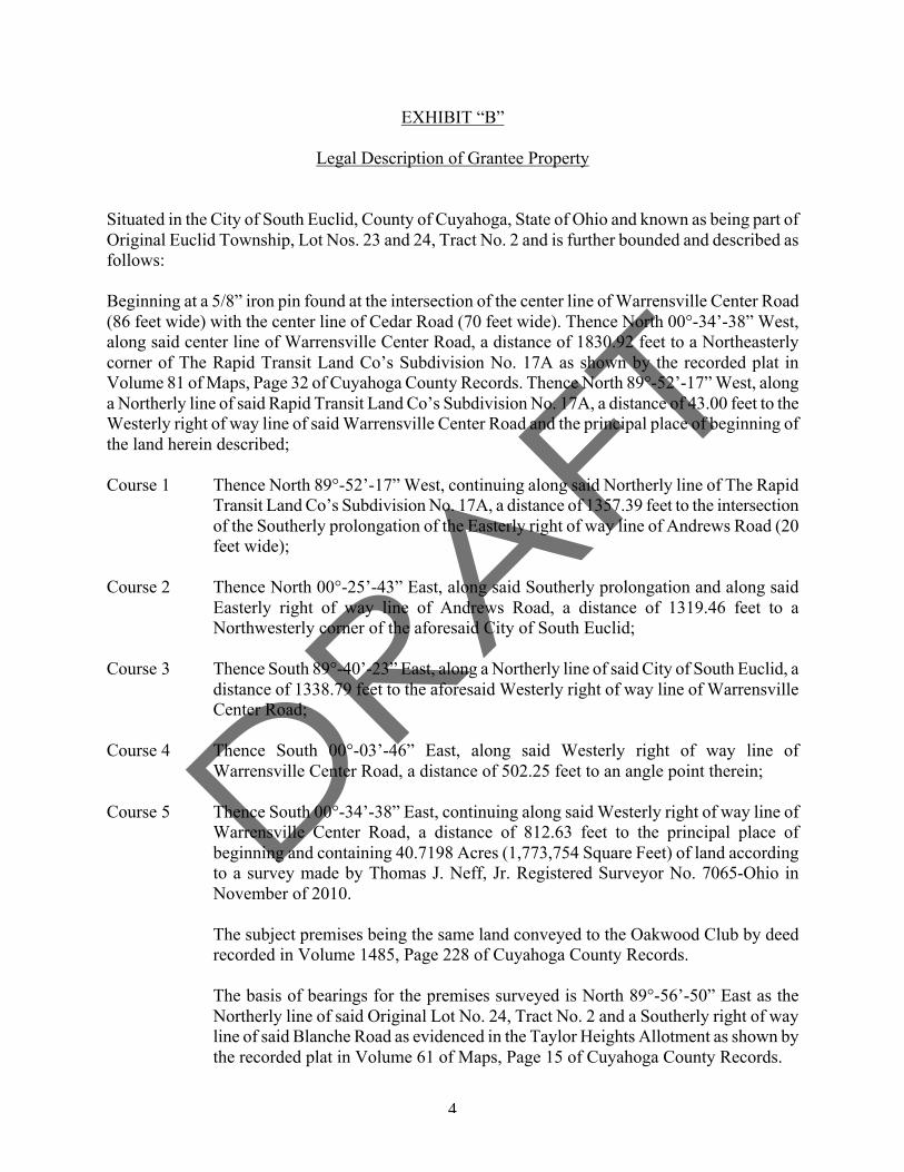
EXHIBIT “B” Legal Description of Grantee Property
Situated in the City of South Euclid, County of Cuyahoga, State of Ohio and known as being part of Original Euclid Township, Lot Nos. 23 and 24, Tract No. 2 and is further bounded and described as follows:
Beginning at a 5/8” iron pin found at the intersection of the center line of Warrensville Center Road (86 feet wide) with the center line of Cedar Road (70 feet wide). Thence North 00°-34’-38” West, along said center line of Warrensville Center Road, a distance of 1830.92 feet to a Northeasterly corner of The Rapid Transit Land Co’s Subdivision No. 17A as shown by the recorded plat in Volume 81 of Maps, Page 32 of Cuyahoga County Records. Thence North 89°-52’-17” West, along a Northerly line of said Rapid Transit Land Co’s Subdivision No. 17A, a distance of 43.00 feet to the Westerly right of way line of said Warrensville Center Road and the principal place of beginning of the land herein described; Course 1 Thence North 89°-52’-17” West, continuing along said Northerly line of The Rapid
Transit Land Co’s Subdivision No. 17A, a distance of 1357.39 feet to the intersection of the Southerly prolongation of the Easterly right of way line of Andrews Road (20 feet wide);
Course 2 Thence North 00°-25’-43” East, along said Southerly prolongation and along said
Easterly right of way line of Andrews Road, a distance of 1319.46 feet to a Northwesterly corner of the aforesaid City of South Euclid;
Course 3 Thence South 89°-40’-23” East, along a Northerly line of said City of South Euclid, a
distance of 1338.79 feet to the aforesaid Westerly right of way line of Warrensville Center Road;
Course 4 Thence South 00°-03’-46” East, along said Westerly right of way line of
Warrensville Center Road, a distance of 502.25 feet to an angle point therein; Course 5 Thence South 00°-34’-38” East, continuing along said Westerly right of way line of
Warrensville Center Road, a distance of 812.63 feet to the principal place of beginning and containing 40.7198 Acres (1,773,754 Square Feet) of land according to a survey made by Thomas J. Neff, Jr. Registered Surveyor No. 7065-Ohio in November of 2010.
The subject premises being the same land conveyed to the Oakwood Club by deed
recorded in Volume 1485, Page 228 of Cuyahoga County Records. The basis of bearings for the premises surveyed is North 89°-56’-50” East as the
Northerly line of said Original Lot No. 24, Tract No. 2 and a Southerly right of way line of said Blanche Road as evidenced in the Taylor Heights Allotment as shown by the recorded plat in Volume 61 of Maps, Page 15 of Cuyahoga County Records.

5
Be the same more or less, but subject to all legal highways and easements of record.

6
EXHIBIT “C” Site Plan

7

Exhibit “E”
Public Benefit Agreement
i. PUBLIC BENEFIT AGREEMENT
This PUBLIC BENEFIT AGREEMENT (this “Agreement”) is made and entered into this ___ day of _______________, 2011, by and between the CITY OF SOUTH EUCLID, OHIO, an Ohio municipal corporation, having a mailing address at 1349 South Green Road, South Euclid, Ohio 44121 (the “City”) and FISE LLC, an Ohio limited liability company, having a mailing address of 25333 Cedar Road, Suite 300, Lyndhurst, Ohio 44124 (“FISE”).
R E C I T A L S:
WHEREAS, pursuant to the terms of that certain Donation Agreement dated as of the date hereof between FISE and the City (the “Donation Agreement”), FISE donated and the City accepted the donation of approximately 21.2286 acres of vacant land more specifically described on Exhibit “A” attached hereto and incorporated herein by reference (the “Donation Property”) which the City intends to utilize as public green space.
WHEREAS, the Donation Property is immediately adjacent to other real property owned by FISE comprised of approximately 40.71 acres of land identified on the Site Plan attached hereto as Exhibit “B” as the “FISE Property”, which FISE intends to develop into a commercial retail shopping center (the “Shopping Center”);
WHEREAS, in connection with and in addition to FISE’s commitment to donate the Donation Property to the City, FISE, at its sole cost and expense, has committed to undertake certain improvements upon the Donation Property (more specifically defined below as the “Green Space Improvements”) for the benefit of the City and for the betterment of the Donation Property for its use as public green space; WHEREAS, the parties hereto wish to specify the timing, conditions and terms of the Green Space Improvements; and WHEREAS, capitalized terms not defined herein shall have the meaning ascribed in the Donation Agreement.
W I T N E S S E T H:
For and in consideration of the covenants herein contained and upon the terms and conditions herein set forth, the City and FISE hereby agree as follows:
19. Improvements. Within fourteen (14) business days after FISE has received final non-appealable site plan and (if required) subdivision approval and issuance of a building permit by the City for Phase I of FISE’s development of the Shopping Center (as such term [i.e. Phase I] is specifically defined in that certain Development Agreement between FISE and the City dated as of the date hereof) (the “Contingency Satisfaction Date”), FISE, at its cost and expense, shall, subject to force majeure, commence to perform and diligently pursue completion of the following work upon the Donation Property:
a. demolition of all residential structures located upon that property identified on the Site Plan as the “E. Antisdale Property” and removal of all materials relating to such demolition;

9
b. installation of a permeable pavement driveway leading to the parking area identified on the Site Plan;
c. installation of a buffer along the entry drive as shown on the Site Plan;
d. installation of a permeable pavement parking area in the area identified on the Site Plan;
e. addition and installation of new sections of asphalt paved trails, having width similar to the existing trails, in the areas indicated on the Site Plan;
f. replacement of all sand trap areas located upon the Donation Property with native species plantings; and
g. construction of a timber framed entranceway feature, with signage, in the area designated on the Site Plan.
All of the foregoing shall be collectively referred to as the “Green Space Improvements”. FISE, at its sole cost and expense (in accordance with the estimated construction budget attached hereto as Exhibit “C”), shall promptly apply for and obtain all necessary permits and approvals for the Green Space Improvements and shall perform and complete all of the Green Space Improvements in a good and workmanlike manner in accordance with all applicable laws, rules, regulations, codes and ordinances.
20. Warranties against Defects, Ongoing Maintenance. FISE shall warrant all Green Space Improvements to be free from defects for a period of two (2) years after the City certifies completion thereof. Except for certain monitoring, maintenance, repairs and replacements to the storm water detention systems placed upon the Donation Property by FISE in accordance with the Storm Water Easement dated of even date herewith, upon the City’s certification of completion of the Green Space Improvements, FISE shall have no further maintenance or other obligations with respect to the Donation Property or the Green Space Improvements; such obligations to be the sole responsibility of the City at its cost and expense.
1. City Cooperation. The City agrees to execute and deliver, or cause to be executed and delivered, any and all permits, consents, approvals and other documents and assurances necessary for commencement and completion of the Green Space Improvements, and to cooperate with FISE in order to allow FISE to complete the Green Space Improvements without hindrance, conditions or unnecessary delay.
2. Charitable Donation. The City hereby acknowledges and agrees that the out-of-pocket expenditures incurred by FISE to provide and construct the Green Space Improvements (the “Contribution”) constitutes a “charitable contribution” within the meaning of Section 170(c)(1) of the Internal Revenue Code of 1986, as amended (the “Code”). With respect to the Contribution, the City hereby acknowledges that the City has not provided any goods or services in consideration, in whole or in part, for the Contribution. The City further agrees to execute and deliver or cause to be executed and delivered any and all documents or certifications that FISE may reasonably request to evidence that the Contribution constitutes a “charitable contribution” within the meaning of Code Section 170(c)(1).

10
3. Miscellaneous.
Estoppel Certificate. Each party hereto agrees that within twenty (20) days after receipt of written request from the other party, it will issue to such party, or its prospective mortgagee or successor, an estoppel certificate stating to the best of such party’s knowledge that as of such date:
(i) whether it knows of any default under this Agreement by the requesting party, and if there are any known defaults, specifying the nature thereof;
(ii) whether this Agreement has been assigned, modified or amended in any way by it and if so, then stating the nature thereof;
(iii) whether this Agreement is in full force and effect; and
(iv) any other reasonable matters relating to this Agreement.
Termination of Agreement. Upon completion of the Green Space Improvements and acceptance by the City and completion of any other applicable obligations hereunder, the parties agree to execute, in recordable form if requested by either party, a statement confirming termination of this Agreement.
Relationship of the Parties. Notwithstanding any provision to the contrary in this Agreement, the parties agree that the relationship between FISE and the City is one of donor and donee only, and no provision of this Agreement shall be construed to create any other type of status or relationship between these parties.
Severability. If any one or more of the provisions contained herein shall for any reason be held to be invalid, illegal or unenforceable in any respect, such invalidity, illegality or unenforceability shall not affect any other provisions of this Agreement, but this Agreement shall be construed as if such invalid, illegal or unenforceable provisions had not been contained herein.
Waiver. The failure of any party to insist, in any one or more instances, upon a strict performance of any of the terms and conditions of this Agreement, or to exercise or fail to exercise any option or right contained herein, shall not be construed as a waiver or a relinquishment for the future of such right or option, but the same shall continue and remain in full force and effect. The continued performance by any party of this Agreement with knowledge of the breach of any term or condition hereof shall not be deemed a waiver of such breach, and no waiver by any party of any provision hereof, shall be deemed to have been made, or operate as estoppel, unless expressed in writing and signed by such party.
Notices. All notices herein authorized or required to be given to the City shall be sent certified mail, registered mail or overnight express, postage prepaid, to the City at:
City of South Euclid Attn: Mayor Georgine Welo

11
1349 South Green Road South Euclid, Ohio 44121
With a copy to: Michael P. Lograsso
City of South Euclid 1414 South Green Road, #310 South Euclid, Ohio 44121
or to such other address as the City may from time to time designate in accordance with this paragraph. All notices herein authorized or required to be given to the FISE shall be sent by certified mail, registered mail or overnight express, postage prepaid, to the FISE at:
FISE LLC The Offices at Legacy Village 25333 Cedar Road, Suite 300 Lyndhurst, Ohio 44124 Attn: Mitchell C. Schneider, President
With a copy to:
First Interstate Properties, Ltd. The Offices at Legacy Village
25333 Cedar Road, Suite 300 Lyndhurst, Ohio 44124
Attn: General Counsel
or to such other address as FISE may from time to time designate in accordance with this paragraph.
Entire Agreement. No oral statements, representations or agreements other than this Agreement and such other agreements referred to herein or related hereto shall have any force or effect and each party hereto agrees that it will not rely on any representations or agreements other than those contained in this Agreement and those contained in any agreements referred to herein or related hereto.
Further Assurances. Each party, upon the request of another party hereto, shall execute and deliver such further documents and instruments as the requesting party may reasonably deem appropriate to carry out the terms and conditions of this Agreement, provided that such further documents and instruments are consistent with the terms and conditions of this Agreement.
Headings. The headings in this Agreement are for the purposes of reference only and shall not affect or define the meanings hereof.
City Council. This Agreement and all terms and provisions hereof are subject to and conditioned upon the approval or ratification by duly enacted ordinance or resolution of the City Council of the City of South Euclid.

12
Successors. This Agreement shall bind and inure to the benefit of the parties hereto, their respective successors and assigns, subject to the provisions herein.
4. Applicable Law and Binding Effect. This Agreement shall be construed and interpreted in accordance with the laws of the State of Ohio.
21. Counterparts. This Agreement may be signed in multiple identical counterparts with the same effect as if the signatures thereof and hereto were upon the same instrument.
[SIGNATURE PAGE FOLLOWS]

EXECUTED on the date first written above.
FISE LLC, an Ohio limited liability company By: Mitchell C. Schneider Its: Managing Member
CITY OF SOUTH EUCLID, OHIO an Ohio municipal corporation By: Its:

EXHIBIT “A”
Legal Description of Donation Property
Situated in the City of South Euclid, County of Cuyahoga, State of Ohio and known as being Sublot No. 455 in The Rapid Transit Co’s Subdivision No. 17A as shown by the recorded plat in Volume 81 of Maps, Page 32 of Cuyahoga County Records, all of and more land being part of Original Euclid Township, Lot Nos. 23 and 24, Tract No. 2 and is further bounded and described as follows:
Beginning at a 5/8” iron pin found at the intersection of the center line of Warrensville Center Road (86 feet wide) with the center line of Cedar Road (70 feet wide). Thence North 00°-34’-38” West, along said center line of Warrensville Center Road, a distance of 1830.92 feet to a Northeasterly corner of said Rapid Transit Land Co’s Subdivision No. 17A. Thence North 89°-52’-17” West, along a Northerly line of said Rapid Transit Land Co’s Subdivision No. 17A, a distance of 43.00 feet to the Westerly right of way line of said Warrensville Center Road. Thence North 89°-52’-17” West, continuing along said Northerly line of The Rapid Transit Land Co’s Subdivision No. 17A, a distance of 1357.38 feet to the intersection of the Southerly prolongation of the Easterly right of way line of Andrews Road (20 feet wide) and the principal place of beginning of the land herein described; Course 1 Thence North 89°-52’-17” West, continuing along said Northerly line of The Rapid
Transit Land Co’s Subdivision No. 17A, a distance of 901.96 feet to the Northeasterly corner of said Sublot No. 455;
Course 2 Thence South 00°-11’-56” East, along the Easterly line of said Sublot No. 455, a
distance of 105.00 feet to the Southeasterly corner thereof and the Northerly right of way line of East Antisdale Road (50 feet wide);
Course 3 Thence North 89°-52’-17” West, along said Northerly right of way line of East
Antisdale Road, distance of 45.00 feet to the Southwesterly corner of said Sublot No. 455;
Course 4 Thence North 00°-11’-56” West, along the Westerly line of said Sublot No. 455, a
distance of 105.00 feet to the Northwesterly corner thereof and the aforesaid Northerly line of The Rapid Transit Land Co’s Subdivision No. 17A;
Course 5 Thence North 89°-52’-17” West, along said Northerly line of The Rapid Transit
Land Co’s Subdivision No. 17A, a distance of 314.99 feet to the Northwesterly corner thereof and an Easterly line of the Taylor Heights Allotment as shown by the recorded plat in Volume 61 of Maps, Page 15 of Cuyahoga County Records;
Course 6 Thence North 00°-11’-56” West, along said Easterly line of the Taylor Heights
Allotment, a distance of 724.74 feet to a 1” iron pin found at the Northwesterly corner of the aforesaid Original Lot No. 24, Tract No. 2 and an interior corner of Blanche Road (25 feet wide);

15
Course 7 Thence North 89°-56’-50” East, along the Northerly line of said Original Lot No. 24, Tract No. 2 and a Southerly right of way line of said Blanche Road, distance of 1269.91 feet to a drill hole found in old fence post foundation at the intersection with the Easterly right of way line of aforesaid Andrews Road;
Course 8 Thence South 00°-25’-43” West, along the aforesaid Southerly prolongation of the
Easterly right of way line of Andrews Road, a distance of 728.76 feet to the principal place of beginning and containing 21.2286 Acres (924,719 Square Feet) of land according to a survey made by Thomas J. Neff, Jr. Registered Surveyor No. 7065-Ohio in November of 2010.
The subject premises being the same land conveyed to FISE LLC by deed recorded
in A.F.N. 201012291035 and 2011 of Cuyahoga County Records. The basis of bearings for the premises surveyed is North 89°-56’-50” East as the
Northerly line of said Original Lot No. 24, Tract No. 2 and a Southerly right of way line of said Blanche Road as evidenced in the Taylor Heights Allotment as shown by the recorded plat in Volume 61 of Maps, Page 15 of Cuyahoga County Records.
Be the same more or less, but subject to all legal highways and easements of record.

EXHIBIT “B”
Site Plan