Embed Size (px)
Citation preview
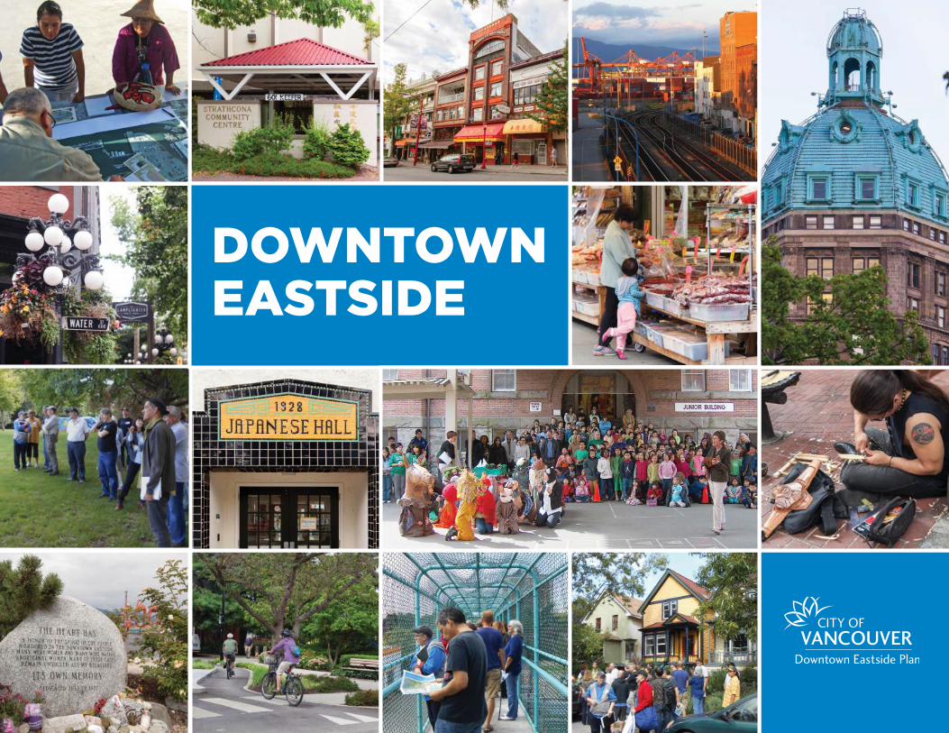
DOWNTOWN EASTSIDE
CONTENTS
1.0 Introduction 3
2.0 Plan Principles 13
3.0 Community Context 17
4.0 Planning Process 25
5.0 Plan Concept 33
6.0 Places 37
7.0 Built Form 61
8.0 Community Well-Being 81
9.0 Housing 91
10.0 Local Economy 109
11.0 Transportation 121
12.0 Parks, Open Space and Greening 129
13.0 Heritage 135
14.0 Arts and Culture 143
15.0 Energy and Climate Change 149
16.0 Utilities and Services 157
17.0 Public Benefits 163
18.0 Implementation 181
19.0 Acknowledgements 202
Glossary 204
Appendix I 207
1ContentsDOWNTOWN EASTSIDE PLAN
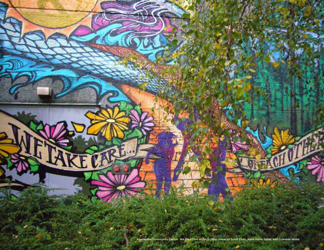
Strathcona Community Centre We Take Care of Each Other mural by Scott Chan, Anne Marie Slater, and Coleman Webb
1INTRODUCTION
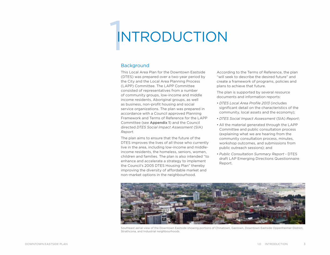
BackgroundThis Local Area Plan for the Downtown Eastside (DTES) was prepared over a two-year period by the City and the Local Area Planning Process (LAPP) Committee. The LAPP Committee consisted of representatives from a number of community groups, low-income and middle income residents, Aboriginal groups, as well as business, non-profit housing and social service organizations. The plan was prepared in accordance with a Council approved Planning Framework and Terms of Reference for the LAPP Committee (see Appendix 1) and the Council directed DTES Social Impact Assessment (SIA) Report.
The plan aims to ensure that the future of the DTES improves the lives of all those who currently live in the area, including low-income and middle-income residents, the homeless, seniors, women, children and families. The plan is also intended “to enhance and accelerate a strategy to implement the Council’s 2005 DTES Housing Plan” thereby improving the diversity of affordable market and non-market options in the neighbourhood.
Southeast aerial view of the Downtown Eastside showing portions of Chinatown, Gastown, Downtown Eastside Oppenheimer District, Strathcona, and Industrial neighbourhoods
According to the Terms of Reference, the plan “will seek to describe the desired future” and create a framework of programs, policies and plans to achieve that future.
The plan is supported by several resource documents and information reports:
• DTES Local Area Profile 2013 (includes significant detail on the characteristics of the community, local assets and the economy);
• DTES Social Impact Assessment (SIA) Report;
• All the material generated through the LAPP Committee and public consultation process (explaining what we are hearing from the community consultation process, minutes, workshop outcomes, and submissions from public outreach sessions); and
• Public Consultation Summary Report - DTES draft LAP Emerging Directions Questionnaire Report.
31.0 IntroduCtIonDOWNTOWN EASTSIDE PLAN
4 1.0 IntroduCtIon DOWNTOWN EASTSIDE PLAN
Victory
Gastown Downtown EastsideOppenheimer District
Chinatown
Strathcona
Industrial
IndustrialThorntonPark
Square
Powell St
Water StTrounce Alley
Alexander St
E Cordova St
Centennial Rd
Powell St
E Waterfront Rd
Railway St
W Waterfront Rd
William St William St
Powell St
Stewart St
Napier St
Venables St
Adanac St
Union St
Qu
eb
ec
St
Keefer St
E Georgia St
Geo
rge S
t
Cla
rk D
r
E Georgia St
Atlantic St
National Ave
Malkin Ave
Terminal Ave
Evans Ave
Milross Ave
National Ave
Nelson St
Prior St
E Pender St
Franklin St
E Hastings St
Pandora St Triumph St
E Pender St
Frances St
E Georgia St
E Hastings St
W Cordova St
W Hastings St
Dunsmuir St
Robson St
W Georgia St
Smithe St
W Pender St
Cambie
St
Sh
ang
hai
Alle
y
Beatty
St Citadel
Par
ade
Hamilt
on St
Mainl
and S
t
Hom
er S
tRic
hard
s St
Horn
by S
t
How
e St
Seym
our S
tGra
nville
St
Go
re Ave
Jack
son
Ave
Du
nle
vy
Ave
Mai
n S
t
Sta
tio
n S
t
Mai
n S
t
Co
lum
bia
St
Pacific B
lvd
Terry Fox Way
Carr
all S
t
Ab
bo
tt S
t
Tayl
or
St
Pri
nce
ss A
ve
Cam
pb
ell
Ave
Ray
mur
Ave
Vern
on
Dr
Wo
od
lan
d D
rW
oo
dla
nd
Dr
Sal
sbu
ry D
r
Gle
n D
r
Heat
ley
Ave
Haw
ks A
ve
Th
orn
ton S
t
Ch
ess
St
Dunsmuir Viaduct
Expo
Blvd
Georgia Viaduct
Griffiths Way
Cambie B
ridg
e
Area Boundary
Streets
Railway
Parks andOpen Space
Sub-area Boundary
LEGEND
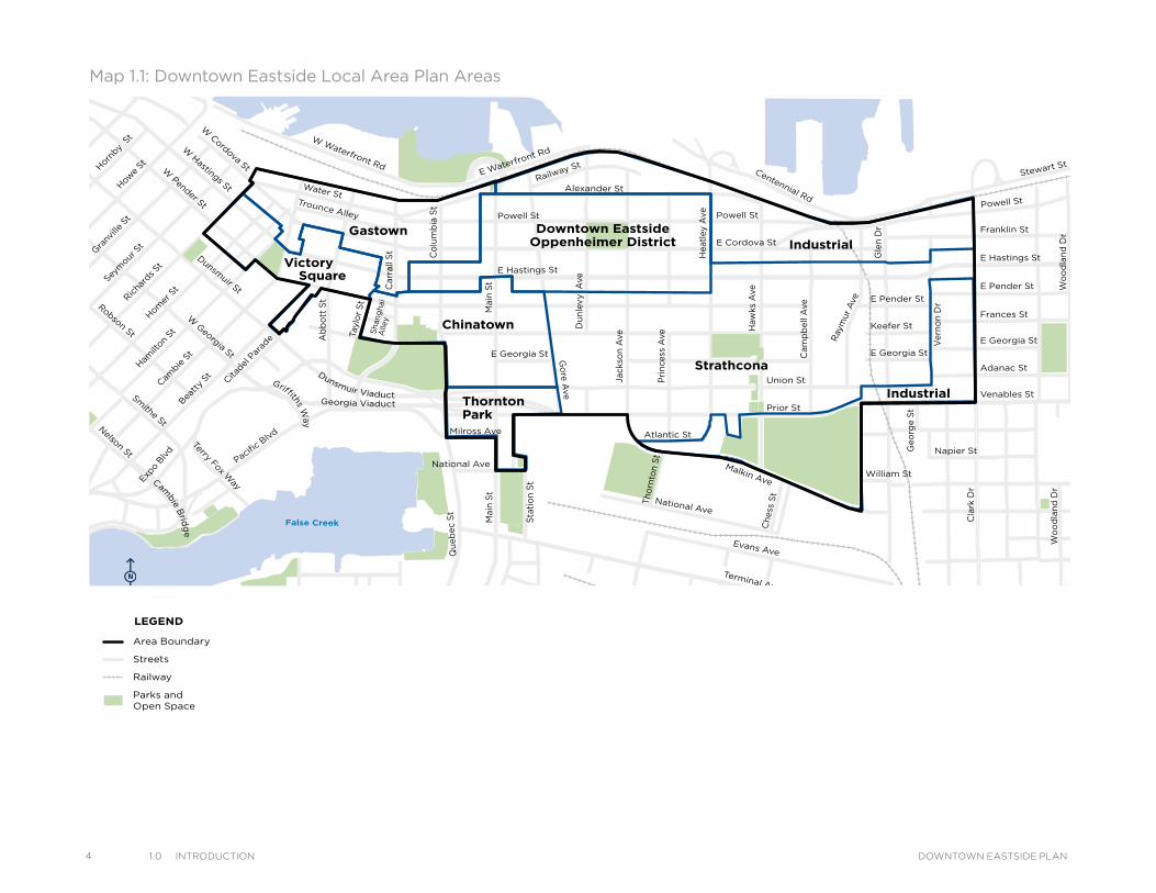
Map 1.1: Downtown Eastside Local Area Plan Areas
Victory
Gastown Downtown EastsideOppenheimer District
Chinatown
Strathcona
Industrial
IndustrialThorntonPark
Square
Powell St
Water StTrounce Alley
Alexander St
E Cordova St
Centennial Rd
Powell St
E Waterfront Rd
Railway St
W Waterfront Rd
William St William St
Powell St
Stewart St
Napier St
Venables St
Adanac St
Union St
Qu
eb
ec
St
Keefer St
E Georgia St
Geo
rge S
t
Cla
rk D
r
E Georgia St
Atlantic St
National Ave
Malkin Ave
Terminal Ave
Evans Ave
Milross Ave
National Ave
Nelson St
Prior St
E Pender St
Franklin St
E Hastings St
Pandora St Triumph St
E Pender St
Frances St
E Georgia St
E Hastings St
W Cordova St
W Hastings St
Dunsmuir St
Robson St
W Georgia St
Smithe St
W Pender St
Cambie
St
Sh
ang
hai
Alle
y
Beatty
St Citadel
Par
ade
Hamilt
on St
Mainl
and S
t
Hom
er S
tRic
hard
s St
Horn
by S
t
How
e St
Seym
our S
tGra
nville
St
Go
re Ave
Jack
son
Ave
Du
nle
vy
Ave
Mai
n S
t
Sta
tio
n S
t
Mai
n S
t
Co
lum
bia
St
Pacific B
lvd
Terry Fox Way
Carr
all S
t
Ab
bo
tt S
t
Tayl
or
St
Pri
nce
ss A
ve
Cam
pb
ell
Ave
Ray
mur
Ave
Vern
on
Dr
Wo
od
lan
d D
rW
oo
dla
nd
Dr
Sal
sbu
ry D
r
Gle
n D
r
Heat
ley
Ave
Haw
ks A
ve
Th
orn
ton S
t
Ch
ess
St
Dunsmuir Viaduct
Expo
Blvd
Georgia Viaduct
Griffiths Way
Cambie B
ridg
e
Area Boundary
Streets
Railway
Parks andOpen Space
Sub-area Boundary
LEGEND
Mike Harcourt, Building Community Society (BCS) Chairperson, has stated “Time and again, the people of the DTES, regardless of their economic circumstances, have demonstrated their capacity to bring positive change to their area. The local planning work is building on this record. In the face of enormous challenges, widely diverse interests within the community are working together alongside those from outside who have a stake in the area.”
The DTES local planning area comprises of seven sub-areas: Chinatown, Gastown, Industrial Area, Oppenheimer District, Strathcona, Thornton Park and Victory Square (see Map 1.1).
The City of Vancouver has been working to improve the quality of life in the DTES for many years. A number of policies, plans, programs and projects have been undertaken in partnership with residents, businesses, non-profit groups and other levels of government. Many of these past efforts have focused on specific topics such as housing, substance use, and economic revitalization but they often significantly overlap in their recommendations or directions. The plan aims to help long-range planning and development become more integrated in future. The plan will enable the development of further partnerships and continue to build on all the past plans, policies and programs that have come before.
The over arching-goal of this plan is to make the DTES a more livable, safe and supportive place for all of its diverse residents, in other words, a healthy neighbourhood for all. Development in the DTES should be founded on the principle of ‘people first’ and centred on identified areas of special importance (“community hearts”) and clusters of community assets identified by the LAPP Committee and neighbourhood stakeholders (see Figure 1.1) and the SIA asset mapping activities (refer to the Downtown Eastside Social Impact Assessment Study (2014)).
Innovative approaches are needed to build community capacity and resilience and reduce barriers to social services, housing and economic sustainability. Many committed residents, non-profit agencies, community organizations, faith-based organizations and private sector partners are busy in the area and are involved in resourceful, social and spiritual initiatives that are already showing promising results when it comes to supporting change and alleviating some of the social challenges and barriers to economic revitalization.
A number of communities have prepared vision statements on how they see the future of their neighbourhoods. Some of these are described here.
In 2008, Carnegie Community Action Project (CCAP) formulated the following DTES Vision:
"Honour the Coast Salish people on whose unceded traditional territory the DTES resides"
"Celebrate our strong community of urban aboriginal and low income people of many ancestries, abilities, cultures, health conditions, genders, ages and sexual orientations"
"Put people first and welcome all who advocate for affordable low income housing and respect our vibrant community values"
"Ensure that low income people have affordable homes and have access to resources to meet our needs"
"Unite in fair processes and act in peaceful and necessary ways to expand our abilities, overcome adversity and protect our community”
The Strathcona Revitalization Committee (June 2008 to 2012 - A Clear Vision for Our Community) describes their vision as:
“Strathcona - a safe and healthy place for everyone who lives and works in our community: families, seniors, children, immigrants, and the small business owners and their employees.”
Their purpose is:
“To promote and enhance the economic, social, and cultural well-being of the Strathcona community.”
The Chinatown community conducted an extensive grass-roots community process to formulate the following vision statement:
"Chinatown will remain a place that tells the history with its physical environment, a place that serves the needs of residents, youth and visitors, and a hub of commercial, social and cultural activities.”
These vision statements are considered important contributions to plan and were included in the visioning process during the planning process (see 3.0 Community Context and 5.0 Plan Concept).
51.0 IntroduCtIonDOWNTOWN EASTSIDE PLAN
6 1.0 IntroduCtIon DOWNTOWN EASTSIDE PLAN
Figure 1.1: Community Asset Mapping
'Our Places' Workshop: identifying community assets
AHEALTHY
CITYFOR ALL
HEALTHY PEOPLE Taking care of the basics
HEALTHY EN
VIR
ON
ME
NT
S
y
Ensu inliva
ilitno
wan
dn
o the futu
re
r gb
it
HE
AL
TH
Y C
OM
MUNITIES
Cultivating connections
WORKING WELLDecent
employment conditions
A GOOD STARTHealthy childhood
development
CRITICAL CONNECTIONS
Strong social relationships and support networks
BEING ANDFEELING SAFE
Addressingfear, violence
and crime
LEARNINGFOR LIFEContinuous
education and development
EXPRESSING OURSELVES
Enhancing arts, culture and
cultural diversity
GETTINGAROUNDSafe, active
and accessible transportation
HUMAN SERVICESHigh-quality, accessible
and inclusive health, social and community
services.
A HOME FOR EVERYONEA range of
housing options
GETTINGOUTSIDE
Access to nature
FEEDING OURSELVES WELL
A healthy, justand sustainable
food systemBEING ACTIVEOpportunities for
active living
MAKINGENDS MEET
Adequate income
A vibrant
SOCIALenvironment
A sustainableNATURAL
environment
A thriving
ECONOMICenvironment
A well-planned
BUILTenvironment
IN THE ‘HOODBelonging
and inclusionclose to home
ACROSSTHE CITY
Engaged citizenshipOUT ANDABOUT
Connecting for belonging at work,at school, at play
Figure 1.2: Healthy City Strategy Towards a Healthy NeighbourhoodThe plan is all about the people of the DTES and the measures needed to help facilitate opportunities for individuals and families to flourish in the context of the Healthy City Strategy (see Figure 1.2). The Healthy City Strategy is an inspirational strategy for all residents of Vancouver regardless of where they live – it is particularly relevant to the diverse neighbourhoods of the DTES. This strategy aspires to the vision of a “Healthy City for All” through three focus areas of “Healthy People” (taking care of basics) “Healthy Communities” (cultivating connections) and “Healthy Environments” (ensuring livability now and into the future).
Local grocers provide access to affordable and fresh produce
71.0 IntroduCtIonDOWNTOWN EASTSIDE PLAN
8 1.0 IntroduCtIon DOWNTOWN EASTSIDE PLAN
Healthy City Strategies: 12 Long Term Goals
1. A Good Start: Vancouver’s children have the best chance of enjoying a healthy childhood
2. A Home for Everyone A range of affordable housing choices are available for all Vancouverites
3. Feeding Ourselves Well Vancouver has a just and sustainable food system
4. Healthy Human Services Vancouverites have equitable access to high-quality social, community and health services
5. Making Ends Meet and Working Well Our residents have adequate income to cover the costs of basic necessities, and have access to a broad range of healthy employment opportunities
6. Being and Feeling Safe and Included Vancouver is a safe city in which residents feel secure
7. Cultivating Connections Vancouverites are connected and engaged in the places and spaces that matter to us
8. Active Living and Getting Outside Vancouverites have incomparable access to nature and active living opportunities
9. Lifelong Learning Vancouverites have access to lifelong learning and development
10. Expressing Ourselves Vancouver has a diverse and thriving cultural ecology that enriches the lives of residents and visitors
11. Getting Around Vancouverites enjoy safe, active, and accessible ways of getting around the city
12. Environments to Thrive In Vancouverites have equitable access to livable environments in which they can thrive
Table 1.1: Healthy City Strategy 12 Long-Term GoalsTwelve long-term goals (see Table 1.1) are important founding goals for the plan. The proposals contained within this plan are aligned to these Healthy City Strategy goals.
The DTES Social Impact Assessment was undertaken as a priority of the LAPP work program and identifies possible impacts of development on the existing low-income community, which comprises a majority of residents in the area. The assessment also sought to identify where opportunities for enhanced affordability and livability may be achieved. The assessment utilized historical research, demographic and other relevant data, policy analysis, key informants, and community input.
During the community input phase of the SIA, approximately 600 residents aged 7 to 97 (primarily low-income people, seniors, children, youth and women) took part in a total of 38 workshop sessions and 168 individual interviews conducted in neighbourhood facilities, at community events, on the street and in people’s homes. Participants in these sessions identified places and things that were most important to them (assets) and things they felt the neighbourhood lacked (gaps). The physical assets were mapped (see Figure 1.3) and the intangible assets and gaps were listed (refer to the Downtown Eastside Social Impact Assessment Report). They also expressed their hopes and fears about development and neighbourhood change. The consultation was made possible through partnership with 16 community organizations. The SIA and the plan were prepared in a parallel and connected process, with the SIA process taking place from October 2011 to March 2013 and the plan starting in March 2012. A DTES LAPP SIA Reference group was formed and provided input on the SIA process and outcomes.
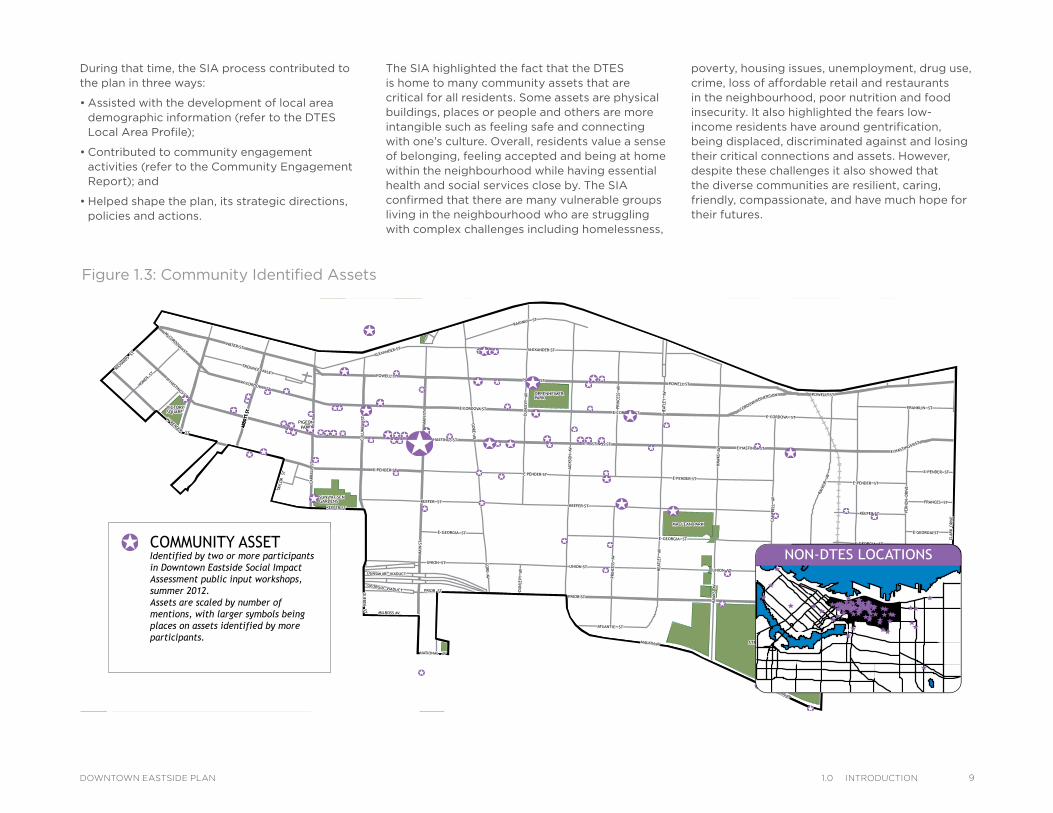
Figure 1.3: Community Identified Assets
AVJA
CKSO
N
VIADUCTGEORGIA
MAI
N ST
HOW
E
ST
SEYM
OUR
ALEXANDER ST
VIADUCTDUNSMUIR
WAY
FOX
TERRY
GEO
RGE
ST
STGEORGIAE
COOPERAGE W
AY
NATIONAL AV
AVG
ORE
PACIFIC BOULEVARD
MALKIN AV
NAPIER ST
ST
PENDER
W
STUNION
STFRANCES
STQ
UEBEC
ROAD
WATERFRONT
E
POWELL ST
AVDU
NLEV
Y
GLE
N DR
IVE
ST
DUNSMUIR
VIADUCT
DUNSMUIR
AVPR
INCE
SS
STCA
RRAL
L
MALKIN AV
ROAD
CENTENNIAL
E HASTINGS ST
STPOWELL
MEWS
KINGHORNE
WATER ST
AVCA
MPB
ELL
GEO
RGE
ST
STST
ATIO
N
STGEORGIAE
ABBO
TT S
T
W GEORGIA ST
AVDU
NLEV
Y
DIVERSION
CORDOVA
AVNATIONAL
STPENDERE
POWELL ST
AVH
EATL
EY
E PENDER ST
PLACEKEEFER
AVH
EATL
EY
E PENDER ST
KEEFER STBEAT
TY ST
ST
GEORGIA
W
STPRIOR
ST
GRANVIL
LE
ST
HOMER
E HASTINGS ST
E PENDER ST
STPENDERE
BOULEVARD
EXPO
AVPR
INCE
SS
MAI
N ST
WILLIAM ST
STKEEFER
W HASTINGS ST
UNION ST
STCORDOVA
W
KEEFER ST
ALLEY
TROUNCE
STCORDOVAE
DRIV
EVE
RNO
N
E HASTINGS ST
ST
STEWART
E CORDOVA ST
AVG
ORE
ST
CAMBIE
STFRANKLIN
STATLANTIC
BOULEVARD
EXPO
PARKER ST
KEEFER ST
STTA
YLOR
DRIV
EG
LEN
CHES
S ST
STUNION
STRAILWAY
MAI
N ST
STADANAC
E CORDOVA ST
BOULEVA
RD
PACIFIC
PARA
DE
CITAD
EL
STGEORGIAE
WILLIAM ST
DRIV
ECL
ARK
AVH
AWKS
VIADUCTGEORGIA
PARKER ST
E GEORGIA ST
ST
CORDOVA
W
DRIV
ECL
ARK
RAYM
UR A
V
THO
RNTO
N ST
ALEXANDER ST
PRIOR ST
ST
HAMILT
ON
AVH
AWKS
SMITHE MEWS
W WATERFRONT ROAD
MILROSS AV
VENABLES ST
WAY
GRIFFITHS
ST
RICHAR
DS
ST
HASTINGSE
CHARLES ST
STCO
LUM
BIA
AV
RAYM
UR
STPOWELL
AVJA
CKSO
N
VIADUCTGEORGIA
MAI
N ST
HOW
E
ST
SEYM
OUR
ALEXANDER ST
VIADUCTDUNSMUIR
WAY
FOX
TERRY
GEO
RGE
ST
STGEORGIAE
COOPERAGE W
AY
NATIONAL AV
AVG
ORE
PACIFIC BOULEVARD
MALKIN AV
NAPIER ST
ST
PENDER
W
STUNION
STFRANCES
STQ
UEBEC
ROAD
WATERFRONT
E
POWELL ST
AVDU
NLEV
Y
GLE
N DR
IVE
ST
DUNSMUIR
VIADUCT
DUNSMUIR
AVPR
INCE
SS
STCA
RRAL
L
MALKIN AV
ROAD
CENTENNIAL
E HASTINGS ST
STPOWELL
MEWS
KINGHORNE
WATER ST
AVCA
MPB
ELL
GEO
RGE
ST
STST
ATIO
N
STGEORGIAE
ABBO
TT S
TAB
BOTT
ST
ABBO
TT S
T
W GEORGIA ST
AVDU
NLEV
Y
DIVERSION
CORDOVA
AVNATIONAL
STPENDERE
POWELL ST
AVH
EATL
EY
E PENDER ST
PLACEKEEFER
AVH
EATL
EY
E PENDER ST
KEEFER STBEAT
TY ST
ST
GEORGIA
W
STPRIOR
ST
GRANVIL
LE
ST
HOMER
E HASTINGS ST
E PENDER ST
STPENDERE
BOULEVARD
EXPO
AVPR
INCE
SS
MAI
N ST
WILLIAM ST
STKEEFER
W HASTINGS ST
UNION ST
STCORDOVA
W
KEEFER ST
ALLEY
TROUNCE
STCORDOVAE
DRIV
EVE
RNO
N
E HASTINGS ST
ST
STEWART
E CORDOVA ST
AVG
ORE
ST
CAMBIE
STFRANKLIN
STATLANTIC
BOULEVARD
EXPO
PARKER ST
KEEFER ST
STTA
YLOR
DRIV
EG
LEN
CHES
S ST
STUNION
STRAILWAY
MAI
N ST
STADANAC
E CORDOVA ST
BOULEVA
RD
PACIFIC
PARA
DE
CITAD
EL
STGEORGIAE
WILLIAM ST
DRIV
ECL
ARK
AVH
AWKS
VIADUCTGEORGIA
PARKER ST
E GEORGIA ST
ST
CORDOVA
W
DRIV
ECL
ARK
RAYM
UR A
V
THO
RNTO
N ST
ALEXANDER ST
PRIOR ST
ST
HAMILT
ON
AVH
AWKS
SMITHE MEWS
W WATERFRONT ROAD
MILROSS AV
VENABLES ST
WAY
GRIFFITHS
ST
RICHAR
DS
ST
HASTINGSE
CHARLES ST
STCO
LUM
BIA
AV
RAYM
UR
STPOWELL
CREEKSIDEPARK
COOPERS P
ARK
CATHEDRALSQUARE
TRILLIUM PARK
SUN YAT-SENGARDENS
ANDY LIVINGSTONE PARK
VICTORYSQUARE
THORNTONPARK
STRATHCONA PARK
CRAB PARK AT PORTSIDE
PIGEONPARK
OPPENHEIMERPARK
MACLEAN PARK
CREEKSIDEPARK
COOPERS P
ARK
CATHEDRALSQUARE
TRILLIUM PARK
SUN YAT-SENGARDENS
ANDY LIVINGSTONE PARK
VICTORYSQUARE
THORNTONPARK
STRATHCONA PARK
CRAB PARK AT PORTSIDE
PIGEONPARK
OPPENHEIMERPARK
MACLEAN PARK
COMMUNITY ASSETS - IDENTIFIED IN SIA PUBLIC INPUT PROCESS
LEGEND
COMMUNITY ASSETIdentified by two or more participantsin Downtown Eastside Social ImpactAssessment public input workshops,summer 2012.Assets are scaled by number ofmentions, with larger symbols beingplaces on assets identified by moreparticipants.
NON-DTES LOCATIONS
During that time, the SIA process contributed to the plan in three ways:
• Assisted with the development of local area demographic information (refer to the DTES Local Area Profile);
• Contributed to community engagement activities (refer to the Community Engagement Report); and
• Helped shape the plan, its strategic directions, policies and actions.
The SIA highlighted the fact that the DTES is home to many community assets that are critical for all residents. Some assets are physical buildings, places or people and others are more intangible such as feeling safe and connecting with one’s culture. Overall, residents value a sense of belonging, feeling accepted and being at home within the neighbourhood while having essential health and social services close by. The SIA confirmed that there are many vulnerable groups living in the neighbourhood who are struggling with complex challenges including homelessness,
poverty, housing issues, unemployment, drug use, crime, loss of affordable retail and restaurants in the neighbourhood, poor nutrition and food insecurity. It also highlighted the fears low-income residents have around gentrification, being displaced, discriminated against and losing their critical connections and assets. However, despite these challenges it also showed that the diverse communities are resilient, caring, friendly, compassionate, and have much hope for their futures.
AVJA
CKS
ON
VIADUCTGEORGIA
MAIN
ST
HOW
E
ST
SEYM
OUR
ALEXANDER ST
VIADUCTDUNSMUIR
WAY
FOX
TE
RRY
GEO
RGE
ST
STGEORGIAE
COOPERAGE W
AY
NATIONAL AV
AVG
ORE
PACIFIC BOULEVARD
MALKIN AV
NAPIER ST
ST
PENDER
W
STUNION
STFRANCES
STQ
UEBEC
ROAD
WATERFRONT
E
POWELL ST
AVD
UN
LEVY
GLE
N D
RIVE
ST
DUNSMUIR
VIADUCT
DUNSMUIR
AVPR
INCES
S
STCARR
ALL
MALKIN AV
ROAD
CENTENNIAL
E HASTINGS ST
STPOWELL
MEWS
KINGHORNE
WATER ST
AVCAM
PBEL
L
GEO
RGE
ST
STST
ATIO
N
STGEORGIAE
ABBO
TT S
T
W GEORGIA ST
AVD
UN
LEVY
DIVERSION
CORDOVA
AVNATIONAL
STPENDERE
POWELL ST
AVH
EATL
EY
E PENDER ST
PLACEKEEFER
AVH
EATL
EY
E PENDER ST
KEEFER STBEAT
TY ST
ST
GEORGIA
W
STPRIOR
ST
GRANV
ILLE
ST
HOMER
E HASTINGS ST
E PENDER ST
STPENDERE
BOULEVARD
EXPO
AVPR
INCES
S
MAIN
ST
WILLIAM ST
STKEEFER
W HASTINGS ST
UNION ST
STCORDOVA
W
KEEFER ST
ALLEY
TROUNCE
STCORDOVAE
DRI
VEVER
NO
N
E HASTINGS ST
ST
STEWART
E CORDOVA ST
AVG
ORE
ST
CAMBI
E
STFRANKLIN
STATLANTIC
BOULEVARD
EXPO
PARKER ST
KEEFER ST
STTA
YLO
R
DRI
VE
GLE
N
CHES
S ST
STUNION
STRAILWAY
MAIN
ST
STADANAC
E CORDOVA ST
BOULEVA
RD
PACIFIC
PARA
DE
CITA
DEL
STGEORGIAE
WILLIAM ST
DRI
VECLA
RK
AVH
AWKS
VIADUCTGEORGIA
PARKER ST
E GEORGIA ST
ST
CORDOVA
W
DRI
VE
CLA
RK
RAYM
UR
AV
THO
RNTO
N S
T
ALEXANDER ST
PRIOR ST
ST
HAMILT
ON
AVH
AWKS
SMITHE MEWS
W WATERFRONT ROAD
MILROSS AV
VENABLES ST
WAY
GRIFFITHS
ST
RICH
ARDS
ST
HASTINGSE
CHARLES ST
STCO
LUM
BIA
AV
RAYM
UR
STPOWELL
AVJA
CKS
ON
VIADUCTGEORGIA
MAIN
ST
HOW
E
ST
SEYM
OUR
ALEXANDER ST
VIADUCTDUNSMUIR
WAY
FOX
TE
RRY
GEO
RGE
ST
STGEORGIAE
COOPERAGE W
AY
NATIONAL AV
AVG
ORE
PACIFIC BOULEVARD
MALKIN AV
NAPIER ST
ST
PENDER
W
STUNION
STFRANCES
STQ
UEBEC
ROAD
WATERFRONT
E
POWELL ST
AVD
UN
LEVY
GLE
N D
RIVE
ST
DUNSMUIR
VIADUCT
DUNSMUIR
AVPR
INCES
S
STCARR
ALL
MALKIN AV
ROAD
CENTENNIAL
E HASTINGS ST
STPOWELL
MEWS
KINGHORNE
WATER ST
AVCAM
PBEL
L
GEO
RGE
ST
STST
ATIO
N
STGEORGIAE
ABBO
TT S
TAB
BOTT
ST
ABBO
TT S
T
W GEORGIA ST
AVD
UN
LEVY
DIVERSION
CORDOVA
AVNATIONAL
STPENDERE
POWELL ST
AVH
EATL
EY
E PENDER ST
PLACEKEEFER
AVH
EATL
EY
E PENDER ST
KEEFER STBEAT
TY ST
ST
GEORGIA
W
STPRIOR
ST
GRANV
ILLE
ST
HOMER
E HASTINGS ST
E PENDER ST
STPENDERE
BOULEVARD
EXPO
AVPR
INCES
S
MAIN
ST
WILLIAM ST
STKEEFER
W HASTINGS ST
UNION ST
STCORDOVA
W
KEEFER ST
ALLEY
TROUNCE
STCORDOVAE
DRI
VEVER
NO
N
E HASTINGS ST
ST
STEWART
E CORDOVA ST
AVG
ORE
ST
CAMBI
E
STFRANKLIN
STATLANTIC
BOULEVARD
EXPO
PARKER ST
KEEFER ST
STTA
YLO
R
DRI
VE
GLE
N
CHES
S ST
STUNION
STRAILWAY
MAIN
ST
STADANAC
E CORDOVA ST
BOULEVA
RD
PACIFIC
PARA
DE
CITA
DEL
STGEORGIAE
WILLIAM ST
DRI
VECLA
RK
AVH
AWKS
VIADUCTGEORGIA
PARKER ST
E GEORGIA ST
ST
CORDOVA
W
DRI
VE
CLA
RK
RAYM
UR
AV
THO
RNTO
N S
T
ALEXANDER ST
PRIOR ST
ST
HAMILT
ON
AVH
AWKS
SMITHE MEWS
W WATERFRONT ROAD
MILROSS AV
VENABLES ST
WAY
GRIFFITHS
ST
RICH
ARDS
ST
HASTINGSE
CHARLES ST
STCO
LUM
BIA
AV
RAYM
UR
STPOWELL
CREEKSIDEPARK
COOPERS P
ARK
CATHEDRALSQUARE
TRILLIUM PARK
SUN YAT-SENGARDENS
ANDY LIVINGSTONE PARK
VICTORYSQUARE
THORNTONPARK
STRATHCONA PARK
CRAB PARK AT PORTSIDE
PIGEONPARK
OPPENHEIMERPARK
MACLEAN PARK
CREEKSIDEPARK
COOPERS P
ARK
CATHEDRALSQUARE
TRILLIUM PARK
SUN YAT-SENGARDENS
ANDY LIVINGSTONE PARK
VICTORYSQUARE
THORNTONPARK
STRATHCONA PARK
CRAB PARK AT PORTSIDE
PIGEONPARK
OPPENHEIMERPARK
MACLEAN PARK
COMMUNITY ASSETS - IDENTIFIED IN SIA PUBLIC INPUT PROCESS
LEGEND
COMMUNITY ASSETIdentified by two or more participantsin Downtown Eastside Social ImpactAssessment public input workshops,summer 2012.Assets are scaled by number ofmentions, with larger symbols beingplaces on assets identified by moreparticipants.
NON-DTES LOCATIONS
91.0 IntroduCtIonDOWNTOWN EASTSIDE PLAN
10 1.0 IntroduCtIon DOWNTOWN EASTSIDE PLAN
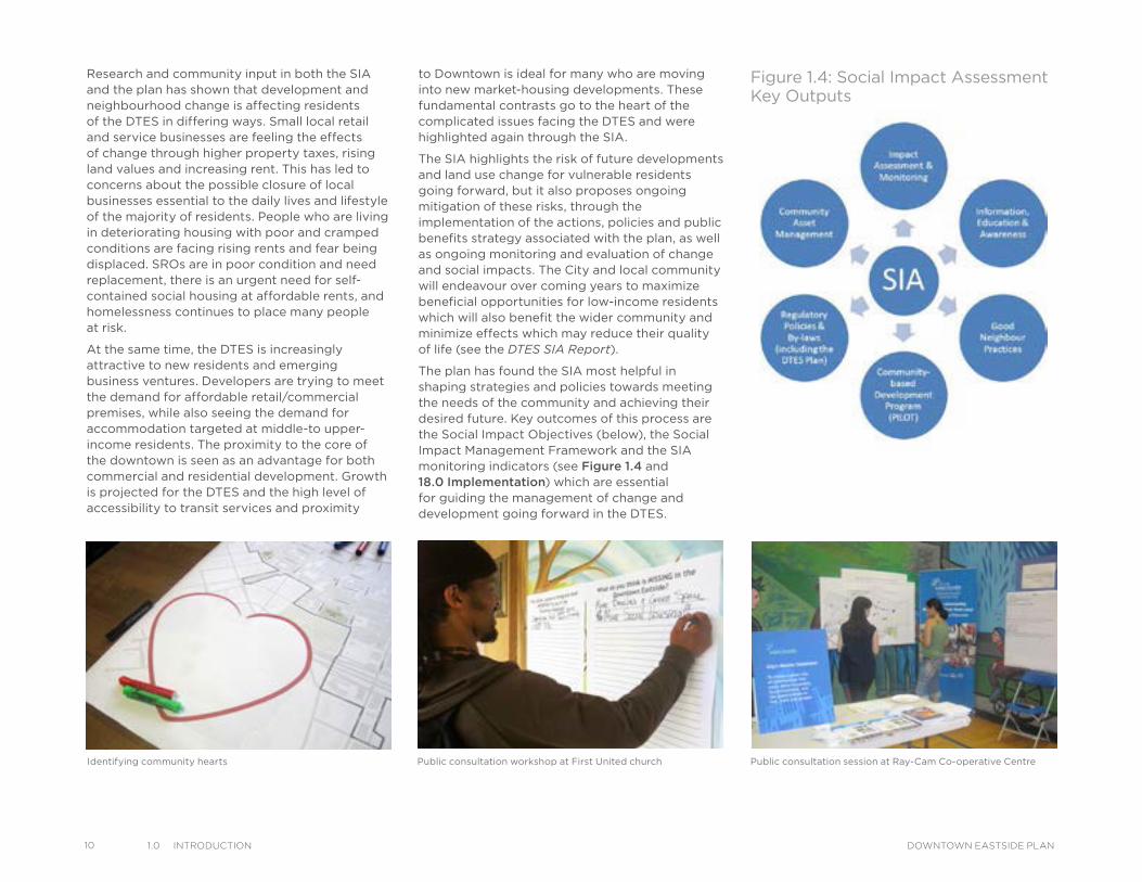
Figure 1.4: Social Impact Assessment Key Outputs
Research and community input in both the SIA and the plan has shown that development and neighbourhood change is affecting residents of the DTES in differing ways. Small local retail and service businesses are feeling the effects of change through higher property taxes, rising land values and increasing rent. This has led to concerns about the possible closure of local businesses essential to the daily lives and lifestyle of the majority of residents. People who are living in deteriorating housing with poor and cramped conditions are facing rising rents and fear being displaced. SROs are in poor condition and need replacement, there is an urgent need for self-contained social housing at affordable rents, and homelessness continues to place many people at risk.
At the same time, the DTES is increasingly attractive to new residents and emerging business ventures. Developers are trying to meet the demand for affordable retail/commercial premises, while also seeing the demand for accommodation targeted at middle-to upper-income residents. The proximity to the core of the downtown is seen as an advantage for both commercial and residential development. Growth is projected for the DTES and the high level of accessibility to transit services and proximity
to Downtown is ideal for many who are moving into new market-housing developments. These fundamental contrasts go to the heart of the complicated issues facing the DTES and were highlighted again through the SIA.
The SIA highlights the risk of future developments and land use change for vulnerable residents going forward, but it also proposes ongoing mitigation of these risks, through the implementation of the actions, policies and public benefits strategy associated with the plan, as well as ongoing monitoring and evaluation of change and social impacts. The City and local community will endeavour over coming years to maximize beneficial opportunities for low-income residents which will also benefit the wider community and minimize effects which may reduce their quality of life (see the DTES SIA Report).
The plan has found the SIA most helpful in shaping strategies and policies towards meeting the needs of the community and achieving their desired future. Key outcomes of this process are the Social Impact Objectives (below), the Social Impact Management Framework and the SIA monitoring indicators (see Figure 1.4 and 18.0 Implementation) which are essential for guiding the management of change and development going forward in the DTES.
Public consultation session at Ray-Cam Co-operative CentrePublic consultation workshop at First United churchIdentifying community hearts
Social Impact Objectives
These objectives seek to:
• Ensure that developments and businesses fit the DTES neighbourhood context, offer needed, locally-serving uses, and do not significantly exclude or negatively impact the low-income community.
• Encourage a wide range of housing options in the neighbourhood, with a particular focus on new and improved social and affordable housing for the homeless and other low- and moderate-income singles and families.
• Ensure diverse development that is respectful of heritage assets, surrounding scale, urban pattern, and social and community context.
• Improve the overall quality, accessibility and inclusiveness of the public realm in the DTES, recognizing the uniqueness of each sub-area.
• Maintain the diversity of existing businesses and commercial uses and support affordable commercial spaces for social enterprises, micro enterprises and small businesses providing low-cost goods and services for residents.
• Encourage the use of local goods and services in the construction, operation and maintenance of the proposed development or business.
• Encourage local and inclusive hiring in the construction, operation and maintenance phases of the improvement and the strengthening of social and micro economies.
• Maintain adequate health and social services within the community, as well as community amenity and gathering spaces to serve the needs of the diverse local population.
• Retain, preserve and celebrate local heritage, arts and culture for all.
Looking ForwardThe plan describes the key issues, directions, priorities, strategies, actions and projects to be implemented over the next 30 years to help achieve the desired future of all residents (young children to seniors) using an innovative implementation approach (see 18.0 Implementation). This will seek to protect critical community assets, support vulnerable residents, stabilize affordable rental housing stock and create positive opportunities for all through community-based development.
While the plan uses a 30-year time frame, it proposes 10-year targets and the action plan will be reviewed regularly to set new targets on the basis of achievements and changes over time. Monitoring of the plan will also be measured through a set of indicators and will incorporate a community consultation process to evaluate both how the local priorities are being met and what impact (negative or beneficial) development is having on the most vulnerable groups and other residents of the DTES. Resources will be allocated to implement this plan and introduce the necessary policies, regulations and guidelines to help meaningful change to take place. It will be important that all residents, communities, agencies, organizations and governments work together to play their part in this effort.
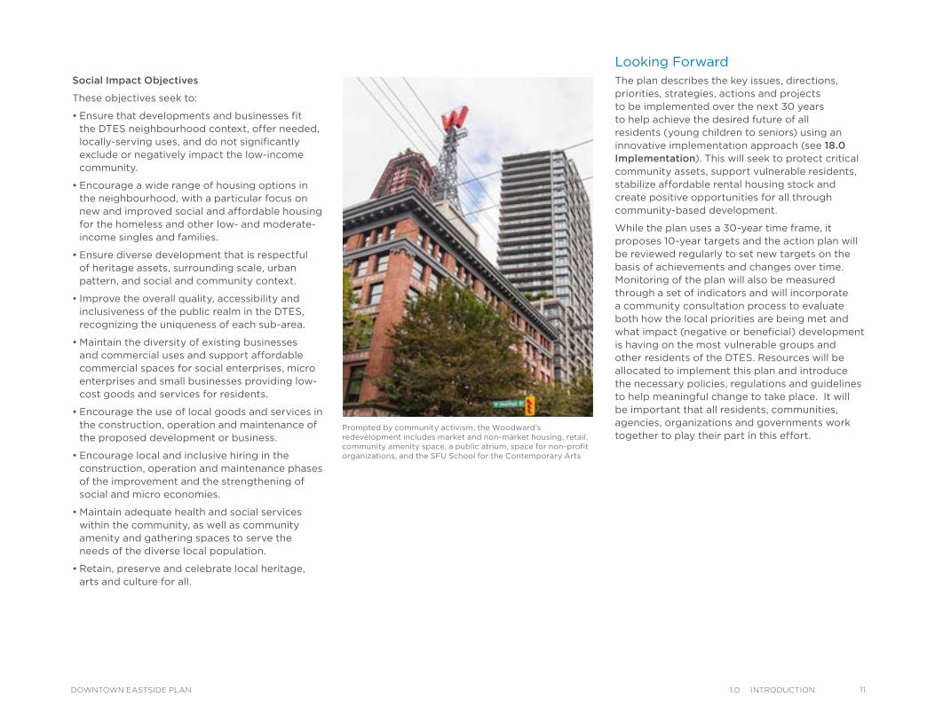
Prompted by community activism, the Woodward’s redevelopment includes market and non-market housing, retail, community amenity space, a public atrium, space for non-profit organizations, and the SFU School for the Contemporary Arts
111.0 IntroduCtIonDOWNTOWN EASTSIDE PLAN
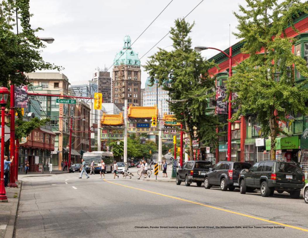
Chinatown, Pender Street looking west towards Carrall Street, the Millennium Gate, and Sun Tower heritage building
2PLAN PRINCIPLES
The plan strives to ensure that the uniqueness of the Downtown Eastside (DTES) is recognized, and special tools and approaches are created to achieve a healthy neighbourhood for all. The plan also endeavours to maintain the existing neighbourhood character and revitalize the area without displacement of residents. Additional principles provide the overall foundation for the Downtown Eastside Plan.
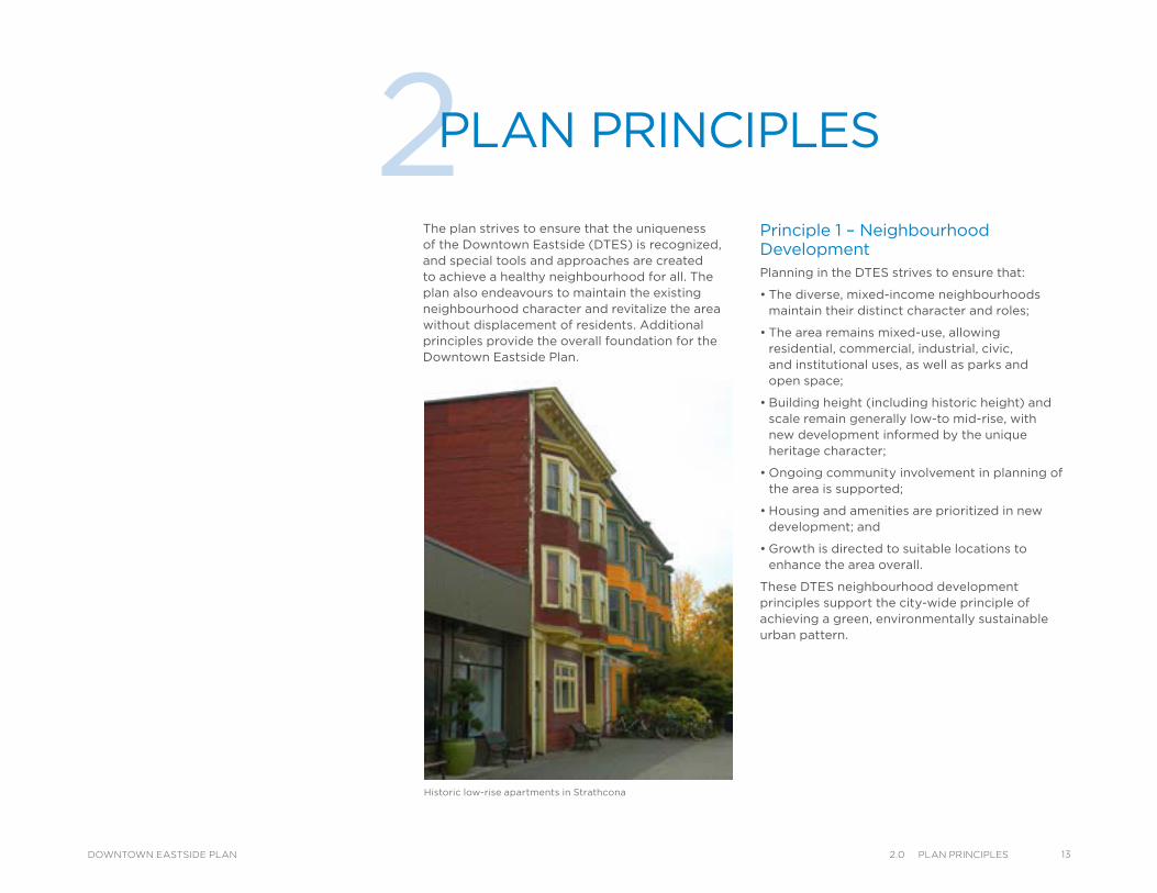
Historic low-rise apartments in Strathcona
Principle 1 – Neighbourhood DevelopmentPlanning in the DTES strives to ensure that:
• The diverse, mixed-income neighbourhoods maintain their distinct character and roles;
• The area remains mixed-use, allowing residential, commercial, industrial, civic, and institutional uses, as well as parks and open space;
• Building height (including historic height) and scale remain generally low-to mid-rise, with new development informed by the unique heritage character;
• Ongoing community involvement in planning of the area is supported;
• Housing and amenities are prioritized in new development; and
• Growth is directed to suitable locations to enhance the area overall.
These DTES neighbourhood development principles support the city-wide principle of achieving a green, environmentally sustainable urban pattern.
132.0 Plan PrInCIPlesDOWNTOWN EASTSIDE PLAN
14 2.0 Plan PrInCIPles DOWNTOWN EASTSIDE PLAN
Principle 3 – Local EconomyPlanning in the DTES strives to ensure that:
• The formal economy connects to local needs and local livelihoods;
• Community economic development is encouraged and supported;
• Retail and mixed-use centres serving local needs are encouraged;
• Local business is supported and barriers to establishing business are reduced;
• Residents are given opportunities to earn a living that at a minimum, pays for their basic needs;
• Social enterprises are encouraged;
• Local hiring and social purchasing policies are a priority;
• Volunteer and the informal economy are recognized;
• Opportunities for employment in local business, social enterprise, green/ high tech and micro enterprises are created; and
• Industrial job space is preserved while accommodating new uses and processes, which align with the evolving economy.
These DTES local economy principles support the city-wide principle of fostering a robust, resilient economy.
Principle 2 – HousingPlanning in the DTES strives to ensure that:
• Access to affordable housing choices in the DTES and across the City is available for low-income people, including the homeless and the working poor, children, families and seniors;
• A housing mix in the neighbourhood continues to be encouraged;
• Conditions of existing low-income housing in the DTES are improved; and
• A range of supports provides basic needs such as food and health services as well as inclusion and belonging.
These DTES housing principles support the city-wide principle of supporting a range of affordable housing options to meet the diverse needs of the community.
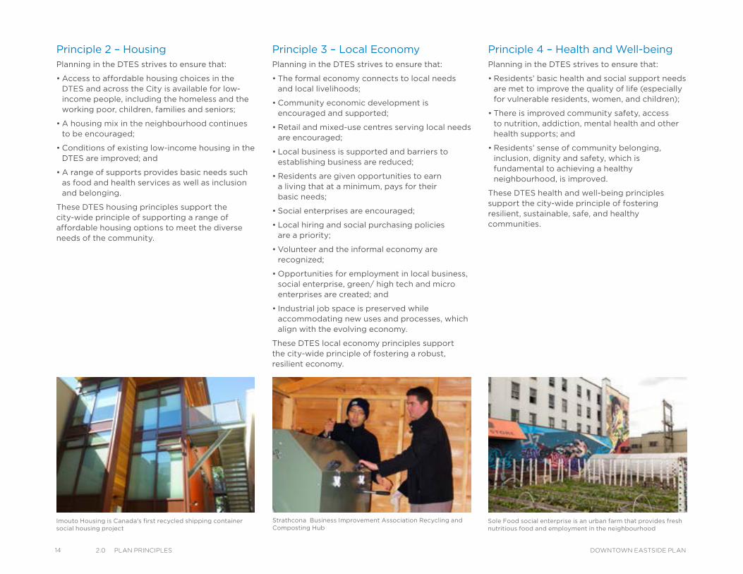
Strathcona Business Improvement Association Recycling and Composting Hub
Imouto Housing is Canada's first recycled shipping container social housing project
Principle 4 – Health and Well-beingPlanning in the DTES strives to ensure that:
• Residents’ basic health and social support needs are met to improve the quality of life (especially for vulnerable residents, women, and children);
• There is improved community safety, access to nutrition, addiction, mental health and other health supports; and
• Residents’ sense of community belonging, inclusion, dignity and safety, which is fundamental to achieving a healthy neighbourhood, is improved.
These DTES health and well-being principles support the city-wide principle of fostering resilient, sustainable, safe, and healthy communities.
Sole Food social enterprise is an urban farm that provides fresh nutritious food and employment in the neighbourhood
Principle 5 – Art, Culture, and HeritagePlanning in the DTES strives to ensure that:
• The arts, cultural, and heritage assets of the area are identified and key assets are protected;
• The local creative economy is strengthened;
• Community arts and artists are supported and celebrated; and
• The area’s diverse cultural heritage is recognized and celebrated (including Aboriginal, Japanese-Canadian, Chinese-Canadian, labour movement, etc.).
These DTES art, culture, and heritage principles support the city-wide principle of enhancing culture, heritage, and creativity within the city.
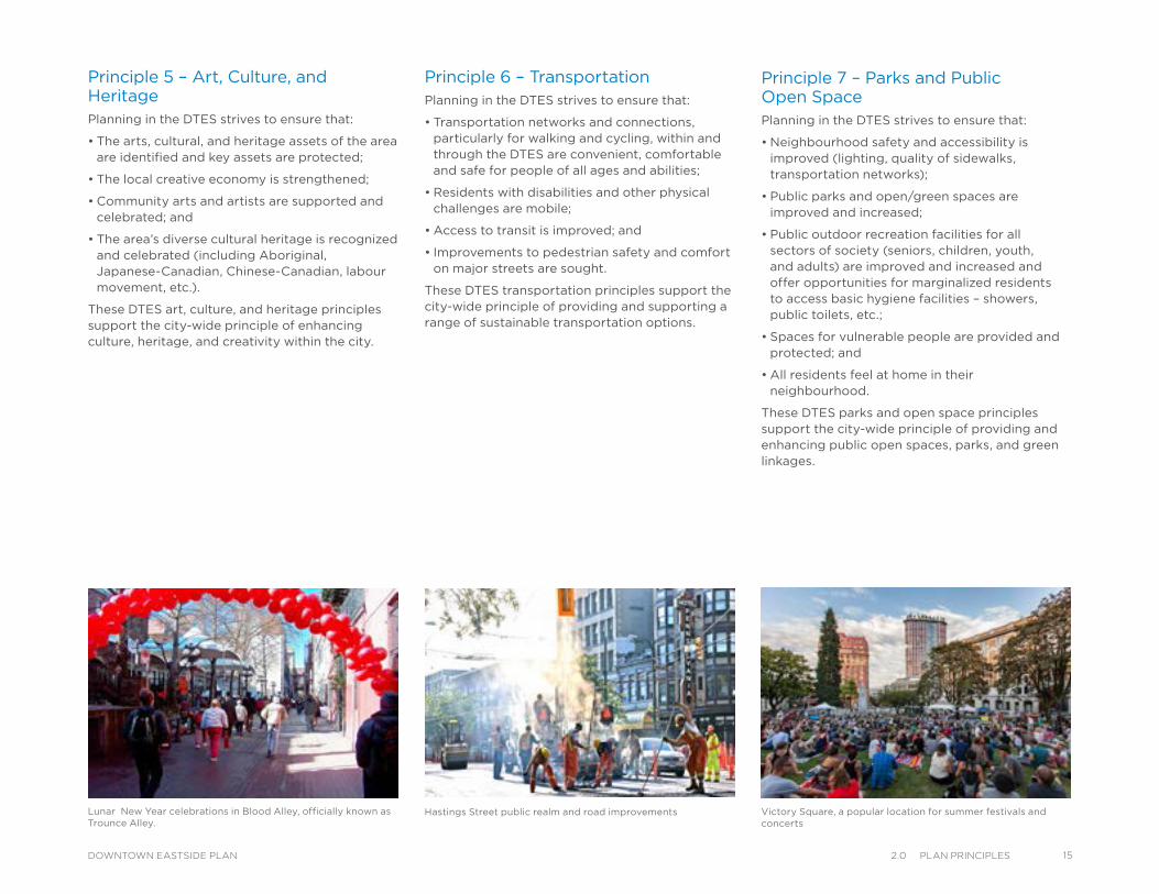
Hastings Street public realm and road improvements Lunar New Year celebrations in Blood Alley, officially known as Trounce Alley.
Principle 6 – TransportationPlanning in the DTES strives to ensure that:
• Transportation networks and connections, particularly for walking and cycling, within and through the DTES are convenient, comfortable and safe for people of all ages and abilities;
• Residents with disabilities and other physical challenges are mobile;
• Access to transit is improved; and
• Improvements to pedestrian safety and comfort on major streets are sought.
These DTES transportation principles support the city-wide principle of providing and supporting a range of sustainable transportation options.
Principle 7 – Parks and Public Open SpacePlanning in the DTES strives to ensure that:
• Neighbourhood safety and accessibility is improved (lighting, quality of sidewalks, transportation networks);
• Public parks and open/green spaces are improved and increased;
• Public outdoor recreation facilities for all sectors of society (seniors, children, youth, and adults) are improved and increased and offer opportunities for marginalized residents to access basic hygiene facilities – showers, public toilets, etc.;
• Spaces for vulnerable people are provided and protected; and
• All residents feel at home in their neighbourhood.
These DTES parks and open space principles support the city-wide principle of providing and enhancing public open spaces, parks, and green linkages.
Victory Square, a popular location for summer festivals and concerts
152.0 Plan PrInCIPlesDOWNTOWN EASTSIDE PLAN
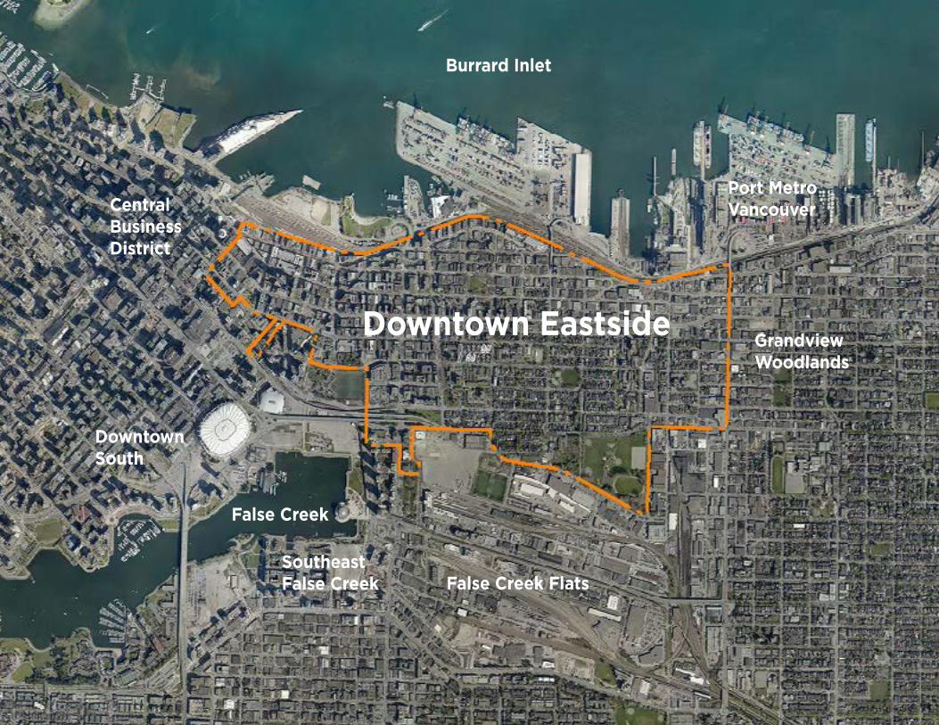
CentralBusinessDistrict
False Creek Flats
GrandviewWoodlands
Downtown Eastside
DowntownSouth
False Creek
Burrard Inlet
Southeast False Creek
Port MetroVancouver
3COMMUNITY CONTEXT
About the CommunityAs home to some of Vancouver’s oldest neighbourhoods and the historic heart of the city, the DTES has a unique and diverse character, with mixed-income residents living in several areas that are rich in history. The DTES is also strongly connected to its founding Aboriginal communities--including the Musqueam (xʷməθkʷəyəm), Tsleil-Wauthuth (mi ce:p kʷətxʷiləm) and Squamish (Skwxwú7mesh Úxwumixw) First Nation, Japanese-Canadians, Chinese-Canadians and other ethnic and cultural groups. The uniqueness of DTES also stems from the early settlements in the areas of Gastown, Powell Street (Japantown), Oppenheimer, Chinatown and Strathcona, with their distinctive low- to medium-rise buildings and smaller scale architecture linked to the diverse communities and their cultural aspirations over time.
The DTES is located on land that Aboriginal communities consider unceded Coast Salish territory and has been the urban home of many Aboriginal communities for generations. Many elements of Canadian history are rooted in the diverse communities of the DTES – the Chinese Head Tax, the forced displacement and internment of the Japanese-Canadian community during the Second World War, the displacement of First Nations and the residential school policy.
The community has considerable diversity; there are working poor and middle income families, couples and singles of all ages living in a range of housing. Residents are proud and value the sense of belonging and feelings of acceptance experienced in the area, and many struggle with complex challenges, including homelessness and affordable housing, unemployment, physical disabilities, addictions, and mental health issues. The area has numerous non-profit organizations, service agencies, and community groups offering critical support to these communities.
Population Characteristics
The DTES is a mixed income neighbourhood with singles, families, low-to moderate-income working poor, children, youth and seniors living in a wide variety of accommodation. It was estimated in 2011 that 18,477 people lived in the neighbourhood. Of these, the Oppenheimer District accommodates 6,108 (33 per cent) people, followed by 5,760 (31 per cent) living in Strathcona, 2,103 (12 per cent) in Victory Square, 1,277 (seven per cent) in Chinatown, 552 (two per cent) in the Industrial Lands and 220 (one per cent) in Thornton Park (see Figure 3.1). Further details are available in the Local Area Profile prepared in 2013 and in 8.0 Community Well-Being.
173.0 CommunIty ContextDOWNTOWN EASTSIDE PLAN
18 3.0 CommunIty Context DOWNTOWN EASTSIDE PLAN
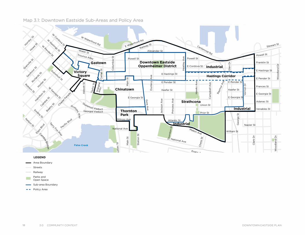
Map 3.1: Downtown Eastside Sub-Areas and Policy Area
Victory
Gastown Downtown EastsideOppenheimer District
Chinatown
Strathcona
Industrial
ThorntonPark
Square Hastings Corridor
Industrial
Industrial
Powell St
Water StTrounce Alley
Alexander St
E Cordova St
Centennial Rd
Powell St
E Waterfront Rd
Railway St
W Waterfront Rd
William St William St
Powell St
Stewart St
Napier St
Venables St
Adanac St
Union St
Qu
eb
ec S
t
Keefer St
E Georgia St
Geo
rge S
t
Cla
rk D
r
E Georgia St
Atlantic St
National Ave
Malkin Ave
Terminal Ave
Evans Ave
Milross Ave
National Ave
Nelson St
Prior St
E Pender St
Franklin St
E Hastings St
Pandora St Triumph St
E Pender St
Frances St
E Georgia St
E Hastings St
E Pender St
W Cordova St
W Hastings St
Dunsmuir St
Robson St
W G
eorgia St
Smithe St
W Pender St
Cam
bie S
t
Sh
an
gh
ai
Alle
y
Beatt
y St Cita
del P
arad
e
Ham
ilton
St
Mai
nlan
d St
Hom
er S
t
Richa
rds St
Hor
nby
St
How
e St
Seym
our S
t
Gra
nville
St
Keefer St
Go
re A
ve
Jackso
n A
ve
Main
St
Sta
tio
n S
t
Main
St
Co
lum
bia
St
Pacific
Blvd
Terry Fox Way
Carr
all
St
Ab
bo
tt S
t
Taylo
r S
t
Pri
ncess
Ave C
am
pb
ell
Ave
Ray
mur
Ave
Vern
on
Dr
Wo
od
lan
d D
rW
oo
dla
nd
Dr
Sals
bu
ry D
r
Gle
n D
r
Heatl
ey A
ve
Haw
ks
Ave
Th
orn
ton S
t
Ch
ess
St
Dunsmuir Viaduct
Expo
Blv
d
Georgia Viaduct
Griffiths Way
Cambie B
ridg
e
Du
nle
vy A
ve
Area Boundary
Streets
Railway
Parks andOpen Space
Sub-area Boundary
Policy Area
LEGEND
More than half of the residents are poor, dependent on Income Assistance support, pensions, charitable and social services. Rising rents and living expenses directly affect the nutrition and health of residents. There are several vulnerable groups including Aboriginal communities, children, women, youth, drug users, homeless, people affected by mental illness, disabled, seniors and sex workers. Added to this is the high percentage of seniors and a majority of the residents over the age of 45. The working poor and middle-income families need additional childcare facilities, school spaces, access to retail stores and affordable housing.
Population Growth
Over the last 10 years, the population of the DTES and the city as a whole grew by 10 per cent (see Figure 3.2). Implementation of the plan, and continued growth trends, may result in a potential population of approximately 28,000 to 30,000 by year 2041. This growth is dependent on a number of factors, including funding for social housing, and the uptake of market development in the area.
Figure 3.2: Population Change 2001-2006
Figure 3.1: Downtown Eastside Population (2006)
DTES Vancouver
2001 2006 2001 2006
Under 5 years
335 435 23,695 24,730
5-19 years 1,295 1,520 77,555 78,685
20-44 years
6,415 6,675 246,045 249,725
45-65 years
4,655 5,660 128,050 148,925
65+ years 3,675 3,740 70,325 75,990
Figure 3.3: Age Profile
Age Profile
According to 2006 Census data, 52 per cent of DTES residents, some 9,600 people are aged 45 or older compared to 39 per cent and 224,915 in the whole city. Seniors also make up a significant group with 4000 (22 per cent) aged 65 plus or more compared to 75,990 (13 per cent) in Vancouver as a whole. Some 1955 (or approximately 10 per cent) of residents are children and youth compared to 103,415 (18 per cent) in Vancouver as a whole (see Figure 3.3).
Household Income
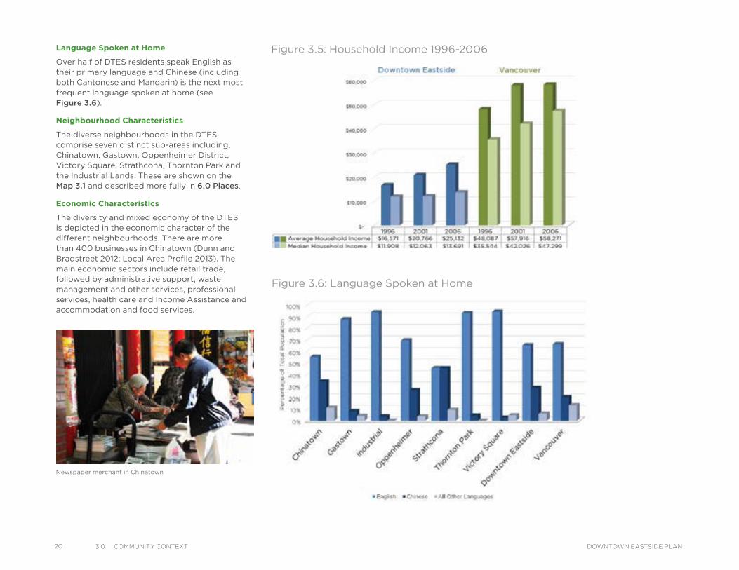
Based on the only available statistical data, Census 2006, the people of the DTES have the lowest median income ($13,691 per annum) in the city – for the rest of the city the median income is $47,299 per annum (see Figure 3.5). This is a reflection of the large proportion of DTES residents on Income Assistance, pensions and other forms of assistance. Poverty presents a significant challenge to the community’s health, social well-being and resilience as a whole.
0 50 100 150 200 250 300 350 400
Triangle West
City Gate
Downtown South
West EndWest End
Granville Slopes
Coal Harbour
False Creek North
Yaletown
Downtown Eastside
Bridgehead
Central Business District
Population Density by Downtown Neighbourhood
47.8
Persons per hectare
62.7
129.9
130.6
155.1
159.2
200.2
216.9
304.9
335.0
352.2
Figure 3.4: Population Density by Downtown Neighbourhood (2011)
-
1,000
2,000
3,000
4,000
5,000
6,000
7,000
Po
pu
lati
on
2001 2006
193.0 CommunIty ContextDOWNTOWN EASTSIDE PLAN
20 3.0 CommunIty Context DOWNTOWN EASTSIDE PLAN
Language Spoken at Home
Over half of DTES residents speak English as their primary language and Chinese (including both Cantonese and Mandarin) is the next most frequent language spoken at home (see Figure 3.6).
Neighbourhood Characteristics
The diverse neighbourhoods in the DTES comprise seven distinct sub-areas including, Chinatown, Gastown, Oppenheimer District, Victory Square, Strathcona, Thornton Park and the Industrial Lands. These are shown on the Map 3.1 and described more fully in 6.0 Places.
Economic Characteristics
The diversity and mixed economy of the DTES is depicted in the economic character of the different neighbourhoods. There are more than 400 businesses in Chinatown (Dunn and Bradstreet 2012; Local Area Profile 2013). The main economic sectors include retail trade, followed by administrative support, waste management and other services, professional services, health care and Income Assistance and accommodation and food services.
Newspaper merchant in Chinatown
Figure 3.6: Language Spoken at Home
Figure 3.5: Household Income 1996-2006
Map 3.2: Business Improvement Associations
Water StTrounce Alley
Alexander St
E Cordova St
Centennial Rd
Powell St
E Waterfront Rd
Railway St
W Waterfront Rd
William St William St
Powell St
Stewart St
Napier St
Venables St
Adanac St
Union St
Qu
eb
ec S
t
Ge
org
e S
t
Cla
rk D
r
Atlantic St
National Ave
Malkin Ave
Terminal Ave
Evans Ave
National Ave
Nelson St
Prior St
Franklin St
E Hastings St
Pandora St Triumph St
E Pender St
Frances St
E Georgia St
E Pender St
W Cordova St
W Hastings St
Dunsmuir St
Robson St
W G
eorgia St
Smithe St
W Pender St
Cam
bie S
t
Sh
an
gh
ai
Alle
y
Beatt
y St Cita
del P
arad
e
Ham
ilton
St
Mai
nlan
d St
Hom
er S
t
Richa
rds St
Hor
nby
St
How
e St
Seym
our S
t
Gra
nville
St
Keefer St
Go
re A
ve
Jackso
n A
ve
Sta
tio
n S
t
Main
St
Co
lum
bia
St
Pacific
Blvd
Terry Fox Way
Carr
all
St
Ab
bo
tt S
t
Taylo
r S
t
Pri
ncess
Ave C
am
pb
ell
Ave
Ray
mur
Ave
Ve
rno
n D
r
Wo
od
lan
d D
rW
oo
dla
nd
Dr
Sals
bu
ry D
r
Gle
n D
r
Heatl
ey A
ve
Haw
ks
Ave
Th
orn
ton S
t
Ch
ess
St
Dunsmuir Viaduct
Expo
Blv
d
Georgia Viaduct
Griffiths Way
Cambie B
ridg
e
Du
nle
vy A
ve
Area Boundary
Streets
Railway
Chinatown BIA
Gastown BIA
Hastings Crossing BIA
Strathcona BIA
LEGEND
213.0 CommunIty ContextDOWNTOWN EASTSIDE PLAN
22 3.0 CommunIty Context DOWNTOWN EASTSIDE PLAN
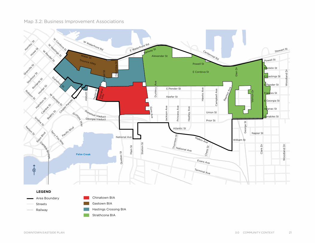
Gastown has over 700 businesses, with a very strong professional, scientific and technical service economy, underpinned by administrative support and waste management, retail trade, accommodation and food. Hastings Crossing Business Improvement Association has approximately 600 businesses, with its main sectors being administrative support and waste management, professional scientific and technical services, closely followed by retail. Finally, the Strathcona area has approximately 600 businesses mainly including manufacturing, wholesale trade, retail trade, administrative support and waste management and other services.
The DTES contains four Business Improvement Associations (BIAs) which play an essential role in coordinating business interests, representing their membership needs and facilitating improvements in the neighbourhood to enhance the business environment. These are the Chinatown, Hastings Crossing, Gastown and Strathcona BIAs (see Map 3.2). The Chinatown Merchants Association is also an additional and important representative body working for Chinatown business interests.
The DTES local economy is increasingly linked to the regional and global economy with opportunities presented by its strategic geographical accessibility, industrial premises, and road, rail and adjacent port infrastructure. In addition, the relatively low rents and the older, unique spaces are very attractive to small start-up
entrepreneurs in the new economy. Added to this high accessibility is the significant heritage value of the oldest neighbourhoods which provides potential to promote the mixed-use commercial environment, digital and animation activities, creative economy, retail products and services in an authentic heritage context (Gastown, Chinatown, Railtown in Industrial and Powell Street (Japantown)).
In contrast, long-established businesses in certain areas such as Chinatown, often find it difficult to adapt to economic change. Factors such as low purchasing power of local residents, as well as smaller markets, affect business viability. Many family-owned businesses with aging owners are deciding to close down or sell. Studies done by Vancouver Economic Commission reflect a trend whereby the economy of the area is changing over time, with less industry and more retail, commercial and office uses (refer to the Local Area Profile 2013 and see 10.0 Local Economy).
The neighbourhood also has a complex local ‘informal economy’ related to the survival livelihoods of at least half of its residents who are dependent on Income Assistance and pensions. Activities that make up this realm include self-employment through micro-enterprise, binning, vending, bartering and volunteering for income supplementation. The street market is an example of a community-based economic initiative bringing substantial opportunities for residents and a more permanent home for such vending markets is being sought.
Employment
In 2006, 7,270 (40 per cent) of the 18,025 DTES residents considered themselves part of the formal work force, 6,385 (87.8 per cent) of these residents were employed and 880 (12.1 per cent) were unemployed. In 2002, it was estimated over 20,000 people were employed by 2,300 businesses in the area. The number of people employed in the DTES appears to have remained more or less stable in the last 10 years and most recent data in 2012 estimate 19,948 people work in the DTES. A large number of these workers commute into the DTES each day, since it is estimated only 900 (13 per cent) of the local residents work close to their homes. Many DTES residents consider themselves employed in the informal economy as well, earning money from activities such as volunteering, vending, and entrepreneurship.
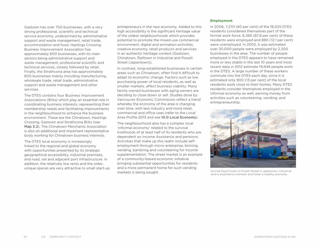
Sunrise Soya Foods on Powell Street in Japantown. Industrial land is essential to maintain and foster a healthy economy.
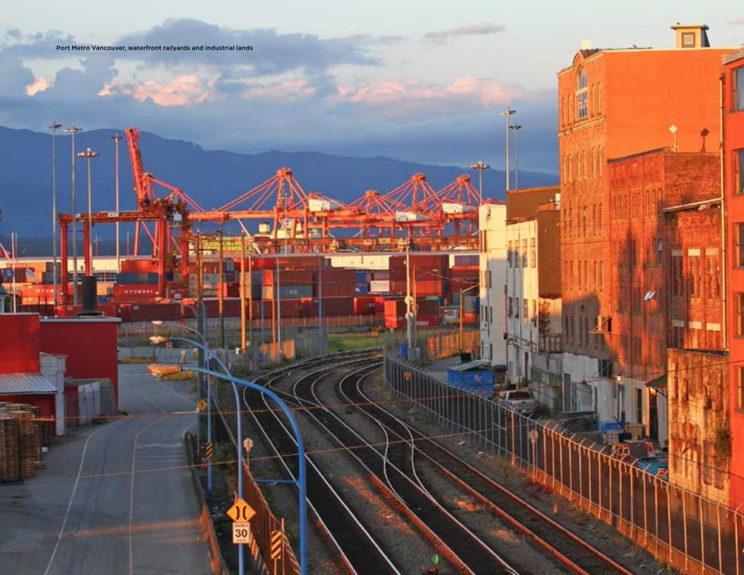
Port Metro Vancouver, waterfront railyards and industrial lands
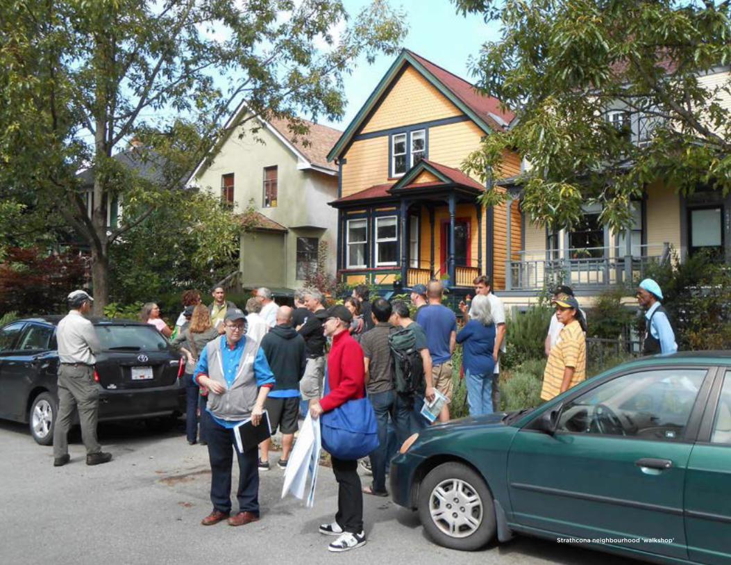
Strathcona neighbourhood ‘walkshop’
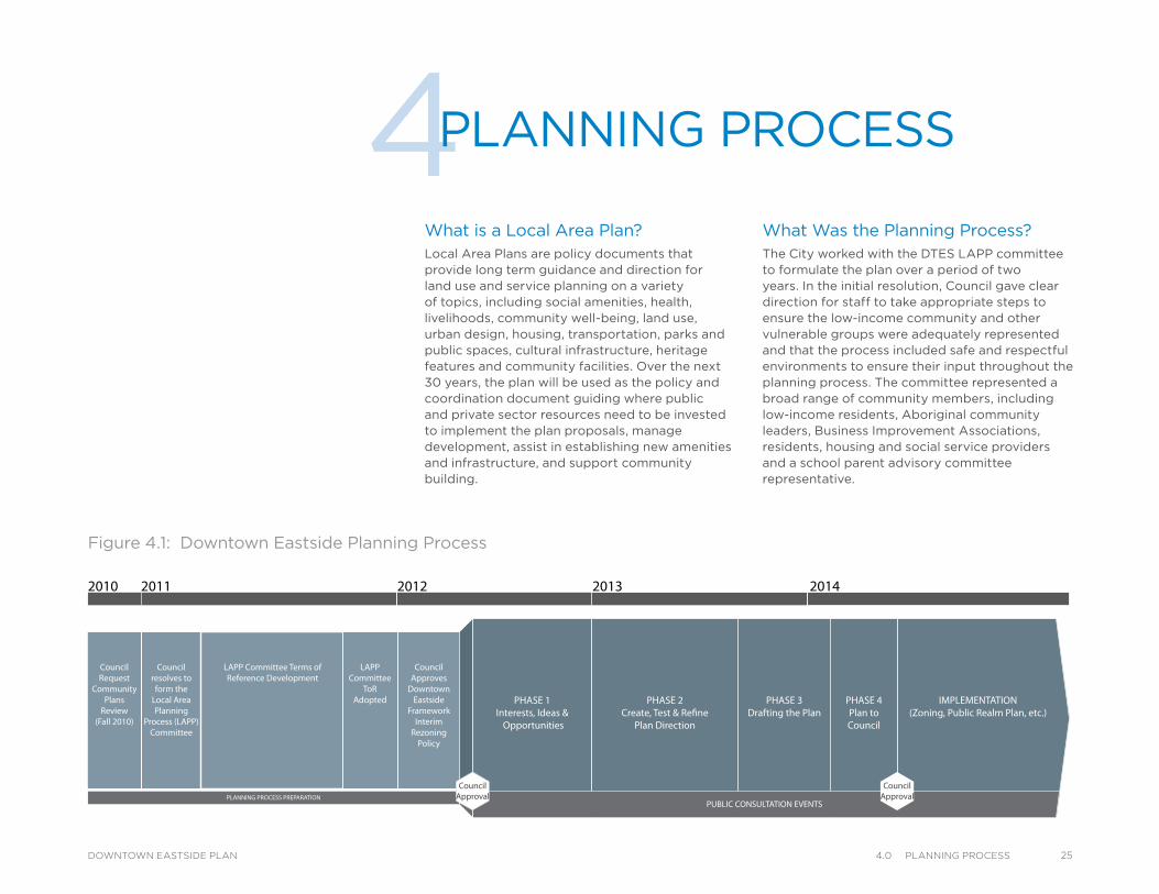
What Was the Planning Process?The City worked with the DTES LAPP committee to formulate the plan over a period of two years. In the initial resolution, Council gave clear direction for staff to take appropriate steps to ensure the low-income community and other vulnerable groups were adequately represented and that the process included safe and respectful environments to ensure their input throughout the planning process. The committee represented a broad range of community members, including low-income residents, Aboriginal community leaders, Business Improvement Associations, residents, housing and social service providers and a school parent advisory committee representative.
What is a Local Area Plan?Local Area Plans are policy documents that provide long term guidance and direction for land use and service planning on a variety of topics, including social amenities, health, livelihoods, community well-being, land use, urban design, housing, transportation, parks and public spaces, cultural infrastructure, heritage features and community facilities. Over the next 30 years, the plan will be used as the policy and coordination document guiding where public and private sector resources need to be invested to implement the plan proposals, manage development, assist in establishing new amenities and infrastructure, and support community building.
4PLANNING PROCESS
Downtown Eastside Planning Process20142013201220112010
CouncilRequest
CommunityPlans
Review(Fall 2010)
Councilresolves to
form theLocal AreaPlanning
Process (LAPP)Committee
LAPP Committee Terms ofReference Development
CouncilApproves
DowntownEastside
FrameworkInterim
RezoningPolicy
PHASE 1Interests, Ideas &
Opportunities
PHASE 2Create, Test & Re�ne
Plan Direction
IMPLEMENTATION(Zoning, Public Realm Plan, etc.)
PHASE 3Drafting the Plan
PHASE 4Plan toCouncil
PUBLIC CONSULTATION EVENTS
CouncilApproval
CouncilApprovalPLANNING PROCESS PREPARATION
LAPPCommittee
ToRAdopted
TOTAL5,065
Participants
ActionWhile
Planning-
ProjectsImplemented
6TOTAL335
Events &Meetings
169LAPP
CommitteeMeetings
90Public Events& Meetings
720 Signed-up on Listserv@
ADVERTISING3 Community-wide Postcard Mailouts
Newspaper Ads
Radio Interviews
Webpage
Posters, etc.d
Figure 4.1: Downtown Eastside Planning Process
254.0 PlannIng ProCessDOWNTOWN EASTSIDE PLAN
26 4.0 PlannIng ProCess DOWNTOWN EASTSIDE PLAN
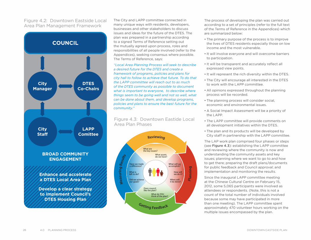
The City and LAPP committee connected in many unique ways with residents, developers, businesses and other stakeholders to discuss issues and ideas for the future of the DTES. The plan was prepared in a partnership according to a signed Terms of Reference setting out the mutually agreed upon process, roles and responsibilities of all people involved (refer to the Appendices), seeking consensus where possible. The Terms of Reference, says:
“Local Area Planning Process will seek to describe a desired future for the DTES and create a framework of programs, policies and plans for city hall to follow to achieve that future. To do that the LAPP committee will reach out to as much of the DTES community as possible to document what is important to everyone, to describe where things seem to be going well and not so well, what can be done about them, and develop programs, policies and plans to ensure the best future for the community.”
The process of developing the plan was carried out according to a set of principles (refer to the full text of the Terms of Reference in the Appendices) which are summarized below:
• The primary purpose of the process is to improve the lives of DTES residents especially those on low income and the most vulnerable.
• It will involve everyone and will overcome barriers to participation.
• It will be transparent and accurately reflect all expressed view points.
• It will represent the rich diversity within the DTES.
• The City will encourage all interested in the DTES to work with the LAPP committee.
• All opinions expressed throughout the planning process will be recorded.
• The planning process will consider social, economic and environmental issues.
• A Social Impact Assessment will be a priority of the LAPP.
• The LAPP committee will provide comments on all development initiatives within the DTES.
• The plan and its products will be developed by City staff in partnership with the LAPP committee.
The LAP work plan comprised four phases or steps (see Figure 4.3): establishing the LAPP committee and reviewing where the community is now and understanding the community assets and key issues; planning where we want to go to and how to get there; preparing the draft plans/documents for public feedback and Council approval; and implementation and monitoring the results.
Since the inaugural LAPP committee meeting at the Chinese Cultural Centre on February 15, 2012, some 5,065 participants were involved as attendees or respondents. (Note, this is not a count of the total number of individuals involved because some may have participated in more than one meeting). The LAPP committee spent approximately 470 volunteer hours working on the multiple issues encompassed by the plan.
Figure 4.2: Downtown Eastside Local Area Plan Management Framework
AN D IN V O LVE MENT
COM
MNITY INFORMATIO
N
What are the key issues?
What assets do we have?
What will we accomplish?
How willwe do it?
When willit be done?
What do YOU think of the plan?
Does council like the plan?
Have we made
What is left to do?
Did we achieve our goals? M
easu
ring
Resu
lts
Reviewing
Getting Feedback
P
lann
ing
Figure 4.3: Downtown Eastide Local Area Plan Phases
BROAD COMMUNITYENGAGEMENT
COUNCIL
CityManager
CityStaff
Enhance and acceleratea DTES Local Area Plan
Develop a clear strategyto implement Council’s
DTES Housing Plan
LAPPComittee
DTESCo-Chairs
Aboriginal place-making workshop in Oppenheimer Park
OurHomes
NOTES/MINUTESOF
WORKSHOPSOUTCOMES
OurPlaces
Integrating Tables
OurWell-being
OurLivelihoods
Social &Housing
Cultural
Our PlacesOur
LivelihoodsOur Homes
OurWell-being
BIA’s
INFORMATION SHARING WORKSHOPS
WHAT ARE WE HEARING EVENT
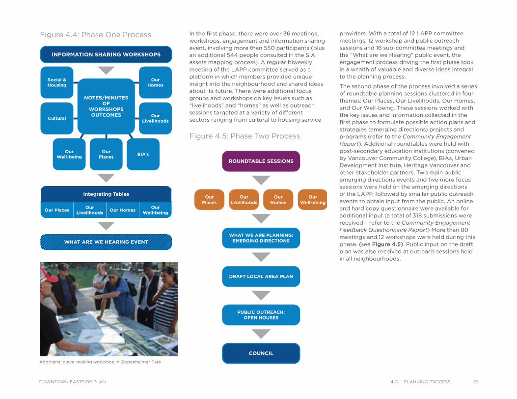
Figure 4.4: Phase One Process
Figure 4.5: Phase Two Process
In the first phase, there were over 36 meetings, workshops, engagement and information sharing event, involving more than 550 participants (plus an additional 544 people consulted in the SIA assets mapping process). A regular biweekly meeting of the LAPP committee served as a platform in which members provided unique insight into the neighbourhood and shared ideas about its future. There were additional focus groups and workshops on key issues such as “livelihoods” and “homes” as well as outreach sessions targeted at a variety of different sectors ranging from cultural to housing service
providers. With a total of 12 LAPP committee meetings, 12 workshop and public outreach sessions and 16 sub-committee meetings and the “What are we Hearing” public event, the engagement process driving the first phase took in a wealth of valuable and diverse ideas integral to the planning process.
The second phase of the process involved a series of roundtable planning sessions clustered in four themes: Our Places, Our Livelihoods, Our Homes, and Our Well-being. These sessions worked with the key issues and information collected in the first phase to formulate possible action plans and strategies (emerging directions) projects and programs (refer to the Community Engagement Report). Additional roundtables were held with post-secondary education institutions (convened by Vancouver Community College), BIAs, Urban Development Institute, Heritage Vancouver and other stakeholder partners. Two main public emerging directions events and five more focus sessions were held on the emerging directions of the LAPP, followed by smaller public outreach events to obtain input from the public. An online and hard copy questionnaire were available for additional input (a total of 318 submissions were received – refer to the Community Engagement Feedback Questionnaire Report) More than 80 meetings and 12 workshops were held during this phase. (see Figure 4.5). Public input on the draft plan was also received at outreach sessions held in all neighbourhoods.
COUNCIL
PUBLIC OUTREACH:OPEN HOUSES
DRAFT LOCAL AREA PLAN
WHAT WE ARE PLANNING:EMERGING DIRECTIONS
ROUNDTABLE SESSIONS
OurHomes
OurWell-being
OurLivelihoods
OurPlaces
274.0 PlannIng ProCessDOWNTOWN EASTSIDE PLAN
28 4.0 PlannIng ProCess DOWNTOWN EASTSIDE PLAN
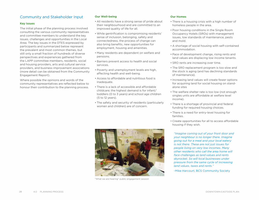
Community and Stakeholder Input
Key Issues
The initial phase of the planning process involved consulting the various community representatives and committee members to understand the key issues, challenges and opportunities in the Local Area. The key issues in the DTES expressed by participants and summarized below represent the prevalent and most common themes, but still only a small fraction of hundreds of diverse perspectives and experiences gathered from the LAPP committee members, residents, social and housing providers, arts and cultural service providers, and business improvement associations (more detail can be obtained from the Community Engagement Report).
Where possible the opinions and words of the community representatives are reflected below to honour their contribution to the planning process.
Our Well-being
• All residents have a strong sense of pride about their neighbourhood and are committed to an improved quality of life for all.
• While gentrification is compromising residents’ sense of inclusion, belonging, safety and connectedness, the process of change can also bring benefits, new opportunities for employment, housing and amenities.
• Many residents are dependent on welfare and pensions.
• Barriers prevent access to health and social services.
• Poverty and unemployment levels are high, affecting health and well-being.
• Access to affordable and nutritious food is inadequate.
• There is a lack of accessible and affordable childcare; the highest demand is for infant/toddlers (0 to 3 years) and school age children (5 to 12 years).
• The safety and security of residents (particularly women and children) are of concern.
Our Homes
• There is a housing crisis with a high number of homeless people in the area.
• Poor housing conditions in the Single Room Occupancy Hotels (SROs) with management issues, low standards of maintenance, pests and mold.
• A shortage of social housing with self-contained accommodation.
• Pace of development change, rising rents and land values are displacing low income tenants.
• SRO rents are increasing over time.
• The SRO replacement program is too slow and the stock is aging (and has declining standards of maintenance).
• Increasing land values will create fewer options for acquiring land for social housing on stand-alone sites
• The welfare shelter rate is too low (not enough singles units are affordable at welfare level income).
• There is a shortage of provincial and federal funding for required housing choices.
• There is a need for entry-level housing for families.
• Create opportunities for all to access affordable housing if they wish.
“Imagine coming out of your front door and your neighbour is no longer there. Imagine going out for a meal and your local eatery is not there. These are not just issues for people living on very low incomes. Many other residents who call the area home will face challenges as land values and rents skyrocket. So will local businesses under pressure from the same cycle of increasing land values, taxes and rents.”
-Mike Harcourt, BCS Community Society
"What we are hearing" public engagement session
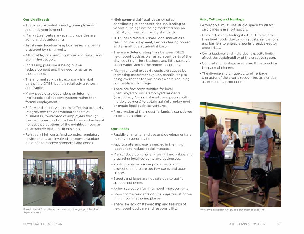
• High commercial/retail vacancy rates contributing to economic decline, leading to vacant buildings not being marketed and an inability to meet occupancy standards.
• DTES has a relatively small local market as a result of unemployment, low purchasing power and a small local residential base.
• There are deteriorating links between DTES neighbourhoods as well as adjacent parts of the city resulting in less business and little strategic cooperation across the region’s economy.
• Rising rent and property costs are caused by increasing assessment values, contributing to rising overheads for business owners, reducing competitive advantages.
• There are few opportunities for local unemployed or underemployed residents (particularly Aboriginal youth and people with multiple barriers) to obtain gainful employment or create local business ventures.
• Preservation of the industrial lands is considered to be a high priority.
Our Places
• Rapidly changing land use and development are leading to gentrification.
• Appropriate land use is needed in the right locations to reduce social impacts.
• Market developments are raising land values and displacing local residents and businesses.
• Public places require improvements and protection; there are too few parks and open spaces.
• Streets and lanes are not safe due to traffic speeds and crime.
• Aging recreation facilities need improvements.
• Low-income residents don’t always feel at home in their own gathering places.
• There is a lack of stewardship and feelings of neighbourhood care and responsibility.
Our Livelihoods
• There is substantial poverty, unemployment and underemployment.
• Many storefronts are vacant, properties are aging and deteriorating.
• Artists and local-serving businesses are being displaced by rising rents.
• Affordable, local-serving stores and restaurants are in short supply.
• Increasing pressure is being put on redevelopment and the need to revitalize the economy.
• The informal survivalist economy is a vital part of the DTES, but it is relatively unknown and fragile.
• Many people are dependent on informal livelihoods and support systems rather than formal employment.
• Safety and security concerns affecting property integrity and the operational aspects of businesses, movement of employees through the neighbourhood at certain times and external negative perceptions of the neighbourhood as an attractive place to do business.
• Relatively high costs (and complex regulatory environment) are involved in renovating older buildings to modern standards and codes.
Powell Street Charette at the Japanese Language School and Japanese Hall
"What we are planning" public engagement session
Arts, Culture, and Heritage
• Affordable, multi-use studio space for all art disciplines is in short supply.
• Local artists are finding it difficult to maintain their livelihoods due to rising costs, regulations, and barriers to entrepreneurial creative-sector enterprises.
• Organizational and individual capacity limits affect the sustainability of the creative sector.
• Cultural and heritage assets are threatened by the pace of change.
• The diverse and unique cultural heritage character of the area is recognized as a critical asset needing protection.
294.0 PlannIng ProCessDOWNTOWN EASTSIDE PLAN
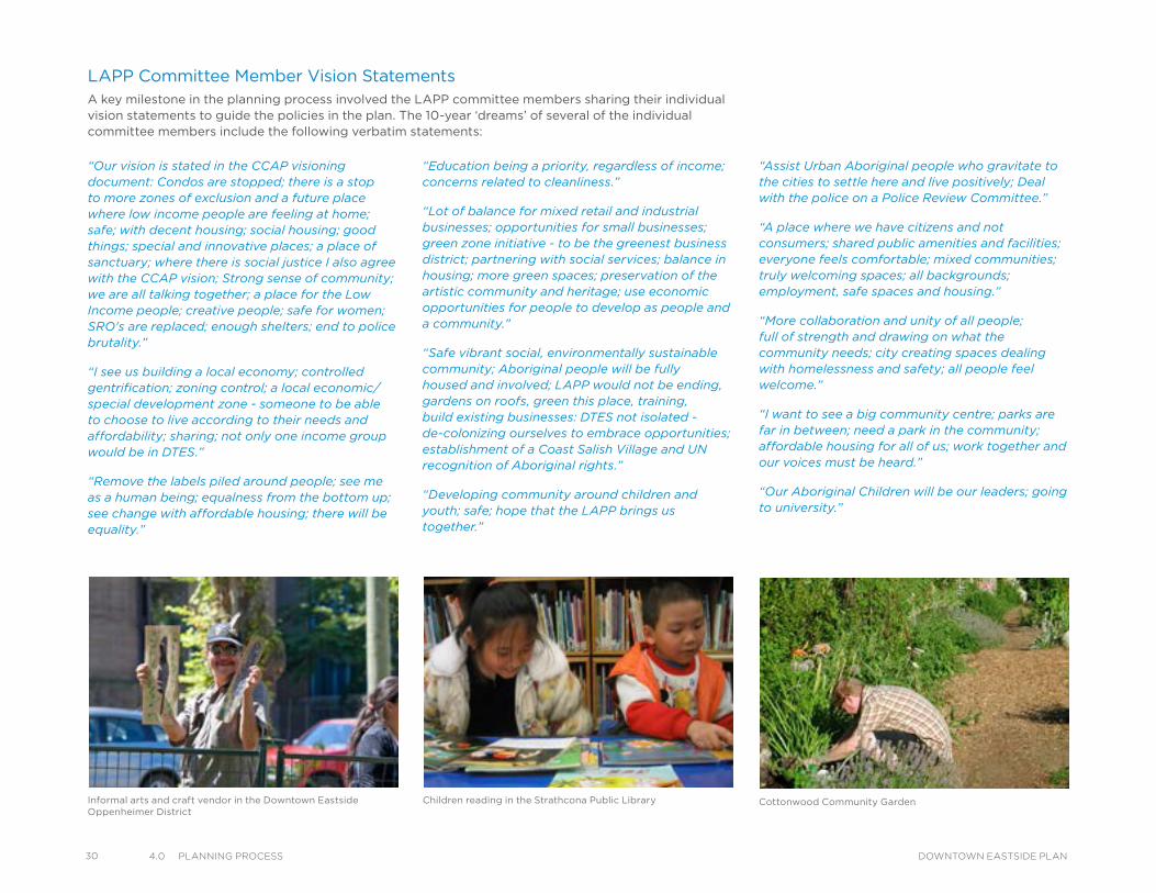
30 4.0 PlannIng ProCess DOWNTOWN EASTSIDE PLAN
“Education being a priority, regardless of income; concerns related to cleanliness.”
“Lot of balance for mixed retail and industrial businesses; opportunities for small businesses; green zone initiative - to be the greenest business district; partnering with social services; balance in housing; more green spaces; preservation of the artistic community and heritage; use economic opportunities for people to develop as people and a community.”
“Safe vibrant social, environmentally sustainable community; Aboriginal people will be fully housed and involved; LAPP would not be ending, gardens on roofs, green this place, training, build existing businesses: DTES not isolated - de-colonizing ourselves to embrace opportunities; establishment of a Coast Salish Village and UN recognition of Aboriginal rights.”
“Developing community around children and youth; safe; hope that the LAPP brings us together.”
“Assist Urban Aboriginal people who gravitate to the cities to settle here and live positively; Deal with the police on a Police Review Committee.”
“A place where we have citizens and not consumers; shared public amenities and facilities; everyone feels comfortable; mixed communities; truly welcoming spaces; all backgrounds; employment, safe spaces and housing.”
“More collaboration and unity of all people; full of strength and drawing on what the community needs; city creating spaces dealing with homelessness and safety; all people feel welcome.”
“I want to see a big community centre; parks are far in between; need a park in the community; affordable housing for all of us; work together and our voices must be heard.”
“Our Aboriginal Children will be our leaders; going to university.”
LAPP Committee Member Vision StatementsA key milestone in the planning process involved the LAPP committee members sharing their individual vision statements to guide the policies in the plan. The 10-year ‘dreams’ of several of the individual committee members include the following verbatim statements:
Cottonwood Community Garden Children reading in the Strathcona Public LibraryInformal arts and craft vendor in the Downtown Eastside Oppenheimer District
“Our vision is stated in the CCAP visioning document: Condos are stopped; there is a stop to more zones of exclusion and a future place where low income people are feeling at home; safe; with decent housing; social housing; good things; special and innovative places; a place of sanctuary; where there is social justice I also agree with the CCAP vision; Strong sense of community; we are all talking together; a place for the Low Income people; creative people; safe for women; SRO's are replaced; enough shelters; end to police brutality.”
“I see us building a local economy; controlled gentrification; zoning control; a local economic/special development zone - someone to be able to choose to live according to their needs and affordability; sharing; not only one income group would be in DTES.”
“Remove the labels piled around people; see me as a human being; equalness from the bottom up; see change with affordable housing; there will be equality.”

“A place where community can care and there is a place for everyone; tax dollars not being spent on cops and ambulance calls - no health care by ambulance; wake up - no ambulance or police sirens; no lights from a next door agency; green spaces; need to know our history.”
“To see marginalized people empowered; protected; not dependent on resources from elsewhere; built up assets; our own food-other vision space for privileged to share spaces; understanding; welcoming people rather than condo's being pushed in.”
“Social housing at welfare rates; self-contained with bathrooms and kitchens; no need to show ID when you visiting your friends; community space for studios; aboriginal culture creativity; where people are not pushed away; keep existing services here for residents; end homelessness; job and business opportunities--self-employed.”
“Preserving services, a sense of belonging; ensure the most marginalized feel comfortable first.”
“Peer run society in the artist community with opportunities for affordable artists spaces; artists will not have to get permission for using local space.”
“Concerned about new agencies; very concerned - the bar needs to be raised for the Low Income housing standards; new definition starting at the 100 block; SIA to start there as well; new housing plan; restored service agencies; sex workers to have rights; and they will have choice, safe and be able to see an area for the sex workers; community education and empowerment; history must come back to this neighbourhood; embracing all residents as one community with equal recognition of people; no divisions between us; all to have a right to live here; vulnerable have opportunity; unity.”
“Helping people; harm reduction; much needed services for the marginalized; people getting work; people will have self-esteem and housing will be affordable.”
Community sports court in Strathcona Hastings urban farm in the Downtown Eastside Oppenheimer District
“Through working together we can create a safer space and a classless community; Low income people should have a choice to stay here; having the most voice in the LAPP.”
“The Low Income Housing goals are met; affordable housing for those beyond core need; everybody's home regardless of class; neighbours care and support each other.”
“Hopeful; know we can have a really strong healthy inclusive neighbourhood, live and work together, play together regardless of income or background; protected mixed community; safe for everyone; no bullying; a place that has a local swimming pool; people can work here, encourages jobs, a community that continues to be extremely generous, fair and listens and treats each other equally; a community dedicated to the community.”
These vision statements have contributed towards the plan and are reflected in the summary of the plan (see 5.0 Plan Concept). The final plan incorporates many elements of these visions, with significant effort at balancing the various perspectives with the goal of a plan which will support a future for the DTES, which is sustainable and brings to fruition the vision statement which is the foundation for the plan.
314.0 PlannIng ProCessDOWNTOWN EASTSIDE PLAN
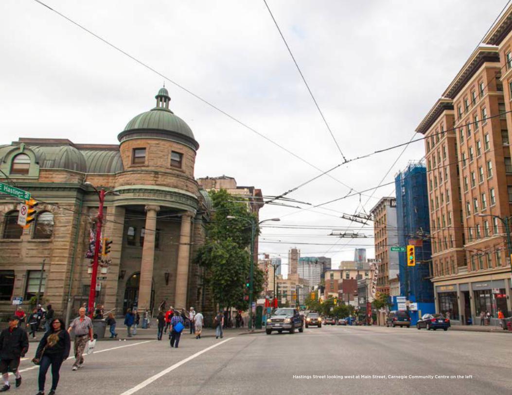
Hastings Street looking west at Main Street, Carnegie Community Centre on the left
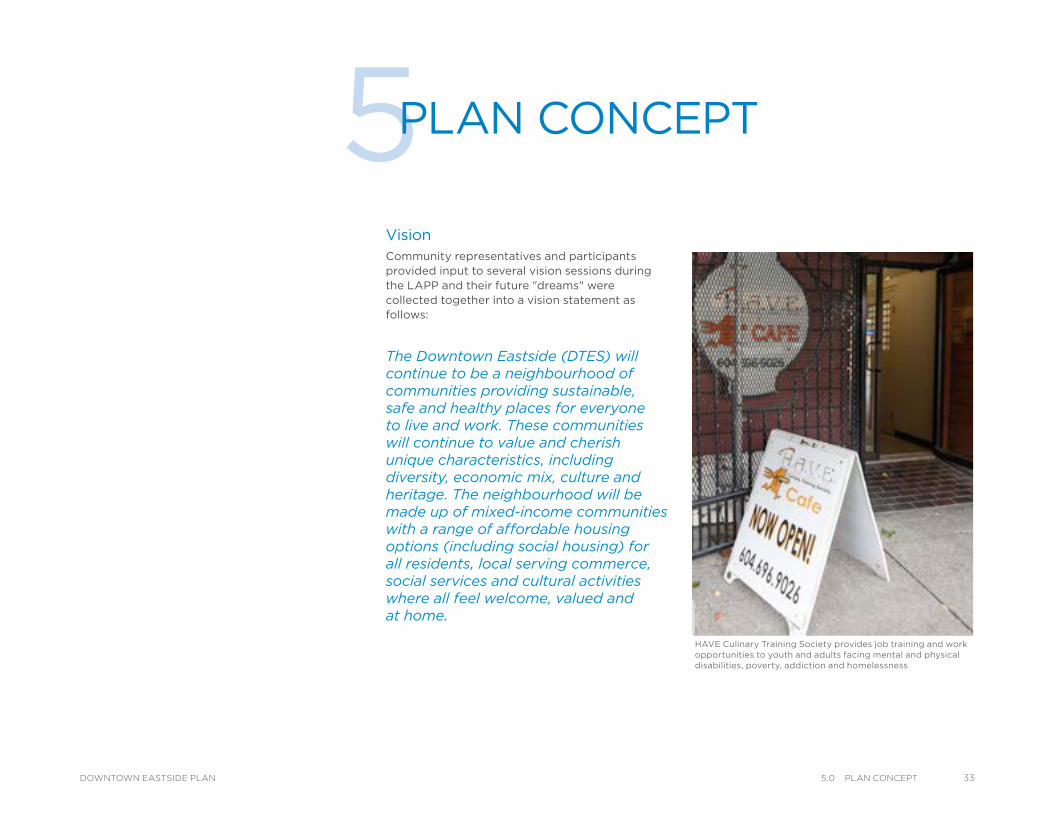
VisionCommunity representatives and participants provided input to several vision sessions during the LAPP and their future "dreams" were collected together into a vision statement as follows:
The Downtown Eastside (DTES) will continue to be a neighbourhood of communities providing sustainable, safe and healthy places for everyone to live and work. These communities will continue to value and cherish unique characteristics, including diversity, economic mix, culture and heritage. The neighbourhood will be made up of mixed-income communities with a range of affordable housing options (including social housing) for all residents, local serving commerce, social services and cultural activities where all feel welcome, valued and at home.
5PLAN CONCEPT
HAVE Culinary Training Society provides job training and work opportunities to youth and adults facing mental and physical disabilities, poverty, addiction and homelessness
335.0 Plan ConCePtDOWNTOWN EASTSIDE PLAN
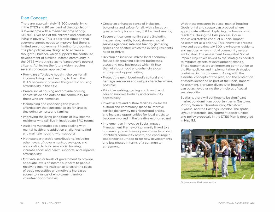
34 5.0 Plan ConCePt DOWNTOWN EASTSIDE PLAN
Plan ConceptThere are approximately 18,500 people living in the DTES and 60 per cent of the population is low-income with a median income of only $13,700. Over half of the children and adults are living in poverty. This is a terrible situation that everyone agrees needs to improve, but there is limited senior government funding forthcoming. The plan policies are designed to achieve a thoughtful balance which supports the continued development of a mixed-income community in the DTES without displacing Vancouver’s poorest citizens. Achieving the future vision requires several conceptual approaches:
• Providing affordable housing choices for all incomes living in and wanting to live in the DTES because it provides the greatest housing affordability in the city;
• Create social housing and provide housing choice inside and outside the community for those who are homeless;
• Maintaining and enhancing the level of affordability that currently exists for singles (including seniors) and families;
• Improving the living conditions of low-income residents who still live in inadequate SRO rooms;
• Assisting vulnerable residents dealing with mental health and addiction challenges to find and maintain housing with supports;
• Motivate partnership contributions, including other levels of governments, developer, and non-profits, to build new social housing, increase social and health supports, and improve affordability;
• Motivate senior levels of government to provide adequate levels of income supports to people receiving Income Assistance to cover the costs of basic necessities and motivate increased access to a range of employment and/or volunteer opportunities;
• Create an enhanced sense of inclusion, belonging, and safety for all, with a focus on greater safety for women, children and seniors;
• Secure critical community assets (including inexpensive, healthy food; showers; social service agencies; safe and friendly gathering spaces and shelter) which the existing residents need to thrive;
• Develop an inclusive, mixed local economy focused on retaining existing businesses, attracting new businesses which fit into the neighbourhood and enhancing local employment opportunities;
• Protect the neighbourhood‘s cultural and heritage resources and unique character where possible;
• Prioritize walking, cycling and transit, and seek to improve livability and community accessibility;
• Invest in arts and culture facilities, co-locate cultural and community space to improve service delivery by neighbourhood artists, and increase opportunities for local artists to become involved in the creative economy; and
• Implement an innovative Social Impact Management Framework primarily linked to a community-based development area to protect identified community assets, and encourage a good neighbourhood fit for new developments and businesses in terms of a community agreement.
Oppenheimer Park celebration
With these measures in place, market housing (both rental and strata) can proceed where appropriate without displacing the low-income residents. During the LAP process, Council also asked staff to conduct a Social Impact Assessment as a priority. This innovative process involved approximately 600 low-income residents and mapped where critical community assets are located. The assessment formulated Social Impact Objectives linked to the strategies needed to mitigate effects of development change. These outcomes are an important contribution to the Plan policies and implementation strategies contained in this document. Along with the essential concepts of the plan, and the protection of assets identified as part of the Social Impact Assessment, a greater diversity of housing can be achieved using the principles of social sustainability.
Spatially, there will continue to be significant market condominium opportunities in Gastown, Victory Square, Thornton Park, Chinatown, Kiwassa, and the Hastings Corridor. The spatial layout of potential development opportunities and policy proposals in the DTES Plan is depicted in Map 5.1.
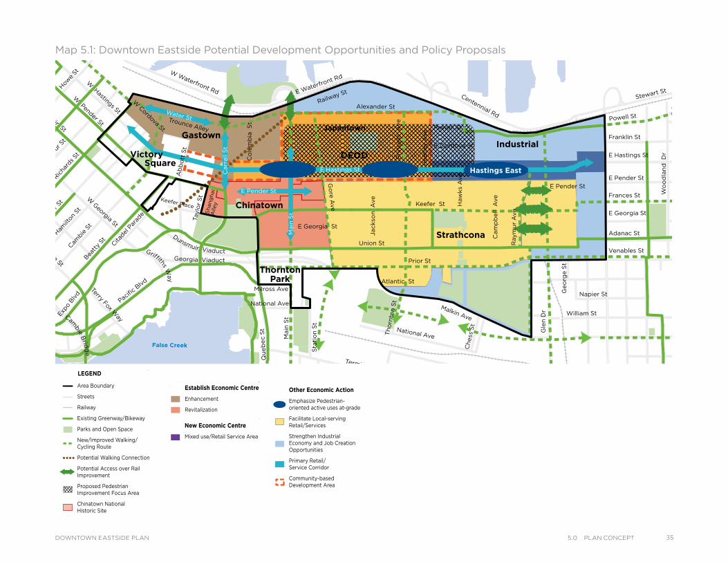
Map 5.1: Downtown Eastside Potential Development Opportunities and Policy Proposals
Powell St
Water StTrounce Alley
Keefer Place
Alexander St
E Cordova St
Centennial Rd
E Waterfront Rd
Railway St
W Waterfront Rd
William St
William St
Powell St
Stewart St
Napier St
Venables St
Adanac St
Union St
Qu
eb
ec S
t
Ge
org
e S
t
Cla
rk D
r
E Georgia St
Atlantic St
National Ave
Malkin Ave
Terminal Ave Evans Ave
Milross Ave
National Ave
Nelson St
Prior St
Franklin St
E Hastings St
Pandora St
Triumph St
E Pender St
Frances St
E Georgia St
E Hastings St
E Pender St
W Cordova St
W Hastings St
Dunsmuir St
Robson StW
Georgia St
Smithe St
W Pender St
Cam
bie S
t
Sh
an
gh
ai
Alle
y
Beatt
y St Cita
del P
arad
e
Ham
ilton
St
Mai
nlan
d St
Hom
er S
tRic
hard
s St
Hor
nby
St
Burra
rd
How
e St
Seym
our S
t
Gra
nville
St
Keefer St
Go
re A
ve
Jackso
n A
ve
Main
St
Sta
tio
n S
t
Main
St
Co
lum
bia
S
t
Pacific
Blvd
Terry Fox Way
Carr
all
St
Taylo
r S
t
Pri
ncess
A
ve
Cam
pb
ell
Ave
Raym
ur
Ave
Wo
od
lan
d D
rW
oo
dla
nd
Dr
Co
mm
erc
ial D
r
Sals
bu
ry D
r
Heatl
ey A
ve
Haw
ks
Ave
Th
orn
ton S
t
Ch
ess
St
Dunsmuir Viaduct
Expo
Blv
d
Georgia Viaduct
Griffiths Way
Cambie B
ridg
e
E Pender St
Gle
n D
r
Ab
bo
tt S
t
Victory DEOD
Strathcona
Industrial
ThorntonPark
SquareHastings East
JapantownGastown
Chinatown
Area Boundary
Streets
Railway
Existing Greenway/Bikeway
Parks and Open Space
New/Improved Walking/ Cycling Route
Potential Walking Connection
Potential Access over Rail Improvement
Proposed Pedestrian Improvement Focus Area
Chinatown NationalHistoric Site
Establish Economic Centre
Enhancement
Revitalization
New Economic Centre
Mixed use/Retail Service Area
Other Economic Action
Emphasize Pedestrian- oriented active uses at-grade
Facilitate Local-serving Retail/Services
Strengthen Industrial Economy and Job Creation Opportunities
Primary Retail/ Service Corridor
Community-based Development Area
LEGEND
Powell St
Water StTrounce Alley
Keefer Place
Alexander St
E Cordova St
Centennial Rd
E Waterfront Rd
Railway St
W Waterfront Rd
William St
William St
Powell St
Stewart St
Napier St
Venables St
Adanac St
Union St
Qu
eb
ec S
t
Ge
org
e S
t
Cla
rk D
r
E Georgia St
Atlantic St
National Ave
Malkin Ave
Terminal Ave Evans Ave
Milross Ave
National Ave
Nelson St
Prior St
Franklin St
E Hastings St
Pandora St
Triumph St
E Pender St
Frances St
E Georgia St
E Hastings St
E Pender St
W C
ordova St
W H
astings StDunsm
uir St
Robson StW
Georgia St
Smithe St
W Pender St
Cam
bie St
Sh
an
gh
ai
Alley
Bea
tty St C
itade
l Par
ade
Ham
ilton
St
Mainlan
d St
Hom
er St
Richa
rds St
Hor
nby St
Bur
rard
How
e St
Seym
our St
Gra
nville St
Keefer St
Go
re A
ve
Jackso
n A
ve
Main
St
Sta
tio
n S
t
Main
St
Co
lum
bia
S
t
Pacifi
c Blv
dTerry Fox W
ay
Carr
all S
t
Taylo
r S
t
Pri
ncess A
ve
Cam
pb
ell A
ve
Raym
ur
Ave
Wo
od
lan
d D
rW
oo
dla
nd
Dr
Co
mm
erc
ial D
r
Sals
bu
ry D
r
Heatl
ey A
ve
Haw
ks A
ve
Th
orn
ton S
t
Ch
ess S
t
Dunsmuir Viaduct
Exp
o Blv
d
Georgia Viaduct
Griffiths W
ay
Cam
bie
Brid
ge
E Pender St
Gle
n D
r
Ab
bo
tt S
t
Victory DEOD
Strathcona
Industrial
ThorntonPark
SquareHastings East
JapantownGastown
Chinatown
Area Boundary
Streets
Railway
Existing Greenway/Bikeway
Parks and Open Space
New/Improved Walking/ Cycling Route
Potential Walking Connection
Potential Access over Rail Improvement
Proposed Pedestrian Improvement Focus Area
Chinatown NationalHistoric Site
Establish Economic Centre
Enhancement
Revitalization
New Economic Centre
Mixed use/Retail Service Area
Other Economic Action
Emphasize Pedestrian- oriented active uses at-grade
Facilitate Local-serving Retail/Services
Strengthen Industrial Economy and Job Creation Opportunities
Primary Retail/ Service Corridor
Community-based Development Area
LEGENDPowell St
Water StTrounce Alley
Keefer Place
Alexander St
E Cordova St
Centennial Rd
E Waterfront Rd
Railway St
W Waterfront Rd
William St
William St
Powell St
Stewart St
Napier St
Venables St
Adanac St
Union St
Qu
eb
ec S
t
Ge
org
e S
t
Cla
rk D
r
E Georgia St
Atlantic St
National Ave
Malkin Ave
Terminal Ave Evans Ave
Milross Ave
National Ave
Nelson St
Prior St
Franklin St
E Hastings St
Pandora St
Triumph St
E Pender St
Frances St
E Georgia St
E Hastings St
E Pender St
W C
ordova St
W H
astings StDunsm
uir St
Robson StW
Georgia St
Smithe St
W Pender St
Cam
bie St
Sh
an
gh
ai
Alley
Bea
tty St C
itade
l Par
ade
Ham
ilton
St
Mainlan
d St
Hom
er St
Richa
rds St
Hor
nby St
Bur
rard
How
e St
Seym
our St
Gra
nville St
Keefer St
Go
re A
ve
Jackso
n A
ve
Main
St
Sta
tio
n S
t
Main
St
Co
lum
bia
S
t
Pacifi
c Blv
dTerry Fox W
ay
Carr
all S
t
Taylo
r S
t
Pri
ncess A
ve
Cam
pb
ell A
ve
Raym
ur
Ave
Wo
od
lan
d D
rW
oo
dla
nd
Dr
Co
mm
erc
ial D
r
Sals
bu
ry D
r
Heatl
ey A
ve
Haw
ks A
ve
Th
orn
ton S
t
Ch
ess S
t
Dunsmuir Viaduct
Exp
o Blv
d
Georgia Viaduct
Griffiths W
ay
Cam
bie
Brid
ge
E Pender St
Gle
n D
r
Ab
bo
tt S
t
Victory DEOD
Strathcona
Industrial
ThorntonPark
SquareHastings East
JapantownGastown
Chinatown
Area Boundary
Streets
Railway
Existing Greenway/Bikeway
Parks and Open Space
New/Improved Walking/ Cycling Route
Potential Walking Connection
Potential Access over Rail Improvement
Proposed Pedestrian Improvement Focus Area
Chinatown NationalHistoric Site
Establish Economic Centre
Enhancement
Revitalization
New Economic Centre
Mixed use/Retail Service Area
Other Economic Action
Emphasize Pedestrian- oriented active uses at-grade
Facilitate Local-serving Retail/Services
Strengthen Industrial Economy and Job Creation Opportunities
Primary Retail/ Service Corridor
Community-based Development Area
LEGEND
355.0 Plan ConCePtDOWNTOWN EASTSIDE PLAN
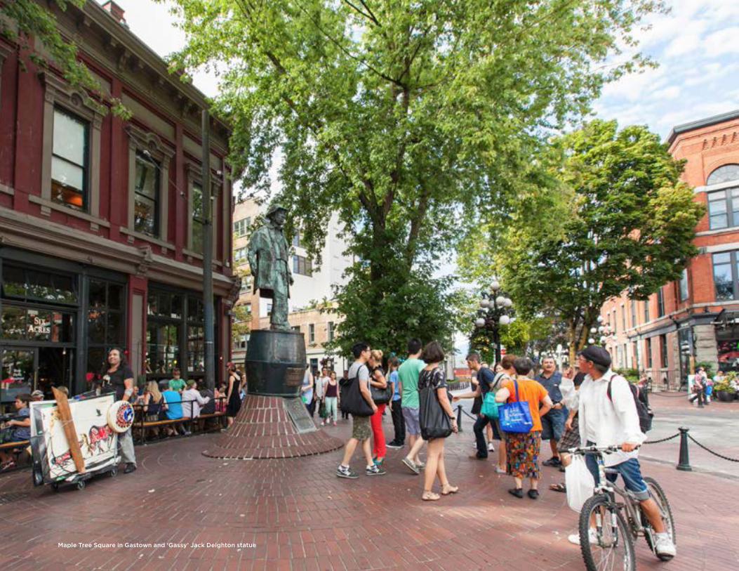
Maple Tree Square in Gastown and ‘Gassy’ Jack Deighton statue
6PLACES
A Community of NeighbourhoodsVancouver’s history can be traced in the places and people of the Downtown Eastside (DTES). From the Coast Salish people, and the old Granville town site to Chinatown and Powell Street (Japantown), the DTES is rich in history, culture and diversity. Settlement patterns and the area’s strong links to industry and related transportation routes are still visible in the physical environment. Today, the DTES remains an area of diverse neighbourhoods and communities, each with its own unique character, as well as challenges and opportunities. This plan respects this diversity, and also acknowledges that the DTES is part of the broader city, and like all neighbourhoods will need to accommodate change as the city grows.
The DTES Plan covers many distinct neighbourhoods and sub-areas, most of which contain a variety of mixed-uses, with residential, commercial and services uses. Each neighbourhood has a distinct personality which has developed over time, which together create the diverse and dynamic identity of the broader DTES area. While the DTES is rich with historic buildings and places, one of the key community assets is the people, with many having deep roots in the area. Each community’s sense of place can often be linked to significant historical events, spiritual connections to previous generations, diverse faiths, access to resources, the physical environment and built form. Special and valuable places are often connected by important walking routes and streets.
Through the planning process, the LAPP committee was instrumental in developing an understanding of “places”, and has clearly stated that a successful plan should have a coordinated approach to addressing the social and physical aspects of the neighbourhood. This input, along with input by the broader community and the existing policy context, ensured a comprehensive understanding of “places” in the neighbourhood. This understanding serves as the framework on which the plan is built, with diagrams illustrating this framework. As a result of this input, the plan sets out to strengthen the DTES as a community of neighbourhoods, and a healthy neighbourhood for all.
This chapter aims to describe how the various neighbourhoods of the DTES will evolve in the future, and identifies specific directions, policies, and strategies to guide and manage change and development. The sub-areas of the DTES are addressed under three categories: Neighbourhoods, Industrial Areas, and Special Opportunity Areas. This chapter should be read in conjunction with 7.0 Built Form, which provides specific details regarding heights and densities for each sub-area.
376.0 PlaCesDOWNTOWN EASTSIDE PLAN
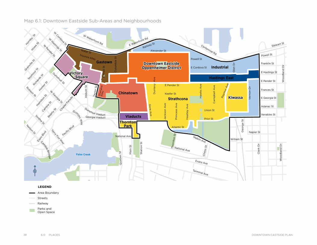
38 6.0 PlaCes DOWNTOWN EASTSIDE PLAN
Map 6.1: Downtown Eastside Sub-Areas and Neighbourhoods
VictorySquare
Kiwassa
Downtown EastsideOppenheimer District
Victory
Downtown EastsideOppenheimer District
Strathcona Kiwassa
Industrial
ThorntonPark
Viaducts
Square Hastings East
Gastown
Chinatown
Water StTrounce Alley
Alexander St
E Cordova St
Centennial Rd
Powell St
E Waterfront Rd
Railway St
W Waterfront Rd
William St William St
Powell St
Stewart St
Napier St
Venables St
Adanac St
Union St
Qu
eb
ec S
t
Ge
org
e S
t
Cla
rk D
r
Atlantic St
National Ave
Malkin Ave
Terminal Ave
Evans Ave
National Ave
Nelson St
Prior St
Franklin St
E Hastings St
Pandora St Triumph St
E Pender St
Frances St
E Georgia St
E Pender St
W Cordova St
W H
astings St
Dunsm
uir St
Robson St
W G
eorgia St
Smithe St
W Pender St
Cam
bie St
Sh
an
gh
ai
Alley
Bea
tty St C
itade
l Par
ade
Ham
ilton
St
Mainlan
d St
Hom
er S
tRicha
rds St
Hor
nby S
t
How
e St
Seym
our S
tGra
nville St
Keefer St
Go
re A
ve
Jackso
n A
ve
Sta
tio
n S
t
Main
St
Co
lum
bia
St
Pacifi
c Blvd
Terry Fox Way
Carr
all S
t
Ab
bo
tt S
t
Taylo
r S
t
Pri
ncess
Ave C
am
pb
ell A
ve
Raym
ur
Ave
Ve
rno
n D
r
Wo
od
lan
d D
rW
oo
dla
nd
Dr
Sals
bu
ry D
r
Gle
n D
r
Heatl
ey A
ve
Haw
ks
Ave
Th
orn
ton S
t
Ch
ess
St
Dunsmuir Viaduct
Expo
Blv
d
Georgia Viaduct
Griffiths W
ay
Cambie B
ridg
e
Du
nle
vy A
ve
Area Boundary
Streets
Railway
Parks andOpen Space
LEGEND
VictorySquare
Kiwassa
Downtown EastsideOppenheimer District
Victory
Downtown EastsideOppenheimer District
Strathcona Kiwassa
Industrial
ThorntonPark
Viaducts
Square Hastings East
Gastown
Chinatown
Water StTrounce Alley
Alexander St
E Cordova St
Centennial Rd
Powell St
E Waterfront Rd
Railway St
W Waterfront Rd
William St William St
Powell St
Stewart St
Napier St
Venables St
Adanac St
Union St
Qu
eb
ec S
t
Ge
org
e S
t
Cla
rk D
r
Atlantic St
National Ave
Malkin Ave
Terminal Ave
Evans Ave
National Ave
Nelson St
Prior St
Franklin St
E Hastings St
Pandora St Triumph St
E Pender St
Frances St
E Georgia St
E Pender St
W Cordova St
W Hastings St
Dunsmuir St
Robson St
W G
eorgia St
Smithe St
W Pender St
Cam
bie S
t
Sh
an
gh
ai
Alle
y
Beatt
y St Cita
del P
arad
e
Ham
ilton
St
Mai
nlan
d St
Hom
er S
t
Richa
rds St
Hor
nby
St
How
e St
Seym
our S
t
Gra
nville
St
Keefer St
Go
re A
ve
Jackso
n A
ve
Sta
tio
n S
t
Main
St
Co
lum
bia
St
Pacific
Blvd
Terry Fox Way
Carr
all
St
Ab
bo
tt S
t
Taylo
r S
t
Pri
ncess
Ave C
am
pb
ell
Ave
Ray
mur
Ave
Ve
rno
n D
r
Wo
od
lan
d D
rW
oo
dla
nd
Dr
Sals
bu
ry D
r
Gle
n D
r
Heatl
ey A
ve
Haw
ks
Ave
Th
orn
ton S
t
Ch
ess
St
Dunsmuir Viaduct
Expo
Blv
d
Georgia Viaduct
Griffiths Way
Cambie B
ridg
e
Du
nle
vy A
ve
Area Boundary
Streets
Railway
Parks andOpen Space
LEGEND
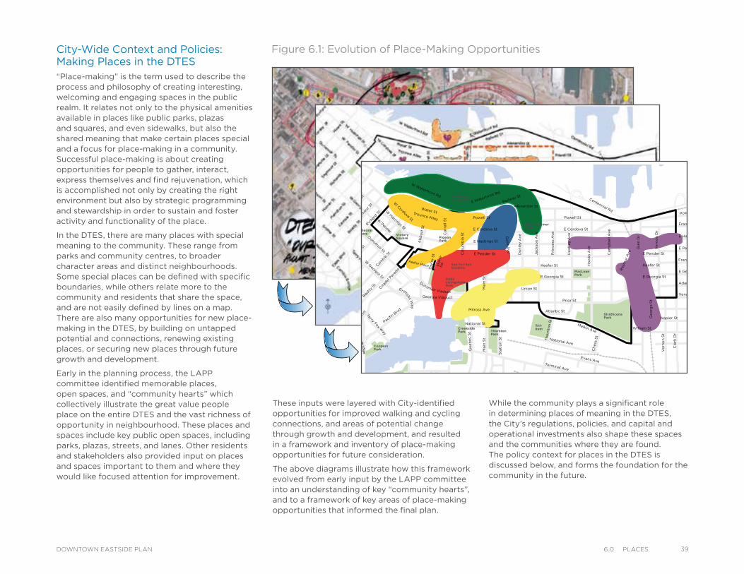
City-Wide Context and Policies: Making Places in the DTES“Place-making” is the term used to describe the process and philosophy of creating interesting, welcoming and engaging spaces in the public realm. It relates not only to the physical amenities available in places like public parks, plazas and squares, and even sidewalks, but also the shared meaning that make certain places special and a focus for place-making in a community. Successful place-making is about creating opportunities for people to gather, interact, express themselves and find rejuvenation, which is accomplished not only by creating the right environment but also by strategic programming and stewardship in order to sustain and foster activity and functionality of the place.
In the DTES, there are many places with special meaning to the community. These range from parks and community centres, to broader character areas and distinct neighbourhoods. Some special places can be defined with specific boundaries, while others relate more to the community and residents that share the space, and are not easily defined by lines on a map. There are also many opportunities for new place-making in the DTES, by building on untapped potential and connections, renewing existing places, or securing new places through future growth and development.
Early in the planning process, the LAPP committee identified memorable places, open spaces, and “community hearts” which collectively illustrate the great value people place on the entire DTES and the vast richness of opportunity in neighbourhood. These places and spaces include key public open spaces, including parks, plazas, streets, and lanes. Other residents and stakeholders also provided input on places and spaces important to them and where they would like focused attention for improvement.
Figure 6.1: Evolution of Place-Making Opportunities
These inputs were layered with City-identified opportunities for improved walking and cycling connections, and areas of potential change through growth and development, and resulted in a framework and inventory of place-making opportunities for future consideration.
The above diagrams illustrate how this framework evolved from early input by the LAPP committee into an understanding of key “community hearts”, and to a framework of key areas of place-making opportunities that informed the final plan.
While the community plays a significant role in determining places of meaning in the DTES, the City’s regulations, policies, and capital and operational investments also shape these spaces and the communities where they are found. The policy context for places in the DTES is discussed below, and forms the foundation for the community in the future.
PLACE
CANADA
SEAWALKHARBOURCOAL
STCO
LUM
BIA
DRI
VECO
MM
ERCI
AL
ST
COOK
DRI
VECO
TTO
N
COTT
RELL
ST
DAVIE ST
AV1STE
E 2ND AVE 2ND AV
EVELEIGH ST
GLE
N D
RIVE
STGRANT
HAMILT
ON ST
AVINDUSTRIAL
KITCHENER ST
ST
LORN
E
AV
MALKIN
STM
ANIT
OBA
MELVILLE ST
MIL
LBAN
K
STNAPIER
STO
NTA
RIO
STPARKER
STQ
UEB
EC
RAYM
UR
AV
DRI
VESA
LSBU
RY
SPYG
LASS
PLA
CE
ST
THUR
LOW
MEW
SKI
NG
HO
RNE
KINGHORN
E
AV
2ND
W
W CORDOVA ST
Marinaside Cres
HINGE PARK
VICTORIA PARK
STRA
THCO
NA
LIN
EAR
PARK
HELMCKENPARK
HARBOURGREEN PARK
ALICETOWNLEY
PARK
HINGE PARK
VICTORIA PARK
STRA
THCO
NA
LIN
EAR
PARK
HELMCKENPARK
HARBOURGREEN PARK
ALICETOWNLEY
PARK
1
MacLeanPark
OppenheimerPark
CRAB Parkat Portside
VictorySquare
Cathedral Square
Strathcona Park
Mosaic
Creek Park
WoodlandPark
Tril-lium
ThorntonPark
CreeksidePark
CoopersPark
Andy LivingstonePark
YaletownPark
Sun Yat-SenGardens
PigeonPark
DOWNTOWN EASTSIDE PLACES AND STRATEGIES
Powell St
Water StTrounce Alley
Keefer Place
Alexander St
E Cordova St E Cordova St
Centennial Rd
Powell St
E Waterfront Rd
Railway St
W Waterfront Rd
William St
Powell St
Stewart St
Napier St
Venables St
Adanac St
Union St
Qu
eb
ec S
t
Keefer St
E Georgia St
Ge
org
e S
t
Ve
rno
n S
t
Cla
rk D
r
E Georgia St
Atlantic St
National Ave
Malkin Ave
Terminal Ave
Evans Ave
Milross Ave
National St
Nelson St
Prior St
E Pender St
Franklin St
E Hastings St
E Pender St
Frances St
E Georgia St
E Hastings St
E Pender St
W Cordova St
W H
astings St
Dunsm
uir St
Robson St
W G
eorgia StSm
ithe St
W Pender
Cam
bie S
t
Sh
an
g-
hai
Bea
tty
St Cita
del P
arad
e
Ham
ilton
St
Hom
er S
tRic
hard
St
Horn
by S
tBur
rard
St
How
e St
Seym
our S
t
Gra
nvill
e St
Keefer St
Go
re A
ve
Ja
ckso
n A
ve
Du
nle
y A
ve
Main
St
Sta
tio
n S
t
Main
St
Co
lum
bia
St
Pacific B
lvd
Terry Fox Way
Carr
all
St
Ab
bo
tt S
t
Taylo
r S
t Pri
nce
ss A
ve
Cam
pb
ell
Ave
Ray
mur
Ave
Ve
rno
n D
r
Wo
od
lan
d D
rW
oo
dla
nd
Dr
Gle
n D
r
He
atl
ey A
ve
Haw
ks
Ave
Th
orn
ton S
t
Ch
ess
St
Dunsmuir Viaduct
Expo
Blv
d
Georgia Viaduct
Griffiths Way
Cambie B
ridg
e
396.0 PlaCesDOWNTOWN EASTSIDE PLAN
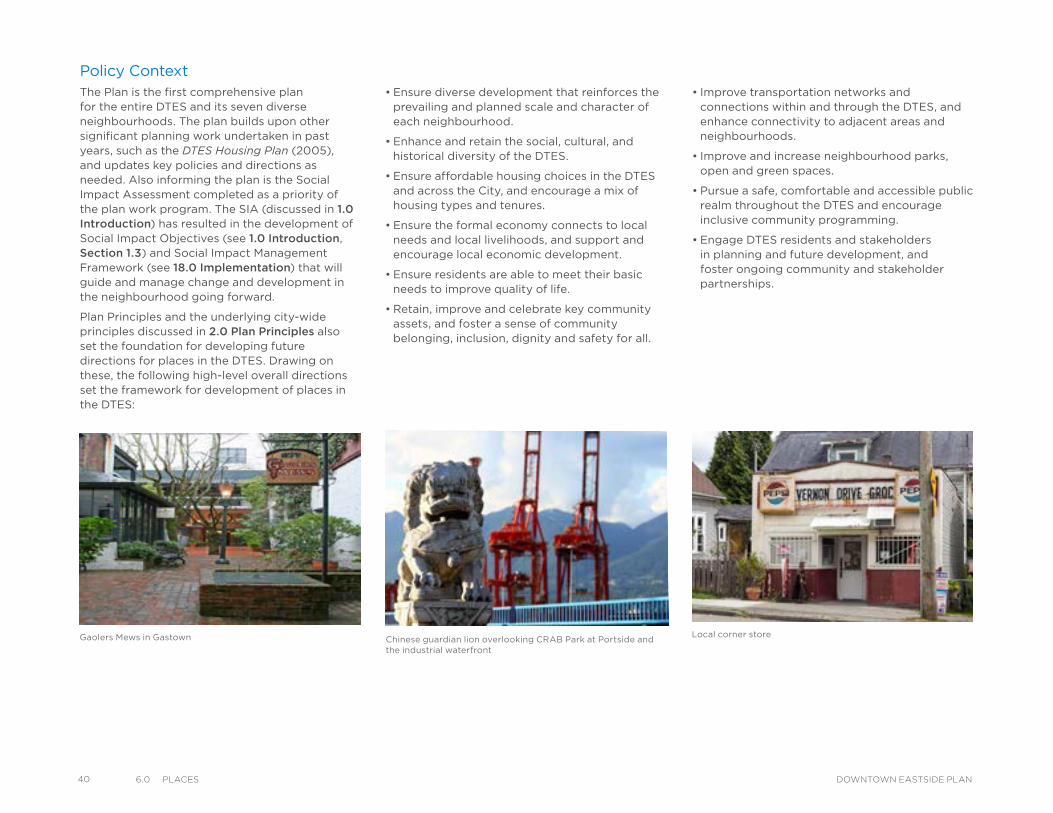
40 6.0 PlaCes DOWNTOWN EASTSIDE PLAN
• Ensure diverse development that reinforces the prevailing and planned scale and character of each neighbourhood.
• Enhance and retain the social, cultural, and historical diversity of the DTES.
• Ensure affordable housing choices in the DTES and across the City, and encourage a mix of housing types and tenures.
• Ensure the formal economy connects to local needs and local livelihoods, and support and encourage local economic development.
• Ensure residents are able to meet their basic needs to improve quality of life.
• Retain, improve and celebrate key community assets, and foster a sense of community belonging, inclusion, dignity and safety for all.
Chinese guardian lion overlooking CRAB Park at Portside and the industrial waterfront
Gaolers Mews in Gastown
Policy ContextThe Plan is the first comprehensive plan for the entire DTES and its seven diverse neighbourhoods. The plan builds upon other significant planning work undertaken in past years, such as the DTES Housing Plan (2005), and updates key policies and directions as needed. Also informing the plan is the Social Impact Assessment completed as a priority of the plan work program. The SIA (discussed in 1.0 Introduction) has resulted in the development of Social Impact Objectives (see 1.0 Introduction, Section 1.3) and Social Impact Management Framework (see 18.0 Implementation) that will guide and manage change and development in the neighbourhood going forward.
Plan Principles and the underlying city-wide principles discussed in 2.0 Plan Principles also set the foundation for developing future directions for places in the DTES. Drawing on these, the following high-level overall directions set the framework for development of places in the DTES:
• Improve transportation networks and connections within and through the DTES, and enhance connectivity to adjacent areas and neighbourhoods.
• Improve and increase neighbourhood parks, open and green spaces.
• Pursue a safe, comfortable and accessible public realm throughout the DTES and encourage inclusive community programming.
• Engage DTES residents and stakeholders in planning and future development, and foster ongoing community and stakeholder partnerships.
Local corner store
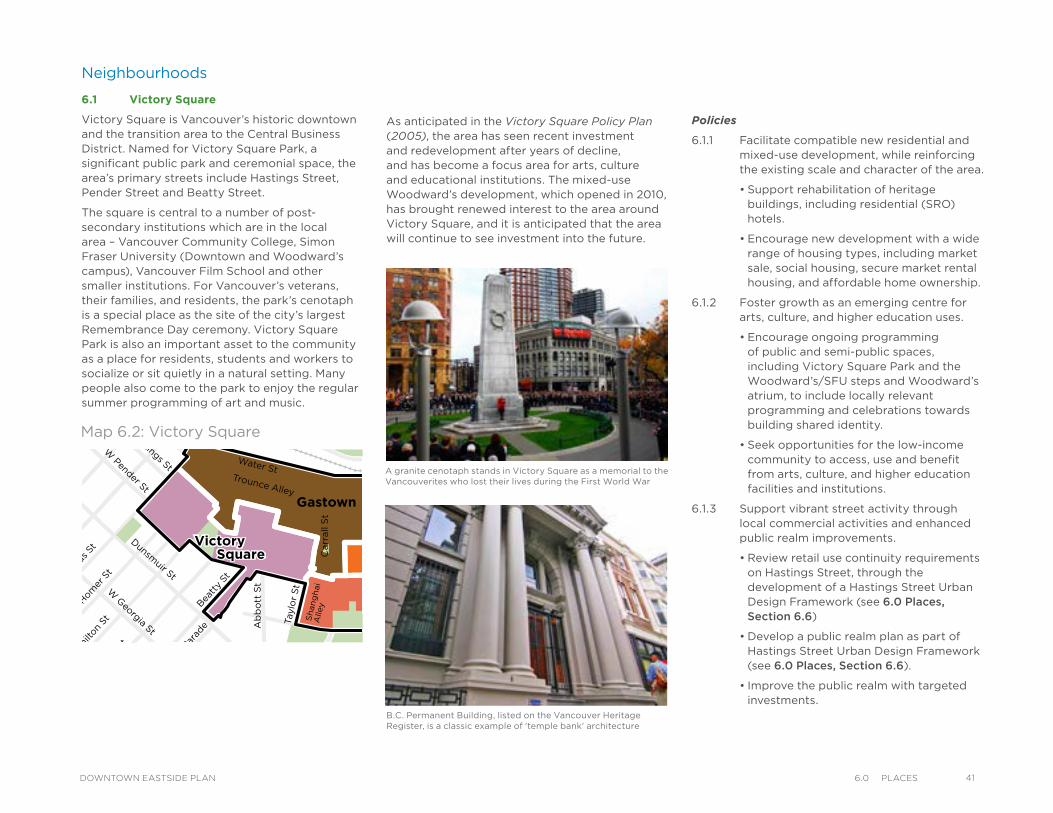
Neighbourhoods
6.1 Victory Square
Victory Square is Vancouver’s historic downtown and the transition area to the Central Business District. Named for Victory Square Park, a significant public park and ceremonial space, the area’s primary streets include Hastings Street, Pender Street and Beatty Street.
The square is central to a number of post-secondary institutions which are in the local area – Vancouver Community College, Simon Fraser University (Downtown and Woodward’s campus), Vancouver Film School and other smaller institutions. For Vancouver’s veterans, their families, and residents, the park’s cenotaph is a special place as the site of the city’s largest Remembrance Day ceremony. Victory Square Park is also an important asset to the community as a place for residents, students and workers to socialize or sit quietly in a natural setting. Many people also come to the park to enjoy the regular summer programming of art and music.
As anticipated in the Victory Square Policy Plan (2005), the area has seen recent investment and redevelopment after years of decline, and has become a focus area for arts, culture and educational institutions. The mixed-use Woodward’s development, which opened in 2010, has brought renewed interest to the area around Victory Square, and it is anticipated that the area will continue to see investment into the future.
VictorySquare
Kiwassa
Downtown EastsideOppenheimer District
Victory
Downtown EastsideOppenheimer District
Strathcona Kiwassa
Industrial
ThorntonPark
Viaducts
Square Hastings East
Gastown
Chinatown
Water StTrounce Alley
Alexander St
E Cordova St
Centennial Rd
Powell St
E Waterfront Rd
Railway St
W Waterfront Rd
William St William St
Powell St
Stewart St
Napier St
Venables St
Adanac St
Union St
Qu
eb
ec S
t
Ge
org
e S
t
Cla
rk D
r
Atlantic St
National Ave
Malkin Ave
Terminal Ave
Evans Ave
National Ave
Nelson St
Prior St
Franklin St
E Hastings St
Pandora St Triumph St
E Pender St
Frances St
E Georgia St
E Pender St
W Cordova St
W Hastings St
Dunsmuir St
Robson St
W G
eorgia St
Smithe St
W Pender St
Cam
bie S
t
Sh
an
gh
ai
Alle
yBeatt
y St
Cita
del P
arad
e
Ham
ilton
St
Mai
nlan
d St
Hom
er S
t
Richa
rds St
Hor
nby
St
How
e St
Seym
our S
t
Gra
nville
St
Keefer St
Go
re A
ve
Jackso
n A
ve
Sta
tio
n S
t
Main
St
Co
lum
bia
St
Pacific
Blvd
Terry Fox Way
Carr
all
St
Ab
bo
tt S
t
Taylo
r S
t
Pri
ncess
Ave C
am
pb
ell
Ave
Ray
mur
Ave
Ve
rno
n D
r
Wo
od
lan
d D
rW
oo
dla
nd
Dr
Sals
bu
ry D
r
Gle
n D
r
Heatl
ey A
ve
Haw
ks
Ave
Th
orn
ton S
t
Ch
ess
St
Dunsmuir Viaduct
Expo
Blv
d
Georgia Viaduct
Griffiths Way
Cambie B
ridg
e
Du
nle
vy A
ve
Area Boundary
Streets
Railway
Parks andOpen Space
LEGEND
Map 6.2: Victory Square
Policies
6.1.1 Facilitate compatible new residential and mixed-use development, while reinforcing the existing scale and character of the area.
• Support rehabilitation of heritage buildings, including residential (SRO) hotels.
• Encourage new development with a wide range of housing types, including market sale, social housing, secure market rental housing, and affordable home ownership.
6.1.2 Foster growth as an emerging centre for arts, culture, and higher education uses.
• Encourage ongoing programming of public and semi-public spaces, including Victory Square Park and the Woodward’s/SFU steps and Woodward’s atrium, to include locally relevant programming and celebrations towards building shared identity.
• Seek opportunities for the low-income community to access, use and benefit from arts, culture, and higher education facilities and institutions.
6.1.3 Support vibrant street activity through local commercial activities and enhanced public realm improvements.
• Review retail use continuity requirements on Hastings Street, through the development of a Hastings Street Urban Design Framework (see 6.0 Places, Section 6.6)
• Develop a public realm plan as part of Hastings Street Urban Design Framework (see 6.0 Places, Section 6.6).
• Improve the public realm with targeted investments.
A granite cenotaph stands in Victory Square as a memorial to the Vancouverites who lost their lives during the First World War
B.C. Permanent Building, listed on the Vancouver Heritage Register, is a classic example of 'temple bank' architecture
416.0 PlaCesDOWNTOWN EASTSIDE PLAN
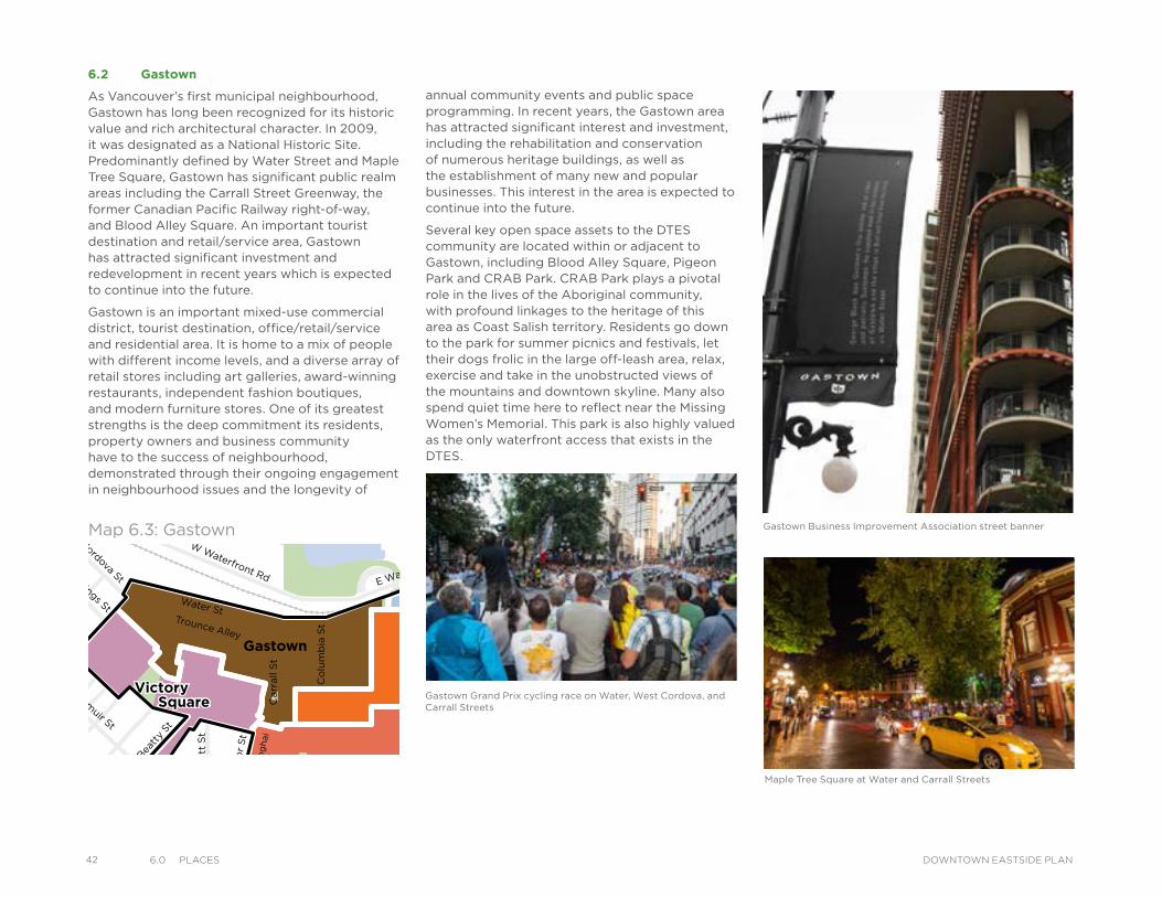
42 6.0 PlaCes DOWNTOWN EASTSIDE PLAN
6.2 Gastown
As Vancouver’s first municipal neighbourhood, Gastown has long been recognized for its historic value and rich architectural character. In 2009, it was designated as a National Historic Site. Predominantly defined by Water Street and Maple Tree Square, Gastown has significant public realm areas including the Carrall Street Greenway, the former Canadian Pacific Railway right-of-way, and Blood Alley Square. An important tourist destination and retail/service area, Gastown has attracted significant investment and redevelopment in recent years which is expected to continue into the future.
Gastown is an important mixed-use commercial district, tourist destination, office/retail/service and residential area. It is home to a mix of people with different income levels, and a diverse array of retail stores including art galleries, award-winning restaurants, independent fashion boutiques, and modern furniture stores. One of its greatest strengths is the deep commitment its residents, property owners and business community have to the success of neighbourhood, demonstrated through their ongoing engagement in neighbourhood issues and the longevity of
annual community events and public space programming. In recent years, the Gastown area has attracted significant interest and investment, including the rehabilitation and conservation of numerous heritage buildings, as well as the establishment of many new and popular businesses. This interest in the area is expected to continue into the future.
Several key open space assets to the DTES community are located within or adjacent to Gastown, including Blood Alley Square, Pigeon Park and CRAB Park. CRAB Park plays a pivotal role in the lives of the Aboriginal community, with profound linkages to the heritage of this area as Coast Salish territory. Residents go down to the park for summer picnics and festivals, let their dogs frolic in the large off-leash area, relax, exercise and take in the unobstructed views of the mountains and downtown skyline. Many also spend quiet time here to reflect near the Missing Women’s Memorial. This park is also highly valued as the only waterfront access that exists in the DTES.
VictorySquare
Kiwassa
Downtown EastsideOppenheimer District
Victory
Downtown EastsideOppenheimer District
Strathcona Kiwassa
Industrial
ThorntonPark
Viaducts
Square Hastings East
Gastown
Chinatown
Water StTrounce Alley
Alexander St
E Cordova St
Centennial Rd
Powell St
E Waterfront Rd
Railway St
W Waterfront Rd
William St William St
Powell St
Stewart St
Napier St
Venables St
Adanac St
Union St
Qu
eb
ec S
t
Ge
org
e S
t
Cla
rk D
rAtlantic St
National Ave
Malkin Ave
Terminal Ave
Evans Ave
National Ave
Nelson St
Prior St
Franklin St
E Hastings St
Pandora St Triumph St
E Pender St
Frances St
E Georgia St
E Pender St
W Cordova St
W Hastings St
Dunsmuir St
Robson St
W G
eorgia St
Smithe St
W Pender St
Cam
bie S
t
Sh
an
gh
ai
Alle
yBeatt
y St
Cita
del P
arad
e
Ham
ilton
St
Mai
nlan
d St
Hom
er S
t
Richa
rds St
Hor
nby
St
How
e St
Seym
our S
t
Gra
nville
St
Keefer St
Go
re A
ve
Jackso
n A
ve
Sta
tio
n S
t
Main
St
Co
lum
bia
St
Pacific
Blvd
Terry Fox Way
Carr
all
St
Ab
bo
tt S
t
Taylo
r S
t
Pri
ncess
Ave C
am
pb
ell
Ave
Ray
mur
Ave
Ve
rno
n D
r
Wo
od
lan
d D
rW
oo
dla
nd
Dr
Sals
bu
ry D
r
Gle
n D
r
Heatl
ey A
ve
Haw
ks
Ave
Th
orn
ton S
t
Ch
ess
St
Dunsmuir Viaduct
Expo
Blv
d
Georgia Viaduct
Griffiths Way
Cambie B
ridg
e
Du
nle
vy A
ve
Area Boundary
Streets
Railway
Parks andOpen Space
LEGEND
Map 6.3: Gastown
Gastown Grand Prix cycling race on Water, West Cordova, and Carrall Streets
Gastown Business Improvement Association street banner
Maple Tree Square at Water and Carrall Streets
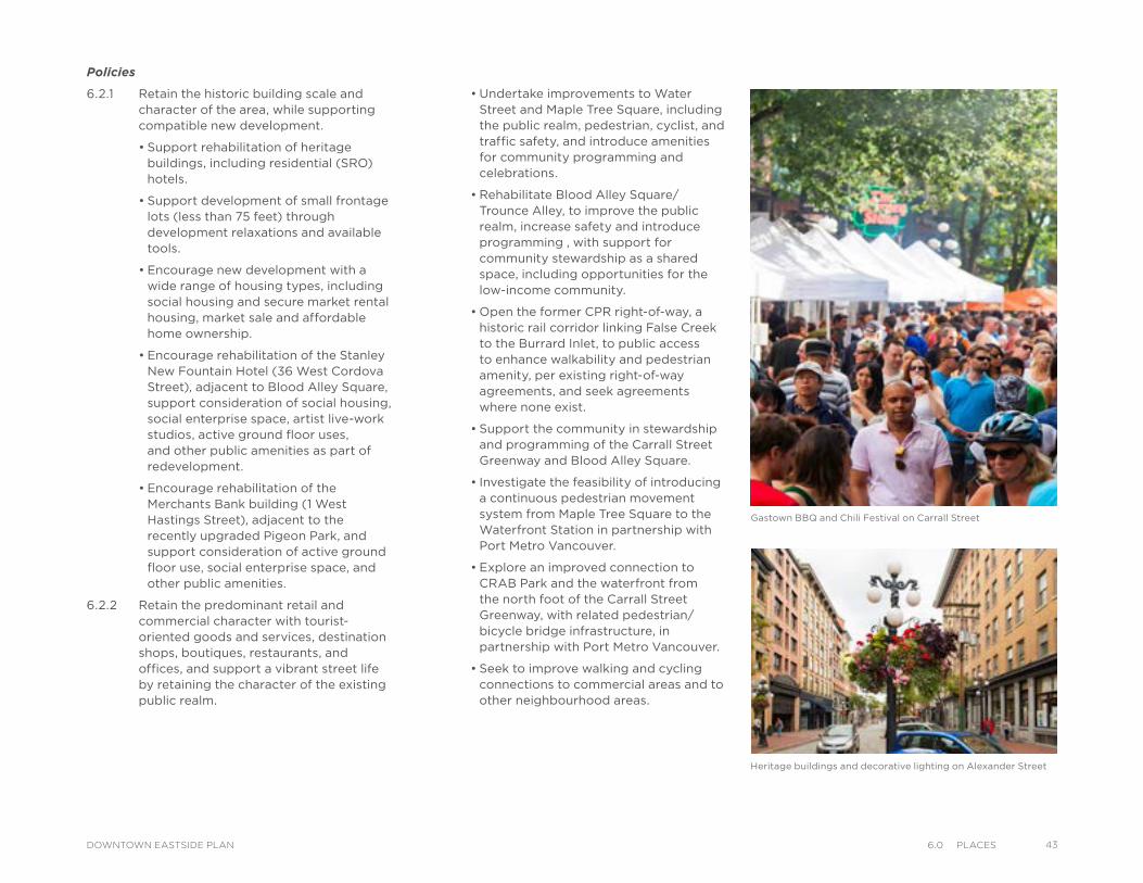
Policies
6.2.1 Retain the historic building scale and character of the area, while supporting compatible new development.
• Support rehabilitation of heritage buildings, including residential (SRO) hotels.
• Support development of small frontage lots (less than 75 feet) through development relaxations and available tools.
• Encourage new development with a wide range of housing types, including social housing and secure market rental housing, market sale and affordable home ownership.
• Encourage rehabilitation of the Stanley New Fountain Hotel (36 West Cordova Street), adjacent to Blood Alley Square, support consideration of social housing, social enterprise space, artist live-work studios, active ground floor uses, and other public amenities as part of redevelopment.
• Encourage rehabilitation of the Merchants Bank building (1 West Hastings Street), adjacent to the recently upgraded Pigeon Park, and support consideration of active ground floor use, social enterprise space, and other public amenities.
6.2.2 Retain the predominant retail and commercial character with tourist-oriented goods and services, destination shops, boutiques, restaurants, and offices, and support a vibrant street life by retaining the character of the existing public realm.
Gastown BBQ and Chili Festival on Carrall Street
• Undertake improvements to Water Street and Maple Tree Square, including the public realm, pedestrian, cyclist, and traffic safety, and introduce amenities for community programming and celebrations.
• Rehabilitate Blood Alley Square/Trounce Alley, to improve the public realm, increase safety and introduce programming , with support for community stewardship as a shared space, including opportunities for the low-income community.
• Open the former CPR right-of-way, a historic rail corridor linking False Creek to the Burrard Inlet, to public access to enhance walkability and pedestrian amenity, per existing right-of-way agreements, and seek agreements where none exist.
• Support the community in stewardship and programming of the Carrall Street Greenway and Blood Alley Square.
• Investigate the feasibility of introducing a continuous pedestrian movement system from Maple Tree Square to the Waterfront Station in partnership with Port Metro Vancouver.
• Explore an improved connection to CRAB Park and the waterfront from the north foot of the Carrall Street Greenway, with related pedestrian/bicycle bridge infrastructure, in partnership with Port Metro Vancouver.
• Seek to improve walking and cycling connections to commercial areas and to other neighbourhood areas.
Heritage buildings and decorative lighting on Alexander Street
436.0 PlaCesDOWNTOWN EASTSIDE PLAN
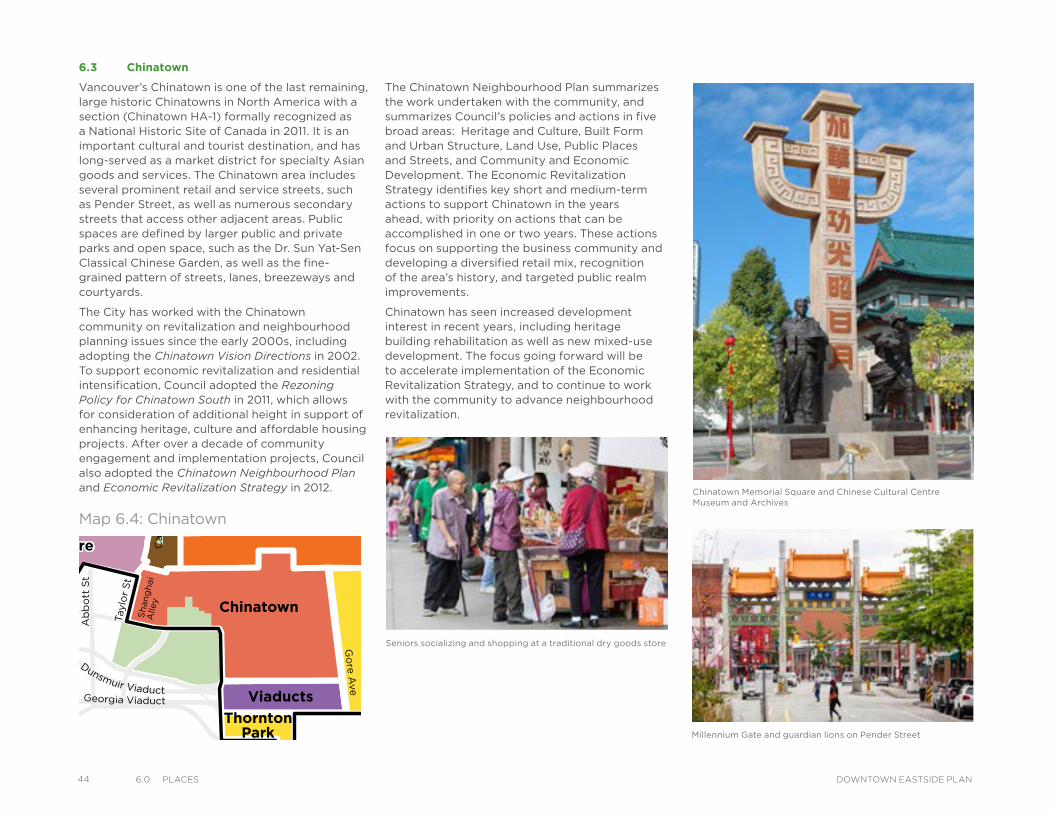
44 6.0 PlaCes DOWNTOWN EASTSIDE PLAN
6.3 Chinatown
Vancouver’s Chinatown is one of the last remaining, large historic Chinatowns in North America with a section (Chinatown HA-1) formally recognized as a National Historic Site of Canada in 2011. It is an important cultural and tourist destination, and has long-served as a market district for specialty Asian goods and services. The Chinatown area includes several prominent retail and service streets, such as Pender Street, as well as numerous secondary streets that access other adjacent areas. Public spaces are defined by larger public and private parks and open space, such as the Dr. Sun Yat-Sen Classical Chinese Garden, as well as the fine-grained pattern of streets, lanes, breezeways and courtyards.
The City has worked with the Chinatown community on revitalization and neighbourhood planning issues since the early 2000s, including adopting the Chinatown Vision Directions in 2002. To support economic revitalization and residential intensification, Council adopted the Rezoning Policy for Chinatown South in 2011, which allows for consideration of additional height in support of enhancing heritage, culture and affordable housing projects. After over a decade of community engagement and implementation projects, Council also adopted the Chinatown Neighbourhood Plan and Economic Revitalization Strategy in 2012.
The Chinatown Neighbourhood Plan summarizes the work undertaken with the community, and summarizes Council’s policies and actions in five broad areas: Heritage and Culture, Built Form and Urban Structure, Land Use, Public Places and Streets, and Community and Economic Development. The Economic Revitalization Strategy identifies key short and medium-term actions to support Chinatown in the years ahead, with priority on actions that can be accomplished in one or two years. These actions focus on supporting the business community and developing a diversified retail mix, recognition of the area’s history, and targeted public realm improvements.
Chinatown has seen increased development interest in recent years, including heritage building rehabilitation as well as new mixed-use development. The focus going forward will be to accelerate implementation of the Economic Revitalization Strategy, and to continue to work with the community to advance neighbourhood revitalization.
Chinatown Memorial Square and Chinese Cultural Centre Museum and Archives
VictorySquare
Kiwassa
Downtown EastsideOppenheimer District
Victory
Downtown EastsideOppenheimer District
Strathcona Kiwassa
Industrial
ThorntonPark
Viaducts
Square Hastings East
Gastown
Chinatown
Water StTrounce Alley
Alexander St
E Cordova St
Centennial Rd
Powell St
E Waterfront Rd
Railway St
W Waterfront Rd
William St William St
Powell St
Stewart St
Napier St
Venables St
Adanac St
Union St
Qu
eb
ec S
t
Ge
org
e S
t
Cla
rk D
r
Atlantic St
National Ave
Malkin Ave
Terminal Ave
Evans Ave
National Ave
Nelson St
Prior St
Franklin St
E Hastings St
Pandora St Triumph St
E Pender St
Frances St
E Georgia St
E Pender St
W Cordova St
W Hastings St
Dunsmuir St
Robson St
W G
eorgia St
Smithe St
W Pender St
Cam
bie S
t
Sh
an
gh
ai
Alle
yBeatt
y St
Cita
del P
arad
e
Ham
ilton
St
Mai
nlan
d St
Hom
er S
t
Richa
rds St
Hor
nby
St
How
e St
Seym
our S
t
Gra
nville
St
Keefer St
Go
re A
ve
Jackso
n A
ve
Sta
tio
n S
t
Main
St
Co
lum
bia
St
Pacific
Blvd
Terry Fox Way
Carr
all
St
Ab
bo
tt S
t
Taylo
r S
t
Pri
ncess
Ave C
am
pb
ell
Ave
Ray
mur
Ave
Ve
rno
n D
r
Wo
od
lan
d D
rW
oo
dla
nd
Dr
Sals
bu
ry D
r
Gle
n D
r
Heatl
ey A
ve
Haw
ks
Ave
Th
orn
ton S
t
Ch
ess
St
Dunsmuir Viaduct
Expo
Blv
d
Georgia Viaduct
Griffiths Way
Cambie B
ridg
e
Du
nle
vy A
ve
Area Boundary
Streets
Railway
Parks andOpen Space
LEGEND
Seniors socializing and shopping at a traditional dry goods store
Map 6.4: Chinatown
Millennium Gate and guardian lions on Pender Street
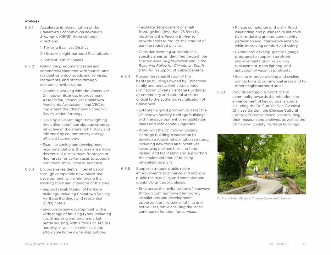
Policies
6.3.1 Accelerate implementation of the Chinatown Economic Revitalization Strategy’s (CERS) three strategic directions:
1. Thriving Business District
2. Historic Neighbourhood Revitalization
3. Vibrant Public Spaces
6.3.2 Retain the predominant retail and commercial character with tourist- and resident-oriented goods and services, restaurants, and offices through economic revitalization.
• Continue working with the Vancouver Chinatown Business Improvement Association, Vancouver Chinatown Merchants Association, and VEC to implement the Chinatown Economic Revitalization Strategy.
• Develop a vibrant night time lighting (including neon) and signage strategy reflective of the area’s rich history and informed by contemporary energy efficient technology.
• Examine zoning and development recommendations that may arise from this work (i.e. maximum frontages or floor areas for certain uses to support and retain small, local businesses).
6.3.3 Encourage residential intensification through compatible new mixed-use development, while reinforcing the existing scale and character of the area.
• Support rehabilitation of heritage buildings including Chinatown Society Heritage Buildings and residential (SRO) hotels.
• Encourage new development with a wide range of housing types, including social housing and secure market rental housing, with a focus on seniors housing as well as market sale and affordable home ownership options.
• Facilitate development of small frontage lots (less than 75 feet) by modifying the Parking By-law to provide tools to reduce the amount of parking required on site.
• Consider rezoning applications in specific areas as identified through the Historic Area Height Review and in the Rezoning Policy for Chinatown South (HA-1A) in support of public benefits.
6.3.4 Pursue the rehabilitation of the heritage buildings owned by Chinatown family and benevolent associations (Chinatown Society Heritage Buildings), as community and cultural anchors critical to the authentic revitalization of Chinatown.
• Establish a grant program to assist the Chinatown Society Heritage Buildings with the development of rehabilitation plans and with capital upgrades.
• Work with the Chinatown Society Heritage Building Association to develop a robust rehabilitation strategy, including new tools and incentives, leveraging partnerships and fund-raising, and facilitating and supporting the implementation of building rehabilitation plans.
6.3.5 Support strategic public realm improvements to enhance and improve public realm quality and amenities and create vibrant public places.
• Encourage the revitalization of laneways through community-led temporary installations and development opportunities, including lighting and active uses, while ensuring the lanes continue to function for services.
• Pursue completion of the Silk Road wayfinding and public realm initiative by introducing greater connectivity, pedestrian and interpretive amenity while improving comfort and safety.
• Extend and develop special signage programs to support storefront improvements, such as awning replacement, neon lighting, and activation of vacant storefronts.
• Seek to improve walking and cycling connections to commercial areas and to other neighbourhood areas.
6.3.6 Provide strategic support to the community towards the retention and enhancement of key cultural anchors including the Dr. Sun Yat-Sen Classical Chinese Garden, the Chinese Cultural Centre of Greater Vancouver including their museum and archives, as well as the Chinatown Society Heritage buildings.
Dr. Sun Yat-Sen Classical Chinese Garden in Chinatown
456.0 PlaCesDOWNTOWN EASTSIDE PLAN
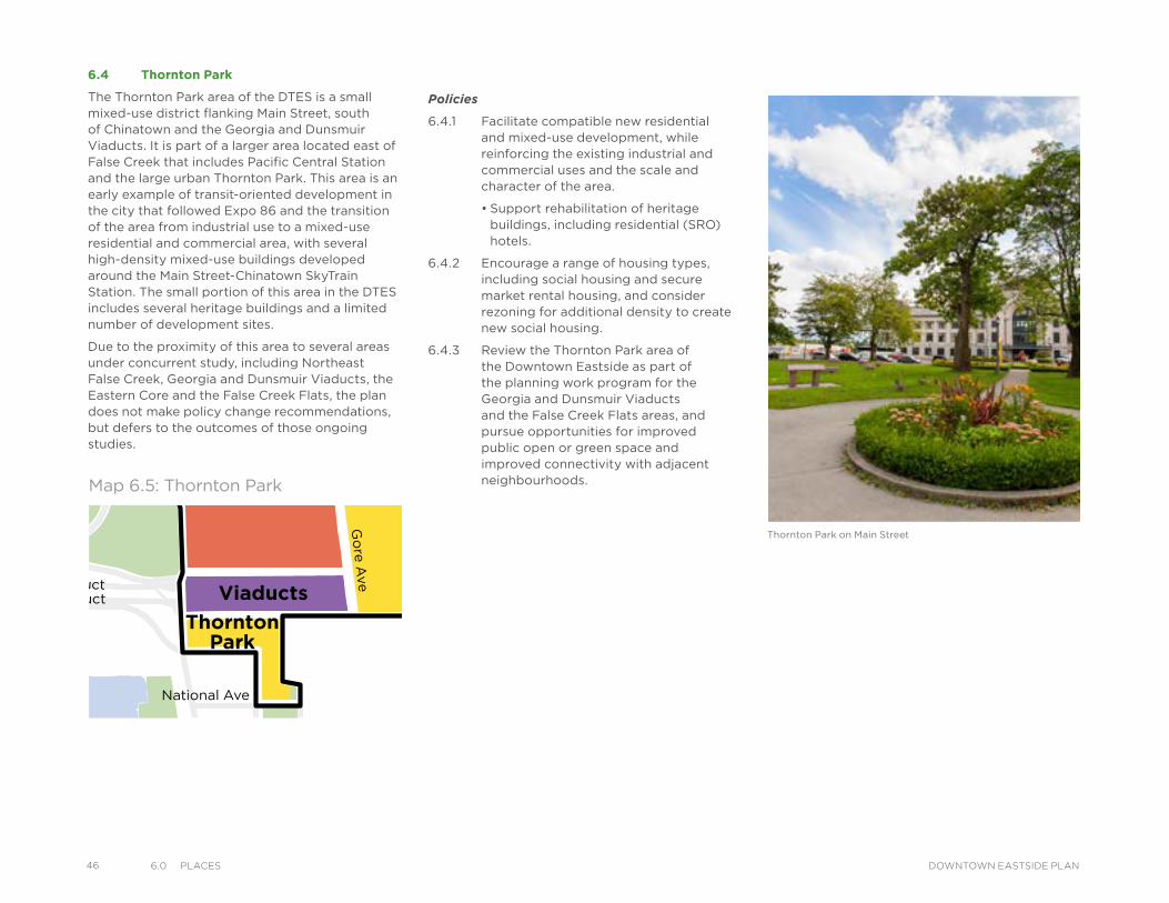
46 6.0 PlaCes DOWNTOWN EASTSIDE PLAN
Policies
6.4.1 Facilitate compatible new residential and mixed-use development, while reinforcing the existing industrial and commercial uses and the scale and character of the area.
• Support rehabilitation of heritage buildings, including residential (SRO) hotels.
6.4.2 Encourage a range of housing types, including social housing and secure market rental housing, and consider rezoning for additional density to create new social housing.
6.4.3 Review the Thornton Park area of the Downtown Eastside as part of the planning work program for the Georgia and Dunsmuir Viaducts and the False Creek Flats areas, and pursue opportunities for improved public open or green space and improved connectivity with adjacent neighbourhoods.
6.4 Thornton Park
The Thornton Park area of the DTES is a small mixed-use district flanking Main Street, south of Chinatown and the Georgia and Dunsmuir Viaducts. It is part of a larger area located east of False Creek that includes Pacific Central Station and the large urban Thornton Park. This area is an early example of transit-oriented development in the city that followed Expo 86 and the transition of the area from industrial use to a mixed-use residential and commercial area, with several high-density mixed-use buildings developed around the Main Street-Chinatown SkyTrain Station. The small portion of this area in the DTES includes several heritage buildings and a limited number of development sites.
Due to the proximity of this area to several areas under concurrent study, including Northeast False Creek, Georgia and Dunsmuir Viaducts, the Eastern Core and the False Creek Flats, the plan does not make policy change recommendations, but defers to the outcomes of those ongoing studies.
VictorySquare
Kiwassa
Downtown EastsideOppenheimer District
Victory
Downtown EastsideOppenheimer District
Strathcona Kiwassa
Industrial
ThorntonPark
Viaducts
Square Hastings East
Gastown
Chinatown
Water StTrounce Alley
Alexander St
E Cordova St
Centennial Rd
Powell St
E Waterfront Rd
Railway St
W Waterfront Rd
William St William St
Powell St
Stewart St
Napier St
Venables St
Adanac St
Union St
Qu
eb
ec S
t
Ge
org
e S
t
Cla
rk D
r
Atlantic St
National Ave
Malkin Ave
Terminal Ave
Evans Ave
National Ave
Nelson St
Prior St
Franklin St
E Hastings St
Pandora St Triumph St
E Pender St
Frances St
E Georgia St
E Pender St
W Cordova St
W Hastings St
Dunsmuir St
Robson St
W G
eorgia St
Smithe St
W Pender St
Cam
bie S
t
Sh
an
gh
ai
Alle
yBeatt
y St
Citadel
Par
ade
Ham
ilton
St
Mai
nlan
d St
Hom
er S
t
Richa
rds St
Hor
nby
St
How
e St
Seym
our S
t
Gra
nville
St
Keefer St
Go
re A
ve
Jackso
n A
ve
Sta
tio
n S
t
Main
St
Co
lum
bia
St
Pacific
Blvd
Terry Fox Way
Carr
all
St
Ab
bo
tt S
t
Tay
lor
St
Pri
ncess
Ave C
am
pb
ell
Ave
Ray
mur
Ave
Ve
rno
n D
r
Wo
od
lan
d D
rW
oo
dla
nd
Dr
Sals
bu
ry D
r
Gle
n D
r
Heatl
ey A
ve
Haw
ks
Ave
Th
orn
ton S
t
Ch
ess
St
Dunsmuir Viaduct
Expo
Blv
d
Georgia Viaduct
Griffiths Way
Cambie B
ridg
e
Du
nle
vy A
ve
Area Boundary
Streets
Railway
Parks andOpen Space
LEGEND
Map 6.5: Thornton Park
Thornton Park on Main Street
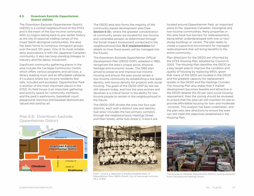
6.5 Downtown Eastside Oppenheimer District (DEOD)
The Downtown Eastside Oppenheimer District (DEOD) is a central neighbourhood of the DTES and is the heart of the low-income community. With its origins dating back to pre-settler history as the site of seasonal trading camps of the Coast Salish aboriginal communities, the area has been home to numerous immigrant groups over the past 120 years. One of its most notable early associations is with the Japanese-Canadian community. It also has long-standing linkages to industry and the labour movement.
Significant community gathering places in the area include the Carnegie Community Centre, which offers various programs and services, a library reading room and an affordable cafeteria. It's a place where low-income residents feel safe, included and accepted. Oppenheimer Park is another of the most important places in the DTES. Its field house is an important gathering and activity space for community members, and the park’s washrooms, basketball court, playground, benches and baseball diamond are valued and used by all.
The Downtown Eastside Oppenheimer District, looking eastward from Columbia and Hastings Street
VictorySquare
Kiwassa
Downtown EastsideOppenheimer District
Victory
Downtown EastsideOppenheimer District
Strathcona Kiwassa
Industrial
ThorntonPark
Viaducts
Square Hastings East
Gastown
Chinatown
Water StTrounce Alley
Alexander St
E Cordova St
Centennial Rd
Powell St
E Waterfront Rd
Railway St
W Waterfront Rd
William St William St
Powell St
Stewart St
Napier St
Venables St
Adanac St
Union St
Qu
eb
ec S
t
Ge
org
e S
t
Cla
rk D
r
Atlantic St
National Ave
Malkin Ave
Terminal Ave
Evans Ave
National Ave
Nelson St
Prior St
Franklin St
E Hastings St
Pandora St Triumph St
E Pender St
Frances St
E Georgia St
E Pender St
W Cordova St
W Hastings St
Dunsmuir St
Robson St
W G
eorgia St
Smithe St
W Pender St
Cam
bie S
t
Sh
an
gh
ai
Alle
y
Beatt
y St Cita
del P
arad
e
Ham
ilton
St
Mai
nlan
d St
Hom
er S
t
Richa
rds St
Hor
nby
St
How
e St
Seym
our S
t
Gra
nville
St
Keefer St
Go
re A
ve
Jackso
n A
ve
Sta
tio
n S
t
Main
St
Co
lum
bia
St
Pacific
Blvd
Terry Fox Way
Carr
all
St
Ab
bo
tt S
t
Taylo
r S
t
Pri
ncess
Ave C
am
pb
ell
Ave
Ray
mur
Ave
Ve
rno
n D
r
Wo
od
lan
d D
rW
oo
dla
nd
Dr
Sals
bu
ry D
r
Gle
n D
r
Heatl
ey A
ve
Haw
ks
Ave
Th
orn
ton S
t
Ch
ess
St
Dunsmuir Viaduct
Expo
Blv
d
Georgia Viaduct
Griffiths Way
Cambie B
ridg
e
Du
nle
vy A
ve
Area Boundary
Streets
Railway
Parks andOpen Space
LEGENDMap 6.6: Downtown Eastside Oppenheimer District
The DEOD area also forms the majority of the community-based development area (See Section 6.10), where the greatest concentration of community assets are located for low-income and vulnerable people, as determined through the Social Impact Assessment conducted in the neighbourhood.(See 18.0 Implementation for details on how these assets will be managed into the future).
The Downtown Eastside Oppenheimer Official Development Plan (DEOD ODP), adopted in 1982, recognizes the area’s unique social, physical, heritage and economic issues. The 1982 plan aimed to preserve and improve low-income housing and ensure the area would remain a low-income community by establishing a low-base density, with bonus density for projects with social housing. The goals of the DEOD ODP by-law are still relevant today, and how the area evolves and develops is a critical factor in the ability for low-income people to remain in the neighbourhood in the future.
The DEOD ODP divides the area into four sub-districts, each with a distinct role and identity. Sub-area 1 includes the two primary corridors through the neighbourhood, Hastings Street and Main Street, while Sub-Areas 2, 3 and 4 are
Asahi Juniors, a Japanese-Canadian baseball team, in Oppenheimer Park (1923) (Credit: City of Vancouver Archives, 46-a JCNM)
located around Oppenheimer Park, an important place to the Japanese-Canadian, Aboriginal and low-income communities. Many properties in this area have low-barriers for redevelopment, being either underdeveloped with one-or two-storey buildings or vacant. The plan seeks to create a supportive environment for managed redevelopment that will bring benefits to the entire community.
Plan directions for the DEOD are informed by the DTES Housing Plan, adopted by Council in 2005. The Housing Plan identifies the DEOD as a key target area to improve the condition and quality of housing by replacing SROs, given that many of the SROs are located in the DEOD and the greatest capacity for replacement resides in the DEOD and the Hastings Corridor. The Housing Plan also states that if market development becomes feasible and attractive in the DEOD despite the 20 per cent social housing requirement, then the zoning should be reviewed to ensure that the area can still maintain its role to provide affordable housing for low- and moderate -incomes. This analysis has been undertaken, and the plan sets new directions to ensure the area can still meet the objectives established in the Housing Plan.
476.0 PlaCesDOWNTOWN EASTSIDE PLAN
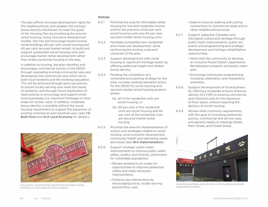
48 6.0 PlaCes DOWNTOWN EASTSIDE PLAN
The plan affirms the base development rights for the neighbourhood, and updates the zoning’s bonus density mechanism to meet the goals of the Housing Plan by prioritizing the area for rental housing. Using innovative development models, the City will encourage mixed-income rental buildings (60 per cent social housing and 40 per cent secured market rental), to build and support sustainable social housing units and encourage market rental development rather than strata-ownership housing in the area.
In addition to housing, the plan identifies and encourages commercial activity in the DEOD through upgrading existing commercial uses and developing new commercial uses which serve both local residents and the working population. This will be achieved through land-use policies to ensure locally-serving uses meet the needs of residents, and through future exploration of retail policies to encourage and support small, local businesses (i.e. maximum frontages or floor areas for certain uses). In addition, moderate bonus density is available without the social housing requirement to support the expansion of existing commercial and industrial uses. (See 7.0 Built Form and 10.0 Local Economy for details.)
Policies
6.5.1 Prioritize the area for affordable rental housing for low and moderate income and for the provision of 60 per cent social housing units and 40 per cent secured market rental housing units.
6.5.2 Facilitate compatible new residential and mixed-use development, while reinforcing the existing scale and character of the area.
6.5.3 Support developments with social housing or significant heritage assets by offering additional height and related bonus density.
6.5.4 Pending the completion of a comprehensive parking strategy for the area, consider parking relaxation policy for the DEOD for social housing and secured market rental housing projects where:
(a) all of the residential units are social housing; or
(b) 60 per cent of the residential units are social housing and 40 per cent of the residential units are secured market rental housing.
6.5.5 Prioritize the area for implementation of actions and strategies related to social housing, local economic development, community health and well-being needs and issues (see 18.0 Implementation).
6.5.6 Support strategic public realm improvements to improve public realm safety, quality, and amenity, particularly for vulnerable populations.
• Review existing truck routes for opportunities to improve pedestrian safety and make necessary improvements.
• Enhance key intersections by encouraging active, locally-serving ground floor uses.
Industrial businesses and activities in the Downtown Eastside Oppenheimer District
City-owned social facilities, like the Evelyne Saller Centre, prioritize survival needs for DTES residents
• Seek to improve walking and cycling connections to commercial areas and to other neighbourhood areas.
6.5.7 Support Japanese-Canadian and Aboriginal culture and heritage through public realm improvements, public art, events and programming and strategic development and heritage rehabilitation opportunities.
• Work with the community to develop an inclusive Powell Street (Japantown) Revitalization program and public realm plan.
• Encourage community programming including celebration, and interpretive amenities.
6.5.8 Support the expansion of local business by offering a moderate amount of bonus density (0.5 FSR) to existing commercial and industrial uses for the expansion of floor space, without requiring the delivery of social housing.
6.5.9 Review retail continuity requirements, with the goal of increasing pedestrian activity, commercial and service uses, and general vitality to Hastings Street, Main Street, and Powell Street.
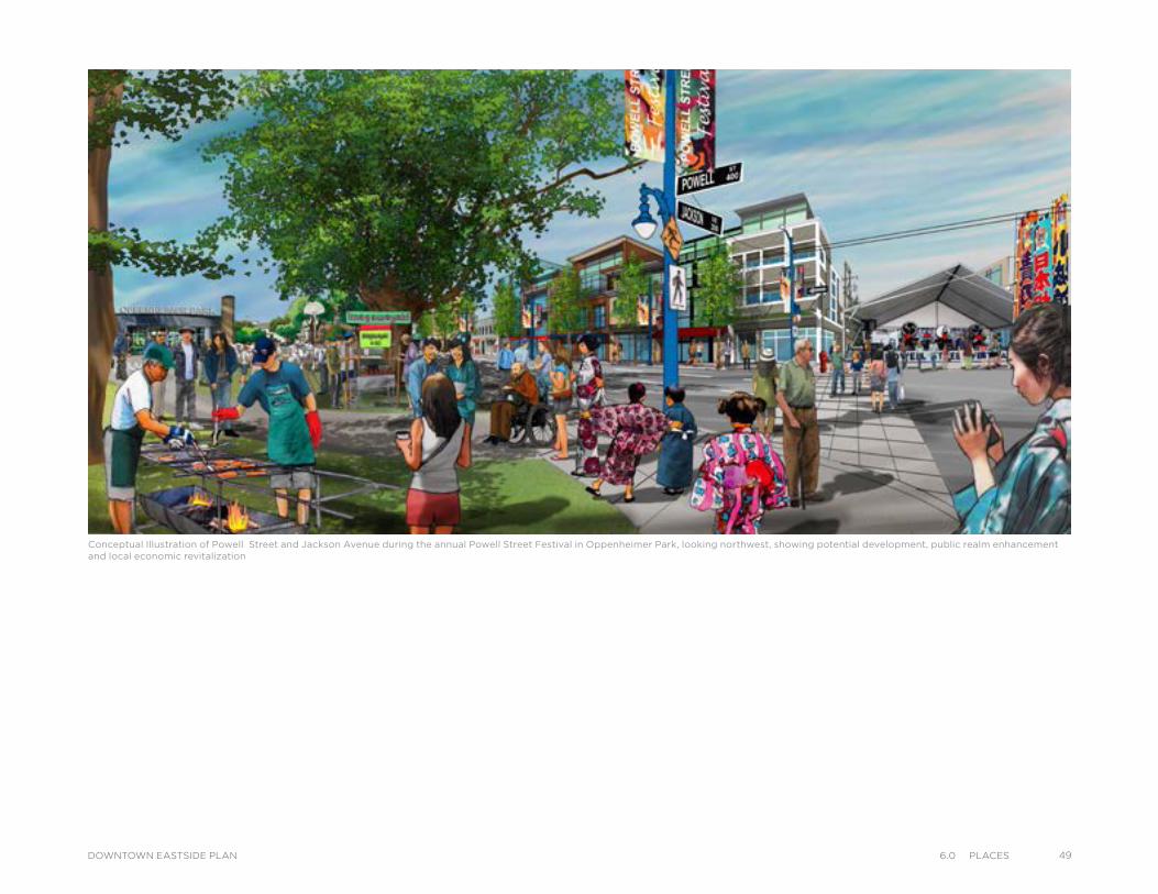
Conceptual Illustration of Powell Street and Jackson Avenue during the annual Powell Street Festival in Oppenheimer Park, looking northwest, showing potential development, public realm enhancement and local economic revitalization
496.0 PlaCesDOWNTOWN EASTSIDE PLAN
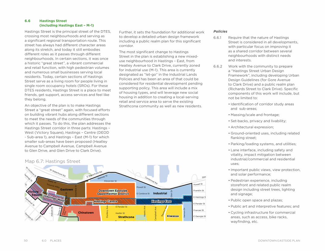
50 6.0 PlaCes DOWNTOWN EASTSIDE PLAN
6.6 Hastings Street (including Hastings East – M-1)
Hastings Street is the principal street of the DTES, crossing most neighbourhoods and serving as a significant regional transportation route. This street has always had different character areas along its stretch, and today it still embodies different roles as it passes through different neighbourhoods. In certain sections, it was once a historic “great street”, a vibrant commercial and retail function, with high pedestrian volumes and numerous small businesses serving local residents. Today, certain sections of Hastings Street serve as a living room for people living in single room occupancy hotels (SROs). For these DTES residents, Hastings Street is a place to meet friends, get support, access services and feel like they belong.
An objective of the plan is to make Hastings Street a “great street” again, with focused efforts on building vibrant hubs along different sections to meet the needs of the communities through which it passes. To do this, the plan addresses the Hastings Street corridor in three parts: Hastings – West (Victory Square), Hastings – Centre (DEOD - Sub-area 1), and Hastings – East (M-1) for which smaller sub-areas have been proposed (Heatley Avenue to Campbell Avenue, Campbell Avenue to Glen Drive, and Glen Drive to Clark Drive).
Kiwassa
Downtown EastsideOppenheimer District
Victory Downtown EastsideOppenheimer District
Strathcona Kiwassa
Industrial
ThorntonPark
Viaducts
Square
Hastings East
Gastown
Chinatown
Hastings CentreHastings Centre Hastings EastHastings East
Hastings West
Hastings West
Water StTrounce Alley
Alexander St
E Cordova St
Centennial Rd
Powell St
E Waterfront Rd
Railway St
W Waterfront Rd
William St William St
Powell St
Stewart St
Napier St
Venables St
Adanac St
Union St
Qu
eb
ec S
t
Geo
rge S
t
Cla
rk D
r
Atlantic St
National Ave
Malkin Ave
Terminal Ave
Evans Ave
National Ave
Nelson St
Prior St
Franklin St
E Hastings St
Pandora St Triumph St
E Pender St
Frances St
E Georgia St
E Pender St
W Cordova St
W Hastings St
Dunsmuir St
Robson St
W G
eorgia St
Smithe St
W Pender St
Cam
bie S
t
Sh
an
gh
ai
Alle
y
Beatt
y St Cita
del P
arad
e
Ham
ilton
St
Mai
nlan
d St
Hom
er S
t
Richa
rds St
Hor
nby
St
How
e St
Seym
our S
t
Gra
nville
St
Keefer St
Go
re A
ve
Jackso
n A
ve
Sta
tio
n S
t
Main
St
Co
lum
bia
St
Pacific
Blvd
Terry Fox Way
Carr
all
St
Ab
bo
tt S
t
Taylo
r S
t
Pri
ncess
Ave C
am
pb
ell
Ave
Ray
mur
Ave
Vern
on
Dr
Wo
od
lan
d D
rW
oo
dla
nd
Dr
Sals
bu
ry D
r
Gle
n D
r
Heatl
ey A
ve
Haw
ks
Ave
Th
orn
ton S
t
Ch
ess
St
Dunsmuir Viaduct
Expo
Blv
d
Georgia Viaduct
Griffiths Way
Cambie B
ridg
e
Du
nle
vy A
ve
Area Boundary
Streets
Railway
Parks andOpen Space
LEGEND
Policies
6.6.1 Require that the nature of Hastings Street is considered in all developments, with particular focus on improving it as a shared corridor between several neighbourhoods with distinct needs and interests.
6.6.2 Work with the community to prepare a “Hastings Street Urban Design Framework”, including developing Urban Design Guidelines (for Gore Avenue to Clark Drive) and a public realm plan (Richards Street to Clark Drive). Specific components of this work will include, but not be limited to:
• Identification of corridor study areas and sub-areas;
• Massing/scale and frontage;
• Set-backs, privacy and livability;
• Architectural expression;
• Ground-oriented uses, including related flanking street;
• Parking/loading systems, and utilities;
• Lane interface, including safety and vitality, impact mitigation between industrial/commercial and residential uses;
• Important public views, view protection, and solar performance;
• Pedestrian experience, including storefront and related public realm design including street trees, lighting and signage;
• Public open space and plazas;
• Public art and interpretive features; and
• Cycling infrastructure for commercial areas, such as access, bike racks, wayfinding, etc.
Further, it sets the foundation for additional work to develop a detailed urban design framework including a public realm plan for this significant corridor.
The most significant change to Hastings Street in the plan is establishing a new mixed-use neighbourhood in Hastings – East, from Heatley Avenue to Clark Drive, currently zoned for industrial use (M-1). This area is currently designated as “let-go” in the Industrial Lands Policies and has been an area of that could be considered for residential development pending supporting policy. This area will include a mix of housing types, and will leverage new social housing in addition to creating a local-serving retail and service area to serve the existing Strathcona community as well as new residents.
Map 6.7: Hastings Street
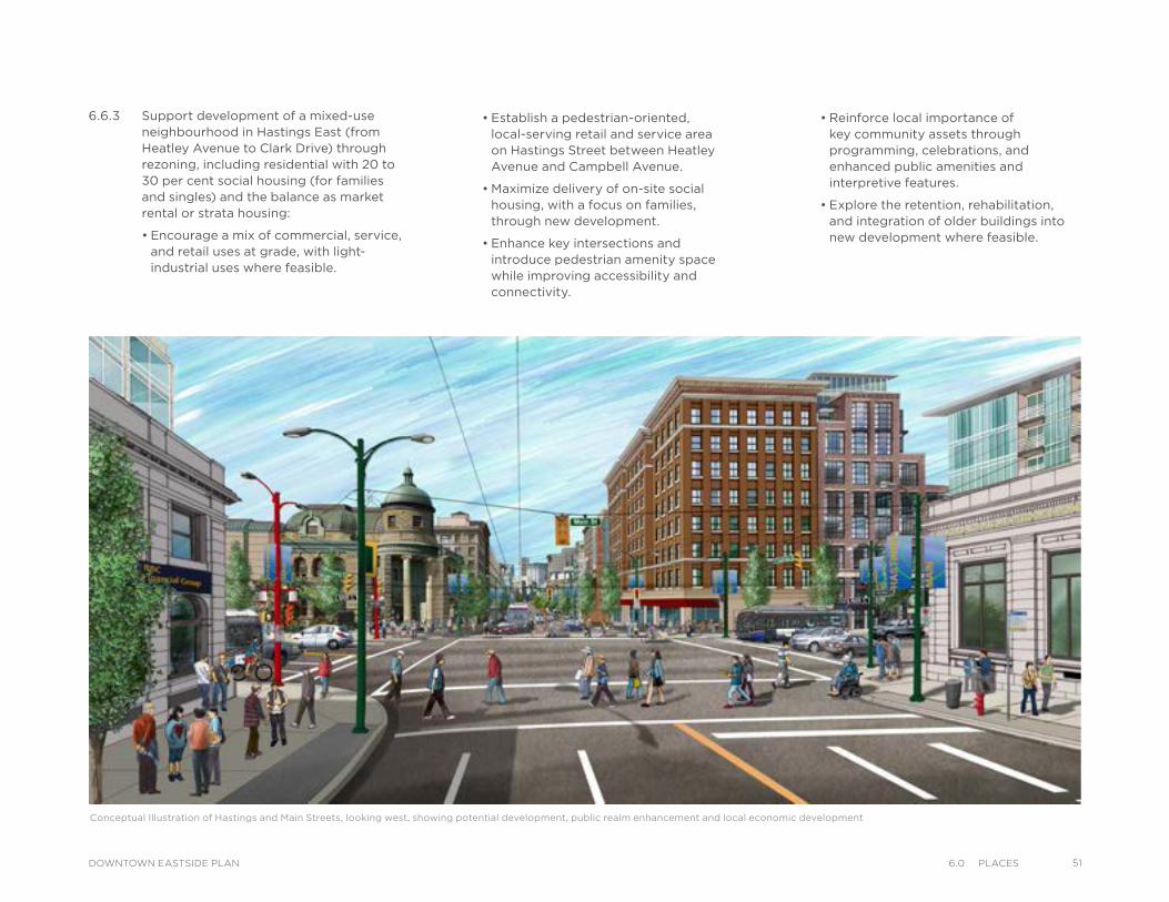
• Establish a pedestrian-oriented, local-serving retail and service area on Hastings Street between Heatley Avenue and Campbell Avenue.
• Maximize delivery of on-site social housing, with a focus on families, through new development.
• Enhance key intersections and introduce pedestrian amenity space while improving accessibility and connectivity.
Conceptual Illustration of Hastings and Main Streets, looking west, showing potential development, public realm enhancement and local economic development
6.6.3 Support development of a mixed-use neighbourhood in Hastings East (from Heatley Avenue to Clark Drive) through rezoning, including residential with 20 to 30 per cent social housing (for families and singles) and the balance as market rental or strata housing:
• Encourage a mix of commercial, service, and retail uses at grade, with light-industrial uses where feasible.
• Reinforce local importance of key community assets through programming, celebrations, and enhanced public amenities and interpretive features.
• Explore the retention, rehabilitation, and integration of older buildings into new development where feasible.
516.0 PlaCesDOWNTOWN EASTSIDE PLAN
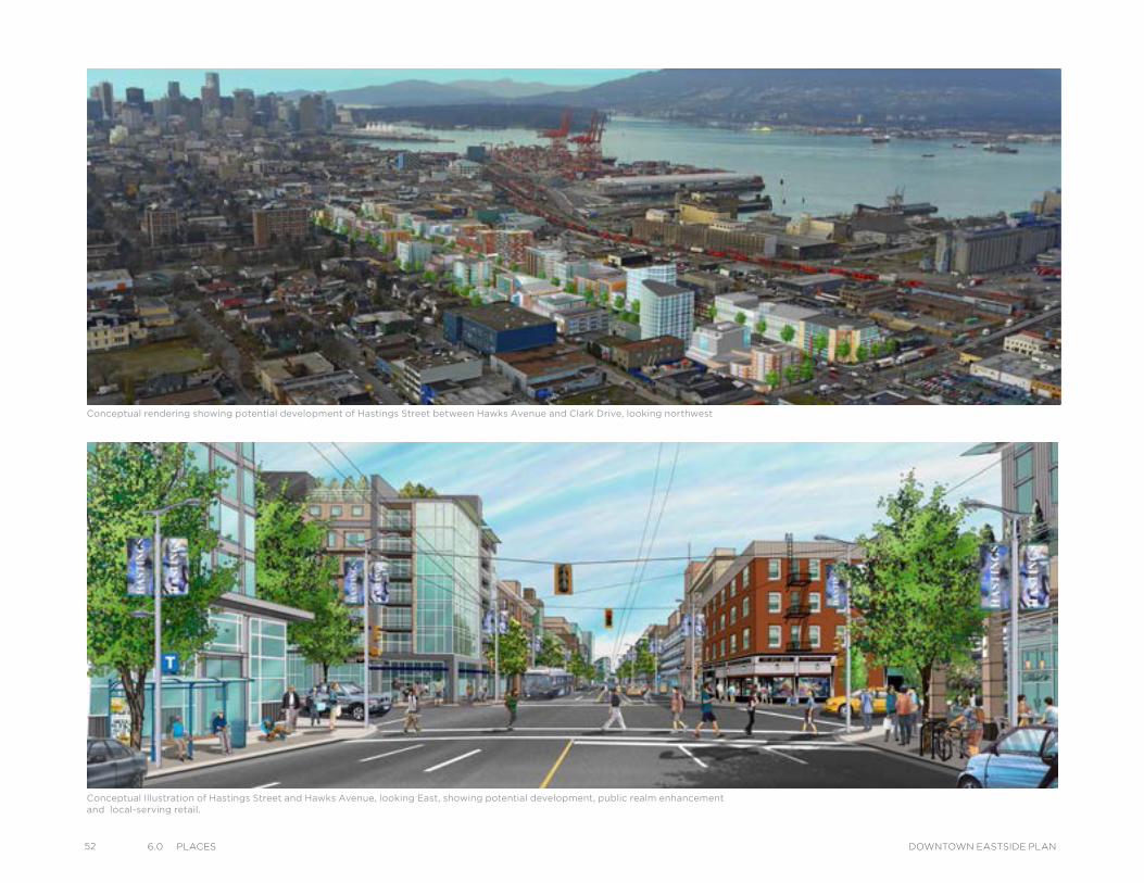
52 6.0 PlaCes DOWNTOWN EASTSIDE PLAN
Conceptual rendering showing potential development of Hastings Street between Hawks Avenue and Clark Drive, looking northwest
Conceptual Illustration of Hastings Street and Hawks Avenue, looking East, showing potential development, public realm enhancement and local-serving retail.
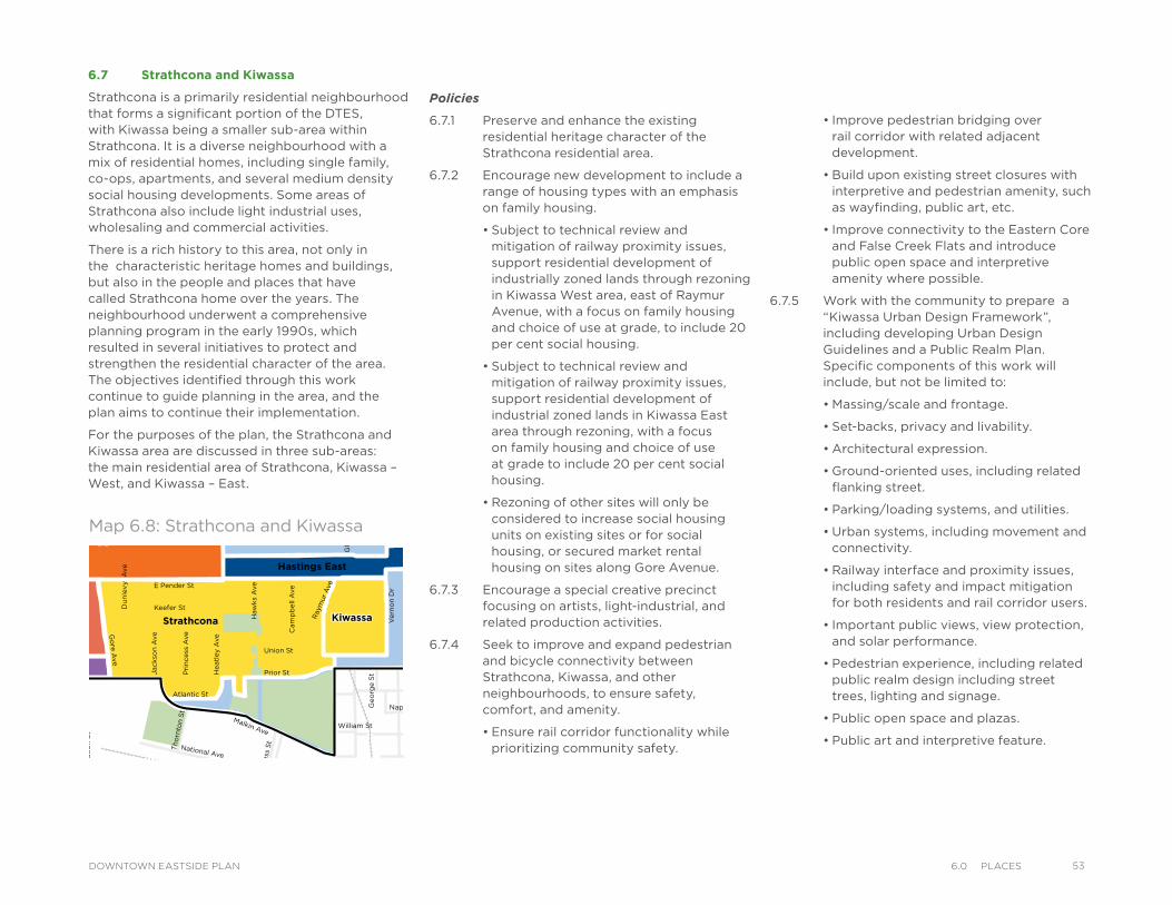
• Improve pedestrian bridging over rail corridor with related adjacent development.
• Build upon existing street closures with interpretive and pedestrian amenity, such as wayfinding, public art, etc.
• Improve connectivity to the Eastern Core and False Creek Flats and introduce public open space and interpretive amenity where possible.
6.7.5 Work with the community to prepare a “Kiwassa Urban Design Framework”, including developing Urban Design Guidelines and a Public Realm Plan. Specific components of this work will include, but not be limited to:
• Massing/scale and frontage.
• Set-backs, privacy and livability.
• Architectural expression.
• Ground-oriented uses, including related flanking street.
• Parking/loading systems, and utilities.
• Urban systems, including movement and connectivity.
• Railway interface and proximity issues, including safety and impact mitigation for both residents and rail corridor users.
• Important public views, view protection, and solar performance.
• Pedestrian experience, including related public realm design including street trees, lighting and signage.
• Public open space and plazas.
• Public art and interpretive feature.
Policies
6.7.1 Preserve and enhance the existing residential heritage character of the Strathcona residential area.
6.7.2 Encourage new development to include a range of housing types with an emphasis on family housing.
• Subject to technical review and mitigation of railway proximity issues, support residential development of industrially zoned lands through rezoning in Kiwassa West area, east of Raymur Avenue, with a focus on family housing and choice of use at grade, to include 20 per cent social housing.
• Subject to technical review and mitigation of railway proximity issues, support residential development of industrial zoned lands in Kiwassa East area through rezoning, with a focus on family housing and choice of use at grade to include 20 per cent social housing.
• Rezoning of other sites will only be considered to increase social housing units on existing sites or for social housing, or secured market rental housing on sites along Gore Avenue.
6.7.3 Encourage a special creative precinct focusing on artists, light-industrial, and related production activities.
6.7.4 Seek to improve and expand pedestrian and bicycle connectivity between Strathcona, Kiwassa, and other neighbourhoods, to ensure safety, comfort, and amenity.
• Ensure rail corridor functionality while prioritizing community safety.
VictorySquare
Kiwassa
Downtown EastsideOppenheimer District
Victory
Downtown EastsideOppenheimer District
Strathcona Kiwassa
Industrial
ThorntonPark
Viaducts
Square Hastings East
Gastown
Chinatown
Water StTrounce Alley
Alexander St
E Cordova St
Centennial Rd
Powell St
E Waterfront Rd
Railway St
W Waterfront Rd
William St William St
Powell St
Stewart St
Napier St
Venables St
Adanac St
Union St
Qu
eb
ec S
t
Ge
org
e S
t
Cla
rk D
r
Atlantic St
National Ave
Malkin Ave
Terminal Ave
Evans Ave
National Ave
Nelson St
Prior St
Franklin St
E Hastings St
Pandora St Triumph St
E Pender St
Frances St
E Georgia St
E Pender St
W Cordova St
W Hastings St
Dunsmuir St
Robson St
W G
eorgia St
Smithe St
W Pender St
Cam
bie S
t
Sh
an
gh
ai
Alle
yBeatt
y St
Cita
del P
arad
e
Ham
ilton
St
Mai
nlan
d St
Hom
er S
t
Richa
rds St
Hor
nby
St
How
e St
Seym
our S
t
Gra
nville
St
Keefer St
Go
re A
ve
Jackso
n A
ve
Sta
tio
n S
t
Main
St
Co
lum
bia
St
Pacific
Blvd
Terry Fox Way
Carr
all
St
Ab
bo
tt S
t
Taylo
r S
t
Pri
ncess
Ave C
am
pb
ell
Ave
Ray
mur
Ave
Ve
rno
n D
r
Wo
od
lan
d D
rW
oo
dla
nd
Dr
Sals
bu
ry D
r
Gle
n D
r
Heatl
ey A
ve
Haw
ks
Ave
Th
orn
ton S
t
Ch
ess
St
Dunsmuir Viaduct
Expo
Blv
d
Georgia Viaduct
Griffiths Way
Cambie B
ridg
e
Du
nle
vy A
ve
Area Boundary
Streets
Railway
Parks andOpen Space
LEGEND
6.7 Strathcona and Kiwassa
Strathcona is a primarily residential neighbourhood that forms a significant portion of the DTES, with Kiwassa being a smaller sub-area within Strathcona. It is a diverse neighbourhood with a mix of residential homes, including single family, co-ops, apartments, and several medium density social housing developments. Some areas of Strathcona also include light industrial uses, wholesaling and commercial activities.
There is a rich history to this area, not only in the characteristic heritage homes and buildings, but also in the people and places that have called Strathcona home over the years. The neighbourhood underwent a comprehensive planning program in the early 1990s, which resulted in several initiatives to protect and strengthen the residential character of the area. The objectives identified through this work continue to guide planning in the area, and the plan aims to continue their implementation.
For the purposes of the plan, the Strathcona and Kiwassa area are discussed in three sub-areas: the main residential area of Strathcona, Kiwassa – West, and Kiwassa – East.
Map 6.8: Strathcona and Kiwassa
536.0 PlaCesDOWNTOWN EASTSIDE PLAN
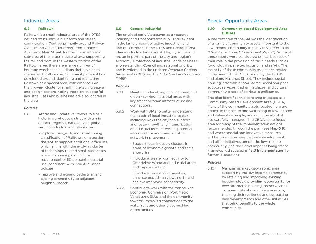
54 6.0 PlaCes DOWNTOWN EASTSIDE PLAN
Special Opportunity Areas
6.10 Community-based Development Area (CBDA)
A key outcome of the SIA was the identification of a range of community assets important to the low-income community in the DTES (Refer to the DTES Social Impact Assessment Report). Some of these assets were considered critical because of their role in the provision of basic needs such as food, clothing, shelter, inclusion and safety. The majority of these community assets are located in the heart of the DTES, primarily the DEOD and along Hastings Street. They include social housing, affordable food stores, social and peer support services, gathering places, and cultural community places of spiritual significance.
The plan identifies this core area of assets as a Community-based Development Area (CBDA). Many of the community assets located here are critical to the health and well-being of low-income and vulnerable people, and could be at risk if not carefully managed. The CBDA is the focus area for many of the implementation actions recommended through the plan (see Map 6.9), and where special and innovative measures will be taken to ensure that new development and other initiatives benefit the low-income community (see the Social Impact Management Framework discussed in 18.0 Implementation for further discussion).
Policies
6.10.1 Maintain as a key geographic area supporting the low-income community by retaining and improving existing housing stock, providing opportunity for new affordable housing, preserve and/or renew critical community assets by tracking their resilience and supporting new developments and other initiatives that bring benefits to the whole community.
Industrial Areas
6.8 Railtown
Railtown is a small industrial area of the DTES, defined by its unique built form and street configuration. Centred primarily around Railway Avenue and Alexander Street, from Princess Avenue to Main Street, Railtown is an informal sub-area of the larger industrial area supporting the rail and port. In the western portion of the Railtown area, there are a large number of heritage warehouse buildings that have been converted to office use. Community interest has developed around identifying and marketing Railtown as a special area, with emphasis on the growing cluster of small, high-tech, creative, and design sectors, noting there are successful industrial uses and businesses are also located in the area.
Policies
6.8.1 Affirm and update Railtown’s role as a historic warehouse district with a mix of local, regional, national, and global-serving industrial and office uses.
• Explore changes to industrial zoning classification of Railtown, or a portion thereof, to support additional office use which aligns with the evolving cluster of technology related small businesses while maintaining a minimum requirement of 50 per cent industrial use, consistent with industrial lands policies.
• Improve and expand pedestrian and cycling connectivity to adjacent neighbourhoods.
6.9 General Industrial
The origin of early Vancouver as a resource industry and transportation hub, is still evident in the large amount of active industrial land and rail corridors in the DTES and broader area. These industrial lands are still highly active and are an important part of the city and region’s economy. Protection of industrial lands has been a long-standing Council and regional priority, and is reflected in the updated Regional Context Statement (2013) and the Industrial Lands Policies (1995).
Policies
6.9.1 Maintain as local, regional, national, and global- serving industrial areas with key transportation infrastructure and connections.
6.9.2 Work with BIAs to better understand the needs of local industrial sector, including ways the city can support and foster growth and intensification of industrial uses, as well as potential infrastructure and transportation network improvements.
• Support local industry clusters in areas of economic growth and social enterprise.
• Introduce greater connectivity to Grandview-Woodland industrial areas and improve safety.
• Introduce pedestrian amenities, enhance pedestrian views north and achieve improved connectivity.
6.9.3 Continue to work with the Vancouver Economic Commission, Port Metro Vancouver, BIAs, and the community towards improved connections to the waterfront and other place-making opportunities.
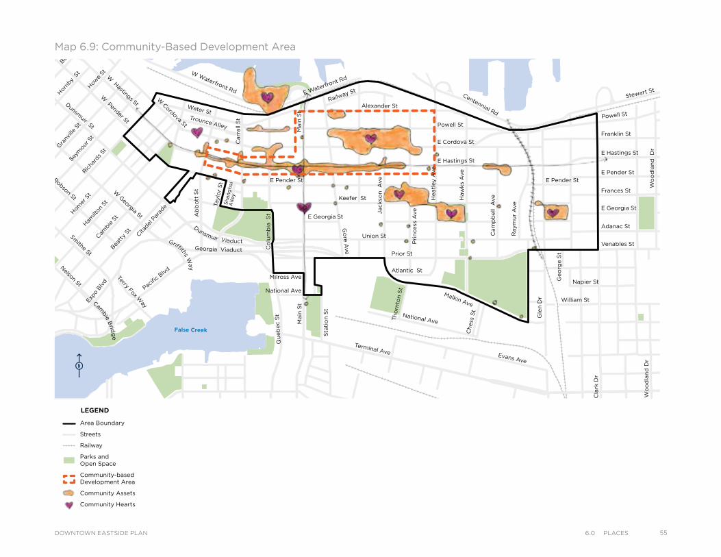
Powell St
Water StTrounce Alley
Alexander St
E Cordova St
Centennial Rd
E Waterfront Rd
Railway St
W Waterfront Rd
William St
William St
Powell St
Stewart St
Napier St
Venables St
Adanac St
Union St
Qu
eb
ec S
t
Geo
rge S
t
Cla
rk D
r
E Georgia St
Atlantic St
National Ave
Malkin Ave
Terminal Ave Evans Ave
Milross Ave
National Ave
Nelson St
Prior St
Franklin St
E Hastings St
Pandora St
Triumph St
E Pender St
Frances St
E Georgia St
E Hastings St
E Pender St
W Cordova St
W Hastings StDunsm
uir St
Robson StW
Georgia St
Smithe St
W Pender St
Cam
bie S
t
Sh
an
gh
ai
Alle
y
Beatt
y St Cita
del P
arad
e
Ham
ilton
St
Mai
nlan
d St
Hom
er S
tRic
hard
s St
Hor
nby
St
Bur
rard
How
e St
Seym
our S
t
Gra
nville
St
Keefer St
Go
re A
ve
Jackso
n A
ve
Main
St
Sta
tio
n S
t
Main
St
Co
lum
bia
S
t
Pacific
Blvd
Terry Fox Way
Carr
all
St
Taylo
r S
t
Pri
ncess
Ave
Cam
pb
ell
Ave
Raym
ur
Ave
Wo
od
lan
d D
rW
oo
dla
nd
Dr
Co
mm
erc
ial D
r
Sals
bu
ry D
r
Heatl
ey A
ve
Haw
ks
Ave
Th
orn
ton S
t
Ch
ess
St
Dunsmuir Viaduct
Expo
Blv
d
Georgia Viaduct
Griffiths Way
Cambie B
ridg
e
E Pender St
Gle
n D
r
Ab
bo
tt S
t
Area Boundary
Streets
Railway
Parks andOpen Space
Community-based Development Area
Community Assets
Community Hearts
LEGEND
Powell St
Water StTrounce Alley
Alexander St
E Cordova St
Centennial Rd
E Waterfront Rd
Railway St
W Waterfront Rd
William St
William St
Powell St
Stewart St
Napier St
Venables St
Adanac St
Union St
Qu
eb
ec S
t
Geo
rge S
t
Cla
rk D
r
E Georgia St
Atlantic St
National Ave
Malkin Ave
Terminal Ave Evans Ave
Milross Ave
National Ave
Nelson St
Prior St
Franklin St
E Hastings St
Pandora St
Triumph St
E Pender St
Frances St
E Georgia St
E Hastings St
E Pender St
W Cordova St
W Hastings StDunsm
uir St
Robson StW
Georgia St
Smithe St
W Pender St
Cam
bie S
t
Sh
an
gh
ai
Alle
y
Beatt
y St Cita
del P
arad
e
Ham
ilton
St
Mai
nlan
d St
Hom
er S
tRic
hard
s St
Hor
nby
St
Bur
rard
How
e St
Seym
our S
t
Gra
nville
St
Keefer St
Go
re A
ve
Jackso
n A
ve
Main
St
Sta
tio
n S
t
Main
St
Co
lum
bia
S
t
Pacific
Blvd
Terry Fox Way
Carr
all
St
Taylo
r S
t
Pri
ncess
Ave
Cam
pb
ell
Ave
Raym
ur
Ave
Wo
od
lan
d D
rW
oo
dla
nd
Dr
Co
mm
erc
ial D
r
Sals
bu
ry D
r
Heatl
ey A
ve
Haw
ks
Ave
Th
orn
ton S
t
Ch
ess
St
Dunsmuir Viaduct
Expo
Blv
d
Georgia Viaduct
Griffiths Way
Cambie B
ridg
e
E Pender St
Gle
n D
r
Ab
bo
tt S
t
Area Boundary
Streets
Railway
Parks andOpen Space
Community-based Development Area
Community Assets
Community Hearts
LEGEND
Map 6.9: Community-Based Development Area
556.0 PlaCesDOWNTOWN EASTSIDE PLAN
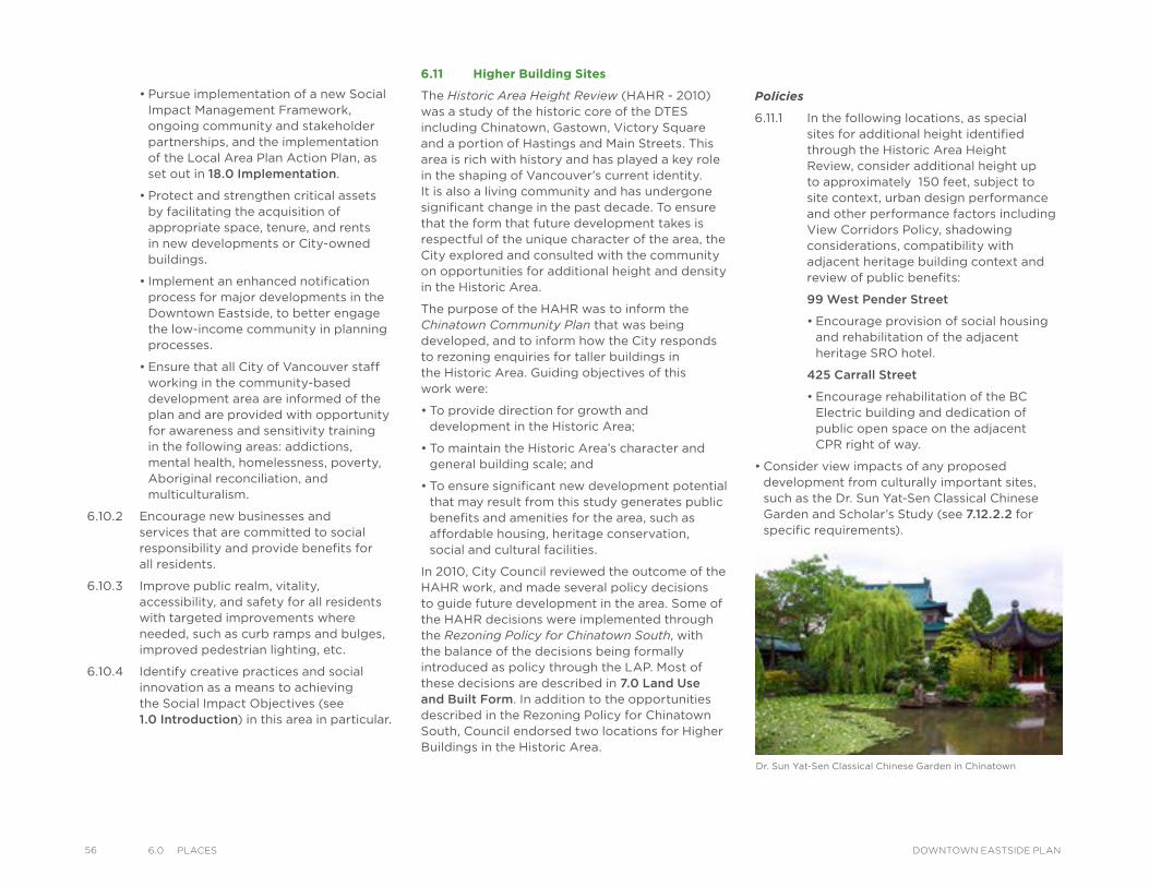
56 6.0 PlaCes DOWNTOWN EASTSIDE PLAN
• Pursue implementation of a new Social Impact Management Framework, ongoing community and stakeholder partnerships, and the implementation of the Local Area Plan Action Plan, as set out in 18.0 Implementation.
• Protect and strengthen critical assets by facilitating the acquisition of appropriate space, tenure, and rents in new developments or City-owned buildings.
• Implement an enhanced notification process for major developments in the Downtown Eastside, to better engage the low-income community in planning processes.
• Ensure that all City of Vancouver staff working in the community-based development area are informed of the plan and are provided with opportunity for awareness and sensitivity training in the following areas: addictions, mental health, homelessness, poverty, Aboriginal reconciliation, and multiculturalism.
6.10.2 Encourage new businesses and services that are committed to social responsibility and provide benefits for all residents.
6.10.3 Improve public realm, vitality, accessibility, and safety for all residents with targeted improvements where needed, such as curb ramps and bulges, improved pedestrian lighting, etc.
6.10.4 Identify creative practices and social innovation as a means to achieving the Social Impact Objectives (see 1.0 Introduction) in this area in particular.
6.11 Higher Building Sites
The Historic Area Height Review (HAHR - 2010) was a study of the historic core of the DTES including Chinatown, Gastown, Victory Square and a portion of Hastings and Main Streets. This area is rich with history and has played a key role in the shaping of Vancouver's current identity. It is also a living community and has undergone significant change in the past decade. To ensure that the form that future development takes is respectful of the unique character of the area, the City explored and consulted with the community on opportunities for additional height and density in the Historic Area.
The purpose of the HAHR was to inform the Chinatown Community Plan that was being developed, and to inform how the City responds to rezoning enquiries for taller buildings in the Historic Area. Guiding objectives of this work were:
• To provide direction for growth and development in the Historic Area;
• To maintain the Historic Area’s character and general building scale; and
• To ensure significant new development potential that may result from this study generates public benefits and amenities for the area, such as affordable housing, heritage conservation, social and cultural facilities.
In 2010, City Council reviewed the outcome of the HAHR work, and made several policy decisions to guide future development in the area. Some of the HAHR decisions were implemented through the Rezoning Policy for Chinatown South, with the balance of the decisions being formally introduced as policy through the LAP. Most of these decisions are described in 7.0 Land Use and Built Form. In addition to the opportunities described in the Rezoning Policy for Chinatown South, Council endorsed two locations for Higher Buildings in the Historic Area.
Policies
6.11.1 In the following locations, as special sites for additional height identified through the Historic Area Height Review, consider additional height up to approximately 150 feet, subject to site context, urban design performance and other performance factors including View Corridors Policy, shadowing considerations, compatibility with adjacent heritage building context and review of public benefits:
99 West Pender Street
• Encourage provision of social housing and rehabilitation of the adjacent heritage SRO hotel.
425 Carrall Street
• Encourage rehabilitation of the BC Electric building and dedication of public open space on the adjacent CPR right of way.
• Consider view impacts of any proposed development from culturally important sites, such as the Dr. Sun Yat-Sen Classical Chinese Garden and Scholar’s Study (see 7.12.2.2 for specific requirements).
Dr. Sun Yat-Sen Classical Chinese Garden in Chinatown
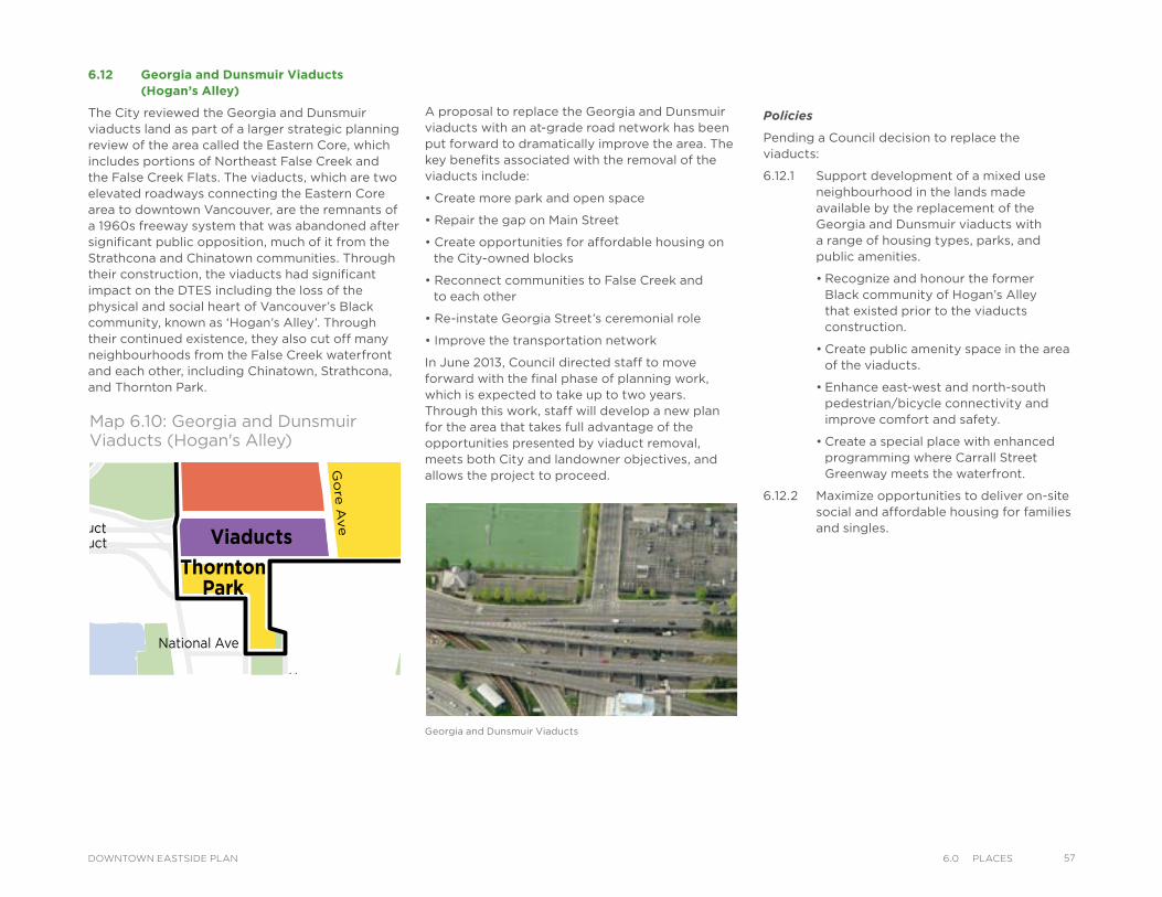
6.12 Georgia and Dunsmuir Viaducts (Hogan’s Alley)
The City reviewed the Georgia and Dunsmuir viaducts land as part of a larger strategic planning review of the area called the Eastern Core, which includes portions of Northeast False Creek and the False Creek Flats. The viaducts, which are two elevated roadways connecting the Eastern Core area to downtown Vancouver, are the remnants of a 1960s freeway system that was abandoned after significant public opposition, much of it from the Strathcona and Chinatown communities. Through their construction, the viaducts had significant impact on the DTES including the loss of the physical and social heart of Vancouver’s Black community, known as ‘Hogan’s Alley’. Through their continued existence, they also cut off many neighbourhoods from the False Creek waterfront and each other, including Chinatown, Strathcona, and Thornton Park.
Georgia and Dunsmuir Viaducts
VictorySquare
Kiwassa
Downtown EastsideOppenheimer District
Victory
Downtown EastsideOppenheimer District
Strathcona Kiwassa
Industrial
ThorntonPark
Viaducts
Square Hastings East
Gastown
Chinatown
Water StTrounce Alley
Alexander St
E Cordova St
Centennial Rd
Powell St
E Waterfront Rd
Railway St
W Waterfront Rd
William St William St
Powell St
Stewart St
Napier St
Venables St
Adanac St
Union St
Qu
eb
ec S
t
Ge
org
e S
t
Cla
rk D
r
Atlantic St
National Ave
Malkin Ave
Terminal Ave
Evans Ave
National Ave
Nelson St
Prior St
Franklin St
E Hastings St
Pandora St Triumph St
E Pender St
Frances St
E Georgia St
E Pender St
W C
ordova St
W H
astings St
Dunsm
uir St
Robson St
W G
eorgia St
Smithe St
W Pender St
Cam
bie St
Sh
an
gh
ai
Alley
Bea
tty St C
itade
l Par
ade
Ham
ilton
St
Mainlan
d St
Hom
er St
Richa
rds St
Hor
nby St
How
e St
Seym
our S
tGra
nville St
Keefer St
Go
re A
ve
Jackso
n A
ve
Sta
tio
n S
t
Main
St
Co
lum
bia
St
Pacifi
c Blvd
Terry Fox Way
Carr
all S
t
Ab
bo
tt S
t
Taylo
r S
t
Pri
ncess A
ve C
am
pb
ell A
ve
Raym
ur
Ave
Ve
rno
n D
r
Wo
od
lan
d D
rW
oo
dla
nd
Dr
Sals
bu
ry D
r
Gle
n D
r
Heatl
ey A
ve
Haw
ks A
ve
Th
orn
ton S
t
Ch
ess
St
Dunsmuir Viaduct
E
xpo
Blv
d
Georgia Viaduct
Griffiths W
ay
Cambie
Brid
ge
Du
nle
vy A
ve
Area Boundary
Streets
Railway
Parks andOpen Space
LEGEND
Map 6.10: Georgia and Dunsmuir Viaducts (Hogan's Alley)
Policies
Pending a Council decision to replace the viaducts:
6.12.1 Support development of a mixed use neighbourhood in the lands made available by the replacement of the Georgia and Dunsmuir viaducts with a range of housing types, parks, and public amenities.
• Recognize and honour the former Black community of Hogan’s Alley that existed prior to the viaducts construction.
• Create public amenity space in the area of the viaducts.
• Enhance east-west and north-south pedestrian/bicycle connectivity and improve comfort and safety.
• Create a special place with enhanced programming where Carrall Street Greenway meets the waterfront.
6.12.2 Maximize opportunities to deliver on-site social and affordable housing for families and singles.
A proposal to replace the Georgia and Dunsmuir viaducts with an at-grade road network has been put forward to dramatically improve the area. The key benefits associated with the removal of the viaducts include:
• Create more park and open space
• Repair the gap on Main Street
• Create opportunities for affordable housing on the City-owned blocks
• Reconnect communities to False Creek and to each other
• Re-instate Georgia Street’s ceremonial role
• Improve the transportation network
In June 2013, Council directed staff to move forward with the final phase of planning work, which is expected to take up to two years. Through this work, staff will develop a new plan for the area that takes full advantage of the opportunities presented by viaduct removal, meets both City and landowner objectives, and allows the project to proceed.
576.0 PlaCesDOWNTOWN EASTSIDE PLAN
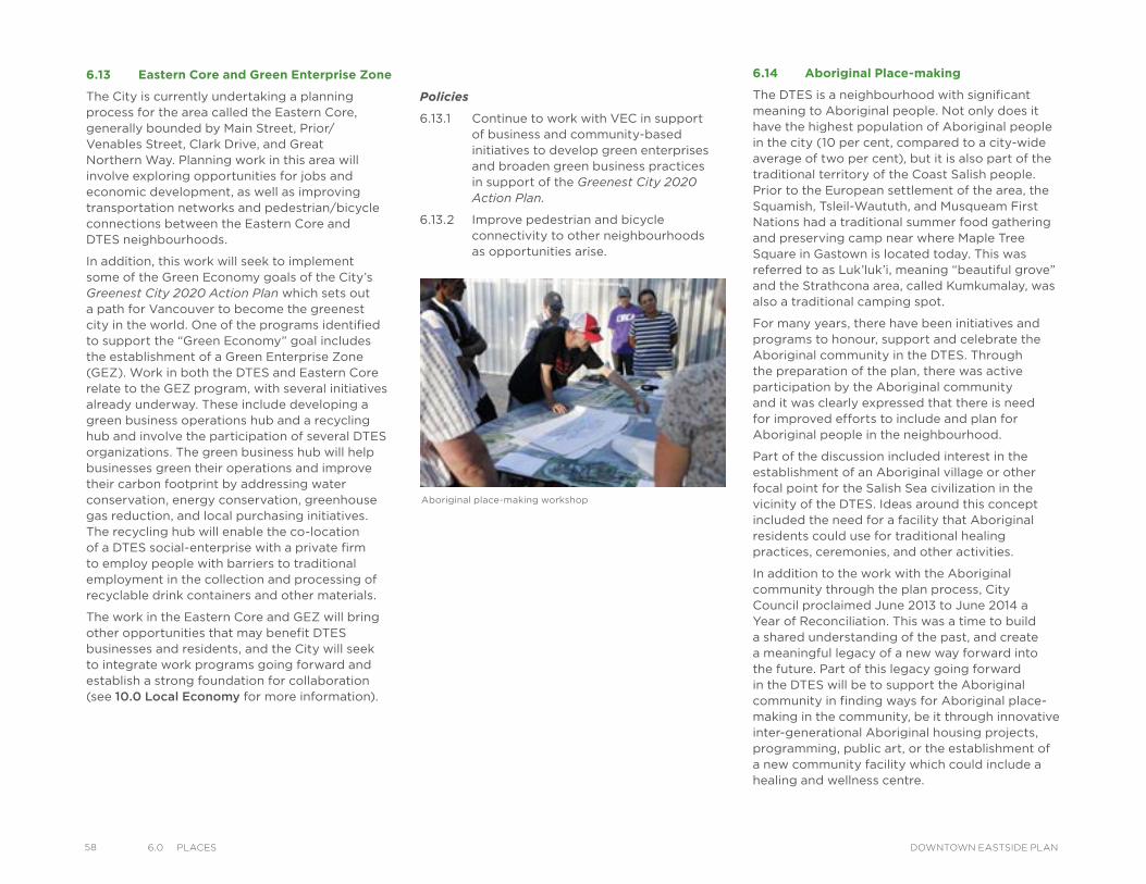
58 6.0 PlaCes DOWNTOWN EASTSIDE PLAN
6.13 Eastern Core and Green Enterprise Zone
The City is currently undertaking a planning process for the area called the Eastern Core, generally bounded by Main Street, Prior/Venables Street, Clark Drive, and Great Northern Way. Planning work in this area will involve exploring opportunities for jobs and economic development, as well as improving transportation networks and pedestrian/bicycle connections between the Eastern Core and DTES neighbourhoods.
In addition, this work will seek to implement some of the Green Economy goals of the City’s Greenest City 2020 Action Plan which sets out a path for Vancouver to become the greenest city in the world. One of the programs identified to support the “Green Economy” goal includes the establishment of a Green Enterprise Zone (GEZ). Work in both the DTES and Eastern Core relate to the GEZ program, with several initiatives already underway. These include developing a green business operations hub and a recycling hub and involve the participation of several DTES organizations. The green business hub will help businesses green their operations and improve their carbon footprint by addressing water conservation, energy conservation, greenhouse gas reduction, and local purchasing initiatives. The recycling hub will enable the co-location of a DTES social-enterprise with a private firm to employ people with barriers to traditional employment in the collection and processing of recyclable drink containers and other materials.
The work in the Eastern Core and GEZ will bring other opportunities that may benefit DTES businesses and residents, and the City will seek to integrate work programs going forward and establish a strong foundation for collaboration (see 10.0 Local Economy for more information).
Policies
6.13.1 Continue to work with VEC in support of business and community-based initiatives to develop green enterprises and broaden green business practices in support of the Greenest City 2020 Action Plan.
6.13.2 Improve pedestrian and bicycle connectivity to other neighbourhoods as opportunities arise.
6.14 Aboriginal Place-making
The DTES is a neighbourhood with significant meaning to Aboriginal people. Not only does it have the highest population of Aboriginal people in the city (10 per cent, compared to a city-wide average of two per cent), but it is also part of the traditional territory of the Coast Salish people. Prior to the European settlement of the area, the Squamish, Tsleil-Waututh, and Musqueam First Nations had a traditional summer food gathering and preserving camp near where Maple Tree Square in Gastown is located today. This was referred to as Luk’luk’i, meaning “beautiful grove” and the Strathcona area, called Kumkumalay, was also a traditional camping spot.
For many years, there have been initiatives and programs to honour, support and celebrate the Aboriginal community in the DTES. Through the preparation of the plan, there was active participation by the Aboriginal community and it was clearly expressed that there is need for improved efforts to include and plan for Aboriginal people in the neighbourhood.
Part of the discussion included interest in the establishment of an Aboriginal village or other focal point for the Salish Sea civilization in the vicinity of the DTES. Ideas around this concept included the need for a facility that Aboriginal residents could use for traditional healing practices, ceremonies, and other activities.
In addition to the work with the Aboriginal community through the plan process, City Council proclaimed June 2013 to June 2014 a Year of Reconciliation. This was a time to build a shared understanding of the past, and create a meaningful legacy of a new way forward into the future. Part of this legacy going forward in the DTES will be to support the Aboriginal community in finding ways for Aboriginal place-making in the community, be it through innovative inter-generational Aboriginal housing projects, programming, public art, or the establishment of a new community facility which could include a healing and wellness centre.
Aboriginal place-making workshop
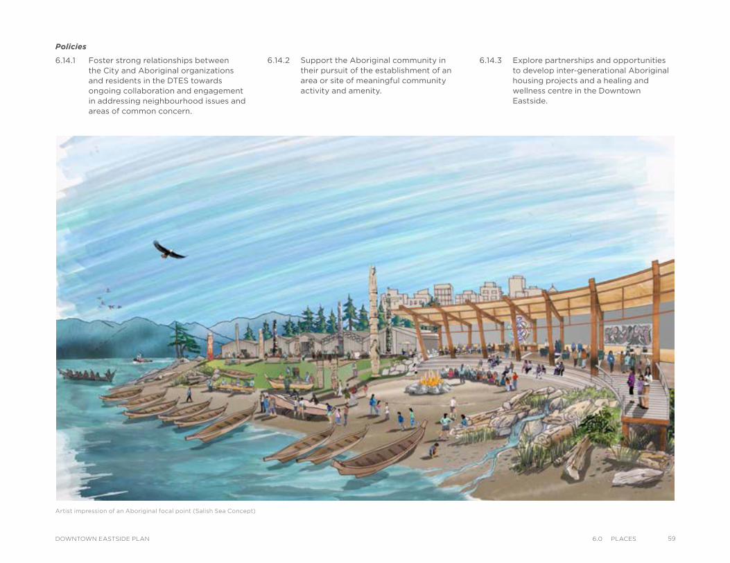
Artist impression of an Aboriginal focal point (Salish Sea Concept)
Policies
6.14.1 Foster strong relationships between the City and Aboriginal organizations and residents in the DTES towards ongoing collaboration and engagement in addressing neighbourhood issues and areas of common concern.
6.14.2 Support the Aboriginal community in their pursuit of the establishment of an area or site of meaningful community activity and amenity.
6.14.3 Explore partnerships and opportunities to develop inter-generational Aboriginal housing projects and a healing and wellness centre in the Downtown Eastside.
596.0 PlaCesDOWNTOWN EASTSIDE PLAN
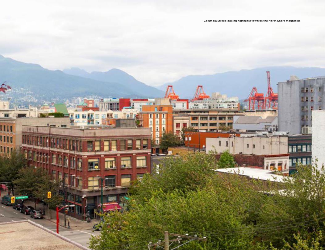
Columbia Street looking northeast towards the North Shore mountains
IntroductionThe DTES will continue to change and develop over the next 30 years in order to meet the needs and aspirations of the community, including residents, businesses, community groups, property owners, investors and visitors. This chapter serves as a guide for future development, and provides built form policies and strategies for each sub-area including heights and densities. It should be read in conjunction with 6.0 Places, which provides the overall direction and policies for each sub-area related to land use and place-making opportunities.
The plan will recognize the distinct character and role of each neighbourhood and provide a range of opportunities to meet the diverse needs of each neighbourhood. The majority of the DTES is proposed to remain under existing land use and development by-laws and policies, while new strategic directions are established for certain sub-areas to meet specific objectives, primarily related to meeting the housing objectives described in 9.0 Housing. For those areas where new strategic directions are established, an urban design intent statement is provided to describe the future built-form vision for the area.
City-wide Context and PoliciesMany of the City’s overall goals relating to affordable housing, sustainability, and economic growth are implemented through development by-laws and policies, which can have a significant impact on communities. In the DTES, the impact of growth and development is felt most by the many vulnerable people who live there. Achieving the City’s goals in the DTES requires a thoughtful and balanced approach which means regulating, supporting, and encouraging development that benefits the existing community (including low-income residents), while allowing the area to evolve over time. This enables reaching the goal of revitalization without displacement. Further details on the proposed approach to managing development so that it benefits everyone in the community are discussed in 18.0 Implementation.
Various zoning by-laws, policies and technical studies influence development and built form in the DTES. Key policies and Council directions which apply to sub-area neighbourhoods in the DTES are identified throughout this chapter.
7BUILT FORM
617.0 BuIlt FormDOWNTOWN EASTSIDE PLAN
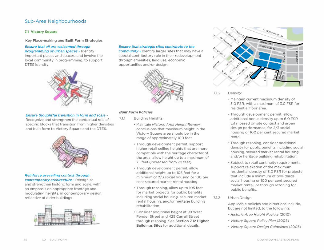
62 7.0 BuIlt Form DOWNTOWN EASTSIDE PLAN
Ensure that strategic sites contribute to the community - Identify larger sites that may have a special contributory role in their redevelopment through amenities, land use, economic opportunities and/or design.
7.1 Victory Square
Water StTrounce Alley
Alexander St
E Cordova St
Centennial Rd
Powell St
E Waterfront Rd
Railway St
W Waterfront Rd
William St William St
Powell St
Stewart St
Napier St
Venables St
Adanac St
Union St
Que
bec
St
Geo
rge
St
Cla
rk D
r
Atlantic St
National Ave
Malkin Ave
Terminal Ave
Evans Ave
National Ave
Nelson St
Prior St
Franklin St
E Hastings St
Pandora St Triumph St
E Pender St
Frances St
E Georgia St
E Pender St
W Cordova St
W Hastings St
Dunsmuir St
Robson St
W Georgia St
Smithe St
W Pender St
Cambie
St
Shan
gha
iA
lley
Beatt
y St
Citadel
Par
ade
Hamilt
on St
Mai
nland S
t
Homer
St
Richar
ds St
Hornby
St
Howe
St
Seym
our StGra
nville
St
Keefer St
Go
re Ave
Jack
son
Ave
Stat
ion
St
Mai
n St
Co
lum
bia
St
Pacific B
lvdTerry Fox W
ay
Car
rall
St
Ab
bot
t St
Tayl
or S
t
Pri
nces
s A
ve
Cam
pb
ell A
ve
Ray
mur
Ave
Ver
non
Dr
Wo
od
land
Dr
Wo
od
land
Dr
Sal
sbur
y D
r
Gle
n D
r
Hea
tley
Ave
Haw
ks A
ve
Thor
nton
St
Che
ss S
t
Dunsmuir Viaduct
Expo
Blvd
Georgia Viaduct
Griffiths Way
Cam
bie Brid
ge
Dun
levy
Ave
Ensure that all are welcomed through programming of urban spaces - Identify important places and spaces, and involve the local community in programming, to support DTES identity.
Ensure thoughtful transition in form and scale - Recognize and strengthen the contextual role of specific blocks that transition from higher densities and built form to Victory Square and the DTES.
Reinforce prevailing context through contemporary architecture - Recognize and strengthen historic form and scale, with an emphasis on appropriate frontage and modulating heights, in contemporary design reflective of older buildings.
7.1.2 Density:
• Maintain current maximum density of 5.0 FSR, with a maximum of 3.0 FSR for residential floor area.
• Through development permit, allow additional bonus density up to 6.0 FSR total based on site context and urban design performance, for 2/3 social housing or 100 per cent secured market rental.
• Through rezoning, consider additional density for public benefits including social housing, secured market rental housing, and/or heritage building rehabilitation.
• Subject to retail continuity requirements, support relaxation of the maximum residential density of 3.0 FSR for projects that include a minimum of two-thirds social housing or 100 per cent secured market rental, or through rezoning for public benefits.
7.1.3 Urban Design:
Applicable policies and directions include, but are not limited, to the following:
• Historic Area Height Review (2010)
• Victory Square Policy Plan (2005)
• Victory Square Design Guidelines (2005)
Key Place-making and Built Form Strategies
Built Form Policies
7.1.1 Building Heights:
• Maintain Historic Area Height Review conclusions that maximum height in the Victory Square area should be in the range of approximately 100 feet.
• Through development permit, support higher retail ceiling heights that are more compatible with the heritage character of the area, allow height up to a maximum of 75 feet (increased from 70 feet).
• Through development permit, allow additional height up to 105 feet for a minimum of 2/3 social housing or 100 per cent secured market rental housing.
• Through rezoning, allow up to 105 feet for market projects for public benefits including social housing, secured market rental housing, and/or heritage building rehabilitation.
• Consider additional height at 99 West Pender Street and 425 Carrall Street through rezoning. See Section 7.12 Higher Buildings Sites for additional details.
Sub-Area Neighbourhoods
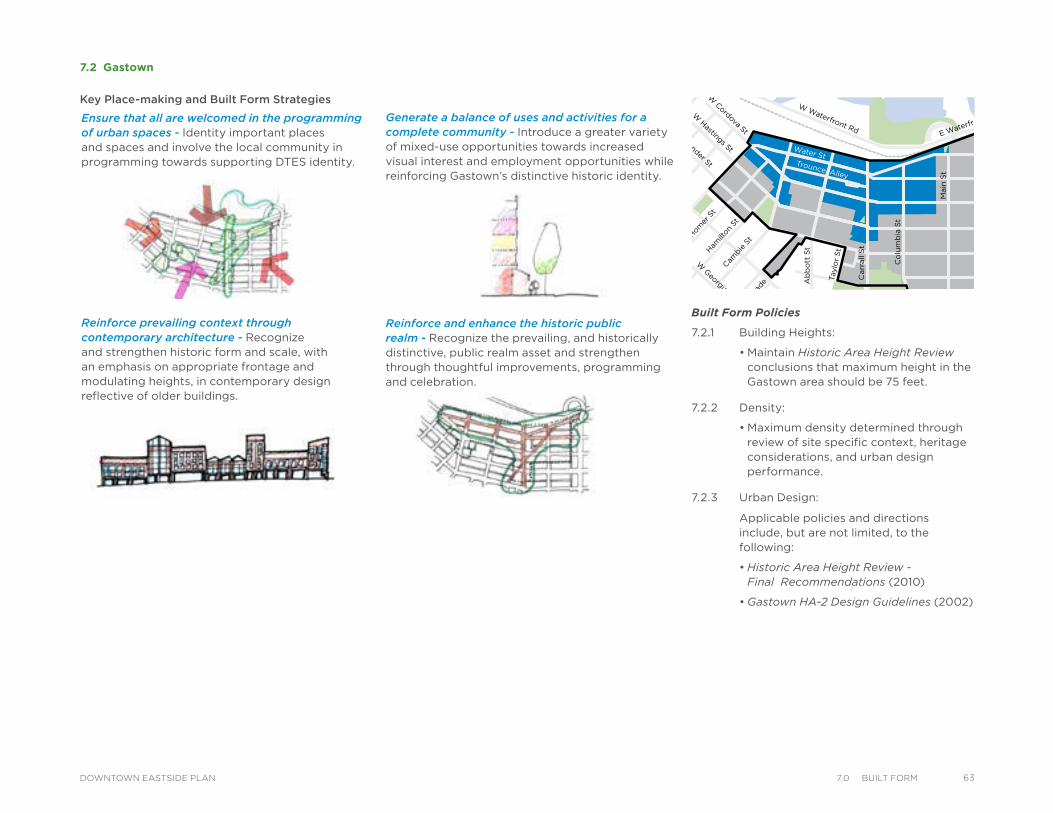
Ensure that all are welcomed in the programming of urban spaces - Identity important places and spaces and involve the local community in programming towards supporting DTES identity.
7.2 Gastown
Reinforce and enhance the historic public realm - Recognize the prevailing, and historically distinctive, public realm asset and strengthen through thoughtful improvements, programming and celebration.
Water StTrounce Alley
Alexander St
E Cordova St
Centennial Rd
Powell St
E Waterfront Rd
Railway St
W Waterfront Rd
William St William St
Powell St
Stewart St
Napier St
Venables St
Adanac St
Union St
Qu
eb
ec S
t
Geo
rge S
t
Cla
rk D
r
Atlantic St
National Ave
Malkin Ave
Terminal Ave
Evans Ave
National Ave
Nelson St
Prior St
Franklin St
E Hastings St
Pandora St Triumph St
E Pender St
Frances St
E Georgia St
E Pender St
W Cordova St
W Hastings St
Dunsmuir St
Robson St
W G
eorgia St
Smithe St
W Pender St
Cam
bie S
t
Beatt
y St Cita
del P
arad
e
Ham
ilton
St
Mai
nlan
d St
Hom
er S
t
Richa
rds St
Hor
nby
St
How
e St
Seym
our S
t
Gra
nville
St
Keefer St
Go
re A
ve
Jackso
n A
ve
Sta
tio
n S
t
Main
St
Co
lum
bia
St
Pacific
Blvd
Terry Fox Way
Carr
all
St
Ab
bo
tt S
t
Taylo
r S
t
Pri
ncess
Ave C
am
pb
ell
Ave
Ray
mur
Ave
Vern
on
Dr
Wo
od
lan
d D
rW
oo
dla
nd
Dr
Sals
bu
ry D
r
Gle
n D
r
Heatl
ey A
ve
Haw
ks
Ave
Th
orn
ton S
t
Ch
ess
St
Dunsmuir Viaduct
Expo
Blv
d
Georgia Viaduct
Griffiths Way
Cambie B
ridg
e
Du
nle
vy A
ve
Key Place-making and Built Form Strategies
Generate a balance of uses and activities for a complete community - Introduce a greater variety of mixed-use opportunities towards increased visual interest and employment opportunities while reinforcing Gastown’s distinctive historic identity.
Reinforce prevailing context through contemporary architecture - Recognize and strengthen historic form and scale, with an emphasis on appropriate frontage and modulating heights, in contemporary design reflective of older buildings.
Built Form Policies
7.2.1 Building Heights:
• Maintain Historic Area Height Review conclusions that maximum height in the Gastown area should be 75 feet.
7.2.2 Density:
• Maximum density determined through review of site specific context, heritage considerations, and urban design performance.
7.2.3 Urban Design:
Applicable policies and directions include, but are not limited, to the following:
• Historic Area Height Review - Final Recommendations (2010)
• Gastown HA-2 Design Guidelines (2002)
637.0 BuIlt FormDOWNTOWN EASTSIDE PLAN
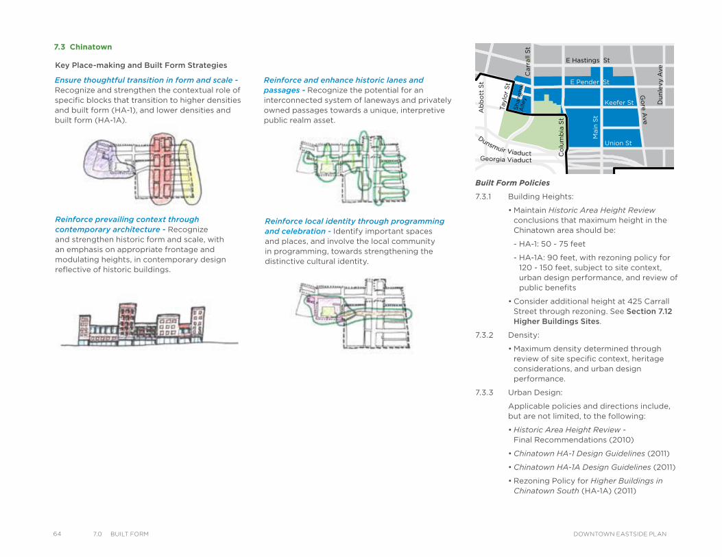
64 7.0 BuIlt Form DOWNTOWN EASTSIDE PLAN
Reinforce prevailing context through contemporary architecture - Recognize and strengthen historic form and scale, with an emphasis on appropriate frontage and modulating heights, in contemporary design reflective of historic buildings.
7.3 Chinatown
Water StTrounce Alley
Alexander St
E Cordova St
Centennial Rd
Powell St
E Waterfront Rd
Railway St
W Waterfront Rd
William St William St
Powell St
Stewart St
Napier St
Venables St
Adanac St
Union St
Qu
eb
ec S
t
Geo
rge S
t
Cla
rk D
r
Atlantic St
National Ave
Malkin Ave
Terminal Ave
Evans Ave
National Ave
Nelson St
Prior St
Franklin St
E Hastings St
Pandora St Triumph St
E Pender St
Frances St
E Georgia St
E Pender St
W Cordova St
W Hastings St
Dunsmuir St
Robson St
W G
eorgia St
Smithe St
W Pender St
Cam
bie S
t
Sh
an
gh
ai
Alle
y
Beatt
y St Cita
del P
arad
e
Ham
ilton
St
Mai
nlan
d St
Hom
er S
t
Richa
rds St
Hor
nby
St
How
e St
Seym
our S
t
Gra
nville
St
Keefer St
Go
re A
ve
Jackso
n A
ve
Sta
tio
n S
t
Main
St
Co
lum
bia
St
Pacific
Blvd
Terry Fox Way
Carr
all
St
Ab
bo
tt S
t
Taylo
r S
t
Pri
ncess
Ave C
am
pb
ell
Ave
Ray
mur
Ave
Vern
on
Dr
Wo
od
lan
d D
rW
oo
dla
nd
Dr
Sals
bu
ry D
r
Gle
n D
r
Heatl
ey A
ve
Haw
ks
Ave
Th
orn
ton S
t
Ch
ess
St
Dunsmuir Viaduct
Expo
Blv
d
Georgia Viaduct
Griffiths Way
Cambie B
ridg
e
Du
nle
vy A
ve
Ensure thoughtful transition in form and scale - Recognize and strengthen the contextual role of specific blocks that transition to higher densities and built form (HA-1), and lower densities and built form (HA-1A).
Built Form Policies
7.3.1 Building Heights:
• Maintain Historic Area Height Review conclusions that maximum height in the Chinatown area should be:
- HA-1: 50 - 75 feet
- HA-1A: 90 feet, with rezoning policy for 120 - 150 feet, subject to site context, urban design performance, and review of public benefits
• Consider additional height at 425 Carrall Street through rezoning. See Section 7.12 Higher Buildings Sites.
7.3.2 Density:
• Maximum density determined through review of site specific context, heritage considerations, and urban design performance.
7.3.3 Urban Design:
Applicable policies and directions include, but are not limited, to the following:
• Historic Area Height Review - Final Recommendations (2010)
• Chinatown HA-1 Design Guidelines (2011)
• Chinatown HA-1A Design Guidelines (2011)
• Rezoning Policy for Higher Buildings in Chinatown South (HA-1A) (2011)
Reinforce and enhance historic lanes and passages - Recognize the potential for an interconnected system of laneways and privately owned passages towards a unique, interpretive public realm asset.
Reinforce local identity through programming and celebration - Identify important spaces and places, and involve the local community in programming, towards strengthening the distinctive cultural identity.
Key Place-making and Built Form Strategies
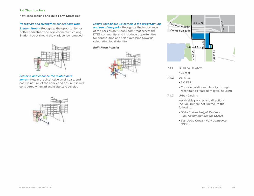
7.4 Thornton Park
Key Place-making and Built Form Strategies
Ensure that all are welcomed in the programming and use of the park - Recognize the importance of the park as an “urban room” that serves the DTES community, and introduce opportunities for contribution and self-expression towards celebrating local identity.
Built Form Policies
Water StTrounce Alley
Alexander St
E Cordova St
Centennial Rd
Powell St
E Waterfront Rd
Railway St
W Waterfront Rd
William St William St
Powell St
Stewart St
Napier St
Venables St
Adanac St
Union St
Qu
eb
ec S
t
Geo
rge S
t
Cla
rk D
r
Atlantic St
National Ave
Malkin Ave
Terminal Ave
Evans Ave
National Ave
Nelson St
Prior St
Franklin St
E Hastings St
Pandora St Triumph St
E Pender St
Frances St
E Georgia St
E Pender St
W Cordova St
W Hastings St
Dunsmuir St
Robson St
W G
eorgia St
Smithe St
W Pender St
Cam
bie S
t
Sh
an
gh
ai
Alle
y
Beatt
y St Cita
del P
arad
e
Ham
ilton
St
Mai
nlan
d St
Hom
er S
t
Richa
rds St
Hor
nby
St
How
e St
Seym
our S
t
Gra
nville
St
Keefer St
Go
re A
ve J
ackso
n A
ve
Sta
tio
n S
t
Main
St
Co
lum
bia
St
Pacific
Blvd
Terry Fox Way
Carr
all
St
Ab
bo
tt S
t
Taylo
r S
t
Pri
ncess
Ave C
am
pb
ell
Ave
Ray
mur
Ave
Vern
on
Dr
Wo
od
lan
d D
rW
oo
dla
nd
Dr
Sals
bu
ry D
r
Gle
n D
r
Heatl
ey A
ve
Haw
ks
Ave
Th
orn
ton S
t
Ch
ess
St
Dunsmuir Viaduct
Expo
Blv
d
Georgia Viaduct
Griffiths Way
Cambie B
ridg
e
Du
nle
vy A
ve
Station Street - Recognize the opportunity for better pedestrian and bike connectivity along Station Street should the viaducts be removed.
Preserve and enhance the related park annex - Retain the distinctive small scale, and passive nature, of the annex and ensure it is well considered when adjacent site(s) redevelop.
7.4.1 Building Heights:
• 75 feet
7.4.2 Density:
• 5.0 FSR
• Consider additional density through rezoning to create new social housing.
7.4.3 Urban Design:
Applicable policies and directions include, but are not limited, to the following:
• Historic Area Height Review - Final Recommendations (2010)
• East False Creek – FC-1 Guidelines (1986)
Recognize and strengthen connections with
657.0 BuIlt FormDOWNTOWN EASTSIDE PLAN
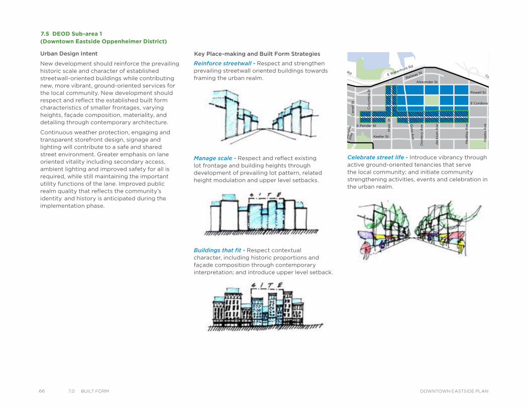
66 7.0 BuIlt Form DOWNTOWN EASTSIDE PLAN
Celebrate street life - Introduce vibrancy through active ground-oriented tenancies that serve the local community; and initiate community strengthening activities, events and celebration in the urban realm.
Reinforce streetwall - Respect and strengthen prevailing streetwall oriented buildings towards framing the urban realm.
Manage scale - Respect and reflect existing lot frontage and building heights through development of prevailing lot pattern, related height modulation and upper level setbacks.
Buildings that fit - Respect contextual character, including historic proportions and façade composition through contemporary interpretation; and introduce upper level setback.
•
7.5 DEOD Sub-area 1(Downtown Eastside Oppenheimer District)
Key Place-making and Built Form Strategies
Water StTrounce Alley
Alexander St
E Cordova St
Centennial Rd
Powell St
E Waterfront Rd
Railway St
W Waterfront Rd
William St William St
Powell St
Stewart St
Napier St
Venables St
Adanac St
Union St
Qu
eb
ec S
t
Ge
org
e S
t
Cla
rk D
r
Atlantic St
National Ave
Malkin Ave
Terminal Ave
Evans Ave
National Ave
Nelson St
Prior St
Franklin St
E Hastings St
Pandora St Triumph St
E Pender St
Frances St
E Georgia St
E Pender St
W Cordova St
W Hastings St
Dunsmuir St
Robson St
W G
eorgia St
Smithe St
W Pender St
Cam
bie S
t
Sh
an
gh
ai
Alle
y
Beatt
y St Cita
del P
arad
e
Ham
ilton
St
Mai
nlan
d St
Hom
er S
t
Richa
rds St
Hor
nby
St
How
e St
Seym
our S
t
Gra
nville
St
Keefer St
Go
re A
ve
Jackso
n A
ve
Sta
tio
n S
t
Main
S
t
Co
lum
bia
St
Pacific
Blvd
Terry Fox Way
Carr
all
St
Ab
bo
tt S
t
Taylo
r S
t
Pri
ncess
Ave
Cam
pb
ell
Ave
Ray
mur
Ave
Ve
rno
n D
r
Wo
od
lan
d D
rW
oo
dla
nd
Dr
Sals
bu
ry D
r
Gle
n D
r
Heatl
ey A
ve
Haw
ks
Ave
Th
orn
ton S
t
Ch
ess
St
Dunsmuir Viaduct
Expo
Blv
d
Georgia Viaduct
Griffiths Way
Cambie B
ridg
e
Du
nle
vy A
ve
Urban Design Intent
New development should reinforce the prevailing historic scale and character of established streetwall-oriented buildings while contributing new, more vibrant, ground-oriented services for the local community. New development should respect and reflect the established built form characteristics of smaller frontages, varying heights, façade composition, materiality, and detailing through contemporary architecture.
Continuous weather protection, engaging and transparent storefront design, signage and lighting will contribute to a safe and shared street environment. Greater emphasis on lane oriented vitality including secondary access, ambient lighting and improved safety for all is required, while still maintaining the important utility functions of the lane. Improved public realm quality that reflects the community’s identity and history is anticipated during the implementation phase.
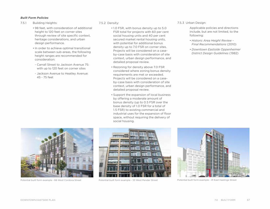
Potential built form example - 33 West Pender Street Potential built form example - 66 West Cordova Street Potential built form example - 41 East Hastings Street
Built Form Policies
7.5.1 Building Heights:
• 98 feet, with consideration of additional height to 120 feet on corner sites through review of site specific context, heritage considerations, and urban design performance.
• In order to achieve optimal transitional scale between sub-areas, the following height ranges are recommended for consideration:
- Carrall Street to Jackson Avenue 75: with up to 120 feet on corner sites
- Jackson Avenue to Heatley Avenue: 45 - 75 feet
7.5.2 Density:
• 1.0 FSR, with bonus density up to 5.0 FSR total for projects with 60 per cent social housing units and 40 per cent secured market rental housing units, with potential for additional bonus density up to 7.0 FSR on corner sites. Projects will be considered on a case-by-case basis with consideration of site context, urban design performance, and detailed proposal review.
• Rezoning for density above 7.0 FSR considered where zoning bonus density requirements are met or exceeded. Projects will be considered on a case-by-case basis with consideration of site context, urban design performance, and detailed proposal review.
• Support the expansion of local business by offering a moderate amount of bonus density (up to 0.5 FSR over the base density of 1.0 FSR for a total of 1.5 FSR) to existing commercial and industrial uses for the expansion of floor space, without requiring the delivery of social housing.
7.5.3 Urban Design:
Applicable policies and directions include, but are not limited, to the following:
• Historic Area Height Review - Final Recommendations (2010)
• Downtown Eastside Oppenheimer District Design Guidelines (1982)
677.0 BuIlt FormDOWNTOWN EASTSIDE PLAN
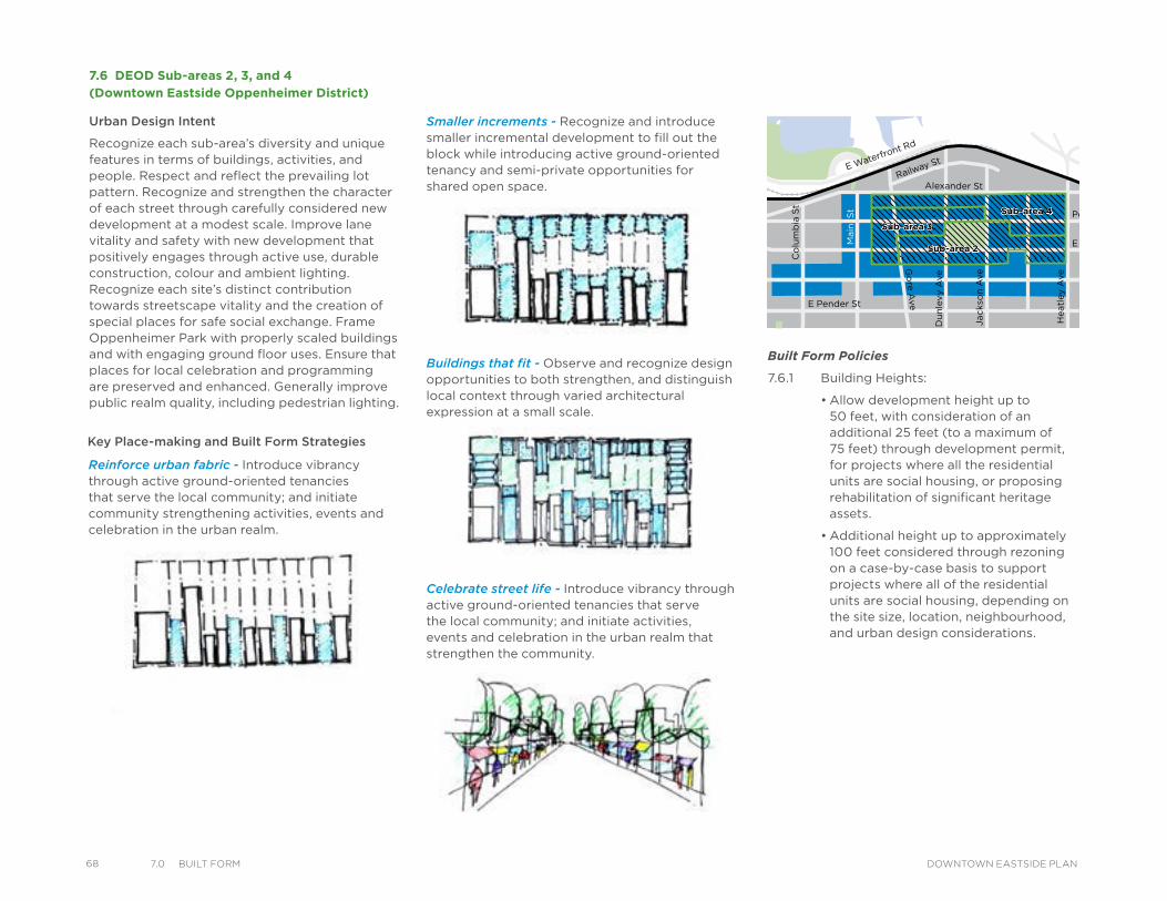
68 7.0 BuIlt Form DOWNTOWN EASTSIDE PLAN
Reinforce urban fabric - Introduce vibrancy through active ground-oriented tenancies that serve the local community; and initiate community strengthening activities, events and celebration in the urban realm.
Smaller increments - Recognize and introduce smaller incremental development to fill out the block while introducing active ground-oriented tenancy and semi-private opportunities for shared open space.
Buildings that fit - Observe and recognize design opportunities to both strengthen, and distinguish local context through varied architectural expression at a small scale.
Celebrate street life - Introduce vibrancy through active ground-oriented tenancies that serve the local community; and initiate activities, events and celebration in the urban realm that strengthen the community.
7.6 DEOD Sub-areas 2, 3, and 4
Sub-area 3Sub-area 3
Sub-area 4Sub-area 4
Water StTrounce Alley
Alexander St
E Cordova St
Centennial Rd
Powell St
E Waterfront Rd
Railway St
W Waterfront Rd
William St William St
Powell St
Stewart St
Napier St
Venables St
Adanac St
Union St
Qu
eb
ec S
t
Ge
org
e S
t
Cla
rk D
r
Atlantic St
National Ave
Malkin Ave
Terminal Ave
Evans Ave
National Ave
Nelson St
Prior St
Franklin St
E Hastings St
Pandora St Triumph St
E Pender St
Frances St
E Georgia St
E Pender St
W Cordova St
W Hastings St
Dunsmuir St
Robson St
W G
eorgia St
Smithe St
W Pender St
Cam
bie S
t
Sh
an
gh
ai
Alle
y
Beatt
y St Cita
del P
arad
e
Ham
ilton
St
Mai
nlan
d St
Hom
er S
t
Richa
rds St
Hor
nby
St
How
e St
Seym
our S
t
Gra
nville
St
Keefer St
Go
re A
ve
Jackso
n A
ve
Sta
tio
n S
t
Main
S
t
Co
lum
bia
St
Pacific
Blvd
Terry Fox Way
Carr
all
St
Ab
bo
tt S
t
Taylo
r S
t
Pri
ncess
Ave
Cam
pb
ell
Ave
Ray
mur
Ave
Ve
rno
n D
r
Wo
od
lan
d D
rW
oo
dla
nd
Dr
Sals
bu
ry D
r
Gle
n D
r
Heatl
ey A
ve
Haw
ks
Ave
Th
orn
ton S
t
Ch
ess
St
Sub-area 2Sub-area 2
Dunsmuir Viaduct
Expo
Blv
d
Georgia Viaduct
Griffiths Way
Cambie B
ridg
e
Du
nle
vy A
ve
Key Place-making and Built Form Strategies
Built Form Policies
7.6.1 Building Heights:
• Allow development height up to 50 feet, with consideration of an additional 25 feet (to a maximum of 75 feet) through development permit, for projects where all the residential units are social housing, or proposing rehabilitation of significant heritage assets.
• Additional height up to approximately 100 feet considered through rezoning on a case-by-case basis to support projects where all of the residential units are social housing, depending on the site size, location, neighbourhood, and urban design considerations.
(Downtown Eastside Oppenheimer District)
Urban Design Intent
Recognize each sub-area’s diversity and unique features in terms of buildings, activities, and people. Respect and reflect the prevailing lot pattern. Recognize and strengthen the character of each street through carefully considered new development at a modest scale. Improve lane vitality and safety with new development that positively engages through active use, durable construction, colour and ambient lighting. Recognize each site’s distinct contribution towards streetscape vitality and the creation of special places for safe social exchange. Frame Oppenheimer Park with properly scaled buildings and with engaging ground floor uses. Ensure that places for local celebration and programming are preserved and enhanced. Generally improve public realm quality, including pedestrian lighting.
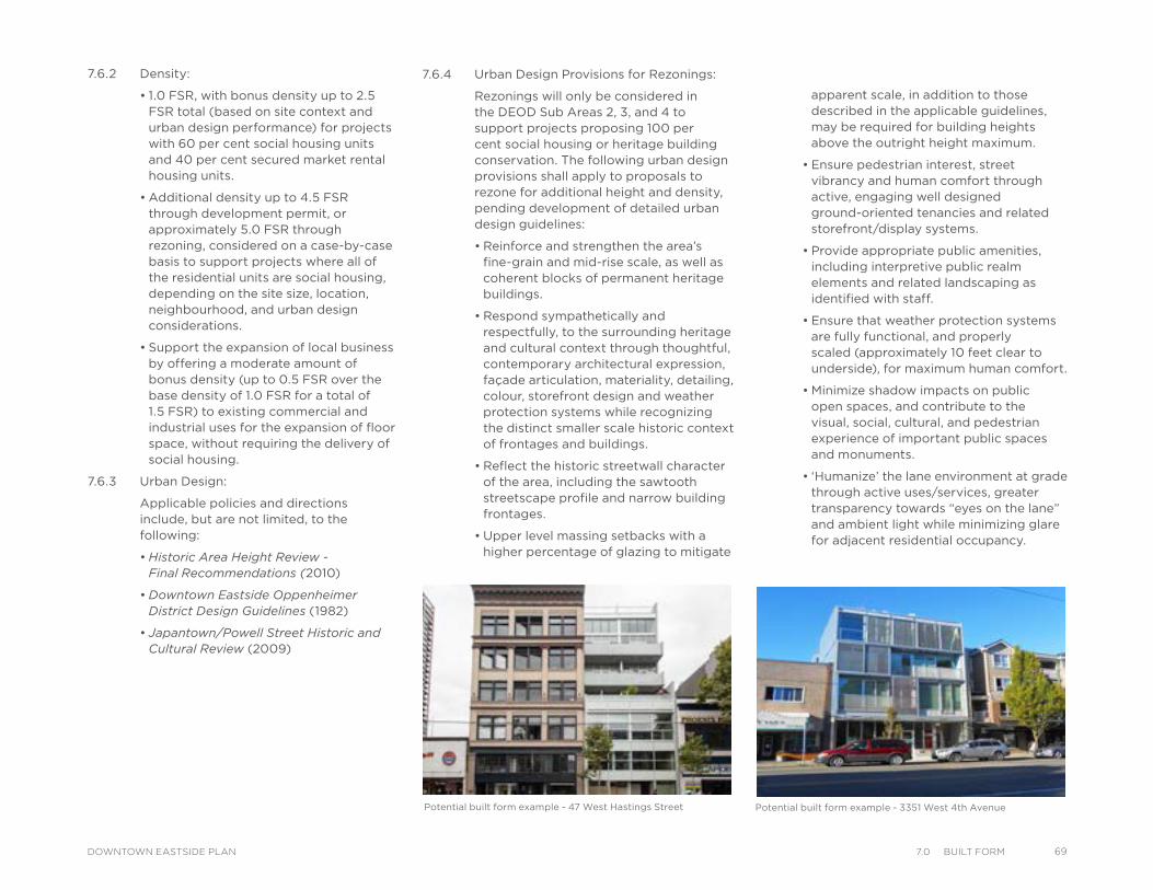
Potential built form example - 3351 West 4th AvenuePotential built form example - 47 West Hastings Street
7.6.2 Density:
• 1.0 FSR, with bonus density up to 2.5 FSR total (based on site context and urban design performance) for projects with 60 per cent social housing units and 40 per cent secured market rental housing units.
• Additional density up to 4.5 FSR through development permit, or approximately 5.0 FSR through rezoning, considered on a case-by-case basis to support projects where all of the residential units are social housing, depending on the site size, location, neighbourhood, and urban design considerations.
• Support the expansion of local business by offering a moderate amount of bonus density (up to 0.5 FSR over the base density of 1.0 FSR for a total of 1.5 FSR) to existing commercial and industrial uses for the expansion of floor space, without requiring the delivery of social housing.
7.6.3 Urban Design:
Applicable policies and directions include, but are not limited, to the following:
• Historic Area Height Review - Final Recommendations (2010)
• Downtown Eastside Oppenheimer District Design Guidelines (1982)
• Japantown/Powell Street Historic and Cultural Review (2009)
7.6.4 Urban Design Provisions for Rezonings:
Rezonings will only be considered in the DEOD Sub Areas 2, 3, and 4 to support projects proposing 100 per cent social housing or heritage building conservation. The following urban design provisions shall apply to proposals to rezone for additional height and density, pending development of detailed urban design guidelines:
• Reinforce and strengthen the area’s fine-grain and mid-rise scale, as well as coherent blocks of permanent heritage buildings.
• Respond sympathetically and respectfully, to the surrounding heritage and cultural context through thoughtful, contemporary architectural expression, façade articulation, materiality, detailing, colour, storefront design and weather protection systems while recognizing the distinct smaller scale historic context of frontages and buildings.
• Reflect the historic streetwall character of the area, including the sawtooth streetscape profile and narrow building frontages.
• Upper level massing setbacks with a higher percentage of glazing to mitigate
apparent scale, in addition to those described in the applicable guidelines, may be required for building heights above the outright height maximum.
• Ensure pedestrian interest, street vibrancy and human comfort through active, engaging well designed ground-oriented tenancies and related storefront/display systems.
• Provide appropriate public amenities, including interpretive public realm elements and related landscaping as identified with staff.
• Ensure that weather protection systems are fully functional, and properly scaled (approximately 10 feet clear to underside), for maximum human comfort.
• Minimize shadow impacts on public open spaces, and contribute to the visual, social, cultural, and pedestrian experience of important public spaces and monuments.
• ‘Humanize’ the lane environment at grade through active uses/services, greater transparency towards “eyes on the lane” and ambient light while minimizing glare for adjacent residential occupancy.
697.0 BuIlt FormDOWNTOWN EASTSIDE PLAN
70 7.0 BuIlt Form DOWNTOWN EASTSIDE PLAN
7.7 Hastings East
Key Place-making and Built Form Strategies
Create new places - Introduce a locally serving shopping street, and related public realm improvements and open space, through new development opportunities.
Accelerate vibrancy - Focus new investment in local services, gathering places and related public amenity as new development occurs.
Emphasize distinctive identity - Observe, recognize and respect the unique urban realm adjacencies towards a shared, distinct shopping street identity.
Water StTrounce Alley
Alexander St
E Cordova St
Centennial Rd
Powell St
E Waterfront Rd
Railway St
W Waterfront Rd
William St William St
Powell St
Stewart St
Napier St
Venables St
Adanac St
Union St
Qu
eb
ec S
t
Ge
org
e S
t
Cla
rk D
r
Atlantic St
National Ave
Malkin Ave
Terminal Ave
Evans Ave
National Ave
Nelson St
Prior St
Franklin St
E Hastings St
Pandora St Triumph St
E Pender St
Frances St
E Georgia St
E Pender St
W Cordova St
W Hastings St
Dunsmuir St
Robson St
W G
eorgia St
Smithe St
W Pender St
Cam
bie S
t
Sh
an
gh
ai
Alle
y
Beatt
y St Cita
del P
arad
e
Ham
ilton
St
Mai
nlan
d St
Hom
er S
t
Richa
rds St
Hor
nby
St
How
e St
Seym
our S
t
Gra
nville
St
Keefer St
Go
re A
ve
Jackso
n A
ve
Sta
tio
n S
t
Main
St
Co
lum
bia
St
Pacific
Blvd
Terry Fox Way
Carr
all
St
Ab
bo
tt S
t
Taylo
r S
t
Pri
ncess
Ave
Cam
pb
ell
Ave
Ray
mur
Ave
Ve
rno
n D
r
Wo
od
lan
d D
rW
oo
dla
nd
Dr
Sals
bu
ry D
r
Gle
n D
r
Heatl
ey A
ve
Haw
ks
Ave
Th
orn
ton S
t
Ch
ess
St
Dunsmuir Viaduct
Expo
Blv
d
Georgia Viaduct
Griffiths Way
Cambie B
ridg
e
Du
nle
vy A
ve
Urban Design Intent
Hastings East is an important transportation corridor and contributes to the larger idea of Hastings as a shared crosstown street. While largely underdeveloped, with the potential to contribute significant housing capacity of mixed tenure, Hastings East should reinforce built form scale and character evident in the older part of the city.
Hastings East should deliver an accessible, locally serving shopping street reflective of community identity needs while providing special ‘places to go’. Sites should develop with varying frontages, with an emphasis on smaller sites in achieving greater density through vertical, compact form, towards establishing an identifiable new character that reinforces Hastings East as a locally serving shopping area. Higher buildings should be located at block ends, and lower buildings should be located in between, to optimize views to the north from established neighbourhoods to the south.
A variety of smaller frontage, ground-oriented tenancies should contribute to a more vibrant pedestrian experience. Public realm and civic amenity investment, including pedestrian and bicycle movement systems, will contribute to a new community focus and identity.
Preserve public views from MacLean Park - The height and form of new development on East Hastings between Heatley Avenue and Campbell Avenue shall respect public views of the north shore mountains ridgeline.
(Heatley Avenue to Clark Drive)
Potential built form example - New York City, Tribeca Neighbourhood
Potential built form example - San Francisco, South of Market Neighbourhood
Potential built form example - Columbia Ohio State University
Built Form Policies
7.7.1 Building Heights:
• Consider development within a height range of 45 – 150 feet, depending on site size, location, neighbourhood and urban design considerations.
• Recommended height ranges are as follows:
- Heatley Avenue to Campbell Avenue: 45 – 75 feet to take into account protection of north views from the MacLean Park area.
- Campbell Avenue to Clark Drive: 45 – 120 feet
- Two flat-iron sites at Hastings Street and Vernon Drive: 45 – 150 feet
7.7.2 Density:
• Consider densities in the range of 2.5 – 7.0 FSR, depending on site size, location, neighbourhood, and urban design considerations and provision of 20 - 30 per cent social housing through rezoning.
• Recommended density ranges are as follows:
- Heatley Avenue to Campbell Avenue: 2.5 – 4.5 FSR
- Campbell Avenue to Clark Drive: 2.5 – 6.0 FSR
- Two flat-iron sites at Hastings Street and Vernon Drive: 2.5 – 7.0 FSR
7.7.3 Urban Design Provisions for Rezonings:
a) Frontage and Assembly:
• See Hastings Street Urban Design Framework (6.0 Places, Section 6.6.2)
• Respect historic frontage pattern with emphasis on re-establishing more locally scaled buildings that reinforce the area’s context and character.
• Maximum development site frontage shall be:
- Heatley Avenue to Campbell Avenue: 150 feet
- Campbell Avenue to Clark Drive: 200 feet
b) Form and Massing:
• Express larger site developments as a series of more individual buildings reflective of locally appropriate street wall scale and character.
• New buildings should be contextually derived and reflect a simple rectilinear form, while expressive of tripartite expression as contemporary architecture.
• New buildings should introduce setbacks of upper levels with a higher percentage of glazing in fenestration patterns to lighten upper massing and introduce random streetwall heights that achieve transitional scale between buildings within the block.
• Ensure proper grade tenancy interior volume for varying active commercial uses, including restaurants, through a floor to floor height of approximately 18 feet.
717.0 BuIlt FormDOWNTOWN EASTSIDE PLAN
72 7.0 BuIlt Form DOWNTOWN EASTSIDE PLAN
Reinforce and strengthen prevailing urban fabric - Recognize and strengthen the prevailing pattern of small lots, and distinctive character and corner-oriented buildings that accommodate a variety of uses and activities towards Strathcona’s distinctive identity and urban realm.
Recognize design opportunities for community serving mixed-use - Consider locally serving, small scale mixed-use opportunities that reinforce Strathcona’s distinctive identity while contributing to pedestrian interest and vibrancy.
Seek opportunities to demonstrate creative skill sets in the public realm - Support special contributions by the community that reinforce the unique public realm quality of Strathcona.
Recognize design opportunities for thoughtful contemporary architecture - Introduce small scale, contextually appropriate, well designed contemporary buildings that contribute to community identity.Water St
Trounce Alley
Alexander St
E Cordova St
Centennial Rd
Powell St
E Waterfront Rd
Railway St
W Waterfront Rd
William St William St
Powell St
Stewart St
Napier St
Venables St
Adanac St
Union St
Qu
eb
ec S
t
Geo
rge S
t
Cla
rk D
r
Atlantic St
National Ave
Malkin Ave
Terminal Ave
Evans Ave
National Ave
Nelson St
Prior St
Franklin St
E Hastings St
Pandora St Triumph St
E Pender St
Frances St
E Georgia St
E Pender St
W Cordova St
W Hastings St
Dunsmuir St
Robson St
W G
eorgia St
Smithe St
W Pender St
Cam
bie S
t
Sh
an
gh
ai
Alle
y
Beatt
y St Cita
del P
arad
e
Ham
ilton
St
Mai
nlan
d St
Hom
er S
t
Richa
rds St
Hor
nby
St
How
e St
Seym
our S
t
Gra
nville
St
Keefer St
Go
re A
ve
Jackso
n A
ve
Du
nle
vy A
ve
Sta
tio
n S
t
Main
St
Co
lum
bia
St
Pacific
Blvd
Terry Fox Way
Carr
all
St
Ab
bo
tt S
t
Taylo
r S
t
Pri
ncess
Ave
Cam
pb
ell
Ave
Raym
ur
Ave
Vern
on
Dr
Wo
od
lan
d D
rW
oo
dla
nd
Dr
Sals
bu
ry D
r
Gle
n D
r
Heatl
ey A
ve
Haw
ks
Ave
Th
orn
ton S
t
Ch
ess
St
Dunsmuir Viaduct
Expo
Blv
d
Georgia Viaduct
Griffiths Way
Cambie B
ridg
e
7.8 Strathcona
Key Place-making and Built Form Strategies Built Form Policies
7.8.1 Building Heights for RT-3 sites:
• 35 feet
• Consider additional height through rezoning only to increase social housing on existing social housing sites, or for 100 per cent secured market rental housing on sites fronting on Gore Avenue.
7.8.2 Density for RT-3 sites:
• 0.6 FSR, which could be relaxed to 0.75 FSR or 0.95 FSR for infill.
• Consider additional density through rezoning only for residential development where the sites is an existing social housing site and the amount of social housing is being increased, or where the site is fronting on Gore Avenue and all of the residential use is for social housing, or secured market rental housing.
7.8.3 Urban Design:
Applicable policies and directions include, but are not limited, to the following:
• Strathcona Plan (1992)
• Strathcona Policies (1992)
• Strathcona/Kiwassa RT-3 Design Guidelines (1992)
Character homes in Strathcona
1902 Heritage house affectionately called ‘The Principal’s House’ as it was home to Gregory Henry Tom, principal of Strathcona School until 1911.
7.9 Kiwassa West
Water StTrounce Alley
Alexander St
E Cordova St
Centennial Rd
Powell St
E Waterfront Rd
Railway St
W Waterfront Rd
William St William St
Powell St
Stewart St
Napier St
Venables St
Adanac St
Union St
Qu
eb
ec S
t
Geo
rge S
t
Cla
rk D
r
Atlantic St
National Ave
Malkin Ave
Terminal Ave
Evans Ave
National Ave
Nelson St
Prior St
Franklin St
E Hastings St
Pandora St Triumph St
E Pender St
Frances St
E Georgia St
E Pender St
W Cordova St
W Hastings St
Dunsmuir St
Robson St
W G
eorgia St
Smithe St
W Pender St
Cam
bie S
t
Sh
an
gh
ai
Alle
y
Beatt
y St Cita
del P
arad
e
Ham
ilton
St
Mai
nlan
d St
Hom
er S
t
Richa
rds St
Hor
nby
St
How
e St
Seym
our S
t
Gra
nville
St
Keefer StGo
re A
ve
Jackso
n A
ve
Sta
tio
n S
t
Main
St
Co
lum
bia
St
Pacific
Blvd
Terry Fox Way
Carr
all
St
Ab
bo
tt S
t
Taylo
r S
t
Pri
ncess
Ave
Cam
pb
ell
Ave
Ray
mur
Ave
Vern
on
Dr
Wo
od
lan
d D
rW
oo
dla
nd
Dr
Sals
bu
ry D
r
Gle
n D
r
Heatl
ey A
ve
Haw
ks
Ave
Th
orn
ton S
t
Ch
ess
St
Dunsmuir Viaduct
Expo
Blv
d
Georgia Viaduct
Griffiths Way
Cambie B
ridg
e
Du
nle
vy A
ve
Key Place-making and Built Form Strategies
Urban distinctiveness – Recognize and strengthen the unique context and buildings towards mixing compatible uses that achieve shared synergy.
Enhance movement – Pursue opportunities with prevailing ownership towards greater connectivity and shared public amenity between West and East Kiwassa and the Eastern Transitional Area.
A place of making – Reveal and showcase creative, and related production, activities through engaging building frontages and adjacent shared public realm.
Gritty and messy – Reveal and celebrate the "un-kept, chaotic and unpredictable" towards urban discovery and local identity.
Urban Design Intent
Recognize the special place-making role this unique area and surrounding precinct can contribute to the DTES. Kiwassa West (west of the rail corridor) has the potential to become a unique “stop along the way” towards connecting the DTES to the False Creek Flats. Introduce greater walking and cycling connections, while recognizing the rail corridor as a character defining feature that connects the False Creek Flats to the Burrard Inlet. Establish a special identity based on local interests, skills and activities. Provide residential opportunities for families and consider diverse active ground-floor uses, such as small cafes, workshops, and other creative activities to provide amenity and attract civic interest. Integrate new housing opportunities in building form and character that reinforces the precinct’s identity as a creative, vibrant place of social exchange and discovery. Building form and character should be simple, durable and reflective of the precinct’s industrial history. All building frontages should be interesting to look at, with mixed-use buildings having pedestrian interest at grade.
737.0 BuIlt FormDOWNTOWN EASTSIDE PLAN
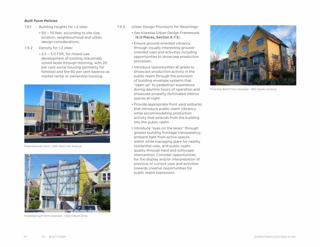
74 7.0 BuIlt Form DOWNTOWN EASTSIDE PLAN
Built Form Policies
7.9.1 Building Heights for I-2 sites:
• 50 – 70 feet, according to site size, location, neighbourhood and urban design considerations.
7.9.2 Density for I-2 sites:
• 2.5 – 3.0 FSR, for mixed-use development of existing industrially zoned lands through rezoning, with 20 per cent social housing (primarily for families) and the 80 per cent balance as market rental or ownership housing.
Potential built form - 3351 West 4th Avenue
Potential built form example - 1332 Odlum Drive
Potential Built Form example - 560 Hawks Avenue
7.9.3 Urban Design Provisions for Rezonings:
• See Kiwassa Urban Design Framework (6.0 Places, Section 6.7.5)
• Ensure ground-oriented vibrancy through visually interesting ground-oriented uses and activities including opportunities to showcase production processes.
• Introduce opportunities at grade to showcase production activity in the public realm through the provision of building envelope systems that “open up” to pedestrian experience during daytime hours of operation and showcase properly illuminated interior spaces at night.
• Provide appropriate front yard setbacks that introduce public realm vibrancy while accommodating production activity that extends from the building into the public realm.
• Introduce “eyes on the lanes” through greater building frontage transparency, ambient light from active spaces within while managing glare for nearby residential uses, and public realm quality through hard and softscape intervention. Consider opportunities for the display and/or interpretation of previous or current uses and activities towards creative opportunities for public realm expression.
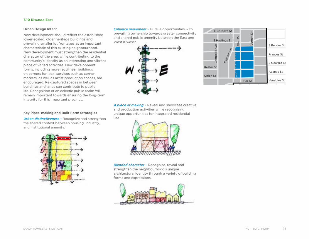
Key Place-making and Built Form Strategies
Urban distinctiveness - Recognize and strengthen the shared context between housing, industry, and institutional amenity.
7.10 Kiwassa East
A place of making – Reveal and showcase creative and production activities while recognizing unique opportunities for integrated residential use.
Blended character – Recognize, reveal and strengthen the neighbourhood’s unique architectural identity through a variety of building forms and expressions.
Water StTrounce Alley
Alexander St
E Cordova St
Centennial Rd
Powell St
E Waterfront Rd
Railway St
W Waterfront Rd
William St William St
Powell St
Stewart St
Napier St
Venables St
Adanac St
Union St
Qu
eb
ec S
t
Geo
rge S
t
Cla
rk D
r
Atlantic St
National Ave
Malkin Ave
Terminal Ave
Evans Ave
National Ave
Nelson St
Prior St
Franklin St
E Hastings St
Pandora St Triumph St
E Pender St
Frances St
E Georgia St
E Pender St
W Cordova St
W Hastings St
Dunsmuir St
Robson St
W G
eorgia St
Smithe St
W Pender St
Cam
bie S
t
Sh
an
gh
ai
Alle
y
Beatt
y St Cita
del P
arad
e
Ham
ilton
St
Mai
nlan
d St
Hom
er S
t
Richa
rds St
Hor
nby
St
How
e St
Seym
our S
t
Gra
nville
St
Keefer StGo
re A
ve
Jackso
n A
ve
Sta
tio
n S
t
Main
St
Co
lum
bia
St
Pacific
Blvd
Terry Fox Way
Carr
all
St
Ab
bo
tt S
t
Taylo
r S
t
Pri
ncess
Ave
Cam
pb
ell
Ave
Ray
mur
Ave
Vern
on
Dr
Wo
od
lan
d D
rW
oo
dla
nd
Dr
Sals
bu
ry D
r
Gle
n D
r
Heatl
ey A
ve
Haw
ks
Ave
Th
orn
ton S
t
Ch
ess
St
Dunsmuir Viaduct
Expo
Blv
d
Georgia Viaduct
Griffiths Way
Cambie B
ridg
e
Du
nle
vy A
ve
Urban Design Intent
New development should reflect the established lower-scaled, older heritage buildings and prevailing smaller lot frontages as an important characteristic of this existing neighbourhood. New development must strengthen the residential character of the area, while contributing to the community’s identity as an interesting and vibrant place of varied activities. New development forms, including more rectilinear buildings on corners for local services such as corner markets, as well as artist production spaces, are encouraged. Re-captured spaces in between buildings and lanes can contribute to public life. Recognition of an eclectic public realm will remain important towards ensuring the long-term integrity for this important precinct.
Enhance movement – Pursue opportunities with prevailing ownership towards greater connectivity and shared public amenity between the East and West Kiwassa.
757.0 BuIlt FormDOWNTOWN EASTSIDE PLAN
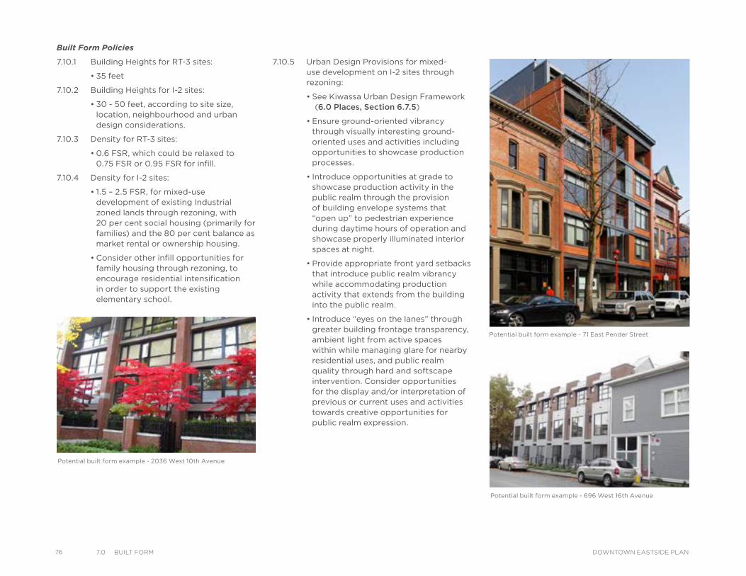
76 7.0 BuIlt Form DOWNTOWN EASTSIDE PLAN
Potential built form example - 2036 West 10th Avenue
Potential built form example - 696 West 16th Avenue
Built Form Policies
7.10.1 Building Heights for RT-3 sites:
• 35 feet
7.10.2 Building Heights for I-2 sites:
• 30 - 50 feet, according to site size, location, neighbourhood and urban design considerations.
7.10.3 Density for RT-3 sites:
• 0.6 FSR, which could be relaxed to 0.75 FSR or 0.95 FSR for infill.
7.10.4 Density for I-2 sites:
• 1.5 – 2.5 FSR, for mixed-use development of existing Industrial zoned lands through rezoning, with 20 per cent social housing (primarily for families) and the 80 per cent balance as market rental or ownership housing.
• Consider other infill opportunities for family housing through rezoning, to encourage residential intensification in order to support the existing elementary school.
Potential built form example - 71 East Pender Street
7.10.5 Urban Design Provisions for mixed-use development on I-2 sites through rezoning:
• See Kiwassa Urban Design Framework (6.0 Places, Section 6.7.5)
• Ensure ground-oriented vibrancy through visually interesting ground-oriented uses and activities including opportunities to showcase production processes.
• Introduce opportunities at grade to showcase production activity in the public realm through the provision of building envelope systems that “open up” to pedestrian experience during daytime hours of operation and showcase properly illuminated interior spaces at night.
• Provide appropriate front yard setbacks that introduce public realm vibrancy while accommodating production activity that extends from the building into the public realm.
• Introduce “eyes on the lanes” through greater building frontage transparency, ambient light from active spaces within while managing glare for nearby residential uses, and public realm quality through hard and softscape intervention. Consider opportunities for the display and/or interpretation of previous or current uses and activities towards creative opportunities for public realm expression.
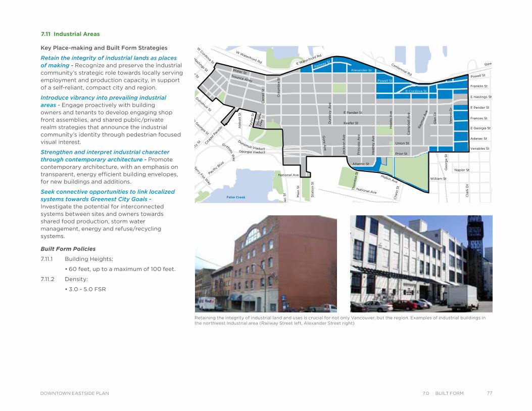
7.11 Industrial Areas
Water StTrounce Alley
Alexander St
E Cordova St
Centennial Rd
Powell St
E Waterfront Rd
Railway St
W Waterfront Rd
William St William St
Powell St
Stewart St
Napier St
Venables St
Adanac St
Union St
Qu
eb
ec S
t
Geo
rge S
t
Cla
rk D
r
Atlantic St
National Ave
Malkin Ave
Terminal Ave
Evans Ave
National Ave
Nelson St
Prior St
Franklin St
E Hastings St
Pandora St Triumph St
E Pender St
Frances St
E Georgia St
E Pender St
W Cordova St
W Hastings St
Dunsmuir St
Robson St
W G
eorgia St
Smithe St
W Pender St
Cam
bie S
t
Sh
an
gh
ai
Alle
y
Beatt
y St Cita
del P
arad
e
Ham
ilton
St
Mai
nlan
d St
Hom
er S
t
Richa
rds St
Hor
nby
St
How
e St
Seym
our S
t
Gra
nville
St
Keefer St
Go
re A
ve
Jackso
n A
ve
Sta
tio
n S
t
Main
St
Co
lum
bia
St
Pacific
Blvd
Terry Fox Way
Carr
all
St
Ab
bo
tt S
t
Taylo
r S
t
Pri
ncess
Ave C
am
pb
ell
Ave
Ray
mur
Ave
Vern
on
Dr W
oo
dla
nd
Dr
Wo
od
lan
d D
r
Sals
bu
ry D
r
Gle
n D
r
Heatl
ey A
ve
Haw
ks
Ave
Th
orn
ton S
t
Ch
ess
St
Dunsmuir Viaduct
Expo
Blv
d
Georgia Viaduct
Griffiths Way
Cambie B
ridg
e
Du
nle
vy A
ve
Key Place-making and Built Form Strategies
Retain the integrity of industrial lands as places of making - Recognize and preserve the industrial community’s strategic role towards locally serving employment and production capacity, in support of a self-reliant, compact city and region.
Introduce vibrancy into prevailing industrial areas - Engage proactively with building owners and tenants to develop engaging shop front assemblies, and shared public/private realm strategies that announce the industrial community’s identity through pedestrian focused visual interest.
Strengthen and interpret industrial character through contemporary architecture - Promote contemporary architecture, with an emphasis on transparent, energy efficient building envelopes, for new buildings and additions.
Seek connective opportunities to link localized systems towards Greenest City Goals - Investigate the potential for interconnected systems between sites and owners towards shared food production, storm water management, energy and refuse/recycling systems.
Built Form Policies
7.11.1 Building Heights:
• 60 feet, up to a maximum of 100 feet.
7.11.2 Density:
• 3.0 - 5.0 FSR
Retaining the integrity of industrial land and uses is crucial for not only Vancouver, but the region. Examples of industrial buildings in the northwest Industrial area (Railway Street left, Alexander Street right)
777.0 BuIlt FormDOWNTOWN EASTSIDE PLAN
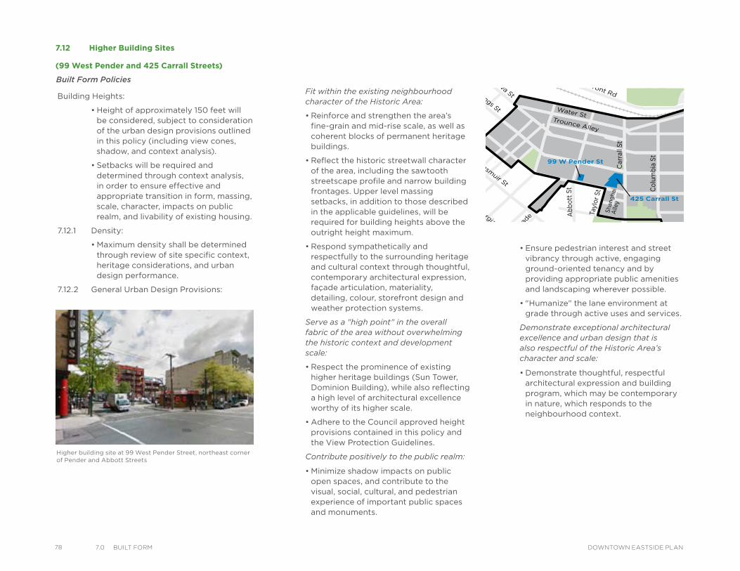
78 7.0 BuIlt Form DOWNTOWN EASTSIDE PLAN
Built Form Policies
7.12 Higher Building Sites
(99 West Pender and 425 Carrall Streets)
Fit within the existing neighbourhood character of the Historic Area:
• Reinforce and strengthen the area’s fine-grain and mid-rise scale, as well as coherent blocks of permanent heritage buildings.
• Reflect the historic streetwall character of the area, including the sawtooth streetscape profile and narrow building frontages. Upper level massing setbacks, in addition to those described in the applicable guidelines, will be required for building heights above the outright height maximum.
• Respond sympathetically and respectfully to the surrounding heritage and cultural context through thoughtful, contemporary architectural expression, façade articulation, materiality, detailing, colour, storefront design and weather protection systems.
Serve as a "high point" in the overall fabric of the area without overwhelming the historic context and development scale:
• Respect the prominence of existing higher heritage buildings (Sun Tower, Dominion Building), while also reflecting a high level of architectural excellence worthy of its higher scale.
• Adhere to the Council approved height provisions contained in this policy and the View Protection Guidelines.
Contribute positively to the public realm:
• Minimize shadow impacts on public open spaces, and contribute to the visual, social, cultural, and pedestrian experience of important public spaces and monuments.
99 W Pender St
425 Carrall St
ChinatownSouth
1195 E Hastings St
1212 E Hastings St
Water StTrounce Alley
Alexander St
E Cordova St
Centennial Rd
Powell St
E Waterfront Rd
Railway St
W Waterfront Rd
William St William St
Powell St
Stewart St
Napier St
Venables St
Adanac St
Union St
Que
bec
St
Geo
rge
St
Cla
rk D
r
Atlantic St
National Ave
Malkin Ave
Terminal Ave
Evans Ave
National Ave
Nelson St
Prior St
Franklin St
E Hastings St
Pandora St Triumph St
E Pender St
Frances St
E Georgia St
E Pender St
W Cordova St
W Hastings St
Dunsmuir St
Robson St
W Georgia St
Smithe St
W Pender St
Cambie
St
Sha
ngha
iA
lley
Beatt
y St
Citadel
Par
ade
Hamilt
on St
Mai
nland S
t
Homer
St
Richar
ds St
Hornby
St
Howe
St
Seym
our St
Granv
ille S
t
Keefer St
Go
re Ave
Jack
son
Ave
Sta
tio
n S
t
Mai
n S
t
Co
lum
bia
St
Pacific B
lvdTerry Fox W
ay
Car
rall
St
Ab
bo
tt S
t
Tayl
or
St
Pri
nce
ss A
ve
Cam
pb
ell A
ve
Ray
mur
Ave
Ver
no
n D
r
Wo
od
lan
d D
rW
oo
dla
nd
Dr
Sal
sbur
y D
r
Gle
n D
r
Hea
tley
Ave
Haw
ks A
ve
Tho
rnto
n St
Che
ss S
t
Dunsmuir Viaduct
Expo
Blvd
Georgia Viaduct
Griffiths Way
Cam
bie Brid
ge
Dun
levy
Ave
Building Heights:
• Height of approximately 150 feet will be considered, subject to consideration of the urban design provisions outlined in this policy (including view cones, shadow, and context analysis).
• Setbacks will be required and determined through context analysis, in order to ensure effective and appropriate transition in form, massing, scale, character, impacts on public realm, and livability of existing housing.
7.12.1 Density:
• Maximum density shall be determined through review of site specific context, heritage considerations, and urban design performance.
7.12.2 General Urban Design Provisions:
• Ensure pedestrian interest and street vibrancy through active, engaging ground-oriented tenancy and by providing appropriate public amenities and landscaping wherever possible.
• "Humanize" the lane environment at grade through active uses and services.
Demonstrate exceptional architectural excellence and urban design that is also respectful of the Historic Area’s character and scale:
• Demonstrate thoughtful, respectful architectural expression and building program, which may be contemporary in nature, which responds to the neighbourhood context.
Higher building site at 99 West Pender Street, northeast corner of Pender and Abbott Streets
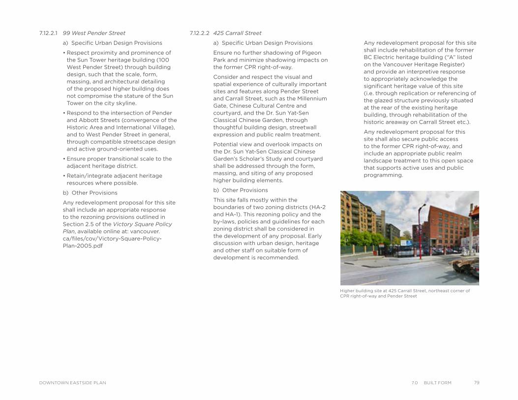
7.12.2.1 99 West Pender Street
a) Specific Urban Design Provisions
• Respect proximity and prominence of the Sun Tower heritage building (100 West Pender Street) through building design, such that the scale, form, massing, and architectural detailing of the proposed higher building does not compromise the stature of the Sun Tower on the city skyline.
• Respond to the intersection of Pender and Abbott Streets (convergence of the Historic Area and International Village), and to West Pender Street in general, through compatible streetscape design and active ground-oriented uses.
• Ensure proper transitional scale to the adjacent heritage district.
• Retain/integrate adjacent heritage resources where possible.
b) Other Provisions
Any redevelopment proposal for this site shall include an appropriate response to the rezoning provisions outlined in Section 2.5 of the Victory Square Policy Plan, available online at: vancouver.ca/files/cov/Victory-Square-Policy-Plan-2005.pdf
7.12.2.2 425 Carrall Street
a) Specific Urban Design Provisions
Ensure no further shadowing of Pigeon Park and minimize shadowing impacts on the former CPR right-of-way.
Consider and respect the visual and spatial experience of culturally important sites and features along Pender Street and Carrall Street, such as the Millennium Gate, Chinese Cultural Centre and courtyard, and the Dr. Sun Yat-Sen Classical Chinese Garden, through thoughtful building design, streetwall expression and public realm treatment.
Potential view and overlook impacts on the Dr. Sun Yat-Sen Classical Chinese Garden’s Scholar’s Study and courtyard shall be addressed through the form, massing, and siting of any proposed higher building elements.
b) Other Provisions
This site falls mostly within the boundaries of two zoning districts (HA-2 and HA-1). This rezoning policy and the by-laws, policies and guidelines for each zoning district shall be considered in the development of any proposal. Early discussion with urban design, heritage and other staff on suitable form of development is recommended.
Any redevelopment proposal for this site shall include rehabilitation of the former BC Electric heritage building (“A” listed on the Vancouver Heritage Register) and provide an interpretive response to appropriately acknowledge the significant heritage value of this site (i.e. through replication or referencing of the glazed structure previously situated at the rear of the existing heritage building, through rehabilitation of the historic areaway on Carrall Street etc.).
Any redevelopment proposal for this site shall also secure public access to the former CPR right-of-way, and include an appropriate public realm landscape treatment to this open space that supports active uses and public programming.
Higher building site at 425 Carrall Street, northeast corner of CPR right-of-way and Pender Street
797.0 BuIlt FormDOWNTOWN EASTSIDE PLAN
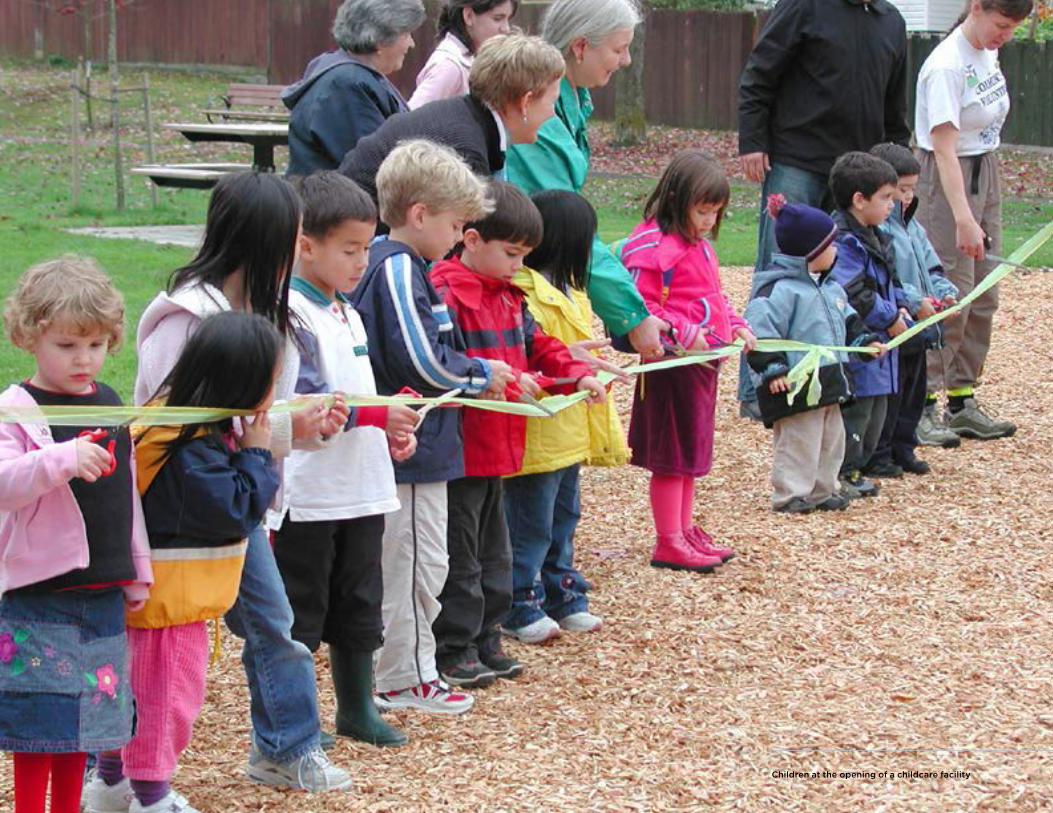
Children at the opening of a childcare facility
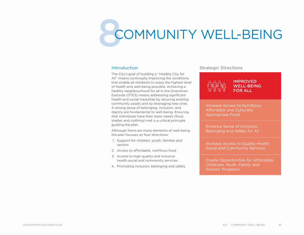
8COMMUNITY WELL-BEING
IntroductionThe City’s goal of building a “Healthy City for All” means continually improving the conditions that enable all residents to enjoy the highest level of health and well-being possible. Achieving a healthy neighbourhood for all in the Downtown Eastside (DTES) means addressing significant health and social inequities by securing existing community assets and by leveraging new ones. A strong sense of belonging, inclusion, and dignity are fundamental to well-being. Ensuring that individuals have their basic needs (food, shelter and clothing) met is a critical principle guiding the plan.
Although there are many elements of well-being, the plan focuses on four directions:
1. Support for children, youth, families and seniors
2. Access to affordable, nutritious food
3. Access to high-quality and inclusive health,social and community services
4. Promoting inclusion, belonging and safety
IMPROVEDWELL-BEINGFOR ALL
Increase Access to Nutritious, Affordable and Culturally Appropriate Food
Enhance Sense of Inclusion,Belonging and Safety for All
Increase Access to Quality Health, Social and Community Services
Create Opportunities for Affordable Childcare, Youth, Family and Seniors’ Programs
Strategic Directions
818.0 CommunIty Well-BeIngDOWNTOWN EASTSIDE PLAN
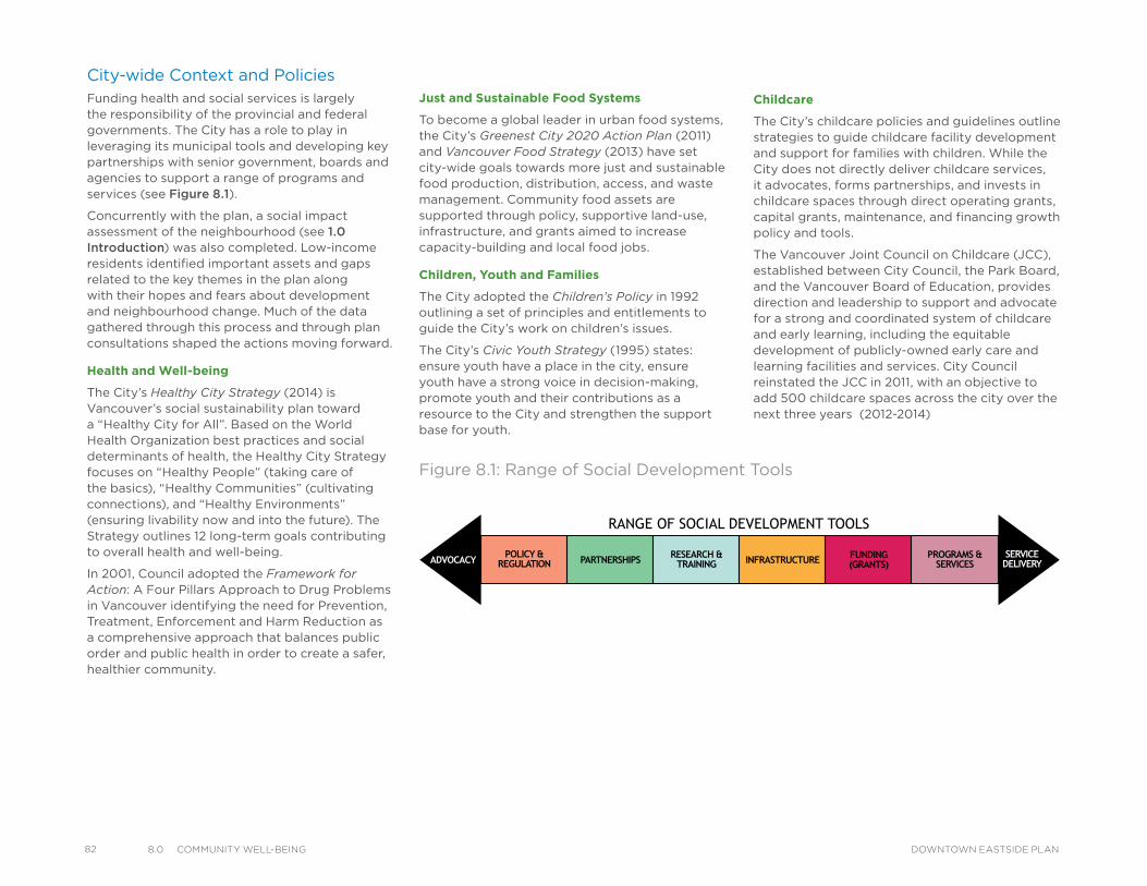
82 8.0 CommunIty Well-BeIng DOWNTOWN EASTSIDE PLAN
City-wide Context and PoliciesFunding health and social services is largely the responsibility of the provincial and federal governments. The City has a role to play in leveraging its municipal tools and developing key partnerships with senior government, boards and agencies to support a range of programs and services (see Figure 8.1).
Concurrently with the plan, a social impact assessment of the neighbourhood (see 1.0 Introduction) was also completed. Low-income residents identified important assets and gaps related to the key themes in the plan along with their hopes and fears about development and neighbourhood change. Much of the data gathered through this process and through plan consultations shaped the actions moving forward.
Health and Well-being
The City’s Healthy City Strategy (2014) is Vancouver’s social sustainability plan toward a “Healthy City for All”. Based on the World Health Organization best practices and social determinants of health, the Healthy City Strategy focuses on “Healthy People” (taking care of the basics), “Healthy Communities” (cultivating connections), and “Healthy Environments” (ensuring livability now and into the future). The Strategy outlines 12 long-term goals contributing to overall health and well-being.
In 2001, Council adopted the Framework for Action: A Four Pillars Approach to Drug Problems in Vancouver identifying the need for Prevention, Treatment, Enforcement and Harm Reduction as a comprehensive approach that balances public order and public health in order to create a safer, healthier community.
Just and Sustainable Food Systems
To become a global leader in urban food systems, the City’s Greenest City 2020 Action Plan (2011) and Vancouver Food Strategy (2013) have set city-wide goals towards more just and sustainable food production, distribution, access, and waste management. Community food assets are supported through policy, supportive land-use, infrastructure, and grants aimed to increase capacity-building and local food jobs.
Children, Youth and Families
The City adopted the Children’s Policy in 1992 outlining a set of principles and entitlements to guide the City’s work on children’s issues.
The City’s Civic Youth Strategy (1995) states: ensure youth have a place in the city, ensure youth have a strong voice in decision-making, promote youth and their contributions as a resource to the City and strengthen the support base for youth.
Childcare
The City’s childcare policies and guidelines outline strategies to guide childcare facility development and support for families with children. While the City does not directly deliver childcare services, it advocates, forms partnerships, and invests in childcare spaces through direct operating grants, capital grants, maintenance, and financing growth policy and tools.
The Vancouver Joint Council on Childcare (JCC), established between City Council, the Park Board, and the Vancouver Board of Education, provides direction and leadership to support and advocate for a strong and coordinated system of childcare and early learning, including the equitable development of publicly-owned early care and learning facilities and services. City Council reinstated the JCC in 2011, with an objective to add 500 childcare spaces across the city over the next three years (2012-2014)
RANGE OF SOCIAL DEVELOPMENT TOOLS
POLICY ®ULATION PARTNERSHIPS RESEARCH &
TRAINING INFRASTRUCTURE FUNDING(GRANTS)
PROGRAMS & SERVICES
SERVICEDELIVERYADVOCACY
Figure 8.1: Range of Social Development Tools

Local Area Directions Building a healthy neighbourhood for all DTES residents is a key goal of the plan. Additional efforts must be made to assist the neighbourhood’s most vulnerable and marginalized groups who face challenges due to homelessness, poverty, unemployment, drug/alcohol misuse, and challenges accessing health and social services. Ensuring that resident’s basic needs are met through access to healthy and nutritious food, adequate housing options and affordable places to shop are maintained and enhanced.
Residents must have a strong sense of community belonging, inclusion, dignity and safety to promote overall personal and community health and well-being. Children, youth and families must have safe, affordable and accessible programs and services promoting healthy human development, strong families, and safe places to learn, work and play. Social and health services must be readily available and accessible for all residents but particularly for more vulnerable residents that struggle with mental health, addiction, homelessness or engage in survival sex work. It is also vitally important to preserve important community social assets and look for opportunities to leverage additional ones.
While the day-to-day vulnerabilities in the DTES are evident, they present unique challenges following emergencies and disasters. The City runs an emergency social services program that helps meet the basic needs of residents when they’re displaced from their homes due to fire and other emergencies. The City is also working towards engaging the extensive local capacity that exists in the DTES, through community-based emergency response planning.
Safety for Sex Workers and Preventing Child and Youth Sexual Exploitation
While senior governments have jurisdiction over a number of health and safety issues for sex workers, the City aims to protect vulnerable adults engaged in street-based sex work from violence and exploitation, and prevent sexual exploitation of children and youth. The City will also address negative impacts of sex work on neighbourhoods and will work to improve the health and safety for all residents.
The Missing Women Commission of Inquiry (MWCI) report released in December 2012 set out a number of recommendations to improve safety for sex workers including three for implementation by the City. The December 2013 Report back on Missing Women Commission of Inquiry and City’s Task Force on Sex Work and Sexual Exploitation responded to the direction of the MWCI and called for a coordinated approach across City departments and with the Vancouver Police Department (VPD) to enhance the health and safety of individuals involved in the sex industry and of all Vancouver residents, to reduce the negative community impacts, and to support prevention of sexual exploitation.
Age-friendly Action Plan
The City of Vancouver Age Friendly Action Plan has over 60 actions to make Vancouver a more safe, inclusive, and engaging city for seniors, from fully independent seniors to those who are more vulnerable and require additional supports.
Aboriginal Peoples and Ethno-cultural Diversity
The City aims to ensure that local services and programs are available and accessible to Aboriginal and ethno-cultural communities. The City supports urban Aboriginal communities and non-profit immigrant service providers through grants, land-use planning, infrastructure supports, as well as partnerships with agencies and other levels of government.
Beginning in June 2013, and in partnership with Reconciliation Canada, the City is supporting a Year of Reconciliation by acknowledging the negative cultural impacts and stereotypes that resulted from Canada’s residential school system, to witness the process of reconciliation and healing, and advance with a greater shared understanding of the historical impacts that have shaped the experiences of Aboriginal people to date.
The memorial to the missing women, CRAB Park at PortsideThe Strathcona Childcare Centre at the Strathcona Community Centre and school
838.0 CommunIty Well-BeIngDOWNTOWN EASTSIDE PLAN
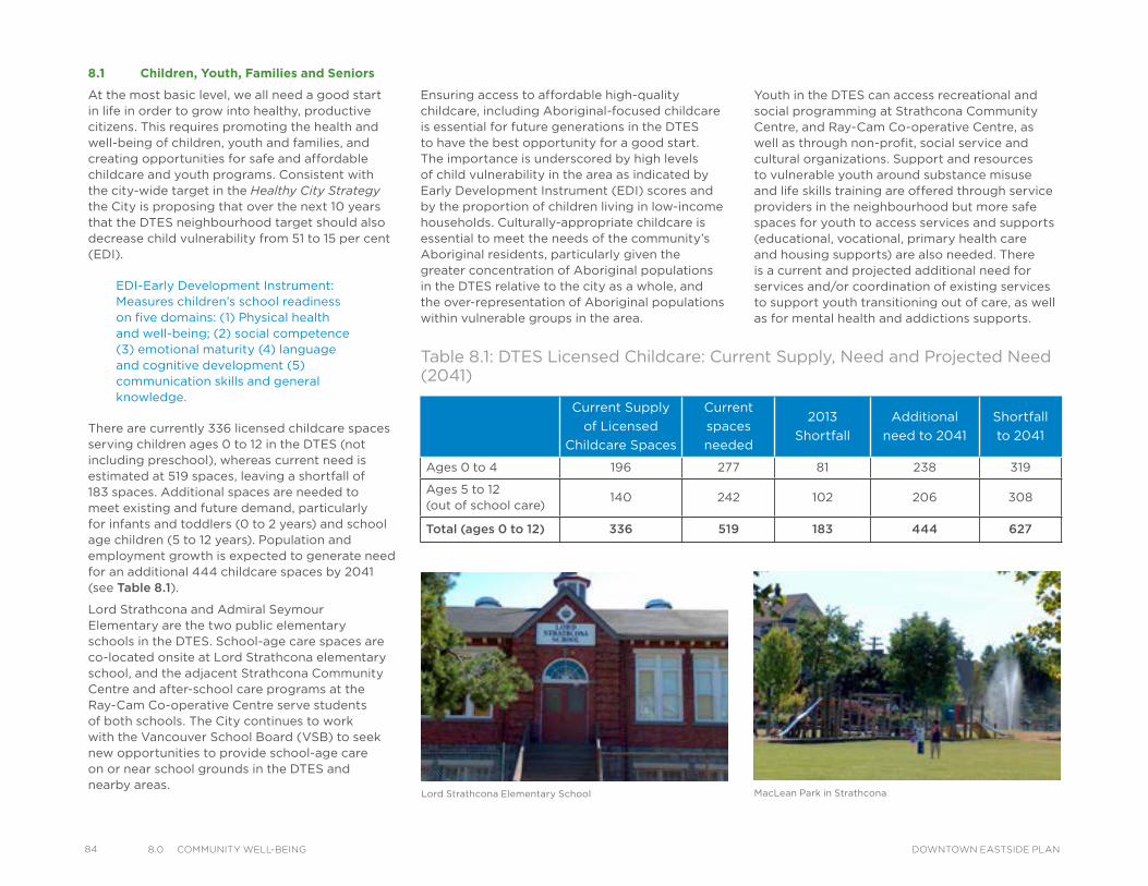
84 8.0 CommunIty Well-BeIng DOWNTOWN EASTSIDE PLAN
8.1 Children, Youth, Families and Seniors
At the most basic level, we all need a good start in life in order to grow into healthy, productive citizens. This requires promoting the health and well-being of children, youth and families, and creating opportunities for safe and affordable childcare and youth programs. Consistent with the city-wide target in the Healthy City Strategy the City is proposing that over the next 10 years that the DTES neighbourhood target should also decrease child vulnerability from 51 to 15 per cent (EDI).
There are currently 336 licensed childcare spaces serving children ages 0 to 12 in the DTES (not including preschool), whereas current need is estimated at 519 spaces, leaving a shortfall of 183 spaces. Additional spaces are needed to meet existing and future demand, particularly for infants and toddlers (0 to 2 years) and school age children (5 to 12 years). Population and employment growth is expected to generate need for an additional 444 childcare spaces by 2041 (see Table 8.1).
Lord Strathcona and Admiral Seymour Elementary are the two public elementary schools in the DTES. School-age care spaces are co-located onsite at Lord Strathcona elementary school, and the adjacent Strathcona Community Centre and after-school care programs at the Ray-Cam Co-operative Centre serve students of both schools. The City continues to work with the Vancouver School Board (VSB) to seek new opportunities to provide school-age care on or near school grounds in the DTES and nearby areas.
MacLean Park in StrathconaLord Strathcona Elementary School
Current Supply
of Licensed
Childcare Spaces
Current
spaces
needed
2013
Shortfall
Additional
need to 2041
Shortfall
to 2041
Ages 0 to 4 196 277 81 238 319
Ages 5 to 12 (out of school care)
140 242 102 206 308
Total (ages 0 to 12) 336 519 183 444 627
Table 8.1: DTES Licensed Childcare: Current Supply, Need and Projected Need (2041)
EDI-Early Development Instrument: Measures children’s school readiness on five domains: (1) Physical health and well-being; (2) social competence (3) emotional maturity (4) language and cognitive development (5) communication skills and general knowledge.
Ensuring access to affordable high-quality childcare, including Aboriginal-focused childcare is essential for future generations in the DTES to have the best opportunity for a good start. The importance is underscored by high levels of child vulnerability in the area as indicated by Early Development Instrument (EDI) scores and by the proportion of children living in low-income households. Culturally-appropriate childcare is essential to meet the needs of the community’s Aboriginal residents, particularly given the greater concentration of Aboriginal populations in the DTES relative to the city as a whole, and the over-representation of Aboriginal populations within vulnerable groups in the area.
Youth in the DTES can access recreational and social programming at Strathcona Community Centre, and Ray-Cam Co-operative Centre, as well as through non-profit, social service and cultural organizations. Support and resources to vulnerable youth around substance misuse and life skills training are offered through service providers in the neighbourhood but more safe spaces for youth to access services and supports (educational, vocational, primary health care and housing supports) are also needed. There is a current and projected additional need for services and/or coordination of existing services to support youth transitioning out of care, as well as for mental health and addictions supports.
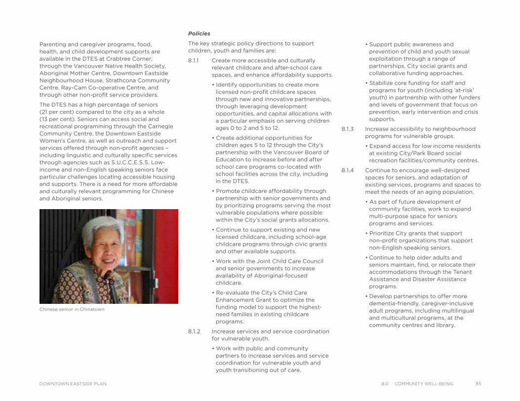
Parenting and caregiver programs, food, health, and child development supports are available in the DTES at Crabtree Corner, through the Vancouver Native Health Society, Aboriginal Mother Centre, Downtown Eastside Neighbourhood House, Strathcona Community Centre, Ray-Cam Co-operative Centre, and through other non-profit service providers.
The DTES has a high percentage of seniors (21 per cent) compared to the city as a whole (13 per cent). Seniors can access social and recreational programming through the Carnegie Community Centre, the Downtown Eastside Women's Centre, as well as outreach and support services offered through non-profit agencies – including linguistic and culturally specific services through agencies such as S.U.C.C.E.S.S. Low-income and non-English speaking seniors face particular challenges locating accessible housing and supports. There is a need for more affordable and culturally relevant programming for Chinese and Aboriginal seniors.
Policies
The key strategic policy directions to support children, youth and families are:
8.1.1 Create more accessible and culturally relevant childcare and after-school care spaces, and enhance affordability supports.
• Identify opportunities to create more licensed non-profit childcare spaces through new and innovative partnerships, through leveraging development opportunities, and capital allocations with a particular emphasis on serving children ages 0 to 2 and 5 to 12.
• Create additional opportunities for children ages 5 to 12 through the City’s partnership with the Vancouver Board of Education to increase before and after school care programs co-located with school facilities across the city, including in the DTES.
• Promote childcare affordability through partnership with senior governments and by prioritizing programs serving the most vulnerable populations where possible within the City’s social grants allocations.
• Continue to support existing and new licensed childcare, including school-age childcare programs through civic grants and other available supports.
• Work with the Joint Child Care Council and senior governments to increase availability of Aboriginal-focused childcare.
• Re-evaluate the City’s Child Care Enhancement Grant to optimize the funding model to support the highest-need families in existing childcare programs.
8.1.2 Increase services and service coordination for vulnerable youth.
• Work with public and community partners to increase services and service coordination for vulnerable youth and youth transitioning out of care.
• Support public awareness and prevention of child and youth sexual exploitation through a range of partnerships, City social grants and collaborative funding approaches.
• Stabilize core funding for staff and programs for youth (including ‘at-risk’ youth) in partnership with other funders and levels of government that focus on prevention, early intervention and crisis supports.
8.1.3 Increase accessibility to neighbourhood programs for vulnerable groups.
• Expand access for low income residents at existing City/Park Board social recreation facilities/community centres.
8.1.4 Continue to encourage well-designed spaces for seniors, and adaptation of existing services, programs and spaces to meet the needs of an aging population.
• As part of future development of community facilities, work to expand multi-purpose space for seniors programs and services.
• Prioritize City grants that support non-profit organizations that support non-English speaking seniors.
• Continue to help older adults and seniors maintain, find, or relocate their accommodations through the Tenant Assistance and Disaster Assistance programs.
• Develop partnerships to offer more dementia-friendly, caregiver-inclusive adult programs, including multilingual and multicultural programs, at the community centres and library.
Chinese senior in Chinatown
858.0 CommunIty Well-BeIngDOWNTOWN EASTSIDE PLAN
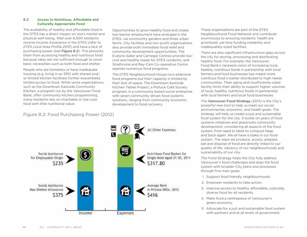
86 8.0 CommunIty Well-BeIng DOWNTOWN EASTSIDE PLAN
Opportunities to grow healthy food and create low-barrier employment have emerged in the DTES, via community gardens and three urban farms. City facilities and non-profit organizations also provide both immediate food relief and community development opportunities. The Evelyne Saller and Carnegie Centres provide low-cost and healthy meals for DTES residents, and Strathcona and Ray-Cam Co-operative Centre operate numerous food programs.
The DTES Neighbourhood House runs extensive food programs but their capacity is limited by their lack of space. The Downtown Eastside Kitchen Tables Project, a Potluck Café Society program, is a community-based social enterprise with seven community-driven food systems solutions, ranging from community economic development to food recovery.
These organizations are part of the DTES Neighbourhood Food Network and contribute enormously to ensuring residents’ health are prioritized, yet face funding instability and inadequately-sized facilities.
There are also significant infrastructure gaps across the city for storing, processing and distributing healthy food. For example, the Vancouver Food Bank’s renewed vision of increasing local, healthy, nutritious foods in partnership with local farmers and food businesses has meant more nutritious food is better distributed to high-needs communities. Their aging and insufficiently sized facility limits their ability to support higher volumes of local, healthy, nutritious foods in partnership with local farmers and local food businesses.
The Vancouver Food Strategy (2013) is the City’s powerful new tool to help us meet our social, environmental, economic, and health goals. The strategy will help us create a just and sustainable food system for the city. It builds on years of food systems initiatives and grassroots community development, considering all aspects of the food system, from seed to table to compost heap and back again. We all have a stake in our food system. The ways we produce, access, prepare, eat and dispose of food are directly linked to our quality of life, vibrancy of our neighbourhoods and sustainability of our city.
The Food Strategy helps the City fully address Vancouver’s food challenges and align the food system with broader City plans and processes through five main goals:
1. Support food friendly neighbourhoods.
2. Empower residents to take action.
3. Improve access to healthy, affordable, culturally diverse food for all residents.
4. Make food a centrepiece of Vancouver’s green economy.
5. Advocate for a just and sustainable food system with partners and at all levels of government.
Figure 8.2: Food Purchasing Power (2012)
8.2 Access to Nutritious, Affordable and Culturally Appropriate Food
The availability of healthy and affordable food in the DTES has a direct impact on one’s mental and physical well-being. Well over 6,500 residents receive Income Assistance in the DTES (refer to DTES Local Area Profile 2013) and have a lack of purchasing power (see Figure 8.2). This prevents them from accessing healthy and nutritious food because rates are not sufficient enough to cover basic necessities such as both food and shelter.
People who are homeless or have inadequate housing (e.g. living in an SRO with shared and/or limited kitchen facilities) further exacerbates limited access to food. While some organizations, such as the Downtown Eastside Community Kitchen, a program run by the Vancouver Food Bank, offer community kitchen programming, many residents rely on charitable or low-cost food with little nutritional value.
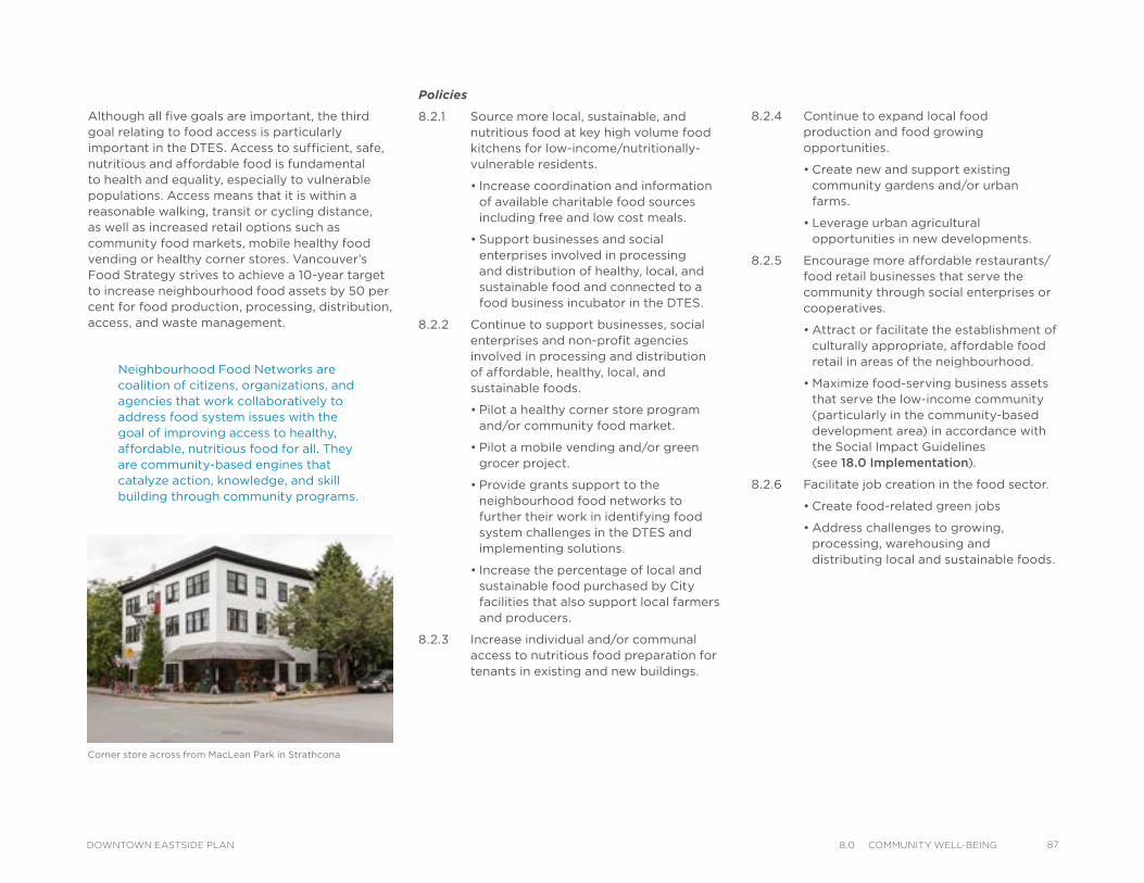
Neighbourhood Food Networks are coalition of citizens, organizations, and agencies that work collaboratively to address food system issues with the goal of improving access to healthy, affordable, nutritious food for all. They are community-based engines that catalyze action, knowledge, and skill building through community programs.
Although all five goals are important, the third goal relating to food access is particularly important in the DTES. Access to sufficient, safe, nutritious and affordable food is fundamental to health and equality, especially to vulnerable populations. Access means that it is within a reasonable walking, transit or cycling distance, as well as increased retail options such as community food markets, mobile healthy food vending or healthy corner stores. Vancouver’s Food Strategy strives to achieve a 10-year target to increase neighbourhood food assets by 50 per cent for food production, processing, distribution, access, and waste management.
Corner store across from MacLean Park in Strathcona
Policies
8.2.1 Source more local, sustainable, and nutritious food at key high volume food kitchens for low-income/nutritionally-vulnerable residents.
• Increase coordination and information of available charitable food sources including free and low cost meals.
• Support businesses and social enterprises involved in processing and distribution of healthy, local, and sustainable food and connected to a food business incubator in the DTES.
8.2.2 Continue to support businesses, social enterprises and non-profit agencies involved in processing and distribution of affordable, healthy, local, and sustainable foods.
• Pilot a healthy corner store program and/or community food market.
• Pilot a mobile vending and/or green grocer project.
• Provide grants support to the neighbourhood food networks to further their work in identifying food system challenges in the DTES and implementing solutions.
• Increase the percentage of local and sustainable food purchased by City facilities that also support local farmers and producers.
8.2.3 Increase individual and/or communal access to nutritious food preparation for tenants in existing and new buildings.
8.2.4 Continue to expand local food production and food growing opportunities.
• Create new and support existing community gardens and/or urban farms.
• Leverage urban agricultural opportunities in new developments.
8.2.5 Encourage more affordable restaurants/food retail businesses that serve the community through social enterprises or cooperatives.
• Attract or facilitate the establishment of culturally appropriate, affordable food retail in areas of the neighbourhood.
• Maximize food-serving business assets that serve the low-income community (particularly in the community-based development area) in accordance with the Social Impact Guidelines (see 18.0 Implementation).
8.2.6 Facilitate job creation in the food sector.
• Create food-related green jobs
• Address challenges to growing, processing, warehousing and distributing local and sustainable foods.
878.0 CommunIty Well-BeIngDOWNTOWN EASTSIDE PLAN

88 8.0 CommunIty Well-BeIng DOWNTOWN EASTSIDE PLAN
Although the DTES has a number of social/recreational facilities, the quality of the social infrastructure requires renewal and expansion to accommodate expected population growth. The Strathcona Community Centre and Ray-Cam Co-operative Centre are essential places for children, youth, families and seniors and are highly valued by the community for social/recreational/cultural programs and services. The Evelyne Saller and Carnegie Centres are two City-owned social facilities that offer programs and services at no cost to patrons that enhance physical, mental, and social well-being. They serve as community living rooms primarily for low-income residents, seniors, and Aboriginal groups. The DTES Neighbourhood House provides programs and services but has space limitations at their current location.
Non-profit organizations provide community-based programs, services, and resources that strengthen neighbourhoods. There are a number of non-profits that deliver programs and services in the DTES that serve residents and visitors, but the need for affordable space is a challenge. Reviewing space needs and identifying co-location opportunities for non-profit organizations in the DTES would benefit a number of organizations, and maximize public benefits in the delivery of amenities.
The DTES has a high proportion of rental and social housing and high numbers of vulnerable residents (including isolated seniors, children, and people who may have underlying illness / existing health stress. These are all indicators for increased vulnerability to heat stress and associated illness. Although heat stress may appear less threatening in BC compared to the rest of the country, much of the BC population is less acclimatized to temperatures above 30 degrees Celsius and air conditioning is uncommon. Emergency room visits in Vancouver already increase with high summer temperatures and are expected to rise further with climate change and an aging population.
The plan’s strategic direction in this area is to increase equitable access to high quality, accessible and inclusive health, social and community services and support organizations working with vulnerable residents. See 17.0 Public Benefits for detailed actions related to social/recreational infrastructure.
Policies
8.3.1 Support programs serving Downtown Eastside residents within the City’s range of policies and tools.
• Utilize the City’s social grants programs including Community Services, Childcare, Food, and Innovation Projects to support programs that serve DTES residents.
• Explore opportunities to utilize City-owned space and/or privately owned sub-leased space at nominal rents for non-profit agencies.
8.3.2 Identify and protect social, recreational and cultural assets in the neighbourhood and leverage opportunities for new assets through development (see 17.0 Public Benefits).
8.3.3 Develop partnerships to identify and pilot new social programs and services for children, youth and families, seniors, newcomers and Aboriginal communities.
8.3.4 Through the Mayor’s Task Force on Mental Health and Addictions, convene researchers, senior government, community partners, people with mental health and addictions issues, and Downtown Eastside residents to address the critical need for a continuum of supports for the most seriously addicted and mentally ill (see 9.0 Housing for actions).
8.3 Health and Social Services
Access to basic needs and high quality, low threshold health, social and community services is critical to the wellbeing of DTES residents. The DTES Local Area Profile describes the diversity of residents in the neighbourhood. The DTES is home to a large number of social and health services that provide critical support to residents but there are still some gaps and on-going challenges with coordination, funding and sustainability.
The DTES is also home to North America’s first supervised injection site (INSITE). Significant research indicates that INSITE contributes to reduced overdose deaths, HIV, and Hepatitis C infection rates, improved access to other health and social services, and an increase in uptake of addictions treatment.
Recent City and academic studies (see 9.0 Housing) have identified a “mental health crisis” in Vancouver with a significant number of people with severe mental health and addiction issues that do not have access to a continuum of treatment and supports. Although the primary mandate for the delivery of health services rests with the Provincial government and Vancouver Coastal Health (VCH), the City plays a role in supporting the social service sector through advocacy, partnerships, leveraging grant funding, provision of space, and direct program and service delivery. Vancouver Coastal Health is currently developing a “Second Generation Health System Strategy for the DTES” with the goal to “support the evolution of local health services towards the provision of cost-effective, evidence-based care within a cohesive network of community-based health services.” VCH has outlined 19 recommendations for action in supporting health care services to develop the best options for improving health outcomes in the DTES.
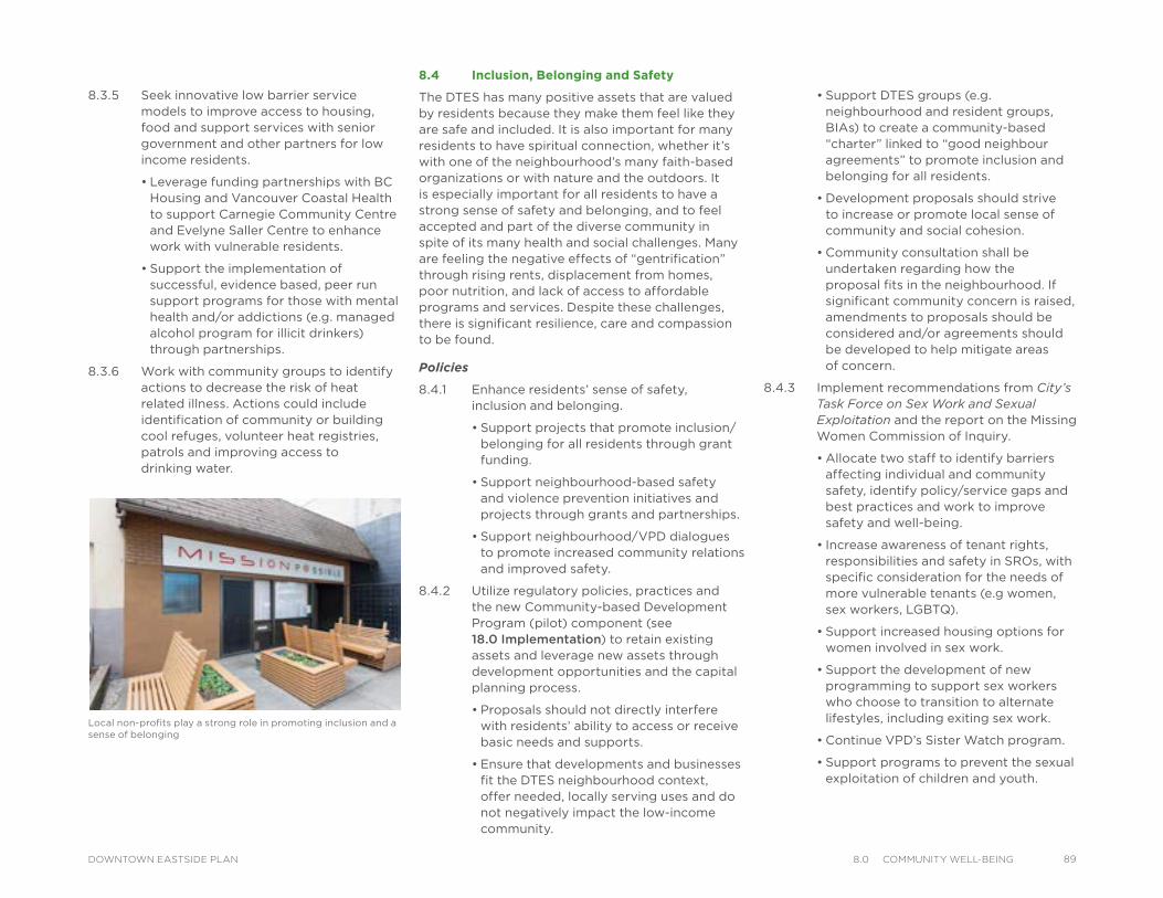
8.3.5 Seek innovative low barrier service models to improve access to housing, food and support services with senior government and other partners for low income residents.
• Leverage funding partnerships with BC Housing and Vancouver Coastal Health to support Carnegie Community Centre and Evelyne Saller Centre to enhance work with vulnerable residents.
• Support the implementation of successful, evidence based, peer run support programs for those with mental health and/or addictions (e.g. managed alcohol program for illicit drinkers) through partnerships.
8.3.6 Work with community groups to identify actions to decrease the risk of heat related illness. Actions could include identification of community or building cool refuges, volunteer heat registries, patrols and improving access to drinking water.
8.4 Inclusion, Belonging and Safety
The DTES has many positive assets that are valued by residents because they make them feel like they are safe and included. It is also important for many residents to have spiritual connection, whether it’s with one of the neighbourhood’s many faith-based organizations or with nature and the outdoors. It is especially important for all residents to have a strong sense of safety and belonging, and to feel accepted and part of the diverse community in spite of its many health and social challenges. Many are feeling the negative effects of “gentrification” through rising rents, displacement from homes, poor nutrition, and lack of access to affordable programs and services. Despite these challenges, there is significant resilience, care and compassion to be found.
Policies
8.4.1 Enhance residents’ sense of safety, inclusion and belonging.
• Support projects that promote inclusion/belonging for all residents through grant funding.
• Support neighbourhood-based safety and violence prevention initiatives and projects through grants and partnerships.
• Support neighbourhood/VPD dialogues to promote increased community relations and improved safety.
8.4.2 Utilize regulatory policies, practices and the new Community-based Development Program (pilot) component (see 18.0 Implementation) to retain existing assets and leverage new assets through development opportunities and the capital planning process.
• Proposals should not directly interfere with residents’ ability to access or receive basic needs and supports.
• Ensure that developments and businesses fit the DTES neighbourhood context, offer needed, locally serving uses and do not negatively impact the low-income community.
• Support DTES groups (e.g. neighbourhood and resident groups, BIAs) to create a community-based “charter” linked to “good neighbour agreements” to promote inclusion and belonging for all residents.
• Development proposals should strive to increase or promote local sense of community and social cohesion.
• Community consultation shall be undertaken regarding how the proposal fits in the neighbourhood. If significant community concern is raised, amendments to proposals should be considered and/or agreements should be developed to help mitigate areas of concern.
8.4.3 Implement recommendations from City’s Task Force on Sex Work and Sexual Exploitation and the report on the Missing Women Commission of Inquiry.
• Allocate two staff to identify barriers affecting individual and community safety, identify policy/service gaps and best practices and work to improve safety and well-being.
• Increase awareness of tenant rights, responsibilities and safety in SROs, with specific consideration for the needs of more vulnerable tenants (e.g women, sex workers, LGBTQ).
• Support increased housing options for women involved in sex work.
• Support the development of new programming to support sex workers who choose to transition to alternate lifestyles, including exiting sex work.
• Continue VPD’s Sister Watch program.
• Support programs to prevent the sexual exploitation of children and youth.
Local non-profits play a strong role in promoting inclusion and a sense of belonging
898.0 CommunIty Well-BeIngDOWNTOWN EASTSIDE PLAN
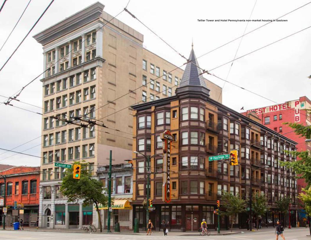
Tellier Tower and Hotel Pennsylvania non-market housing in Gastown
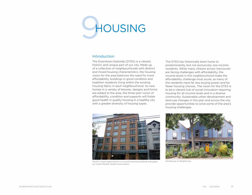
IntroductionThe Downtown Eastside (DTES) is a vibrant, historic and unique part of our city. Made up of a collection of neighbourhoods with distinct and mixed housing characteristics, the housing vision for the area balances the need for more affordability, buildings in good condition and healthier residents living within the existing housing fabric in each neighbourhood. As new homes in a variety of tenures, designs and forms are added to the area, the three-part vision of affordability, condition and supports will foster good health in quality housing in a healthy city with a greater diversity of housing types.
9HOUSING
Pacific Coast apartments is a social housing building managed by Coast Mental Health Association
Rowhouse in Strathcona
The DTES has historically been home to predominantly, but not exclusively, low-income residents. While many citizens across Vancouver are facing challenges with affordability, the income levels in this neighbourhood make the affordability challenge most acute, as many of the residents have far less buying power and far fewer housing choices. The vision for the DTES is to be a vibrant hub of social innovation requiring housing for all income levels and in a diverse community. Sustainable urban development and land-use changes in this plan and across the city provide opportunities to solve some of the area’s housing challenges.
919.0 HousIngDOWNTOWN EASTSIDE PLAN
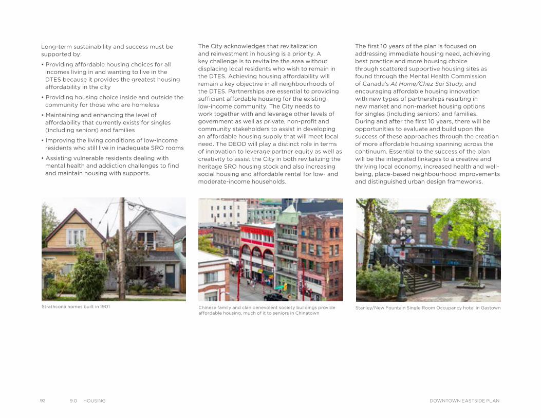
92 9.0 HousIng DOWNTOWN EASTSIDE PLAN
The City acknowledges that revitalization and reinvestment in housing is a priority. A key challenge is to revitalize the area without displacing local residents who wish to remain in the DTES. Achieving housing affordability will remain a key objective in all neighbourhoods of the DTES. Partnerships are essential to providing sufficient affordable housing for the existing low-income community. The City needs to work together with and leverage other levels of government as well as private, non-profit and community stakeholders to assist in developing an affordable housing supply that will meet local need. The DEOD will play a distinct role in terms of innovation to leverage partner equity as well as creativity to assist the City in both revitalizing the heritage SRO housing stock and also increasing social housing and affordable rental for low- and moderate-income households.
Long-term sustainability and success must be supported by:
• Providing affordable housing choices for all incomes living in and wanting to live in the DTES because it provides the greatest housing affordability in the city
• Providing housing choice inside and outside the community for those who are homeless
• Maintaining and enhancing the level of affordability that currently exists for singles (including seniors) and families
• Improving the living conditions of low-income residents who still live in inadequate SRO rooms
• Assisting vulnerable residents dealing with mental health and addiction challenges to find and maintain housing with supports.
Strathcona homes built in 1901 Chinese family and clan benevolent society buildings provide affordable housing, much of it to seniors in Chinatown
Stanley/New Fountain Single Room Occupancy hotel in Gastown
The first 10 years of the plan is focused on addressing immediate housing need, achieving best practice and more housing choice through scattered supportive housing sites as found through the Mental Health Commission of Canada’s At Home/Chez Soi Study, and encouraging affordable housing innovation with new types of partnerships resulting in new market and non-market housing options for singles (including seniors) and families. During and after the first 10 years, there will be opportunities to evaluate and build upon the success of these approaches through the creation of more affordable housing spanning across the continuum. Essential to the success of the plan will be the integrated linkages to a creative and thriving local economy, increased health and well-being, place-based neighbourhood improvements and distinguished urban design frameworks.
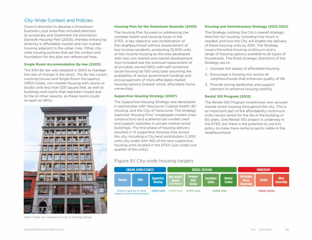
Ensure capacity to meetneeds of street homelessness
2,900 units 5,000 units 6,000 units Market driven5,000 units
Figure 9.1 City-wide housing targets
City-Wide Context and PoliciesCouncil direction to develop a Downtown Eastside Local Area Plan included direction to accelerate and implement the Downtown Eastside Housing Plan (2005), thereby enhancing diversity in affordable market and non-market housing adjacent to the urban core. Other city-wide housing policies that set the context and foundation for this plan are referenced here.
Single Room Accommodation By-law (2003)
The SRA By-law was adopted in 2003 to manage the rate of change in the stock. The By-law covers rooming houses and Single Room Occupancy (SRO) hotels, non-market housing with rooms or studio units less than 320 square feet, as well as buildings and rooms that had been closed due to fire or other reasons, as these rooms could re-open as SROs.
Housing Plan for the Downtown Eastside (2005)
The Housing Plan focused on addressing the complex health and housing issues in the DTES. A key objective was revitalization of the neighbourhood without displacement of low-income residents, protecting 10,000 units of low-income housing as the area developed with new non-market and market development. Also included was the eventual replacement of all privately owned SROs with self-contained social housing (at 100 units/year assuming the availability of senior government funding) and encouragement of more affordable market housing options (market rental, affordable home ownership).
Supportive Housing Strategy (2007)
The Supportive Housing Strategy was developed in partnership with Vancouver Coastal Health, BC Housing, and the City of Vancouver. The Strategy explored ‘Housing First’ congregate models (new construction) and scattered site models (rent and support subsidies in private market rental buildings). The first phase of housing delivery resulted in 14 supportive housing sites across the city, including a City land contribution (1,500 units city-wide) with 462 of the new supportive housing units located in the DTES (just under one quarter of the units).
Housing and Homelessness Strategy (2012-2021)
The Strategy outlines the City's overall strategic direction for housing, including how much is needed, and how the City will enable the delivery of these housing units by 2021. The Strategy covers the entire housing continuum and a range of housing options available to all types of households. The three strategic directions of the Strategy are to:
1. Increase the supply of affordable housing
2. Encourage a housing mix across all neighbourhoods that enhances quality of life
3. Provide strong leadership and support partners to enhance housing stability
Rental 100 Program (2012)
The Rental 100 Program incentivizes new secured market rental housing throughout the city. This is an important part of the affordability continuum. Units remain rental for the life of the building or 60 years. One Rental 100 project is underway in the DTES, but there is the potential to use this policy to make more rental projects viable in the neighbourhood.
Tellier Tower non-market housing on Hastings Street
939.0 HousIngDOWNTOWN EASTSIDE PLAN
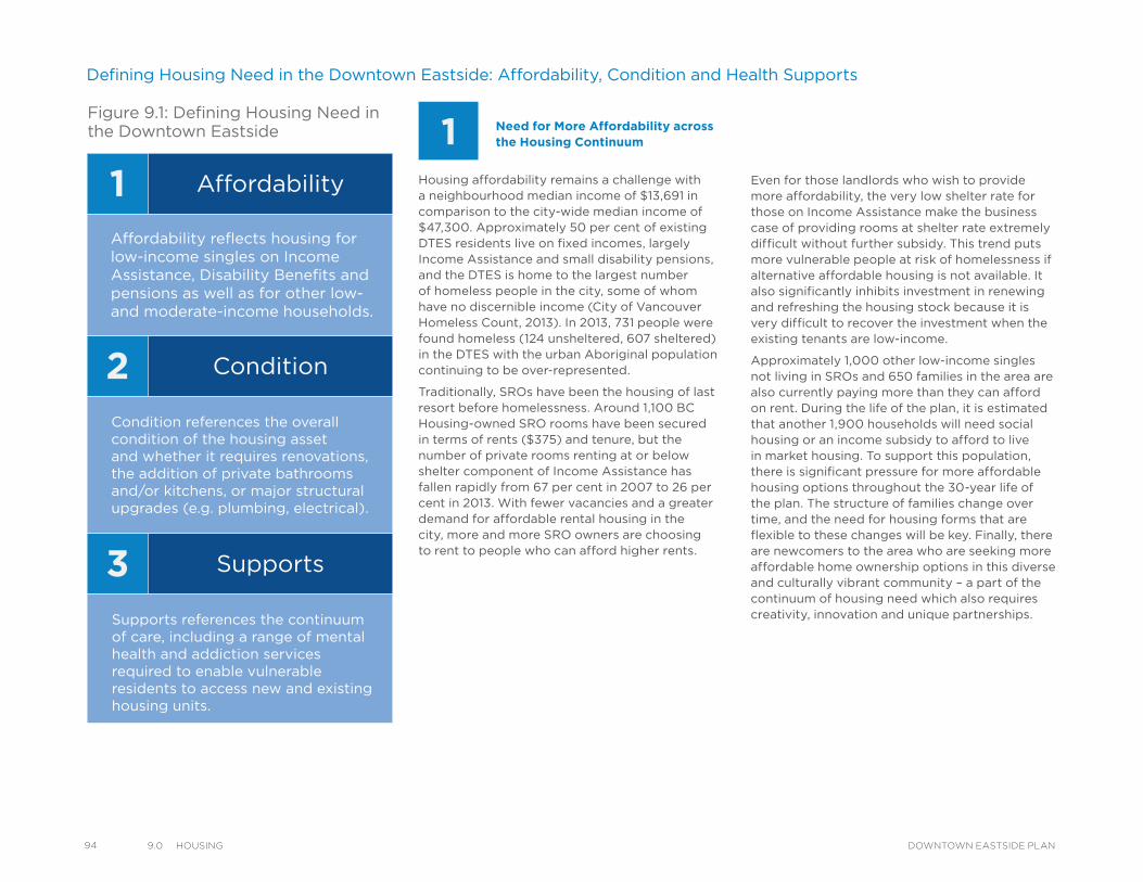
94 9.0 HousIng DOWNTOWN EASTSIDE PLAN
Housing affordability remains a challenge with a neighbourhood median income of $13,691 in comparison to the city-wide median income of $47,300. Approximately 50 per cent of existing DTES residents live on fixed incomes, largely Income Assistance and small disability pensions, and the DTES is home to the largest number of homeless people in the city, some of whom have no discernible income (City of Vancouver Homeless Count, 2013). In 2013, 731 people were found homeless (124 unsheltered, 607 sheltered) in the DTES with the urban Aboriginal population continuing to be over-represented.
Traditionally, SROs have been the housing of last resort before homelessness. Around 1,100 BC Housing-owned SRO rooms have been secured in terms of rents ($375) and tenure, but the number of private rooms renting at or below shelter component of Income Assistance has fallen rapidly from 67 per cent in 2007 to 26 per cent in 2013. With fewer vacancies and a greater demand for affordable rental housing in the city, more and more SRO owners are choosing to rent to people who can afford higher rents.
Need for More Affordability across the Housing Continuum
Defining Housing Need in the Downtown Eastside: Affordability, Condition and Health Supports
Even for those landlords who wish to provide more affordability, the very low shelter rate for those on Income Assistance make the business case of providing rooms at shelter rate extremely difficult without further subsidy. This trend puts more vulnerable people at risk of homelessness if alternative affordable housing is not available. It also significantly inhibits investment in renewing and refreshing the housing stock because it is very difficult to recover the investment when the existing tenants are low-income.
Approximately 1,000 other low-income singles not living in SROs and 650 families in the area are also currently paying more than they can afford on rent. During the life of the plan, it is estimated that another 1,900 households will need social housing or an income subsidy to afford to live in market housing. To support this population, there is significant pressure for more affordable housing options throughout the 30-year life of the plan. The structure of families change over time, and the need for housing forms that are flexible to these changes will be key. Finally, there are newcomers to the area who are seeking more affordable home ownership options in this diverse and culturally vibrant community – a part of the continuum of housing need which also requires creativity, innovation and unique partnerships.
1
2
3
Affordability
Condition
Supports
Affordability reflects housing forlow-income singles on IncomeAssistance, Disability Benefits andpensions as well as for other low-and moderate-income households.
Condition references the overallcondition of the housing assetand whether it requires renovations,the addition of private bathroomsand/or kitchens, or major structuralupgrades (e.g. plumbing, electrical).
Supports references the continuumof care, including a range of mentalhealth and addiction servicesrequired to enable vulnerableresidents to access new and existinghousing units.
Figure 9.1: Defining Housing Need in the Downtown Eastside 1
2
3
Affordability
Condition
Supports
Affordability reflects housing forlow-income singles on IncomeAssistance, Disability Benefits andpensions as well as for other low-and moderate-income households.
Condition references the overallcondition of the housing assetand whether it requires renovations,the addition of private bathroomsand/or kitchens, or major structuralupgrades (e.g. plumbing, electrical).
Supports references the continuumof care, including a range of mentalhealth and addiction servicesrequired to enable vulnerableresidents to access new and existinghousing units.
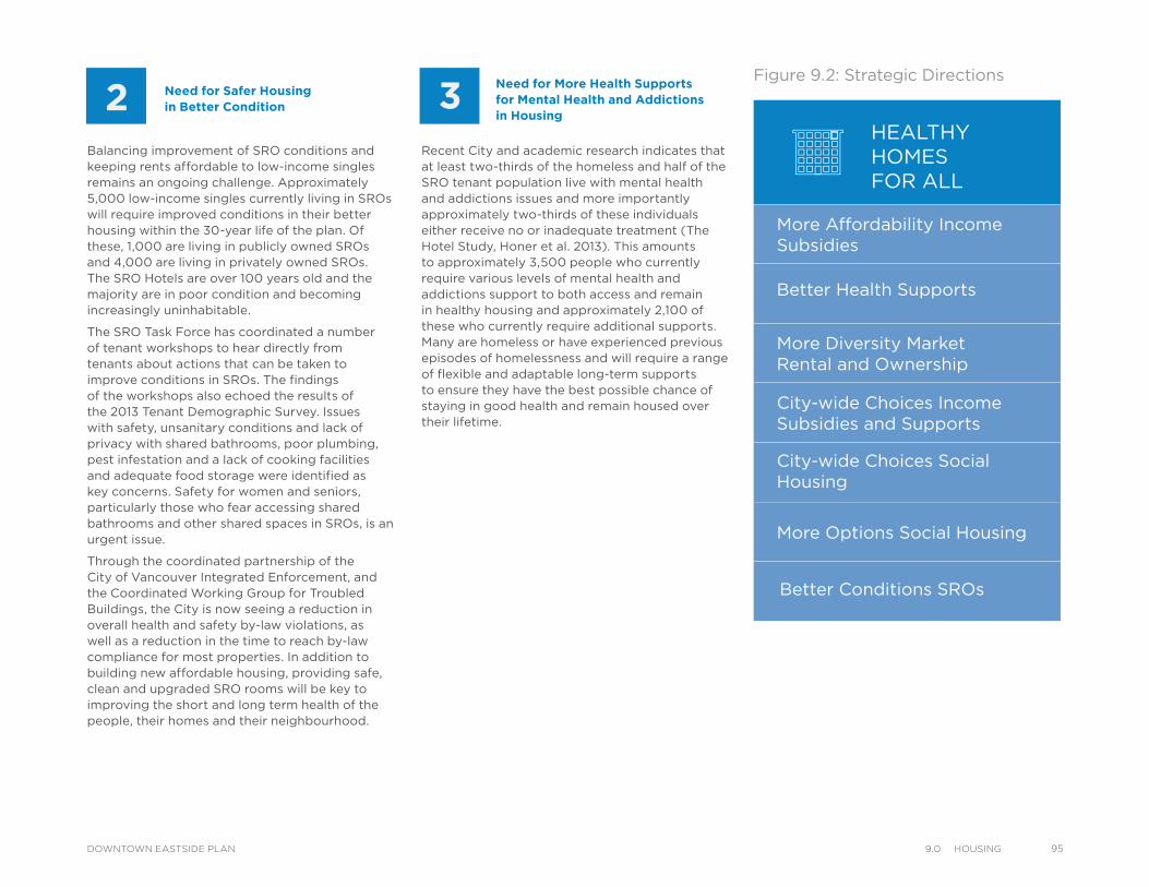
Need for More Health Supports for Mental Health and Addictions in Housing
Balancing improvement of SRO conditions and keeping rents affordable to low-income singles remains an ongoing challenge. Approximately 5,000 low-income singles currently living in SROs will require improved conditions in their better housing within the 30-year life of the plan. Of these, 1,000 are living in publicly owned SROs and 4,000 are living in privately owned SROs. The SRO Hotels are over 100 years old and the majority are in poor condition and becoming increasingly uninhabitable.
The SRO Task Force has coordinated a number of tenant workshops to hear directly from tenants about actions that can be taken to improve conditions in SROs. The findings of the workshops also echoed the results of the 2013 Tenant Demographic Survey. Issues with safety, unsanitary conditions and lack of privacy with shared bathrooms, poor plumbing, pest infestation and a lack of cooking facilities and adequate food storage were identified as key concerns. Safety for women and seniors, particularly those who fear accessing shared bathrooms and other shared spaces in SROs, is an urgent issue.
Through the coordinated partnership of the City of Vancouver Integrated Enforcement, and the Coordinated Working Group for Troubled Buildings, the City is now seeing a reduction in overall health and safety by-law violations, as well as a reduction in the time to reach by-law compliance for most properties. In addition to building new affordable housing, providing safe, clean and upgraded SRO rooms will be key to improving the short and long term health of the people, their homes and their neighbourhood.
Need for Safer Housing in Better Condition
Recent City and academic research indicates that at least two-thirds of the homeless and half of the SRO tenant population live with mental health and addictions issues and more importantly approximately two-thirds of these individuals either receive no or inadequate treatment (The Hotel Study, Honer et al. 2013). This amounts to approximately 3,500 people who currently require various levels of mental health and addictions support to both access and remain in healthy housing and approximately 2,100 of these who currently require additional supports. Many are homeless or have experienced previous episodes of homelessness and will require a range of flexible and adaptable long-term supports to ensure they have the best possible chance of staying in good health and remain housed over their lifetime.
Figure 9.2: Strategic Directions
HEALTHYHOMESFOR ALL
More Affordability Income Subsidies
Better Health Supports
More Diversity MarketRental and Ownership
City-wide Choices Income Subsidies and Supports
City-wide Choices Social Housing
More Options Social Housing
Better Conditions SROs
1
2
3
Affordability
Condition
Supports
Affordability reflects housing forlow-income singles on IncomeAssistance, Disability Benefits andpensions as well as for other low-and moderate-income households.
Condition references the overallcondition of the housing assetand whether it requires renovations,the addition of private bathroomsand/or kitchens, or major structuralupgrades (e.g. plumbing, electrical).
Supports references the continuumof care, including a range of mentalhealth and addiction servicesrequired to enable vulnerableresidents to access new and existinghousing units.
959.0 HousIngDOWNTOWN EASTSIDE PLAN
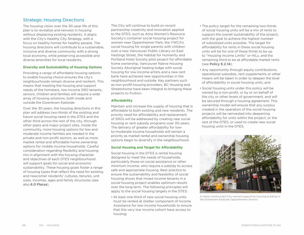
96 9.0 HousIng DOWNTOWN EASTSIDE PLAN
Strategic Housing DirectionsThe housing vision over the 30-year life of this plan is to revitalize and reinvest in housing without displacing existing residents. It aligns with the City’s Healthy City Strategy, with a focus on healthy homes for healthy people. The housing directions will contribute to a sustainable, inclusive and diverse community with a strong local economy, while preserving accessible and diverse amenities for local residents.
Diversity and Sustainability of Housing Options
Providing a range of affordable housing options to enable housing choice ensures the city’s neighbourhoods remain diverse and resilient. This means that meeting the housing and support needs of the homeless, low-income SRO tenants, seniors, children and families will require a wide array of housing solutions, both inside and outside the Downtown Eastside.
Over the 30 years, the housing directions in this plan will address two-thirds of the existing and future social housing need in the DTES and the other third across the rest of the city, through other plans and major project sites. Inside the community, more housing options for low and moderate income families are needed in the private and non-profit sectors, as well as more market rental and affordable home ownership options for middle income households. Careful consideration regarding flexibility and housing mix in alignment with the housing character and objectives of each DTES neighbourhood will support goals for social and economic sustainability. These housing goals foster a range of housing types that reflect the need for existing and newcomer residents’ cultures, tenures, unit sizes, incomes, ages and family structures (see also 6.0 Places).
The City will continue to build on recent partnership creativity and innovation applied to the DTES, such as Atira Women’s Resource Society’s container social housing project for women near Oppenheimer Park, the YWCA’s social housing for single parents with children over a new Vancouver Public Library on East Hastings Street, the Habitat for Humanity and Portland Hotel Society pilot project for affordable home ownership, Vancouver Native Housing Society Aboriginal healing lodge with social housing for low-income artists and a new rent bank have achieved new opportunities in the neighbourhood and outside. Key partners such as non-profit housing providers, BC Housing and Streetohome have been integral to bringing these projects to fruition.
Affordability
Maintain and increase the supply of housing that is affordable to both existing and new residents. The priority need for affordability and replacement of SROs will be addressed by creating new social housing or rent subsidy programs over 30-years. The delivery of greater affordability for low-to-moderate income households will remain a priority as market rental and ownership housing options begin to diversify in the neighbourhood.
Social Housing and Target for Affordability
Social housing in the DTES is rental housing designed to meet the needs of households, particularly those on social assistance or other minimum income, who require a subsidy to access safe and appropriate housing. Best practice to ensure the sustainability and feasibility of social housing shows that mixed income tenants in a social housing project enables optimum results over the long term. The following principles will apply to the social housing targets in the DTES:
• At least one-third of new social housing units must be rented at shelter component of Income Assistance for low-income households to ensure that this very low income cohort have access to housing;
• The policy target for the remaining two-thirds of social housing units will be a mix of rents to support the overall sustainability of the project, with the goal to achieve the highest number of subsidized units possible. The target for affordability for rents in these social housing units will be for one of these thirds to be up to “Housing Income Limits” or HILs, and the remaining third to be at affordable market rents (see Policy 9.2.14);
• Any opportunity through equity contributions, operational subsidies, rent supplements or other means will be taken in order to deepen the level of affordability in social housing units; and
• Social housing units under this policy will be owned by a non-profit, or by or on behalf of the city or other levels of government, and will be secured through a housing agreement. This ownership model will ensure that any surplus created in the operation of the social housing projects will be reinvested into deepening affordability for units within the project, or the rest of the DTES, or used to create new social housing units in the DTES.
A newly constructed City-owned supportive housing building in the Downtown Eastside Oppenheimer District
Renovated Rooms Designated under the Single Room Accommodation By-law – Target for Affordability
Recognizing the significant role SRA designated rooms currently play in providing low-income housing for vulnerable tenants, the target for affordability for upgraded rooms will be one-third at shelter component of Income Assistance, one-third at no more than average SRO rent as defined by the City of Vancouver bi-annual Low-Income Housing Survey, and one-third at more than average SRO rents for the DTES.
Condition – Improve conditions in rooms designated under the SRA By-law in the short term through grants to non-profit owners or operators while replacing them with self-contained social housing and other supportive housing options over the longer term. A key focus will be upgrading rooms while maintaining affordability and minimizing room loss as well as continuing to aggressively enforce health and safety by-laws and working with our partners (e.g. Vancouver Police Department and the Provincial Residential Tenancy Branch) to improve overall property management practices.
Supports – Work with the Province, Vancouver Coastal Health, and non-profit housing operators to increase availability of rent/income subsidies and health supports, including scattered site supported rental housing. Support approaches will be tailored to fit specific vulnerable groups, e.g. youth, Aboriginal people, women, sex-workers.
Housing Objectives
Location of New Units by Sub-area
The housing objectives Map 9.1, demonstrates the various opportunities to support diversity and affordability of housing in each DTES neighbourhood, highlighting the big change areas for housing, including the DEOD, Hastings East, and Kiwassa areas. Provincially-owned and non-profit owned sites should wherever possible be leveraged for more affordable housing through their redevelopment potential within the life of the plan.
Summary of 10-Year and 30-Year Housing Objectives
Given the sensitivity to the amount of housing need, condition of current low-income housing in the private sector (i.e. SROs) and consideration for mental health and addictions support services, the housing objectives for the DTES have been strategically staged over the life of the plan. The first five to 10 years will be to mobilize partnerships and innovation to address the current housing and health crisis in the neighbourhood. Years 10 to 30 will continue to build and sustain a vibrant and affordable community next to the urban core. A comprehensive summary of the housing objectives for the total 30 years are reflected below. Unique to this plan is the addition of targeted housing objectives to be met in the first 10 years in recognition of the urgency to meet specific housing need in the DTES.
Total 30-Year Objectives:
1. Create 4,400 new social housing units in the DTES
2. Address the need for an additional 3,350 social housing units for DTES residents outside the DTES (including social housing, supportive/scattered site housing or rent subsidies)
3. Request 1,650 ongoing rent subsidies from the Province for DTES residents to increase affordability in existing social housing and private market rental housing
4. Achieve partnership funding for 1,900 scattered sites (income and health supports) for DTES residents with mental health and addictions and 150 residential beds in the DTES
5. Encourage 2,200 upgrades to SRO rooms (including 1,100 renovated BC Housing rooms and 1,100 upgrades to non-profit operated rooms to contain private bathrooms and cooking facilities)
6. Create 3,000 new units of secured market rental housing (including Rental 100 projects, 40 per cent market rental policy in DEOD, and converted SRO rooms to units)
7. Accommodate estimated 8,850 new affordable home ownership units
First 10-Year Objectives:
1. Create 1,400 new social housing units in the DTES
2. Request 1,650 new rent subsidies from the Province for DTES residents to increase affordability in existing social housing and private market rental housing
3. Achieve partnership funding for 1,300 scattered sites (income and health supports) for DTES residents with mental health and addictions and 150 residential beds in the DTES
4. Encourage 1,900 upgrades to SRO rooms (including 1,100 renovated BC Housing rooms and 800 upgrades to non-profit operated rooms to contain private bathrooms and cooking facilities)
5. Create 1,650 new units of secured market rental housing (including Rental 100 projects, 40 per cent market rental policy in DEOD, and converted SRO rooms to units)
979.0 HousIngDOWNTOWN EASTSIDE PLAN
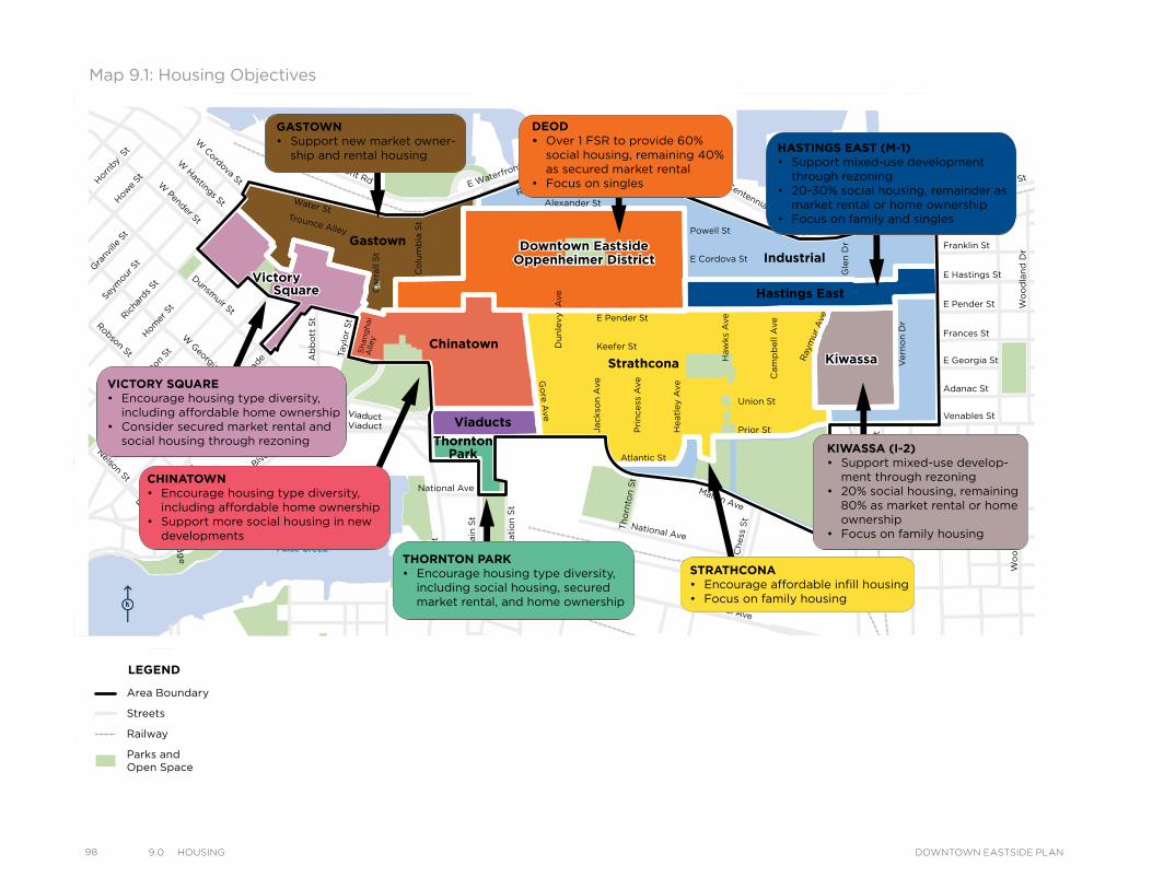
98 9.0 HousIng DOWNTOWN EASTSIDE PLAN
Map 9.1: Housing Objectives
VictorySquare
Kiwassa
Downtown EastsideOppenheimer District
Victory
Downtown EastsideOppenheimer District
Strathcona Kiwassa
Industrial
ThorntonPark
Viaducts
Square Hastings East
Gastown
Chinatown
Water StTrounce Alley
Alexander St
E Cordova St
Centennial Rd
Powell St
E Waterfront Rd
Railway St
W Waterfront Rd
William St William St
Powell St
Stewart St
Napier St
Venables St
Adanac St
Union St
Qu
eb
ec S
t
Ge
org
e S
t
Cla
rk D
r
Atlantic St
National Ave
Malkin Ave
Terminal Ave
Evans Ave
National Ave
Nelson St
Prior St
Franklin St
E Hastings St
Pandora St Triumph St
E Pender St
Frances St
E Georgia St
E Pender St
W Cordova St
W Hastings St
Dunsmuir St
Robson St
W G
eorgia St
Smithe St
W Pender St
Cam
bie S
t
Sh
an
gh
ai
Alle
y
Beatt
y St Cita
del P
arad
e
Ham
ilton
St
Mai
nlan
d St
Hom
er S
t
Richa
rds St
Hor
nby
St
How
e St
Seym
our S
t
Gra
nville
St
Keefer St
Go
re A
ve
Jackso
n A
ve
Sta
tio
n S
t
Main
St
Co
lum
bia
St
Pacific
Blvd
Terry Fox Way
Carr
all
St
Ab
bo
tt S
t
Taylo
r S
t
Pri
ncess
Ave C
am
pb
ell
Ave
Ray
mur
Ave
Ve
rno
n D
r
Wo
od
lan
d D
rW
oo
dla
nd
Dr
Sals
bu
ry D
r
Gle
n D
r
Heatl
ey A
ve
Haw
ks
Ave
Th
orn
ton S
t
Ch
ess
St
Dunsmuir Viaduct
Expo
Blv
d
Georgia Viaduct
Griffiths Way
Cambie B
ridg
e
Du
nle
vy A
ve
Area Boundary
Streets
Railway
Parks andOpen Space
LEGENDGASTOWN• Support new market owner-
ship and rental housing
DEOD• Over 1 FSR to provide 60%
social housing, remaining 40% as secured market rental
• Focus on singles
HASTINGS EAST (M-1)• Support mixed-use development
through rezoning• 20-30% social housing, remainder as
market rental or home ownership• Focus on family and singles
KIWASSA (I-2)• Support mixed-use develop-
ment through rezoning• 20% social housing, remaining
80% as market rental or home ownership
• Focus on family housing
STRATHCONA• Encourage affordable infill housing• Focus on family housing
CHINATOWN• Encourage housing type diversity,
including affordable home ownership• Support more social housing in new
developments
VICTORY SQUARE• Encourage housing type diversity,
including affordable home ownership• Consider secured market rental and
social housing through rezoning
THORNTON PARK• Encourage housing type diversity,
including social housing, secured market rental, and home ownership
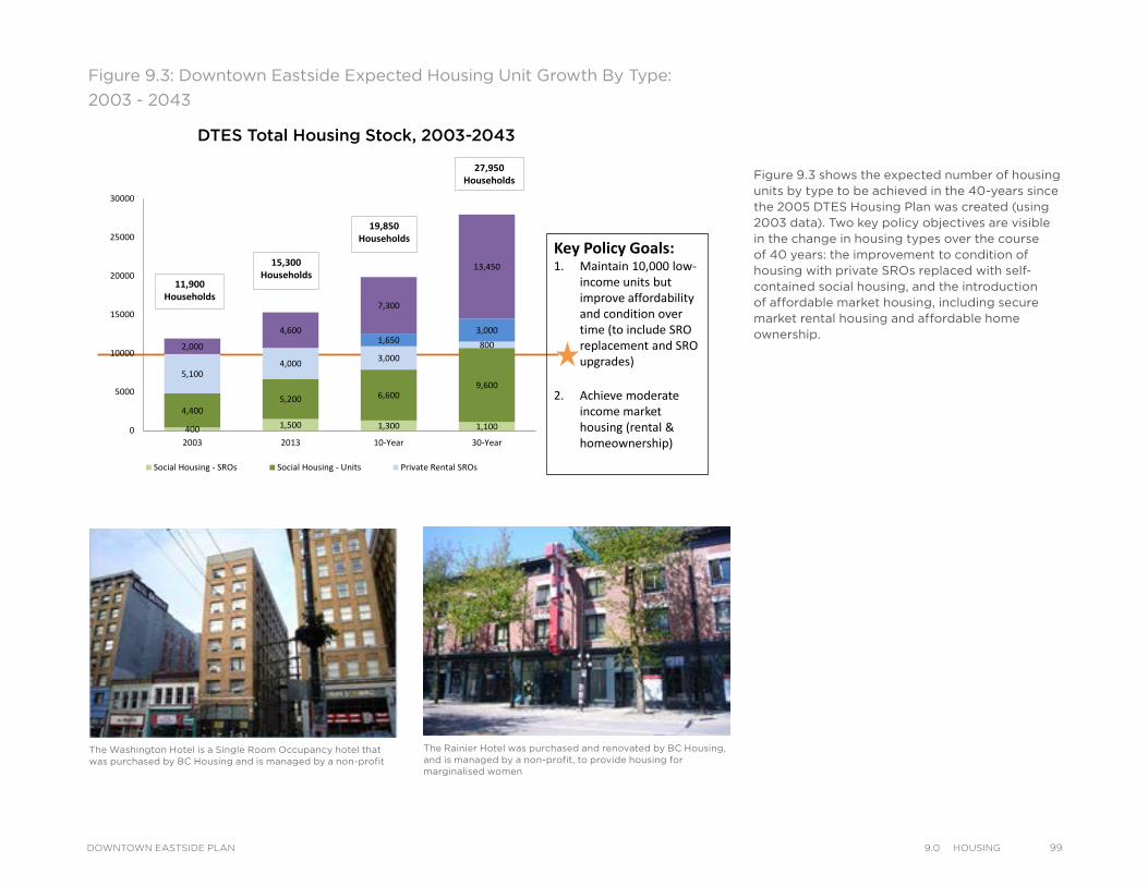
Figure 9.3 shows the expected number of housing units by type to be achieved in the 40-years since the 2005 DTES Housing Plan was created (using 2003 data). Two key policy objectives are visible in the change in housing types over the course of 40 years: the improvement to condition of housing with private SROs replaced with self-contained social housing, and the introduction of affordable market housing, including secure market rental housing and affordable home ownership.
The Rainier Hotel was purchased and renovated by BC Housing, and is managed by a non-profit, to provide housing for marginalised women
The Washington Hotel is a Single Room Occupancy hotel that was purchased by BC Housing and is managed by a non-profit
Figure 9.3: Downtown Eastside Expected Housing Unit Growth By Type:
2003 - 2043
DTES Total Housing Stock, 2003-2043
Key Policy Goals:1. Maintain 10,000 low-
income units but improve affordability and condition over time (to include SRO replacement and SRO upgrades)
2. Achieve moderate income market housing (rental & homeownership)
400 1,500 1,300 1,100
4,4005,200 6,600
9,6005,100
4,000 3,0008001,650
3,000
2,000
4,600
7,300
13,450
0
5000
10000
15000
20000
25000
30000
2003 2013 10-Year 30-Year
Social Housing - SROs Social Housing - Units Private Rental SROs
Private Secured Rental Units Market Other
15,300Households
19,850Households
27,950Households
11,900Households
DTES Total Housing Stock, 2003-2043
999.0 HousIngDOWNTOWN EASTSIDE PLAN
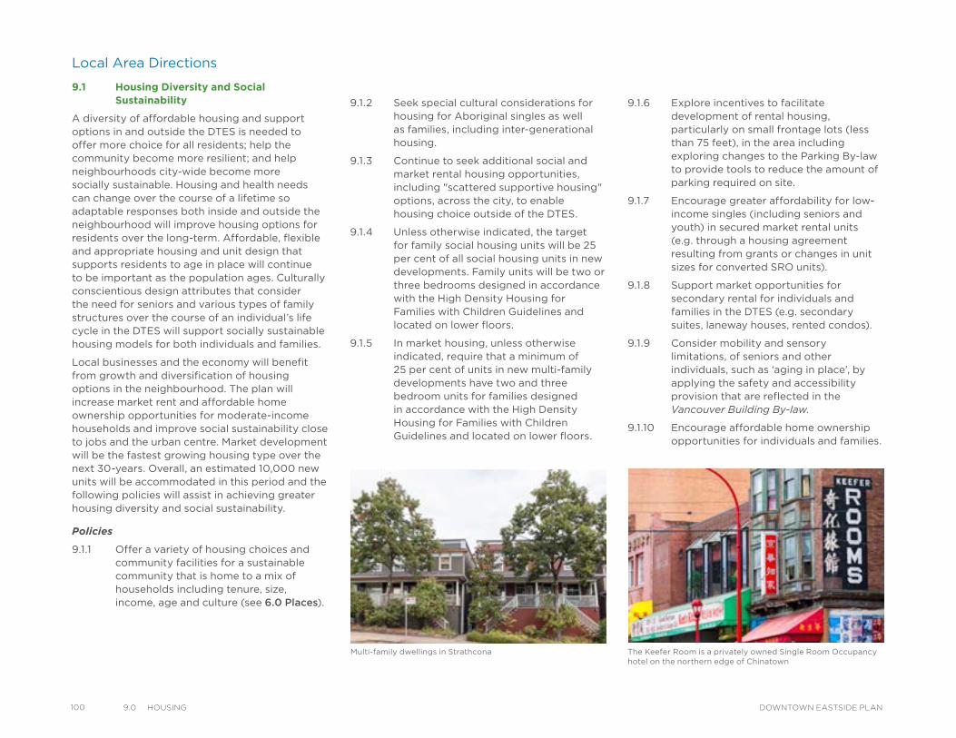
100 9.0 HousIng DOWNTOWN EASTSIDE PLAN
Local Area Directions
9.1 Housing Diversity and Social Sustainability
A diversity of affordable housing and support options in and outside the DTES is needed to offer more choice for all residents; help the community become more resilient; and help neighbourhoods city-wide become more socially sustainable. Housing and health needs can change over the course of a lifetime so adaptable responses both inside and outside the neighbourhood will improve housing options for residents over the long-term. Affordable, flexible and appropriate housing and unit design that supports residents to age in place will continue to be important as the population ages. Culturally conscientious design attributes that consider the need for seniors and various types of family structures over the course of an individual’s life cycle in the DTES will support socially sustainable housing models for both individuals and families.
Local businesses and the economy will benefit from growth and diversification of housing options in the neighbourhood. The plan will increase market rent and affordable home ownership opportunities for moderate-income households and improve social sustainability close to jobs and the urban centre. Market development will be the fastest growing housing type over the next 30-years. Overall, an estimated 10,000 new units will be accommodated in this period and the following policies will assist in achieving greater housing diversity and social sustainability.
Policies
9.1.1 Offer a variety of housing choices and community facilities for a sustainable community that is home to a mix of households including tenure, size, income, age and culture (see 6.0 Places).
9.1.2 Seek special cultural considerations for housing for Aboriginal singles as well as families, including inter-generational housing.
9.1.3 Continue to seek additional social and market rental housing opportunities, including "scattered supportive housing" options, across the city, to enable housing choice outside of the DTES.
9.1.4 Unless otherwise indicated, the target for family social housing units will be 25 per cent of all social housing units in new developments. Family units will be two or three bedrooms designed in accordance with the High Density Housing for Families with Children Guidelines and located on lower floors.
9.1.5 In market housing, unless otherwise indicated, require that a minimum of 25 per cent of units in new multi-family developments have two and three bedroom units for families designed in accordance with the High Density Housing for Families with Children Guidelines and located on lower floors.
9.1.6 Explore incentives to facilitate development of rental housing, particularly on small frontage lots (less than 75 feet), in the area including exploring changes to the Parking By-law to provide tools to reduce the amount of parking required on site.
9.1.7 Encourage greater affordability for low-income singles (including seniors and youth) in secured market rental units (e.g. through a housing agreement resulting from grants or changes in unit sizes for converted SRO units).
9.1.8 Support market opportunities for secondary rental for individuals and families in the DTES (e.g. secondary suites, laneway houses, rented condos).
9.1.9 Consider mobility and sensory limitations, of seniors and other individuals, such as ‘aging in place’, by applying the safety and accessibility provision that are reflected in the Vancouver Building By-law.
9.1.10 Encourage affordable home ownership opportunities for individuals and families.
Multi-family dwellings in Strathcona The Keefer Room is a privately owned Single Room Occupancy hotel on the northern edge of Chinatown
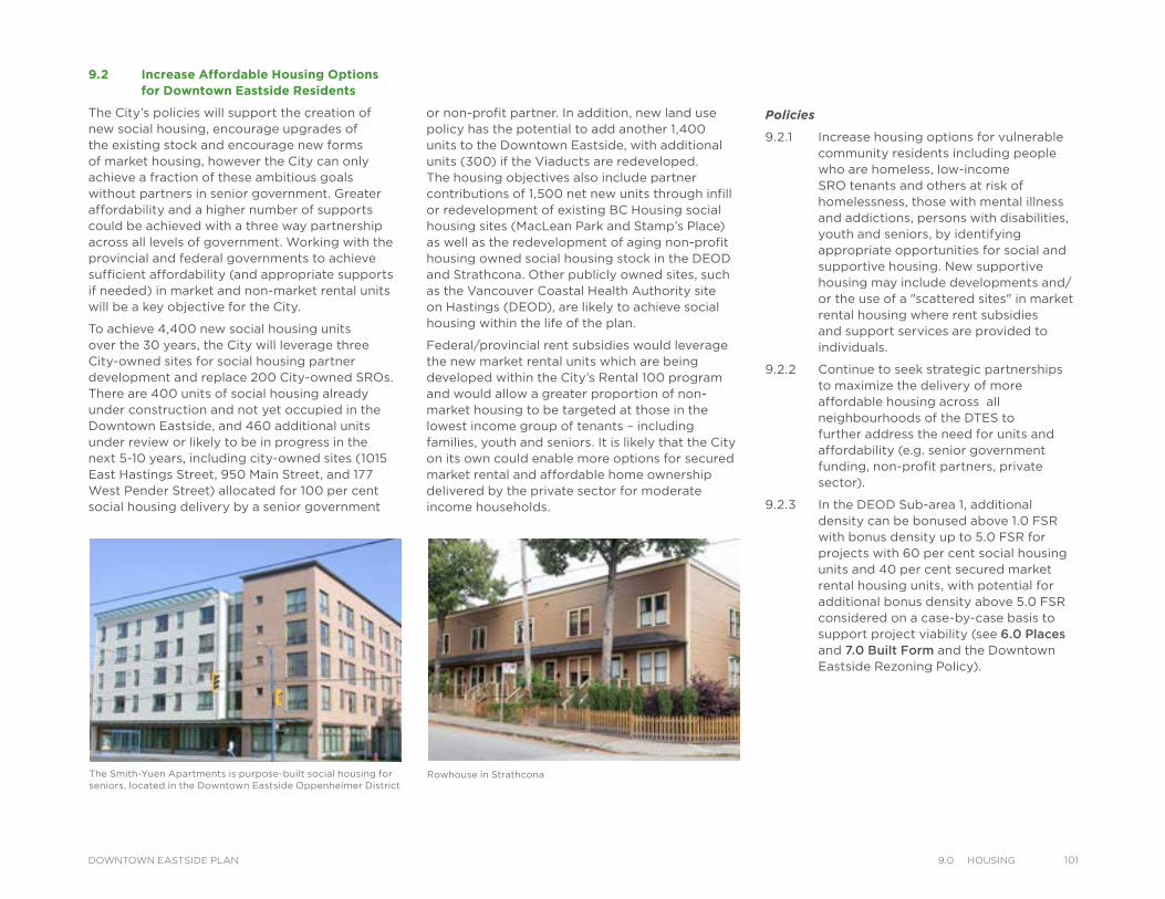
9.2 Increase Affordable Housing Options for Downtown Eastside Residents
The City’s policies will support the creation of new social housing, encourage upgrades of the existing stock and encourage new forms of market housing, however the City can only achieve a fraction of these ambitious goals without partners in senior government. Greater affordability and a higher number of supports could be achieved with a three way partnership across all levels of government. Working with the provincial and federal governments to achieve sufficient affordability (and appropriate supports if needed) in market and non-market rental units will be a key objective for the City.
To achieve 4,400 new social housing units over the 30 years, the City will leverage three City-owned sites for social housing partner development and replace 200 City-owned SROs. There are 400 units of social housing already under construction and not yet occupied in the Downtown Eastside, and 460 additional units under review or likely to be in progress in the next 5-10 years, including city-owned sites (1015 East Hastings Street, 950 Main Street, and 177 West Pender Street) allocated for 100 per cent social housing delivery by a senior government
Rowhouse in Strathcona
or non-profit partner. In addition, new land use policy has the potential to add another 1,400 units to the Downtown Eastside, with additional units (300) if the Viaducts are redeveloped. The housing objectives also include partner contributions of 1,500 net new units through infill or redevelopment of existing BC Housing social housing sites (MacLean Park and Stamp’s Place) as well as the redevelopment of aging non-profit housing owned social housing stock in the DEOD and Strathcona. Other publicly owned sites, such as the Vancouver Coastal Health Authority site on Hastings (DEOD), are likely to achieve social housing within the life of the plan.
Federal/provincial rent subsidies would leverage the new market rental units which are being developed within the City’s Rental 100 program and would allow a greater proportion of non-market housing to be targeted at those in the lowest income group of tenants – including families, youth and seniors. It is likely that the City on its own could enable more options for secured market rental and affordable home ownership delivered by the private sector for moderate income households.
Policies
9.2.1 Increase housing options for vulnerable community residents including people who are homeless, low-income SRO tenants and others at risk of homelessness, those with mental illness and addictions, persons with disabilities, youth and seniors, by identifying appropriate opportunities for social and supportive housing. New supportive housing may include developments and/or the use of a "scattered sites" in market rental housing where rent subsidies and support services are provided to individuals.
9.2.2 Continue to seek strategic partnerships to maximize the delivery of more affordable housing across all neighbourhoods of the DTES to further address the need for units and affordability (e.g. senior government funding, non-profit partners, private sector).
9.2.3 In the DEOD Sub-area 1, additional density can be bonused above 1.0 FSR with bonus density up to 5.0 FSR for projects with 60 per cent social housing units and 40 per cent secured market rental housing units, with potential for additional bonus density above 5.0 FSR considered on a case-by-case basis to support project viability (see 6.0 Places and 7.0 Built Form and the Downtown Eastside Rezoning Policy).
The Smith-Yuen Apartments is purpose-built social housing for seniors, located in the Downtown Eastside Oppenheimer District
1019.0 HousIngDOWNTOWN EASTSIDE PLAN
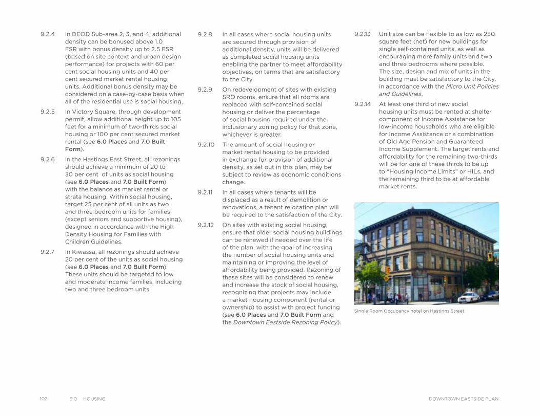
102 9.0 HousIng DOWNTOWN EASTSIDE PLAN
9.2.4 In DEOD Sub-area 2, 3, and 4, additional density can be bonused above 1.0 FSR with bonus density up to 2.5 FSR (based on site context and urban design performance) for projects with 60 per cent social housing units and 40 per cent secured market rental housing units. Additional bonus density may be considered on a case-by-case basis when all of the residential use is social housing.
9.2.5 In Victory Square, through development permit, allow additional height up to 105 feet for a minimum of two-thirds social housing or 100 per cent secured market rental (see 6.0 Places and 7.0 Built Form).
9.2.6 In the Hastings East Street, all rezonings should achieve a minimum of 20 to 30 per cent of units as social housing (see 6.0 Places and 7.0 Built Form) with the balance as market rental or strata housing. Within social housing, target 25 per cent of all units as two and three bedroom units for families (except seniors and supportive housing), designed in accordance with the High Density Housing for Families with Children Guidelines.
9.2.7 In Kiwassa, all rezonings should achieve 20 per cent of the units as social housing (see 6.0 Places and 7.0 Built Form). These units should be targeted to low and moderate income families, including two and three bedroom units.
9.2.8 In all cases where social housing units are secured through provision of additional density, units will be delivered as completed social housing units enabling the partner to meet affordability objectives, on terms that are satisfactory to the City.
9.2.9 On redevelopment of sites with existing SRO rooms, ensure that all rooms are replaced with self-contained social housing or deliver the percentage of social housing required under the inclusionary zoning policy for that zone, whichever is greater.
9.2.10 The amount of social housing or market rental housing to be provided in exchange for provision of additional density, as set out in this plan, may be subject to review as economic conditions change.
9.2.11 In all cases where tenants will be displaced as a result of demolition or renovations, a tenant relocation plan will be required to the satisfaction of the City.
9.2.12 On sites with existing social housing, ensure that older social housing buildings can be renewed if needed over the life of the plan, with the goal of increasing the number of social housing units and maintaining or improving the level of affordability being provided. Rezoning of these sites will be considered to renew and increase the stock of social housing, recognizing that projects may include a market housing component (rental or ownership) to assist with project funding (see 6.0 Places and 7.0 Built Form and the Downtown Eastside Rezoning Policy).
9.2.13 Unit size can be flexible to as low as 250 square feet (net) for new buildings for single self-contained units, as well as encouraging more family units and two and three bedrooms where possible. The size, design and mix of units in the building must be satisfactory to the City, in accordance with the Micro Unit Policies and Guidelines.
9.2.14 At least one third of new social housing units must be rented at shelter component of Income Assistance for low-income households who are eligible for Income Assistance or a combination of Old Age Pension and Guaranteed Income Supplement. The target rents and affordability for the remaining two-thirds will be for one of these thirds to be up to “Housing Income Limits” or HILs, and the remaining third to be at affordable market rents.
Single Room Occupancy hotel on Hastings Street
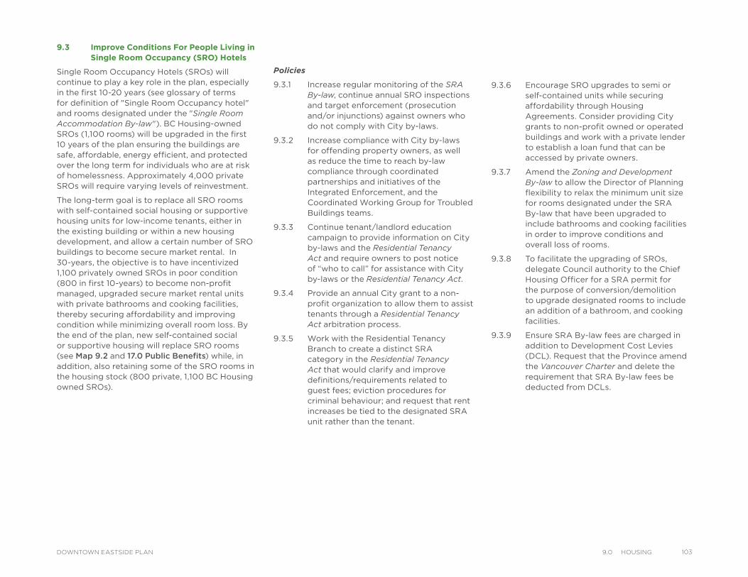
9.3 Improve Conditions For People Living in Single Room Occupancy (SRO) Hotels
Single Room Occupancy Hotels (SROs) will continue to play a key role in the plan, especially in the first 10-20 years (see glossary of terms for definition of "Single Room Occupancy hotel" and rooms designated under the "Single Room Accommodation By-law"). BC Housing-owned SROs (1,100 rooms) will be upgraded in the first 10 years of the plan ensuring the buildings are safe, affordable, energy efficient, and protected over the long term for individuals who are at risk of homelessness. Approximately 4,000 private SROs will require varying levels of reinvestment.
The long-term goal is to replace all SRO rooms with self-contained social housing or supportive housing units for low-income tenants, either in the existing building or within a new housing development, and allow a certain number of SRO buildings to become secure market rental. In 30-years, the objective is to have incentivized 1,100 privately owned SROs in poor condition (800 in first 10-years) to become non-profit managed, upgraded secure market rental units with private bathrooms and cooking facilities, thereby securing affordability and improving condition while minimizing overall room loss. By the end of the plan, new self-contained social or supportive housing will replace SRO rooms (see Map 9.2 and 17.0 Public Benefits) while, in addition, also retaining some of the SRO rooms in the housing stock (800 private, 1,100 BC Housing owned SROs).
Policies
9.3.1 Increase regular monitoring of the SRA By-law, continue annual SRO inspections and target enforcement (prosecution and/or injunctions) against owners who do not comply with City by-laws.
9.3.2 Increase compliance with City by-laws for offending property owners, as well as reduce the time to reach by-law compliance through coordinated partnerships and initiatives of the Integrated Enforcement, and the Coordinated Working Group for Troubled Buildings teams.
9.3.3 Continue tenant/landlord education campaign to provide information on City by-laws and the Residential Tenancy Act and require owners to post notice of “who to call” for assistance with City by-laws or the Residential Tenancy Act.
9.3.4 Provide an annual City grant to a non-profit organization to allow them to assist tenants through a Residential Tenancy Act arbitration process.
9.3.5 Work with the Residential Tenancy Branch to create a distinct SRA category in the Residential Tenancy Act that would clarify and improve definitions/requirements related to guest fees; eviction procedures for criminal behaviour; and request that rent increases be tied to the designated SRA unit rather than the tenant.
9.3.6 Encourage SRO upgrades to semi or self-contained units while securing affordability through Housing Agreements. Consider providing City grants to non-profit owned or operated buildings and work with a private lender to establish a loan fund that can be accessed by private owners.
9.3.7 Amend the Zoning and Development By-law to allow the Director of Planning flexibility to relax the minimum unit size for rooms designated under the SRA By-law that have been upgraded to include bathrooms and cooking facilities in order to improve conditions and overall loss of rooms.
9.3.8 To facilitate the upgrading of SROs, delegate Council authority to the Chief Housing Officer for a SRA permit for the purpose of conversion/demolition to upgrade designated rooms to include an addition of a bathroom, and cooking facilities.
9.3.9 Ensure SRA By-law fees are charged in addition to Development Cost Levies (DCL). Request that the Province amend the Vancouver Charter and delete the requirement that SRA By-law fees be deducted from DCLs.
1039.0 HousIngDOWNTOWN EASTSIDE PLAN
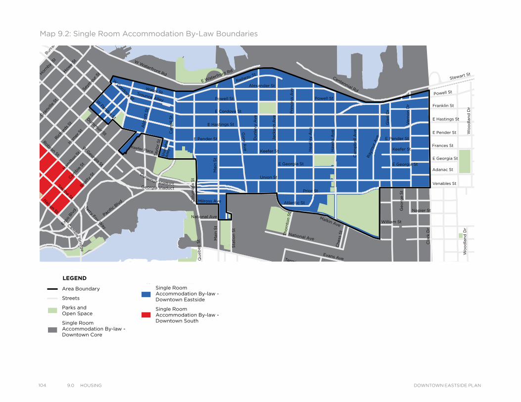
104 9.0 HousIng DOWNTOWN EASTSIDE PLAN
Powell St
Water StTrounce Alley
Keefer Place
Alexander St
E Cordova St
Centennial Rd
Powell St
E Waterfront Rd
Railway St
W Waterfront Rd
William St William St
Powell St
Stewart St
Napier St
Venables St
Adanac St
Union St
Qu
eb
ec S
t
Keefer St
E Georgia St
Ge
org
e S
t
Cla
rk D
r
E Georgia St
Atlantic St
National Ave
Malkin Ave
Terminal Ave
Evans Ave
Milross Ave
National Ave
Nelson St
Prior St
E Pender St
Franklin St
E Hastings St
Pandora St
Triumph St
E Pender St
Frances St
E Georgia St
E Hastings St
E Pender St
W Cordova St
Dunsmuir St
Robson St
W G
eorgia St
Smithe St
W Pender St
Cam
bie S
t
Sh
an
gh
ai
Alle
y
Beatt
y St
Ham
ilton
St
Mai
nlan
d St
Hom
er S
t
Richa
rds St
Hor
nby
St
Burra
rd
How
e St
Seym
our S
t
Gra
nville
St
Keefer St
Go
re A
ve
Jackso
n A
ve
Du
nle
vy A
ve
Main
St
Sta
tio
n S
t
Main
St
Co
lum
bia
St
Pacific
Blvd
Terry Fox Way
Carr
all
St
Ab
bo
tt S
t
Taylo
r S
t
Pri
ncess
Ave
Cam
pb
ell
Ave
Ray
mur
Ave
Ve
rno
n D
r
Wo
od
lan
d D
rW
oo
dla
nd
Dr
Co
mm
erc
ial D
r
Sals
bu
ry D
r
Gle
n D
r
Heatl
ey A
ve
Haw
ks
Ave
Th
orn
ton S
t
Ch
ess
St
Dunsmuir Viaduct
Expo
Blv
d
Georgia Viaduct
Cambie B
ridg
e
Area Boundary
Streets
Parks andOpen Space
Single Room Accommodation By-law - Downtown Core
Single Room Accommodation By-law - Downtown Eastside
Single Room Accommodation By-law - Downtown South
LEGEND
Map 9.2: Single Room Accommodation By-Law Boundaries
Powell St
Water StTrounce Alley
Keefer Place
Alexander St
E Cordova St
Centennial Rd
Powell St
E Waterfront Rd
Railway St
W Waterfront Rd
William St William St
Powell St
Stewart St
Napier St
Venables St
Adanac St
Union St
Qu
eb
ec S
t
Keefer St
E Georgia St
Ge
org
e S
t
Cla
rk D
r
E Georgia St
Atlantic St
National Ave
Malkin Ave
Terminal Ave
Evans Ave
Milross Ave
National Ave
Nelson St
Prior St
E Pender St
Franklin St
E Hastings St
Pandora St
Triumph St
E Pender St
Frances St
E Georgia St
E Hastings St
E Pender St
W Cordova St
Dunsmuir St
Robson St
W G
eorgia St
Smithe St
W Pender St
Cam
bie S
t
Sh
an
gh
ai
Alle
y
Beatt
y St
Ham
ilton
St
Mai
nlan
d St
Hom
er S
t
Richa
rds St
Hor
nby
St
Burra
rd
How
e St
Seym
our S
t
Gra
nville
St
Keefer St
Go
re A
ve
Jackso
n A
ve
Du
nle
vy A
ve
Main
St
Sta
tio
n S
t
Main
St
Co
lum
bia
St
Pacific
Blvd
Terry Fox Way
Carr
all
St
Ab
bo
tt S
t
Taylo
r S
t
Pri
ncess
Ave
Cam
pb
ell
Ave
Ray
mur
Ave
Ve
rno
n D
r
Wo
od
lan
d D
rW
oo
dla
nd
Dr
Co
mm
erc
ial D
r
Sals
bu
ry D
r
Gle
n D
r
Heatl
ey A
ve
Haw
ks
Ave
Th
orn
ton S
t
Ch
ess
St
Dunsmuir Viaduct
Expo
Blv
d
Georgia Viaduct
Cambie B
ridg
e
Area Boundary
Streets
Parks andOpen Space
Single Room Accommodation By-law - Downtown Core
Single Room Accommodation By-law - Downtown Eastside
Single Room Accommodation By-law - Downtown South
LEGENDPowell St
Water StTrounce Alley
Keefer Place
Alexander St
E Cordova St
Centennial Rd
Powell St
E Waterfront Rd
Railway St
W Waterfront Rd
William St William St
Powell St
Stewart St
Napier St
Venables St
Adanac St
Union St
Qu
eb
ec S
t
Keefer St
E Georgia St
Ge
org
e S
t
Cla
rk D
r
E Georgia St
Atlantic St
National Ave
Malkin Ave
Terminal Ave
Evans Ave
Milross Ave
National Ave
Nelson St
Prior St
E Pender St
Franklin St
E Hastings St
Pandora St
Triumph St
E Pender St
Frances St
E Georgia St
E Hastings St
E Pender St
W Cordova St
Dunsmuir St
Robson St
W G
eorgia St
Smithe St
W Pender St
Cam
bie S
t
Sh
an
gh
ai
Alle
y
Beatt
y St
Ham
ilton
St
Mai
nlan
d St
Hom
er S
t
Richa
rds St
Hor
nby
St
Burra
rd
How
e St
Seym
our S
t
Gra
nville
St
Keefer St
Go
re A
ve
Jackso
n A
ve
Du
nle
vy A
ve
Main
St
Sta
tio
n S
t
Main
St
Co
lum
bia
St
Pacific
Blvd
Terry Fox Way
Carr
all
St
Ab
bo
tt S
t
Taylo
r S
t
Pri
ncess
Ave
Cam
pb
ell
Ave
Ray
mur
Ave
Ve
rno
n D
r
Wo
od
lan
d D
rW
oo
dla
nd
Dr
Co
mm
erc
ial D
r
Sals
bu
ry D
r
Gle
n D
r
Heatl
ey A
ve
Haw
ks
Ave
Th
orn
ton S
t
Ch
ess
St
Dunsmuir Viaduct
Expo
Blv
d
Georgia Viaduct
Cambie B
ridg
e
Area Boundary
Streets
Parks andOpen Space
Single Room Accommodation By-law - Downtown Core
Single Room Accommodation By-law - Downtown Eastside
Single Room Accommodation By-law - Downtown South
LEGEND
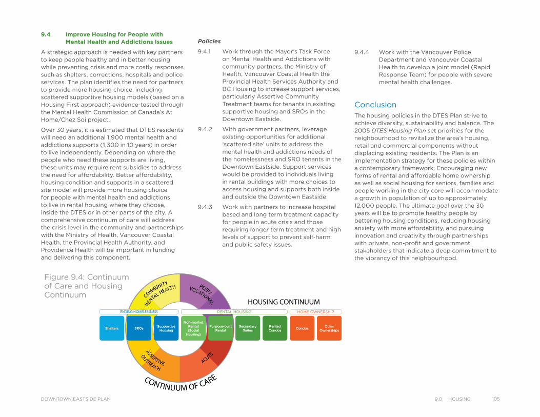
9.4 Improve Housing for People with Mental Health and Addictions Issues
A strategic approach is needed with key partners to keep people healthy and in better housing while preventing crisis and more costly responses such as shelters, corrections, hospitals and police services. The plan identifies the need for partners to provide more housing choice, including scattered supportive housing models (based on a Housing First approach) evidence-tested through the Mental Health Commission of Canada’s At Home/Chez Soi project.
Over 30 years, it is estimated that DTES residents will need an additional 1,900 mental health and addictions supports (1,300 in 10 years) in order to live independently. Depending on where the people who need these supports are living, these units may require rent subsidies to address the need for affordability. Better affordability, housing condition and supports in a scattered site model will provide more housing choice for people with mental health and addictions to live in rental housing where they choose, inside the DTES or in other parts of the city. A comprehensive continuum of care will address the crisis level in the community and partnerships with the Ministry of Health, Vancouver Coastal Health, the Provincial Health Authority, and Providence Health will be important in funding and delivering this component.
Policies
9.4.1 Work through the Mayor’s Task Force on Mental Health and Addictions with community partners, the Ministry of Health, Vancouver Coastal Health the Provincial Health Services Authority and BC Housing to increase support services, particularly Assertive Community Treatment teams for tenants in existing supportive housing and SROs in the Downtown Eastside.
9.4.2 With government partners, leverage existing opportunities for additional ‘scattered site’ units to address the mental health and addictions needs of the homelessness and SRO tenants in the Downtown Eastside. Support services would be provided to individuals living in rental buildings with more choices to access housing and supports both inside and outside the Downtown Eastside.
9.4.3 Work with partners to increase hospital based and long term treatment capacity for people in acute crisis and those requiring longer term treatment and high levels of support to prevent self-harm and public safety issues.
CONTINUUM OF CARE
HOME OWNERSHIPRENTAL HOUSINGENDING HOMELESSNESS
Shelters SROs Supportive Housing
Non-market Rental (Social
Housing)
Purpose-built Rental
Secondary Suites
Rented Condos Condos Other
Ownerships
ASSERTIVE
OUTREACHACUTE
COMMUNITY
MENT
AL HEALTH PEER/
VOCATIONAL HOUSING CONTINUUM
Figure 9.4: Continuum of Care and Housing Continuum
9.4.4 Work with the Vancouver Police Department and Vancouver Coastal Health to develop a joint model (Rapid Response Team) for people with severe mental health challenges.
ConclusionThe housing policies in the DTES Plan strive to achieve diversity, sustainability and balance. The 2005 DTES Housing Plan set priorities for the neighbourhood to revitalize the area’s housing, retail and commercial components without displacing existing residents. The Plan is an implementation strategy for these policies within a contemporary framework. Encouraging new forms of rental and affordable home ownership as well as social housing for seniors, families and people working in the city core will accommodate a growth in population of up to approximately 12,000 people. The ultimate goal over the 30 years will be to promote healthy people by bettering housing conditions, reducing housing anxiety with more affordability, and pursuing innovation and creativity through partnerships with private, non-profit and government stakeholders that indicate a deep commitment to the vibrancy of this neighbourhood.
1059.0 HousIngDOWNTOWN EASTSIDE PLAN
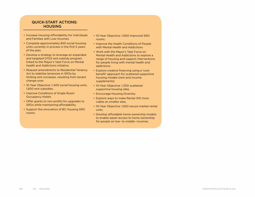
106 9.0 HousIng DOWNTOWN EASTSIDE PLAN
• Increase Housing Affordability for Individuals and Families with Low-Incomes
• Complete approximately 850 social housing units currently in process in the first 5 years of the plan.
• Develop a strategy to leverage an expanded and targeted DTES rent subsidy program linked to the Mayor’s Task Force on Mental Health and Addictions initiative.
• Request amendments to Residential Tenancy Act to stabilize tenancies in SROs by limiting rent increases, resulting from tenant change-over.
• 10-Year Objective: 1,400 social housing units, 1,650 rent subsidies.
• Improve Conditions of Single Room Occupancy Hotels
• Offer grants to non-profits for upgrades to SROs while maintaining affordability.
• Support the renovation of BC Housing SRO rooms.
QUICK-START ACTIONS: HOUSING
• 10-Year Objective: 1,900 improved SRO rooms.
• Improve the Health Conditions of People with Mental Health and Addictions
• Work with the Mayor’s Task Force on Mental Health and Addictions to explore a range of housing and support interventions for people living with mental health and addictions.
• Explore creative financing using a ‘cost-benefit’ approach for scattered supportive housing models (rent and income supplements).
• 10-Year Objective: 1,300 scattered supportive housing sites.
• Encourage Housing Diversity
• Explore ways to make Rental 100 more viable on smaller sites.
• 10-Year Objective: 1,650 secure market rental units.
• Develop affordable home ownership models to enable easier-access to home ownership for people on low- to middle- incomes.
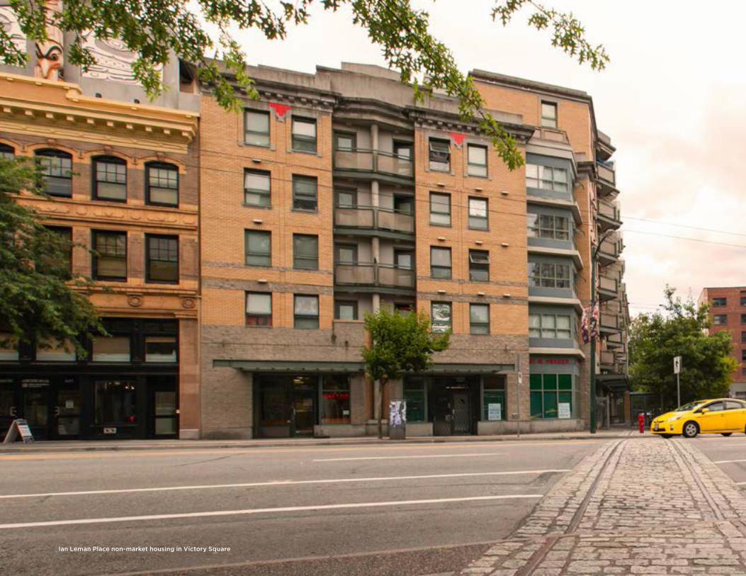
Ian Leman Place non-market housing in Victory Square
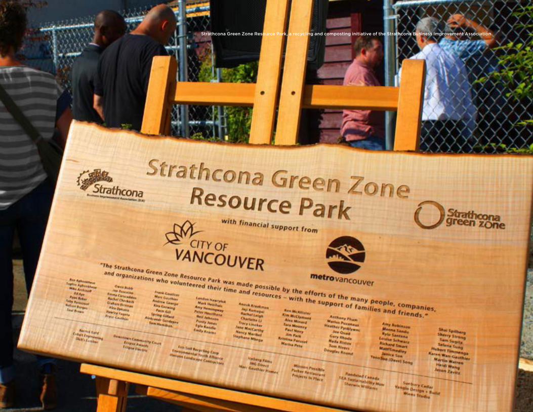
Strathcona Green Zone Resource Park, a recycling and composting initiative of the Strathcona Business Improvement Association
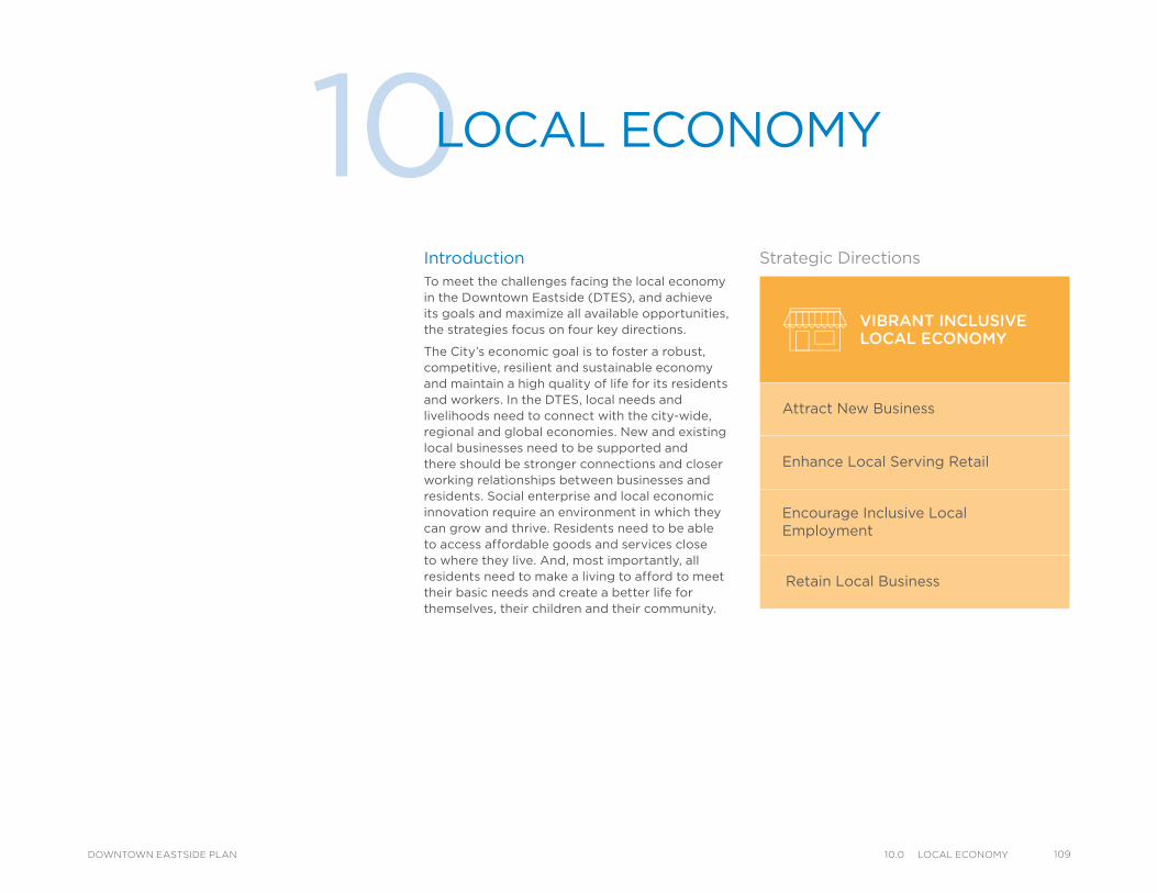
IntroductionTo meet the challenges facing the local economy in the Downtown Eastside (DTES), and achieve its goals and maximize all available opportunities, the strategies focus on four key directions.
The City’s economic goal is to foster a robust, competitive, resilient and sustainable economy and maintain a high quality of life for its residents and workers. In the DTES, local needs and livelihoods need to connect with the city-wide, regional and global economies. New and existing local businesses need to be supported and there should be stronger connections and closer working relationships between businesses and residents. Social enterprise and local economic innovation require an environment in which they can grow and thrive. Residents need to be able to access affordable goods and services close to where they live. And, most importantly, all residents need to make a living to afford to meet their basic needs and create a better life for themselves, their children and their community.
10LOCAL ECONOMY
VIBRANT INCLUSIVELOCAL ECONOMY
Attract New Business
Enhance Local Serving Retail
Encourage Inclusive Local Employment
Retain Local Business
Strategic Directions
10910.0 loCal eConomyDOWNTOWN EASTSIDE PLAN
110 10.0 loCal eConomy DOWNTOWN EASTSIDE PLAN
There are significant structural issues that create barriers to achieving employment and economic prosperity for DTES residents and businesses. A large proportion of DTES residents experience poverty through living on fixed incomes and inadequate Income Assistance levels have remained the same (from 2007 to 2014) despite cost of living increases. This lack of purchasing power to support local businesses and an inability to participate fully in the economy is just one of the challenges facing this area. A “digital divide” is also evident where many residents lack sufficient access to technological and communication tools and the opportunities associated with them. It is clear that the local economy cannot be separated from the housing issues, built form, history, heritage, safety and well-being of its residents. As a result, an integrated approach with support from senior levels of government is required.
This chapter builds on decades of work to revitalize the local economy in the DTES while accommodating growth and without displacing any existing residents. It proposes special actions and policies to encourage local economic development and build the mixed economy (micro to global economic activities), while at the same time ensuring that commerce, retail services and employment opportunities are available for all residents into the future.
The DTES local economy strategies will be implemented in each neighbourhood as shown in Map 10.1.
City-wide Context and PoliciesThe local economy in the DTES involves many different economic activities ranging from small family businesses, community volunteering and survival livelihoods, to large international and global enterprises. There are approximately 2,800 businesses and industries in the area (including many social enterprises) and about 19,500 people working there. An estimated 13 per cent of people who work in the DTES also live in the area. Statistics Canada estimated in 2006 that 11.3 per cent of the people who could work were unemployed for various reasons. Volunteerism is high and deeply valued by many residents. In 2013, 2,075 volunteers contributed to 29 organizations funded by the City of Vancouver, giving 108,955 hours of their time. In addition, residents often participate in other informal and survival economic activities. There are opportunities for the economy to grow in such a way that the many residents who are interested in working could also benefit.
The DTES has mixed land uses and many diverse economic activities. In recent years, there have been signs of economic improvement, with new businesses locating in some neighbourhoods and a number of social enterprises creating local employment and services. The most prevalent DTES businesses are classified as professional, scientific and technical services, administration, support services, waste management and remediation and retail activities (Dunn and Bradstreet 2012), with Chinatown and Gastown seeing the most growth in commercial floor space since 2001 (Local Area Profile 2013). The DTES also has a long history of industrial activities such as apparel, food manufacturing and wholesaling and creative outlets.
Considerable growth in the digital creative industry, animation and design studios is occurring and more education institutions are attracting younger residents to the area. Many local businesses are moving towards "green" enterprise models and practices and adapting their operations to align with global trends and, at the same time, helping the City achieve its
Greenest City Action Plan sustainability objectives. Compared to city-wide trends, there is a large cluster of non-profit service agencies in DTES (estimated at 174 in 2012) sponsoring numerous social enterprises linked to low-barrier jobs (e.g. jobs with more casual work hours, on-the-job supports, graduated entry etc.) service industries and support for local businesses and residents. Some examples of the positive impact that social enterprises have already had include the fact that four of the larger social enterprises in the DTES employed 360 residents in 2012 and are believed to provide substantial savings to public service subsidies and programs.
The arts play an important role in the economic vitality of the DTES with a strong creative community contributing to positive change in the area. Artists tend to be attracted to this neighbourhood due to the inexpensive housing and easy access to resources such as studio space, galleries, rehearsal and performance spaces, artist-run centres and associations.
The future DTES community is expected to continue to include people with diverse social and economic backgrounds. Accordingly, the main challenges going forward are centred on building the economy to serve the interests of all residents of all incomes and business interests while also creating benefits for those who are unemployed, dependent on Income Assistance, pensions and/or the informal economy, the working poor and who are more vulnerable to the effects of change. The goal is to provide a base to support existing and new businesses and retail outlets, resulting in the tenanting of vacant storefronts and buildings while ensuring that low-income residents have better access to the inexpensive goods and services they need. Using the DTES SIA as a priority of the plan, Social Impact Objectives and a Social Impact Management Framework were developed as a result and are proposed as a tool for implementing local economic development strategies (See 18.0 Implementation).
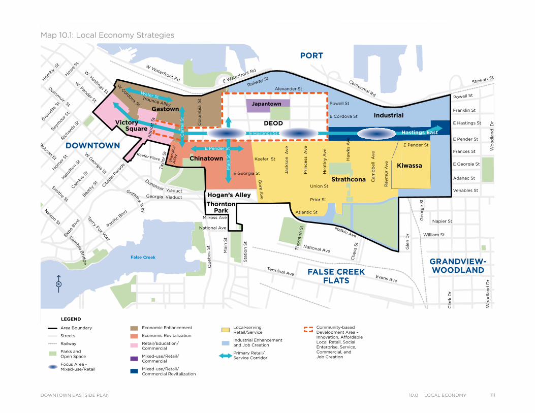
Powell StTrounce Alley
Keefer Place
Alexander St
E Cordova St
Centennial Rd
E Waterfront Rd
Railway St
W Waterfront Rd
William St William St
Powell St
Stewart St
Napier St
Venables St
Adanac St
Union St
Qu
eb
ec S
t
Geo
rge S
t
Cla
rk D
r
E Georgia St
Atlantic St
National Ave
Malkin Ave
Terminal Ave Evans Ave
Milross Ave
National Ave
Nelson St
Prior St
Franklin St
E Hastings St
Pandora St
Triumph St
E Pender St
Frances St
E Georgia St
W Cordova St
W Hastings St
Dunsmuir St
Robson StW
Georgia St
Smithe St
W Pender St
Cam
bie S
t
Sh
an
gh
ai
Alle
y
Beatt
y St Cita
del P
arad
e
Ham
ilton
St
Mai
nlan
d St
Hom
er S
tRic
hard
s St
Hor
nby
St
How
e St
Seym
our S
t
Gra
nville
St
Keefer St
Go
re A
ve
Jackso
n A
ve
Sta
tio
n S
t
Main
St
Co
lum
bia
S
t
Pacific
Blvd
Terry Fox Way
Ab
bo
tt S
t
Taylo
r S
t
Pri
ncess
A
ve
Cam
pb
ell
Ave
Raym
ur
Ave
Wo
od
lan
d D
rW
oo
dla
nd
Dr
Co
mm
erc
ial D
r
Sals
bu
ry D
r
Heatl
ey A
ve
Haw
ks
Ave
Th
orn
ton S
t
Ch
ess
St
Dunsmuir Viaduct
Expo
Blv
d
Georgia Viaduct
Griffiths Way
Cambie B
ridg
e
E Pender St
Gle
n D
r
E Hastings St
E Pender St
Main
St
Carr
all
St
Water St
Victory
Gastown
DEOD
Kiwassa
Industrial
ThorntonPark
Square
Japantown
Hogan’s Alley
Hastings East
Chinatown
Strathcona
PORT
DOWNTOWN
FALSE CREEKFLATS
GRANDVIEW-WOODLAND
Area Boundary
Streets
Railway
Parks andOpen Space
Focus Area - Mixed-use/Retail
Economic Enhancement
Economic Revitalization
Retail/Education/ Commercial
Mixed-use/Retail/ Commercial
Mixed-use/Retail/ Commercial Revitalization
Local-servingRetail/Service
Industrial Enhancement and Job Creation
Primary Retail/ Service Corridor
Community-based Development Area - Innovation, Affordable Local Retail, Social Enterprise, Service, Commercial, andJob Creation
LEGEND
Map 10.1: Local Economy Strategies
Powell StTrounce Alley
Keefer Place
Alexander St
E Cordova St
Centennial Rd
E Waterfront Rd
Railway St
W Waterfront Rd
William St William St
Powell St
Stewart St
Napier St
Venables St
Adanac St
Union St
Qu
eb
ec S
t
Geo
rge S
t
Cla
rk D
r
E Georgia St
Atlantic St
National Ave
Malkin Ave
Terminal Ave Evans Ave
Milross Ave
National Ave
Nelson St
Prior St
Franklin St
E Hastings St
Pandora St
Triumph St
E Pender St
Frances St
E Georgia St
W Cordova St
W Hastings St
Dunsmuir St
Robson StW
Georgia St
Smithe St
W Pender St
Cam
bie S
t
Sh
an
gh
ai
Alle
y
Beatt
y St Cita
del P
arad
e
Ham
ilton
St
Mai
nlan
d St
Hom
er S
tRic
hard
s St
Hor
nby
St
How
e St
Seym
our S
t
Gra
nville
St
Keefer St
Go
re A
ve
Jackso
n A
ve
Sta
tio
n S
t
Main
St
Co
lum
bia
S
t
Pacific
Blvd
Terry Fox Way
Ab
bo
tt S
t
Taylo
r S
t
Pri
ncess
A
ve
Cam
pb
ell
Ave
Raym
ur
Ave
Wo
od
lan
d D
rW
oo
dla
nd
Dr
Co
mm
erc
ial D
r
Sals
bu
ry D
r
Heatl
ey A
ve
Haw
ks
Ave
Th
orn
ton S
t
Ch
ess
St
Dunsmuir Viaduct
Expo
Blv
d
Georgia Viaduct
Griffiths Way
Cambie B
ridg
e
E Pender St
Gle
n D
r
E Hastings St
E Pender St
Main
St
Carr
all
St
Water St
Victory
Gastown
DEOD
Kiwassa
Industrial
ThorntonPark
Square
Japantown
Hogan’s Alley
Hastings East
Chinatown
Strathcona
PORT
DOWNTOWN
FALSE CREEKFLATS
GRANDVIEW-WOODLAND
Area Boundary
Streets
Railway
Parks andOpen Space
Focus Area - Mixed-use/Retail
Economic Enhancement
Economic Revitalization
Retail/Education/ Commercial
Mixed-use/Retail/ Commercial
Mixed-use/Retail/ Commercial Revitalization
Local-servingRetail/Service
Industrial Enhancement and Job Creation
Primary Retail/ Service Corridor
Community-based Development Area - Innovation, Affordable Local Retail, Social Enterprise, Service, Commercial, andJob Creation
LEGENDPowell St
Trounce Alley
Keefer Place
Alexander St
E Cordova St
Centennial Rd
E Waterfront Rd
Railway St
W Waterfront Rd
William St William St
Powell St
Stewart St
Napier St
Venables St
Adanac St
Union St
Qu
eb
ec S
t
Geo
rge S
t
Cla
rk D
r
E Georgia St
Atlantic St
National Ave
Malkin Ave
Terminal Ave Evans Ave
Milross Ave
National Ave
Nelson St
Prior St
Franklin St
E Hastings St
Pandora St
Triumph St
E Pender St
Frances St
E Georgia St
W Cordova St
W Hastings St
Dunsmuir St
Robson StW
Georgia St
Smithe St
W Pender St
Cam
bie S
t
Sh
an
gh
ai
Alle
y
Beatt
y St Cita
del P
arad
e
Ham
ilton
St
Mai
nlan
d St
Hom
er S
tRic
hard
s St
Hor
nby
St
How
e St
Seym
our S
t
Gra
nville
St
Keefer St
Go
re A
ve
Jackso
n A
ve
Sta
tio
n S
t
Main
St
Co
lum
bia
S
t
Pacific
Blvd
Terry Fox Way
Ab
bo
tt S
t
Taylo
r S
t
Pri
ncess
A
ve
Cam
pb
ell
Ave
Raym
ur
Ave
Wo
od
lan
d D
rW
oo
dla
nd
Dr
Co
mm
erc
ial D
r
Sals
bu
ry D
r
Heatl
ey A
ve
Haw
ks
Ave
Th
orn
ton S
t
Ch
ess
St
Dunsmuir Viaduct
Expo
Blv
d
Georgia Viaduct
Griffiths Way
Cambie B
ridg
e
E Pender St
Gle
n D
r
E Hastings St
E Pender St
Main
St
Carr
all
St
Water St
Victory
Gastown
DEOD
Kiwassa
Industrial
ThorntonPark
Square
Japantown
Hogan’s Alley
Hastings East
Chinatown
Strathcona
PORT
DOWNTOWN
FALSE CREEKFLATS
GRANDVIEW-WOODLAND
Area Boundary
Streets
Railway
Parks andOpen Space
Focus Area - Mixed-use/Retail
Economic Enhancement
Economic Revitalization
Retail/Education/ Commercial
Mixed-use/Retail/ Commercial
Mixed-use/Retail/ Commercial Revitalization
Local-servingRetail/Service
Industrial Enhancement and Job Creation
Primary Retail/ Service Corridor
Community-based Development Area - Innovation, Affordable Local Retail, Social Enterprise, Service, Commercial, andJob Creation
LEGEND
Powell StTrounce Alley
Keefer Place
Alexander St
E Cordova St
Centennial Rd
E Waterfront Rd
Railway St
W Waterfront Rd
William St William St
Powell St
Stewart St
Napier St
Venables St
Adanac St
Union St
Qu
eb
ec S
t
Geo
rge S
t
Cla
rk D
r
E Georgia St
Atlantic St
National Ave
Malkin Ave
Terminal Ave Evans Ave
Milross Ave
National Ave
Nelson St
Prior St
Franklin St
E Hastings St
Pandora St
Triumph St
E Pender St
Frances St
E Georgia St
W Cordova St
W Hastings St
Dunsmuir St
Robson StW
Georgia St
Smithe St
W Pender St
Cam
bie S
t
Sh
an
gh
ai
Alle
y
Beatt
y St Cita
del P
arad
e
Ham
ilton
St
Mai
nlan
d St
Hom
er S
tRic
hard
s St
Hor
nby
St
How
e St
Seym
our S
t
Gra
nville
St
Keefer St
Go
re A
ve
Jackso
n A
ve
Sta
tio
n S
t
Main
St
Co
lum
bia
S
t
Pacific
Blvd
Terry Fox Way
Ab
bo
tt S
t
Taylo
r S
t
Pri
ncess
A
ve
Cam
pb
ell
Ave
Raym
ur
Ave
Wo
od
lan
d D
rW
oo
dla
nd
Dr
Co
mm
erc
ial D
r
Sals
bu
ry D
r
Heatl
ey A
ve
Haw
ks
Ave
Th
orn
ton S
t
Ch
ess
St
Dunsmuir Viaduct
Expo
Blv
d
Georgia Viaduct
Griffiths Way
Cambie B
ridg
e
E Pender St
Gle
n D
r
E Hastings St
E Pender St
Main
St
Carr
all
St
Water St
Victory
Gastown
DEOD
Kiwassa
Industrial
ThorntonPark
Square
Japantown
Hogan’s Alley
Hastings East
Chinatown
Strathcona
PORT
DOWNTOWN
FALSE CREEKFLATS
GRANDVIEW-WOODLAND
Area Boundary
Streets
Railway
Parks andOpen Space
Focus Area - Mixed-use/Retail
Economic Enhancement
Economic Revitalization
Retail/Education/ Commercial
Mixed-use/Retail/ Commercial
Mixed-use/Retail/ Commercial Revitalization
Local-servingRetail/Service
Industrial Enhancement and Job Creation
Primary Retail/ Service Corridor
Community-based Development Area - Innovation, Affordable Local Retail, Social Enterprise, Service, Commercial, andJob Creation
LEGEND
11110.0 loCal eConomyDOWNTOWN EASTSIDE PLAN
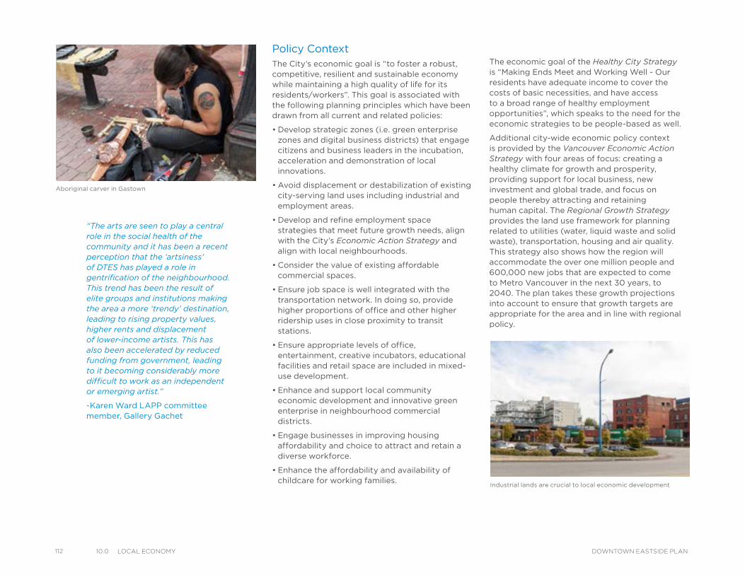
112 10.0 loCal eConomy DOWNTOWN EASTSIDE PLAN
Policy ContextThe City’s economic goal is “to foster a robust, competitive, resilient and sustainable economy while maintaining a high quality of life for its residents/workers”. This goal is associated with the following planning principles which have been drawn from all current and related policies:
• Develop strategic zones (i.e. green enterprise zones and digital business districts) that engage citizens and business leaders in the incubation, acceleration and demonstration of local innovations.
• Avoid displacement or destabilization of existing city-serving land uses including industrial and employment areas.
• Develop and refine employment space strategies that meet future growth needs, align with the City’s Economic Action Strategy and align with local neighbourhoods.
• Consider the value of existing affordable commercial spaces.
• Ensure job space is well integrated with the transportation network. In doing so, provide higher proportions of office and other higher ridership uses in close proximity to transit stations.
• Ensure appropriate levels of office, entertainment, creative incubators, educational facilities and retail space are included in mixed-use development.
• Enhance and support local community economic development and innovative green enterprise in neighbourhood commercial districts.
• Engage businesses in improving housing affordability and choice to attract and retain a diverse workforce.
• Enhance the affordability and availability of childcare for working families.
The economic goal of the Healthy City Strategy is “Making Ends Meet and Working Well - Our residents have adequate income to cover the costs of basic necessities, and have access to a broad range of healthy employment opportunities”, which speaks to the need for the economic strategies to be people-based as well.
Additional city-wide economic policy context is provided by the Vancouver Economic Action Strategy with four areas of focus: creating a healthy climate for growth and prosperity, providing support for local business, new investment and global trade, and focus on people thereby attracting and retaining human capital. The Regional Growth Strategy provides the land use framework for planning related to utilities (water, liquid waste and solid waste), transportation, housing and air quality. This strategy also shows how the region will accommodate the over one million people and 600,000 new jobs that are expected to come to Metro Vancouver in the next 30 years, to 2040. The plan takes these growth projections into account to ensure that growth targets are appropriate for the area and in line with regional policy.
Aboriginal carver in Gastown
“The arts are seen to play a central role in the social health of the community and it has been a recent perception that the ‘artsiness’ of DTES has played a role in gentrification of the neighbourhood. This trend has been the result of elite groups and institutions making the area a more ‘trendy’ destination, leading to rising property values, higher rents and displacement of lower-income artists. This has also been accelerated by reduced funding from government, leading to it becoming considerably more difficult to work as an independent or emerging artist.”
-Karen Ward LAPP committee member, Gallery Gachet
Industrial lands are crucial to local economic development
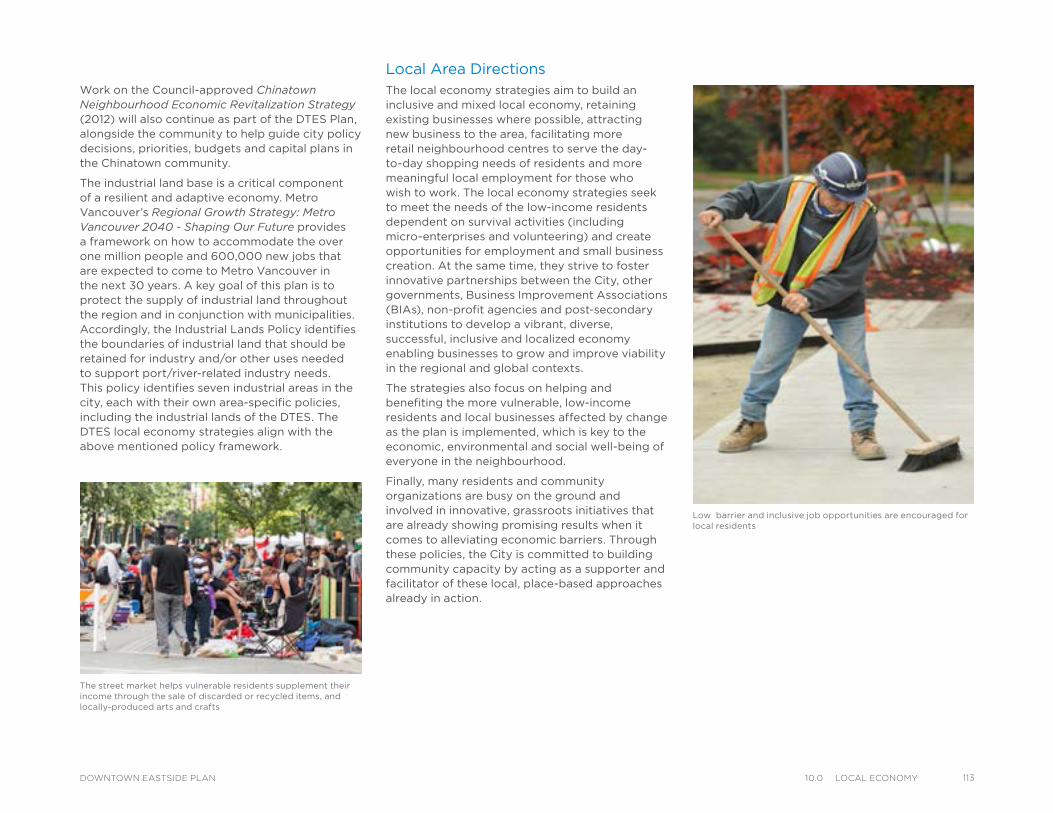
Work on the Council-approved Chinatown Neighbourhood Economic Revitalization Strategy (2012) will also continue as part of the DTES Plan, alongside the community to help guide city policy decisions, priorities, budgets and capital plans in the Chinatown community.
The industrial land base is a critical component of a resilient and adaptive economy. Metro Vancouver’s Regional Growth Strategy: Metro Vancouver 2040 - Shaping Our Future provides a framework on how to accommodate the over one million people and 600,000 new jobs that are expected to come to Metro Vancouver in the next 30 years. A key goal of this plan is to protect the supply of industrial land throughout the region and in conjunction with municipalities. Accordingly, the Industrial Lands Policy identifies the boundaries of industrial land that should be retained for industry and/or other uses needed to support port/river-related industry needs. This policy identifies seven industrial areas in the city, each with their own area-specific policies, including the industrial lands of the DTES. The DTES local economy strategies align with the above mentioned policy framework.
Low barrier and inclusive job opportunities are encouraged for local residents
Local Area DirectionsThe local economy strategies aim to build an inclusive and mixed local economy, retaining existing businesses where possible, attracting new business to the area, facilitating more retail neighbourhood centres to serve the day-to-day shopping needs of residents and more meaningful local employment for those who wish to work. The local economy strategies seek to meet the needs of the low-income residents dependent on survival activities (including micro-enterprises and volunteering) and create opportunities for employment and small business creation. At the same time, they strive to foster innovative partnerships between the City, other governments, Business Improvement Associations (BIAs), non-profit agencies and post-secondary institutions to develop a vibrant, diverse, successful, inclusive and localized economy enabling businesses to grow and improve viability in the regional and global contexts.
The strategies also focus on helping and benefiting the more vulnerable, low-income residents and local businesses affected by change as the plan is implemented, which is key to the economic, environmental and social well-being of everyone in the neighbourhood.
Finally, many residents and community organizations are busy on the ground and involved in innovative, grassroots initiatives that are already showing promising results when it comes to alleviating economic barriers. Through these policies, the City is committed to building community capacity by acting as a supporter and facilitator of these local, place-based approaches already in action.
The street market helps vulnerable residents supplement their income through the sale of discarded or recycled items, and locally-produced arts and crafts
11310.0 loCal eConomyDOWNTOWN EASTSIDE PLAN
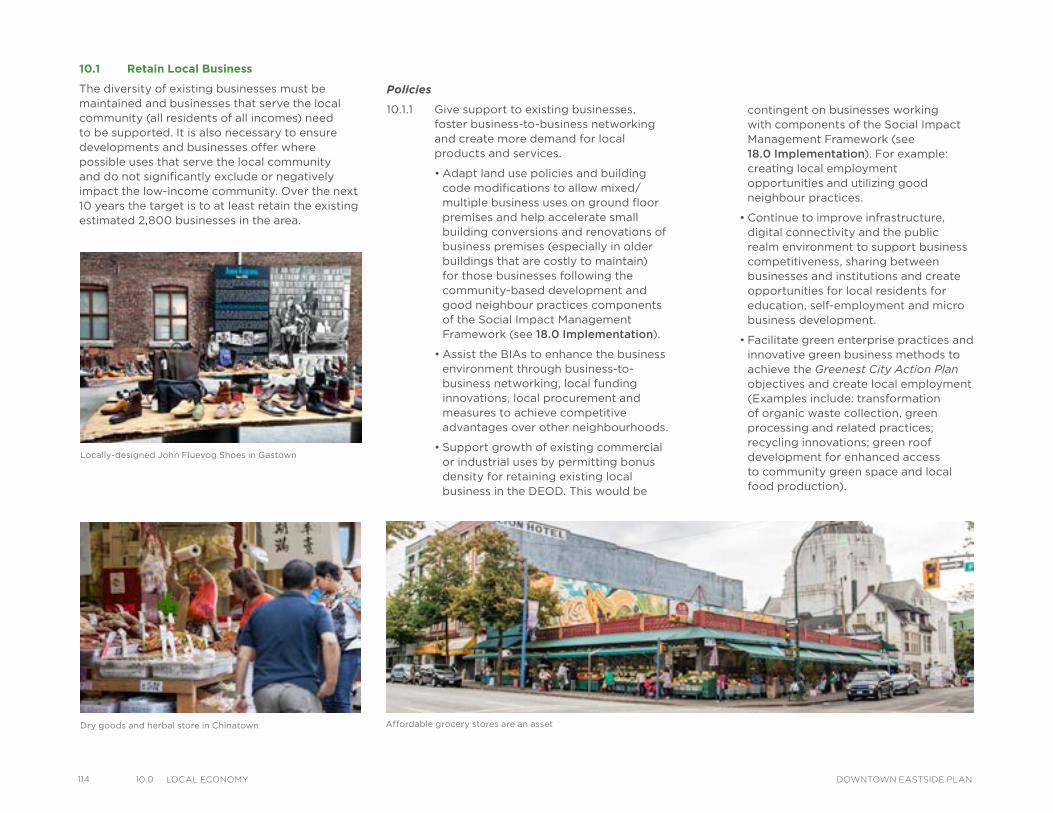
114 10.0 loCal eConomy DOWNTOWN EASTSIDE PLAN
contingent on businesses working with components of the Social Impact Management Framework (see 18.0 Implementation). For example: creating local employment opportunities and utilizing good neighbour practices.
• Continue to improve infrastructure, digital connectivity and the public realm environment to support business competitiveness, sharing between businesses and institutions and create opportunities for local residents for education, self-employment and micro business development.
• Facilitate green enterprise practices and innovative green business methods to achieve the Greenest City Action Plan objectives and create local employment (Examples include: transformation of organic waste collection, green processing and related practices; recycling innovations; green roof development for enhanced access to community green space and local food production).
Policies
10.1.1 Give support to existing businesses, foster business-to-business networking and create more demand for local products and services.
• Adapt land use policies and building code modifications to allow mixed/multiple business uses on ground floor premises and help accelerate small building conversions and renovations of business premises (especially in older buildings that are costly to maintain) for those businesses following the community-based development and good neighbour practices components of the Social Impact Management Framework (see 18.0 Implementation).
• Assist the BIAs to enhance the business environment through business-to-business networking, local funding innovations, local procurement and measures to achieve competitive advantages over other neighbourhoods.
• Support growth of existing commercial or industrial uses by permitting bonus density for retaining existing local business in the DEOD. This would be
10.1 Retain Local Business
The diversity of existing businesses must be maintained and businesses that serve the local community (all residents of all incomes) need to be supported. It is also necessary to ensure developments and businesses offer where possible uses that serve the local community and do not significantly exclude or negatively impact the low-income community. Over the next 10 years the target is to at least retain the existing estimated 2,800 businesses in the area.
Locally-designed John Fluevog Shoes in Gastown
Dry goods and herbal store in Chinatown Affordable grocery stores are an asset
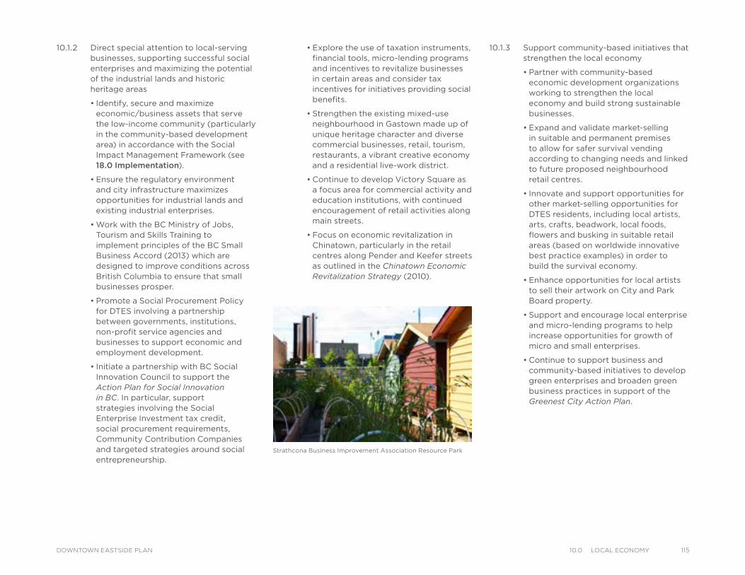
10.1.2 Direct special attention to local-serving businesses, supporting successful social enterprises and maximizing the potential of the industrial lands and historic heritage areas
• Identify, secure and maximize economic/business assets that serve the low-income community (particularly in the community-based development area) in accordance with the Social Impact Management Framework (see 18.0 Implementation).
• Ensure the regulatory environment and city infrastructure maximizes opportunities for industrial lands and existing industrial enterprises.
• Work with the BC Ministry of Jobs, Tourism and Skills Training to implement principles of the BC Small Business Accord (2013) which are designed to improve conditions across British Columbia to ensure that small businesses prosper.
• Promote a Social Procurement Policy for DTES involving a partnership between governments, institutions, non-profit service agencies and businesses to support economic and employment development.
• Initiate a partnership with BC Social Innovation Council to support the Action Plan for Social Innovation in BC. In particular, support strategies involving the Social Enterprise Investment tax credit, social procurement requirements, Community Contribution Companies and targeted strategies around social entrepreneurship.
• Explore the use of taxation instruments, financial tools, micro-lending programs and incentives to revitalize businesses in certain areas and consider tax incentives for initiatives providing social benefits.
• Strengthen the existing mixed-use neighbourhood in Gastown made up of unique heritage character and diverse commercial businesses, retail, tourism, restaurants, a vibrant creative economy and a residential live-work district.
• Continue to develop Victory Square as a focus area for commercial activity and education institutions, with continued encouragement of retail activities along main streets.
• Focus on economic revitalization in Chinatown, particularly in the retail centres along Pender and Keefer streets as outlined in the Chinatown Economic Revitalization Strategy (2010).
10.1.3 Support community-based initiatives that strengthen the local economy
• Partner with community-based economic development organizations working to strengthen the local economy and build strong sustainable businesses.
• Expand and validate market-selling in suitable and permanent premises to allow for safer survival vending according to changing needs and linked to future proposed neighbourhood retail centres.
• Innovate and support opportunities for other market-selling opportunities for DTES residents, including local artists, arts, crafts, beadwork, local foods, flowers and busking in suitable retail areas (based on worldwide innovative best practice examples) in order to build the survival economy.
• Enhance opportunities for local artists to sell their artwork on City and Park Board property.
• Support and encourage local enterprise and micro-lending programs to help increase opportunities for growth of micro and small enterprises.
• Continue to support business and community-based initiatives to develop green enterprises and broaden green business practices in support of the Greenest City Action Plan.
Strathcona Business Improvement Association Resource Park
11510.0 loCal eConomyDOWNTOWN EASTSIDE PLAN
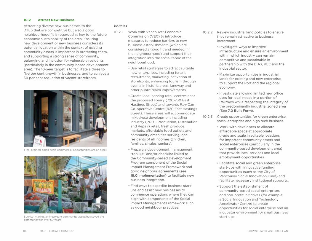
116 10.0 loCal eConomy DOWNTOWN EASTSIDE PLAN
Policies
10.2.1 Work with Vancouver Economic Commission (VEC) to introduce measures to reduce barriers to new business establishments (which are considered a good fit and needed in the neighbourhood) and support their integration into the social fabric of the neighbourhood.
• Use retail strategies to attract suitable new enterprises, including tenant recruitment, marketing, activation of storefronts, enhancing tourism through events in historic areas, laneway and other public realm improvements.
• Create local-serving retail centres near the proposed library (720-730 East Hastings Street) and towards Ray-Cam Co-operative Centre (920 East Hastings Street). These areas will accommodate mixed-use development including industry (PDR – Production, Distribution and Repair) retail, fresh produce markets, affordable food outlets and community amenities serving local residents of all incomes (children, families, singles, seniors).
• Prepare a development management "tool kit" and/or checklist linked to the Community-based Development Program component of the Social Impact Management Framework and good neighbour agreements (see 18.0 Implementation) to facilitate new business integration.
• Find ways to expedite business start-ups and assist new businesses to commence operations where they can align with components of the Social Impact Management Framework such as good neighbour practices.
10.2 Attract New Business
Attracting diverse new businesses to the DTES that are competitive but also a good neighbourhood fit is regarded as key to the future economic sustainability of the area. Ensuring new development or new business considers its potential location within the context of existing community assets is important in protecting them, and supporting a strong sense of community, belonging and inclusion for vulnerable residents (particularly in the community-based development area). The 10-year target is to facilitate a three to five per cent growth in businesses, and to achieve a 50 per cent reduction of vacant storefronts.
10.2.2 Review industrial land policies to ensure they remain attractive to business investment.
• Investigate ways to improve infrastructure and ensure an environment within which industry can remain competitive and sustainable in partnership with the BIAs, VEC and the industrial sector.
• Maximize opportunities in industrial lands for existing and new enterprise to support the Port and the regional economy.
• Investigate allowing limited new office uses for local needs in a portion of Railtown while respecting the integrity of the predominantly industrial zoned area (See 7.0 Built Form).
10.2.3 Create opportunities for green enterprise, social enterprise and high tech business.
• Work with developers to allocate affordable space at appropriate grade and scale in suitable locations for important community assets and social enterprises (particularly in the community-based development area) that provide local services and local employment opportunities.
• Facilitate social and green enterprise start-ups with innovative funding opportunities (such as the City of Vancouver Social Innovation Fund) and facilitate necessary institutional supports.
• Support the establishment of community-based social enterprises and non-profit initiatives (for example: a Social Innovation and Technology Accelerator Centre) to create opportunities for social enterprise and an incubator environment for small business start-ups.
Fine-grained, small-scale commercial opportunities are an asset
Sunrise market, an important community asset, has seved the community for over 50 years
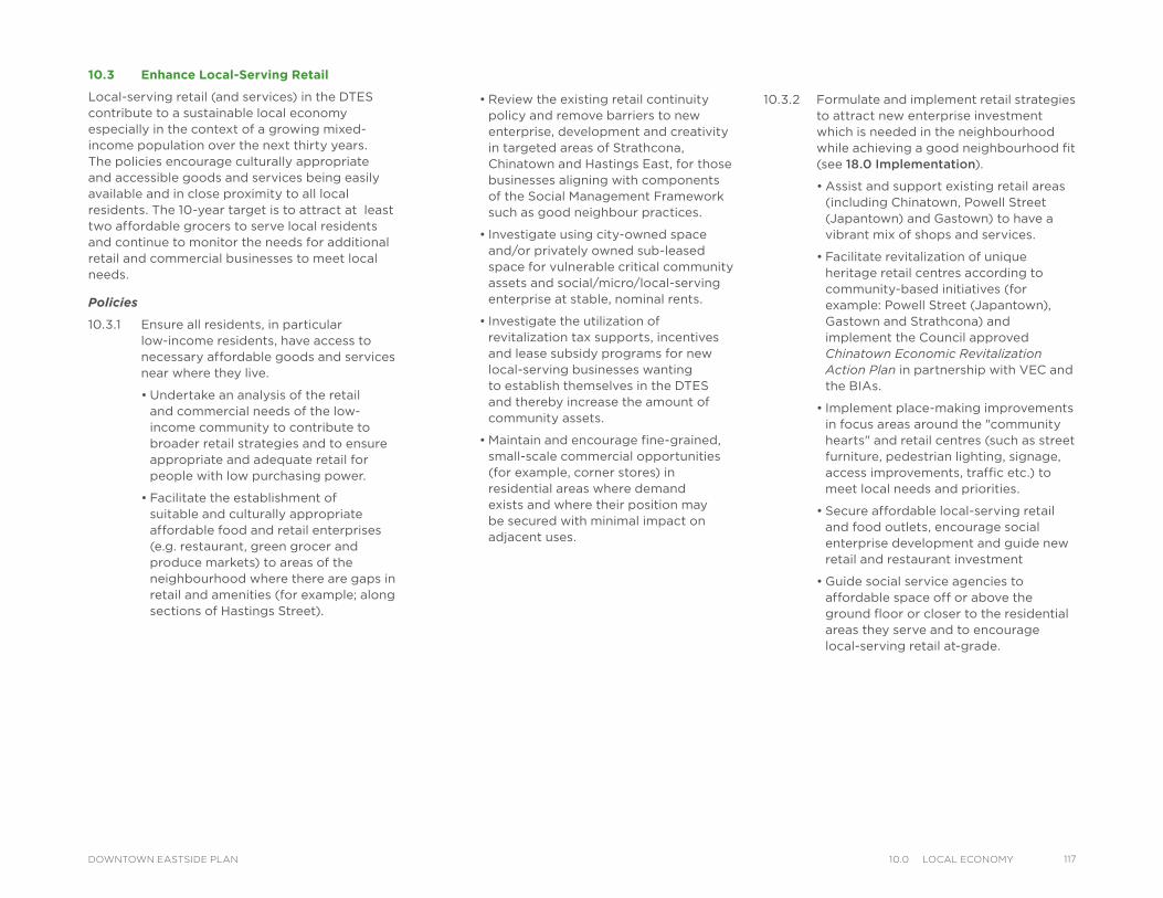
10.3.2 Formulate and implement retail strategies to attract new enterprise investment which is needed in the neighbourhood while achieving a good neighbourhood fit (see 18.0 Implementation).
• Assist and support existing retail areas (including Chinatown, Powell Street (Japantown) and Gastown) to have a vibrant mix of shops and services.
• Facilitate revitalization of unique heritage retail centres according to community-based initiatives (for example: Powell Street (Japantown), Gastown and Strathcona) and implement the Council approved Chinatown Economic Revitalization Action Plan in partnership with VEC and the BIAs.
• Implement place-making improvements in focus areas around the "community hearts" and retail centres (such as street furniture, pedestrian lighting, signage, access improvements, traffic etc.) to meet local needs and priorities.
• Secure affordable local-serving retail and food outlets, encourage social enterprise development and guide new retail and restaurant investment
• Guide social service agencies to affordable space off or above the ground floor or closer to the residential areas they serve and to encourage local-serving retail at-grade.
10.3 Enhance Local-Serving Retail
Local-serving retail (and services) in the DTES contribute to a sustainable local economy especially in the context of a growing mixed-income population over the next thirty years. The policies encourage culturally appropriate and accessible goods and services being easily available and in close proximity to all local residents. The 10-year target is to attract at least two affordable grocers to serve local residents and continue to monitor the needs for additional retail and commercial businesses to meet local needs.
Policies
10.3.1 Ensure all residents, in particular low-income residents, have access to necessary affordable goods and services near where they live.
• Undertake an analysis of the retail and commercial needs of the low-income community to contribute to broader retail strategies and to ensure appropriate and adequate retail for people with low purchasing power.
• Facilitate the establishment of suitable and culturally appropriate affordable food and retail enterprises (e.g. restaurant, green grocer and produce markets) to areas of the neighbourhood where there are gaps in retail and amenities (for example; along sections of Hastings Street).
• Review the existing retail continuity policy and remove barriers to new enterprise, development and creativity in targeted areas of Strathcona, Chinatown and Hastings East, for those businesses aligning with components of the Social Management Framework such as good neighbour practices.
• Investigate using city-owned space and/or privately owned sub-leased space for vulnerable critical community assets and social/micro/local-serving enterprise at stable, nominal rents.
• Investigate the utilization of revitalization tax supports, incentives and lease subsidy programs for new local-serving businesses wanting to establish themselves in the DTES and thereby increase the amount of community assets.
• Maintain and encourage fine-grained, small-scale commercial opportunities (for example, corner stores) in residential areas where demand exists and where their position may be secured with minimal impact on adjacent uses.
11710.0 loCal eConomyDOWNTOWN EASTSIDE PLAN
118 10.0 loCal eConomy DOWNTOWN EASTSIDE PLAN
10.4 Encourage Inclusive Local Employment
Creating employment in the local economy strengthens local business, improves purchasing power, entails a lower carbon footprint and creates community development. There are some residents who do not want work, only feel comfortable volunteering or participating in the informal economy or are unable to work and poverty is significant in the area. The unemployment rate is higher in DTES than across the city as a whole and these strategies seek to create opportunities for those who would choose to work. The 10-year target is to facilitate a minimum 1,500 new jobs (to employ 50 per cent of the estimated people currently unemployed). At a conservative growth estimate of five per cent per annum beyond 10 years it is projected that employment could increase by a further 2,000 jobs to the year 2043.
Policies
10.4.1 Create employment (especially low-barrier jobs) through inclusive, social impact hiring, and local employment opportunities.
• Encourage development that connects housing construction and economic enterprises with job creation, job space, and services/training.
• Encourage labour intensive local industry, light and service industry and the creative arts sector.
• Foster a supportive environment for social and micro economic activity of residents to increase local self-employment opportunities.
• Maintain industrial lands for industrial uses that contribute to local job creation.
10.4.2 Encourage employment supports for workers and support for those local businesses which hire workers with barriers to employment.
• Support inclusive “social impact” local hiring policies, practices and organizations with an emphasis on assisting youth and Aboriginal communities as a priority.
• Facilitate partnerships between local trainers, employment support organizations and the existing businesses in the area wanting to hire local residents.
• Support the creation of retraining job programs for residents (particularly youth and Aboriginal community members) who have been out of employment.
10.4.3 Give support to existing community place-based approaches being undertaken by local residents and community organizations attempting to reduce barriers to economic sustainability.
• Encourage and support local, grassroots initiatives that are cultivating innovative partnerships between the community, local businesses and developers to leverage economic/employment opportunities, particularly for youth and Aboriginal residents.
• Recognize the role and contribution of volunteers in City-run programs and establishments in order to create appropriate and accredited volunteer programs to transfer skills and enable access to employment opportunities.
10.4.4 Build partnerships in training and skills development.
• Establish a working partnership between the BIAs (with member businesses), governments, non-profits and post-secondary education institutions to identify skills gaps, hiring needs/opportunities and skills training requirements.
• Facilitate training programs, skills training and apprenticeships for local residents with access to appropriate financial support for those who wish to return to study.
• Encourage employment support programs, job readiness and mentorship partnership programs to prepare local residents seeking employment for the working environment.
• Partner with post-secondary institutions, BIAs and non-profits to carry out skills training and employment preparedness for adult earners wishing to access employment opportunities in green enterprise and high tech businesses.
• Work in partnership with resource centres and training organizations to strengthen artists’ entrepreneurial capacity and skills.
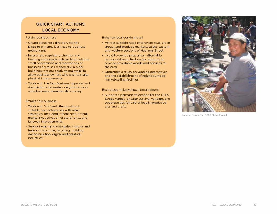
Local vendor at the DTES Street Market
Retain local business
• Create a business directory for the DTES to enhance business-to-business networking.
• Investigate regulatory changes and building code modifications to accelerate small conversions and renovations of business premises (especially in older buildings that are costly to maintain) to allow business owners who wish to make physical improvements.
• Work with the four Business Improvement Associations to create a neighbourhood-wide business characteristics survey.
Attract new business
• Work with VEC and BIAs to attract suitable new enterprises with retail strategies, including: tenant recruitment, marketing, activation of storefronts, and laneway improvements.
• Support emerging enterprise clusters and hubs (for example, recycling, building deconstruction, digital and creative industries.
QUICK-START ACTIONS:
LOCAL ECONOMY
Enhance local-serving retail
• Attract suitable retail enterprises (e.g. green grocer and produce markets) to the eastern and western sections of Hastings Street.
• Use City-owned properties, affordable leases, and revitalization tax supports to provide affordable goods and services to the area.
• Undertake a study on vending alternatives and the establishment of neighbourhood market-selling facilities
Encourage inclusive local employment
• Support a permanent location for the DTES Street Market for safer survival vending, and opportunities for sale of locally-produced arts and crafts.
11910.0 loCal eConomyDOWNTOWN EASTSIDE PLAN
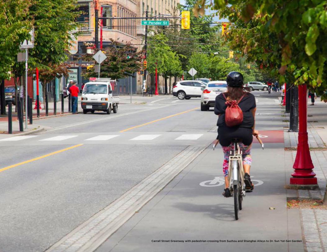
Carrall Street Greenway with pedestrian crossing from Suzhou and Shanghai Alleys to Dr. Sun Yat-Sen Garden
11TRANSPORTATION
IntroductionThe transportation network, which includes sidewalks, bikeways and greenways, transit routes, major and local streets, and laneways, is an essential component of our communities, the city, and the region. Enhancing sustainable transportation choices will allow us to address the challenge of continued growth without increased road space.
The City is responsible for building and maintaining our roads, sidewalks and public spaces, as well as managing how our streets are used. By working with external agencies, such as TransLink, the City provides an integrated transportation system. Providing and supporting a range of transportation options with vibrant and attractive streetscapes and public spaces in the Downtown Eastside (DTES) will continue to promote walking, cycling and transit, make efficient use of the road network, and support the local economy. This will make it easier, safer and more comfortable for people of all ages and abilities to get around the community, the city, and the region.
IMPROVEDTRANSPORTATIONINFRASTRUCTUREAND SAFETY
Expanded Cycling Facilities and Connections
Improved Transit Facilities and Services
Efficient Goods Movement andLoading Facilities
Safe and Convenient Walking Infrastructure
Strategic Transportation Directions
12111.0 transPortatIonDOWNTOWN EASTSIDE PLAN
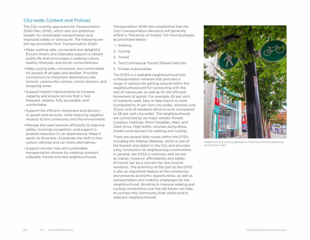
122 11.0 transPortatIon DOWNTOWN EASTSIDE PLAN
City-wide Context and PoliciesThe City recently approved the Transportation 2040 Plan (2012), which sets out ambitious targets for sustainable transportation and improved safety in Vancouver. The following are the key principles from Transportation 2040:
• Make walking safe, convenient and delightful. Ensure streets and sidewalks support a vibrant public life that encourages a walking culture, healthy lifestyles, and social connectedness.
• Make cycling safe, convenient, and comfortable for people of all ages and abilities. Prioritize connections to important destinations like schools, community centres, transit stations, and shopping areas.
• Support transit improvements to increase capacity and ensure service that is fast, frequent, reliable, fully accessible, and comfortable.
• Support the efficient movement and delivery of goods and services, while reducing negative impacts to the community and the environment.
• Manage the road network efficiently to improve safety, minimize congestion, and support a gradual reduction in car dependence. Make it easier to drive less. Accelerate the shift to low-carbon vehicles and car-share alternatives.
• Support shorter trips and sustainable transportation choices by creating compact, walkable, transit-oriented neighbourhoods.
Transportation 2040 also established that the City’s transportation decisions will generally reflect a “hierarchy of modes” for moving people, as prioritized below:
1. Walking
2. Cycling
3. Transit
4. Taxi/Commercial Transit/Shared Vehicles
5. Private Automobiles
The DTES is a walkable neighbourhood with a transportation network that provides a range of options for getting around within the neighbourhood and for connecting with the rest of Vancouver, as well as for the efficient movement of goods. For example, 65 per cent of residents walk, bike or take transit to work (compared to 41 per cent city-wide), whereas only 33 per cent of residents drive to work (compared to 58 per cent city-wide). The neighbourhoods are connected by six major streets: Powell, Cordova, Hastings, Prior/Venables, Main, and Clark Drive. High traffic volumes along these streets pose barriers for walking and cycling.
There are several bike routes within the DTES, including the Adanac Bikeway, which is one of the busiest and oldest in the City and provides a key connection to neighbouring communities. In general, the DTES is relatively well served by transit; however, affordability and safety of transit can be a concern for low-income residents. The proximity of the port to the DTES is also an important feature of the community and presents economic opportunities, as well as transportation and livability challenges for the neighbourhood. Working to improve walking and cycling connections over the rail tracks can help to connect the community both within and to adjacent neighbourhoods.
Pedestrian and cycling signage on the Carrall Street greenway and Suzhou Alley
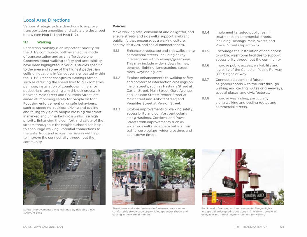
Safety improvements along Hastings St, including a new 30 km/hr zone
Local Area DirectionsVarious strategic policy directions to improve transportation amenities and safety are described below (see Map 11.1 and Map 11.2).
11.1 Walking
Pedestrian mobility is an important priority for the DTES community, both as an active mode of transportation and as an affordable one. Concerns about walking safety and accessibility have been highlighted in various studies specific to the area and some of the highest pedestrian collision locations in Vancouver are located within the DTES. Recent changes to Hastings Street, such as reducing the speed limit to 30 kilometres per hour, installation of countdown timers for pedestrians, and adding a mid-block crosswalk between Main Street and Columbia Street, are aimed at improving safety for people on foot. Focusing enforcement on unsafe behaviours, such as speeding, reckless driving and cycling, and failing to yield to people crossing the street in marked and unmarked crosswalks, is a high priority. Enhancing the comfort and safety of the streets throughout the neighbourhood can help to encourage walking. Potential connections to the waterfront and across the railway will help to improve the connectivity throughout the community.
Policies
Make walking safe, convenient and delightful, and ensure streets and sidewalks support a vibrant public life that encourages a walking culture, healthy lifestyles, and social connectedness.
11.1.1 Enhance streetscape and sidewalks along commercial streets, including at key intersections with bikeways/greenways. This may include wider sidewalks, new benches, lighting, landscaping, street trees, wayfinding, etc.
11.1.2 Explore enhancements to walking safety and comfort at intersection crossings on major streets, such as Hastings Street at Carrall Street, Main Street, Gore Avenue, and Jackson Street; Pender Street at Main Street and Abbott Street; and Venables Street at Vernon Street.
11.1.3 Explore improvements to walking safety, accessibility and comfort particularly along Hastings, Cordova, and Powell Streets with improvements such as wider sidewalks, adequate buffers from traffic, curb bulges, wider crossings and countdown timers.
11.1.4 Implement targeted public realm treatments on commercial streets, including Hastings, Main, Water, and Powell Street (Japantown).
11.1.5 Encourage the installation of and access to public washroom facilities to support accessibility throughout the community.
11.1.6 Improve public access, walkability and legibility of the Canadian Pacific Railway (CPR) right-of-way.
11.1.7 Connect adjacent and future neighbourhoods with the Port through walking and cycling routes or greenways, special places, and civic features.
11.1.8 Improve wayfinding, particularly along walking and cycling routes and commercial streets.
Street trees and water features in Gastown create a more comfortable streetscape by providing greenery, shade, and cooling in the warmer months
Public realm features, such as ornamental Dragon lights and specially-designed street signs in Chinatown, create an enjoyable and interesting environment for walking
12311.0 transPortatIonDOWNTOWN EASTSIDE PLAN
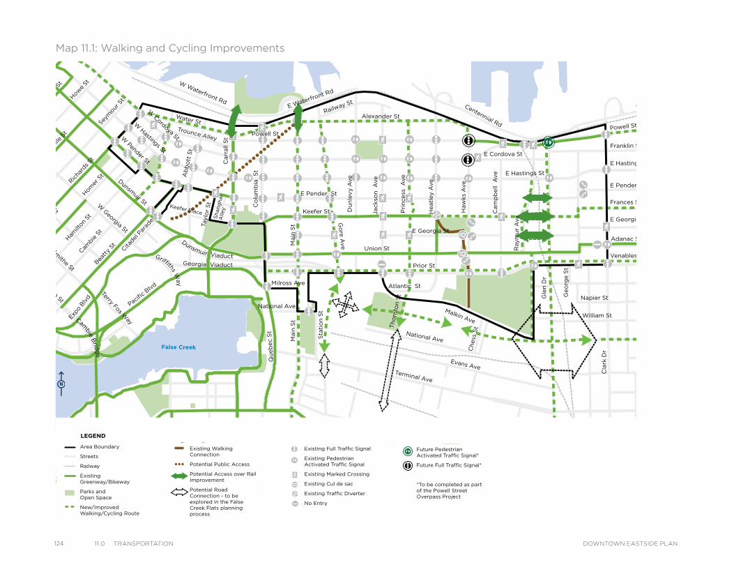
124 11.0 transPortatIon DOWNTOWN EASTSIDE PLAN
Powell St
Water StTrounce Alley
Keefer Place
Alexander St
E Cordova St
Centennial Rd
E Waterfront Rd
Railway St
W Waterfront Rd
William St William St
Powell St
Stewart St
Napier St
Venables St
Adanac St
Union St
Qu
eb
ec S
t
Geo
rge S
t
Cla
rk D
r
E Georgia St
Atlantic St
National Ave
Malkin Ave
Terminal Ave
Evans Ave
Milross Ave
National Ave
Nelson St
Prior St
Franklin St
E Hastings St
Pandora St
Triumph St
E Pender St
Frances St
E Georgia St
E Hastings St
E Pender St
W Cordova St
W Hastings St
Dunsmuir St
Robson StW
Georgia St
Smithe St
W Pender St
Cam
bie S
t
Sh
an
gh
ai
Alle
y
Beatt
y St Cita
del P
arad
e
Ham
ilton
St
Mai
nlan
d St
Hom
er S
t
Richa
rds St
Hor
nby
St
Burra
rd
How
e St
Seym
our S
t
Gra
nville
St
Keefer St
Go
re A
ve
Jackso
n A
ve
Du
nle
vy A
ve
Main
St
Sta
tio
n S
t
Main
St
Co
lum
bia
S
t
Pacific
Blvd
Terry Fox Way
Carr
all
St
Ab
bo
tt S
t
Taylo
r S
t
Pri
ncess
A
ve
Cam
pb
ell
Ave
Raym
ur
Ave
Wo
od
lan
d D
rW
oo
dla
nd
Dr
Co
mm
erc
ial D
r
Sals
bu
ry D
r
Heatl
ey A
ve
Haw
ks
Ave
Th
orn
ton S
t
Ch
ess
St
Dunsmuir Viaduct
Expo
Blv
d
Georgia Viaduct
Griffiths Way
Cambie B
ridg
e
Gle
n D
r
Area Boundary
Streets
Railway
Existing Greenway/Bikeway
Parks andOpen Space
New/Improved Walking/Cycling Route
Existing Walking Connection
Potential Public Access
Potential Access over Rail Improvement
Potential Road Connection - to be explored in the False Creek Flats planning process
Existing Full Traffic Signal
Existing Pedestrian Activated Traffic Signal
Existing Marked Crossing
Existing Cul de sac
Existing Traffic Diverter
No Entry
Future Pedestrian Activated Traffic Signal*
Future Full Traffic Signal*
*To be completed as part of the Powell Street Overpass Project
LEGENDMap 11.1: Walking and Cycling Improvements
Powell St
Water StTrounce Alley
Keefer Place
Alexander St
E Cordova St
Centennial Rd
E Waterfront Rd
Railway St
W Waterfront Rd
William St William St
Powell St
Stewart St
Napier St
Venables St
Adanac St
Union St
Qu
eb
ec S
t
Geo
rge S
t
Cla
rk D
r
E Georgia St
Atlantic St
National Ave
Malkin Ave
Terminal Ave
Evans Ave
Milross Ave
National Ave
Nelson St
Prior St
Franklin St
E Hastings St
Pandora St
Triumph St
E Pender St
Frances St
E Georgia St
E Hastings St
E Pender St
W Cordova St
W Hastings St
Dunsmuir St
Robson StW
Georgia St
Smithe St
W Pender St
Cam
bie S
t
Sh
an
gh
ai
Alle
y
Beatt
y St Cita
del P
arad
e
Ham
ilton
St
Mai
nlan
d St
Hom
er S
t
Richa
rds St
Hor
nby
St
Burra
rd
How
e St
Seym
our S
t
Gra
nville
St
Keefer St
Go
re A
ve
Jackso
n A
ve
Du
nle
vy A
ve
Main
St
Sta
tio
n S
t
Main
St
Co
lum
bia
S
t
Pacific
Blvd
Terry Fox Way
Carr
all
St
Ab
bo
tt S
t
Taylo
r S
t
Pri
ncess
A
ve
Cam
pb
ell
Ave
Raym
ur
Ave
Wo
od
lan
d D
rW
oo
dla
nd
Dr
Co
mm
erc
ial D
r
Sals
bu
ry D
r
Heatl
ey A
ve
Haw
ks
Ave
Th
orn
ton S
t
Ch
ess
St
Dunsmuir Viaduct
Expo
Blv
d
Georgia Viaduct
Griffiths Way
Cambie B
ridg
e
Gle
n D
r
Area Boundary
Streets
Railway
Existing Greenway/Bikeway
Parks andOpen Space
New/Improved Walking/Cycling Route
Existing Walking Connection
Potential Public Access
Potential Access over Rail Improvement
Potential Road Connection - to be explored in the False Creek Flats planning process
Existing Full Traffic Signal
Existing Pedestrian Activated Traffic Signal
Existing Marked Crossing
Existing Cul de sac
Existing Traffic Diverter
No Entry
Future Pedestrian Activated Traffic Signal*
Future Full Traffic Signal*
*To be completed as part of the Powell Street Overpass Project
LEGEND
Powell St
Water StTrounce Alley
Keefer Place
Alexander St
E Cordova St
Centennial Rd
E Waterfront Rd
Railway St
W Waterfront Rd
William St William St
Powell St
Stewart St
Napier St
Venables St
Adanac St
Union St
Qu
eb
ec S
t
Geo
rge S
t
Cla
rk D
rE Georgia St
Atlantic St
National Ave
Malkin Ave
Terminal Ave
Evans Ave
Milross Ave
National Ave
Nelson St
Prior St
Franklin St
E Hastings St
Pandora St
Triumph St
E Pender St
Frances St
E Georgia St
E Hastings St
E Pender St
W Cordova St
W Hastings St
Dunsmuir St
Robson StW
Georgia St
Smithe St
W Pender St
Cam
bie S
t
Sh
an
gh
ai
Alle
y
Beatt
y St Cita
del P
arad
e
Ham
ilton
St
Mai
nlan
d St
Hom
er S
t
Richa
rds St
Hor
nby
St
Burra
rd
How
e St
Seym
our S
t
Gra
nville
St
Keefer St
Go
re A
ve
Jackso
n A
ve
Du
nle
vy A
ve
Main
St
Sta
tio
n S
t
Main
St
Co
lum
bia
S
t
Pacific
Blvd
Terry Fox Way
Carr
all
St
Ab
bo
tt S
t
Taylo
r S
t
Pri
ncess
A
ve
Cam
pb
ell
Ave
Raym
ur
Ave
Wo
od
lan
d D
rW
oo
dla
nd
Dr
Co
mm
erc
ial D
r
Sals
bu
ry D
r
Heatl
ey A
ve
Haw
ks
Ave
Th
orn
ton S
t
Ch
ess
St
Dunsmuir Viaduct
Expo
Blv
d
Georgia Viaduct
Griffiths Way
Cambie B
ridg
e
Gle
n D
r
Area Boundary
Streets
Railway
Existing Greenway/Bikeway
Parks andOpen Space
New/Improved Walking/Cycling Route
Existing Walking Connection
Potential Public Access
Potential Access over Rail Improvement
Potential Road Connection - to be explored in the False Creek Flats planning process
Existing Full Traffic Signal
Existing Pedestrian Activated Traffic Signal
Existing Marked Crossing
Existing Cul de sac
Existing Traffic Diverter
No Entry
Future Pedestrian Activated Traffic Signal*
Future Full Traffic Signal*
*To be completed as part of the Powell Street Overpass Project
LEGEND
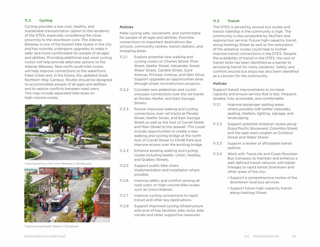
Policies
Make cycling safe, convenient, and comfortable for people of all ages and abilities. Prioritize connections to important destinations like schools, community centres, transit stations, and shopping areas.
11.2.1 Explore potential new walking and cycling routes on Charles Street, Prior Street, Keefer Street, Alexander Street, Water Street, Cambie Street, Gore Avenue, Princess Avenue, and Glen Drive. Support upgrades as opportunities arise through street reconstruction projects.
11.2.2 Consider new pedestrian and cyclist overpass connections over the rail tracks at Pender, Keefer, and East Georgia Streets.
11.2.3 Pursue improved walking and cycling connections over rail tracks at Pender Street, Keefer Street, and East Georgia Street as well as the foot of Carrall Street and Main Street to the seawall. This could include opportunities to create a new walking and cycling bridge at the north foot of Carrall Street to CRAB Park and improve access over the existing bridge.
11.2.4 Enhance existing walking and cycling routes including Keefer, Union, Heatley, and Quebec Streets.
11.2.5 Support public bike-share implementation and installation where possible.
11.2.6 Improve safety and comfort among all road users on high-volume bike routes such as Union/Adanac.
11.2.7 Improve cycling connections to rapid transit and other key destinations.
11.2.8 Support improved cycling infrastructure with end-of-trip facilities, bike racks, bike corrals and other supportive measures.
11.2 Cycling
Cycling provides a low-cost, healthy, and sustainable transportation option to the residents of the DTES, especially considering the close proximity to the downtown core. The Adanac Bikeway is one of the busiest bike routes in the city and has recently undergone upgrades to make it safer and more comfortable for people of all ages and abilities. Providing additional east-west cycling routes will help provide alternate options to the Adanac Bikeway. New north-south bike routes will help improve connections to the waterfront, False Creek and, in the future, the updated Great Northern Way Campus. Routes should be designed to accommodate people of all ages and abilities and to reduce conflicts between road users. This may include separated bike lanes on high-volume routes.
Improvements to the Union Bikeway in Strathcona
11.3 Transit
The DTES is served by several bus routes and transit ridership in the community is high. The community is also accessible by SkyTrain and regional bus service. Future high-capacity transit along Hastings Street as well as the restoration of the streetcar routes could help to further improve transit connections in the DTES. Despite the availability of transit in the DTES, the cost of transit fares has been identified as a barrier to accessing transit for many residents. Safety and comfort around bus stops has also been identified as a concern for the community.
Policies
Support transit improvements to increase capacity and ensure service that is fast, frequent, reliable, fully accessible, and comfortable.
11.3.1 Improve passenger waiting areas where possible with better sidewalks, seating, shelters, lighting, signage, and landscaping.
11.3.2 Support potential streetcar routes along Expo/Pacific Boulevard, Columbia Street, and the east-west couplet on Cordova Street and Water Street.
11.3.3 Support a review of affordable transit options.
11.3.4 Work with TransLink and Coast Mountain Bus Company to maintain and enhance a well-defined transit network with better linkages to rapid transit downtown and other areas of the city:
• Support a comprehensive review of the downtown local bus services.
• Support future high-capacity transit along Hastings Street
Transit along Pender Street in Chinatown
12511.0 transPortatIonDOWNTOWN EASTSIDE PLAN
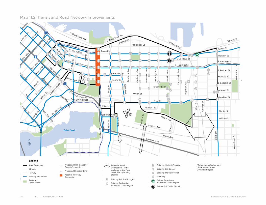
126 11.0 transPortatIon DOWNTOWN EASTSIDE PLAN
Powell St
Water StTrounce Alley
Keefer Place
Alexander St
E Cordova St
Centennial Rd
E Waterfront Rd
Railway St
W Waterfront Rd
William St
William St
Powell St
Stewart St
Napier St
Venables St
Adanac St
Union St
Qu
eb
ec S
t
Geo
rge S
t
Cla
rk D
r
E Georgia St
Atlantic St
National Ave
Malkin Ave
Terminal Ave
Evans Ave
Milross Ave
National Ave
Nelson St
Prior St
Franklin St
E Hastings St
Pandora St
Triumph St
E Pender St
Frances St
E Georgia St
E Hastings St
E Pender St
W Cordova St
W H
astings St
Dunsm
uir St
Robson StW
Georgia St
Smithe St
W Pender St
Cam
bie
St
Sh
an
gh
ai
Alley
Bea
tty
St Cita
del P
arad
e
Ham
ilton
St
Mai
nlan
d St
Hom
er S
t
Ric
hard
s St
Hor
nby
St
Bur
rard
How
e St
Seym
our S
t
Gra
nville
St
Keefer St
Go
re A
ve
Jackso
n A
ve
Du
nle
vy A
ve
Main
St
Sta
tio
n S
t
Main
St
Co
lum
bia
S
t
Pacifi
c Blvd
Terry Fox Way
Carr
all S
t
Ab
bo
tt S
t
Taylo
r S
t
Pri
ncess
A
ve
Cam
pb
ell A
ve
Raym
ur
Ave
Wo
od
lan
d D
rW
oo
dla
nd
Dr
Co
mm
erc
ial D
r
Sals
bu
ry D
r
Heatl
ey A
ve
Haw
ks
Ave
Th
orn
ton S
t
Ch
ess
St
Dunsmuir Viaduct
Expo
Blv
d
Georgia Viaduct
Griffiths Way
Cambie B
ridg
e
Gle
n D
r
Area Boundary
Streets
Railway
Existing Bus Route
Parks andOpen Space
Proposed High Capacity Transit Connection
Proposed Streetcar Line
Possible Two-way Conversion
Potential Road Connection - to be explored in the False Creek Flats planning process
Existing Full Traffic Signal
Existing Pedestrian Activated Traffic Signal
Existing Marked Crossing
Existing Cul de sac
Existing Traffic Diverter
No Entry
Future Pedestrian Activated Traffic Signal*
Future Full Traffic Signal*
*To be completed as part of the Powell Street Overpass Project
LEGEND
Map 11.2: Transit and Road Network Improvements
Powell St
Water StTrounce Alley
Keefer Place
Alexander St
E Cordova St
Centennial Rd
E Waterfront Rd
Railway St
W Waterfront Rd
William St
William St
Powell St
Stewart St
Napier St
Venables St
Adanac St
Union St
Qu
eb
ec S
t
Geo
rge S
t
Cla
rk D
r
E Georgia St
Atlantic St
National Ave
Malkin Ave
Terminal Ave
Evans Ave
Milross Ave
National Ave
Nelson St
Prior St
Franklin St
E Hastings St
Pandora St
Triumph St
E Pender St
Frances St
E Georgia St
E Hastings St
E Pender St
W Cordova St
W H
astings St
Dunsm
uir St
Robson StW
Georgia St
Smithe St
W Pender St
Cam
bie
St
Sh
an
gh
ai
Alley
Bea
tty
St Cita
del P
arad
e
Ham
ilton
St
Mai
nlan
d St
Hom
er S
t
Ric
hard
s St
Hor
nby
St
Bur
rard
How
e St
Seym
our S
t
Gra
nville
St
Keefer St
Go
re A
ve
Jackso
n A
ve
Du
nle
vy A
ve
Main
St
Sta
tio
n S
t
Main
St
Co
lum
bia
S
t
Pacifi
c Blvd
Terry Fox Way
Carr
all S
t
Ab
bo
tt S
t
Taylo
r S
t
Pri
ncess
A
ve
Cam
pb
ell A
ve
Raym
ur
Ave
Wo
od
lan
d D
rW
oo
dla
nd
Dr
Co
mm
erc
ial D
r
Sals
bu
ry D
r
Heatl
ey A
ve
Haw
ks
Ave
Th
orn
ton S
t
Ch
ess
St
Dunsmuir Viaduct
Expo
Blv
d
Georgia Viaduct
Griffiths Way
Cambie B
ridg
e
Gle
n D
r
Area Boundary
Streets
Railway
Existing Bus Route
Parks andOpen Space
Proposed High Capacity Transit Connection
Proposed Streetcar Line
Possible Two-way Conversion
Potential Road Connection - to be explored in the False Creek Flats planning process
Existing Full Traffic Signal
Existing Pedestrian Activated Traffic Signal
Existing Marked Crossing
Existing Cul de sac
Existing Traffic Diverter
No Entry
Future Pedestrian Activated Traffic Signal*
Future Full Traffic Signal*
*To be completed as part of the Powell Street Overpass Project
LEGEND
Powell St
Water StTrounce Alley
Keefer Place
Alexander St
E Cordova St
Centennial Rd
E Waterfront Rd
Railway St
W Waterfront Rd
William St
William St
Powell St
Stewart St
Napier St
Venables St
Adanac St
Union St
Qu
eb
ec S
t
Geo
rge S
t
Cla
rk D
r
E Georgia St
Atlantic St
National Ave
Malkin Ave
Terminal Ave
Evans Ave
Milross Ave
National Ave
Nelson St
Prior St
Franklin St
E Hastings St
Pandora St
Triumph St
E Pender St
Frances St
E Georgia St
E Hastings St
E Pender St
W Cordova St
W H
astings St
Dunsm
uir St
Robson StW
Georgia St
Smithe St
W Pender St
Cam
bie
St
Sh
an
gh
ai
Alley
Bea
tty
St Cita
del P
arad
e
Ham
ilton
St
Mai
nlan
d St
Hom
er S
t
Ric
hard
s St
Hor
nby
St
Bur
rard
How
e St
Seym
our S
t
Gra
nville
St
Keefer St
Go
re A
ve
Jackso
n A
ve
Du
nle
vy A
ve
Main
St
Sta
tio
n S
t
Main
St
Co
lum
bia
S
t
Pacifi
c Blvd
Terry Fox Way
Carr
all S
t
Ab
bo
tt S
t
Taylo
r S
t
Pri
ncess
A
ve
Cam
pb
ell A
ve
Raym
ur
Ave
Wo
od
lan
d D
rW
oo
dla
nd
Dr
Co
mm
erc
ial D
r
Sals
bu
ry D
r
Heatl
ey A
ve
Haw
ks
Ave
Th
orn
ton S
t
Ch
ess
St
Dunsmuir Viaduct
Expo
Blv
d
Georgia Viaduct
Griffiths Way
Cambie B
ridg
e
Gle
n D
r
Area Boundary
Streets
Railway
Existing Bus Route
Parks andOpen Space
Proposed High Capacity Transit Connection
Proposed Streetcar Line
Possible Two-way Conversion
Potential Road Connection - to be explored in the False Creek Flats planning process
Existing Full Traffic Signal
Existing Pedestrian Activated Traffic Signal
Existing Marked Crossing
Existing Cul de sac
Existing Traffic Diverter
No Entry
Future Pedestrian Activated Traffic Signal*
Future Full Traffic Signal*
*To be completed as part of the Powell Street Overpass Project
LEGEND
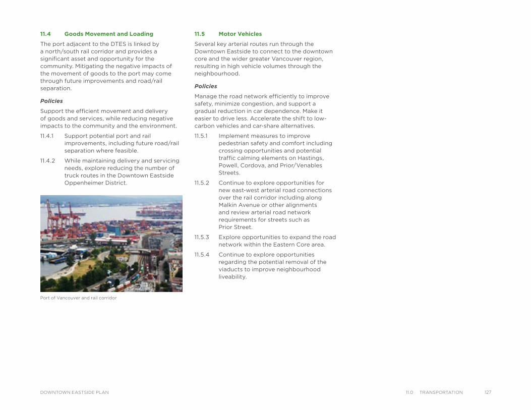
Port of Vancouver and rail corridor
11.4 Goods Movement and Loading
The port adjacent to the DTES is linked by a north/south rail corridor and provides a significant asset and opportunity for the community. Mitigating the negative impacts of the movement of goods to the port may come through future improvements and road/rail separation.
Policies
Support the efficient movement and delivery of goods and services, while reducing negative impacts to the community and the environment.
11.4.1 Support potential port and rail improvements, including future road/rail separation where feasible.
11.4.2 While maintaining delivery and servicing needs, explore reducing the number of truck routes in the Downtown Eastside Oppenheimer District.
11.5 Motor Vehicles
Several key arterial routes run through the Downtown Eastside to connect to the downtown core and the wider greater Vancouver region, resulting in high vehicle volumes through the neighbourhood.
Policies
Manage the road network efficiently to improve safety, minimize congestion, and support a gradual reduction in car dependence. Make it easier to drive less. Accelerate the shift to low-carbon vehicles and car-share alternatives.
11.5.1 Implement measures to improve pedestrian safety and comfort including crossing opportunities and potential traffic calming elements on Hastings, Powell, Cordova, and Prior/Venables Streets.
11.5.2 Continue to explore opportunities for new east-west arterial road connections over the rail corridor including along Malkin Avenue or other alignments and review arterial road network requirements for streets such as Prior Street.
11.5.3 Explore opportunities to expand the road network within the Eastern Core area.
11.5.4 Continue to explore opportunities regarding the potential removal of the viaducts to improve neighbourhood liveability.
12711.0 transPortatIonDOWNTOWN EASTSIDE PLAN
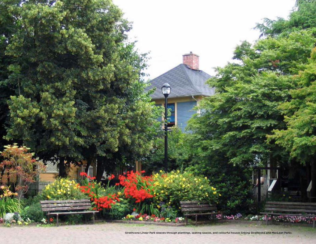
Strathcona Linear Park weaves through plantings, seating spaces, and colourful houses linking Strathcona and MacLean Parks
IntroductionVancouver’s identity and reputation as one of the world’s most livable cities is strongly tied to its natural beauty. Whether it is our parks, community gardens, waterfront walkways, vibrant commercial streets, plazas, or that favourite bench, these spaces contribute to our sense of community by providing places for recreation and play, gathering and socializing, and connecting with nature. As the Downtown Eastside (DTES) grows and evolves over the next 30 years, maintaining, improving and expanding our parks and open spaces, as well as ensuring they are easily accessible to everyone, will become increasingly important.
City-wide Context and PoliciesThe City is committed to ensuring that everyone has equal opportunity to enjoy our parks, open spaces and greenways. One of Vancouver’s key policies in this regard, is the Greenest City 2020 Action Plan. Targets related to parks and open spaces in this plan include: ensuring everyone is within a five-minute walk of a park, greenway, or other natural space; and planting 150,000 new trees by 2020.
12PARKS, OPEN SPACE AND GREENING
IMPROVED SAFEAND ACCESSIBLE PARKS OPEN SPACE
Improved and Expanded Parksand Green Space
Improved Commercial Streets
New and Enhanced Plazas and Parklets
Additional and Healthier Street Trees
Strategic Directions
12912.0 Parks, oPen sPaCe and greenIngDOWNTOWN EASTSIDE PLAN
130 12.0 Parks, oPen sPaCe and greenIng DOWNTOWN EASTSIDE PLAN
MacLeanPark
OppenheimerPark
CRAB Parkat Portside
VictorySquare
Cathedral Square
Strathcona Park
MosaicCreek
Park
Grandview Park
SalsburyPark
WoodlandPark
TrilliumPark
ThorntonPark
CreeksidePark
CoopersPark
Andy LivingstonePark
YaletownPark
Sun Yat-SenGardens
PigeonPark
Powell St
Water StTrounce Alley
Alexander St
E Cordova St
Centennial Rd
E Waterfront Rd
Railway St
W Waterfront Rd
William St William St
Powell St
Stewart St
Napier St
Venables St
Adanac St
Union St
Qu
eb
ec S
t
Geo
rge S
t
Cla
rk D
r
E Georgia St
Atlantic St
National Ave
Malkin Ave
Terminal Ave
Evans Ave
Milross Ave
National Ave
Nelson St
Prior St
Franklin St
E Hastings St
Pandora St
Triumph St
E Pender St
Frances St
E Georgia St
E Hastings St
E Pender St
W Cordova St
W Hastings St
Dunsmuir St
Robson St
W G
eorgia St
Smithe St
W Pender St
Cam
bie S
t
Sh
an
gh
ai
Alle
y
Beatt
y St Cita
del P
arad
e
Ham
ilton
St
Mai
nlan
d St
Hom
er S
t
Richa
rds St
Hor
nby
St
Burra
rd
How
e St
Seym
our S
t
Gra
nville
St
Keefer St
Go
re A
ve
Jackso
n A
ve
Du
nle
vy A
ve
Main
St
Sta
tio
n S
t
Main
St
Co
lum
bia
S
t
Pacific
Blvd
Terry Fox Way
Carr
all
St
Ab
bo
tt S
t
Taylo
r S
t Pri
ncess
A
ve
Cam
pb
ell
Ave
Raym
ur
Ave
Wo
od
lan
d D
rW
oo
dla
nd
Dr
Co
mm
erc
ial D
r
Sals
bu
ry D
r
Heatl
ey A
ve
Haw
ks
Ave
Th
orn
ton S
t
Ch
ess
St
Dunsmuir Viaduct
Expo
Blv
d
Georgia Viaduct
Griffiths Way
Cambie B
ridg
e
E Pender St
Gle
n D
r
Area Boundary
Streets
Railway
Parks andOpen Space
LEGEND
Map 12.1: Parks, Open Space, and Greening
MacLeanPark
OppenheimerPark
CRAB Parkat Portside
VictorySquare
Cathedral Square
Strathcona Park
MosaicCreek
Park
Grandview Park
SalsburyPark
WoodlandPark
TrilliumPark
ThorntonPark
CreeksidePark
CoopersPark
Andy LivingstonePark
YaletownPark
Sun Yat-SenGardens
PigeonPark
Powell St
Water StTrounce Alley
Alexander St
E Cordova St
Centennial Rd
E Waterfront Rd
Railway St
W Waterfront Rd
William St William St
Powell St
Stewart St
Napier St
Venables St
Adanac St
Union St
Qu
eb
ec S
t
Geo
rge S
t
Cla
rk D
r
E Georgia St
Atlantic St
National Ave
Malkin Ave
Terminal Ave
Evans Ave
Milross Ave
National Ave
Nelson St
Prior St
Franklin St
E Hastings St
Pandora St
Triumph St
E Pender St
Frances St
E Georgia St
E Hastings St
E Pender St
W Cordova St
W Hastings St
Dunsmuir St
Robson St
W G
eorgia St
Smithe St
W Pender St
Cam
bie S
t
Sh
an
gh
ai
Alle
y
Beatt
y St Cita
del P
arad
e
Ham
ilton
St
Mai
nlan
d St
Hom
er S
t
Richa
rds St
Hor
nby
St
Burra
rd
How
e St
Seym
our S
t
Gra
nville
St
Keefer St
Go
re A
ve
Jackso
n A
ve
Du
nle
vy A
ve
Main
St
Sta
tio
n S
t
Main
St
Co
lum
bia
S
t
Pacific
Blvd
Terry Fox Way
Carr
all
St
Ab
bo
tt S
t
Taylo
r S
t Pri
ncess
A
ve
Cam
pb
ell
Ave
Raym
ur
Ave
Wo
od
lan
d D
rW
oo
dla
nd
Dr
Co
mm
erc
ial D
r
Sals
bu
ry D
r
Heatl
ey A
ve
Haw
ks
Ave
Th
orn
ton S
t
Ch
ess
St
Dunsmuir Viaduct
Expo
Blv
d
Georgia Viaduct
Griffiths Way
Cambie B
ridg
e
E Pender St
Gle
n D
r
Area Boundary
Streets
Railway
Parks andOpen Space
LEGEND
Local Area Directions
12.1 Parks and Green Spaces
The DTES has a diversity of parks and green spaces, ranging from linear neighbourhood parks to the vibrant urban plazas. In addition, there are a number of parks and open spaces immediately adjacent to the neighbourhood including CRAB Park at Portside, the area’s only waterfront beach park. These special places contribute greatly to the DTES’s distinctive character. Green space is highly valued by residents and helps maintain livability in a high density community.
Fortunately, access to a park, greenway, or natural space is within a five-minute walk from almost everywhere within the DTES, with the exception of some parts of the largely industrial north-east section. DTES parks are generally in good condition as many, such as Oppenheimer Park, have been recently upgraded. Nevertheless, some park infrastructure is aging and in need of improvement. There are also opportunities for some of these spaces to be expanded, or improved with additional amenities, to better meet the needs of residents.
Policies
12.1.1 Enhance existing parks, green and open spaces, and natural areas to improve the quality, diversity and inclusiveness of spaces.
12.1.2 Expand neighbourhood green and open space, as opportunities arise, to ensure greater access to nature and parks space.
12.1.3 Pursue opportunities to create new public spaces accessible to everyone, such as parks, green and open spaces, as part of new developments particularly in areas with the greatest need, e.g. northeast section.
12.1.4 Support urban ecological systems, wildlife habitat, storm water management, urban agriculture, and opportunities for connections with nature.
CRAB Park at Portside
Beehives in StrathconaPlayground in Oppenheimer Park
Dr. Sun Yat-Sen Classical Chinese Garden in Chinatown
Concert in Victory Square Thornton Park
13112.0 Parks, oPen sPaCe and greenIngDOWNTOWN EASTSIDE PLAN
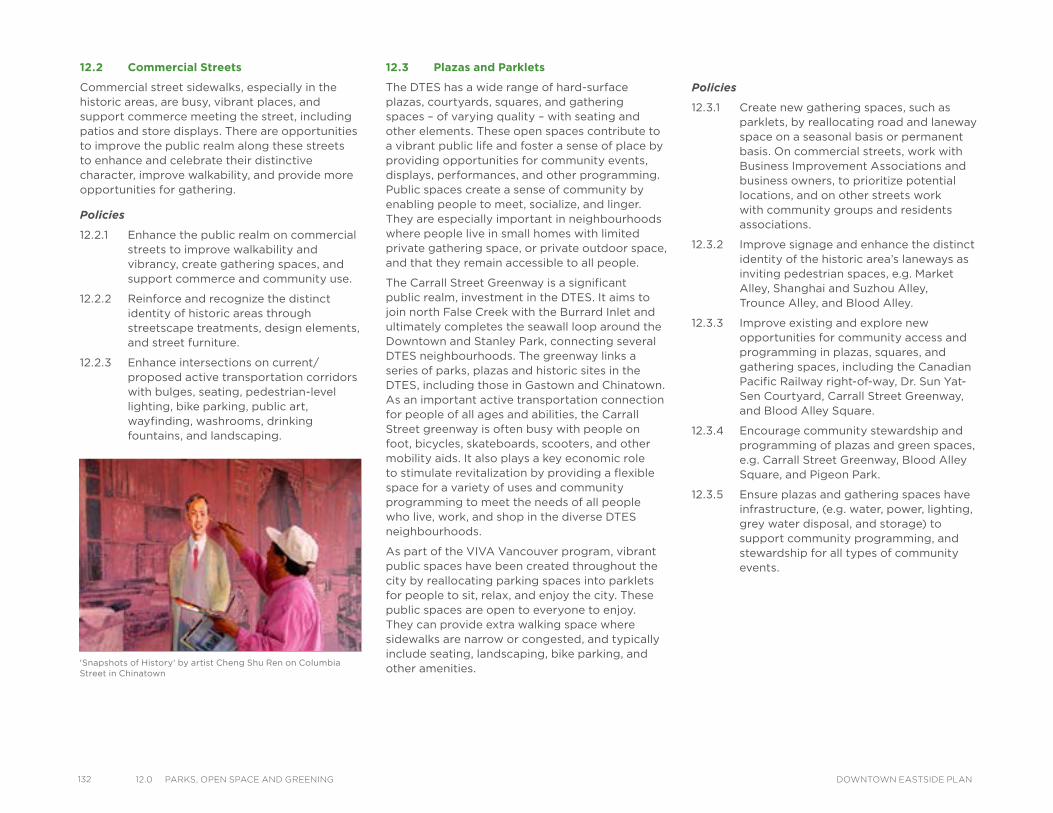
132 12.0 Parks, oPen sPaCe and greenIng DOWNTOWN EASTSIDE PLAN
12.2 Commercial Streets
Commercial street sidewalks, especially in the historic areas, are busy, vibrant places, and support commerce meeting the street, including patios and store displays. There are opportunities to improve the public realm along these streets to enhance and celebrate their distinctive character, improve walkability, and provide more opportunities for gathering.
Policies
12.2.1 Enhance the public realm on commercial streets to improve walkability and vibrancy, create gathering spaces, and support commerce and community use.
12.2.2 Reinforce and recognize the distinct identity of historic areas through streetscape treatments, design elements, and street furniture.
12.2.3 Enhance intersections on current/proposed active transportation corridors with bulges, seating, pedestrian-level lighting, bike parking, public art, wayfinding, washrooms, drinking fountains, and landscaping.
12.3 Plazas and Parklets
The DTES has a wide range of hard-surface plazas, courtyards, squares, and gathering spaces – of varying quality – with seating and other elements. These open spaces contribute to a vibrant public life and foster a sense of place by providing opportunities for community events, displays, performances, and other programming. Public spaces create a sense of community by enabling people to meet, socialize, and linger. They are especially important in neighbourhoods where people live in small homes with limited private gathering space, or private outdoor space, and that they remain accessible to all people.
The Carrall Street Greenway is a significant public realm, investment in the DTES. It aims to join north False Creek with the Burrard Inlet and ultimately completes the seawall loop around the Downtown and Stanley Park, connecting several DTES neighbourhoods. The greenway links a series of parks, plazas and historic sites in the DTES, including those in Gastown and Chinatown. As an important active transportation connection for people of all ages and abilities, the Carrall Street greenway is often busy with people on foot, bicycles, skateboards, scooters, and other mobility aids. It also plays a key economic role to stimulate revitalization by providing a flexible space for a variety of uses and community programming to meet the needs of all people who live, work, and shop in the diverse DTES neighbourhoods.
As part of the VIVA Vancouver program, vibrant public spaces have been created throughout the city by reallocating parking spaces into parklets for people to sit, relax, and enjoy the city. These public spaces are open to everyone to enjoy. They can provide extra walking space where sidewalks are narrow or congested, and typically include seating, landscaping, bike parking, and other amenities.
Policies
12.3.1 Create new gathering spaces, such as parklets, by reallocating road and laneway space on a seasonal basis or permanent basis. On commercial streets, work with Business Improvement Associations and business owners, to prioritize potential locations, and on other streets work with community groups and residents associations.
12.3.2 Improve signage and enhance the distinct identity of the historic area’s laneways as inviting pedestrian spaces, e.g. Market Alley, Shanghai and Suzhou Alley, Trounce Alley, and Blood Alley.
12.3.3 Improve existing and explore new opportunities for community access and programming in plazas, squares, and gathering spaces, including the Canadian Pacific Railway right-of-way, Dr. Sun Yat-Sen Courtyard, Carrall Street Greenway, and Blood Alley Square.
12.3.4 Encourage community stewardship and programming of plazas and green spaces, e.g. Carrall Street Greenway, Blood Alley Square, and Pigeon Park.
12.3.5 Ensure plazas and gathering spaces have infrastructure, (e.g. water, power, lighting, grey water disposal, and storage) to support community programming, and stewardship for all types of community events.
'Snapshots of History' by artist Cheng Shu Ren on Columbia Street in Chinatown
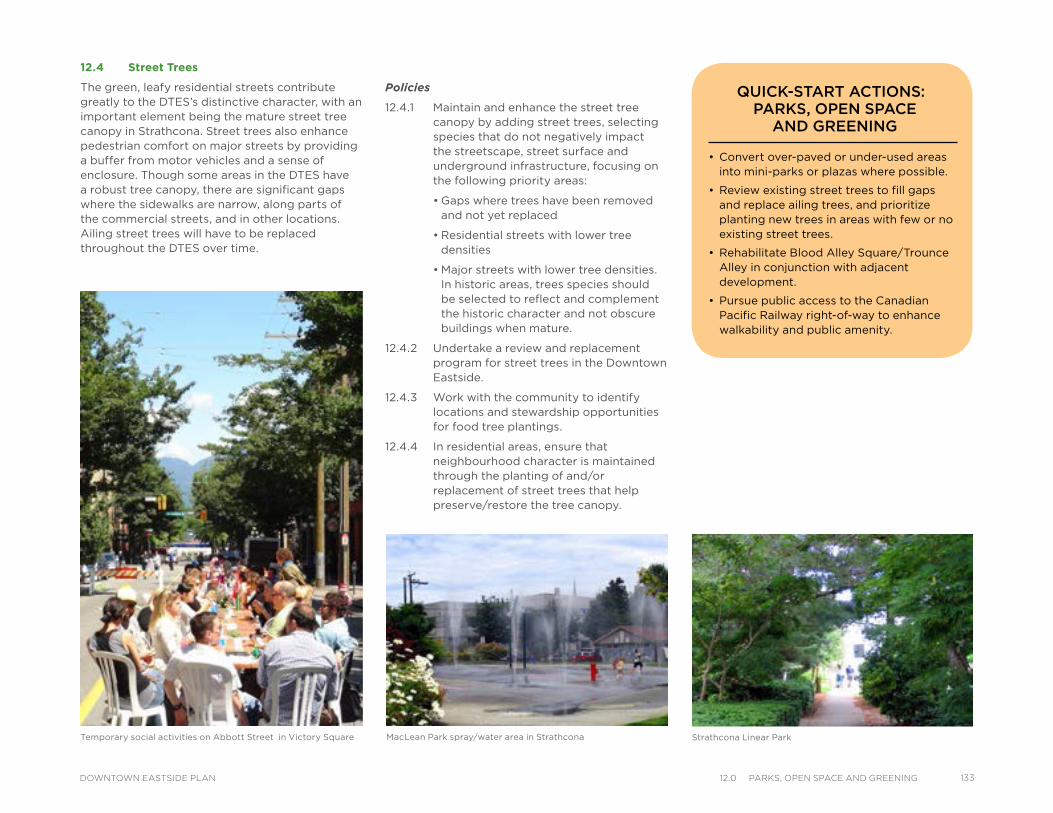
12.4 Street Trees
The green, leafy residential streets contribute greatly to the DTES’s distinctive character, with an important element being the mature street tree canopy in Strathcona. Street trees also enhance pedestrian comfort on major streets by providing a buffer from motor vehicles and a sense of enclosure. Though some areas in the DTES have a robust tree canopy, there are significant gaps where the sidewalks are narrow, along parts of the commercial streets, and in other locations. Ailing street trees will have to be replaced throughout the DTES over time.
Temporary social activities on Abbott Street in Victory Square MacLean Park spray/water area in Strathcona Strathcona Linear Park
Policies
12.4.1 Maintain and enhance the street tree canopy by adding street trees, selecting species that do not negatively impact the streetscape, street surface and underground infrastructure, focusing on the following priority areas:
• Gaps where trees have been removed and not yet replaced
• Residential streets with lower tree densities
• Major streets with lower tree densities. In historic areas, trees species should be selected to reflect and complement the historic character and not obscure buildings when mature.
12.4.2 Undertake a review and replacement program for street trees in the Downtown Eastside.
12.4.3 Work with the community to identify locations and stewardship opportunities for food tree plantings.
12.4.4 In residential areas, ensure that neighbourhood character is maintained through the planting of and/or replacement of street trees that help preserve/restore the tree canopy.
• Convert over-paved or under-used areas into mini-parks or plazas where possible.
• Review existing street trees to fill gaps and replace ailing trees, and prioritize planting new trees in areas with few or no existing street trees.
• Rehabilitate Blood Alley Square/Trounce Alley in conjunction with adjacent development.
• Pursue public access to the Canadian Pacific Railway right-of-way to enhance walkability and public amenity.
QUICK-START ACTIONS: PARKS, OPEN SPACE
AND GREENING
13312.0 Parks, oPen sPaCe and greenIngDOWNTOWN EASTSIDE PLAN
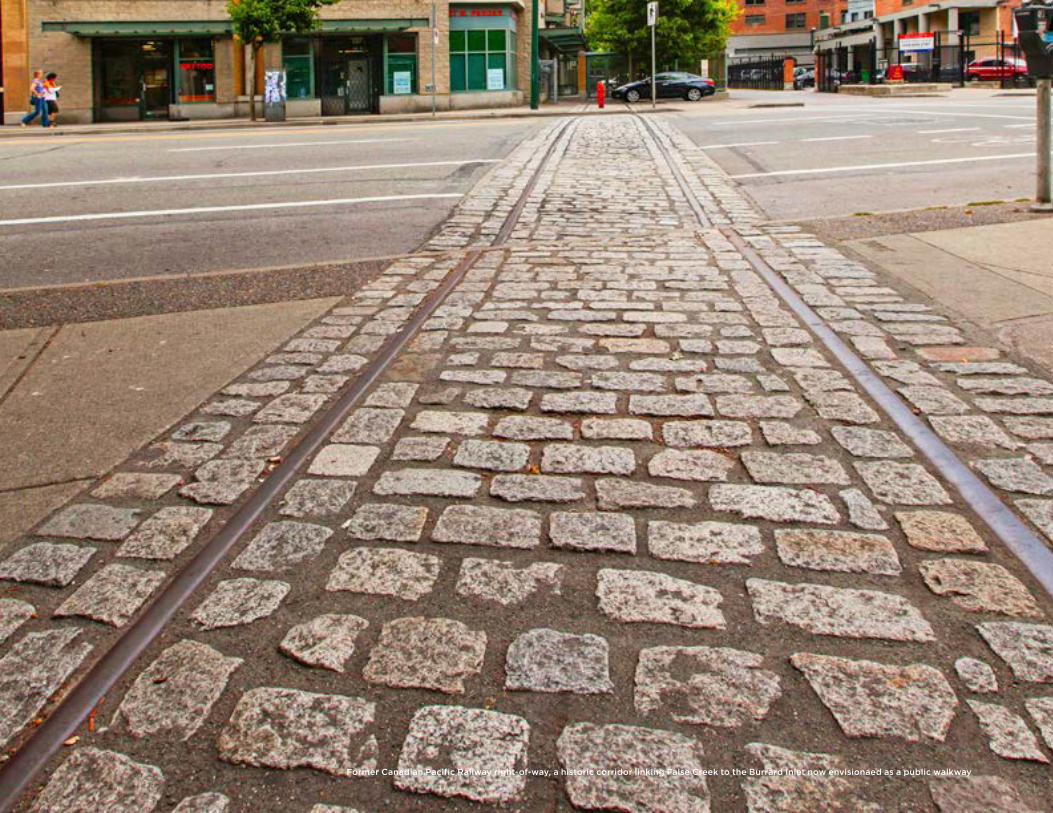
Former Canadian Pacific Railway right-of-way, a historic corridor linking False Creek to the Burrard Inlet now envisionaed as a public walkway
13HERITAGE
IntroductionThe Downtown Eastside (DTES) is where Vancouver was first established and has a long and rich First Nations history. This is also where many immigrants made their first home in Western Canada. The area contains many heritage resources including buildings, monuments, and places of historical and cultural significance. These physical and spiritual sites should be preserved and celebrated to educate all Vancouver residents about their significance and to maintain the area character and uniqueness.
The heritage resources in the DTES are affected by numerous challenges including the lack of understanding of their value and the need to identify and protect them. In addition, the neighbourhood is experiencing increased development activities, making conservation of heritage resources even more relevant, while working within constraints of limited funding to achieve this.
In meeting these challenges, it is important to seek partnerships with other agencies, groups and senior government. It will also require ongoing support for the Heritage Conservation Program and its incentive programs, as presented by four local area directions with associated policies to be implemented.
CELEBRATIONOF HERITAGE
Support Community HeritageInitiatives
Broader Heritage Values
Enhanced Tools and Create Partnerships
Better Public Heritage Awareness
Strategic Heritage Directions
13513.0 HerItageDOWNTOWN EASTSIDE PLAN
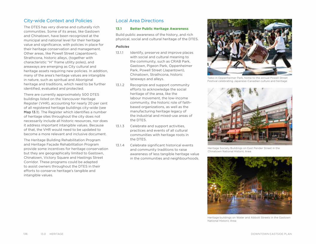
136 13.0 HerItage DOWNTOWN EASTSIDE PLAN
City-wide Context and PoliciesThe DTES has very diverse and culturally rich communities. Some of its areas, like Gastown and Chinatown, have been recognized at the municipal and national level for their heritage value and significance, with policies in place for their heritage conservation and management. Other areas, like Powell Street (Japantown), Strathcona, historic alleys, (together with characteristic “H” frame utility poles), and areaways are emerging as City cultural and heritage assets requiring new policies. In addition, many of the area’s heritage values are intangible in nature, such as spiritual and Aboriginal heritage and traditions, which need to be further identified, evaluated and protected.
There are currently approximately 500 DTES buildings listed on the Vancouver Heritage Register (VHR), accounting for nearly 20 per cent of all registered heritage buildings city-wide (see Map 13.1). The Register which identifies a number of heritage sites throughout the city does not necessarily include all historic resources, nor does it address important intangible values. Because of that, the VHR would need to be updated to become a more relevant and inclusive document.
The Heritage Building Rehabilitation Program and Heritage Façade Rehabilitation Program provide some incentives for heritage conservation but they are geographically limited to Gastown, Chinatown, Victory Square and Hastings Street Corridor. These programs could be adapted to assist owners throughout the DTES in their efforts to conserve heritage’s tangible and intangible values.
Taiko in Oppenheimer Park, home to the annual Powell Street Festival celebrating Japanese-Canadian culture and heritage
Local Area Directions
13.1 Better Public Heritage Awareness
Build public awareness of the history, and rich physical, social and cultural heritage of the DTES.
Policies
13.1.1 Identify, preserve and improve places with social and cultural meaning to the community, such as CRAB Park, Gastown, Pigeon Park, Oppenheimer Park, Powell Street (Japantown), Chinatown, Strathcona, historic laneways and alleys.
13.1.2 Recognize and support community efforts to acknowledge the social heritage of the area, like the labour movement, the low-income community, the historic role of faith-based organizations, as well as the manufacturing heritage legacy of the industrial and mixed-use areas of the DTES.
13.1.3 Celebrate and support activities, practices and events of all cultural communities with heritage roots in the DTES.
13.1.4 Celebrate significant historical events and community traditions to raise awareness of less tangible heritage value in the communities and neighbourhoods.
Heritage Society Buildings on East Pender Street in the Chinatown National Historic Area
Heritage buildings on Water and Abbott Streets in the Gastown National Historic Area
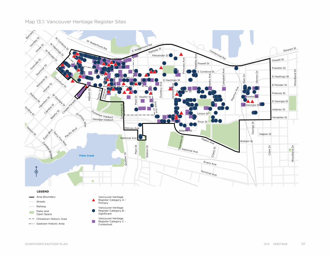
Alexander St
E Cordova St
Centennial Rd
Powell St
E Waterfront Rd
Railway St
W Waterfront Rd
William St William St
Powell St
Stewart St
Napier St
Venables St
Adanac St
Union St
Qu
eb
ec S
t
Keefer St
E Georgia St
Geo
rge S
t
Cla
rk D
r
Atlantic St
National Ave
Malkin Ave
Terminal Ave
Evans Ave
Milross Ave
National Ave
Nelson St
Prior St
Franklin St
E Hastings St
Pandora St
Triumph St
E Pender St
Frances St
E Georgia St
E Hastings St
E Pender St
W Cordova St
W Hastings St
Dunsmuir St
Robson St
W G
eorgia StSm
ithe St
W Pender St
Cam
bie S
t
Sh
an
gh
ai
Alle
y
Beatt
y St Cita
del P
arad
e
Ham
ilton
St
Mai
nlan
d St
Hom
er S
t
Richa
rds St
Hor
nby
StBurra
rd S
tHow
e St
Seym
our S
t
Gra
nville
St
Keefer St
Go
re A
ve
Jackso
n A
ve
Du
nle
vy A
ve
Main
St
Sta
tio
n S
t
Main
St
Co
lum
bia
St
Pacific
Blvd
Terry Fox Way
Ab
bo
tt S
t
Taylo
r S
t
Pri
ncess
Ave
Cam
pb
ell
Ave
Ray
mur
Ave
Vern
on
Dr
Wo
od
lan
d D
rW
oo
dla
nd
Dr
Co
mm
erc
ial D
r
Sals
bu
ry D
r
Gle
n D
r
Heatl
ey A
ve
Haw
ks
Ave
Th
orn
ton S
t
Ch
ess
St
Dunsmuir Viaduct
Expo
Blv
d
Georgia Viaduct
Griffiths Way
Cambie B
ridg
e
Area Boundary
Streets
Railway
Parks andOpen Space
Chinatown Historic Area
Gastown Historic Area
Vancouver Heritage Register Category A - Primary
Vancouver Heritage Register Category B - Significant
Vancouver Heritage Register Category C - Contextual
LEGEND
Map 13.1: Vancouver Heritage Register Sites
Alexander St
E Cordova St
Centennial Rd
Powell St
E Waterfront Rd
Railway St
W Waterfront Rd
William St William St
Powell St
Stewart St
Napier St
Venables St
Adanac St
Union St
Qu
eb
ec S
t
Keefer St
E Georgia St
Geo
rge S
t
Cla
rk D
r
Atlantic St
National Ave
Malkin Ave
Terminal Ave
Evans Ave
Milross Ave
National Ave
Nelson St
Prior St
Franklin St
E Hastings St
Pandora St
Triumph St
E Pender St
Frances St
E Georgia St
E Hastings St
E Pender St
W Cordova St
W Hastings St
Dunsmuir St
Robson St
W G
eorgia StSm
ithe St
W Pender St
Cam
bie S
t
Sh
an
gh
ai
Alle
y
Beatt
y St Cita
del P
arad
e
Ham
ilton
St
Mai
nlan
d St
Hom
er S
t
Richa
rds St
Hor
nby
StBurra
rd S
tHow
e St
Seym
our S
t
Gra
nville
St
Keefer St
Go
re A
ve
Jackso
n A
ve
Du
nle
vy A
ve
Main
St
Sta
tio
n S
t
Main
St
Co
lum
bia
St
Pacific
Blvd
Terry Fox Way
Ab
bo
tt S
t
Taylo
r S
t
Pri
ncess
Ave
Cam
pb
ell
Ave
Ray
mur
Ave
Vern
on
Dr
Wo
od
lan
d D
rW
oo
dla
nd
Dr
Co
mm
erc
ial D
r
Sals
bu
ry D
r
Gle
n D
r
Heatl
ey A
ve
Haw
ks
Ave
Th
orn
ton S
t
Ch
ess
St
Dunsmuir Viaduct
Expo
Blv
d
Georgia Viaduct
Griffiths Way
Cambie B
ridg
e
Area Boundary
Streets
Railway
Parks andOpen Space
Chinatown Historic Area
Gastown Historic Area
Vancouver Heritage Register Category A - Primary
Vancouver Heritage Register Category B - Significant
Vancouver Heritage Register Category C - Contextual
LEGEND
13713.0 HerItageDOWNTOWN EASTSIDE PLAN
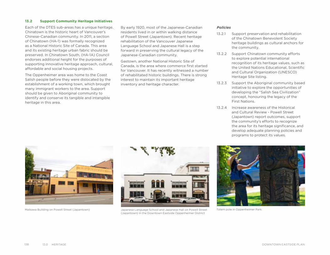
138 13.0 HerItage DOWNTOWN EASTSIDE PLAN
13.2 Support Community Heritage Initiatives
Each of the DTES sub-areas has a unique heritage. Chinatown is the historic heart of Vancouver’s Chinese-Canadian community. In 2011, a section of Chinatown (HA-1) was formally recognized as a National Historic Site of Canada. This area and its existing heritage urban fabric should be preserved. In Chinatown South, (HA-1A) Council endorses additional height for the purposes of supporting innovative heritage approach, cultural, affordable and social housing projects.
The Oppenheimer area was home to the Coast Salish people before they were dislocated by the establishment of a working town, which brought many immigrant workers to the area. Support should be given to Aboriginal community to identify and conserve its tangible and intangible heritage in this area.
By early 1920, most of the Japanese-Canadian residents lived in or within walking distance of Powell Street (Japantown). Recent heritage rehabilitation of the Vancouver Japanese Language School and Japanese Hall is a step forward in preserving the cultural legacy of the Japanese-Canadian community.
Gastown, another National Historic Site of Canada, is the area where commerce first started for Vancouver. It has recently witnessed a number of rehabilitated historic buildings. There is strong interest to maintain its important heritage inventory and heritage character.
Maikawa Building on Powell Street (Japantown) Totem pole in Oppenheimer ParkJapanese Language School and Japanese Hall on Powell Street (Japantown) in the Downtown Eastside Oppenheimer District
Policies
13.2.1 Support preservation and rehabilitation of the Chinatown Benevolent Society heritage buildings as cultural anchors for the community.
13.2.2 Support Chinatown community efforts to explore potential international recognition of its heritage values, such as the United Nations Educational, Scientific and Cultural Organization (UNESCO) Heritage Site listing.
13.2.3 Support the Aboriginal community based initiative to explore the opportunities of developing the “Salish Sea Civilization” concept, honouring the legacy of the First Nations.
13.2.4 Increase awareness of the Historical and Cultural Review - Powell Street (Japantown) report outcomes, support the community’s efforts to recognize the area for its heritage significance, and develop adequate planning policies and programs to protect its values.
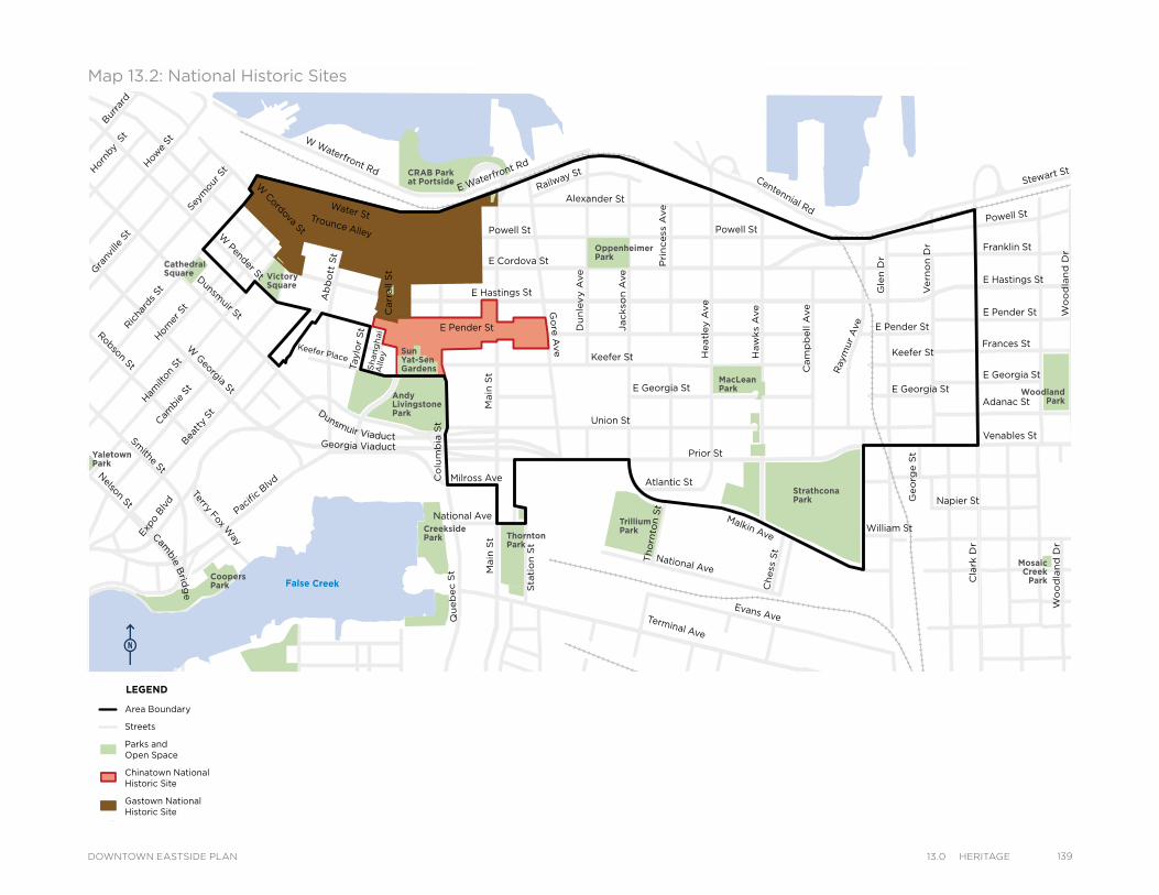
MacLeanPark
OppenheimerPark
CRAB Parkat Portside
VictorySquare
Cathedral Square
Strathcona Park
MosaicCreek
Park
Grandview Park
SalsburyPark
WoodlandPark
TrilliumPark
ThorntonPark
CreeksidePark
CoopersPark
Andy LivingstonePark
YaletownPark
Sun Yat-SenGardens
Powell St
Water StTrounce Alley
Keefer Place
Alexander St
E Cordova St
Centennial Rd
Powell St
E Waterfront Rd
Railway St
W Waterfront Rd
William St William St
Powell St
Stewart St
Napier St
Venables St
Adanac St
Union St
Qu
eb
ec S
t
Keefer St
E Georgia St
Geo
rge S
t
Cla
rk D
r
E Georgia St
Atlantic St
National Ave
Malkin Ave
Terminal Ave
Evans Ave
Milross Ave
National Ave
Nelson St
Prior St
E Pender St
Franklin St
E Hastings St
Pandora St
Triumph St
E Pender St
Frances St
E Georgia St
E Hastings St
E Pender St
W Cordova St
Dunsm
uir St
Robson St
W G
eorgia St
Smithe St
W Pender St
Cam
bie
St
Sh
an
gh
ai
Alley
Bea
tty
St
Ham
ilton
St
Mai
nlan
d St
Hom
er S
t
Ric
hard
s St
Hor
nby
St
Bur
rard
How
e St
Seym
our S
t
Gra
nville
St
Keefer St
Go
re A
ve
Jackso
n A
ve
Du
nle
vy A
ve
Main
St
Sta
tio
n S
t
Main
St
Co
lum
bia
St
Pacifi
c Blvd
Terry Fox Way
Carr
all S
t
Ab
bo
tt S
t
Taylo
r S
t
Pri
ncess
Ave
Cam
pb
ell A
ve
Ray
mur
Ave
Vern
on
Dr
Wo
od
lan
d D
rW
oo
dla
nd
Dr
Co
mm
erc
ial D
r
Sals
bu
ry D
r
Gle
n D
r
Heatl
ey A
ve
Haw
ks
Ave
Th
orn
ton S
t
Ch
ess
St
Dunsmuir Viaduct
Expo
Blv
d
Georgia Viaduct
Cambie B
ridg
e
Area Boundary
Streets
Parks andOpen Space
Chinatown National Historic Site
Gastown National Historic Site
LEGEND
Map 13.2: National Historic Sites
MacLeanPark
OppenheimerPark
CRAB Parkat Portside
VictorySquare
Cathedral Square
Strathcona Park
MosaicCreek
Park
Grandview Park
SalsburyPark
WoodlandPark
TrilliumPark
ThorntonPark
CreeksidePark
CoopersPark
Andy LivingstonePark
YaletownPark
Sun Yat-SenGardens
Powell St
Water StTrounce Alley
Keefer Place
Alexander St
E Cordova St
Centennial Rd
Powell St
E Waterfront Rd
Railway St
W Waterfront Rd
William St William St
Powell St
Stewart St
Napier St
Venables St
Adanac St
Union St
Qu
eb
ec S
t
Keefer St
E Georgia St
Geo
rge S
t
Cla
rk D
r
E Georgia St
Atlantic St
National Ave
Malkin Ave
Terminal Ave
Evans Ave
Milross Ave
National Ave
Nelson St
Prior St
E Pender St
Franklin St
E Hastings St
Pandora St
Triumph St
E Pender St
Frances St
E Georgia St
E Hastings St
E Pender St
W Cordova St
Dunsm
uir St
Robson St
W G
eorgia St
Smithe St
W Pender St
Cam
bie
St
Sh
an
gh
ai
Alley
Bea
tty
St
Ham
ilton
St
Mai
nlan
d St
Hom
er S
t
Ric
hard
s St
Hor
nby
St
Bur
rard
How
e St
Seym
our S
t
Gra
nville
St
Keefer St
Go
re A
ve
Jackso
n A
ve
Du
nle
vy A
ve
Main
St
Sta
tio
n S
t
Main
St
Co
lum
bia
St
Pacifi
c Blvd
Terry Fox Way
Carr
all S
t
Ab
bo
tt S
t
Taylo
r S
t
Pri
ncess
Ave
Cam
pb
ell A
ve
Ray
mur
Ave
Vern
on
Dr
Wo
od
lan
d D
rW
oo
dla
nd
Dr
Co
mm
erc
ial D
r
Sals
bu
ry D
r
Gle
n D
r
Heatl
ey A
ve
Haw
ks
Ave
Th
orn
ton S
t
Ch
ess
St
Dunsmuir Viaduct
Expo
Blv
d
Georgia Viaduct
Cambie B
ridg
e
Area Boundary
Streets
Parks andOpen Space
Chinatown National Historic Site
Gastown National Historic Site
LEGEND
13913.0 HerItageDOWNTOWN EASTSIDE PLAN
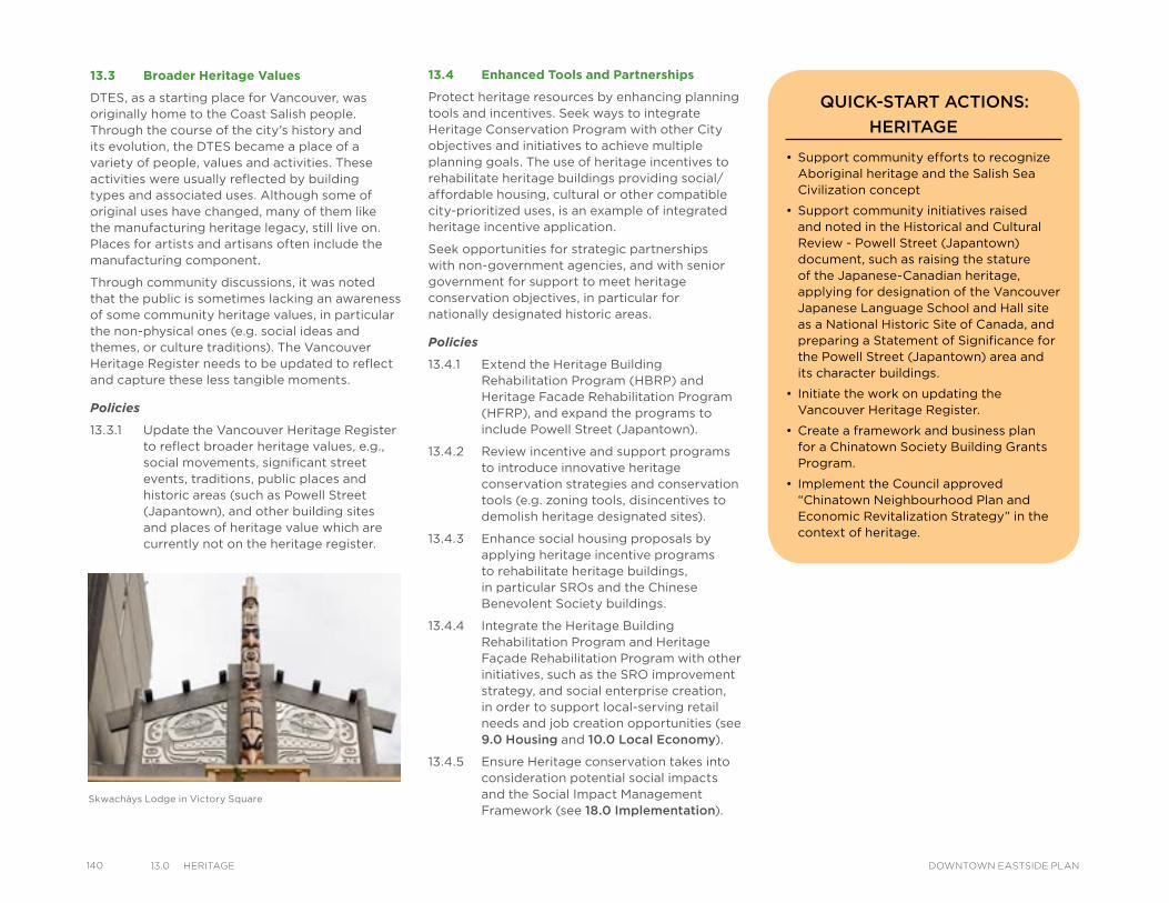
140 13.0 HerItage DOWNTOWN EASTSIDE PLAN
13.4 Enhanced Tools and Partnerships
Protect heritage resources by enhancing planning tools and incentives. Seek ways to integrate Heritage Conservation Program with other City objectives and initiatives to achieve multiple planning goals. The use of heritage incentives to rehabilitate heritage buildings providing social/affordable housing, cultural or other compatible city-prioritized uses, is an example of integrated heritage incentive application.
Seek opportunities for strategic partnerships with non-government agencies, and with senior government for support to meet heritage conservation objectives, in particular for nationally designated historic areas.
Policies
13.4.1 Extend the Heritage Building Rehabilitation Program (HBRP) and Heritage Facade Rehabilitation Program (HFRP), and expand the programs to include Powell Street (Japantown).
13.4.2 Review incentive and support programs to introduce innovative heritage conservation strategies and conservation tools (e.g. zoning tools, disincentives to demolish heritage designated sites).
13.4.3 Enhance social housing proposals by applying heritage incentive programs to rehabilitate heritage buildings, in particular SROs and the Chinese Benevolent Society buildings.
13.4.4 Integrate the Heritage Building Rehabilitation Program and Heritage Façade Rehabilitation Program with other initiatives, such as the SRO improvement strategy, and social enterprise creation, in order to support local-serving retail needs and job creation opportunities (see 9.0 Housing and 10.0 Local Economy).
13.4.5 Ensure Heritage conservation takes into consideration potential social impacts and the Social Impact Management Framework (see 18.0 Implementation).
13.3 Broader Heritage Values
DTES, as a starting place for Vancouver, was originally home to the Coast Salish people. Through the course of the city’s history and its evolution, the DTES became a place of a variety of people, values and activities. These activities were usually reflected by building types and associated uses. Although some of original uses have changed, many of them like the manufacturing heritage legacy, still live on. Places for artists and artisans often include the manufacturing component.
Through community discussions, it was noted that the public is sometimes lacking an awareness of some community heritage values, in particular the non-physical ones (e.g. social ideas and themes, or culture traditions). The Vancouver Heritage Register needs to be updated to reflect and capture these less tangible moments.
Policies
13.3.1 Update the Vancouver Heritage Register to reflect broader heritage values, e.g., social movements, significant street events, traditions, public places and historic areas (such as Powell Street (Japantown), and other building sites and places of heritage value which are currently not on the heritage register.
Skwachàys Lodge in Victory Square
• Support community efforts to recognize Aboriginal heritage and the Salish Sea Civilization concept
• Support community initiatives raised and noted in the Historical and Cultural Review - Powell Street (Japantown) document, such as raising the stature of the Japanese-Canadian heritage, applying for designation of the Vancouver Japanese Language School and Hall site as a National Historic Site of Canada, and preparing a Statement of Significance for the Powell Street (Japantown) area and its character buildings.
• Initiate the work on updating the Vancouver Heritage Register.
• Create a framework and business plan for a Chinatown Society Building Grants Program.
• Implement the Council approved “Chinatown Neighbourhood Plan and Economic Revitalization Strategy” in the context of heritage.
QUICK-START ACTIONS:
HERITAGE
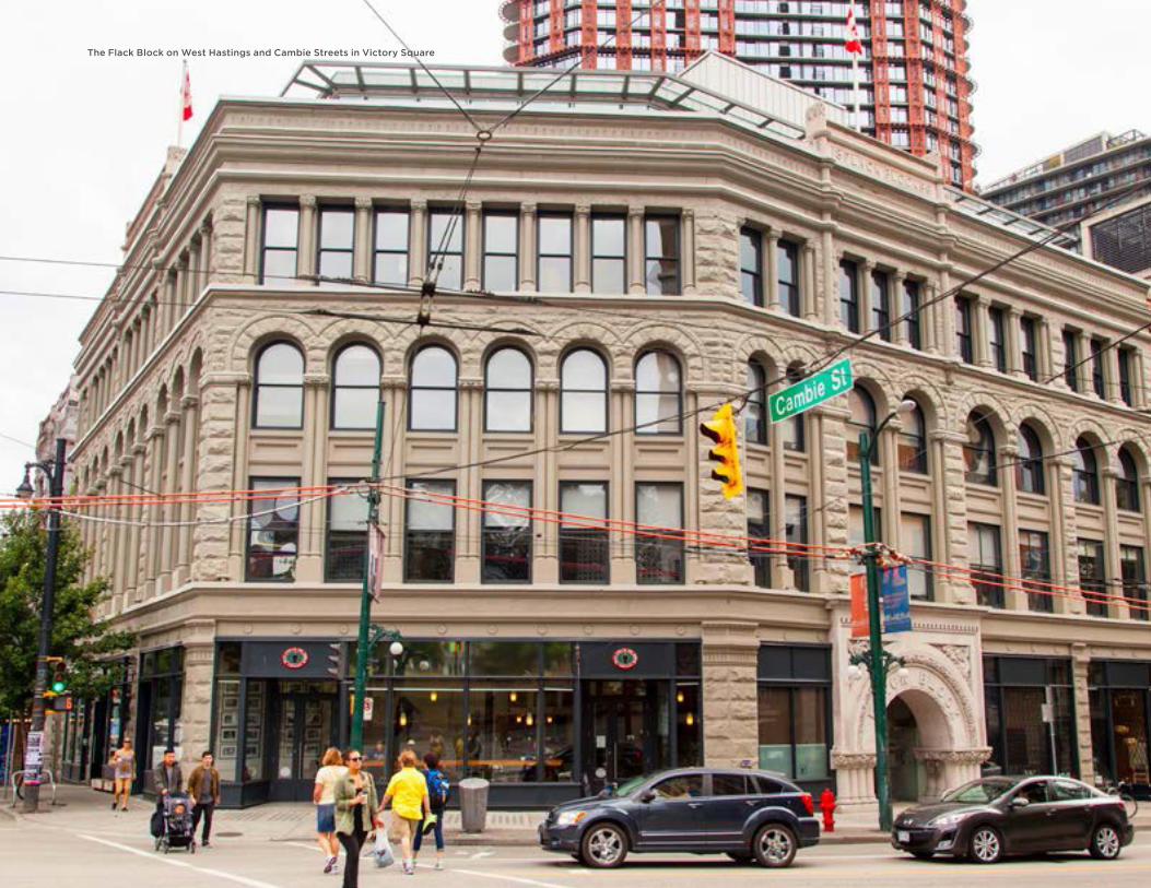
The Flack Block on West Hastings and Cambie Streets in Victory Square

Davie Street, looking northwest towards English BayDecorative art elements on the heritage Flack Block building on West Hastings Street in Gastown
ARTS AND CULTUREOPPORTUNITIES
Improved Arts and Culture Facilities
Art in Public Places
Increased Opportunities forthe Creative Economy
14ARTS AND CULTURE
IntroductionArts and culture can play an important role in contributing to the quality of life as well as the social and economic vitality of cities. For an individual, the arts can stimulate, inspire and entertain. At the neighbourhood level, strong creative communities contribute to positive change in local economies, social environments, social justice, neighbourhood character and demographics. The Downtown Eastside (DTES) is home to one of the highest per capita concentrations of artists in Vancouver and a plethora of arts and culture non-profit organizations and businesses. The DTES also hosts a number of arts and cultural events and festivals throughout the year including Aboriginal Day celebrations, the Powell Street Festival, the Vancouver Chinatown Spring Festival and Parade and the Heart of the City Festival.
Strategic Directions
14314.0 arts and CultureDOWNTOWN EASTSIDE PLAN
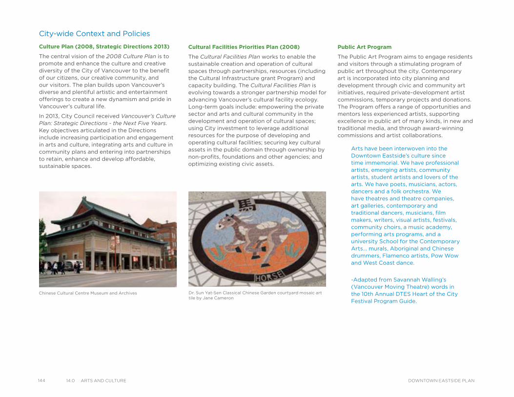
144 14.0 arts and Culture DOWNTOWN EASTSIDE PLAN
City-wide Context and Policies
Culture Plan (2008, Strategic Directions 2013)
The central vision of the 2008 Culture Plan is to promote and enhance the culture and creative diversity of the City of Vancouver to the benefit of our citizens, our creative community, and our visitors. The plan builds upon Vancouver’s diverse and plentiful artistic and entertainment offerings to create a new dynamism and pride in Vancouver’s cultural life.
In 2013, City Council received Vancouver’s Culture Plan: Strategic Directions - the Next Five Years. Key objectives articulated in the Directions include increasing participation and engagement in arts and culture, integrating arts and culture in community plans and entering into partnerships to retain, enhance and develop affordable, sustainable spaces.
Arts have been interwoven into the Downtown Eastside’s culture since time immemorial. We have professional artists, emerging artists, community artists, student artists and lovers of the arts. We have poets, musicians, actors, dancers and a folk orchestra. We have theatres and theatre companies, art galleries, contemporary and traditional dancers, musicians, film makers, writers, visual artists, festivals, community choirs, a music academy, performing arts programs, and a university School for the Contemporary Arts… murals, Aboriginal and Chinese drummers, Flamenco artists, Pow Wow and West Coast dance.
-Adapted from Savannah Walling’s (Vancouver Moving Theatre) words in the 10th Annual DTES Heart of the City Festival Program Guide.
Cultural Facilities Priorities Plan (2008)
The Cultural Facilities Plan works to enable the sustainable creation and operation of cultural spaces through partnerships, resources (including the Cultural Infrastructure grant Program) and capacity building. The Cultural Facilities Plan is evolving towards a stronger partnership model for advancing Vancouver’s cultural facility ecology. Long-term goals include: empowering the private sector and arts and cultural community in the development and operation of cultural spaces; using City investment to leverage additional resources for the purpose of developing and operating cultural facilities; securing key cultural assets in the public domain through ownership by non-profits, foundations and other agencies; and optimizing existing civic assets.
Chinese Cultural Centre Museum and Archives Dr. Sun Yat-Sen Classical Chinese Garden courtyard mosaic art tile by Jane Cameron
Public Art Program
The Public Art Program aims to engage residents and visitors through a stimulating program of public art throughout the city. Contemporary art is incorporated into city planning and development through civic and community art initiatives, required private-development artist commissions, temporary projects and donations. The Program offers a range of opportunities and mentors less experienced artists, supporting excellence in public art of many kinds, in new and traditional media, and through award-winning commissions and artist collaborations.
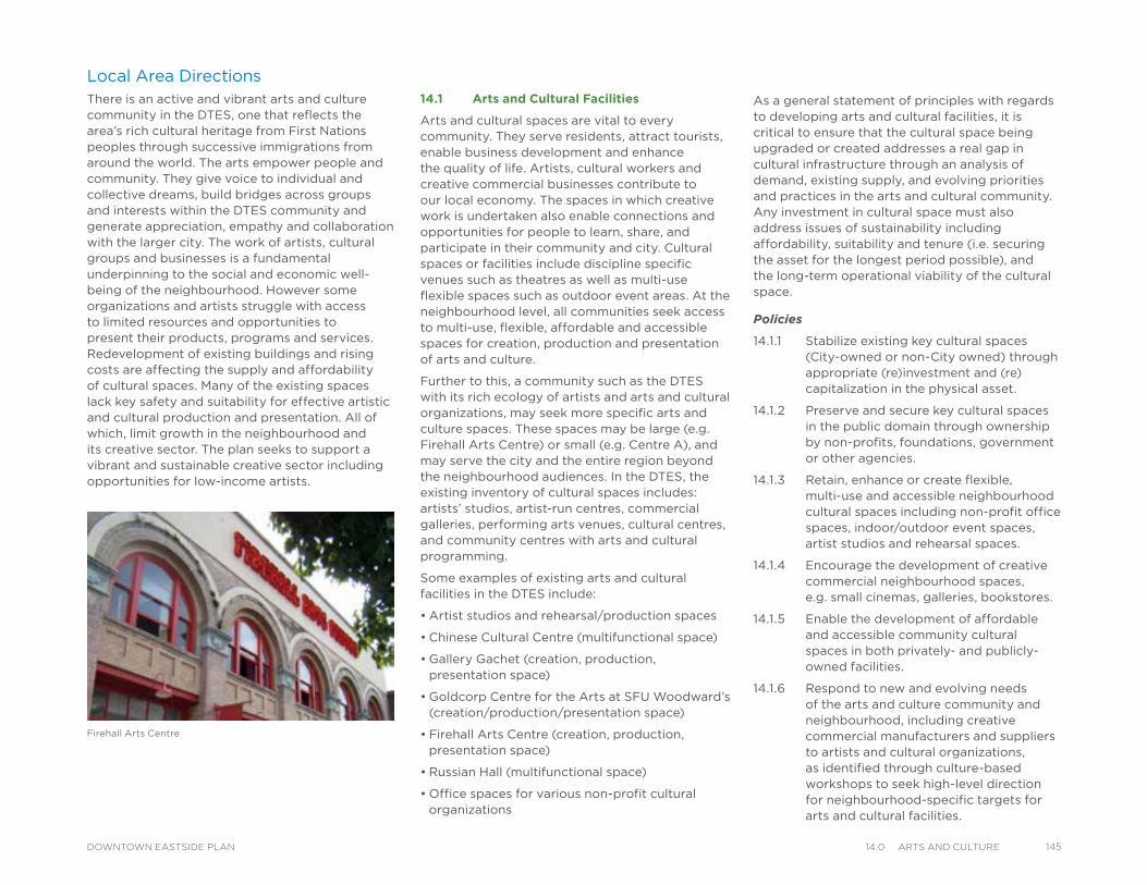
Firehall Arts Centre
Local Area Directions There is an active and vibrant arts and culture community in the DTES, one that reflects the area’s rich cultural heritage from First Nations peoples through successive immigrations from around the world. The arts empower people and community. They give voice to individual and collective dreams, build bridges across groups and interests within the DTES community and generate appreciation, empathy and collaboration with the larger city. The work of artists, cultural groups and businesses is a fundamental underpinning to the social and economic well-being of the neighbourhood. However some organizations and artists struggle with access to limited resources and opportunities to present their products, programs and services. Redevelopment of existing buildings and rising costs are affecting the supply and affordability of cultural spaces. Many of the existing spaces lack key safety and suitability for effective artistic and cultural production and presentation. All of which, limit growth in the neighbourhood and its creative sector. The plan seeks to support a vibrant and sustainable creative sector including opportunities for low-income artists.
14.1 Arts and Cultural Facilities
Arts and cultural spaces are vital to every community. They serve residents, attract tourists, enable business development and enhance the quality of life. Artists, cultural workers and creative commercial businesses contribute to our local economy. The spaces in which creative work is undertaken also enable connections and opportunities for people to learn, share, and participate in their community and city. Cultural spaces or facilities include discipline specific venues such as theatres as well as multi-use flexible spaces such as outdoor event areas. At the neighbourhood level, all communities seek access to multi-use, flexible, affordable and accessible spaces for creation, production and presentation of arts and culture.
Further to this, a community such as the DTES with its rich ecology of artists and arts and cultural organizations, may seek more specific arts and culture spaces. These spaces may be large (e.g. Firehall Arts Centre) or small (e.g. Centre A), and may serve the city and the entire region beyond the neighbourhood audiences. In the DTES, the existing inventory of cultural spaces includes: artists’ studios, artist-run centres, commercial galleries, performing arts venues, cultural centres, and community centres with arts and cultural programming.
Some examples of existing arts and cultural facilities in the DTES include:
• Artist studios and rehearsal/production spaces
• Chinese Cultural Centre (multifunctional space)
• Gallery Gachet (creation, production, presentation space)
• Goldcorp Centre for the Arts at SFU Woodward’s (creation/production/presentation space)
• Firehall Arts Centre (creation, production, presentation space)
• Russian Hall (multifunctional space)
• Office spaces for various non-profit cultural organizations
As a general statement of principles with regards to developing arts and cultural facilities, it is critical to ensure that the cultural space being upgraded or created addresses a real gap in cultural infrastructure through an analysis of demand, existing supply, and evolving priorities and practices in the arts and cultural community. Any investment in cultural space must also address issues of sustainability including affordability, suitability and tenure (i.e. securing the asset for the longest period possible), and the long-term operational viability of the cultural space.
Policies
14.1.1 Stabilize existing key cultural spaces (City-owned or non-City owned) through appropriate (re)investment and (re)capitalization in the physical asset.
14.1.2 Preserve and secure key cultural spaces in the public domain through ownership by non-profits, foundations, government or other agencies.
14.1.3 Retain, enhance or create flexible, multi-use and accessible neighbourhood cultural spaces including non-profit office spaces, indoor/outdoor event spaces, artist studios and rehearsal spaces.
14.1.4 Encourage the development of creative commercial neighbourhood spaces, e.g. small cinemas, galleries, bookstores.
14.1.5 Enable the development of affordable and accessible community cultural spaces in both privately- and publicly-owned facilities.
14.1.6 Respond to new and evolving needs of the arts and culture community and neighbourhood, including creative commercial manufacturers and suppliers to artists and cultural organizations, as identified through culture-based workshops to seek high-level direction for neighbourhood-specific targets for arts and cultural facilities.
14514.0 arts and CultureDOWNTOWN EASTSIDE PLAN
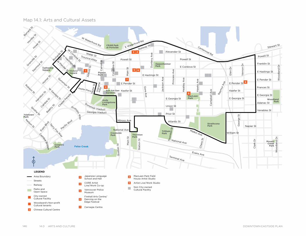
146 14.0 arts and Culture DOWNTOWN EASTSIDE PLAN
MacLeanPark
OppenheimerPark
CRAB Parkat Portside
VictorySquare
Cathedral Square
Strathcona Park
MosaicCreek
Park
Grandview Park
SalsburyPark
WoodlandPark
TrilliumPark
ThorntonPark
CreeksidePark
CoopersPark
Andy LivingstonePark
YaletownPark
Sun Yat-SenGardens
PigeonPark
Powell St
Water StTrounce Alley
Keefer Place
Alexander St
E Cordova St
Centennial Rd
Powell St
E Waterfront Rd
Railway St
W Waterfront Rd
William St William St
Powell St
Stewart St
Napier St
Venables St
Adanac StUnion St
Qu
eb
ec S
t
Keefer St
E Georgia St
Geo
rge S
t
Cla
rk D
r
E Georgia St
Atlantic St
National Ave
Malkin Ave
Terminal Ave
Evans Ave
Milross Ave
National Ave
Nelson St
Prior St
E Pender St
Franklin St
E Hastings St
Pandora St
Triumph St
E Pender St
Frances St
E Georgia St
E Hastings St
E Pender St
W Cordova St
W Hastings St
Dunsmuir St
Robson St
W G
eorgia St
Smithe St
W Pender St
Cam
bie S
t
Sh
an
gh
ai
Alle
y
Beatt
y St Cita
del P
arad
e
Ham
ilton
St
Mai
nlan
d St
Hom
er S
t
Richa
rds St
Hor
nby
StBurra
rd S
tHow
e St
Seym
our S
t
Gra
nville
St
Keefer St
Go
re A
ve
Jackso
n A
ve
Du
nle
vy A
ve
Main
St
Sta
tio
n S
t
Main
St
Co
lum
bia
St
Pacific
Blvd
Terry Fox Way
Carr
all
St
Ab
bo
tt S
tTaylo
r S
t Pri
ncess
Ave
Cam
pb
ell
Ave
Ray
mur
Ave
Vern
on
Dr
Wo
od
lan
d D
rW
oo
dla
nd
Dr
Co
mm
erc
ial D
r
Sals
bu
ry D
r
Gle
n D
r
Heatl
ey A
ve
Haw
ks
Ave
Th
orn
ton S
t
Ch
ess
St
Dunsmuir Viaduct
Expo
Blv
d
Georgia Viaduct
Griffiths Way
Cambie B
ridg
e
Area Boundary
Streets
Railway
Parks andOpen Space
City-ownedCultural Facility
Woodward’s Non-profit Cultural tenants
Chinese Cultural Centre
Japanese Language School and Hall
CORE Artist Live/Work Co-op
Vancouver Police Museum
Firehall Arts Centre/ Dancing on theEdge Festival
Carnegie Centre
MacLean Park Field House Artist Studio
Artist Live/Work Studio
Non City-owned Cultural Facility
LEGEND
Map 14.1: Arts and Cultural Assets
MacLeanPark
OppenheimerPark
CRAB Parkat Portside
VictorySquare
Cathedral Square
Strathcona Park
MosaicCreek
Park
Grandview Park
SalsburyPark
WoodlandPark
TrilliumPark
ThorntonPark
CreeksidePark
CoopersPark
Andy LivingstonePark
YaletownPark
Sun Yat-SenGardens
PigeonPark
Powell St
Water StTrounce Alley
Keefer Place
Alexander St
E Cordova St
Centennial Rd
Powell St
E Waterfront Rd
Railway St
W Waterfront Rd
William St William St
Powell St
Stewart St
Napier St
Venables St
Adanac StUnion St
Qu
eb
ec S
t
Keefer St
E Georgia St
Geo
rge S
t
Cla
rk D
r
E Georgia St
Atlantic St
National Ave
Malkin Ave
Terminal Ave
Evans Ave
Milross Ave
National Ave
Nelson St
Prior St
E Pender St
Franklin St
E Hastings St
Pandora St
Triumph St
E Pender St
Frances St
E Georgia St
E Hastings St
E Pender St
W Cordova St
W Hastings St
Dunsmuir St
Robson St
W G
eorgia St
Smithe St
W Pender St
Cam
bie S
t
Sh
an
gh
ai
Alle
y
Beatt
y St Cita
del P
arad
e
Ham
ilton
St
Mai
nlan
d St
Hom
er S
t
Richa
rds St
Hor
nby
StBurra
rd S
tHow
e St
Seym
our S
t
Gra
nville
St
Keefer St
Go
re A
ve
Jackso
n A
ve
Du
nle
vy A
ve
Main
St
Sta
tio
n S
t
Main
St
Co
lum
bia
St
Pacific
Blvd
Terry Fox Way
Carr
all
St
Ab
bo
tt S
tTaylo
r S
t Pri
ncess
Ave
Cam
pb
ell
Ave
Ray
mur
Ave
Vern
on
Dr
Wo
od
lan
d D
rW
oo
dla
nd
Dr
Co
mm
erc
ial D
r
Sals
bu
ry D
r
Gle
n D
r
Heatl
ey A
ve
Haw
ks
Ave
Th
orn
ton S
t
Ch
ess
St
Dunsmuir Viaduct
Expo
Blv
d
Georgia Viaduct
Griffiths Way
Cambie B
ridg
e
Area Boundary
Streets
Railway
Parks andOpen Space
City-ownedCultural Facility
Woodward’s Non-profit Cultural tenants
Chinese Cultural Centre
Japanese Language School and Hall
CORE Artist Live/Work Co-op
Vancouver Police Museum
Firehall Arts Centre/ Dancing on theEdge Festival
Carnegie Centre
MacLean Park Field House Artist Studio
Artist Live/Work Studio
Non City-owned Cultural Facility
LEGEND
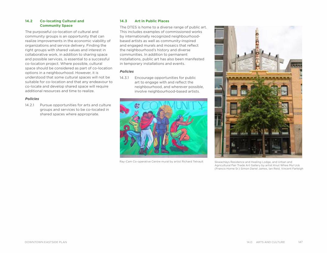
Skwachàys Residence and Healing Lodge, and Urban and Agricultural Fair Trade Art Gallery by artist Knut Whee Mul Uck (Francis Horne Sr.) Simon Danel James, Ian Reid, Vincent Farleigh
Ray-Cam Co-operative Centre mural by artist Richard Tetrault
14.2 Co-locating Cultural and Community Space
The purposeful co-location of cultural and community groups is an opportunity that can realize improvements in the economic viability of organizations and service delivery. Finding the right groups with shared values and interest in collaborative work, in addition to sharing space and possible services, is essential to a successful co-location project. Where possible, cultural space should be considered as part of co-location options in a neighbourhood. However, it is understood that some cultural spaces will not be suitable for co-location and that any endeavour to co-locate and develop shared space will require additional resources and time to realize.
Policies
14.2.1 Pursue opportunities for arts and culture groups and services to be co-located in shared spaces where appropriate.
14.3 Art in Public Places
The DTES is home to a diverse range of public art. This includes examples of commissioned works by internationally recognized neighbourhood-based artists as well as community-inspired and engaged murals and mosaics that reflect the neighbourhood’s history and diverse communities. In addition to permanent installations, public art has also been manifested in temporary installations and events.
Policies
14.3.1 Encourage opportunities for public art to engage with and reflect the neighbourhood, and wherever possible, involve neighbourhood-based artists.
14714.0 arts and CultureDOWNTOWN EASTSIDE PLAN
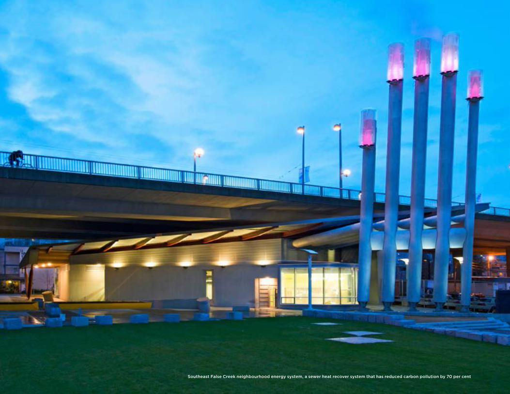
Southeast False Creek neighbourhood energy system, a sewer heat recover system that has reduced carbon pollution by 70 per cent
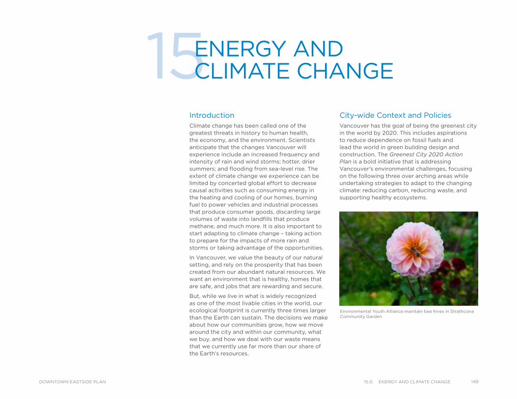
Environmental Youth Alliance maintain bee hives in Strathcona Community Garden
IntroductionClimate change has been called one of the greatest threats in history to human health, the economy, and the environment. Scientists anticipate that the changes Vancouver will experience include an increased frequency and intensity of rain and wind storms; hotter, drier summers; and flooding from sea-level rise. The extent of climate change we experience can be limited by concerted global effort to decrease causal activities such as consuming energy in the heating and cooling of our homes, burning fuel to power vehicles and industrial processes that produce consumer goods, discarding large volumes of waste into landfills that produce methane, and much more. It is also important to start adapting to climate change – taking action to prepare for the impacts of more rain and storms or taking advantage of the opportunities.
In Vancouver, we value the beauty of our natural setting, and rely on the prosperity that has been created from our abundant natural resources. We want an environment that is healthy, homes that are safe, and jobs that are rewarding and secure.
But, while we live in what is widely recognized as one of the most livable cities in the world, our ecological footprint is currently three times larger than the Earth can sustain. The decisions we make about how our communities grow, how we move around the city and within our community, what we buy, and how we deal with our waste means that we currently use far more than our share of the Earth's resources.
15ENERGY AND CLIMATE CHANGE
City-wide Context and PoliciesVancouver has the goal of being the greenest city in the world by 2020. This includes aspirations to reduce dependence on fossil fuels and lead the world in green building design and construction. The Greenest City 2020 Action Plan is a bold initiative that is addressing Vancouver's environmental challenges, focusing on the following three over arching areas while undertaking strategies to adapt to the changing climate: reducing carbon, reducing waste, and supporting healthy ecosystems.
14915.0 energy and ClImate CHangeDOWNTOWN EASTSIDE PLAN
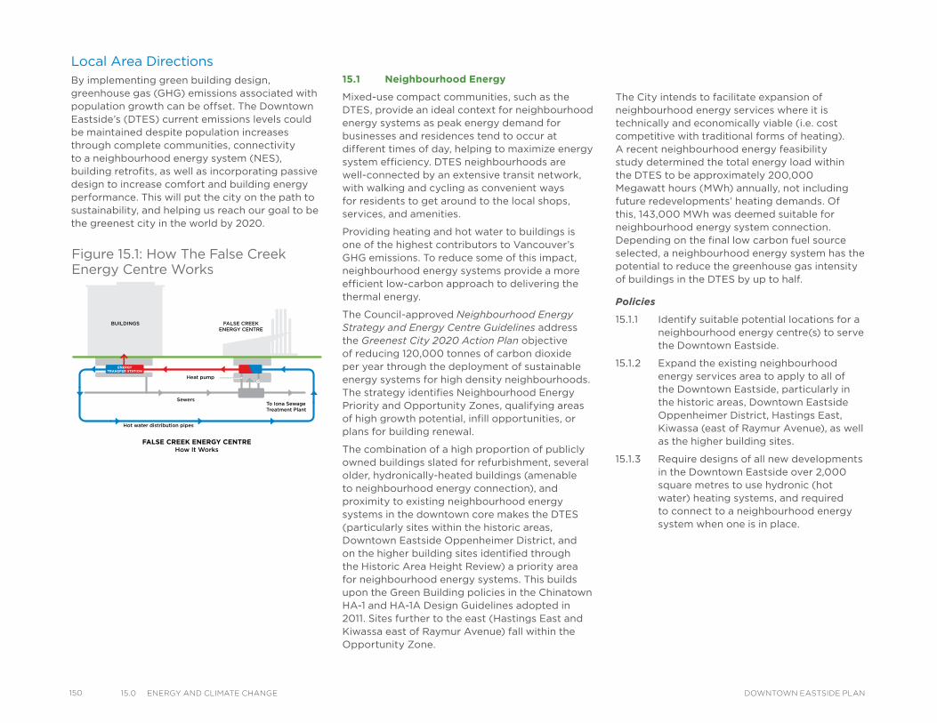
150 15.0 energy and ClImate CHange DOWNTOWN EASTSIDE PLAN
15.1 Neighbourhood Energy
Mixed-use compact communities, such as the DTES, provide an ideal context for neighbourhood energy systems as peak energy demand for businesses and residences tend to occur at different times of day, helping to maximize energy system efficiency. DTES neighbourhoods are well-connected by an extensive transit network, with walking and cycling as convenient ways for residents to get around to the local shops, services, and amenities.
Providing heating and hot water to buildings is one of the highest contributors to Vancouver’s GHG emissions. To reduce some of this impact, neighbourhood energy systems provide a more efficient low-carbon approach to delivering the thermal energy.
The Council-approved Neighbourhood Energy Strategy and Energy Centre Guidelines address the Greenest City 2020 Action Plan objective of reducing 120,000 tonnes of carbon dioxide per year through the deployment of sustainable energy systems for high density neighbourhoods. The strategy identifies Neighbourhood Energy Priority and Opportunity Zones, qualifying areas of high growth potential, infill opportunities, or plans for building renewal.
The combination of a high proportion of publicly owned buildings slated for refurbishment, several older, hydronically-heated buildings (amenable to neighbourhood energy connection), and proximity to existing neighbourhood energy systems in the downtown core makes the DTES (particularly sites within the historic areas, Downtown Eastside Oppenheimer District, and on the higher building sites identified through the Historic Area Height Review) a priority area for neighbourhood energy systems. This builds upon the Green Building policies in the Chinatown HA-1 and HA-1A Design Guidelines adopted in 2011. Sites further to the east (Hastings East and Kiwassa east of Raymur Avenue) fall within the Opportunity Zone.
Local Area DirectionsBy implementing green building design, greenhouse gas (GHG) emissions associated with population growth can be offset. The Downtown Eastside’s (DTES) current emissions levels could be maintained despite population increases through complete communities, connectivity to a neighbourhood energy system (NES), building retrofits, as well as incorporating passive design to increase comfort and building energy performance. This will put the city on the path to sustainability, and helping us reach our goal to be the greenest city in the world by 2020.
The City intends to facilitate expansion of neighbourhood energy services where it is technically and economically viable (i.e. cost competitive with traditional forms of heating). A recent neighbourhood energy feasibility study determined the total energy load within the DTES to be approximately 200,000 Megawatt hours (MWh) annually, not including future redevelopments’ heating demands. Of this, 143,000 MWh was deemed suitable for neighbourhood energy system connection. Depending on the final low carbon fuel source selected, a neighbourhood energy system has the potential to reduce the greenhouse gas intensity of buildings in the DTES by up to half.
Policies
15.1.1 Identify suitable potential locations for a neighbourhood energy centre(s) to serve the Downtown Eastside.
15.1.2 Expand the existing neighbourhood energy services area to apply to all of the Downtown Eastside, particularly in the historic areas, Downtown Eastside Oppenheimer District, Hastings East, Kiwassa (east of Raymur Avenue), as well as the higher building sites.
15.1.3 Require designs of all new developments in the Downtown Eastside over 2,000 square metres to use hydronic (hot water) heating systems, and required to connect to a neighbourhood energy system when one is in place.
Figure 15.1: How The False Creek Energy Centre Works
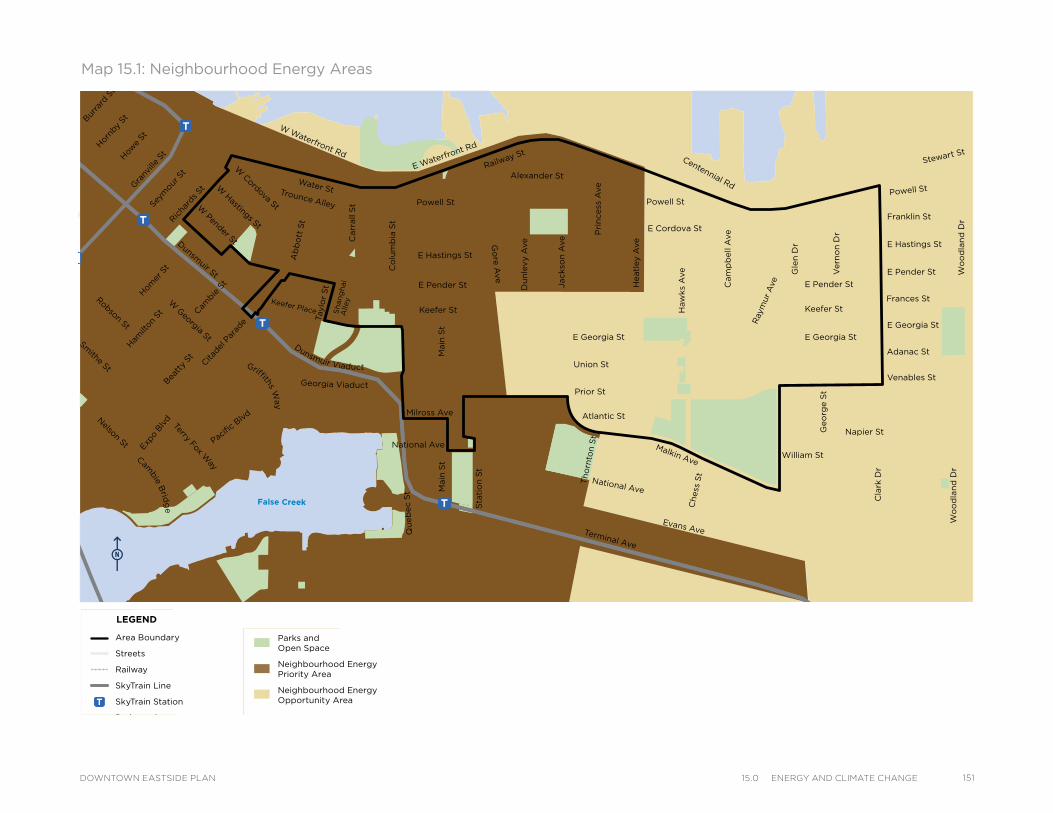
Powell St
Water StTrounce Alley
Keefer Place
Alexander St
E Cordova St
Centennial Rd
Powell St
E Waterfront Rd
Railway St
W Waterfront Rd
William St William St
Powell St
Stewart St
Napier St
Venables St
Adanac St
Union St
Qu
eb
ec S
t
Keefer St
E Georgia St
Geo
rge S
t
Cla
rk D
r
E Georgia St
Atlantic St
National Ave
Malkin Ave
Terminal Ave
Evans Ave
Milross Ave
National Ave
Nelson St
Prior St
E Pender St
Franklin St
E Hastings St
Pandora St
Triumph St
E Pender St
Frances St
E Georgia St
E Hastings St
E Pender St
W Cordova St
W Hastings St
Dunsmuir St
Robson St
W G
eorgia StSm
ithe St
W Pender St
Cam
bie S
t
Sh
an
gh
ai
Alle
y
Beatt
y St Cita
del P
arad
e
Ham
ilton
St
Mai
nlan
d St
Hom
er S
tRic
hard
s St
Hor
nby
StBurra
rd S
tHow
e St
Seym
our S
t
Gra
nville
St
Keefer St
Go
re A
ve
Jackso
n A
ve
Main
St
Sta
tio
n S
t
Main
St
Co
lum
bia
St
Pacific
Blvd
Terry Fox Way
Carr
all
St
Ab
bo
tt S
t
Taylo
r S
t
Pri
ncess
Ave
Cam
pb
ell
Ave
Ray
mur
Ave
Vern
on
Dr
Wo
od
lan
d D
rW
oo
dla
nd
Dr
Co
mm
erc
ial D
r
Sals
bu
ry D
r
Gle
n D
r
Heatl
ey A
ve
Haw
ks
Ave
Th
orn
ton S
t
Ch
ess
St
Dunsmuir Viaduct
Expo
Blv
d
Georgia Viaduct
Griffiths Way
Cambie B
ridg
e
Du
nle
vy A
ve
Area Boundary
Streets
Railway
SkyTrain Line
SkyTrain Station
Parks andOpen Space
Neighbourhood Energy Priority Area
Neighbourhood Energy Opportunity Area
LEGEND
Map 15.1: Neighbourhood Energy Areas
Powell St
Water StTrounce Alley
Keefer Place
Alexander St
E Cordova St
Centennial Rd
Powell St
E Waterfront Rd
Railway St
W Waterfront Rd
William St William St
Powell St
Stewart St
Napier St
Venables St
Adanac St
Union St
Qu
eb
ec S
t
Keefer St
E Georgia St
Geo
rge S
t
Cla
rk D
r
E Georgia St
Atlantic St
National Ave
Malkin Ave
Terminal Ave
Evans Ave
Milross Ave
National Ave
Nelson St
Prior St
E Pender St
Franklin St
E Hastings St
Pandora St
Triumph St
E Pender St
Frances St
E Georgia St
E Hastings St
E Pender St
W Cordova St
W Hastings St
Dunsmuir St
Robson St
W G
eorgia StSm
ithe St
W Pender St
Cam
bie S
t
Sh
an
gh
ai
Alle
y
Beatt
y St Cita
del P
arad
e
Ham
ilton
St
Mai
nlan
d St
Hom
er S
tRic
hard
s St
Hor
nby
StBurra
rd S
tHow
e St
Seym
our S
t
Gra
nville
St
Keefer St
Go
re A
ve
Jackso
n A
ve
Main
St
Sta
tio
n S
t
Main
St
Co
lum
bia
St
Pacific
Blvd
Terry Fox Way
Carr
all
St
Ab
bo
tt S
t
Taylo
r S
t
Pri
ncess
Ave
Cam
pb
ell
Ave
Ray
mur
Ave
Vern
on
Dr
Wo
od
lan
d D
rW
oo
dla
nd
Dr
Co
mm
erc
ial D
r
Sals
bu
ry D
r
Gle
n D
r
Heatl
ey A
ve
Haw
ks
Ave
Th
orn
ton S
t
Ch
ess
St
Dunsmuir Viaduct
Expo
Blv
d
Georgia Viaduct
Griffiths Way
Cambie B
ridg
e
Du
nle
vy A
ve
Area Boundary
Streets
Railway
SkyTrain Line
SkyTrain Station
Parks andOpen Space
Neighbourhood Energy Priority Area
Neighbourhood Energy Opportunity Area
LEGEND
Powell St
Water StTrounce Alley
Keefer Place
Alexander St
E Cordova St
Centennial Rd
Powell St
E Waterfront Rd
Railway St
W Waterfront Rd
William St William St
Powell St
Stewart St
Napier St
Venables St
Adanac St
Union St
Qu
eb
ec S
t
Keefer St
E Georgia St
Geo
rge S
t
Cla
rk D
r
E Georgia St
Atlantic St
National Ave
Malkin Ave
Terminal Ave
Evans Ave
Milross Ave
National Ave
Nelson St
Prior St
E Pender St
Franklin St
E Hastings St
Pandora St
Triumph St
E Pender St
Frances St
E Georgia St
E Hastings St
E Pender St
W Cordova St
W Hastings St
Dunsmuir St
Robson St
W G
eorgia StSm
ithe St
W Pender St
Cam
bie S
t
Sh
an
gh
ai
Alle
y
Beatt
y St Cita
del P
arad
e
Ham
ilton
St
Mai
nlan
d St
Hom
er S
tRic
hard
s St
Hor
nby
StBurra
rd S
tHow
e St
Seym
our S
t
Gra
nville
St
Keefer St
Go
re A
ve
Jackso
n A
ve
Main
St
Sta
tio
n S
t
Main
St
Co
lum
bia
St
Pacific
Blvd
Terry Fox Way
Carr
all
St
Ab
bo
tt S
t
Taylo
r S
t
Pri
ncess
Ave
Cam
pb
ell
Ave
Ray
mur
Ave
Vern
on
Dr
Wo
od
lan
d D
rW
oo
dla
nd
Dr
Co
mm
erc
ial D
r
Sals
bu
ry D
r
Gle
n D
r
Heatl
ey A
ve
Haw
ks
Ave
Th
orn
ton S
t
Ch
ess
St
Dunsmuir Viaduct
Expo
Blv
d
Georgia Viaduct
Griffiths Way
Cambie B
ridg
e
Du
nle
vy A
ve
Area Boundary
Streets
Railway
SkyTrain Line
SkyTrain Station
Parks andOpen Space
Neighbourhood Energy Priority Area
Neighbourhood Energy Opportunity Area
LEGEND
15115.0 energy and ClImate CHangeDOWNTOWN EASTSIDE PLAN
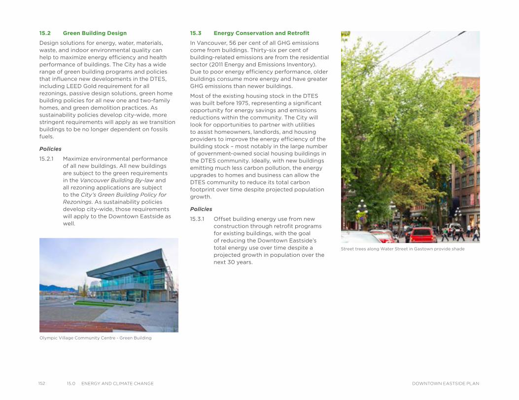
152 15.0 energy and ClImate CHange DOWNTOWN EASTSIDE PLAN
15.2 Green Building Design
Design solutions for energy, water, materials, waste, and indoor environmental quality can help to maximize energy efficiency and health performance of buildings. The City has a wide range of green building programs and policies that influence new developments in the DTES, including LEED Gold requirement for all rezonings, passive design solutions, green home building policies for all new one and two-family homes, and green demolition practices. As sustainability policies develop city-wide, more stringent requirements will apply as we transition buildings to be no longer dependent on fossils fuels.
Policies
15.2.1 Maximize environmental performance of all new buildings. All new buildings are subject to the green requirements in the Vancouver Building By-law and all rezoning applications are subject to the City’s Green Building Policy for Rezonings. As sustainability policies develop city-wide, those requirements will apply to the Downtown Eastside as well.
15.3 Energy Conservation and Retrofit
In Vancouver, 56 per cent of all GHG emissions come from buildings. Thirty-six per cent of building-related emissions are from the residential sector (2011 Energy and Emissions Inventory). Due to poor energy efficiency performance, older buildings consume more energy and have greater GHG emissions than newer buildings.
Most of the existing housing stock in the DTES was built before 1975, representing a significant opportunity for energy savings and emissions reductions within the community. The City will look for opportunities to partner with utilities to assist homeowners, landlords, and housing providers to improve the energy efficiency of the building stock – most notably in the large number of government-owned social housing buildings in the DTES community. Ideally, with new buildings emitting much less carbon pollution, the energy upgrades to homes and business can allow the DTES community to reduce its total carbon footprint over time despite projected population growth.
Policies
15.3.1 Offset building energy use from new construction through retrofit programs for existing buildings, with the goal of reducing the Downtown Eastside’s total energy use over time despite a projected growth in population over the next 30 years.
Olympic Village Community Centre - Green Building
Street trees along Water Street in Gastown provide shade
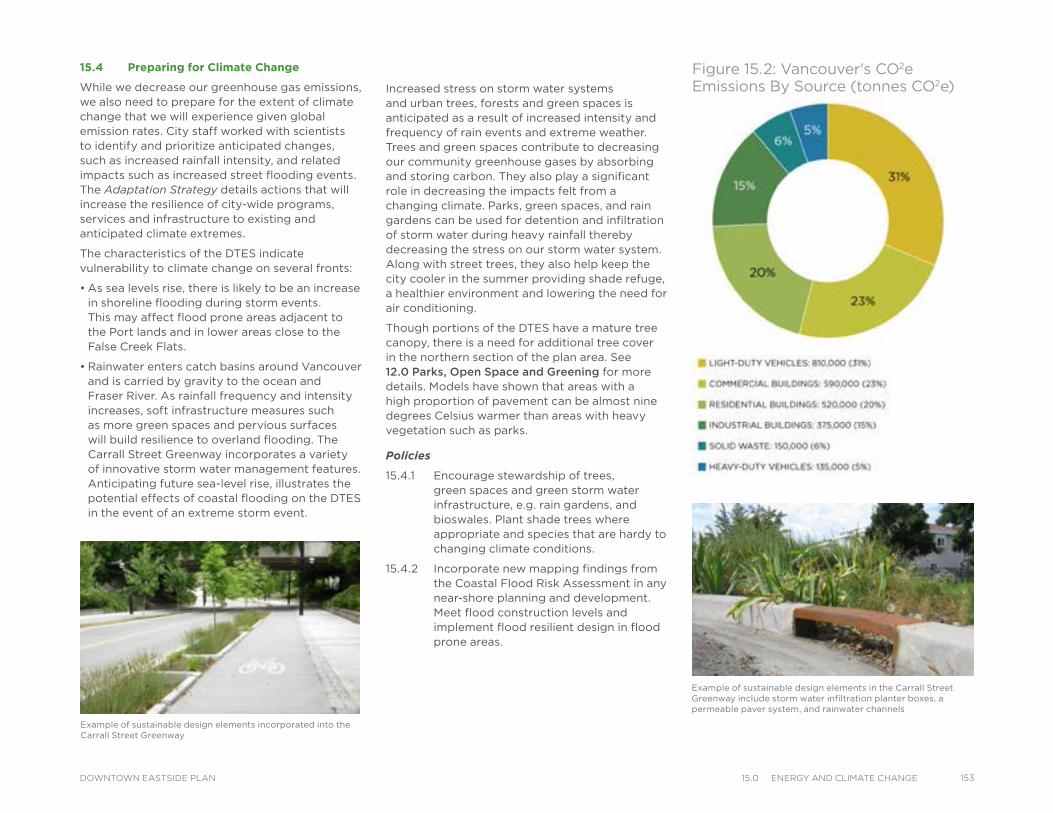
Figure 15.2: Vancouver's CO2e Emissions By Source (tonnes CO2e)
15.4 Preparing for Climate Change
While we decrease our greenhouse gas emissions, we also need to prepare for the extent of climate change that we will experience given global emission rates. City staff worked with scientists to identify and prioritize anticipated changes, such as increased rainfall intensity, and related impacts such as increased street flooding events. The Adaptation Strategy details actions that will increase the resilience of city-wide programs, services and infrastructure to existing and anticipated climate extremes.
The characteristics of the DTES indicate vulnerability to climate change on several fronts:
• As sea levels rise, there is likely to be an increase in shoreline flooding during storm events. This may affect flood prone areas adjacent to the Port lands and in lower areas close to the False Creek Flats.
• Rainwater enters catch basins around Vancouver and is carried by gravity to the ocean and Fraser River. As rainfall frequency and intensity increases, soft infrastructure measures such as more green spaces and pervious surfaces will build resilience to overland flooding. The Carrall Street Greenway incorporates a variety of innovative storm water management features. Anticipating future sea-level rise, illustrates the potential effects of coastal flooding on the DTES in the event of an extreme storm event.
Example of sustainable design elements incorporated into the Carrall Street Greenway
Example of sustainable design elements in the Carrall Street Greenway include storm water infiltration planter boxes, a permeable paver system, and rainwater channels
Increased stress on storm water systems and urban trees, forests and green spaces is anticipated as a result of increased intensity and frequency of rain events and extreme weather. Trees and green spaces contribute to decreasing our community greenhouse gases by absorbing and storing carbon. They also play a significant role in decreasing the impacts felt from a changing climate. Parks, green spaces, and rain gardens can be used for detention and infiltration of storm water during heavy rainfall thereby decreasing the stress on our storm water system. Along with street trees, they also help keep the city cooler in the summer providing shade refuge, a healthier environment and lowering the need for air conditioning.
Though portions of the DTES have a mature tree canopy, there is a need for additional tree cover in the northern section of the plan area. See 12.0 Parks, Open Space and Greening for more details. Models have shown that areas with a high proportion of pavement can be almost nine degrees Celsius warmer than areas with heavy vegetation such as parks.
Policies
15.4.1 Encourage stewardship of trees, green spaces and green storm water infrastructure, e.g. rain gardens, and bioswales. Plant shade trees where appropriate and species that are hardy to changing climate conditions.
15.4.2 Incorporate new mapping findings from the Coastal Flood Risk Assessment in any near-shore planning and development. Meet flood construction levels and implement flood resilient design in flood prone areas.
15315.0 energy and ClImate CHangeDOWNTOWN EASTSIDE PLAN
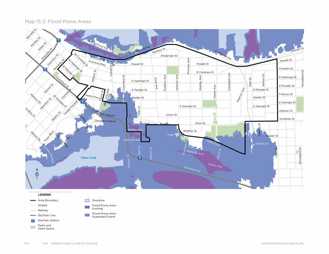
154 15.0 energy and ClImate CHange DOWNTOWN EASTSIDE PLAN
Powell St
Water StTrounce Alley
Keefer Place
Alexander St
E Cordova St
Centennial Rd
Powell St
E Waterfront Rd
Railway St
W Waterfront Rd
William St William St
Powell St
Stewart St
Napier St
Venables St
Adanac St
Union St
Qu
eb
ec S
t
Keefer St
E Georgia St
Geo
rge S
t
Cla
rk D
r
E Georgia St
Atlantic St
National Ave
Malkin Ave
Terminal Ave
Evans Ave
Milross Ave
National Ave
Nelson St
Prior St
E Pender St
Franklin St
E Hastings St
Pandora St
Triumph St
E Pender St
Frances St
E Georgia St
E Hastings St
E Pender St
W Cordova St
W Hastings St
Dunsmuir St
Robson St
W G
eorgia StSm
ithe St
W Pender St
Cam
bie S
t
Sh
an
gh
ai
Alle
y
Beatt
y St Cita
del P
arad
e
Ham
ilton
St
Mai
nlan
d St
Hom
er S
tRic
hard
s St
Hor
nby
StBurra
rd S
tHow
e St
Seym
our S
t
Gra
nville
St
Keefer St
Go
re A
ve
Jackso
n A
ve
Du
nle
vy A
ve
Main
St
Sta
tio
n S
t
Main
St
Co
lum
bia
St
Pacific
Blvd
Terry Fox Way
Carr
all
St
Ab
bo
tt S
t
Tay
lor
St
Pri
ncess
Ave
Cam
pb
ell
Ave
Ray
mur
Ave
Vern
on
Dr
Wo
od
lan
d D
rW
oo
dla
nd
Dr
Co
mm
erc
ial D
r
Sals
bu
ry D
r
Gle
n D
r
Heatl
ey A
ve
Haw
ks
Ave
Th
orn
ton S
t
Ch
ess
St
Dunsmuir Viaduct
Expo
Blv
d
Georgia Viaduct
Griffiths Way
Cambie B
ridg
e
Area Boundary
Streets
Railway
SkyTrain Line
SkyTrain Station
Parks andOpen Space
Shoreline
Flood Prone Area - Existing
Flood Prone Area - Expanded Extent
LEGEND
Map 15.2: Flood Prone Areas
Powell St
Water StTrounce Alley
Keefer Place
Alexander St
E Cordova St
Centennial Rd
Powell St
E Waterfront Rd
Railway St
W Waterfront Rd
William St William St
Powell St
Stewart St
Napier St
Venables St
Adanac St
Union St
Qu
eb
ec S
t
Keefer St
E Georgia St
Geo
rge S
t
Cla
rk D
r
E Georgia St
Atlantic St
National Ave
Malkin Ave
Terminal Ave
Evans Ave
Milross Ave
National Ave
Nelson St
Prior St
E Pender St
Franklin St
E Hastings St
Pandora St
Triumph St
E Pender St
Frances St
E Georgia St
E Hastings St
E Pender St
W Cordova St
W Hastings St
Dunsmuir St
Robson St
W G
eorgia StSm
ithe St
W Pender St
Cam
bie S
t
Sh
an
gh
ai
Alle
y
Beatt
y St Cita
del P
arad
e
Ham
ilton
St
Mai
nlan
d St
Hom
er S
tRic
hard
s St
Hor
nby
StBurra
rd S
tHow
e St
Seym
our S
t
Gra
nville
St
Keefer St
Go
re A
ve
Jackso
n A
ve
Du
nle
vy A
ve
Main
St
Sta
tio
n S
t
Main
St
Co
lum
bia
St
Pacific
Blvd
Terry Fox Way
Carr
all
St
Ab
bo
tt S
t
Tay
lor
St
Pri
ncess
Ave
Cam
pb
ell
Ave
Ray
mur
Ave
Vern
on
Dr
Wo
od
lan
d D
rW
oo
dla
nd
Dr
Co
mm
erc
ial D
r
Sals
bu
ry D
r
Gle
n D
r
Heatl
ey A
ve
Haw
ks
Ave
Th
orn
ton S
t
Ch
ess
St
Dunsmuir Viaduct
Expo
Blv
d
Georgia Viaduct
Griffiths Way
Cambie B
ridg
e
Area Boundary
Streets
Railway
SkyTrain Line
SkyTrain Station
Parks andOpen Space
Shoreline
Flood Prone Area - Existing
Flood Prone Area - Expanded Extent
LEGEND
Powell St
Water StTrounce Alley
Keefer Place
Alexander St
E Cordova St
Centennial Rd
Powell St
E Waterfront Rd
Railway St
W Waterfront Rd
William St William St
Powell St
Stewart St
Napier St
Venables St
Adanac St
Union St
Qu
eb
ec S
t
Keefer St
E Georgia St
Geo
rge S
t
Cla
rk D
r
E Georgia St
Atlantic St
National Ave
Malkin Ave
Terminal Ave
Evans Ave
Milross Ave
National Ave
Nelson St
Prior St
E Pender St
Franklin St
E Hastings St
Pandora St
Triumph St
E Pender St
Frances St
E Georgia St
E Hastings St
E Pender St
W Cordova St
W Hastings St
Dunsmuir St
Robson St
W G
eorgia StSm
ithe St
W Pender St
Cam
bie S
t
Sh
an
gh
ai
Alle
y
Beatt
y St Cita
del P
arad
e
Ham
ilton
St
Mai
nlan
d St
Hom
er S
tRic
hard
s St
Hor
nby
StBurra
rd S
tHow
e St
Seym
our S
t
Gra
nville
St
Keefer St
Go
re A
ve
Jackso
n A
ve
Du
nle
vy A
ve
Main
St
Sta
tio
n S
t
Main
St
Co
lum
bia
St
Pacific
Blvd
Terry Fox Way
Carr
all
St
Ab
bo
tt S
t
Tay
lor
St
Pri
ncess
Ave
Cam
pb
ell
Ave
Ray
mur
Ave
Vern
on
Dr
Wo
od
lan
d D
rW
oo
dla
nd
Dr
Co
mm
erc
ial D
r
Sals
bu
ry D
r
Gle
n D
r
Heatl
ey A
ve
Haw
ks
Ave
Th
orn
ton S
t
Ch
ess
St
Dunsmuir Viaduct
Expo
Blv
d
Georgia Viaduct
Griffiths Way
Cambie B
ridg
e
Area Boundary
Streets
Railway
SkyTrain Line
SkyTrain Station
Parks andOpen Space
Shoreline
Flood Prone Area - Existing
Flood Prone Area - Expanded Extent
LEGEND
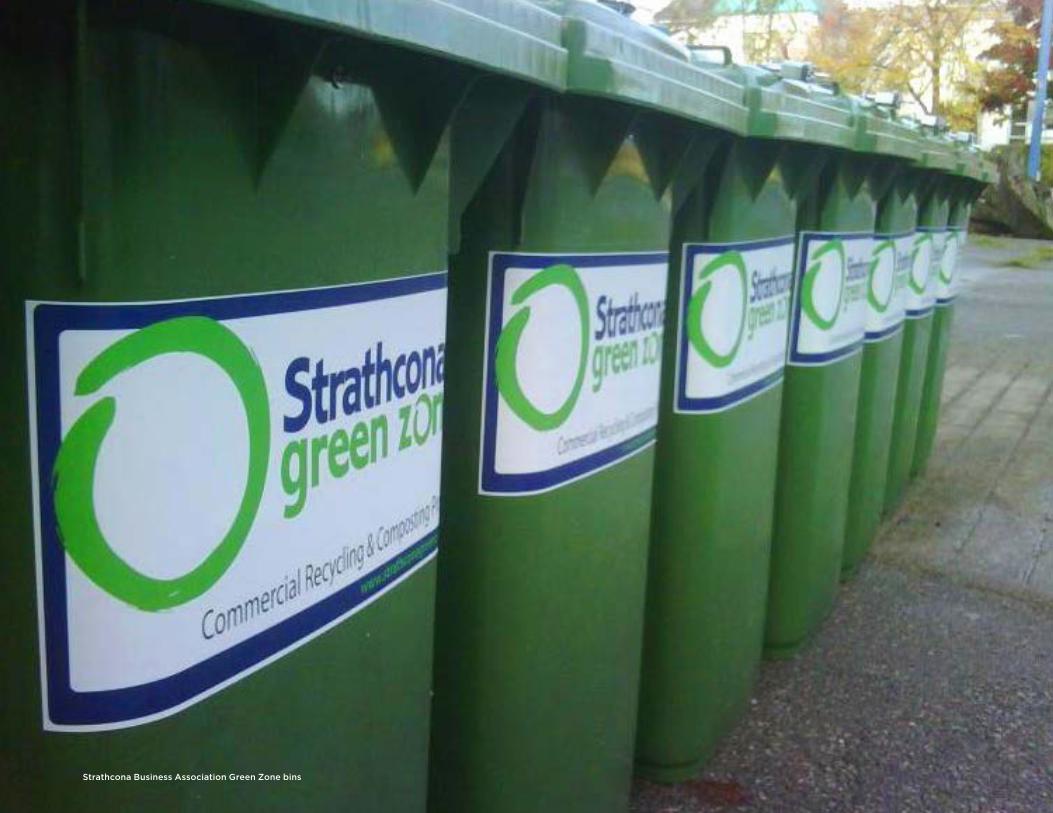
Strathcona Business Association Green Zone bins
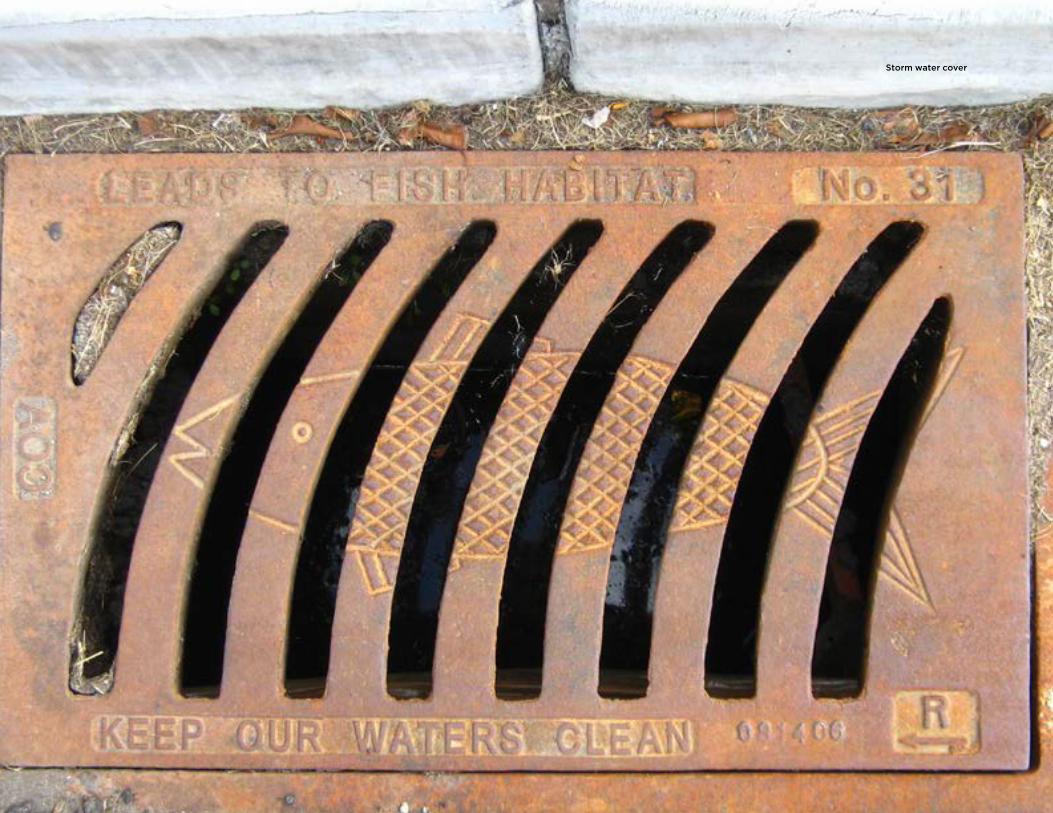
Storm water cover
IntroductionUtilities and services are sometimes hidden, but are vitally important for a City to function. The water, sanitary, storm water and solid waste systems are key to the city’s sustainability, as well as to our health and well-being.
Vancouver has:
Safe, accessible drinking water
Vancouver's water is collected in the Capilano, Seymour and Coquitlam mountain reservoirs. On an average day, the water system delivers 330 million litres of drinking water throughout the city.
Water conservation and protection
Using our water efficiently, and being aware of what goes into the sewer and how local waterways are affected are important parts of working towards the goal of becoming the greenest city in the world by 2020.
Environmental protection
Replacing combined sewer systems with separated sewer systems ensures sufficient capacity and prevents sewage from entering Vancouver’s waterways, protecting the environment.
Emergency preparedness
A major disaster, such as an earthquake, could make our conventional fire protection system unusable. Our Dedicated Fire Protection System (DFPS) is designed to pump potable water, plus salt water when needed. Plans for a hardened grid of water mains city-wide will provide further system resiliency. Maintaining and upgrading the Downtown Eastside (DTES) utilities and services will be essential to meeting our sustainability goals, supporting a growing population, and helping ensure our future health and well-being.
16UTILITIES AND SERVICES
Sewer cleanout box cover
15716.0 utIlItIes and servICesDOWNTOWN EASTSIDE PLAN
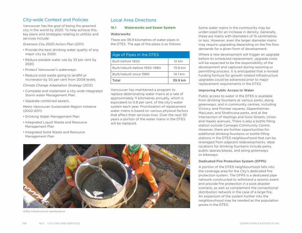
158 16.0 utIlItIes and servICes DOWNTOWN EASTSIDE PLAN
Local Area Directions
16.1 Waterworks and Sewer System
Waterworks
There are 39.9 kilometres of water pipes in the DTES. The age of the pipes is as follows:
Vancouver has maintained a program to replace deteriorating water mains at a rate of approximately 11 kilometres annually, which is equivalent to 0.8 per cent, of the city’s water system each year. Prioritization of replacement water mains is based on various physical factors that affect their services lives. Over the next 30 years a portion of the water mains in the DTES will be replaced.
Some water mains in the community may be under-sized for an increase in density. Generally, these are mains with diameters of 15 centimetres or less. However, even the larger diameter mains may require upgrading depending on the fire flow demands for a given form of development.
Where a new development will trigger an upgrade before its scheduled replacement, upgrade costs will be expected to be the responsibility of the development and captured during rezoning or permitting process. It is anticipated that a revised funding formula for growth-related infrastructure upgrades could be advanced prior to major replacement requirements in the DTES.
Improving Public Access to Water
Public access to water in the DTES is available from drinking fountains at various parks, along greenways, and in community centres, including Victory, and Pioneer squares, Oppenheimer, MacLean, and Strathcona parks, and at the intersection of Hastings and Gore Streets, Union and Hawks avenues. There is also a bottle filling station outside Carnegie Community Centre. However, there are further opportunities for additional drinking fountains or bottle filling stations in the DTES neighbourhood that can be leveraged from adjacent redevelopments. Ideal locations for drinking fountains include parks, public spaces/plazas, and along greenways or bikeways.
Dedicated Fire Protection System (DFPS)
A portion of the DTES neighbourhood falls into the coverage area for the City’s dedicated fire protection system. The DFPS is a dedicated pipe network constructed to withstand a seismic event and provide fire protection in a post disaster scenario, as well as complement the conventional distribution network in the case of a large fire. An expansion of the system further into the neighbourhood may be needed as the population grows in the DTES.
City-wide Context and PoliciesVancouver has the goal of being the greenest city in the world by 2020. To help achieve this, key plans and strategies relating to utilities and services include:
Greenest City 2020 Action Plan (2011)
• Provide the best drinking water quality of any major city by 2020.
• Reduce potable water use by 33 per cent by 2020.
• Protect Vancouver's waterways.
• Reduce solid waste going to landfill or incinerator by 50 per cent from 2008 levels.
Climate Change Adaptation Strategy (2012)
• Complete and implement a city-wide Integrated Storm water Management Plan.
• Separate combined sewers.
Metro Vancouver Sustainable Region Initiative (2002-2011)
• Drinking Water Management Plan
• Integrated Liquid Waste and Resource Management Plan
• Integrated Solid Waste and Resource Management Plan
Utility infrastructure maintenance
Age of Pipes in the DTES
Built before 1950 12 km
Built/rebuilt before 1950-1980 13.8 km
Built/rebuilt since 1980 14.1 km
Total 39.9 km
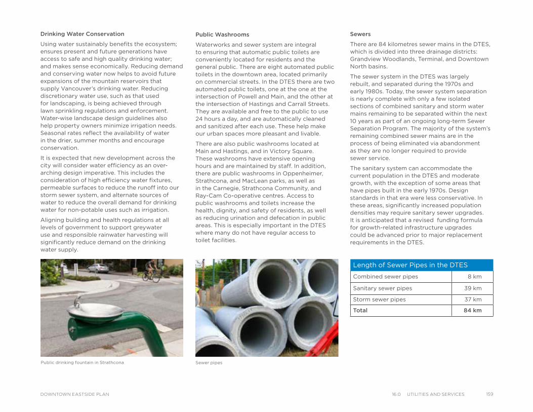
Drinking Water Conservation
Using water sustainably benefits the ecosystem; ensures present and future generations have access to safe and high quality drinking water; and makes sense economically. Reducing demand and conserving water now helps to avoid future expansions of the mountain reservoirs that supply Vancouver’s drinking water. Reducing discretionary water use, such as that used for landscaping, is being achieved through lawn sprinkling regulations and enforcement. Water-wise landscape design guidelines also help property owners minimize irrigation needs. Seasonal rates reflect the availability of water in the drier, summer months and encourage conservation.
It is expected that new development across the city will consider water efficiency as an over-arching design imperative. This includes the consideration of high efficiency water fixtures, permeable surfaces to reduce the runoff into our storm sewer system, and alternate sources of water to reduce the overall demand for drinking water for non-potable uses such as irrigation.
Aligning building and health regulations at all levels of government to support greywater use and responsible rainwater harvesting will significantly reduce demand on the drinking water supply.
Public Washrooms
Waterworks and sewer system are integral to ensuring that automatic public toilets are conveniently located for residents and the general public. There are eight automated public toilets in the downtown area, located primarily on commercial streets. In the DTES there are two automated public toilets, one at the one at the intersection of Powell and Main, and the other at the intersection of Hastings and Carrall Streets. They are available and free to the public to use 24 hours a day, and are automatically cleaned and sanitized after each use. These help make our urban spaces more pleasant and livable.
There are also public washrooms located at Main and Hastings, and in Victory Square. These washrooms have extensive opening hours and are maintained by staff. In addition, there are public washrooms in Oppenheimer, Strathcona, and MacLean parks, as well as in the Carnegie, Strathcona Community, and Ray-Cam Co-operative centres. Access to public washrooms and toilets increase the health, dignity, and safety of residents, as well as reducing urination and defecation in public areas. This is especially important in the DTES where many do not have regular access to toilet facilities.
Sewer pipes
Sewers
There are 84 kilometres sewer mains in the DTES, which is divided into three drainage districts: Grandview Woodlands, Terminal, and Downtown North basins.
The sewer system in the DTES was largely rebuilt, and separated during the 1970s and early 1980s. Today, the sewer system separation is nearly complete with only a few isolated sections of combined sanitary and storm water mains remaining to be separated within the next 10 years as part of an ongoing long-term Sewer Separation Program. The majority of the system’s remaining combined sewer mains are in the process of being eliminated via abandonment as they are no longer required to provide sewer service.
The sanitary system can accommodate the current population in the DTES and moderate growth, with the exception of some areas that have pipes built in the early 1970s. Design standards in that era were less conservative. In these areas, significantly increased population densities may require sanitary sewer upgrades. It is anticipated that a revised funding formula for growth-related infrastructure upgrades could be advanced prior to major replacement requirements in the DTES.
Public drinking fountain in Strathcona
Length of Sewer Pipes in the DTES
Combined sewer pipes 8 km
Sanitary sewer pipes 39 km
Storm sewer pipes 37 km
Total 84 km
15916.0 utIlItIes and servICesDOWNTOWN EASTSIDE PLAN
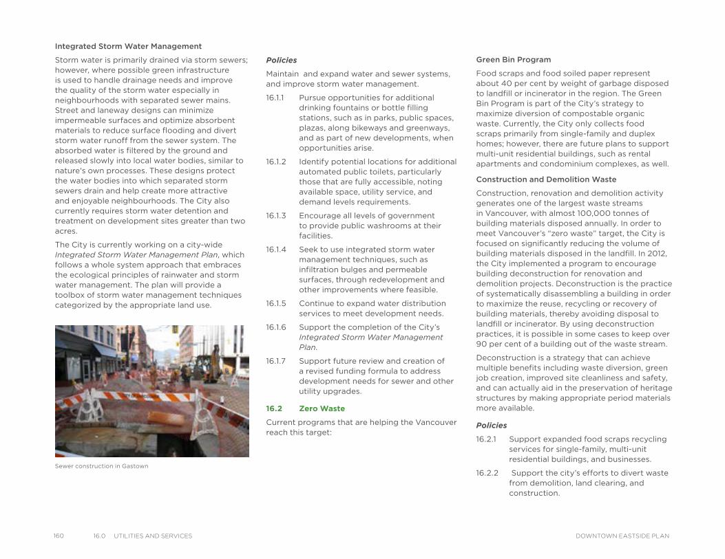
160 16.0 utIlItIes and servICes DOWNTOWN EASTSIDE PLAN
Integrated Storm Water Management
Storm water is primarily drained via storm sewers; however, where possible green infrastructure is used to handle drainage needs and improve the quality of the storm water especially in neighbourhoods with separated sewer mains. Street and laneway designs can minimize impermeable surfaces and optimize absorbent materials to reduce surface flooding and divert storm water runoff from the sewer system. The absorbed water is filtered by the ground and released slowly into local water bodies, similar to nature's own processes. These designs protect the water bodies into which separated storm sewers drain and help create more attractive and enjoyable neighbourhoods. The City also currently requires storm water detention and treatment on development sites greater than two acres.
The City is currently working on a city-wide Integrated Storm Water Management Plan, which follows a whole system approach that embraces the ecological principles of rainwater and storm water management. The plan will provide a toolbox of storm water management techniques categorized by the appropriate land use.
Policies
Maintain and expand water and sewer systems, and improve storm water management.
16.1.1 Pursue opportunities for additional drinking fountains or bottle filling stations, such as in parks, public spaces, plazas, along bikeways and greenways, and as part of new developments, when opportunities arise.
16.1.2 Identify potential locations for additional automated public toilets, particularly those that are fully accessible, noting available space, utility service, and demand levels requirements.
16.1.3 Encourage all levels of government to provide public washrooms at their facilities.
16.1.4 Seek to use integrated storm water management techniques, such as infiltration bulges and permeable surfaces, through redevelopment and other improvements where feasible.
16.1.5 Continue to expand water distribution services to meet development needs.
16.1.6 Support the completion of the City’s Integrated Storm Water Management Plan.
16.1.7 Support future review and creation of a revised funding formula to address development needs for sewer and other utility upgrades.
16.2 Zero Waste
Current programs that are helping the Vancouver reach this target:
Green Bin Program
Food scraps and food soiled paper represent about 40 per cent by weight of garbage disposed to landfill or incinerator in the region. The Green Bin Program is part of the City’s strategy to maximize diversion of compostable organic waste. Currently, the City only collects food scraps primarily from single-family and duplex homes; however, there are future plans to support multi-unit residential buildings, such as rental apartments and condominium complexes, as well.
Construction and Demolition Waste
Construction, renovation and demolition activity generates one of the largest waste streams in Vancouver, with almost 100,000 tonnes of building materials disposed annually. In order to meet Vancouver’s “zero waste” target, the City is focused on significantly reducing the volume of building materials disposed in the landfill. In 2012, the City implemented a program to encourage building deconstruction for renovation and demolition projects. Deconstruction is the practice of systematically disassembling a building in order to maximize the reuse, recycling or recovery of building materials, thereby avoiding disposal to landfill or incinerator. By using deconstruction practices, it is possible in some cases to keep over 90 per cent of a building out of the waste stream.
Deconstruction is a strategy that can achieve multiple benefits including waste diversion, green job creation, improved site cleanliness and safety, and can actually aid in the preservation of heritage structures by making appropriate period materials more available.
Policies
16.2.1 Support expanded food scraps recycling services for single-family, multi-unit residential buildings, and businesses.
16.2.2 Support the city’s efforts to divert waste from demolition, land clearing, and construction.
Sewer construction in Gastown
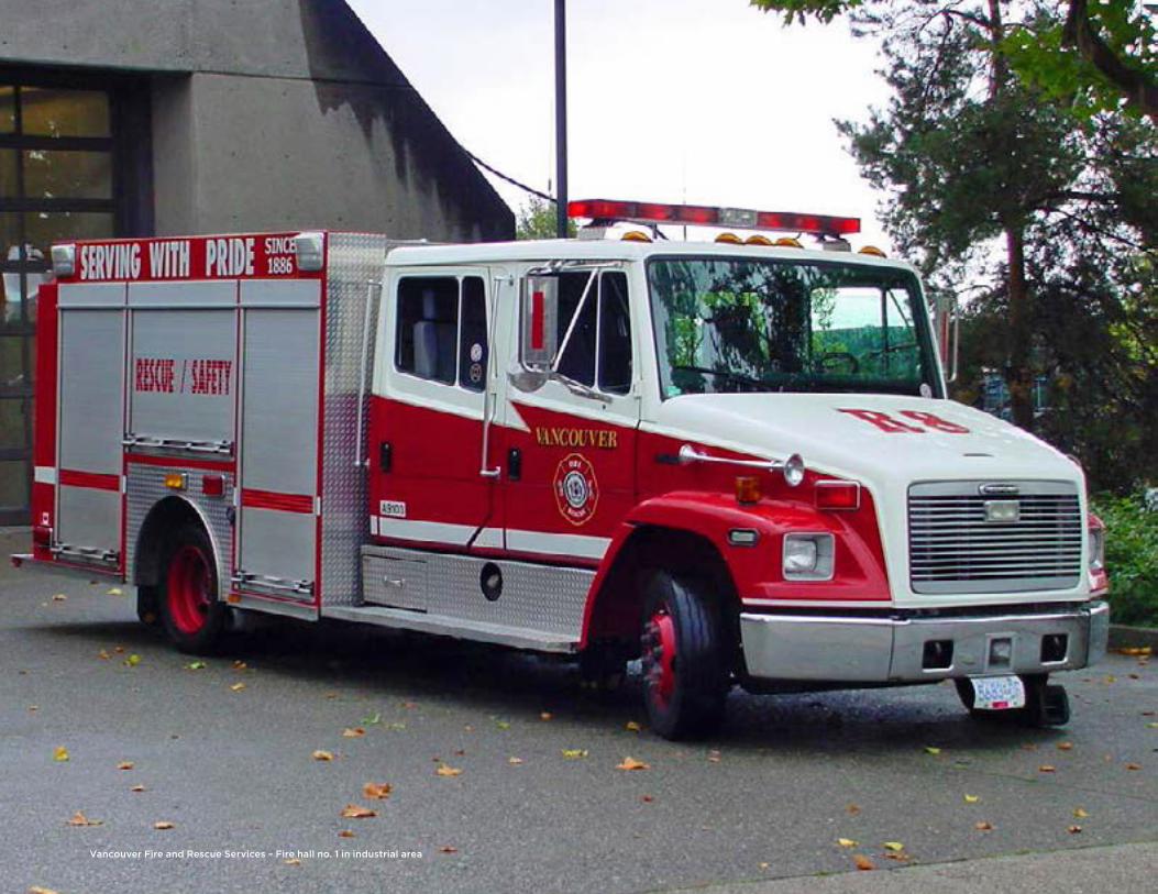
Vancouver Fire and Rescue Services – Fire hall no. 1 in industrial area
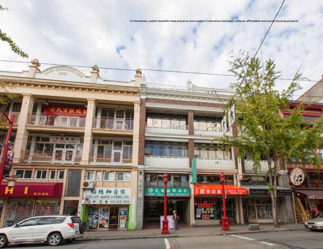
In Chinatown, public benefits help preserve and support innovative heritage, cultural, affordable and social housing projects
17PUBLIC BENEFITS
IntroductionA Public Benefits Strategy (PBS) provides strategic direction for future capital investments in a community over the long term (30 years). It covers six areas that support livable, healthy and sustainable communities: community facilities, parks and open spaces, heritage, affordable housing, public safety, transportation, and utilities. Each PBS takes into account the existing network of amenities and infrastructure within the community, as well as district-serving and city-serving amenities located beyond the community’s boundary.
There are four key steps in preparing a PBS:
1. Assessing local needs within a city-wide context
2. Developing an amenity and infrastructure strategy (including outcomes and/or targets) for addressing the identified needs
3. Providing a rough order-of-magnitude cost to fulfill the strategy
4. Outlining a financial strategy to support the outcome-based strategy.
The needs assessment considers the following:
• Current gaps, deficiencies or shortfalls in service and program delivery, if any; and
• New demands anticipated from population and job growth over the next 30 years.
The amenity and infrastructure strategy considers the following:
• Existing amenities and infrastructure to be renewed over the next 30 years; and
• An optimal network of amenities and infrastructure that supports service and program delivery at city-wide, district and local levels.
The outcome-based strategy for the local community is developed within an overall city-wide framework that includes the following guiding principles:
• Provide core services across communities; determine best model for delivering each service.
• Partner strategically across all sectors (government, non-profit and private).
• Adapt to demographic changes and service needs; build flexible, adaptable and scale-able amenities.
• Prioritize renewal of existing amenities and infrastructure to support services delivery.
• Prioritize multi-use facilities.
• Phase large-scale projects; enhance cross-project coordination to optimize efficiency.
• Ensure long-term operational/financial sustainability.
16317.0 PuBlIC BeneFItsDOWNTOWN EASTSIDE PLAN
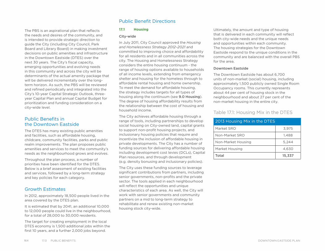
164 17.0 PuBlIC BeneFIts DOWNTOWN EASTSIDE PLAN
The PBS is an aspirational plan that reflects the needs and desires of the community, and is intended to provide strategic direction to guide the City (including City Council, Park Board and Library Board) in making investment decisions on public amenities and infrastructure in the Downtown Eastside (DTES) over the next 30 years. The City’s fiscal capacity, emerging opportunities and evolving needs in this community and across the city will be determinants of the actual amenity package that will be delivered incrementally over the long-term horizon. As such, the PBS will be reviewed and refined periodically and integrated into the City’s 10-year Capital Strategic Outlook, three-year Capital Plan and annual Capital Budget for prioritization and funding consideration on a city-wide level.
Public Benefits in the Downtown EastsideThe DTES has many existing public amenities and facilities, such as affordable housing, childcare, community facilities, parks and public realm improvements. The plan proposes public amenities and services to meet the community’s needs as the neighbourhood grows and evolves.
Throughout the plan process, a number of priorities have been identified for the DTES. Below is a brief assessment of existing facilities and services, followed by a long-term strategy and key policies for each category.
Growth EstimatesIn 2012, approximately 18,500 people lived in the area covered by the DTES plan.
It is estimated that by 2041, an additional 10,000 to 12,000 people could live in the neighbourhood, for a total of 28,000 to 30,000 residents.
The target for creating employment in the local DTES economy is 1,500 additional jobs within the first 10 years, and a further 2,000 jobs beyond.
Public Benefit Directions
17.1 Housing
City-wide
In July 2011, City Council approved the Housing and Homelessness Strategy 2012–2021 and committed to improving choice and affordability for all residents and in all communities across the city. The Housing and Homelessness Strategy considers the entire housing continuum - the range of housing options available to households of all income levels, extending from emergency shelter and housing for the homeless through to affordable rental housing and home ownership. To meet the demand for affordable housing, the strategy includes targets for all types of housing along the continuum (see 9.0 Housing).The degree of housing affordability results from the relationship between the cost of housing and household income.
The City achieves affordable housing through a range of tools, including partnerships to develop social housing on City-owned land, capital grants to support non-profit housing projects, and inclusionary housing policies that require and incentivize the inclusion of affordable housing in private developments. The City has a number of funding sources for delivering affordable housing including development cost levies (DCLs), Capital Plan resources, and through development (e.g. density bonusing and inclusionary policies).
The City uses these funding sources to leverage significant contributions from partners, including senior governments, non-profits and the private sector. The tools applied in each neighbourhood will reflect the opportunities and unique characteristics of each area. As well, the City will work with senior governments and community partners on a mid to long-term strategy to rehabilitate and renew existing non-market housing stock city-wide.
Ultimately, the amount and type of housing that is delivered in each community will reflect both city-wide needs and the unique needs and opportunities within each community. The housing strategies for the Downtown Eastside respond to the unique conditions in the community and are balanced with the overall PBS for the area.
Downtown Eastside
The Downtown Eastside has about 6,700 units of non-market (social) housing, including approximately 1,500 publicly owned Single Room Occupancy rooms. This currently represents about 44 per cent of housing stock in the neighbourhood and about 27 per cent of the non-market housing in the entire city.
2013 Housing Mix in the DTES
Market SRO 3,975
Non-Market SRO 1,488
Non-Market Housing 5,244
Market Housing 4,630
Total 15,337
Table 17.1: Housing Mix in the DTES
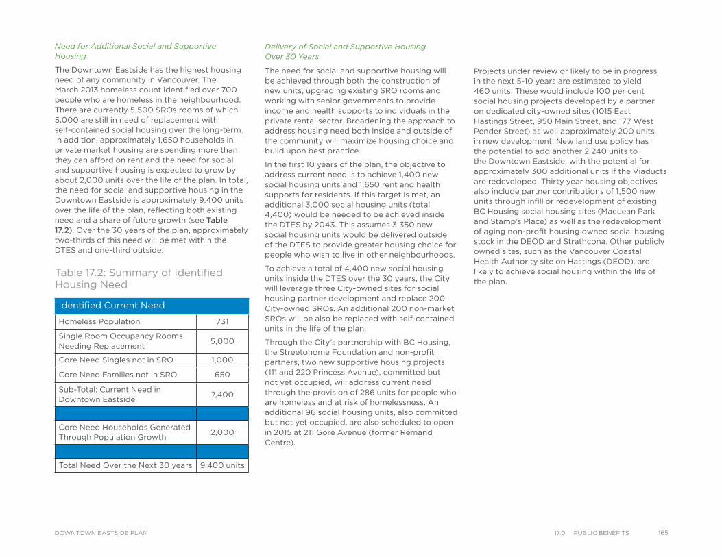
Need for Additional Social and Supportive Housing
The Downtown Eastside has the highest housing need of any community in Vancouver. The March 2013 homeless count identified over 700 people who are homeless in the neighbourhood. There are currently 5,500 SROs rooms of which 5,000 are still in need of replacement with self-contained social housing over the long-term. In addition, approximately 1,650 households in private market housing are spending more than they can afford on rent and the need for social and supportive housing is expected to grow by about 2,000 units over the life of the plan. In total, the need for social and supportive housing in the Downtown Eastside is approximately 9,400 units over the life of the plan, reflecting both existing need and a share of future growth (see Table 17.2). Over the 30 years of the plan, approximately two-thirds of this need will be met within the DTES and one-third outside.
Identified Current Need
Homeless Population 731
Single Room Occupancy Rooms Needing Replacement
5,000
Core Need Singles not in SRO 1,000
Core Need Families not in SRO 650
Sub-Total: Current Need in Downtown Eastside
7,400
Core Need Households Generated Through Population Growth
2,000
Total Need Over the Next 30 years 9,400 units
Table 17.2: Summary of Identified Housing Need
Delivery of Social and Supportive Housing Over 30 Years
The need for social and supportive housing will be achieved through both the construction of new units, upgrading existing SRO rooms and working with senior governments to provide income and health supports to individuals in the private rental sector. Broadening the approach to address housing need both inside and outside of the community will maximize housing choice and build upon best practice.
In the first 10 years of the plan, the objective to address current need is to achieve 1,400 new social housing units and 1,650 rent and health supports for residents. If this target is met, an additional 3,000 social housing units (total 4,400) would be needed to be achieved inside the DTES by 2043. This assumes 3,350 new social housing units would be delivered outside of the DTES to provide greater housing choice for people who wish to live in other neighbourhoods.
To achieve a total of 4,400 new social housing units inside the DTES over the 30 years, the City will leverage three City-owned sites for social housing partner development and replace 200 City-owned SROs. An additional 200 non-market SROs will be also be replaced with self-contained units in the life of the plan.
Through the City’s partnership with BC Housing, the Streetohome Foundation and non-profit partners, two new supportive housing projects (111 and 220 Princess Avenue), committed but not yet occupied, will address current need through the provision of 286 units for people who are homeless and at risk of homelessness. An additional 96 social housing units, also committed but not yet occupied, are also scheduled to open in 2015 at 211 Gore Avenue (former Remand Centre).
Projects under review or likely to be in progress in the next 5-10 years are estimated to yield 460 units. These would include 100 per cent social housing projects developed by a partner on dedicated city-owned sites (1015 East Hastings Street, 950 Main Street, and 177 West Pender Street) as well approximately 200 units in new development. New land use policy has the potential to add another 2,240 units to the Downtown Eastside, with the potential for approximately 300 additional units if the Viaducts are redeveloped. Thirty year housing objectives also include partner contributions of 1,500 new units through infill or redevelopment of existing BC Housing social housing sites (MacLean Park and Stamp’s Place) as well as the redevelopment of aging non-profit housing owned social housing stock in the DEOD and Strathcona. Other publicly owned sites, such as the Vancouver Coastal Health Authority site on Hastings (DEOD), are likely to achieve social housing within the life of the plan.
16517.0 PuBlIC BeneFItsDOWNTOWN EASTSIDE PLAN
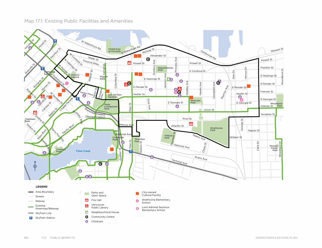
166 17.0 PuBlIC BeneFIts DOWNTOWN EASTSIDE PLAN
MacLeanPark
OppenheimerPark
CRAB Parkat Portside
VictorySquare
Cathedral Square
Strathcona Park
MosaicCreek
Park
Grandview Park
SalsburyPark
WoodlandPark
TrilliumPark
ThorntonPark
CreeksidePark
CoopersPark
Andy LivingstonePark
YaletownPark
Sun Yat-SenGardens
PigeonPark
Powell St
Water StTrounce Alley
Keefer Place
Alexander St
E Cordova St
Centennial Rd
Powell St
E Waterfront Rd
Railway St
W Waterfront Rd
William St William St
Powell St
Stewart St
Napier St
Venables St
Adanac St
Union St
Qu
eb
ec S
t
Keefer St
E Georgia St
Ge
org
e S
t
Cla
rk D
r
E Georgia St
Atlantic St
National Ave
Malkin Ave
Terminal Ave
Evans Ave
Milross Ave
National Ave
Nelson St
Prior St
E Pender St
Franklin St
E Hastings St
Pandora St
Triumph St
E Pender St
Frances St
E Georgia St
E Hastings St
E Pender St
W Cordova St
W Hastings St
Dunsmuir St
Robson St
W G
eorgia St
Smithe St
W Pender St
Cam
bie S
t
Sh
an
gh
ai
Alle
y
Beatt
y St Cita
del P
arad
e
Ham
ilton
St
Mai
nlan
d St
Hom
er S
t
Richa
rds St
Hor
nby
St
How
e St
Seym
our S
t
Gra
nville
St
Keefer St
Go
re A
ve
Jackso
n A
veD
un
lev
y A
ve
Main
St
Sta
tio
n S
t
Main
St
Co
lum
bia
St
Pacific
Blvd
Terry Fox Way
Carr
all
St
Ab
bo
tt S
tTaylo
r S
t
Pri
ncess
Ave
Cam
pb
ell
Ave
Ray
mur
Ave
Ve
rno
n D
r
Wo
od
lan
d D
rW
oo
dla
nd
Dr
Co
mm
erc
ial D
r
Sals
bu
ry D
r
Gle
n D
r
Heatl
ey A
ve
Haw
ks
Ave
Th
orn
ton S
t
Ch
ess
St
Dunsmuir Viaduct
Expo
Blv
d
Georgia Viaduct
Griffiths Way
Cambie B
ridg
e
Area Boundary
Streets
Railway
Existing Greenway/Bikeway
SkyTrain Line
SkyTrain Station
Parks andOpen Space
Fire Hall
VancouverPublic Library
Neighbourhood House
Community Centre
Childcare
City-ownedCultural Facility
Strathcona Elementary School
Lord Admiral Seymour Elementary School
LEGEND
Map 17.1: Existing Public Facilities and Amenities
MacLeanPark
OppenheimerPark
CRAB Parkat Portside
VictorySquare
Cathedral Square
Strathcona Park
MosaicCreek
Park
Grandview Park
SalsburyPark
WoodlandPark
TrilliumPark
ThorntonPark
CreeksidePark
CoopersPark
Andy LivingstonePark
YaletownPark
Sun Yat-SenGardens
PigeonPark
Powell St
Water StTrounce Alley
Keefer Place
Alexander St
E Cordova St
Centennial Rd
Powell St
E Waterfront Rd
Railway St
W Waterfront Rd
William St William St
Powell St
Stewart St
Napier St
Venables St
Adanac St
Union St
Qu
eb
ec S
t
Keefer St
E Georgia St
Ge
org
e S
t
Cla
rk D
r
E Georgia St
Atlantic St
National Ave
Malkin Ave
Terminal Ave
Evans Ave
Milross Ave
National Ave
Nelson St
Prior St
E Pender St
Franklin St
E Hastings St
Pandora St
Triumph St
E Pender St
Frances St
E Georgia St
E Hastings St
E Pender St
W Cordova St
W Hastings St
Dunsmuir St
Robson St
W G
eorgia St
Smithe St
W Pender St
Cam
bie S
t
Sh
an
gh
ai
Alle
y
Beatt
y St Cita
del P
arad
e
Ham
ilton
St
Mai
nlan
d St
Hom
er S
t
Richa
rds St
Hor
nby
St
How
e St
Seym
our S
t
Gra
nville
St
Keefer St
Go
re A
ve
Jackso
n A
veD
un
lev
y A
ve
Main
St
Sta
tio
n S
t
Main
St
Co
lum
bia
St
Pacific
Blvd
Terry Fox Way
Carr
all
St
Ab
bo
tt S
tTaylo
r S
t
Pri
ncess
Ave
Cam
pb
ell
Ave
Ray
mur
Ave
Ve
rno
n D
r
Wo
od
lan
d D
rW
oo
dla
nd
Dr
Co
mm
erc
ial D
r
Sals
bu
ry D
r
Gle
n D
r
Heatl
ey A
ve
Haw
ks
Ave
Th
orn
ton S
t
Ch
ess
St
Dunsmuir Viaduct
Expo
Blv
d
Georgia Viaduct
Griffiths Way
Cambie B
ridg
e
Area Boundary
Streets
Railway
Existing Greenway/Bikeway
SkyTrain Line
SkyTrain Station
Parks andOpen Space
Fire Hall
VancouverPublic Library
Neighbourhood House
Community Centre
Childcare
City-ownedCultural Facility
Strathcona Elementary School
Lord Admiral Seymour Elementary School
LEGEND
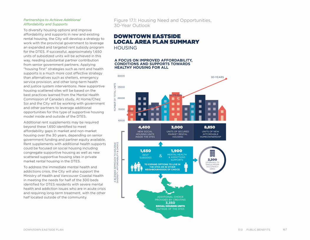
Partnerships to Achieve Additional Affordability and Supports
To diversify housing options and improve affordability and supports in new and existing rental housing, the City will develop a strategy to work with the provincial government to leverage an expanded and targeted rent subsidy program for the DTES. If successful, approximately 1,650 units of subsidized units will be achieved in this way, needing substantial partner contribution from senior government partners. Applying "housing first" strategies such as rent and health supports is a much more cost effective strategy than alternatives such as shelters, emergency service provision, and other long-term health and justice system interventions. New supportive housing scattered sites will be based on the best practices learned from the Mental Health Commission of Canada’s study, At Home/Chez Soi and the City will be working with government and other partners to leverage additional opportunities for this type of supportive housing model inside and outside of the DTES.
Additional rent supplements may be required beyond these 1,650 identified to meet affordability gaps in market and non-market housing over the 30 years, depending on senior government funding and partner equity available. Rent supplements with additional health supports could be focused on social housing including congregate supportive housing as well as new scattered supportive housing sites in private market rental housing in the DTES.
To address the immediate mental health and addictions crisis, the City will also support the Ministry of Health and Vancouver Coastal Health in meeting the needs for half of the 300 beds identified for DTES residents with severe mental health and addiction issues who are in acute crisis and requiring long-term treatment, with the other half located outside of the community.
Figure 17.1: Housing Need and Opportunities, 30-Year Outlook
DOWNTOWN EASTSIDELOCAL AREA PLAN SUMMARYHOUSING
ADDITIONAL CHOICEPROVIDED BY CREATING
3,350SOCIAL HOUSING UNITSOUTSIDE OF THE DTES
4,400 3,000 8,850NEW SOCIAL
HOUSING UNITSINSIDE THE DTES
UNITS OF SECUREDMARKET RENTAL
HOUSING
UNITS OF NEWAFFORDABLE
HOMEOWNERSHIP
2013
10-YEARS
30-YEARS
15000
20000
10000
25000
30000
2003
A FOCUS ON IMPROVED AFFORDABILITY, CONDITIONS AND SUPPORTS TOWARDS HEALTHY HOUSING FOR ALL
A B
LE
ND
ED
AP
PR
OA
CH
TO
HO
US
ING
DIV
ER
SIT
Y, A
FF
OR
DA
BIL
ITY
& C
HO
ICE
2,200 UPGRADES TO SINGLE-ROOMOCCUPANCY
(SRO)
NU
MB
ER
OF
TO
TA
L U
NIT
S
RENT SUBSIDIES
& MENTAL HEALTH& ADDICTIONS
SUPPORTS
TO EXPAND OPTIONS TO LIVE IN THE DTES OR IN OTHER
NEIGHBOURHOODS OF CHOICE
PLANNING & DEVELOPMENT SERVICES DEPARTMENT I CITY OF VANCOVUER 16717.0 PuBlIC BeneFItsDOWNTOWN EASTSIDE PLAN
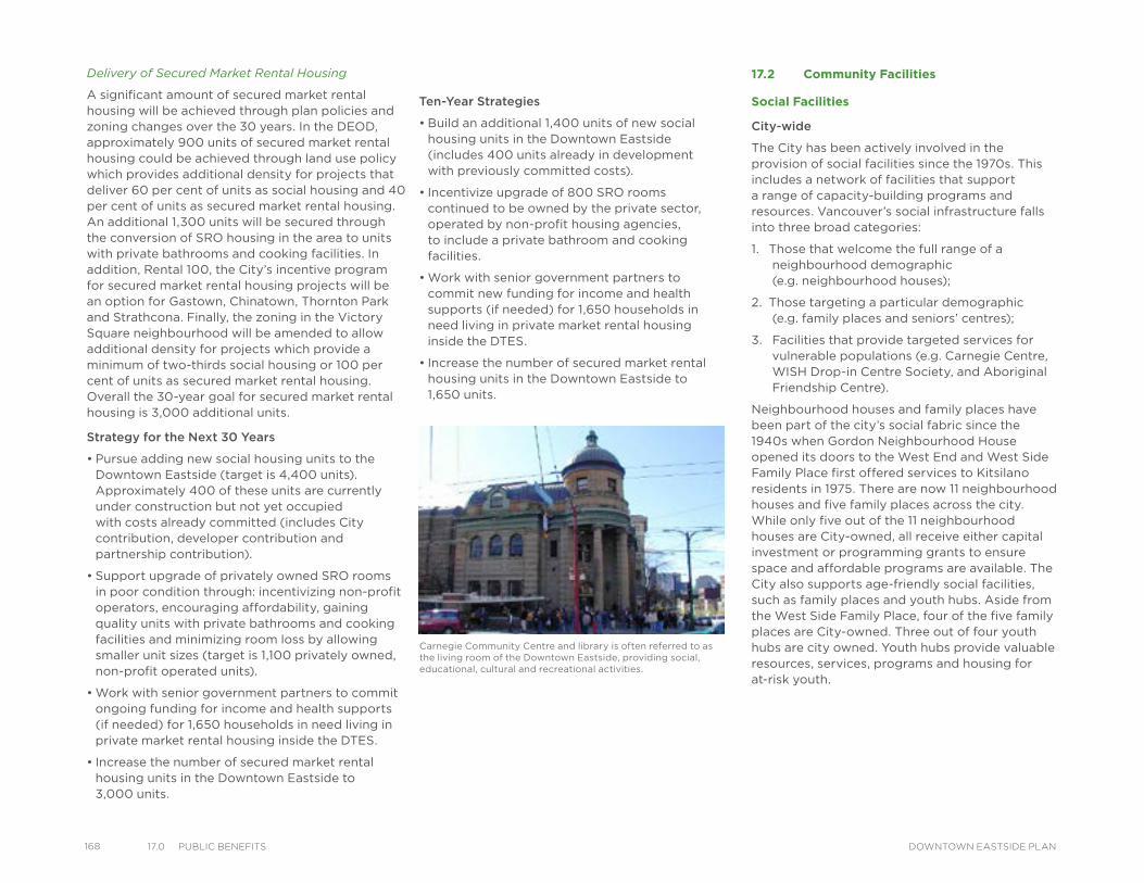
168 17.0 PuBlIC BeneFIts DOWNTOWN EASTSIDE PLAN
17.2 Community Facilities
Social Facilities
City-wide
The City has been actively involved in the provision of social facilities since the 1970s. This includes a network of facilities that support a range of capacity-building programs and resources. Vancouver’s social infrastructure falls into three broad categories:
1. Those that welcome the full range of a neighbourhood demographic (e.g. neighbourhood houses);
2. Those targeting a particular demographic (e.g. family places and seniors’ centres);
3. Facilities that provide targeted services for vulnerable populations (e.g. Carnegie Centre, WISH Drop-in Centre Society, and Aboriginal Friendship Centre).
Neighbourhood houses and family places have been part of the city’s social fabric since the 1940s when Gordon Neighbourhood House opened its doors to the West End and West Side Family Place first offered services to Kitsilano residents in 1975. There are now 11 neighbourhood houses and five family places across the city. While only five out of the 11 neighbourhood houses are City-owned, all receive either capital investment or programming grants to ensure space and affordable programs are available. The City also supports age-friendly social facilities, such as family places and youth hubs. Aside from the West Side Family Place, four of the five family places are City-owned. Three out of four youth hubs are city owned. Youth hubs provide valuable resources, services, programs and housing for at-risk youth.
Carnegie Community Centre and library is often referred to as the living room of the Downtown Eastside, providing social, educational, cultural and recreational activities.
Delivery of Secured Market Rental Housing
A significant amount of secured market rental housing will be achieved through plan policies and zoning changes over the 30 years. In the DEOD, approximately 900 units of secured market rental housing could be achieved through land use policy which provides additional density for projects that deliver 60 per cent of units as social housing and 40 per cent of units as secured market rental housing. An additional 1,300 units will be secured through the conversion of SRO housing in the area to units with private bathrooms and cooking facilities. In addition, Rental 100, the City’s incentive program for secured market rental housing projects will be an option for Gastown, Chinatown, Thornton Park and Strathcona. Finally, the zoning in the Victory Square neighbourhood will be amended to allow additional density for projects which provide a minimum of two-thirds social housing or 100 per cent of units as secured market rental housing. Overall the 30-year goal for secured market rental housing is 3,000 additional units.
Strategy for the Next 30 Years
• Pursue adding new social housing units to the Downtown Eastside (target is 4,400 units). Approximately 400 of these units are currently under construction but not yet occupied with costs already committed (includes City contribution, developer contribution and partnership contribution).
• Support upgrade of privately owned SRO rooms in poor condition through: incentivizing non-profit operators, encouraging affordability, gaining quality units with private bathrooms and cooking facilities and minimizing room loss by allowing smaller unit sizes (target is 1,100 privately owned, non-profit operated units).
• Work with senior government partners to commit ongoing funding for income and health supports (if needed) for 1,650 households in need living in private market rental housing inside the DTES.
• Increase the number of secured market rental housing units in the Downtown Eastside to 3,000 units.
Ten-Year Strategies
• Build an additional 1,400 units of new social housing units in the Downtown Eastside (includes 400 units already in development with previously committed costs).
• Incentivize upgrade of 800 SRO rooms continued to be owned by the private sector, operated by non-profit housing agencies, to include a private bathroom and cooking facilities.
• Work with senior government partners to commit new funding for income and health supports (if needed) for 1,650 households in need living in private market rental housing inside the DTES.
• Increase the number of secured market rental housing units in the Downtown Eastside to 1,650 units.
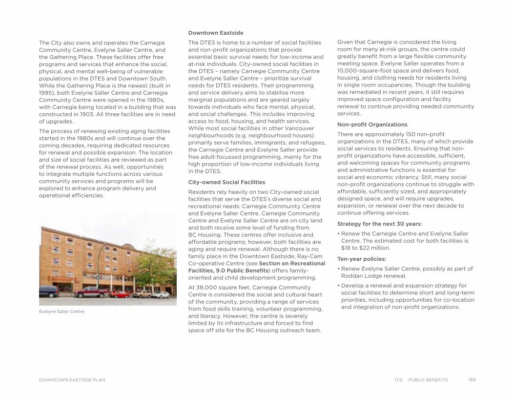
The City also owns and operates the Carnegie Community Centre, Evelyne Saller Centre, and the Gathering Place. These facilities offer free programs and services that enhance the social, physical, and mental well-being of vulnerable populations in the DTES and Downtown South. While the Gathering Place is the newest (built in 1995), both Evelyne Saller Centre and Carnegie Community Centre were opened in the 1980s, with Carnegie being located in a building that was constructed in 1903. All three facilities are in need of upgrades.
The process of renewing existing aging facilities started in the 1980s and will continue over the coming decades, requiring dedicated resources for renewal and possible expansion. The location and size of social facilities are reviewed as part of the renewal process. As well, opportunities to integrate multiple functions across various community services and programs will be explored to enhance program delivery and operational efficiencies.
Downtown Eastside
The DTES is home to a number of social facilities and non-profit organizations that provide essential basic survival needs for low-income and at-risk individuals. City-owned social facilities in the DTES – namely Carnegie Community Centre and Evelyne Saller Centre – prioritize survival needs for DTES residents. Their programming and service delivery aims to stabilise more marginal populations and are geared largely towards individuals who face mental, physical, and social challenges. This includes improving access to food, housing, and health services. While most social facilities in other Vancouver neighbourhoods (e.g. neighbourhood houses) primarily serve families, immigrants, and refugees, the Carnegie Centre and Evelyne Saller provide free adult-focussed programming, mainly for the high proportion of low-income individuals living in the DTES.
City-owned Social Facilities
Residents rely heavily on two City-owned social facilities that serve the DTES’s diverse social and recreational needs: Carnegie Community Centre and Evelyne Saller Centre. Carnegie Community Centre and Evelyne Saller Centre are on city land and both receive some level of funding from BC Housing. These centres offer inclusive and affordable programs; however, both facilities are aging and require renewal. Although there is no family place in the Downtown Eastside, Ray-Cam Co-operative Centre (see Section on Recreational Facilities, 9.0 Public Benefits) offers family-oriented and child development programming.
At 38,000 square feet, Carnegie Community Centre is considered the social and cultural heart of the community, providing a range of services from food skills training, volunteer programming, and literacy. However, the centre is severely limited by its infrastructure and forced to find space off site for the BC Housing outreach team.
Given that Carnegie is considered the living room for many at-risk groups, the centre could greatly benefit from a large flexible community meeting space. Evelyne Saller operates from a 10,000-square-foot space and delivers food, housing, and clothing needs for residents living in single room occupancies. Though the building was remediated in recent years, it still requires improved space configuration and facility renewal to continue providing needed community services.
Non-profit Organizations
There are approximately 150 non-profit organizations in the DTES, many of which provide social services to residents. Ensuring that non-profit organizations have accessible, sufficient, and welcoming spaces for community programs and administrative functions is essential for social and economic vibrancy. Still, many social non-profit organizations continue to struggle with affordable, sufficiently sized, and appropriately designed space, and will require upgrades, expansion, or renewal over the next decade to continue offering services.
Strategy for the next 30 years:
• Renew the Carnegie Centre and Evelyne Saller Centre. The estimated cost for both facilities is $18 to $22 million.
Ten-year policies:
• Renew Evelyne Saller Centre, possibly as part of Roddan Lodge renewal.
• Develop a renewal and expansion strategy for social facilities to determine short and long-term priorities, including opportunities for co-location and integration of non-profit organizations.
Evelyne Saller Centre
16917.0 PuBlIC BeneFItsDOWNTOWN EASTSIDE PLAN
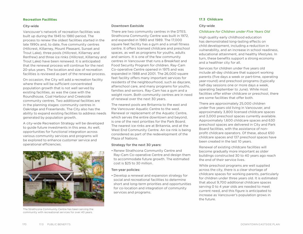
170 17.0 PuBlIC BeneFIts DOWNTOWN EASTSIDE PLAN
Recreation Facilities
City-wide
Vancouver’s network of recreation facilities was built up during the 1945 to 1980 period. The process to renew the oldest facilities started in the late 1990s and, to date, five community centres (Hillcrest, Killarney, Mount Pleasant, Sunset and Trout Lake), three pools (Hillcrest, Killarney and Renfrew) and three ice rinks (Hillcrest, Killarney and Trout Lake) have been renewed. It is anticipated that the renewal process will continue for the next 20-plus years. The location and size of recreation facilities is reviewed as part of the renewal process.
On occasion, the City will add a recreation facility where there will be sufficient concentrated population growth that is not well served by existing facilities, as was the case with the Roundhouse, Coal Harbour and Creekside community centres. Two additional facilities are in the planning stages: community centres in Oakridge and Fraserlands. The City also has the ability to expand existing facilities to address needs generated by population growth.
A city-wide Recreation Strategy will be developed to guide future investments in this area. As well, opportunities for functional integration across various community services and programs will be explored to enhance customer service and operational efficiencies.
Downtown Eastside
There are two community centres in the DTES. Strathcona Community Centre was built in 1972, and expanded in 1980 and 1989. The 17,000 square feet facility has a gym and a small fitness centre. It offers licensed childcare and preschool spaces, as well as programs for youths, adults and seniors. It is one of the few community centres in Vancouver that runs a Breakfast and Food Security Program for children. Ray-Cam Co-operative Centre opened in 1975 and was expanded in 1988 and 2001. The 26,000 square feet facility offers many important services for residents of the neighbourhood, such as daycare, afterschool care, and many programs for youths, families and seniors. Ray-Cam has a gym and a weight room. Both community centres are in need of renewal over the next 30 years.
The nearest pools are Britannia to the east and the Vancouver Aquatic Centre to the west. Renewal or replacement of the Aquatic Centre, which serves the entire downtown and beyond, is one of the next priorities for the Park Board. The nearest ice rinks are at Britannia, and at the West End Community Centre. An ice rink is being considered as part of the redevelopment of the Plaza of Nations.
Strategy for the next 30 years:
• Renew Strathcona Community Centre and Ray-Cam Co-operative Centre and design them to accommodate future growth. The estimated cost is $25 to 30 million.
Ten-year policies:
• Develop a renewal and expansion strategy for social and recreational facilities to determine short and long-term priorities and opportunities for co-location and integration of community services and programs.
17.3 Childcare
City-wide
Childcare for Children under Five Years Old
High quality early childhood education has demonstrated long-lasting effects on child development, including a reduction in vulnerability, and an increase in school readiness, educational attainment, and healthy lifestyles. In turn, these benefits support a strong economy and a healthier city for all.
Services for children under five years old include all-day childcare that support working parents (five days a week or part-time, operating year-round) and preschool programs (typically half-day sessions one or more days a week, operating September to June). While most facilities offer either childcare or preschool, there are some facilities that offer both.
There are approximately 25,000 children under five years old living in Vancouver, and approximately 3,800 licensed childcare spaces and 3,000 preschool spaces currently available. Approximately 1,600 childcare spaces and 630 preschool spaces are delivered in City and Park Board facilities, with the assistance of non-profit childcare operators. Of these, about 650 childcare spaces and 137 preschool spaces have been created in the last 10 years.
Renewal of existing childcare facilities will become gradually more important as older buildings constructed 30 to 40 years ago reach the end of their service lives.
While preschool programs are well supplied across the city, there is a clear shortage of childcare spaces for working parents, particularly for children under three years old. It is estimated that about 9,700 additional childcare spaces serving 0 to 4 year olds are needed to meet current need, and this figure is anticipated to increase as Vancouver’s population grows in the future.
The Strathcona Community Centre has been serving the community with recreational services for over 40 years.
The targeted 148 spaces for the 0 to four age group may be provided in a number of ways – as part of one or more major developments or through expansion of existing facilities. Cost-effective options will be pursued as much as possible, including co-locating childcare with other family services. Depending on development and expansion opportunities, type of construction, and on the availability of public land, providing these spaces is estimated to cost within the range of $13 to 17 million (including investments from all partners).
Providing the targeted 144 spaces for the five to 12 age group is estimated to cost within the range of $1 million (including investments from all partners), depending on availability of space within school buildings or land on school sites, and on the availability of other opportunities near schools.
The City, Park Board and School Board are committed to increasing the number of childcare spaces and have forged a strong partnership with non-profit childcare operators. The City continues to advocate for the participation of the federal and/or provincial governments in the delivery of childcare services.
Childcare for School-age Children
Childcare services for school-age children (five to 12 years old) include out-of-school programs for before and after school (five days a week, operating September to June). Ideally, the programs are located at elementary schools. Some programs are offered off-site because of the physical limitations at the schools. There are instances where a childcare facility offers programs for both school-age children and children under five years old.
There are approximately 37,000 children between the ages of five and 12 years old living in Vancouver, and approximately 3,900 licensed out-of-school care spaces currently available. Approximately 2,500 spaces are currently delivered on-site at Vancouver School Board elementary schools and 460 spaces at City and Park Board facilities, with the assistance of non-profit childcare operators. Of these, about 76 spaces have been created in the last 10 years.
Because most programs are offered at elementary schools, renewal and expansion of existing childcare facilities can be achieved when the school is renewed. There is a clear shortage of out-of-school care spaces. It is estimated that about 10,000 additional spaces serving ages five to 12 are needed to meet current need, and this figure is anticipated to increase as Vancouver’s population grows in the future. The City, Park Board and School Board are committed to increasing the number of childcare spaces for school-aged children and have forged a strong partnership with non-profit childcare operators. The City continues to advocate for the participation of the federal and/or provincial governments in the delivery of childcare services.
Downtown Eastside
The majority of the DTES plan area is located in the Strathcona local area. The Strathcona local area has the highest percentage of children who are not ready for school when they enter kindergarten (UBC HELP, 2013), and the highest percentage of children under six living in low-income households (2006 Census). In the DTES, the highest unmet childcare need is for infant/toddler spaces (age 0 to two) and school age care (ages five to 12). Due to the large number of low-income families and a high proportion of Aboriginal groups in the DTES, there is a pressing need for affordability supports and Aboriginal-focused childcare.
In the DTES, there are presently 196 licensed full-time childcare spaces serving ages 0 to four and 140 licensed childcare spaces serving ages five to 12. There are also 86 licensed spaces for part-time preschool programs serving ages three to four.
Recognizing that childcare is primarily the responsibility of senior governments, but also recognizing the commitment of City Council to contribute to closing the shortfall, staff have proposed a city-wide target of 10,000 new city-facilitated childcare spaces by 2041 . Based on evaluation of childcare need in the DTES, the area’s proportion of total city-wide spaces, and neighbourhood-level child vulnerability scores, approximately 292 of these target spaces should be created in the DTES, split between the age groups as noted in Table 17.3.
Table 17.4: DTES Childcare: Current Supply, Need and Projected Need (2041)
AgeCurrent Supply
Current Spaces Needed
2013 Shortfall
Additional Need to 2041
Shortfall to 2041
Ages 0 to 4 196 277 81 238 319
Ages 5 to 12 140 242 102 206 308
Total (ages 0 to 12) 336 519 183 444 627
Table 17.3: Childcare Space Targets to 2041 by Age Group for the Downtown Eastside
Age Spaces
Ages 0 to 4 148
Ages 5 to 12 144
Total 292
17117.0 PuBlIC BeneFItsDOWNTOWN EASTSIDE PLAN
172 17.0 PuBlIC BeneFIts DOWNTOWN EASTSIDE PLAN
Strategy for the next 30 years:
• Seek opportunities to provide additional childcare for children 0 to 4 years of age (target is 148 spaces) with emphasis on infants/toddlers and Aboriginal-focused care as population grows. The estimated cost is $13 to 17 million (includes City contribution, development industry contribution and partnership contribution).
• Work with the Vancouver Board of Education and other partners to seek new opportunities to provide school age care spaces on or near school grounds (target is 144 spaces). The estimated cost is $1 million (includes City contribution, development industry contribution and partnership contribution).
• Promote affordability of childcare in the Downtown Eastside through partnership with senior levels of government, and through prioritizing programs serving the most vulnerable populations where possible within the City’s social grants allocations supporting childcare affordability
Ten-year policies:
• Review opportunities at publicly-owned sites (including land/buildings owned by the City, Park Board, schools) and as part of new developments
• Develop an implementation strategy, and work with non-profit and senior government partners and the development industry to facilitate additional childcare spaces in the Downtown Eastside to meet need.
• Optimize and target grant-based supports to affordability and quality of non-profit childcare programs serving vulnerable populations.
17.4 Cultural Facilities
City-wide
Arts and cultural spaces are vital to every community. They serve residents, attract tourists, enable business development and enhance the quality of life. Artists, cultural workers and creative commercial businesses contribute to our local economy. Spaces in which creative work is undertaken also enable connections and opportunities for people to learn, share, and participate in their community and city.
Vancouver’s Culture Plan and Strategic Directions (2008/2013) aim to enhance, promote and support the culture and creative diversity of the city to the benefit of its citizens, creative community and visitors. The Cultural Facilities Priorities Plan (also 2008) provides a detailed strategy specific to cultural spaces/facilities that focuses on the sustainable creation and operation of cultural spaces. The City provides support for cultural facilities through the provision of space, technical advice and regulatory assistance, and through the capital plan via the Cultural Infrastructure Grant Program, development-related investment (community amenity contributions, or CACs) and occasional land contributions.
Cultural spaces tend to be unique, singular spaces (no two are alike) that result from a synchronicity of opportunity—that of a clearly identified need, a development opportunity, and an organization capable of addressing the need. The City uses blended staff/community peer review panels to assess priorities and proposals to ensure that investment in cultural spaces addresses critical priorities for arts and culture. The Cultural Facilities Plan is moving towards a stronger partnership model for advancing Vancouver’s cultural facility ecology. Long-term
goals include: empowering the private sector and arts and cultural community in the development and operation of cultural spaces; using City investment to leverage additional resources for the purpose of developing and operating cultural facilities; securing key cultural assets in the public domain through ownership by non-profits, foundations and other agencies; and optimizing and stabilizing existing civic assets for operational and financial sustainability.
There are approximately 50-plus City-owned or controlled spaces, and 500 non-City-owned cultural spaces across Vancouver. Renewal of key cultural spaces will be an important priority in the implementation of all community plans. In addition there is an interest in the strategic co-location of cultural organizations where appropriate. Finally, there is an interest in maximizing the effectiveness of existing facilities through investment in the physical structure and in the security of the asset where it may be in a vulnerable ownership or lease situation. Growth in absolute numbers of cultural facilities is less important than strategic and effective investment in existing spaces that improves their long term affordability, suitability and viability as cultural spaces.
Downtown Eastside
The DTES is one of several creative hubs in Vancouver with one of the city’s highest concentrations of artists and cultural workers. It is a significant area for studios, galleries, rehearsal and performance spaces and administrative headquarters for non-profit cultural organizations.
Strategy for the next 30 years:
• As the community grows and changes, the Public Benefits Strategy must consider and respond to new and evolving needs of the neighbourhood including the arts and cultural community. Inclusive of the 10-year targets below, additional neighbourhood consultation and research into demand, supply and gaps in cultural infrastructure will position the community to best respond to new opportunities. Priorities for new or re-investment must address need (through an understanding of demand, supply and gaps) and the ability to provide affordable, viable, suitable space that is secured for the long-term.
• Pending future development opportunities, allocate funds to address key gaps in arts and culture spaces.
Ten-year policies:
Priorities for investment per the following will be determined through consideration of the planning principles and policies (Section 14.0) of this plan and the need for, and ability to provide, affordable, viable, suitable space that is secured for the long-term and that best matches the opportunities as they present themselves.
• Stabilize the physical asset of existing key cultural spaces (City-owned or non-City owned).
• Preserve and secure key existing cultural spaces through ownership in the public domain.
• Retain/create flexible, multi-use and accessible neighbourhood spaces such as studios, offices, rehearsal/production and indoor/outdoor event space.
• Pursue co-location (i.e. cultural hub) opportunities for cultural space as appropriate.
• Include art in public places.
17.5 Libraries
City-wide
Vancouver’s network of libraries includes a Central Library and 20 branch libraries. The Central Library was originally located in Carnegie Community Centre at Main Street and Hastings Street in 1903, relocated to Robson Street and Burrard Street in 1957, and moved to its current location at Robson and Homer Streets in 1995.
A network of branch libraries to serve more neighbourhoods was created in 1927, grew modestly until 1945, and then saw rapid expansion during the 1945 to 1980 period, in which 16 branch libraries were established. Since 1980, two libraries have been added to the system and 10 existing libraries have been renewed. The renewal process will continue for the next 20-plus years. The location, size and service area of libraries are reviewed by the Library Board and the City as part of the renewal process.
On occasion, the Library Board will recommend adding or relocating library services where there will be sufficient concentrated population growth that is not well served by existing facilities, as was the case with the Terry Salman Branch (relocation and expansion) and the new full-service Downtown Eastside/Strathcona Branch.
Downtown Eastside
The City of Vancouver, the Vancouver Public Library and the Metro Vancouver YWCA are working together to open a new facility on Hastings Street. The site will feature a new full-service DTES/Strathcona Branch, as well as supportive housing units for single mothers and their children operated by the YWCA. The new library will replace the current Strathcona Branch and complement the services offered by the Carnegie Reading Room. It will service the needs of the neighbourhood over the next 30 years.
nəcaʔmat ct Strathcona Public Library groundbreaking
17317.0 PuBlIC BeneFItsDOWNTOWN EASTSIDE PLAN
174 17.0 PuBlIC BeneFIts DOWNTOWN EASTSIDE PLAN
17.6 Parks, Open Space and Greening
City-wide
Vancouver has 220 parks. While parks are relatively well-distributed across the city, the ratio of neighbourhood parks to residents is much higher in some areas than in others. Grandview-Woodland and Fairview have the lowest neighbourhood park ratios. The Greenest City 2020 Action Plan target is for all Vancouver residents to live within a five-minute walk of a park, greenway or other green space. This will be achieved through a variety of approaches including converting portions of city roads to small green spaces and plazas, designing mini-parks into developments occurring on large sites across the city, and targeting acquisition of small sites for conversion to green space. Communities that have a lower park ratio and gaps in access to green space will be given priority for these approaches to increase access to green space. These spaces will be designed to maximize functionality and to create active and highly useable public spaces that are unique to their location and reflect neighbourhood character.
Many of Vancouver’s 220 parks have be renewed over the past 20 years, while many others have never been updated and are not as useable as they could be. Given the high land cost of acquiring new park space, a major objective to address the growing need for useable green spaces is to optimize the use of existing parks. Vancouver has an ongoing program of park renewal to upgrade and improve the variety of facilities in existing parks to make them more attractive and functional for a wider range of the population. This program generally targets upgrading one or two major parks in the city annually. All parks across the city in need of upgrading are ranked based on overall condition, current need, recent and projected area population growth and costs to upgrade. Estimated upgrading costs for the top ranked parks are then included in the City’s 3-year Capital Plan and are reviewed as part of the annual Capital Budget. The objective is to allocate limited resources equitably and to address areas with the greatest needs first.
Downtown Eastside
Within the DTES, there are nine city parks, totalling just over 17 hectares in size. In addition, five parks (with over nine hectares of parks space) are located immediately adjacent to the neighbourhood. More park space will be developed immediately adjacent to the DTES as part of the Trillium property. Most parks have been renewed in the past 10 to 15 years. While the overall amount of parks space is sufficient, several parks would benefit from new features to make them more attractive and functional. Some parts of the north east sector of the plan area, which consists mainly of industrial lands, do not have access to nature within a five-minute walk. Existing public plazas should be enhanced to improve useability and public access across the CPR Rail yards to CRAB Park, located on the waterfront, needs to be improved.
Tree canopy coverage is sparse in the DTES, and a comprehensive street tree planting program should be developed and implemented.
Strategy for the next 30 years:
• Make existing parks more useable by adding new features. The estimated cost is $6 million.
• Enhance Maple Tree Square and Blood Alley to improve the quality and inclusiveness of spaces. The estimated cost is $5 million.
Ten-year policies:
• Pursue opportunities to create mini parks and urban plazas, primarily in the northeast
• Renew Blood Alley as a historic public open space.
• Explore opportunities to improve access to CRAB Park, including a pedestrian bridge noted in the Transportation section.
• Develop a street tree planting program to increase canopy coverage.
17.7 Heritage
City-wide
The conservation of heritage resources is a city-wide amenity that is enjoyed by all Vancouver citizens and visitors. Sites with heritage value are identified on the Vancouver Heritage Register and can include city-wide and neighbourhood landmarks, and vernacular buildings or sites which tell the story of the city’s social, cultural and physical development over time. These can be individual sites, clusters and precincts, and streetscapes located in neighbourhoods. Often, other public benefits such as cultural facilities or housing can be accommodated in a heritage building, or public art can incorporate elements of a neighbourhood’s history resulting in multiple public benefits being achieved.
The City has an array of tools available to facilitate heritage conservation. Council policy encourages the conservation of resources identified on the Heritage Register, which is often done by providing incentives. One of the primary ways to do this is through the use of relaxations and variances to regulations. In some areas, capital grants and property tax exemption is also available. Another key tool is the creation and transfer of heritage amenity density, which involves the allocation of community amenity contributions, through a rezoning, towards the purchase of heritage amenity density.
Downtown Eastside
The DTES has the most significant concentration of heritage resources. There are approximately 500 buildings in the neighbourhood that are listed on the Vancouver Heritage Register, which represents 20 per cent off all listed buildings. Gastown and Chinatown, both located in the DTES, are municipally and nationally designated historic areas. The HA-1 zoned area of Chinatown is home to many of Chinatown’s historic Society Buildings.
In Chinatown, Gastown, Victory Square and Hastings Street Corridor, the City of Vancouver offers additional incentives for the retention and conservation of eligible heritage buildings, including façade grants and property tax exemption. Since 2003, these incentives are available through the Heritage Façade Rehabilitation Program (HFRP) and Heritage Building Rehabilitation Program (HFRP). Recently, Council endorsed additional heights through rezoning in certain parts of Chinatown HA-1A district, to support the allocation of some CACs towards supporting innovative heritage, cultural, affordable and social housing projects, such as Chinatown Society Buildings.
Strategy for the next 30 years:
• Integrate heritage conservation efforts with other public benefit objectives such as public realm improvements, housing, cultural and social planning goals.
• Extend the Heritage Façade Rehabilitation and Heritage Building Rehabilitation Programs and expand the eligibility area to include Powell Street (Japantown) character area. The cost for the programs is estimated to be $200,000 annually or $2 million for 10 years, and $300,000 annually after that for a total of $8 million over 30 years.
• Review incentive and support programs to achieve heritage conservation objectives.
Ten-year policies:
• Review and update the Vancouver Heritage Register to incorporate significant heritage resources in the Downtown Eastside.
• Create a framework and business plan and explore leveraging additional funding to augment current public benefit funds for the Chinatown Society Building Grants program. The City may contribute up to 10 per cent of renewal cost (up to $15 million out of an estimated $150 million, if all 12 buildings are renewed).
17.8 Transportation
City-wide
Transportation 2040, the City’s recently approved transportation plan, sets a target that two thirds of all trips will be by sustainable modes (walking, cycling or transit) by 2040 and that we will work toward a zero transportation-related fatalities. Walking is the City’s top transportation priority. Transportation 2040 includes policies that aim to make streets safer and more convenient for walking and to close gaps in the pedestrian network. Key initiatives to implement these policies include widening sidewalks in commercial areas and near transit and improving crossings along the three False Creek bridges.
With over 255 kilometres of bikeways, the cycling network has become an integral part of the City’s transportation system. Policies in Transportation 2040 include building cycling routes that feel safe, comfortable, and convenient for users of all ages and abilities (AAA routes), especially in and close to downtown, and improving and expanding the cycling network generally.
There are 67 kilometres of rapid transit (SkyTrain and Canada Line) in the Lower Mainland. Vancouver’s transit system includes 24.5 kilometres of rapid transit and numerous bus services across the city. The 2005 Vancouver/UBC Area Transit Plan identified B-Line transit service upgrades to the existing #135 bus along Hastings Street, and the main policies in Transportation 2040 are to advance new and improve existing rapid and local transit services. Currently, the top city-wide transit priority is high-capacity rapid transit in the Broadway Corridor.
Improving walking, cycling and transit also requires reinvestment in maintaining and repairing current sidewalks, bikeways, roads and bridges. The City’s Asset Management Strategy provides directions for minimizing life cycle costs while providing appropriate service levels by ensuring infrastructure is renewed on a regular basis. Renewal is focused on the following key areas:
• Sidewalks in areas with high pedestrian volumes or where there is significant need to improve conditions to enhance walking safety.
• Priority transportation routes where restoring the condition of the street pavements is critical for maintaining effective transit service, goods movement, and ensuring safe and comfortable transportation service for all road users.
• Local streets where rehabilitation is coordinated with other utility renewals or addresses priority routes such as local bikeways.
Bus stop on East Pender Street in Chinatown
17517.0 PuBlIC BeneFItsDOWNTOWN EASTSIDE PLAN
176 17.0 PuBlIC BeneFIts DOWNTOWN EASTSIDE PLAN
Downtown Eastside
Walking is the most important way of getting around in the Downtown Eastside. A primary focus for the community is safety and comfort for people crossing major intersections on foot or with mobility aids, which could be improved through shorter crossings, signal upgrades, and sidewalk-level lighting. Comfort and safety can be further enhanced by investing in high-quality, walking-friendly streets, which could include additional transit shelters, seating, public plazas, and drinking fountains. Easy access to public washrooms is also essential in the Downtown Eastside and there is a need to install more public toilets in the neighbourhood. There are currently two automated public toilets and several public washrooms available to use.
Both the walking and cycling networks show some gaps, and some aging sidewalks need to be rebuilt, while better crossings over railway tracks are required in some locations. Both east-west and north-south active transportation connections are needed not only to connect important existing bikeways and greenways, but also to improve access to the waterfront and other key destinations. Walking and cycling access to the waterfront could be enhanced through a new crossing over the railway tracks at Carrall Street and an improved crossing at Main Street. Better east-west connections could also be made over the railway tracks along Raymur Avenue. The Powell Street overpass is currently under construction, and will include new walking and cycling facilities that will provide another east-west connection to the downtown.
The Downtown Eastside has a number of major roads that are part of a designated network of arterial streets that are important to transit service, goods movement as well as local and regional transportation. Although no significant road capacity expansions are currently envisioned, all of the major roads in the Downtown Eastside will need to be repaved over the next 30 years.
As part of the Vancouver/UBC Area Transit Plan, the #135 bus service was identified for upgrades to a new B-Line service along Hastings Street. Reserved bus lanes are already in place on Hastings Street through the Downtown Eastside. Therefore, only relatively minor upgrades would be required to make a B-Line operational. Implementation of the service is dependent on TransLink either expanding service hours and fleet or reallocating existing B-Line articulated buses to accommodate the new service. In the longer term, Hastings Street could also accommodate a high-capacity rapid transit service.
Strategy for the next 30 years:
• Maintain existing walking infrastructure in a state of good repair (estimated cost: $7 to 8 million).
• Improve walking and cycling conditions to make walking and cycling in the Downtown Eastside safer, more comfortable, and more convenient for people of all ages and abilities:
• New sidewalk, curb ramps and pedestrian-cyclist signals (estimated cost: $2.5 million);
• Public realm improvements (estimated cost: $9 to $9.5 million);
• New drinking fountains and automated public toilets (estimated cost: $0.5 million);
• Improvements to existing bikeways and creation of new bikeways (estimated cost: $9.5 million); and
• Improvements to existing pedestrian-cyclist overpasses above railways (estimated cost: $13.5 million).
• Pursue implementation of the 95 B-Line express bus service and explore future high-capacity transit service along Hastings Street (To be determined, future discussions with TransLink required).
• Support future streetcar service by protecting rights-of-way.
• Implement transit improvements and make minor modifications to road network (e.g. converting one-way portion of Columbia Street to a two-way street) (estimated cost is $2 to 3 million).
• Renew current roads as required, including reconstruction of Water Street in Gastown (estimated cost is $20 million).
Ten-year policies:
• Improve safety of major street crossings
• Maintain the sidewalk network in good condition
• Implement potential AAA cycling route along Alexander and Powell Streets as the Powell Street Overpass is completed
• Repave major roads based on the city-wide standards and schedule
• Pursue grade-separated crossings of railways as part of False Creek Flats work
• Improve pedestrian waiting areas and public spaces with better sidewalks, seating, shelters, lighting, and signage.
• Identify locations and explore options to provide more public washrooms.
Hastings Street looking east showing a new 30 km/hr zoning and local bus service
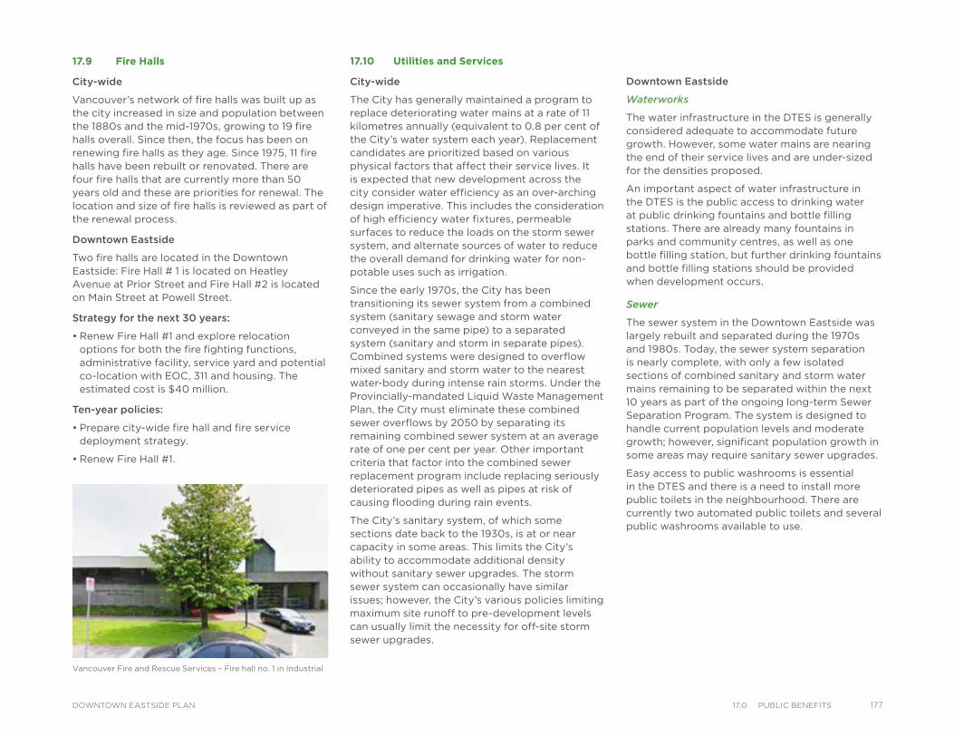
17.9 Fire Halls
City-wide
Vancouver’s network of fire halls was built up as the city increased in size and population between the 1880s and the mid-1970s, growing to 19 fire halls overall. Since then, the focus has been on renewing fire halls as they age. Since 1975, 11 fire halls have been rebuilt or renovated. There are four fire halls that are currently more than 50 years old and these are priorities for renewal. The location and size of fire halls is reviewed as part of the renewal process.
Downtown Eastside
Two fire halls are located in the Downtown Eastside: Fire Hall # 1 is located on Heatley Avenue at Prior Street and Fire Hall #2 is located on Main Street at Powell Street.
Strategy for the next 30 years:
• Renew Fire Hall #1 and explore relocation options for both the fire fighting functions, administrative facility, service yard and potential co-location with EOC, 311 and housing. The estimated cost is $40 million.
Ten-year policies:
• Prepare city-wide fire hall and fire service deployment strategy.
• Renew Fire Hall #1.
17.10 Utilities and Services
City-wide
The City has generally maintained a program to replace deteriorating water mains at a rate of 11 kilometres annually (equivalent to 0.8 per cent of the City’s water system each year). Replacement candidates are prioritized based on various physical factors that affect their service lives. It is expected that new development across the city consider water efficiency as an over-arching design imperative. This includes the consideration of high efficiency water fixtures, permeable surfaces to reduce the loads on the storm sewer system, and alternate sources of water to reduce the overall demand for drinking water for non-potable uses such as irrigation.
Since the early 1970s, the City has been transitioning its sewer system from a combined system (sanitary sewage and storm water conveyed in the same pipe) to a separated system (sanitary and storm in separate pipes). Combined systems were designed to overflow mixed sanitary and storm water to the nearest water-body during intense rain storms. Under the Provincially-mandated Liquid Waste Management Plan, the City must eliminate these combined sewer overflows by 2050 by separating its remaining combined sewer system at an average rate of one per cent per year. Other important criteria that factor into the combined sewer replacement program include replacing seriously deteriorated pipes as well as pipes at risk of causing flooding during rain events.
The City’s sanitary system, of which some sections date back to the 1930s, is at or near capacity in some areas. This limits the City’s ability to accommodate additional density without sanitary sewer upgrades. The storm sewer system can occasionally have similar issues; however, the City’s various policies limiting maximum site runoff to pre-development levels can usually limit the necessity for off-site storm sewer upgrades.
Downtown Eastside
Waterworks
The water infrastructure in the DTES is generally considered adequate to accommodate future growth. However, some water mains are nearing the end of their service lives and are under-sized for the densities proposed.
An important aspect of water infrastructure in the DTES is the public access to drinking water at public drinking fountains and bottle filling stations. There are already many fountains in parks and community centres, as well as one bottle filling station, but further drinking fountains and bottle filling stations should be provided when development occurs.
Sewer
The sewer system in the Downtown Eastside was largely rebuilt and separated during the 1970s and 1980s. Today, the sewer system separation is nearly complete, with only a few isolated sections of combined sanitary and storm water mains remaining to be separated within the next 10 years as part of the ongoing long-term Sewer Separation Program. The system is designed to handle current population levels and moderate growth; however, significant population growth in some areas may require sanitary sewer upgrades.
Easy access to public washrooms is essential in the DTES and there is a need to install more public toilets in the neighbourhood. There are currently two automated public toilets and several public washrooms available to use.
Vancouver Fire and Rescue Services – Fire hall no. 1 in Industrial
17717.0 PuBlIC BeneFItsDOWNTOWN EASTSIDE PLAN
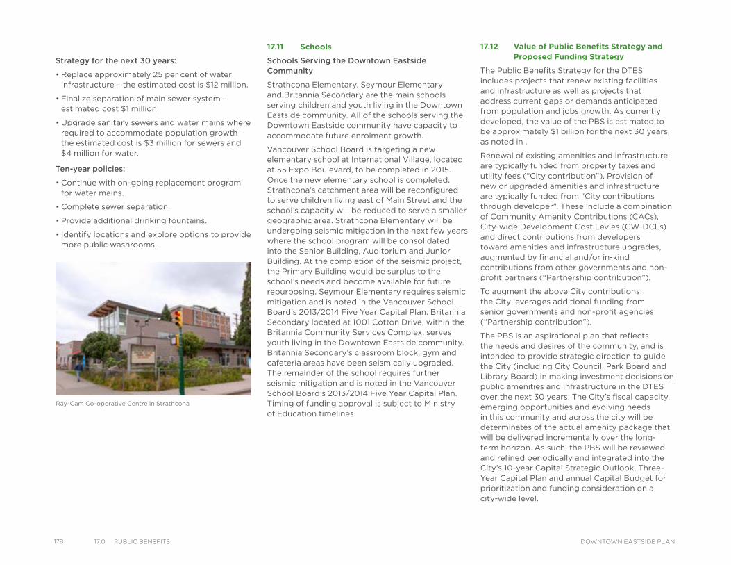
178 17.0 PuBlIC BeneFIts DOWNTOWN EASTSIDE PLAN
Strategy for the next 30 years:
• Replace approximately 25 per cent of water infrastructure – the estimated cost is $12 million.
• Finalize separation of main sewer system – estimated cost $1 million
• Upgrade sanitary sewers and water mains where required to accommodate population growth – the estimated cost is $3 million for sewers and $4 million for water.
Ten-year policies:
• Continue with on-going replacement program for water mains.
• Complete sewer separation.
• Provide additional drinking fountains.
• Identify locations and explore options to provide more public washrooms.
17.11 Schools
Schools Serving the Downtown Eastside Community
Strathcona Elementary, Seymour Elementary and Britannia Secondary are the main schools serving children and youth living in the Downtown Eastside community. All of the schools serving the Downtown Eastside community have capacity to accommodate future enrolment growth.
Vancouver School Board is targeting a new elementary school at International Village, located at 55 Expo Boulevard, to be completed in 2015. Once the new elementary school is completed, Strathcona’s catchment area will be reconfigured to serve children living east of Main Street and the school’s capacity will be reduced to serve a smaller geographic area. Strathcona Elementary will be undergoing seismic mitigation in the next few years where the school program will be consolidated into the Senior Building, Auditorium and Junior Building. At the completion of the seismic project, the Primary Building would be surplus to the school’s needs and become available for future repurposing. Seymour Elementary requires seismic mitigation and is noted in the Vancouver School Board’s 2013/2014 Five Year Capital Plan. Britannia Secondary located at 1001 Cotton Drive, within the Britannia Community Services Complex, serves youth living in the Downtown Eastside community. Britannia Secondary’s classroom block, gym and cafeteria areas have been seismically upgraded. The remainder of the school requires further seismic mitigation and is noted in the Vancouver School Board’s 2013/2014 Five Year Capital Plan. Timing of funding approval is subject to Ministry of Education timelines.
17.12 Value of Public Benefits Strategy and Proposed Funding Strategy
The Public Benefits Strategy for the DTES includes projects that renew existing facilities and infrastructure as well as projects that address current gaps or demands anticipated from population and jobs growth. As currently developed, the value of the PBS is estimated to be approximately $1 billion for the next 30 years, as noted in .
Renewal of existing amenities and infrastructure are typically funded from property taxes and utility fees (“City contribution”). Provision of new or upgraded amenities and infrastructure are typically funded from "City contributions through developer". These include a combination of Community Amenity Contributions (CACs), City-wide Development Cost Levies (CW-DCLs) and direct contributions from developers toward amenities and infrastructure upgrades, augmented by financial and/or in-kind contributions from other governments and non-profit partners (“Partnership contribution”).
To augment the above City contributions, the City leverages additional funding from senior governments and non-profit agencies (“Partnership contribution”).
The PBS is an aspirational plan that reflects the needs and desires of the community, and is intended to provide strategic direction to guide the City (including City Council, Park Board and Library Board) in making investment decisions on public amenities and infrastructure in the DTES over the next 30 years. The City’s fiscal capacity, emerging opportunities and evolving needs in this community and across the city will be determinates of the actual amenity package that will be delivered incrementally over the long-term horizon. As such, the PBS will be reviewed and refined periodically and integrated into the City’s 10-year Capital Strategic Outlook, Three-Year Capital Plan and annual Capital Budget for prioritization and funding consideration on a city-wide level.
Ray-Cam Co-operative Centre in Strathcona
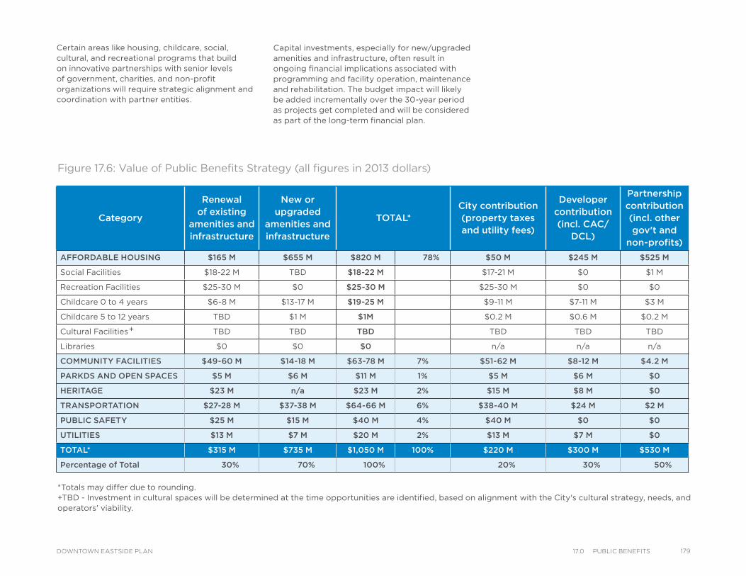
*Totals may differ due to rounding. +TBD - Investment in cultural spaces will be determined at the time opportunities are identified, based on alignment with the City's cultural strategy, needs, and operators' viability.
Category
Renewal of existing
amenities and infrastructure
New or upgraded
amenities and infrastructure
TOTAL*City contribution (property taxes and utility fees)
Developer contribution (incl. CAC/
DCL)
Partnership contribution (incl. other gov't and
non-profits)
AFFORDABLE HOUSING $165 M $655 M $820 M 78% $50 M $245 M $525 M
Social Facilities $18-22 M TBD $18-22 M $17-21 M $0 $1 M
Recreation Facilities $25-30 M $0 $25-30 M $25-30 M $0 $0
Childcare 0 to 4 years $6-8 M $13-17 M $19-25 M $9-11 M $7-11 M $3 M
Childcare 5 to 12 years TBD $1 M $1M $0.2 M $0.6 M $0.2 M
Cultural Facilities TBD TBD TBD TBD TBD TBD
Libraries $0 $0 $0 n/a n/a n/a
COMMUNITY FACILITIES $49-60 M $14-18 M $63-78 M 7% $51-62 M $8-12 M $4.2 M
PARKDS AND OPEN SPACES $5 M $6 M $11 M 1% $5 M $6 M $0
HERITAGE $23 M n/a $23 M 2% $15 M $8 M $0
TRANSPORTATION $27-28 M $37-38 M $64-66 M 6% $38-40 M $24 M $2 M
PUBLIC SAFETY $25 M $15 M $40 M 4% $40 M $0 $0
UTILITIES $13 M $7 M $20 M 2% $13 M $7 M $0
TOTAL* $315 M $735 M $1,050 M 100% $220 M $300 M $530 M
Percentage of Total 30% 70% 100% 20% 30% 50%
Figure 17.6: Value of Public Benefits Strategy (all figures in 2013 dollars)
Certain areas like housing, childcare, social, cultural, and recreational programs that build on innovative partnerships with senior levels of government, charities, and non-profit organizations will require strategic alignment and coordination with partner entities.
Capital investments, especially for new/upgraded amenities and infrastructure, often result in ongoing financial implications associated with programming and facility operation, maintenance and rehabilitation. The budget impact will likely be added incrementally over the 30-year period as projects get completed and will be considered as part of the long-term financial plan.
+
17917.0 PuBlIC BeneFItsDOWNTOWN EASTSIDE PLAN
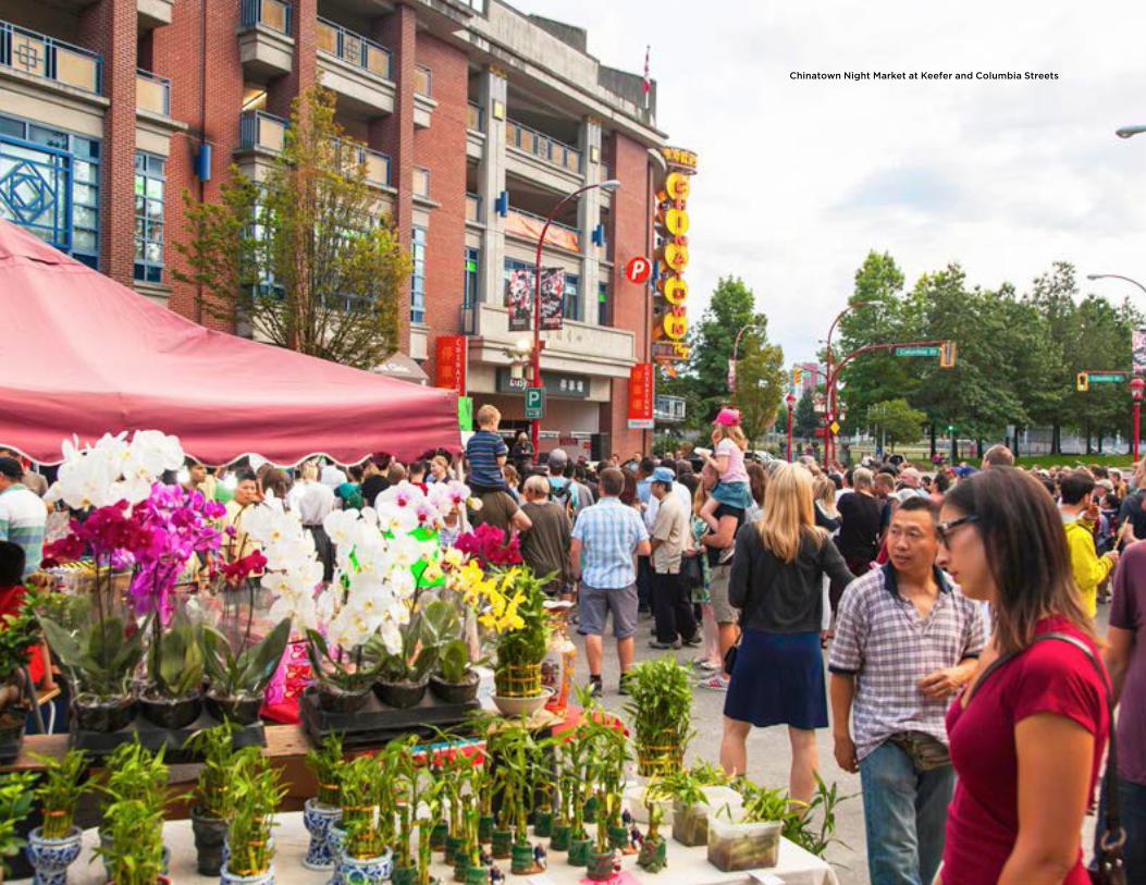
Chinatown Night Market at Keefer and Columbia Streets
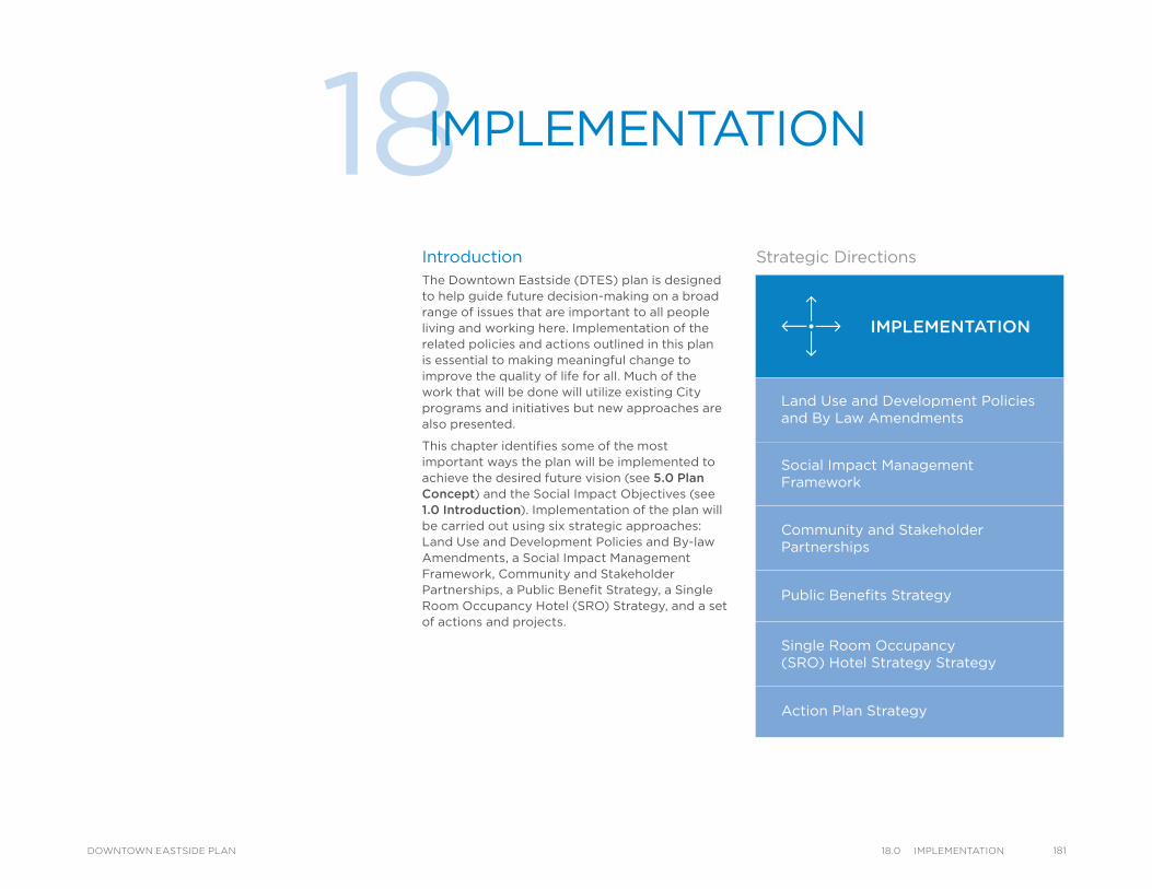
18IMPLEMENTATION
IntroductionThe Downtown Eastside (DTES) plan is designed to help guide future decision-making on a broad range of issues that are important to all people living and working here. Implementation of the related policies and actions outlined in this plan is essential to making meaningful change to improve the quality of life for all. Much of the work that will be done will utilize existing City programs and initiatives but new approaches are also presented.
This chapter identifies some of the most important ways the plan will be implemented to achieve the desired future vision (see 5.0 Plan Concept) and the Social Impact Objectives (see 1.0 Introduction). Implementation of the plan will be carried out using six strategic approaches: Land Use and Development Policies and By-law Amendments, a Social Impact Management Framework, Community and Stakeholder Partnerships, a Public Benefit Strategy, a Single Room Occupancy Hotel (SRO) Strategy, and a set of actions and projects.
IMPLEMENTATION
Land Use and Development Policies and By Law Amendments
Social Impact ManagementFramework
Community and StakeholderPartnerships
Public Benefits Strategy
Single Room Occupancy(SRO) Hotel Strategy Strategy
Action Plan Strategy
Strategic Directions
18118.0 ImPlementatIonDOWNTOWN EASTSIDE PLAN
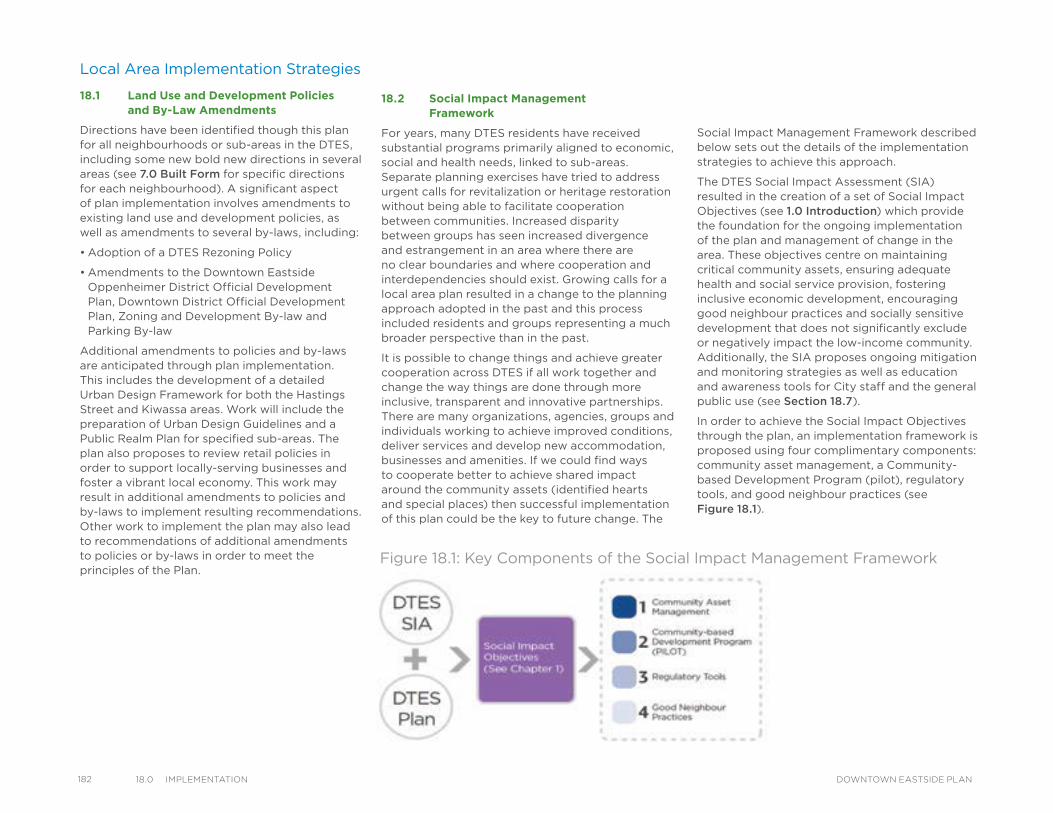
182 18.0 ImPlementatIon DOWNTOWN EASTSIDE PLAN
Local Area Implementation Strategies
18.1 Land Use and Development Policies and By-Law Amendments
Directions have been identified though this plan for all neighbourhoods or sub-areas in the DTES, including some new bold new directions in several areas (see 7.0 Built Form for specific directions for each neighbourhood). A significant aspect of plan implementation involves amendments to existing land use and development policies, as well as amendments to several by-laws, including:
• Adoption of a DTES Rezoning Policy
• Amendments to the Downtown Eastside Oppenheimer District Official Development Plan, Downtown District Official Development Plan, Zoning and Development By-law and Parking By-law
Additional amendments to policies and by-laws are anticipated through plan implementation. This includes the development of a detailed Urban Design Framework for both the Hastings Street and Kiwassa areas. Work will include the preparation of Urban Design Guidelines and a Public Realm Plan for specified sub-areas. The plan also proposes to review retail policies in order to support locally-serving businesses and foster a vibrant local economy. This work may result in additional amendments to policies and by-laws to implement resulting recommendations. Other work to implement the plan may also lead to recommendations of additional amendments to policies or by-laws in order to meet the principles of the Plan.
18.2 Social Impact Management Framework
For years, many DTES residents have received substantial programs primarily aligned to economic, social and health needs, linked to sub-areas. Separate planning exercises have tried to address urgent calls for revitalization or heritage restoration without being able to facilitate cooperation between communities. Increased disparity between groups has seen increased divergence and estrangement in an area where there are no clear boundaries and where cooperation and interdependencies should exist. Growing calls for a local area plan resulted in a change to the planning approach adopted in the past and this process included residents and groups representing a much broader perspective than in the past.
It is possible to change things and achieve greater cooperation across DTES if all work together and change the way things are done through more inclusive, transparent and innovative partnerships. There are many organizations, agencies, groups and individuals working to achieve improved conditions, deliver services and develop new accommodation, businesses and amenities. If we could find ways to cooperate better to achieve shared impact around the community assets (identified hearts and special places) then successful implementation of this plan could be the key to future change. The
Social Impact Management Framework described below sets out the details of the implementation strategies to achieve this approach.
The DTES Social Impact Assessment (SIA) resulted in the creation of a set of Social Impact Objectives (see 1.0 Introduction) which provide the foundation for the ongoing implementation of the plan and management of change in the area. These objectives centre on maintaining critical community assets, ensuring adequate health and social service provision, fostering inclusive economic development, encouraging good neighbour practices and socially sensitive development that does not significantly exclude or negatively impact the low-income community. Additionally, the SIA proposes ongoing mitigation and monitoring strategies as well as education and awareness tools for City staff and the general public use (see Section 18.7).
In order to achieve the Social Impact Objectives through the plan, an implementation framework is proposed using four complimentary components: community asset management, a Community-based Development Program (pilot), regulatory tools, and good neighbour practices (see Figure 18.1).
Figure 18.1: Key Components of the Social Impact Management Framework
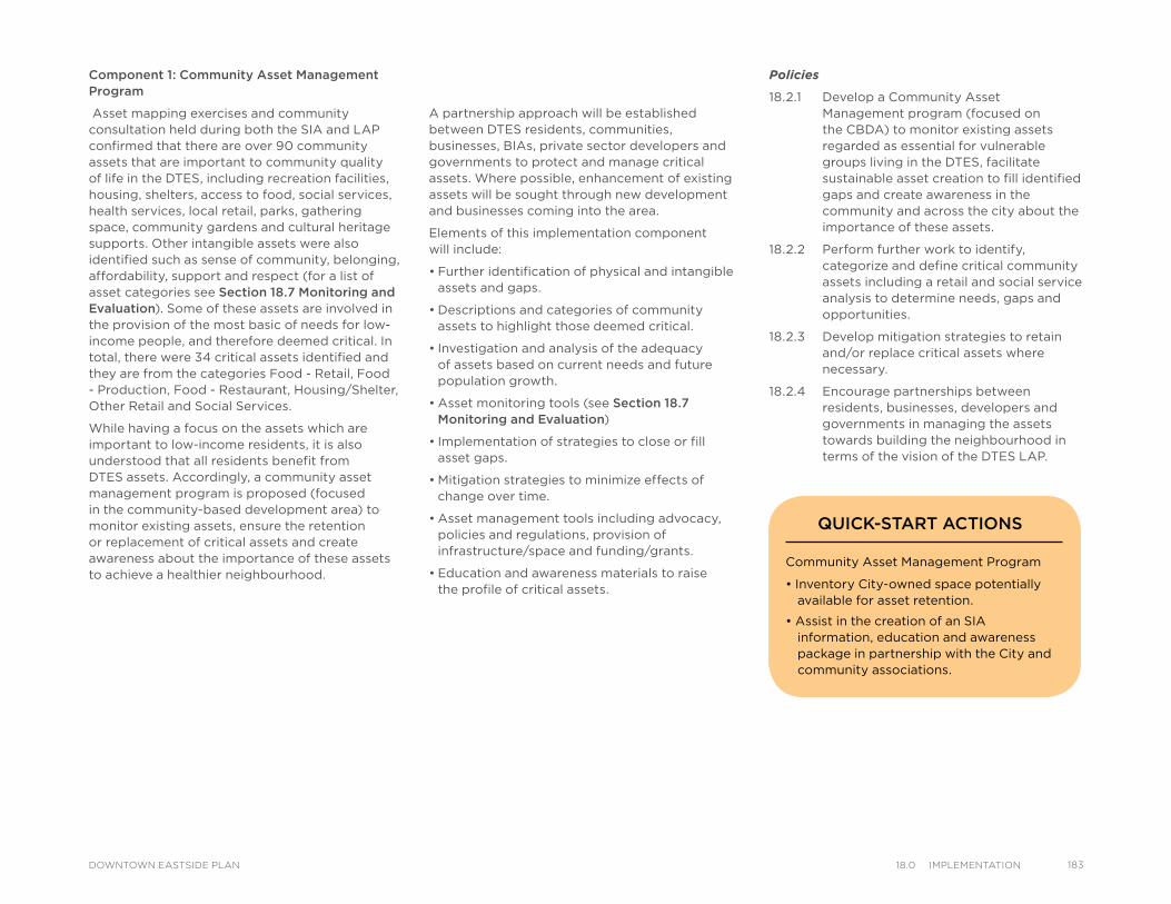
Policies
18.2.1 Develop a Community Asset Management program (focused on the CBDA) to monitor existing assets regarded as essential for vulnerable groups living in the DTES, facilitate sustainable asset creation to fill identified gaps and create awareness in the community and across the city about the importance of these assets.
18.2.2 Perform further work to identify, categorize and define critical community assets including a retail and social service analysis to determine needs, gaps and opportunities.
18.2.3 Develop mitigation strategies to retain and/or replace critical assets where necessary.
18.2.4 Encourage partnerships between residents, businesses, developers and governments in managing the assets towards building the neighbourhood in terms of the vision of the DTES LAP.
A partnership approach will be established between DTES residents, communities, businesses, BIAs, private sector developers and governments to protect and manage critical assets. Where possible, enhancement of existing assets will be sought through new development and businesses coming into the area.
Elements of this implementation component will include:
• Further identification of physical and intangible assets and gaps.
• Descriptions and categories of community assets to highlight those deemed critical.
• Investigation and analysis of the adequacy of assets based on current needs and future population growth.
• Asset monitoring tools (see Section 18.7 Monitoring and Evaluation)
• Implementation of strategies to close or fill asset gaps.
• Mitigation strategies to minimize effects of change over time.
• Asset management tools including advocacy, policies and regulations, provision of infrastructure/space and funding/grants.
• Education and awareness materials to raise the profile of critical assets.
Component 1: Community Asset Management Program
Asset mapping exercises and community consultation held during both the SIA and LAP confirmed that there are over 90 community assets that are important to community quality of life in the DTES, including recreation facilities, housing, shelters, access to food, social services, health services, local retail, parks, gathering space, community gardens and cultural heritage supports. Other intangible assets were also identified such as sense of community, belonging, affordability, support and respect (for a list of asset categories see Section 18.7 Monitoring and Evaluation). Some of these assets are involved in the provision of the most basic of needs for low-income people, and therefore deemed critical. In total, there were 34 critical assets identified and they are from the categories Food - Retail, Food - Production, Food - Restaurant, Housing/Shelter, Other Retail and Social Services.
While having a focus on the assets which are important to low-income residents, it is also understood that all residents benefit from DTES assets. Accordingly, a community asset management program is proposed (focused in the community-based development area) to monitor existing assets, ensure the retention or replacement of critical assets and create awareness about the importance of these assets to achieve a healthier neighbourhood.
Community Asset Management Program
• Inventory City-owned space potentially available for asset retention.
• Assist in the creation of an SIA information, education and awareness package in partnership with the City and community associations.
QUICK-START ACTIONS
18318.0 ImPlementatIonDOWNTOWN EASTSIDE PLAN
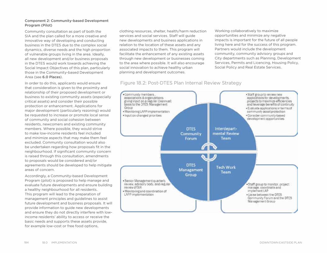
184 18.0 ImPlementatIon DOWNTOWN EASTSIDE PLAN
Figure 18.2: Post-DTES Plan Internal Review Strategy
Component 2: Community-based Development Program (Pilot)
Community consultation as part of both the SIA and the plan called for a more creative and innovative way of developing and conducting business in the DTES due to the complex social dynamics, diverse needs and the high proportion of vulnerable groups living in the area. Ideally, all new development and/or business proposals in the DTES would work towards achieving the Social Impact Objectives of this plan, particularly those in the Community-based Development Area (see 6.0 Places).
In order to do this, applicants would ensure that consideration is given to the proximity and relationship of their proposed development or business to existing community assets (especially critical assets) and consider their possible protection or enhancement. Applications for major development (particularly rezoning) would be requested to increase or promote local sense of community and social cohesion between residents, newcomers and existing community members. Where possible, they would strive to make low-income residents feel included and minimize aspects that may make them feel excluded. Community consultation would also be undertaken regarding how proposals fit in the neighbourhood. If significant community concern is raised through this consultation, amendments to proposals would be considered and/or agreements should be developed to help mitigate areas of concern.
Accordingly, a Community-based Development Program (pilot) is proposed to help manage and evaluate future developments and ensure building a healthy neighbourhood for all residents. This program will lead to the preparation of management principles and guidelines to assist future development and business proposals. It will provide information to guide new developments and ensure they do not directly interfere with low-income residents’ ability to access or receive the basic needs and supports these assets provide, for example low-cost or free food options,
clothing resources, shelter, health/harm reduction services and social services. Staff will guide new developments and business applications in relation to the location of these assets and any associated impacts to them. This program will facilitate the enhancement of any existing assets through new development or businesses coming to the area where possible. It will also encourage social innovation to achieve healthy urban planning and development outcomes.
Working collaboratively to maximize opportunities and minimize any negative impacts is important for the future of all people living here and for the success of this program. Partners would include the development community, community advisory groups and City departments such as Planning, Development Services, Permits and Licencing, Housing Policy, Social Policy and Real Estate Services.
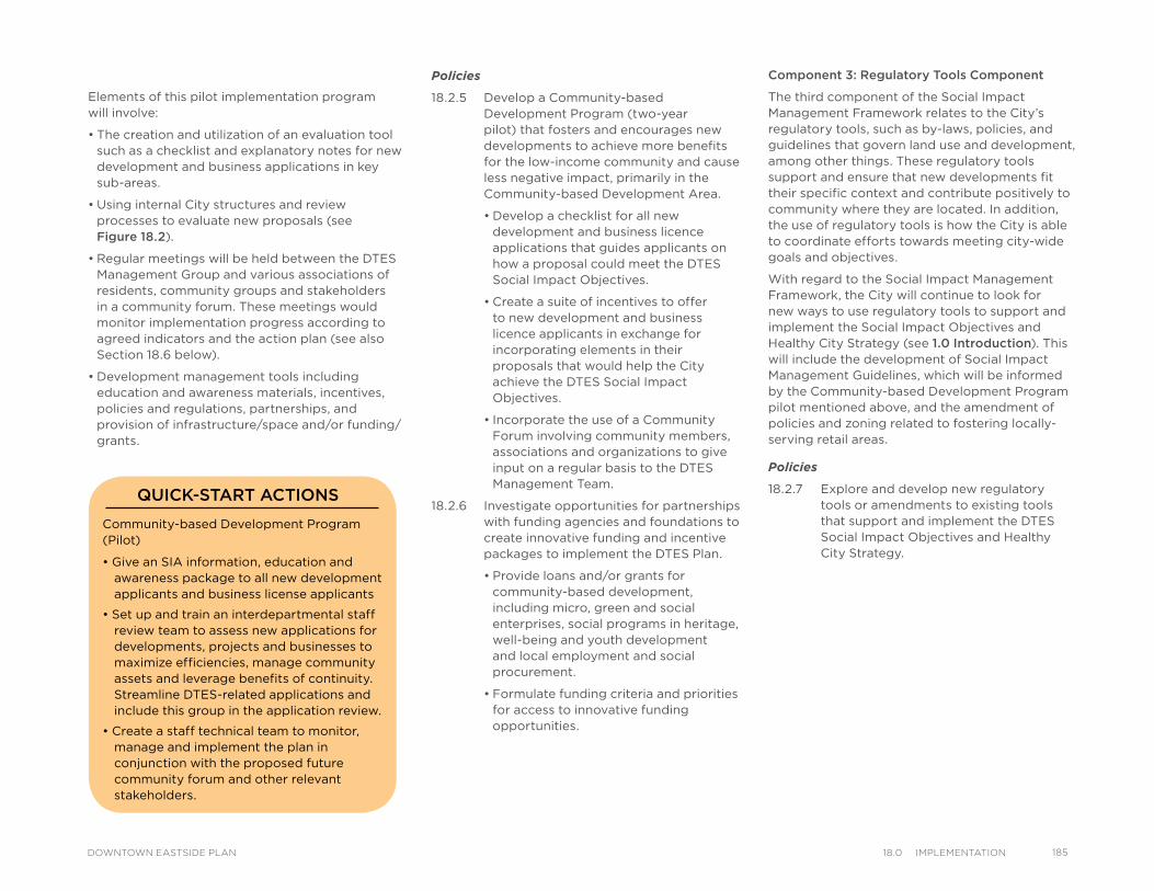
Policies
18.2.5 Develop a Community-based Development Program (two-year pilot) that fosters and encourages new developments to achieve more benefits for the low-income community and cause less negative impact, primarily in the Community-based Development Area.
• Develop a checklist for all new development and business licence applications that guides applicants on how a proposal could meet the DTES Social Impact Objectives.
• Create a suite of incentives to offer to new development and business licence applicants in exchange for incorporating elements in their proposals that would help the City achieve the DTES Social Impact Objectives.
• Incorporate the use of a Community Forum involving community members, associations and organizations to give input on a regular basis to the DTES Management Team.
18.2.6 Investigate opportunities for partnerships with funding agencies and foundations to create innovative funding and incentive packages to implement the DTES Plan.
• Provide loans and/or grants for community-based development, including micro, green and social enterprises, social programs in heritage, well-being and youth development and local employment and social procurement.
• Formulate funding criteria and priorities for access to innovative funding opportunities.
Elements of this pilot implementation program will involve:
• The creation and utilization of an evaluation tool such as a checklist and explanatory notes for new development and business applications in key sub-areas.
• Using internal City structures and review processes to evaluate new proposals (see Figure 18.2).
• Regular meetings will be held between the DTES Management Group and various associations of residents, community groups and stakeholders in a community forum. These meetings would monitor implementation progress according to agreed indicators and the action plan (see also Section 18.6 below).
• Development management tools including education and awareness materials, incentives, policies and regulations, partnerships, and provision of infrastructure/space and/or funding/grants.
Component 3: Regulatory Tools Component
The third component of the Social Impact Management Framework relates to the City’s regulatory tools, such as by-laws, policies, and guidelines that govern land use and development, among other things. These regulatory tools support and ensure that new developments fit their specific context and contribute positively to community where they are located. In addition, the use of regulatory tools is how the City is able to coordinate efforts towards meeting city-wide goals and objectives.
With regard to the Social Impact Management Framework, the City will continue to look for new ways to use regulatory tools to support and implement the Social Impact Objectives and Healthy City Strategy (see 1.0 Introduction). This will include the development of Social Impact Management Guidelines, which will be informed by the Community-based Development Program pilot mentioned above, and the amendment of policies and zoning related to fostering locally-serving retail areas.
Policies
18.2.7 Explore and develop new regulatory tools or amendments to existing tools that support and implement the DTES Social Impact Objectives and Healthy City Strategy.
Community-based Development Program (Pilot)
• Give an SIA information, education and awareness package to all new development applicants and business license applicants
• Set up and train an interdepartmental staff review team to assess new applications for developments, projects and businesses to maximize efficiencies, manage community assets and leverage benefits of continuity. Streamline DTES-related applications and include this group in the application review.
• Create a staff technical team to monitor, manage and implement the plan in conjunction with the proposed future community forum and other relevant stakeholders.
QUICK-START ACTIONS
18518.0 ImPlementatIonDOWNTOWN EASTSIDE PLAN
186 18.0 ImPlementatIon DOWNTOWN EASTSIDE PLAN
LAPP Committee Member Perspective:
“This initiative aims to create a healthier dialogue between low-income residents and businesses, old or new, build social capital, and deal with a range of issues regarding exclusion, inclusion, accessibility and encourages social impact hiring and purchasing through the creation of a 'good neighbours' charter and recognition program.”
“Businesses need support in order to better understand their impacts in a low-income area like the Downtown Eastside. Residents similarly could benefit from support in understanding the opportunities that new businesses present in our community. The outcome of this project will be the creation of a decal and recognition program identifying charter member businesses that have gone through an appropriate, but not onerous, education, dialogue and work-shopping module that can help them to improve their understanding of social inclusion strategies and put them into practice. This would include better understanding of common mental health issues in the DTES and how to more effectively deal with a situation involving someone with a mental health or addiction barrier, the opportunities they have as businesses to incorporate socially inclusive items or services that are affordable to lower income residents, and knowledge of the supports available to them as businesses to hire and retain residents from the area, including residents with barriers to traditional employment.”
-Wes Regan (LAPP committee member and executive director of Hastings Crossing BIA)
Component 4: Good Neighbour Practices Program
Community consultation emphasized the need to enhance local economic development in the DTES while encouraging commercial/industrial developers and local businesses to be sensitive to the community context (respectful of surrounding scale, urban pattern, social and community needs). People also emphasized the need for affordable commercial spaces and locally-serving uses that do not significantly exclude the low-income community. The four BIAs in the DTES also expressed the desire to work collectively to maximize opportunities for economic development on a larger, more coordinated scale while maintaining each organization’s autonomy and diverse interests. Overall, people wanted to see more good neighbour practices implemented in the community.
Ideally, all residents, associations, organizations and businesses (particularly in the Community-based Development area) in the DTES would work towards achieving the Social Impact Objectives of this plan. In order to do this, new development and business proposals would try to ensure that they fit the DTES neighbourhood context and also offer locally-serving uses and not exclude, displace or negatively impact the low-income community or affect community assets without making provision for their relocation or replacement. Local businesses and communities would also work together to promote inclusion and belonging for all residents.
Partnerships are the key to creating a more neighbourly community. DTES community members, residents, community associations and organizations, non-profit agencies, BIAs, businesses and property owners all need to make this work. Elements of this implementation component will include:
• Education, sensitivity and awareness tools
• A DTES Community Charter
• Good Neighbour Agreements
• A BIA Good Neighbour Accreditation program
• Networking and community-bridging opportunities
• Support for new businesses coming to the neighbourhood
Policies
18.2.8 Develop a good neighbour practices program to support local business, bridge the local resident community with the local business community, maximize opportunities to leverage community benefits from these connections and promote inclusive community economic development
• Support the DTES BIAs and community group (see Section 18.3) to create a Good Neighbour Charter and recognition program.
Good Neighbour Practices Program
• Conduct research on best practices related to good neighbour practices and the types of tools used to implement them.
• Work with the BIAs, residents, and other stakeholders to integrate the lessons from the SIA into a set of good neighbour practices that can be used to achieve the Social Impact Objectives.
QUICK-START ACTIONS
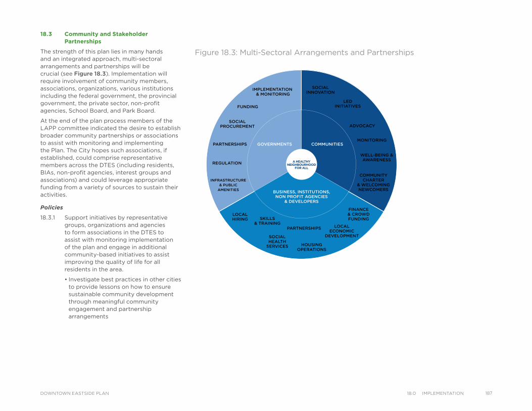
18.3 Community and Stakeholder Partnerships
The strength of this plan lies in many hands and an integrated approach, multi-sectoral arrangements and partnerships will be crucial (see Figure 18.3). Implementation will require involvement of community members, associations, organizations, various institutions including the federal government, the provincial government, the private sector, non-profit agencies, School Board, and Park Board.
At the end of the plan process members of the LAPP committee indicated the desire to establish broader community partnerships or associations to assist with monitoring and implementing the Plan. The City hopes such associations, if established, could comprise representative members across the DTES (including residents, BIAs, non-profit agencies, interest groups and associations) and could leverage appropriate funding from a variety of sources to sustain their activities.
Policies
18.3.1 Support initiatives by representative groups, organizations and agencies to form associations in the DTES to assist with monitoring implementation of the plan and engage in additional community-based initiatives to assist improving the quality of life for all residents in the area.
• Investigate best practices in other cities to provide lessons on how to ensure sustainable community development through meaningful community engagement and partnership arrangements
SOCIALINNOVATION
LEDINITIATIVES
ADVOCACY
MONITORING
WELL-BEING &AWARENESS
INFRASTRUCTURE& PUBLIC
AMENITIES
COMMUNITYCHARTER
& WELCOMINGNEWCOMERS
FINANCE& CROWDFUNDING
LOCALECONOMIC
DEVELOPMENT
HOUSINGOPERATIONS
PARTNERSHIPS
SOCIALHEALTH
SERVICES
LOCALHIRING
REGULATION
PARTNERSHIPS
SOCIALPROCUREMENT
FUNDING
IMPLEMENTATION & MONITORING
GOVERNMENTS COMMUNITIES
BUSINESS, INSTITUTIONS,NON PROFIT AGENCIES
& DEVELOPERS
SKILLS& TRAINING
A HEALTHYNEIGHBOURHOOD
FOR ALL
Figure 18.3: Multi-Sectoral Arrangements and Partnerships
18718.0 ImPlementatIonDOWNTOWN EASTSIDE PLAN
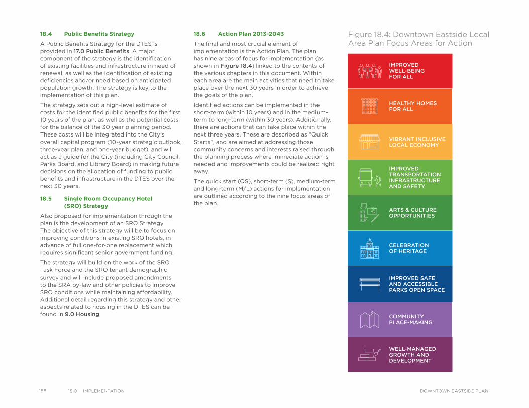
188 18.0 ImPlementatIon DOWNTOWN EASTSIDE PLAN
18.4 Public Benefits Strategy
A Public Benefits Strategy for the DTES is provided in 17.0 Public Benefits. A major component of the strategy is the identification of existing facilities and infrastructure in need of renewal, as well as the identification of existing deficiencies and/or need based on anticipated population growth. The strategy is key to the implementation of this plan.
The strategy sets out a high-level estimate of costs for the identified public benefits for the first 10 years of the plan, as well as the potential costs for the balance of the 30 year planning period. These costs will be integrated into the City’s overall capital program (10-year strategic outlook, three-year plan, and one-year budget), and will act as a guide for the City (including City Council, Parks Board, and Library Board) in making future decisions on the allocation of funding to public benefits and infrastructure in the DTES over the next 30 years.
18.5 Single Room Occupancy Hotel (SRO) Strategy
Also proposed for implementation through the plan is the development of an SRO Strategy. The objective of this strategy will be to focus on improving conditions in existing SRO hotels, in advance of full one-for-one replacement which requires significant senior government funding.
The strategy will build on the work of the SRO Task Force and the SRO tenant demographic survey and will include proposed amendments to the SRA by-law and other policies to improve SRO conditions while maintaining affordability. Additional detail regarding this strategy and other aspects related to housing in the DTES can be found in 9.0 Housing.
18.6 Action Plan 2013-2043
The final and most crucial element of implementation is the Action Plan. The plan has nine areas of focus for implementation (as shown in Figure 18.4) linked to the contents of the various chapters in this document. Within each area are the main activities that need to take place over the next 30 years in order to achieve the goals of the plan.
Identified actions can be implemented in the short-term (within 10 years) and in the medium-term to long-term (within 30 years). Additionally, there are actions that can take place within the next three years. These are described as “Quick Starts”, and are aimed at addressing those community concerns and interests raised through the planning process where immediate action is needed and improvements could be realized right away.
The quick start (QS), short-term (S), medium-term and long-term (M/L) actions for implementation are outlined according to the nine focus areas of the plan.
Figure 18.4: Downtown Eastside Local Area Plan Focus Areas for Action
IMPROVEDWELL-BEINGFOR ALL
COMMUNITYPLACE-MAKING
ARTS & CULTUREOPPORTUNITIES
WELL-MANAGEDGROWTH ANDDEVELOPMENT
IMPROVED SAFEAND ACCESSIBLE PARKS OPEN SPACE
VIBRANT INCLUSIVELOCAL ECONOMY
CELEBRATIONOF HERITAGE
HEALTHY HOMESFOR ALL
IMPROVEDTRANSPORTATIONINFRASTRUCTUREAND SAFETY
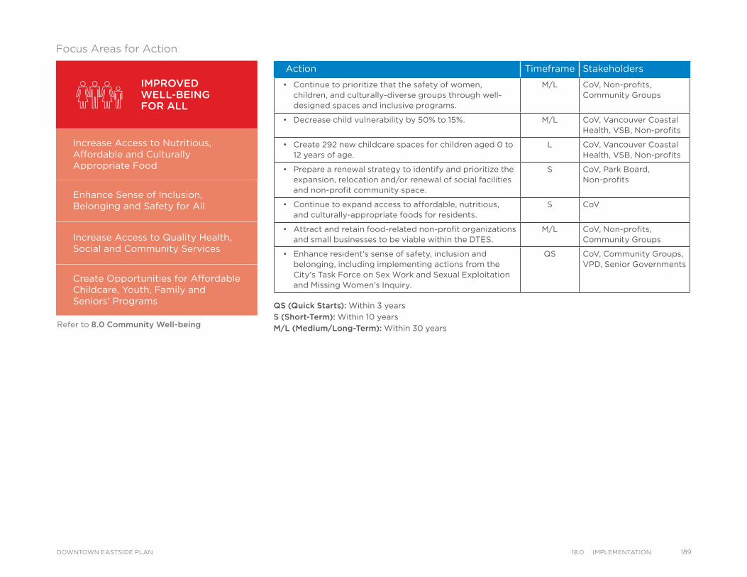
*Refer to 8.0 Community Well-Being
Action Timeframe Stakeholders
• Continue to prioritize that the safety of women, children, and culturally-diverse groups through well-designed spaces and inclusive programs.
M/L CoV, Non-profits, Community Groups
• Decrease child vulnerability by 50% to 15%. M/L CoV, Vancouver Coastal Health, VSB, Non-profits
• Create 292 new childcare spaces for children aged 0 to 12 years of age.
L CoV, Vancouver Coastal Health, VSB, Non-profits
• Prepare a renewal strategy to identify and prioritize the expansion, relocation and/or renewal of social facilities and non-profit community space.
S CoV, Park Board, Non-profits
• Continue to expand access to affordable, nutritious, and culturally-appropriate foods for residents.
S CoV
• Attract and retain food-related non-profit organizations and small businesses to be viable within the DTES.
M/L CoV, Non-profits, Community Groups
• Enhance resident's sense of safety, inclusion and belonging, including implementing actions from the City's Task Force on Sex Work and Sexual Exploitation and Missing Women's Inquiry.
QS CoV, Community Groups, VPD, Senior Governments
IMPROVEDWELL-BEINGFOR ALL
Increase Access to Nutritious, Affordable and Culturally Appropriate Food
Enhance Sense of Inclusion,Belonging and Safety for All
Increase Access to Quality Health, Social and Community Services
Create Opportunities for Affordable Childcare, Youth, Family and Seniors’ Programs
Refer to 8.0 Community Well-being
QS (Quick Starts): Within 3 years
S (Short-Term): Within 10 years
M/L (Medium/Long-Term): Within 30 years
Focus Areas for Action
18918.0 ImPlementatIonDOWNTOWN EASTSIDE PLAN
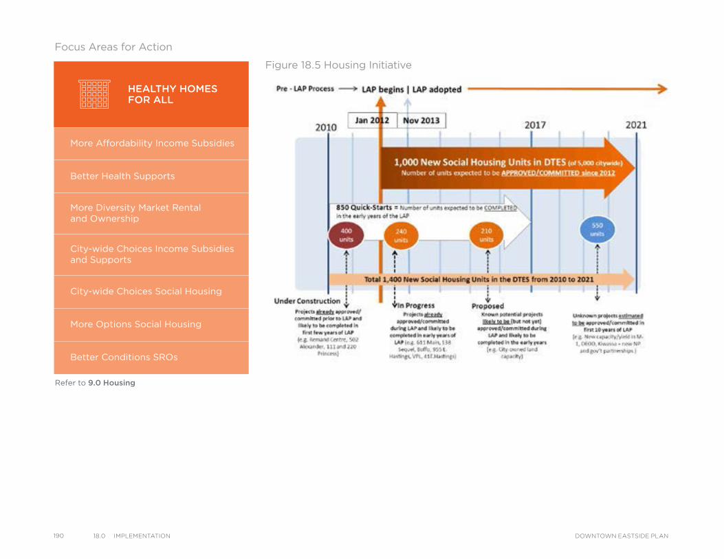
190 18.0 ImPlementatIon DOWNTOWN EASTSIDE PLAN
Refer to 9.0 Housing
Figure 18.5 Housing Initiative
HEALTHY HOMESFOR ALL
More Affordability Income Subsidies
Better Health Supports
More Diversity Market Rentaland Ownership
City-wide Choices Income Subsidies and Supports
City-wide Choices Social Housing
More Options Social Housing
Better Conditions SROs
Focus Areas for Action
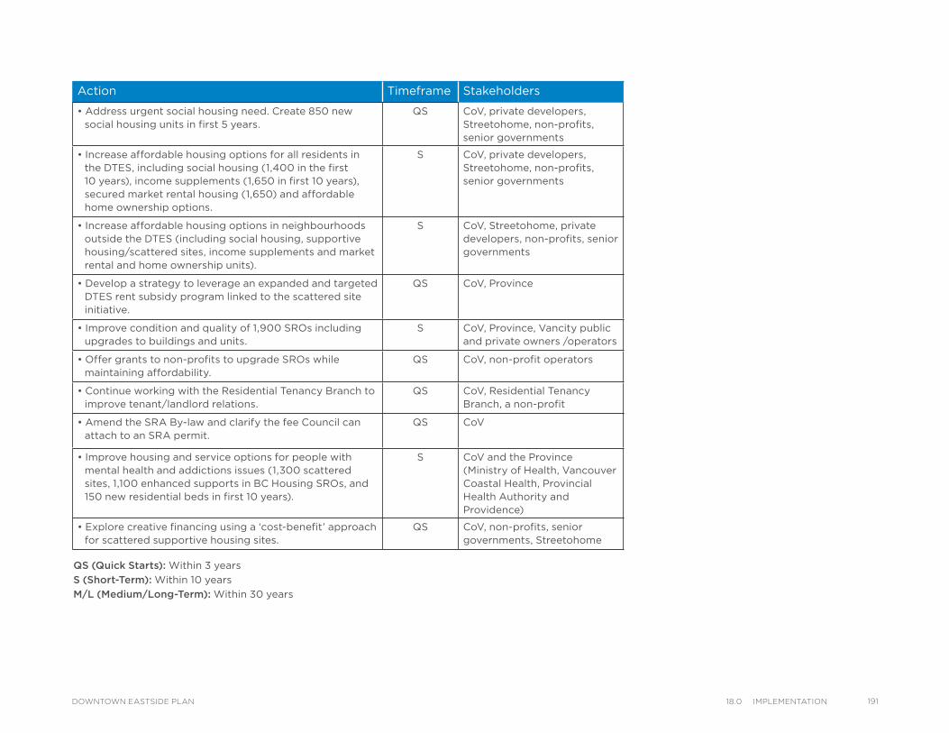
Action Timeframe Stakeholders
• Address urgent social housing need. Create 850 new social housing units in first 5 years.
QS CoV, private developers, Streetohome, non-profits, senior governments
• Increase affordable housing options for all residents in the DTES, including social housing (1,400 in the first 10 years), income supplements (1,650 in first 10 years), secured market rental housing (1,650) and affordable home ownership options.
S CoV, private developers, Streetohome, non-profits, senior governments
• Increase affordable housing options in neighbourhoods outside the DTES (including social housing, supportive housing/scattered sites, income supplements and market rental and home ownership units).
S CoV, Streetohome, private developers, non-profits, senior governments
• Develop a strategy to leverage an expanded and targeted DTES rent subsidy program linked to the scattered site initiative.
QS CoV, Province
• Improve condition and quality of 1,900 SROs including upgrades to buildings and units.
S CoV, Province, Vancity public and private owners /operators
• Offer grants to non-profits to upgrade SROs while maintaining affordability.
QS CoV, non-profit operators
• Continue working with the Residential Tenancy Branch to improve tenant/landlord relations.
QS CoV, Residential Tenancy Branch, a non-profit
• Amend the SRA By-law and clarify the fee Council can attach to an SRA permit.
QS CoV
• Improve housing and service options for people with mental health and addictions issues (1,300 scattered sites, 1,100 enhanced supports in BC Housing SROs, and 150 new residential beds in first 10 years).
S CoV and the Province (Ministry of Health, Vancouver Coastal Health, Provincial Health Authority and Providence)
• Explore creative financing using a ‘cost-benefit’ approach for scattered supportive housing sites.
QS CoV, non-profits, senior governments, Streetohome
QS (Quick Starts): Within 3 years
S (Short-Term): Within 10 years
M/L (Medium/Long-Term): Within 30 years
19118.0 ImPlementatIonDOWNTOWN EASTSIDE PLAN
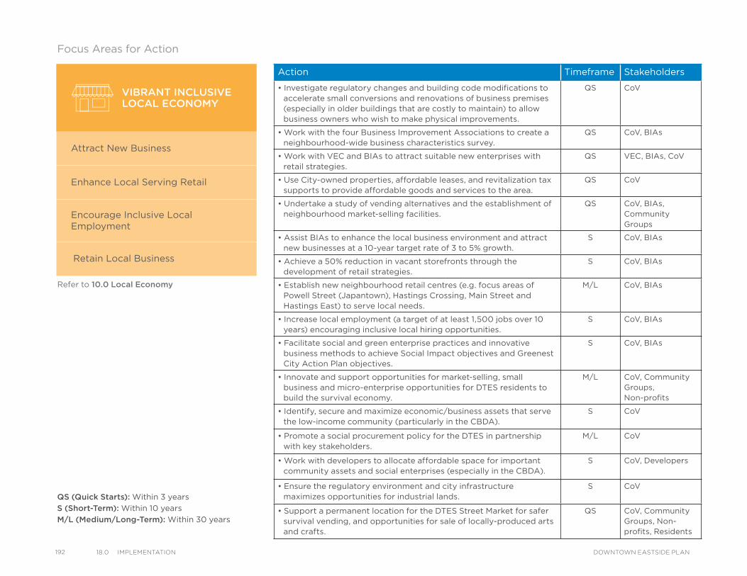
192 18.0 ImPlementatIon DOWNTOWN EASTSIDE PLAN
Refer to 10.0 Local Economy
Action Timeframe Stakeholders
• Investigate regulatory changes and building code modifications to accelerate small conversions and renovations of business premises (especially in older buildings that are costly to maintain) to allow business owners who wish to make physical improvements.
QS CoV
• Work with the four Business Improvement Associations to create a neighbourhood-wide business characteristics survey.
QS CoV, BIAs
• Work with VEC and BIAs to attract suitable new enterprises with retail strategies.
QS VEC, BIAs, CoV
• Use City-owned properties, affordable leases, and revitalization tax supports to provide affordable goods and services to the area.
QS CoV
• Undertake a study of vending alternatives and the establishment of neighbourhood market-selling facilities.
QS CoV, BIAs, Community Groups
• Assist BIAs to enhance the local business environment and attract new businesses at a 10-year target rate of 3 to 5% growth.
S CoV, BIAs
• Achieve a 50% reduction in vacant storefronts through the development of retail strategies.
S CoV, BIAs
• Establish new neighbourhood retail centres (e.g. focus areas of Powell Street (Japantown), Hastings Crossing, Main Street and Hastings East) to serve local needs.
M/L CoV, BIAs
• Increase local employment (a target of at least 1,500 jobs over 10 years) encouraging inclusive local hiring opportunities.
S CoV, BIAs
• Facilitate social and green enterprise practices and innovative business methods to achieve Social Impact objectives and Greenest City Action Plan objectives.
S CoV, BIAs
• Innovate and support opportunities for market-selling, small business and micro-enterprise opportunities for DTES residents to build the survival economy.
M/L CoV, Community Groups, Non-profits
• Identify, secure and maximize economic/business assets that serve the low-income community (particularly in the CBDA).
S CoV
• Promote a social procurement policy for the DTES in partnership with key stakeholders.
M/L CoV
• Work with developers to allocate affordable space for important community assets and social enterprises (especially in the CBDA).
S CoV, Developers
• Ensure the regulatory environment and city infrastructure maximizes opportunities for industrial lands.
S CoV
• Support a permanent location for the DTES Street Market for safer survival vending, and opportunities for sale of locally-produced arts and crafts.
QS CoV, Community Groups, Non-profits, Residents
VIBRANT INCLUSIVELOCAL ECONOMY
Attract New Business
Enhance Local Serving Retail
Encourage Inclusive Local Employment
Retain Local Business
QS (Quick Starts): Within 3 years
S (Short-Term): Within 10 years
M/L (Medium/Long-Term): Within 30 years
Focus Areas for Action
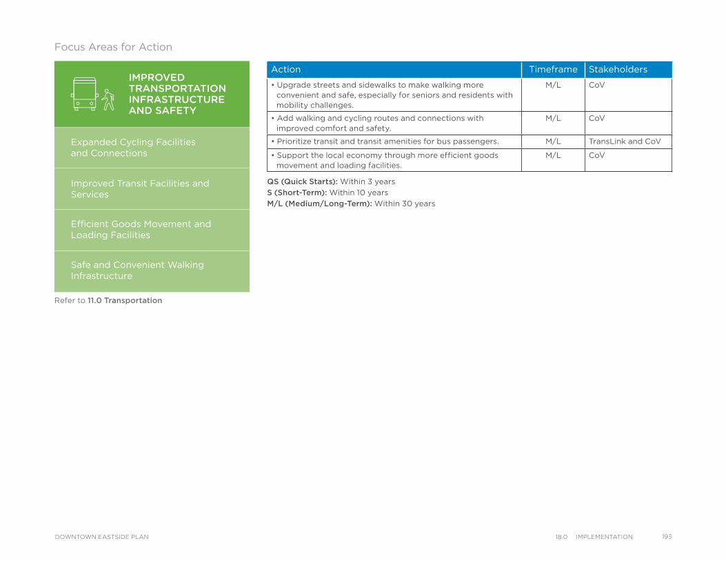
Action Timeframe Stakeholders
• Upgrade streets and sidewalks to make walking more convenient and safe, especially for seniors and residents with mobility challenges.
M/L CoV
• Add walking and cycling routes and connections with improved comfort and safety.
M/L CoV
• Prioritize transit and transit amenities for bus passengers. M/L TransLink and CoV
• Support the local economy through more efficient goods movement and loading facilities.
M/L CoV
QS (Quick Starts): Within 3 years
S (Short-Term): Within 10 years
M/L (Medium/Long-Term): Within 30 years
IMPROVEDTRANSPORTATIONINFRASTRUCTUREAND SAFETY
Expanded Cycling Facilities and Connections
Improved Transit Facilities and Services
Efficient Goods Movement andLoading Facilities
Safe and Convenient Walking Infrastructure
Refer to 11.0 Transportation
Focus Areas for Action
19318.0 ImPlementatIonDOWNTOWN EASTSIDE PLAN
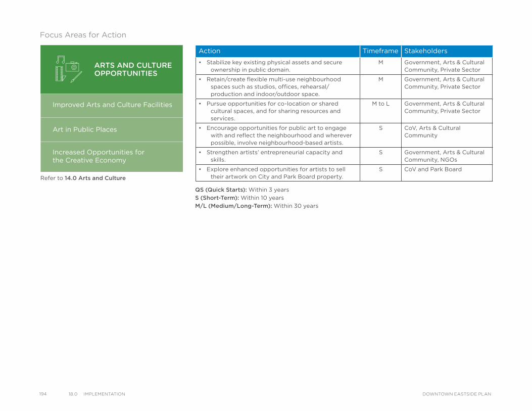
194 18.0 ImPlementatIon DOWNTOWN EASTSIDE PLAN
Refer to 14.0 Arts and Culture
Action Timeframe Stakeholders
• Stabilize key existing physical assets and secure ownership in public domain.
M Government, Arts & Cultural Community, Private Sector
• Retain/create flexible multi-use neighbourhood spaces such as studios, offices, rehearsal/production and indoor/outdoor space.
M Government, Arts & Cultural Community, Private Sector
• Pursue opportunities for co-location or shared cultural spaces, and for sharing resources and services.
M to L Government, Arts & Cultural Community, Private Sector
• Encourage opportunities for public art to engage with and reflect the neighbourhood and wherever possible, involve neighbourhood-based artists.
S CoV, Arts & Cultural Community
• Strengthen artists’ entrepreneurial capacity and skills.
S Government, Arts & Cultural Community, NGOs
• Explore enhanced opportunities for artists to sell their artwork on City and Park Board property.
S CoV and Park Board
ARTS AND CULTUREOPPORTUNITIES
Improved Arts and Culture Facilities
Art in Public Places
Increased Opportunities forthe Creative Economy
Focus Areas for Action
QS (Quick Starts): Within 3 years
S (Short-Term): Within 10 years
M/L (Medium/Long-Term): Within 30 years
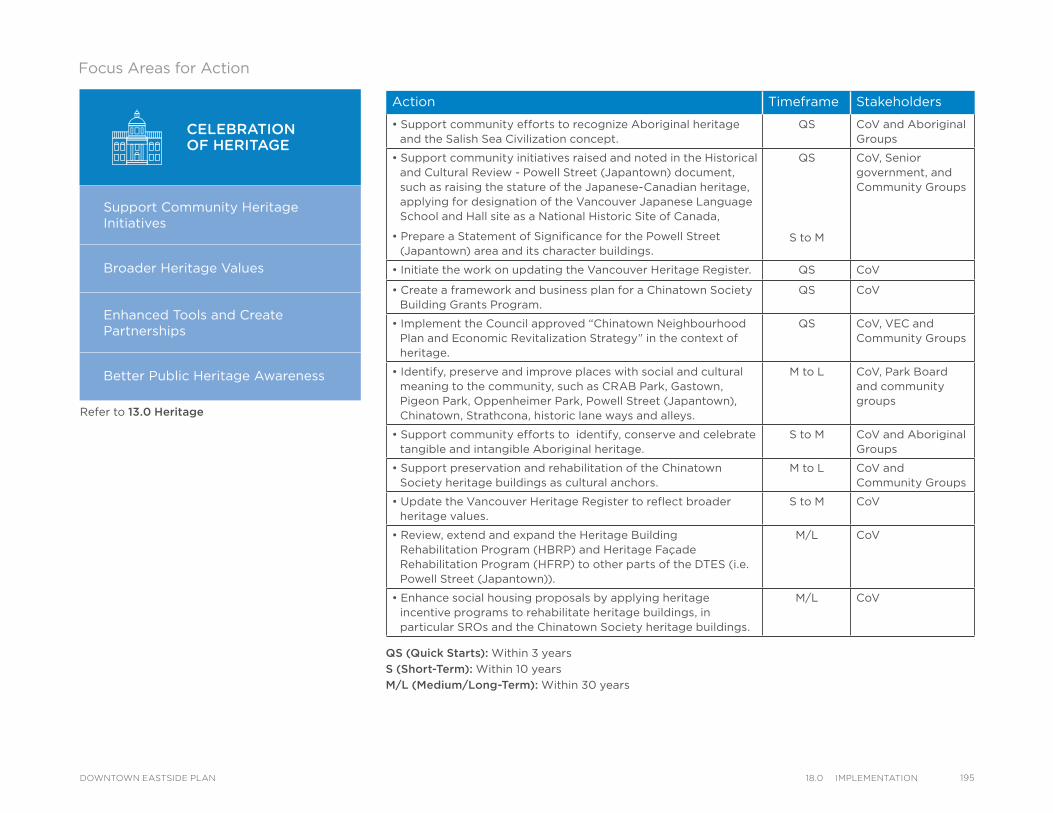
Refer to 13.0 Heritage
Action Timeframe Stakeholders
• Support community efforts to recognize Aboriginal heritage and the Salish Sea Civilization concept.
QS CoV and Aboriginal Groups
• Support community initiatives raised and noted in the Historical and Cultural Review - Powell Street (Japantown) document, such as raising the stature of the Japanese-Canadian heritage, applying for designation of the Vancouver Japanese Language School and Hall site as a National Historic Site of Canada,
• Prepare a Statement of Significance for the Powell Street (Japantown) area and its character buildings.
QS
S to M
CoV, Senior government, and Community Groups
• Initiate the work on updating the Vancouver Heritage Register. QS CoV
• Create a framework and business plan for a Chinatown Society Building Grants Program.
QS CoV
• Implement the Council approved “Chinatown Neighbourhood Plan and Economic Revitalization Strategy” in the context of heritage.
QS CoV, VEC and Community Groups
• Identify, preserve and improve places with social and cultural meaning to the community, such as CRAB Park, Gastown, Pigeon Park, Oppenheimer Park, Powell Street (Japantown), Chinatown, Strathcona, historic lane ways and alleys.
M to L CoV, Park Board and community groups
• Support community efforts to identify, conserve and celebrate tangible and intangible Aboriginal heritage.
S to M CoV and Aboriginal Groups
• Support preservation and rehabilitation of the Chinatown Society heritage buildings as cultural anchors.
M to L CoV and Community Groups
• Update the Vancouver Heritage Register to reflect broader heritage values.
S to M CoV
• Review, extend and expand the Heritage Building Rehabilitation Program (HBRP) and Heritage Façade Rehabilitation Program (HFRP) to other parts of the DTES (i.e. Powell Street (Japantown)).
M/L CoV
• Enhance social housing proposals by applying heritage incentive programs to rehabilitate heritage buildings, in particular SROs and the Chinatown Society heritage buildings.
M/L CoV
CELEBRATIONOF HERITAGE
Support Community HeritageInitiatives
Broader Heritage Values
Enhanced Tools and Create Partnerships
Better Public Heritage Awareness
QS (Quick Starts): Within 3 years
S (Short-Term): Within 10 years
M/L (Medium/Long-Term): Within 30 years
Focus Areas for Action
19518.0 ImPlementatIonDOWNTOWN EASTSIDE PLAN
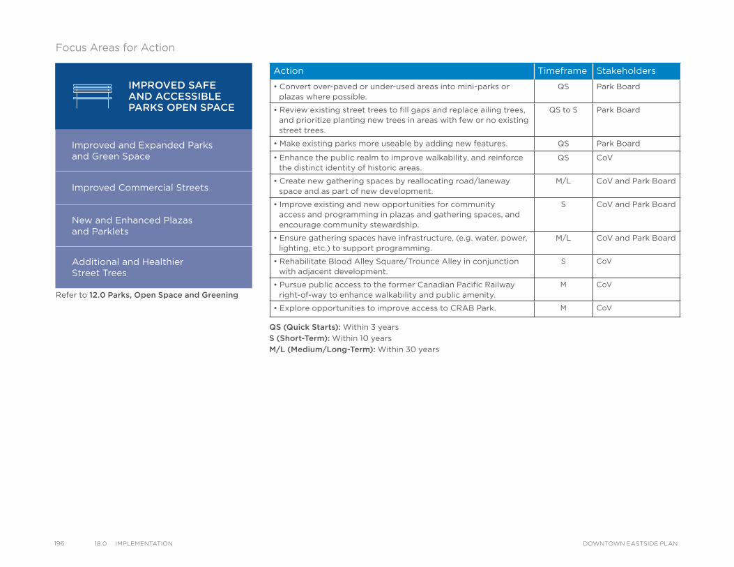
196 18.0 ImPlementatIon DOWNTOWN EASTSIDE PLAN
Refer to 12.0 Parks, Open Space and Greening
Action Timeframe Stakeholders
• Convert over-paved or under-used areas into mini-parks or plazas where possible.
QS Park Board
• Review existing street trees to fill gaps and replace ailing trees, and prioritize planting new trees in areas with few or no existing street trees.
QS to S Park Board
• Make existing parks more useable by adding new features. QS Park Board
• Enhance the public realm to improve walkability, and reinforce the distinct identity of historic areas.
QS CoV
• Create new gathering spaces by reallocating road/laneway space and as part of new development.
M/L CoV and Park Board
• Improve existing and new opportunities for community access and programming in plazas and gathering spaces, and encourage community stewardship.
S CoV and Park Board
• Ensure gathering spaces have infrastructure, (e.g. water, power, lighting, etc.) to support programming.
M/L CoV and Park Board
• Rehabilitate Blood Alley Square/Trounce Alley in conjunction with adjacent development.
S CoV
• Pursue public access to the former Canadian Pacific Railway right-of-way to enhance walkability and public amenity.
M CoV
• Explore opportunities to improve access to CRAB Park. M CoV
IMPROVED SAFEAND ACCESSIBLE PARKS OPEN SPACE
Improved and Expanded Parksand Green Space
Improved Commercial Streets
New and Enhanced Plazas and Parklets
Additional and Healthier Street Trees
Focus Areas for Action
QS (Quick Starts): Within 3 years
S (Short-Term): Within 10 years
M/L (Medium/Long-Term): Within 30 years
Refer to 12.0 Parks, Open Space and Greening
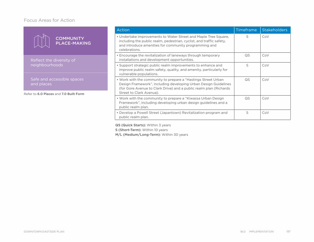
Refer to 6.0 Places and 7.0 Built Form
Action Timeframe Stakeholders
• Undertake improvements to Water Street and Maple Tree Square, including the public realm, pedestrian, cyclist, and traffic safety, and introduce amenities for community programming and celebrations.
S CoV
• Encourage the revitalization of laneways through temporary installations and development opportunities.
QS CoV
• Support strategic public realm improvements to enhance and improve public realm safety, quality, and amenity, particularly for vulnerable populations.
S CoV
• Work with the community to prepare a “Hastings Street Urban Design Framework”, including developing Urban Design Guidelines (for Gore Avenue to Clark Drive) and a public realm plan (Richards Street to Clark Avenue).
QS CoV
• Work with the community to prepare a “Kiwassa Urban Design Framework”, including developing urban design guidelines and a public realm plan.
QS CoV
• Develop a Powell Street (Japantown) Revitalization program and public realm plan.
S CoV
COMMUNITYPLACE-MAKING
Reflect the diversity of neighbourhoods
Safe and accessible spacesand places
Focus Areas for Action
QS (Quick Starts): Within 3 years
S (Short-Term): Within 10 years
M/L (Medium/Long-Term): Within 30 years
19718.0 ImPlementatIonDOWNTOWN EASTSIDE PLAN
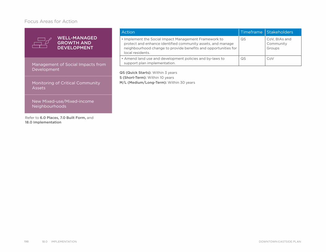
198 18.0 ImPlementatIon DOWNTOWN EASTSIDE PLAN
WELL-MANAGEDGROWTH ANDDEVELOPMENT
Management of Social Impacts from Development
Monitoring of Critical Community Assets
New Mixed-use/Mixed-income Neighbourhoods
Refer to 6.0 Places, 7.0 Built Form, and 18.0 Implementation
Action Timeframe Stakeholders
• Implement the Social Impact Management Framework to protect and enhance identified community assets, and manage neighbourhood change to provide benefits and opportunities for local residents.
QS CoV, BIAs and Community Groups
• Amend land use and development policies and by-laws to support plan implementation.
QS CoV
QS (Quick Starts): Within 3 years
S (Short-Term): Within 10 years
M/L (Medium/Long-Term): Within 30 years
Focus Areas for Action
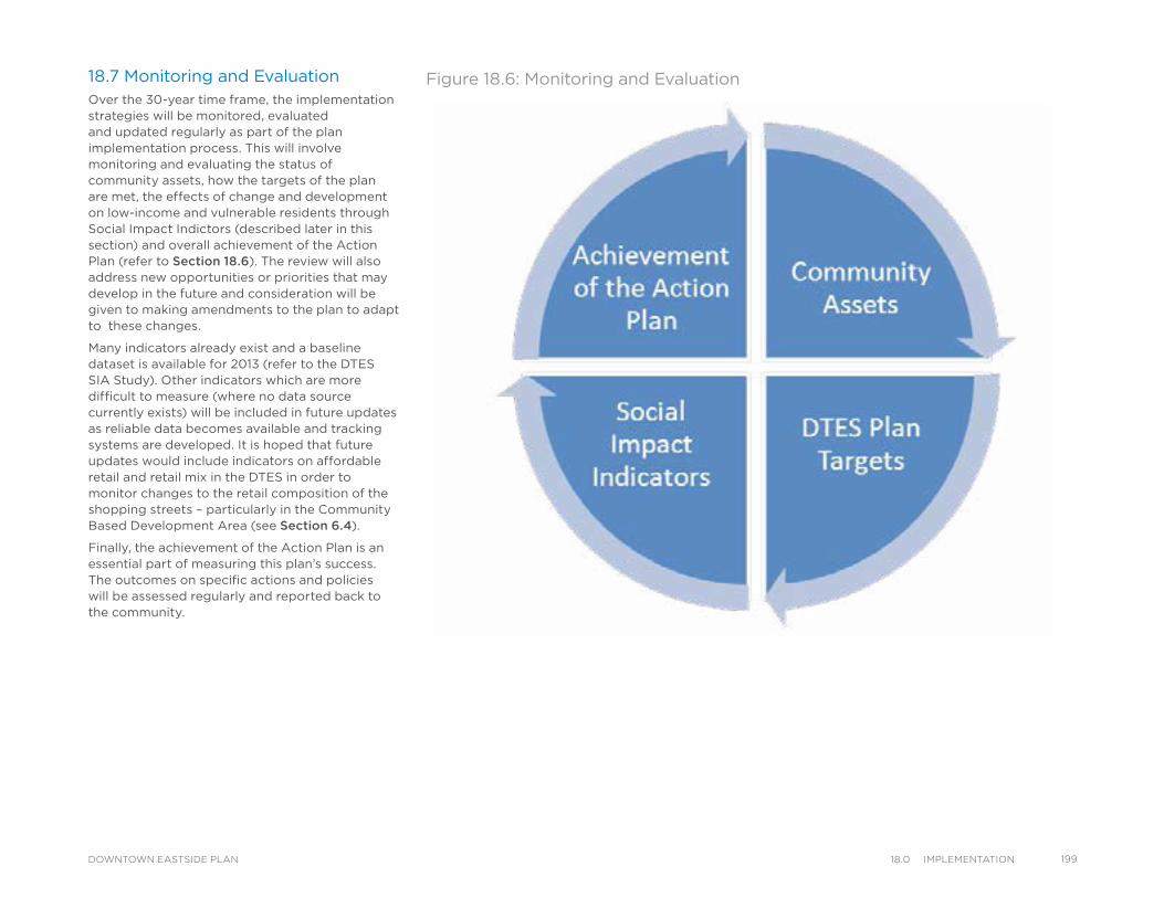
18.7 Monitoring and EvaluationOver the 30-year time frame, the implementation strategies will be monitored, evaluated and updated regularly as part of the plan implementation process. This will involve monitoring and evaluating the status of community assets, how the targets of the plan are met, the effects of change and development on low-income and vulnerable residents through Social Impact Indictors (described later in this section) and overall achievement of the Action Plan (refer to Section 18.6). The review will also address new opportunities or priorities that may develop in the future and consideration will be given to making amendments to the plan to adapt to these changes.
Many indicators already exist and a baseline dataset is available for 2013 (refer to the DTES SIA Study). Other indicators which are more difficult to measure (where no data source currently exists) will be included in future updates as reliable data becomes available and tracking systems are developed. It is hoped that future updates would include indicators on affordable retail and retail mix in the DTES in order to monitor changes to the retail composition of the shopping streets – particularly in the Community Based Development Area (see Section 6.4).
Finally, the achievement of the Action Plan is an essential part of measuring this plan’s success. The outcomes on specific actions and policies will be assessed regularly and reported back to the community.
Figure 18.6: Monitoring and Evaluation
19918.0 ImPlementatIonDOWNTOWN EASTSIDE PLAN
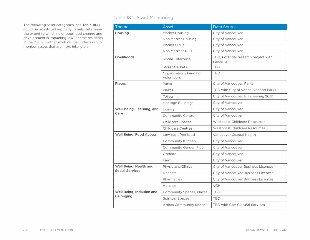
200 18.0 ImPlementatIon DOWNTOWN EASTSIDE PLAN
The following asset categories (see Table 18.1)could be monitored regularly to help determine the extent to which neighbourhood change and development is impacting low-income residents in the DTES. Further work will be undertaken to monitor assets that are more intangible.
Table 18.1: Asset Monitoring
Theme Asset Data Source
Housing Market Housing City of Vancouver
Non Market Housing City of Vancouver
Market SROs City of Vancouver
Non Market SROs City of Vancouver
LivelihoodsSocial Enterprise
TBD, Potential research project with students
Street Markets TBD
Organizations Funding Volunteers
TBD
Places Parks City of Vancouver, Parks
Plazas TBD with City of Vancouver and Parks
Toilets City of Vancouver, Engineering 2012
Heritage Buildings City of Vancouver
Well-being, Learning, and Care
Library City of Vancouver
Community Centre City of Vancouver
Childcare Spaces Westcoast Childcare Resources
Childcare Centres Westcoast Childcare Resources
Well Being, Food Access Low cost, free food Vancouver Coastal Health
Community Kitchen City of Vancouver
Community Garden Plot City of Vancouver
Orchard City of Vancouver
Farm City of Vancouver
Well Being, Health and Social Services
Physicians/Clinics City of Vancouver Business Licences
Dentists City of Vancouver Business Licences
Pharmacies City of Vancouver Business Licences
Hospice VCH
Well Being, Inclusion and Belonging
Community Spaces, Places TBD
Spiritual Spaces TBD
Artists Community Space TBD with CoV Cultural Services
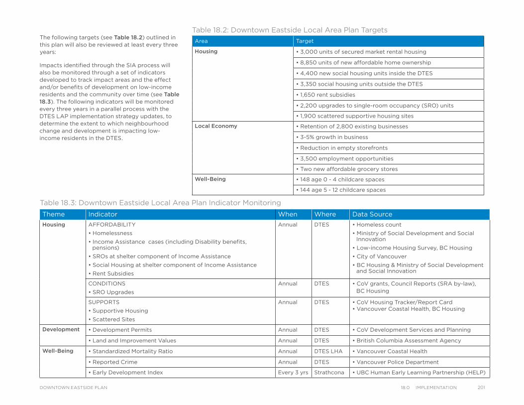
The following targets (see Table 18.2) outlined in this plan will also be reviewed at least every three years:
Table 18.2 Downtown Eastside Local Area Plan targets
Area Target
Housing • 3,000 units of secured market rental housing
• 8,850 units of new affordable home ownership
• 4,400 new social housing units inside the DTES
• 3,350 social housing units outside the DTES
• 1,650 rent subsidies
• 2,200 upgrades to single-room occupancy (SRO) units
• 1,900 scattered supportive housing sites
Local Economy • Retention of 2,800 existing businesses
• 3-5% growth in business
• Reduction in empty storefronts
• 3,500 employment opportunities
• Two new affordable grocery stores
Well-Being • 148 age 0 - 4 childcare spaces
• 144 age 5 - 12 childcare spaces
Table 18.2: Downtown Eastside Local Area Plan Targets
Theme Indicator When Where Data Source
Housing AFFORDABILITY
• Homelessness
• Income Assistance cases (including Disability benefits, pensions)
• SROs at shelter component of Income Assistance
• Social Housing at shelter component of Income Assistance
• Rent Subsidies
Annual DTES • Homeless count
• Ministry of Social Development and Social Innovation
• Low-income Housing Survey, BC Housing
• City of Vancouver
• BC Housing & Ministry of Social Development and Social Innovation
CONDITIONS
• SRO Upgrades
Annual DTES • CoV grants, Council Reports (SRA by-law), BC Housing
SUPPORTS
• Supportive Housing
• Scattered Sites
Annual DTES • CoV Housing Tracker/Report Card• Vancouver Coastal Health, BC Housing
Development • Development Permits Annual DTES • CoV Development Services and Planning
• Land and Improvement Values Annual DTES • British Columbia Assessment Agency
Well-Being • Standardized Mortality Ratio Annual DTES LHA • Vancouver Coastal Health
• Reported Crime Annual DTES • Vancouver Police Department
• Early Development Index Every 3 yrs Strathcona • UBC Human Early Learning Partnership (HELP)
Table 18.3: Downtown Eastside Local Area Plan Indicator Monitoring
Impacts identified through the SIA process will also be monitored through a set of indicators developed to track impact areas and the effect and/or benefits of development on low-income residents and the community over time (see Table 18.3). The following indicators will be monitored every three years in a parallel process with the DTES LAP implementation strategy updates, to determine the extent to which neighbourhood change and development is impacting low-income residents in the DTES.
20118.0 ImPlementatIonDOWNTOWN EASTSIDE PLAN
202 19.0 aCknoWledgements DOWNTOWN EASTSIDE PLAN
Many people representing local residents, community organizations, institutions, and stakeholder partners invested substantial time, energy, insight and expertise into preparing this plan. This commitment to the future well-being of the Downtown Eastside is sincerely appreciated and acknowledged with gratitude on behalf of the City and the communities involved. The following people and organizations are recognized for their exceptional dedication, without which the planning process would not have been achieved.
Downtown Eastside Local Area Planning Process CommitteeAt the direction of Council, the LAPP committee was co-chaired by representatives of Building Community Society and Downtown Eastside Neighbourhood Council, which enabled a very diverse group of stakeholders around the table to work with each other and City staff in a remarkable process.
The committee consisted of representatives from:
• Aboriginal Front Door Society (Kelvin Bee, Mona Woodward)
• Aboriginal Life in Vancouver Enhancement (Scott Clark, Grace Tait)
• Building Community Society (Ian Chang, Michael Clague, Ray Spaxman)
• Carnegie Community Centre Association (Jean Swanson, Gena Thompson, Phoenix Winter)
• Chinese seniors (Kim Tang, Lily Tang, translator Deanna Wong)
• Downtown Eastside Neighbourhood Council (Richard Cunningham, Jacek Lorek)
ACKNOWLEDGEMENTS
• Downtown Eastside Power of Women (Harsha Walia)
• Downtown Eastside Women’s Centre (Carol Martin, Fionna York)
• Gallery Gachet (Karen Ward)
• Gastown Business Improvement Association (Leonoire Salli)
• Hastings Crossing Business Improvement Association (Am Johal, Wesley Regan)
• Powell Street Festival Society/Japanese Language School and Hall (Kirsten Lambertson, Rika Uto)
• Strathcona Business Improvement Association (Joji Kumagi)
• Strathcona Elementary Parent Advisory Committee (Stacey Bonenfant, Angelia Ellis)
• Strathcona Residents Association (Pete Fry)
• Survival Sex Workers (Colleen Bourdreau)
• Vancouver Area Network of Drug Users (Dave Hamm, Ann Livingston)
• Vancouver Chinatown Business Improvement Association (Jordan Eng, Albert Fok)
• Vancouver Chinatown Revitalization Committee (Shirley Chan, Henry Thom)
• Vancouver Urban Core Community Workers’ Association (Hendrik Hoekema, Jonathan Oldman, Karen O'Shannacery)
• Western Aboriginal Harm Reduction Society (Tracey Morrison, Kevin Yake)
• Representatives of low-income and middle income residents at-large, and the dedication and contributions of many others in the community.
Community and City-wide Groups, Stakeholders, and Other Organizations• Atira Women’s Resource Society
• BC Housing
• British Columbia Institute of Technology
• Capilano University
• Carnegie Community Centre
• HAVE Culinary Training Society
• Inner City Neighbourhood Coalition
• Pigeon Savings Bank
• Portland Hotel Society
• Potluck Café
• Ray-Cam Co-operative Centre
• Simon Fraser University
• Strathcona Community Centre
• Streetohome
• United Gospel Mission
• University of British Columbia
• Urban Development Institute
• Vancouver Film School
• Vancouver Native Housing Society
• Vancouver Public Library – Carnegie Branch
• Vancity Credit Union
• Vancouver Board of Trade
• Vancouver Coastal Health
• Vancouver Community College
• Vancouver Foundation
• Vancouver Heritage Foundation
• Vancouver School Board
City Advisory Agencies, Boards and Committees• Active Transportation Policy Council
• Chinatown Historic Area Planning Committee
• Gastown Historic Area Planning Committee
• Seniors Advisory Committee
• Urban Design Panel
• Vancouver City Planning Commission
• Vancouver Heritage Commission
City Council Liaisons• Councillor Andrea Reimer
• Councillor Tony Tang
ConsultantsCoriolis Consulting Corp., Mcllhargey/Brown Associates Ltd.
Photography• Andrew Leung - cover (4), page 23,
40 (middle), 41 (lower), 42 (right), 77 (left)
• City of Vancouver Archives – page 47 (middle)
• EMBERS – page 113
• Gastown BIA – page 114 (upper)
• Henriquez Partners – page 67 (left)
• Perkins+Will –page 67 (right)
• Strathcona BIA – page 14, 108, 115, 155
All other photographs, credit City of Vancouver.
City Staff
General Manager of Planning and Development:
Brian Jackson
Downtown Eastside Plan Project Team:
Kevin McNaney (Assistant Director, Downtown Division), Tom Wanklin (Lead Planner), Tanya Fink, Wesley Joe, Tanis Knowles-Yarnell, Bonnie Ma
Previous team members: Celine Mauboules (Lead Planner), Eugene Boulanger, Allison Dunnet, Kira Gerwing, Camilla Lade, Jonathan Taylor
Staff Team:
Abi Bond, Debbie Anderson Eng, Elaine Ayres, Joshua Bassett, Kirsten Behler, Brad Badelt, Fergal Broderick, Cathy Buckham, Grace Cheng, Chris Clibbon, Andy Coupland, Thomas Daley, Michel Desrochers, Doug Durand, Nancy Eng, Aaron Grill, Marten Hansen, Hugo Haley, Scot Hein, Matthew Holm, Dianna Hurford, Ingrid Hwang, Michael Irvine, Zlatan Jankovic, Vanessa Kay, Catherine Kinahan, Angela Ko, Andrea Law, Lisa Leblanc, Wendy LeBreton, Kieran McConnell, Peter Marriott, Tamsin Mills, Thien Phan, Hayley Rowlands, Nicola Sharp, Paul Storer, Tracy Vaughan, Jayson Walker, Jennifer White, Mary Clare Zak
Interns:
Daniel Iwama, Edmund Ma, Carmut Me, Jeremy Stone, Sandra Vigil-Fonseca, Chelsey Wesley
20319.0 aCknoWledgementsDOWNTOWN EASTSIDE PLAN
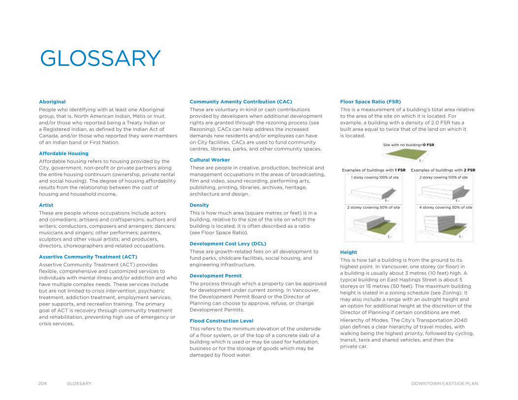
204 glossary DOWNTOWN EASTSIDE PLAN
Floor Space Ratio (FSR)
This is a measurement of a building’s total area relative to the area of the site on which it is located. For example, a building with a density of 2.0 FSR has a built area equal to twice that of the land on which it is located.
Height
This is how tall a building is from the ground to its highest point. In Vancouver, one storey (or floor) in a building is usually about 3 metres (10 feet) high. A typical building on East Hastings Street is about 5 storeys or 15 metres (50 feet). The maximum building height is stated in a zoning schedule (see Zoning). It may also include a range with an outright height and an option for additional height at the discretion of the Director of Planning if certain conditions are met.
Hierarchy of Modes. The City’s Transportation 2040 plan defines a clear hierarchy of travel modes, with walking being the highest priority, followed by cycling, transit, taxis and shared vehicles, and then the private car.
Examples of buildings with 1 FSR Examples of buildings with 2 FSR
Site with no building=0 FSR
2 storey covering 50% of site 4 storey covering 50% of site
1 storey covering 100% of site 2 storey covering 100% of site
Community Amenity Contribution (CAC)
These are voluntary in-kind or cash contributions provided by developers when additional development rights are granted through the rezoning process (see Rezoning). CACs can help address the increased demands new residents and/or employees can have on City facilities. CACs are used to fund community centres, libraries, parks, and other community spaces.
Cultural Worker
These are people in creative, production, technical and management occupations in the areas of broadcasting, film and video, sound recording, performing arts, publishing, printing, libraries, archives, heritage, architecture and design.
Density
This is how much area (square metres or feet) is in a building, relative to the size of the site on which the building is located. It is often described as a ratio (see Floor Space Ratio).
Development Cost Levy (DCL)
These are growth-related fees on all development to fund parks, childcare facilities, social housing, and engineering infrastructure.
Development Permit
The process through which a property can be approved for development under current zoning. In Vancouver, the Development Permit Board or the Director of Planning can choose to approve, refuse, or change Development Permits.
Flood Construction Level
This refers to the minimum elevation of the underside of a floor system, or of the top of a concrete slab of a building which is used or may be used for habitation, business or for the storage of goods which may be damaged by flood water.
Aboriginal
People who identifying with at least one Aboriginal group, that is, North American Indian, Métis or Inuit, and/or those who reported being a Treaty Indian or a Registered Indian, as defined by the Indian Act of Canada, and/or those who reported they were members of an Indian band or First Nation.
Affordable Housing
Affordable housing refers to housing provided by the City, government, non-profit or private partners along the entire housing continuum (ownership, private rental and social housing). The degree of housing affordability results from the relationship between the cost of housing and household income.
Artist
These are people whose occupations include actors and comedians; artisans and craftspersons; authors and writers; conductors, composers and arrangers; dancers; musicians and singers; other performers; painters, sculptors and other visual artists; and producers, directors, choreographers and related occupations.
Assertive Community Treatment (ACT)
Assertive Community Treatment (ACT) provides flexible, comprehensive and customized services to individuals with mental illness and/or addiction and who have multiple complex needs. These services include but are not limited to crisis intervention, psychiatric treatment, addiction treatment, employment services, peer supports, and recreation training. The primary goal of ACT is recovery through community treatment and rehabilitation, preventing high use of emergency or crisis services.
GLOSSARY
High-capacity Transit
Any form of transit that carries more people and typically provides faster, more frequent service with fewer stops than a local bus service
Housing First Approach
This approach involves providing homeless people who have mental health and/or addiction issues with immediate access to subsidized housing, together with supports. Key principles includes no conditions on housing readiness, housing choice, individualized support services, harm reduction, and social and community integration.
Income Assistance
A government transfer managed by the Ministry of Human and Social Development. Types of Income Assistance include: child in home of relative, expected to work, expected to work (medical condition), long term care, medical services only, no employment options, old age security, persons with persistent multiple barriers and persons with disabilities. Also known as welfare.
Informal Economy
Economic sectors that are not taxed or monitor and at times discouraged. It includes work such as binning and vending.
Inter-generational Housing
Inter-generational housing refers to housing projects that address the cultural, collective and individual housing and support needs of multiple generations as they move through various life cycles. Inter-generational housing may include various types of housing within one project – from independent, supported or assisted living for singles to family housing units. The focus of inter-generational housing is to promote a strong sense of cultural inclusion and belonging, safety, healthy communities and opportunities for both formal and informal support networks within a housing context.
Low Income
There are multiple measures of low income, including:
• Low Income Cut Off (LICO): Relative measure of low income status. Describes a household that spends over 20 percentage points on a median goods basket. Low Income Measures (LIM) varies by family size, community size and tax.
• Low Income Measure (LIM): Relative measure of low income status. Describes a household that learns less than half of median income.
• Market Basket Measure (MBM): Absolute measure of low income status. The disposable income needed for
a basket of goods.
Low Income Household
Determined by Statistics Canada as those households that qualify for Low Income Cut-off (LICO). LICO is the income level below which a family spends 20 per cent more of its income on necessities (food, shelter and clothing) than the average family does.
Mode of Transportation
This is the way a person gets around the city. Examples include walking, cycling, taking public transit, riding in a taxi, sharing a ride with someone, or driving.
Neighbourhood Energy Connectivity
Building design strategies required of developers in anticipation of future building connection to a Neighbourhood Energy System. These are described in detail in the City’s Neighbourhood Energy Connectivity Standards Design Guidelines (January 2014).
Neighbourhood Energy Systems (NES)
Shared infrastructure platforms which provide heating and/or cooling infrastructure for multiple buildings, and are most suitable in dense urban areas. NES provide the utility business model and economy of scale necessary to make use of a variety of renewable energy resources that are often not available or affordable to implement in individual buildings.
Public Art
This refers to artwork in any media that is made to engage with the public realm, usually outside and accessible to all.
Public Benefit Strategy (PBS)
A PBS provides strategic direction for future investments in the community over the long term. It includes six key areas that support livable, healthy and sustainable communities: community facilities, parks and open spaces, affordable housing, public safety, transportation and utilities.
Public Hearing
This is a meeting of City Council where members of the public can express their opinion on an issue prior to Council making a decision. A Public Hearing is a legal requirement for rezonings and by-law amendments.
Rezoning
This is the process through which development can be approved at a greater density or height than allowed under current zoning. City Council can approve, refuse, or amend rezonings after a Public Hearing.
Secure Market Rental Housing
Secured market rental housing means a development, or part of a development, used only as market rental housing with an attached covenant or housing agreement registered against title restricting its use to market rental housing for the longer of 60 years or the life of the building, or for such other term as may be agreed upon by the city and the owner.
Single Room Accommodation (SRA)
The term Single Room Accommodation (SRA) is based on a City by-law. Adopted in 2003, the SRA by-law designate as SRAs, all rooms in rooming houses and residential hotels in the Downtown Core, as well as all non-market housing with rooms or studio units less than 320 feet. So the term “SRA” is more encompassing and inclusive than “SRO” because it also includes small self-contained units, whereas an “SRO” refers to a single, 10x10 foot room without kitchen or bathroom. It should be noted that the SRA By-law includes buildings and rooms that had been closed due to fire or other reasons, as these rooms could re-open.
Single Room Occupancy (SRO) Hotels
SROs were built in the early 1900s to provide transitional housing largely for men working in the resource industries. A typical SRO room consists of one room of about 10 x 10 feet with shared bathrooms and minimal or no cooking facilities. Public SROs are owned and operated by a government or non-profit agency. Private SROs are owned by a private owner and may be privately operated or operated by a non-profit.
205glossaryDOWNTOWN EASTSIDE PLAN
206 glossary DOWNTOWN EASTSIDE PLAN
Single Room Occupancy (SRO) Strategy
The SRO Strategy is a combination of actions to improve both the affordability and the condition of SRO buildings and rooms, while minimizing loss of the stock. Actions include a new City grant to support the upgrading of rooms to include private bathrooms and cooking facilities for SRO buildings operated by non-profit organizations, an education strategy for tenants and landlords on rights and responsibilities, a City-funded pilot project to mediate landlord/tenant conflict and provide assistance through the Residential Tenancy Act arbitration process, a request to the Province to refine the Residential Tenancy Act for SRA-designated buildings, continuing to improve by-law enforcement and amendments to the SRA By-law. These actions are the result of the work of the SRO Task Force and are supported by the research findings of the 2013 Tenant Demographic and Low-Income Housing surveys. Actions will be supported by the work of the coordinated partnership of the City of Vancouver Integrated Enforcement and the Coordinated Working Group for Troubled Buildings as well as non-profit and private partners.
Social Enterprise
A non-profits or business that operates with the intention of improving social, economic and/or environmental well-being.
Social Housing
Social Housing means rental housing:
• In which at least one third of the dwelling units are occupied by persons eligible for either Income Assistance or a combination of basic Old Age Security pension and Guaranteed Income Supplement and are rented at rates no higher than the shelter component of Income Assistance;
• Which is owned by a non-profit corporation, by a non-profit co-operative association, or by or on behalf of the City, the Province of British Columbia, or Canada; and
• In respect of which the registered owner or ground lessee of the freehold or leasehold title to the land on which the housing is situated has granted to the City a section 219 covenant, housing agreement, or other security for the housing commitments required by the City, registered against the freehold or leasehold title, with such priority of registration as
the City may require.
Social Impact Assessment (SIA)
A study to review the impact of future development on the existing low-income residents of the Downtown Eastside. Involved community input, literature reviews and data analysis.
Supportive Housing (Congregate and Scattered Sites)
Supportive housing includes added services to help people living with mental health and addictions to live independently. Two types of supportive housing include ‘congregate’ supportive housing and ‘scattered sites’. Congregate supportive housing is a social housing building with supports tied to each unit. The scattered site model attaches supports, including income supports if needed, to a person living in either a social housing unit or private market rental unit.
Tenure
Refers to whether some member of the household owns or rents the dwelling or whether the dwelling is band housing (on an Indian reserve or settlement).
Transitional Housing
Transitional housing typically includes private rooms or apartments intended to provide a supportive living environment for individuals who have experienced repeated housing crises and require support and assistance over a sustained period to address their health and social needs.
View Corridor
This is a field of space that protects a view from a specific vantage point. View corridors help to determine the design and location of a building on a site to protect views for the public.
Vulnerable
A population at great risk of poor health conditions and well-being. Risk may be due to socio-economic conditions, gender, ethnicity, and a host of other facts.
Zoning
This is the legal tool used to regulate how land can be developed. Each zone or area in the city has a zoning schedule that sets out rules for a building’s use, siting, maximum density, building height, etc. (see Height).
APPENDIX I
LAPP Committee Terms of Reference: Principles, Porcesses and Relationships of the Downtown Eastside Local Area Planning Process
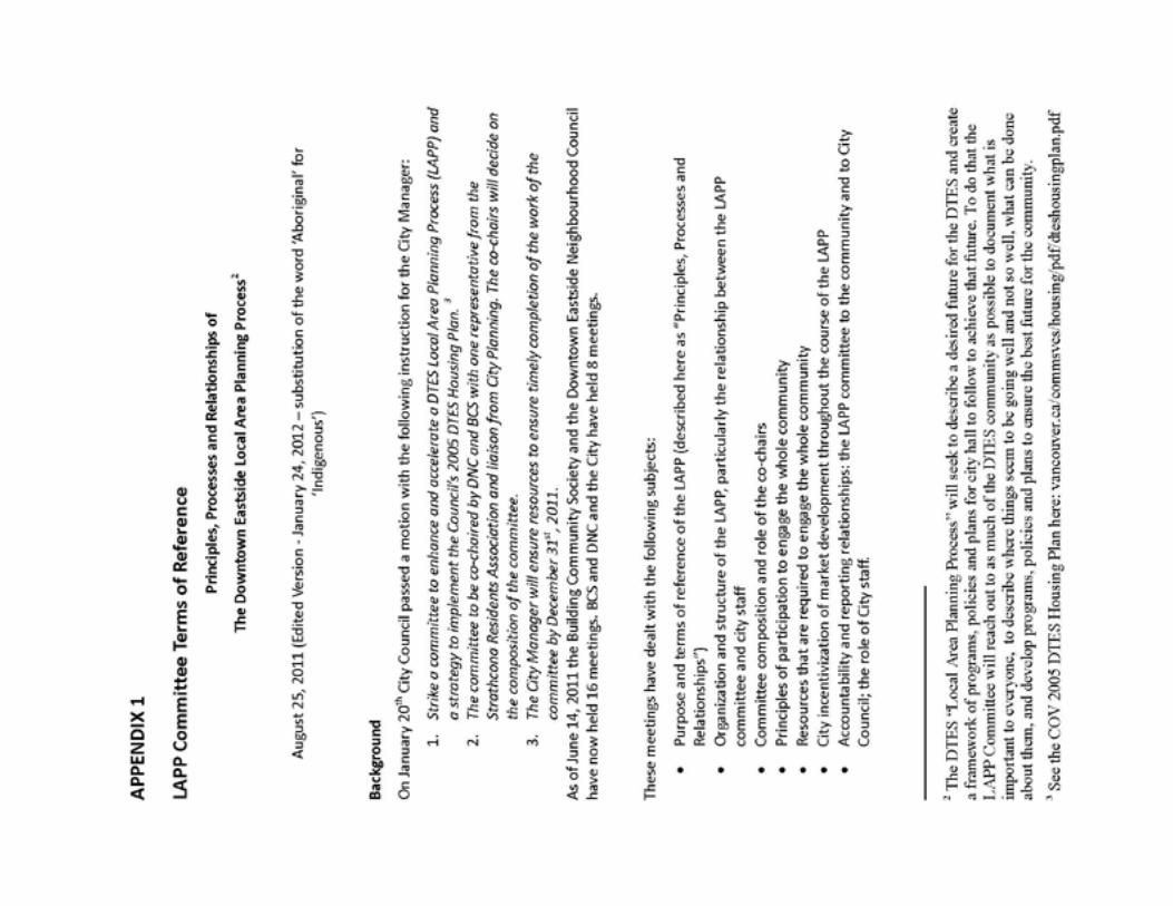
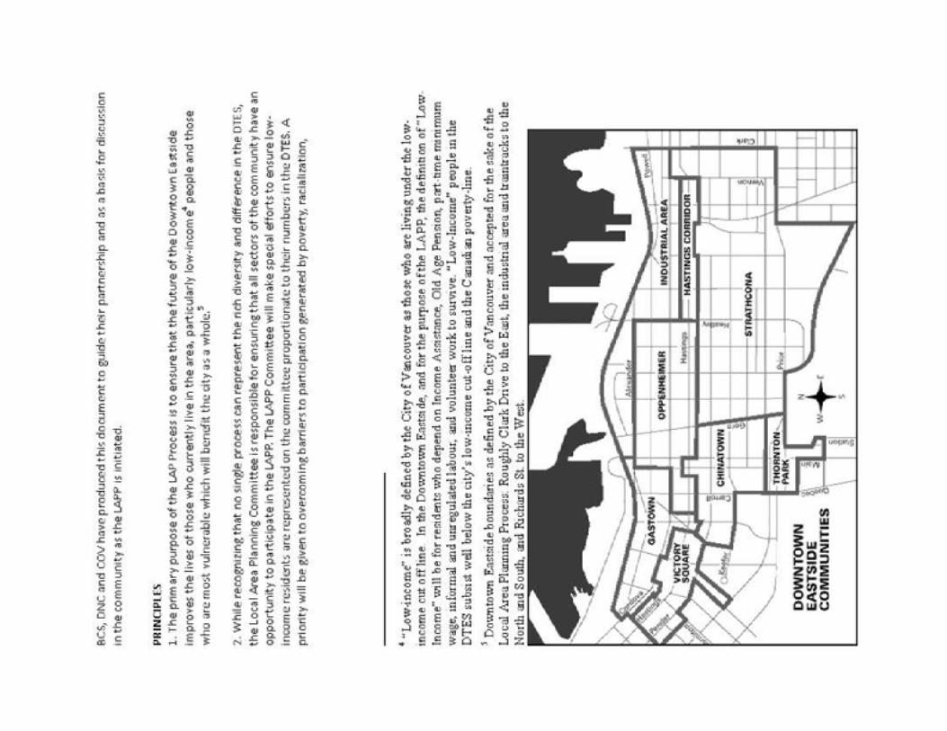
vancouver.ca/dtesplan
This plan was approved by
Vancouver City Council on March 15, 2014.
Printed © 2015