Embed Size (px)
Citation preview

DOLMAGE CN~.W ES Consulting Geological & Mining En~;ineers
1000 Guinncu:; Tower Vancouver 1, B.C.
British Columbia Hydro and Power Authority
THERMAL COAL RESOURCES OF BRITISH COLUMBIA
Y
Report on the
SIMILKAMEEN COALFIELDS of the
INTERIOR BELT of
BRITISH COLUMBIA
November 30, 1974

I DOLMAGE Cm.lPBELL & *SSOCIATES LTD.
I
I L
I LIST OF ILLUSTRATIONS
1
I
Figure 1
Figure 2
Figure 3
Figure 4
Figure 5
Figure 6
Figure 7
Figure 8
Table 1
Table 2
Location Map
District Geology
Tulameen Basin
Tulameen Coal Deposit
Cross-Section, Tulameen Basin
Princeton Basin
Princeton Coal Deposits
Schematic Cross-Section B-B’
Coal Reserves, Tulameen Basin
Coal Resources, Tulameen Basin
Following Page
3
4
7
7
7
17
17
17
Page
14
17
1 1
-l-
DOLMAGE CAMPBELL 6. ASSOCIATES LTD.
COHS”L,,NG GEOLOGICU & YlNlNG ENGINEERS
,000 OUINNESS TOWER
“*NCO”“ER 1. B.C.
SUMMARY
The Similkameen coalfields, centred on the confluence of the Tulameen ond Similkomeen Rivers and the town of Princeton in southern British Columibo, have produced coal continuously from 1909 to 1961. A total of 4,429,551 tons were extracted from the district during these years from the Tulameen and Princeton basins.
The Similkomeen coalfields occur within the Princeton Group of volcanic and sedimentary rocks of Eocene age. Coal lies within a central sedimentary formation of sandstone, shale, conglomerate and bentonite. The Princeton Group in the area occurs as several isolated Tertiary basins. Coal has been produced from the two largest.
The Tulameen coal deposit, which essentially consists of a coal zone 70 feet in thickness containing three coal seams with interbedded coaly shale and shaley cool, occurs within a 260 foot thick coal measure in the Tulameen basin. The zone, traced with a reasonable degree of confidence around most of the periphery of the basin, lends itself to extraction by open cast mining methods. The in situ strippoble reserves are estimated to be 40,600,OOO short tons grading 9000 B.T.U.‘s per lb. with selective mining. Deeper in situ coal resources in the basin ore calculated to be 146,500,OOO short tons grading 10,000 B.T.U.‘s per lb. Imperial Metals and Power Ltd. hold or control all coal licenses in the Tulameen basin.
The Princeton coal deposits occur essentially in four poorly-defined zones extending over 1700 feet of stratigraphic section within the southern half of the Princeton basin. Possible in situ strippable reserves ore estimoted to be 11,100,000 short tons grading 6000 B.T.U.‘s per lb. with selective mining. Although the northern half of the basin is unexplored postulated deep in situ coal resources are estimated at 4,700,000,000 short tons of unknown grade in the entire basin. Bethlehem Copper Corp. Ltd. are the largest license holder in the Princeton basin.
lt is concluded that a 250 megawatt thermal plant could probably be - supported by strippable coal reserves established in the Tulameen basin. Additional
tonnages may become available from the deeper parts of the basin providing that the underground coal con ultimately be extracted economically. The Princeton deposits offer restricted potential forthe development of substantial open cast coal reserves until more geological and quality information con be mode available by systematic exploration of the entire basin.

-2-
DOLMAGE CAMPBELL 6, ASSOCIATES LTD.
CONS”LTINO GEOtnGIcAl. .% H,H,NG ENGINEERS
,000 GUINNESS TOWER
VANCOUVER I, B.C.
2-2 INTRODUCTION
TERMS OF REFERENCE
Cool deposits in the Princeton area occur exclusively in Tertiary age sedimentary rocks. Lying within a 20 mile radius of the town of Princeton, British Columbia, this region of coal occurrence and post production has been designated the Similkameen Coolfields. Two basins, the Tulomeen and the Princeton, comprise the bulk of the coalfields. These basins contain sufficient quantities of coal to have supported relatively continuous mining operations in the district from 1909 to 1961.
Aside from presenting an in~ventory of the Similkomeen coal resources, the more specific objective of this study is: to investigate the potential of the coalfields OS a thermal coal source for power generation proposes.
AVAILABLE DATA
The data upon which this report is based have been derived essentially from the available government literature on the area OS well as from various reports by mining companies who have operated in the district. The district’s lengthy production history has been documented, more or less regularly, in the annual Minister of Mines reports. Three public companies, Imperial Metals and Power Ltd., Granby Mining Company Ltd. and Bethlehem Copper Corporation Ltd. have made their file data and reports available.
Following is a list of publications which comprise the principal source of data for the preparation of this report:
1909 Camsell, C. - “Tulameen District”, Geological Survey of Canada Summary Report.
1910 Comsell, C. - “Parts of the Similkameen and Tulameen Districts”, Geological Survey of Canada Summary Report.
1913 Camsell, C. - “Geology and Mineral Deposits of the Tulameen
District”, Geological Survey of Canada, Memoir 26.
1914 Dowling, D. B. - “Coalfields of Manitoba, Saskatchewan, Alberta,
and B.C.“, Geological Survey of Canada, Memoir 53.

J ./
1915
1915
1920
1947
1947
1952
1952
1972
Dowling, D. B. - “Coolfields and cool resources of Canada”, Geological Survey of Canada, Memoir 59.
Dowling, D. B. - “Coalfields of B.C.“, Geological Survey of Canada, Memoir 69.
I Cossidy, B.C. and Wilson R. R. - “Granby Consolidated Colliery”,
Coal Age, Volume 17, Number 7.
Hughes, E. R. - “The Princeton coolfield”, Western Miner,
Volume 20.
I
Rice, H. M. A. - “Geology and Mineral Deposits of Princeton
Map Area”, Geological Survey of Canada, Memoir 243.
Show, W. S. - “Princeton Coalfield”, Geological Survey of Canada, Paper 52-12.
Show, W. S. - “Tulameen Coalfield”, Geological Survey of Canada, Paper 52-19.
Donaldson, T. R. - “Petrography of Coal from Blakeburn Strip Mine”, Geological Survey of Canada, Paper 72-39.
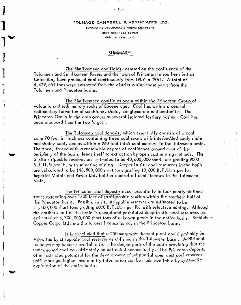
LOCATION AND ACCESS (49” 30’ N. Lat., 120° 30’ W. Long.) (Figure 1)
The Similkameen Coalfields in southern British Columbia lie at the southern extremity of the Interior Plateau, o short distance north of the International boundary. The district, centred on the confluence of the Tulameen and Similkameen Rivers, embraces cm area of remnant basins of Tertiary sedimentary rocks which comprise the coolfields.
The region is well serviced by road and rail. The all-weather Southern Transprovinciol Highway provides road access from east and west. Highway 5 from Merrit and Kamloops to the north joins the Southern Tronsprovincial at Princeton. The Kettle Valley brunch of the Canadian Pacific Railway connects Princeton with Vancouver on the coast, via Spences Bridge, a distance of 275 miles by rail.
CLIMATE AND PHYSIOGRAPHY
The Similkameen district lies, for’the most part, in the Interior Plateau, but abuts the Cascade Mountains on its western and southern borders. The Tulameen and Princeton basins are situated in the transition zone separating these two physiographic regions. Hence the terrain comprises rolling hills and ridges dis:ected sharply by numerous streams and two large rivers, the Similkomeen and the Tulameen. Glaciation has mantled most of the areas of Tertiary rocks with deposits ranging up to fifty feet in depth.
-?&ggy . “ANCOuvtP, CANADA
---%%.>?9n B.C.HYDRO 8 POWER AUTHORITY
VANCOUVER, CANADA
Es@@ TERTlARY SEDIMENTARY ROCKS
.-_..-
A ,-
LOCA-I-ION MAP JJ I
(0 : 16mi.
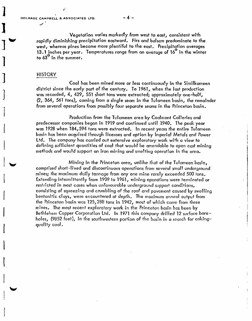
Vegetation varies markedly from west to east, consistent with rapidly diminishing precipitation eastward. Firs and balsam predominate to the west, whereas pines become more plentiful to the east. Precipitation averages 13.1 inches per year. Temperatures range from an overage of 16O in the winter to 63O in the summer.
HISTORY
Coal has been mined more or less continuously in the Similkomeen district since the early part of the century. To 1961, when the lost production wcs recorded, 4, 429, 551 short tons were extracted; approximately one-half, (2, 364, 561 tons), coming from a single seam in the Tulameen basin, the remainder from several operations from possibly four separate seams in the Princeton basin.
Production from the Tulameen arecl by Coalmont Colleries and predecessor companies began in 1919 and continued until 1940. The peak year was 1928 when 184,594 tons were extracted. In recent years the entire Tulameen basin has been acquired through licenses and option by Imperial Metals and Power Ltd. The company has carried out extensive exploratory work with a view to defining sufficient quantities of coal that would be amendable to open cast mining methods and would support an iron mining and smelting operation in the area.
Mining in the Princeton area, unlike that of the Tulameen basin, comprised short-lived and discontinuous operations from several small underground mines; the maximum daily tonnage from any one mine rarely exceeded 500 tons. Extending intermittently from 1909 to 1961, mining operations were terminated or restricted in most cases when unfavourable underground support conditions, consisting of squeezing and crumbling of the roof and pavement caused by swelling bentonitic clays, were encountered at depth. The maximum annual output from the Princeton basin was 125,288 tons in 1942, most of which came From three mines. The most recent exploratory work in the Princeton basin has been by Bethlehem Copper Corporation Ltd. In 1971 this company drilled 12 surface bore- holes, (9852 feet), in the southwestern portion of the basin in a search for coking- quality cool.

-- DOLMAGE CAMPBELL & ASSOCIATES LTD. CONSULTANT
BC. HYDRO 8 POWER AUTHORITY
VANCOUVER , CANADA -.-l_ls_“~ .,-, _-
&W%MEEN COALFIELDS
DISTRICT GEOLOGY

-5-
2-3 COALFIELD GEOLOGY
Coal deposits in the Similkameen fields occur exclusively in sedimentary rock which lies between two Tertiary volcanic formations. Together the three formations comprise the Princeton Group.
PRINCETON GROUP (Figure 2)
The basal volcanic formation in the Princeton Group contains massive and banded lavas with a few thin tuffaceous beds. The colour varies from grey-purplish to purplish-red. The estimated thickness is somewhat in
excess of 4500 feet.
The sedimentary rocks, designated the Allenby Formation in the Princeton basin, consist of fluvial and lacustrine sediments with intercalated coal horizons. These rocks for the most part overlie the lower volcanic formation but also in the district frequently are found in unconformable contact with under- lying Upper Triassic volcanic and Cretoceous granitic intrusive basement rocks. The Allenby Formation contains fine grained shale, a&sic sandstone, and conglo- merate with predominantly granitic boulders. Coal and bentonitic clays occur at
intervals throughout the sedimentary section. The estimated thickness of the formation is 3500 feet.
The upper volcanic formation, approximately 500 feet in thickness, is characterized by lengthy sections of pyroclastic rocks, (tuffs, agglomerates, etc.), interbedded with massive volcanic flows. They tend to be reddish-black in colour.
The age of the Princeton Group has been dated as Eocene, although the upper volcanic formation may extend into the Oligocene. In the Similkameen district, Princeton Group sedimentary rocks are distributed in two large basins, the Princeton basin and the Tulameen basin, and in several, much smaller basins which, because of their limited areal extent, are of little economic interest.
TULAMEEN BASIN (Figure 3)
The Tulameen basin consists of an elongate, northwesferly-trending sequence of sedimentary rocks, which covers an area 34 miles in length by 2; miles in width. The sedimentary formation comprising the centre of the basin conformably overlies lower volcanic rocks of the Princeton Group at the north- western edge of the basin, but toward the southeast it overlaps these volcanic rocks and rests directly on the pre-Tertiary basement. The formation, exhibiting
a thickness of 2560 feet, is not overlain by Princeton Group volcanic rocks, having been folded, eroded, and subsequently caPped by younger volcanic rocks of
Miocene-Pliocene age.
-6-
The strata comprising the sedimentary formation are divisible into three distinct memben; an upper member (1900 feet in thickness), a middle coal- bearing member (460 feet), and a basal member (200 feet). The basal member contains sandstone, shale, and siltstone with one or two thin lava flows. The middle member contains shale, siltstone, sandy shale, and minor sandstone with interbedded coal and bentonite. The coal measure lies in the lower 260 feet of the middle member.
The upper member exhibits a marked change in lithology. The strata comprise massive beds of conglomerate and sandstone indicating rapid deposition of material. A f ew e s o s a e and minor lenses of cooly material b d f h I reflect local short-lived quiescent conditions in the basin. This relatively abrupt major change in the sedimentary environment, from coal forming swamps to on inundation of molasse-type conglomerates, is common to other explored Tertiary basins in the central interior belt of British Columbia.
Structurally, the basin has been folded in synclinal fashion along a northwest axis. Asymetrically folded, the basin exhibits gentle (20°-25’) dips on its southwestern limb and steeper (40”-65’) dips on its northeastern flank (Figure 5). Two large fault zones which partially transect the basin (Figure 4), have been mapped in old mine workings. The faults strike northeast and north northeast and dip steeply. Severely crushed coal beds along the northeastern rim of the basin probably reflect differential movement due to folding rather than indications of faulting.
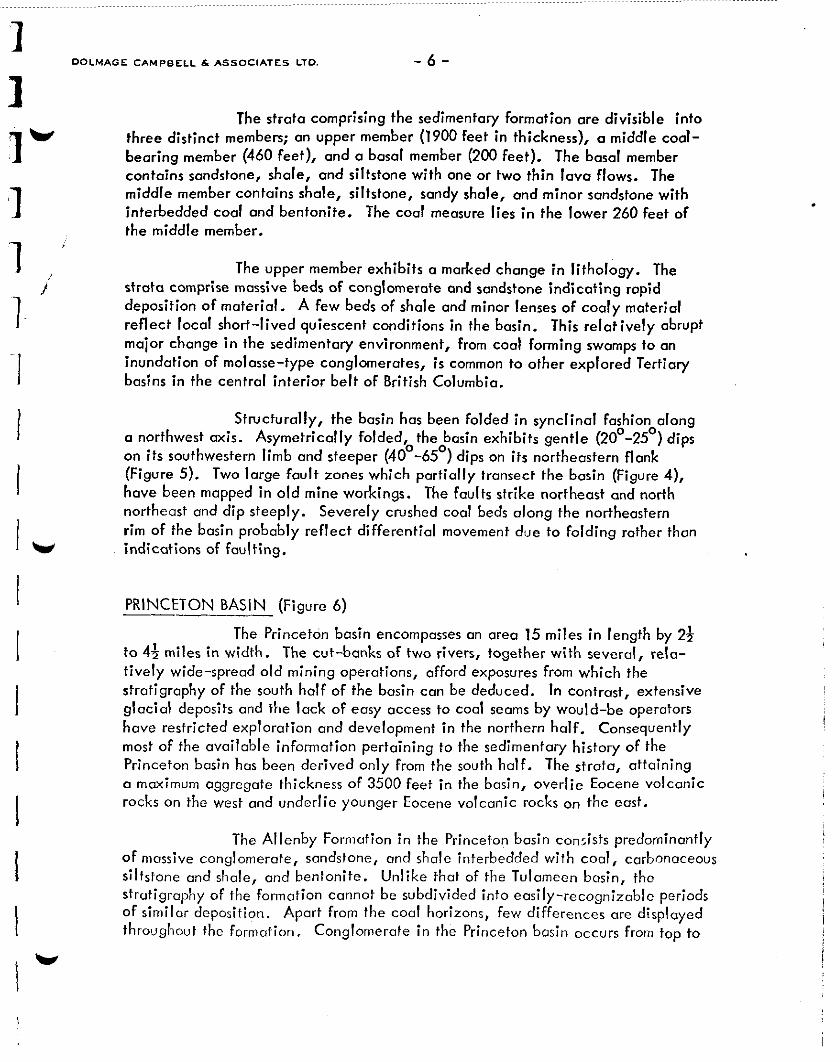
PRINCETON BASIN (Figure 6)
The Princetdn basin encompasses on area 15 miles in length by 24 to 4; miles in width. The cut-banks of two rivers, together with several, rela- tively wide-spread old mining operations, afford exposures from which the stratigraphy of the south half of the basin con be deduced. In contrast, extensive glacial deposits and the lack of easy access to cool seams by would-be operators have restricted exploration and development in the northern half. Consequently most of the available information pertaining to the sedimentary history of the Princeton basin has been derived only from the south half. The strata, attaining Q maximum aggregate thickness of 3500 feet in the basin, overlie Eocene volcanic rocks on the west and underlie younger Eocene volcanic rocks on the east.
The Allenby Formation in the Princeton basin con:ists predominantly of massive conglomerate, sandstone, and shale interbedded with coal, carbonaceous siltstone and shale, and bentonite. Unlike that of the Tulamccn basin, tho strutigraphy of the formation cannot be subdivided into easily-recognizable periods of similar deposition. Apart from the coal horizons, few differences ore displayed throughout the formation, Conglomerate in the Princeton basin occurs from top to
.

bottom of the sedimentary sequence, whereas in the Tulameen basin conglomerate generally is confined to the upper two-thirds of the formation, and above the coal measure. Four coal zones, possibly five, are evident in the Princeton basin. They occur within (I coal measure, or stratigraphic interval, of approximately 1700 feet in thickness near the middle of the Allenby Formation.
The sedimentary strata in the Princeton basin appear to be much more complexly folded than those in the Tulameen basin. The southern half of the Princeton basin comprises a broad, northerly-trending synclinal structure modified by three anticlinal folds; one anticline trends east-west, the other two trend essentially north-south. In general, on the western flank of the basin the strata dip steeply eastward, flattening toward the deeper part of the basin. In the northern half of the basin the structure is incompletely understood due to a lack of outcrop and sparse exploration activity. No maior faults are in evidence or have been interpreted in the Princeton basin. A comprehensive drill exploration program, incorporating a few deep drill holes, will be required if the structure of the Princeton basin is to be clearly understood.
1

LEGEND
A- A EDGE OF BASIN
A
OLD MINE WORKINGS
WLAMEEN BASIN SYNCLINAL AXIS
.:
./
I
i
!
/
! I

Souttwest A
LEGEND
MlocmE - PLIOCENE “GLCANICS
EOCENE SEDIMEN7ARY ROCKS
EOCENE VOLCANICS
A’ Northeast ~,
y-y& ... . . . . . . . . . . -.\x t\,
CROSS - SECTION TULAMEEN BASIN

2-4 TULAMEEN COAL DEPOSIT
ECONOMIC GEOLOGY
HISTORY: Exploration for coal in the Tulameen basin began around the turn of the century. Coal was found in outcrop in Collins Gulch and Fraser Gulch and at a locality between these gulches known as Bear’s Den, (Figure 4). Exten- sive exploration and development were done; but, with very poor results, no production was achieved. L t a er, coal was discovered in outcrop along the south- western rim of the basin on Blakeburn Creek. These exposures were developed successfully and production began in 1919 and extended through 1940. Mining, confined to one seam ranging in thickness from 7 to 12 feet, was carried out along strike for 7500 feet and down dip for 2500 feet. Three separate underground mines were developed, separated from one another by faults.
Beginning in 1954, Mullins Strip Mine Co. Ltd. produced 238,000 tons of coal from the No. 3 Mine pillar by open-cast mining. In addition, the company implemented further exploration along the northeastern rim of the basin by trenching the area between Collins’ and Fraser Gulches. Six thousand feet of continuous coal was established along strike around the northeastern periphery of the basin.
Subsequently, Imperial Metals and Power Ltd. carried out extensive exploration over the entire periphery of the basin with a view to defining sufficient coal reserves to support a possible intergrated iron pelletizing operation in the area. The company exposed the main coal zone on the southwest rim northwestward for an additional 7500 feet and drilled the zone to provide samples for testing purposes. In addition, further trenching along the northeastern rim extended the coal zone exposures an additional 8000 feet northwestward.
COAL RIGHTS: Imperial Metals and Power Ltd. presently hold or control coal licenses encompassing the entire Tulameen basin. The company directly controls 2,880 acres held under lease from the Government of British Columbia. The remaining 2,560 acres are held under lease by Mullins Strip Mine Co. Ltd. who has optioned its rights to Imperial Metals and Power Ltd.
The coal leases held by Imperial Metals and Power Ltd. are:

No. 145 320 acres
No. 146 320 acres
No. 147 320 acres
No. 154 640 acres
No. 15.5 320 OCES
No. 156 3200~~s
No. 157 160 acres
No. 158 320 acres
No. 159 160 acres
The coal leases held under option from Mullins Strip Mines Ltd.
No. 69 640ocres
No. 70 640 owes
No. 71 320 acres
No. 125 640 acres
No. 126 320 acres
COAL MEASURE: The coal-bearing member within the sedimentary sequence of the Tulameen basin is 460 Feet in thickness. The coal measure within the member
occurs in the lower 260 feet of the member. Coal seams are interbedded with shale, bentonite and minor sandstone.
The coal measure, characterized by dark grey to chocolate- coloured fissile shales, thin beds of bentonite, siltstone, and coal, can be traced with reasonable confidence throughout the entire periphery of the Tulameen basin. The rim of the basin has been explored by bulldozer-trenching for approximately three quarters of its length.
COAL ZONES: Exploration carried out by Imperial Metals and Power Ltd. and Muiiin Strip Mine Co. Ltd. has defined a coal-bearing section that averages 70 feet in thickness and ranges up to 120 feet in thickr,css. The section hos been explored most intensely at two localities around the rim of the basin; on Blokeburn Creek where all production from the basin occurred, al,d on the northeast where
intermittent explol.ation (surface and underground) I ,as b(>cn undertaken over many
years.

! Four cool seams have been recognized in the cool section on
Blakeburn Creek; the upper three, ronging in thickness from 7-12 feet, are interbedded with cooly shale and ore sufficiently close together to form o single mineable coal zone. The lowest (fourth) seam, of unknown thickness, apparently lies near the base of the cool section; however, little is known about
this seam. The uppermost seam in the coal section, which also occurs within the mineoble coal zone, provided all of the underground production from the Tulomeen
basin.
The cool zone has been traced by bulldozer trenching for 7500 feet in strike length, occurring os a surface pillar above the old underground mines. Mullins Strip Mine CO. Ltd. h ave extracted 238,000 tons of coal from the surface pillar of the old No, 3 mine since 1954. The zone has been traced north- westward for on additional 7500 feet by bulldozer trenching and by drilling four
holes.
On the northeast rim of the basin bulldozer trenching confirmed the continuity of the coal zone between the Collins and the Fraser gulches, os shown on Figure 4. A width of 70 feet of coal and cooly shale is indicated.
The area between Blakeburn Creek and the northeastern area on the northern rim of the basin has been explored by bulldozer trenching, although not as systematically and thoroughly OS the two principal localities. However, sufficient exploration has been done to indicate that the zone is continuous.
Along the eastern rim, insufficient bulldozer trenching has been done to determine fully whether the cool zone continues oround the complete periphery of the basin, although it is evident that the cool member does.
COAL RESERVES
The known and inferred coal in the Tulameen basin has been separated into two basic types for the purpose of the present evaluation:
(a) Reserves -- coal that can be mined by currently economic methods.
(b) Resources -- cod that probably cannot be mined by currently economic methods but which may prove economically recoverable in the future by means of new mining technology. The future possibility of underground gasification may be considered for such deposits.

In the Tulomeen basin underground mining in the past was economically limited at depth by squeezing roof support conditions.
COAL GRADE
The colorific value of the coal mined in the early days by Coolmont Collieries Ltd. is reported to have averaged 11,800 B.T.U.‘s per lb.; however, the earlier mined coal wets extracted from a single seam hence this figure connot be expected to apply over a wider zone of poorer quality coal mined by normal surface methods or mechanized underground methods. The coal mined by Mullin Strip Mine Ltd. averaged 9000 B.T.U.? per lb. and apparently consisted of coaly shale material that contained these coal seams, all included within the 70 foot thick coal zone. Some sorting was apparently carried out selectively during the mining.
Imperial Metals and Power Ltd. analyzed coal from three of the four holes drilled in the area north of the old underground workings. A composite of the three samples returned the following proximate analysis:
TOTAL MOISTURE
RESIDUAL MOISTURE
ASH.
VOLATILE MATTER
FIXED CARBON
SULPHUR
%
%
%
%
%
%
As Received Air Dry 2.Y
7.4 -- --
-- 1.3 --
20.22 21.55 21.83
29.86 31.82 .32.24
42.52 45.33 45.93
-29 .31 .31
CALORIFIC VALUE BTU’s per lb. 10,028 10,687 10,828
The above samples were derived from the clean coal intersected in the drill holes and did not include the shale bands which must be mined with the coal and cooly shale. Sink float tests run by the company from four samples indicated that if all material in the zone is included the calorific value averages 7,091 B.T.U.‘s per lb.
The grade of the potential resources of the Tulameen basin, where better selectivity of coal would be achieved by underground mining, but to a much
lesser extent by surface stripping, of individual seams would be approximately 10,000 B.T.U.‘s per lb. The grade of the best seom was 11,800 B.T.U.‘s per lb.; presumably, the two lower seams in the zone consist of poorer quality coal, hence they were not mined.

~fnce this cool is non-agglomerating it would be ranked as sub- bituminous A on the basis af the above analyses.
SURFACE COAL RESERVES
Opencast (strip) mining in the Tulameen basin is contingent on the local influence of two principal conditions; namely, the general ruggedness of the terrain, and the variable dips of the sedimentary strata containing the coal zone. Because of these variabilities, the coal/waste stripping ratios will differ considerably in different sectors of the basin periphery. The influence of topo- graphy alone can be inferred from the contours around the periphery of the basin shown in Figure 3.
For this report the Tulameen surface coal reserves are considered to be established and are placed in proven, probable and/or possible categories, recognizing that detailed studies of stripping ratios may prohibit surface mining in some localities.
Criteria: The periphery of the Tulameen basin has been divided into four sectors for the purpose of calculating coal reserves, (Figure 4). They are; the southwest (Blakeburn Creek), the north, the northeast, and the east sectors. The dips of the coal zane in each sector are based on assumed di s of 20’ - 35’ northeast along the southwest portion of the basin, and 40° - 65
8 southwest along the northeast
portion. Intervening dips, on the north and east, are assumed to be approximately 4o”. The lengths of the sectors are: southwest, 15,000 feet; north, 8000 feet; northeast, 8000 feet; and east, 8500 feet. The average thickness of the zane is estimated to be 70 feet. The tonnage factor used for the mixed coal and coaly
shale that comprise the zone is 21.6 cu. ft. per ton.
Categories for established reserves are defined as follows for the Tulameen basin:
Proven reserves are those whose continuity along strike has been demonstrated by systematic bulldozer trenching and supported by diclmond drilling or underground workings down dip. The coal zone is then projected down dip to a vertical distance of 150 feet regardless of the prevailing stripping ratio.
Probable reserves ore those whose continuity along strike can be projected with areasonable degree of confidence on the basis of continuous geology, supported by some bulldozer trenching. They have been projected down dip to a vertical distance of 150 feet. In addition, probable rcscrves are calculated to extend down dip a further 50 feet vertically (to 200 feet) beneath proven reserves.

f
Possible reserves ore those that ore inferred to exist by reason of well established surface geological indications. They ore taken down dip to o vertical depth of 150 feet and have been further assumed to exist 50 feet vertically (to 200 feet) below probable reserves in those sectors where no proven reserves are
/
indicated.
Table 1 lists the calculations for the established surface coal reserves in the Tulameen basin, based on the above-described porameters. In summary these reserves are:
Proven 18.15 million short tons
Probable 13.68 million short tons
Possible 8.77 million short tons
TOTAL 40.6 million short tons of surface cool.
Probable calorific value = 7000 B.T.U.‘s/lb. with no selective mining.
= 9000 B.T.U.‘s/lb, with selective mining.

- 14 -
TABLE 1
COAL RESERVES, TULAMEEN BASIN
(A) Mineable by Surface Methods
Short tons
Proven Reserves
Southwest Sector 15000x 70 x 150 21.6 z27Jo
Northeast Sector 6000 x 70 x 150 21.6 cor53$O
Previous Stripping - Mullins Strip Mine Ltd.
Probable Reserves
North Sector
Northeast Sector
Southwest Sector (to 200 ft.)
Northeast Sector (to 200 ft.)
Possible Reserves --
East Sector
North Sector (to 200 ft.)
Northeast Sector
8000x70 x 150 21.6 &-4c$"
2000x 70 x 150 -__-
- 21.6 cos 53$f"
15000 x 70 x 50 21.6 G27s"
6000x70 x 50 21.6 cos53p
8500x70 x 150 c~
21.6 cos4Op
8000x70 x 50 21.6- cos 4o;O
2000x70 x 50 __---_-- 21.6 cos53~"
15,800,OOO tons
3,630,ooo
19,430,OOO tons - 280,000
18,150,OOO tons
6,000,OOO
1,210,000
5,260,OOO
1,210,000
6,370,OOO
2,000,000
400 000 ----w-c- 8,770,OOO tons
--__
TOTAL 40 600 OOOtons -‘--!--- ___-

UNDERGROUND COAL RESOURCES
The Tulomeen coal down-dip from the surface reserves has been categorized for the purpose of this report as potential resources, rather than established reserves, because the economy of modern underground mining in the
Tulomeen basin has not been determined at this time. There is little doubt that if the demand for this coal is great encugh methods will be found to mine it underground. Until such methods are known, the percentage of the coal that can be recovered is unknown, also, with current improvements in coal extraction technology, together with a possibility of employing in situ gasification at some time in the future, particularly in CI closed basin such as the Tulameen, no depth
limitation for underground mining has been set for the Tulameen cool. Any such limit would be arbitrary at this time. Therefore, the coal resources listed here for the Tulomeen basin are the total in situ tons.
Within the Tulameen coal zone three coal seams, with a combined coal thickness of 24% feet, occur within the 70 feet zone thickness. The calculations, shown in Table 2, are based on the assumption that the three seams would be mined individually underground.
As shown in Table 2, the calculations based on the described assumptions indicate potential in situ underground coal resources in the Tulameen basin to be in the order of:
146.5 million short tons
Probable calorific vdlue = 10,000 B.T.U.‘s/lb.
SUMMARY OF TULAMEEN BASIN COAL POTENTIAL:
Surface reserves:
Proven 18.15 million short tons Probable 13.68 million short tons Possible 8.77 million short tons
Total 40.6 million short tons
@ 7000-9000 B.T.U.‘s/lb.
Underground resources: 146.5 million short tons
@ 10,000 B.T.U.‘s/lb.
TOTAL 187.1 million short tons -

I ~3. DOLMAOE CAMPBELL h A5SOC1ATES LTD. - 16- 1
I- .A , Because of advances in underground mining technology, particularly
I-
since 1960, it is possible thbt much of the Tulameen coal could now be economically I recovered by underground mining; however, in the present evaluation it has been i assumed that this is not certain enough to permit such coal to be classed as
1
“reserves”, but rather that they should be considered as “potential resources”. At the same time, in this study the depth to which the Tulameen coal can be sensibly
j stripped from the surface has been arbitrorily set at 200 feet, with any coal below
3 I
that depth being considered OS a potential resource rather than an established
! reserve. This assumption is not unreasonable at this time; however, the economics of coal stripping hove improved in recent years, and may continue to do so for some
1 time; therefore, the 200-foot depth limit could possibly deepen considerably,
I depending on the future need for this coal.
. . : ,_ ,. -. .j __.. .

r/ - 17 -
TABLE 2
COAL RESOURCES, TULAMEEN BASIN
(B) Mineable by Underground Methods
Short tons
Southwest Limb:
Limb Strike Length 15,000 feet Coal Thickness 24.5 feet Tonnage Factor 24.6 for bituminous coal Limb Dip Length 7,750 feet (from Figure 5) Mined out Coal 2,364,561 tons (
Tonnage = 15,000 x 24.5 x 7750 - 2,364,561 = 112,600,OOO short tons 24.6 : *
Northeast Limb:
Limb Strike Length 15,000 feet Coal Thickness 24.5 feet Tonnage Factor 24.6 for bituminous coal Limb Dip Length 3,330 (from Figure 5) Mined out Coal 0
Tonnage = 15,0x24.5x3330 = 50,000,OOO short tons 24.6
Established Reserves: (3 Seams only)
40,600,000x 24.5 x 24.6 -70
-- x 21.6
= (16,100,OOO)short tons
= 146,500,OO~ short tons

LEGEND
*s/7--GwGx9-G zGlFi7. 79vd4 DOLMAGE-CAMPBELL & ASSOCIATES CON5ULTAh
“ANCO”“ER, CANADA
B,C.HYDRO 8 POWER AUTHORITY VANCOUVER, CANADA
SIMILKAMEEN COALFIELDS
SdHEM6iiC CROSS -SECTION 8 - B’
2-5 PRINCETON COAL DEPOSITS
ECONOMIC GEOLOGY:
HISTORY: Since the early 1900’s, several small-tonnage underground mining
operations extracted coal from a number of seams in the southern half of the Princeton basin, principally supplying a local market. Mining in the Princeton district, never on a large scale (maximum daily tonnage of 500 tons from a single mine), was usually terminated down dip by squeezing and crumbling of roof rock with increasing depth, due primarily to the presence of beds of swelling bentonite (an altered volcanic ash deposit) that lie close to the coal seams. Up fo the end of 1951, a total of 2,025,460 short tons had been produced from the entire basin. From 1951 to 1961 an additional 39,530 short tons were produced from the Blue Flame mine, (Ml4 on Figure 7).
Coal was extracted from 13 underground mines and one small
surface strip mine. Only three underground mines were reported to have produced on a continuous basis for any appreciable length of time, the remainder were essentially prospecf adits. Granby Consolidafed Mining Co. Ltd. were able to support a 17,500 KW steam generating plant located at Princeton for several years from two operations on Bromley Creek, the Granby underground mine (Mi3)
and the Black mine (M8), which was a modest surface stripping operation.
Exploration within the basin has been carried out in sporadic fashion by various operators with a view to supplementing their operations which would be experiencing the normal mining difficulties characteristic of the district. Usually, the exploration consisted of locafing bore holes along creeks or rivers where adit access to a potential seam could be developed. However, little new coal was discovered from these early bore holes. In 1971 Bethlehem Copper Corporation Ltd. acquired several leases in the district and carried out a limited diamond drill program (12 holes, 9852 feet) north of the Blue Flame mine (M14) where coal was once produced from the central 8; feet of a seam 31 feet in thick-
ness. Bethlehem Copper was exploring for metallurgical coal and, since all of the coal discovered was non-coking, the company halted exploration but have retained the licences.
In the northern half of the Princeton basin, few coal occurrences have been reported and no commercial production was attained. For the most part the area is masked by extensive, if not necessarily thick, glacial deposits. The lack of deeply-incising creeks or rivers has precluded the easy discovery and exploitation of coal seams that occurred in the southern half of the Princeton basin.
,. . ,.

COAL RIGHTS: Subject to a renewal of their licenses, Bethlehem Copper Corp. Ltd. are the principal landholders in the Princeton basin. The company presently retains 34 coal licenses covering approximately 9505 acres, extending over two- thirds of the southern half of the basin, (Figure 6). The license numbers held are 2019 to 2C42 inclusive and 2222 - 2231 inclusive.
Several small groups and individuals retain coal rights in the basin; however, these rights are in the form of alienated land or crown grant status. For the most part, the individual blocks cover old underground mines or prospect odits.
COAL MEASURE: The stratigrophy of the Princeton basin is not clearly understood, particularly ~1s compared to that of the Tulameen basin. In the northern half of the basin, the lack of outcrops, coupled with the absence of old mine workings, practically negates a comprehensive appraisal of the basin strotigrophy in that area. In the southern half, direct odit entry to cool seams was a basic requirement for the economic development of mines in the district. Consequently, most of the available information from which the basin stratigraphy ccm be derived is concen- trated along the Similkameen and Tulomeen rivers and two of the larger creeks which flow into the Similkomeen. Because of the more complex depositional history of the Princeton basin, (IS compared to the Tulameen basin, precise corre- lations between drill holes (also along valleys), mine workings, and outcrop exposures must be viewed with reservation, particularly since few if any records were kept of the old mines and also since present access to the mines is essentially non-existent. The best available marker beds are the coal seams themselves and also the larger bentonite seams, even though to some extent these apparently tend to lense and pinch out locally along strike and down dip.
On the basis of the presently available information, the coal- bearing section (the coal measure) of the Allenby Formation consists of 1700 feet of sedimentary rocks situated near the centre of the 3500 foot-thick formotion, (Figure 8). The coal measure comprises shale, sandstone, conglomerate, cool and
bentonite with various mixtures of these rocks including cool, shales or shaley coal, which in close proximity with coal seams may be of economic significance.
COAL ZONES (Figure 7): Within the coal measure four coal zones have been Ena by previous workers in the district. Coal has been mined from indi- vidual seams within each of the zones. The presence of a fifth zone or seam is indicated; however, whether it occurs above or below the four principal zones, or indeed whether it even exists, remains conjectural 1 A COO! zone in the Princeton basin is defined 0s 0 carbonaceous section containing one or more seems of coal in
excess of five feet in thickness. The stratigraphic interval between zones contains many coal seams but normally they range in thickness from one to three feet and ore not considered of economic interest at this time.
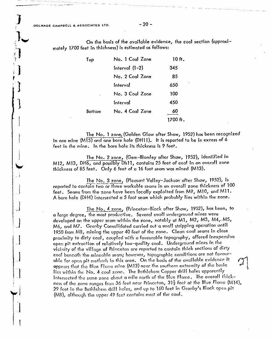
On the basis of the ovoiloble evidence, the cool section (approxi- mately 1700 feet in thickness) is estimated as follows:
TOP
Bottom
No. 1 Coal Zone
Interval (1-2)
No. 2 Coal Zone
Interval
No. 3 Coal Zone
Interval
No. 4 Coal Zone
10 ft.
345
85
650
100
450
60
1700 ft.
The No. 1 zone, (Golden Glow after Show, 1952) hos been recognized in one mine (M15) and one bore hole (DHl 1). It is reported to be in excess of 6 feet in the mine. In the bore hole its thickness is 9 feet.
The No. 2 zone, (Gem-Blomley after Show, 1952), identified in M12, M13, DH6, and possibly Dhll, contains 25 feet of coal in on overall zone thickness of 85 feet. Only 6 feet of a 16 foot seam was mined (M13).
The No. 3 zone, (Pleasant Valley-Jackson after Show, 1952), is reported to contain two or three workable seams in on overall zone thickness of 100 feet. Seams from the zone hove been locally exploited from M9, MlO, and Ml 1. A bore hole (DH4) intersected a 5 foot seam which probably lies within the zone.
The No. 4 zone, (Princeton-Black after Shaw, 1952), has been, to o large degree, the most productive. Several small underground mines were developed on the upper seam within the zone, notably at Ml, M2, M3, M4,. M5, M6, and M7. Granby Consolidated carried out a small stripping operation until 1950 from M8, mining the upper 40 feet of the zone. Clean coal seams in close proximity to dirty coal, coupled with o fovourable topography, offered inexpensive
open pit extraction of relatively low-quality coal. Underground mines in the vicinity of the village of Princeton ore reported to contain thick sections of dirty coal beneath the mineable seam; however, topographic conditions ore not favour- oble for open pit methods in this area. On the basis of the available evidence it ‘~ appears that the Blue Fl~mw mine (M13) near the southern extremity of the basin
~q lies within tho No. 4 coal zone. The Bethlehem Copper drill holes apparently intersected the some zone about a mile north of the Blue Flame. The overall thick- ness of the zone ranges from 36 feet near Princeton, 313 feet at the Blue Flame (M14), 29 feet in the Bethlehem drill holes, and vp to 160 feet in Granby’s Black open pit
(M8), although the upper 49 feet contains most of the coal.

Coal is known to occur at isolated localities in the northern half of the Princeton basin. Insufficient exposures and a lock of previous production precludes an analysis of the stratigrophy of the northern area. However, coal
zones of comparable thickness and extent to those in the southern half could occur, but exploration consisting initially of wide-spaced fairly-deep drill holes would be required to determine this.
COAL GRADE:
Coal from the Princeton basin has been variously classified as having a rank ranging from lignite to sub-bituminous “A”. It has been reported to slack readily upon exposure to air and to exhibit generally poor storage characteristics, with a tendency to spontaneous combustion when stockpiled in large volumes.
Coal onolyses data are available from three localities in the southern half of the basin:
1) Five samples each were taken from two mines near the town of Princeton by the British Columbia Dept. of Mines in 1947; the thickness of the seam (presumably from the No. 4 zone) was not specified. The assays of the two samples
averaged (probably on on as received basis):
Moisture 14.5 %
Ash 13.0 %
Volatile Matter 28.5 %
Fixed Carbon 43.8 %
Calorific Value 8745 B.T.U.‘s per lb.
The colorific values ranged from 7,400 to 10,360 B.T.U.‘s per lb.
2) Bethlehem Copper Corp. Ltd. intersected cool in seven of twelve holes drilled. Coal thickness ranged from 23 to 49 feet, averaging 29 feet. The central core of the zone for the seven holes averaged 12 fee~t and only it was assayed, presumably because it was recognized as the best coal for coking purposes. The values ranged as follows (on a kbasis):
Moisture ---
Ash 23.0-26.1 %
Volarile Mutter 33.3 - 34.4 %
Fixed Carbon 40.5 - 42.6 %
Sulphur 0.75 - 0.83 %
Calorific Value 9941 - 10,336 B.T.U.‘s per lb.

3) In 1947 Gronby Consolidated sampled the Block pit (M8) in order to test the suitability of the No.~4 zone for thermal plant feed. The
company sampled the zone over widths of 58 feet and 94 feet. In each case the zone material was analyzed both with and without bonds of waste, which were extracted by hand. The results were recorded OS follows (on on OS received basis).
a) Width 58 feet with waste included
Moisture 24.9 %
Ash 35.3 %
Calorific Value 4996 B.T.U.‘s per lb.
b) Width 58 feet with waste (9 feet) excluded
Moisture 24.7 %
Ash 21.1 %
Colorific Value 6040 B.T.U.‘s per lb.
c) Width 94 feet with waste included
Moisture 24.6 %
Ash 37.6 %
Calorific Value 4571 B.T.U.‘s per lb.
d) Width 94 feet with waste (11 feet) excluded
Moisture 24.5 %
Ash 25.7 %
Colorific Value 5304 B.T.U.‘s per lb.
To summarize: The upper 58 feet of the No. 4 zone (at M8) could be upgraded from 5000 to 6000 B.T.U. ‘s per lb. ond from 35% to 21% osh with sorting at the pit.
The upper 94 feet of the No. 4 zone could be upgraded from 4500 to 5300 B.T.U.’ s per lb. apd from 37% to 26% ash with pit sorting.
Coal occurs interbedded with shale, sandstone, and bentonite beneath the sompled section of the zone (overall width 126 to 160 feet near M8); h owever, the proportion of coal apparently decreoscs ma rkedly SO that if the entire zone were to be mined either pit sorting and/or wa;hing might be required to provide a suitable thermal plant feed.
I

COAL RESERVES (STRIPPABLE)
SURFACE COAL RESERVES:
Because of the scattered and very poorly documented nature of the post production in the Princeton basin, no attempt will be mode in this report to derive established coal reserves which require exploitation by underground mining
methods. Coal which could possibly be mined by surface methods will be placed into established reserve categories, (proven, probable, and possible), whereas under- ground coal is viewed as potential resources for the some reasons OS those adopted for.the Tulameen basin; namely, undetermined underground mining conditions.
From a practical standpoint opencost mining will probably require the extraction of a zone of coal seams, cooly shale, and interbedded coal and shale, rather than individual coal seams. The quality may possibly be improved by some selective mining or by washing.
As in the Tulameen basin, a combination of zone thickness, dip, and a favourable topographic setting will dictate whether a zone ccln be economically extracted by surface mining methods. (Reviewing the four established zones in the basin, it appears that zones 1, 2, and 3 are less favourable for stripping than zone No. 4. The No. 4 zone has been mined by surface stripping at one locality (Ma), where up to 160 feet of coaly material is available in the section, and, therefore, offers the most promise for developing potential strippable coal along strike from the old strip mine.
Criteria: It is assumed that o subcrop of the No. 4 zone can ultimately be traced from M8 southward to the Blue Flame mine (M13), a distance of approximately 4 miles, (Figure 7). The dip of the zone at MS is SO” east; at Ml3 is assumed to be 20° north. Intermediate dips between are therefore taken to be 35O easterly. The thickness of the mineable zone at M8 is considered to be 49 feet although a thicker zone of lower quality coal could be available. The thickness of the zone projected
southward is assumed to be the average of the No. 4 zone for the southern half of the district; that is, 36 feet. For calculation of reserves the zone is represented in two sectors; one 5500 feet in length containing the Granby pit, shown as a definite and probable coal horizon, (Figure 7); the other projected southward along a moderately- depressed lineal belt for CI distance of 18000 feet.
per ton. The tonnage factor used for mixed coal and cooly shale is 21.6 CU. feet
Proven reserves have not been established in the Princeton basin because no defi;;i?z measurements are available from systematic exploration or development.

I I’ 3 1 ‘1 I I I I w
I I I I I I I I’ !
Probable reserves can be projected along strike with a reasonable degree of confidence on the basis of continuous geology exposed by the small Granby or Black pit (M8) and are projected down dip for a vertical distance of 150 feet.
Possible reserves ore assumed from surface geology and are reason- ably expected to occur along strike and to a vertical depth of 150 feet. Possible
reserves are also presumed to extend down dip beyond 150 feet vertically to a vertical depth of 200 feet beneath probable reserves.
be:
Surface coal reserves in the Princeton basin are thus estimated to
A) Proven Reserves - none
B) Probable Reserves
M8 area
C) Possible Reserves
M8 area
5500 x 49 x 150 21.6 z-50”
5500X49X 50 21.6 co15o”
2,450,OOO short tons
820,000 short tons
Southern extension 18000 x 36 x 150 7,830,OOO short tons 21.6 cos35O
TOTAL 11,100,000 short tons
COAL RESOURCES: In addition to the above coal reserves the potential coal resources of the Princeton basin are large; however, the great majority of it would have to either be mined by underground methods, providing the technology con be developed to cope with the squeezing ground caused by expanding bentonitic clays, or by in situ gasification. This cool must be viewed OS CI potential resource.
TO calculate the approximate in situ coal resources in the Princeton basin the following assumptions are made:
1) Princeton basin area 54.5 sq. miles.
2) The four recognizable zones extend throughout the basin. The
total coal thicknesses will on avcroge remain consistent within each zone throughout the basin.
3) Tonnage factor for bituminous COOI is 24.6 tons per CU. ft.

DOIMAGE CAMPBELL a ASSOCIATES LTD. - 25 -
1 4) The average thickness of coal in each of the four zones,
7’ for (seam zones thicknesses 1 to 4 respectively. in excess of 5 feet), is 9, 13, 18, and 36 feet (total 76 feet)
1 The potential in situ coal resources in the total Princeton basin are therefore 4,700,000,000 tons. In the southern half of the coal field from
I ,
which all of the data has been derived the potential in situ resources are 2,750,000,000 tons.

- 26-
DOLMAGE CAMPBELL 6, ASSOCIATES LTD. CONWLTlNG GEOLOGIC*L & MlNlNG FINGINEERS
,000 G”,NNESS TOWER VANCOUVER 1. B.C.
CONCLUSIONS
On the basis of the presently available data, it is evident that the establishment of a thermal power plant in the Similkameen district should be predicated, at least initially, on the coal present in the Tulameen basin. Larger strippable tonnages (40,600,OOO tons) are indicated to occur in the Tulameen basin than in the Princeton basin (11,100,000 tons). In addition, the coal grade is higher (7000 B.T.U.‘s per lb. as compared with 5000) and appears to be more consistent. Ash content appears to be similar, whereas moisture content is appreciably lower at Tulameen. It is emphasized that much of the coal grade data is inconsistent and erratic, particularly with respect to samples token from the Princeton basin.
._ .:~ . ’ L
Assuming that 40,000,000 short tons of economically mineable coal can be established at Tulameen and that 75% can be recovered, then 30,000,OOO tons of thermal plant feed, grading 9000 B.T.U.‘s per lb. with selective mining, could be available. Such a deposit, producing l,OOO,OOO tons annually, might therefore support a 250 megawatt thermal plant for 30 years.
,i
The potential of the Princeton basin as a source of thermal plant fuel must be regarded as speculative as the amount of potentially strippoble coal and the accompanying coal quality are relatively-poorly known at the present time. From the present information,poor continuity of coal zones and the erratic grades indicated by rather wide-spaced information prevent a clear assessment of the basin’s thermal cool potential. More exploration, comprising a few reconnaissance-type relatively-deep drill holes distributed over the entire basin and detailed geological mapping around the known coal areas, is required. Aside from the potential strippable zone indicated at the southwestern periphery and possibly other potential strippable areas in the northern half which may eventually be developed from a reconnaissance exploration progrom, the Princeton basin represents a coal source that would be better suited for in situ gasification.
Respectfully submitted by,
(--~DJp4w.
R. S. Adornson, P.Eng.
D. D. Campbell, Ph.D., P.Eng.