Embed Size (px)
Citation preview
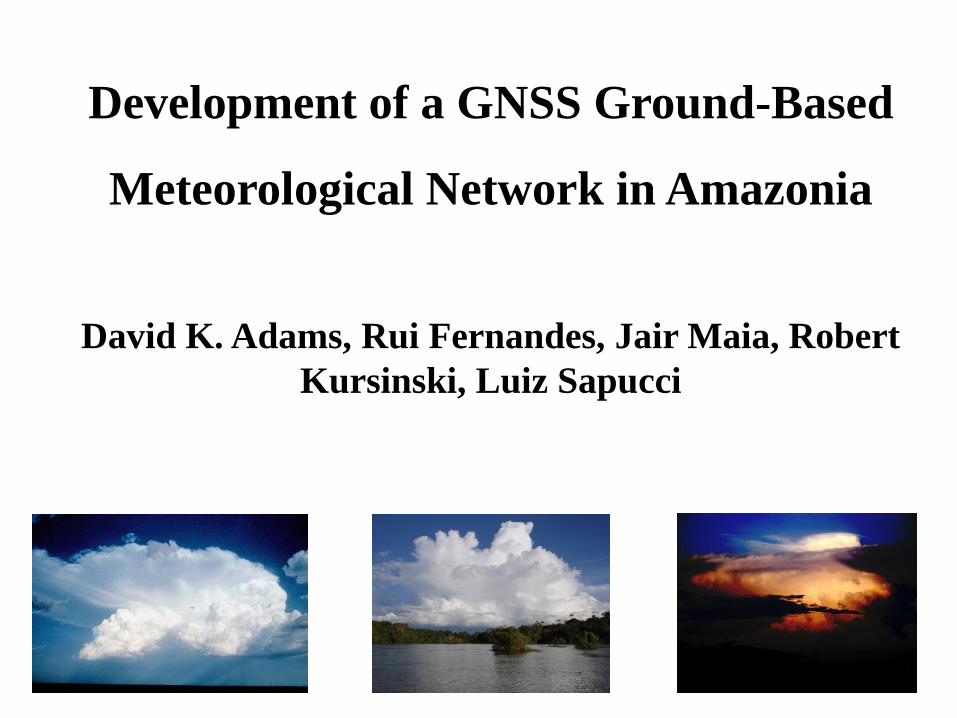
Development of a GNSS Ground-Based
Meteorological Network in Amazonia
David K. Adams, Rui Fernandes, Jair Maia, Robert
Kursinski, Luiz Sapucci
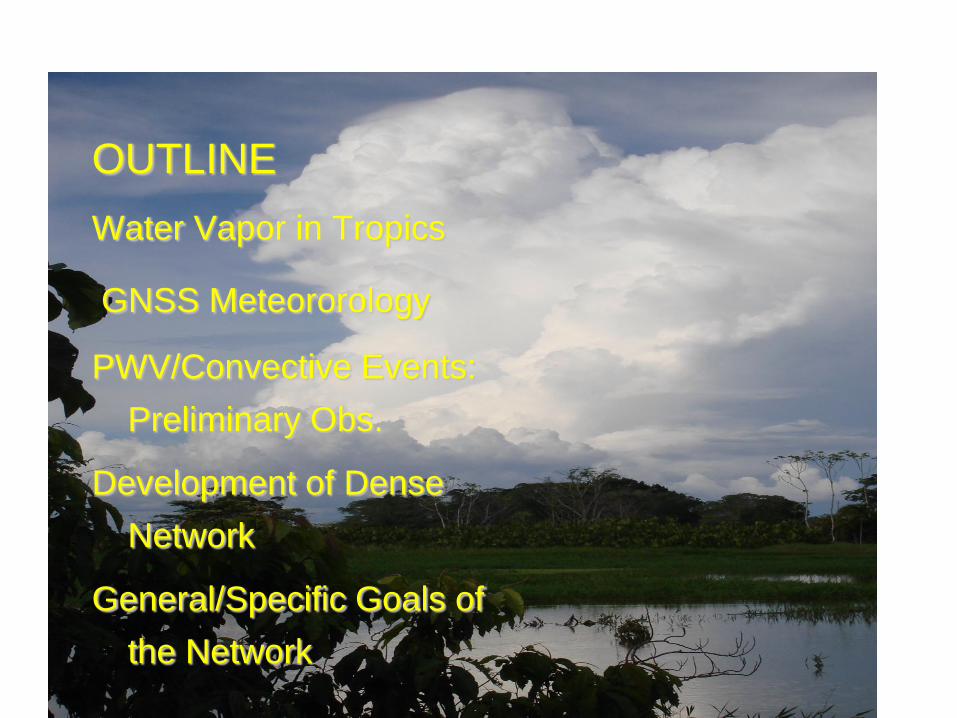
OUTLINE
Water Vapor in Tropics
GNSS Meteororology
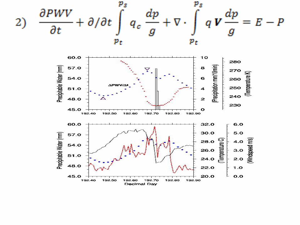
PWV/Convective Events:
Preliminary Obs.
Development of Dense
Network
General/Specific Goals of
the Network
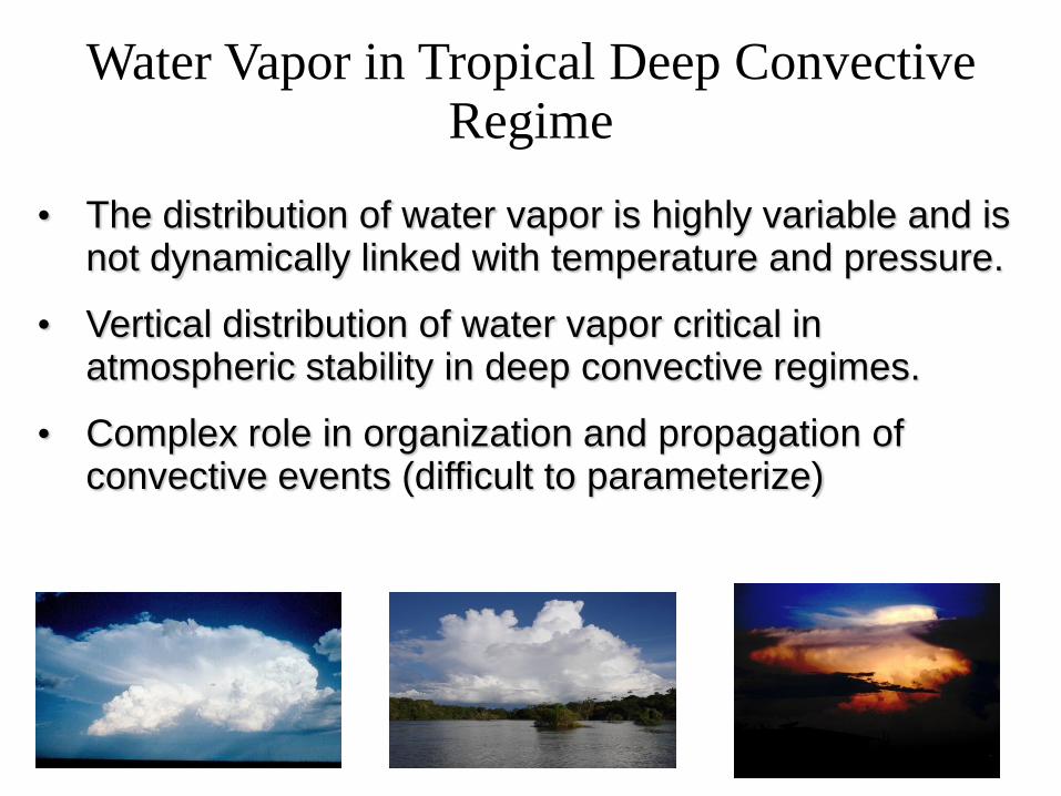
Water Vapor in Tropical Deep Convective Regime
• The distribution of water vapor is highly variable and is not dynamically linked with temperature and pressure.
• Vertical distribution of water vapor critical in atmospheric stability in deep convective regimes.
• Complex role in organization and propagation of convective events (difficult to parameterize)
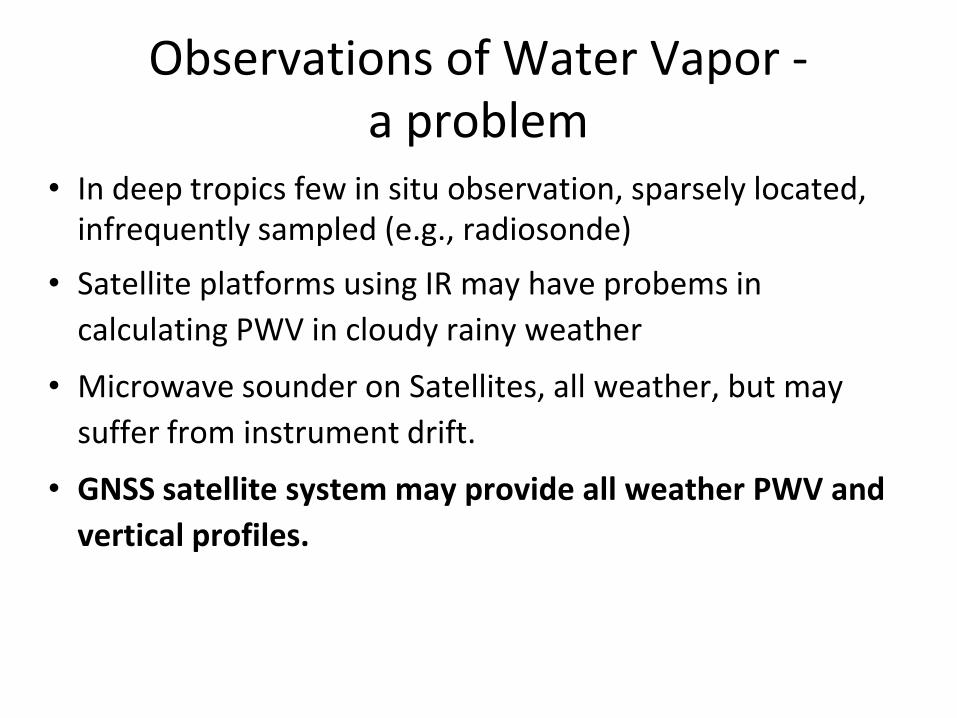
Observations of Water Vapor -a problem
• In deep tropics few in situ observation, sparsely located, infrequently sampled (e.g., radiosonde)
• Satellite platforms using IR may have probems in
calculating PWV in cloudy rainy weather
• Microwave sounder on Satellites, all weather, but may
suffer from instrument drift.
• GNSS satellite system may provide all weather PWV and
vertical profiles.
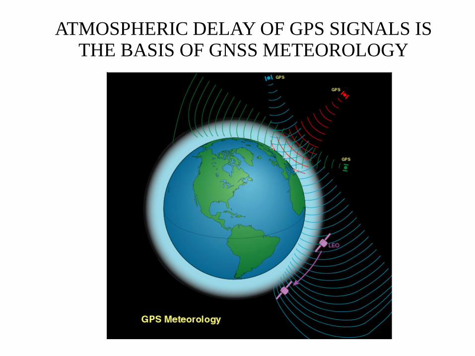
ATMOSPHERIC DELAY OF GPS SIGNALS IS THE BASIS OF GNSS METEOROLOGY

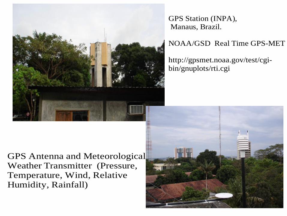
GPS Station (INPA), Manaus, Brazil.
NOAA/GSD Real Time GPS-MET
http://gpsmet.noaa.gov/test/cgi-bin/gnuplots/rti.cgi
GPS Antenna and MeteorologicalWeather Transmitter (Pressure,Temperature, Wind, RelativeHumidity, Rainfall)
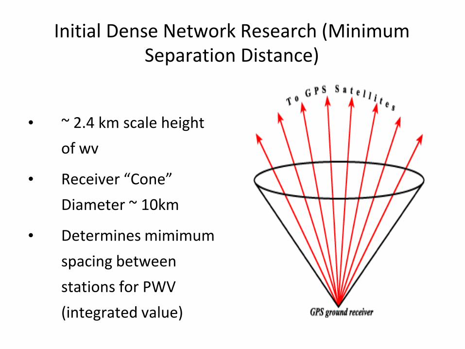
Initial Dense Network Research (Minimum Separation Distance)
• ~ 2.4 km scale height
of wv
• Receiver “Cone”
Diameter ~ 10km
• Determines mimimum
spacing between
stations for PWV
(integrated value)
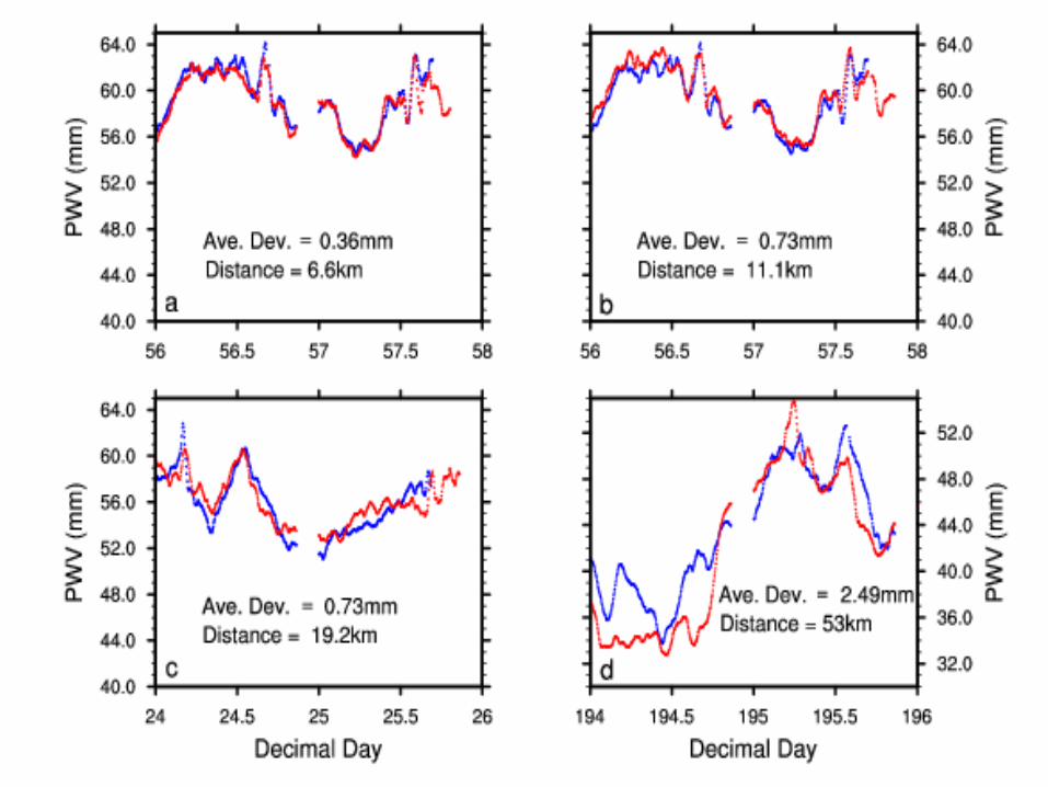
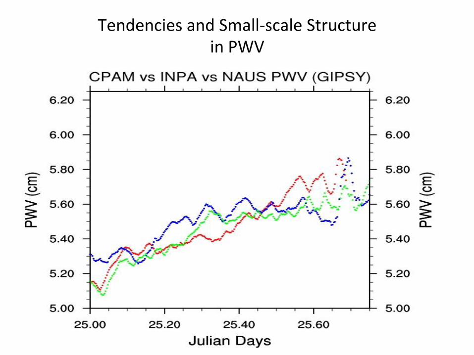
Tendencies and Small-scale Structurein PWV
• irregular spacing
(necessity)
• internet (a few)
• communication by
radio (expensive)
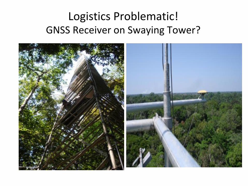
Logistics Problematic!GNSS Receiver on Swaying Tower?
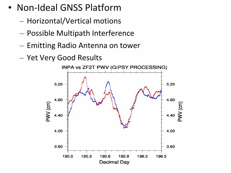
• Non-Ideal GNSS Platform– Horizontal/Vertical motions
– Possible Multipath Interference
– Emitting Radio Antenna on tower
– Yet Very Good Results
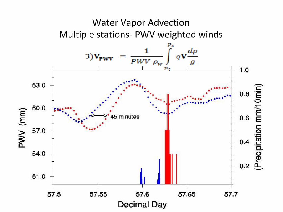
Water Vapor AdvectionMultiple stations- PWV weighted winds
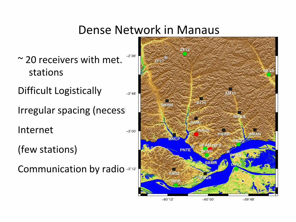
Dense Network in Manaus
~ 20 receivers with met. stations
Difficult Logistically
Irregular spacing (necessity)
Internet
(few stations)
Communication by radio
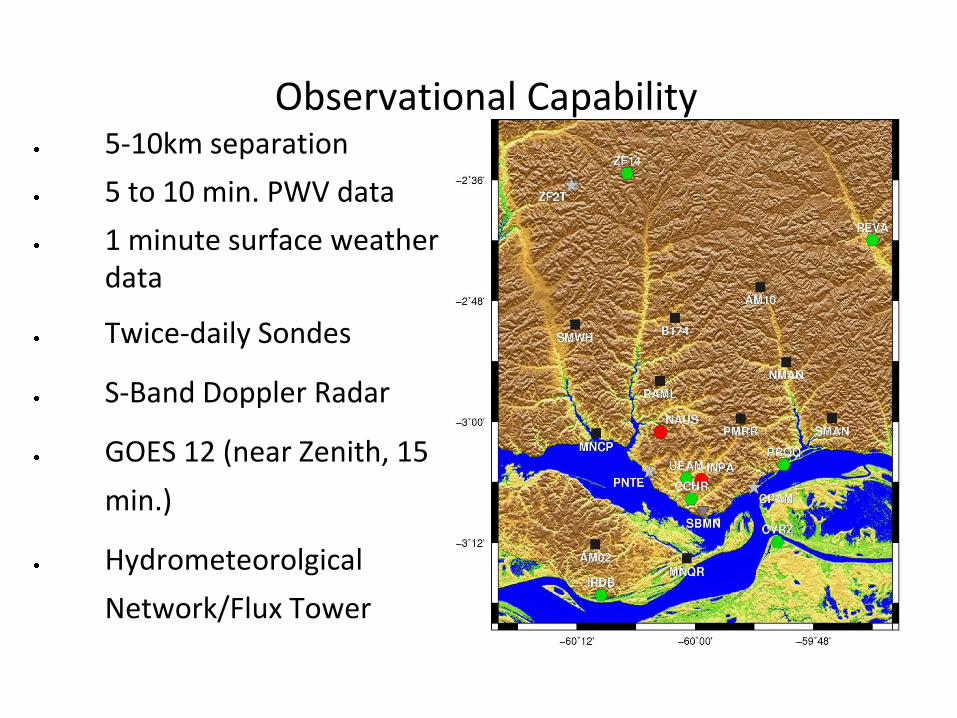
Observational Capability5-10km separation
5 to 10 min. PWV data
1 minute surface weather data
Twice-daily Sondes
S-Band Doppler Radar
GOES 12 (near Zenith, 15
min.)
Hydrometeorolgical
Network/Flux Tower
General Goals for Ground-Based GNSS in the Amazon
• Development of GNSS network throughout Brazil (Icaro Vitorello, INPE)
• Development of GNSS meteorology and Data Assimilation of
products (Luiz Sapucci, CPTEC, Joao Galera, UNESP)
• Development of Data Processing techniques (Rui Fernandes,
UBI, Joao Galera, UNESP)
• GPM-CHUVA Campaign in Manaus, late 2011 (Luiz
Machado, CPTEC)
• Water Vapor/Deep Convection studies (Rob Kursinski, UofA
and Dave Adams, UEA)
Water Vapor/Convection Studies
• Examine Deep Convection/Water Vapor relationship at scale appropriate for mesoscale organization.
• Role of Cold Pools in convective organization (Tompkins
2001a,b and Khairoutdinov and Randall 2006)
• Closure of the hydrological cycle (CHUVA) during
convective events
Expectations for the Network
• Functioning early 2011
• Planned for 1 year (capture seasonal cycle)
• Real-time data transfer and assimilation
• Generate convective climatology (e.g. role of cold pools)
• 3D water vapor fields (using slant path analysis)
• Datasets for initializing, constraining or verifying high
resolution models
Special Thanks to:
Icaro Vitorello - INPE
Antonio Manzi - INPA/LBA
Micrometeorology Group- INPA/LBA
Jorg Ohly - UEA
and You for attending.