Embed Size (px)
Citation preview
Determining Regulatory Jurisdiction and Reporting Requirements for
Ditching Activities
Is it a Ditch, Intermittent or Perennial Stream
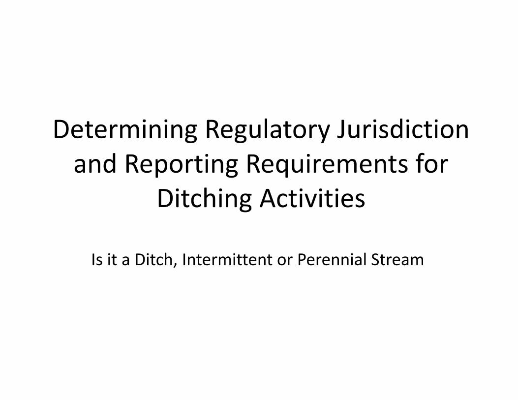
Presentation Outline
• Jurisdiction and Reporting Requirements• Methods for Identifying Ditches, Intermittent and Perennial Streams
• Meeting Non‐Reporting Implementation Requirements
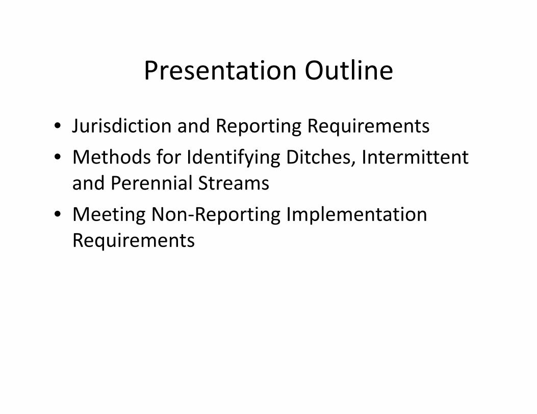
Jurisdiction and Reporting Categories Applicable to Ditching Activities
Non‐JurisdictionalActivities on intermittent streams
JurisdictionalActivities on Perennial Streams
Non‐ReportingMaintenance of an existing channelized perennial stream with a drainage area of less than 0.5 square miles conducted in a manner that meets implementation requirements.
Reporting All other activities on perennial streams
Determining Jurisdiction and Reporting Requirements
1.Is it a human constructed ditch or a naturally occurring stream?
2.Is it intermittent or perennial?3.Is it an existing channelized perennial stream with a D.A. less than 0.5 mi2?
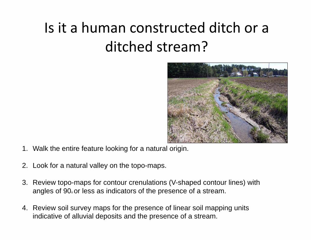
1. Walk the entire feature looking for a natural origin.
2. Look for a natural valley on the topo-maps.
3. Review topo-maps for contour crenulations (V-shaped contour lines) with angles of 90o or less as indicators of the presence of a stream.
4. Review soil survey maps for the presence of linear soil mapping units indicative of alluvial deposits and the presence of a stream.
Is it a human constructed ditch or a ditched stream?
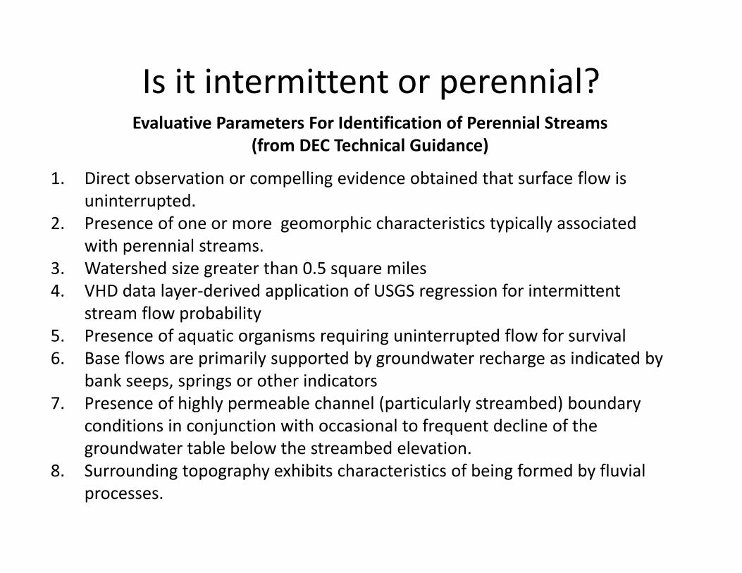
Evaluative Parameters For Identification of Perennial Streams (from DEC Technical Guidance)
1. Direct observation or compelling evidence obtained that surface flow is uninterrupted.
2. Presence of one or more geomorphic characteristics typically associated with perennial streams.
3. Watershed size greater than 0.5 square miles4. VHD data layer‐derived application of USGS regression for intermittent
stream flow probability5. Presence of aquatic organisms requiring uninterrupted flow for survival6. Base flows are primarily supported by groundwater recharge as indicated by
bank seeps, springs or other indicators7. Presence of highly permeable channel (particularly streambed) boundary
conditions in conjunction with occasional to frequent decline of the groundwater table below the streambed elevation.
8. Surrounding topography exhibits characteristics of being formed by fluvial processes.
Is it intermittent or perennial?
Evaluative Parameters (from DEC Technical Guidance)
1. Direct observation or compelling evidence obtained that surface flow is uninterrupted.– Observation of flow during low flow conditions– Testimony of local area residents
Evaluative Parameters (from DEC Technical Guidance)
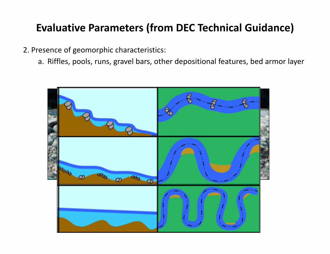
2. Presence of geomorphic characteristics:a. Riffles, pools, runs, gravel bars, other depositional features, bed armor layer
Evaluative Parameters (from DEC Technical Guidance)
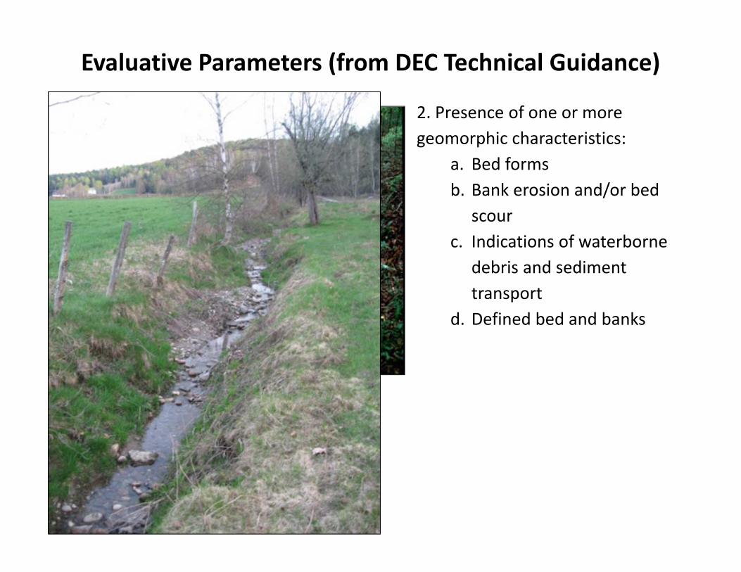
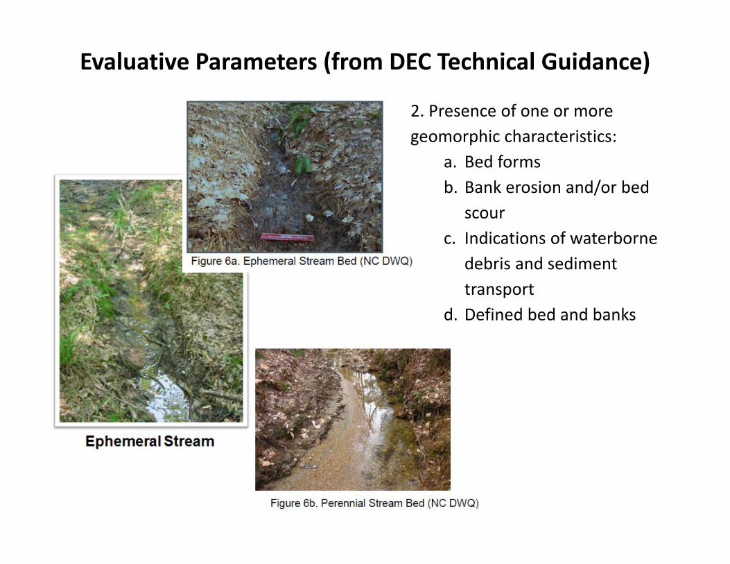
2. Presence of one or more geomorphic characteristics:
a. Bed formsb. Bank erosion and/or bed
scourc. Indications of waterborne
debris and sediment transport
d. Defined bed and banks
Evaluative Parameters (from DEC Technical Guidance)
2. Presence of one or more geomorphic characteristics:
a. Bed formsb. Bank erosion and/or bed
scourc. Indications of waterborne
debris and sediment transport
d. Defined bed and banks
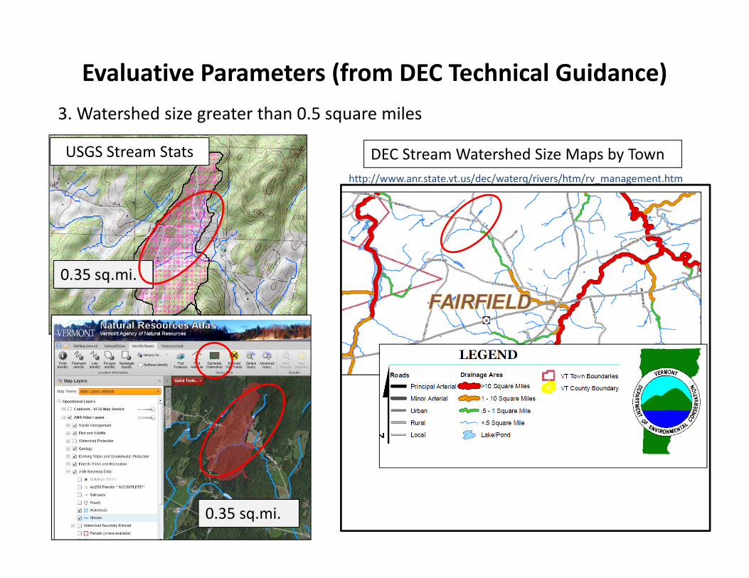
Evaluative Parameters (from DEC Technical Guidance)3. Watershed size greater than 0.5 square miles
0.35 sq.mi.
DEC Stream Watershed Size Maps by Townhttp://www.anr.state.vt.us/dec/waterq/rivers/htm/rv_management.htm
USGS Stream Stats

Evaluative Parameters (from DEC Technical Guidance)4. VHD data layer‐derived application of USGS regression for intermittent stream flow probability
Evaluative Parameters (from DEC Technical Guidance)
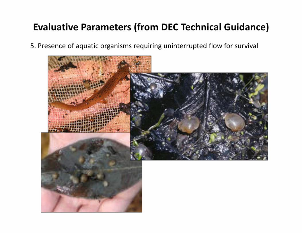
5. Presence of aquatic organisms requiring uninterrupted flow for survival
Evaluative Parameters (from DEC Technical Guidance)
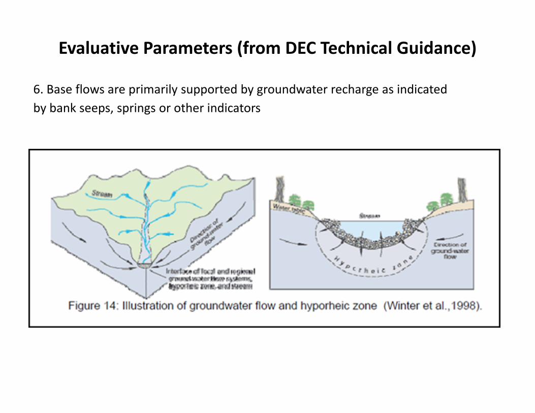
6. Base flows are primarily supported by groundwater recharge as indicated by bank seeps, springs or other indicators
Evaluative Parameters (from DEC Technical Guidance)
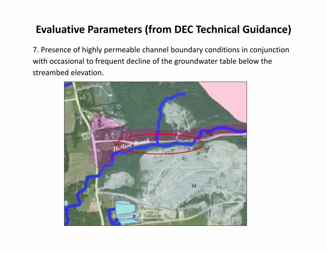
7. Presence of highly permeable channel boundary conditions in conjunction with occasional to frequent decline of the groundwater table below the streambed elevation.
Evaluative Parameters (from DEC Technical Guidance)
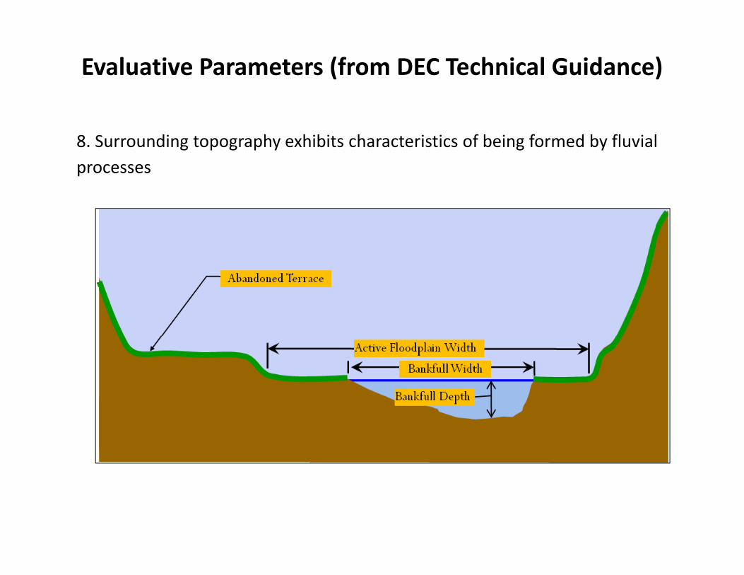
8. Surrounding topography exhibits characteristics of being formed by fluvial processes
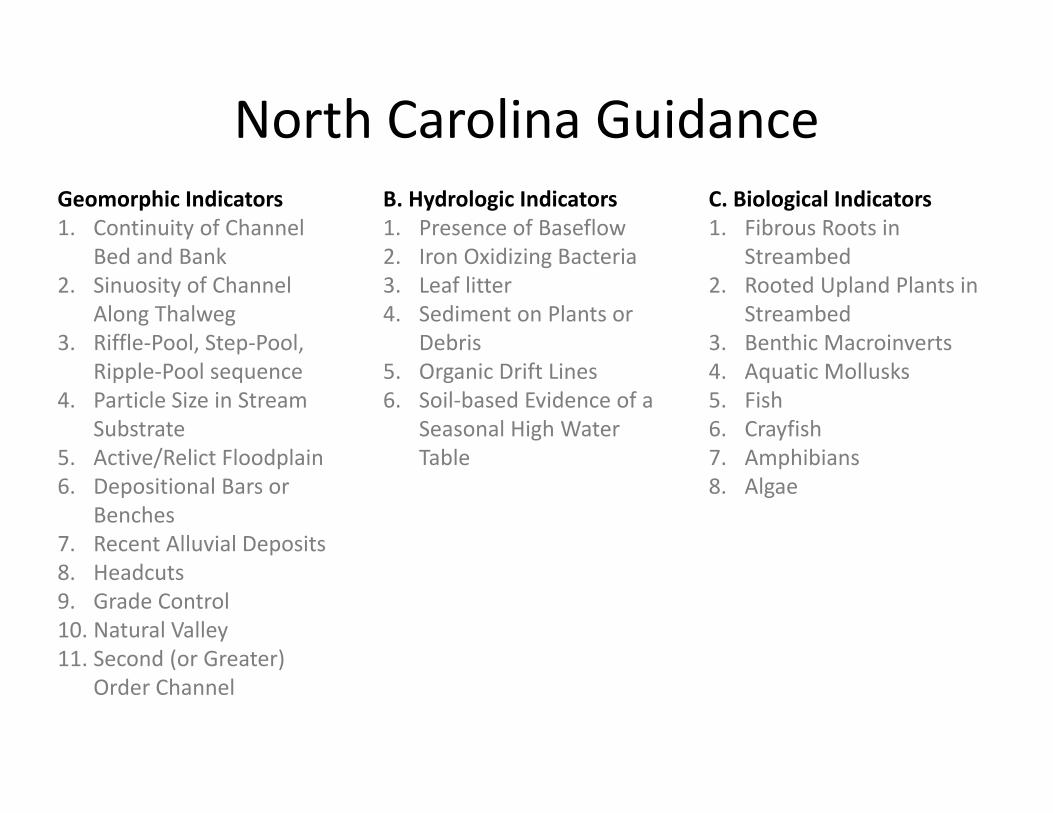
North Carolina GuidanceGeomorphic Indicators1. Continuity of Channel
Bed and Bank 2. Sinuosity of Channel
Along Thalweg3. Riffle‐Pool, Step‐Pool,
Ripple‐Pool sequence 4. Particle Size in Stream
Substrate 5. Active/Relict Floodplain 6. Depositional Bars or
Benches 7. Recent Alluvial Deposits 8. Headcuts 9. Grade Control10. Natural Valley11. Second (or Greater)
Order Channel
B. Hydrologic Indicators 1. Presence of Baseflow 2. Iron Oxidizing Bacteria 3. Leaf litter 4. Sediment on Plants or
Debris 5. Organic Drift Lines 6. Soil‐based Evidence of a
Seasonal High Water Table
C. Biological Indicators1. Fibrous Roots in
Streambed2. Rooted Upland Plants in
Streambed3. Benthic Macroinverts4. Aquatic Mollusks5. Fish 6. Crayfish7. Amphibians8. Algae
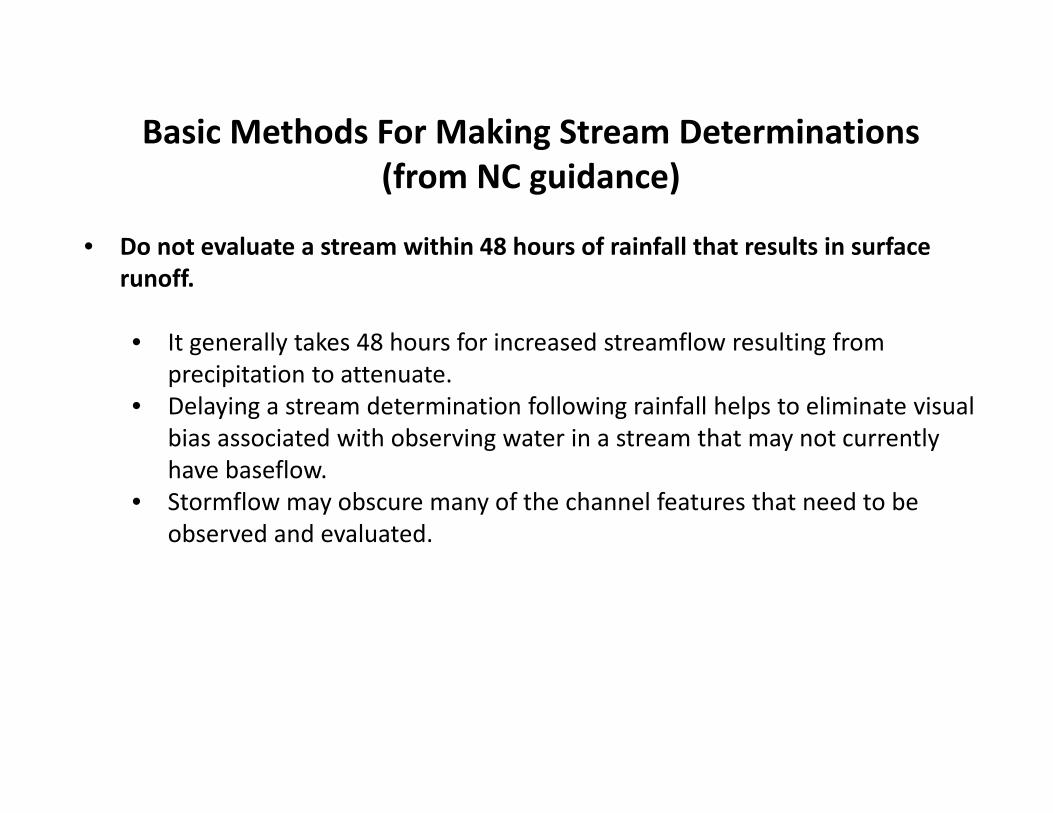
Basic Methods For Making Stream Determinations (from NC guidance)
• Do not evaluate a stream within 48 hours of rainfall that results in surface runoff.
• It generally takes 48 hours for increased streamflow resulting from precipitation to attenuate.
• Delaying a stream determination following rainfall helps to eliminate visual bias associated with observing water in a stream that may not currently have baseflow.
• Stormflow may obscure many of the channel features that need to be observed and evaluated.
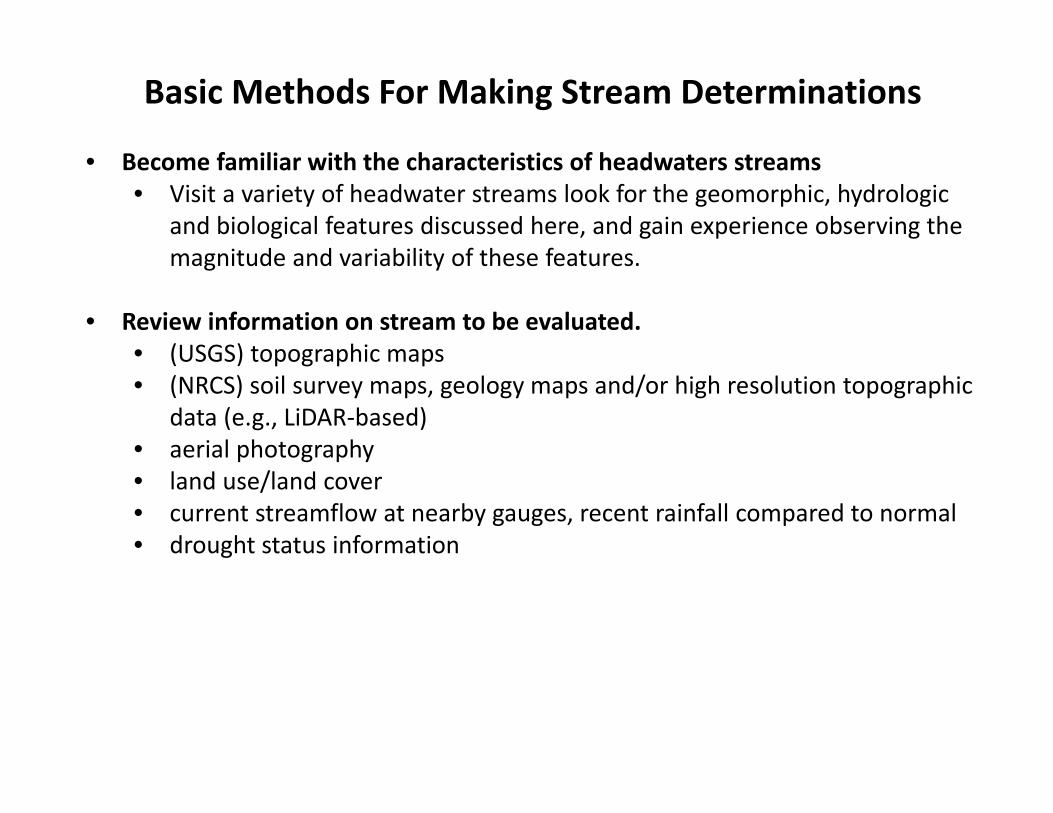
Basic Methods For Making Stream Determinations
• Become familiar with the characteristics of headwaters streams • Visit a variety of headwater streams look for the geomorphic, hydrologic
and biological features discussed here, and gain experience observing the magnitude and variability of these features.
• Review information on stream to be evaluated. • (USGS) topographic maps• (NRCS) soil survey maps, geology maps and/or high resolution topographic
data (e.g., LiDAR‐based) • aerial photography • land use/land cover • current streamflow at nearby gauges, recent rainfall compared to normal • drought status information
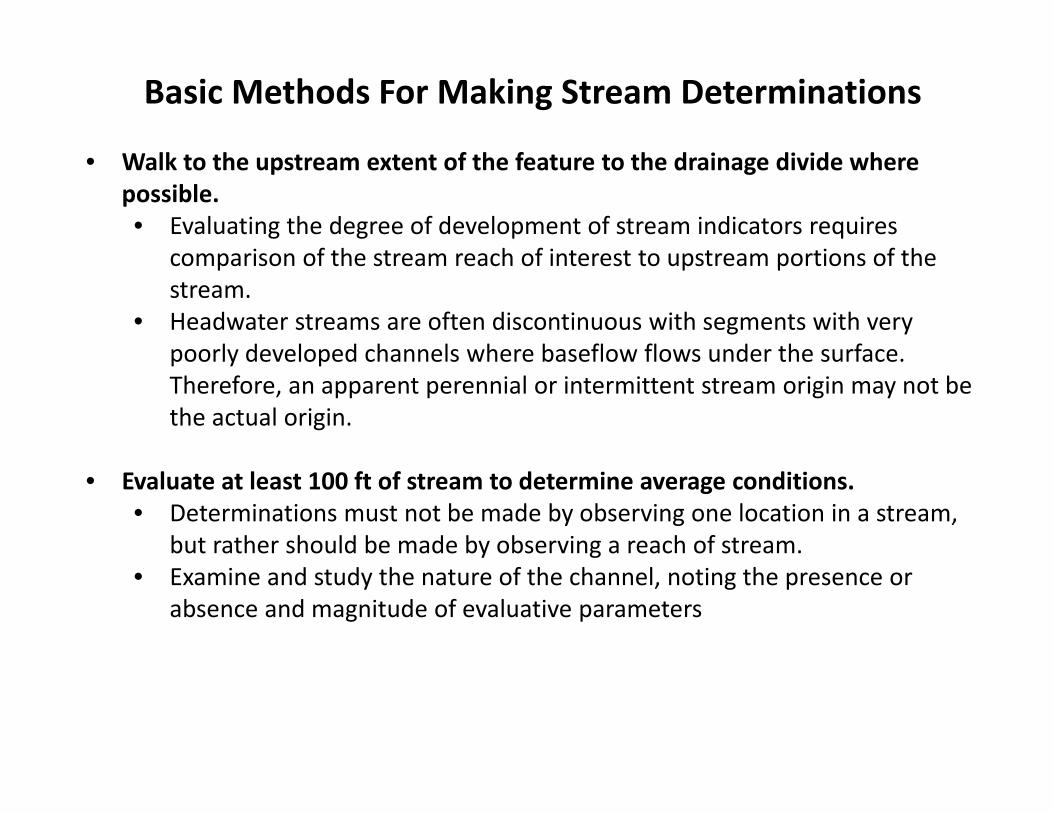
Basic Methods For Making Stream Determinations
• Walk to the upstream extent of the feature to the drainage divide where possible. • Evaluating the degree of development of stream indicators requires
comparison of the stream reach of interest to upstream portions of the stream.
• Headwater streams are often discontinuous with segments with very poorly developed channels where baseflow flows under the surface. Therefore, an apparent perennial or intermittent stream origin may not be the actual origin.
• Evaluate at least 100 ft of stream to determine average conditions. • Determinations must not be made by observing one location in a stream,
but rather should be made by observing a reach of stream. • Examine and study the nature of the channel, noting the presence or
absence and magnitude of evaluative parameters
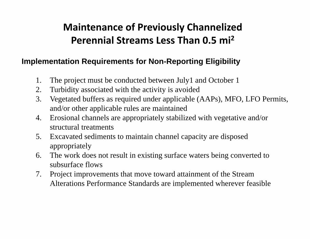
Maintenance of Previously Channelized Perennial Streams Less Than 0.5 mi2
Implementation Requirements for Non-Reporting Eligibility
1. The project must be conducted between July1 and October 12. Turbidity associated with the activity is avoided3. Vegetated buffers as required under applicable (AAPs), MFO, LFO Permits,
and/or other applicable rules are maintained4. Erosional channels are appropriately stabilized with vegetative and/or
structural treatments5. Excavated sediments to maintain channel capacity are disposed
appropriately 6. The work does not result in existing surface waters being converted to
subsurface flows7. Project improvements that move toward attainment of the Stream
Alterations Performance Standards are implemented wherever feasible
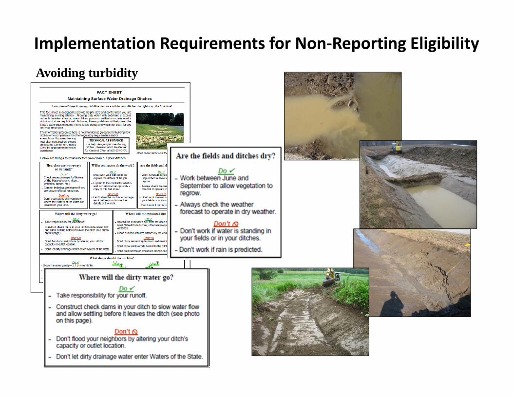
Implementation Requirements for Non‐Reporting EligibilityAvoiding turbidity
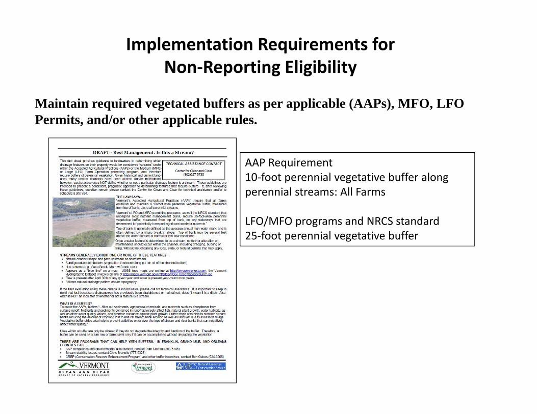
Maintain required vegetated buffers as per applicable (AAPs), MFO, LFO Permits, and/or other applicable rules.
Implementation Requirements for Non‐Reporting Eligibility
AAP Requirement10‐foot perennial vegetative buffer along perennial streams: All Farms
LFO/MFO programs and NRCS standard25‐foot perennial vegetative buffer
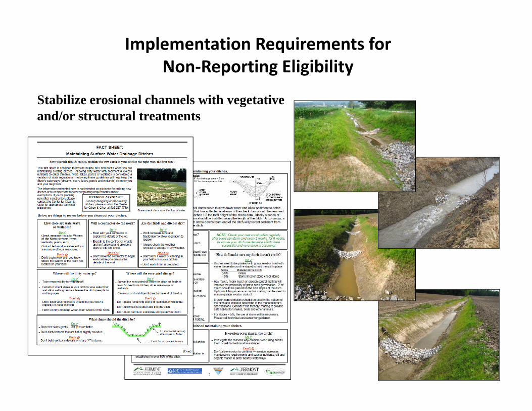
Stabilize erosional channels with vegetative and/or structural treatments
Implementation Requirements for Non‐Reporting Eligibility
Conversion of Surface to Sub‐Surface Flows
Channels cannot be filledChannels cannot be culverted for extensive length
Implementation Requirements for Non‐Reporting Eligibility

Proper Disposal of Excavated Sediments
Implementation Requirements for Non‐Reporting Eligibility
Make improvements that move the watercourse toward attainment of Stream Alterations Performance Standards where feasible
Equilibrium Standard
a. An activity shall not cause a stream to depart from, further depart from, or impede its attainment of the channel width, depth, meander pattern, and slope associated with the stream processes and the equilibrium conditions.
b. Following the stream alteration, the water flow, sediment, and woody debris produced by the watershed will be trans‐ported by the stream channel in such a manner that the stream maintains its dimension, general pattern, and slope with no unnatural aggrading or degrading of the channel bed.
Implementation Requirements for Non‐Reporting Eligibility
Make improvements that move the watercourse toward attainment of Stream Alterations Performance Standards where feasible
Connectivity Standard
a) An activity shall not result in changes in the erosion or deposition of instream materials that results in localized, abrupt changes to or disconnects within the horizontal alignment of streambanks or the vertical profile of the stream bed.
b) A person shall not change the course, current, or cross‐section of a watercourse so as to create a physical obstruction or velocity barrier to the movement of aquatic organisms.
c) A person shall not establish, construct, or maintain a berm in a flood hazard area or river corridor.
Implementation Requirements for Non‐Reporting Eligibility

End