Embed Size (px)
Citation preview

DepressionDepression
2/M John R. Jaromahum2/M John R. Jaromahum
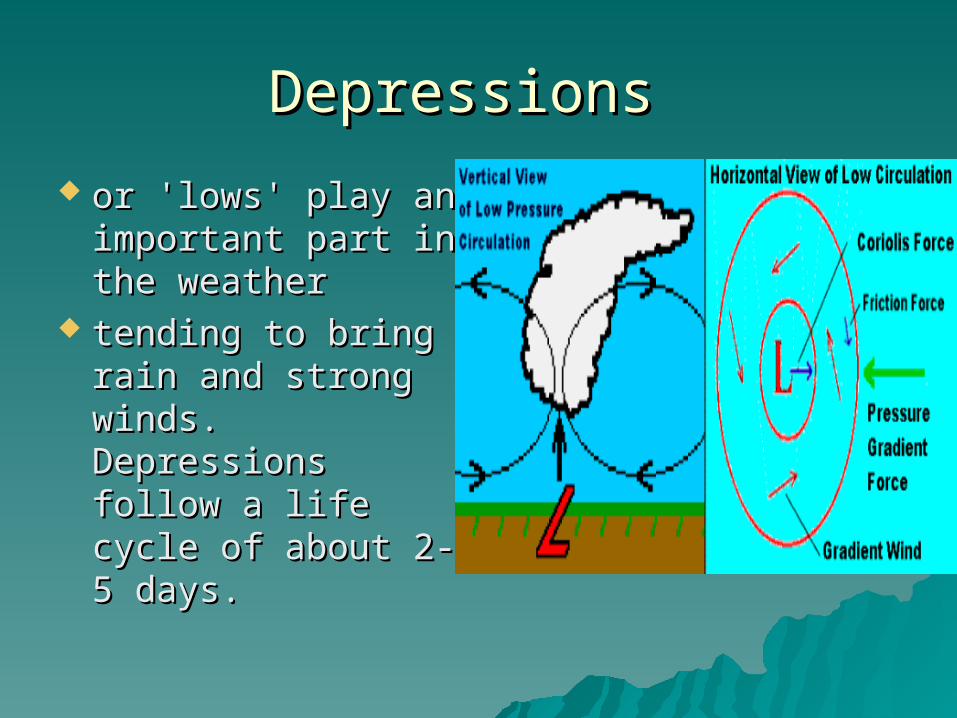
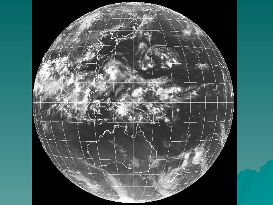
Depressions Depressions
or 'lows' play an or 'lows' play an important part in important part in the weather the weather
tending to bring tending to bring rain and strong rain and strong winds. Depressions winds. Depressions follow a life cycle follow a life cycle of about 2-5 days. of about 2-5 days.
DepressionsDepressions
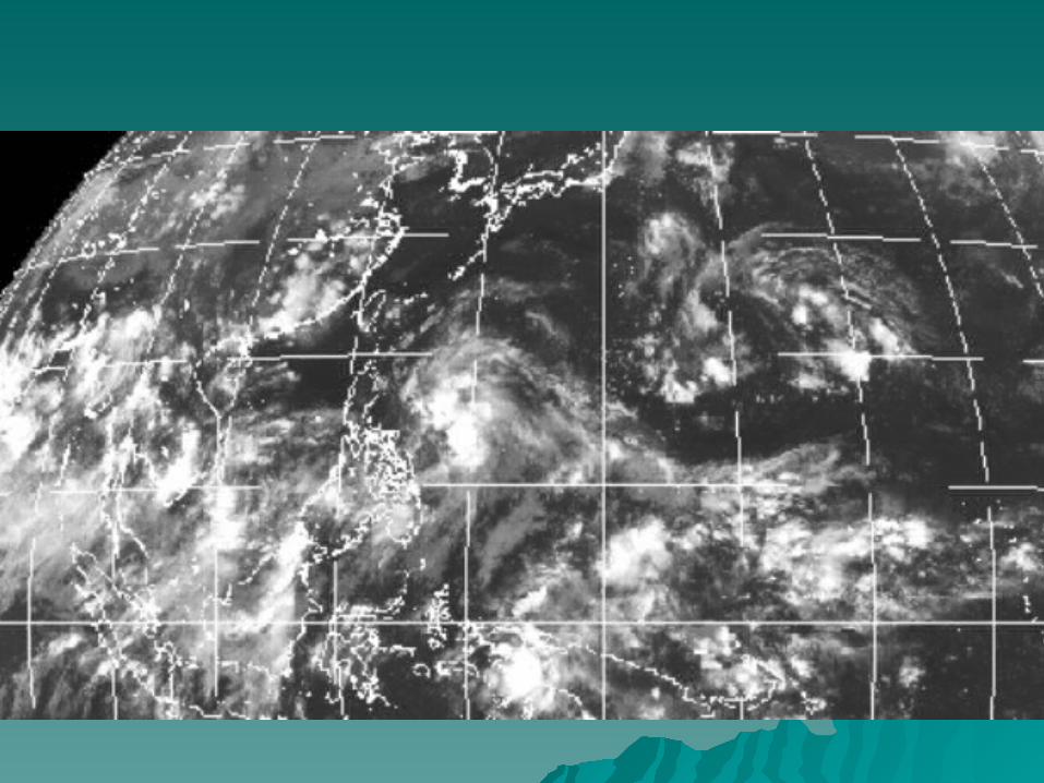
Region of low pressure, usually ranging Region of low pressure, usually ranging between 950 and 1020 millibars, and which between 950 and 1020 millibars, and which originates along polar fronts. Depressions originates along polar fronts. Depressions frequently develop over the oceans in frequently develop over the oceans in temperate latitudes and travel eastwards to temperate latitudes and travel eastwards to bring cloud and rain to the western edges of bring cloud and rain to the western edges of the continental landmasses, e.g. the British the continental landmasses, e.g. the British Isles and Western Europe. A depression Isles and Western Europe. A depression may range in size from 150 km to 3000 km may range in size from 150 km to 3000 km and may travel up to 1000 km a day. and may travel up to 1000 km a day.
DepressionDepression
it is another name for an area of it is another name for an area of low pressurelow pressure, a low, or , a low, or troughtrough. It also . It also applies to a stage of tropical cyclone applies to a stage of tropical cyclone development and is known as a development and is known as a tropical depression to distinguish it tropical depression to distinguish it from other synoptic features. from other synoptic features.
Stages of DevelopmentStages of Development
1: Embryo Stage1: Embryo Stage Depressions develop from small waves in the
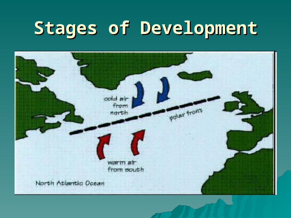
polar front (called frontogenesis). The polar front is where cold air meets warm air,often cold dry polar continental (Pc) air meeting warm moist tropical maritime (Tm) air. convergence of the air masses results in the warmer air being forced up over the colder air in a spiral motion. The upward movement of the air results in 'less' air at the Earth's surface giving an area of below average pressure, known as a 'low'. The wave develops and the kink becomes more pronounced. The developing depression with its warm front and cold front usually moves in a north-westerly direction under the influence of the upper westerlies, ie the front of the polar jet stream.
Stages of DevelopmentStages of Development
Stages of DevelopmentStages of Development
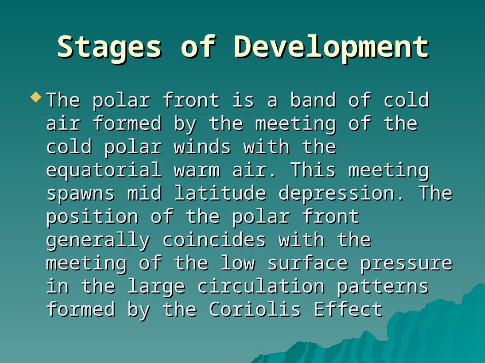
The polar front is a band of cold air The polar front is a band of cold air formed by the meeting of the cold formed by the meeting of the cold polar winds with the equatorial warm polar winds with the equatorial warm air. This meeting spawns mid latitude air. This meeting spawns mid latitude depression. The position of the polar depression. The position of the polar front generally coincides with the front generally coincides with the meeting of the low surface pressure meeting of the low surface pressure in the large circulation patterns in the large circulation patterns formed by the Coriolis Effectformed by the Coriolis Effect
Stages of DevelopmentStages of Development
Stages of DevelopmentStages of Development
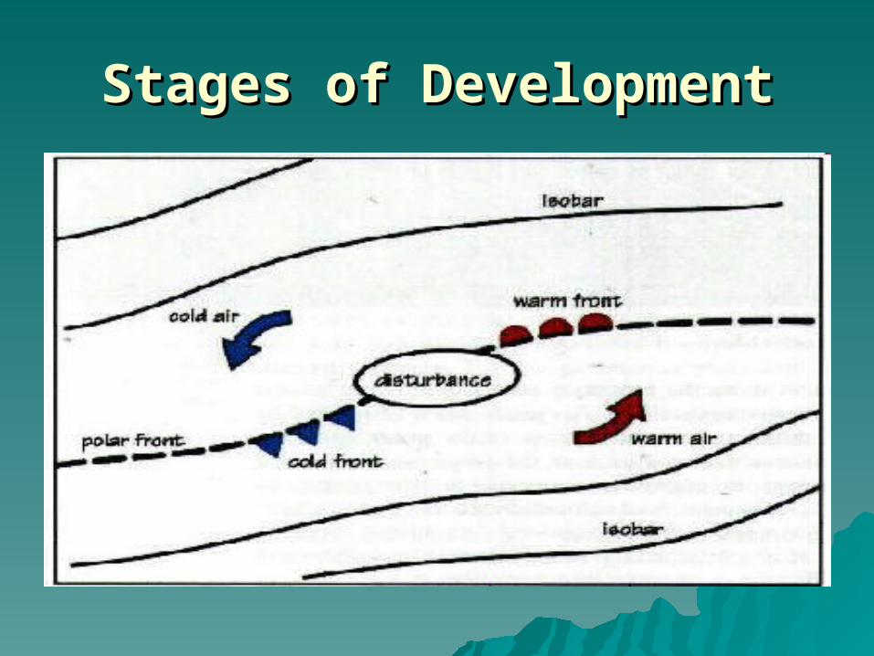
Such a disturbance is known as Such a disturbance is known as Baroclinic instability. if this instability Baroclinic instability. if this instability is strong enough the front will is strong enough the front will develop a wave on it, which will grow develop a wave on it, which will grow and intensify. The process of warm and intensify. The process of warm air sliding over the top of the cold air air sliding over the top of the cold air will be particularly intense in the will be particularly intense in the area of perturbation so this will leadarea of perturbation so this will lead
Stages of DevelopmentStages of Development
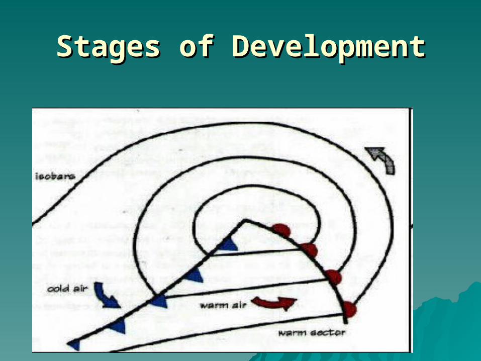
Stages of DevelopmentStages of Development The fully developed lowThe fully developed low
As the warm air slides over the cold air, the baroclinic As the warm air slides over the cold air, the baroclinic perturbation begins to grow with intensity and the perturbation begins to grow with intensity and the whole thing turns into a huge vortex with the air being whole thing turns into a huge vortex with the air being sucked in and then deflected by the Coriolis effect sucked in and then deflected by the Coriolis effect resulting in a n anticlockwise rotation in the northern resulting in a n anticlockwise rotation in the northern hemisphere and a clockwise one in the southern hemisphere and a clockwise one in the southern hemisphere. This section of the polar front can now be hemisphere. This section of the polar front can now be seen to split into a system of individual fronts-The seen to split into a system of individual fronts-The warm front behind which is warm air and the cold warm front behind which is warm air and the cold front behind which is cold air. The area between these front behind which is cold air. The area between these two fronts is called the warm sector and area where two fronts is called the warm sector and area where the surface winds are strong and blowing in the same the surface winds are strong and blowing in the same direction for some distance.direction for some distance.
Stages of DevelopmentStages of Development
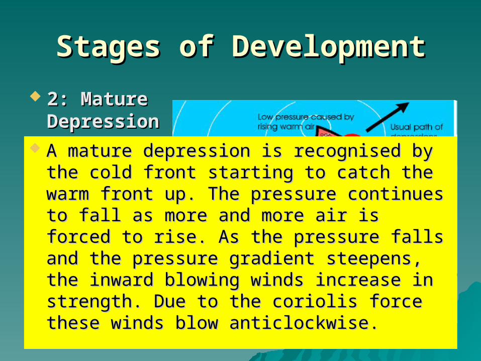
2: Mature 2: Mature DepressionDepression
A mature depression is recognised by the A mature depression is recognised by the cold front starting to catch the warm front cold front starting to catch the warm front up. The pressure continues to fall as more up. The pressure continues to fall as more and more air is forced to rise. As the and more air is forced to rise. As the pressure falls and the pressure gradient pressure falls and the pressure gradient steepens, the inward blowing winds steepens, the inward blowing winds increase in strength. Due to the coriolis increase in strength. Due to the coriolis force these winds blow anticlockwise. force these winds blow anticlockwise.
Stages of DevelopmentStages of Development
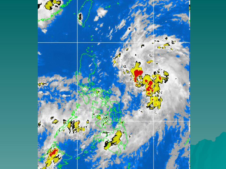
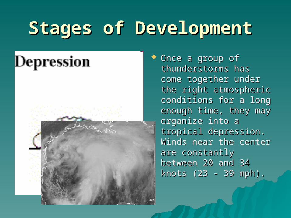
Once a group of Once a group of thunderstorms has thunderstorms has come together under come together under the right atmospheric the right atmospheric conditions for a long conditions for a long enough time, they enough time, they may organize into a may organize into a tropical depression. tropical depression. Winds near the center Winds near the center are constantly are constantly between 20 and 34 between 20 and 34 knots (23 - 39 mph). knots (23 - 39 mph).
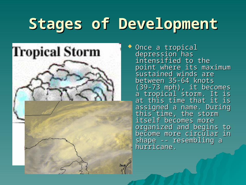
Stages of DevelopmentStages of Development Once a tropical Once a tropical
depression has depression has intensified to the point intensified to the point where its maximum where its maximum sustained winds are sustained winds are between 35-64 knots between 35-64 knots (39-73 mph), it becomes (39-73 mph), it becomes a tropical storm. It is at a tropical storm. It is at this time that it is this time that it is assigned a name. assigned a name. During this time, the During this time, the storm itself becomes storm itself becomes more organized and more organized and begins to become more begins to become more circular in shape -- circular in shape -- resembling a hurricane. resembling a hurricane.
Stages of DevelopmentStages of Development
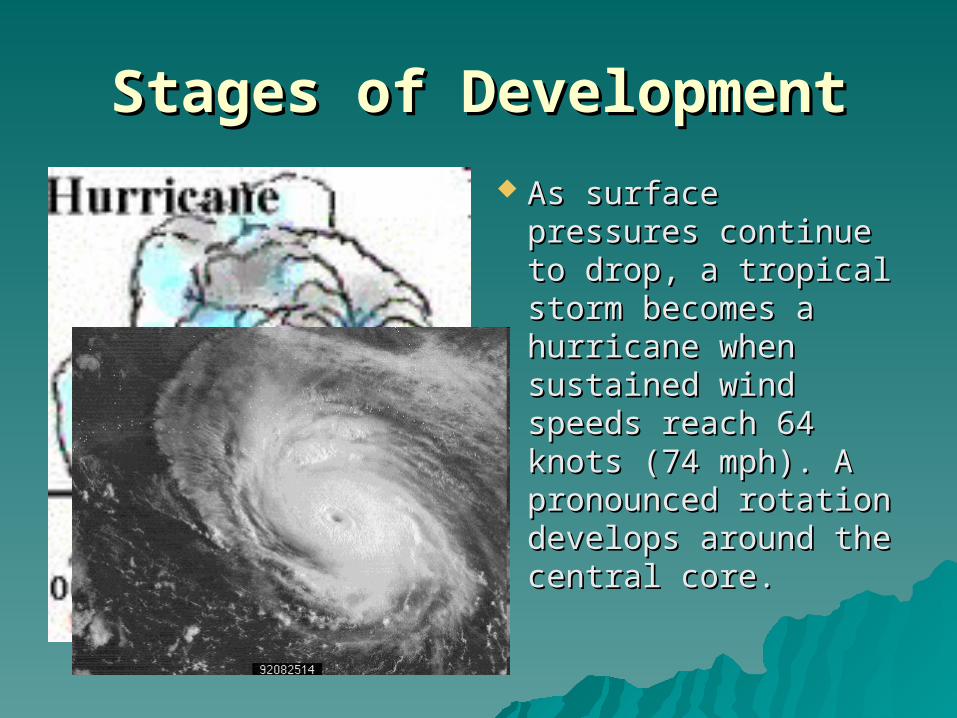
As surface pressures As surface pressures continue to drop, a continue to drop, a tropical storm tropical storm becomes a hurricane becomes a hurricane when sustained wind when sustained wind speeds reach 64 speeds reach 64 knots (74 mph). A knots (74 mph). A pronounced rotation pronounced rotation develops around the develops around the central core. central core.