Embed Size (px)
Citation preview
__________________________________________________________________________
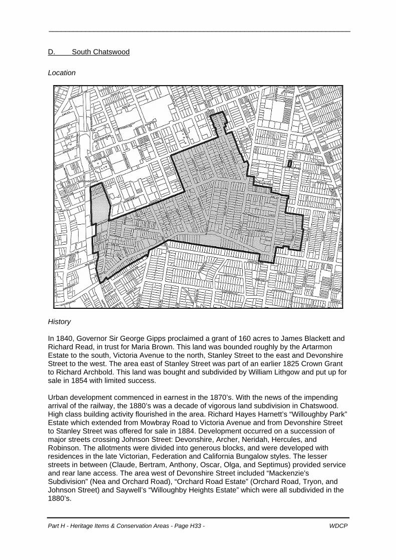
D. South Chatswood
Location
History In 1840, Governor Sir George Gipps proclaimed a grant of 160 acres to James Blackett and Richard Read, in trust for Maria Brown. This land was bounded roughly by the Artarmon Estate to the south, Victoria Avenue to the north, Stanley Street to the east and Devonshire Street to the west. The area east of Stanley Street was part of an earlier 1825 Crown Grant to Richard Archbold. This land was bought and subdivided by William Lithgow and put up for sale in 1854 with limited success. Urban development commenced in earnest in the 1870’s. With the news of the impending arrival of the railway, the 1880’s was a decade of vigorous land subdivision in Chatswood. High class building activity flourished in the area. Richard Hayes Harnett’s “Willoughby Park” Estate which extended from Mowbray Road to Victoria Avenue and from Devonshire Street to Stanley Street was offered for sale in 1884. Development occurred on a succession of major streets crossing Johnson Street: Devonshire, Archer, Neridah, Hercules, and Robinson. The allotments were divided into generous blocks, and were developed with residences in the late Victorian, Federation and California Bungalow styles. The lesser streets in between (Claude, Bertram, Anthony, Oscar, Olga, and Septimus) provided service and rear lane access. The area west of Devonshire Street included “Mackenzie's Subdivision” (Nea and Orchard Road), “Orchard Road Estate” (Orchard Road, Tryon, and Johnson Street) and Saywell’s “Willoughby Heights Estate” which were all subdivided in the 1880’s.
Part H - Heritage Items & Conservation Areas - Page H33 - WDCP
__________________________________________________________________________
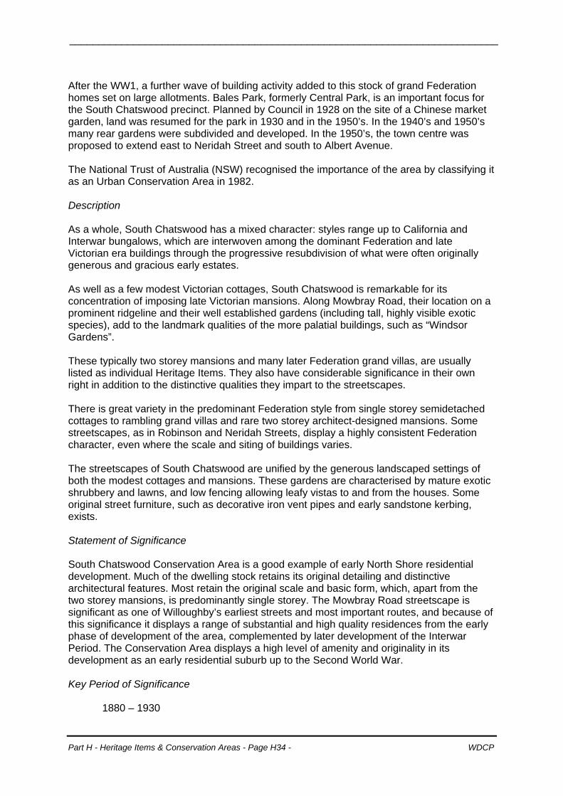
After the WW1, a further wave of building activity added to this stock of grand Federation homes set on large allotments. Bales Park, formerly Central Park, is an important focus for the South Chatswood precinct. Planned by Council in 1928 on the site of a Chinese market garden, land was resumed for the park in 1930 and in the 1950’s. In the 1940’s and 1950’s many rear gardens were subdivided and developed. In the 1950’s, the town centre was proposed to extend east to Neridah Street and south to Albert Avenue. The National Trust of Australia (NSW) recognised the importance of the area by classifying it as an Urban Conservation Area in 1982. Description As a whole, South Chatswood has a mixed character: styles range up to California and Interwar bungalows, which are interwoven among the dominant Federation and late Victorian era buildings through the progressive resubdivision of what were often originally generous and gracious early estates. As well as a few modest Victorian cottages, South Chatswood is remarkable for its concentration of imposing late Victorian mansions. Along Mowbray Road, their location on a prominent ridgeline and their well established gardens (including tall, highly visible exotic species), add to the landmark qualities of the more palatial buildings, such as “Windsor Gardens”. These typically two storey mansions and many later Federation grand villas, are usually listed as individual Heritage Items. They also have considerable significance in their own right in addition to the distinctive qualities they impart to the streetscapes. There is great variety in the predominant Federation style from single storey semidetached cottages to rambling grand villas and rare two storey architect-designed mansions. Some streetscapes, as in Robinson and Neridah Streets, display a highly consistent Federation character, even where the scale and siting of buildings varies. The streetscapes of South Chatswood are unified by the generous landscaped settings of both the modest cottages and mansions. These gardens are characterised by mature exotic shrubbery and lawns, and low fencing allowing leafy vistas to and from the houses. Some original street furniture, such as decorative iron vent pipes and early sandstone kerbing, exists. Statement of Significance South Chatswood Conservation Area is a good example of early North Shore residential development. Much of the dwelling stock retains its original detailing and distinctive architectural features. Most retain the original scale and basic form, which, apart from the two storey mansions, is predominantly single storey. The Mowbray Road streetscape is significant as one of Willoughby’s earliest streets and most important routes, and because of this significance it displays a range of substantial and high quality residences from the early phase of development of the area, complemented by later development of the Interwar Period. The Conservation Area displays a high level of amenity and originality in its development as an early residential suburb up to the Second World War. Key Period of Significance
1880 – 1930
Part H - Heritage Items & Conservation Areas - Page H34 - WDCP
__________________________________________________________________________
Management policies • Retain the scale, form, massing and detailing of original buildings of heritage significance
and the typical scale, rhythm and character of individual streetscapes; • Retain the predominant single storey scale of the Conservation Area by preventing
visible two storey additions or intrusive two storey infill development; • Retain landscaped settings by minimising hard surfaces forward of the building line,
locating carparking structures behind the building alignment where possible, and maintaining the existing patterns of low/semi transparent fencing to the street;
• Infill development must respect existing patterns of development including the spacing, rhythm and siting of built forms, the landscaped settings, and the scale massing, form and materials of the general development; and
• Protect the special significance of the Mowbray Road streetscape by retaining the fabric and enhancing the landscaped settings of the original development, and by ensuring that new development does not dominate or detract from this significance.
Development in the minor streets (Bertram, Claude, Anthony & Olga) are to be designed to be compatible with the South Chatswood Conservation Area in relation to: • The spacing of buildings and driveways; • Proportion of primary façade elements; • Form and pitch of roof elements; • The scale of the building form; • Massing of new building forms (particularly asymmetrical forms and room in roof forms); • Single storey carport structures; • Use of materials in roofing front and side façades; • Height and materials of front fencing; and • Predominantly soft landscaped front yard areas.
these streets, the intent of this plan is that over time development will more closely reflect Inthe historic character of the South Chatswood Conservation Area. The existing character development guidelines apply to all streets in the conservation area.
Part H - Heritage Items & Conservation Areas - Page H35 - WDCP
__________________________________________________________________________
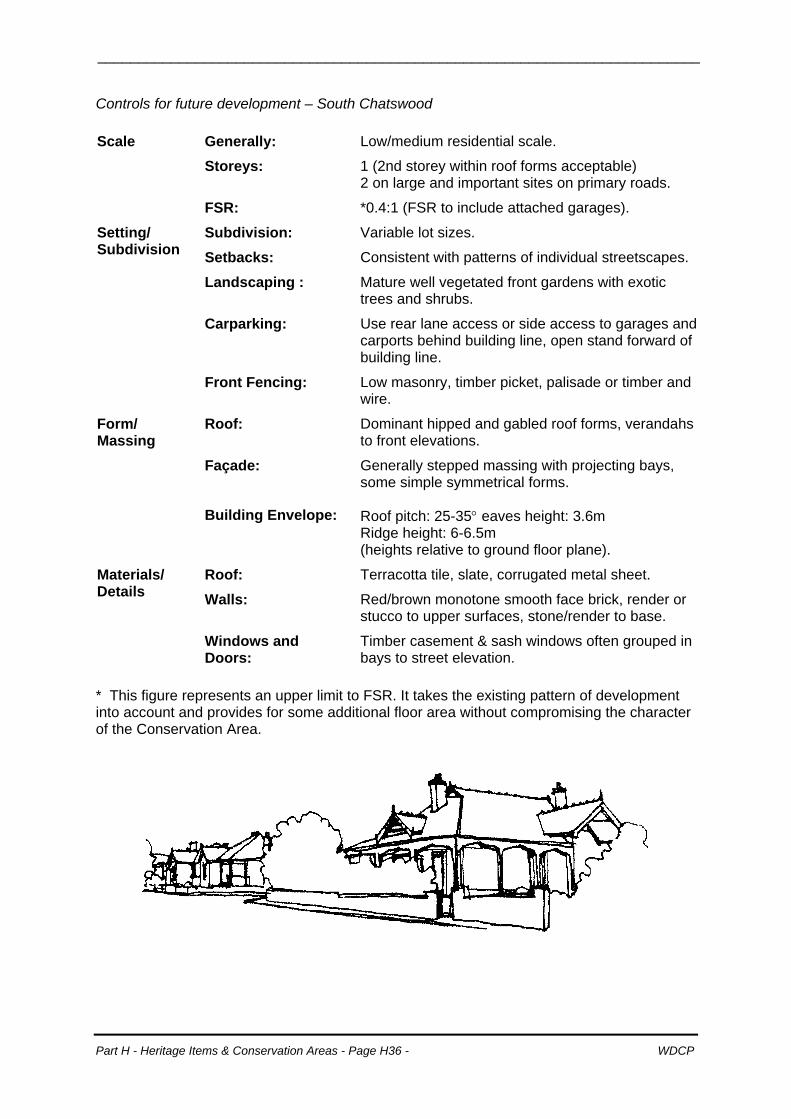
Controls for future development – South Chatswood Scale Generally: Low/medium residential scale.
Storeys: 1 (2nd storey within roof forms acceptable) 2 on large and important sites on primary roads.
FSR: *0.4:1 (FSR to include attached garages).
Subdivision: Variable lot sizes. Setting/ Subdivision Setbacks: Consistent with patterns of individual streetscapes.
Landscaping : Mature well vegetated front gardens with exotic trees and shrubs.
Carparking: Use rear lane access or side access to garages and carports behind building line, open stand forward of building line.
Front Fencing: Low masonry, timber picket, palisade or timber and wire.
Form/ Massing
Roof: Dominant hipped and gabled roof forms, verandahs to front elevations.
Façade:
Generally stepped massing with projecting bays, some simple symmetrical forms.
Building Envelope:
Roof pitch: 25-35° eaves height: 3.6m Ridge height: 6-6.5m (heights relative to ground floor plane).
Roof: Terracotta tile, slate, corrugated metal sheet.
Walls: Red/brown monotone smooth face brick, render or stucco to upper surfaces, stone/render to base.
Materials/ Details
Windows and Doors:
Timber casement & sash windows often grouped in bays to street elevation.
* This figure represents an upper limit to FSR. It takes the existing pattern of development into account and provides for some additional floor area without compromising the character of the Conservation Area.
Part H - Heritage Items & Conservation Areas - Page H36 - WDCP
__________________________________________________________________________
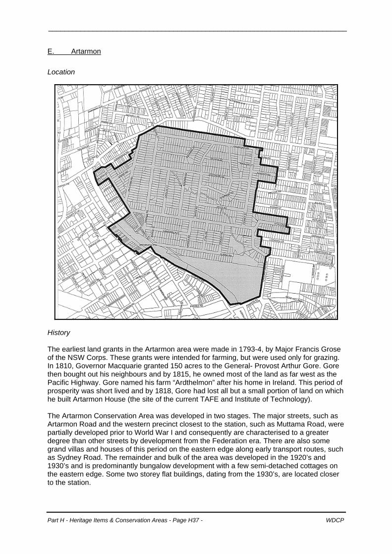
E. Artarmon
Location
History The earliest land grants in the Artarmon area were made in 1793-4, by Major Francis Grose of the NSW Corps. These grants were intended for farming, but were used only for grazing. In 1810, Governor Macquarie granted 150 acres to the General- Provost Arthur Gore. Gore then bought out his neighbours and by 1815, he owned most of the land as far west as the Pacific Highway. Gore named his farm “Ardthelmon” after his home in Ireland. This period of prosperity was short lived and by 1818, Gore had lost all but a small portion of land on which he built Artarmon House (the site of the current TAFE and Institute of Technology). The Artarmon Conservation Area was developed in two stages. The major streets, such as Artarmon Road and the western precinct closest to the station, such as Muttama Road, were partially developed prior to World War I and consequently are characterised to a greater degree than other streets by development from the Federation era. There are also some grand villas and houses of this period on the eastern edge along early transport routes, such as Sydney Road. The remainder and bulk of the area was developed in the 1920’s and 1930’s and is predominantly bungalow development with a few semi-detached cottages on the eastern edge. Some two storey flat buildings, dating from the 1930’s, are located closer to the station.
Part H - Heritage Items & Conservation Areas - Page H37 - WDCP

__________________________________________________________________________
The National Trust of Australia (NSW) recognised the importance of the area by classifying it as an Urban Conservation Area in 1989. Description A rectilinear subdivision pattern has been superimposed on a hilly area of moderate slopes. The regularity of the lot layout is interrupted by several well vegetated drainage reserves flowing across to the remnant bushland of Artarmon Reserve. The original subdivision pattern of narrow carriageways and wide grassy verges (usually planted with mature street trees, such as brush box and jacaranda) prevails, except for Artarmon and Sydney Roads, which have wider carriageways taking the main traffic volumes to and from Artarmon Station and shopping centre. The combination of undulating landform, well established street trees and other vegetation (including mature trees behind houses, remnant bushland in the drainage reserves and the pattern of usually generous lot sizes) creates vistas of leafy ridges and valleys and a wide range of interesting streetscapes with houses stepped down the terrain. Houses are either red-brown brick and terracotta tile Federation styles or a rich variety of 1920’s to 1930’s bungalows. The latter range from typical California Bungalow styles to the transitional 1930’s Interwar bungalows of brown to liver brick with red or brown tiled roofs. The character is predominantly single storey other than the small number of Interwar flats and relatively few second storey additions. Good individual examples including some of the older flat buildings, with Art Deco or Spanish Mission characteristics, also occur. The denser pattern of settlement near Artarmon Station is a good example of Interwar flat development providing comfortable housing that is well integrated with nearby public transport and commercial opportunities. The well proportioned flat buildings form a cohesive residential precinct of generally consistent two storey scale, of similar materials and with shared modest embellishments, including decorative brickwork. Such characteristics enhance their unity with the earlier group of Edwardian commercial buildings at Wilkes Plaza. Statement of Significance The Conservation Area is outstanding for its intactness, with few unsympathetic intrusions occurring. The wide range of largely intact California and Interwar bungalows as well as Federation housing in generally good condition, occur in either groupings of consistent styles or subtle blends of successive periods to produce a mix of interesting and varied streetscapes. The area is significant as a harmonious and unified 1910 – 1920’s lower North Shore residential area whose development relates to the development of the railway. Key Period of Significance
1900-1940
Part H - Heritage Items & Conservation Areas - Page H38 - WDCP
__________________________________________________________________________
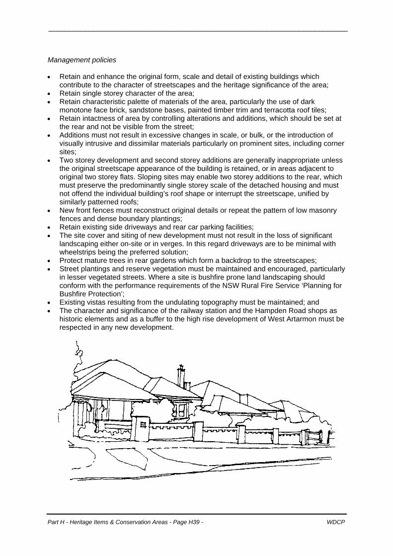
Management policies • Retain and enhance the original form, scale and detail of existing buildings which
contribute to the character of streetscapes and the heritage significance of the area; • Retain single storey character of the area; • Retain characteristic palette of materials of the area, particularly the use of dark
monotone face brick, sandstone bases, painted timber trim and terracotta roof tiles; • Retain intactness of area by controlling alterations and additions, which should be set at
the rear and not be visible from the street; • Additions must not result in excessive changes in scale, or bulk, or the introduction of
visually intrusive and dissimilar materials particularly on prominent sites, including corner sites;
• Two storey development and second storey additions are generally inappropriate unless the original streetscape appearance of the building is retained, or in areas adjacent to original two storey flats. Sloping sites may enable two storey additions to the rear, which must preserve the predominantly single storey scale of the detached housing and must not offend the individual building’s roof shape or interrupt the streetscape, unified by similarly patterned roofs;
• New front fences must reconstruct original details or repeat the pattern of low masonry fences and dense boundary plantings;
• Retain existing side driveways and rear car parking facilities; • The site cover and siting of new development must not result in the loss of significant
landscaping either on-site or in verges. In this regard driveways are to be minimal with wheelstrips being the preferred solution;
• Protect mature trees in rear gardens which form a backdrop to the streetscapes; • Street plantings and reserve vegetation must be maintained and encouraged, particularly
in lesser vegetated streets. Where a site is bushfire prone land landscaping should conform with the performance requirements of the NSW Rural Fire Service ‘Planning for Bushfire Protection’; Existing vistas resultin• g from the undulating topography must be maintained; and
• The character and significance of the railway station and the Hampden Road shops as historic elements and as a buffer to the high rise development of West Artarmon must be respected in any new development.
Part H - Heritage Items & Conservation Areas - Page H39 - WDCP
__________________________________________________________________________
Controls for future development – Artarmon Scale Generally:
Uniform low scale, detached bungalows, few semi detached cottages and flat buildings at station.
Storeys: 1 (2nd storey within roof forms or basement acceptable), 2 in flat precinct.
FSR: *0.4:1 (FSR to include attached garages).
Setting/ Subdivision
Subdivision: Rectilinear subdivision superimposed on moderate slopes, Average 675m2 15m (12.5 m min) frontages.
Setbacks: Generally uniform within streets or within groups of houses. Side: 0.9- 2.5m (driveway).
Landscaping : Generous well landscaped front and rear yards, mature native & exotic plantings, trees to rear gardens.
Carparking: Single garage to side or rear of dwelling, or part of basement.
Front Fencing: Low face brick.
Form/Massing Roof: Simple, mainly hipped with some gabled forms.
Façade:
Symmetrical or asymmetrical, generally stepped massing, incorporating porch or verandah.
Building Envelope:
Roof pitch: 25-30° Eaves height: 3.5m Ridge height: 6-6.5m (heights relative to ground floor plane).
Materials/ Details
Roof: Terracotta tile Strapwork or shingle gable end details.
Walls: Red brown, brown or liver smooth face brick, roughcast to upper wall surfaces.
Windows and Doors:
Timber casement or sash windows, some leadlight, timber glazed & panelled entry doors.
Joinery and Decoration:
Decorative brickwork, use of sandstone/ render trim, robust verandah detailing.
* This figure represents an upper limit to FSR. It takes the existing pattern of development into account and provides for some additional floor area without compromising the character of the Conservation Area.
Part H - Heritage Items & Conservation Areas - Page H40 - WDCP
__________________________________________________________________________
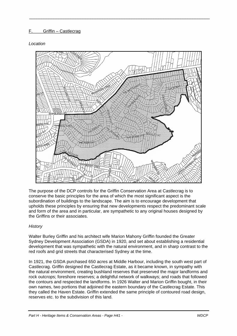
F. Griffin – Castlecrag
Location
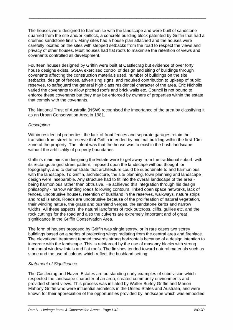
The purpose of the DCP controls for the Griffin Conservation Area at Castlecrag is to conserve the basic principles for the area of which the most significant aspect is the subordination of buildings to the landscape. The aim is to encourage development that upholds these principles by ensuring that new developments respect the predominant scale and form of the area and in particular, are sympathetic to any original houses designed by the Griffins or their associates. History Walter Burley Griffin and his architect wife Marion Mahony Griffin founded the Greater Sydney Development Association (GSDA) in 1920, and set about establishing a residential development that was sympathetic with the natural environment, and in sharp contrast to the red roofs and grid streets that characterised Sydney at the time. In 1921, the GSDA purchased 650 acres at Middle Harbour, including the south west part of Castlecrag. Griffin designed the Castlecrag Estate, as it became known, in sympathy with the natural environment, creating bushland reserves that preserved the major landforms and rock outcrops; foreshore reserves; a delightful network of walkways; and roads that followed the contours and respected the landforms. In 1926 Walter and Marion Griffin bought, in their own names, two portions that adjoined the eastern boundary of the Castlecrag Estate. This they called the Haven Estate. Griffin extended the same principle of contoured road design, reserves etc. to the subdivision of this land.
Part H - Heritage Items & Conservation Areas - Page H41 - WDCP
__________________________________________________________________________
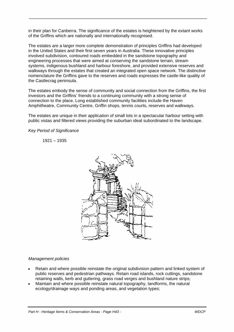
The houses were designed to harmonise with the landscape and were built of sandstone quarried from the site and/or knitlock, a concrete building block patented by Griffin that had a crushed sandstone finish. Many sites had a house plan attached and the houses were carefully located on the sites with stepped setbacks from the road to respect the views and privacy of other houses. Most houses had flat roofs to maximise the retention of views and covenants controlled all development. Fourteen houses designed by Griffin were built at Castlecrag but evidence of over forty house designs exists. GSDA exercised control of design and siting of buildings through covenants affecting the construction materials used, number of buildings on the site, setbacks, design of fences, advertising signs, and required contribution to upkeep of public reserves, to safeguard the general high class residential character of the area. Eric Nicholls varied the covenants to allow pitched roofs and brick walls etc. Council is not bound to enforce these covenants but they may be enforced by owners of properties within the estate that comply with the covenants. The National Trust of Australia (NSW) recognised the importance of the area by classifying it as an Urban Conservation Area in 1981. Description Within residential properties, the lack of front fences and separate garages retain the transition from street to reserve that Griffin intended by minimal building within the first 10m zone of the property. The intent was that the house was to exist in the bush landscape without the artificiality of property boundaries. Griffin’s main aims in designing the Estate were to get away from the traditional suburb with its rectangular grid street pattern, imposed upon the landscape without thought for topography, and to demonstrate that architecture could be subordinate to and harmonious with the landscape. To Griffin, architecture, the site planning, town planning and landscape design were inseparable. Any structure had to fit into the overall landscape of the area - being harmonious rather than obtrusive. He achieved this integration through his design philosophy - narrow winding roads following contours, linked open space networks, lack of fences, unobtrusive houses, retention of bushland in the reserves, walkways, nature strips and road islands. Roads are unobtrusive because of the proliferation of natural vegetation, their winding nature, the grass and bushland verges, the sandstone kerbs and narrow widths. All these aspects, the natural landforms of rock outcrops, cliffs, gullies etc. and the rock cuttings for the road and also the culverts are extremely important and of great significance in the Griffin Conservation Area. The form of houses proposed by Griffin was single storey, or in rare cases two storey buildings based on a series of projecting wings radiating from the central area and fireplace. The elevational treatment tended towards strong horizontals because of a design intention to integrate with the landscape. This is reinforced by the use of masonry blocks with strong horizontal window lintels and flat roofs. The finishes tended toward natural materials such as stone and the use of colours which reflect the bushland setting. Statement of Significance The Castlecrag and Haven Estates are outstanding early examples of subdivision which respected the landscape character of an area, created community environments and provided shared views. This process was initiated by Walter Burley Griffin and Marion Mahony Griffin who were influential architects in the United States and Australia, and were known for their appreciation of the opportunities provided by landscape which was embodied
Part H - Heritage Items & Conservation Areas - Page H42 - WDCP
__________________________________________________________________________
in their plan for Canberra. The significance of the estates is heightened by the extant works of the Griffins which are nationally and internationally recognised. The estates are a larger more complete demonstration of principles Griffins had developed in the United States and their first seven years in Australia. These innovative principles involved subdivision, contoured roads embedded in the sandstone topography and engineering processes that were aimed at conserving the sandstone terrain, stream systems, indigenous bushland and harbour foreshore, and provided extensive reserves and walkways through the estates that created an integrated open space network. The distinctive nomenclature the Griffins gave to the reserves and roads expresses the castle-like quality of the Castlecrag peninsula. The estates embody the sense of community and social connection from the Griffins, the first investors and the Griffins’ friends to a continuing community with a strong sense of connection to the place. Long established community facilities include the Haven Amphitheatre, Community Centre, Griffin shops, tennis courts, reserves and walkways. The estates are unique in their application of small lots in a spectacular harbour setting with public vistas and filtered views providing the suburban ideal subordinated to the landscape. Key Period of Significance
1921 – 1935
Management policies • Retain and where possible reinstate the original subdivision pattern and linked system of
public reserves and pedestrian pathways. Retain road islands, rock cuttings, sandstone retaining walls, kerb and guttering, grass road verges and bushland nature strips;
• Maintain and where possible reinstate natural topography, landforms, the natural ecology/drainage ways and ponding areas, and vegetation types;
Part H - Heritage Items & Conservation Areas - Page H43 - WDCP
__________________________________________________________________________
• Permit new development which fits in with the original subdivision pattern, and which blends with and preserves as much as possible of the natural landscape, its remnant bushland and rocky terrain;
• New development must carefully follow the contours of the land to minimise bulk, and cutting and infilling;
• The height, scale, bulk, massing and proportion, site cover, location and visibility of new development must be such that: - built forms are subordinate to the natural landscape; - the spacing between buildings and rhythms of the streetscapes are retained, or
opened up to create vistas of the natural landscape; - primary views from nearby and adjoining dwellings and public reserves, roadways,
pathways and drainage reserves are not obstructed; - undercroft areas are not visually intrusive in the landscape when viewed from the
water or the land; - buildings are highly articulated in plan and elevation; and - amenity of public reserves is maintained as public open space.
• Materials and colours must blend inconspicuously with the predominant colours of the local bushland;
• Significant heritage items including landscape must not be encroached upon; • Carparking, including garages is to be designed and sited to retain the unique character
of the usually well vegetated narrow winding roadways and public open spaces; • No fences, screens or gates other than very low fencing (300mm in height) forward of
the building line; • No fences or screens adjoining public reserves and pathways:
- indigenous vegetation to be used to achieve privacy; and - where special security requirements can be demonstrated, fencing to a maximum of 1200mm may be permitted to be constructed of timber posts or metal frame posts with light weight open mesh infill. Acceptable styles include arris rail or piped rail and diagonal mesh, horse wire or childproof weldmesh in unpainted galvanised finish. Where bushfire prone land is identified non-combustible materials must be used;
• Locally indigenous vegetation is to be used for landscaped areas, including private open space adjoining Griffin walkways, reserves and public open space; and
• Where a site is bushfire prone land, landscaping should conform with the performance requirements of the NSW Rural Fire Service ‘Planning for Bushfire Protection’.
Part H - Heritage Items & Conservation Areas - Page H44 - WDCP
__________________________________________________________________________
Controls for future development – Griffin (Castlecrag) Scale Generally: Low scale, maintain and reinstate predominance
of native landscape over built form. Ensure no encroachment by new buildings into public vistas.
Storeys: Generally 1- 1.5, maximum 2.
FSR See table below.
Massing The scale and massing of new development is to respect the Griffins’ objective to have all built forms subservient to the landscape. Development in the vicinity of Heritage Items shall respect the scale and massing of those items and ensure public view corridors to them.
Setting/ Subdivision
Subdivision: Retain and enhance original Griffin subdivision and its intention with emphasis on the natural qualities, views and topography of the site.
Setbacks:
Natural features, public walkways, or existing heritage buildings: 3m. Street: variable, typically 6-10m. Public reserves: min 10m from the rear boundary with reserve. One side: 3m. Façades visible to pathways or reserves are to incorporate setbacks stepped in plan to create articulation and reduce visual bulk.
Landscaping :
Informal, heavily landscaped front gardens dominated by indigenous shrubs and trees. Maintain, enhance and protect indigenous landscape, natural features, landforms & vegetation (For bushfire prone land refer to Management Policies).
Carparking:
Small scale, carparking behind building line where possible, else 5m setback for carports. Reduce impact of cars through the use of lightweight open carports and absorbent surface materials (not interfering with public view from street). Open hard stand parking spaces or lightweight open sided carports, with absorbent ground surface materials preferred rather than enclosed garages to reduce the impact of cars.
Preservation of views from public places:
Retain public views of waterways and other significant outlooks.
Fencing: (Refer to Management Policies).
Gates behind Building alignment
Behind building alignment, no gate or “see through”/open mesh form gates to maximum 1200mm is preferred. Gates permitted on boundaries adjoining public pathways and reserves. (Refer to Management Policies).
Form/Massing Roof: Simple flat roofs or low pitched hipped roof forms
Part H - Heritage Items & Conservation Areas - Page H45 - WDCP
__________________________________________________________________________
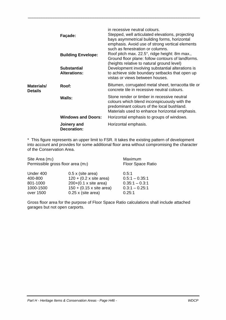
in recessive neutral colours. Façade: Stepped, well articulated elevations, projecting
bays asymmetrical building forms, horizontal emphasis. Avoid use of strong vertical elements such as fenestration or columns.
Building Envelope: Roof pitch max. 22.5°, ridge height: 8m max., Ground floor plane: follow contours of landforms. (heights relative to natural ground level)
Substantial Alterations:
Development involving substantial alterations is to achieve side boundary setbacks that open up vistas or views between houses.
Materials/ Details
Roof: Bitumen, corrugated metal sheet, terracotta tile or concrete tile in recessive neutral colours.
Walls: Stone render or timber in recessive neutral colours which blend inconspicuously with the predominant colours of the local bushland. Materials used to enhance horizontal emphasis.
Windows and Doors: Horizontal emphasis to groups of windows.
Joinery and Decoration:
Horizontal emphasis.
* This figure represents an upper limit to FSR. It takes the existing pattern of development into account and provides for some additional floor area without compromising the character of the Conservation Area. Site Area (m2) Maximum Permissible gross floor area (m2) Floor Space Ratio Under 400 0.5 x (site area) 0.5:1 400-800 120 + (0.2 x site area) 0.5:1 – 0.35:1 801-1000 200+(0.1 x site area) 0.35:1 – 0.3:1 1000-1500 150 + (0.15 x site area) 0.3:1 – 0.25:1 over 1500 0.25 x (site area) 0.25:1 Gross floor area for the purpose of Floor Space Ratio calculations shall include attached garages but not open carports.
Part H - Heritage Items & Conservation Areas - Page H46 - WDCP