Embed Size (px)
Citation preview

CS 128/ES 228 - Lecture 1a 1
What is GIS?

CS 128/ES 228 - Lecture 1a 2
Geographical information systems
Okay to leave now?
No!
Two parts to the definition…
CS 128/ES 228 - Lecture 1a 3
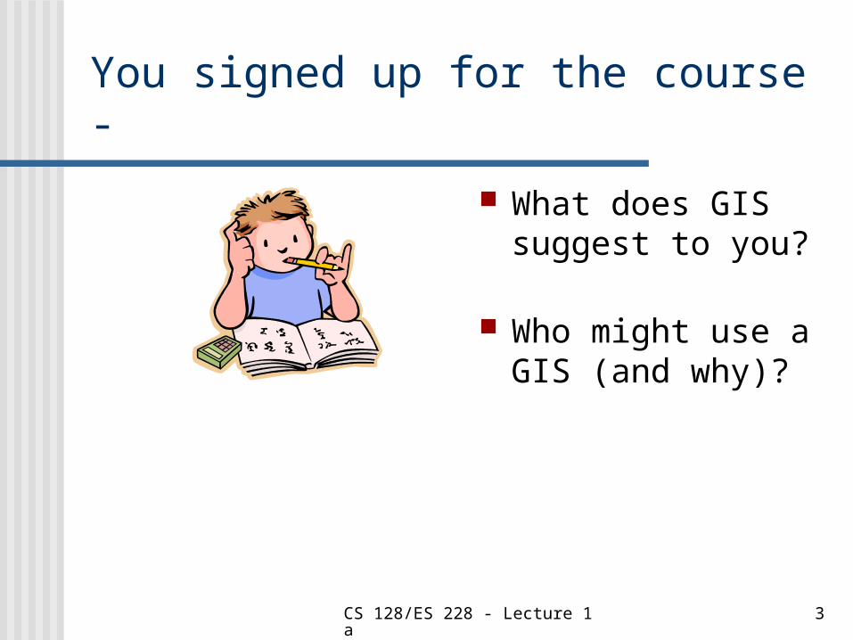
You signed up for the course -
What does GIS suggest to you?
Who might use a GIS (and why)?
CS 128/ES 228 - Lecture 1a 4
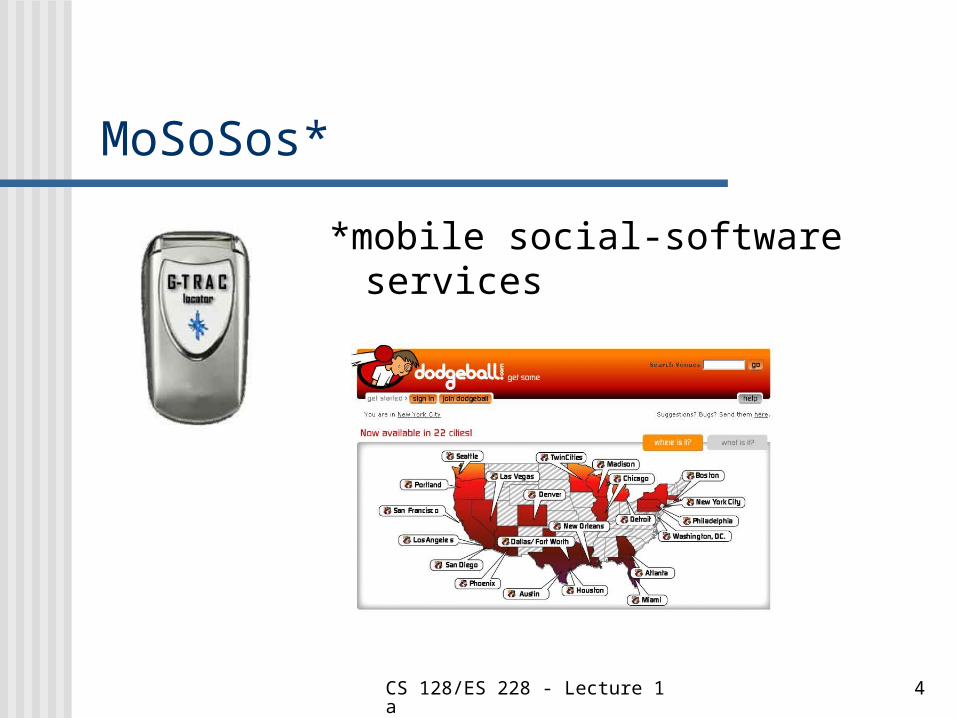
MoSoSos*
*mobile social-software services

CS 128/ES 228 - Lecture 1a 5
Some textbook definitions
“A powerful set of tools for collecting, storing, retrieving at will, transforming and displaying spatial data from the real world.”
Burroughs 1986 (Principles of Geographical Information Systems for Land Resources Assessment)

CS 128/ES 228 - Lecture 1a 6
Some textbook definitions
”A decision support system involving the integration of spatially referenced data in a problem solving environment.”
Cowen 1988 (Photogrammetric Engineering and Remote Sensing 54:1551-4)

CS 128/ES 228 - Lecture 1a 7
Some textbook definitions
”Any manual or computer based set of procedures used to store and manipulate geographically referenced data.”
Aronoff 1989 (Geographic Information Systems: a Management Perspective)

CS 128/ES 228 - Lecture 1a 8
Some textbook definitions
”An information system that is designed to work with data referenced by spatial or geographic coordinates. In other words, a GIS is both a database system with specific capabilities for spatially-referenced data, as well as a set of operations for working with the data.”
Estes & Star (in Clarke 2001, Getting Started with Geographic Information Systems)

CS 128/ES 228 - Lecture 1a 9
Some textbook definitions”A special case of information systems
where the database consists of observations on spatially distributed features, activities or events, which are definable in space as points, lines, and areas, to retrieve data for ad hoc queries and analyses.”
Dueker (in Clarke 2001, Getting Started with Geographic Information Systems)

CS 128/ES 228 - Lecture 1a 10
What do these definitions have in common?

CS 128/ES 228 - Lecture 1a 11
Here’s what we think …1. A GIS is a special type of database, designed to be used
with spatially or geographically-referenced objects (features, processes, or events)
CS 128/ES 228 - Lecture 1a 12
Here’s what we think …1. A GIS is a special type of database, designed to be used
with spatially or geographically-referenced objects (features, processes, or events)
2. A GIS contains operations or tools for working with spatial data. These tools include typical database operations (sorting, selecting, querying, etc.) plus specifically geographic operations (setting and changing scales and projections, etc.)

CS 128/ES 228 - Lecture 1a 13
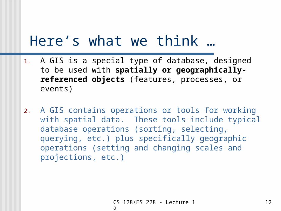
Here’s what we think …
1. A GIS is a special type of database, designed to be used with spatially or geographically-referenced objects (features, processes, or events)
2. A GIS contains operations or tools for working with spatial data. These tools include typical database operations (sorting, selecting, querying, etc.) as well as operations specific to geographic issues (setting and changing scales and projections, etc.)
3. A GIS serves a wide variety of purposes, centering on the storage, display, and analysis of spatial data.

CS 128/ES 228 - Lecture 1a 14
Two things that a GIS isn’t*
1. A computerized map-drawing (cartographic) system
GISs often display their data and analyses by means of maps, but they are themselves much more than just the map.
* But is often confused with

CS 128/ES 228 - Lecture 1a 15
Two things that a GIS isn’t*
2. A GPS (Global Positioning System)
Both the U. S. & Russia operate satellite systems that can provide ground coordinates to a hand-held unit, but the coordinates, without other data, don’t constitute a GIS.
* But is often confused with
(Why not?)

CS 128/ES 228 - Lecture 1a 16
The class mascot
Name ???
Useful information?

CS 128/ES 228 - Lecture 1a 17
A Real-life GIS

CS 128/ES 228 - Lecture 1a 18
Looks like just a map?
CS 128/ES 228 - Lecture 1a 19
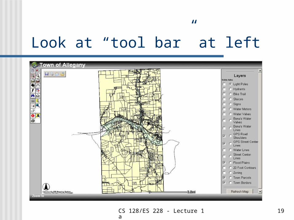
Look at “tool bar” at left

CS 128/ES 228 - Lecture 1a 20
Use the Zoom tool

CS 128/ES 228 - Lecture 1a 21
Where’s SBU?

CS 128/ES 228 - Lecture 1a 22
How to find our mascot?
CS 128/ES 228 - Lecture 1a 23
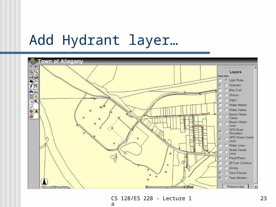
Add Hydrant layer…

CS 128/ES 228 - Lecture 1a 24
It still looks like just a map
CS 128/ES 228 - Lecture 1a 25
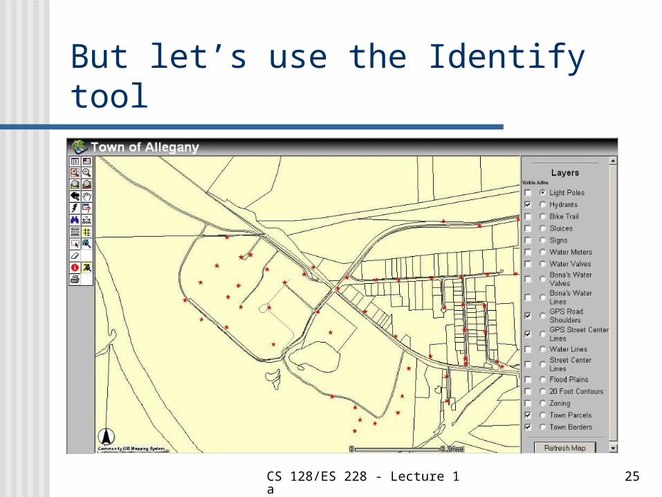
But let’s use the Identify tool

CS 128/ES 228 - Lecture 1a 26
Here’s the database

CS 128/ES 228 - Lecture 1a 27
What could you use this for?

CS 128/ES 228 - Lecture 1a 28
MCI
What is it?

CS 128/ES 228 - Lecture 1a 29
What is MCI? Telecommunications company? Initials of Michael C. Irving? 1101 in Roman Numerals? The Medial Carry Interrupt
instruction in assembly language?
Without context, you can’t tell!
CS 128/ES 228 - Lecture 1a 30
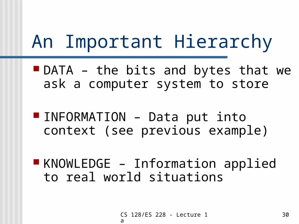
An Important Hierarchy DATA – the bits and bytes that we
ask a computer system to store
INFORMATION – Data put into context (see previous example)
KNOWLEDGE – Information applied to real world situations

CS 128/ES 228 - Lecture 1a 31
Components of a GIS Computer Systems and Software
Spatial Data
Data Management and Analysis Procedures
People

CS 128/ES 228 - Lecture 1a 32
Effective GIS Any Information System is only as
effective to the degree it helps create knowledge
Ways a GIS can help create knowledge Maps Database-type reports (including query
results and calculations) Prose-style reports

CS 128/ES 228 - Lecture 1a 33
The key to being effective
Knowing what questions to ask
And designing the GIS to answer those questions