Embed Size (px)
Citation preview
Project Scope & Biodiversity Features
Country Philippines
Province Davao del Norte
Municipality Island Garden City of Samal
Barangays Sitio Dapia, Barangay Sta. Cruz, Talicud Island
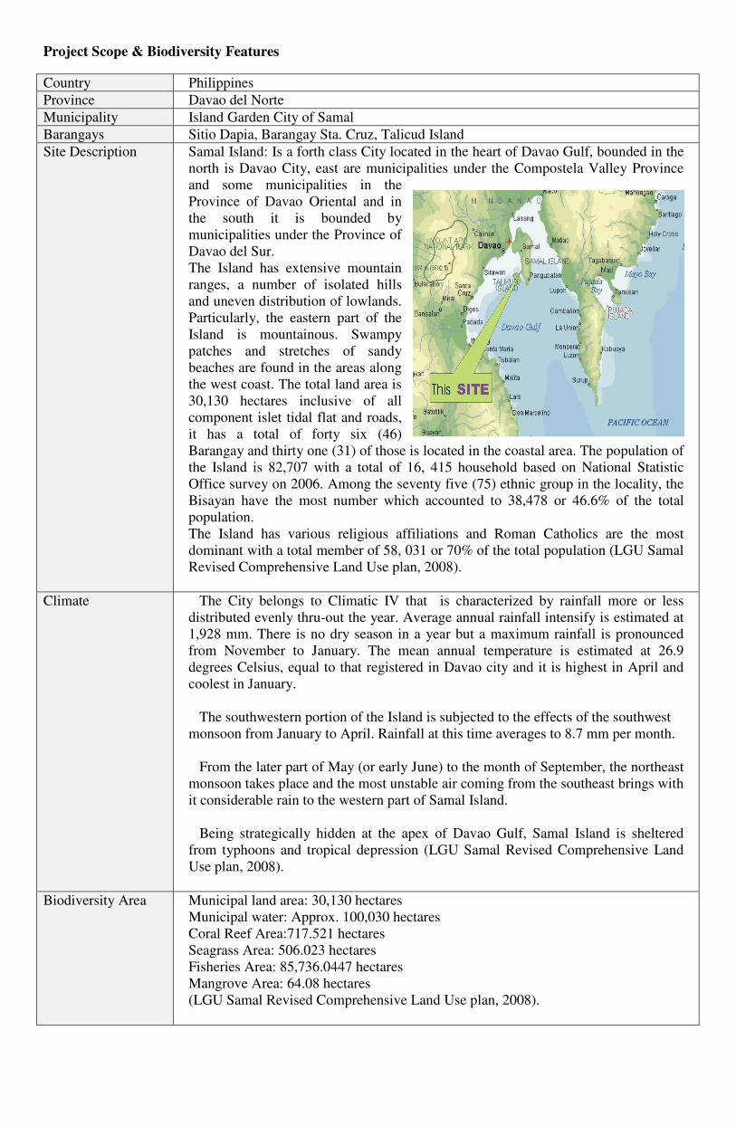
Site Description Samal Island: Is a forth class City located in the heart of Davao Gulf, bounded in the
north is Davao City, east are municipalities under the Compostela Valley Province
and some municipalities in the
Province of Davao Oriental and in
the south it is bounded by
municipalities under the Province of
Davao del Sur.
The Island has extensive mountain
ranges, a number of isolated hills
and uneven distribution of lowlands.
Particularly, the eastern part of the
Island is mountainous. Swampy
patches and stretches of sandy
beaches are found in the areas along
the west coast. The total land area is
30,130 hectares inclusive of all
component islet tidal flat and roads,
it has a total of forty six (46)
Barangay and thirty one (31) of those is located in the coastal area. The population of
the Island is 82,707 with a total of 16, 415 household based on National Statistic
Office survey on 2006. Among the seventy five (75) ethnic group in the locality, the
Bisayan have the most number which accounted to 38,478 or 46.6% of the total
population.
The Island has various religious affiliations and Roman Catholics are the most
dominant with a total member of 58, 031 or 70% of the total population (LGU Samal
Revised Comprehensive Land Use plan, 2008).
Climate The City belongs to Climatic IV that is characterized by rainfall more or less
distributed evenly thru-out the year. Average annual rainfall intensify is estimated at
1,928 mm. There is no dry season in a year but a maximum rainfall is pronounced
from November to January. The mean annual temperature is estimated at 26.9
degrees Celsius, equal to that registered in Davao city and it is highest in April and
coolest in January.
The southwestern portion of the Island is subjected to the effects of the southwest
monsoon from January to April. Rainfall at this time averages to 8.7 mm per month.
From the later part of May (or early June) to the month of September, the northeast
monsoon takes place and the most unstable air coming from the southeast brings with
it considerable rain to the western part of Samal Island.
Being strategically hidden at the apex of Davao Gulf, Samal Island is sheltered
from typhoons and tropical depression (LGU Samal Revised Comprehensive Land
Use plan, 2008).
Biodiversity Area Municipal land area: 30,130 hectares
Municipal water: Approx. 100,030 hectares
Coral Reef Area:717.521 hectares
Seagrass Area: 506.023 hectares
Fisheries Area: 85,736.0447 hectares
Mangrove Area: 64.08 hectares
(LGU Samal Revised Comprehensive Land Use plan, 2008).
Biodiversity
Background
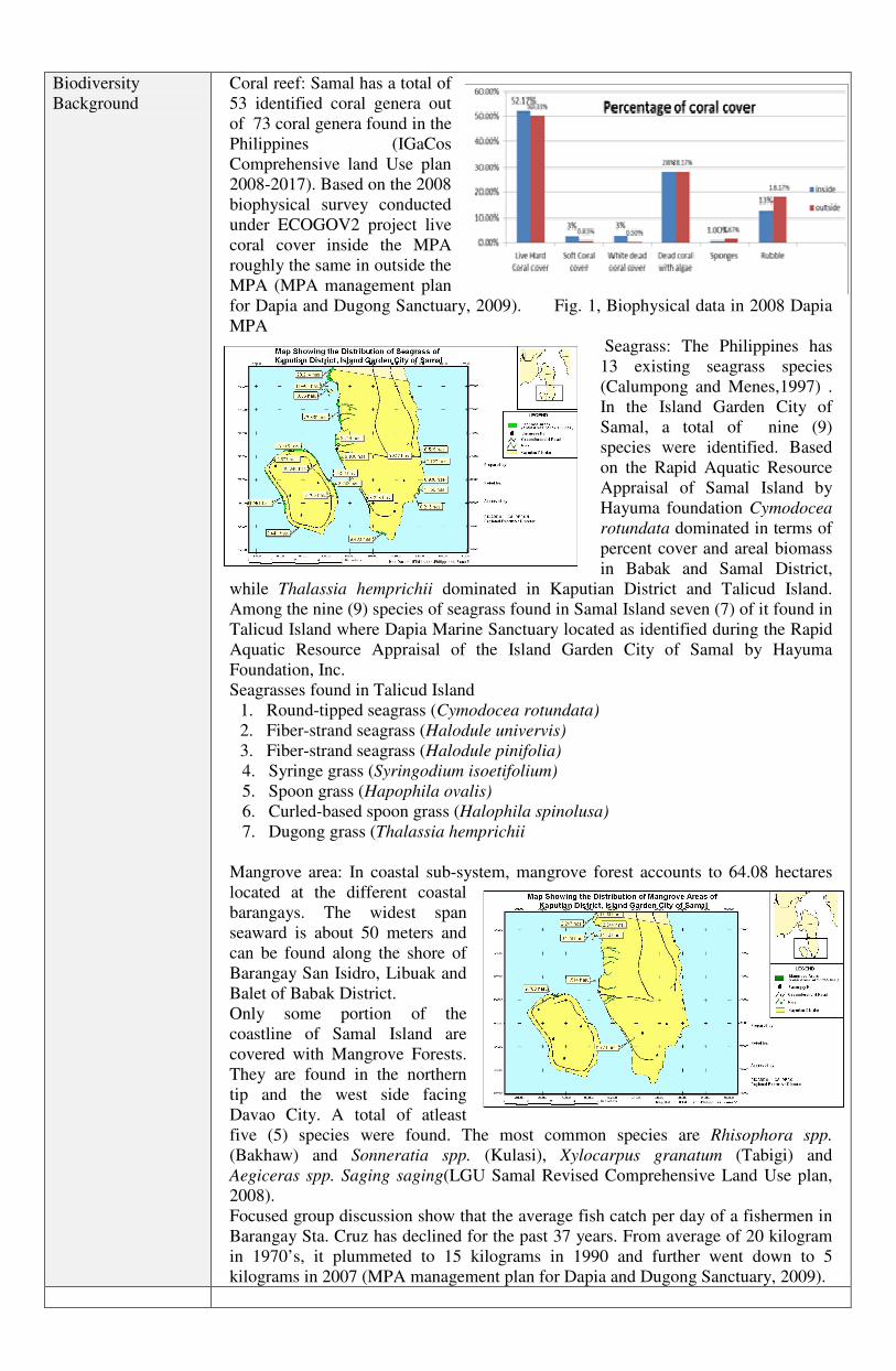
Coral reef: Samal has a total of
53 identified coral genera out
of 73 coral genera found in the
Philippines (IGaCos
Comprehensive land Use plan
2008-2017). Based on the 2008
biophysical survey conducted
under ECOGOV2 project live
coral cover inside the MPA
roughly the same in outside the
MPA (MPA management plan
for Dapia and Dugong Sanctuary, 2009). Fig. 1, Biophysical data in 2008 Dapia
MPA
Seagrass: The Philippines has
13 existing seagrass species
(Calumpong and Menes,1997) .
In the Island Garden City of
Samal, a total of nine (9)
species were identified. Based
on the Rapid Aquatic Resource
Appraisal of Samal Island by
Hayuma foundation Cymodocea
rotundata dominated in terms of
percent cover and areal biomass
in Babak and Samal District,
while Thalassia hemprichii dominated in Kaputian District and Talicud Island.
Among the nine (9) species of seagrass found in Samal Island seven (7) of it found in
Talicud Island where Dapia Marine Sanctuary located as identified during the Rapid
Aquatic Resource Appraisal of the Island Garden City of Samal by Hayuma
Foundation, Inc.
Seagrasses found in Talicud Island
1. Round-tipped seagrass (Cymodocea rotundata)
2. Fiber-strand seagrass (Halodule univervis)
3. Fiber-strand seagrass (Halodule pinifolia)
4. Syringe grass (Syringodium isoetifolium)
5. Spoon grass (Hapophila ovalis)
6. Curled-based spoon grass (Halophila spinolusa)
7. Dugong grass (Thalassia hemprichii
Mangrove area: In coastal sub-system, mangrove forest accounts to 64.08 hectares
located at the different coastal
barangays. The widest span
seaward is about 50 meters and
can be found along the shore of
Barangay San Isidro, Libuak and
Balet of Babak District.
Only some portion of the
coastline of Samal Island are
covered with Mangrove Forests.
They are found in the northern
tip and the west side facing
Davao City. A total of atleast
five (5) species were found. The most common species are Rhisophora spp.
(Bakhaw) and Sonneratia spp. (Kulasi), Xylocarpus granatum (Tabigi) and
Aegiceras spp. Saging saging(LGU Samal Revised Comprehensive Land Use plan,
2008).
Focused group discussion show that the average fish catch per day of a fishermen in
Barangay Sta. Cruz has declined for the past 37 years. From average of 20 kilogram
in 1970’s, it plummeted to 15 kilograms in 1990 and further went down to 5
kilograms in 2007 (MPA management plan for Dapia and Dugong Sanctuary, 2009).
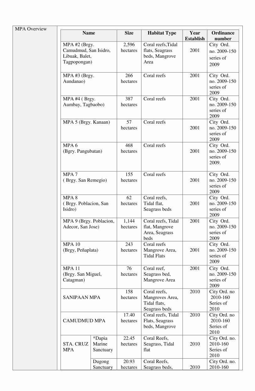
MPA Overview Name Size Habitat Type Year
Establish
Ordinance
number
MPA #2 (Brgy.
Camudmud, San Isidro,
Libuak, Balet,
Tagpopongan)
2,596
hectares
Coral reefs,Tidal
flats, Seagrass
beds, Mangrove
Area
2001
City Ord.
no. 2009-150
series of
2009
MPA #3 (Brgy.
Aundanao)
266
hectares
Coral reefs
2001 City Ord.
no. 2009-150
series of
2009
MPA #4 ( Brgy.
Aumbay, Tagbaobo)
387
hectares
Coral reefs 2001 City Ord.
no. 2009-150
series of
2009
MPA 5 (Brgy. Kanaan) 57
hectares
Coral reefs
2001
City Ord.
no. 2009-150
series of
2009
MPA 6
(Bgry. Pangubatan)
468
hectares
Coral reefs
2001
City Ord.
no. 2009-150
series of
2009.
MPA 7
( Brgy. San Remegio)
155
hectares
Coral reefs
2001
City Ord.
no. 2009-150
series of
2009
MPA 8
( Brgy. Poblacion, San
Isidro)
62
hectares
Coral reefs,
Tidal flat,
Seagrass beds
2001
City Ord.
no. 2009-150
series of
2009
MPA 9 (Brgy. Poblacion,
Adecor, San Jose)
1,144
hectares
Coral reefs, Tidal
flat, Mangrove
Area, Seagrass
beds
2001 City Ord.
no. 2009-150
series of
2009
MPA 10
(Brgy, Peñaplata)
243
hectares
Coral reefs
Mangrove Area,
Tidal Flats
2001
City Ord.
no. 2009-150
series of
2009
MPA 11
(Brgy. San Miguel,
Catagman)
76
hectares
Coral reef,
Seagrass bed,
Mangrove Area
2001 City Ord.
no. 2009-150
series of
2009
SANIPAAN MPA
158
hectares
Coral reefs,
Mangroves Area,
Tidal flats,
Seagrass beds
2010 City Ord. no
2010-160
Series of
2010
CAMUDMUD MPA
17.40
hectares
Coral reefs, Tidal
Flats, Seagrass
beds, Mangrove
2010 City Ord. no
2010-160
Series of
2010
STA. CRUZ
MPA
*Dapia
Marine
Sanctuary
22.45
hectares
Coral Reefs,
Seagrass, Tidal
flat
2010
City Ord. no.
2010-160
Series of
2010
Dugong
Sanctuary
20.93
hectares
Coral Reefs,
Seagrass beds,
2010
City Ord. no.
2010-160
Tidal flats Series of
2010
COGON MPA
34.88 Coral reefs 2010 City Ord.no.
2010-160
Series of
2010
DADATAN
MPA
Mansud 5
hectares
Coral reefs
2010
MPA
Ord.no.
2010-160
Series of
2010
Dadatan
Coral
Garden
26
hectares
Coral reefs,
Seagrass beds,
Tidal flats
2010
MPA Ord.
no. 2010-
160
Series of
2010
LINOSUTAN MPA
35.5
hectares
Coral reefs,
Seagrass beds,
tidal flats
2010
MPA Ord.
no. 2010-
160
Series of
2010
(LGU Samal Revised Comprehensive Land Use plan, 2008).
Technical
Description of
MPAs
Dapia MPA has a total of 22.45 hectares of no take zone with fifty (50) meters buffer
zone from the no take zone with the following coordinates
Point Latitude Longitude
1 06.10’55.22”N 125.41’20.73’’E
2 06.10’8.71”N 125.41’21.72”E
3 06.10’7.86”N 125.41’38.53”E
4 06.10’54.81”N 125.41’39.76”E
(MPA management plan for Dapia and Dugong
Sanctuary, 2009
Site Map Reference http://maps.google.com.ph/maps?hl=fil&bav=on.2,or.r_gc.r_pw.r_qf.&biw=1366&bih=664&noj
=1&q=island+garden+city+of+samal&um=1&ie=UTF-
8&hq=&hnear=0x32f9701aad3fe53b:0xebd6a17f6716630f,Island+Garden+City+of+Samal&gl=ph
&sa=X&ei=7ItVUO2EE8TImQWvi4HoAw&ved=0CC8Q8gEwAQ
Protected Area
Categories
All MPA was declared thru City ordinances:
City Ordinance number 2010-160 s. 2010 (An Ordinance for the establishment and
management of the Island Garden City of Samal marine Protected Areas (MPAs) and
Providing funds thereof)
City Ordinance number 2009-150 s. 2009 (An Ordinance enacting the Revised Zoning
Regulations of the Island Garden City of Samal amending for the purpose City
Ordinance No. 2000-30)
City Ordinance number 2008-142 s. 2008 (An ordinance providing for the
development, protection, conservation, rehabilitation, utilization and management of
the fisheries and aquatic resources in the Island Garden City of Samal).
Red-List Species IUCN Threat Classification can be accessed here, or in Appendix A:
http://www.iucnredlist.org/technical-documents/classification-schemes/threats-
classification-scheme-ver3
Giant Clam – Tridacna squamosa (IUCN least concerned)
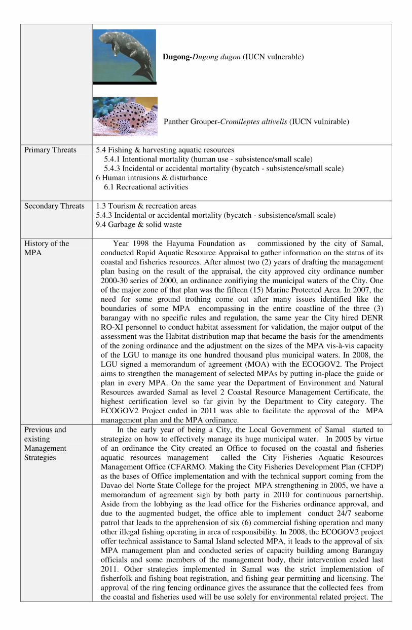
Dugong-Dugong dugon (IUCN vulnerable)
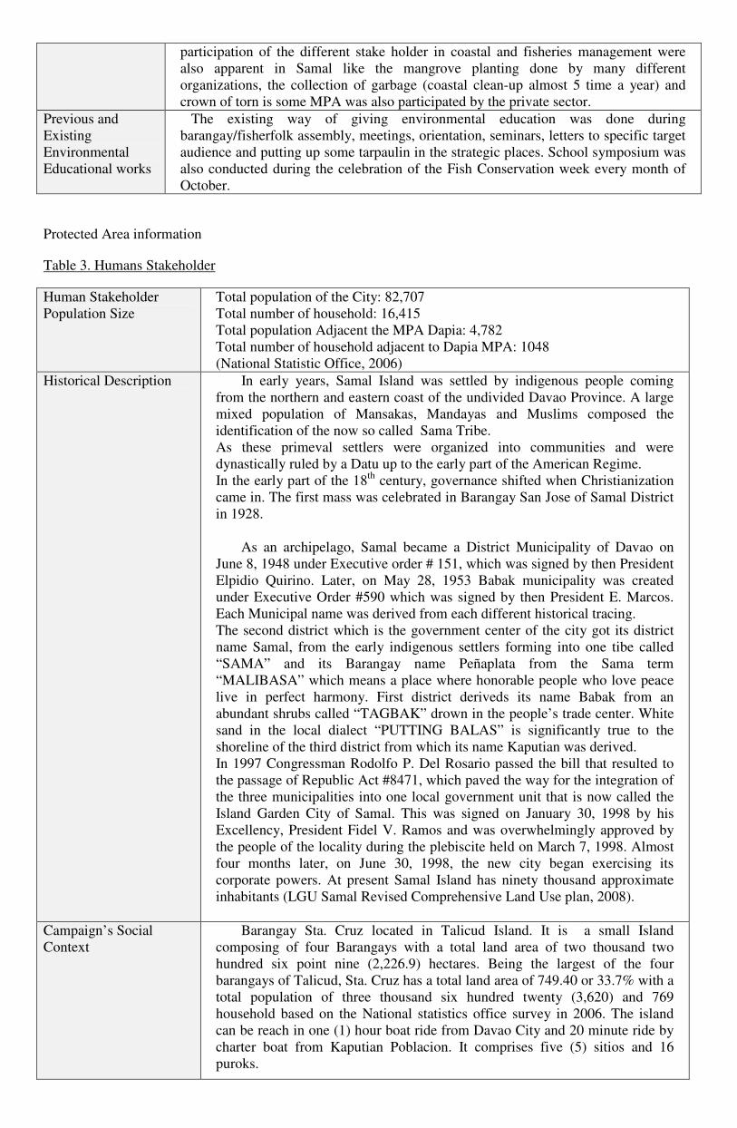
Panther Grouper-Cromileptes altivelis (IUCN vulnirable)
Primary Threats 5.4 Fishing & harvesting aquatic resources
5.4.1 Intentional mortality (human use - subsistence/small scale)
5.4.3 Incidental or accidental mortality (bycatch - subsistence/small scale)
6 Human intrusions & disturbance
6.1 Recreational activities
Secondary Threats 1.3 Tourism & recreation areas
5.4.3 Incidental or accidental mortality (bycatch - subsistence/small scale)
9.4 Garbage & solid waste
History of the
MPA
Year 1998 the Hayuma Foundation as commissioned by the city of Samal,
conducted Rapid Aquatic Resource Appraisal to gather information on the status of its
coastal and fisheries resources. After almost two (2) years of drafting the management
plan basing on the result of the appraisal, the city approved city ordinance number
2000-30 series of 2000, an ordinance zonifiying the municipal waters of the City. One
of the major zone of that plan was the fifteen (15) Marine Protected Area. In 2007, the
need for some ground trothing come out after many issues identified like the
boundaries of some MPA encompassing in the entire coastline of the three (3)
barangay with no specific rules and regulation, the same year the City hired DENR
RO-XI personnel to conduct habitat assessment for validation, the major output of the
assessment was the Habitat distribution map that became the basis for the amendments
of the zoning ordinance and the adjustment on the sizes of the MPA vis-à-vis capacity
of the LGU to manage its one hundred thousand plus municipal waters. In 2008, the
LGU signed a memorandum of agreement (MOA) with the ECOGOV2. The Project
aims to strengthen the management of selected MPAs by putting in-place the guide or
plan in every MPA. On the same year the Department of Environment and Natural
Resources awarded Samal as level 2 Coastal Resource Management Certificate, the
highest certification level so far givin by the Department to City category. The
ECOGOV2 Project ended in 2011 was able to facilitate the approval of the MPA
management plan and the MPA ordinance.
Previous and
existing
Management
Strategies
In the early year of being a City, the Local Government of Samal started to
strategize on how to effectively manage its huge municipal water. In 2005 by virtue
of an ordinance the City created an Office to focused on the coastal and fisheries
aquatic resources management called the City Fisheries Aquatic Resources
Management Office (CFARMO. Making the City Fisheries Development Plan (CFDP)
as the bases of Office implementation and with the technical support coming from the
Davao del Norte State College for the project MPA strengthening in 2005, we have a
memorandum of agreement sign by both party in 2010 for continuous parnertship.
Aside from the lobbying as the lead office for the Fisheries ordinance approval, and
due to the augmented budget, the office able to implement conduct 24/7 seaborne
patrol that leads to the apprehension of six (6) commercial fishing operation and many
other illegal fishing operating in area of responsibility. In 2008, the ECOGOV2 project
offer technical assistance to Samal Island selected MPA, it leads to the approval of six
MPA management plan and conducted series of capacity building among Barangay
officials and some members of the management body, their intervention ended last
2011. Other strategies implemented in Samal was the strict implementation of
fisherfolk and fishing boat registration, and fishing gear permitting and licensing. The
approval of the ring fencing ordinance gives the assurance that the collected fees from
the coastal and fisheries used will be use solely for environmental related project. The
Protected Area information
Table 3. Humans Stakeholder
Human Stakeholder
Population Size
Total population of the City: 82,707
Total number of household: 16,415
Total population Adjacent the MPA Dapia: 4,782
Total number of household adjacent to Dapia MPA: 1048
(National Statistic Office, 2006)
Historical Description In early years, Samal Island was settled by indigenous people coming
from the northern and eastern coast of the undivided Davao Province. A large
mixed population of Mansakas, Mandayas and Muslims composed the
identification of the now so called Sama Tribe.
As these primeval settlers were organized into communities and were
dynastically ruled by a Datu up to the early part of the American Regime.
In the early part of the 18th
century, governance shifted when Christianization
came in. The first mass was celebrated in Barangay San Jose of Samal District
in 1928.
As an archipelago, Samal became a District Municipality of Davao on
June 8, 1948 under Executive order # 151, which was signed by then President
Elpidio Quirino. Later, on May 28, 1953 Babak municipality was created
under Executive Order #590 which was signed by then President E. Marcos.
Each Municipal name was derived from each different historical tracing.
The second district which is the government center of the city got its district
name Samal, from the early indigenous settlers forming into one tibe called
“SAMA” and its Barangay name Peñaplata from the Sama term
“MALIBASA” which means a place where honorable people who love peace
live in perfect harmony. First district deriveds its name Babak from an
abundant shrubs called “TAGBAK” drown in the people’s trade center. White
sand in the local dialect “PUTTING BALAS” is significantly true to the
shoreline of the third district from which its name Kaputian was derived.
In 1997 Congressman Rodolfo P. Del Rosario passed the bill that resulted to
the passage of Republic Act #8471, which paved the way for the integration of
the three municipalities into one local government unit that is now called the
Island Garden City of Samal. This was signed on January 30, 1998 by his
Excellency, President Fidel V. Ramos and was overwhelmingly approved by
the people of the locality during the plebiscite held on March 7, 1998. Almost
four months later, on June 30, 1998, the new city began exercising its
corporate powers. At present Samal Island has ninety thousand approximate
inhabitants (LGU Samal Revised Comprehensive Land Use plan, 2008).
Campaign’s Social
Context
Barangay Sta. Cruz located in Talicud Island. It is a small Island
composing of four Barangays with a total land area of two thousand two
hundred six point nine (2,226.9) hectares. Being the largest of the four
barangays of Talicud, Sta. Cruz has a total land area of 749.40 or 33.7% with a
total population of three thousand six hundred twenty (3,620) and 769
household based on the National statistics office survey in 2006. The island
can be reach in one (1) hour boat ride from Davao City and 20 minute ride by
charter boat from Kaputian Poblacion. It comprises five (5) sitios and 16
puroks.
participation of the different stake holder in coastal and fisheries management were
also apparent in Samal like the mangrove planting done by many different
organizations, the collection of garbage (coastal clean-up almost 5 time a year) and
crown of torn is some MPA was also participated by the private sector.
Previous and
Existing
Environmental
Educational works
The existing way of giving environmental education was done during
barangay/fisherfolk assembly, meetings, orientation, seminars, letters to specific target
audience and putting up some tarpaulin in the strategic places. School symposium was
also conducted during the celebration of the Fish Conservation week every month of
October.
The Island is mostly plain having a slope of 0-8% with little sloping areas.
The soil is of Bolinao Clay type suitable for coconut and corn (major product
of the Island). This type of soil is also suitable for cotton farming. Owing to its
thick and rocky strata, potable water source is scare. There is no pronounced
erosion and flooding occurrences in the area (MPA management plan for
Dapia and Dugong Sanctuary, 2009)
Legislative Context RA 7160 – section 3 (i) Local Government Units shall share with the national
government in the management and maintenance of ecological balance within
their territorial jurisdiction.
RA 7160 – section 17 – Basic Services and Facilities.
RA 8550 – section 16 municipal/city governments have jurisdiction over
municipal waters. This jurisdiction includes responsibilities over the
protection, management and conservation of municipal waters, coastal and
riparian areas, and the enforcement of all fishery laws, rules and regulations
and valid fishery ordinances.
City Ordinance No. 2009-150, series of 2009- An ordinance enacting the
Revised Zoning Regulations of the Island Garden City of Samal amending for
the purpose City No. 2000-30 and (2) Resolution No. 852, s. 2009- Resolution
adopting and approving the revised 10-year Comprehensive Development Plan
of the Island Garden City of Samal
City Ordinance # 2008-142- An ordinance providing for the development,
protection, conservation, rehabilitation, utilization and management of the
fisheries and aquatic resources in the Island Garden City of Samal.
City Ordinance # 156, series of 2010 - An Ordinance for the Establishment
and Management of the Island Garden City of Samal Marine Protected Areas
and Providing Funds thereof
Barangay Development Plan of Barangay Sta. Cruz (BDC Resolution No.
04, s. of 2003 (dated Aug. 25, 2003); Sang. Brgy. Resolution No.32 s. 2003
(dated Sept 1, 2003) CDC Resolution No. 12 s. 2003 (dated Sept 11, 2003); SP
Resolution No. 267-D s. 2003 (dated September 30, 2003)
Table 4. Campaign Project Team
Name Role in
Campaign
Organization Title/Position in
Organization
Responsibility or
function this person
might have in the pride
campaign
% of time allocated
of Pride campaign
Jemelita Q. Camaso Supervisor LGU-Samal City Budget
Office
Take the lead in the
monitoring of the
social marketing
campaign in the local
level. Responsible in
the lobbying for
approval of the budget
requirements for the
campaign. Take the
lead in the feed
10%
backing to the Local
Chief Executive and to
RARE. The the lead in
the liquidation of
expense fund of RARE
Juniemar D. Montera CF LGU-Samal Aqua-culturist I Take the lead in the
implementation of all
the activities related to
the campaign. Take the
lead in the preparation
of budget expense item
and take the lead in the
conduct of regular
feed backing to the
LAP supervisor as to
the status of the
campaign. Take the
lead in the liquidation
of all fund disbursed
during the campaign.
Attend and deliver all
assignments for the
university phase.
90%
Amado C. Asoy Alternative
CF
LGU-Samal Planning officer
IV
Fisheries
Division Head
Assist the CF in all
activities. Provide CF
access to office logistic
such as motorcycle,
fuel and internet
connection, office
supplies
10%
Table 5. Key Partners Support
Name of Partners/Group Role (s) Contact Name Phone/email
contact
Name of agency or group
that may be involved or
integral to the success of
the Pride campaign
Role that this organization might
play in the Pride campaign
Primary contact’s name
Barangay Local
Government of Brgy. Sta.
Cruz
Take the lead in the management of
the MPA in local level. Responsible
for the budget allocation (barangay
funds)
Take the lead as over-all MPA
coordinator. Team leader of the
bantay dagat
Hon. Fidencio B. Matro Brgy. Captain
Brgy. Sta. Cruz, Talicud,
Kaputian District, Island
Garden City of Samal
Hon. Jovel Parilla Brgy. Kagawad
09152300837
Department of
Agriculture-Bureau of
Technical support, Provision of
alternative livelihood, Provision of
Fatma Idris, DR.RDEV Regional Director

Fisheries and Aquatic
Resources
(DA-BFAR)
MPA logistics. DA-BFAR ROXI
Magsaysay Avenue,
Davao City
Provincial Agriculture
Office Fisheries Division
Technical support, Provision of
alternative livelihood, Provision of
MPA logistic.
Alfredo Avenido Provincial Fishery
Officer
Provincial Agriculture
Office, Capitol Drive,
Mankilam, Tagum City
Department of Education Member of the management
committee. Focal person in the
campaign inside the school campus
Mrs. Lea Muquiros Head Teacher-High
School
Fisherfolk Association Member of the management
committee.
Arnel Cutamora Fisherfolk Organization
Chairman
Sitio Dapia, Sta. Cruz,
Talicud Island
BFARMC Take the lead in the Policy advisory
and consultative body of any
possible management option
specially that needs legislation
Nicholas Tandug BFARMC Chairman
Sta. Cruz, Talicud Island
APPENDIX A: IUCN Threat Classification
1 Residential & commercial development
1.1 Housing & urban areas
1.2 Commercial & industrial areas
1.3 Tourism & recreation areas
2 Agriculture & aquaculture
2.1 Annual & perennial non-timber crops
2.1.1 Shifting agriculture
2.1.2 Small-holder farming
2.1.3 Agro-industry farming
2.1.4 Scale Unknown/Unrecorded
2.2 Wood & pulp plantations
2.2.1 Small-holder plantations
2.2.2 Agro-industry plantations
2.2.3 Scale Unknown/Unrecorded
2.3 Livestock farming & ranching
2.3.1 Nomadic grazing
2.3.2 Small-holder grazing, ranching or farming
2.3.3 Agro-industry grazing, ranching or farming
2.3.4 Scale Unknown/Unrecorded
2.4 Marine & freshwater aquaculture
2.4.1 Subsistence/artisinal aquaculture
2.4.2 Industrial aquaculture
2.4.3 Scale Unknown/Unrecorded
3 Energy production & mining
3.1 Oil & gas drilling
3.2 Mining & quarrying
3.3 Renewable energy
4 Transportation & service corridors
4.1 Roads & railroads
4.2 Utility & service lines
4.3 Shipping lanes
4.4 Flight paths
5 Biological resource use
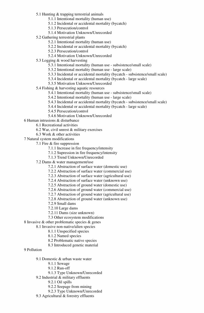
5.1 Hunting & trapping terrestrial animals
5.1.1 Intentional mortality (human use)
5.1.2 Incidental or accidental mortality (bycatch)
5.1.3 Persecution/control
5.1.4 Motivation Unknown/Unrecorded
5.2 Gathering terrestrial plants
5.2.1 Intentional mortality (human use)
5.2.2 Incidental or accidental mortality (bycatch)
5.2.3 Persecution/control
5.2.4 Motivation Unknown/Unrecorded
5.3 Logging & wood harvesting
5.3.1 Intentional mortality (human use - subsistence/small scale)
5.3.2 Intentional mortality (human use - large scale)
5.3.3 Incidental or accidental mortality (bycatch - subsistence/small scale)
5.3.4 Incidental or accidental mortality (bycatch - large scale)
5.3.5 Motivation Unknown/Unrecorded
5.4 Fishing & harvesting aquatic resources
5.4.1 Intentional mortality (human use - subsistence/small scale)
5.4.2 Intentional mortality (human use - large scale)
5.4.3 Incidental or accidental mortality (bycatch - subsistence/small scale)
5.4.4 Incidental or accidental mortality (bycatch - large scale)
5.4.5 Persecution/control
5.4.6 Motivation Unknown/Unrecorded
6 Human intrusions & disturbance
6.1 Recreational activities
6.2 War, civil unrest & military exercises
6.3 Work & other activities
7 Natural system modifications
7.1 Fire & fire suppression
7.1.1 Increase in fire frequency/intensity
7.1.2 Supression in fire frequency/intensity
7.1.3 Trend Unknown/Unrecorded
7.2 Dams & water management/use
7.2.1 Abstraction of surface water (domestic use)
7.2.2 Abstraction of surface water (commercial use)
7.2.3 Abstraction of surface water (agricultural use)
7.2.4 Abstraction of surface water (unknown use)
7.2.5 Abstraction of ground water (domestic use)
7.2.6 Abstraction of ground water (commercial use)
7.2.7 Abstraction of ground water (agricultural use)
7.2.8 Abstraction of ground water (unknown use)
7.2.9 Small dams
7.2.10 Large dams
7.2.11 Dams (size unknown)
7.3 Other ecosystem modifications
8 Invasive & other problematic species & genes
8.1 Invasive non-native/alien species
8.1.1 Unspecified species
8.1.2 Named species
8.2 Problematic native species
8.3 Introduced genetic material
9 Pollution
9.1 Domestic & urban waste water
9.1.1 Sewage
9.1.2 Run-off
9.1.3 Type Unknown/Unrecorded
9.2 Industrial & military effluents
9.2.1 Oil spills
9.2.2 Seepage from mining
9.2.3 Type Unknown/Unrecorded
9.3 Agricultural & forestry effluents

9.3.1 Nutrient loads
9.3.2 Soil erosion, sedimentation
9.3.3 Herbicides and pesticides
9.3.4 Type Unknown/Unrecorded
9.4 Garbage & solid waste
9.5 Air-borne pollutants
9.5.1 Acid rain
9.5.2 Smog
9.5.3 Ozone
9.5.4 Type Unknown/Unrecorded
9.6 Excess energy
9.6.1 Light pollution
9.6.2 Thermal pollution
9.6.3 Noise pollution
9.6.4 Type Unknown/Unrecorded
10 Geological events
10.1 Volcanoes
10.2 Earthquakes/tsunamis
10.3 Avalanches/landslides
11 Climate change & severe weather
11.1 Habitat shifting & alteration
11.2 Droughts
11.3 Temperature extremes
11.4 Storms & flooding
11.5 Other impacts