Embed Size (px)
DESCRIPTION
Temple University Masters of Landscape Architecture, and Professional Work
Citation preview

p o r t f o l i o
a r c h i t e c t u r eS P E R O F FC O R Y
l a n d s c a p e
d e s i g n
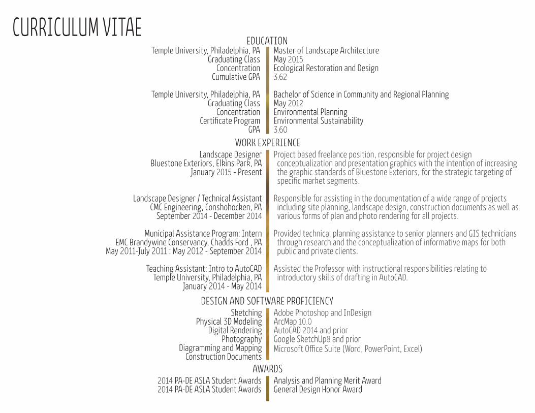
CURRICULUM VITAE Master of Landscape ArchitectureMay 2015Ecological Restoration and Design 3.62
Bachelor of Science in Community and Regional Planning May 2012Environmental PlanningEnvironmental Sustainability3.60
Temple University, Philadelphia, PAGraduating Class
Concentration Cumulative GPA
Temple University, Philadelphia, PAGraduating Class
ConcentrationCertificate Program
GPA
2014 PA-DE ASLA Student Awards2014 PA-DE ASLA Student Awards
Analysis and Planning Merit Award General Design Honor Award
EDUCATION
WORK EXPERIENCE Landscape Designer
Bluestone Exteriors, Elkins Park, PAJanuary 2015 - Present
Landscape Designer / Technical Assistant CMC Engineering, Conshohocken, PA
September 2014 - December 2014
Municipal Assistance Program: Intern EMC Brandywine Conservancy, Chadds Ford , PA
May 2011-July 2011 : May 2012 - September 2014
Teaching Assistant: Intro to AutoCADTemple University, Philadelphia, PA
January 2014 - May 2014
Project based freelance position, responsible for project design conceptualization and presentation graphics with the intention of increasing the graphic standards of Bluestone Exteriors, for the strategic targeting of specific market segments.
Responsible for assisting in the documentation of a wide range of projects including site planning, landscape design, construction documents as well as various forms of plan and photo rendering for all projects.
Provided technical planning assistance to senior planners and GIS technicians through research and the conceptualization of informative maps for both public and private clients.
Assisted the Professor with instructional responsibilities relating to introductory skills of drafting in AutoCAD.
DESIGN AND SOFTWARE PROFICIENCYSketching
Physical 3D ModelingDigital Rendering
Photography Diagramming and Mapping
Construction Documents
Adobe Photoshop and InDesignArcMap 10.0 AutoCAD 2014 and priorGoogle SketchUp8 and priorMicrosoft Office Suite (Word, PowerPoint, Excel)
AWARDS
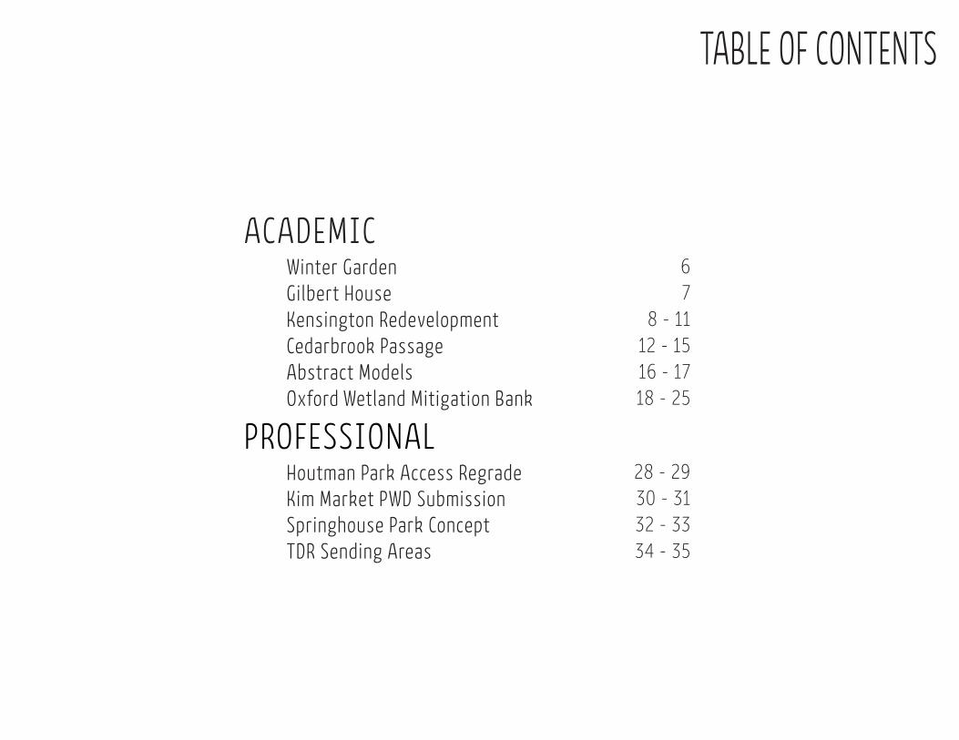
TABLE OF CONTENTS
ACADEMIC
PROFESSIONAL
Kensington Redevelopment Cedarbrook Passage
Oxford Wetland Mitigation Bank
Springhouse Park Concept
Houtman Park Access Regrade Kim Market PWD Submission
Winter GardenGilbert House
Abstract Models
30 - 31 32 - 33
18 - 25
28 - 29
16 - 1712 - 15
8 - 1176
TDR Sending Areas 34 - 35


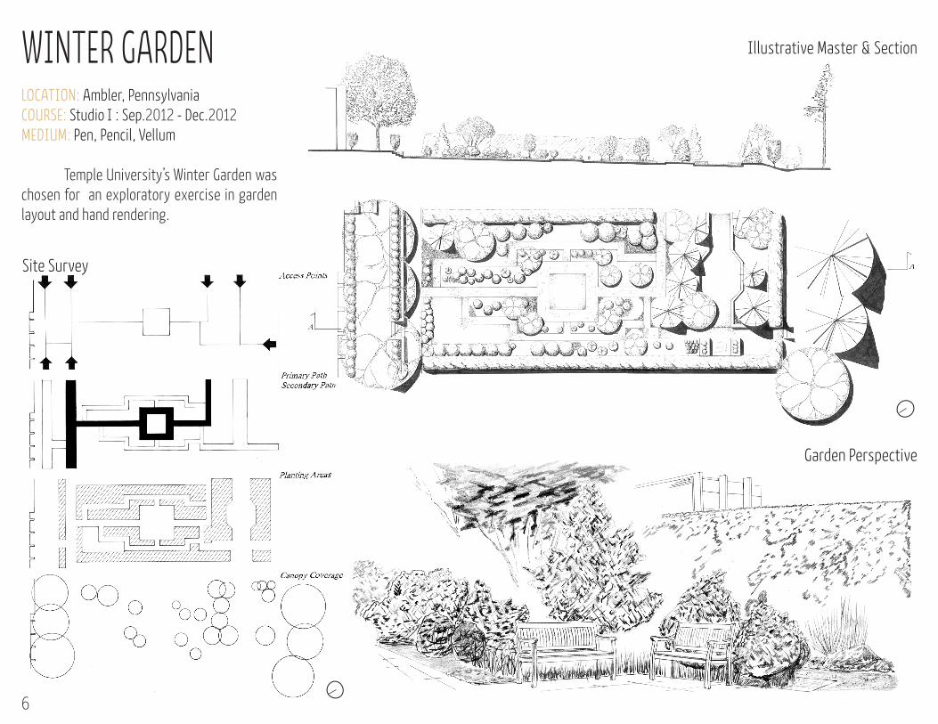
LOCATION: Ambler, PennsylvaniaCOURSE: Studio I : Sep.2012 - Dec.2012MEDIUM: Pen, Pencil, Vellum
Temple University’s Winter Garden was chosen for an exploratory exercise in garden layout and hand rendering.
WINTER GARDEN
Site Survey
Illustrative Master & Section
Garden Perspective
6
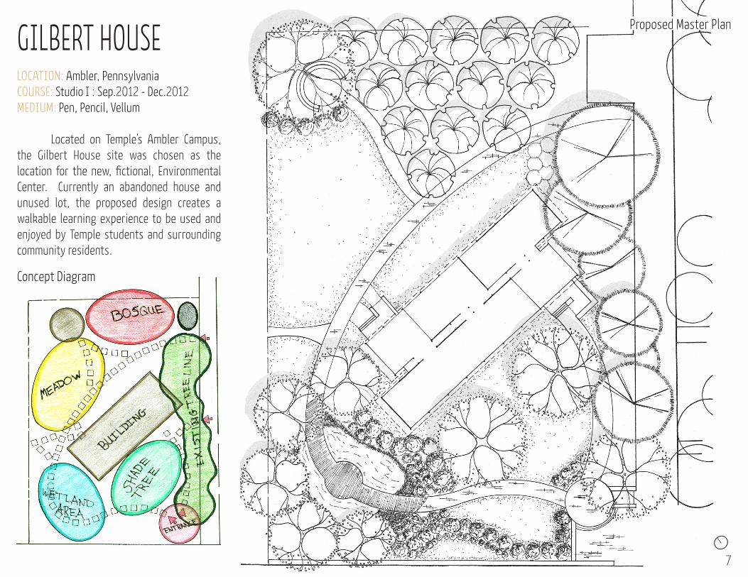
LOCATION: Ambler, PennsylvaniaCOURSE: Studio I : Sep.2012 - Dec.2012MEDIUM: Pen, Pencil, Vellum
Located on Temple’s Ambler Campus, the Gilbert House site was chosen as the location for the new, fictional, Environmental Center. Currently an abandoned house and unused lot, the proposed design creates a walkable learning experience to be used and enjoyed by Temple students and surrounding community residents.
GILBERT HOUSE
7
Proposed Master Plan
Concept Diagram
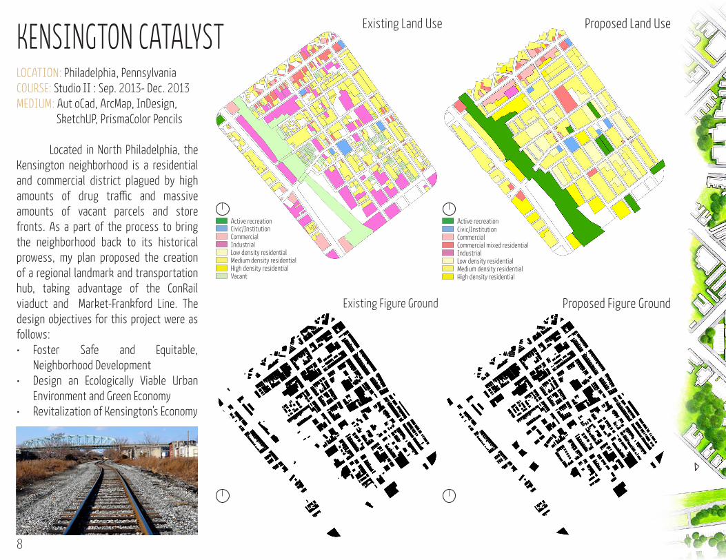
Existing Land Use Proposed Land Use
Active recreationCivic/InstitutionCommercialCommercial mixed residentialIndustrialLow density residential Medium density residential High density residential
KENSINGTON CATALYST LOCATION: Philadelphia, PennsylvaniaCOURSE: Studio II : Sep. 2013- Dec. 2013MEDIUM: Aut oCad, ArcMap, InDesign, SketchUP, PrismaColor Pencils
Located in North Philadelphia, the Kensington neighborhood is a residential and commercial district plagued by high amounts of drug traffic and massive amounts of vacant parcels and store fronts. As a part of the process to bring the neighborhood back to its historical prowess, my plan proposed the creation of a regional landmark and transportation hub, taking advantage of the ConRail viaduct and Market-Frankford Line. The design objectives for this project were as follows:• Foster Safe and Equitable,
Neighborhood Development • Design an Ecologically Viable Urban
Environment and Green Economy • Revitalization of Kensington’s Economy
Civic/InstitutionCommercialIndustrialLow density residential Medium density residential High density residential Vacant
Active recreation
Existing Figure Ground Proposed Figure Ground
8
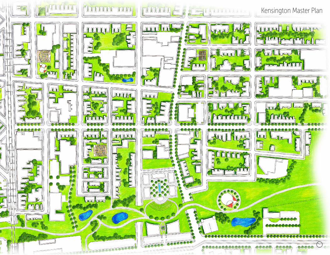
Kensington Master Plan
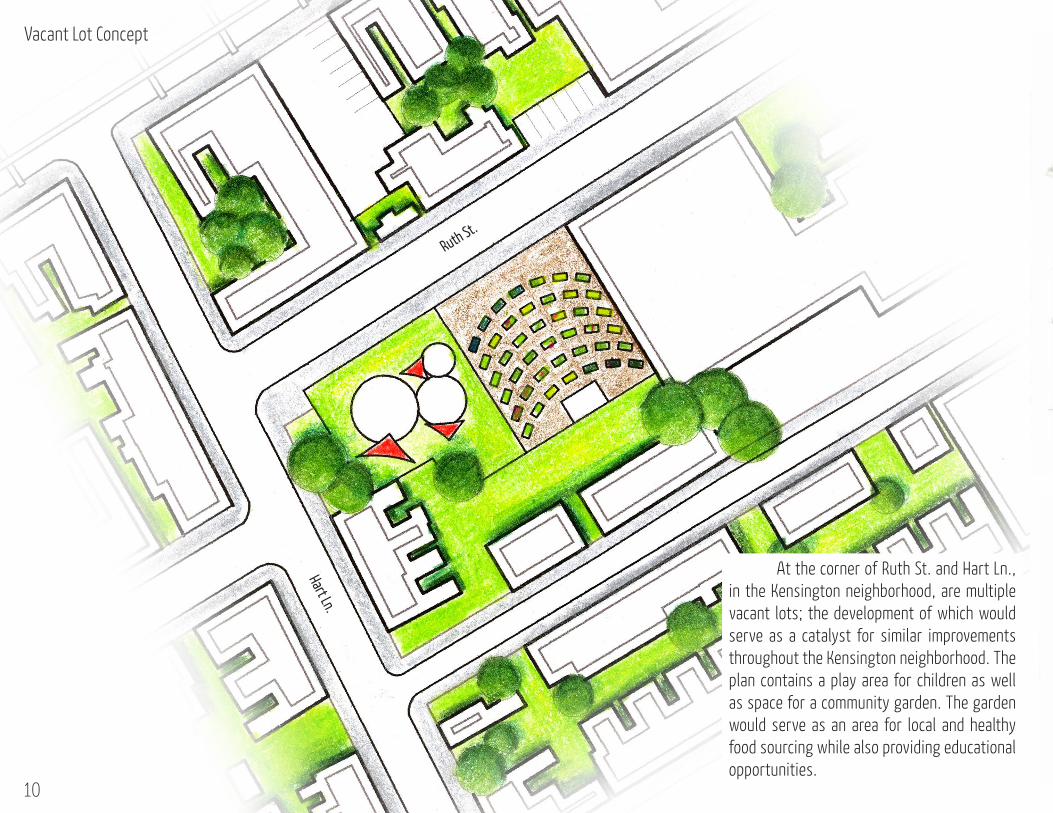
Vacant Lot Concept
At the corner of Ruth St. and Hart Ln., in the Kensington neighborhood, are multiple vacant lots; the development of which would serve as a catalyst for similar improvements throughout the Kensington neighborhood. The plan contains a play area for children as well as space for a community garden. The garden would serve as an area for local and healthy food sourcing while also providing educational opportunities.
10
Ruth St.
Hart Ln.
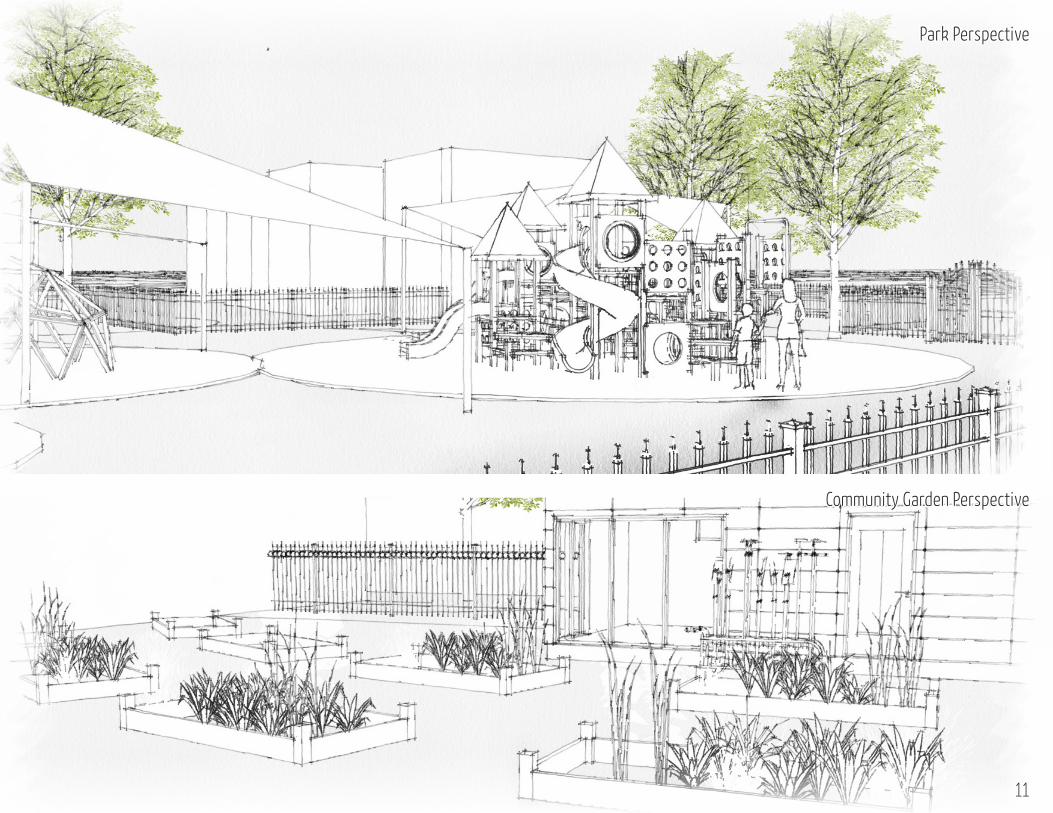
Park Perspective
Community Garden Perspective
11
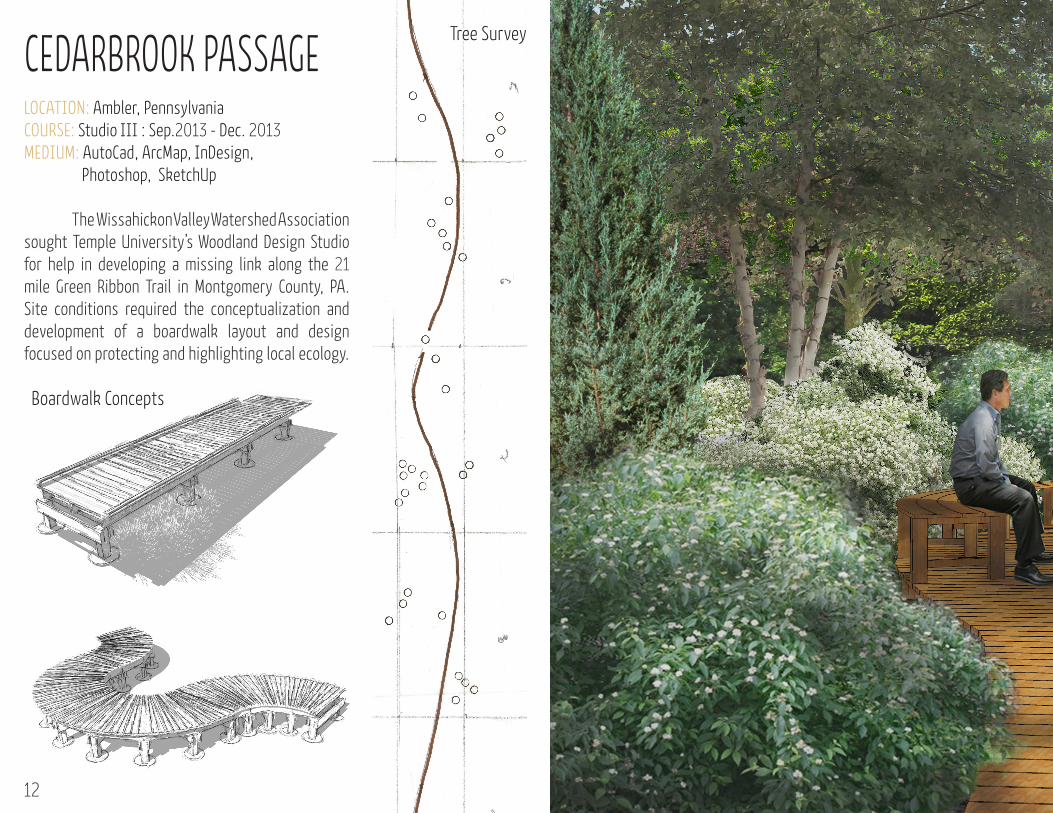
CEDARBROOK PASSAGE LOCATION: Ambler, PennsylvaniaCOURSE: Studio III : Sep.2013 - Dec. 2013MEDIUM: AutoCad, ArcMap, InDesign, Photoshop, SketchUp
The Wissahickon Valley Watershed Association sought Temple University’s Woodland Design Studio for help in developing a missing link along the 21 mile Green Ribbon Trail in Montgomery County, PA. Site conditions required the conceptualization and development of a boardwalk layout and design focused on protecting and highlighting local ecology.
Tree Survey
12
Boardwalk Concepts

Boardwalk Perspective One
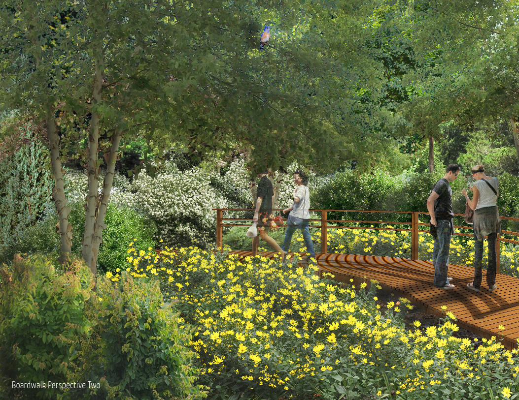
Boardwalk Perspective Two
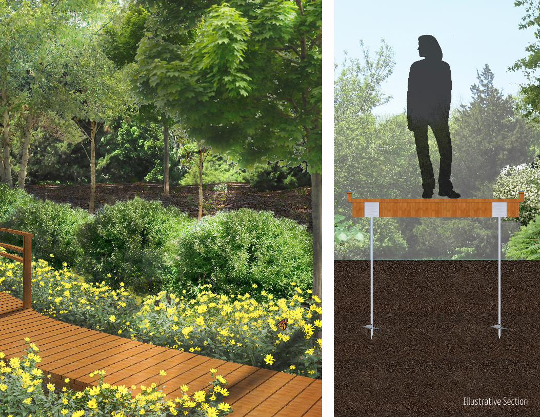
Illustrative Section

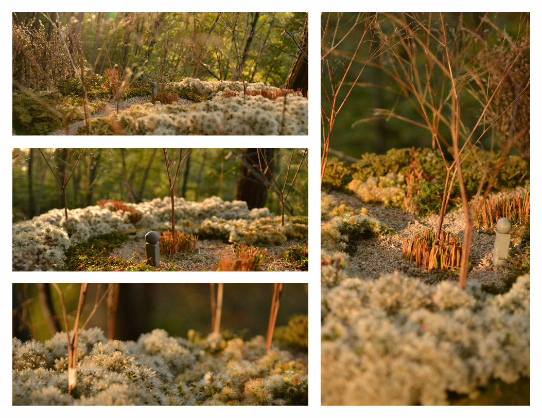
LOCATION: Ambler, PennsylvaniaCOURSE: Studio III : Sep.2013 - Dec. 2013MEDIUM: Plywood, Foam, Clay, Plant Material Starting by selecting an abstract painting, spaces and topography were extracted through three iterations of models. Each iteration became more tactile and more visually representative of a vegetated space than the last. The painting chosen was Lyubov Popova’s Space Force Construction
MODEL ABSTRACTION

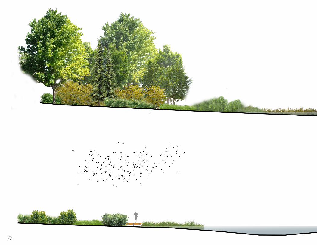
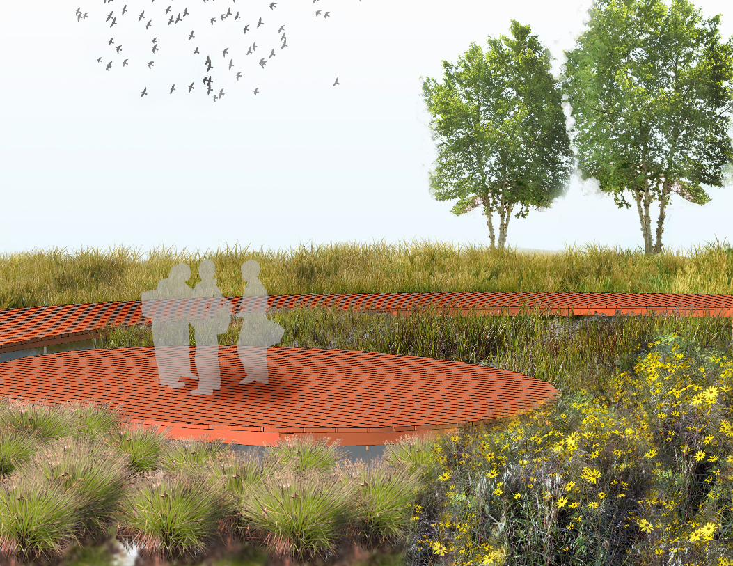
OXFORD WETLAND MITIGATION BANKLOCATION: Oxford, New JerseyCOURSE: Studio IV : Jan.2014 - May 2014MEDIUM: AutoCad, ArcMap, Excel, InDesign Photoshop, SketchUp
Under the guidance of the Evaluation for Planned Wetlands (EPW), the Oxford Wetland Mitigation Bank was developed using six ranking criteria. Each category is scored based on a scale of 0.0 to 1.0, 0.0 meaning that there is low potential in the wetland, and 1.0 meaning there is high potential in the wetland. • Fish (Non-Tidal Stream/River)• Sediment Stabilization • Shoreline Bank Erosion Control • Uniqueness & Heritage• Water Quality• Wildlife
18
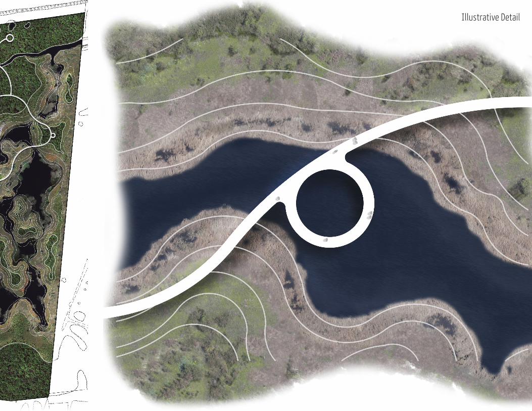
Master Plan Illustrative Detail

Planting Areas
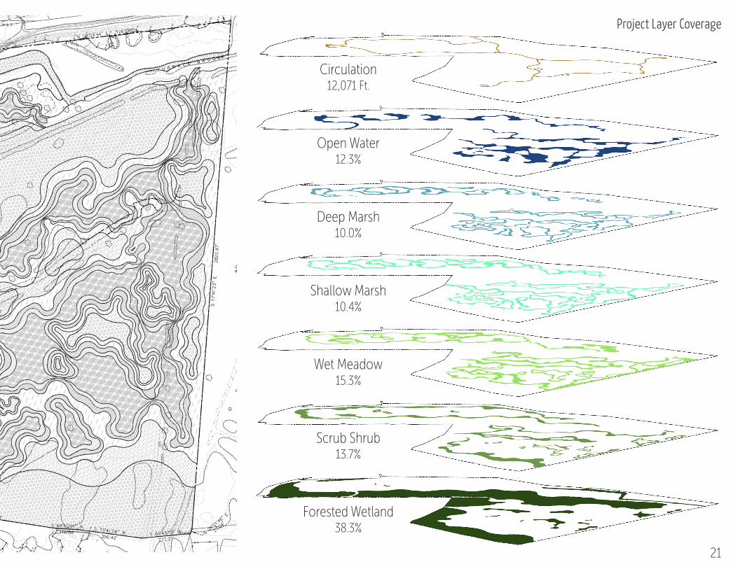
Forested Wetland38.3%
Scrub Shrub13.7%
Wet Meadow15.3%
Shallow Marsh10.4%
Deep Marsh10.0%
Open Water12.3%
Circulation12,071 Ft.
Project Layer CoveragePlanting Areas
21
22
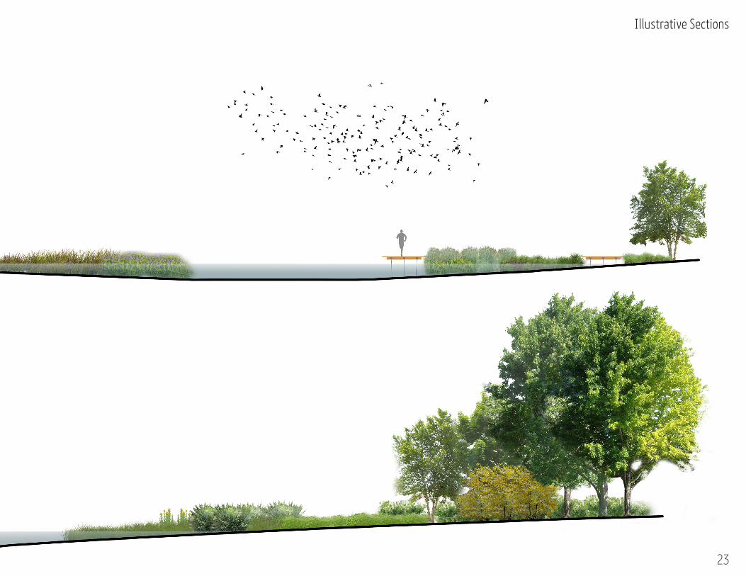
Illustrative Sections
2323
Illustrative Sections

Wetland Perspective
25


HOUTMAN PARK ACCESS REGRADELOCATION: Bryn Mawr, Pennsylvania FIRM: CMC Engineering : Sep.2014 - Dec 2014
MEDIUM: AutoCad
Tasked with creating a utility truck entrance for an Aqua of Pennsylvania pump station, the following plans shows the demolition plan proposed road access.
28
Demolition Plan
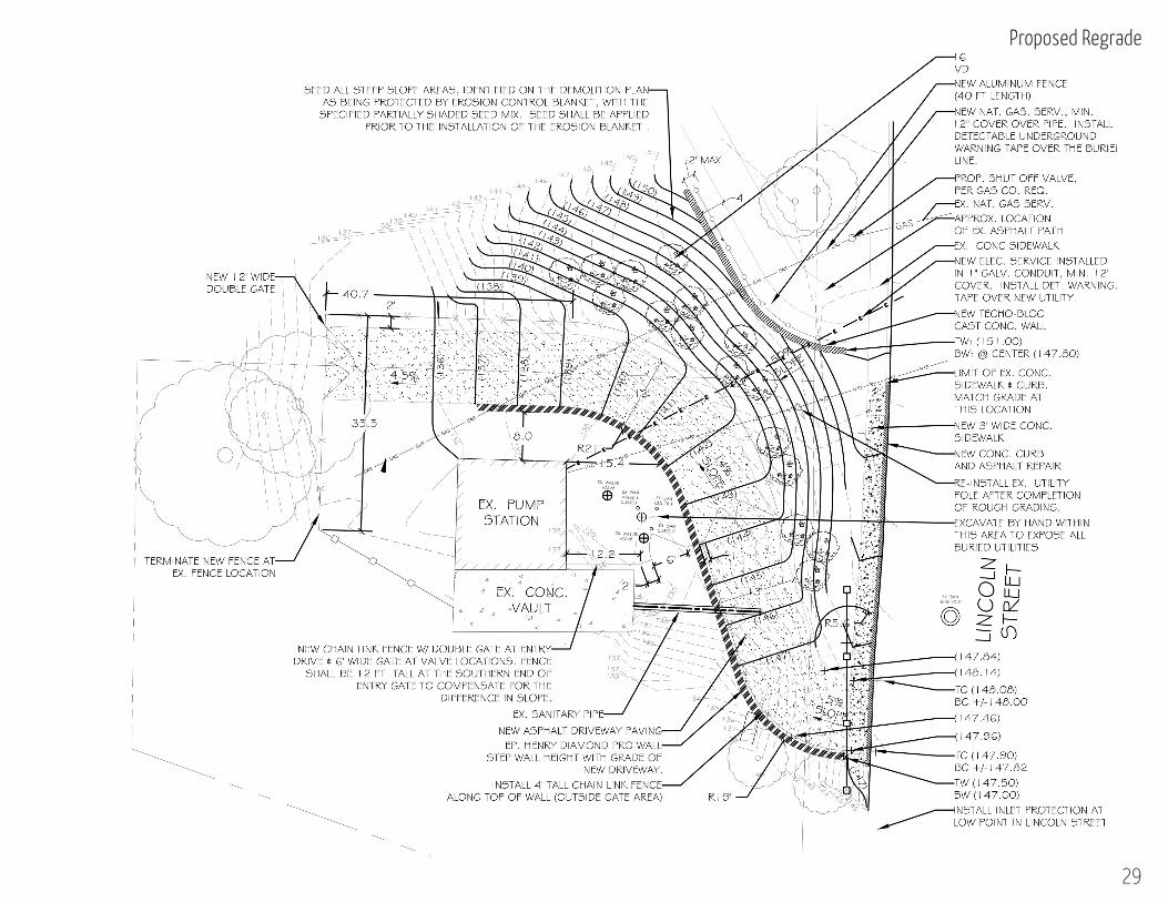
Proposed Regrade
29
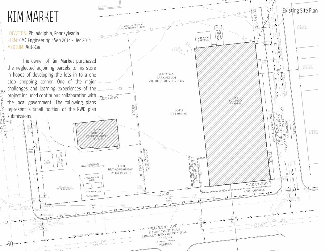
LOCATION: Philadelphia, Pennsylvania FIRM: CMC Engineering : Sep.2014 - Dec 2014
MEDIUM: AutoCad
The owner of Kim Market purchased the neglected adjoining parcels to his store in hopes of developing the lots in to a one stop shopping corner. One of the major challenges and learning experiences of the project included continuous collaboration with the local government. The following plans represent a small portion of the PWD plan submissions.
30
Existing Site Plan
KIM MARKET
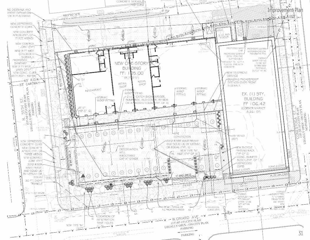
31
Improvement Plan
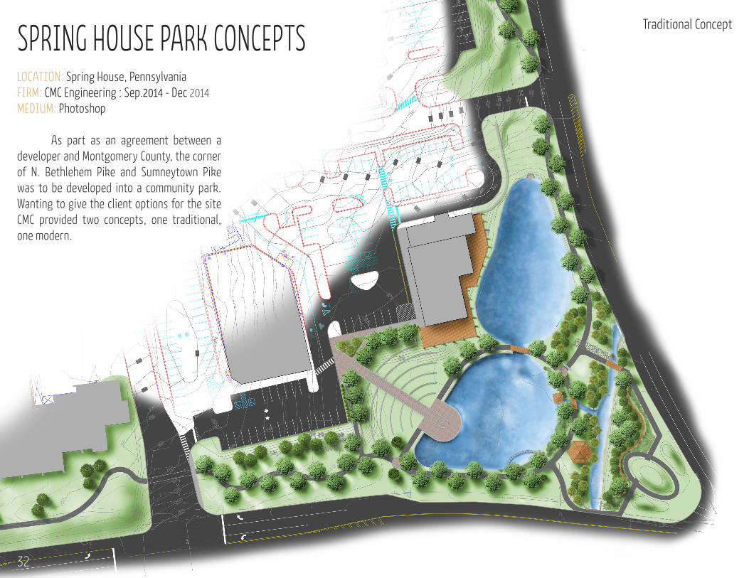
SPRING HOUSE PARK CONCEPTSLOCATION: Spring House, Pennsylvania FIRM: CMC Engineering : Sep.2014 - Dec 2014
MEDIUM: Photoshop
As part as an agreement between a developer and Montgomery County, the corner of N. Bethlehem Pike and Sumneytown Pike was to be developed into a community park. Wanting to give the client options for the site CMC provided two concepts, one traditional, one modern.
Traditional Concept
32
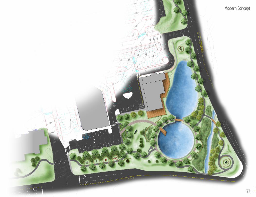
Modern Concept
33
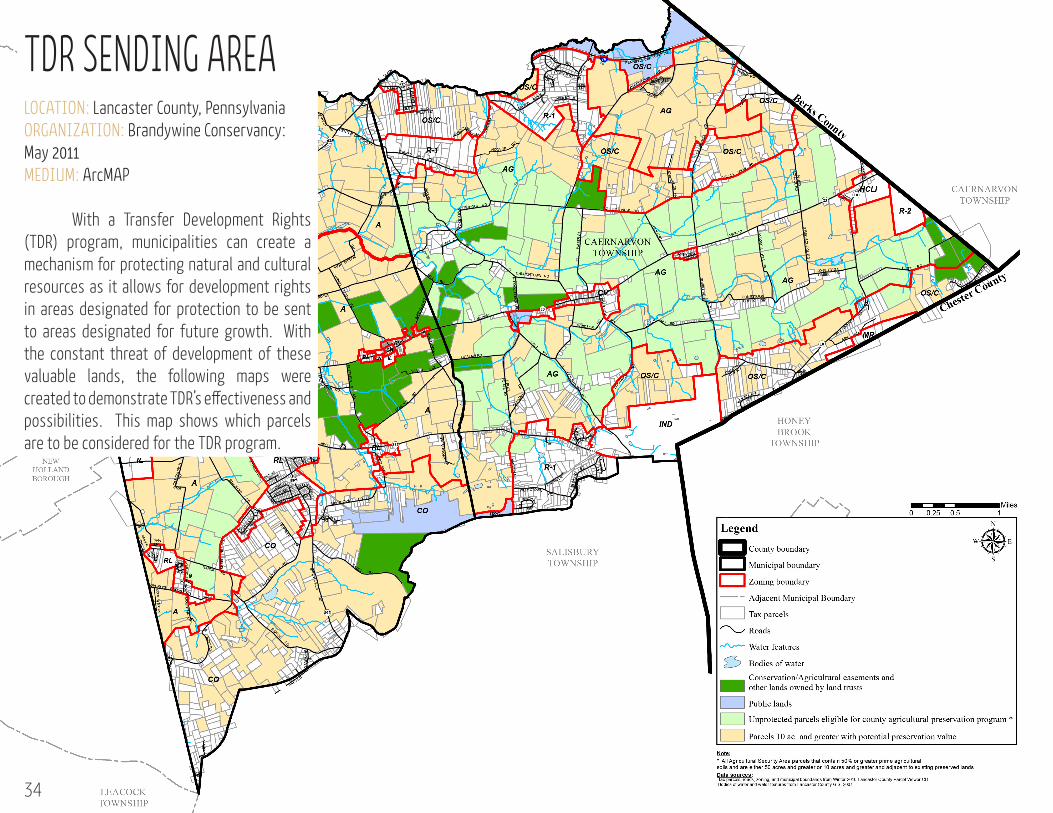
TDR SENDING AREALOCATION: Lancaster County, Pennsylvania ORGANIZATION: Brandywine Conservancy: May 2011MEDIUM: ArcMAP
With a Transfer Development Rights (TDR) program, municipalities can create a mechanism for protecting natural and cultural resources as it allows for development rights in areas designated for protection to be sent to areas designated for future growth. With the constant threat of development of these valuable lands, the following maps were created to demonstrate TDR’s effectiveness and possibilities. This map shows which parcels are to be considered for the TDR program.
34
10.000000
10.000001
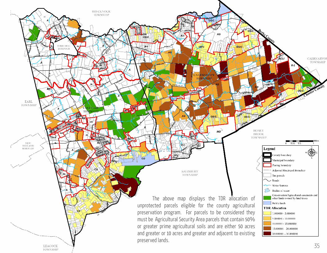
The above map displays the TDR allocation of unprotected parcels eligible for the county agricultural preservation program. For parcels to be considered they must be Agricultural Security Area parcels that contain 50% or greater prime agricultural soils and are either 50 acres and greater or 10 acres and greater and adjacent to existing preserved lands.
35