Embed Size (px)
Citation preview
Copyright © 2009, Open Geospatial Consortium, Inc.Copyright © 2009, Open Geospatial Consortium, Inc.
Geospatial Standards, the OGC and Geospatial Standards, the OGC and Pervasive ComputingPervasive Computing
Carl Reed, PhD
CTO
Open Geospatial Consortium
November 11, 2009
Helping the World to CommunicateGeographically
Copyright © 2009 Open Geospatial Consortium
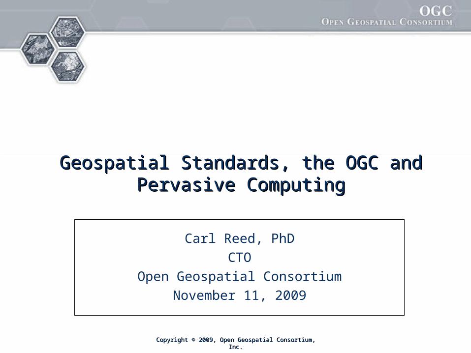
The OpenGIS® Vision
Achieve the full societal, economic and scientific benefits of integrating location
resources into commercial and institutional processes worldwide
Copyright © 2009 Open Geospatial Consortium, Inc. 2
PortalUPortalUGerman Environmental Information PortalGerman Environmental Information Portal
SURA Coastal Ocean Observing and Prediction (SCOOP) Program
Helping the World to CommunicateGeographically
Copyright © 2009 Open Geospatial Consortium
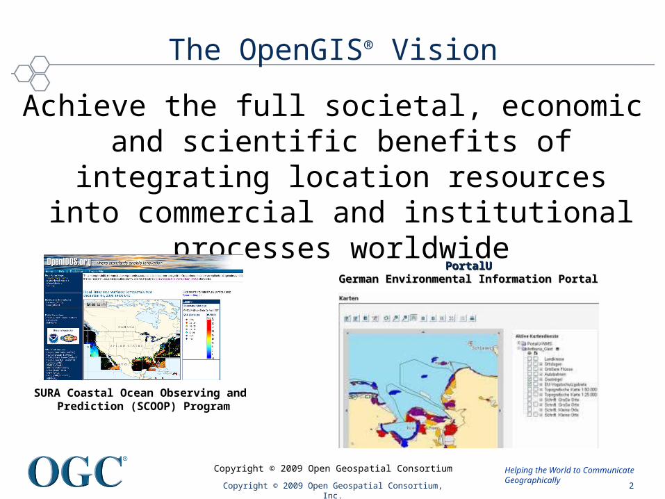
The OGC Mission
• To serve as a global forum for the development, development, promotion and harmonization of open and promotion and harmonization of open and freely available geospatial standards …freely available geospatial standards …
Copyright © 2009 Open Geospatial Consortium, Inc. 3
Urban Model of Berlin based on OGC CityGMLUrban Model of Berlin based on OGC CityGMLSource: Source: www.3d-stadtmodell-berlin.de www.3d-stadtmodell-berlin.de
Helping the World to CommunicateGeographically
Copyright © 2009 Open Geospatial Consortium
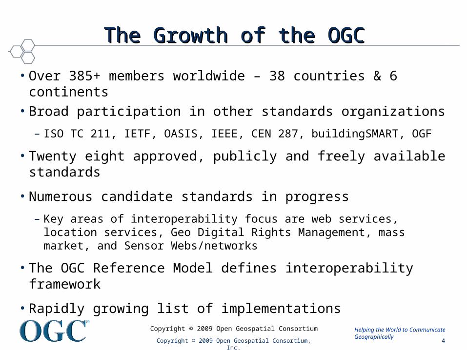
The Growth of the OGCThe Growth of the OGC
• Over 385+ members worldwide – 38 countries & 6 continents• Broad participation in other standards organizations
– ISO TC 211, IETF, OASIS, IEEE, CEN 287, buildingSMART, OGF
• Twenty eight approved, publicly and freely available standards
• Numerous candidate standards in progress
– Key areas of interoperability focus are web services, location services, Geo Digital Rights Management, mass market, and Sensor Webs/networks
• The OGC Reference Model defines interoperability framework
• Rapidly growing list of implementations
Copyright © 2009 Open Geospatial Consortium, Inc. 4
Helping the World to CommunicateGeographically
Copyright © 2009 Open Geospatial Consortium
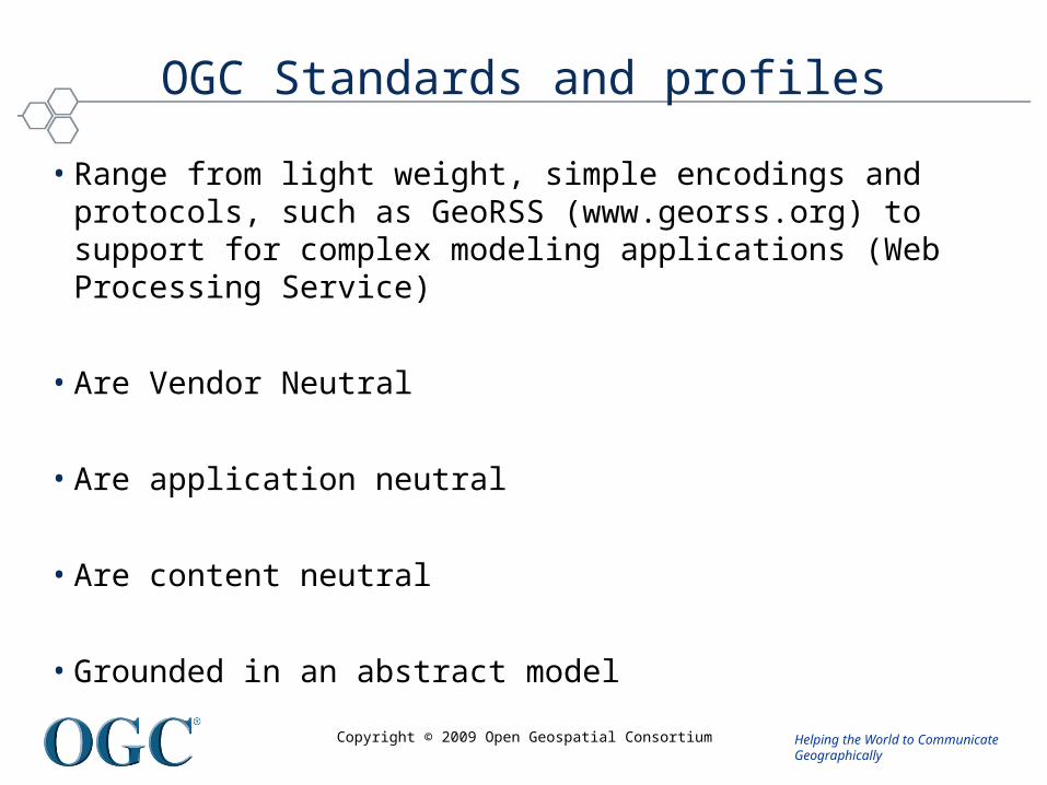
OGC Standards and profiles
• Range from light weight, simple encodings and protocols, such as GeoRSS (www.georss.org) to support for complex modeling applications (Web Processing Service)
• Are Vendor Neutral
• Are application neutral
• Are content neutral
• Grounded in an abstract model
Helping the World to CommunicateGeographically
Copyright © 2009 Open Geospatial Consortium
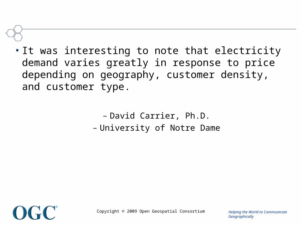
• It was interesting to note that electricity demand varies greatly in response to price depending on geography, customer density, and customer type.
– David Carrier, Ph.D.– University of Notre Dame
Helping the World to CommunicateGeographically
Copyright © 2009 Open Geospatial Consortium
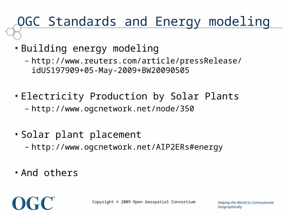
OGC Standards and Energy modeling
• Building energy modeling– http://www.reuters.com/article/pressRelease/idUS197909+05-May-
2009+BW20090505
• Electricity Production by Solar Plants – http://www.ogcnetwork.net/node/350
• Solar plant placement– http://www.ogcnetwork.net/AIP2ERs#energy
• And others
Helping the World to CommunicateGeographically
Copyright © 2009 Open Geospatial Consortium
OGC Simple Features - Ubiquitous services: Standard database access
• Provides a well-defined and common way for applications to store and access geospatial feature data in relational or object-relational databases
• Implemented in all major commercial database software
• Implemented in all Open Source database software
• Used by thousands of applications and millions of users.
Helping the World to CommunicateGeographically
Copyright © 2009 Open Geospatial Consortium
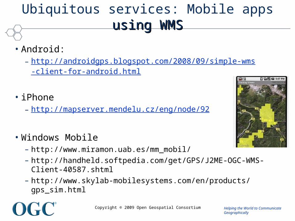
Ubiquitous services: Mobile apps using WMS using WMS
• Android:– http://androidgps.blogspot.com/2008/09/simple-wms
-client-for-android.html
• iPhone– http://mapserver.mendelu.cz/eng/node/92
• Windows Mobile– http://www.miramon.uab.es/mm_mobil/ – http://handheld.softpedia.com/get/GPS/J2ME-OGC-WMS-Client-
40587.shtml – http://www.skylab-mobilesystems.com/en/products/gps_sim.html
Helping the World to CommunicateGeographically
Copyright © 2009 Open Geospatial Consortium
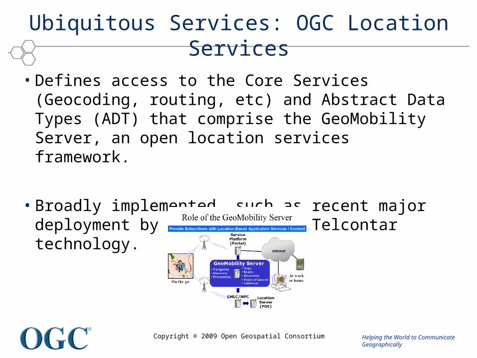
Ubiquitous Services: OGC Location Services
• Defines access to the Core Services (Geocoding, routing, etc) and Abstract Data Types (ADT) that comprise the GeoMobility Server, an open location services framework.
• Broadly implemented, such as recent major deployment by T-Mobile using Telcontar technology.
Helping the World to CommunicateGeographically
Copyright © 2009 Open Geospatial Consortium
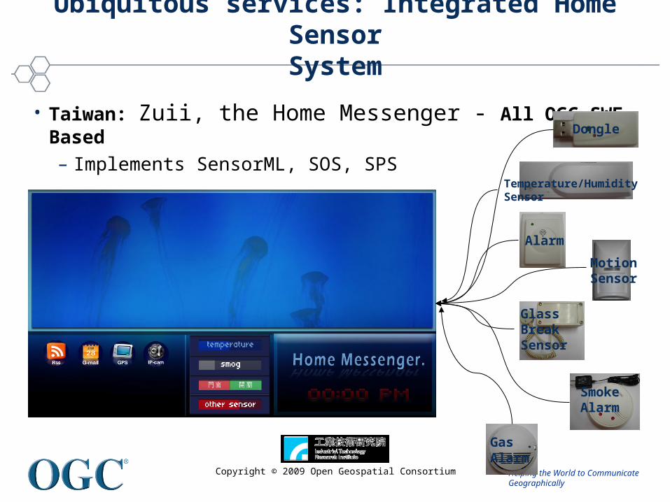
Ubiquitous services: Integrated Home SensorSystem
• Taiwan: Zuii, the Home Messenger - All OGC SWE Based– Implements SensorML, SOS, SPS
Dongle
Temperature/Humidity Sensor
Alarm
MotionSensor
Glass BreakSensor
SmokeAlarm
GasAlarm
Helping the World to CommunicateGeographically
Copyright © 2009 Open Geospatial Consortium
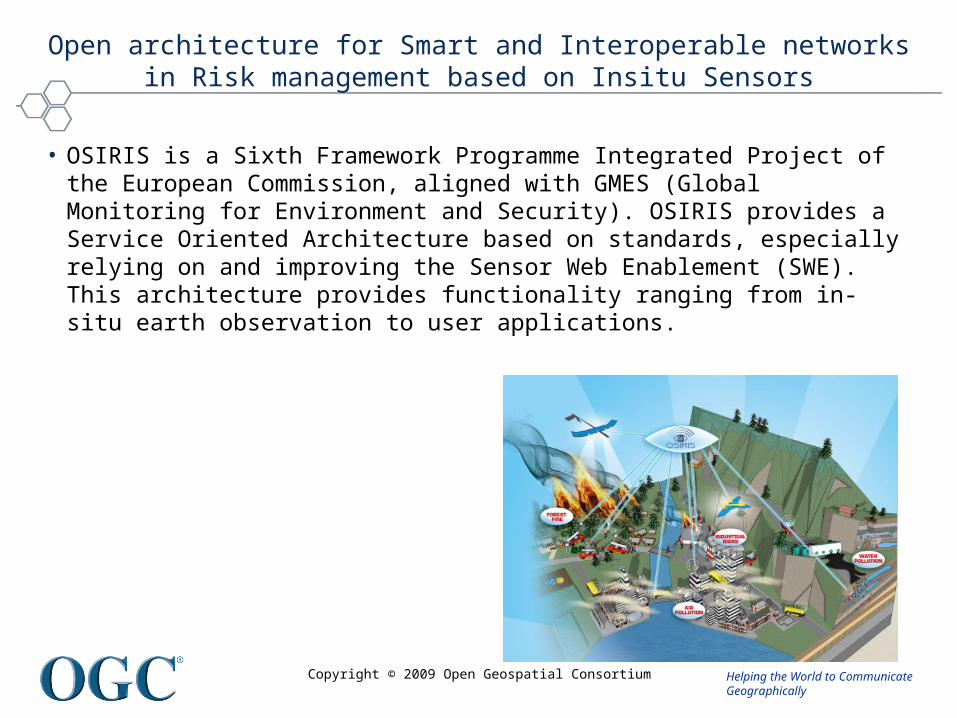
Open architecture for Smart and Interoperable networks in Risk management based on Insitu Sensors
• OSIRIS is a Sixth Framework Programme Integrated Project of the European Commission, aligned with GMES (Global Monitoring for Environment and Security). OSIRIS provides a Service Oriented Architecture based on standards, especially relying on and improving the Sensor Web Enablement (SWE). This architecture provides functionality ranging from in situ earth ‐observation to user applications.
Helping the World to CommunicateGeographically
Copyright © 2009 Open Geospatial Consortium
OSIRIS Application Objectives
• Within OSIRIS four key areas of major environmental risk are investigated:– forest fires: early detection of forest fires and efficient handling of the
crisis situation if a fire occurs– industrial risks: more reliable fire detection by combining various sensor
types and thus especially reducing the number of false alarms– unexpected fresh water pollution: sensor networks for detecting natural
arsenic concentration as well as accidental hydrocarbon pollutions– air pollution in urban areas: using mobile as well as fixed sensors linked
to simulation models for assessing the air quality
• http://tws01.terranovaws.it/osiris/doc/Invitation_OSIRIS_Workshop.pdf