Embed Size (px)
Citation preview
Confluence, our Water Ways inartThe Blanchardville Public Library’s summer theme is “Library’sRock” which makes the art exhibit depicting the hydrologiccycle perfect. Ten community artists came together(confluence) to create a beautiful and educational exhibitillustrating elements of the hydrologic cycle — our “waterways.”
Land use and water qualityAll land uses have an effect on water flow and water quality;some are positive, some are negative. In healthy ecosystemsreceiving little human disturbance, most rainfall soaks intothe soil rather than running off the ground, stream flows arefairly steady, and water quality is good. In built-up areaswith pavement and buildings or agricultural areas where landis bare rainfall causes runoff and poorer water quality. Infact, land use practices are the most important water qualityfactor.
Runoff
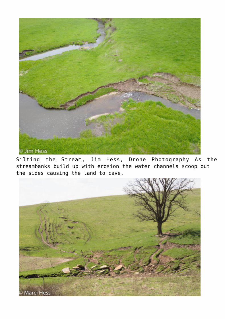
Silting the Stream, Jim Hess, Drone Photography As thestreambanks build up with erosion the water channels scoop outthe sides causing the land to cave.
Ruts to the Stream, Marci Hess, Photography Livestock pathscreate a direct channel for water runoff and the resultingerosion, emptying topsoil and manure into the stream.Runoff is the water draining off the land; it is a natural andnecessary part of the landscape. Water will follow the rules ofgravity and move from a higher point to a lower point. If the water isfiltered through native plants’ roots, it is important for rechargingour groundwater. Negative runoff situations arise when the landbecomes bare. When the water runs off hard surfaces and accumulatescontaminants. In urban areas, these hard surfaces are pavement andconcrete. In rural areas, solid surfaces are created by bare land.Other runoff occurs in cropped lands via drain tiles or land tilledtoo close to a stream. These negative situations are mitigated withgood conservation farming practices, maintaining native wetlands,planting native plants along streams, and ensuring stormwater isfiltered before it enters our waterways.
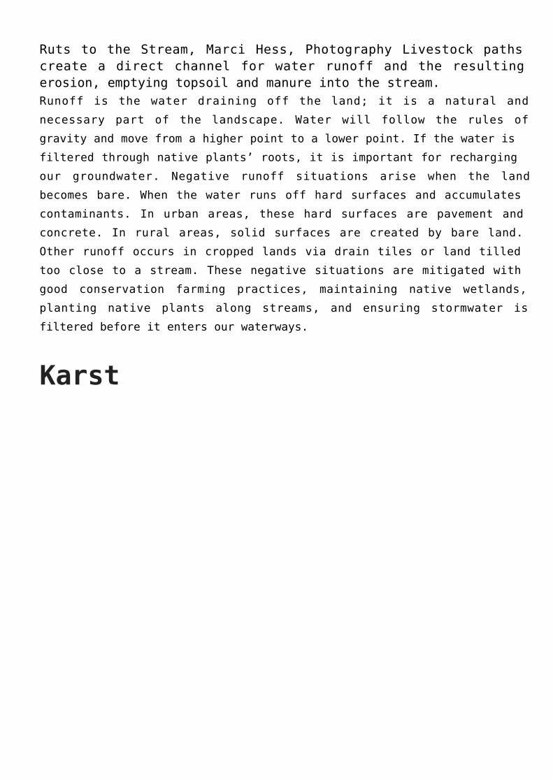
Karst
Karst is a topography characterized by carbonate rock(limestone, dolomite, gypsum) that easily dissolves inrainwater forming cracks, sink holes and even large cavesystems. Water quickly moves through the cracks in karst andenters the groundwater. These cracks act as direct conduitsfor pollutants to enter our groundwater, wells, springs, andstreams. There are many regions in the world that have karstgeology, southwestern Wisconsin is one of them so are areas ofMexico, Germany, and Florida to name a few.
Lafayette County is sensitive to water pollutants because ofour karst landscape. Whenever material above the aquifer ispermeable, pollutants can readily sink into groundwatersupplies and our drinking water supplies. Good conservationpractices can ease the statistic that croplands areresponsible for 96% of nitrates leached into groundwater.
Karst landscape is particularly easy to see in the winter.
Where the road cuts through the earth you can see thebeautiful icicles! This is the water seeping through therocks, then freezing.
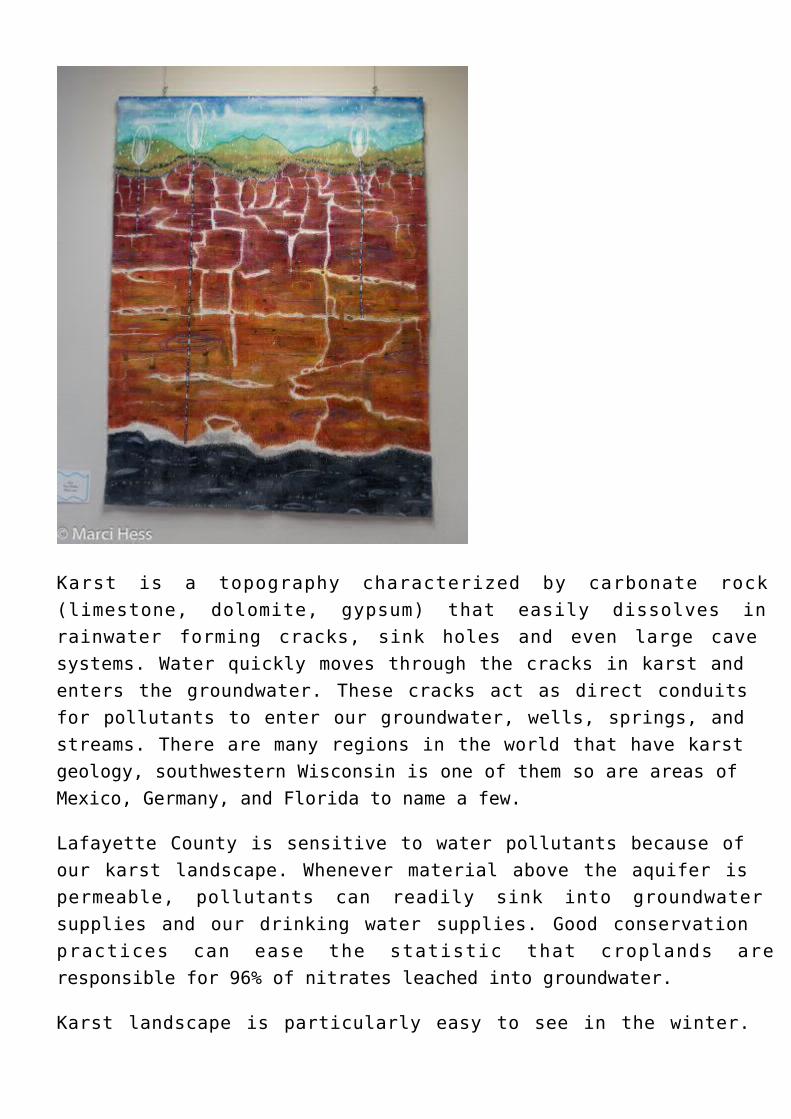
The salmon-colored areas are where karst landscape can befound in Wisconsin. Notice that Lafayette County is a darkarea, meaning our drinking water is particularly close to thesurface.
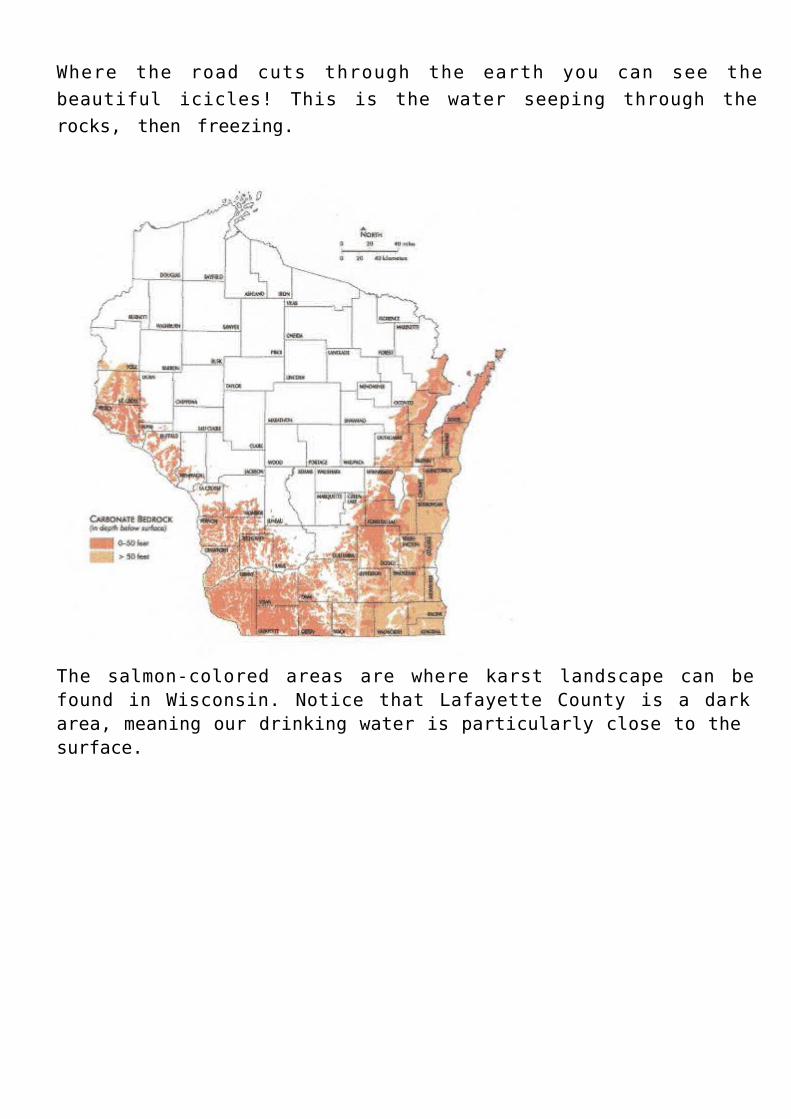
This map shows the karst landscape across the U.S.
GroundwaterGroundwater is the water found underground in the cracks andspaces in soil, sand, and rock. It is stored in and movesslowly through geologic formations called aquifers.Groundwater is a necessary resource; it supplies drinkingwater for 51% of the total U.S. population and 99% of therural population.
Groundwater is also a limited resource. It’s difficult tothink this is possible when we currently average 34.5” everyyear, but only about 25% of all rainfall in the U.S. becomesgroundwater. In the past that average has fluctuated from21-44”annually.
Agriculture is the largest consumer of freshwater resources.In the United States 64% of groundwater is drawn down toirrigate crops.
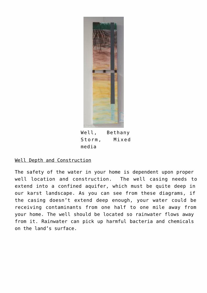
Well, BethanyStorm, Mixedmedia
Well Depth and Construction
The safety of the water in your home is dependent upon properwell location and construction. The well casing needs toextend into a confined aquifer, which must be quite deep inour karst landscape. As you can see from these diagrams, ifthe casing doesn’t extend deep enough, your water could bereceiving contaminants from one half to one mile away fromyour home. The well should be located so rainwater flows awayfrom it. Rainwater can pick up harmful bacteria and chemicalson the land’s surface.
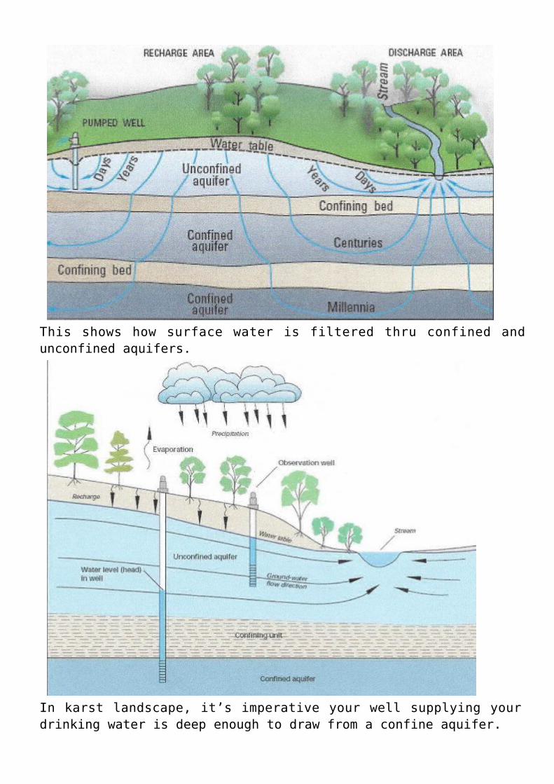
This shows how surface water is filtered thru confined andunconfined aquifers.
In karst landscape, it’s imperative your well supplying yourdrinking water is deep enough to draw from a confine aquifer.
Surface WaterSurface water is freshwater you see on the top or surface ofthe landscape. It includes rivers, streams, creeks, lakes, andreservoirs; these are vitally important to our everydaylife. The amount and location of surface water changes,varying in response to climate and human activities.
Surface water represents only about 3% of all water on Earth.Freshwater lakes account for a mere 0.29% of the Earth’sfreshwater. Lake Baikal in Asia has 20% of all fresh surfacewater; another 20% is stored in the Great Lakes. What aprecious resource we have near us!!
Runoff and erosion have negative effects for surface water andeventually our groundwater. Excess nitrogen and phosphorusfrom runoff causes the algal blooms on our lakes, subsequentdeaths of animals, and a loss of tourism dollars. Excessnitrogen in the streams where livestock drink can causedisease. Pesticides are dangerous too and are found in surfacewater 97% of the time near agricultural areas and 61% of thetime in other landscapes.
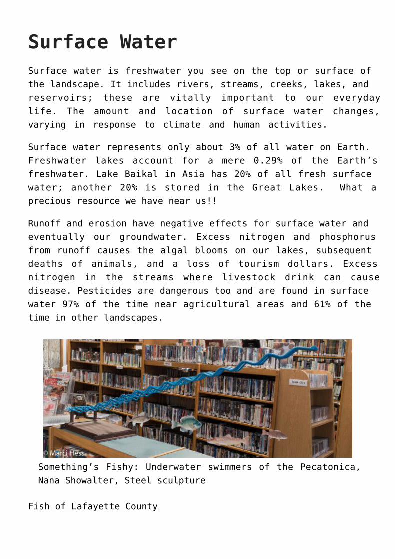
Something’s Fishy: Underwater swimmers of the Pecatonica,Nana Showalter, Steel sculpture
Fish of Lafayette County
Smallmouth bass and trout fishing are popular in our warmwaterways. Our lakes support panfish suchas bluegill and crappie along with the occasional northernpike. Fishing for brown trout is popular and the LafayetteCounty area has several restored coldwater streams.
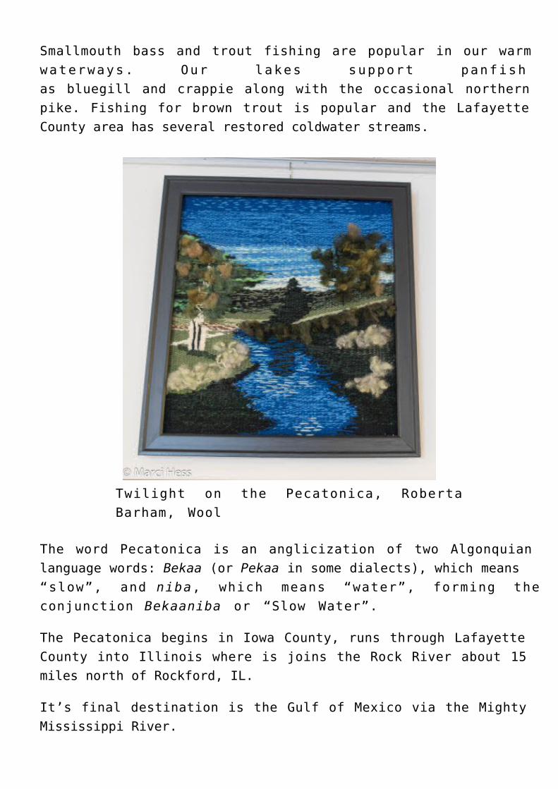
Twilight on the Pecatonica, RobertaBarham, Wool
The word Pecatonica is an anglicization of two Algonquianlanguage words: Bekaa (or Pekaa in some dialects), which means“slow”, and niba, which means “water”, forming theconjunction Bekaaniba or “Slow Water”.
The Pecatonica begins in Iowa County, runs through LafayetteCounty into Illinois where is joins the Rock River about 15miles north of Rockford, IL.
It’s final destination is the Gulf of Mexico via the MightyMississippi River.
Hydrologic Cycle
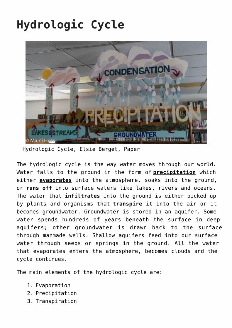
Hydrologic Cycle, Elsie Berget, Paper
The hydrologic cycle is the way water moves through our world.Water falls to the ground in the form of precipitation whicheither evaporates into the atmosphere, soaks into the ground,or runs off into surface waters like lakes, rivers and oceans.The water that infiltrates into the ground is either picked upby plants and organisms that transpire it into the air or itbecomes groundwater. Groundwater is stored in an aquifer. Somewater spends hundreds of years beneath the surface in deepaquifers; other groundwater is drawn back to the surfacethrough manmade wells. Shallow aquifers feed into our surfacewater through seeps or springs in the ground. All the waterthat evaporates enters the atmosphere, becomes clouds and thecycle continues.
The main elements of the hydrologic cycle are:
Evaporation1.Precipitation2.Transpiration3.
Runoff4.Infiltration5.
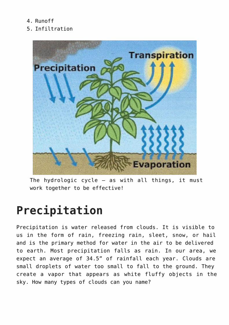
The hydrologic cycle — as with all things, it mustwork together to be effective!
PrecipitationPrecipitation is water released from clouds. It is visible tous in the form of rain, freezing rain, sleet, snow, or hailand is the primary method for water in the air to be deliveredto earth. Most precipitation falls as rain. In our area, weexpect an average of 34.5” of rainfall each year. Clouds aresmall droplets of water too small to fall to the ground. Theycreate a vapor that appears as white fluffy objects in thesky. How many types of clouds can you name?
EvaporationEvaporation is the process by which water changes from aliquid to a gas or vapor. Studies have shown the oceans, seas,lakes, and rivers provide nearly 90% of the moisture in theatmosphere via evaporation, with the remaining 10 percentbeing contributed by plant transpiration. Once evaporated, awater molecule spends about 10 days in the air.
TranspirationTranspiration is how we describe plants’ breathing. Plants’roots draw water and nutrients up into the stems and leaves;some of this water is returned to the air by transpiration.Transpiration rates vary widely depending on weatherconditions. During dry periods, transpiration can contributeto the loss of moisture in the upper soil zone, which can havean effect on food-crop fields.
An acre of corn gives off about 3,000-4,000 gallons of watereach day, and a large oak tree can transpire 40,000 gallonsper year. Keeping the numerous oak savannas in LafayetteCounty healthy would be very good for us!!
WatershedA watershed is the land where all the water drains off of itbefore entering into a particular water body. Watersheds canvary in size and are determined by topography (the peaks andvalleys). In southwestern Wisconsin, we are located in theUpper Mississippi watershed. Everything we do on our land heretravels to the Mississippi River and eventually reaches theGulf of Mexico either from overland flow or throughunderground channels. Major watersheds like the UpperMississippi are made up of many little watersheds. In fact
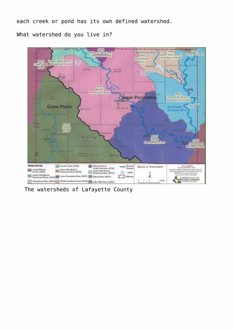
each creek or pond has its own defined watershed.
What watershed do you live in?
The watersheds of Lafayette County
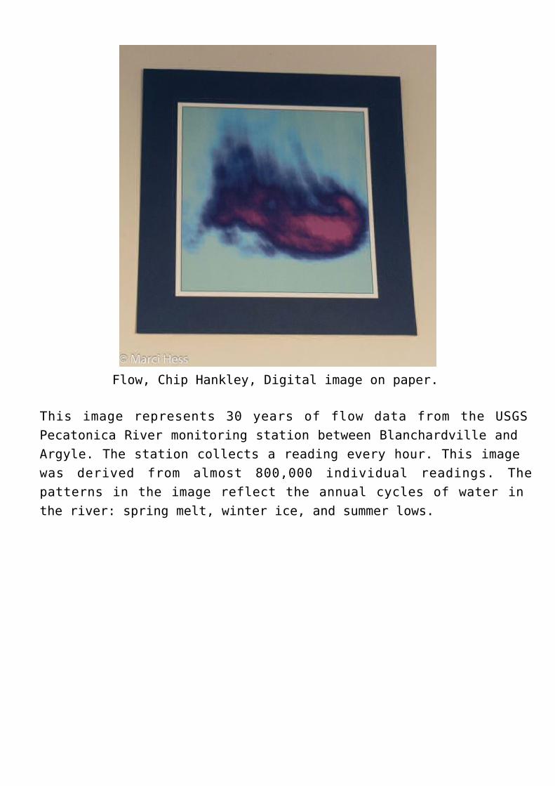
Flow, Chip Hankley, Digital image on paper.
This image represents 30 years of flow data from the USGSPecatonica River monitoring station between Blanchardville andArgyle. The station collects a reading every hour. This imagewas derived from almost 800,000 individual readings. Thepatterns in the image reflect the annual cycles of water inthe river: spring melt, winter ice, and summer lows.
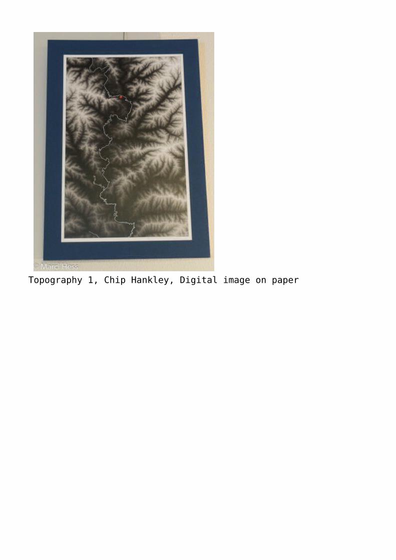
Topography 1, Chip Hankley, Digital image on paper
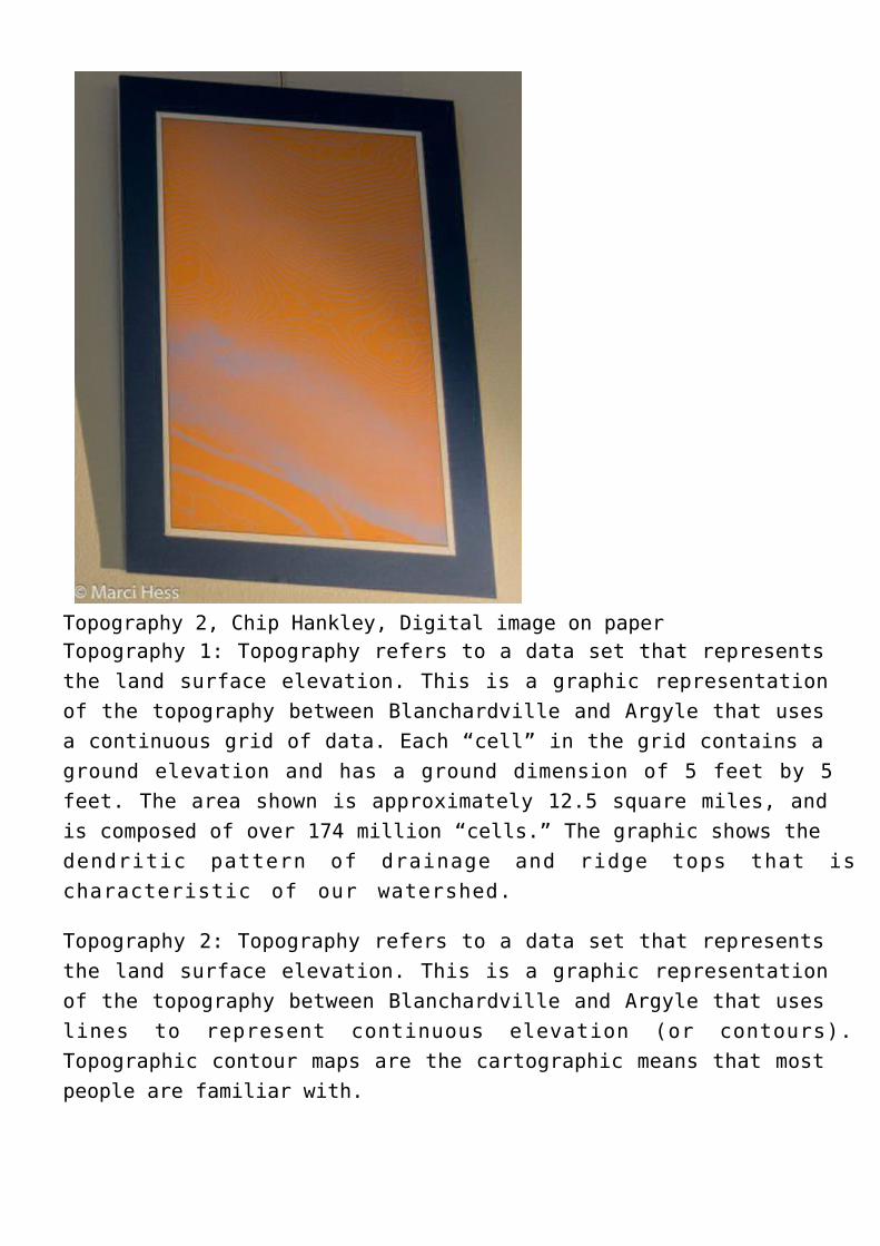
Topography 2, Chip Hankley, Digital image on paperTopography 1: Topography refers to a data set that representsthe land surface elevation. This is a graphic representationof the topography between Blanchardville and Argyle that usesa continuous grid of data. Each “cell” in the grid contains aground elevation and has a ground dimension of 5 feet by 5feet. The area shown is approximately 12.5 square miles, andis composed of over 174 million “cells.” The graphic shows thedendritic pattern of drainage and ridge tops that ischaracteristic of our watershed.
Topography 2: Topography refers to a data set that representsthe land surface elevation. This is a graphic representationof the topography between Blanchardville and Argyle that useslines to represent continuous elevation (or contours).Topographic contour maps are the cartographic means that mostpeople are familiar with.
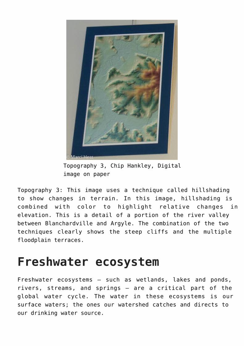
Topography 3, Chip Hankley, Digitalimage on paper
Topography 3: This image uses a technique called hillshadingto show changes in terrain. In this image, hillshading iscombined with color to highlight relative changes inelevation. This is a detail of a portion of the river valleybetween Blanchardville and Argyle. The combination of the twotechniques clearly shows the steep cliffs and the multiplefloodplain terraces.
Freshwater ecosystemFreshwater ecosystems – such as wetlands, lakes and ponds,rivers, streams, and springs – are a critical part of theglobal water cycle. The water in these ecosystems is oursurface waters; the ones our watershed catches and directs toour drinking water source.
Freshwater is also imperative to the survival of humans. Wecannot stay alive without fresh water, yet we are facing anumber of threats to our supply: 1) runoff from agriculturaland urban areas, 2) draining of wetlands for agricultural usesand development, 3) overexploitation (i.e. high capacitywells) and pollution, and 4) invasion of exotic species.
All freshwater ultimately depends on the continued healthyfunctioning of organisms interacting in the aquaticenvironment. These organisms include fish, aquatic insects,amphibians, turtles, water fowl, and mammals such as ottersand beavers. Freshwater is home to 40% of the world’s fishspecies. At present, more than 20% of these fish species areextinct or imperiled.
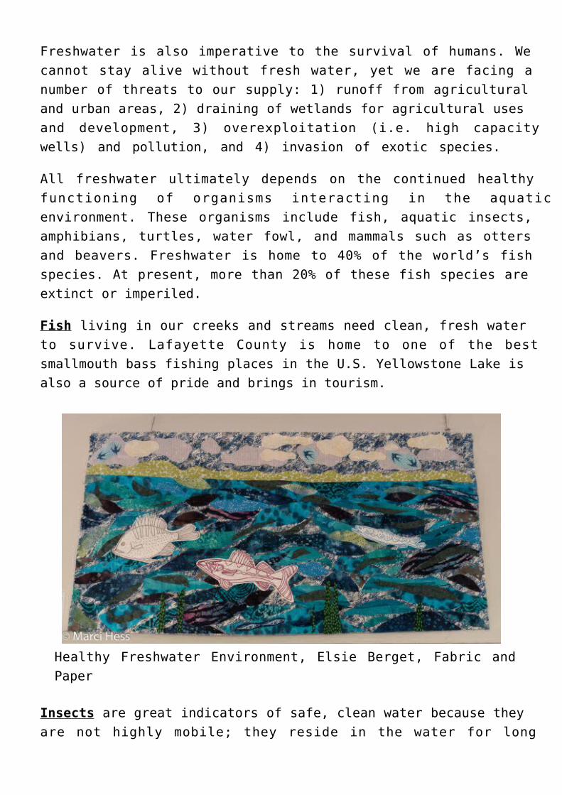
Fish living in our creeks and streams need clean, fresh waterto survive. Lafayette County is home to one of the bestsmallmouth bass fishing places in the U.S. Yellowstone Lake isalso a source of pride and brings in tourism.
Healthy Freshwater Environment, Elsie Berget, Fabric andPaper
Insects are great indicators of safe, clean water because theyare not highly mobile; they reside in the water for long
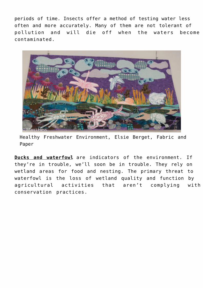
periods of time. Insects offer a method of testing water lessoften and more accurately. Many of them are not tolerant ofpollution and will die off when the waters becomecontaminated.
Healthy Freshwater Environment, Elsie Berget, Fabric andPaper
Ducks and waterfowl are indicators of the environment. Ifthey’re in trouble, we’ll soon be in trouble. They rely onwetland areas for food and nesting. The primary threat towaterfowl is the loss of wetland quality and function byagricultural activities that aren’t complying withconservation practices.
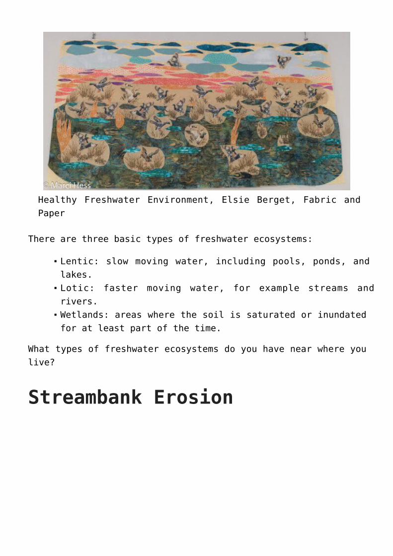
Healthy Freshwater Environment, Elsie Berget, Fabric andPaper
There are three basic types of freshwater ecosystems:
Lentic: slow moving water, including pools, ponds, andlakes.Lotic: faster moving water, for example streams andrivers.Wetlands: areas where the soil is saturated or inundatedfor at least part of the time.
What types of freshwater ecosystems do you have near where youlive?
Streambank Erosion
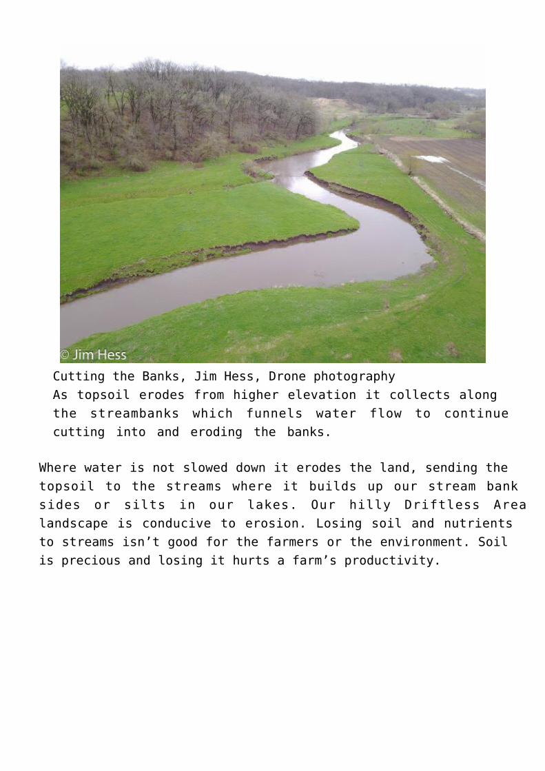
Cutting the Banks, Jim Hess, Drone photographyAs topsoil erodes from higher elevation it collects alongthe streambanks which funnels water flow to continuecutting into and eroding the banks.
Where water is not slowed down it erodes the land, sending thetopsoil to the streams where it builds up our stream banksides or silts in our lakes. Our hilly Driftless Arealandscape is conducive to erosion. Losing soil and nutrientsto streams isn’t good for the farmers or the environment. Soilis precious and losing it hurts a farm’s productivity.
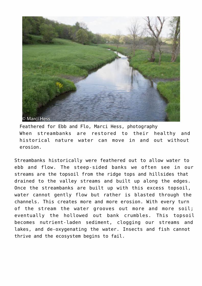
Feathered for Ebb and Flo, Marci Hess, photographyWhen streambanks are restored to their healthy andhistorical nature water can move in and out withouterosion.
Streambanks historically were feathered out to allow water toebb and flow. The steep-sided banks we often see in ourstreams are the topsoil from the ridge tops and hillsides thatdrained to the valley streams and built up along the edges.Once the streambanks are built up with this excess topsoil,water cannot gently flow but rather is blasted through thechannels. This creates more and more erosion. With every turnof the stream the water grooves out more and more soil;eventually the hollowed out bank crumbles. This topsoilbecomes nutrient-laden sediment, clogging our streams andlakes, and de-oxygenating the water. Insects and fish cannotthrive and the ecosystem begins to fail.
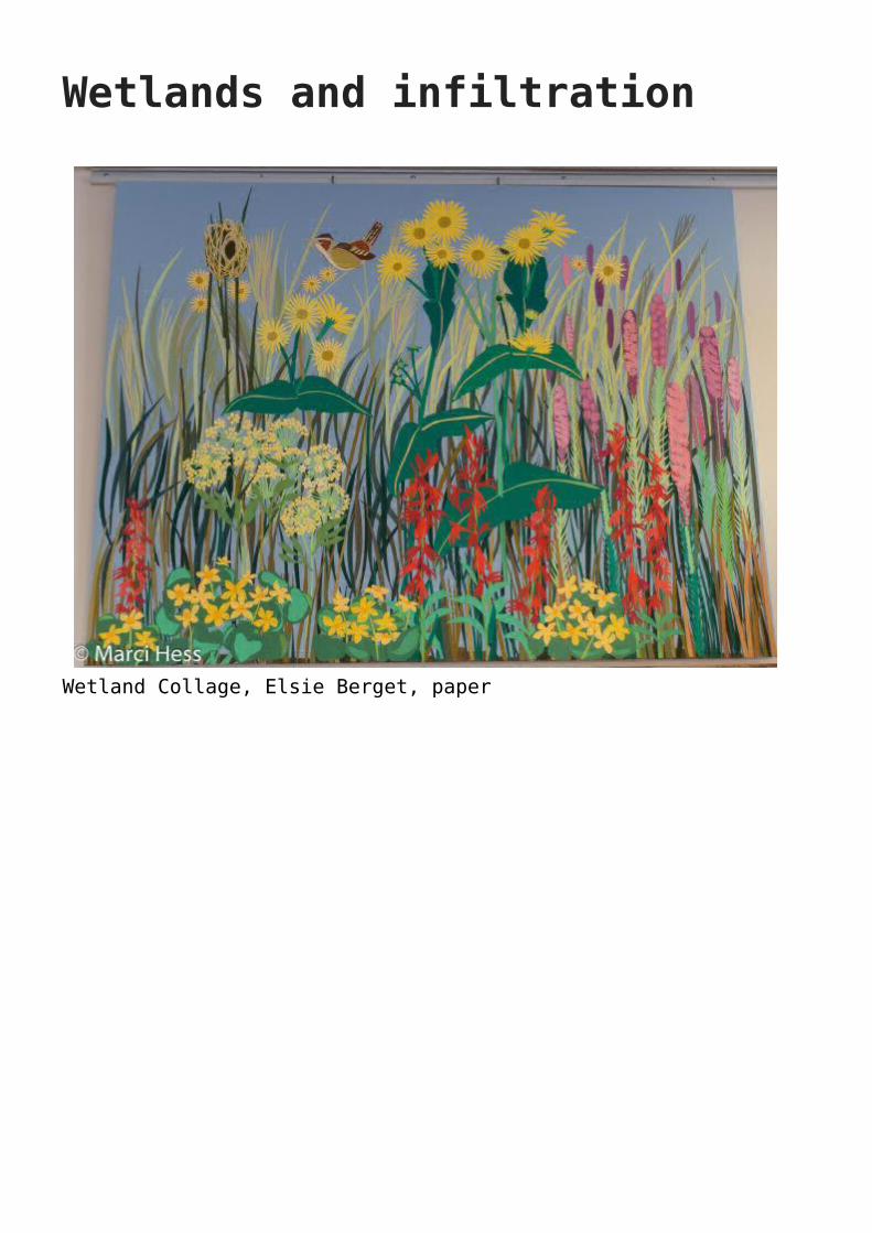
Wetlands and infiltration
Wetland Collage, Elsie Berget, paper
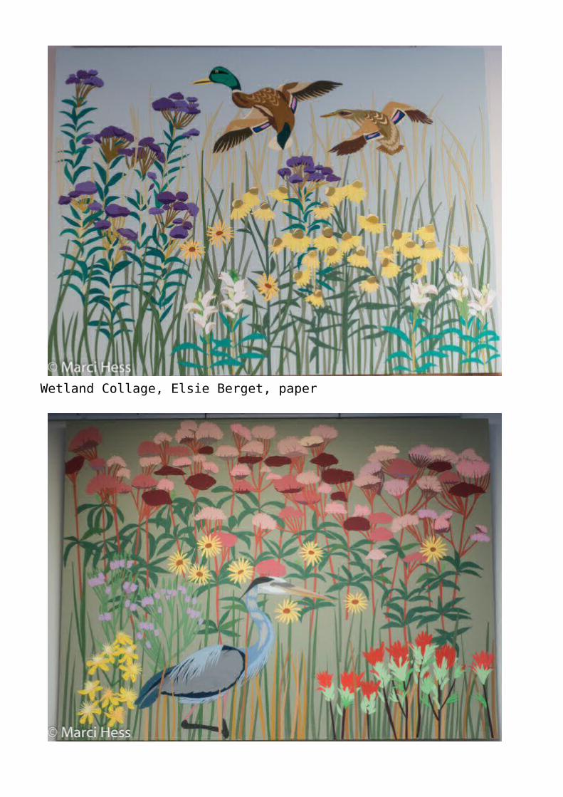
Wetland Collage, Elsie Berget, paper
Wetland Collage, Elsie Berget, paper
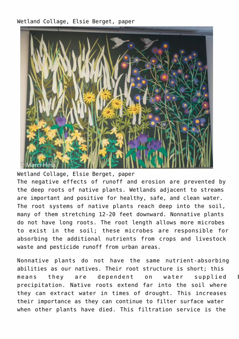
Wetland Collage, Elsie Berget, paperThe negative effects of runoff and erosion are prevented bythe deep roots of native plants. Wetlands adjacent to streamsare important and positive for healthy, safe, and clean water.The root systems of native plants reach deep into the soil,many of them stretching 12-20 feet downward. Nonnative plantsdo not have long roots. The root length allows more microbesto exist in the soil; these microbes are responsible forabsorbing the additional nutrients from crops and livestockwaste and pesticide runoff from urban areas.
Nonnative plants do not have the same nutrient-absorbingabilities as our natives. Their root structure is short; thismeans they are dependent on water supplied byprecipitation. Native roots extend far into the soil wherethey can extract water in times of drought. This increasestheir importance as they can continue to filter surface waterwhen other plants have died. This filtration service is the
most significant method for purifying our drinking water.
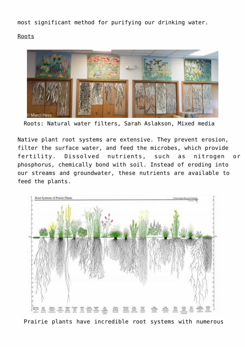
Roots
Roots: Natural water filters, Sarah Aslakson, Mixed media
Native plant root systems are extensive. They prevent erosion,filter the surface water, and feed the microbes, which providefertility. Dissolved nutrients, such as nitrogen orphosphorus, chemically bond with soil. Instead of eroding intoour streams and groundwater, these nutrients are available tofeed the plants.
Prairie plants have incredible root systems with numerous
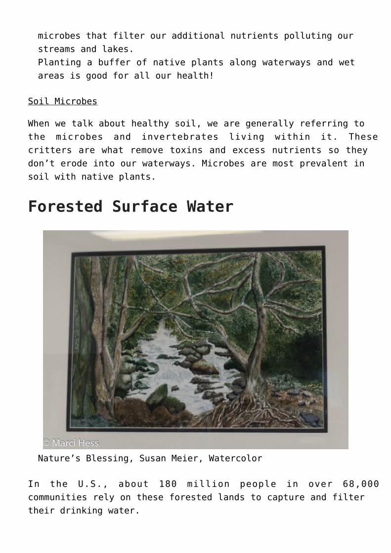
microbes that filter our additional nutrients polluting ourstreams and lakes.Planting a buffer of native plants along waterways and wetareas is good for all our health!
Soil Microbes
When we talk about healthy soil, we are generally referring tothe microbes and invertebrates living within it. Thesecritters are what remove toxins and excess nutrients so theydon’t erode into our waterways. Microbes are most prevalent insoil with native plants.
Forested Surface Water
Nature’s Blessing, Susan Meier, Watercolor
In the U.S., about 180 million people in over 68,000communities rely on these forested lands to capture and filtertheir drinking water.
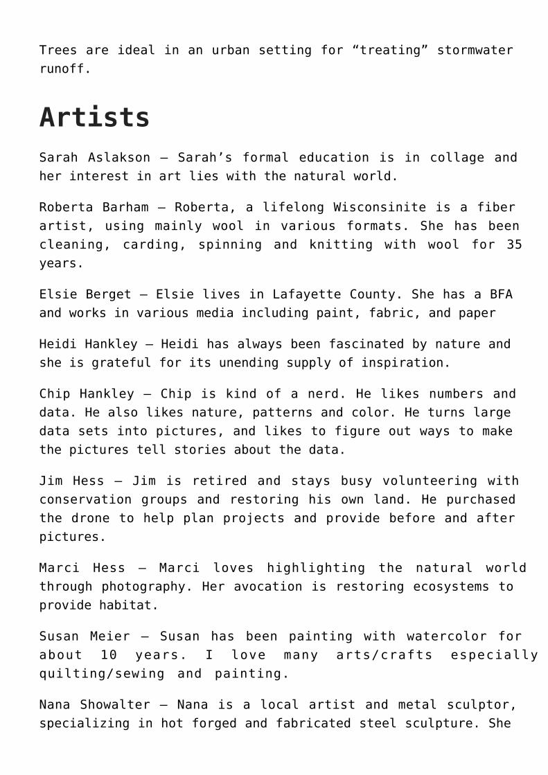
Trees are ideal in an urban setting for “treating” stormwaterrunoff.
ArtistsSarah Aslakson – Sarah’s formal education is in collage andher interest in art lies with the natural world.
Roberta Barham – Roberta, a lifelong Wisconsinite is a fiberartist, using mainly wool in various formats. She has beencleaning, carding, spinning and knitting with wool for 35years.
Elsie Berget – Elsie lives in Lafayette County. She has a BFAand works in various media including paint, fabric, and paper
Heidi Hankley – Heidi has always been fascinated by nature andshe is grateful for its unending supply of inspiration.
Chip Hankley – Chip is kind of a nerd. He likes numbers anddata. He also likes nature, patterns and color. He turns largedata sets into pictures, and likes to figure out ways to makethe pictures tell stories about the data.
Jim Hess – Jim is retired and stays busy volunteering withconservation groups and restoring his own land. He purchasedthe drone to help plan projects and provide before and afterpictures.
Marci Hess – Marci loves highlighting the natural worldthrough photography. Her avocation is restoring ecosystems toprovide habitat.
Susan Meier – Susan has been painting with watercolor forabout 10 years. I love many arts/crafts especiallyquilting/sewing and painting.
Nana Showalter – Nana is a local artist and metal sculptor,specializing in hot forged and fabricated steel sculpture. She

works in the original Postville Blacksmith Shop and teachesclasses in basic blacksmithing.
Bethany Storm – Bethany Storm spent her tenure working in thenatural resources. In pseudo retirement, she owns and operatesa nonprofit, sustainable homestead farm in Postville.