Embed Size (px)
Citation preview
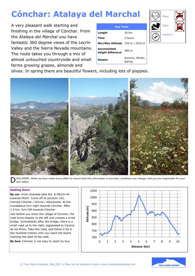
A very pleasant walk starting and
finishing in the village of Cónchar. From
the Atalaya del Marchal you have
fantastic 360 degree views of the Lecrin
Valley and the Sierra Nevada mountains.
The route takes you through a mix of
almost untouched countryside and small
farms growing grapes, almonds and
olives. In spring there are beautiful flowers, including lots of poppies.
Cónchar: Atalaya del Marchal
Getting there
By car: From Granada take the E-902/A-44
towards Motríl. Come off at junction 153,
marked Cónchar / Dúrcal / Albuñuelas. At the
roundabout turn right towards Cónchar. After
1.5 km, turn left towards Cónchar.
Just before you enter the village of Conchar, the
road turns sharply to the left and crosses a small
bridge. Immediately after the bridge, there is a
small road up to the right, signposted to Camino
de los Pinos. Take this road, and follow it for a
few hundred metres until you reach the board
marking the start of the walk.
By bus: Cónchar is not easy to reach by bus.
Key Facts
Length 10 km
Time 3 hours
Min/Max Altitude 720 m / 1015 m
Accumulated
height difference 580 m
Season Autumn, Winter,
Spring
Easy
Easy
Medium
© Trek Sierra Nevada, May 2017 • May not be altered or sold • www.treksierranevada.com
D ISCLAIMER: While we have made every effort to ensure that this information is accurate, conditions can change, and you are responsible for your
own safety.
700
750
800
850
900
950
1000
1050
0 1 2 3 4 5 6 7 8 9 10
Alt
itu
de
(m)
Distance (km)

1. Start walking up the road from the
information panel at the start of the
walk (see above). The route is
signposted in places (see right), and is
also marked with cairns and painted
arrows, but the marking is not very
comprehensive, so you’ll need to
follow these instructions.
2. After about 200m, turn left on the
road and then right down a path.
3. Follow the path round along the
edge of the valley. After about 1.5 km,
it turns steeply uphill to the right.
4. Follow the path for about 500m and then turn left onto a
bigger path.
5. After another 500m take the path up to the right, which then
turns into a track and merges into a small road (bearing right).
6. Follow this small road until you reach the main road. (You
will pass a signpost towards Cónchar - this is the route you will
eventually take back near the end of the walk.) Turn right onto
the main road and after 100 m take the path up to the left.
7. After about 400m bear right up the hill and merge with a
track. Carry on upwards.
8. After about
600m, you will
reach the
watchtower at the
highest point. This
is called the Atalaya
del Marchal. From
here you get 360°
views. Continue on
the same path down
the other side of the
hill. The path turns
into a track.
9. After about 500m
or so, turn left onto
another track
heading downhill.
10. After about
6-700m, take the
track up to the left.
11. When you rejoin
the main road, turn
left. After 250m
turn right onto the
small road you used
earlier (6).
12. Turn left at the signpost towards Cónchar (after about
350m).
13. After 1 km follow the main track down and round to the
left. After another 800m, turn right onto the main road and
continue back down into the village and the start of the walk.
© Trek Sierra Nevada, May 2017 • May not be altered or sold • www.treksierranevada.com
N
© INSTITUTO GEOGRÁFICO NACIONAL DE ESPAÑA, Original Scale 1:25,000
right