Embed Size (px)
Citation preview

CONCEPTS AND SCIENCE FOR
COASTAL EROSION MANAGEMENT
CONCISE REPORT FOR POLICY MAKERS

2
Colophon © Deltares, 2010
To be cited as:M. Marchand (Ed.). Concepts and Science for Coastal Erosion Management. Concise report for policy makers. Deltares, Delft. 2010.
Editor: Marcel Marchand (Deltares)
Design and layout: Erik Devilee (EUCC)
Printed by:Drukkerij All•in, Katwijk, The Netherlands
© Copyright Photos:Cover photo: Rijkswaterstaat, page 6: Sebastião Bráz Teixeira, CCDR-Algarve, page 8 Rijkswaterstaat, page 11: Joos Versfelt, page 14: Rijkswaterstaat, page 20: CMRC, page 22: Deltares, page 25: Ian Thomas, page 26: Erik Devilee, page 28: James Sunderland, page 31: BSCC, page 32: Rijkswaterstaat.
Acknowledgements:The CONSCIENCE project was co-funded by the EC 6th Framework Programme for Research, Technology and Development as a specific targeted research project (STREP) under contract nr. 044122. Special thanks for contributions are expressed to Dr. Karen Fabbri (EU) and Ian Thomas (Pevensey Coastal Defence Ltd.). This report could not have been written without the work done by all project team members. Specific contributions are acknowledged from Jeremy Gault, Annemarie O’ Hagan, Jan Mulder, Leo van Rijn, Marcello Sano and James Sutherland.
Contact: [email protected]
Table of Contents 3 Foreword
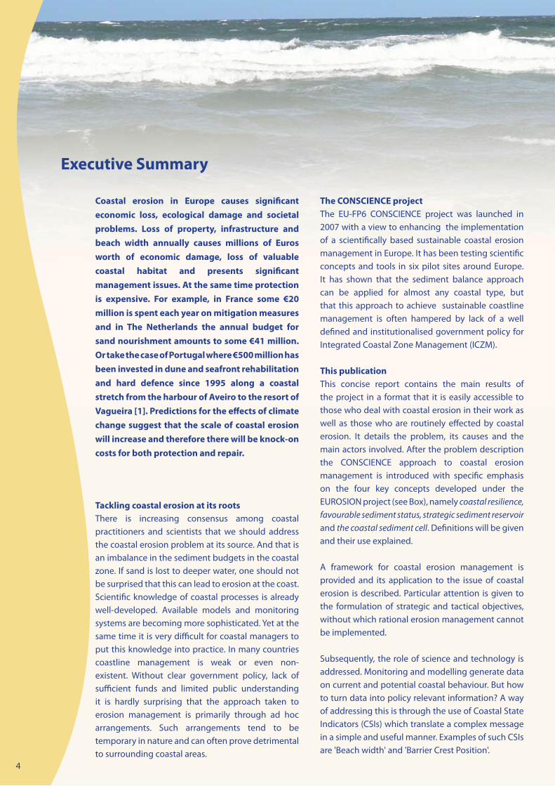
4 Executive Summary
6 What is coastal erosion and when is it a problem?
10 Towards coastal erosion management
12 A Framework for coastal erosion management
16 Turning data into policy relevant information
19 What can coastal managers do if erosion is a problem?
21 How are setback lines defined?
22 Using models to define setback kines
Case studies:
24 Pevensey (UK): Public-private partnership in coastal erosion management•
26 The Holland coast (NL): a multi-scale management challenge•
28 How can EU policies and Directives help to manage coastal erosion?
30 The way forward
31 References

3
Foreword By Karen FabbriDG Research, Technology and DevelopmentEU Commission
implementation of EU policy and management initiatives. The project builds on the sound principles established through the EUROSION project that proper management of coastal zones can only be achieved successfully if it is founded on a thorough understanding of natural processes. But at the same time the project showed the equally important role of policy makers in this respect. Without explicit objectives for coastal management, at both national and local level, scientific knowledge remains unused and measures to control erosion face the risk of being taken ad hoc, inappropriately and hardly accountable. By introducing a policy framework for coastal erosion management, the project enabled to clearly pinpoint the relations between policy objectives, scientific knowledge as well as intervention technology. By using such a framework, communication between practitioners, policy makers and scientists can greatly improve. And it can therefore support the design of an appropriate, resilience based coastal erosion management practice.
This report marks the end of the CONSCIENCE project and will hopefully enhance a closer interaction of end users and scientists needed to implement a resilient and climate adaptive coastal management. There is still a long road ahead. Let us work on it at EU, national and local level so that in future our next generations can enjoy our coasts the same way as we do.
Coastal authorities are faced with the increasingly complex task of balancing development and managing coastal risks. Given the combined effects of further human encroachment on the coast and impacts of climate change, coastal erosion and flooding are problems of growing intensity. In this context, the pan-European study EUROSION recommended the restoration of the sediment balance and to enhance coastal resilience. This requires achieving a favourable sediment status in vulnerable coastal sediment cells and the designation of strategic sediment reservoirs to replenish the coastal zone in case of extreme events and to accommodate for sea level rise. The implementation of this recommendation is a great challenge for the coastal practitioner as well as for policy makers at national and European level. It puts a high demand on the knowledge of coastal processes, data availability as well as stakeholder involvement. Although scientific knowledge is rather well advanced, sophisticated monitoring technology is available and models become more accurate, much of this is underutilised in day-to-day coastal management. There still remains a dire need for applied research and collaboration between experts and managers to close the gap in the science-policy interface. This has prompted the launch of the CONSCIENCE project within the 6th Framework for Research, Technology and Development of the European Union in order to operationalise key concepts to improve sustainable management of coastal erosion.
The CONSCIENCE project, of which this concise report for policy makers is one of the products, had an ambitious goal. The project is commendable in attempting to add value to earlier EU funded research and to help integrate the knowledge obtained through science and through the development of 'best practices' to support the formulation and
4
Coastal erosion in Europe causes significant economic loss, ecological damage and societal problems. Loss of property, infrastructure and beach width annually causes millions of Euros worth of economic damage, loss of valuable coastal habitat and presents significant management issues. At the same time protection is expensive. For example, in France some €20 million is spent each year on mitigation measures and in The Netherlands the annual budget for sand nourishment amounts to some €41 million. Or take the case of Portugal where €500 million has been invested in dune and seafront rehabilitation and hard defence since 1995 along a coastal stretch from the harbour of Aveiro to the resort of Vagueira [1]. Predictions for the effects of climate change suggest that the scale of coastal erosion will increase and therefore there will be knock-on costs for both protection and repair.
Tackling coastal erosion at its rootsThere is increasing consensus among coastal practitioners and scientists that we should address the coastal erosion problem at its source. And that is an imbalance in the sediment budgets in the coastal zone. If sand is lost to deeper water, one should not be surprised that this can lead to erosion at the coast. Scientific knowledge of coastal processes is already well-developed. Available models and monitoring systems are becoming more sophisticated. Yet at the same time it is very difficult for coastal managers to put this knowledge into practice. In many countries coastline management is weak or even non-existent. Without clear government policy, lack of sufficient funds and limited public understanding it is hardly surprising that the approach taken to erosion management is primarily through ad hoc arrangements. Such arrangements tend to be temporary in nature and can often prove detrimental to surrounding coastal areas.
The CONSCIENCE projectThe EU-FP6 CONSCIENCE project was launched in 2007 with a view to enhancing the implementation of a scientifically based sustainable coastal erosion management in Europe. It has been testing scientific concepts and tools in six pilot sites around Europe. It has shown that the sediment balance approach can be applied for almost any coastal type, but that this approach to achieve sustainable coastline management is often hampered by lack of a well defined and institutionalised government policy for Integrated Coastal Zone Management (ICZM).
This publicationThis concise report contains the main results of the project in a format that it is easily accessible to those who deal with coastal erosion in their work as well as those who are routinely effected by coastal erosion. It details the problem, its causes and the main actors involved. After the problem description the CONSCIENCE approach to coastal erosion management is introduced with specific emphasis on the four key concepts developed under the EUROSION project (see Box), namely coastal resilience, favourable sediment status, strategic sediment reservoir and the coastal sediment cell. Definitions will be given and their use explained.
A framework for coastal erosion management is provided and its application to the issue of coastal erosion is described. Particular attention is given to the formulation of strategic and tactical objectives, without which rational erosion management cannot be implemented.
Subsequently, the role of science and technology is addressed. Monitoring and modelling generate data on current and potential coastal behaviour. But how to turn data into policy relevant information? A way of addressing this is through the use of Coastal State Indicators (CSIs) which translate a complex message in a simple and useful manner. Examples of such CSIs are 'Beach width' and 'Barrier Crest Position'.
Executive Summary

5
Pilot sites of the CONSCIENCE project
(Map source: EUROSION project).
1: Holland coast (the Netherlands)
2: Hel peninsula (Poland)
3: Danube Delta coast (Romania)
4: Costa Brava (Spain)
5: Pevensey Bay (United Kingdom)
6: Inch Beach (Ireland)
Three types of measures which are often used in erosion management are discussed: the use of set-back lines, sand nourishment and hard engineered structures. A short description, including probable effectiveness and associated costs of such measures is given. Set-back policy is explored in some detail, outlining what it is, how it can be defined and how it can be supported with customised modelling.
Details from two of the six project sites are given as case studies of current approaches to coastal erosion management:
Pevensey Bay, on the English Channel coast • of Southern England, shows how a public-private partnership model can be applied.
The Dutch coast presents the simultaneous • implementation of erosion management for three strategic objectives that relate to different time scales: safety, hold the line and adaptation to sea level rise.
The publication ends with a summary of recommendations and suggestions of how policy makers can effectively contribute to a more sustainable management of coastal erosion in Europe.
The project website: www.consience-eu.net, contains all the project documents, reports, pilot site descriptions as well as guidelines for erosion management.
The EUROSION project
The EUROSION project was commissioned in 2001 by the Directorate-General Environment of the European Commission upon an initiative of the European Parliament. Its aim was to evaluate the social, economic and ecological impact of coastal erosion on European coasts and assess the needs for action. The two-year project that started in 2002 was implemented by a European consortium, led by the National Institute of Coastal and Marine Management of the Netherlands.
The study covered all EU Member States with coastlines, including the new EU Member States. For the study, a special Geographical Information System was set up for the entire European coastline, as well as a database with information on shoreline management from 60 case-study sites across Europe (see EUROSION website: www.eurosion.org).

6
Coastal evolution is governed by the balance between
demand and supply of sediment (modified from [3])
Defining coastal erosion is rather straightforward. But to understand the phenomenon is far from easy. There is a widespread perception that coastal erosion is always irreversible, especially, for example, immediately after a storm event when erosion is more evident. This sometimes results in a call from both local residents and political representatives for hard engineering works to be constructed. There is little public awareness of the physics behind coastal processes that causes the difference between structural and episodic erosion. Few will know how natural coasts change due to fluctuations in forcing. And that erosion can be followed by coastal accretion when boundary conditions change, either at a seasonal, annual or much longer, geological time scale.
Interplay of sediments, wind and waterUnderstanding coastal erosion processes requires an insight into all the factors that interact along the shoreline and an awareness of different time scales. On geological time scales, coastal evolution in sedimentary environments is governed by the demand and supply of sediments [3, 4]. Sediment demand of a coast is determined by the rate of relative sea-level rise and by the morphology of the coastal plain. Sediment supply is determined by the availability of sediment and by the transport capacity of wind and water. The balance between sediment demand and supply drives the evolution of the coast (figure right): when supply is greater than demand, the coast will grow seaward, when demand equals supply, the coast will stay in place, and when the supply is insufficient, the coast will tend to retreat.
Definition of coastal erosion
Coast erosion is the process of wearing away material from a coastal profile due to imbalance in the supply and export of material from a certain section. It takes place in the form of scouring in the foot of the cliffs or dunes or at the subtidal foreshore. Coastal erosion takes place mainly during strong winds, high waves and high tides and storm surge conditions, and results in coastline retreat and loss of land. The rate of erosion is correctly expressed in volume/length/time, e.g. in m3/m/year, but erosion rate is often used synonymously with coastline retreat, and thus expressed in m/year [2].
What is coastal erosion and when is it a problem?

7
Diagram explaining coastal evolution through a combination of sea level changes and sediment availability (modified from [5])
Dune erosion during storm
Storm surge level
Dune accretion undernormal conditions Normal sea level
E
A
The diagram on the right teaches us that with sea level rise, the coastline could be stable or even grow seaward, if there is sufficient sediment supply. It also shows that even without coastal erosion the coastline can retreat when the sea level rises and causes submergence of the coast.
If we look at what happens during a storm only a part of the long term processes is visible. On a sandy coast, for example, a combination of high tide and strong winds pushes up the sea water level, exposing the beach and dunes to heavy attack by the incoming waves, usually resulting in erosion. Sand is dragged down the slope by the down rush causing erosion of the beach and dunes and undermining of the dune toe. Part of the dune face may collapse and this slumped sediment will slide downwards where it can be eroded further again by wave-induced processes. The sediment is then transported to the sea where it will settle at deeper water. During a subsequent calmer period some of the sediment may return to the coast through onshore directed wave-driven and wind-driven transport, usually resulting in accretion in the beach zone. However, longshore currents may also remobilise the sediment, leading to further sediment movement away from the original location.
This is a simplification of the processes involved and these will vary according to the types of coast in question, cliff, coarse gravel or sandy beaches, etc. What is clear from this description is that coastal erosion is a dynamic process. It is often event-driven (a storm) and its consequences may be at least partially reversed during calmer periods. Such events are superimposed on the long term coastal evolution, described earlier.
Coastal behaviour also has a spatial dimension: the longshore currents may permanently remove sediment from the shore, but they also may bring new sediments from elsewhere. Therefore it is important to describe these processes in relation to the concept of the coastal cell.

sink
cross-shoretransport
mining
nourishment
longshoretransport
dune erosion
longshoretransport
canyon
lagoon
wind transport
river
The coastal cell and its sediment transport pathways
8
Coastal sediment cell and sub-cell boundaries for England and Wales
The coastal cell as unifying conceptA coastal cell is defined as a relatively self-contained unit within which sediment circulates. A cell contains a complete cycle of sedimentation including sources, transport paths and sinks. Its boundaries separate those parts of the coast that are interdependent from those that are independent in terms of physical processes. Delineating the coast into several coastal cells is most easily achieved by using natural or artificial boundaries, such as headlands, capes or long groynes.
The adoption of the coastal cell concept facilitates setting up a sediment budget, i.e. a mass balance of inputs and outputs of sediment for the cell. Possible sources of sediment are riverine input, onshore transport of sediment from offshore marine deposits, and inflow from adjacent cells through longshore transport. Human interference through nourishment (artificial deposition of sand from dredging of adjacent offshore areas) may also form an important input. The coastal cell also loses material in various ways, including trapping in deep offshore channels and submarine canyons or mining. Sediment may be transported to estuaries, lagoons and inner seas and by wind to beaches and dunes from where it may only return to the beach through further erosion or exceptional storms. Longshore currents also may transport sediments to adjacent coastal cells.
The net balance between losses from and inputs to a coastal cell determines, to a large extent, whether a coastline is eroding or accreting, especially in the longer term. It is clear that any human interference in these processes, such as the blocking of sediment transport by building a jetty or breakwater, or
sediment starvation through reduced riverine input could have repercussions on the delicate natural balance and thus on erosion patterns. Transport rates for each of these processes are used to model the changes in the sediment budget, which makes it possible to predict future coastline fluctuations caused by such human interventions.
When does erosion become a problem?Coastal erosion becomes a problem when there is no room to accommodate change: a highly urbanised coastal zone will certainly face difficulties with coastal erosion. The question is how much room is needed and what human uses are compatible with a dynamic coastline. Unless we know the natural behaviour of the coast, we cannot formulate a sustainable, economically rational and socially acceptable coastal management strategy.

9
Urban sprawl along the Dutch coast. Urbanised areas
appear in red. Courtesy: Rijkswaterstaat
Principle of sea level rise causing coastal retreat
With increasing urbanisation of European coasts, the demand for shoreline defences and erosion control also increases. This could lead to a self-reinforcing effect as additional property and economic activities require further and often more robust defences [6]. Short-term economic gain often stimulates this development, without taking into account erosion risks. These developments all lead to reduced coastal resilience since the coastline has nowhere to move. It is questionable whether this type of development is sustainable in the long term, especially in view of climate change.
How does climate change affect coastal erosion?Climate change will probably lead to an increase in coastal erosion. In terms of the main drivers for accelerated erosion, the relative rise of sea level is the most important. As explained earlier, a rising sea level implies an increase in sediment demand, which if not supplied results in coastal retreat. Current predicted changes in sea level estimate a rise of up to 0.6 m by 2100 [7]. Higher sea levels will raise extreme water levels, allow waves to break nearer to the coast and transmit more wave energy to the shoreline. This will promote erosion and coastal retreat at sediment starved locations. Sea-level rise is therefore likely to cause an inland migration of beaches and the loss of up to 20% of coastal wetlands [8].
Other drivers that may exacerbate erosion rates are increased storminess, higher waves and changes in prevalent wind directions. The condition and performance of existing coastal defence structures may also deteriorate through interactions with rising sea level, higher waves, more severe surges and changes in the shape of the shoreline. Several recent studies indicate that coastal protection strategies and changes in the behaviour or frequency of storms may be more important than the projected acceleration of sea-level rise in determining future coastal erosion rates [9].
It has been estimated that for England and Wales, a worst case climate scenario could lead to nine times more severe erosion than the present day [10]. In The Netherlands, the volume of sand needed to nourish and maintain the coastline could increase from 12 to 80 Mm3 per year due to predicted sea level for 2050.
Who is responsible for erosion management? Because the cause of coastal erosion is not always directly evident and is often seen as a natural phenomenon, the question of who is responsible for its management is not an easy one. People often tend to look towards public authorities when it comes to taking measures. Hardly ever are parties responsible for coastal erosion made accountable for the consequences. Public expenditure in Europe specifically for coastline protection against the risk of erosion and flooding reached an estimated €3,200 million in 2001. It is highly probable that private funding for coastal erosion management does not amount to 10% of the figure for public expenditure [1]. Even more worrying is the fact that much of the government spending is done in a rather piecemeal and informal way, given there is no strategic erosion policy at national level. This therefore reduces the effectiveness of these measures. Many hard engineered protection works have only a positive effect in the short time and can exacerbate erosion at adjacent locations. Many countries lack a coordinated, well-planned and explicitly formulated policy on coastal erosion or indeed coastal management more generally.
‘Short term economic gain often stimulates development, without taking into account erosion risks’

10
Management plans for coastal erosion should be based on the principle of working with natural processes. The EUROSION recommendations [1] propose four concepts to assist in making this principle operational:
the coastal sediment cell, •coastal resilience,•favourable sediment status, and•strategic sediment reservoir. •
Coastal sediment cellWe already encountered the coastal sediment cell in the previous chapter, where it was defined as a coastal compartment that contains a complete cycle of sedimentation including sources, transport paths and sinks. The cell boundaries delineate the geographical area within which the budget of sediment is determined, providing the framework for the quantitative analysis of coastal erosion and accretion. In this respect, coastal sediment cells constitute the most appropriate units for achieving the objective of favourable sediment status and hence coastal resilience. The application of coastal sediment cells requires the establishment of a sand budget for a coastal area. This gives an insight into the relative importance of the various sediment sources and losses, resulting in deposition and erosion. The determination of the correct fluxes for specific coastal environments is sometimes surrounded with large uncertainties which could make the job of the coastal manager more difficult.
Coastal resilienceCoastal resilience is the inherent ability of the coast to accommodate changes induced by sea level rise, extreme events and occasional human impacts, whilst maintaining the functions fulfilled by the coastal system in the longer term [1]. Because resilience is based on natural processes, it varies between different coastal types: a beach dune coast is obviously more resilient than a cliff coast because of the self restoring capacity of dunes.
Note that this definition does not require a coastline to remain in an equilibrium state. Especially on longer time scales most coasts are evolving systems an are not necessarily in equilibrium [11]. Coastal resilience therefore should refer to coastal functions: compatibility and adaptability of uses to coastal erosion management which allows natural fluctuations of the coastline.
Favourable sediment statusEUROSION proposed the introduction of the concept of favourable sediment status as the cornerstone for sustainable shoreline management to European legislation but this was not realised. It is defined as the situation where the availability of coastal sediments support the objective of promoting coastal resilience in general and of preserving dynamic coastlines in particular. A neutral or positive sediment balance is often required to arrive at this favourable status. As we can see from the diagram on page 9, we can expect that the impact of sea level rise results in a higher demand, which - if not supplied - will lead to coastline retreat.
A favourable sediment status for the coastal zone shall be achieved for each coastal sediment cell principally through sediment management including nourishments and the designation of strategic sediment reservoirs in combination with traditional measures such as spatial planning, building regulations and environmental assessment procedures. As we will see later, not only the availability of sufficient sediment is required, but also the spatial distribution needs attention.
‘Coastal resilience should refer to coastal functions: compatibility and
adaptability of uses to coastal erosion management which allows natural
fluctuations of the coastline’
Towards coastal erosion management

11
Strategic sediment reservoirsStrategic sediment reservoirs are supplies of sediment of ‘appropriate’ characteristics that are available for replenishment of the coastal zone, either temporarily (to compensate for losses due to extreme storms) or in the long term (at least 100 years). They can be identified offshore, in the coastal zone (both above and below low water) and in the hinterland.
It is recognised that many coastal erosion problems are caused by a human induced imbalance in the sediment budget. Natural sediment sources are depleted by sand mining activities, trapped in river reservoirs upstream or fixed by coastal engineering structures. Restoring this balance will require identifying areas where essential sediment processes occur, and identifying strategic sediment reservoirs from where sediment can be taken without endangering the natural balance.
Why are these concepts important?These concepts are interlinked through coastal processes but they also have a policy and management dimension. Take for instance the favourable sediment status. It refers to the sediment balance and distribution within a coastal cell, but also to a certain desired state. To describe the sediment balance as ‘favourable’ depends on the objective for erosion management. If erosion is not acceptable, the sediment balance should be such that there is no net loss of sediment out of the coastal cell. Due to the dynamic character of soft coasts also the sediment balance is dynamic. For instance in the stormy season the sediment balance can be negative, while during calm weather it may be positive. Therefore, coastal erosion management should consider both a short and long time frame. The short time frame that addresses hours to days is needed to anticipate extreme events, such as storms, which can lead to sudden erosion. The long time frame of decades to centuries is important when considering the impact of climate change, which is likely to significantly increase coastal erosion in the future.
For a sediment status to remain favourable, a strategic sediment reservoir is required. Sediment reservoirs can fulfil two roles in this respect. In the first place they should be conserved as a source of sediment when needed in the future to maintain the proper sediment balance. The coastal cell receives a sediment input from the reservoir, either through natural transport mechanisms or artificial nourishment. Typically, such a sediment reservoir is located outside of the coastal cell.
Secondly, a sediment reservoir may also be defined within a coastal cell. This is when the actual location of the sediment is important. It may be necessary to spatially define a sediment reservoir within a coastal cell in fairly great detail. For instance as a volume of sand above storm surge water level to prevent flooding of the hinterland.
Working as much as possible with natural processes implies that the favourable sediment status will fluctuate: the status need not to be sufficient at any point in time. As a consequence, managers should anticipate a certain fluctuation of the coastline. Therefore, coastal resilience is imperative for sustainable coastal erosion management. Coastal resilience should be maintained as much as possible by ensuring sufficient buffer between the coastline and the built up area. Implementing set-back lines is a useful measure for this [see page 21].
How does management of coastal erosion relate to ICZM?Many of the principles of good ICZM contained in the EU Recommendation [12] are relevant to the implementation of a sustainable approach to erosion management. These principles include taking a long term perspective, local specificity, involving all the relevant parties and working with natural processes. Therefore, management plans for coastal erosion should be part of a broader policy on ICZM. Such policy provides the objectives for coastal erosion management, such as whether or not to hold the line, or allow some coastline retreat to a certain extent. In the next chapter we will show how important it is to formulate policy objectives for erosion management.
‘Management plans for coastal erosion should be part of a broader
policy on ICZM’

12
Generic Frame of Reference for coastal management
StrategicObjective
TacticalObjectives
Quantitative State Concept
Benchmarking procedure
Intervention Evaluation procedure
Desired state
Current state
Indicator
Parameters
Process knowledge
1 2 3 4
From the preceding chapters it is clear that a sustainable solution to coastal erosion problems should be based on an understanding of the sediment dynamics, framed in a policy context with explicit objectives and an institutional environment in which each stakeholder has a clear role. The CONSCIENCE project introduces the Frame of Reference [13] as an aid to formulate this policy. Through this Frame a transparent erosion management policy becomes possible. Also the different Eurosion concepts can be given a suitable place in management.
The Frame of Reference for policy formulationCharacteristics of the Frame of Reference are the definition of clear objectives at strategic and tactical levels and an operational decision recipe involving four steps. At the highest (policy) level a strategic objective is formulated, determined by the long term vision about desired development of the coast. This vision could be based on generic ideas about sustainable development and should ideally reflect the interdependency of the natural coastal and socioeconomic systems.
At the next level one or more objectives are formulated describing in more detail what has to be carried out in order to achieve the strategic objective.
As this implies a choice between different tactics, we call these the tactical objective(s). If, for instance, at a strategic level the objective formulated is 'sustainable development of coastal values and functions', then at the tactical level we have to choose between different options, such as maintaining the coastline at its current position (i.e. not allowing erosion), or allowing a certain variability in coastline position.
Once this tactical objective has been defined, the actual management process regarding interventions can be formulated through four steps, namely:
Quantitative state concept:1. a means of quantifying the problem at hand. Coastal state indicators (CSIs) (i.e. specific parameters that play a role in decision making) are relevant at this stage of the process.Benchmarking process:2. a means of assessing whether or not action is required. CSIs are compared to a threshold value at this stage. Intervention procedure: 3. a detailed definition of what action is required if the benchmark values are exceeded. Evaluation procedure: 4. Impact assessment of the action taken. If the action was not successful it may be necessary to revise the strategic/tactical objectives (hence the feedback loops in the figure below).
A Framework for Coastal Erosion Management

13
Having formulated the strategic and tactical objectives, the operational management is largely a matter for coastal practitioners and experts. In the benchmarking procedure the current state of the coast is compared with the desired state, after which the need for intervention is determined. The procedure describes the kind of information that is needed and how it is collected. Ideally a monitoring programme is in place which enables a pro-active response. Simulation models can be used to predict future coastal behaviour based on historic data.
In order to follow these operational steps, it is evident that we first need tactical and strategic objectives. These cannot be derived by scientists and practitioners alone, since this requires political decisions about the desired development of the coast and how much effort (time and money) society is willing to spend on reaching or maintaining this desired development.
Setting objectives At the strategic level we have to answer questions regarding the values and functions of our coast. For instance, many coasts contain valuable ecosystems, sometimes explicitly protected through national or European legislation (e.g. Natura 2000). At the same time these coasts are used for recreation, housing, groundwater extraction, agriculture etc. Where the hinterland is low lying, the coast also has a protection function against flooding from sea. Coastal erosion can threaten one or more of these values and functions. Before deciding to act to control erosion, it is advisable first to analyse the relationship between coastal dynamics and the functions of the coast. For instance, a dynamic and sometimes eroding coastline is less of a problem in the absence of built-up areas. Seasonal beach erosion may not be a problem for recreation, if it only happens during the winter storms. In other instances, it may be essential not to tolerate any coastal erosion in case this would lead to significant coastal flooding of built-up areas.
‘A sustainable solution to coastal erosion problems should be based
on an understanding of the sediment dynamics, framed in a policy context
with explicit objectives’

14
In practice, it appears very difficult to set realistic and unambiguous objectives for coastal erosion management. This already became apparent from the analysis of 60 case studies done by the EUROSION project, which concluded that very few case studies had clearly defined their objectives for coastal erosion management [1]. Developing strategic and tactical objectives should be part of a broader ICZM policy. Using the principles of ICZM is the best way to guarantee a sustainable development policy for coastal erosion, which has the support of all relevant stakeholders.
At the strategic level, objectives are often linked to key policy principles, such as safety and sustainable development. But from a strategic objective it does not directly become clear how to deal with coastal erosion. Therefore, a tactical objective is needed to determine if coastal erosion needs to be controlled or not.
For instance, in the UK, the Department for the Environment, Food and Rural Affairs (Defra) has defined the following possible tactical objectives for coastal erosion management [14]:
Hold the line: maintain or upgrade the level • of protection provided by defences;
Advance the line: build new defences • seaward of the existing defence line;
Managed realignment: allowing retreat of • the shoreline, with management to control or limit movement;
No active intervention: a decision not to • invest in providing or maintaining defences.
The table below shows the different strategic and tactical objectives found in the 6 CONSCIENCE pilot sites. Note that in some cases these objectives were not officially laid down in policy documents.
Site Strategic objectives Tactical objectivesThe Holland coast (the Netherlands)
Safety, sustainable values & functions Preserve dune strength, hold the line and adapt to sea level rise
Hel Peninsula (Poland)
Preserve the peninsula Maintain beach widthPrevent breaching
Danube Delta (Romania)
Sustainable coastal development Reduce coastal erosion
Costa Brava (Spain)
Maintain recreational carrying capacityEnhance safety of infrastructure
Maintain beach configuration
Inch Beach (Ireland)
Promote sustainable tourism Prevent damage to infrastructure
Pevensey Bay (United Kingdom)
Sustainable risk management Hold the line
Strategic and tactical objectives for the CONSCIENCE pilot sites

15
A graphical representation of objectives in time and spacespace (km)
Time
(years)
1 10 1000.1
0.1
1
10
100
Safety
Hold the line
Grow with sea level
Temporal and spatial scales for objectivesIt is important to realise that objectives can be made for different time horizons. For instance, providing safety against erosion and flooding due to a storm has a typical time horizon of days: the coast should be strong enough to withstand a storm on any day of the year (and especially during the stormy season). On the other side of the spectrum we may find a time horizon of decades to centuries. For instance if we would like to manage coastal erosion in view of sea level rise and climate change. For each of these temporal scales there is an associated spatial scale: for every day safety we need to zoom in to the condition of the coast up to metres or hundreds of metres. For adaptation to sea level rise we define the coastal cell at the scale of tens to hundreds of kilometres. By way of example take a look at the three different scales for management of the Dutch coast [page 26].
How do the EUROSION concepts fit in?In many instances, enhancing coastal resilience is an appropriate means to promote sustainability. It should therefore be used as a guiding principle when formulating objectives for coastal management. Good examples of resilient objectives are ‘managed realignment’ and ‘do nothing’. But even an objective such as ‘hold the line’ could allow for some resilience, for instance by using nourishment to replace losses and maintain a healthy beach. It is often not necessary to demand that at any point in time and place the coastline should be at a pre-defined position. Allowing some flexibility in this criterion would enable the coastline to fluctuate around an average position, which is much more efficient. For example, the Dutch definition of the ‘coastline’ is related to a volume of sand around the mean low water line. This definition allows redistribution of sediment close to the coastline without changing the formal coastline position.
The concepts of coastal sediment cell, strategic sediment reservoir and favourable sediment status are useful for implementation of erosion management at the operational level:
The coastal sediment cell is the most logical • unit to express the sediment situation. Therefore, the coastal cells concept is used in definitions of the quantitative state of the coast.
Favourable sediment status is an expression • of the desired state of our coast and should be used for the benchmarking procedure.
The strategic sediment reservoir is an • essential component of the quantitative state of the coast, and can be used as a sediment supply for nourishments as an intervention measure.

16
In the last few years there has been a rapid change in the technology developed for monitoring the coastal zone, with the emergence of remote sensing, in particular, radically altering the type and volume of data available for addressing coastal management problems. Many of these tools have been developed by scientists to answer questions about detailed coastal processes. Translating the measurements and models of detailed processes (often on small space and time scales) into tools for coastal erosion risk management is not easy or straightforward. The Frame of Reference can assist us what kind of information we need and when. This can be used to design routine monitoring strategies, which currently are lacking in many parts of the European coast.
The use of coastal state indicators (CSIs)By using the Frame of Reference it becomes possible to identify when data is key to informing coastal erosion management decisions. First of all data on the contemporary coastal condition is required for benchmarking: i.e. comparing the current state of the coast with a preferred situation. Secondly, data is needed for the evaluation of measures: do the measures bring the state of the coast closer to the desired state? For these comparisons it is necessary to define Coastal State Indicators (CSIs). CSIs can be described as a reduced set of parameters that can simply, adequately and quantitatively describe the dynamic-state and evolutionary trends of a coastal
system. In other words, CSIs relay a complex message in a simple and useful manner [15]. These indicators should adequately describe the quantitative state concepts, as mentioned in the Frame of Reference, allowing a comparison with threshold conditions in the benchmarking step.
CONSCIENCE has developed the use of Coastal State Indicators in coastal erosion management and tested their application at a number of pilot sites. The table below shows the CSIs used in the different pilot sites of the project. It should be noted that these are not the only suitable CSIs that could be used or developed for coastal erosion.
Coastal State Indicators can be measured in different ways. Methods vary between simple low cost monitoring systems, such as using the traditional theodolite, to advanced technologies, using airborne radar and laser equipment. For instance, in the Pevensey case, the information for the CSIs is obtained by mounting a GPS system on a quad bike and driving along breaks in the profile. On the next pages the use of different monitoring systems is discussed.
‘Coastal State Indicators should adequately describe the quantitative
state of the coast, allowing a comparison with threshold conditions’
Turning data into policy relevant information
CSI Quantity represented Pilot SiteDune strength Standard of protection (SoP) for storm Dutch coast
Barrier width Standard of protection for storm Pevensey
Total barrier volume Standard of protection for storm Pevensey
Backshore width Standard of protection for storm Black Sea
Dune zone width Standard of protection for storm Black Sea
Dune zone height Standard of protection for storm Black Sea
Momentary coastline Position & boundary condition for SoP Dutch coast
Beach width Boundary condition for SoP of hard defence Costa Brava
Barrier crest position Position Pevensey
Shoreline position Position Black Sea, Hel Peninsula
Coastline position Perception of safety Inch Beach
Coastal foundation Growth with sea level rise Dutch coast
Shoreface volume Flood and coastal erosion risk Hel Peninsula
Coastal slope Flood and coastal erosion risk Black Sea
Grouped Coastal State Indicators found at the pilot sites

17
A quad bike with GPS system on Pevensey Beach
Monitoring in the coastal zoneMonitoring of beaches provides important information about the state of the coastal system. Data from monitoring provides the input for the statistical descriptors and numerical models of beach behaviour.
There has been an increase in the use of centralised data-stores with standardised procedures and formats for the storage of coastal monitoring data at a regional scale. Examples of this include the development of the Channel Coast Observatory in the UK and the Jarkus database in the Netherlands. Moreover there has been an increase in the development of large-scale numerical models of systems of defences for flood risk management (such as Risk Assessment for Strategic Planning in the UK and VNK in the Netherlands). However, the coastal erosion element in flood and coastal erosion risk management has been neglected up to now.
Monitoring guidance
The key points for monitoring guidance include:Establish what the data is to be used for. A wide range of data could be used in • coastal management, including data on wind, waves, tides, beach sediment, offshore bathymetry, coastal profiles, geomorphological features, coastal defences, beach nourishment or recycling. All will cost money to collect and that cost should be justified; Establish a reliable system of ground control points or permanent markers that can be • used by all surveying groups, whatever technique they are using;Explicitly state the datum system to be used;• Establish a clear set of guidelines for the surveys, including tolerances and national • or international standards to be met (such as ISO or British Standards) and guidance on when to survey (with respect to the months, the spring-neap tidal cycle and the occurrence of storms).

18
In light of the above, CONSCIENCE has produced an inventory of innovative monitoring methods and has updated the overview of models developed in EUROSION. The table below gives a list of the methods which have been described and illustrates the variety of methods available. Some of these methods are quite cheap, others require expensive equipment or are costly to operate, such as airborne methods. Each method has its advantages and disadvantages. It is therefore essential to establish what the data will be used for (see box for guidance, on preceding page). A survey programme may, therefore, be based on a conceptual (or numerical) model of coastal hazards or risks. For example, exposed sites with a high risk or flooding or coastal erosion may be surveyed at a closer intervals and more often than a hard rock coastline with a strategy of no active intervention.
One of the most important data needs is for the beach level at the toe of coastal defence structures. In order to be able to identify the beach levels with reasonable confidence, a high resolution is required. Conventional LIDAR (Light Detection and Ranging – it uses light to measure distances) can now provide elevations within ±0.15m, which is good enough for this purpose, but if the data is at 2m intervals, the LIDAR system may miss a seawall. High-resolution LIDAR can provide greater accuracy and reduced distance between surveyed points, so combined with a ground-survey it would achieve the required resolution. All remote sensing systems need a good network of control points to be most effective.
Monitoring type Explanation Examples
Small scaleLinear arrays of point sensors Measurement of the depth of
scour under all conditionsTell Tail scour monitoring system
Underwater acoustic measurements of the seabed
An acoustic backscatter device can be used to detect the level of the seabed and give information about sediment in suspension in situations where the seabed and instrument are fully submerged.
Autonomous Sand Ripple Profiler (ASRP)
Measurements of emerged toe levels
There are a number of techniques that can be used to measure emerged coastal defence structure toe levels at a point every low tide.
Argus video systemCounting the number of steps above the beach level at access points
Measurements of mixing depth The seabed mixing depth is the maximum depth below the seabed where sediment motion occurs
Stack of numbered aluminium disks of known height
Medium scaleCross-shore profile surveys and topographic surveys
Beach profiles and topographic surveys are typically collected using a large range of methods
TheodoliteKinematic GPS (e.g. mounted on a quad bike)Laser scanning systemsRepeated digital photography (Argus)X-band radar
Large-scaleMapping of tidelines or shorelines The position of the shoreline or
tidelines (i.e. location of some representation of high water level and low water level) is commonly marked on maps. Different editions of the same map series, sometimes stretching back more than 100 years, can be used to determine long term changes to the position of the shoreline.
Orthorectified aerial or satellite photosTopographic LIDARBathymetric LIDARSynthetic Aperture Radar (SAR)Bathymetric surveys from ships
Coastal Monitoring Methods

19
Cross-shore profiles of dune, beach and shoreface
nourishments
The third step at the operational level of the Frame of Reference deals with interventions. When benchmarking reveals a substantial deviation of the current with the desired situation, something has to be done sooner or later. Accepting erosion may be possible in areas where no essential functions or values are threatened, or where a sufficient buffer zone has been created through a set-back line (see next chapter). But otherwise there is a dire need for restoring the sediment balance. If this does not suffice, hard structures can be the last resort.
A combination of these measures often provides the best results. Generally speaking, the preferred order of measures is as follows: 1) define set-back lines, 2) apply soft nourishment to restore the sediment balance, and 3) implement hard engineered structures if no other options are possible.
Sand nourishmentsSand nourishment can be carried out at various locations in the profile and along the shoreline (see figure of cross-shore profiles), as follows:
dune reinforcement: • dunes are reinforced/protected landward or seaward above dune toe level against breaching during storms;beach nourishment:• sand is dumped as high as possible on the beach as an elongated buffer layer of sand on the beach or as a continuous source at one or more specific locations (stock pile); typical volumes are in the range of 30 to 150 m3/m;shoreface nourishment: • nearshore berms or mounds are constructed from dredged material as a feeder berm in shallow water at the seaward flank of the most offshore bar or as a reef berm in deeper water to act as a filter for storm waves; typical volumes are in the range of 300 to 500 m3/m.
If there is a substantial loss of sediment over a period of 5 years or so, nourishment of the area with a sediment volume equal to the observed volume loss may be considered. Shoreface nourishment is the mechanical placement of sand in the nearshore zone to advance the shoreline or to maintain the volume of sand in the littoral system (coastal cell). It is a soft protective and remedial measure that leaves
the coast in a more natural state than hard structures and preserves its recreational value. The method is relatively cheap if the borrow area is not too far away (<10 km) and the sediment is placed at the seaward flank of the outer bar where the navigational depth is sufficient for hopper dredgers.
Beach nourishment is mainly used to compensate local erosion in regions with relatively narrow and low dunes (in regions where coastal safety is critical) or when the local beach is too small for recreational purposes. Beach nourishment is about twice as expensive as shoreface nourishment per unit of volume.
Experiences with nourishments on the Holland coast show that shoreface nourishment has an efficiency (defined as the ratio of local volume increase to initial nourishment volume) of 20% to 30% after about 4 to 5 years. Beach nourishment has an extremely low life cycle of 1 to 2 years along the Holland coast.
Practical experience of the Holland coast also shows that large-scale erosion can be stopped by massive beach and shoreface nourishment over long periods of time. This approach is only feasible if sufficient quantities of sand are available and the dredging and dumping costs are acceptable (about €10 to €15 million per year or €100 to €150 per metre of coastline for the Holland coast with a total length of about 100 km).
What can coastal managers do if erosion is a problem?

20
Hard structuresGenerally, coastal structures such as groynes, detached breakwaters and artificial reefs are built to significantly reduce coastal beach erosion and to maintain a minimum beach for recreation. These structures are, however, no remedy for structural sediment deficiencies due to sea level rise, nor for dune erosion during conditions with relatively high surge levels (above the dune toe level). Seawalls and revetments are usually built in regions (along boulevards of beach resorts) where natural dunes are absent or have been removed for recreational purposes.
Costs of measuresIt is difficult to make generalised cost estimations for measures, since this largely depends on local conditions, such as the design of the measure, the type of material used, local prices for labour and material etc. The costs can range from a few thousand Euros for localised protection measures to several millions of Euros for a complete restructuring of the coast. An example from the Dutch coast provides some indication of the costs for different types of measures.
Hard structures (groynes, detached breakwaters) require relatively high capital investment plus the cost of maintenance works (storm damage, subsidence, scour problems, redesign, etc.) and costs of supplementary beach nourishment to deal with local erosion problems (opposite gaps and along the downdrift side). The construction costs of rubble-mound groynes with a length of 200 m (spacing of 600 m) is about €1 million. When interest and maintenance costs are added, this brings the figure to approximately €3 to €5 million over a period of 50 years or about €100 to €150 per m coastline per year. The construction of detached breakwaters is considerably larger, in the range of €200 to €300 per m coastline per year. The use of soft shoreface nourishment requires less initial investments, but the cost of regular maintenance of the feeder berm (every 3 to 5 years) has to be added resulting in annual costs of about €100 to €150 per metre of coastline per year. Beach nourishment is twice as expensive (€200 to €300 per metre of coastline per year).
In conclusion one could say that in general the differences in costs between hard and soft engineering solutions are relatively small. Other considerations, such as secondary effects, amenity value etc. will often play a much larger role in the choice of the type of intervention.
‘Hard structures are no remedy for structural sediment deficiencies due to
sea level rise’
Type of structureConstruction + maintenance costs over 50 years (in Euro per m coastline per year)
Straight rock groynes 50 to 150
Rock revetments 100 to 200
Shoreface nourishments (every 5 years) 100 to 200 (if sand is easily available)
Sea walls 150 to 300
Beach fills (every 3 years) 200 to 300 (if sand is easily available)
Submerged breakwaters 200 to 400
Emerged breakwaters 250 to 500
Indication of investment costs of shoreline protection measures

21Example of risk lines for a coastal town
A setback line is normally defined as the landward limit of a buffer zone along the coastline where building restrictions or prohibitions are applied. The width of this buffer will depend on the associated physical, environmental and socioeconomic criteria.
The use of setback lines is basically a trade off between coastal development on the one hand and prevention of an unacceptable risk due to coastal erosion on the other. Many investors are either unaware of the risk, or do not think they are liable for any possible damage. Often only the commercial potential is included in the investment decision to build close to the sea while the risk is entirely disregarded [16]. Regional and national governments should however maintain a broader perspective of the issue, including the long term risks and the need for coastal resilience. This requires an assessment of the risk from coastal erosion as well as a procedure how to incorporate this risk into an economic cost-benefit analysis. Furthermore, also ecological values and social motives, such as public access to the beach, can be included in the rationale for defining set back lines.
A preliminary analysis of the legal instruments and policies of the EU and of individual Member States show the lack of a common methodology for setback lines at the European level. However, the Protocol on ICZM of the Barcelona Convention is one example of where there is a clear reference to setback lines (see box). The development of a common method for setback lines should be considered by the Commission as a part of the European cohesion policy and as an initiative which could foster the implementation of the Mediterranean ICZM Protocol in Member States that are Contracting parties to that Convention (Spain, France, Italy, Slovenia, Greece, Malta, Cyprus).
This common method should be based on scientific knowledge of natural processes, information on ecological and landscape values and an analysis of the costs of implementation under local circumstances. This information should be combined with the perceptions and views of stakeholders at the local level in a process of open communication and discussion. The outcome of this participatory process should be used to make a final decision on a setback line that is scientific valid, socioeconomically defendable and broadly acceptable to the public. Appropriate pilots sites along the European coast could be used to test the methodology.
‘A setback line is basically a trade off between coastal development and
prevention of an unacceptable risk due to coastal erosion’
Article 8 of the Mediterranean Protocol on Integrated Coastal Zone Management states: ‘[…] the Parties: (a) Shall establish in coastal zones, as from the highest winter waterline, a zone where construction is not allowed. Taking into account, inter alia, the areas directly and negatively affected by climate change and natural risks, this zone may not be less than 100 meters in width, subject to the provisions of subparagraph (b) below. Stricter national measures determining this width shall continue to apply.(b) May adapt, in a manner consistent with the objectives and principles of this Protocol, the provisions mentioned above:
1) for projects of public interest;2) in areas having particular geographical or other local constraints, especially related to population density or social needs, where individual housing, urbanisation or development are provided for by national legal instruments.
[…]’
How are setback lines defined?
Coastal erosion experiment in the Deltaflume facility22
incoming broken wave(bore)
wave collision
reflected wave
dune face
uprush point
swash zone
Schematised representation of a storm surge attacking a dune
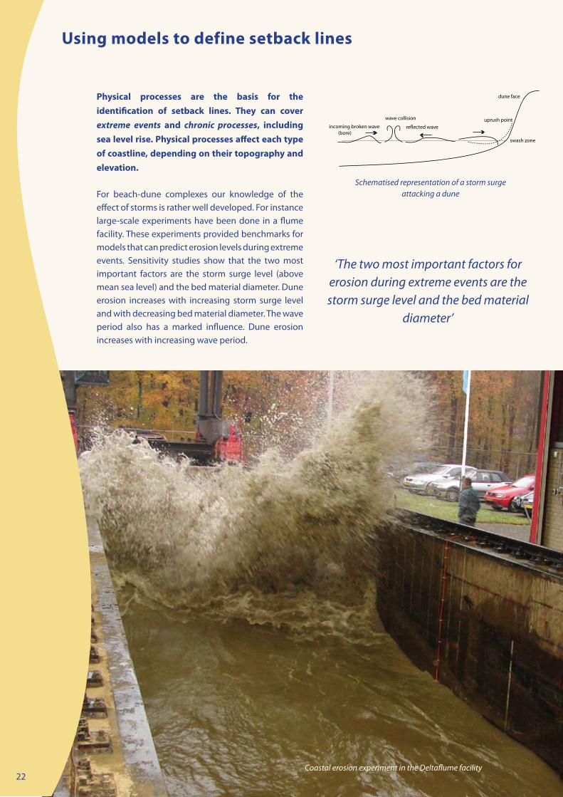
Physical processes are the basis for the identification of setback lines. They can cover extreme events and chronic processes, including sea level rise. Physical processes affect each type of coastline, depending on their topography and elevation.
For beach-dune complexes our knowledge of the effect of storms is rather well developed. For instance large-scale experiments have been done in a flume facility. These experiments provided benchmarks for models that can predict erosion levels during extreme events. Sensitivity studies show that the two most important factors are the storm surge level (above mean sea level) and the bed material diameter. Dune erosion increases with increasing storm surge level and with decreasing bed material diameter. The wave period also has a marked influence. Dune erosion increases with increasing wave period.
‘The two most important factors for erosion during extreme events are the storm surge level and the bed material
diameter’
Using models to define setback lines

23
0
50
100
150
200
250
300
350
0 0,5 1 1,5 2 2,5 3 3,5 4 4,5 5
Storm surge level above MSL (m)
)m/3
m( LSS evoba aera noisore enuD
0
5
10
15
20
25
30
35
)m( noissecer enu
D
d50=0.15 mmd50=0.2 mmd50=0.25 mmd50=0.3 mmd50=0.4 mmd50=0.5 mmd50=1 mm
Hs,o= 4 to 8 mTp=7 to 12 s
Dune erosion after 5 hours of a storm event as a function of sediment size (d50) and storm surge level;
dune recession based on dune height of 10 m above SSL
The graph below depicts the dune erosion area (above the storm surge level) after 5 hours as a function of sediment size and storm surge level based on the cross-shore model of Van Rijn [17]. What the figure shows is that dune erosion is very much dependent on the diameter of the sediment. Dune erosion rates are largest for relatively fine sediments and reduce rapidly for coarser sediments. Dune erosion of gravel (1 mm) is only 15% of that of fine sand (0.15 mm). What the figure also shows is that for a fine sandy dune 10 m high a severe storm will produce an erosion rate in the order of 30 m. With this kind of model output, risk lines can be developed such as those shown in the figure on page 21. For example, a North Sea storm with a surge level of 5 m above mean sea level has a return period of about 10,000 years (so on average once in 10,000 years). The return period of a surge level of only 2 m is 1 year; so, on average once every year. The computed dune erosion values are of the order of 20 m3/m for a surge level of 1 m and up to 300 m3/m for a large surge level of 5 m. To withstand an extreme event with surge level of 5 m above mean sea level, the dune row fronting the sea should have a minimum width in the order of 50 m.
We can also estimate whether or not the beach/dune complex will recover from chronic erosion. In ‘normal’ conditions with two or three events per year and surge levels between 1 and 2 m per year, the total annual dune erosion may be as large as 50 m3/m/year along sandy North Sea coasts. Most of the eroded dune sand will be deposited on the beach from where it can be returned to the dune front by wind-induced forces or carried away by cross-shore and longshore currents. Dune accretion at the dune front due to wind effects is in the order of 10 to 20 m3/m/year and is generally not sufficient to compensate dune erosion on the annual time scale. Thus, dune erosion generally leads to a permanent loss of sand which can only be compensated by artificial nourishment or dune reinforcement of the order of 50 m3/m/year.
Beach erosion during minor storm events with surge levels below 1 m is of the order of 10 to 20 m3/m per event. Beach build-up during daily fair-weather waves is in the order of 1 to 2 m3/m/day. Thus, beach erosion can easily be compensated for by natural processes on a time scale of weeks.
‘Beach erosion during minor storm events can easily be compensated for
by natural processes on a time scale of weeks’

24
The present day policy of holding the line is implemented by PCD in the following way:
gradual removal of about 140 relict groynes, • leaving only 10 groynes at locations with a significant change in beach orientation where they protect properties on top of the shingle barrier;annual renourishment of the beach using • shingle imported from offshore dredge sites (Hastings & Owers Banks); by-passing shingle round Sovereign • Harbour to the main beach;recycling shingle to depleted areas • (generally involving movement of shingle in lorries along the beach from east to west);re-profiling of beach to push shingle back • towards the barrier crest; andemergency response.•
There are several advantages of ‘outsourcing’ the management using a service level agreement instead of having the work done by the Environment Agency. First of all savings can be achieved compared to traditional procurement routes. The objectives are specified, not how they are achieved. In combination with the fixed price at which the objectives must be reached, this triggers the consortium to increase efficiency through innovation. Because PCD will be on the beach for 25 years, there is a unique opportunity to collect coastal data over a long time period and to try different methods that can potentially make the management of the beach more efficient, sustainable or more beneficial to the environment. A long term contract is attractive to research facilities as well, and Pevensey has already attracted a variety of research projects and will doubtlessly continue to do so in the future. Several innovations have been developed and tested, such as the use of car tyres as a substitute for beach material and modified 'rainbowing' of shingle nourishments on the beach.
The management of the Pevensey shingle barrier is a unique example of a public-private partner-ship. The shingle barrier beach at Pevensey Bay (East Sussex, UK) protects rare habitats, properties, roads and other assets from flooding and erosion. The beach is managed in an adaptive manner by a private consortium, Pevensey Coastal Defence Ltd. (PCD). Although managing flood risk is the responsibility of the Environment Agency (a government agency in the UK), it has contracted out the management of this barrier beach to the PCD for a period of 25 years to June 2025 as a pathfinder sea defence project in the form of a Public Private Partnership (PPP).
Pevensey Coastal Defence Ltd. is a consortium consisting of Westminster Dredging (provision of shingle), Dean & Dyball (Rock Works), Mackley Construction (Maintenance & Emergency Response) and the Mouchel Group (Design & Management).
PCD is contracted to maintain a 1 in 400 year standard of protection against breach. It has a secondary objective to prevent loss of crest top properties, although the standard of protection varies with the location of the properties.
‘The fixed price at which the objectives must be reached triggers
the consortium to increase efficiency through innovation’
Public-private partnerships in coastal erosion management: Pevensey shingle beach and barrier
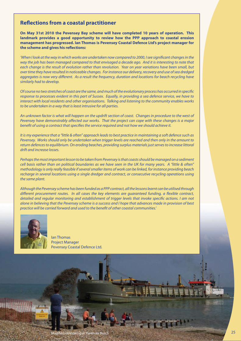
Modified rainbowing at Pevensey Beach 25
Reflections from a coastal practitioner
On May 31st 2010 the Pevensey Bay scheme will have completed 10 years of operation. This landmark provides a good opportunity to review how the PPP approach to coastal erosion management has progressed. Ian Thomas is Pevensey Coastal Defence Ltd’s project manager for the scheme and gives his reflections:
‘When I look at the way in which works are undertaken now compared to 2000, I see significant changes in the way the job has been managed compared to that envisaged a decade ago. And it is interesting to note that each change is the result of evolution rather than revolution. Year on year variations have been small, but over time they have resulted in noticeable changes. For instance our delivery, recovery and use of sea dredged aggregates is now very different. As a result the frequency, duration and locations for beach recycling have similarly had to develop.
Of course no two stretches of coast are the same, and much of the evolutionary process has occurred in specific response to processes evident in this part of Sussex. Equally, in providing a sea defence service, we have to interact with local residents and other organisations. Talking and listening to the community enables works to be undertaken in a way that is least intrusive for all parties.
An unknown factor is what will happen on the updrift section of coast. Changes in procedure to the west of Pevensey have demonstrably affected our works. That the project can cope with these changes is a major benefit of using a contract that specifies the service required and not how we should achieve it.
It is my experience that a “little & often” approach leads to best practice in maintaining a soft defence such as Pevensey. Works should only be undertaken when trigger levels are reached and then only in the amount to return defences to equilibrium. On eroding beaches, providing surplus materials just serves to increase littoral drift and increase losses.
Perhaps the most important lesson to be taken from Pevensey is that coasts should be managed on a sediment cell basis rather than on political boundaries as we have seen in the UK for many years. A “little & often” methodology is only really feasible if several smaller items of work can be linked, for instance providing beach recharge in several locations using a single dredger and contract, or consecutive recycling operations using the same plant.
Although the Pevensey scheme has been funded as a PPP contract, all the lessons learnt can be utilised through different procurement routes. In all cases the key elements are guaranteed funding, a flexible contract, detailed and regular monitoring and establishment of trigger levels that invoke specific actions. I am not alone in believing that the Pevensey scheme is a success and I hope that advances made in provision of best practice will be carried forward and used to the benefit of other coastal communities.’
Ian ThomasProject ManagerPevensey Coastal Defence Ltd.

26
Coastal erosion is a common feature along the Dutch sandy shorelines. Since 1990 a policy has been adopted that aims at controlling structural erosion mainly through sand nourishments. Although this policy has proven to be successful to keep the coastline at its 1990 position, there is increased concern with regard to the fate of the strategic sediment reserves in deeper water, in view of sea level rise, new claims for sand mining initiatives and construction of new harbours.
The Dutch coastline along the southeast part of the North sea is about 350 km long and consists of straight sandy beaches and various large-scale tidal inlet coasts. Large stretches of the coast have dunes that prevent the low lying hinterland (which in many places is below sea level) from being regularly flooded. Where dunes are absent, sea dikes have been constructed as a flood protection measure.
The application of the Frame of Reference to the Dutch coast is illustrated in the figure below and contains the following elements:
The Holland coast: a multi-scale management challenge

27
Definition sketch of three different management objectives: dune residual strength (days – metres); Basal Coast Line (years – kilometres) and Coastal foundation (decades to centuries – 10s to 100s of kilometres)
Strategic ObjectivesIn order to stop any further structural retreat of the coastline, in 1990 the Dutch Government adopted the national policy of Dynamic Preservation. The strategic objective of this policy is: a sustainable safety level and sustainable preservation of values and functions in the dune area. This objective was translated into the tactical objective to maintain the coast line at its 1990 position. Considering that morphological developments at larger scales (e.g. sand losses at larger depths and long term developments like seal level rise) are neglected, in 1995 the Dutch Government decided on an extended large-scale approach: additional compensation of sand losses at deeper water. The recent National Spatial Strategy (2004) reconfirmed the strategic objective of the large-scale coastal policy in the Netherlands, rephrasing it as: to guarantee safety against flooding and to preserve spatial quality of the coastal zone. As an additional large-scale tactical objective, the Strategy defined the preservation and improvement of the Coastal Foundation: the area between dunes and the –20 m depth contour. The Coastal Foundation is a new large-scale coastal state indicator acknowledging sand as ‘the carrier of all functions’.
In fact the coastal policy of Dynamic Preservation aims to maintain morphological boundary conditions proportional to changing hydrodynamic boundary conditions; as such the objective has been described recently as “growing with sea level”. In this way, safety against flooding of the predominantly sandy coast – the primary concern of coastal policy in the Netherlands – can be guaranteed in a sustainable way.
Tactical ObjectivesStrategic coastal policy objectives have been translated into tactical management objectives at three different scales
Guarantee • residual dune strengthMaintain coastline position of 1990 • (basal coast line)Preserve and improve • coastal foundation
The basic idea behind the distinction into different management scales is that the large scale provides boundary conditions for the smaller scales. The minimum requirement of the dune strength creates boundary conditions for safety against flooding in any place at any time. The maintenance of the Basal Coast Line (BCL) creates boundary conditions for the assurance of the dune rest strength over a period of (10) years and alongshore distances of kilometres. The preservation of the Coastal Foundation in turn creates boundary conditions for maintenance of the BCL over decades to centuries and over alongshore distances of 10s to 100s of kilometres.
The basic idea behind the distinction into different management scales is
that the large scale provides boundary conditions for the smaller scales’

28
Since coastal erosion is occurring on a European wide scale and in many cases has a transboundary character, it is legitimate to ask ourselves in what way can EU policies and Directives help manage coastal erosion. In this respect it is rather disappointing that there is a lack of European legal requirement concerning coastal erosion management.
The existing Directives on floods, water and sea and draft Soil Directive do not address the coastal erosion problem as one of the issues to be solved from a European perspective. Furthermore, the EU policy regarding ICZM has the status of a Recommendation only. Member States were encouraged to develop and publish coastal strategies by 2006 under the EU Recommendation on ICZM. Although policies for the EU’s coasts have a long history they have not been implemented in an integrated manner so far [18]. Being a Recommendation only, countries are not obliged to implement ICZM. The lack of a Directive for ICZM reflects the complexity of socioeconomic issues involved in coastal land use, differences in legal systems across Member States and the difficulty of defining acceptable management strategies for the different residents, users and interest groups involved with the coastal region [19].
Nevertheless, in the implementation of these policies and directives, elements for managing coastal erosion could be included after all. Member states that have signed the Mediterranean ICZM Protocol (Spain, France, Italy, Slovenia, Greece, Malta and Cyprus) have committed themselves to undertake the necessary measures to mitigate the impact of coastal erosion (see box).
ICZM Mediterranean ProtocolArticle 23 COASTAL EROSION
"In conformity with the objectives and principles set out in Articles 5 and 6 of this Protocol, the Parties, with a view to preventing and mitigating the negative impact of coastal erosion more effectively, undertake to adopt the necessary measures to maintain or restore the natural capacity of the coast to adapt to changes, including those caused by the rise in sea levels.
The Parties, when considering new activities and works located in the coastal zone including marine structures and coastal defence works, shall take particular account of their negative effects on coastal erosion and the direct and indirect costs that may result. In respect of existing activities and structures, the Parties should adopt measures to minimize their effects on coastal erosion.
The Parties shall endeavour to anticipate the impacts of coastal erosion through the integrated management of activities, including adoption of special measures for coastal sediments and coastal works.
The Parties undertake to share scientific data that may improve knowledge on the state, development and impacts of coastal erosion."
‘The existing Directives on floods, water and sea do not address the coastal
erosion problem’
How can EU policies and Directives help manage coastal erosion?

29
ICZM recommendation (2002)The EU ICZM Recommendation is a guiding policy for implementing sustainable erosion management. The recommendation stresses the fact that coastal zones are threatened by the effects of climate change, in particular rising sea levels, changes in storm frequency and strength, and increased coastal erosion and flooding. Working with natural processes and respecting the carrying capacity of ecosystems are also basic principles for protection strategies.
Marine Strategy Framework DirectiveThe EU Marine Strategy Framework Directive, which was adopted in June 2008, provides an opportunity to frame sustainable erosion management practices within a wider marine spatial planning system thereby ensuring a consistent approach to issues such as monitoring. The Marine Strategy does not explicitly address the issue of coastal erosion, but could pose restrictions to measures for erosion control, if these affect the good environmental status of the marine environment. Especially the designation of strategic sediment reservoirs should be taken up as an important component of marine planning.
Inspire Directive The Inspire Directive, approved in 2007, aims to establish an infrastructure for spatial information (SDI) for Europe. The European SDI is going to be the common framework and standard for spatial data flow, including technologies, datasets, metadata and services. The INSPIRE Directive should support the standardised delineation of coastal sediment cells by incorporating key input datasets required for such a delineation into Spatial Data Infrastructure (SDI) standards being established under the terms of the Directive. Also the preparation of setback lines should be adapted to the requirements of this Directive.
Floods DirectiveThe objective of the Floods Directive on the Assessment and Management of Flood Risks (2007/60/EC) is to reduce and manage flood-related risks to human health, the environment, infrastructure and property. This Directive is closely related to the Water Framework Directive (WFD), and its implementation will be coordinated with River Basin Districts under the WFD. The Directive provides for the drafting of flood risk maps and management plans. Within these plans, coastal erosion should be recognised as an important factor in coastal flooding.
EU Thematic Strategy on SoilsAlthough the EU Thematic Strategy on Soils, approved in 2006, acknowledges the importance of soil protection since soil functions contribute to coastal management, there is no explicit reference in the Strategy to the problem of coastal erosion. In the implementation of the strategy it is therefore recommended to recognise the contribution of river catchments to the sediment budget and sediment quality within the coastal sediment cell. The preparation of coastal erosion risk maps and provision of guidelines for the integration of soil concerns into spatial planning through the identification of strategic sediment reservoirs should be promoted.
EU Thematic Strategy on the Urban EnvironmentThe Thematic Strategy on the Urban Environment has the objective of ‘contributing to a better quality of life through an integrated approach concentrating on urban areas’ and to contribute ‘to a high level of quality of life and social well-being for citizens by providing an environment where the level of pollution does not give rise to harmful effects on human health and the environment and by encouraging sustainable urban development’. For many cities in Europe that are located in the coastal zone it would be wise to take account of coastal erosion. Within this context the need to make spatial allocations for ‘strategic sediment reserves’ should be recognised in urban planning strategies for coastal zones vulnerable to erosion. From a resilience point of view sediment reservoirs can be combined with setback zones along the shoreline.
Natura 2000The extent to which Natura 2000 sites are currently used as sources to supply sediments to compensate chronic deficits of sediments as a result of human intervention should be monitored. It will also be important to consider the effect of allowing the natural dynamic to operate (particularly in realignment schemes) within these sites as this can lead to the replacement of one habitat by another with a potential loss of Favourable Conservation Status in the habitat which is replaced. The way this is approached needs to be considered and guidance given by the Commission.

30
In this report we have presented the Frame of Reference as a method for streamlining coastal erosion management. We have also seen that the Frame of Reference can be used as a guidance for applying the EUROSION concepts for making erosion management more sustainable.
Although the steps in this Frame are logical and rational, the practice of erosion management shows that many of them are omitted or remain implicit. Often measures are taken without an explicit strategic objective. Coastal state indicators are often not monitored regularly and evaluations are seldom performed. This hampers an effective and sustainable solution to the problem. It also makes erosion control practices less transparent and thus difficult to engage stakeholders in the decision-making process. We have also concluded that the EUROSION recommendations have not yet been implemented at EU and National levels.
We have formulated recommendations for end users at three different levels: the policy makers at EU level, decision makers at national (Member State) level and coastal practitioners at local and regional level. At the EU level there are many potential policy areas where the EUROSION concepts can be taken forward and made more operational. Member States on their turn should set clear objectives for coastal erosion management – if not done yet – and provide sufficient budget for monitoring and interventions. And coastal practitioners at local level have a task in implementing the EUROSION concepts, monitoring and taking actions if necessary.
At EU level we propose the following recommendations:
Promoting the use of the Inspire Directive • to support the standardized delineation of coastal sediment cells by incorporating key input datasets required for such delineation into Spatial Data Infrastructure standards being established under the terms of the Directive. Promoting the designation of strategic • sediment reservoirs in marine planning by Member States under the Marine Strategy Framework Directive and in the spirit of the Soil Strategy.Promoting the use of setback lines in urban • areas by Member States under the Thematic Strategy on the Urban Environment. Promoting a consistent approach to the • monitoring of coastal erosion, which will require cooperation between adjoining coastal Member States.
At national Member States level we recommend that:
Coastal erosion policies be formulated at • national level, both for the short (event) and long (climate change) time scale.Member States use the four basic steps • of the Frame of Reference (defining the quantitative state, benchmarking, intervention and evaluation) for implementing the policy at regional or local level.Member States should make effective • arrangements with respect to the budgetary requirements of coastal erosion management. Accountability of actions that are detrimental to the favourable sediment status should be part of such arrangements. The effectiveness of public private partnerships under service level agreements should be explored.
For the coastal practitioner we recommend to: Formulate CSIs in order to enable • benchmarking and monitoring. Use the EUROSION concepts as guidance for • making the steps of the Frame of Reference operational.
‘The Frame of Reference can be used as a guidance for applying the EUROSION
concepts for making erosion management more sustainable’
The way forward

31
Eurosion (2004). 1. Living with coastal erosion in Europe: Sediment and Space for Sustainability. A guide to coastal erosion management practices in Europe. Brussels. Directorate General Environment. European Commission.Mangor, K. (2004). 2. Shoreline Management Guidelines. DHI Water and Environment, 294 pp.Nicholls, M.M.,1989. 3. Sediment accumulation rates and relative sea-level rise in lagoons. Marine Geology 88 201-219..Beets, D.J., A.J.F. van der Spek, 2000. 4. The Holocene evolution of the barrier and back-barrier basins of Belgium and the Netherlands as a function of late Weichselian morphology, relative sea-level rise and sediment supply. Geologie en Mijnbouw/Netherlands Journal of Geosciences 79 (1) 3-16.Valentin, H. (1952). 5. Die kuste der Erde. Petermanns Geographische Mitteilungen Erganzsungheft 246. Taussik, J., Ballinger, R., Ball, I., Carter, D., & Wilson, R. (2006). 6. Adapting to changing coastlines and rivers: developing a broader portfolio of options to deliver flooding and coastal solutions. Marine and Coastal Environment Research Group and Cardiff University. Making Space for Water: Strand SD2 taking forward a new Government strategy for flood and coastal erosion risk management. IPCC. (2007). 7. Climate 2007 - Fourth Assessment Report of the United Nations Intergovernmental Panel for Climate Change. Alcamo, J., Moreno, J.M., Nováky, B., Bindi, M., Corobov, 8. R., Devoy, R.J.N., Giannakopoulos, C., Martin, E., Olesen, J.E. & Shvidenko, A. (2007). Climate Change 2007: Impacts, Adaptation and Vulnerability: Europe. Contribution of Working Group II to the Fourth Assessment Report of the Intergovernmental Panel on Climate Change; Parry, M.L., Canziani, O.F., Palutikof, J.P., van der Linden, P.J. & Hanson, C.E. (Eds.). Cambridge University Press, Cambridge, UK. (p. 543)
9. Leont’yev, I.O. (2003). Modelling erosion of sedimentary coasts in the Western Russian Arctic. Coastal Engineering, 47, 413-429.
10. King, D.A. (2004) Climate change science: adapt, mitigate, or ignore? Science, 303, 176-177.
11. Klein, R.J.T. , Smit, M.J. , Goosen, H., & Hulsbergen, C.H. (1998). Resilience and vulnerability: coastal dynamics or Dutch dykes? The Geographic Journal, Vol. 164, No. 3. pp. 259-268.
12. EU (2002). Recommendation of the European Parliament and of the Council of 30 May 2002 concerning the implementation of Integrated Coastal Zone Management in Europe. (2002/413/EC) Official Journal of the European Communities, 6-6-2002.
13. Van Koningsveld , M. (2003). Matching specialist knowledge with end user needs. PhD Thesis, University of Twente.
14. Defra (2006). Shoreline Management Plan Guidance. March 2006, published in two volumes. www.defra.gov.uk.
15. Jimenez, J. & Van Koningsveld, M. (2002). Coastal state indicators. A bridge between coastal science and coastal management. COASTVIEW-EU Mast project no. EVK3-CT-2001-0054. Initial report on coastal state indicators. (available from: www.thecoastviewproject.org).
16. Winckel, P.R., J.K. Vrijling & J. van de Graaff (2007). Developing a building policy for the erosion zone. Solutions to some key (Dutch) questions. Coastal Engineering 55. pp. 79-92.
17. Van Rijn, L. (2008). Modelling of beach and dune erosion. Report Z4173/Z4230 Delft Hydraulics. Delft.
18. EEA (2006). The changing faces of Europe’s coastal areas. European Environment Agency, Copenhagen.
19. Vermaat, J.E., Ledoux, L., Turner, K., Salomons, W., & Bouwer, L. Eds. (2005). Managing European Coast: Past, Present and Future. Springer, Berlin. 387 pp.
References
32
Coastal Union
EUCC
The CONSCIENCE project was a collaboration between 8 European institutes and organisations. It was co-ordinated by Deltares, the Netherlands and was executed from 1st of March, 2007 till 31st of May, 2010.
Deltares, Delft, the Netherlands• EUCC Mediterranean Centre, Barcelona, Spain• Coastal & Marine Resources Centre, National University of Ireland , Cork, Ireland• International Centre for Coastal Resources Research (CIIRC), Polytechnic University of Catalonia, • Barcelona, SpainHR Wallingford Ltd, Wallingford, United Kingdom• National Institute for Marine Geology and Geo-ecology (GEOECOMAR), Bucharest, Romania• Institute of Hydroengineering, Polish Academy of Sciences, Gdansk, Poland• Priority Actions Programme Regional Activity Centre (PAP/RAC), Split, Croatia•
www.conscience-eu.net
Partners