Embed Size (px)
Citation preview
EAGLE RIVER
Vilas County, Wisconsin
City of
2013-2033 COMPREHENSIVE PLAN
July 9, 2013 Updated: January 10, 2017 Ordinance 548

Intentionally blank
PREFACE
i 2013-2033 COMPREHENSIVE PLAN
Insert Adoption Ordinance

PREFACE
ii 2013-2033 COMPREHENSIVE PLAN
PREFACE
iii 2013-2033 COMPREHENSIVE PLAN
Plan Amendments This plan may be amended in the years between major updates (see Section 4.4 Plan Adoption and Amendment Procedures). Amendments should be noted here. AMENDMENT DATE PAGE # DESCRIPTION

PREFACE
iv 2013-2033 COMPREHENSIVE PLAN
PREFACE
v 2013-2033 COMPREHENSIVE PLAN
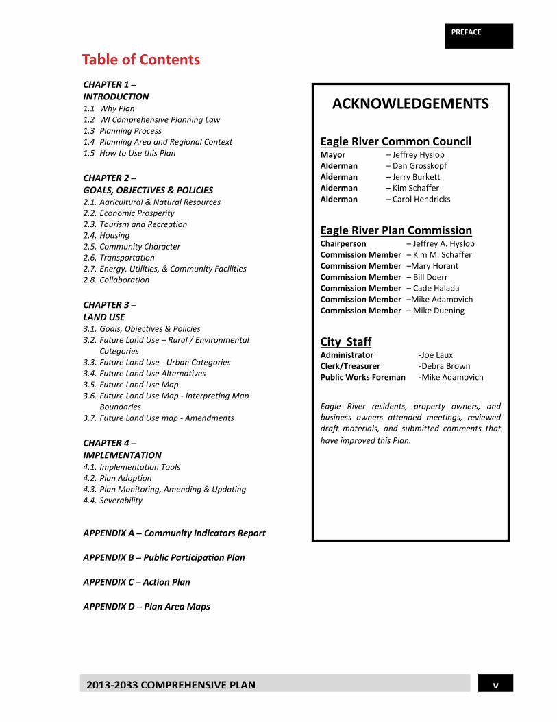
Table of Contents
ACKNOWLEDGEMENTS
Eagle River Common Council Mayor – Jeffrey Hyslop Alderman – Dan Grosskopf Alderman – Jerry Burkett Alderman – Kim Schaffer Alderman – Carol Hendricks
Eagle River Plan Commission Chairperson – Jeffrey A. Hyslop Commission Member – Kim M. Schaffer Commission Member –Mary Horant Commission Member – Bill Doerr Commission Member – Cade Halada Commission Member –Mike Adamovich Commission Member – Mike Duening
City Staff Administrator -Joe Laux Clerk/Treasurer -Debra Brown Public Works Foreman -Mike Adamovich
Eagle River residents, property owners, and business owners attended meetings, reviewed draft materials, and submitted comments that have improved this Plan.
CHAPTER 1 – INTRODUCTION 1.1 Why Plan 1.2 WI Comprehensive Planning Law 1.3 Planning Process 1.4 Planning Area and Regional Context 1.5 How to Use this Plan CHAPTER 2 – GOALS, OBJECTIVES & POLICIES 2.1. Agricultural & Natural Resources 2.2. Economic Prosperity 2.3. Tourism and Recreation 2.4. Housing 2.5. Community Character 2.6. Transportation 2.7. Energy, Utilities, & Community Facilities 2.8. Collaboration CHAPTER 3 – LAND USE 3.1. Goals, Objectives & Policies 3.2. Future Land Use – Rural / Environmental
Categories 3.3. Future Land Use - Urban Categories 3.4. Future Land Use Alternatives 3.5. Future Land Use Map 3.6. Future Land Use Map - Interpreting Map
Boundaries 3.7. Future Land Use map - Amendments CHAPTER 4 – IMPLEMENTATION 4.1. Implementation Tools 4.2. Plan Adoption 4.3. Plan Monitoring, Amending & Updating 4.4. Severability APPENDIX A – Community Indicators Report APPENDIX B – Public Participation Plan APPENDIX C – Action Plan APPENDIX D – Plan Area Maps

PREFACE
vi 2013-2033 COMPREHENSIVE PLAN
1-1 2011-2031 COMPREHENSIVE PLAN
1.1 Why Plan?
The purpose of this plan is to establish a shared vision for the future of the City that will guide future actions and decisions. This guidance provides predictability and consistency over time, which encourages investment.
1.2 Wisconsin Comprehensive Planning Law Wisconsin’s “Smart Growth” planning law [s. 66.1001 Wis. Stats.] was adopted in October of 1999. The law requires that, beginning January 1, 2010, if a local government unit enacts or amends any of the following ordinances, the ordinance must be consistent with that local governmental unit’s comprehensive plan: Official mapping established or amended under s. 62.23 (6) Local subdivision regulations under s. 236.45 or 236.46 County zoning ordinances enacted or amended under s. 59.69 City zoning ordinances enacted or amended under s. 62.23 (7) Zoning of shore lands or wetlands in shore lands under s. 59.692, 61.351 or 62.231
The law defines a Comprehensive Plan as containing nine required elements:
1. Issues and Opportunities (the content of this element as described in s. 66.1001 is incorporated within the other planning elements within this plan)
2. Housing 3. Transportation (also termed “Mobility” within this plan) 4. Utilities and Community Facilities (also including the term “Energy” within this plan) 5. Agricultural, Natural and Cultural Resources (Cultural Resources also termed “Community
Character” within this plan) 6. Economic Development (also termed “Economic Prosperity” within this plan) 7. Intergovernmental Cooperation (also termed “Collaboration” within this plan) 8. Land Use 9. Implementation
Introduction Why Plan? .................................................................................... Pg. 1-1 Wisconsin Comprehensive Planning Law .................................... Pg. 1-1 Required Comprehensive Planning Goals …………………..….……….Pg. 1-2 Planning Process .......................................................................... Pg. 1-2 Planning Area and Regional Context ........................................... Pg. 1-3 How to Use this Plan ................................................................... Pg. 1-4
CHAPTER 1
Introduction
1-2 2013-2033 COMPREHENSIVE PLAN
CHAPTER 1
1.3 Required Comprehensive Planning Goals ~ Planning Grant Recipients Listed below are the fourteen local comprehensive planning goals as described in s. 16.965(4), Wis.Stats. All communities who receive grant funds from the Wisconsin Department of Administration (WIDOA) to complete a comprehensive plan must address these fourteen goals. The City of Eagle River did receive WIDOA funds and the content of this plan compliments these fourteen goals.
1. Promotion of the redevelopment of lands with existing infrastructure and public services and the
maintenance and rehabilitation of existing residential, commercial and industrial structures.
2. Encouragement of neighborhood designs that support a range of transportation choices.
3. Protection of natural areas, including wetlands, wildlife habitats, lakes, woodlands, opens spaces and groundwater resources.
4. Protection of economically productive areas, including farmland and forests.
5. Encouragement of land uses, densities and regulations that promote efficient development patterns and relatively low municipal, state governmental and utility costs.
6. Preservation of cultural, historic and archaeological sites.
7. Encouragement of coordination and cooperation among nearby units of government.
8. Building of community identity by revitalizing main streets and enforcing design standards.
9. Providing an adequate supply of affordable housing for individuals of all income levels throughout each community.
10. Providing adequate infrastructure and public services and an adequate supply of developable land to meet existing and future market demand for residential, commercial and industrial uses.
11. Promoting the expansion or stabilization of the current economic base and the creation of a range of employment opportunities at the state, regional and local levels.
12. Balancing individual property rights with community interests and goals.
13. Planning and development of land uses that create or preserve varied and unique urban and rural communities.
14. Providing an integrated, efficient and economical transportation system that affords mobility, convenience and safety and that meets the needs of all citizens, including transit–dependent and disabled citizens
1.4 Planning Process As required by SS 66.1001, every community must adopt a public participation plan at the beginning of the planning process. The purpose of the public participation plan is to define procedures for public involvement during every stage of the planning process (See Appendix B for the complete Public Participation Plan).
Introduction
1-3 2013-2033 COMPREHENSIVE PLAN
CHAPTER 1
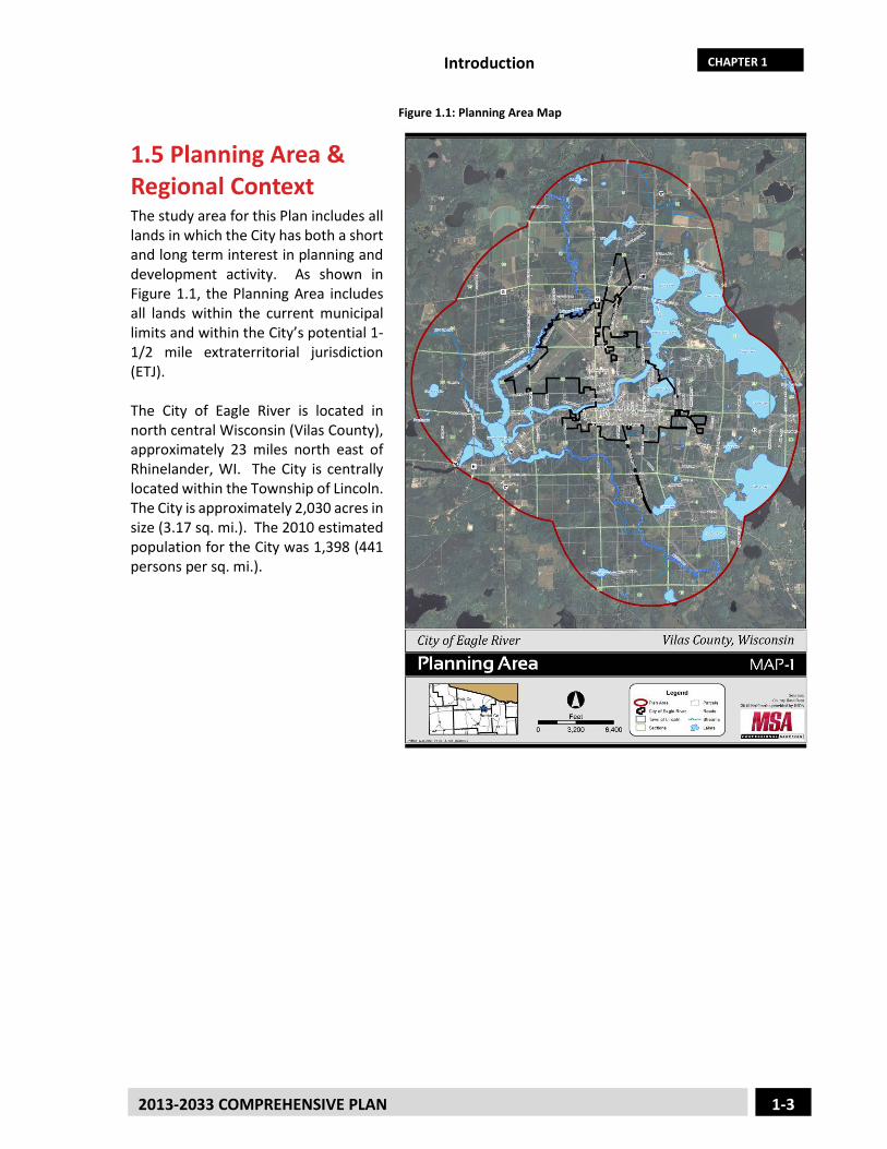
Figure 1.1: Planning Area Map
1.5 Planning Area & Regional Context The study area for this Plan includes all lands in which the City has both a short and long term interest in planning and development activity. As shown in Figure 1.1, the Planning Area includes all lands within the current municipal limits and within the City’s potential 1-1/2 mile extraterritorial jurisdiction (ETJ). The City of Eagle River is located in north central Wisconsin (Vilas County), approximately 23 miles north east of Rhinelander, WI. The City is centrally located within the Township of Lincoln. The City is approximately 2,030 acres in size (3.17 sq. mi.). The 2010 estimated population for the City was 1,398 (441 persons per sq. mi.).
Introduction
1-4 2013-2033 COMPREHENSIVE PLAN
CHAPTER 1
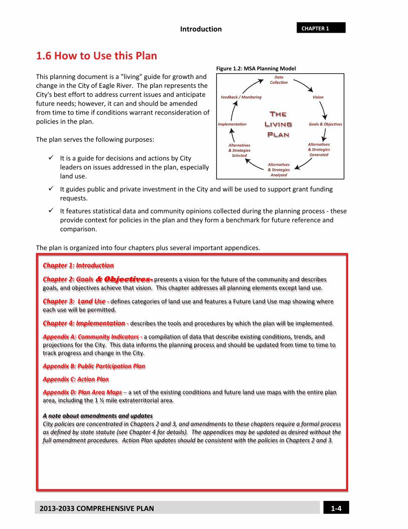
1.6 How to Use this Plan Figure 1.2: MSA Planning Model
This planning document is a "living" guide for growth and change in the City of Eagle River. The plan represents the City's best effort to address current issues and anticipate future needs; however, it can and should be amended from time to time if conditions warrant reconsideration of policies in the plan. The plan serves the following purposes: It is a guide for decisions and actions by City
leaders on issues addressed in the plan, especially land use.
It guides public and private investment in the City and will be used to support grant funding requests.
It features statistical data and community opinions collected during the planning process - these provide context for policies in the plan and they form a benchmark for future reference and comparison.
The plan is organized into four chapters plus several important appendices.
Chapter 1: Introduction
Chapter 2: Goals & Objectives- presents a vision for the future of the community and describes goals, and objectives achieve that vision. This chapter addresses all planning elements except land use.
Chapter 3: Land Use - defines categories of land use and features a Future Land Use map showing where each use will be permitted.
Chapter 4: Implementation - describes the tools and procedures by which the plan will be implemented.
Appendix A: Community Indicators - a compilation of data that describe existing conditions, trends, and projections for the City. This data informs the planning process and should be updated from time to time to track progress and change in the City.
Appendix B: Public Participation Plan
Appendix C: Action Plan
Appendix D: Plan Area Maps – a set of the existing conditions and future land use maps with the entire plan area, including the 1 ½ mile extraterritorial area. A note about amendments and updates City policies are concentrated in Chapters 2 and 3, and amendments to these chapters require a formal process as defined by state statute (see Chapter 4 for details). The appendices may be updated as desired without the full amendment procedures. Action Plan updates should be consistent with the policies in Chapters 2 and 3.
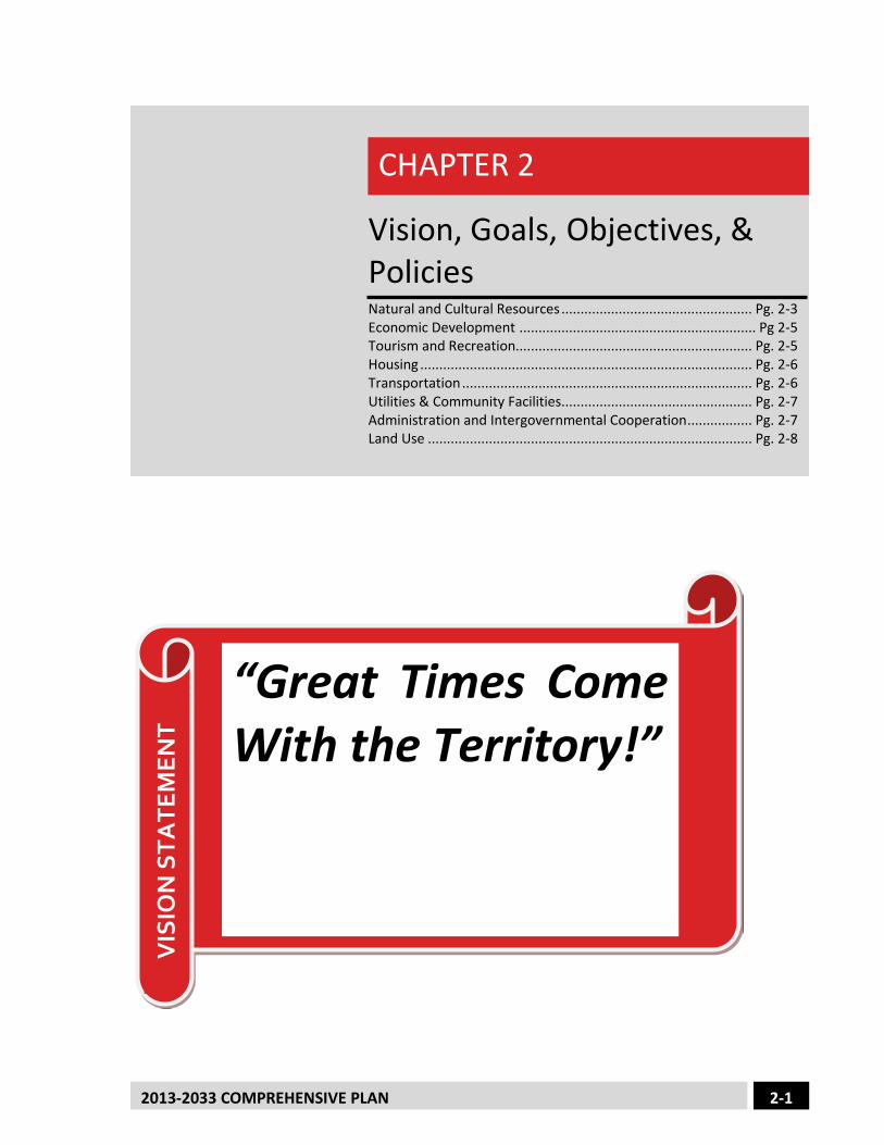
2-1 2013-2033 COMPREHENSIVE PLAN
Vision, Goals, Objectives, & Policies
Natural and Cultural Resources .................................................. Pg. 2-3 Economic Development .............................................................. Pg 2-5 Tourism and Recreation.............................................................. Pg. 2-5 Housing ....................................................................................... Pg. 2-6 Transportation ............................................................................ Pg. 2-6 Utilities & Community Facilities.................................................. Pg. 2-7 Administration and Intergovernmental Cooperation ................. Pg. 2-7 Land Use ..................................................................................... Pg. 2-8
CHAPTER 2
VIS
ION
STA
TEM
ENT
“Great Times Come With the Territory!”
Goals and Objectives
CHAPTER 2
2-2 2013-2033 COMPREHENSIVE PLAN
Each element of the comprehensive plan contains goals, objectives, and policies established during the planning process based on public input and the information contained in Appendix A: Community Indicators. This section defines goals, objectives and policies, as follows: Goal: A goal is a long-term target that states what the community wants to accomplish. Written in general terms, the statement offers a desired condition. Objective: An objective is a statement that identifies a course of action to achieve a goal. They are more specific than goals and are usually attainable through planning and implementation activities.

Goals and Objectives
CHAPTER 2
2-3 2013-2033 COMPREHENSIVE PLAN
2.1 Natural and Cultural Resources
Objectives: 1. Consider structural development in environmentally sensitive areas such as wetlands, floodplains,
lowlands, waterfront and steep slopes. 2. Promote the use of city sewer and water systems wherever possible and practical. 3. Consider assisting lake associations with Aquatic Invasive Species management and other assistance. 4. Assess development impacts on public well water sources to protect wellhead areas from
contamination.
5. Cultural Resources Eagle River has a long history and a bright future which is enhanced by features that attract visitors and provide residents a quality of life. These cultural resources are important selling points which help to bring new residents to the area. They foster growth and aid the economy. We recognize that we must be open to additions and revisions, but at the same time, strive to maintain the cultural character of our city. The following cultural resources fit into this plan for the years ahead. 1. Library Continue support of the Olson Memorial Library and its expansion. 2. Schools Cooperate with the aims of the Northland Pines District. Encourage other types of education including Nicolet College classes, YMCA availability and other types of formal education such as church schools and early childhood facilities. 3. Museums Foster the continuance and development of museums - presently the Northwood’s Children=s Museum, the Eagle River Historical Society and the World Snowmobile Headquarters. 4. Parks Continue maintaining and improving the parks, including the Eagle River Golf Course and Silver Lake Beach, Miller Park, Riverview Park and the park area behind City Hall. The Vilas County Fairgrounds (owned by Vilas County) and the World Championship Snowmobile Derby (under private ownership) are facilities which offer a place to hold events that greatly benefit the area with increased tourism.
Maintain and enhance the aesthetic quality of life consistent with the Northwood’s Character.
GO
AL
Goals and Objectives
CHAPTER 2
2-4 2013-2033 COMPREHENSIVE PLAN
5. Hospital Support the Eagle River Memorial Hospital and its services which are so important to the community. 6. Churches and Service Clubs The city offers a large selection of churches which help to meet special needs of the area such as the Vilas Food Pantry and Northwood’s Share. The Service Clubs make large contributions to the welfare of the city and its residents. 7. History Recognize the importance of Trees for Tomorrow for its educational and historical aspects. Encourage the preservation of historical buildings and the character of the downtown area. 8. Events Continue support of festivals and events which attract visitors to Eagle River such as Cranberry Fest, Performing Arts Concert Series, Paul Bunyan Fest, 4th of July Parade, Street Dances and many other sponsored events. 9. Sports Hockey represents an important activity with skating events centered at the Eagle River Hockey Arena. USA Hockey, Pond Hockey Championship is a more recent competition bringing in participants from miles away. Other sports which play an important role in past and recent history are fishing and other water sports, snowmobiling, cross country skiing, golfing, biking, hunting and other team sports such as baseball and soccer. We are recognized as the following: - Snowmobile Capital of the World 7 - Home of Wisconsin Hockey Hall of Fame - The Hockey Capital of Wisconsin J - World=s Largest Chain of 28 Connected Lakes For the physical and mental health of the community these activities should be encouraged. We need to examine and encourage new opportunities for cultural development which maintain the character of the city. However, it is necessary to limit additional tax-exempt property. We must make use of Apayment in lieu of taxes@ to eliminate additional burden on taxpayers. Eagle River should be grateful for, and protective of, these cultural resources which we have inherited from the past to protect for the future.
Goals and Objectives
CHAPTER 2
2-5 2013-2033 COMPREHENSIVE PLAN
2.2 Economic Development
Objectives:
1. Encourage new opportunities for local employment of Eagle River citizens. 2. Explore possibilities to increase and support commercial business, tourism related business, and
light industrial growth within the planned commercial areas. 3. Encourage business and light industrial development which strengthens and diversifies the
economic base; creates family wage jobs; develops and operates in a manner that protects the environment; and uses our natural resources efficiently.
4. Accommodate home-based businesses which do not significantly increase traffic, noise and odor or detract from the character of the surrounding area.
5. Consider opportunities to work with economic development activities with the local Chamber of Commerce, Eagle River Revitalization Program/Main Street Program, Wisconsin Economic Development Corporation, Vilas County Economic Development Corporation, Grow North and other applicable agencies and organizations that are involved in growth management.
6. Assess and evaluate each expansion request of the City limits through annexation. 7. Increase land acreage available for business development in Eagle River.
2.3 Tourism and Recreation
Objectives: 1. Promote common sense regulations to coordinate the use, access, and opportunity of land or water
recreational vehicles. 2. Consider enhancing recreational facilities that provide multi-use recreation opportunities.
Maintain, enhance and diversify the local economy.
GO
AL 1
Enhance and develop year-round recreational opportunities in the City of Eagle River while minimizing user conflicts.
GO
AL
Goals and Objectives
CHAPTER 2
2-6 2013-2033 COMPREHENSIVE PLAN
3. Maintain participation in the Vilas County Comprehensive Outdoor Recreation Plan to direct improvement projects and maintain eligibility to compete for WDNR recreational program and facility grants.
4. Support existing and work toward providing additional snowmobile, hiking, skiing and biking trails. 5. Explore opportunities to develop integrated, multi-use trail systems. 6. Encourage connection of multi-use trails to other Vilas County communities, if possible. 7. Pursue state and federal funding programs which can aid in the development and acquisition of parks,
trails, scenic and environmentally significant areas. 8. Recognize the need to accommodate all age groups and abilities in recreational pursuits. 9. Evaluate the need, conditions, and maintenance requirements of public access to waterways. 10. Continue to work with, support and cooperate with service clubs and organizations related to the
maintenance and development of recreational facilities and activities.
2.4 Housing
Objectives: 1. Encourage the conservation and improvements in the quality of existing housing and development of
available lots. 2. Continue to pursue housing block grants or similar programs.
2.6 Transportation
Objectives: 1. Utilize road standards for public and private roads in accordance with existing city standards. 2. Consider access controls in accordance with specific planned uses along roadways. 3. Develop and maintain a road plan to address long-term needs for road upgrades and new roads,
including where possible parallel pathways for alternative forms of transportation, e.g., bicycle, pedestrian, snowmobile, slow moving vehicles and transportation for the disabled.
4. Reserve adequate right-of-way for future road linkage. 5. Identify roads and highways by function.
Develop land use plans that guide the location, use and density of existing and future housing development.
GO
AL 1
Provide and maintain a safe, reliable transportation network
GO
AL 1
Goals and Objectives
CHAPTER 2
2-7 2013-2033 COMPREHENSIVE PLAN
6. Assess and integrate local, state and regional road or transportation plans. 7. Participate in the review for public transportation with on-going regional efforts. 8. Maintain airport safety standards in accordance with Federal Airport Administration and Department
of Transportation regulations.
2.7 Infrastructure, Utilities & Community Facilities
Objective: 1. Develop overall comprehensive facility planning documents that will be updated and reviewed on an
ongoing basis to meet the overall infrastructure needs of the community for current and future service and economic development purposes. a. Capacity, Management, Operations & Maintenance (CMOM) Comprehensive Plan for the Sanitary
Sewer Plant, Lift Stations and conveyance system (completed/updated January 2017). b. Capital Improvement Plan for the Public Streets and right of way to safely and efficiently move
traffic and economic activity throughout the community and connecting the community to the region (completed/updated January 2017).
c. Storm Water Management Plan for the community to manage and control storm water runoff issues for Eagle River’s neighborhoods and environment (completed/updated January 2017).
d. Water Facility Plan to provide safe and reliable potable drinking water to Eagle River homes and businesses within the community. The plan also addresses maintaining proper water pressures throughout the community to ensure Fire Flow demand is met for Fire protection purposes (completed/updated January 2017).
e. Electric Facility Plan to provide reliable electricity needs to the residents and businesses within the City of Eagle River including future load growth as the community grows (completed/updated January 2017).
2. Develop associated cost estimates for the planning documents and seek grants/aids to assist with implementing the plans.
Guide future development of infrastructure, utilities and community facilities in accordance with the Comprehensive Land Use Plan.
GO
AL
Goals and Objectives
CHAPTER 2
2-8 2013-2033 COMPREHENSIVE PLAN
2.8 Administration and Intergovernmental Cooperation
Objectives: 1. Encourage Vilas County to create sewer only zones in areas that have sanitary sewer available to the
property within the Eagle River extraterritorial planning area. 2. Cooperate with the Town of Lincoln to develop a mutually beneficial boundary agreement with the
City of Eagle River to encourage sustained growth in the border areas. 3. Seek and establish mutually beneficial intergovernmental relations. 4. Continue to cooperatively provide services for the library, airport, fire, landfill, combating Aquatic
Invasive Species, old landfill, buoy placement etc.
2.9 Land Use
Objectives: 1. Plan for future residential, light industrial, commercial, urban forestry, recreation conservancy and
other uses in accordance with public input. 2. Recommend development patterns. 3. Guide future development for compatibility. 4. Develop a future land use map for the future potential land uses considering existing use, economic
conditions, location and density over the next 20 years.
Strengthen local control of land use decisions.
GO
AL 1
Guide future development and redevelopment of both public and private property.
GO
AL 1
3-1 2013-2033 COMPREHENSIVE PLAN
As part of the Comprehensive Planning Process the City of Eagle River is required to provide an existing Land Use Plan and a Future Land Use Plan. Many of the parcels identified follow the current zoning map that the City of Eagle River uses for day to day zoning regulations. The City of Eagle River has also identified some areas that may differ from the current zoning maps. This comprehensive plan is not intended to be used to force property owners into compliance with the current zoning and allows property owners the use of the property under current zoning regulations. All zoning codes are defined in the City of Eagle River Zoning Code. The following land use categories are used for the existing and future land use map: Mixed Use This land use category is intended for commercial, office, entertainment, institutional, and residential uses. The idea is to customize development to the land/water features bordering the property and the State Highway infrastructure. Appropriate Zoning Districts: The following zoning districts are most appropriate for this future land use category: Highway Commercial, Multi-Family Residence, Single- and Two-Family Residence, Single-Family Residence, Office/Residence, and Planned Unit Development (PUD) Single Family Use This Zoning District land use category is intended for low density single family residential. Appropriate Zoning Districts: Single Family or Planned Unit Development (PUD) Single/Two Family Use This Zoning District land use category is intended for moderate density Single/Two Family residential. Appropriate Zoning Districts: Single/Two Family or Planned Unit Development (PUD) Multiple Family Use This Zoning District land use category is intended for high density Multiple Family Residence District. Appropriate Zoning: Multiple Family Residences or Planned Unit Development (PUD)
Land Use
Future Land Use Categories ........................................................ Pg. 3-1 Future Land Use Map – Interpreting Boundaries ........................ Pg. 3-3 Future Land Use Map – Amendments ......................................... Pg. 3-3
CHAPTER 3
Land Use
CHAPTER 3
3-2 2013-2033 COMPREHENSIVE PLAN
Office/Residential Use This land use category is intended for moderate density residences with office buildings or civic, government, educational or institutional structures. Appropriate Zoning Districts: Office/Residence, Planned Unit Development (PUD) or Government Use Downtown Commercial Use This zoning district land use category encompasses the downtown commercial core and allows limited residential uses as described in the City of Eagle River Zoning Code. This district is intended to accommodate the wide variety of property uses. which were part of the historic development of the downtown area of Eagle River. Appropriate Zoning Districts: Downtown Commercial or Planned Unit Development (PUD) Highway Commercial Use This zoning district land use category is intended to accommodate those motorist orientated commercial activities which may not be compatible with the downtown commercial district and whose services are community or region wide and to accommodate limited residential uses as described in the City of Eagle River Zoning Code. Appropriate Zoning Districts: Highway Commercial or Planned Unit Development (PUD) Industrial Use This zoning district land use category is intended to accommodate manufacturing, warehousing, fabricating, packing, packaging, assembly, repairs, terminals, departments, storage and similar uses which do not include residential uses or short term residential use or dwelling unit of any kind. Appropriate Zoning Districts: Industrial Park and Recreation Use This land use category is intended to preserve and perpetuate in an open state certain areas, such as rivers and drainage ways, wetlands and marshes, parks, flood plains and green belts and natural habitats for plants and animal life. It is also intended to utilize these areas for parks, recreation and recreation facilities including, through conditional use, campgrounds. Appropriate Zoning Districts: Park and Recreation District or Government Use (GU) District Government Use This land use category applies to those lands where federal, state, local governmental and quasi-governmental activities are conducted and where governments or quasi-governmental units hold title to such lands for community or public use. All Appropriate Zoning Districts: Government Use (GU) District
Land Use
CHAPTER 3
3-3 2013-2033 COMPREHENSIVE PLAN
3.2 Future Land Use Map – Interpreting Boundaries Where uncertainty exists as to the boundaries of districts shown on the Future Land Use Map, the following rules will apply:
1. Boundaries indicated as approximately following the centerlines of streets, highways, or alleys will be construed to follow such centerlines.
2. Boundaries indicated as approximately following platted lot lines or U.S. Public Land Survey lines will be construed as following such lot lines.
3. Boundaries indicated as approximately following municipal boundaries will be construed as
following such boundaries.
4. Boundaries indicated as following shorelines and floodplains, will be construed to follow such shorelines and floodplains, and in the event of change in the shorelines and floodplains, it will be construed as moving the mapped boundary.
5. Boundaries indicated as following the centerlines of streams, rivers, canals, or other bodies of
water will be construed to follow such centerlines.
6. Boundaries indicated as parallel to extension of features indicated in the preceding above will be so construed. The scale of the map will determine distances not specifically indicated on the map
3.3 Future Land Use Map - Amendments The City of Eagle River recognizes that from time to time it may be necessary to amend the future land use map to account for changes in the current planning environment that were not anticipated. A property owner may petition1 for a change to the Future Land Use Map2. The City will consider petitions based on, but not limited to, the following criteria:
Agricultural The land does not have a history of productive farming activities or is not viable for long-term agricultural use. The land is too small to be economically used for agricultural purposes, or is inaccessible to the machinery needed to produce and harvest products.
1 Petitions to change future land use classifications may only be submitted by landowners (or their agents) within the City, by City Officials, or by officials from adjacent municipalities. 2 Changes in the Future Land Use Map, and associated policies, shall require a recommendation from the City Plan Commission, a public hearing, and City Council approval.
Land Use
CHAPTER 3
3-4 2013-2033 COMPREHENSIVE PLAN
Compatibility The proposed development will not have a substantial adverse effect upon adjacent property or the character of the area, with a particular emphasis on existing agricultural operations and residential neighborhoods. A petitioner may indicate approaches that will minimize incompatibilities between uses.
Natural Resources The land does not include important natural features such as wetlands, floodplains, steep slopes, scenic vistas or significant woodlands, which will be adversely affected by the proposed development. The proposed building envelope is not located within the setback of Shoreland and Floodplain zones (raised above regional flood line). The proposed development will not result in undue water, air, light, or noise pollution. Petitioner may indicate approaches that will preserve or enhance the most important and sensitive natural features of the proposed site.
Emergency Vehicle Access The lay of the land will allow for construction of appropriate roads and/or driveways that are suitable for travel or access by emergency vehicles.
Ability to Provide Services Provision of public facilities and services will not place an unreasonable burden on the ability of the City to provide and fund those facilities and services. Petitioners may demonstrate to the City that the current level of services in the City, including but not limited to school capacity, transportation system capacity, emergency services capacity (police, fire, EMS), parks and recreation, library services, and potentially water and/or sewer services, are adequate to serve the proposed use. Petitioners may also demonstrate how they will assist the City with any shortcomings in public services or facilities.
Public Need There is a clear public need for the proposed change or unanticipated circumstances have resulted in a need for the change. The proposed development is likely to have a positive fiscal impact on the City. The City may require that the property owner, or their agent, fund the preparation of a fiscal impact analysis by an independent professional.
Adherence to Other Portions of this Plan The proposed development is consistent with the general vision for the City, and the other goals, objectives, and policies of this Plan.
2013-2033 COMPREHENSIVE PLAN 4-1
This Chapter describes the implementation tools available to the City, including an assessment of current use and future intention to make use of those tools. This chapter addresses the issue of consistency, including how this plan is consistent with existing policies that affect the City and how local decisions must be consistent with this plan. Finally, this chapter describes the process for reviewing implementation progress and amending the plan in future years.
4.1 Implementation Tools Local codes and ordinances are an important means of implementing the policies of a comprehensive plan. The zoning ordinance and subdivision regulations comprise the principal regulatory devices used to protect existing development and guide future growth as prescribed by the comprehensive plan. The City Council is responsible for amending and adopting these local ordinances. Zoning Ordinance Zoning is used to regulate the use of land and the design and placement of structures. A zoning ordinance establishes how lots may be developed, including setbacks and separation for structures, the height and bulk of those structures, and density. The general purpose for zoning is to avoid undesirable side effects of development by segregating incompatible uses and by setting standards for individual uses. It is also one of the important legal tools that a community can use to control development and growth.
Zoning is controlled through the City of Eagle River Zoning Code. The City intends to use this
plan along with the City’s Zoning Ordinance to guide future development. Official Maps An official map shows areas identified as necessary for future public streets, recreation areas, and other public grounds. By showing the area on the Official Map, the municipality puts the property owner on notice that the property has been reserved for future dedication for a public facility or purpose. The municipality may refuse to issue a permit for any building or development on the designated parcel; however, the municipality has one year to purchase the property upon notice by the owner of the intended development.
Implementation Implementation Tools ....................................................................... 4-1 Plan Adoption & Amendment Procedures ........................................ 4-4 Consistency Among Plan Elements ................................................... 4-6 Plan Monitoring, Amending & Updating ........................................... 4-7 Severability ........................................................................................ 4-7
CHAPTER 4
Implementation
Chapter 4
2013-2033 COMPREHENSIVE PLAN 4-2
The City does not currently utilize an official map as authorized to do so by state statute 61.35
(via 62.23 (6)), and the City reserves the option to create one. Sign Regulations Local governments may adopt regulations, such as sign ordinances, to limit the height and other dimensional characteristics of advertising and identification signs. The purpose of these regulations is to promote the well-being of the community by ensuring that signs do not compromise the rights of City residents to a safe, healthful and attractive environment. Sign requirements are regulated under the City’s Zoning Code.
Erosion/Stormwater Control Ordinances The purpose of stormwater or erosion control ordinances is to establish rules that will prevent or reduce water pollution caused by the development or redevelopment of land. Local stormwater ordinances may be adopted to supplement existing Vilas County and Wisconsin Department of Natural Resources permit requirements. The City has Erosion control ordinance. Currently no Stormwater Control Ordinances
exists. Historic Preservation Ordinances An historic preservation ordinance is established to protect, enhance, and perpetuate buildings of special character or the special historic or aesthetic interest of districts that represent a community's cultural, social, economic, political, and architectural history. The jurisdiction’s governing body may create a landmarks commission to designate historic landmarks and establish historic districts.
In accordance with Wisconsin Statutes 101.121 and 44.44, a municipality (city, town or county) may request the State Historical Society of Wisconsin to certify a local historic preservation ordinance in order to establish a “certified municipal register of historic property” to qualify locally designated historic buildings for the Wisconsin Historic Building Code. The purpose of the Wisconsin Historic Building Code, which has been developed by the Department of Commerce, is to facilitate the preservation or restoration of designated historic buildings through the provision of alternative building standards. Owners of qualified historic buildings are permitted to elect to be subject to the Historic Building code in lieu of any other state or municipal building codes.
The City does not have a historic preservation ordinance at this time.
Site Plan Regulations A site plan is a detailed plan of a lot indicating all proposed improvements. Some communities have regulations requiring site plans prepared by an engineer, surveyor, or architect. Site plan regulations may require specific inclusions like: General Layout, Drainage and Grading, Utilities, Erosion Control, Landscaping and Lighting, and Building Elevations. The City does not have site plan regulation at this time.
Implementation
Chapter 4
2013-2033 COMPREHENSIVE PLAN 4-3
Design Review Ordinances Design Review Ordinances are used to protect the character of a community by regulating aesthetic design issues. They include guidelines that can address a wide range of building and site design criteria, and they are typically implemented by a design review committee that reviews all proposed development within a designated area for consistency with the guidelines. Areas designated for application of a design review ordinance are called overlay districts, and they do not change the underlying zoning regulations.
The City does not have a design review ordinance at this time.
Building Codes and Housing Codes The Uniform Dwelling Code (UDC) is the statewide building code for one- and two-family dwellings built since June 1, 1980. As of January 1, 2005, there is enforcement of the UDC in all Wisconsin municipalities. Municipal or county building inspectors who must be state-certified primarily enforce the UDC. In lieu of local enforcement, municipalities have the option to have the state provide enforcement through state-certified inspection agencies for just new homes. Permit requirements for alterations and additions will vary by municipality. Regardless of permit requirements, state statutes require compliance with the UDC rules by owners and builders even if there is no enforcement.
The City requires adherence to the Uniform Dwelling Code, including building permit and
inspection requirements. Mechanical Codes In the State of Wisconsin, the 2000 International Mechanical Code (IMC) and 2000 International Energy Conservation Code (IECC) have been adopted with Wisconsin amendments for application to commercial buildings.
The City requires adherence to all state mechanical codes.
Sanitary Codes The Wisconsin Uniform Plumbing Code (WUPC), which is usually enforced by a county, provides local regulation for communities that do not have municipal sanitary service. The WUPC establishes rules for the proper siting, design, installation, inspection and management of private onsite wastewater treatment systems (POWTS) and non-plumbing sanitation systems.
The City requires adherence to the Wisconsin Uniform Plumbing Code and Vilas County POWTS
maintenance agreements. Renewable Energy Ordinances Renewable energy ordinances can be established to oversee the permitting of renewable energy systems (wind, solar, bio-fuels) to preserve and protect public health and safety without significantly increasing the cost or decreasing the efficiency of a renewable energy system. At this time, the City does not have an ordinance that covers all renewable energy
systems; however, the City does have a Telecommunications and Wind Energy Systems Ordinance (see Chapter 83).
Implementation
Chapter 4
2013-2033 COMPREHENSIVE PLAN 4-4
Land Division and Subdivision Ordinance Land division regulations serve an important function by ensuring the orderly growth and development of unplatted and undeveloped land. These regulations are intended to protect the community and occupants of the proposed subdivision by setting forth reasonable regulations for public utilities, storm water drainage, lot sizes, street design open space, other improvements necessary to ensure that new development will be an asset to the City. The City Council makes the final decisions on the content of the land division ordinance. These decisions are preceded by public hearings and recommendations of the plan commission. The division of land in the City is governed by the Wisconsin Statutes.
4.2 Plan Adoption and Amendment Procedures The procedures for comprehensive plan adoption or amendment are established by Wisconsin’s Comprehensive Planning Law (66.1001, Stats.). This comprehensive plan and any future amendments must be adopted by the City Council in the form of an adoption ordinance approved by a majority vote. Two important steps must occur before the City Council may adopt or amend the plan: the Plan Commission must recommend adoption and the City must hold an official public hearing.
Plan Commission Recommendation The Plan Commission recommends adoption or amendment by passing a resolution that very briefly summarizes the plan and its various components. The resolution should also reference the reasons for creating plan and the public involvement process used during the planning process. The resolution must pass by a majority vote of the Commission, and the approved resolution should be included in the adopted plan document
Public Hearing Prior to adopting the Plan, the City Council must hold at least one public hearing to discuss the proposed plan. At least 30 days prior to the hearing a Class 1 notice must be published that contains, at minimum, the following: The date, time and location of the hearing, A summary of the proposed plan or plan amendment, The local government staff who may be contacted for additional information, Where to inspect and how to obtain a copy of the proposed plan or amendment before the
hearing.
The notice should also provide a method for submitting written comments, and those comments should be read or summarized at the public hearing.
Implementation
Chapter 4
2013-2033 COMPREHENSIVE PLAN 4-5
Draft Distribution and Public Hearing Notifications The City is required to provide direct notice of the public hearing to any owner, leaseholder or operator of a nonmetallic mineral deposit (i.e. a gravel pit). The City should send a copy of the public hearing notice at least 30 days prior to the hearing to any known mining operations in the City and to anyone that has submitted a written request for such notification. The City is also required to maintain a list of any individuals who request, in writing, notification of the proposed comprehensive plan. Each such individual must be sent a notice of the public hearing and a copy of the plan at least 30 days prior to the public hearing. The City may charge a fee equal to the cost of providing such notice and copy. Finally, the City should send the notice and a copy of the proposed plan to each of the following:
1. Every governmental body that is located in whole or in part within the boundaries of the City, including any school district, sanitary district, or other special district.
2. The clerk of every town, city, city, and county that borders the City. 3. The regional planning commission in which the City is located. 4. The public library that serves the area in which the City is located.
These draft distributions are not required by statute prior to adoption, but are strongly recommended as a matter of courtesy and good planning practice. The City should coordinate directly with the public library to make a hard copy of the proposed plan available for viewing by any interested party.
Plan Adoption/Amendment This plan and any future amendments become official City policy when the City Council passes, by a majority vote of all elected members, an adoption ordinance. The Council may choose to revise the plan after it has been recommended by the Plan Commission and after the public hearing. It is not a legal requirement to consult with the Plan Commission on such changes prior to adoption, but, depending on the significance of the revision, such consultation may be advisable.
Adopted Plan Distribution Following final adoption of this plan, and again following any amendments to the plan, a copy of the plan or amendment must be sent to each of the following:
1. Every governmental body that is located in whole or in part within the boundaries of the City, including any school district, sanitary district, or other special district.
2. The clerk of every town, city, city, and county that borders the City. 3. The regional planning commission in which the City is located. 4. The public library that serves the area in which the City is located. 5. The Comprehensive Planning Program at the Department of Administration.
Implementation
Chapter 4
2013-2033 COMPREHENSIVE PLAN 4-6
4.3 Consistency Among Plan Elements Once formally adopted, the Plan becomes a tool for communicating the community’s land use policy and for coordinating legislative decisions. Per the requirements of Wisconsin’s Comprehensive Planning Law, beginning on January 1, 2010 if the City of Eagle River engages in any of the actions listed below, those actions will be consistent with its comprehensive plan: Official mapping established or amended under s. 62.23 (6) Local subdivision regulations under s. 236.45 or 236.46 County zoning ordinances enacted or amended under s. 59.69 City or city zoning ordinances enacted or amended under s. 62.23 (7) Zoning of shore lands or wetlands in shore lands under s. 59.692, 61.351 or 62.231
An action will be deemed consistent if it furthers or does not contradict the objectives, goals and policies contained in this plan. The State of Wisconsin planning legislation requires that the implementation element describe how each of the nine-elements will be integrated and made consistent with the other elements of the plan. Prior to adoption of the plan the City of Eagle River reviewed, updated, and completed all elements of this plan together, and no inconsistencies were found. Inconsistencies with the 2009 Vilas County Comprehensive Plan The policies of this Plan encourage continued cooperation with Vilas County to jointly plan boundary areas and coordinate their long-term growth plans with the City Comprehensive Plan.
Inconsistencies with 2002 Town of Lincoln Comprehensive Plan The Town’s land use and zoning are regulated by Vilas County. The policies of this Plan encourage continued cooperation with the Town of Lincoln.
Implementation
Chapter 4
2013-2033 COMPREHENSIVE PLAN 4-7
4.4 Plan Monitoring, Amending, & Updating Although this Plan is intended to guide decisions and action by the City over a 20-year period, it is impossible to predict future conditions in the City. Amendments may be appropriate following original adoption, particularly if emerging issues or trends render aspects of the plan irrelevant or inappropriate. To monitor consistency with the Comprehensive Plan the City will review its content prior to any important decisions, especially those that will affect land use. From time to time the City may be faced with an opportunity, such as a development proposal, that does not fit the plan but is widely viewed to be appropriate for the City. Should the City wish to approve such an opportunity, it must first amend the plan so that the decision is consistent with the plan. Any change to the plan text or maps constitutes an amendment to the plan and must follow the adoption/amendment process described in Section 4.4. Amendments may be proposed by either the City Council or the Plan Commission, and each will need to approve the change per the statutory process. Wisconsin’s comprehensive planning statute (66.1001) requires that this plan be updated at least once every 10 years. Unlike an amendment, the plan update is a major re-write of the plan document and supporting maps. The purpose of the update is to incorporate new data and ensure that the plan remains relevant to current conditions and decisions. The availability of new Census or mapping data and/or a series of significant changes in the community may justify an update after less than 10 years. Frequent requests for amendments to the plan should signal the need for a comprehensive update.
4.5 Severability If any provision of this Comprehensive Plan will be found to be invalid or unconstitutional, or if the application of this Comprehensive Plan to any person or circumstances is found to be invalid or unconstitutional, such invalidity or unconstitutionality will not affect the other provisions or applications of this Comprehensive Plan, which can be given effect without the invalid or unconstitutional provision or application.