Embed Size (px)
Citation preview
COMPLETESTREETSDESIGN MANUAL
city ofnew haven
DRAFT March 2010
John DeStefano, Jr., Mayor

DRAFT03/18/10
NEW HAVEN COMPLETE STREETS DESIGN MANUAL 2010
Introduction 3
John DeStefano, Jr., Mayor
City of New HavenComplete Streets Design Manual
2010

DRAFT03/18/10
NEW HAVEN COMPLETE STREETS DESIGN MANUAL 2010
Introduction 5
t a b l e o f CONTENTSIntroduction 71. Policy & Ordinance 11
1.1 Complete Streets Policy 111.2 BOA Order 11
2. New Haven Context 152.1 Infrastructure 152.2 Demographics 152.3 Safety Concerns & Community Involvement 16
3. What are Complete Streets? 193.1 Complete Streets are Public Spaces 193.2 Complete Streets and Land Use 193.3 Complete Streets as
Multi-Modal Transportation Network 203.4 Complete Streets are Context Sensitive 20
4. Why Complete Streets? 234.1 The Status Quo 234.2 Bene!ts of Complete Streets 234.3 Guiding Principles for
New Haven Complete Streets 25
5. Street Design Process 271. Project Initiation 302. Plan Development 303. Funding & Design 304. Installation 30
6. Engineering Considerations for Complete Streets 33
6.1 Guidelines 336.2 Roadway Classi!cation System 356.3 Street Typologies 366.3.1 General Street 366.3.2 Boulevard 376.3.3 Slow Street 376.3.3 Pedestrian OnlyStreet 386.4 Vehicle Target Speed 386.5 Design Vehicles, Emergency Access, Sanitation 396.6 Intersections 396.7 On-Street Parking 406.8 Pedestrian & Bicycle Use 416.9 Public Transportation 426.10 Pedestrian Access In Construction Zones 426.11 Environmental Design 436.12 Land Use Context 44
7. How to Create Complete Streets 477.1 Complete Streets Toolbox 487.1.1 Sidewalk Widening 487.1.2 ADA Compliant Curb Ramps 487.1.3 Street Furniture 487.1.4 Crosswalks 48
7.1.5 Tree Belt Enhancements 487.1.6 Sidewalk Surface Treatments 497.1.7 Roadway Surface Treatments 497.1.8 Pavement Markings 497.1.9 Speed Humps 497.1.10 Refuge Islands 497.1.11 Bump-outs/Chokers 507.1.12 Chicanes 507.1.13 Diverters 507.1.14 Road Closures 517.1.15 Tra"c Patterns 517.1.16 Bike Routes 527.1.16 Bike Routes, continued 537.1.18 Bike Boulevards 537.1.19 Bike Parking 537.1.20 Shared Lane Markings 537.1.21 Bike Signage 547.1.22 Roadway Narrowing 547.1.23 Mini Roundabouts 557.1.24 Roundabouts 557.2 Other Complete Streets Tools 567.3 What NOT To Do 56
8. Measurement: Making it Count 598.1 Why Measure? 598.2 Who to Measure? 608.3 What to Measure? 608.3.1 Objective Data 608.3.2 Subjective Data 618.4 When & Where to Measure 61
9. Funding, Future Strategy & Review Process 659.1 Funding 659.1.1 City of New Haven 659.1.2 State of Connecticut / South Central Regional
Council of Governments 669.2 Future Strategy 679.2.1 Overview 679.2.2 Key Early Milestones 699.3 Enforcement of Tra"c Violations 699.4 Streets Smarts Educational Campaign 709.5 Periodic REview Process 70
Notes 71Appendices 73
Appendix A: Project Request Form 75Appendix B: Roadway Classi!cation Map 77Appendix C: Land Use Map 79Appendix D: Standard Details 81Appendix E: Decision Matrix 103Appendix F: Bicycle Boulevards 105Appendix G: Bicycle Parking 107Appendix H: Tree Policies 113

DRAFT03/18/10
NEW HAVEN COMPLETE STREETS DESIGN MANUAL 2010
Introduction 7
Introduction
On October 23, 2008, The New Haven Board of Aldermen unanimously passed an
order creating a nine member Complete Streets Steering Committee to guide the
development of the following elements for the purpose of addressing the status of city
streets: policy document, design manual, public process, educational campaign and
tra"c enforcement.
Michele Edmonds-Sepulveda, Ward 30 »Roland Lemar, Ward 9 »
Erin Sturgis-Pascale, Ward 14 »
Karyn Gilvarg, City Plan »Richard Miller, Engineering »
Michael Piscitelli, Transportation »Tra!c & Parking
Tokunbo Anifalaje »Thomas Harned »
Sylvie Rivetta »
Susmitha Attota, New Haven City Plan »Rachel Bright, Fitzgerald & Halliday, Inc. »Emily Byrne, New Haven Mayor’s O!ce »
Michael Morehouse, »Fitzgerald & Halliday, Inc.
Howard Weissberg, New Haven »Public Works
OTHER PARTICIPANTS
CITIZEN REPRESENTATIVES
CITY REPRESENTATIVES
BOA REPRESENTATIVES <<This document ful!lls the above mandate to create a design manual for the development
of progressive design guidelines. It provides technical guidance on the building,
rebuilding, repair and rehabilitation of city streets with the intent of balancing the needs
of all users. It is guided by a set of principles appropriate for an evolving understanding
of the importance of streets to the social and economic fabric of a community.
Additionally, this manual is intended to provide the citizens of New Haven the tools and
information needed to engage in constructive conversations about solving local tra"c
problems with City sta#.
To guide our work, the Complete Streets Steering Committee developed the following
mission statement: To develop and promote a safe, context-sensitive transportation network that serves all users and integrates the planning and design of complete streets that foster a livable, sustainable and economically vibrant community.
By articulating the many roles of city streets and linking their impact to larger policy
goals, we are providing a focus for the considerable public investment in these streets.
Rather than a static delivery of a narrow service that is divorced from the aspirations of
our city, we acknowledge that street building will play a central role in the long-term
health and vitality of our community. This manual strives to provide the framework for
this transformation by enlisting our public infrastructure investments in the e#ort to
address a host of critical issues that face our city.
It is our hope that this document, along with the companion components of the
Complete Streets order, will provide immediate guidance to on-going projects as well
as forming the base upon which future strategies will be developed.
Respectfully Submitted,
Complete Streets Steering Committee Members
BOOK DESIGNCaroline Ehorn »Rachel Bright »

chapter 1
complete streetsPOLICY & ORDINANCE

DRAFT03/18/10
NEW HAVEN COMPLETE STREETS DESIGN MANUAL 2010
11Chapter 1: Policy and Ordinance
1. Policy & Ordinance
1.1 COMPLETE STREETS POLICY
1.2 BOA ORDER
The order of the New Haven Board of Aldermen speci!es the creation of a policy that:
requires the accommodation of the safety and convenience of all users a.
of the transportation system using a Complete Streets hierarchy of users,
which begins with pedestrians, bicyclists, transit users. These users shall be
accommodated and balanced in all types of transportation and development
projects and through all phases of a project so that the vulnerable – children,
elderly, and persons with disabilities – can travel safely within the public
right of way;
mandates the application of this policy, through adherence to principles of b.
the Design Manual, to any new or improvement project a#ecting the public
streets and sidewalks (including resurfacing, restoring, and rehabilitation
projects);
prioritizes walkability, inter-modal transit, tra"c calming and pedestrian-c.
based urban economic development over competing goals; and
references performance standards, with measurable outcomes and d.
benchmarks.
Various improvements are subject to review by City Plan, the Legal Tra"c
Authority, the Board of Aldermen, other state and federal agencies, and partners
in the Complete Streets process.
The City of New Haven shall require the accommodation of the safety and convenience of all users of the
transportation system using a hierarchy of users which supports and encourages non-motorized transportation
and prioritizes the needs of the most vulnerable users: children, the elderly and persons with disabilities. This
accommodation will be executed through the application of the complete street designs guidelines described in
the Complete Streets Design Manual.


who?
chapter 2
NEW HAVEN CONTEXT

NEW HAVEN COMPLETE STREETS DESIGN MANUAL 2010
15Chapter 2: New Haven Context
DRAFT03/18/10
2. New Haven Context
The City of New Haven is committed to creating a safe and sustainable transportation system for all of its residents, visitors and businesses. The Complete Streets Manual re!ects this commitment and our priority emphasis on education, enforcement and physical change to city streets.
New Haven streets are public spaces. Thousands of people walk through the downtown
area, the medical district and our neighborhoods every day. Likewise, bicycles have
replaced the car for many residents and cyclists are on city streets at every hour of
the day. Shifting demographic patterns, combined with the rising cost of fuel and the
tremendous growth in downtown all suggest that even more people will be walking
and cycling on city streets in the coming years.
2.1 INFRASTRUCTURE
The City of New Haven encompasses an area of a little more than 18 square miles. We
have 232 miles of streets occupying 11% of our land area. We have 340 miles of sidewalk
and approximately 68 million square feet of buildings. Because it is an older city with
a street system mostly laid out prior to the advent of the automobile, New Haven is in
many ways ideal for walking and cycling. The terrain is not too hilly, and most of the
city’s streets are laid out in a grid pattern with reasonably short blocks and relatively
narrow roadways compared with surrounding communities. Though our street design
and management has for many years prioritized motorized transportation, we have a
strong foundation on which to create Complete Streets.
2.2 DEMOGRAPHICS
The current population of New Haven is 126,000 (2007 ACS estimate). Of the 10 largest
cities in New England, New Haven has the highest percentage of residents who walk
to work (13.6%) and the highest proportion of persons using non-motorized means to
journey to work, (15.5%). This is undoubtedly due in many cases to choice; in other cases to
necessity, as New Haven has poverty rates approaching 25%. Daily ridership on commuter
rail is equally impressive, with 1,100 people now arriving at New Haven on Shoreline East,
2,000 arriving via MetroNorth Railroad, and 23,000 using CT Transit bus lines.
NEW HAVEN COMPLETE STREETS DESIGN MANUAL 2010
16 Chapter 2: New Haven Context
DRAFT03/18/10
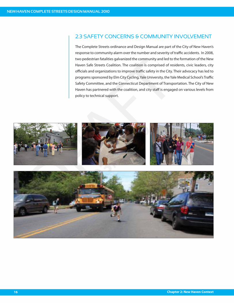
2.3 SAFETY CONCERNS & COMMUNITY INVOLVEMENT
The Complete Streets ordinance and Design Manual are part of the City of New Haven’s
response to community alarm over the number and severity of tra"c accidents. In 2008,
two pedestrian fatalities galvanized the community and led to the formation of the New
Haven Safe Streets Coalition. The coalition is comprised of residents, civic leaders, city
o"cials and organizations to improve tra"c safety in the City. Their advocacy has led to
programs sponsored by Elm City Cycling, Yale University, the Yale Medical School’s Tra"c
Safety Committee, and the Connecticut Department of Transportation. The City of New
Haven has partnered with the coalition, and city sta# is engaged on various levels from
policy to technical support.

what?
chapter 3
WHAT ARE COMPLETE STREETS

NEW HAVEN COMPLETE STREETS DESIGN MANUAL 2010
19Chapter 3: What are Complete Streets?
DRAFT03/18/10
3. What are Complete Streets?
Complete Streets are designed and operated to enable safe access for all users, including
pedestrians, bicyclists, motorists and transit riders of all ages and abilities. Complete
Streets may look di#erent and contain di#erent elements depending on the location.
In urban communities like New Haven, the concept of Complete Streets goes beyond
safety, tying in with issues of human health, equity, aesthetics, economic development,
environmental protection, and livability, all within a speci!c neighborhood context.
Complete Streets represents a paradigm shift in traditional road construction philosophy.
Instead of a reactive attempt to accommodate bicycle- and pedestrian-friendly practices
in projects, Complete Streets policies require all road construction and improvement
projects to begin by evaluating how the right-of-way serves all who use it.1
3.1 COMPLETE STREETS ARE PUBLIC SPACES
Above any speci!c need by an individual or group of users, the city street is a public
space. Due to New Haven’s density and pre-automobile neighborhood layouts, our
streets are literally our front yards. At their best, streets:
Create space for social interaction and physical activity
Provide a clean and attractive framework for economic development
Embrace the vernacular of a place thereby de!ning a unique identity
Provide for the safe and e"cient movement of goods and people of
all ages and abilities
3.2 COMPLETE STREETS AND LAND USE
In urban communities like New Haven, the comparatively short distances between
people and services due to compact development make walking, cycling and transit
use reasonable travel choices. The density of habitation provides important commercial
opportunities. For us, street design that is inherently safe for all users, that encourages
the use of non-motorized transportation, and that creates a varied and lively streetscape
is essential to our social and economic success.
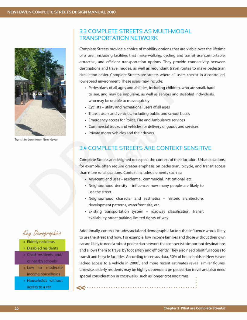
Chapel Street, New Haven
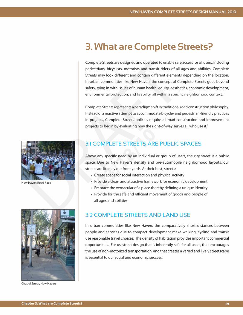
New Haven Road Race
NEW HAVEN COMPLETE STREETS DESIGN MANUAL 2010
20 Chapter 3: What are Complete Streets?
DRAFT03/18/10
3.3 COMPLETE STREETS AS MULTI-MODAL TRANSPORTATION NETWORK
Complete Streets provide a choice of mobility options that are viable over the lifetime
of a user, including facilities that make walking, cycling and transit use comfortable,
attractive, and e"cient transportation options. They provide connectivity between
destinations and travel modes, as well as redundant travel routes to make pedestrian
circulation easier. Complete Streets are streets where all users coexist in a controlled,
low-speed environment. These users may include:
Pedestrians of all ages and abilities, including children, who are small, hard
to see, and may be impulsive, as well as seniors and disabled individuals,
who may be unable to move quickly
Cyclists – utility and recreational users of all ages
Transit users and vehicles, including public and school buses
Emergency access for Police, Fire and Ambulance services
Commercial trucks and vehicles for delivery of goods and services
Private motor vehicles and their drivers
Complete Streets are designed to respect the context of their location. Urban locations,
for example, often require greater emphasis on pedestrian, bicycle, and transit access
than more rural locations. Context includes elements such as:
Adjacent land uses – residential, commercial, institutional, etc.
Neighborhood density – in$uences how many people are likely to
use the street.
Neighborhood character and aesthetics – historic architecture,
development patterns, waterfront site, etc.
Existing transportation system – roadway classi!cation, transit
availability, street parking, limited rights-of-way.
Additionally, context includes social and demographic factors that in$uence who is likely
to use the street and how. For example, low income families and those without their own
car are likely to need a robust pedestrian network that connects to important destinations
and allows them to travel by foot safely and e"ciently. They also need plentiful access to
transit and bicycle facilities. According to census data, 30% of households in New Haven
lacked access to a vehicle in 20002, and more recent estimates reveal similar !gures.
Likewise, elderly residents may be highly dependent on pedestrian travel and also need
special consideration in crosswalks, such as longer crossing times.
3.4 COMPLETE STREETS ARE CONTEXT SENSITIVE
Key Demographics
<<
Transit in downtown New Haven
Elderly residents »
Disabled residents »
Child residents and/ »
or nearby schools
Low to moderate »
income households
Households without »
access to a car
why?
chapter 4
REASONS FOR COMPLETING THE STREETS

NEW HAVEN COMPLETE STREETS DESIGN MANUAL 2010
23Chapter 4: Why Complete Streets?
DRAFT03/18/10
4.1 THE STATUS QUO
4. Why Complete Streets?
The City of New Haven is committed to a safe and sustainable transportation system for
all of its residents, visitors and businesses. The City is also committed to supporting and
encouraging the use of non-motorized transportation. These goals, however, exist in
the context of a street system that, despite being mostly laid out prior to the advent of
the automobile, has since been engineered to facilitate and prioritize the movement of
people and goods in and out of the city via motor vehicles, resulting in the subordination
of non-motorized transportation and related land uses such as shopping, recreation,
residential uses and other social activities.
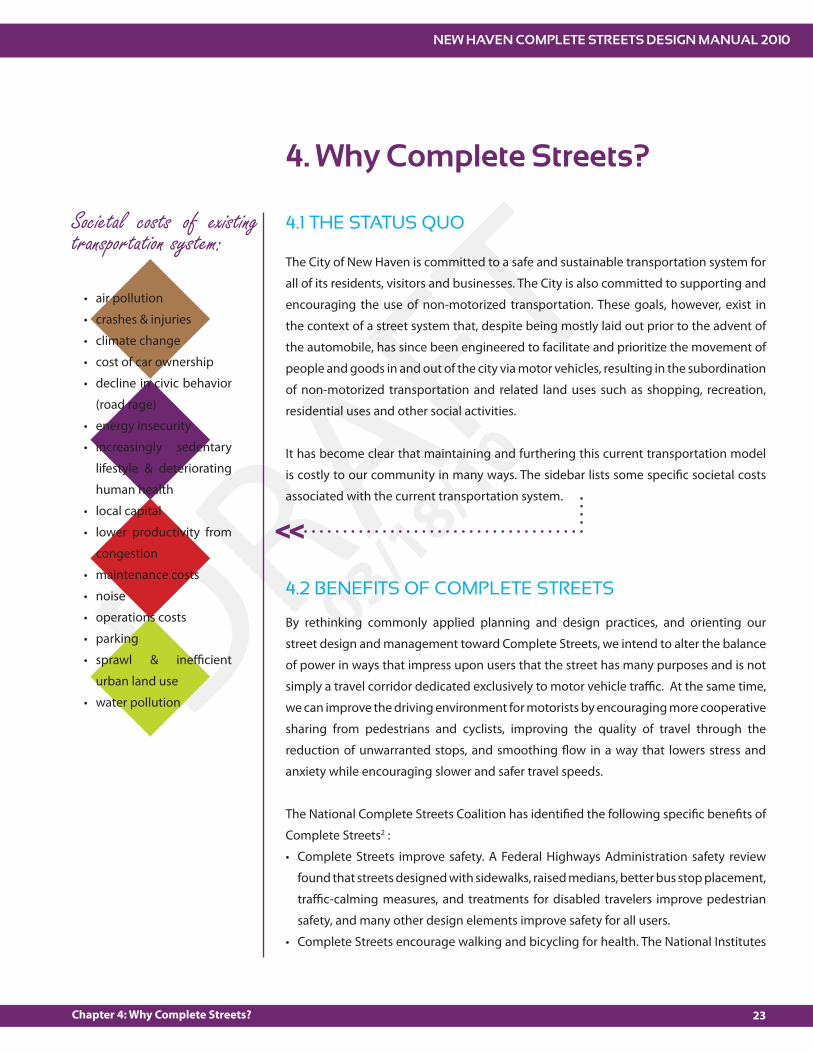
It has become clear that maintaining and furthering this current transportation model
is costly to our community in many ways. The sidebar lists some speci!c societal costs
associated with the current transportation system.
Societal costs of existing transportation system:
4.2 BENEFITS OF COMPLETE STREETS
By rethinking commonly applied planning and design practices, and orienting our
street design and management toward Complete Streets, we intend to alter the balance
of power in ways that impress upon users that the street has many purposes and is not
simply a travel corridor dedicated exclusively to motor vehicle tra"c. At the same time,
we can improve the driving environment for motorists by encouraging more cooperative
sharing from pedestrians and cyclists, improving the quality of travel through the
reduction of unwarranted stops, and smoothing $ow in a way that lowers stress and
anxiety while encouraging slower and safer travel speeds.
The National Complete Streets Coalition has identi!ed the following speci!c bene!ts of
Complete Streets2 :
Complete Streets improve safety. A Federal Highways Administration safety review
found that streets designed with sidewalks, raised medians, better bus stop placement,
tra"c-calming measures, and treatments for disabled travelers improve pedestrian
safety, and many other design elements improve safety for all users.
Complete Streets encourage walking and bicycling for health. The National Institutes
<<
air pollution
crashes & injuries
climate change
cost of car ownership
decline in civic behavior
(road rage)
energy insecurity
increasingly sedentary
lifestyle & deteriorating
human health
local capital
lower productivity from
congestion
maintenance costs
noise
operations costs
parking
sprawl & ine"cient
urban land use
water pollution
NEW HAVEN COMPLETE STREETS DESIGN MANUAL 2010
24 Chapter 4: Why Complete Streets?
DRAFT03/18/10
of Medicine recommends !ghting childhood obesity by establishing ordinances to
encourage construction of sidewalks, bikeways, and other places for physical activity.
One study found that 43% of people with safe places to walk within 10 minutes of
home met recommended activity levels; among individuals without safe place to
walk, just 27% were active enough.
Complete Streets address climate change and oil dependence. The 2001 National
Household Transportation Survey found 50% of all trips in metropolitan areas are
three miles or less and 28% of all metropolitan trips are one mile or less – distances
easy to walk, bike, or hop a bus or train. Yet 65% of the shortest trips are now made
by automobile, in part because of incomplete streets that make it dangerous or
unpleasant for other modes of travel.
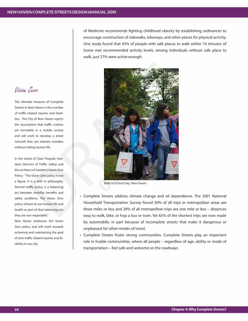
Complete Streets foster strong communities. Complete Streets play an important
role in livable communities, where all people – regardless of age, ability or mode of
transportation – feel safe and welcome on the roadways.
Walk to School Day, New Haven
Vision ZeroThe ultimate measure of Complete
Streets in New Haven is the number
of tra"c-related injuries and fatali-
ties. The City of New Haven rejects
the assumption that tra"c crashes
are inevitable in a mobile society
and will work to develop a street
network that can tolerate mistakes
without risking human life.
In the words of Claes Tingvall, Swe-
den’s Director of Tra"c Safety and
the architect of Sweden’s Vision Zero
Policy: “The Vision Zero policy is not
a !gure; it is a shift in philosophy.
Normal tra"c policy is a balancing
act between mobility bene!ts and
safety problems. The Vision Zero
policy refuses to use human life and
health as part of that balancing act;
they are non negotiable.”
New Haven embraces the Vision
Zero policy and will work towards
achieving and maintaining the goal
of zero tra"c related injuries and fa-
talities in our city.
NEW HAVEN COMPLETE STREETS DESIGN MANUAL 2010
25Chapter 4: Why Complete Streets?
DRAFT03/18/10
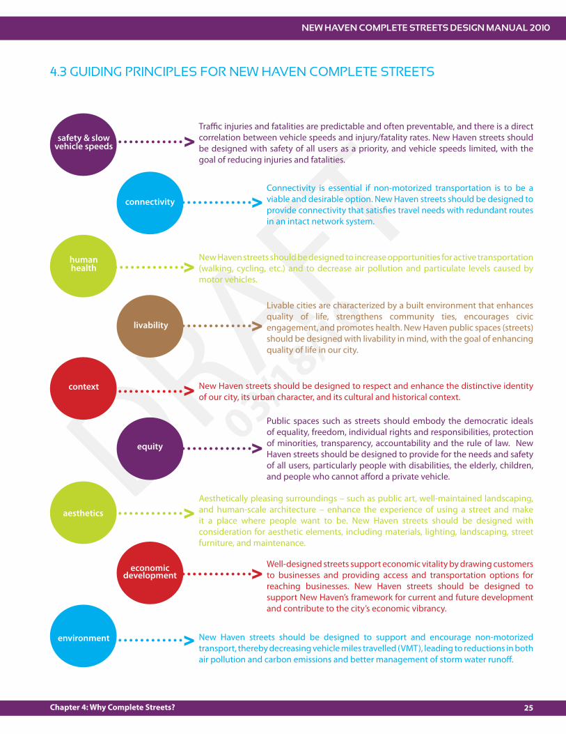
4.3 GUIDING PRINCIPLES FOR NEW HAVEN COMPLETE STREETS
safety & slow vehicle speeds
connectivity
human health
livability
context
equity
aesthetics
economic development
environment
Tra"c injuries and fatalities are predictable and often preventable, and there is a direct correlation between vehicle speeds and injury/fatality rates. New Haven streets should be designed with safety of all users as a priority, and vehicle speeds limited, with the goal of reducing injuries and fatalities.
Connectivity is essential if non-motorized transportation is to be a viable and desirable option. New Haven streets should be designed to provide connectivity that satis!es travel needs with redundant routes in an intact network system.
New Haven streets should be designed to increase opportunities for active transportation (walking, cycling, etc.) and to decrease air pollution and particulate levels caused by motor vehicles.
New Haven streets should be designed to respect and enhance the distinctive identity of our city, its urban character, and its cultural and historical context.
Livable cities are characterized by a built environment that enhances quality of life, strengthens community ties, encourages civic engagement, and promotes health. New Haven public spaces (streets) should be designed with livability in mind, with the goal of enhancing quality of life in our city.
Public spaces such as streets should embody the democratic ideals of equality, freedom, individual rights and responsibilities, protection of minorities, transparency, accountability and the rule of law. New Haven streets should be designed to provide for the needs and safety of all users, particularly people with disabilities, the elderly, children, and people who cannot a#ord a private vehicle.
Aesthetically pleasing surroundings – such as public art, well-maintained landscaping, and human-scale architecture – enhance the experience of using a street and make it a place where people want to be. New Haven streets should be designed with consideration for aesthetic elements, including materials, lighting, landscaping, street furniture, and maintenance.
New Haven streets should be designed to support and encourage non-motorized transport, thereby decreasing vehicle miles travelled (VMT), leading to reductions in both air pollution and carbon emissions and better management of storm water runo#.
Well-designed streets support economic vitality by drawing customers to businesses and providing access and transportation options for reaching businesses. New Haven streets should be designed to support New Haven’s framework for current and future development and contribute to the city’s economic vibrancy.
>
>
>
>
>
>
>
>
>

what now?
chapter 5
STREET DESIGN PROCESS

NEW HAVEN COMPLETE STREETS DESIGN MANUAL 2010
29Chapter 5: Street Design Process
DRAFT03/18/10
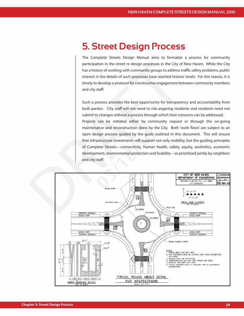
The Complete Streets Design Manual aims to formalize a process for community
participation in the street re-design processes in the City of New Haven. While the City
has a history of working with community groups to address tra"c safety problems, public
interest in the details of such processes have reached historic levels. For this reason, it is
timely to develop a protocol for constructive engagement between community members
and city sta#.
Such a process provides the best opportunity for transparency and accountability from
both parties. City sta# will not need to risk angering residents and residents need not
submit to changes without a process through which their concerns can be addressed.
Projects can be initiated either by community request or through the on-going
maintenance and reconstruction done by the City. Both ‘work $ows’ are subject to an
open design process guided by the goals outlined in this document. This will ensure
that infrastructure investments will support not only mobility, but the guiding principles
of Complete Streets—connectivity, human health, safety, equity, aesthetics, economic
development, environmental protection and livability—as prioritized jointly by neighbors
and city sta#.
5. Street Design Process

NEW HAVEN COMPLETE STREETS DESIGN MANUAL 2010
30 Chapter 5: Street Design Process
DRAFT03/18/10
The citizens of the City of New Haven have a vested interest in the changes that occur in
the public spaces of their communities, including their streets. Given access to pertinent
information, input from quali!ed professionals and a participatory process that allows for
thoughtful collaboration between educated citizens and city sta#, !nal street designs will
result in changes that most clearly re$ect the desires and needs of the community.
The steps described below can assist New Haven residents, neighborhood groups, elected
o"cials and City sta# in navigating a street design process that will e#ectively address
tra"c, safety and other street-related issues.
Identify project goals. Goals should be consistent with the Complete Streets Policy and Guiding Principles (see Chapters 1 & 4 of this manual).Submit Complete Streets Project Request Form (see Appendix) to City Engineer.
>
Review Project Request Form for community-initiated projects.Collect and analyze data as necessary.Conduct initial screening of street design tools. (Decision matrices are included in the appendices.)Meet with community members and stakeholders to review design options.
Rank and prioritize project.Identify and secure project funding.Develop "nal design.Secure appropriate approvals.Meet with community members and stakeholders to review design.
community role
Work with City sta# to form consensus around design plan.
Identify and secure outside funding sources and possible maintenance partners.
Construct projectPerform post-construction evaluation of project e#ectivenessIf temporary measure installed, collect data to monitor e#ectiveness and hold public meeting to elicit feedback and discuss permanent options.
Work with City to evaluate e#ectiveness of project.Perform maintenance if applicable.
> >
1. Project Initiation
2. Plan Development 3. Funding & Design 4. Installation
Identify project location, scope and goals. Goals should be consistent with the Complete Streets Policy and Guiding Principles.
COMMUNITY%INITIATED PROJECTS
CITY%INITIATED PROJECTS
city role
community role
community role
community role
city role
city role
city role

what else?
chapter 6
ENGINEERING CONSIDERATIONS

NEW HAVEN COMPLETE STREETS DESIGN MANUAL 2010
33Chapter 6: Engineering Considerations for Complete Streets
DRAFT03/18/10
6. Engineering Considerations for Complete Streets
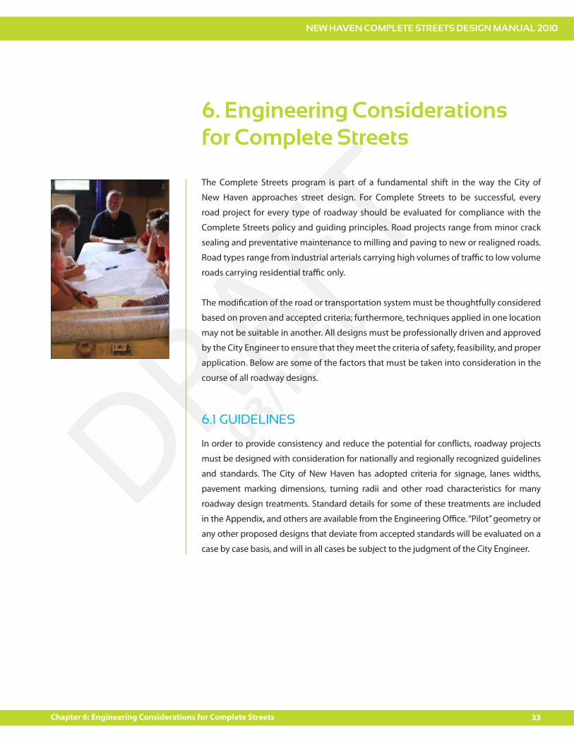
The Complete Streets program is part of a fundamental shift in the way the City of
New Haven approaches street design. For Complete Streets to be successful, every
road project for every type of roadway should be evaluated for compliance with the
Complete Streets policy and guiding principles. Road projects range from minor crack
sealing and preventative maintenance to milling and paving to new or realigned roads.
Road types range from industrial arterials carrying high volumes of tra"c to low volume
roads carrying residential tra"c only.
The modi!cation of the road or transportation system must be thoughtfully considered
based on proven and accepted criteria; furthermore, techniques applied in one location
may not be suitable in another. All designs must be professionally driven and approved
by the City Engineer to ensure that they meet the criteria of safety, feasibility, and proper
application. Below are some of the factors that must be taken into consideration in the
course of all roadway designs.
6.1 GUIDELINES
In order to provide consistency and reduce the potential for con$icts, roadway projects
must be designed with consideration for nationally and regionally recognized guidelines
and standards. The City of New Haven has adopted criteria for signage, lanes widths,
pavement marking dimensions, turning radii and other road characteristics for many
roadway design treatments. Standard details for some of these treatments are included
in the Appendix, and others are available from the Engineering O"ce. “Pilot” geometry or
any other proposed designs that deviate from accepted standards will be evaluated on a
case by case basis, and will in all cases be subject to the judgment of the City Engineer.
NEW HAVEN COMPLETE STREETS DESIGN MANUAL 2010
34 Chapter 6: Engineering Considerations for Complete Streets
DRAFT03/18/10
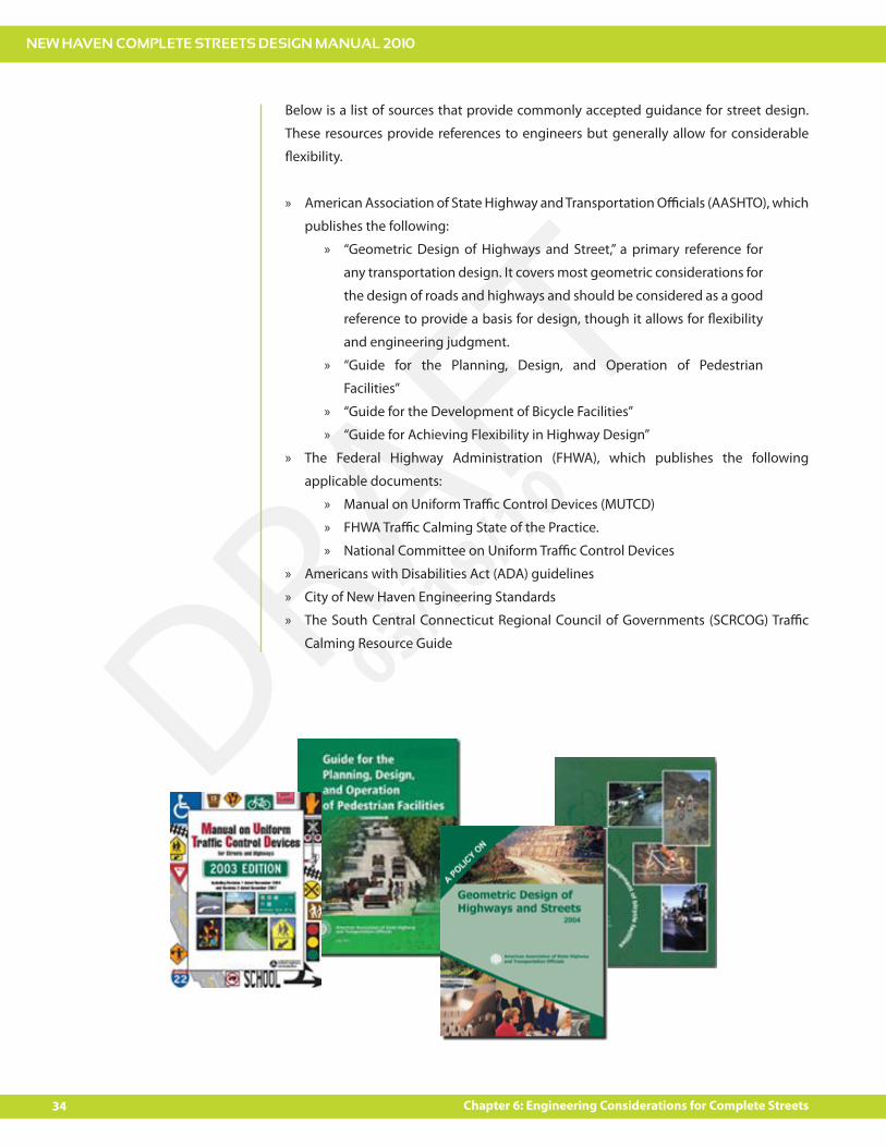
Below is a list of sources that provide commonly accepted guidance for street design.
These resources provide references to engineers but generally allow for considerable
$exibility.
American Association of State Highway and Transportation O"cials (AASHTO), which »
publishes the following:
“Geometric Design of Highways and Street,” a primary reference for »
any transportation design. It covers most geometric considerations for
the design of roads and highways and should be considered as a good
reference to provide a basis for design, though it allows for $exibility
and engineering judgment.
“Guide for the Planning, Design, and Operation of Pedestrian »
Facilities”
“Guide for the Development of Bicycle Facilities” »
“Guide for Achieving Flexibility in Highway Design” »
The Federal Highway Administration (FHWA), which publishes the following »
applicable documents:
Manual on Uniform Tra"c Control Devices (MUTCD) »
FHWA Tra"c Calming State of the Practice. »
National Committee on Uniform Tra"c Control Devices »
Americans with Disabilities Act (ADA) guidelines »
City of New Haven Engineering Standards »
The South Central Connecticut Regional Council of Governments (SCRCOG) Tra"c »
Calming Resource Guide
NEW HAVEN COMPLETE STREETS DESIGN MANUAL 2010
35Chapter 6: Engineering Considerations for Complete Streets
DRAFT03/18/10
6.2 ROADWAY CLASSIFICATION SYSTEM
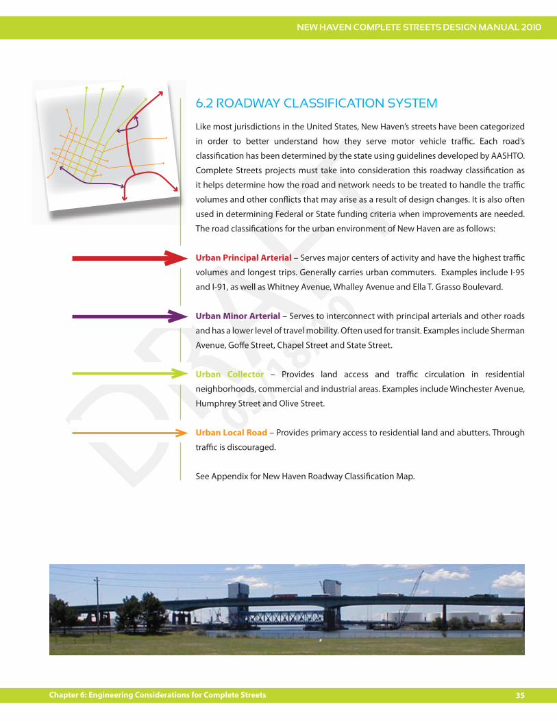
Like most jurisdictions in the United States, New Haven’s streets have been categorized
in order to better understand how they serve motor vehicle tra"c. Each road’s
classi!cation has been determined by the state using guidelines developed by AASHTO.
Complete Streets projects must take into consideration this roadway classi!cation as
it helps determine how the road and network needs to be treated to handle the tra"c
volumes and other con$icts that may arise as a result of design changes. It is also often
used in determining Federal or State funding criteria when improvements are needed.
The road classi!cations for the urban environment of New Haven are as follows:
Urban Principal Arterial – Serves major centers of activity and have the highest tra"c
volumes and longest trips. Generally carries urban commuters. Examples include I-95
and I-91, as well as Whitney Avenue, Whalley Avenue and Ella T. Grasso Boulevard.
Urban Minor Arterial – Serves to interconnect with principal arterials and other roads
and has a lower level of travel mobility. Often used for transit. Examples include Sherman
Avenue, Go#e Street, Chapel Street and State Street.
Urban Collector – Provides land access and tra"c circulation in residential
neighborhoods, commercial and industrial areas. Examples include Winchester Avenue,
Humphrey Street and Olive Street.
Urban Local Road – Provides primary access to residential land and abutters. Through
tra"c is discouraged.
See Appendix for New Haven Roadway Classi!cation Map.
NEW HAVEN COMPLETE STREETS DESIGN MANUAL 2010
36 Chapter 6: Engineering Considerations for Complete Streets
DRAFT03/18/10
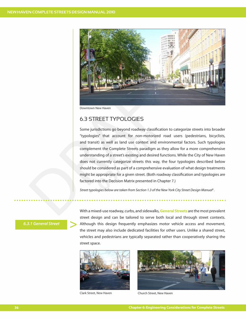
6.3 STREET TYPOLOGIES
Some jurisdictions go beyond roadway classi!cation to categorize streets into broader
“typologies” that account for non-motorized road users (pedestrians, bicyclists,
and transit) as well as land use context and environmental factors. Such typologies
complement the Complete Streets paradigm as they allow for a more comprehensive
understanding of a street’s existing and desired functions. While the City of New Haven
does not currently categorize streets this way, the four typologies described below
should be considered as part of a comprehensive evaluation of what design treatments
might be appropriate for a given street. (Both roadway classi!cation and typologies are
factored into the Decision Matrix presented in Chapter 7.)
Street typologies below are taken from Section 1.3 of the New York City Street Design Manual4 .
With a mixed-use roadway, curbs, and sidewalks, General Streets are the most prevalent
street design and can be tailored to serve both local and through street contexts.
Although this design frequently emphasizes motor vehicle access and movement,
the street may also include dedicated facilities for other users. Unlike a shared street,
vehicles and pedestrians are typically separated rather than cooperatively sharing the
street space.
6.3.1 General Street >
Clark Street, New Haven Church Street, New Haven
Downtown New Haven
NEW HAVEN COMPLETE STREETS DESIGN MANUAL 2010
37Chapter 6: Engineering Considerations for Complete Streets
DRAFT03/18/10
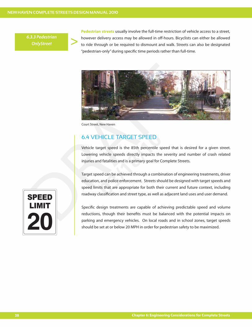
6.3.3 Slow Street >Slow Streets are local streets that makes extensive use of tra"c calming measures
to discourage vehicular through tra"c, reduce vehicle speeds, green and beautify the
streetscape, and create a comfortable environment for bicycling and walking. Variations
of the Slow Street include “Home Zones” or “Woonerfs” where pedestrian and bicycle
access is prioritized and all users share the road space without boundaries such as lanes
and curbs. Such streets were popularized in Europe and are gaining gradual acceptance
in the United States. Slow Streets are especially well-suited to local residential streets and
streets adjacent to schools. Slow streets should be paired with a reduced speed limit.
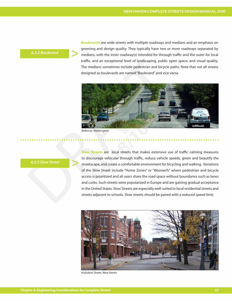
6.3.2 Boulevard >Boulevards are wide streets with multiple roadways and medians and an emphasis on
greening and design quality. They typically have two or more roadways separated by
medians, with the inner roadway(s) intended for through tra"c and the outer for local
tra"c, and an exceptional level of landscaping, public open space, and visual quality.
The medians sometimes include pedestrian and bicycle paths. Note that not all streets
designed as boulevards are named “Boulevard” and vice versa.
www.pedbikeimages.org/Dan Burden
Bellevue, Washington
Audubon Street, New Haven
NEW HAVEN COMPLETE STREETS DESIGN MANUAL 2010
38 Chapter 6: Engineering Considerations for Complete Streets
DRAFT03/18/10
6.3.3 Pedestrian OnlyStreet >
Pedestrian streets usually involve the full-time restriction of vehicle access to a street,
however delivery access may be allowed in o#-hours. Bicyclists can either be allowed
to ride through or be required to dismount and walk. Streets can also be designated
“pedestrian-only” during speci!c time periods rather than full-time.
Court Street, New Haven
Vehicle target speed is the 85th percentile speed that is desired for a given street.
Lowering vehicle speeds directly impacts the severity and number of crash related
injuries and fatalities and is a primary goal for Complete Streets.
Target speed can be achieved through a combination of engineering treatments, driver
education, and police enforcement. Streets should be designed with target speeds and
speed limits that are appropriate for both their current and future context, including
roadway classi!cation and street type, as well as adjacent land uses and user demand.
Speci!c design treatments are capable of achieving predictable speed and volume
reductions, though their bene!ts must be balanced with the potential impacts on
parking and emergency vehicles. On local roads and in school zones, target speeds
should be set at or below 20 MPH in order for pedestrian safety to be maximized.
6.4 VEHICLE TARGET SPEED
SPEEDLIMIT
NEW HAVEN COMPLETE STREETS DESIGN MANUAL 2010
39Chapter 6: Engineering Considerations for Complete Streets
DRAFT03/18/10
A design vehicle is the vehicle-type that must regularly be accommodated on a roadway
for the purpose of designing the road. The design vehicles used for geometric street
designs should re$ect the predominant intended users of the street in question. In
addition, all street designs must meet minimum standards for !re department and other
emergency vehicle access and must consider the needs of sanitation vehicles used for
street cleaning, refuse collection, and snow clearing.
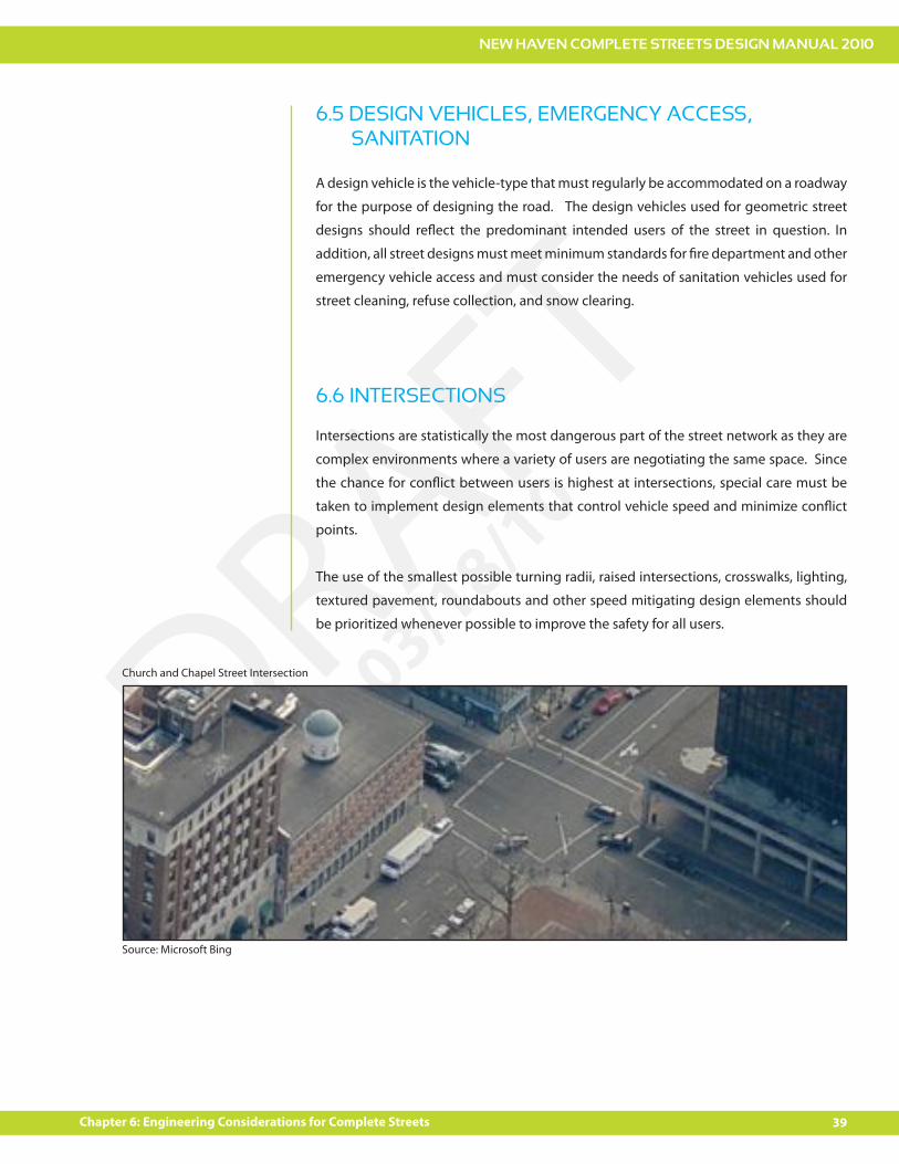
Intersections are statistically the most dangerous part of the street network as they are
complex environments where a variety of users are negotiating the same space. Since
the chance for con$ict between users is highest at intersections, special care must be
taken to implement design elements that control vehicle speed and minimize con$ict
points.
The use of the smallest possible turning radii, raised intersections, crosswalks, lighting,
textured pavement, roundabouts and other speed mitigating design elements should
be prioritized whenever possible to improve the safety for all users.
6.5 DESIGN VEHICLES, EMERGENCY ACCESS, SANITATION
6.6 INTERSECTIONS
Church and Chapel Street Intersection
Source: Microsoft Bing
NEW HAVEN COMPLETE STREETS DESIGN MANUAL 2010
40 Chapter 6: Engineering Considerations for Complete Streets
DRAFT03/18/10
In New Haven, on-street parking o#ers a number of important bene!ts. The availability of
the appropriate amount of on-street parking is an important factor for many residential
streets where historical homes did not allocate space for vehicles. On-street parking is
also necessary for supporting businesses in Downtown New Haven and neighborhood
‘main street’ business districts. On-street parking is more e"cient than o#-street parking
as on-street spaces are more likely to be shared by a number of users.
When properly oriented, on-street parking can also have a tra"c calming e#ect by
slowing vehicle speeds. For instance, when combined with chicanes, on-street parking
can break up straight stretches of roadway. Throughout the city, there are opportunities
to substantially increase the number of parking spaces available while simultaneously
narrowing the roadway through the replacement of parallel parking with reverse angle
parking or simply by striping the parking spaces in the roadway.
The bene!ts of on-street parking should be only be implemented with the use of
appropriate design elements to avoid negative consequences. Cars parked on the street
can block access to crosswalks and impede sightlines for other users. The space that is
dedicated to parking cannot be used for bike lanes and the very presence of parking
encourages driving; therefore, parking needs to be carefully managed and incorporated
into a larger complete streets plan. One important management tool is ensuring,
wherever appropriate, that on-street parking be properly priced through meters, kiosks,
or residential parking permits.
6.7 ON-STREET PARKING
NEW HAVEN COMPLETE STREETS DESIGN MANUAL 2010
41Chapter 6: Engineering Considerations for Complete Streets
DRAFT03/18/10
The Complete Streets policy requires that all roadway designs take into consideration
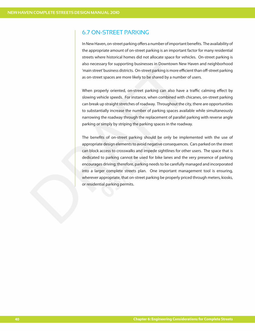
use by pedestrians and bicyclists of all ages and abilities. Factors that contribute to a
good environment for walking include the following:
Pleasant visual environment
Continuous and connected pedestrian facilities separated from vehicle
tra"c movements
Short street crossing distances
A good mix of land uses
Pedestrian scale lighting
Slow and controlled motor vehicle movements
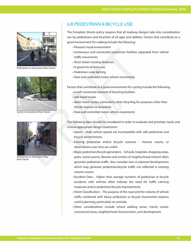
Factors that contribute to a good environment for cycling include the following:
a well-connected network of bicycling facilities
safe travel routes
direct travel routes, particularly when bicycling for purposes other than
strictly exercise or recreation
Slow and controlled motor vehicle movements
The following data should be considered in order to evaluate and prioritize needs and
choose appropriate design treatments:
Speed – High vehicle speeds are incompatible with safe pedestrian and
bicycle environments.
Existing pedestrian and/or bicycle volumes – Volume counts, or
observations over time are useful.
Major pedestrian/bicycle generators – Schools, hospitals, shopping areas,
parks, transit points, libraries and centers of neighborhood interest often
generate pedestrian tra"c. Also consider new or planned developments
which may generate pedestrian/bicycle tra"c not re$ected in existing
volume counts.
Accident Data – Higher than average numbers of pedestrian or bicycle
accidents with vehicles often indicate the need for tra"c calming
measures and/or pedestrian/bicycle improvements.
Street Classi!cation – The purpose of the road and the volume of vehicle
tra"c combined with heavy pedestrian or bicycle movements requires
careful planning, particularly on arterials.
Other considerations include school walking zones, transit routes,
commercial areas, neighborhood characteristics, and development.
6.8 PEDESTRIAN & BICYCLE USE
Cyclist in downtown New Haven
Pedestrians in Sherman’s Alley, New Haven
Pedestrians in downtown New Haven
NEW HAVEN COMPLETE STREETS DESIGN MANUAL 2010
42 Chapter 6: Engineering Considerations for Complete Streets
DRAFT03/18/10
Public transportation and Complete Streets are naturally complimentary. Transit vehicles
operating on New Haven’s street serve people who live, work, shop and recreate in the
city. Not only must transit vehicles interface with general tra"c, but passengers are also
pedestrians for a portion of their trip. Also, Complete Streets are those which facilitate
intermodal transfers and prioritize the needs of many di#erent users.
Road projects in the city should consider the presence of transit vehicles, stops, and
locations where passengers must cross the roadway or use sidewalks to access the
system. Traditional road construction projects can exclude the needs of transit users in
the design phase, so the Complete Streets process will provide opportunity to prioritize
transit improvements in such projects.
Incorporating transit more e#ectively in road projects may increase the usage of the
transit system over time. Safety, convenience and comfort are important considerations
for transit users. Well designed streets can improve the pedestrian or bicycle interface
with the transit system and encourage more people to use alternative modes of
transportation. Complete Streets that prioritize transit can also improve the running
time of buses which can make transit more competitive with cars.
Complete Streets require that protected pedestrian facilities are maintained during
all phases of construction projects that encroach upon the public right of way. The
Transportation, Tra"c and Parking Department reviews right-of-way and encroachment
permit applications. As part of that e#ort, the department’s policy is to maintain safe
pedestrian access at construction zones. If pedestrian tra"c is directed across a street,
temporary controls, including ADA accessible mid-block ramp systems, are often
required to reduce pedestrian travel delay.
6.9 PUBLIC TRANSPORTATION
6.10 PEDESTRIAN ACCESS IN CONSTRUCTION ZONES
0
NEW HAVEN COMPLETE STREETS DESIGN MANUAL 2010
43Chapter 6: Engineering Considerations for Complete Streets
DRAFT03/18/10
6.11 ENVIRONMENTAL DESIGN
Roadway designs should enhance both the environmental quality and aesthetic appeal
of streets. Elements such as landscaping and street trees accomplish both of these
goals, reducing air pollution and improving stormwater control, while contributing to a
pleasant and appealing environment for street users.
A tree belt is recommended between the curb and the project property line whenever
possible. The width of the tree belt should be as wide as possible. A minimum width of
5’ is desired unless site conditions do not make this width feasible. Lawn is the preferred
surface within the tree belt to maximize the soil volume and to promote tree growth and
vitality. If lawn is not feasible as a surface within the tree belt, then adequate openings
within paved areas should be provided for placement of soil to support tree growth.
More information on New Haven’s street tree policy can be found in the Appendix.
Drainage plans should incorporate elements such as bioswales, which are landscaped
depressions between sidewalks and streets. Bioswales detain water and allow it to be
absorbed into the ground, reducing runo# into the sewer system, while at the same time
providing space for aesthetic enhancement landscaping. Stormwater runo# can also be
reduced through the use of permeable paving materials. The use of these materials
should be prioritized whenever possible.
Appropriate city agencies and abutting neighbors should be engaged in the design
process to ensure that street elements can be properly maintained.
NEW HAVEN COMPLETE STREETS DESIGN MANUAL 2010
44 Chapter 6: Engineering Considerations for Complete Streets
DRAFT03/18/10
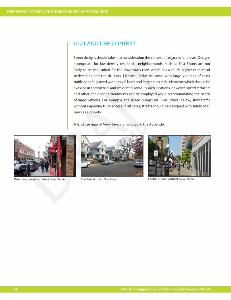
6.12 LAND USE CONTEXT
Street designs should take into consideration the context of adjacent land uses. Designs
appropriate for low-density residential neighborhoods, such as East Shore, are not
likely to be well-suited for the downtown core, which has a much higher number of
pedestrians and transit users. Likewise, industrial areas with large volumes of truck
tra"c generally need wider travel lanes and larger curb radii, elements which should be
avoided in commercial and residential areas. In such locations, however, speed reducers
and other engineering treatments can be employed while accommodating the needs
of large vehicles. For example, the speed humps on River Street (below) slow tra"c
without impeding truck access. In all cases, streets should be designed with safety of all
users as a priority.
A land use map of New Haven is included in the Appendix.
Mixed use, downtown street, New Haven Residential street, New Haven Central business district, New Haven
how?
chapter 7
CREATING COMPLETE STREETS

NEW HAVEN COMPLETE STREETS DESIGN MANUAL 2010
47Chapter 7: How to Create Complete Streets
DRAFT03/18/10
A variety of design treatments can be employed to create Complete Streets, each with
varying degrees of community involvement, engineering and education necessary for
successful implementation. Following is a list of treatments that are most likely to be
applicable to New Haven streets. This manual presents them as options in the form of
a “toolbox”, and it is expected that all roadway projects - whether initiated by the city,
state or community groups - will employ the toolbox as a starting point. The toolbox
does not prescribe which speci!c tools must be used in a given situation. Instead, it
o#ers users guidance in determining which elements are most appropriate and feasible
given the context and goals of the particular project, and given the Complete Streets
policy and guiding principles outlined in the manual.
The Decision Matrix presented later in this chapter provides additional guidance for this
decision-making process and provides an important check for evaluating inclusion of
Complete Street elements in every project undertaken by the City of New Haven that
a#ects the City Right-of-Way.
7. How to Create Complete Streets
Orange Street, New Haven
NEW HAVEN COMPLETE STREETS DESIGN MANUAL 2010
48 Chapter 7: How to Create Complete Streets
DRAFT03/18/10
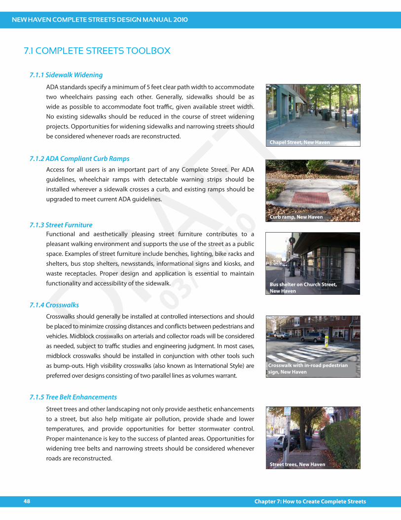
ADA standards specify a minimum of 5 feet clear path width to accommodate two wheelchairs passing each other. Generally, sidewalks should be as wide as possible to accommodate foot tra"c, given available street width. No existing sidewalks should be reduced in the course of street widening projects. Opportunities for widening sidewalks and narrowing streets should be considered whenever roads are reconstructed.
7.1.2 ADA Compliant Curb RampsAccess for all users is an important part of any Complete Street. Per ADA guidelines, wheelchair ramps with detectable warning strips should be installed wherever a sidewalk crosses a curb, and existing ramps should be upgraded to meet current ADA guidelines.
Functional and aesthetically pleasing street furniture contributes to a pleasant walking environment and supports the use of the street as a public space. Examples of street furniture include benches, lighting, bike racks and shelters, bus stop shelters, newsstands, informational signs and kiosks, and waste receptacles. Proper design and application is essential to maintain functionality and accessibility of the sidewalk.
Crosswalks should generally be installed at controlled intersections and should be placed to minimize crossing distances and con$icts between pedestrians and vehicles. Midblock crosswalks on arterials and collector roads will be considered as needed, subject to tra"c studies and engineering judgment. In most cases, midblock crosswalks should be installed in conjunction with other tools such as bump-outs. High visibility crosswalks (also known as International Style) are preferred over designs consisting of two parallel lines as volumes warrant.
Street trees and other landscaping not only provide aesthetic enhancements to a street, but also help mitigate air pollution, provide shade and lower temperatures, and provide opportunities for better stormwater control. Proper maintenance is key to the success of planted areas. Opportunities for widening tree belts and narrowing streets should be considered whenever roads are reconstructed.
7.1 COMPLETE STREETS TOOLBOX
7.1.1 Sidewalk Widening
7.1.3 Street Furniture
7.1.4 Crosswalks
7.1.5 Tree Belt Enhancements
Chapel Street, New Haven
Curb ramp, New Haven
Bus shelter on Church Street, New Haven
Crosswalk with in-road pedestrian sign, New Haven
Street trees, New Haven
NEW HAVEN COMPLETE STREETS DESIGN MANUAL 2010
49Chapter 7: How to Create Complete Streets
DRAFT03/18/10
7.1.6 Sidewalk Surface TreatmentsSidewalks are typically surfaced in standard concrete, but alternative materials
such as brick or stone pavers or even tinted concrete can be used for aesthetic
enhancements that contribute to a pleasant walking environment, as well as
to improve stormwater control through permeability. Proper maintenance is
essential, as some materials, particularly brick pavers, can lift or settle over
time and create tripping hazards or obstacles for wheelchairs.
A variety of pavement markings can be employed to improve street safety
and functionality for all road users. Some examples include directional
arrows, school zone warning signs, and stop bars. Several types of markings
are discussed in more detail in this toolbox, including crosswalks (above) and
road narrowing and bike lanes (below). Roadway pavement markings typically
follow guidelines set forth in the Manual on Uniform Tra"c Control Devices
(MUTCD), and any “pilot” markings proposed are subject to the judgment of
the City Engineer.
Roadways are typically paved in asphalt or concrete. However, other surface
treatments such as pavers or stamped/imprinted concrete or asphalt may be
used in certain locations to enhance aesthetic character, improve stormwater
control through permeability and/or delineate space for various street users.
Maintenance is an important consideration for any unconventional surface
treatment.
A speed hump is a raised area in the roadway pavement surface that can help
reduce speeds. Speed humps are most e#ective when used in combination
with other tra"c calming/speed reducing measures, and they are not suitable
for all locations. Also, they require strong community support to o#set
negative impacts such as noise.
7.1.9 Speed Humps
7.1.7 Roadway Surface Treatments
7.1.8 Pavement Markings
Sidewalk surface treatment, Crown Street, New Haven
Stamped concrete crosswalk, New Haven
Chapel Street, New Haven
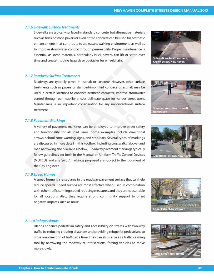
Islands enhance pedestrian safety and accessibility on streets with two-way
tra"c by reducing crossing distances and providing refuge for pedestrians to
cross one direction of tra"c at a time. They can also serve as a tra"c calming
tool by narrowing the roadway at intersections, forcing vehicles to move
more slowly.
7.1.10 Refuge Islands
Tuttle Street, New Haven
Directional arrows, New Haven
NEW HAVEN COMPLETE STREETS DESIGN MANUAL 2010
50 Chapter 7: How to Create Complete Streets
DRAFT03/18/10
Bump-outs (also known as curb extensions or neckdowns) are an expansion of
the curb line into the adjacent roadway (typically a parking lane) either at a corner
or mid–block. Two bump-outs can be located on either side of a street to create a
choker. Bump-outs have many potential bene!ts including the following:
Narrowing the roadway both physically and visually
Slowing turning vehicles
Shortening crossing distance and reducing potential con$icts between
vehicles and pedestrians
Making pedestrians more visible to drivers
Highlighting the presence of the crosswalk and discouraging illegal parking
within crosswalk
Providing additional pedestrian space, which can help reduce crowding
at bus stops and for queueing at crossings, as well as location for street
furniture
Can discourage illegal parking in front of hydrants
Can discourage truck turns onto local streets
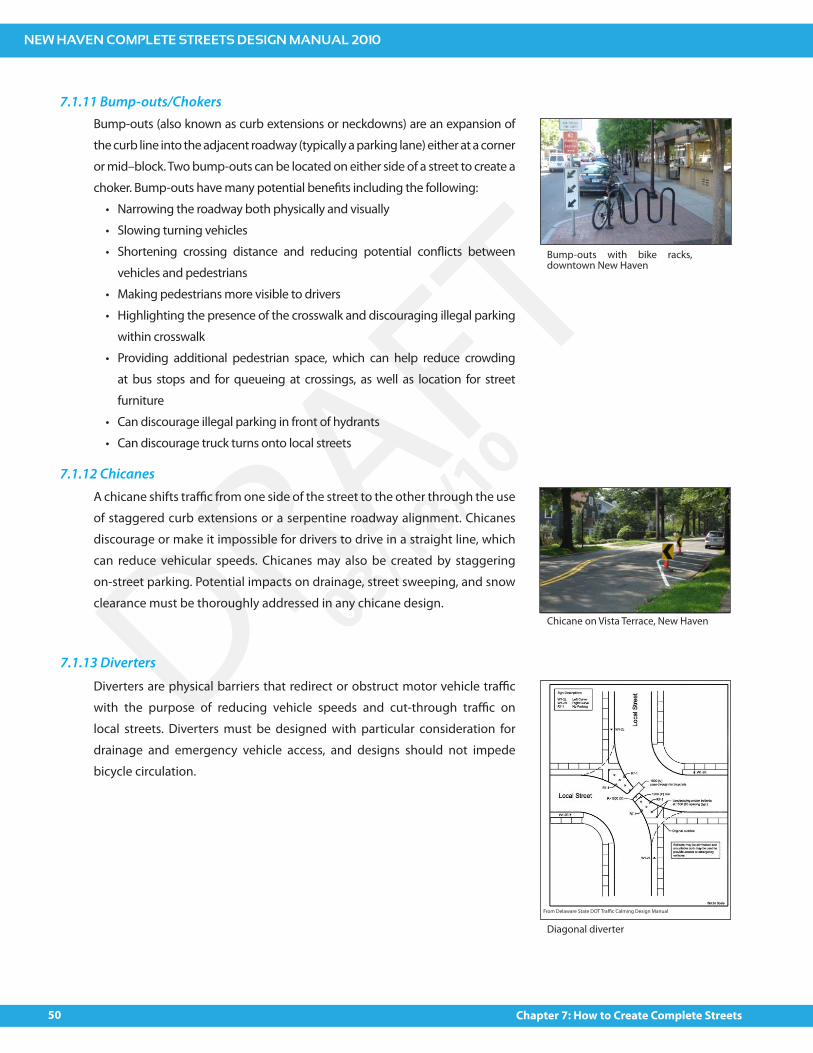
A chicane shifts tra"c from one side of the street to the other through the use
of staggered curb extensions or a serpentine roadway alignment. Chicanes
discourage or make it impossible for drivers to drive in a straight line, which
can reduce vehicular speeds. Chicanes may also be created by staggering
on-street parking. Potential impacts on drainage, street sweeping, and snow
clearance must be thoroughly addressed in any chicane design.
7.1.11 Bump-outs/Chokers
7.1.12 Chicanes
Bump-outs with bike racks, downtown New Haven
Chicane on Vista Terrace, New Haven
Diverters are physical barriers that redirect or obstruct motor vehicle tra"c
with the purpose of reducing vehicle speeds and cut-through tra"c on
local streets. Diverters must be designed with particular consideration for
drainage and emergency vehicle access, and designs should not impede
bicycle circulation.
7.1.13 Diverters
Diagonal diverter
From Delaware State DOT Tra"c Calming Design Manual
NEW HAVEN COMPLETE STREETS DESIGN MANUAL 2010
51Chapter 7: How to Create Complete Streets
DRAFT03/18/10
A road closure is a physical barrier placed at one end of a street with the
purpose of eliminating cut-through tra"c. A partial closure may also be used
to discourage through tra"c by prohibiting entry or exit in one direction
on a two–way street. In either case, provision should be made for bicycle
circulation, as well as emergency vehicle access which can be accommodated
with mountable curbs.
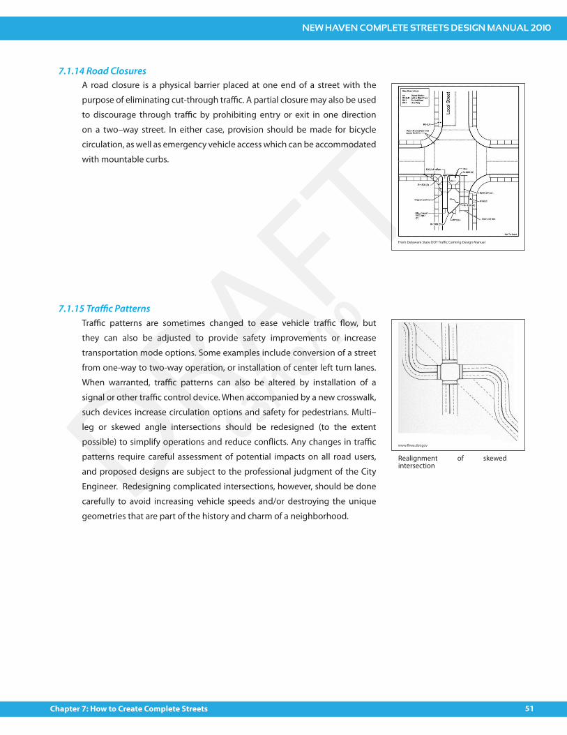
Tra"c patterns are sometimes changed to ease vehicle tra"c $ow, but
they can also be adjusted to provide safety improvements or increase
transportation mode options. Some examples include conversion of a street
from one-way to two-way operation, or installation of center left turn lanes.
When warranted, tra"c patterns can also be altered by installation of a
signal or other tra"c control device. When accompanied by a new crosswalk,
such devices increase circulation options and safety for pedestrians. Multi–
leg or skewed angle intersections should be redesigned (to the extent
possible) to simplify operations and reduce con$icts. Any changes in tra"c
patterns require careful assessment of potential impacts on all road users,
and proposed designs are subject to the professional judgment of the City
Engineer. Redesigning complicated intersections, however, should be done
carefully to avoid increasing vehicle speeds and/or destroying the unique
geometries that are part of the history and charm of a neighborhood.
7.1.14 Road Closures
7.1.15 Tra!c Patterns
Partial road closure
www.fhwa.dot.gov
Realignment of skewed intersection
From Delaware State DOT Tra"c Calming Design Manual
NEW HAVEN COMPLETE STREETS DESIGN MANUAL 2010
52 Chapter 7: How to Create Complete Streets
DRAFT03/18/10
All roads except for limited access highways are available for bicycle use.
Vehicle drivers are legally required to share the road with bicycles, and cyclists
have a legal responsibility to obey all tra"c regulations. Dedicated bicycle
facilities generally fall into one of the three categories below:
Shared use paths (Class 1) provide separate travel ways designated for non-
motorized uses. Bicycles, pedestrians, skaters, and in some cases even cross-
country skiers may use these paths for commuting or recreational purposes
without con$icts with vehicles. A local example is the Farmington Canal
Greenway.
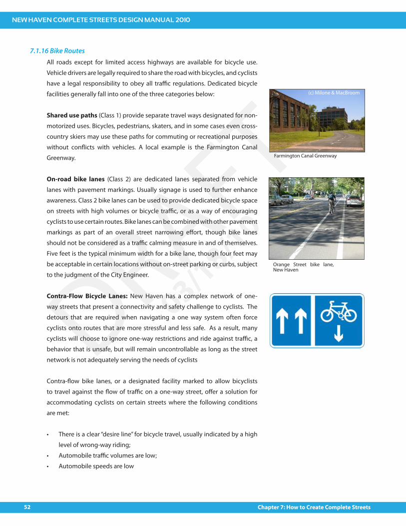
On-road bike lanes (Class 2) are dedicated lanes separated from vehicle
lanes with pavement markings. Usually signage is used to further enhance
awareness. Class 2 bike lanes can be used to provide dedicated bicycle space
on streets with high volumes or bicycle tra"c, or as a way of encouraging
cyclists to use certain routes. Bike lanes can be combined with other pavement
markings as part of an overall street narrowing e#ort, though bike lanes
should not be considered as a tra"c calming measure in and of themselves.
Five feet is the typical minimum width for a bike lane, though four feet may
be acceptable in certain locations without on-street parking or curbs, subject
to the judgment of the City Engineer.
Contra-Flow Bicycle Lanes: New Haven has a complex network of one-
way streets that present a connectivity and safety challenge to cyclists. The
detours that are required when navigating a one way system often force
cyclists onto routes that are more stressful and less safe. As a result, many
cyclists will choose to ignore one-way restrictions and ride against tra"c, a
behavior that is unsafe, but will remain uncontrollable as long as the street
network is not adequately serving the needs of cyclists
Contra-$ow bike lanes, or a designated facility marked to allow bicyclists
to travel against the $ow of tra"c on a one-way street, o#er a solution for
accommodating cyclists on certain streets where the following conditions
are met:
There is a clear “desire line” for bicycle travel, usually indicated by a high
level of wrong-way riding;
Automobile tra"c volumes are low;
Automobile speeds are low
7.1.16 Bike Routes
Farmington Canal Greenway
Orange Street bike lane, New Haven
(c) Milone & MacBroom
NEW HAVEN COMPLETE STREETS DESIGN MANUAL 2010
53Chapter 7: How to Create Complete Streets
DRAFT03/18/10
7.1.18 Bike Boulevards
7.1.19 Bike Parking
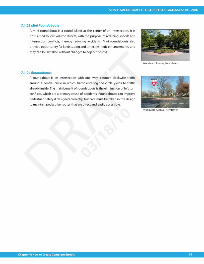
7.1.20 Shared Lane MarkingsShared lane markings (“Sharrows”) are arrows painted on the roadway, usually
in combination with signage, to alert drivers to the presence of bicycles on
roads that have no dedicated bicycle lanes (usually Class 3 bike routes). They
are often used in locations where a bike lane is desired but not feasible due
to roadway width constraints.
A bicycle boulevard is a shared roadway where the bicycle, or any other
human-powered vehicle, is the primary design vehicle. Bicycle boulevards
should be considered as a potential improvement on residential streets or
neighborhood streets where high-volume, high-speed motor vehicle tra"c
is undesirable.
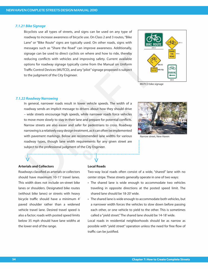
Bicycle parking can be broken into four (4) categories. These are short term
public parking, long-term public parking, short term private parking, and
long-term private parking. These four areas are described in greater detail in
Appendix (X).
www.pedbikeimages.org/Heather Bowden
Sharrows in Hilliard, Ohio
Bike parking at Union Station, New Haven
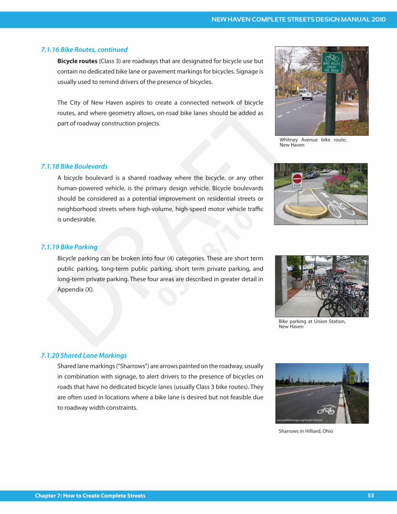
Bicycle routes (Class 3) are roadways that are designated for bicycle use but
contain no dedicated bike lane or pavement markings for bicycles. Signage is
usually used to remind drivers of the presence of bicycles.
The City of New Haven aspires to create a connected network of bicycle
routes, and where geometry allows, on-road bike lanes should be added as
part of roadway construction projects.
7.1.16 Bike Routes, continued
Whitney Avenue bike route, New Haven
NEW HAVEN COMPLETE STREETS DESIGN MANUAL 2010
54 Chapter 7: How to Create Complete Streets
DRAFT03/18/10
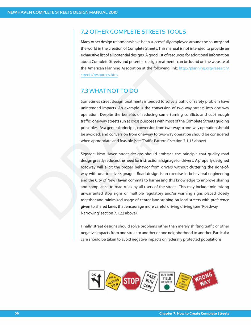
In general, narrower roads result in lower vehicle speeds. The width of a
roadway sends an implicit message to drivers about how they should drive
– wide streets encourage high speeds, while narrower roads force vehicles
to move more slowly to stay in their lane and prepare for potential con$icts.
Narrow streets are also easier and safer for pedestrians to cross. Roadway
narrowing is a relatively easy design treatment, as it can often be implemented
with pavement markings. Below are recommended lane widths for various
roadway types, though lane width requirements for any given street are
subject to the professional judgment of the City Engineer.
Arterials and CollectorsRoadways classi!ed as arterials or collectors
should have maximum 10-11’ travel lanes.
This width does not include on-street bike
lanes or shoulders. Designated bike routes
(without bike lanes) or streets with heavy
bicycle tra"c should have a minimum 4’
paved shoulder rather than a widened
vehicle travel lane. Desired travel speed is
also a factor; roads with posted speed limits
below 35 mph should have lane widths at
the lower end of the range.
Local RoadsTwo-way local roads often consist of a wide, “shared” lane with no
center stripe. These streets generally operate in one of two ways:
The shared lane is wide enough to accommodate two vehicles
traveling in opposite directions at the posted speed limit. The
shared lane should be 18-20’ wide.
The shared lane is wide enough to accommodate both vehicles, but
a narrower width forces the vehicles to slow down before passing
each other, or one vehicle to yield to the other. This is sometimes
called a “yield street.” The shared lane should be 14-18’ wide.
Local roads in residential neighborhoods should be as narrow as
possible with “yield street” operation unless the need for free $ow of
tra"c can be justi!ed.
7.1.22 Roadway Narrowing
> >
Narrow street, New Haven
7.1.21 Bike SignageBicyclists use all types of streets, and signs can be used on any type of
roadway to increase awareness of bicycle use. On Class 2 and 3 routes, “Bike
Lane” or “Bike Route” signs are typically used. On other roads, signs with
messages such as “Share the Road” can improve awareness. Additionally,
signage can be used to direct cyclists on where and how to ride, thereby
reducing con$icts with vehicles and improving safety. Current available
options for roadway signage typically come from the Manual on Uniform
Tra"c Control Devices (MUTCD), and any “pilot” signage proposed is subject
to the judgment of the City Engineer.
MUTCD bike signage
NEW HAVEN COMPLETE STREETS DESIGN MANUAL 2010
55Chapter 7: How to Create Complete Streets
DRAFT03/18/10
A roundabout is an intersection with one–way, counter–clockwise tra"c
around a central circle in which tra"c entering the circle yields to tra"c
already inside. The main bene!t of roundabouts is the elimination of left turn
con$icts, which are a primary cause of accidents. Roundabouts can improve
pedestrian safety if designed correctly, but care must be taken in the design
to maintain pedestrian routes that are direct and easily accessible.
7.1.24 Roundabouts
A mini roundabout is a round island at the center of an intersection. It is
best suited to low-volume streets, with the purpose of reducing speeds and
intersection con$icts, thereby reducing accidents. Mini roundabouts also
provide opportunity for landscaping and other aesthetic enhancements, and
they can be installed without changes to adjacent curbs.
7.1.23 Mini Roundabouts
Woodward Avenue, New Haven
Woodward Avenue, New Haven
NEW HAVEN COMPLETE STREETS DESIGN MANUAL 2010
56 Chapter 7: How to Create Complete Streets
DRAFT03/18/10
7.2 OTHER COMPLETE STREETS TOOLS
Many other design treatments have been successfully employed around the country and
the world in the creation of Complete Streets. This manual is not intended to provide an
exhaustive list of all potential designs. A good list of resources for additional information
about Complete Streets and potential design treatments can be found on the website of
the American Planning Association at the following link: http://planning.org/research/
streets/resources.htm.
7.3 WHAT NOT TO DO
Sometimes street design treatments intended to solve a tra"c or safety problem have
unintended impacts. An example is the conversion of two-way streets into one-way
operation. Despite the bene!ts of reducing some turning con$icts and cut-through
tra"c, one-way streets run at cross purposes with most of the Complete Streets guiding
principles. As a general principle, conversion from two-way to one-way operation should
be avoided, and conversion from one-way to two-way operation should be considered
when appropriate and feasible (see “Tra"c Patterns” section 7.1.15 above).
Signage: New Haven street designs should embrace the principle that quality road
design greatly reduces the need for instructional signage for drivers. A properly designed
roadway will elicit the proper behavior from drivers without cluttering the right-of-
way with unattractive signage. Road design is an exercise in behavioral engineering
and the City of New Haven commits to harnessing this knowledge to improve sharing
and compliance to road rules by all users of the street. This may include minimizing
unwarranted stop signs or multiple regulatory and/or warning signs placed closely
together and minimized usage of center lane striping on local streets with preference
given to shared lanes that encourage more careful driving driving (see “Roadway
Narrowing” section 7.1.22 above).
Finally, street designs should solve problems rather than merely shifting tra"c or other
negative impacts from one street to another or one neighborhood to another. Particular
care should be taken to avoid negative impacts on federally protected populations.

measurement
chapter 8
MAKING IT COUNT

NEW HAVEN COMPLETE STREETS DESIGN MANUAL 2010
59Chapter 8: Measurement
DRAFT03/18/10
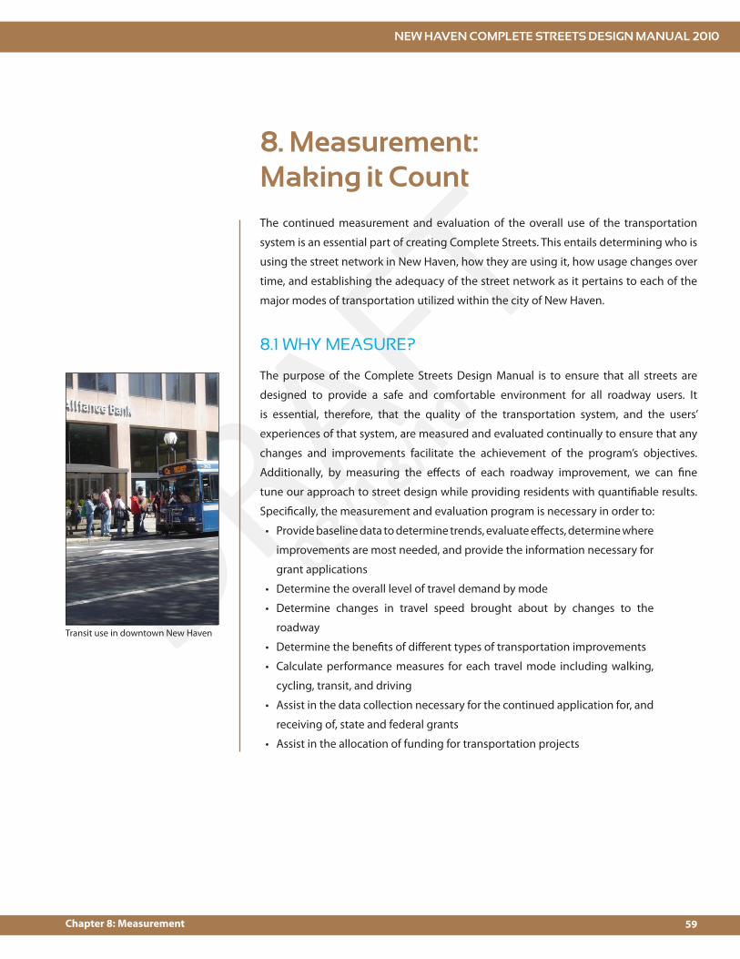
8. Measurement: Making it CountThe continued measurement and evaluation of the overall use of the transportation
system is an essential part of creating Complete Streets. This entails determining who is
using the street network in New Haven, how they are using it, how usage changes over
time, and establishing the adequacy of the street network as it pertains to each of the
major modes of transportation utilized within the city of New Haven.
The purpose of the Complete Streets Design Manual is to ensure that all streets are
designed to provide a safe and comfortable environment for all roadway users. It
is essential, therefore, that the quality of the transportation system, and the users’
experiences of that system, are measured and evaluated continually to ensure that any
changes and improvements facilitate the achievement of the program’s objectives.
Additionally, by measuring the e#ects of each roadway improvement, we can !ne
tune our approach to street design while providing residents with quanti!able results.
Speci!cally, the measurement and evaluation program is necessary in order to:
Provide baseline data to determine trends, evaluate e#ects, determine where
improvements are most needed, and provide the information necessary for
grant applications
Determine the overall level of travel demand by mode
Determine changes in travel speed brought about by changes to the
roadway
Determine the bene!ts of di#erent types of transportation improvements
Calculate performance measures for each travel mode including walking,
cycling, transit, and driving
Assist in the data collection necessary for the continued application for, and
receiving of, state and federal grants
Assist in the allocation of funding for transportation projects
8.1 WHY MEASURE?
Transit use in downtown New Haven
NEW HAVEN COMPLETE STREETS DESIGN MANUAL 2010
60 Chapter 8: Measurement
DRAFT03/18/10
Measurement and evaluation of the transportation system should focus on the collection
of both objective and subjective data.
8.3.1 Objective DataObjective data includes the volume of users, the number and rate of tra"c accidents,
travel speeds, and the demographics of roadway users. Objective data may be obtained
using a variety of methods and sources including manual counts, automated counts,
user surveys, and accident reports. In order to ensure that all roadway users are counted,
it should be a requirement that pedestrians, cyclists, and transit users are counted
whenever automobile counts are undertaken. In other words, all tra"c counts must
count all tra"c.
In addition to collecting data, it is important to make use of objective performance
measures for each major mode of transportation, including automobile, bicycle,
pedestrian, transit and multimodal levels of service (LOS). Much of the current imbalance
in our transportation system has come about in part as a result of overreliance on
automobile LOS as a metric for the quality of a given roadway segment, intersection,
8.2 WHO TO MEASURE?
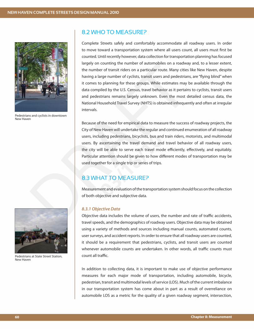
Complete Streets safely and comfortably accommodate all roadway users. In order
to move toward a transportation system where all users count, all users must !rst be
counted. Until recently however, data collection for transportation planning has focused
largely on counting the number of automobiles on a roadway and, to a lesser extent,
the number of transit riders on a particular route. Many cities like New Haven, despite
having a large number of cyclists, transit users and pedestrians, are “$ying blind” when
it comes to planning for these groups. While estimates may be available through the
data compiled by the U.S. Census, travel behavior as it pertains to cyclists, transit users
and pedestrians remains largely unknown. Even the most detailed census data, the
National Household Travel Survey (NHTS) is obtained infrequently and often at irregular
intervals.
Because of the need for empirical data to measure the success of roadway projects, the
City of New Haven will undertake the regular and continued enumeration of all roadway
users, including pedestrians, bicyclists, bus and train riders, motorists, and multimodal
users. By ascertaining the travel demand and travel behavior of all roadway users,
the city will be able to serve each travel mode e"ciently, e#ectively, and equitably.
Particular attention should be given to how di#erent modes of transportation may be
used together for a single trip or series of trips.
8.3 WHAT TO MEASURE?
Pedestrians at State Street Station, New Haven
Pedestrians and cyclists in downtown New Haven

NEW HAVEN COMPLETE STREETS DESIGN MANUAL 2010
61Chapter 8: Measurement
DRAFT03/18/10
or corridor. Recognizing that all transportation modes must be provided for, the !ve
measures mentioned above should be reported in the course of all major studies and
projects, allowing for a comprehensive and thorough summary of the quality of the
transportation network.
8.3.2 Subjective DataRecognizing that users’ experiences of the transportation system cannot always be
captured by objective measures, user surveys will be administered at regular intervals
and integrated with the city’s transportation planning and engineering projects. Surveys
can be administered in a variety of di#erent ways including intercept surveys, take-
home surveys and web-based surveys. This subjective data focuses on the attitudes and
beliefs of those individuals using the transportation system.
8.4 WHEN & WHERE TO MEASURE
As mentioned above, a large amount of data is generally obtained at irregular intervals
during the course of transportation plans and studies. This data provides important
snapshots of how the transportation system is used; however, for measurement
and evaluation of the transportation network to be maximally e#ective, it must be
standardized and undertaken at regular intervals. Below are data collection guidelines
for the measurement and evaluation program:
Counts and user surveys should be done annually.
Counts should re$ect a typical weekday and typical weekend with particular
emphasis on peak periods of travel demand.
A set of permanent count locations should be established so that trends and
changes may be observed and measured.
Because of the large student population in New Haven, counts should be
taken when both the universities and New Haven public schools are in
session.
Counts should not be undertaken during inclement weather or during
festivals or special events.
User surveys should be kept relatively constant so that results from di#erent
survey years may be compared. While new survey questions can and should
be introduced, this should be done carefully and sparingly.
In order to understand the e#ects and bene!ts of improvements made to the
transportation system, it is essential to conduct before and after studies, obtaining data
on volumes, modal split, travel speed, and accident experience. By doing this, we can
determine which improvements are maximally e#ective, discontinue improvements
that are ine#ective, and demonstrate the overall return on investment to taxpayers.
<<Choice of travel
mode
Choice of route Level of
satisfaction with existing
service/facilitiesPerceived gaps or
de!cienciesDesired
improvements
Barriers to transportation
Reported modal
split
Subjective Data
Purpose of trip


funding,
chapter 9
FUTURE STRATEGY &
review process

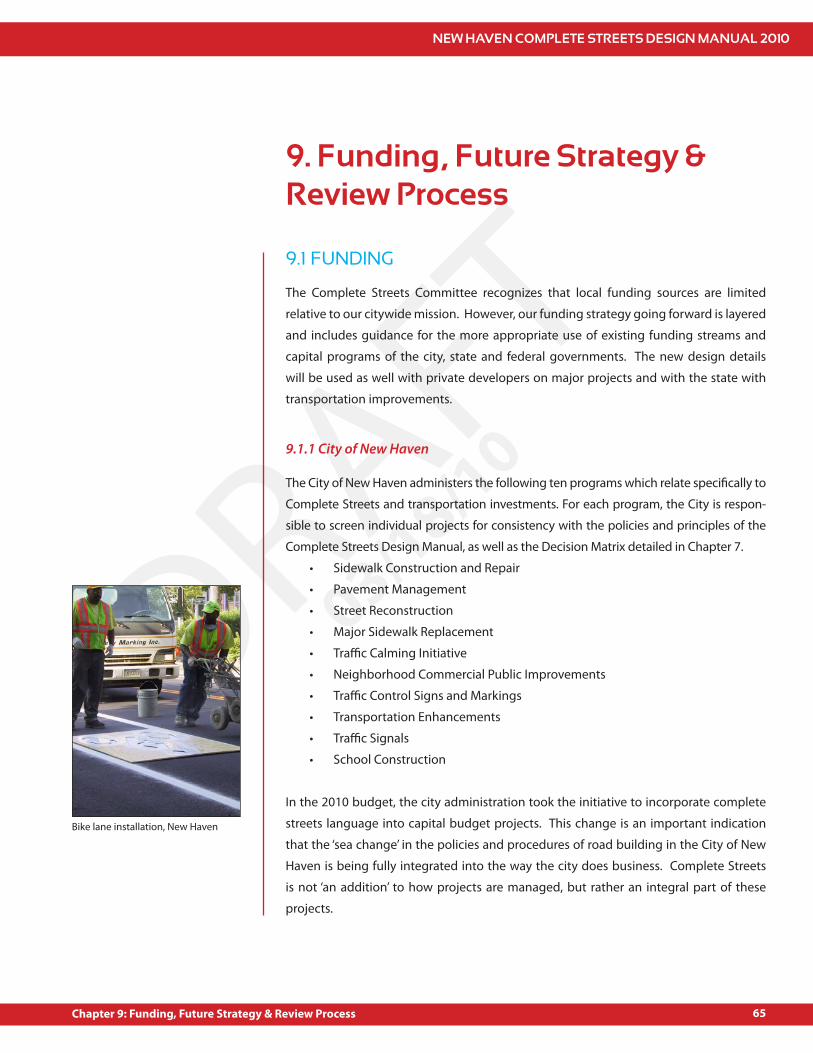
NEW HAVEN COMPLETE STREETS DESIGN MANUAL 2010
65Chapter 9: Funding, Future Strategy & Review Process
DRAFT03/18/10
9. Funding, Future Strategy & Review Process
9.1 FUNDING
The Complete Streets Committee recognizes that local funding sources are limited
relative to our citywide mission. However, our funding strategy going forward is layered
and includes guidance for the more appropriate use of existing funding streams and
capital programs of the city, state and federal governments. The new design details
will be used as well with private developers on major projects and with the state with
transportation improvements.
The City of New Haven administers the following ten programs which relate speci!cally to
Complete Streets and transportation investments. For each program, the City is respon-
sible to screen individual projects for consistency with the policies and principles of the
Complete Streets Design Manual, as well as the Decision Matrix detailed in Chapter 7.
Sidewalk Construction and Repair
Pavement Management
Street Reconstruction
Major Sidewalk Replacement
Tra"c Calming Initiative
Neighborhood Commercial Public Improvements
Tra"c Control Signs and Markings
Transportation Enhancements
Tra"c Signals
School Construction
In the 2010 budget, the city administration took the initiative to incorporate complete
streets language into capital budget projects. This change is an important indication
that the ‘sea change’ in the policies and procedures of road building in the City of New
Haven is being fully integrated into the way the city does business. Complete Streets
is not ‘an addition’ to how projects are managed, but rather an integral part of these
projects.
9.1.1 City of New Haven
Bike lane installation, New Haven
NEW HAVEN COMPLETE STREETS DESIGN MANUAL 2010
66 Chapter 9: Funding, Future Strategy & Review Process
DRAFT03/18/10
While each program is mainly focused on traditional state-of-good repair investments,
the Decision Matrix will serve as a guide toward the seamless integration of the
Complete Streets Design Manual with the general run of government. To better ensure
that each of these programs is consistent with the manual, the managing departments
will coordinate their work on a monthly basis.
In addition, the City Plan Department administers the site plan review process. Site
plan review is required to aid the City in determining the conformity of a proposed
building, use, or structure with speci!c provisions of the Zoning Ordinance as adopted
by the Board of Aldermen. As part of this review, City Plan reviews a submission against
the Engineer’s typical project details, which are now updated with Complete Streets
guidelines. Site plan review applies to the following projects:
All variance, special permit and special exception applications when required as
a condition of approval
Any new construction or change in an existing use for three or more dwelling
units, whether in a single structure or in multiple structures, whether in new
structures or converted space
Any new construction or change in an existing use involving 5,000 or more
square feet of gross building area
Any new construction or change in an existing use involving ten or more parking
spaces
Any use involving a drive up service window or facility
Other uses and applications as speci!ed in the Zoning Ordinance
9.1.2 State of Connecticut / South Central Regional Council of Governments
The City works closely with the Connecticut Department of Transportation and the
South Central Regional Council of Governments on the planning and implementation
of state and federally funded transportation projects in the City. For these projects, the
City will work with project planners and engineers to review speci!c projects from a
Complete Streets perspective. While the City generally must work within the parameters
of these larger programs, it is the responsibility of City sta# to (1) brief the State’s project
managers on the Complete Streets program; (2) select projects which enhance bicycle
and pedestrian access / safety; and (3) seek design exceptions and waivers as necessary
to create a Complete Street.
For general maintenance work, the City will arrange an annual review meeting with the
Connecticut District III and IIIA District Engineers to review work plans on state highways
and seek to enhance bicycle and pedestrian safety, reduce travel speed and improve
safety at key intersections.
Public meeting, CT Statewide Bicycle and Pedestrian Plan
NEW HAVEN COMPLETE STREETS DESIGN MANUAL 2010
67Chapter 9: Funding, Future Strategy & Review Process
DRAFT03/18/10
9.2 FUTURE STRATEGY
Often, projects that a#ect the ROW do not involve road reconstruction but are disruptive
and result in reestablishing much of the road. Such is the case with major sewer or drain
replacement projects that are managed by the GNHWPCA or related work that DOT is
doing to improve its roadway. As these projects come forward, it is often a good time
to incorporate Complete Street criteria as part of the project. In some cases, it may be
necessary to provide some supplemental funds that would allow this to happen. In doing
so, savings are realized. In most cases, mobilization costs, paving costs, and tra"c control
costs are made part of the eligible work which would otherwise be tagged to a separate
project. Leveraging other project work to satisfy needs of the complete streets work can
be considered when reviewing plans involving other work that disturbs the city ROW.
9.2.1 Overview
The City’s Comprehensive Plan, Sustainable Transportation Framework and the State’s
Long Range Transportation Plan provide the foundation for long-term investments. These
plans provide guidance for the more speci!c implementation e#orts found in municipal
development plans, development agreements, neighborhood-based and commercial
district improvement plans and other programs. City sta# and the Board of Aldermen
are responsible for the review of these more speci!c plans to ensure consistency with
the Complete Streets mission.
Complete Streets Guidance
Complete Streets Design Manual
Connecticut Long Range Transportation Plan
New Haven Comprehensive Plan
New Haven Greenways and Trails Plan
New Haven Sustainable Transportation Framework
Implementation Plans and Projects
City of New Haven Initiatives
Community Requests
CTDOT District III and IIIA Operating and Capital Programs
Elm City Cycling Bike Plan
Municipal Development Plans and Development Agreements
Safe Routes to Schools Master Plans
Neighborhood Bike, Pedestrian and Tra"c Calming Plans
In addition, the City will work closely with the South Central Regional Council of
Governments to design and schedule Complete Streets projects as part of the regional

NEW HAVEN COMPLETE STREETS DESIGN MANUAL 2010
68 Chapter 9: Funding, Future Strategy & Review Process
DRAFT03/18/10
work program. This includes both planning projects (“urban work program”) as well
as the regional plan for federal transportation funds, known as the Transportation
Improvement Program (TIP). The City will aggressively pursue funding through smaller
programs, including the Transportation Enhancement Program (for bike and public
transit projects) and the Safe Routes to School Program for school-based investments.
Reauthorization of SAFETEA-LU, the federal transportation authorization bill, will de!ne the
future of these programs, so the City has joined T4America, a nationwide advocacy group
that is lobbying the federal government for progressive changes to federal transportation
funding programs. Finally, the City will work closely with CT DOT on state projects that
ful!ll the mandate of the state’s Complete Streets legislation (Senate Bill 735).
The City of New Haven’s new O"ce of Sustainability has been charged with developing a
tra"c demand management strategy for the City of New Haven. This presents an important
opportunity for the City to develop transportation related polices and incentives that
support many of the guiding principle of this Complete Streets initiative.
There are important opportunities for reform of the New Haven zoning ordinances to
support Complete Streets goals. For instance, with support from the City Plan Department,
a new zoning category, BA-1 Neighborhood Center-Mixed Use, has been proposed. This
new zone would support higher density, pedestrian-oriented neighborhood business
districts by, in part, creating parking maximums. This is in contrast to the balance of
zoning categories that set minimums for parking, which counterproductively encourage
low-density, car-oriented development patterns.
Zoning reforms such as this can be further developed to include standards and
requirements for bike parking and other transportation related improvements that will
better support active transportation and transit in the City of New Haven.
Another future strategy that could be pursued to support the evolution of Complete Streets
in New Haven is the creation of guidelines for applying to the Federal Highway Administration
for status as a trial city for bicycle, pedestrian, and transit accommodations.
Finally, the Complete Streets Steering Committee recommends that in addition
communicating these guidelines to the City Plan Commission, that the joint committee
of the Police Commission and the Tra"c Commission also receive this document.
Immediate actions should include a presentation to the Commission members on the
content of the manual. It is strongly recommended that for future appointments to
this joint Commission that the Mayor prioritizes the selection of new member(s) with
expertise in transportation planning or related !elds.
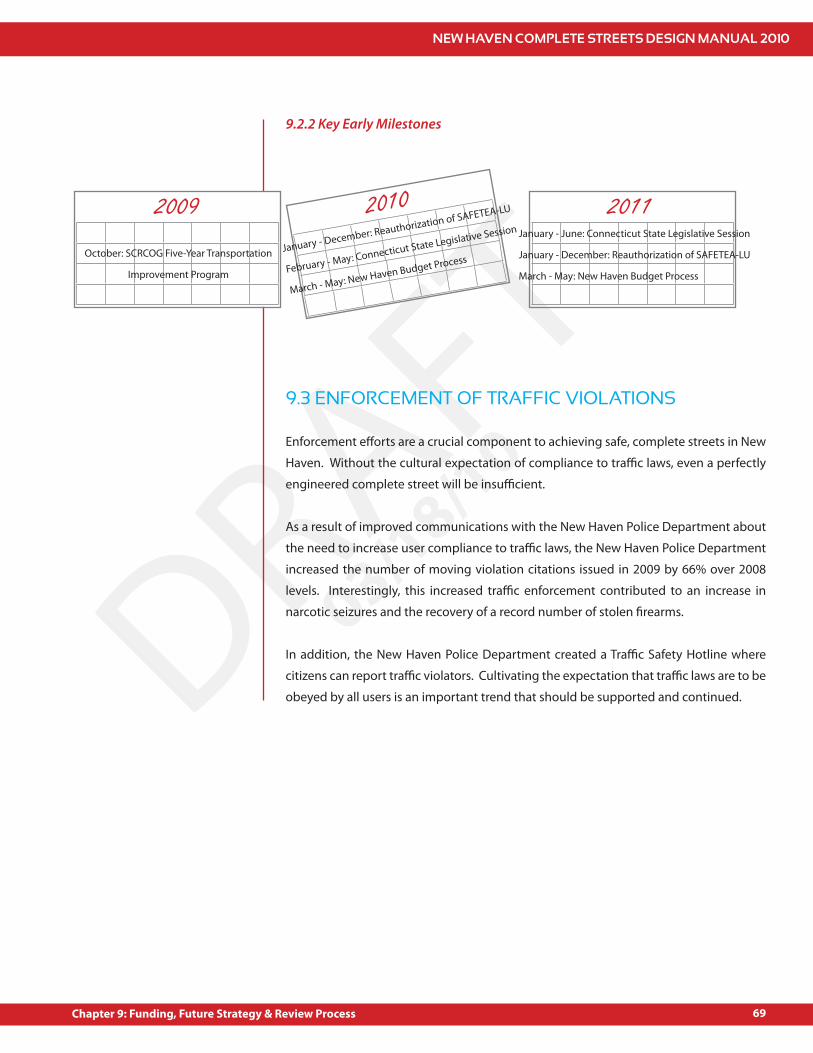
NEW HAVEN COMPLETE STREETS DESIGN MANUAL 2010
69Chapter 9: Funding, Future Strategy & Review Process
DRAFT03/18/10
9.2.2 Key Early Milestones
9.3 ENFORCEMENT OF TRAFFIC VIOLATIONS
Enforcement e#orts are a crucial component to achieving safe, complete streets in New
Haven. Without the cultural expectation of compliance to tra"c laws, even a perfectly
engineered complete street will be insu"cient.
As a result of improved communications with the New Haven Police Department about
the need to increase user compliance to tra"c laws, the New Haven Police Department
increased the number of moving violation citations issued in 2009 by 66% over 2008
levels. Interestingly, this increased tra"c enforcement contributed to an increase in
narcotic seizures and the recovery of a record number of stolen !rearms.
In addition, the New Haven Police Department created a Tra"c Safety Hotline where
citizens can report tra"c violators. Cultivating the expectation that tra"c laws are to be
obeyed by all users is an important trend that should be supported and continued.
2009October: SCRCOG Five-Year Transportation
Improvement Program
2010January - December: Reauthorization of SAFETEA-LU
February - May: Connecticut State Legislative Session
March - May: New Haven Budget Process
2011January - June: Connecticut State Legislative Session
January - December: Reauthorization of SAFETEA-LU
March - May: New Haven Budget Process

NEW HAVEN COMPLETE STREETS DESIGN MANUAL 2010
70 Chapter 9: Funding, Future Strategy & Review Process
DRAFT03/18/10
9.4 STREETS SMARTS EDUCATIONAL CAMPAIGN
9.5 PERIODIC REVIEW PROCESS
Tra"c safety education is the proper companion to any increased enforcement activity,
and the award-winning “Streets Smarts” Campaign accomplishes this in a savvy and
e#ective way. This campaign, which targets the three street user groups: walkers,
cyclists and drivers, seeks to educate users on their rights and responsibilities while
using the public streets. To date, the campaign has made over 6 million media
impressions and over 2,000 people have signed and submitted the “Smart Driver
Pledge. In an e#ort to create a dynamic web presence for Street Smarts, the City of
New Haven partnered with Yale University to create an engaging animated website
about tra"c safety: www.yale.edu/streetsmarts
On an annual basis, the City of New Haven will review roadway projects that have been
completed or are in the process of being completed to help determine the success of the
Complete Streets initiative. The City Engineer will include this information in its Annual
Report which is submitted to the Board of Alderman and the Mayor’s O"ce. The report
will include information about particular projects, including before and after data on
volumes, accidents, multi-modal LOS, etc. (see Chapter 8 for components of before and
after studies). The report will also include an evaluation of lessons learned and things
that should be changed. It will also provide data on public requests for projects, public
involvement in the planning process, and public response to completed projects.
In addition to the BOA report, the City of New Haven will convene an annual meeting
(likely around January-February) with stakeholders including city agency sta#, police
representatives, BOA members, and other interested parties to discuss Complete Streets
and plan for the future of the program.
Smart Driver
Pledge of Commitment
Walk Smart
Bike Smart
Drive Smart
Safe Streets take Street Smarts
I understand that my driving affects the safety and livability of other people’s
neighborhoods, just as other people’s driving affects my neighborhood. In recognition
of the desire of all citizens for quality of life, safety and the pursuit of happiness,
I declare PEACE in our neighborhoods and commit to using my Street Smarts
everyday by:
Driving slowly and courteously.
Acting like a guest in all neighborhoods.
Sharing the road with pedestrians and cyclists.
Giving myself enough travel time so that I’m not sacrificing courtesy or safety.
Refusing to be pressured by others’ impatience to drive above the speed limit.
Obeying the law by yielding for pedestrians in crosswalks.
Respecting others by keeping car stereo, horn and muffler noises at a low level.
Displaying my Street Smarts magnet on my vehicle and encouraging others to join.
NAME
ADDRESS
SIGNATURE
DATE
Please return this form to:
Mayor’s Office c/o Emily Byrne
165 Church Street
New Haven, CT 06510
Your Street Smarts magnet will
be sent to the above address.
NEW HAVEN COMPLETE STREETS DESIGN MANUAL 2010
71
DRAFT03/18/10
NotesAmerican Planning Association. http://planning.org/research/streets/1.
Census 2000 Summary File 3 (SF 3) - Sample Data, DP-4. Pro!le of Selected Housing 2.
Characteristics: 2000.
National Complete Streets Coalition. http://www.completestreets.org/complete-3.
streets-fundamentals/complete-streets-faq/
New York City Department of Transportation, Street Design Manual, Section 1.3, pp. 4.
30-33.
Notes


NEW HAVEN COMPLETE STREETS DESIGN MANUAL 2010
73
DRAFT03/18/10
Appendices
Appendix A: Project Request Form
Appendix B: Roadway Classi!cation Map
Appendix C: Land Use Map
Appendix D: Standard Details
Appendix E: Decision Matrix
Appendix F: Bicycle Boulevards
Appendix G: Bicycle Parking
Appendix H: Tree Policies
Appendices

NEW HAVEN COMPLETE STREETS DESIGN MANUAL 2010
74
DRAFT03/18/10

NEW HAVEN COMPLETE STREETS DESIGN MANUAL 2010
75
DRAFT03/18/10
APPENDIX A: PROJECT REQUEST FORM
Project Name
Project Location and Limits
Contact
Brief Description of Project
Project Impetus
Project Goals
Estimated Cost of Project (if known)
Funding Sources (if known)
Describe project context, including adjacent land uses, neighborhood character, and existing transportation system
Classi!cation of a#ected street(s)
PROJECT INFO
CONSISTENCY WITH COMPLETE STREETS POLICY & GUIDING PRINCIPLES
Appendix A

NEW HAVEN COMPLETE STREETS DESIGN MANUAL 2010
76
DRAFT03/18/10
Describe how proposed project supports Guiding Principles for Complete Streets.
See page 16 of this Manual for descriptions of each principle.
Safety and slow vehicle speeds
Connectivity
Human health
Livability
Context
Equity
Aesthetics
Economic development
Environment
Appendix A
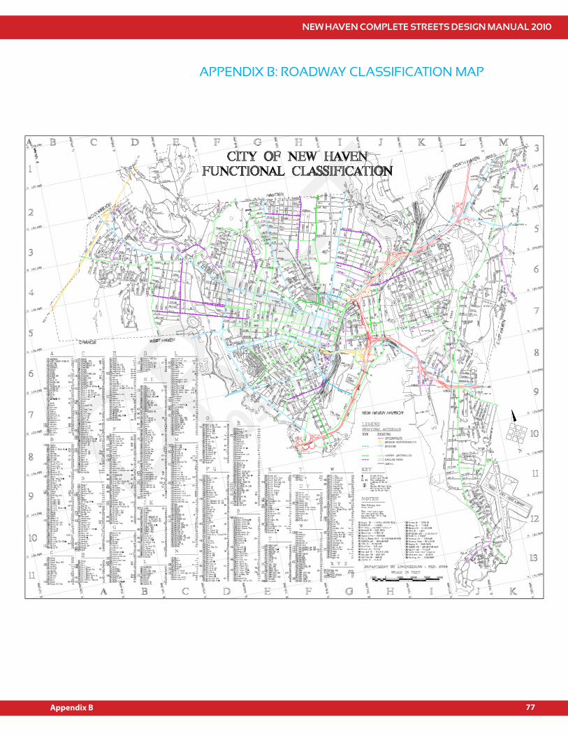
NEW HAVEN COMPLETE STREETS DESIGN MANUAL 2010
77
DRAFT03/18/10
APPENDIX B: ROADWAY CLASSIFICATION MAP
Appendix B

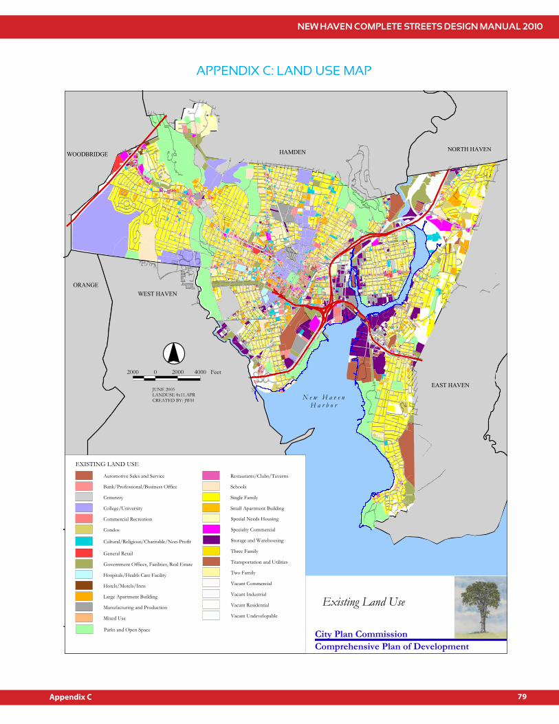
NEW HAVEN COMPLETE STREETS DESIGN MANUAL 2010
79
DRAFT03/18/10
APPENDIX C: LAND USE MAP
HAMDEN
GE
B
NORTH HWOODBRIDGE
EAST HAVENWEST HAVEN
WEST HAVENORANGE
WOODBRIDGE HAMDEN NORTH HAVEN
EAST HAVEN
.-,91
.-,95 .-,95
2000 0 2000 4000 Feet
JUNE 2003LANDUSE 8x11.APRCREATED BY: JWH N e w H a v e n
H a r b o r
EXISTING LAND USE
Automotive Sales and Service
Bank/Professional/Business Office
Cemetery
College/University
Commercial Recreation
Condos
General Retail
Government Offices, Facilities, Real Estate
Hospitals/Health Care Facility
Hotels/Motels/Inns
Large Apartment Building
Manufacturing and Production
Mixed Use
Parks and Open Space
Cultural/Religious/Charitable/Non-Profit
Restaurants/Clubs/Taverns
Schools
Single Family
Small Apartment Building
Special Needs Housing
Specialty Commercial
Storage and Warehousing
Three Family
Transportation and Utilities
Two Family
Vacant Commercial
Vacant Industrial
Vacant Residential
Vacant Undevelopable
City Plan Commission
Existing Land Use
Comprehensive Plan of Development
Appendix C

NEW HAVEN COMPLETE STREETS DESIGN MANUAL 2010
81
DRAFT03/18/10
APPENDIX D: STANDARD DETAILS
Bike Lane Detail Plan
Bike Lane Tra"c Marking Details
Tree Pit with Stone Dust Surface
Tree Planting with Mulch Saucer
Tree Protection Notes
Recommended Tree Types
Speed Hump Detail
Typical Roundabout Detail for Intersections Crossing Islands/Center Medians and Typical
Bumpout Detail for Intersections Center Roundabout
Typical Cross Section Mini Roundabout with Planter
Typical Cross Section
Appendix D
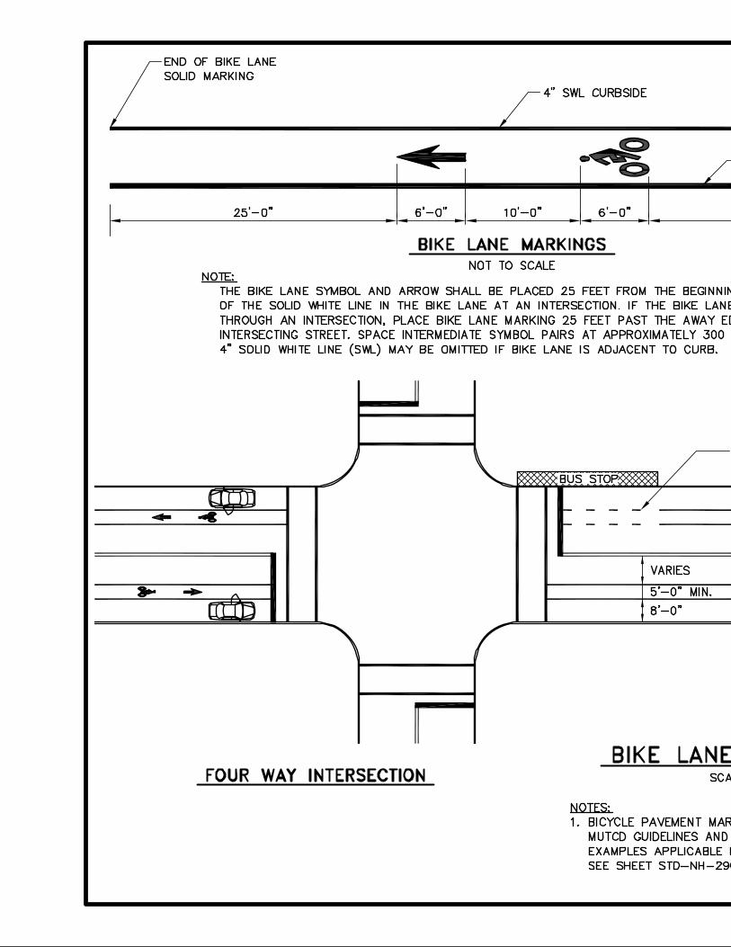
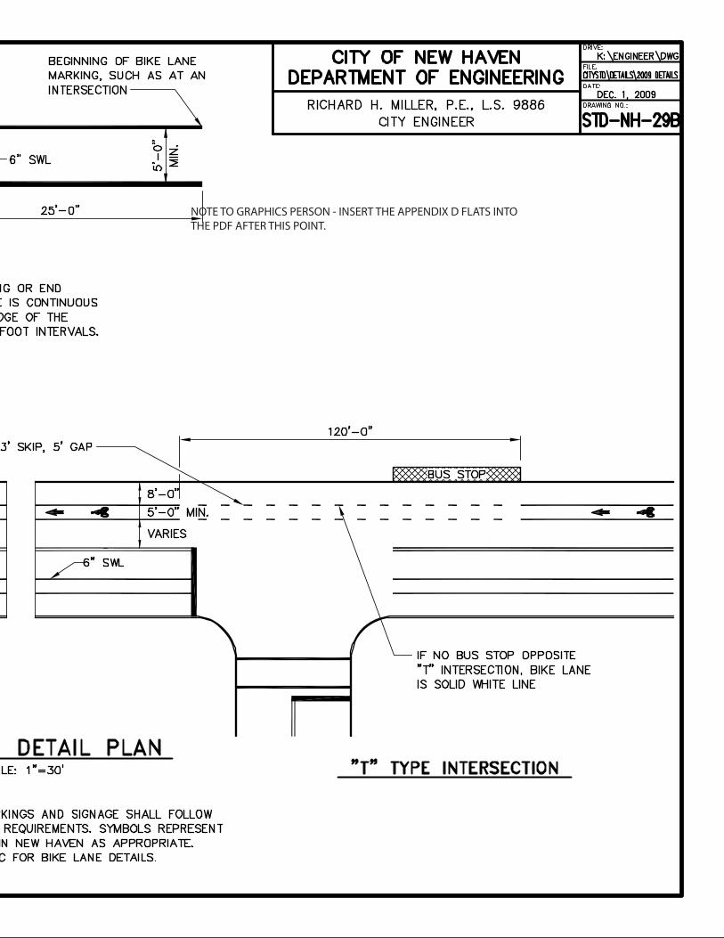
NOTE TO GRAPHICS PERSON - INSERT THE APPENDIX D FLATS INTO THE PDF AFTER THIS POINT.

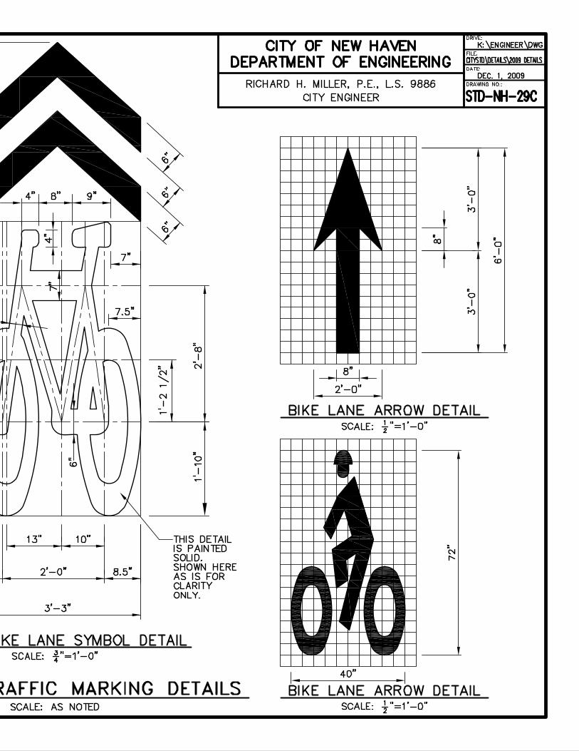
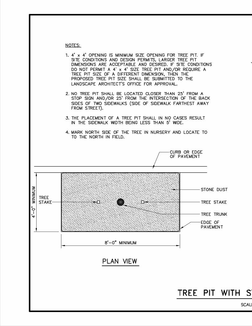


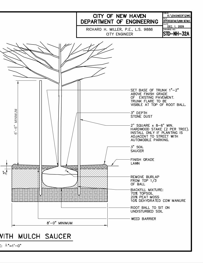
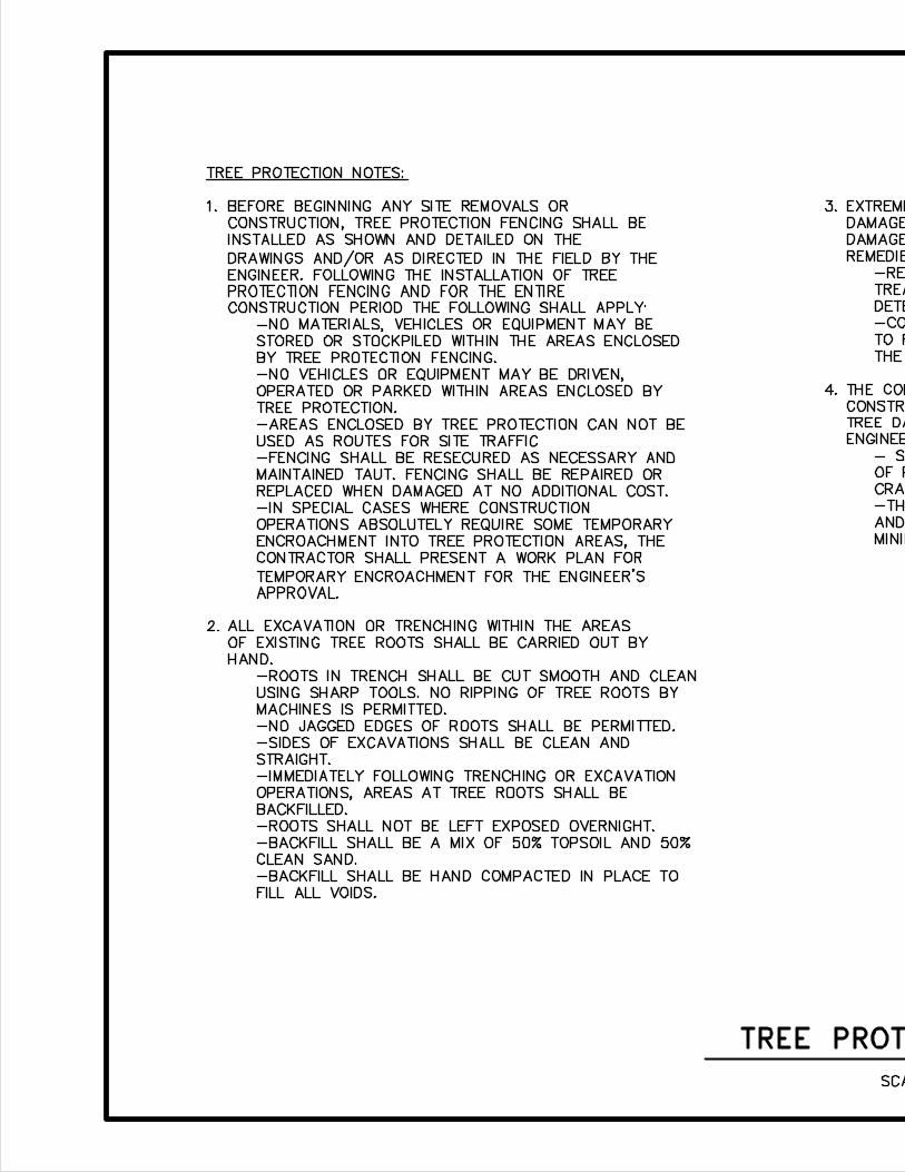
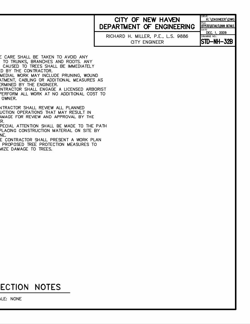

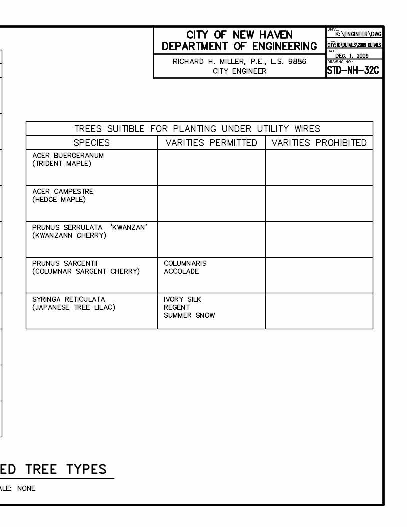
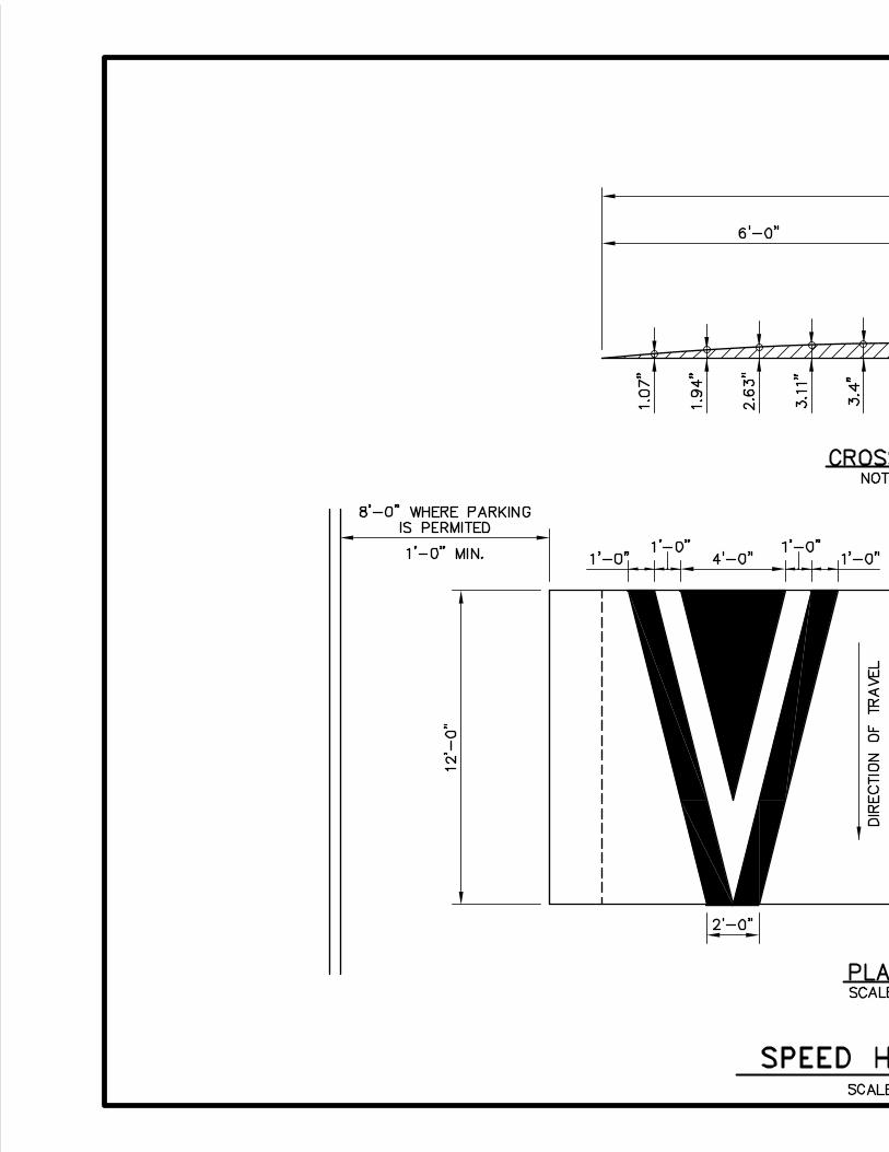
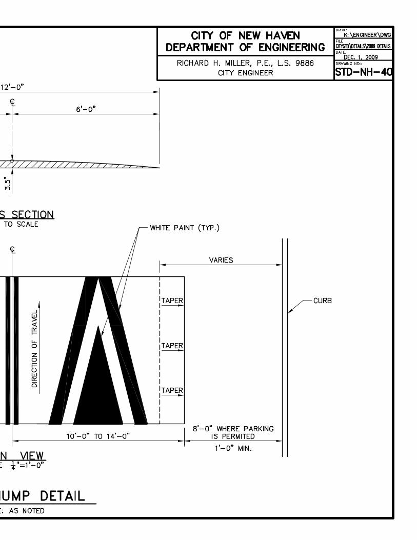


NEW HAVEN COMPLETE STREETS DESIGN MANUAL 2010
103
DRAFT03/18/10
APPENDIX E: DECISION MATRIX
Design criteria for the
street design tools
described above are
included in the following
Decision Matrix. These
criteria will ensure that a
selected technique not
only is appropriate for a
given road and project,
but also have the tra"c
characteristics that will
ensure a successful
installation.
Appendix E
CO
MP
LE
TE
ST
RE
ET
S D
EC
ISIO
N M
AT
RIX
Calm
ing
Str
eets
Sid
ew
alk
sIN
VO
LV
EM
EN
T G
UID
ELIN
ES
CLA
SS
IFIC
AT
ION
GU
IDLE
INE
S
RO
AD
AC
TIV
ITY
No Road Work Planned
Preservation
Resurfacing
Mill and Pave
Road Reconstruction
New Road
Sidewalk Repair
Sidewalk Reconstruction
New Sidewalk
Neighborhood Interest
Community Support
Adjacent Neighbor Consent
Education
City Interest
Speed/Volume Study
Principal Arterial >10,000 vpd
Minor Arterial 5,000-10,000 vpd
Collector 1,000-5,000 vpd
Local 500-1,000 vpd
Low-Volume Local <500 vpd
Serv
ice L
ife (
years
)0
47
15
20
20
515
15
Lead T
ime (
month
s)
03
69
18
36
36
24
Enhancem
ent
Pedestr
ian
Sid
ew
alk
wid
enin
gY
NN
NY
YN
YY
YY
YN
YN
NY
YY
YY
Handic
apped r
am
ps
YN
NN
YY
YY
YN
NN
NN
NN
YY
YY
Y
Str
eet fu
rniture
YN
NN
YY
NY
YY
YY
NN
NN
YY
YY
Y
Cro
ssw
alk
sY
YY
YY
YN
YY
YY
Y
Surf
ace tre
atm
ent
YN
NN
YY
NY
YY
YN
NN
NN
YY
YY
Y
Tre
e b
elt e
nhancem
ents
YN
NN
YY
NY
YY
YN
NN
NN
YY
YY
Y
Moto
r
Pavem
ent M
ark
ings
NY
YY
YY
NY
YN
NN
YY
YN
YY
YY
Y
Surf
ace tre
atm
ent
YY
YY
YY
NN
NN
NN
YN
NN
YY
YY
Y
Speed H
um
ps
YN
YY
YY
NN
NY
YY
YY
YN
NY
YY
N
Isla
nds
YN
NN
YY
NN
NY
YY
YY
YN
YY
YN
N
Chokers
/ B
um
p-o
uts
YN
NY
YY
NY
YY
YY
YY
YN
YY
YY
Y
Circle
sY
NN
YY
YN
YY
YY
YY
YY
YN
YY
YN
Chic
anes
YN
NY
YY
NY
YY
YY
YY
YN
NY
YY
N
Div
ert
ers
YN
NY
YY
NY
YY
YY
YY
YY
NN
YY
Y
Road C
losure
sY
NN
YY
YN
YY
YY
YY
YY
YN
NN
YN
YN
NY
YY
NY
YY
YN
YY
YY
NN
YY
N
Roundabouts
YN
NN
YY
NY
YY
YN
YY
YY
YY
YY
N
Roadw
ay n
arr
ow
ing
NN
NN
YY
NY
YY
YN
YY
NN
YY
YY
Y
Bic
ycle
Bik
e lanes
YY
YY
YY
NN
NN
NY
YY
NN
YY
YN
N
Sharr
ow
sY
YY
YY
YN
NN
NN
YY
YN
NY
YY
NN
Sig
nage
YY
YY
YY
NN
NN
NY
NN
NN
YY
YN
N

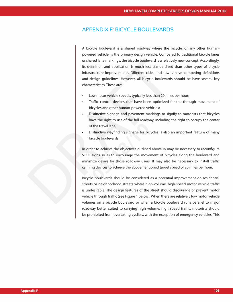
NEW HAVEN COMPLETE STREETS DESIGN MANUAL 2010
105
DRAFT03/18/10
A bicycle boulevard is a shared roadway where the bicycle, or any other human-
powered vehicle, is the primary design vehicle. Compared to traditional bicycle lanes
or shared lane markings, the bicycle boulevard is a relatively new concept. Accordingly,
its de!nition and application is much less standardized than other types of bicycle
infrastructure improvements. Di#erent cities and towns have competing de!nitions
and design guidelines. However, all bicycle boulevards should be have several key
characteristics. These are:
Low motor vehicle speeds, typically less than 20 miles per hour;
Tra"c control devices that have been optimized for the through movement of
bicycles and other human-powered vehicles;
Distinctive signage and pavement markings to signify to motorists that bicycles
have the right to use of the full roadway, including the right to occupy the center
of the travel lane;
Distinctive way!nding signage for bicycles is also an important feature of many
bicycle boulevards.
In order to achieve the objectives outlined above in may be necessary to recon!gure
STOP signs so as to encourage the movement of bicycles along the boulevard and
minimize delays for those roadway users. It may also be necessary to install tra"c
calming devices to achieve the abovementioned target speed of 20 miles per hour.
Bicycle boulevards should be considered as a potential improvement on residential
streets or neighborhood streets where high-volume, high-speed motor vehicle tra"c
is undesirable. The design features of the street should discourage or prevent motor
vehicle through tra"c (see Figure 1 below). When there are relatively low motor vehicle
volumes on a bicycle boulevard or when a bicycle boulevard runs parallel to major
roadway better suited to carrying high volume, high speed tra"c, motorists should
be prohibited from overtaking cyclists, with the exception of emergency vehicles. This
APPENDIX F: BICYCLE BOULEVARDS
Appendix F
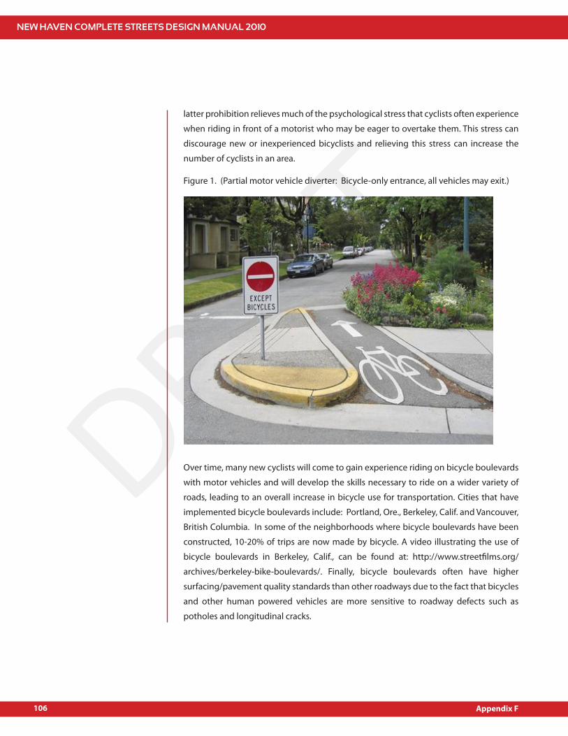
NEW HAVEN COMPLETE STREETS DESIGN MANUAL 2010
106
DRAFT03/18/10
latter prohibition relieves much of the psychological stress that cyclists often experience
when riding in front of a motorist who may be eager to overtake them. This stress can
discourage new or inexperienced bicyclists and relieving this stress can increase the
number of cyclists in an area.
Figure 1. (Partial motor vehicle diverter: Bicycle-only entrance, all vehicles may exit.)
Over time, many new cyclists will come to gain experience riding on bicycle boulevards
with motor vehicles and will develop the skills necessary to ride on a wider variety of
roads, leading to an overall increase in bicycle use for transportation. Cities that have
implemented bicycle boulevards include: Portland, Ore., Berkeley, Calif. and Vancouver,
British Columbia. In some of the neighborhoods where bicycle boulevards have been
constructed, 10-20% of trips are now made by bicycle. A video illustrating the use of
bicycle boulevards in Berkeley, Calif., can be found at: http://www.street!lms.org/
archives/berkeley-bike-boulevards/. Finally, bicycle boulevards often have higher
surfacing/pavement quality standards than other roadways due to the fact that bicycles
and other human powered vehicles are more sensitive to roadway defects such as
potholes and longitudinal cracks.
Appendix F
NEW HAVEN COMPLETE STREETS DESIGN MANUAL 2010
107
DRAFT03/18/10
APPENDIX G: BICYCLE PARKING
Appendix G
Bicycle Parking and StorageJust as the amount of available parking can encourage or reduce of motor vehicle travel,
an ample supply of bicycle parking can increase the number of cyclists on the road.
In New Haven, as in cities throughout the country, bicycle theft remains a signi!cant
problem and therefore a major deterrent to bicycle transportation. In many ways, the
available parking supply represents the terminal capacity of the bicycle transportation
system. Simply put, people will be reluctant or unwilling to utilize the bicycle as a form
of transportation if they are not certain that they will have a safe place to secure their
bicycle at the end of each trip. A failure to accommodate cyclists parking needs may
result in a modal shift away from bicycling and a corresponding increase in automobile
travel and the associated costs that accompany it, including increased pollution, tra"c
congestion and demand for automobile parking facilities.
As a result, it is essential that City of New Haven be committed to providing high-quality
bicycle parking in su"cient quantity to meet current and projected demands. Broadly
speaking, bicycle parking can be broken into four (4) categories. These are:
Short Term Public Parking;
Long-Term Public Parking;
Short Term Private Parking;
Long-Term Private Parking.
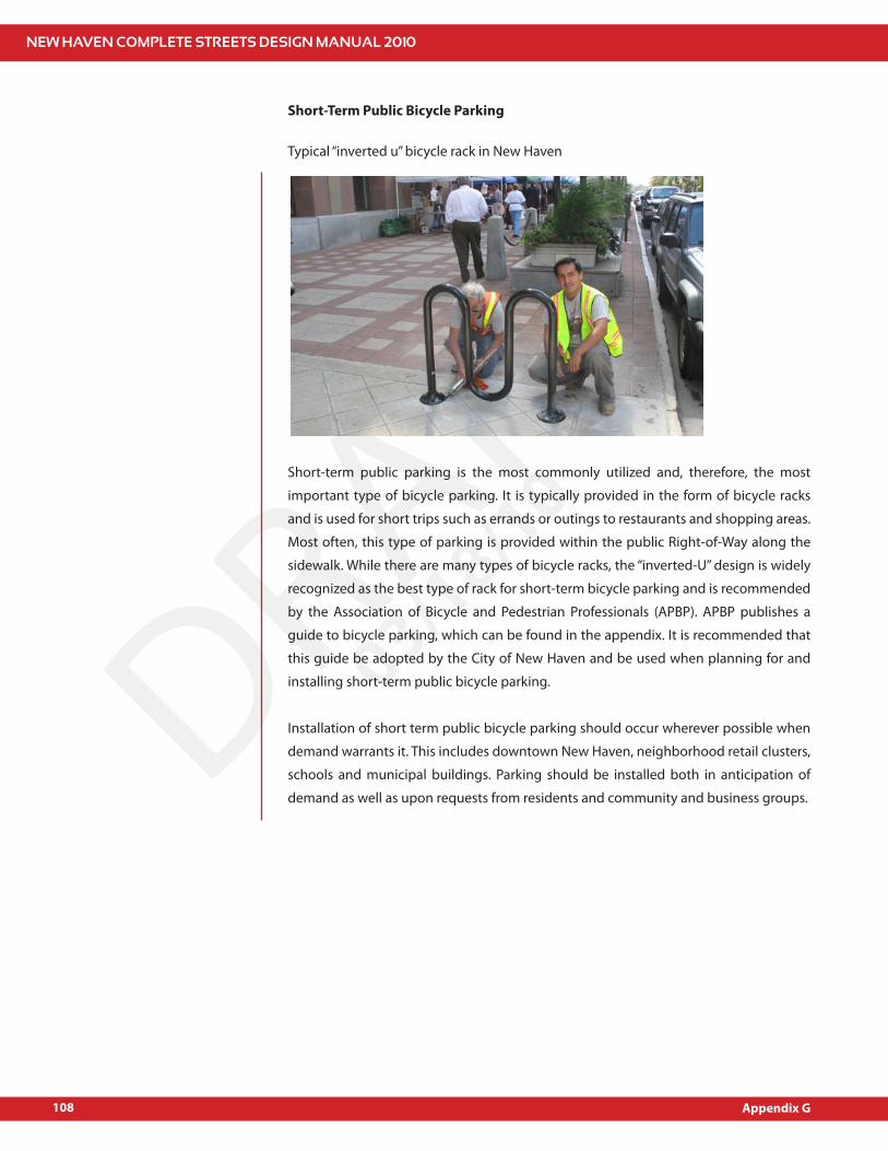
NEW HAVEN COMPLETE STREETS DESIGN MANUAL 2010
108
DRAFT03/18/10
Short-Term Public Bicycle Parking
Typical “inverted u” bicycle rack in New Haven
Short-term public parking is the most commonly utilized and, therefore, the most
important type of bicycle parking. It is typically provided in the form of bicycle racks
and is used for short trips such as errands or outings to restaurants and shopping areas.
Most often, this type of parking is provided within the public Right-of-Way along the
sidewalk. While there are many types of bicycle racks, the “inverted-U” design is widely
recognized as the best type of rack for short-term bicycle parking and is recommended
by the Association of Bicycle and Pedestrian Professionals (APBP). APBP publishes a
guide to bicycle parking, which can be found in the appendix. It is recommended that
this guide be adopted by the City of New Haven and be used when planning for and
installing short-term public bicycle parking.
Installation of short term public bicycle parking should occur wherever possible when
demand warrants it. This includes downtown New Haven, neighborhood retail clusters,
schools and municipal buildings. Parking should be installed both in anticipation of
demand as well as upon requests from residents and community and business groups.
Appendix G
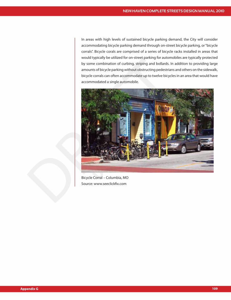
NEW HAVEN COMPLETE STREETS DESIGN MANUAL 2010
109
DRAFT03/18/10
In areas with high levels of sustained bicycle parking demand, the City will consider
accommodating bicycle parking demand through on-street bicycle parking, or “bicycle
corrals”. Bicycle corals are comprised of a series of bicycle racks installed in areas that
would typically be utilized for on-street parking for automobiles are typically protected
by some combination of curbing, striping and bollards. In addition to providing large
amounts of bicycle parking without obstructing pedestrians and others on the sidewalk,
bicycle corrals can often accommodate up to twelve bicycles in an area that would have
accommodated a single automobile.
Bicycle Corral – Columbia, MO
Source: www.seeclick!x.com
Appendix G

NEW HAVEN COMPLETE STREETS DESIGN MANUAL 2010
110
DRAFT03/18/10
Long-Term Public Parking
Long-term public bicycle parking is necessary when cyclists have to store their bicycles
away from their homes for an extend period of time. Demand of this type of bicycle
parking is most common at major transit hubs where cyclists may be arriving by bicycle
and then switching to other modes of transportation such as trains or buses. It is also
necessary outside of major public sector employers such as schools, libraries, municipal
buildings. Long-term bicycle parking should be located inside buildings whenever
possible to protect bicycles from theft as well as inclement weather. Depending on
building type and location, indoor bicycle parking may be e#ectively provided in a
number of ways, including:
Bicycle racks inside New Haven Parking Authority (NHPA) garages;
Covered parking at major transit hubs;
Bicycle racks in the basement of public buildings;
Bicycle storage areas inside of public schools;
Bicycle stations o#ering sta#ed parking areas such as the City Hall Bicycle Station.
Appendix G
NEW HAVEN COMPLETE STREETS DESIGN MANUAL 2010
111
DRAFT03/18/10
Appendix G
Private Bicycle Parking
Private bicycle parking includes residential parking, bicycle parking provided by
business, and bicycle parking provided by institutions. As part of its e#orts to develop
a transportation system that serves all users e#ectively, the City will encourage and, at
times, require private business and institutions to provide safe and accessible bicycle
parking. Just as the City often requires private developers and organizations to provide
a speci!ed amount of automobile parking through minimum parking requirements,
similar consideration should be given to bicycle parking during the site plan approval
process. As with publicly provided parking, private organizations should provide both
short-term and long-term bicycle parking facilities.

NEW HAVEN COMPLETE STREETS DESIGN MANUAL 2010
113
DRAFT03/18/10
APPENDIX H: TREE POLICIES
New Haven is famously known as “Elm City” in the post-civil war era due to the planting
of numerous elm trees by James Hillhouse and David Austin and for the preservation of
older trees already standing since the year 1790, which serve as “shade and ornament
to the City.” Compared to a treeless landscape, downtown shoppers linger longer, tra"c
slows, crime is reduced, and property values soar where healthy trees shade urban
streets. Trees and natural views have been also been found to be e#ective in soil erosion
control, stormwater management and in the treatment of various developmental
disorders. Hence, tree planting should be incorporated as a component and feature of
any site development and/or work within the public right-of-way.
A tree belt is recommended between the curb and the project property line whenever
possible. The width of the tree belt should be as wide as possible. A minimum width of
5’ is desired unless site conditions do not make this width feasible. Lawn is the preferred
surface within the tree belt to maximize the soil volume and to promote tree growth and
vitality. If lawn is not feasible as a surface within the tree belt, then adequate openings
within paved areas should be provided for placement of soil to support tree growth.
The preferred minimum opening for a tree pit is 4’ by 8’. To maximize the number of
trees incorporated within a tree belt, the minimum recommended distance between
tree plantings is 25’. Depending on the tree species and site conditions, trees should
be spaced 25’ to 40’ at the center. No tree should be planted closer than 25’ to a street
corner. Any tree that is to be planted underneath an overhead utility wire should have a
maximum mature height of 30’.
Proper care should be taken to avoid con$icts between tree planting and utility lines
located within the public right-of-way. Tree roots may sometimes damage these utility
lines and cause considerable expense and discomfort to property owners and public
service authorities involved. In order to protect and minimize disturbance to the existing
street trees located in areas of proposed construction, the tree protection policies
outlined in the following Section 7025 are recommended.
Appendix H
NEW HAVEN COMPLETE STREETS DESIGN MANUAL 2010
114
DRAFT03/18/10
During construction of sidewalks, the “Zone of Rapid Taper” should be clearly determined
and marked so that it is clearly visible during all phases of construction. If construction
work requires the cutting of roots in the “Zone of Rapid Taper”, a tree preservation
plan should be required (see form). If the construction work takes place outside of the
“Zone of Rapid Taper but may/will impact roots of the tree, the tree should be watered
beginning one week before the start of the construction, through out the construction
period, and for one week after the completion of construction. Thus, watering should
occur at a minimum of every four days during this period. If practical, the “Zone of Rapid
Taper” should be fenced during all phases of construction. Clean soil should be placed
between the pruned roots and construction area. For example, a form may be placed
against a cut root and when this form is removed soil is replaced. A contractor may want
to and/or be required to enhance these measures by the City Arborist or Tree Warden.
For non-city contractors performing any pruning, removal, or disturbance to the City’s
street trees located on City property, City right-of-ways, or the tree belt of City streets,
the policies outlined in the following Section 7025 are applicable.
In case of new tree plantings along public rights-of-way, the policies outlined in Section
02930 are recommended to be followed (Section 02930 Planting can be provided upon
request). Private property owners should be educated about the role of street trees
in tra"c calming and encouraged to plant and maintain trees on the front yards of
their properties. Public-private partnerships need to be fostered as a !rst step. A list of
recommended and discouraged street trees can be provided by the City of New Haven
as well as the City’s policy on using non-city contractors.
Appendix H
NEW HAVEN COMPLETE STREETS DESIGN MANUAL 2010
115
DRAFT03/18/10
SECTION 7025 TREE PROTECTION
7025.10 DESCRIPTIONWork under this item shall include the furnishing and installation of tree protection and
root removal during any construction activity within the City Right of Way or as directed
by the Engineer in accordance with these speci!cations. It is the City’s policy that healthy
trees within the city right of way are appropriately protected during any construction
activity that a#ects the canopy or root zone of the tree(s). Activities of excavation such
as sidewalk construction or utility trenching must consider the health and protection
of the tree(s) for any disturbance of the root zone or canopy. The following section shall
apply.
7025.20 QUALITY ASSURANCEPrior to any construction activity within the City Right of Way where trees may be a#ected
by the work being proposed, the contractor shall contact the Urban Forester, at the New
Haven Department of Parks, Recreation and Trees at 203-946-6556. At his/her direction
the potential tree(s) that are a#ected shall be inventoried and a determination made as
to its health and anticipated protection required to ensure the construction activities
will have a minimal impact on the identi!ed tree(s). If required the contractor may be
directed to hire an independent licensed arborist as approved by the Department of
Parks, Recreation and Trees to guide the contractor on protective measures or work that
is necessary to minimize damage to the tree(s) impacted.
7025.21 MATERIALS AND EQUIPMENTDuring construction where pruning is involved the equipment being used must follow
OSHA and ANSI standards including bucket trucks, chippers, and personnel safety
equipment. When working around tree roots the contactor shall not use any equipment
that rips or tears at the root zone. Hand tools and appropriate excavation methods of
care around root zones are required. Back !ll material, if required, in formed tree wells
shall be clean soil.
7025.30 CONSTRUCTION METHODSExcavations or sidewalk removals and replacements require careful recognition of the
tree(s) that may be a#ected by the construction activity. Removal of sidewalks where
tree roots have raised the walk require special attention after the initial screening by the
Urban Forester. Any sidewalk that has tree root intrusion should be carefully removed by
pealing o# the slab or broken-up with hand tools and removed. Where applicable, the
Appendix H
NEW HAVEN COMPLETE STREETS DESIGN MANUAL 2010
116
DRAFT03/18/10
contractor shall provide the largest tree well possible creating a root zone for the tree
and a minimum sidewalk area for passage at 48”. In extreme cases 42” may be required.
Any tree roots over 6” in diameter that interfere with the safe minimum passage shall
be pruned by a licensed arborist with a minimum of !ve years experience as approved
by the Department of Parks, Recreation and Trees. The following provides further
guidance:
A. Protection of Existing TreesAll trees shall be protected from damage to trunks, branches and roots.1.
Do not disturb the existing grade inside the tree root zone unless otherwise 2.
indicated or directed in the !eld by the Engineer. The root zone is considered
equal to the branch spread of the tree.
No materials, vehicles or equipment shall be stored, or stockpiled within the 3.
root zone of existing trees.
Machinery shall not be driven over the root zone unless it is absolutely 4.
necessary to gain access to the construction site.
The contractor shall exercise caution in operating all machinery so that there 5.
is no damage to tree trunk, roots or branches.
B. Root PruningAll excavation required within the area of existing tree roots shall be carried 1.
out by hand.
Roots shall be cut smooth and clean using sharp root cutting tools in 2.
accordance with good arboricultural practice. Cutting, ripping or tearing of
tree roots using a backhoe or other non hand tool is not permitted.
Pruning of tree roots shall be kept to the absolute minimum necessary to 3.
install sidewalk and base course.
Root removal and materials covering existing roots shall be timed so exposed 4.
roots are not left exposed overnight or over non-working days or weekends.
All roots that will be left exposed for more than three hours shall be sprayed 5.
periodically with water and/or covered with moisture laden material to keep
the roots moist.
Pruning of any root 6” or greater in diameter shall be done by a licensed/certi!ed 6.
arborist or an urban forester employed by the New Haven Department of Parks,
Recreation & Trees. To contact an urban forester employed by the New Haven
Department of Parks, Recreation & Trees call 410-2482. Urban foresters require
24 hours notice before coming to the job site.
Appendix H

NEW HAVEN COMPLETE STREETS DESIGN MANUAL 2010
117
DRAFT03/18/10
C. Tree RepairAny damage caused to trees by the work of this contract through negligence 1.
by the contractor shall be immediately remedied by the contractor.
Remedial work may include pruning, wound treatment, cabling, or additional 2.
support measures as determined by the Engineer.
Contractor shall engage a licensed arborist to perform such work, as approved 3.
by the Engineer.
All required remedial work shall be performed to the satisfaction of the New 4.
Haven Department of Parks, Recreation and Trees, at no additional cost to
the Owner.
D. Tree ReplacementIf damage to any tree is severe, because of negligence by the contractor as 1.
determined by the New Haven Department of Parks, Recreation and Trees, it
shall be replaced with a new tree of equal size caliper and species as that of
the damaged tree.
If a replacement tree of equal size caliper is not possible, it shall be a minimum 2.
caliper size of 4”.
Replacement trees shall be supplied and installed at no additional costs to 3.
the Owner, including all incidental costs including the costs of inspection of
the tree at the nursery and any other incidental costs associated with tree
replacement.
7025.40 METHOD OF MEASUREMENT
Unless speci!cally identi!ed as a pay item per tree, all work as required under these
speci!cations shall be made part of the work being performed that a#ects any tree(s)
within the city right of way or as directed.
7025.50 BASIS OF PAYMENT
Payment for this work shall be included as part of other bid items of the contract, unless
identi!ed as a pay item per tree.
Appendix H