Embed Size (px)
Citation preview

Complete Streets Initiative Updates
Transportation and Trinity River Project Committee
September 15, 2015
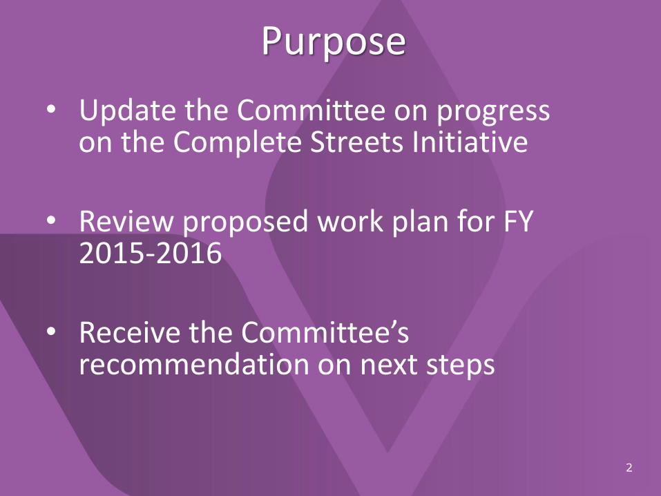
Purpose
2
• Update the Committee on progress on the Complete Streets Initiative
• Review proposed work plan for FY 2015-2016
• Receive the Committee’s recommendation on next steps
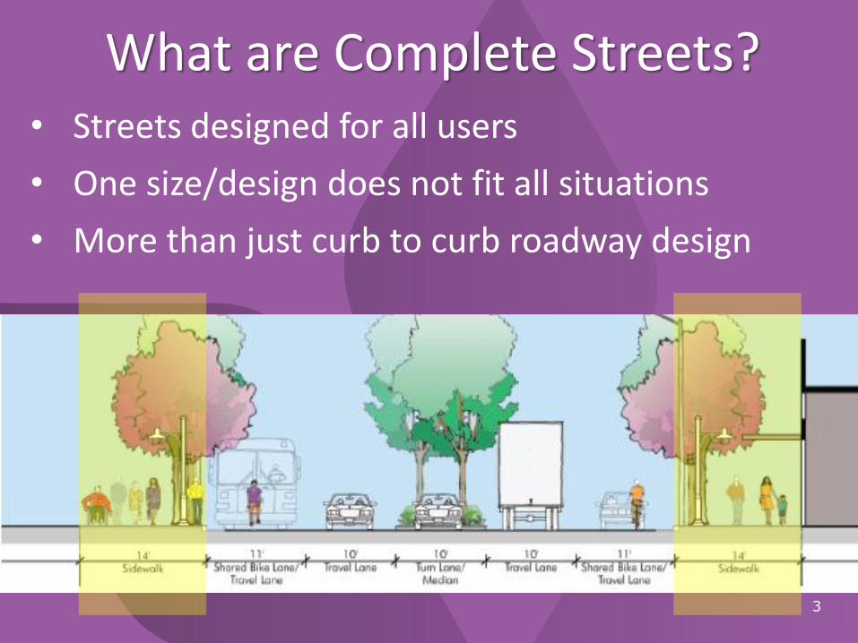
What are Complete Streets?
3
• Streets designed for all users
• One size/design does not fit all situations
• More than just curb to curb roadway design
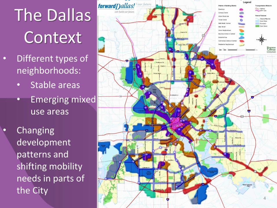
• Different types of neighborhoods:
• Stable areas
• Emerging mixed use areas
• Changing development patterns and shifting mobility needs in parts of the City
4
The Dallas Context

Key Progress Milestones
5
• 2011 Bike Plan marked a significant shift in bike policy
• 2011 Federal grant awarded to develop complete streets policy
• 2012 Bond Program included targeted funding for Complete Street projects
• Since 2012 – Annual funding commitment to on-street bike lane striping
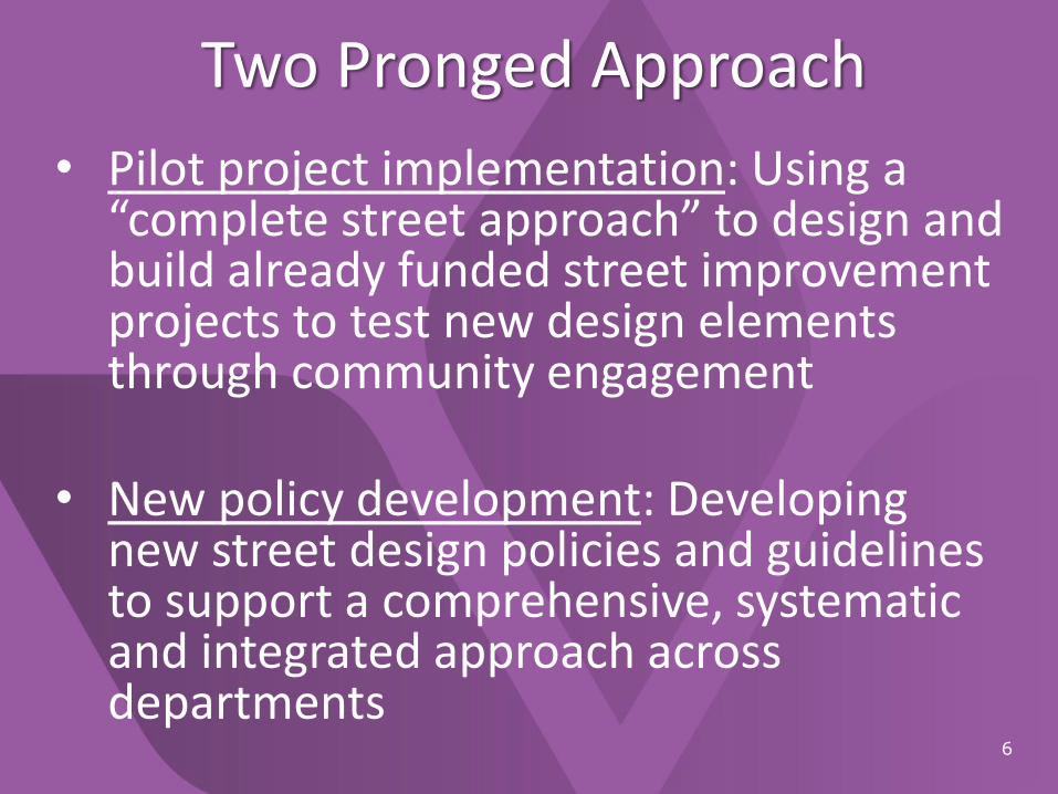
Two Pronged Approach
6
• Pilot project implementation: Using a “complete street approach” to design and build already funded street improvement projects to test new design elements through community engagement
• New policy development: Developing new street design policies and guidelines to support a comprehensive, systematic and integrated approach across departments
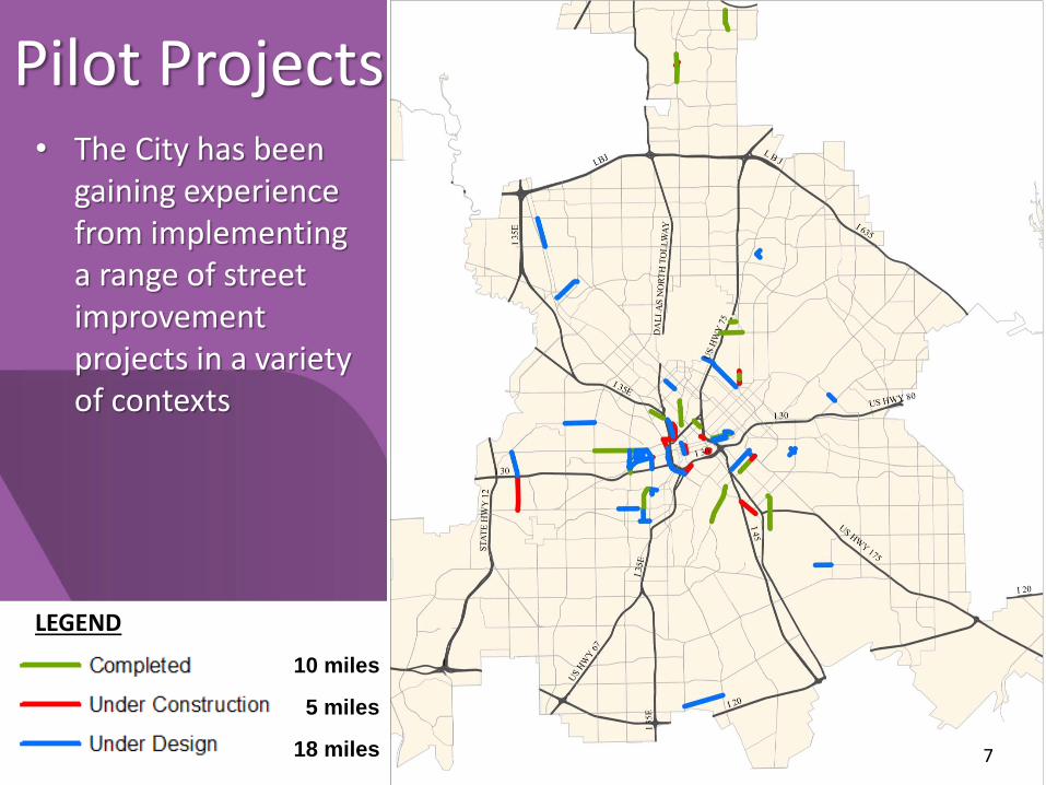
7* This map does not include street restriping projects with bike lanes.
Pilot Projects
LEGEND
10 miles
5 miles
18 miles
• The City has been gaining experience from implementing a range of street improvement projects in a variety of contexts
7
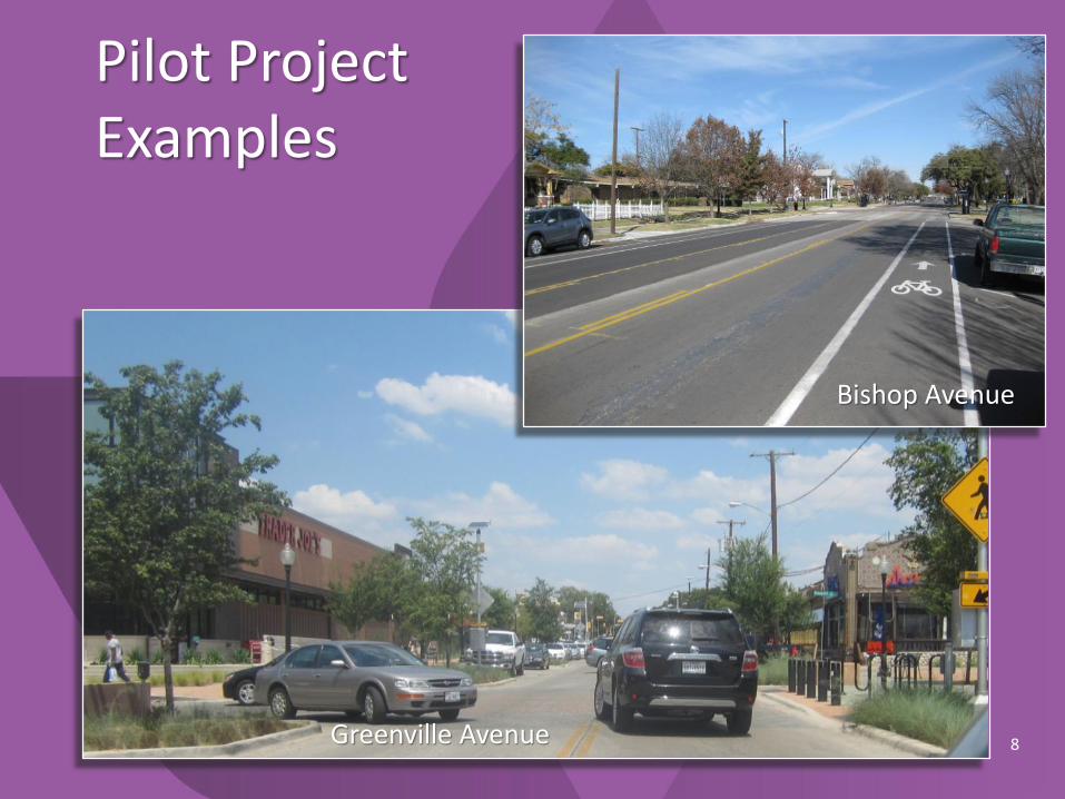
Pilot Project Examples
Greenville Avenue
Bishop Avenue
8

Pilot Project Examples
Elm Street 9
Sylvan Avenue
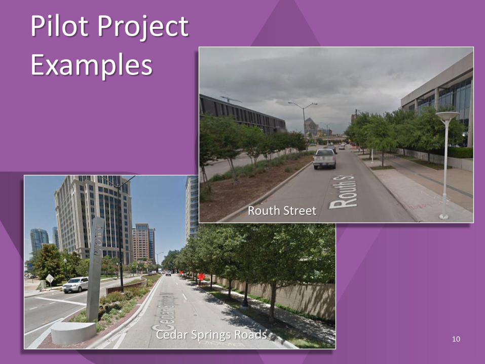
Pilot Project Examples
Cedar Springs Roads 10
Routh Street
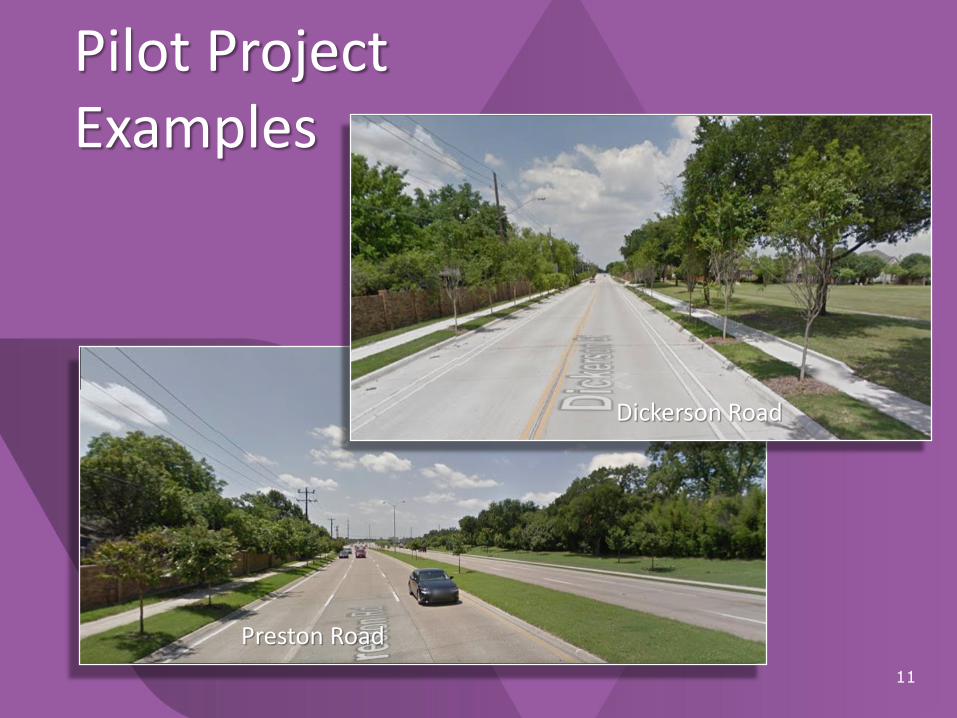
11
Preston Road
Pilot Project Examples
Dickerson Road

New Policy DevelopmentDraft Complete Streets Design Manual
• Street design policies and guidelines
• Multi-disciplinary project planning and implementation process
• Complete Street Vision Map overlay
12
Web link to draft manual:http://dallascityhall.com/departments/sustainabledevelopment/DCH%20Documents/pdf/DCS-Design-Manual_DRAFT_091713.pdf

Pedestrian Zone Design Guidelines
• Street Furniture
– Seating
– Bike racks
– Bollards
– Recycling/garbage bins
– Newspaper racks
• Transit Stops
• Driveways
• Urban Open Space
– Plazas, pocket parks, parklets
– Sidewalk cafes13
Pedestrian Zone
Pedestrian Zone
Design guidelines for elements between the street curb and the building face
• Pedestrian lighting
• Informational kiosks
• Way-finding and signage
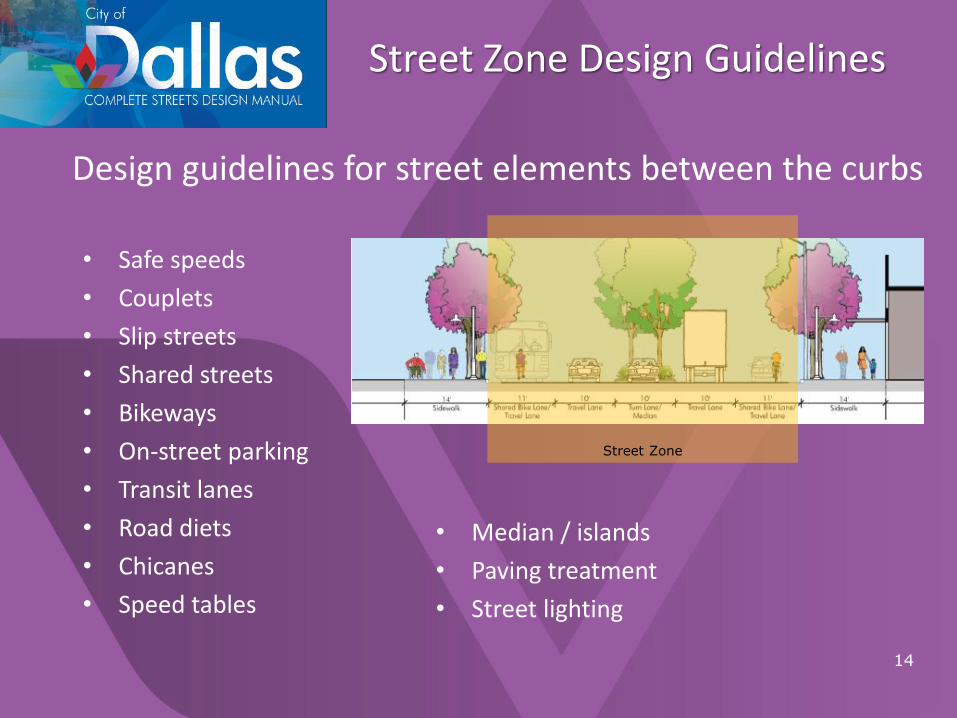
Street Zone Design Guidelines
• Safe speeds
• Couplets
• Slip streets
• Shared streets
• Bikeways
• On-street parking
• Transit lanes
• Road diets
• Chicanes
• Speed tables
14
Street Zone
Design guidelines for street elements between the curbs
• Median / islands
• Paving treatment
• Street lighting
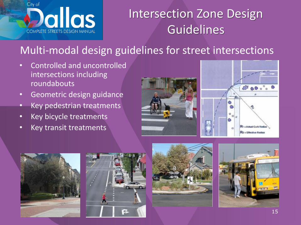
Intersection Zone Design Guidelines
• Controlled and uncontrolled intersections including roundabouts
• Geometric design guidance
• Key pedestrian treatments
• Key bicycle treatments
• Key transit treatments
15
Multi-modal design guidelines for street intersections
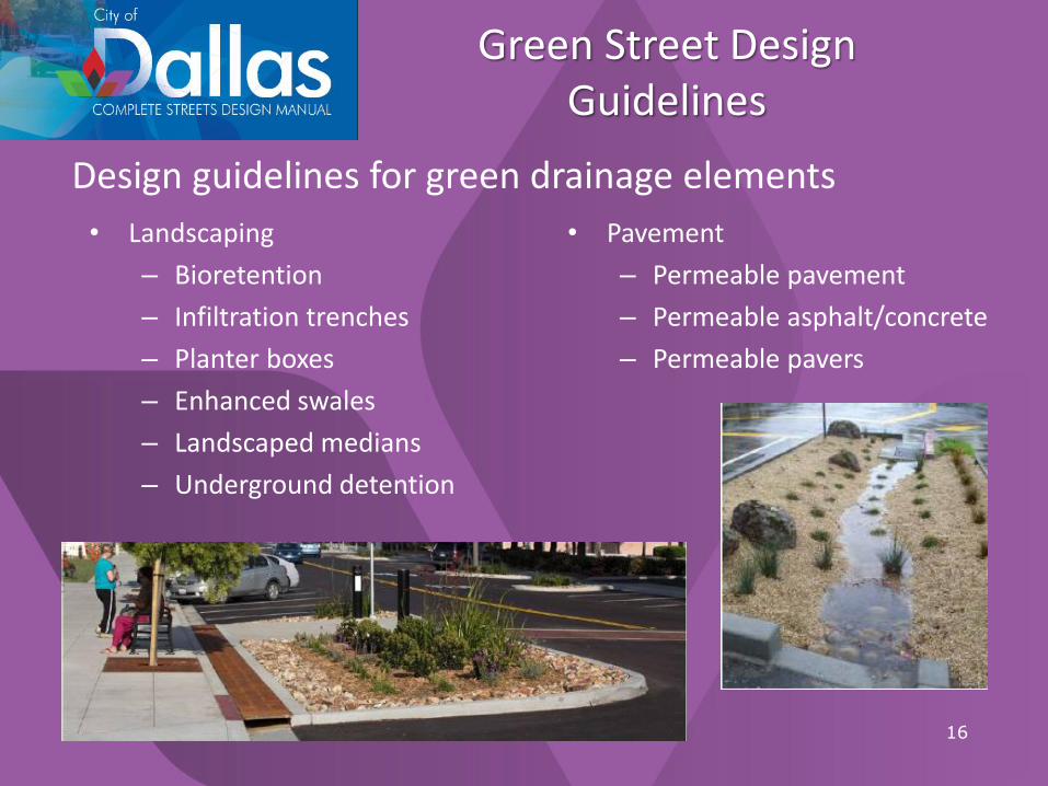
Green Street Design Guidelines
• Landscaping
– Bioretention
– Infiltration trenches
– Planter boxes
– Enhanced swales
– Landscaped medians
– Underground detention
16
Design guidelines for green drainage elements
• Pavement
– Permeable pavement
– Permeable asphalt/concrete
– Permeable pavers
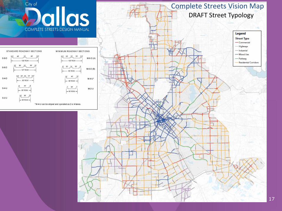
Thoroughfare Plan Map
17
Complete Streets Vision MapDRAFT Street Typology

Design Priorities
18
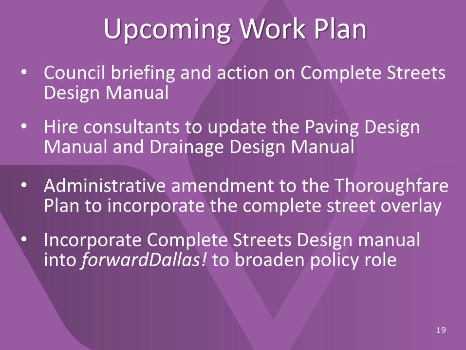
Upcoming Work Plan
19
• Council briefing and action on Complete Streets Design Manual
• Hire consultants to update the Paving Design Manual and Drainage Design Manual
• Administrative amendment to the Thoroughfare Plan to incorporate the complete street overlay
• Incorporate Complete Streets Design manual into forwardDallas! to broaden policy role
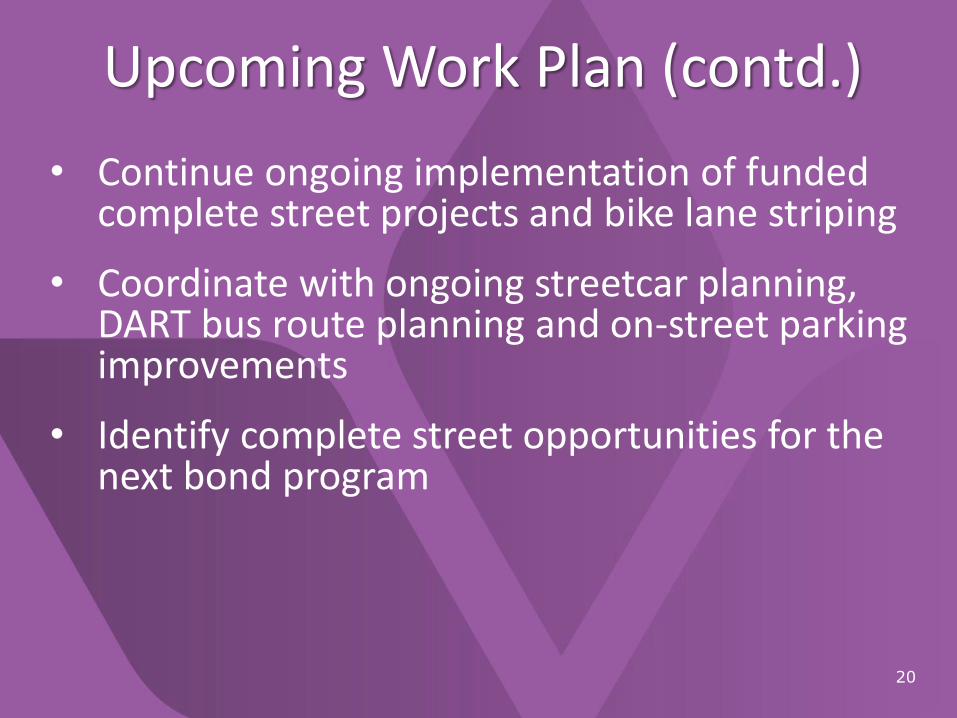
Upcoming Work Plan (contd.)
20
• Continue ongoing implementation of funded complete street projects and bike lane striping
• Coordinate with ongoing streetcar planning, DART bus route planning and on-street parking improvements
• Identify complete street opportunities for the next bond program
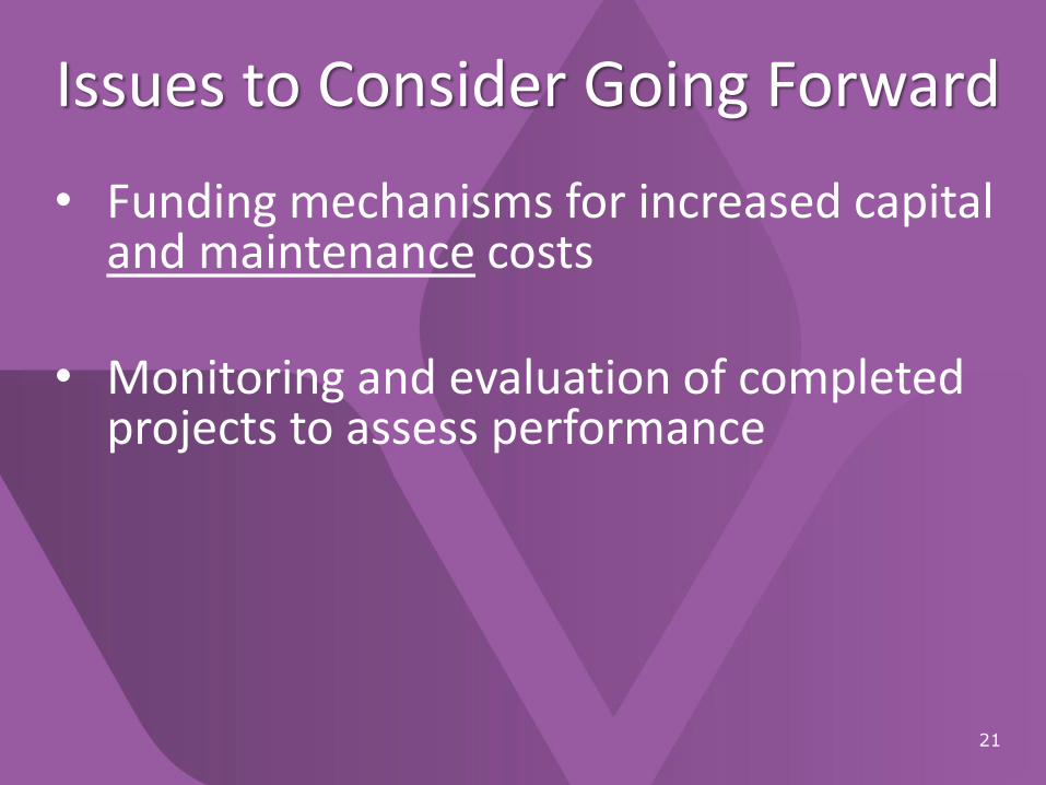
Issues to Consider Going Forward
21
• Funding mechanisms for increased capital and maintenance costs
• Monitoring and evaluation of completed projects to assess performance
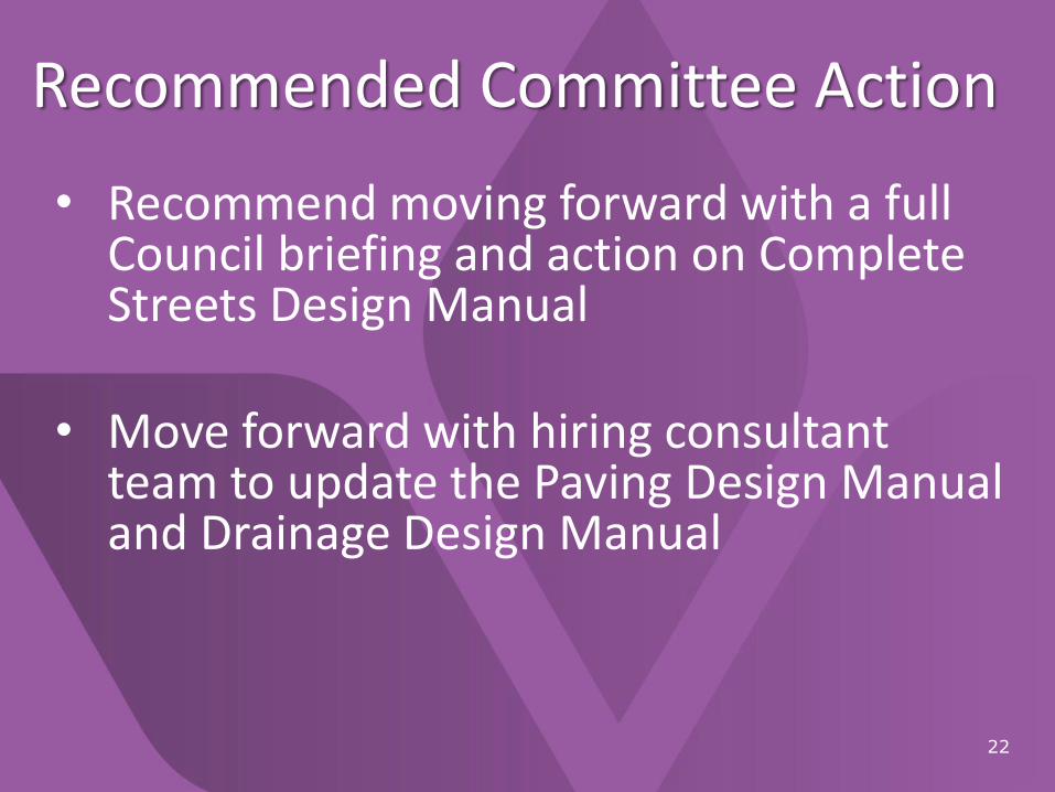
Recommended Committee Action
22
• Recommend moving forward with a full Council briefing and action on Complete Streets Design Manual
• Move forward with hiring consultant team to update the Paving Design Manual and Drainage Design Manual

Discussion
23
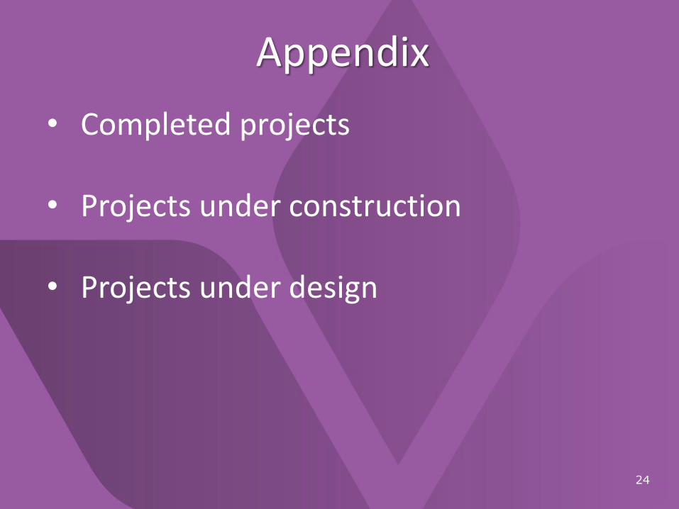
Appendix
24
• Completed projects
• Projects under construction
• Projects under design

Completed Projects
25
Street Names and Extents
• Bexar: Municipal to Elsie Faye Heggins
• Bishop (Phase 1): Neely to 8th
• Bishop (Phase 2): Colorado to Neely
• Cedar Crest: Morrell to Cleveland
• Cedar Springs: Harwood to Katy Trail
• Dickerson: McCullum to Frankford
• Elm: Good Latimer to Expedition
• Greenville (Phase 1): Alta to Bell
• Hi Line: I 35 to Trinity Strand Trail
• MLK (Phase 1): Intersection improvements at Atlanta, Malcolm X, R.B. Cullum
• Mockingbird: Airline to Matilda
• Mockingbird Plaza: SMU Blvd
• Preston: Arapaho to Davenport
• Routh: Woodall Rodgers to San Jacinto
• Singleton: Canada to Hampton
• Sylvan (Phase 1): IH 30 to Ft Worth

Projects Under Construction
26
Street Names and Extents
• Beckley/Commerce Intersection
• Cadiz: Riverfront to Lamar
• Chalk Hill (Phase I): I 30 to Davis
• Continental : Riverfront to Houston
• Greenville (Phase 2): Alta to Ross and Belmont to Bell
• Griffin: Young to Elm
• Houston: All Star to Lamar
• Keller Springs/Westgrove Interchange
• MLK (Phase 2): R.B. Cullum to Trunk
• Pearl: Live Oak to Gaston
• Pearl and Taylor (Farmers Market)
• Riverfront (Phase 1): Continental to UPRR
• S. Lamar: IH 45 to Emery
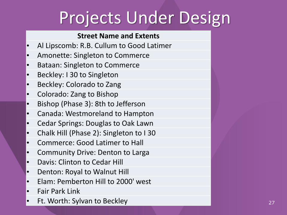
Projects Under Design
27
Street Name and Extents• Al Lipscomb: R.B. Cullum to Good Latimer• Amonette: Singleton to Commerce• Bataan: Singleton to Commerce• Beckley: I 30 to Singleton• Beckley: Colorado to Zang• Colorado: Zang to Bishop• Bishop (Phase 3): 8th to Jefferson• Canada: Westmoreland to Hampton• Cedar Springs: Douglas to Oak Lawn• Chalk Hill (Phase 2): Singleton to I 30• Commerce: Good Latimer to Hall• Community Drive: Denton to Larga• Davis: Clinton to Cedar Hill• Denton: Royal to Walnut Hill• Elam: Pemberton Hill to 2000' west• Fair Park Link• Ft. Worth: Sylvan to Beckley

Projects Under Design (Contd.)
28
Street Name and Extents• Henderson: US75 to Ross• Herbert: Singleton to Commerce• Highland: Ferguson to Primrose• Holly Hill: Phoenix to Pineland• JB Jackson: Al Lipscomb to MLK• Jefferson: Zang to Adams• Knox: Katy Trail to US75• Lamar: Young to Ross• Main: Good Latimer to Hall• Phoenix: Holly Hill to Fair Oaks• Riverfront (Phase 2): UPRR to Cadiz• Spring: Hatcher to Carter• Sylvan (Phase 2): Fort Worth to Singleton• Troy: Heggins to Collins• Victory: Hi Line to Lamar• Wheatland: University Hills to Lancaster